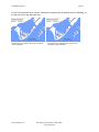
1
2003 DMTI Spatial Inc. Page 3 Major Roads Casements (mrc) .................................................................................. 47 Municipality Boundaries (mun) ................................................................................... 48 Other Transportation (ot).......................................................................................... 50 Physiography (ph).................................................................................................. 51 National and Provincial Parks (pk) .............................................................................. 52 Populated Placenames (ppn) .................................................................................... 53 Provincial Boundaries (prv) ....................................................................................... 54 Pipelines and Transmission (pt) ................................................................................. 55 Recreation and Amusement (ra)................................................................................. 57 Rail (rl) ............................................................................................................... 58 Roads (rds).......................................................................................................... 59 Roads Look Up Table (rds_lut) .................................................................................. 60 Regional Municipality Boundaries (rmn) ........................................................................ 61 Recreation and Amusement – Regions (rp) ................................................................... 62 Rail Stops (rs)....................................................................................................... 64 Rail Transit – Lines (rtl)............................................................................................ 65 Rail Transit - Points (rtp) .......................................................................................... 66 Trail Casements (tlc)............................................................................................... 67 Toll Booths (tol) ..................................................................................................... 68 Topographic Coverage Areas (top) ............................................................................. 69 Time Zones – Standard Time (tzs) / Daylight Savings Time (tzv) .......................................... 70 Vegetation (ve) ..................................................................................................... 71 National Water (wat) ............................................................................................... 72 Wetlands (we) ...................................................................................................... 73 Water Feature Labels (wl) ........................................................................................ 74 Highway Exits (xit)................................................................................................. 75 APPENDIX E: SUGGESTED CANMAP SUITE OF PRODUCTS LAYERING ............................. 76 Layering in MapInfo................................................................................................... 76 ArcView, ArcGIS Layering ........................................................................................... 77 Other CanMap layers ................................................................................................ 78 APPENDIX F: GEOGRAPHICAL PLACEMENT OF DATA..................................................... 79 Precision Codes ....................................................................................................... 79 APPENDIX G: JOINING RDS AND RDS_LUT DATA FILES................................................... 80 In MapInfo Format:.................................................................................................... 80 In ArcView Format: ................................................................................................... 80 In ArcGIS Format:..................................................................................................... 81 APPENDIX H: SHORELINED VS UNSHORELINED BOUNDARIES ......................................... 82 APPENDIX I: CENSUS SUBDIVISION BOUNDARIES AND DATA .......................................... 84 APPENDIX J: FORMAT SPECIFIC INSTRUCTIONS.................................................................. 85 ArcView and ArcGIS Users: .......................................................................................... 85 Shape Files .......................................................................................................... 85 CanMap Label Tool for ArcView 3.x............................................................................. 86 CanMap Identify Tool for ArcView 3.x .......................................................................... 88 MapGuide Users: ..................................................................................................... 89 Unique ID Field ..................................................................................................... 89 CanMap Data Set Configuration for MapGuide .............................................................. 89 www.dmtispatial.com Proprietary and Confidential to DMTI Spatial Not to be disclosed