1
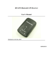
www.rhydolabz.com Document : Datasheet Date : 11-Apr-10 Model # : GPS - 1319 GPS Receiver with Antenna (5V TTL Serial) - User Manual Rhydo Technologies (P) Ltd. (An ISO 9001:2008 Certified R&D Company) Golden Plaza, Chitoor Road, Cochin – 682018, Kerala State, India Phone : 0091- 484-2370444, 2371666 Cell : 0091- 99466 70444 Fax : 0091 - 484-2370579 E-mail : [email protected], [email protected] WebSite : http://www.rhydolabz.com We bring the world to you.. www.rhydolabz.com This is a high gain GPS Receiver (5V Serial) with 4-pin 2.54mm pitch Berg strip. Receiver is made with third generation POT (Patch Antenna On Top) GPS module. The built in 3V3 to 5V level convertor enable us to interface with normal 5V Microcontrollers. Its low pin count (4-Pin) will make it easy to interface and it is bread board friendly (2.54 mm connector). The 4 Pins are 5V, TX, RX, GND. Yes, there is no setting required, just plug in to the power (5V), your data (NMEA 0183) is ready at TX pin! This is a standalone 5V GPS Module and requires no external components. It has internal RTC Back up battery. It can be directly connected to Microcontroller's USART. This GPS engine provides a solution with high position and speed accuracy performances as well as high sensitivity and tracking capabilities in urban conditions and it provides standard NMEA0183 strings in “raw” mode for any microcontroller. The module provides current time, date, latitude, longitude, speed, altitude and travel direction / heading among other data, and can be used in a host of applications, including navigation, tracking systems, fleet management, mapping and robotics. The GPS chipsets inside the module are designed by MediaTek Inc.,which is the world's leading digital media solution provider and largest fab-less IC company in Taiwan. The module can support up to 51 channels. The GPS solution enables small form factor devices. They deliver major advancements in GPS performances, accuracy, integration, computing power and flexibility. They are designed to simplify the embedded system integration process. FEATURES Single 5V DC supply @ 60 mA (typical) TTL asynchronous serial interface Data output Baud rate: 9600 bps(Default) Standard NMEA0183 output format Standard 4-pin Berg strip interface (2.54mm Pitch). Module will be provided with two type berg strip (Normal & Right angled) Based on MediaTek Single Chip Architecture. Patch Antenna Size: 25mm x 25mm x 4mm Low Power Consumption: 50mA @ acquisition, 45mA @ tracking L1 Frequency, C/A code, 51-channel High Sensitivity: Up to -158 dBm tracking, superior urban performances Position Accuracy: < 3m CEP (50%) without SA (horizontal) Cold Start is Under 36 seconds (Typical) We bring the world to you.. www.rhydolabz.com Warm Start is Under 34 seconds (Typical) Hot Start is Under 1 second (Typical) Max. Update Rate : 5 Hz (Default: 1 Hz) PIN DEFINITIONS PIN PIN NAME DETAILS 5V Power Supply RXD Receive Pin for Data Reception TXD Transmit Pin for Data Transmission GND Ground Ground Level of Power supply Power Supply Input (5V) DIMENSIONS We bring the world to you.. www.rhydolabz.com INTERFACING WITH MICROCONTROLLER Below is an example of interfacing the GPS Module with PIC 16F877A microcontroller. +5 +5 0.1MF 11 R1 10K C1 U1 SW1 1 2 3 4 5 6 7 8 9 10 31 32 RESET 13 Y1 14 20MHz C2 22PF C3 22PF 15 16 17 18 VCC RST/MCLR RA0/AN0 RA1/AN1 RA2/AN2 RA3/AN3 RA4/T0CKI RA5/SS/AN4 RE0/WR/AN5 RE1/AN6 RE2/AN7 VSS VDD RB7/PGD RB6/PGC RB5 RB4 RB3/PGM RB2 RB1 RB0/INT RD7/PSP7 RD6/PSP6 RD5/PSP5 RD4/PSP4 OSC1 RD3/PSP3 RD2/PSP2 RD1/PSP1 OSC2 RD0/PSP0 RC7/RX RC0/T1CKI RC6/TX RC1/CCP2 RC5/SDO RC2/CCP1 RC4/SDA/SDI RC3/SCL GND 40 39 38 37 36 35 34 33 30 29 28 27 22 21 20 19 26 25 24 23 12 +5 PIC16F877 We bring the world to you.. www.rhydolabz.com CHIPSET SPECIFICATION Chipset GENERAL MTK MT3318 Frequency L1, 1575.42MHz C/A Code 1.023 MHz Channels 51 channels DGPS RTCM protocol WAAS, EGNOS, MSAS Datum WGS84(Default), Tokyo-M, Tokyo-A, User Define CPU ARM7TDMI DIMENSIONS Length/Width/Height 26mm x26mm x 11.7mm Weight 12.5g PERFORMANCE CHARACTERISTICS Without aid:3.0m 2D-RMS Position Accuracy < 3m CEP (50%) without SA (horizontal) DGPS (RTCM, SBAS (WAAS, EGNOS, MSAS)):2.5m Velocity Accuracy Acceleration Timing Accuracy Without aid:0.1 m/s DGPS (RTCM, SBAS (WAAS, EGNOS, MSAS)):0.05m/s Without aid:< 4g DGPS (RTCM, SBAS (WAAS, EGNOS, MSAS)):< 4g 100 ns RMS Acquisition:-146dBm (Cold Start) Sensitivity 1 Reacquisition:-156dBm Tracking:-158dBm Max. Update Rate 5Hz (Default: 1 Hz) We bring the world to you.. www.rhydolabz.com ACQUISITION (OPEN SKY, STATIONARY) 1 Reacquisition Time 1 Hot start 1 Warm start 1 Cold start Less than 1 second 1 second (Typical) 34seconds (Typical) 36 seconds (Typical) Altitude DYNAMIC Maximum 18,000m Velocity Maximum 515m/s Acceleration Maximum 4g INPUT/OUTPUT Signal Output 8 data bits, no parity, 1 stop bit Available Baud Rates 9600 bps(Default),4800/9600/14400/19200/38400/57600/ 115200 is also available Protocols NMEA 0183 v3.01, MTK NMEA Command DATA OUTPUT INTERFACE Protocol messages 9600 bps/8/N/1 (Default) Output format (Default) GGA(1sec),GSA(1sec),RMC(1sec),VTG(1sec),GSV(5sec) ENVIRONMENT Operating Temperature Storage Temperature Operating Humidity 1 -40℃ to 85 ℃ (without coin battery) -20℃ to 60 ℃ (with coin battery ) -50℃ to 90 ℃(without coin battery) -20℃ to 60 ℃ (with coin battery ) 5% to 95% (no condensing) Reference to GPS chipset specification We bring the world to you.. www.rhydolabz.com DC CHARACTERISTICS Parameter Supply Voltage Specification Condition Unit Min. Typ. Max. Vcc 4.5 5.0 5.8 V Acquisition 50 60 80 mA Tracking 45 60 85 mA Power Consumption @ 5V NMEA OUTPUT SENTENCE Table-1 lists each of the NMEA output sentences specifically developed and defined by MTK for use within MTK products NMEA Output Sentence Table-1 Option GGA Description Time, position and fix type data. GSA GPS receiver operating mode, active satellites used in the position solution, and DOP values. GSV The number of GPS satellites in view satellite ID numbers, elevation, azimuth, and SNR values. RMC Time, date, position, course and speed data. Recommended Minimum Navigation Information. VTG Course and speed information relative to the ground. We bring the world to you.. www.rhydolabz.com GGA—Global Positioning System Fixed Data. Time, Position and fix related data for a GPS receiver Table-2 contains the values for the following example: $GPGGA,035238.000,2307.1219,N,12016.4423,E,1,9,0.89,23.6,M,17.8,M,,*69 GGA Data Format Table-2 Name Example Message ID $GPGGA GGA protocol header UTC Time 035238.000 hhmmss.sss Latitude 2307.1219 ddmm.mmmm N/S Indicator N N=north or S=south Longitude 12016.4424 dddmm.mmmm E/W Indicator E E=east or W=west Satellites Used 9 Range 0 to 14 HDOP 0.89 Horizontal Dilution of Precision MSL Altitude 17.3 meters Antenna Altitude above/below mean-sea-level Units M meters Units of antenna altitude Geoidal Separation 17.8 meters Units M meters Units of geoidal separation second Null fields when DGPS is not used Age of Diff. Corr. Checksum <CR> <LF> Units Description *69 End of message termination We bring the world to you.. www.rhydolabz.com GSA—GNSS DOP and Active Satellites Table-3 contains the values for the following example: $GPGSA,A,3,29,21,09,18,10,26,12,24,15,,,,1.20,0.89,0.80*04 GSA Data Format Table-3 Name Example Units Message ID $GPGSA GSA protocol header Mode 1 A See Table-4 Mode 2 3 See Table-5 Satellite Used 29 SV on Channel 1 Satellite Used 21 SV on Channel 2 .... …. …. Satellite Used Description .... SV on Channel 12 PDOP 1.20 Position Dilution of Precision HDOP 0.89 Horizontal Dilution of Precision VDOP 0.80 Vertical Dilution of Precision Checksum *04 <CR> <LF> End of message termination Mode 1 Value Table-4 M Description Manual—forced to operate in 2D or 3D mode A 2D Automatic—allowed to automatically switch 2D/3D Mode 2 Table-5 Value Description 1 Fix not available 2 2D (<4 SVs used) 3 3D (≧4 SVs used) We bring the world to you.. www.rhydolabz.com GSV—GNSS Satellites in View Table-7 contains the values for the following example: $GPGSV,3,1,10,24,76,195,48,09,62,173,48,21,50,308,48,15,45,021,48*73 $GPGSV,3,2,10,26,33,031,46,18,29,319,46,10,21,092,45,29,18,221,44*7D $GPGSV,3,3,10,12,05,167,24,05,03,181,*76 GSV Data Format Table-6 Name Example Units Description Message ID $GPGSV GSV protocol header Number of Messages 3 Range 1 to 3 (Depending on the number of satellites tracked, multiple messages of GSV data may be required.) Message Number1 1 Satellites in View 10 Satellite ID 24 Elevation 76 degrees Channel 1 (Maximum 90) Azimuth 195 degrees Channel 1 (True, Range 0 to 359) SNR (C/No) 48 dBHz Range 0 to 99, (null when not tracking) .... …. …. .... Satellite ID 15 Elevation 45 degrees Channel 4 (Maximum 90) Azimuth 021 degrees Channel 4 (True, Range 0 to 359) SNR (C/No) 48 dBHz Range 0 to 99, (null when not tracking) Checksum *73 <CR> <LF> Range 1 to 3 Channel 1 (Range 1 to 32) Channel 4 (Range 1 to 32) End of message termination We bring the world to you.. www.rhydolabz.com RMC—Recommended Minimum Navigation Information Table-7 contains the values for the following example: $GPRMC,035242.000,A,2307.1220,N,12016.4420,E,0.06,0.00,140508,,,A*63 RMC Data Format Table-7 Name Example Message ID $GPRMC RMC protocol header UTC Time 035242.000 hhmmss.sss Status A A=data valid or V=data not valid Latitude 2307. 1220 ddmm.mmmm N/S Indicator N N=north or S=south Longitude 12016.4420 dddmm.mmmm E/W Indicator E E=east or W=west Speed Over Ground 0.06 knots Course Over Ground 0.00 degrees Date 140508 Magnetic Variation Units Description True ddmmyy degrees E=east or W=west (MTK does support magnetic declination) Mode A A= Autonomous mode D= Differential mode E= Estimated mode Checksum <CR> <LF> *63 End of message termination We bring the world to you.. www.rhydolabz.com VTG — Course and speed information relative to the ground. Table-8 contains the values for the following example: $GPVTG,0.00,T,,M,0.06,N,0.11,K,A*3B VTG Data Format Table-8 Name Message ID Example $GPVTG Units Description VTG protocol header Course 0.00 degrees Measured heading Reference T Course Reference True degrees M Measured heading Magnetic (MTK does not support magnetic declination.) Speed 0.06 Units N Speed 0.11 Units K Kilometers per hour Mode A A= Autonomous mode D= Differential mode E= Estimated mode Checksum *3B <CR> <LF> knots Measured horizontal speed Knots km/hr Measured horizontal speed End of message termination MTK NMEA Command Protocol Packet Type: 103 PMTK_CMD_COLD_START Packet Meaning: Cold Start:Don’t use Time, Position, Almanacs and Ephemeris data at re-start. Example:$PMTK103*30<CR><LF> We bring the world to you.. www.rhydolabz.com GETTING STARTED Connect the GPS Connect the GPS board as per the circuit diagram given. Power Supply Connect the power Supply (5V DC) to the power supply input pins. Led Indication When the module is successfully powered-up, the Green LED (PWR) will be ON. Baud rate The default Baud rate supported by the GPS is 9600. Make sure the host system is set to the supported baud rate. Testing with a PC 1. 2. 3. Connect the GPS Module to a PC Com port using a MAX-232 level conversion circuit or TTLRS-232/TTL-USB convertor and Power it Up. Create a HyperTerminal (Windows tool for serial port communications) window with Baudrate 9600 and connect it to the ComPort to which the Gps is connected. You could see the GPS data in the hyper terminal window. Terminal Window on PC where GPS is connected We bring the world to you.. www.rhydolabz.com PC INTERFACE SOFTWARE FOR GPS Download setup file from www.rhydolabz.com/documents/gps_gsm/gps_mapping_software.zip Install the setup file in your PC. Once the installation is completed, open the application from StartMenu-Programs-Rhydolabz-GpsMapping Connect the Gps to a PC Com port using a MAX-232 circuit or TTL-RS-232/TTL-USB and Power it Up. Select the Comport* (in the application software) to which Gps is connected and select the refresh rate in seconds (Between 10 and 65).Press the “Plot” button. If GPS data is received through serial port, the circle in the GPS Frame in software will start blinking (Green). The software displays the current Latitude and Longitude and plots the position in Google Maps. * If the comport number does not appear in the software, re-assign the Comport to an available one.(Can be done in Device Manager- Comport-Properties) We bring the world to you.. www.rhydolabz.com TECHNICAL SUPPORT If you are experiencing a problem that is not described in this manual, please contact us. Our phone lines are open from 9:00 AM – 5.00 PM (Indian Standard Time) Monday through Saturday excluding holidays. Email can be sent to [email protected] LIMITATIONS AND WARRANTEES This product is intended for personal or lab experimental purpose and in no case should be used where it harmfully effect human and nature. No liability will be accepted by the publisher for any consequence of its use. Use of the product software and or hardware is with the understanding that any outcome whatsoever is at the users own risk. All products are tested for their best performance before shipping, still rhydoLABZ is offering One year Free service warranty (Components cost + Shipping cost will be charged from Customer). DISCLAIMER Copyright © Rhydo Technologies (P) Ltd All rights are reserved. Reproduction in whole or in part is prohibited without the prior written consent of the copyright owner. The information presented in this document does not form part of any quotation or contract, is believed to be accurate and reliable and may be changed without notice. Rhydo Technologies (P) Ltd. (An ISO 9001:2008 Certified R&D Company) Golden Plaza, Chitoor Road, Cochin – 682018, Kerala State, India Phone : 0091- 484-2370444, 2371666 Cell : 0091- 99466 70444 Fax : 0091 - 484-2370579 E-mail : [email protected], [email protected] WebSite : http://www.rhydolabz.com We bring the world to you..