1
Introduction
1.0
The Agroecological Resource Area maps were developed
to provide biophysically
units at a scale of 1:2 million w^hich can be used to study agriculture, land use
homogenous
and conservation.
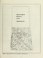
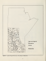
These Agroecological Resource Areas (ARAs) represent areas of generally similar agricultural
potential, and are based on ecoclimatic zonation, landform and soil characteristics (Figure 1).
The
ARAs have
served as a convenient planning unit upon which to develop data for use in
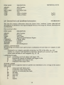
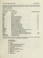
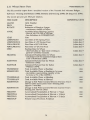
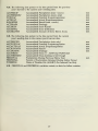
It is the purpose of this report to document the types of information stored
agricultural research.
in these data files.
The
digitized
ARA maps for Alberta, Saskatchew^an and Manitoba, and the associated data files,
ARC /INFO Geographic Information System (GIS). This GIS is part of the
currently reside in an
Canadian
Soil
Information System (CanSIS). The
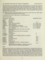
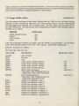
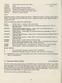
common linking factor, or key, between all
the
data files is the combined ARA number and province designation. ARA numbers are
unique wdthin provinces. The addition of the province code makes the key unique country-wide.
There is also a linkage, through the soil series code, to the Soil Names File and Soil Layer File,
ARA
which are stored
in the National Soil DataBase.
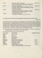
Data can be exported from these files in Arc Export or ASCII format, along with appropriate
documentation. Requests to obtain these data should be addressed to:
Dr. J. Dumanski, Research Scientist,
Centre for Land and Biological Resources Research,
Research Branch, Agriculture Canada,
Central Exp)erimental Farm, Building 74,
Ottawa, Ontario,
Canada,
The
ARA maps
KIA 0C6
can be obtained in electronic or hard copy format by contacting:
Head, CanSIS,
Centre for Land and Biological Resources Research,
Research Branch, Agriculture Canada,
Central Experimental Farm, Neatby Building,
Ottawa, Ontario
Canada,
KIA 0C6
file