1
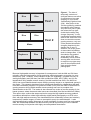
These “approximate” boundaries should be identified separately so that the ones
that are classified as rice can be updated in the future from either a previous aerial
photograph or by using a GPS in the field. When the difference is small (for
example, due to a missing rice bay in a paddock), this defines a change that can
probably be fixed from past aerial photos. When the change is too big to be
identified properly from previous photos, someone will need to update the boundary
using a GPS unit in the field. Remember, the date of update, who recorded the GPS
data, and who updated the GIS boundary could be recorded in the GIS paddock
boundary file.
These three steps are outlined below.
5.2
Defining flooded areas on the imagery
The purpose of this initial pass is only to assess which paddocks may need updating and
requires a per-pixel classification. Since water absorbs light in the wavelengths around
1650 nm where band 5 is centred, the rice areas during this time of year have very low
values. Also, non-rice paddocks are predominantly some much drier surface (e.g., soil,
stubble, or green crops that are not near canopy closure), revealing very high values in ETM
band 5. Therefore, it is generally very easy to classify water versus non-water (which is
really what we are doing); we assume that all the flooded paddocks are rice. We will put
these values in a per-paddock context later. Be careful to note whether a heavy rainfall
occurred just prior to image acquisition as this might influence the results of this analysis.
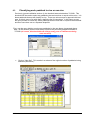
• First, the GRID of ETM band 5, generated in the Ground Validation section, above is
classified using the threshold value determined in that same section. As determined
above, the threshold between rice/non-rice from our training sets was 75.5838.
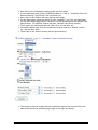
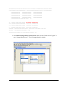
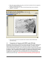
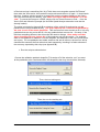
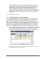
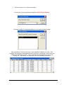
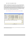
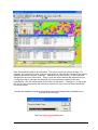
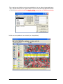
• This entails using the “Map Calculator” in the Analysis/ menu. Set up the equation
to define the classes based on the above threshold (see figure below):
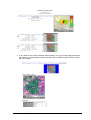
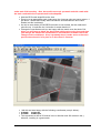
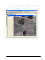
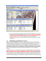
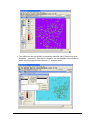
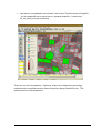
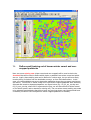
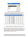
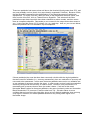
• This will result in the calculation of a GRID that has a two classes: zero’s for nonwater areas and one’s for water (see below).
CSIRO Land and Water
- 20 -