1
ENVI Services Engine 5.3 User Guide
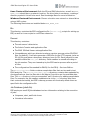
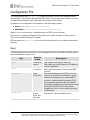
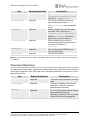
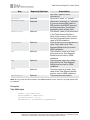
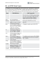
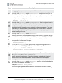
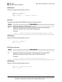
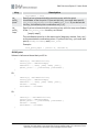
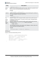
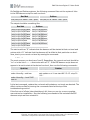
Field
rpc_
samp_
den_
coeff
Description
Specify a 20-element, double-precision array of RPC sample
denominator coefficients.
Example:
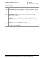
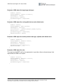
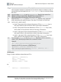
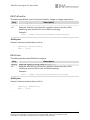
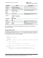
JSON Syntax
Values in italics are those that you fill in.
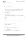
{
"factory" : "RPCRasterSpatialRef",
"rpc_offsets" : [ Line_Offset, Sample_Offset, Latitude_Offset,
Longitude_Offset, Height_Offset ],
"rpc_scales" : [ Line_Scale, Sample_Scale, Latitude_Scale,
Longitude_Scale, Height_Scale ],
"rpc_line_den_coeff" : [ RPC_line_denominator_coefficients ],
"rpc_samp_num_coeff" : [ RPC_sample_denominator_coefficients ]
}
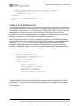
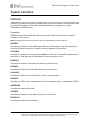
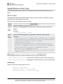
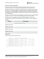
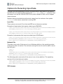
ENVIStandardRasterSpatialRef
This data type describes ENVIStandardRasterSpatialRef objects, which is the most
common form of spatial reference.
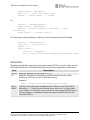
You must specify either coord_sys_code or coord_sys_string, but not both.
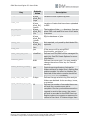
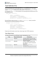
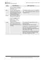
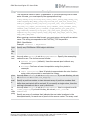
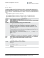
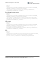
Field
factory
coord_
sys_
code
coord_
sys_
string
Description
Required. Specify a string value of StandardRasterSpatialRef.
Specify a valid geographic or projected coordinate system code.
Example:
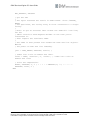
"coord_sys_code" : 20354
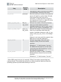
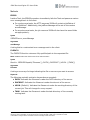
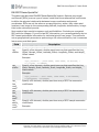
Specify a valid geographic or projected coordinate system string.
Example:
"coord_sys_string" : "PROJCS["AGD_1984_AMG_Zone_
54",GEOGCS["GCS_Australian_1984",DATUM["D_Australian_
1984",SPHEROID["Australian",6378160.0,298.25]],PRIMEM
["Greenwich",0.0],UNIT
["Degree",0.0174532925199433]],PROJECTION["Transverse_
Mercator"],PARAMETER["False_Easting",500000.0],PARAMETER
["False_Northing",10000000.0],PARAMETER["Central_
Meridian",141.0],PARAMETER["Scale_
Factor",0.9996],PARAMETER["Latitude_Of_Origin",0.0],UNIT
© 2015 Exelis Visual Information Solutions, Inc., a subsidiary of Harris Corporation. All Rights
Reserved. This information is not subject to the controls of ITAR or EAR. Use or disclosure of this
information is subject to the restrictions on the Title Page of this document.
86