1
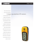
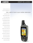
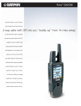
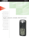
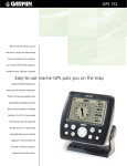
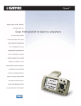
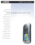
eTrex® series
With an eTrex® series GPS by your
side, you can take on the big wide
world without looking back. For basic
navigation, look to the original eTrex,
the low-cost GPS, or the Venture, which
Compact, go-anywhere GPS receivers
accepts downloaded points of interest.
The Legend steps up the mapping
capabilities with its detailed basemap.
eTrex Summit is a basic GPS with built-in
electronic compass and barometric
altimeter while the Vista has all this plus
a detailed basemap. These smart little
handhelds are tough and waterproof.
All feature simple, one-hand operations.
For your next adventure on land or sea,
pack light. Go with eTrex.
eTrex® series
specifications
Navigation features
Waypoints/icons:
1000 with name and graphic symbol
Tracks:
Automatic track log; 10 saved tracks let
you retrace your path in both directions
Trip computer:
Current speed, average speed, time of
sunrise/sunset, resetable maximum
speed, trip timer and trip distance
Map datums:
More than 100
Position format:
Lat/Lon, UTM/UPS, Maidenhead, MGRS,
Loran TDs (Venture, Legend and Vista
only) and other grids
GPS performance
Receiver:
WAAS enabled (Venture, Legend, Vista
only), 12 parallel channel GPS receiver continuously tracks and uses up to 12 satellites
to compute and update your position
Acquisition times:
Warm:
Approximately 15 seconds
Cold:
Approximately 45 seconds
AutoLocate™:
Approximately 5 minutes
Update rate:
1/second, continuous
GPS accuracy:
Position:
< 15 meters, 95% typical*
Velocity:
0.05 meter/sec steady state
DGPS (USCG) accuracy:
Position:
3-5 meters, 95% typical
Velocity:
0.05 meter/sec steady state
DGPS (WAAS) accuracy:
Position:
< 3 meters, 95% typical
Velocity:
0.05 meter/sec steady state
Dynamics:
6g’s
Interfaces:
RS232 with NMEA 0183, RTCM 104 DGPS
data format and proprietary GARMIN
Antenna:
Built-in patch
Power
Source:
2 “AA” batteries (not included)
Physical
Size:
Weight:
Display:
Case:
Temperature range:
User data storage:
Accessories
Standard:
Optional:
eTrex Venture
eTrex Venture
Mark waypoint page
Map page
eTrex Summit
eTrex Legend
4.4"H x 2.0"W x 1.2"D (11.2 x 5.1 x 3.0 cm)
5.3 ounces (150 g) with batteries
2.1"H x 1.1"W (5.4 x 2.7 cm) high-contrast
LCD with bright backlighting
Waterproof to IEC 529 IPX7 standards
5ºF to 158ºF (-15ºC to 70ºC)
Indefinite, no memory battery required
PC interface cable
(Venture, Legend and Vista only)
User’s guide
Quick reference guide
Wrist strap
Carrying case
Holster
PC interface cable
PC interface cable with 12-volt adapter
12-volt adapter cable
Handlebar mount
Marine mount
Automotive suction mount
Adjustable automotive mounting bracket
MapSource CD-ROMs
Instructional video
Compass page
Map page
(shown with optional MapSource
Fishing Hot Spots® detail)
eTrex Vista
eTrex Vista
Electronic compass feature (eTrex Summit and Vista only)
Accuracy:
±2 degrees with proper calibration
(typical); ±5 degrees extreme northern
and southern latitudes
Resolution:
1 degree
Barometric altimeter feature (eTrex Summit and Vista only)
Accuracy:
10 feet with proper calibration
(user and/or automatic calibration)
Resolution:
1 foot
Range:
–2,000 to 30,000 feet
Elevation computer: Current elevation, resetable minimum
and maximum elevation, ascent/descent
rate, total ascent/descent, average and
maximum ascent/descent rate
Pressure:
Local pressure (mbar/inches HG), 12-hour
automatic pressure trend recording
Here’s how the units are different
eTrex
eTrex
eTrex Legend
eTrex Summit
eTrex Vista
Elevation page
Map page
(shown with optional
MapSource Topo detail)
©2003 Garmin Ltd. or its subsidiaries
Garmin International, Inc.
1200 East 151st Street
Olathe, Kansas 66062, U.S.A.
913/397.8200 fax 913/397.8282
Garmin (Europe) Ltd.
Unit 5, The Quadrangle
Abbey Park Industrial Estate
Romsey, SO51 9DL, U.K.
44/1794.519944 fax 44/1794.519222
WAAS enabled
database or map
display resolution
routes
battery life
sensors
not available
none
64 x 128 pixels
1 reversible
22 hours
none
WAAS enabled
city point database
160 x 288 pixels
20 reversible
20 hours
none
MapSource™
compatibility
limited — able to
transfer waypoints,
routes and tracks
between PC and GPS
some — accepts
1 MB data from the
Points of Interest CD**
REV0903
WAAS enabled
detailed basemap
160 x 288 pixels
20 reversible
18 hours
none
not available
none
64 x 128 pixels
20 reversible
16 hours
electronic compass,
barometric altimeter
extensive — accepts
limited — able to
8 MB of downloaded
transfer waypoints,
map detail from a variety routes and tracks
of MapSource™ CDs**
between PC and GPS
WAAS enabled
detailed basemap
160 x 288 pixels
20 reversible
12 hours
electronic compass,
barometric altimeter
extensive — accepts
24 MB of downloaded
map detail from a variety
of MapSource™ CDs**
M01-20000-01
Garmin Corporation
No. 68, Jangshu 2nd Rd.
Shijr, Taipei County, Taiwan
886/2.2642.9199 fax 886/2.2642.9099
www.garmin.com
Specifications are preliminary and subject to change
without notice.
* Subject to accuracy degradation to 100m
2DRMS under the U.S. Department of Defense
imposed Selective Availability Program.
** These units are also able to transfer waypoints,
routes and tracks between the PC and GPS
using MapSource.™