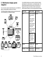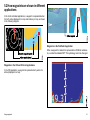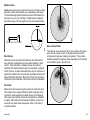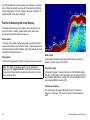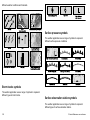
1
C-Series Widescreen
Multifunction Display
User reference handbook
C90W, C120W and C140W models
Trademarks and registered trademarks
Autohelm, HSB, RayTech Navigator, Sail Pilot, SeaTalk and Sportpilot are UK registered trademarks of Raymarine UK Limited.
Pathfinder and Raymarine are UK registered trademarks of Raymarine Holdings Limited. 45STV, 60STV, AST, Autoadapt, Auto GST,
AutoSeastate, AutoTrim, Bidata, G Series, HDFI, LifeTag, Marine Intelligence, Maxiview, On Board, Raychart, Raynav, Raypilot, RayTalk,
Raystar, ST40, ST60+, Seaclutter, Smart Route, Tridata, UniControl and Waypoint Navigation are trademarks of Raymarine UK Limited.
All other product names are trademarks or registered trademarks of their respective owners.
Copyright ©2008 Raymarine UK Ltd. All rights reserved.
ENGLISH
Document number: 81312-1
Date: November 2008
Contents
Chapter 1 Important Information............................... 9
Safety notices...................................................................9
TFT LCD Displays .......................................................... 10
Water ingress ................................................................. 10
Disclaimers .................................................................... 10
CompactFlash cards ....................................................... 11
EMC conformance .......................................................... 11
Suppression ferrites ........................................................ 11
Connections to other equipment ...................................... 11
Declaration of conformity................................................. 11
Product disposal ............................................................. 12
Warranty registration....................................................... 12
IMO and SOLAS............................................................. 12
Technical accuracy ......................................................... 12
Chapter 2 Handbook information............................ 13
2.1 User reference handbook information ......................... 14
2.2 About this manual ..................................................... 14
Chapter 3 Getting started ........................................ 15
3.1 Multifunction display system integration ...................... 16
3.2 Powering the display on/off ........................................ 18
3.3 Controls.................................................................... 19
3.4 Using buttons and softkeys ........................................ 20
3.5 Using the cursor........................................................ 20
3.6 Navigating pages and menus..................................... 21
3.7 Initial setup ............................................................... 25
Chapter 4 Managing display data ........................... 33
4.1 CompactFlash cards overview ................................... 34
4.2 Writing and retrieving data ......................................... 36
4.3 Transferring data using a PC ..................................... 37
4.4 Operating a networked display ................................... 37
Chapter 5 Using waypoints ..................................... 39
5.1 Waypoints ................................................................ 40
5.2 How waypoints are shown in different
applications....................................................... 41
5.3 Waypoint placement .................................................. 42
5.4 Displaying the waypoint list ........................................ 42
5.5 Waypoint navigation .................................................. 43
5.6 Editing a waypoint ..................................................... 44
5.7 Waypoint groups ....................................................... 46
5.8 Password protecting your waypoints........................... 47
Chapter 6 Using the chart........................................ 49
6.1 Chart application overview ......................................... 50
6.2 Ensure safe navigation .............................................. 50
6.3 Using the chart safely ................................................ 51
5
6.4 What the chart displays ............................................. 51
6.5 Chart cards............................................................... 52
6.6 Chart datum.............................................................. 52
6.7 Chart setup............................................................... 53
6.8 Moving around the chart ............................................ 59
6.9 Chart presentation..................................................... 60
6.10 Locating your vessel on the chart display .................. 72
6.11 Waypoints ............................................................... 73
6.12 Routes.................................................................... 75
6.13 Tracks .................................................................... 82
6.14 Measuring distances and bearings ........................... 84
Chapter 7 Using the 3D chart .................................. 85
7.1 3D chart overview ..................................................... 86
7.2 3D chart setup .......................................................... 87
7.3 3D chart cards .......................................................... 88
7.4 3D chart display overview .......................................... 88
Chapter 8 Using autopilot control........................... 95
8.1 Disengaging the autopilot in an emergency................. 96
8.2 Autopilot control ........................................................ 96
8.3 Autopilot control options ............................................ 98
8.4 Autopilot alarms ........................................................ 98
Chapter 9 Using radar .............................................. 99
9.1 Radar overview....................................................... 100
6
9.2 Radar scanner power modes ................................... 100
9.3 Radar range and image quality ................................ 101
9.4 Radar display overview ........................................... 104
9.5 Dual range radar operation (digital scanners
only) ............................................................... 105
9.6 Radar mode and orientation..................................... 106
9.7 Radar tuning — DIGITAL scanners .......................... 109
9.8 Radar tuning — ANALOG scanners ......................... 114
9.9 Waypoints .............................................................. 120
9.10 Using radar to measure distances, ranges, and
bearings ......................................................... 121
9.11 Using radar to track targets and avoid
collisions......................................................... 124
9.12 Radar alarms ........................................................ 128
9.13 Setting up your radar ............................................. 129
Chapter 10 Using AIS ............................................. 133
10.1 AIS overview......................................................... 134
10.2 AIS prerequisites................................................... 135
10.3 Classes of AIS data............................................... 136
10.4 Enabling or disabling AIS ....................................... 137
10.5 Displaying AIS vectors........................................... 137
10.6 AIS status symbols................................................ 138
10.7 AIS silent mode..................................................... 138
10.8 Viewing AIS target information ............................... 139
10.9 Using AIS to avoid collisions .................................. 140
C-Series Widescreen user reference
10.10 AIS options ......................................................... 141
10.11 AIS alarms .......................................................... 142
10.12 Buddy tracking .................................................... 142
Chapter 11 Using the Course Deviation
Indicator .................................................... 145
11.1 Course Deviation Indicator overview ....................... 146
11.2 Selecting the CDI application.................................. 146
11.3 Using the CDI Application ...................................... 147
Chapter 12 Using the fishfinder ............................ 149
12.1 Fishfinder introduction ........................................... 150
12.2 The sonar image ................................................... 151
12.3 Fishfinder presets.................................................. 153
12.4 Fishfinder display modes ....................................... 154
12.5 Fishfinder range .................................................... 157
12.6 Fishfinder presentation options............................... 159
12.7 Fishfinder waypoints.............................................. 164
12.8 Fishfinder alarms................................................... 165
12.9 Setting up your fishfinder ....................................... 166
Chapter 13 Using the engine monitor................... 171
13.1 Engine monitor overview........................................ 172
13.2 Displaying the engine monitor application ............... 172
13.3 Setting up the engine monitor application................ 173
13.4 Changing what the engine monitor displays ............ 173
13.5 Silencing engine monitor alarms............................. 174
Chapter 14 Using the data application ................. 175
14.1 Data application overview ...................................... 176
14.2 Pre-configured data in the data application ............. 176
14.3 Customizing the data application ............................ 178
Chapter 15 Using the weather application
(North America only)................................ 179
15.1 Weather application overview................................. 180
15.2 Weather application setup...................................... 180
15.3 Weather application display overview ..................... 181
15.4 Weather map navigation ........................................ 185
15.5 Weather reports .................................................... 185
15.6 Storm tracking....................................................... 186
15.7 Animated weather graphics.................................... 187
Chapter 16 Using Sirius satellite radio (North
America only) ........................................... 189
16.1 Sirius radio overview ............................................. 190
16.2 Displaying the Sirius radio application..................... 190
16.3 Sirius radio basic operations .................................. 191
16.4 Sirius radio presets................................................ 192
16.5 Favorite Sirius radio song alerts ............................. 193
16.6 Sirius radio parental locking ................................... 194
Chapter 17 Using Navtex ....................................... 195
17.1 Navtex overview.................................................... 196
17.2 Navtex setup......................................................... 196
7
17.3 Viewing and Managing Navtex Messages ............... 197
22.3 Navionics support.................................................. 219
Chapter 18 Using video.......................................... 199
18.1 Video application overview..................................... 200
18.2 Displaying the video application ............................. 201
18.3 Changing the video aspect ratio ............................. 201
18.4 Adjusting the video picture ..................................... 202
Chapter 19 DSC VHF radio integration................. 203
19.1 Using a DSC VHF radio with your display ............... 204
19.2 Enabling DSC VHF radio integration....................... 205
Chapter 20 Customizing your display .................. 207
20.1 Customizing page sets .......................................... 208
20.2 Customizing the databar ........................................ 209
Chapter 21 Maintaining your display.................... 211
21.1 Servicing and safety .............................................. 212
21.2 Routine equipment checks..................................... 212
21.3 Cleaning ............................................................... 213
21.4 Cleaning the display case ...................................... 213
21.5 Cleaning the display screen ................................... 214
21.6 Resetting your display ........................................... 214
Chapter 22 Technical support ............................... 217
22.1 Raymarine technical support .................................. 218
22.2 Sirius support........................................................ 218
8
C-Series Widescreen user reference
Chapter 1: Important Information
Warning: High voltages
Safety notices
This product contains high voltages. Do NOT remove
any covers or otherwise attempt to access internal
components, unless specifically instructed in this
document.
Warning: Ensure safe navigation
This product (including the electronic charts) is
intended for use only as an aid to navigation. It is
designed to facilitate the use of official government
charts, NOT REPLACE THEM. Only official
government charts and notices to mariners contain all
the current information needed for safe navigation,
and the captain is responsible for their prudent use. It
is the user’s responsibility to use official government
charts, notices to mariners, caution and proper
navigational skill when operating this or any other
Raymarine product.
Warning: Sonar operation
Warning: Product installation and
operation
Before rotating the radar scanner, ensure all personnel
are clear.
This product must be installed and operated in
accordance with the Raymarine instructions provided.
Failure to do so could result in personal injury, damage
to your boat and/or poor product performance.
Warning: Radar transmission safety
• NEVER operate the sounder with the boat out of
the water.
• NEVER touch the transducer face when the sounder
is powered on.
• SWITCH OFF the sounder if divers are likely to be
within 25 ft (5 m) of the transducer.
Warning: Radar scanner safety
The radar scanner transmits electromagnetic energy.
Ensure all personnel are clear of the scanner when
the radar is transmitting.
Warning: Product installation
This equipment must be installed in accordance with
the Raymarine instructions provided. Failure to do so
could result in poor product performance, personal
injury, and/or damage to the vessel.
Important Information
9
Caution: Care of chart cards
To avoid irreparable damage to and/or loss of data
from chart cards:
• Ensure that chart cards are fitted the correct way
around. DO NOT try to force a card into position.
• DO NOT save data (waypoints, routes, and so
on) to a Navionics chart card, as the charts may
be overwritten.
• DO NOT use a metallic instrument such as a
screwdriver or pliers to remove a chart card.
• DO NOT remove a chart card while information
is being written to or read from it.
Caution: Ensure chart card door is
securely closed
To prevent water ingress and consequent damage
to the display, ensure that the chart card door is
firmly closed. This can be confirmed by an audible
click.
Caution: Cleaning
When cleaning this product do NOT use acid,
ammonia-based or abrasive products, and do NOT
use high pressure washing (jet wash) equipment.
10
TFT LCD Displays
The colors of the display may seem to vary when viewed against
a colored background or in colored light. This is a perfectly normal
effect that can be seen with all color Liquid Crystal Displays (LCDs).
In common with all Thin Film Transistor (TFT) LCD units, the screen
may exhibit a few (less than 7) wrongly illuminated pixels. These
may appear as black pixels in a light area of the screen or as colored
pixels in black areas.
Water ingress
As it exceeds the water proof rating capacity outlined by standards
IPX6, subjecting any Raymarine equipment to commercial
high pressure washing equipment may cause water intrusion
and subsequent equipment failure. Raymarine will not warrant
equipment subjected to high pressure washing.
Disclaimers
This product (including the electronic charts) is intended to be used
only as an aid to navigation. It is designed to facilitate use of official
government charts, not replace them. Only official government
charts and notices to mariners contain all the current information
needed for safe navigation, and the captain is responsible for their
prudent use. It is the user’s responsibility to use official government
charts, notices to mariners, caution and proper navigational skill
when operating this or any other Raymarine product. This product
supports electronic charts provided by third party data suppliers
which may be embedded or stored on memory card. Use of such
charts is subject to the supplier’s End-User Licence Agreement
included in the documentation for this product or supplied with the
memory card (as applicable).
C-Series Widescreen user reference
Raymarine does not warrant that this product is error-free or that it
is compatible with products manufactured by any person or entity
other than Raymarine.
This product uses digital chart data, and electronic information from
the Global Positioning System (GPS) which may contain errors.
Raymarine does not warrant the accuracy of such information and
you are advised that errors in such information may cause the
product to malfunction. Raymarine is not responsible for damages
or injuries caused by your use or inability to use the product, by the
interaction of the product with products manufactured by others, or
by errors in chart data or information utilized by the product and
supplied by third parties.
Correct installation is required to ensure that EMC performance is
not compromised.
Suppression ferrites
Do not remove ferrite
Raymarine cables may be fitted with suppression ferrites. These
are important for correct EMC performance. If a ferrite has to be
removed for any purpose (e.g. installation or maintenance), it must
be replaced in the original position before the product is used.
Use only ferrites of the correct type, supplied by Raymarine
authorized dealers.
CompactFlash cards
Navionics chart cards
Connections to other equipment
The Display is pre-loaded with Navionics chart data. If you wish to
use different chart data, you can insert Navionics chart cards into
the CompactFlash card slot on the unit.
Requirement for ferrites on non-Raymarine cables
Use branded chart cards
When archiving data, Raymarine recommends the use of SanDisk
CF memory cards. Other brands of CF memory card may not work
in your unit.
EMC conformance
If your Raymarine equipment is to be connected to other equipment
using a cable not supplied by Raymarine, a suppression ferrite
MUST always be attached to the cable near the Raymarine unit.
Declaration of conformity
Raymarine Ltd. declares that the C-Series Multifunction Displays
are in compliance with the essential requirements of EMC directive
2004/108/EC.
Basic EMC conformance statement.
Raymarine equipment and accessories conform to the appropriate
Electromagnetic Compatibility (EMC) regulations for use in the
recreational marine environment.
Important Information
11
The original Declaration of Conformity certificate may be viewed on
the relevant product page at www.raymarine.com
Product disposal
Dispose this product in accordance with the WEEE Directive.
Technical accuracy
To the best of our knowledge, the information in this document was
correct at the time it was produced. However, Raymarine cannot
accept liability for any inaccuracies or omissions it may contain. In
addition, our policy of continuous product improvement may change
specifications without notice. As a result, Raymarine cannot accept
liability for any differences between the product and this document.
The Waste Electrical and Electronic Equipment (WEEE)
Directive requires the recycling of waste electrical and electronic
equipment. Whilst the WEEE Directive does not apply to some
Raymarine products, we support its policy and ask you to be aware
of how to dispose of this product.
Warranty registration
To register your Raymarine product ownership, please take a few
minutes to fill out the warranty registration card found in the box, or
visit www.raymarine.com and register on-line.
It is important that you register your product to receive full warranty
benefits. Your unit package includes a bar code label indicating the
serial number of the unit. You should stick this label to the warranty
registration card.
IMO and SOLAS
The equipment described within this document is intended for use
on leisure marine boats and workboats not covered by International
Maritime Organization (IMO) and Safety of Life at Sea (SOLAS)
Carriage Regulations.
12
C-Series Widescreen user reference
Chapter 2: Handbook information
Chapter contents
•
2.1 User reference handbook information on page 14
•
2.2 About this manual on page 14
Handbook information
13
2.1 User reference handbook information
2.2 About this manual
This handbook contains important information on using the C-Series
Widescreen range of multifunction displays.
This manual describes how to operate your multifunction display in
conjunction with Navionics cartography.
The handbook is for use with the following models:
It assumes that all peripheral equipment to be operated with it is
compatible and has been correctly installed. This manual is intended
for users of varying marine abilities, but assumes a general level of
knowledge of display use, nautical terminology and practices.
• C90W Widescreen Multifunction Display
• C120W Widescreen Multifunction Display
• C140W Widescreen Multifunction Display
C-Series handbooks
The C-Series Widescreen Multifunction Display has the following
handbooks available.
All documents are available to download as PDFs from
www.raymarine.com
C-Series handbooks
Description
Part number
Installation and commissioning
instructions
87101
Operating instructions (quick
reference)
86135
User reference handbook
81312
Additional handbooks
Description
Part number
SeaTalkng reference manual
81300
14
C-Series Widescreen user reference
Chapter 3: Getting started
Chapter contents
•
3.1 Multifunction display system integration on page 16
•
3.2 Powering the display on/off on page 18
•
3.3 Controls on page 19
•
3.4 Using buttons and softkeys on page 20
•
3.5 Using the cursor on page 20
•
3.6 Navigating pages and menus on page 21
•
3.7 Initial setup on page 25
Getting started
15
3.1 Multifunction display system
integration
You can connect a number of external devices to your multifunction
display, providing additional features and functions.
The following diagram illustrates the various external devices that
can be connected to your multifunction display:
Instruments
Your multifunction display uses a number of protocols to transfer
data between the various devices in your networked system. The
following table details which devices may be connected to your
display, and the type of connectivity (in terms of protocols and
physical interfaces) that they use to exchange data with the display:
Device Type
Suitable Devices
Connectivity
Radar
• ONE 4 kilowatt Digital
Radome Scanner,
OR
SeaTalkhs
Video/Camera
• ONE 4 kilowatt HD
Digital Open Array
Scanner, OR
Autopilot
External GPS
• ONE 4 kilowatt SHD
Digital Open Array
Scanner, OR
C-Series display
Digital OpenArray radar scanner
DSC VHF
• ONE 12 kilowatt SHD
Digital Open Array
Scanner
11.18.02
RAY240
OK
MENU
CH
16/9
HI/LO
WX
SCAN
WATCH
SQ
or
Note: HD and
SHD Open Array
Scanners must
be using software
version V2.23 or
later.
Digital Radome scanner
AIS receiver
Fishfinder
DSM 30 & 300
SeaTalkhs
switch
Additional
C-Series display
Weather receiver
D11522_1
Personal
Computer
Fishfinder
• ONE DSM 30, OR
SeaTalkhs
• ONE DSM 300
Cartography — included
16
Embedded (internal)
Navionics cartography
Internal storage
C-Series Widescreen user reference
Device Type
Suitable Devices
Connectivity
Device Type
Suitable Devices
Connectivity
Cartography — optional
External Navionics
CompactFlash chart
card (including Platinum
level)
CompactFlash card slot
Raytech charting
software
Raytech software
version V6.1
SeaTalkhs
Sirius Weather/Audio
Sirius SR100 only
SeaTalkhs
AIS
AIS 250, AIS 500, or
AIS Class A or Class B
receiver/transceiver
NMEA 0183
Navtex
Navtex Receiver
NMEA 0183 (Navtex
protocol)
Fast Heading Sensor
Fast Heading Sensor
NMEA 0183
GPS — external
Raystar125 GPS or
third-party external GPS
receiver
SeaTalk, SeaTalkng, or
NMEA 0183
Instruments
All current Raymarine
instruments
SeaTalk, SeaTalkng
Autopilot — Raymarine
All current Raymarine
autopilots
SeaTalk, SeaTalkng
Autopilot — third party
Third-party autopilots
NMEA 0183 (waypoint
and bearing information)
VHF radio
Raymarine DSC VHF
radios
NMEA 0183, SeaTalk
Additional Multifunction
Display
ONE C90W, C120W, or
C140W
SeaTalk, SeaTalkhs,
SeaTalkng
Video/camera
Composite PAL or NTSC
video source
BNC connector
Getting started
17
3.2 Powering the display on/off
Powering the display on
1. Press and hold the POWER button until the Raymarine logo
appears.
2. Press OK to acknowledge the warning window.
Powering the Display Off
1. Press and hold the POWER button until the countdown reaches
zero.
Note: If the POWER button is released before the countdown
reaches zero, the power off is cancelled.
18
C-Series Widescreen user reference
3.3 Controls
1
5 ACTIVE
Selects which of the split windows
is active.The selected window is
outlined in red, and the associated
softkeys displayed.
7 MENU
Press to access the
set up menus.
2 PAGE
Press to display the available page
softkeys for the current page set.
Press and hold to access the Page
Setup menu.
Chart card slot
Open the card reader door to
insert or remove CompactFlash
cards, which are used for
upgrading cartography
,
and archiving waypoint,
route and other data.
3 WPTS/MOB
Press and release to show the waypoint
softkeys. Press again to place a waypoint
at your vessel's position. Press and hold
to place a Man Overboard (MOB) marker
at your current position.
1
2
3
4
6 DATA
Press to access the archive and transfer
,
and databar options.
5
6
7
8
8 CANCEL
Press to quit the selected on-screen option
when editing data, or to return to a previous
softkey or menu level.
9
11
10
Softkeys
Press to select the corresponding function identified by the on-screen label.
Getting started
4 RANGE
Press to change the display scale
so that a smaller or larger area can
be seen on the screen.
9 Unicontrol™
The smooth inner ring is the
TRACKP
AD,
which controls the on-screen cursor and
scrolls through menus.
The outer ring is
the ROTARY CONTROL, which is used to
adjust values. In the middle of the Unicontrol
is the OK button, which is used to select options.
11 POWER
Press once to switch the unit ON. Press again
to access the backlight adjustment and scanner
power controls. Press and hold to switch the
unit OFF
.
19
3.4 Using buttons and softkeys
3.5 Using the cursor
The following diagram shows you how to select functions using the
buttons and softkeys:
In the Chart and Radar applications, the cursor is used to move
around the screen:
The cursor appears on the screen as a white cross.
PAGE
Buttons
Access system functions or change what you see on-screen.
Within the text of this document they are written in bold capitals
e.g. WPTS/MOB.
Press and hold to access short cuts.
DATA
D7368_2
ACTIVE
D7366_3
WPTS
MOB
Softkeys
WAYPOINT
AT
VESSEL
WAYPOINT
AT
LAT/LONG
...
GOTO WAYPOINT REVIEW
ANDEDIT
OPTIONS
…
WAYPOINTS
WPT
ERASE
WAYPOINT
SORT LIST
SET DEF
AULT SYM
& GROUP
...
WAYPOINT
GROUPS
...
VIEWANDEDIT
DET
AILS
…
The cursor is context-sensitive - when it is placed over an
object e.g. a waypoint or chart feature, it changes color and a
label or information associated with the object is displayed.
When you place the cursor over certain items, the soft keys
change to enable you to access related operations.
List of cursor labels
SET UP DEF
AULT
SYMB GROUP
EDIT DEF
AULT
Example:
The example above shows the series of button and softk
ey presses
required to change the waypoint default symbol or group
.
Note: To disable the audible "beep" that you hear when a button
or softkey is pressed, go to Menu > Display Setup > Key Beep.
20
D7369-2
WAYPOINT
AT
CURSOR
D11529-1
They change depending on
application or function
being performed.
Press the corresponding key
(below the screen) to select.
Further softkeys may be
displayed.
If a key has several options,
each press will highlight the
next option.
If a key displays a single
value or a slider above, use
the rotary control to adjust.
Within the text of this
document they are written
in capitals e.g. SORT LIST.
If the cursor has not been moved for a short period of time,
it changes to a circle with a cross in it, to make it easier to
locate on the screen.
Label
Feature
Application
A/B
Ruler line
Chart
AIS
AIS target
Chart
COG
Course Over Ground
vector
Chart
CTR
Center of radar
Radar
C-Series Widescreen user reference
Feature
Application
FLT
Floating EBL/VRM
Radar
GRD
Guard zone
Radar
HDG
Heading vector
Chart
MARPA
MARPA target
Radar
MOB
Man Over Board marker
Chart, Radar
POS
Vessel’s position
Chart
RTE
Route leg
Chart
SHM
Ship’s Heading Marker
Radar
TIDE
Tide indicator
Chart
VRM/EBL
VRM and EBL, 1 or 2
Radar
WIND
Wind indicator
Chart
WPT
Waypoint
Chart, Radar
3.6 Navigating pages and menus
Displaying applications
The various applications that make up your multifunction display
are shown in a series of screens known as page sets. There are
4 pre-configured and one empty page set to choose from. Each
page set contains 5 pages. These pages are made up of 1, 2, 3 or
4 windows combined in various formats. Each window can display
an application:
Pa ge set
Chart
Pa ge
(consists of 1,2,
3 or 4 windows)
CDI
Fishfinder
Engine
monitor Radar
Data
Window
D8928_1
Label
If required, you can change the combination and layout of these
page sets to meet your particular needs.
Selecting a page set and application page
1. Press and hold the PAGE button until the Select Page Set dialog
appears.
2. Using the trackpad, highlight the required page set.
3. Press the OK button to select the highlighted page set. An
application page from that page set is displayed.
Getting started
21
4. Press the PAGE button repeatedly to toggle between the
available application pages in the page set. Alternatively, use the
appropriate softkey to select the relevant application page.
Selecting an application window
1. When more than one application is displayed at any one time,
the active application window is highlighted with a red border:
2. Press the ACTIVE button to move the red border to another
window on the screen.
3. Press and hold the ACTIVE button to switch the currently
highlighted window to full-screen mode.
4. Press and hold the ACTIVE button to return the screen to
split-window mode.
22
C-Series Widescreen user reference
Screen information
Status bar
Databar
Status icons
•
•
Confirm status of
Sounder,GPS, AIS and
Autopilot.
•
Gives information specific to
each application.
Cannot be edited or moved.
•
•
•
•
Gives information associated with
your vessel or the environment.
Customizable content.
Vertical or horizontal format.
Display or hide.
Normal or large size.
Database lists
•
•
•
Include information you have added to the
display's memory, such as waypoints.
Highlight an entry using trackpad or rotary
control to display related information.
Editable using softkeys.
Pop-up messages
•
•
•
Alert you to a situation, such as an alarm,
or unavailable function
.
Not editable.
May require a response. For example,
ACKNOWLEDGE to silence alarms
.
Dialog boxes
Enable data to be edited or entered into a
store/list e.g. editing a waypoint.
Getting started
23
Editing dialog box information
Accessing a menu
1. In the dialog box, use the rotary control to select the field you
want to edit.
2. Press the EDIT... softkey.
3. Use the trackpad and rotary control to edit the information in
the field.
4. Click OK to apply any changes.
5. Repeat Steps 1 to 4 until all the required details have been
changed.
1. Press the MENU button.
2. Using the trackpad or rotary control, highlight the relevant menu
item.
3. Press the trackpad right to select the menu item.
4. Repeat Steps 2 to 3 for navigating sub-menus.
5. Once you have selected the relevant option(s), press the OK
button to keep any changes and return to the application.
Note: Entries in dialog boxes are not case sensitive, so character
text can be entered in upper or lower case.
Note: Enable the Extended Character Set in the System Setup
Menu if you need to use special or accented characters.
Status icons
The status icons on the databar confirm whether the appropriate
connections to your multifunction display have been made.
Status
icon
Using menus
The boat and fish icon indicates the current status of your
fishfinder:
Menus enable you to configure your system to your particular needs.
Whenever the Menu button is pressed, the Setup menu is displayed.
It contains a list of all the menus available for the active application,
together with system-wide menus:
24
• Icon animated: connection to a DSM has been successful.
• Icon static: the DSM is connected but not transmitting.
• Icon greyed-out: no DSM is connected.
The satellite icon indicates the current status of your GPS:
Setup
Ra d ar Setup ...
External equipment/
instruments
GPS Status...
Compass Setup
...
AIS La yer Status...
System-wide menus
S ys tem Setup ...
Alarm Setup ...
Displa y Setup ...
Databar Set...
Select P age Setup ...
S ys tem Diagnostics...
Re m ove CF Card
• Fix: your unit is successfully connected to a GPS receiver.
• No Fix: your unit has been unable to connect to a suitable
GPS receiver.
D7370_2
Menus for the active
application
Description
C-Series Widescreen user reference
Status
icon
3.7 Initial setup
Description
The scanner icon indicates the current status of your radar
scanner:
• Icon rotates: the scanner is transmitting (TRANSMIT/TX
mode).
• Icon static: the scanner is powered on but is not currently
transmitting (STANDBY mode).
• Icon greyed-out: this indicates that the scanner is currently
powered off (OFF mode).
• Icon rotates and is then static: a power save mode in which
the scanner powers on/off intermittently (TIMED TRANSMIT
mode).
----
Note: There are also additional status icons for AIS and Autopilot
functionality. These icons are described in the respective
chapters.
Initial setup procedures
A number of tasks must be completed before you use your display
for the first time.
When you first use your multifunction display after it has been
commissioned (see Installation Guide), we recommend that you
carry out the following:
• Set the language, the date and time format and preferred units
of measurement.
• Adjust the display lighting.
Setting the language, date/time, and units of measurement
1.
2.
3.
4.
Press the MENU button.
Using the trackpad, highlight the System Setup menu item.
Press right on the trackpad to enter the System Setup menu.
Using the trackpad, highlight the required setup item from the
menu.
5. Using the tackpad and rotary control, adjust the values for the
setup item.
6. Repeat Steps 4 and 5 for each setup item (Language, Date/Time/
Units of Measurement) that you want to change.
Adjusting the display lighting
1. Press the POWER button once. The brightness level control is
displayed.
2. Using the rotary control, adjust the brightness level as required.
Getting started
25
3. To switch the color palatte between Day (very bright) and Night
(dark) modes, press the PALETTE softkey and select the DAY
or NIGHT option.
GPS receiver selection
You must configure your multifunction display to use either the
internal GPS receiver, or an externally-connected GPS receiver.
Your multifunction display has a built-in (internal) GPS receiver. It is
high-sensitivity, allowing reliable performance even with the display
unit mounted below decks or in any orientation. By default, your
multifunction display will use the built-in GPS receiver.
However, you may prefer to connect your multifunction display to
an external GPS receiver. In this case, you must configure your
multifunction display to use the external GPS receiver instead of
the internal GPS receiver.
without data from a GPS antenna, radar scanner, fishfinder or AIS
receiver.
The Simulator mode is switched on/off in the System Setup Menu.
Once enabled, you can use the Simulator:
• Before installation: Connect the display to a 12V DC power
supply, fused at 1 amp by attaching the red core from the power
lead to positive (+) and the black core to negative (-).
• After installation: Whilst in a marina or at anchor.
Note: Incoming AIS safety messages cannot be displayed while
the display is in Simulator mode.
Note: Any system settings made whilst in Simulator mode are not
transmitted via SeaTalk to other equipment.
GPS Selection for Multiple Displays
Enabling the simulator mode
When using multiple multifunction displays, ensure that you use the
GPS receiver with the best signal.
1. Press Menu.
2. Select the System Setup menu.
3. Select the Simulator item, and change its value to On.
You must disable the internal GPS receiver on any additional
displays you have connected to your master multifunction display.
If you are using an external GPS receiver, you must disable the
internal GPS receiver on ALL displays.
System setup menu
Switching between internal and external GPS receivers
The following table describes the various options in the System
Setup menu for your multifunction display.
1. Press the MENU button.
2. Using the trackpad, select the Internal GPS menu item.
3. Using the trackpad, select the ON option to use the internal
GPS, or the OFF option to use an external GPS.
4. Press the OK button.
Simulator mode
The Simulator mode enables you to practice operating your display
26
Menu item
Description
Options
Position Mode
Determines how
positioning data is
displayed — as
Latitude/Longitude
coordinates, or Loran
TDs.
• Lat/Long (default)
• TDs
C-Series Widescreen user reference
Menu item
Description
Options
Menu item
Description
Options
TD Setup
When the Position Mode
(see above) is set to
TDs, you can specify the
chain identifier, slave,
and ASF values.
Chain
MOB Data Type
Determines whether
positional data or dead
reckoning is displayed.
Assuming that your
vessel and the Man
Over Board (MOB) are
subject to the same tide
and wind effects, the
dead reckoning setting
normally gives a more
accurate course.
• Dead
Reckoning (default)
This setting
compensates for the
naturally occuring offset
of the earth’s magnetic
field. When set to Auto,
the system automatically
compensates,
and displays the
compensation value
in brackets. To enter
your own compensation
value, use the Manual
option, then specify the
value using the Manual
Variation setting (see
below).
• Auto (compensation
value displayed in
brackets) (default)
• Various options,
depending on
cartography.
Slave 1/2
• Various options,
depending on
cartography.
ASF 1/2
• –09.9 to +09.9
Simulator
Bearing Mode
Getting started
Enables or disables
simulator mode,
which allows you to
practice operating your
multifunction display
without data from a
GPS antenna, fishfinder
(DSM sonar), or any
other external unit.
• OFF (default)
Determines how all
bearing and heading
data is displayed in.
This does not affect
how the chart or radar
displays are drawn.
• True (default)
• ON
• DEMO
• Magnetic
Variation Source
• Position
• Manual
27
Menu item
Description
Options
Menu item
Description
Options
Manual Variation
When the Variation
Source menu item is
set to Manual (see
above), you use the
Manual Variation
setting to specify the
compensation value that
you want to use. This
value is also transmitted
to any other connected
SeaTalk instruments.
• 0 degrees
East (default)
Settings Reset
Resets all system setup
menus, including page
sets and the databar,
to the factory default
settings. Waypoints,
routes and tracks are
NOT deleted.
Reset Defaults
confirmation
Factory Reset
confirmation
Determines the
language that will be
used for all on-screen
text, labels, menus and
options.
Options vary depending
on the geographic
location where you
purchased your
multifunction display.
Resets all system setup
menus, including page
sets and the databar,
to the factory default
settings. Waypoints,
routes and tracks ARE
deleted.
Extended Character
Set
Determines whether
additional accented
characters are made
available when you are
entering text.
• OFF (default)
Ground Trip Reset
Resets the chosen
ground trip distance
counter to zero.
• Ground Trip 1 Reset
Language
• Range: 0 to 30
degrees East or West
•
Settings and Data
Reset
• ON
• Ground Trip 2 Reset
• Ground Trip 3 Reset
• Ground Trip 4 Reset
28
• YES
• NO
• YES
• NO
Note: For systems
using multiple
multifunction displays
(networked displays),
the complete system
database is deleted
on the data master
(primary display).
Only the waypoints,
routes and tracks
will be deleted
from any additional
multifunction
displays.
C-Series Widescreen user reference
Menu item
Description
Options
Date/Time Setup
These options enable
you to customize the
date and time format
to your requirements.
You can also specify
a local time offset
from Universal Time
Constant (UTC), to
compensate for any time
zone difference.
Date Format
Units Setup
• mm/dd/yy
• dd/mm/yy
Description
the units in Feet. If
the Distance unit is
set to Kilometers, the
system displays the
units in Meters.
Options
Temperature Units
• Fahrenheit (default)
• Celsius
Time Format
Pressure Units
• 12hr
• Bar
• 24hr
• PSI (default)
Local Time Offset
• Kilopascals
• –013.0 to +013.0
Volume Units
Enables you to specify
the units used for
the following key
measurements:
Distance Units
• US Gallons
• Nautical
Miles (default)
• Imp (Imperial)
Gallons (default)
• Distance
• Statute Miles
• Liters
• Speed
• Kilometers
• Depth
Speed Units
• Temperature
• Knots (default)
• Pressure
• mph (miles per hour)
• Volume
• kph (kilometers per
hour)
Note: If the
Distance unit is
set to Nautical Miles
or Statute Miles, and
the data displayed
is less than 1 unit,
the system displays
Getting started
Menu item
Depth Units
• Meters
• Feet (default)
• Fathoms
System Integration
Determines the
connection settings
for external equipment.
The following items
are available in the
sub-menu:
Autopilot Control
• Autopilot Control
— If set to Enabled,
this option allows
you to control
certain aspects
of a connected
pilot control head,
such as sending
commands to engage
and disengage the
• OFF (default)
• Disabled (default)
• Enabled
DSC Message
• ON
SeaTalk Alarms
• ON (default)
• OFF
Data Master
29
Menu item
Description
autopilot. If set to
Disabled, you will not
be able to control the
autopilot from your
multifunction display,
and all functions must
be controlled from
the pilot control head
itself.
• DSC Message — If
set to ON, details
of distress DSC
messages from a
connected DSC VHF
radio will be displayed
on your multifunction
display. If set to OFF,
the messages will
NOT be displayed
on your multifunction
display.
• SeaTalk Alarms — If
set to ON, all system
alarms generated
by any connected
SeaTalk units will be
displayed on your
multifunction display.
If set to OFF, the
alarms will NOT be
displayed on your
multifunction display.
• Data Alarms — If you
have more than one
30
Options
• ON (default)
• OFF
Bridge NMEA Heading
• OFF (default)
• ON
SeaTalk2 Keyboard
• OFF (default)
• ALL
• ONE
NMEA Output Setup
• APB
• BWC
• BWR
• DBT
• DPT
• GGA
• GLL
• MTW
• MWV
• RMA
• RMB
• RMC
Menu item
Description
Options
multifunction display
on the same network,
one of them must
be set as the data
master. When this
option is set to ON,
the multifunction
display you are
currently using will
be set as the data
master.
• Bridge NMEA
Heading — If
set to ON, NMEA
heading data will
be bridged onto the
SeaTalk data bus,
and will be sent to
all NMEA-connected
devices. If set to OFF,
NMEA heading data
will NOT be bridged
onto the SeaTalk
bus. An example of a
use for this setting is
when using MARPA
with an external
fast heading sensor,
in which case you
should set this option
to OFF to ensure that
all NMEA-connected
units receive heading
data from the external
heading sensor.
• RSD
• RTE
• TTM
• VHW
• VLW
• WPL
• VTG
• ZDA
NMEA Port Setting
• NMEA 4800 (default)
• Navtex 4800
• Navtex 9600
• AIS 38400
C-Series Widescreen user reference
Menu item
Description
• SeaTalk2 Keyboard
— Set to ONE
or ALL if you
have a SeaTalk2
keyboard connected.
Otherwise, set to
OFF.
• NMEA Output Setup
— allows you to
enable or disable
the individual NMEA
output “sentences” for
each NMEA port.
Options
Menu item
Description
Options
Waypoint Password
Setup
This menu allows you
to enable password
protection for waypoints,
and to change the
password.
Enable Password
• OFF (default)
• ON
Change Password
• Displays Edit
Waypoint Password
dialog.
• NMEA Port Setting
— Allows you
to specify the
appropriate port
speed for the
equipment connected
to each NMEA port.
When the Navtex
4800 or Navtex 9600
option is selected,
you will be able to
view the Navtex
message list.
Getting started
31
32
C-Series Widescreen user reference
Chapter 4: Managing display data
Chapter contents
•
4.1 CompactFlash cards overview on page 34
•
4.2 Writing and retrieving data on page 36
•
4.3 Transferring data using a PC on page 37
•
4.4 Operating a networked display on page 37
Managing display data
33
4.1 CompactFlash cards overview
Caution: Care of chart cards
CompactFlash cards enable you to use additional cartographic
information , and save and archive data.
To avoid irreparable damage to and/or loss of data
from chart cards:
Their uses include:
• Ensure that chart cards are fitted the correct way
around. DO NOT try to force a card into position.
• Detailed cartographic information: Obtain detailed cartographic
information of the area that you navigate using Navionics® chart
cards. To check the current availability of Navionics chart card
types, please visit www.navionics.com or www.navionics.it. The
amount of cartographic detail shown varies for different areas
and for different scales. The chart scale in use is indicated in the
status bar - the number represents the distance in nautical miles
from the top of the chart window to the bottom of the chart window.
• Archiving: To archive waypoints, routes and tracks.
• Saving: To save waypoint, route and track data for use by other
equipment, such as a PC.
You can remove and insert cards while a chart is displayed provided
that you follow the correct procedure. The chart information is
retained on-screen until the chartplotter redraws the screen; for
example, when you pan outside the current area, or use the Range
button to change the chart scale.
34
• DO NOT save data (waypoints, routes, and so
on) to a Navionics chart card, as the charts may
be overwritten.
• DO NOT use a metallic instrument such as a
screwdriver or pliers to remove a chart card.
• DO NOT remove a chart card while information
is being written to or read from it.
Inserting a CompactFlash card
1. Check that you are using the correct type of card (see Important
Information, at the beginning of this manual).
2. Open the chart card door, located on the front right of the display.
3. Insert the card as shown in the diagram below, with the lip of the
card facing outwards. It should position easily. If it does not, DO
NOT force it, check the direction in which the lip is facing.
4. Gently press the card all the way in to the card slot.
5. To prevent the ingress of water and consequent damage, close
the chart card door and press firmly until a click is heard.
C-Series Widescreen user reference
5. Press the card eject button.
6. To prevent the ingress of water and consequent damage, close
the chart card door and press firmly until a click is heard.
7. Press OK.
D11530-1
Caution: Ensure chart card door is
securely closed
To prevent water ingress and consequent damage
to the display, ensure that the chart card door is
firmly closed. This can be confirmed by an audible
click.
Removing a CompactFlash Card
1. If the multifunction display is powered on, press the MENU
button. Otherwise, skip to Step 4.
2. Highlight the Remove CF Card menu option.
3. Using the trackpad, highlight the Remove CF Card menu option,
then press the trackpad right to select it.
4. Open the chart card door, located on the front right of the display.
Managing display data
35
4.2 Writing and retrieving data
You can transfer data between a number of devices to help you
backup and manage your waypoints, routes, and tracks.
Your multifunction display can save up to 3000 waypoints, 150
routes and 15 tracks in database lists. Once this number is
reached you will need to archive data to a CompactFlash card for
safe-keeping or retrieval at a later date. Alternatively, you can
transfer data to another instrument or PC using NMEA. When
navigation is active, you can also receive waypoints, routes and
tracks from a PC, SeaTalk and NMEA instruments.
3. Press the ARCHIVE AND TRANSFER softkey.
4. Press the RETRIEVE FROM CARD softkey.
5. Select the type of data that you want to retrieve (Waypoint,
Route, or Track).
6. To retrieve all items of that type of data, press the RETRIEVE
ALL softkey.
7. To retrieve an individual item of data, select the item from the list
and press the RETRIEVE softkey.
Note: If the type of data you have selected already exists in the
display’s memory, use the softkeys to select a suitable action;
retrieve as new data, replace existing data, or cancel.
Saving data to a CompactFlash card
Note: Raymarine strongly recommends that you save data to
a separate CompactFlash card, and not to a Navionics card
containing cartography.
1.
2.
3.
4.
5.
Insert card in to the CompactFlash card slot
Press the DATA button.
Press the ARCHIVE AND TRANSFER softkey.
Press the SAVE TO CARD softkey.
Select the type of data that you want to save (Waypoint, Route,
or Track).
6. To save all items of that type of data, press the SAVE ALL
softkey.
7. To save an individual item of data, select the item from the list
and press the SAVE softkey.
Erasing data from a CompactFlash card
1.
2.
3.
4.
5.
Insert the card in to the CompactFlash card slot.
Press the DATA button.
Press the ARCHIVE AND TRANSFER softkey.
Press the ERASE FROM CARD softkey.
Use the SELECT LIST softkey to select the type of data you
want to erase.
6. To erase all the data, press the ERASE ALL softkey.
7. To erase an individual item of data from the list, highlight the
relevant entry in the list and press the ERASE softkey.
Retrieving data from a CompactFlash card
1. Insert card in to the CompactFlash card slot
2. Press the DATA button.
36
C-Series Widescreen user reference
4.3 Transferring data using a PC
4.4 Operating a networked display
You can transfer waypoints or routes to and from your display and a
PC or instrument, using NMEA.
You can connect an additional multifunction display for a more
flexible and accessible system.
With the RayTech V6.0 (or later) software you can transfer waypoints
and routes via a CompactFlash memory card. Such transfers
require that the PC is connected to the display’s NMEA port via
a serial data cable.
If you have multifunction displays connected together (using a
crossover coupler or a SeaTalkhs switch), you can input, edit, and
view data across all displays. However, there are some functions
and settings that are not ’seen’ or shared by all displays on your
network. These exceptions are detailed below.
Transferring waypoint and route data
Exceptions
1.
2.
3.
4.
Press the DATA button.
Press the ARCHIVE AND TRANSFER softkey.
Press the TRANSFER ON NMEA softkey.
Press the appropriate softkey to send or receive NMEA data.
Note: The TRANSFER ON NMEA softkey is only available when
compatible NMEA equipment is powered on and connected to
your multifunction display.
The following functions and local settings only affect the
multifunction display that you are currently using:
• Video — the picture from any video/camera source will only
be shown on the display that the video/camera is physically
connected to.
• Page set — selecting a set, name, and applications for a particular
page.
• Power On/Off button (including Day/Night settings).
• The ACTIVE window function.
• The displayed panel in the Data and Engine Data applications.
• Radar and Fishfinder presentation settings.
• Radar VRMs, EBLs, and Wakes.
• Chart presentation settings when the Chart View is set to LOCAL.
• Show/hide waypoints, routes, or tracks.
• Fishfinder Setup Menu options (excluding Transducer Settings
and DSM Settings).
• Video, Databar, and Display Setup menus.
• Databar on/off and configuration.
• Ruler settings.
Managing display data
37
Designating a Data Master Display
To ensure that the latest system data — such as databases of
waypoints, routes and tracks — is available at all multifunction
displays, one of the displays must be designated as the “data
master”.
All system data is managed by the data master. The display that has
been designated as the data master should always be powered-on
— preferably first, before any additional displays. This is because
every time a change is made to the system data, the data master will
copy its databases to all other displays that are currently powered
on. If the data master is not powered-on, or a data master has not
been designated, an alarm will sound, and you will be prompted to
select a master display.
Note: When changing the designated data master display, or
adding an additional display, ensure that all your data is archived
to a CompactFlash card so that you can restore it later in the
event of a mistake.
Designating the master display
The following task must be performed on the multifunction display
that you want to designate as the data master:
1.
2.
3.
4.
5.
38
Press the MENU button.
Using the trackpad, select the System Setup menu item.
Using the trackpad, select the System Integration menu item.
Using the trackpad, select the Data Master > ON option.
Press the OK button.
C-Series Widescreen user reference
Chapter 5: Using waypoints
Chapter contents
•
5.1 Waypoints on page 40
•
5.2 How waypoints are shown in different applications on page 41
•
5.3 Waypoint placement on page 42
•
5.4 Displaying the waypoint list on page 42
•
5.5 Waypoint navigation on page 43
•
5.6 Editing a waypoint on page 44
•
5.7 Waypoint groups on page 46
•
5.8 Password protecting your waypoints on page 47
Using waypoints
39
5.1 Waypoints
A waypoint is a position marked on a chart, radar or fishfinder
window to indicate a site (for fishing, diving etc.) or as a place to
navigate to. By default, all waypoints are indicated on screen by a
waypoint symbol (x). This symbol can be changed if required. You
can also select an alternative symbol to be used as the default for
newly created waypoints.
to another NMEA compatible instrument. If the system receives an
active waypoint over SeaTalk or NMEA, it is displayed but cannot
be edited. If required, you can prevent access to, modification and
sight of your waypoint and route databases and functions by means
of a password.
D9440_1
Default symbol
Waypoints are a core feature of your multifunction display. They can
be created in any application and are displayed on the radar, chart
and fishfinder windows. A series of waypoints can be combined
together to form a route. The details of all waypoints, irrespective
of the application they were created in, are stored in a dedicated
waypoint list which will hold up to 3000 waypoints. All waypoints are,
by default, placed in the MY WAYPOINTS group. If required, you
can create new groups and change the default group. If necessary,
waypoints can be archived to a CompactFlash card or transferred
40
C-Series Widescreen user reference
5.2 How waypoints are shown in different
applications
In the chart and radar applications, a waypoint is represented when
it is both active (displayed in a box) and inactive (no box), as shown
in the following diagram:
Active waypoint
Wpt 1
D11587_1
Wpt 2
Alternative waypoint symbols
Active waypoint (boxed)
D11586_1
Waypoints in the Fishfinder Application
When a waypoint is created it is represented on fishfinder windows,
by a vertical line labelled WPT. This symbology cannot be changed.
Waypoints in the CDI and 3D chart applications
In the CDI application, a waypoint is represented only when it is
active (displayed in a box):
WPT
WPT
WPT
Using waypoints
D11588_1
WPT
41
5.3 Waypoint placement
5.4 Displaying the waypoint list
Placing a waypoint at the cursor position
1. Press the WPTS/MOB button.
2. Press the REVIEW AND EDIT WAYPOINTS softkey.
1. Press the WPTS MOB button.
2. Move the cursor to the position on the chart where you want
the waypoint.
3. Press the WAYPOINT AT CURSOR softkey.
4. Press OK or wait 4 seconds.
Placing a waypoint at your vessel’s position
1.
2.
3.
4.
Press the WPTS MOB button.
Press the WAYPOINT AT VESSEL softkey.
Press OK or wait 4 seconds.
Alternatively, press the WPTS MOB button twice, and then press
OK.
Sorting the waypoint list
1.
2.
3.
4.
Display the waypoint list.
Press the SORT LIST softkey.
Press the SELECT SORT OPTION softkey.
Using the trackpad or rotary control, select the criteria by which
you want to sort the list (for example, by Name).
5. Press the OK button to apply the change.
Placing a waypoint at a known position
1.
2.
3.
4.
42
Press the WPTS MOB button.
Press the WAYPOINT AT LAT/LON softkey.
Enter the Latitude/Longitude position..
Press OK twice.
C-Series Widescreen user reference
5.5 Waypoint navigation
Navigating to a waypoint using the WPTS MOB
button
1.
2.
3.
4.
4. Alternatively, position the cursor over the active waypoint, and
press the STOP GOTO softkey.
Note: Once navigation is no longer active, the waypoint symbol
returns to its normal unboxed state, and the dashed line between
your boat and the waypoint is removed.
Press the WPTS/MOB button.
Press the GOTO WAYPOINT OPTIONS softkey.
Select the required waypoint from the list.
Press the GOTO WAYPOINT softkey.
Navigating to an existing waypoint selected
on screen
In the chart application:
1. Position the cursor over the required waypoint.
2. Press the GOTO WAYPOINT softkey.
The chart displays a dashed line from your vessel to the active
waypoint, and navigation commences.
Note: When you arrive at your target waypoint, a message
will appear, and an alarm will sound. To acknowledge the
message and silence the alarm, wait 10 seconds or press
ACKNOWLEDGE.
To stop navigating to a waypoint
1. Press the WPTS/MOB button.
2. Press the GOTO WAYPOINT OPTIONS softkey.
3. Press the STOP GOTO softkey.
Using waypoints
43
5.6 Editing a waypoint
Once a waypoint has been placed it can be edited in a variety of
ways. You can:
• Change the waypoint details - name, symbol, group or add a
comment.
2.
3.
4.
5.
Press the VIEW AND EDIT DETAILS softkey.
Press the EDIT SYMBOL softkey.
Using the trackpad, highlight the required symbol in the list
Press the OK button.
• Move a waypoint.
Moving a waypoint
• Erase a waypoint.
Moving a waypoint using the cursor
• Change the default symbol and group of newly placed waypoints.
In the chart application:
Changing waypoint details
In the chart application:
1. Using the trackpad, move the cursor to the relevant waypoint.
Alternatively, select a waypoint from the Waypoint List.
2. Press the VIEW AND EDIT DETAILS softkey.
3. Using the rotary control, highlight the information you want to
change.
4. Press the relevant EDIT... softkey.
5. Using the rotary control and trackpad, edit the details in each
field as required.
6. Press the OK button once to apply the changes for a single field,
and twice to exit the Edit Waypoint dialog.
Note: If you make an editing mistake, press CANCEL.
Changing a waypoint symbol
In the chart application:
1.
2.
3.
4.
Using the trackpad, move the cursor to the relevant waypoint.
Press the MOVE WAYPOINT softkey.
Using the trackpad, drag the waypoint to the desired location.
Press the relevant PLACE WAYPOINT softkey.
Note: To abandon a move waypoint operation, press CANCEL.
Moving a waypoint by entering new coordinates
In the chart application:
1. Using the trackpad, move the cursor to the relevant waypoint.
Alternatively, select a waypoint from the Waypoint List.
2. Press the VIEW AND EDIT DETAILS softkey.
3. Using the rotary control, highlight the information you want to
change.
4. Press the relevant EDIT softkey.
5. Using the rotary control and trackpad, edit the information in the
Position, BRG, and RNG fields as appropriate.
6. Press the OK button once to apply the changes and twice to
exit the Edit Waypoint dialog.
1. Using the trackpad, move the cursor to the relevant waypoint.
Alternatively, select a waypoint from the Waypoint List.
44
C-Series Widescreen user reference
Note: To abandon a move waypoint operation, press CANCEL.
Erasing all waypoints
In the chart or radar application:
Erasing waypoints
Erasing a Waypoint Using the Cursor
In the chart or radar application:
1. Using the trackpad, position the cursor over the waypoint you
want to erase.
The softkeys change to provide waypoint-related functions.
2. Press the ERASE WAYPOINT softkey.
3. Press the YES softkey to confirm.
4. Press the OK button.
1.
2.
3.
4.
Press the DATA button.
Press the ARCHIVE AND TRANSFER softkey.
Press the ERASE FROM DISPLAY softkey.
Press the SELECT LIST softkey until the WPT option is selected.
The System Waypoint List is displayed.
5. Press the ERASE ALL WAYPOINTS softkey.
6. Press the YES softkey to confirm.
Note: If a route is hidden, its waypoints can still be displayed. If
you attempt to erase a waypoint from a hidden route, a warning is
displayed.
Note: If a route is hidden, its waypoints can still be displayed. If
you attempt to erase a waypoint from a hidden route, a warning is
displayed.
Erasing a waypoint using the waypoint list
In the chart or radar application:
1.
2.
3.
4.
5.
6.
Press the WPTS/MOB button.
Press the REVIEW AND EDIT WAYPOINTS softkey.
Using the trackpad, highlight the waypoint you want to erase.
Press the ERASE WAYPOINT softkey
Press the YES softkey to confirm.
Press the OK button.
Note: If a route is hidden, its waypoints can still be displayed. If
you attempt to erase a waypoint from a hidden route, a warning is
displayed.
Using waypoints
45
5.7 Waypoint groups
Moving waypoints between groups
Provided that you have not changed the default group, all waypoints
are automatically placed in the default “My Waypoints” group
when they are created. In order to make your waypoints easier to
manage, you can organize them into groups of your choice. When
fishing, for example, you may only wish to see the waypoints that
indicate good fishing sites. Other waypoints, say, for racing, would
be superfluous at this time.
1. Display the Waypoint Group List:
i. Press the WPTS MOB button.
ii. Press the REVIEW AND EDIT WAYPOINTS softkey.
iii. Press the WAYPOINT GROUPS softkey.
2. Using the trackpad, select the appropriate waypoint group from
the list.
3. Press the MOVE BETWEEN GROUPS softkey.
4. Press the SELECT GROUP A softkey.
5. Using the rotary control, select the waypoint group that contains
the waypoint you want to move (known as Group A, or the
“source”).
6. Press the OK button.
7. Press the trackpad right to select the waypoint group that
you want to move the waypoint to (known as Group B, or the
“destination”).
8. If the Group B list does not contain the waypoint group you want
to move your waypoint to, press the SELECT GROUP B softkey,
and use the rotary control to select the required group.
9. Press the MOVE WAYPOINT FROM softkey.
The waypoint is moved to the new group.
Note: A waypoint cannot be placed in multiple groups.
Displaying the waypoint group list
1. Press the WPTS MOB button.
2. Press the REVIEW AND EDIT WAYPOINTS softkey.
3. Press the WAYPOINT GROUPS softkey.
The Waypoint Group List is displayed.
Making a new waypoint group
1. Display the Waypoint Group List:
i. Press the WPTS MOB button.
ii. Press the REVIEW AND EDIT WAYPOINTS softkey.
iii. Press the WAYPOINT GROUPS softkey.
2. Press the MAKE NEW GROUP softkey.
3. Press the EDIT GROUP NAME softkey (or press OK to accept
the default name).
4. Using the rotary control, edit the name for the new waypoint
group.
5. Press the OK button to save the changes.
46
Changing the default waypoint group
1.
2.
3.
4.
5.
Press the WPTS MOB button.
Press the REVIEW AND EDIT WAYPOINTS softkey.
Press the SET DEFAULT SYM & GROUP softkey.
Press the EDIT DEFAULT softkey.
Using the trackpad, select the waypoint group that you want to
make the default.
6. Press the OK button.
C-Series Widescreen user reference
Note: To abandon the group default change operation, press
CANCEL.
5.8 Password protecting your waypoints
You can prevent access to, modification, and visibility of your
waypoints and routes by applying a password.
Erasing a waypoint group
Password Confirmation
1. Display the Waypoint Group list:
i. Press the WPTS MOB button.
ii. Press the REVIEW AND EDIT WAYPOINTS softkey.
iii. Press the WAYPOINT GROUPS softkey.
2. Using the trackpad, select the waypoint group that you want to
erase.
3. Press theERASE GROUP softkey.
4. Press the YES softkey to confirm.
When Password Protection is enabled and you are attempting to
access a password protected function for the first time during a
power-cycle, the system will request confirmation of your password
before you can:
Showing and hiding waypoint groups
• Archive or transfer any waypoints.
In the chart application:
1. Press the PRESENTATION softkey.
2. Press the SHOW/HIDE WAYPOINTS softkey.
3. Using the SHOW BY softkey, select the SHOW BY GROUP
option.
4. A list of available waypoint groups is displayed. Using the rotary
control, select the waypoint group that you want to show or hide.
5. Using the ON CHART softkey, select the SHOW or HIDE option,
as appropriate.
6. Repeat Steps 4 to 5 for each waypoint group you want to show
or hide.
• Access WPTS key functions. This does not affect the operation of
the MOB function.
• Access ROUTE softkey functions.
• Create a route from a track. All other track functions are
unaffected.
• Enter the Waypoint Password Setup menu.
Note: Once you have provided a password to the system, it must
be entered to access the Password Setup sub-menu, regardless
of the whether Password Protection is set to ON or OFF.
Note: Raymarine strongly recommends that you backup your
waypoint data BEFORE password protecting your waypoints.
This is so that, in the event that you forget your password, you
can easily restore your waypoints.
Disabled Data/Functions
When Password Protection is ON and you have not entered a
password, you will NOT be able to:
• View details of waypoint and route databases.
• Edit waypoints or routes.
Using waypoints
47
• Goto an existing waypoint.
Changing the waypoints password
• Follow a route.
1. Press the MENU button.
2. Using the trackpad, select the System Setup menu item, and
press the trackpad right to select the menu item.
3. Using the trackpad, select the Waypoint Password Setup menu
item, and press the trackpad right to select the menu item.
4. Using the trackpad, select the Change Password menu item,
and press the trackpad right to select the menu item.
5. Using the trackpad, enter your new waypoints password (1 to 16
characters, and case sensitive).
6. Press the OK button.
7. Repeat Steps 5 to 6 to confirm the password.
8. Enter a hint to help you remember the password (optional).
9. Press the OK button.
• View waypoints on screen (even when the SHOW/HIDE status
is set to SHOW).
• View waypoint names on screen (even when WAYPOINT NAME
is set to ON).
All other options including GOTO CURSOR are unaffected.
Specifying a password for waypoints
1. Press the MENU button.
2. Using the trackpad, select the System Setup menu item, and
press the trackpad right to select the menu item.
3. Using the trackpad, select the Waypoint Password Setup menu
item, and press the trackpad right to select the menu item.
4. Using the trackpad, select the Enable Password menu item, and
press the trackpad down to select the ON option.
5. Press the OK button.
6. Read the displayed warning, and press the YES softkey to
accept it, as appropriate.
7. Using the trackpad, enter the password (1 to 16 characters, and
case sensitive).
8. Press the OK button.
9. Repeat Steps 7 to 8 to confirm the password.
10. Add a hint to help you remember the password (optional).
11. Press the OK button.
The password is now set and protection enabled, although access
to the waypoint and route functions remains available until you
restart your multifunction display.
48
Disabling password protection for waypoints
1. Press the MENU button.
2. Using the trackpad, select the System Setup menu item, and
press the trackpad right to select the menu item.
3. Using the trackpad, select the Waypoint Password Setup menu
item, and press the trackpad right to select the menu item.
4. When prompted, enter your existing waypoints password.
5. Press the OK button.
6. Using the trackpad, select the Enable Password menu item, and
press the trackpad up to select the OFF option.
7. Press the OK button.
C-Series Widescreen user reference
Chapter 6: Using the chart
Chapter contents
•
6.1 Chart application overview on page 50
•
6.2 Ensure safe navigation on page 50
•
6.3 Using the chart safely on page 51
•
6.4 What the chart displays on page 51
•
6.5 Chart cards on page 52
•
6.6 Chart datum on page 52
•
6.7 Chart setup on page 53
•
6.8 Moving around the chart on page 59
•
6.9 Chart presentation on page 60
•
6.10 Locating your vessel on the chart display on page 72
•
6.11 Waypoints on page 73
•
6.12 Routes on page 75
•
6.13 Tracks on page 82
•
6.14 Measuring distances and bearings on page 84
Using the chart
49
6.1 Chart application overview
6.2 Ensure safe navigation
With suitable heading and position data from your charts and a GPS
module, your multifunction display enables you to
Ensure safe basic navigation at all times.
• Find out where you are.
• Interpret your surroundings.
• Measure the distance and bearing between two points.
• Place waypoints at specific locations.
• Navigate to a specific point.
This product is intended only as an aid to navigation and must
never be used in preference to sound navigational judgment. Only
official government charts and notices to mariners contain all the
current information needed for safe navigation, and the captain is
responsible for their prudent use. It is the user’s responsibility to
use official government charts, notices to mariners, caution and
proper navigational skill when operating this or any other Raymarine
product.
• Build and follow a route.
• Monitor where you are going.
• Distinguish between fixed and moving objects using radar overlay.
• Record where you have been.
• Manage and edit routes and tracks.
• View AIS data.
You can also use your multifunction display to customize your chart
application to your own particular requirements and circumstances.
You can:
• Alter the way the chart is drawn in relation to your boat and the
direction you are travelling in (chart orientation and motion mode).
• Manage and edit chart data you have entered.
• Control the level of detail displayed on-screen.
50
C-Series Widescreen user reference
6.3 Using the chart safely
6.4 What the chart displays
When using your chartplotter you should always check that a route
is safe.
The chart display has a number of features to help you navigate.
Zoom in to check for hazards, such as small shoals, that may
not be shown on a smaller scale chart. Until you are familiar with
interpreting the chart display, you should take every opportunity to
compare the displayed objects with visual targets, such as buoys
and coastal structures. You should practice harbour and coastal
navigation during daylight and in clear weather conditions. The
simulator mode can also be used to help you gain experience.
The following diagram illustrates the main features:
Chart orientation
Chart range
Chart view
Status
bar
Active
waypoint
Current
position
Cartographic
object
Using the chart
Motion mode
AIS
target
51
6.5 Chart cards
6.6 Chart datum
Chart cards can be used with your multifunction display to provide
chart detail for specific geographic areas.
In order for your GPS and chart to correlate accurately with your
paper charts, they must be using the same datum.
Your multifunction display is supplied with embedded cartography
that provides a level of detail suitable for basic navigation in a
specific geographic area. If you require charts with a higher level
of detail, or for a different geographic area, it is necessary to
purchase Navionics® chart cards. To check the current availability
of Navionics chart card types and the latest feature sets, visit
www.navionics.com or www.navionics.it. To obtain Navionics cards,
contact your local dealer or visit the Navionics web site.
The default datum for your display is WGS1984. If this is not
suitable, you can change the setting via the Chart Setup menu.
When you adjust the datum of your multifunction display, a
Raymarine GPS will automatically correlate. If you have an external
third party GPS, you will need to correlate this separately.
52
C-Series Widescreen user reference
6.7 Chart setup
The set up for your chart and its cartography can be changed from
the standard configuration to suit your particular needs.
Although you will probably only do this when you first use the chart,
you may decide to make subsequent adjustments once you become
more familiar with the system. Any settings that you change are
retained even when you power off.
Selecting the chart setup menu
In the chart application:
1. Press the MENU button.
2. Using the trackpad, highlight the Chart Setup menu item.
3. Press right on the trackpad to enter the Chart Setup menu.
Chart setup menu options
The following table describes the various options in the Chart Setup
Menu for your multifunction display.
Using the chart
Menu item
Description
Options
Object Information
Determines how further
information is accessed
for cartographic areas
and objects:
• OFF
• Points ON
• All ON (default)
• OFF — Information
is displayed for a
cartographic object
when you move the
cursor over the object
and press the OK
button.
• ALL ON —
Information is
displayed for
cartographic objects
and areas when you
move the cursor over
an object or area.
• Points ON —
Information is
displayed for a
cartographic object
when you move the
cursor over the object.
53
Menu item
Description
Options
Menu item
Description
Options
Vector Length
The distance that your
vessel travels in the
time period specified for
this option, determines
the length of the vector
lines drawn on the
chart display. This
affects COG and HDG
(heading) vectors. If
theInfinite option is
selected, the vector will
extend to the edge of
the chart window.
• 3 mins
Record Vessel Track
By
Determines how track
points are recorded on
the chart:
• Auto (default)
Sets the width of
the COG and HDG
(heading) chart vector
lines.
• Thin
Sets the width of routes.
• Thin
Vector Width
Route Width
• 6 mins
• Infinite (default)
• Auto — track points
are automatically
created.
• Time
• Distance
• Time — track points
are created based on
time.
• Distance — track
points are created
based on distance.
• Normal (default)
• Wide
• Normal (default)
• Wide
54
C-Series Widescreen user reference
Menu item
Description
Options
Menu item
Description
Options
Track Interval
Determines the interval
that will be used for
track point creation.
The options available
depend on the option
selected for the Record
Vessel Track By menu
item, as follows:
If TIME is selected for
the Record Vessel
Track By menu item:
Datum
• WGS1984 (default)
• Auto — If the Auto
option is selected for
the Record Vessel
Track By menu
item, no options
are available for the
Track Interval menu
item.
• 30 secs
In order for your GPS
and chart to correlate
accurately with your
paper charts, they must
be using the same
datum. The default
datum for your display
is WGS1984. If this is
not suitable, you can
change the setting.
When you change the
datum setting, the chart
grid will subsequently
move according to
the new datum, and
the latitude/longitude
of the cartographic
features will also change
accordingly. The system
attempts to set up any
GPS to the new mode,
and indicates whether
this was successful or
not.
• Time — If the Time
option is selected for
the Record Vessel
Track By menu item,
you can use theTrack
Interval menu item
to specify the time
interval.
• Distance — If the
Distance option is
selected for the
Record Vessel Track
By menu item, you
can use theTrack
Interval menu item to
specify the distance
interval.
Using the chart
• 2 secs
• 5 secs
• 10 secs
• 1 min
• 3 min
• 5 min
• 10 min
• 30 min
If DISTANCE is selected
for the Record Vessel
Track By menu item:
• 0.02 nm
• 0.05 nm
• List of available
datum
• 0.1 nm
• 0.2 nm
• 0.5 nm
• 1.0 nm
55
Menu item
Description
Options
Menu item
Description
Options
Chart Offset
Allows you to move
the position of the
chart in order to correct
for position errors in
the cartography. This
adjustment is indicated
in the chart application
as a distance north/west
(+ve) or south/east
(-ve) from your vessel
position, to a maximum
of 1000m. When you
press the trackpad right
to select this menu item,
the OFFSET softkey is
displayed, enabling you
to switch chart offset ON
or OFF.
• ON
Chart Display
Determines the level
of detail shown on the
chart.
• Simple
• OFF (default)
• Extra Detailed
Chart Grid
Determines whether
grid lines representing
longitude and latitude
are displayed on the
chart:
• ON (default)
• ON — grid lines are
displayed.
Chart Text
Determines whether
chart text is displayed
(place names and so
on).
• OFF
• ON (default)
• OFF — chart text is
NOT displayed.
• ON — chart text is
displayed.
In the chart application:
Chart Boundaries
Determines whether a
line indicating the chart
boundary is displayed.
Cartography setup menu options
• OFF — chart
boundary is NOT
displayed.
The following table describes the various options in the Cartography
Setup Menu for your multifunction display.
• ON — chart boundary
is displayed.
56
• OFF
• OFF — grid lines are
NOT displayed.
Selecting the cartography setup menu
1. Press the MENU button.
2. Using the trackpad, highlight the Cartography Setup menu item.
3. Press right on the trackpad to enter the Cartography Setup menu.
• Detailed (default)
• OFF
• ON (default)
C-Series Widescreen user reference
Menu item
Description
Options
Menu item
Description
Options
Spot Soundings
Determines whether a
number indicating depth
is displayed.
• OFF
Hide Rocks
Determines whether
rocks are shown or
hidden on the chart, and
the depth at which they
are shown:
• OFF (default)
• ON (default)
• OFF — depth is NOT
displayed.
• OFF — rocks are
displayed.
• ON — depth is
displayed.
Safety Contour
Areas with depths that
are SHALLOWER than
this specified value are
shaded in a blue color
that is darker than areas
with depths that are
GREATER than this
specified value.
• 7 ft
• 16 ft
• 20 ft
• 66 ft — rocks are
hidden at depths of
66ft and greater.
• 16 ft
• 33 ft
• 66 ft
• ALL (default)
• 66 ft
• 33 ft — rocks are
hidden at depths of
33ft and greater.
• OFF
• 20 ft
• 33 ft
• 20 ft — rocks are
hidden at depths of
20ft and greater.
• 10 ft
• 66 ft (default)
The depth contour is
shown on the chart
display as a line
indicating the depth
at a particular position.
• 20 ft
• 16 ft — rocks are
hidden at depths of
16ft and greater.
• OFF
• 33 ft
Depth Contour
• 16 ft
Nav. Marks
Determines whether
navigation marks are
displayed on the chart:
• OFF
• ON (default)
• OFF — navigation
marks are NOT
displayed.
• ON — navigation
marks are displayed.
Using the chart
57
Menu item
Description
Options
Menu item
Description
Options
Nav. Marks Symbols
Determines which set of
navigation mark symbols
is used — International,
or US. These symbols
correspond to paper
charts.
• International (default)
Marine Features
When this menu item
is set to ON, the
following water-based
cartographic features
are displayed:
• OFF
Determines whether
the sector of light cast
by a fixed beacon is
displayed or not.
• OFF
Light Sectors
• US
• Cables.
• Nature of seabed
points.
• ON (default)
• Tide stations.
• OFF — sector of light
is NOT displayed.
• Current stations.
• Port information.
• ON — sector of light
is displayed.
Caution & Routing
Data
Determines whether
caution and routing data
is displayed or not.
• OFF — caution and
routing data is NOT
displayed.
• ON — caution
and routing data
is displayed.
58
• ON (default)
Land Features
• OFF
• ON (default)
Colored Seabed Areas
Background Color
When this menu item is
set to ON, land-based
cartographic features
are displayed.
• OFF
When this menu item is
set to ON, the seabed
is shown in greater
definition in certain
areas where the extra
detail is available.
• OFF (default)
Determines what color
the background water
will be in any areas
where Navionics
cartography is not
available.
• White (default)
• ON (default)
• ON
• Blue
C-Series Widescreen user reference
Menu item
Description
Options
6.8 Moving around the chart
Business Services
When this menu item
is set to ON, symbols
indicating the location
of a business will be
shown.
• OFF
You can move around the chart using the pan and zoom controls.
• ON (default)
A combination of zooming and panning is required to move around
the chart and display an area at the appropriate scale.
Determines the area
that will be displayed for
aerial photo overlay.
• On Land and Sea
Determines whether
major coastal roads are
displayed on the chart:
• OFF
Aerial Photo Overlay
Roads
• On Land (default)
When you zoom in, the chart scale changes to show a smaller
area in more detail. Conversely, if you zoom out the chart area
displayed is increased but the detail is reduced.
• ON — coastal roads
are displayed.
Determines whether
extended information for
new wrecks is displayed:
• OFF — extended
wreck information is
NOT displayed.
• ON — extended
wreck information is
displayed.
Panning moves the displayed chart to a different area. When
the cursor reaches the edge of the screen, the chart pans.
• ON (default)
• OFF — coastal roads
are NOT displayed.
Additional Wrecks
Note: When you pan the chart, or when you change the scale in
autorange mode; the motion mode is suspended.
• OFF
• ON (default)
Note: The cartographic detail available on charts varies
according to the chart and the chart scale. Some areas provide
detail at smaller scales than others.
A feature of the chart is ‘autoscale’. If you select a chart scale that
does not have cartographic detail in some areas, the chart will use
the most detailed level available for the surrounding area and stretch
it to fit the selected scale. This means that you will never have blank
or hatched areas on your screen. However there may be some
mis-alignment of objects which cross the chart boundary in this area.
Zooming in and out
1. To zoom in closer to the picture, press the RANGE IN control.
Using the chart
59
2. To zoom out further from the picture, press the RANGE OUT
control.
3. Press and hold the button to zoom continuously.
Panning around the display
1. To pan around the display, press the trackpad in the direction in
which you want to pan.
2. Press and hold the trackpad in the relevant direction to pan
continuously.
Navigating to the cursor position on the chart
1. Position the cursor at the desired destination on the chart.
2. Press the GOTO softkey.
3. Press the GOTO CURSOR softkey.
Note: This target waypoint is also identified on the radar.
6.9 Chart presentation
The chart can be viewed in a number of ways to suit your needs.
You will normally view your chart with the vessel on screen and
motion mode ‘active’. When motion mode is active, as your vessel
moves, the chart is redrawn to keep the vessel on screen. When
you zoom the chart in active mode, the chart zooms about your
vessel position. Alternatively, you may be planning a journey and
do not want the chart to redraw as your vessel moves. You can
suspend the active motion mode by using the cursor to pan the chart
or by selecting FIND CURSOR. When motion mode is suspended,
the mode is shown in the status bar in parenthesis e.g. (RELATIVE
MOTION); zoom operates about your cursor position. Provided the
necessary data to ascertain your vessel’s position is available, you
can activate the motion mode, by selecting FIND SHIP.
Changing the chart display
Each chart window can be tailored to meet your particular needs.
You can:
• Set the chart view for individual windows or system wide.
• Change how the chart is orientated.
• Change the way your chart is drawn in relation to your boat
movement.
Working with multiple chart views
If you have more than one chart window, you can either share the
presentation or present each window independently. The option
you have chosen is indicated on the chart status bar as LOCAL or
SYSTEM.
60
C-Series Widescreen user reference
SYSTEM
chart view
When a chart application is started, it defaults to SYSTEM
view. Any windows set to SYSTEM view will have the same
presentation as other system windows for:
• Chart mode and orientation.
• Chart layers — radar and AIS.
LOCAL
chart view
It is used in conjunction with motion mode to control how your boat
and chart relate to one another and how they are displayed on
screen. The mode that you choose is restored at power up. Any
changes that you make to a chart window that is set to system
view will be reflected in all other system view chart windows. The
following options are available:
• Radar/chart synchronization.
North Up (N-up)
• Show/hide waypoints, routes and tracks.
• Declutter.
In North Up mode, the chart orientation is fixed with true north
upwards. As your heading changes the boat symbol moves
accordingly. This is the default mode for the chart application.
• Vectors.
Head Up (H-up)
If you change any of these options in one window, all system
windows will be updated.
Head Up mode displays the chart with your boat’s current heading
upwards. As the heading changes the boat symbol remains fixed
and the chart picture rotates accordingly.
When LOCAL chart view is selected, the presentation for each
window is set independently.
Selecting local or system chart view
In the chart application:
1. Press the PRESENTATION softkey.
2. Press the CHART VIEW softkey to toggle between LOCAL and
SYSTEM chart views.
Note: The motion mode will be set but not synchronized across
windows when the chart view is set to SYSTEM.
Chart orientation
The orientation of a chart refers to the relationship between the
chart and the direction that you are travelling in.
Note: To prevent continuous backwards and forwards rotations
as the boat yaws from side-to-side, the chart will not update
unless the heading changes by at least 10 degrees from the last
displayed orientation.
Note: It is not possible to select Head Up when the motion mode
is set to True.
Course Up (C-up)
In Course Up mode, the chart picture is stabilized and shown with
your current course upwards. As your boat’s heading changes, the
ship symbol moves accordingly. If you select a new course, the
picture will reset to display the new course upwards. The reference
used for Course-Up depends upon the information available at a
given time. The system always prioritizes this information in the
following order:
1. Bearing from origin to destination, i.e. intended course.
Using the chart
61
2. Locked heading from an Autopilot.
• True Motion
3. Bearing to waypoint.
• Autorange
4. Instantaneous heading.
When you pan the chart or toggle Find Ship/Cursor to Cursor, the
motion mode is suspended. This is indicated in the status bar by ‘(
)’ around the motion mode and enables you to view another area
of the chart whilst navigating. To reset the motion mode and return
your vessel to the screen, press Find Ship. Manually changing
the range in autorange also suspends motion mode. The default
setting is relative motion with zero offset. The mode that you select
is restored at power up. When a chart window is set to System
view, the motion mode will be set but not synchronized across other
system view windows.
If heading data becomes unavailable whilst in this mode, a warning
message will be shown and the chart uses 0° heading in relative
motion.
Setting the chart orientation
In the chart application:
1. Press the PRESENTATION softkey.
2. Press the CHART MODE AND ORIENTATION softkey.
3. Press the ORIENTATION softkey until the required option (H-UP,
N-UP, or C-UP) is selected.
4. Press the OK button.
Maintaining a view of your navigation
In the chart application:
1. Press the PRESENTATION softkey.
2. Press the CHART MODE AND ORIENTATION softkey.
3. Press the MOTION MODE softkey, and select the AR option.
The chart will automatically maintain a view of both your vessel and
the target waypoint on screen.
Relative Motion (RM) with optional vessel offset
When the motion mode is set to Relative, the position of your vessel
is fixed on the screen and the chart picture moves relative to your
vessel. You can specify using the Vessel Offset softkey, whether
the vessel is fixed in the centre of the window (0 offset) or offset by
1/3 or 2/3. If you change the offset to 1/3 or 2/3, the view ahead
of your vessel will be increased.
2/3 Vessel offset
1/3 Vessel offset
0 Vessel offset
Setting the motion mode
Whilst motion mode is active, as your vessel moves, the chart is
redrawn to keep the vessel on-screen. The three motion modes are:
D6839_3
The motion mode controls the relationship between the chart and
your vessel.
• Relative Motion
62
C-Series Widescreen user reference
D6840_2
In the following example the motion mode has been set to Relative,
with a vessel offset of 1/3. The vessel is fixed in the offset position
and the chart moves accordingly:
True Motion (TM)
When the motion mode is set to True, the chart is fixed and the
vessel moves in true perspective to fixed landmasses on the screen.
As the vessel’s position approaches the edge of the screen, the
chart picture is automatically reset to reveal the area ahead of the
vessel.
Note: It is not possible to select True Motion when the orientation
is set to Head Up.
cartography by moving the position of the chart.
This adjustment is indicated as a distance north/west (+ve) or
south/east (-ve) from your vessel position, to a maximum of 1000m.
To view the effects of an offset you can turn the feature on or off.
Once calculated, the offset is applied to all charts.
Note: Any offset entered will be applied to all charts on the chart
card. You should therefore ensure that this feature is switched
off once you have compensated for the position errors in the
cartography. Any charting errors that you discover should be
reported to Navionics.
Enabling chart offset
1. Press the MENU button.
2. Using the trackpad, highlight the Chart Setup menu option, and
press the trackpad right to select it.
3. Using the trackpad, highlight the Chart Offset menu option, and
press the trackpad right to select it.
4. Press the OFFSET softkey, and select the ON option.
D6841-2
Note: If your vessel position is not available, the current chart
center is used as the reference point.
Autorange
Autorange selects and maintains the largest possible scale of chart
that will display both the vessel and the target waypoint. Autorange
is not available if radar-chart synchronization is on.
Chart offset
Changing the chart offset value
1. Press the MENU button.
2. Using the trackpad, highlight the Chart Setup menu item. Press
the trackpad right to select the menu item.
3. Using the trackpad, highlight the Chart Offset menu item. Press
the trackpad right to select the menu item.
4. Press the OFFSET softkey to switch Chart Offset ON.
5. Press the ADJUST N-S or ADJUST E-W softkey as appropriate,
and use the rotary control to change the value.
Chart offset enables you to compensate for position errors in the
Using the chart
63
6. Press the OK button.
Enabling aerial photo overlay
Resetting the chart offset value
In the chart application:
1. Press the MENU button.
2. Highlight the Chart Setup menu option, and press the right
cursor key to select it.
3. Highlight the Chart Offset option, and press the right cursor
key to select it.
4. Press the OFFSET softkey to select the ON option.
5. Press the SET OFFSET softkey.
6. Press the CLEAR OFFSET softkey.
1. Press the PRESENTATION softtkey.
2. Press the CHART LAYERS softkey.
3. Press the AERIAL OVERLAY softkey repeatedly until the ON
option is selected.
4. Press the OK button.
Chart layers
Aerial photo overlay
You can overlay an aerial photo on to the chart display, helping you
to interpret your environment and its features.
If you are using a suitable chart card, you can overlay an aerial
photo on to the chart display. This covers the navigable waters up to
three miles inside the coastline.
Beyond these limits, the land will appear green, and the resolution is
dependent on the region covered by the chart card you are using.
Using the options in the Cartography Setup Menu, you can specify
whether the aerial photo overlay is displayed for land areas only, or
for land and sea areas.
You can also adjust the opacity of the aerial photo overlay if required.
Specifying aerial overlay opacity
In the chart application:
1. Press the PRESENTATION softtkey.
2. Press the CHART LAYERS softkey.
3. Press the AERIAL OVERLAY softkey repeatedly until the ON
option is selected.
The opacity gauge is displayed above the softkey.
4. Using the rotary control, select the level of opacity required,
between 1 and 100%.
5. Press the OK button.
Specifying the aerial overlay area
In the chart application, with aerial photo overlay enabled:
1.
2.
3.
4.
Press the MENU button.
Using the trackpad, select the Cartography Setup menu item.
Using the trackpad, select the Aerial Photo Overlay menu item.
Press the trackpad right to select the On Land or On Land and
Sea option, as appropriate.
Note: When the CHART VIEW mode is set to SYSTEM, the
aerial photo overlay is displayed in ALL networked displays.
64
C-Series Widescreen user reference
5. Press the OK button.
Radar overlay
You can combine the chart with the radar or MARPA functions to
provide target tracking or to help you distinguish between fixed
objects and other marine traffic.
You can enhance the use of your chart by combining it with the
following radar features:
• Radar range synchronization.
• MARPA.
• Radar overlay (for distinguishing between fixed and moving
objects).
Radar range synchronization
When synchronization is switched on:
• The radar range in all radar windows, changes to match the chart
scale.
• ‘Sync’ is indicated in the top left-hand corner of the chart window.
Using radar overlay to distinguish between fixed and moving
objects
You can overlay radar image data over your chart image allowing
better distinction between fixed objects and other marine traffic. For
best results, switch on Radar-Chart synchronization to ensure radar
range and chart scale are synchronized.
Enabling and disabling radar overlay
In the chart application:
1. Press the PRESENTATION softkey.
2. Press the CHART LAYERS softkey.
3. Press the RADAR OVERLAY softkey until the ON or OFF option
is selected, as required.
Note: If radar overlay is applied to a chart window that is set
to system view, the overlay will be displayed in all other system
view chart windows.
Changing the radar range from the chart display
In the chart application:
• If you change the scale of a synchronized chart window, all radar
windows change range to match.
1.
2.
3.
4.
5.
Using the radar to view MARPA targets on the chart
Synchronizing the chart with the radar range
• If you change the radar range, in any radar window, all
synchronized chart views change scale to match.
The Mini Automatic Radar Plotting Aid (MARPA) function is used
for target tracking and risk analysis. When MARPA is set up in
radar mode or radar overlay, all MARPA targets are displayed in the
chart window and associated MARPA functions can be accessed
via the chart.
Using the chart
Press the PRESENTATION softkey.
Press the CHART MODE AND ORIENTATION softkey.
Press the CHART SYNC softkey until the RDR option is selected.
Press the OK button.
Use the RANGE IN or OUT control to change the radar range.
In the chart application:
1. Press the PRESENTATION softkey.
2. Press the CHART MODE AND ORIENTATION softkey.
3. Press the CHART SYNC softkey until the RDR option is selected.
65
Note: Radar range synchronization is not available when the
chart motion mode is set to AUTORANGE.
Chart scale and radar range synchronization
You can synchronize the radar range in all radar windows with the
chart scale.
When synchronization is switched on:
• The radar range in all radar windows changes to match the chart
scale.
• ‘Sync’ is indicated in the top left-hand corner of the chart window.
• If you change the radar range, in any radar window, all
synchronized chart views change scale to match.
• If you change the scale of a synchronized chart window, all radar
windows change range to match.
Synchronizing radar range with chart scale
In the chart application:
1.
2.
3.
4.
Press the PRESENTATION softkey.
Press the CHART MODE AND ORIENTATION softkey.
Press the CHART SYNC softkey until the RDR option is selected.
Press the OK button.
Note: Radar range synchronization is not available when the
chart motion mode is set to AUTORANGE.
2. Alternatively, with Radar Overlay switched on, press the
TARGET TRACKING softkey.
Bathymetric data
You can view detailed bathymetric contour data in the chart
application for use during fishing.
Before you can display bathymetric data in the chart application, you
must have Navionics chart cards with the relevant level of detail.
When you change the CHART TYPE to the FISH option, bathymetric
data is shown on the chart (where available, based on your chart
card).
Enabling bathymetric data
In the chart application:
1. Press the PRESENTATION softkey.
2. Press the CHART LAYERS softkey.
3. Press the CHART TYPE softkey repeatedly until the FISH option
is selected.
4. Press the OK button.
AIS objects
You can view AIS objects in the chart display to help you avoid
collisions, and identify vessels.
Accessing MARPA controls on the chart
If you have a suitable AIS receiver or transceiver connected to your
multifunction display, you can use the AIS layer to:
In the chart application:
• Display targets for any other AIS-equipped vessels.
1. Select the target using the cursor.
• Display voyage information being broadcasted by these targets
— for example, their position, course, speed and rate of turn.
The MARPA-related softkeys are displayed.
66
C-Series Widescreen user reference
• Display basic or detailed information for each target vessel
including safety-critical target data.
• Set up a safe zone around your boat.
• View AIS alarm and safety related messages.
Enabling AIS objects
In the chart application:
1. Press the PRESENTATION softkey.
2. Press the CHART LAYERS softkey.
3. Press the CHART LAYERS softkey.
The Chart Layers menu is displayed.
4. Using the trackpad, select the AIS Objects menu item.
5. Press the trackpad right to select the ON option.
6. Press the OK button.
The Chart Layers menu is displayed.
4. Using the trackpad, select the AIS Objects menu item.
5. Press the trackpad right to select the ON option.
6. Press the OK button.
3D chart view locator
You can show a 3D view locator on the 2D chart to indicate the
boundaries of the area currently shown on the 3D chart.
The 3D view locator is a polygon outlined in blue that can be
overlayed on the 2D chart. As you rotate and pitch the vessel
symbol on the display, or use the pan and zoom controls, the blue
polygon moves on the 2D chart to indicate the boundaries of the
area currently shown on the 3D chart.
Enabling the 3D locator
In the chart application:
Range rings
Displaying range rings on the chart enables you to measure
distances.
1. Press the PRESENTATION softkey.
2. Press the CHART LAYERS softkey.
3. Press the CHART LAYERS softkey.
Range rings give you an incremental representation of distance
from your vessel to help you judge distances at a glance. The rings
are always centred on your vessel, and the scale varies to suit your
current zoom setting. Each ring is labelled with the distance from
your vessel.
The Chart Layers menu is displayed.
4. Using the trackpad, select the 3D Locator menu item.
5. Press the trackpad right to select the ON option.
6. Press the OK button.
Enabling range rings
Chart vectors
In the chart application:
1. Press the PRESENTATION softkey.
2. Press the CHART LAYERS softkey.
3. Press the CHART LAYERS softkey.
Using the chart
Chart vectors show additional information on the chart display,
including heading and COG vectors, and wind and tide arrows.
67
A range of vector graphics can be superimposed on to the chart
display. The following vectors can be independently enabled or
disabled:
If there are a large number of cartographic objects in a particular
area, you can turn on the declutter option to hide the following
cartographic objects:
• HDG (heading) vector — shows the vessel’s heading, displayed
as a line with an open arrow head. It does not take winds or tides
into account.
• Text.
• COG (Course Over Ground) vector — indicates the vessel’s actual
course, and is displayed as a line with two open arrow heads.
• Spot soundings.
• Wind and tide vectors — winds and tides are displayed as lines
with solid arrow heads in the direction of the wind or tidal set.
Wind arrows point towards your vessel, and tidal arrows point
away. The width of the arrow indicates its strength.
• Light sectors.
Note: The length of the HDG and COG vector lines is determined
by the distance your vessel will travel in the time you have
specified (3 mins, 6 mins or Infinite) in the Chart Setup Menu at
the current speed. Any times that you specify will apply to all
chart views, and if theInfinite option is selected, the vector will
extend to the edge of the chart window.
Note: If neither Speed Over Ground (SOG) or heading data is
available, vectors cannot be displayed.
Enabling and disabling chart vectors
1. Press the DATA button.
2. Press the CHART VECTORS softkey.
3. Press the appropriate softkey to enable or disable the chart
vectors you want to use.
Decluttering the chart
• Chart boundaries.
• Depth contours.
• Caution and routing Data.
• Land and marine features.
• Business services (if available for your cartography).
Decluttering the chart display
In the chart application:
1. Press the PRESENTATION softkey.
2. Press the DECLUTTER softkey and select the ON option.
Displaying details of tides and currents
Displaying details of tides
In the chart application:
1. Using the trackpad, position the cursor over the diamond-shaped
tidal symbol.
2. Press the OK button to display information for that tide.
3. To display additional tidal data, press the TIDAL DATA softkey.
4. To move the time selector, use the trackpad.
You can reduce the amount of detail shown on the chart by
de-cluttering the chart display.
68
C-Series Widescreen user reference
5. To change the displayed date, use the appropriate softkeys.
Displaying details of currents
In the chart application:
1. Using the trackpad, position the cursor over the diamond-shaped
current symbol.
2. Press the OK button to display information for that current.
3. To display additional current data, press the CURRENT DATA
softkey.
4. To move the time selector, use the trackpad.
5. To change the displayed date, use the appropriate softkeys.
Animated tide and current information
You can set the date for the animation and choose to see the
whole animation from the beginning or start it at any point within
the 24-hour period.
Symbol
Description
Direction and speed of current (green
arrows).
You can also choose to view the animation continuously or to step
through it in increments of time that you set.
Tide height.
Viewing animated tide and current information
In the chart application:
1. Using the cursor, highlight a tide or current icon.
2. Press OK to open the Object Info dialog box and toolbar.
Using the chart
69
3. Press the Animate softkey.
The Tide/Current Animation screen opens with the animation
paused.
Controlling tide and current animations
In the chart application, with a tide animation displayed:
1. To start or stop the animation, press the ANIMATION
PLAY/PAUSE softkey.
2. To view the animation in steps, use the STEP BACK or STEP
FWD softkeys.
3. To set the animation step interval, pause any playing animations,
and press the SET TIME INTERVAL softkey.
4. To set the animation date, press the SET DATE softkey. The Edit
Date screen shows the following options:
TODAY’S
DATE
Set the animation date to the current date.
PREV DATE
Set the animation date to 24-hours previous to
current date.
NEXT DATE
Set the animation date to 24-hours ahead of
current date.
EDIT DATE
Opens the Edit Date pop-up screen: use the
trackpad or rotary control to enter the date you
want to see an animation for.
5. Press OK to save the new date and return to the Tide/Current
Animation screen, or CANCEL to ignore the date change and
return to the Tide/Current Animation screen, leaving the date
setting unchanged.
Additional chart information
You can display additional information on the chart for cartographic
objects, ports, and marinas.
Depending on the chart card you are using, you will also be able to
view some or all of the following additional information:
• Details of each cartographic object that is marked on the chart,
including source data for structures, lines, open sea areas, and
so on.
• Details of ports, port features, and business services.
• Pilot book information (similar to what you would see in a marine
almanac). Pilot book information is available at certain ports.
• Panoramic photos of ports and marinas. The availability of photos
is indicated by a camera symbol on the chart display.
Note: For full details of the features available with each chart
card type, refer to the Navionics website: www.navionics.com or
www.navionics.it.
Using the port search option
In the chart application:
1.
2.
3.
4.
5.
6.
Press the OK button.
Press the SEARCH BY NAME softkey.
Press the EDIT NAME softkey.
Enter the name of the port, and press theOK button.
Press theSEARCH softkey.
If the search returns more than one port, highlight the required
port, and press right on the trackpad to select it.
7. Use the trackpad to select a service associated with that port.
Using the cursor to find a port
In the chart application:
70
C-Series Widescreen user reference
1.
2.
3.
4.
5.
6.
Select the appropriate port symbol in the chart view.
Press the OK button.
A list of services associated with the port is displayed.
Press theVIEW DETAILS softkey.
Use the trackpad to select a service.
Press the SHOW ON CHART softkey to center the screen on
the selected port, if required.
Displaying details of services and points of interest
Business services/points of inter
est symbols
Anchorage
Airport
Babysitting
Barber
Bank
Camping
Car hire
Firemen
Fishing
equipment
Gas/Petrol
Parking
Golf
Gym
Hospital
Hotel
Laundry
Nautical
repairs
Marina
Museum
Police
Ship
repairs
Shop
Taxi
station
Tourist
information
Train
Water
transport
In the chart application:
1. Using the trackpad, move the cursor over the service or point
of interest symbol.
2. Press the OK button. Additional information is displayed.
Post Office Restaurant
Business services and points of interest symbols
The location of various business services and points of interest is
indicated by the following symbols:
D8226_1
Weather
station
Displaying details of objects and features
In the chart application:
1. Using the trackpad, move the cursor over the object. The basic
object information will be displayed.
2. Press the OK button. Detailed information for that object is
displayed.
Using the chart
71
3. If the object you have selected has more than one subject
area, use the rotary control to highlight and select the required
information.
6.10 Locating your vessel on the chart
display
Displaying pilot book information
Your current position is represented on screen by a boat symbol.
In the chart application, when a port symbol is displayed:
1. Using the trackpad, move the cursor over the port symbol.
2. Press the OK button.
The boat symbol is shown below:
D6627-1
Boat symbol
The Object Info dialog is displayed.
3. Using the trackpad, highlight the Pilot Book menu item, and
press the trackpad right to select it.
4. Using the trackpad, highlight the relevant book or chapter.
5. Press the VIEW PILOT BOOK softkey.
If neither heading nor Course Over Ground (COG) data is available,
the vessel is shown as a solid circle. If positional data has been
selected for display, your position will be displayed in the data bar
under VES POS.
Displaying panoramic photos
How to locate your vessel
In the chart application, when a camera symbol is displayed,
indicating the availability of a photo:
In the chart application:
1. Using the trackpad, move the cursor over the camera symbol.
2. Press the OK button.
3. Press the VIEW PHOTO softkey.
72
1. Press the FIND softkey and select the SHIP option.
Your vessel is displayed in the center of the chart.
2. To mark this position, press the WPTS MOB button twice, then
press the OK button.
C-Series Widescreen user reference
6.11 Waypoints
To stop navigating to a waypoint
Waypoint navigation
1.
2.
3.
4.
Navigating to a waypoint using the cursor
In the chart application:
1. Position the cursor over the waypoint you want to navigate to.
2. Press the GO TO WAYPOINT softkey.
Press the WPTS/MOB button.
Press the GOTO WAYPOINT OPTIONS softkey.
Press the STOP GOTO softkey.
Alternatively, position the cursor over the active waypoint, and
press the STOP GOTO softkey.
Note: Once navigation is no longer active, the waypoint symbol
returns to its normal unboxed state, and the dashed line between
your boat and the waypoint is removed.
Navigating to a waypoint using the GOTO option
In the chart application:
1. Press the GOTO softkey.
2. Press the GOTO WAYPOINT OPTIONS or GOTO CURSOR
softkey, as appropriate.
3. Select the required waypoint from the list.
4. Press the GOTO WAYPOINT softkey.
Navigating to an existing waypoint selected on screen
In the chart application:
1. Position the cursor over the required waypoint.
2. Press the GOTO WAYPOINT softkey.
The chart displays a dashed line from your vessel to the active
waypoint, and navigation commences.
Note: When you arrive at your target waypoint, a message
will appear, and an alarm will sound. To acknowledge the
message and silence the alarm, wait 10 seconds or press
ACKNOWLEDGE.
Waypoint editing
Moving a waypoint by entering new coordinates
In the chart application:
1. Using the trackpad, move the cursor to the relevant waypoint.
Alternatively, select a waypoint from the Waypoint List.
2. Press the VIEW AND EDIT DETAILS softkey.
3. Using the rotary control, highlight the information you want to
change.
4. Press the relevant EDIT softkey.
5. Using the rotary control and trackpad, edit the information in the
Position, BRG, and RNG fields as appropriate.
6. Press the OK button once to apply the changes and twice to
exit the Edit Waypoint dialog.
Note: To abandon a move waypoint operation, press CANCEL.
Erasing a waypoint using the cursor
In the chart application:
Using the chart
73
1. Using the trackpad, move the cursor to the relevant waypoint.
Alternatively, select a waypoint from the Waypoint List.
2. Press the ERASE WAYPOINT softkey.
3. Press the YES softkey to confirm, or NO softkey to cancel.
Hiding a waypoint on the chart display
In the chart application:
1. Press the PRESENTATION softkey.
2. Press the SHOW/HIDE WAYPOINTS softkey.
3. Press the ON CHART softkey repeatedly until the HIDE option
is selected.
4. Press the OK button.
Waypoint appearance
Showing and hiding waypoint names
In the chart or radar application:
1. In the Chart application, press the PRESENTATION softkey.
2. Press the SHOW/HIDE WAYPOINTS softkey.
3. Using the WAYPOINT NAME softkey, select the WAYPOINT
NAME ON option to show waypoint names, or the WAYPOINT
NAME OFF option to hide waypoint names.
3. Using the SHOW BY softkey, select the SHOW BY GROUP
option.
4. A list of available waypoint groups is displayed. Using the rotary
control, select the waypoint group that you want to show or hide.
5. Using the ON CHART softkey, select the SHOW or HIDE option,
as appropriate.
6. Repeat Steps 4 to 5 for each waypoint group you want to show
or hide.
Showing and hiding waypoint symbols
In the chart application:
1.
2.
3.
4.
Press the PRESENTATION softkey.
Press the SHOW/HIDE WAYPOINTS softkey.
Using the SHOW BY softkey, select the SHOW BY SYM option.
A list of available waypoint symbols is displayed. Using the
rotary control, select the waypoint symbol that you want to show
or hide.
5. Using the ON CHART softkey, select the SHOW or HIDE option,
as appropriate.
6. Repeat Steps 4 to 5 for each waypoint symbol you want to show
or hide.
Note: Waypoints in an active route are always displayed,
regardless of whether the display is set to show or hide.
Showing and hiding waypoint groups
In the chart application:
1. Press the PRESENTATION softkey.
2. Press the SHOW/HIDE WAYPOINTS softkey.
74
C-Series Widescreen user reference
6.12 Routes
Note: A route can also be created from a track.
A route is a series of waypoints used to navigate a course.
A route is displayed on screen as a series of waypoints linked by a
line.
Route name
Sunda y Trip
• When a route is being built it is not active and does not affect
any current navigation.
D8327_1
Waypoint
Route
destination
Up to 150 routes can be added to your system, each consisting of
up to 50 waypoints. As each waypoint is added, it is assigned an
index number corresponding to its position in the route and drawn
on the chart using the currently specified symbol. The following
should be noted:
With routes you can:
• Build a temporary route that you follow immediately (Quick
Route). If you do not rename a quick route, it will be overwritten
and its waypoints deleted when a new quick route is built.
• You can include a waypoint more than once in a route, but the
same waypoint cannot be placed consecutively.
• You can create a new route when the route list is full but on saving
this, you will be prompted to choose an existing route to overwrite.
• You cannot save a new route if any of the waypoints within it are
currently active.
• The way in which the OK and CANCEL buttons operate is
different when you are building and editing routes.
• Build and save a route for later use, in which case the route is
stored in the route list.
• Convert a track of your course into a route.
Once created you have the option to view a route’s details, amend
its course, edit its name and color or erase it. All route options can
be accessed via the ROUTES softkey.
Building a route
Routes can either be built on screen or via the waypoint list. A route
consists of:
• New waypoints that you have specifically placed for that route; or:
• Existing waypoints that are already stored in the system; or:
• A combination of new and existing waypoints.
Using the chart
Building a route
Building a route using new waypoints
In the chart application:
1.
2.
3.
4.
Press the NAVIGATION OPTIONS softkey.
Press the ROUTES softkey.
Press the BUILD NEW ROUTE softkey.
Using the trackpad, position the cursor at the desired position
on the Chart.
5. Press the PLACE WAYPOINT softkey.
6. Repeat Steps 4 to 5 for each new waypoint, until the route is
complete.
75
7. To follow the route immediately without saving it for future use
(Quick Route), press the FOLLOW (QUICK) ROUTE softkey.
8. To save the route for future use, press the SAVE ROUTE softkey.
Note: If you place a waypoint at the wrong position, press the
UNDO WAYPOINT softkey.
Building a route using existing waypoints
In the chart application:
1.
2.
3.
4.
5.
6.
7.
8.
Press the NAVIGATION OPTIONS softkey.
Press the ROUTES softkey.
Press the BUILD NEW ROUTE softkey.
Using the trackpad, position the cursor over an existing waypoint
on the Chart.
Press the USE THIS WAYPOINT softkey.
Repeat Steps 4 to 5 for each existing waypoint you want to add
to the route, until the route is complete.
To follow the route immediately without saving it for future use
(Quick Route), press the FOLLOW (QUICK) ROUTE softkey.
To save the route for future use, press the SAVE ROUTE softkey.
6. Press the INSERT WAYPOINT softkey.
7. Repeat Steps 4 to 5 for each existing waypoint you want to add
to the route, until the route is complete.
8. To follow the route immediately without saving it for future use
(Quick Route), press the FOLLOW (QUICK) ROUTE softkey.
9. To save the route for future use, press the SAVE ROUTE softkey.
Note: If you insert a waypoint incorrectly into a route that you are
building using the waypoint list, highlight the waypoint in the list
and press the REMOVE WAYPOINT softkey.
Building a route from a track
Creating a route from a track enables you to retrace the course of
that track.
When a track is converted the system creates the closest route
through the recorded track, using the minimum number of
waypoints. Each waypoint created will be saved with the depth and
temperature data (if applicable) for that position.
Note: If you place a waypoint at the wrong position, press the
UNDO WAYPOINT softkey.
Building a route using the waypoint list
1.
2.
3.
4.
5.
76
NAVIGATION OPTIONS softkey.
Press the ROUTES softkey.
Press the BUILD NEW ROUTE softkey.
Press the USE WAYPOINT LIST softkey.
Using the trackpad, highlight the waypoint you want to use from
the waypoint list.
D8366-1
In the chart application:
C-Series Widescreen user reference
On completion, the maximum deviation of the route from the
recorded track is displayed and the new route is added to the route
list. It can now be displayed, edited and erased etc. in the same
way as other routes in the system.
Note: If a track break occurs, only the last segment is converted
to a route.
Building a route from the current track
In the chart application:
1.
2.
3.
4.
Press the NAVIGATION OPTIONS softkey.
Press the TRACKS softkey.
Press the CREATE ROUTE FROM TRACK softkey.
Using the trackpad, select the track you want to create the route
from.
5. Press the CREATE ROUTE FROM TRACK softkey.
6. Press the YES softkey to name the route, or NO to accept the
default route name.
A route will be created, and the current track will continue to be
recorded until you press the STOP TRACK softkey.
Adding a waypoint at the start of a route
In the chart application:
1.
2.
3.
4.
Press the NAVIGATION OPTIONS softkey.
Press the ROUTES softkey.
Press the REVIEW AND EDIT ROUTES softkey.
Using the trackpad or rotary control, select the route you want to
add a waypoint to.
5. Press the AMEND ROUTE COURSE softkey.
6. Press the USE WAYPOINT LIST softkey.
7. Press the trackpad right to highlight the right-hand column of
the list.
8. Press the trackpad up until a new (empty) row is created at the
top of the list.
9. Press the trackpad left to highlight the left-hand column of the list.
10. Using the trackpad or rotary control, highlight the waypoint you
want to insert at the start of the route.
11. Press the INSERT WAYPOINT softkey.
12. Press the OK button.
Adding a waypoint within a route
Building a route from a saved track
In the chart application:
In the chart application:
1. In the Chart or Radar applications, use the trackpad to move the
cursor over the appropriate leg of the route.
2. Press the INSERT WAYPOINT softkey.
3. Using the trackpad, move the cursor so that it stretches the leg
of the route to the desired position on the chart.
4. Press the PLACE WAYPOINT softkey.
1. , position the cursor over the track you want to create the route
from.
2. Press the CREATE ROUTE FROM TRACK softkey.
3. Press the YES softkey to name the route, or NO to accept the
default route name.
A route will be created, and the current track will continue to be
recorded until you press the STOP TRACK softkey.
Adding a waypoint to the end of a route
In the chart application:
1. Press the NAVIGATION OPTIONS softkey.
Using the chart
77
2. Press the ROUTES softkey.
3. Press the REVIEW AND EDIT ROUTES softkey.
4. Using the trackpad or rotary control, select the route you want to
add a waypoint to.
5. Press the AMEND ROUTE COURSE softkey.
6. To define a new waypoint using the Chart, position the cursor
over the appropriate route leg, and then drag it to the new
position and press the PLACE WAYPOINT softkey.
7. To add a waypoint from the waypoint list, press the USE
WAYPOINT LIST softkey.
8. Press the trackpad right to highlight the right-hand column of
the list.
9. Press the trackpad down until the last entry in the list is
highlighted.
10. Press the trackpad left to highlight the left-hand column of the list.
11. Using the trackpad or rotary control, highlight the waypoint you
want to insert at the start of the route.
12. Press the INSERT WAYPOINT softkey.
13. Press the OK button.
Displaying the route list
In the chart application:
1. Press the NAVIGATION OPTIONS softkey.
2. Press the ROUTES softkey.
3. Press the REVIEW AND EDIT ROUTES softkey.
• View the route list and then select the required route, or
• Select the required route on-screen.
The TIME and SOG options can then be used to aid passage
planning by displaying the time in hours or as an ETA and the SOG
as actual or planned. If the route is currently being navigated to
(active), the data is updated to show bearing, distance and time
from your current position.
Displaying route details using the cursor
In the chart application:
1. Using the trackpad, position the cursor over any leg of the
required route.
2. Press the REVIEW AND EDIT ROUTES softkey.
3. Using the trackpad, highlight the required route from the list.
4. Press the ROUTE DETAILS softkey.
Displaying route details using the route list
In the chart application:
1.
2.
3.
4.
5.
Press the NAVIGATION OPTIONS softkey.
Press the ROUTES softkey.
Press the REVIEW AND EDIT ROUTES softkey.
Using the trackpad, highlight the required route from the list.
Press the ROUTE DETAILS softkey.
Following a route
Displaying route details
When you are following a route the active route is shown on all
chart windows.
Details of all routes that you create are held in the Route List.
When the distance to the next waypoint in the route is less than that
specified for the arrival alarm radius, or your vessel reaches the
closest point of approach to the target (defined by a line passing
You can:
78
C-Series Widescreen user reference
through the waypoint and perpendicular to the route leg), a warning
dialog is displayed and an alarm sounds. Once the alarm is
acknowledged the next waypoint is selected, the display updates
to indicate the next leg of the route, and the system sends the new
navigation data to the autopilot.
There are several ways to select the follow route option:
• Using Quick Route.
• From a selected waypoint or any point within a route.
• Using the route list.
Following a route using the route list
In the chart application:
1. Press the GOTO softkey.
2. Press the FOLLOW ROUTE OPTIONS softkey.
3. Using the trackpad or rotary control, select the route you want to
follow.
4. Press the FOLLOW ROUTE softkey.
Note: You can stop following a route at any time by pressing
the STOP FOLLOW softkey.
• In reverse order.
Following a route using quick route
In the chart application:
1. Build your route.
2. After adding the final waypoint in your route, press the FOLLOW
(QUICK) ROUTE softkey.
Note: You can stop following a route at any time by pressing
the STOP FOLLOW softkey.
Following a route from a selected waypoint or point within a
route
In the chart application:
1. Using the trackpad, position the cursor over the appropriate leg
of the route, or a waypoint in the route.
2. Press the FOLLOW THIS ROUTE or FOLLOW FROM HERE
softkey.
Following a route in reverse order
In the chart application:
1. Press the GOTO softkey.
2. Press the FOLLOW ROUTE OPTIONS softkey.
3. Using the trackpad or rotary control, select the route you want to
follow.
4. Press the REVERSE AND FOLLOW softkey.
Note: You can stop following a route at any time by pressing
the STOP FOLLOW softkey.
Advancing to the next waypoint in a route
While following a route in the chart application:
1. Press the GOTO softkey, or position the cursor over the route.
2. Press the ADVANCE WAYPOINT softkey.
Note: You can stop following a route at any time by pressing
the STOP FOLLOW softkey.
Using the chart
79
Note: If the current destination is the last waypoint, the chart
advances on to the first waypoint in the route.
Resetting Cross Track Error (XTE)
While following a route in the chart application:
1. Press the RESTART XTE softkey.
Editing a route
Once you have created a route, it can be edited in a variety of ways.
You can:
• Reverse a route.
• Amend the course of a route (although you cannot edit a target
waypoint that you are currently navigating to).
• Change the name or color of a route.
• Erase a route.
Note: An active route can be edited, with the exception of the
target waypoint. If a waypoint being edited becomes the target,
then the system shall cancel the edit; the waypoint shall remain in
its original position.
7. Press the EDIT NAME or EDIT COLOR softkey, as appropriate.
8. Using the trackpad, select the new name of color for the route.
9. Press the OK button to save the changes.
Note: If the route you are editing has been saved by pressing
the FOLLOW (QUICK) ROUTE softkey, the route is named
“Quick Route” by default. Changing its name prevents it being
overwritten the next time the FOLLOW (QUICK) ROUTE softkey
is used.
Adjusting the thickness of route lines
In the chart application:
1.
2.
3.
4.
5.
Press the MENU button.
Using the trackpad, select the Chart Setup option.
Using the trackpad, select the Route Width menu item.
Using the trackpad, select the appropriate route line thickness.
Press the OK button.
Showing or hiding a route
In the chart application:
1. Using the trackpad, position the cursor over the appropriate
route.
2. Press the HIDE ROUTE softkey.
Changing the name or color of a route
In the chart application:
1.
2.
3.
4.
5.
6.
80
Press the NAVIGATION OPTIONS softkey.
Press the ROUTES softkey.
Press the REVIEW AND EDIT ROUTES softkey.
Using the trackpad, highlight the required route from the list.
Press the EDIT NAME AND COLOR softkey.
Using the trackpad, select the Name or Color field.
Moving a waypoint within a route
In the chart application:
1. Using the trackpad, move the cursor over the waypoint you want
to move.
2. Press the MOVE WAYPOINT softkey.
3. Using the trackpad, move the cursor so that it stretches the leg
of the route to the desired position on the chart.
C-Series Widescreen user reference
4. Press the OK button.
Removing a waypoint from a route
Note: You can delete any route, except for the one that you are
curently following. When you erase a route, only those waypoints
associated with that route are deleted.
In the chart application:
1. Using the trackpad, move the cursor over the waypoint you want
to remove.
2. Press the REMOVE WAYPOINT softkey.
Reversing a route
In the chart application:
1. Ensure that you are not following a route (press the STOP
FOLLOW softkey to stop following a route).
2. Position the cursor over the appropriate route.
3. Press the REVERSE ROUTE softkey.
The waypoints in the route are renumbered, and the route name
is moved.
Erasing a route
In the chart application:
1.
2.
3.
4.
5.
6.
Press the NAVIGATION OPTIONS softkey.
Press the ROUTES softkey.
Press the REVIEW AND EDIT ROUTES softkey.
Using the trackpad, highlight the required route from the list.
Press the ERASE ROUTE softkey.
Press the YES softkey to confirm the action, or the NO softkey to
cancel the action.
Using the chart
81
6.13 Tracks
• Specify the distance between each track point.
You can create and save tracks to keep a permanent record of
where you’ve been.
Creating a Track
A track is an on-screen trail that represents the course you have
taken. This trail is made up of a series of track points which are
created automatically.
When you want to record where you have been, you can use the
START TRACK softkey to start tracking your journey. The track will
then be created automatically as you navigate your vessel.
It is also possible to create a route from the track.
Creating a track
In the chart application:
1. Press the NAVIGATION OPTIONS softkey.
2. Press the TRACKS softkey.
3. Press the START TRACK softkey.
As you navigate your vessel, your journey is automatically recorded
as a track.
Note: If the power fails whilst a track is being recorded or the
position fix is lost, a break will occur in the track. Only the last
segment of a track can be converted into a route.
With tracks you can:
• Review where you have been.
• Retrace your original journey by converting the track to a route
and automatically reversing it.
If required, a track can be personalized and the track options
customized to your own particular needs. You can:
• Rename a track.
• Change the color of a track.
Note: If the maximum number of tracking points is reached, you
will be warned. The track will continue to be recorded with the
earlier tracking points being overwritten.
Displaying the track list
In the chart application:
1. Press the NAVIGATION OPTIONS softkey.
2. Press the TRACKS softkey.
• Specify the time period between track point creation.
82
C-Series Widescreen user reference
3. Press the REVIEW AND EDIT TRACKS softkey.
Erasing a track
In the cfhart application:
Editing a track
Once you have created a track, it can be edited in a variety of ways.
You can:
• Change the name of a track.
• Change the color of a track.
• Erase a track.
Changing the name or color of a track
1.
2.
3.
4.
5.
6.
, press the NAVIGATION OPTIONS softkey.
Press the TRACKS softkey.
Press the REVIEW AND EDIT TRACKS softkey.
Using the trackpad, highlight the required track from the list.
Press the ERASE TRACK softkey.
Press the YES softkey to confirm the action, or the NO softkey to
cancel the action.
Note: You can also erase all tracks, using the ARCHIVE AND
TRANSFER function.
In the chart application:
1.
2.
3.
4.
5.
6.
7.
8.
9.
Press the NAVIGATION OPTIONS softkey.
Press the TRACKS softkey.
Press the REVIEW AND EDIT TRACKS softkey.
Using the trackpad, highlight the required track from the list.
Press the EDIT NAME AND COLOR softkey.
Using the trackpad, select the Name or Color field.
Press the EDIT NAME or EDIT COLOR softkey, as appropriate.
Using the trackpad, select the new name of color for the track.
Press the OK button to save the changes.
Showing or hiding a track
In the chart application:
1.
2.
3.
4.
5.
Press the NAVIGATION OPTIONS softkey.
Press the TRACKS softkey.
Press the REVIEW AND EDIT TRACKS softkey.
Using the trackpad, highlight the required track from the list.
Use the TRACK ON CHART softkey to select the SHOW or
HIDE option, as appropriate.
Using the chart
83
6.14 Measuring distances and bearings
You can use the databar information and the ruler to measure
distances in the chart application.
1. Press the DATA button.
2. Press the RULER softkey.
3. Press the CLEAR RULER softkey.
You can determine the distance and bearing :
• from your boat to the position of the cursor;
• between two points on the chart.
Positioning the chart ruler
In the chart application:
1. Using the trackpad, position the cursor at the start point of your
measurement or bearing.
2. Press the DATA button.
3. Press the RULER softkey.
4. Using the trackpad, position the cursor at the end point of your
measurement or bearing. The range and bearing is displayed.
5. Press the OK button to fix the new ruler position.
Repositioning the chart ruler
In the chart application, with the ruler displayed:
1. Press the ADJUST A or ADJUST B softkey to select the start
or end point, as appropriate.
2. Using the trackpad, move the cursor to the new ruler position.
3. Press the OK button to fix the new ruler position.
Clearing the chart ruler
In the chart application:
84
C-Series Widescreen user reference
Chapter 7: Using the 3D chart
Chapter contents
•
7.1 3D chart overview on page 86
•
7.2 3D chart setup on page 87
•
7.3 3D chart cards on page 88
•
7.4 3D chart display overview on page 88
Using the 3D chart
85
7.1 3D chart overview
The 3D chart provides a number of features to help you navigate
with your vessel.
Note: Before you can use the 3D chart applicaton, your
multifunction display must be receiving accurate heading and
position data from a suitable source (such as a GPS, for
example). You must also have 3D chart cards containing 3D
cartography for the appropriate area.
• What fishing pattern to use.
• Safe routes.
If the area that you are in is new to you, or visibility is poor, 3D
cartography can help to give you the confidence to know where you
are and what is around you. As with a conventional chart, active
waypoints and routes can also be shown on the 3D chart.
Safety
The 3D chart is an aid to visualization. When navigating with your
3D chart you should also check your 2D chart and ensure that a
route is safe. Until you are familiar with interpreting the 3D chart,
you should take every opportunity to compare the displayed objects
with visual targets, such as buoys and coastal structures. You
should practice harbour and coastal navigation during daylight and
in clear weather conditions. The simulator mode can also be used
to help you gain experience.
The 3D application should not be used as a substitute for good
navigational practice nor for official government paper charts. Do
not use this application before you have read this chapter.
Uses for the 3D Chart
3D cartography introduces an easy-to-use chart format that provides
you with a three dimensional graphical view of land and sea
contours around your boat. Land masses are shown in green, the
shade depending on the height above sea level. Water, the sea-bed
and submerged objects are shown in varying shades of blue.
Much of the information available on a conventional chart can be
shown in three dimensions, giving you an accurate easy-to-view
image of the area around your boat that can help you plan:
• Fishing spots.
86
C-Series Widescreen user reference
7.2 3D chart setup
You can configure a number of options to tailor the 3D chart
application to your requirements.
Ideally, the 3D chart application should be configured before first
use. You may also want to make additional adjustments as you
become more familiar with the application.
Function
Description
Options
Vessel Symbol
The style of symbol that
represents your vessel
on screen.
• Sail
Use this option to specify
the size of the symbol
that represents your
vessel on screen.
• Tiny
Vessel Size
Note: Any changes that you make to the 3D chart configuration
are retained when you power off the display.
• Power
• Small
• Medium
• Large
• Huge
Selecting the 3D chart setup menu
Aerial Photo Overlay
In the 3D chart application:
1. Press the MENU button.
2. Using the trackpad, select the 3D Chart Setup menu item, then
press the trackpad right to select it.
3. Use the trackpad to highlight the required menu option, then
press the trackpad right to adjust the setting.
4. Press the OK button to save your changes.
Chart Text
Navigation Marks
3D chart setup menu options
Determines whether
an aerial photograph
is overlayed on the 3D
chart display.
• ON
Determines whether
descriptive text (such
as place names, for
example) appears on
the chart.
• ON
Determines whether
navigation marks appear
on the chart.
• ON
• OFF
• OFF
• OFF
The following table explains the options available in the 3D Chart
Setup Menu.
Function
Description
Options
Center-of-View Indicator
Determines whether a
white cross is displayed,
indicating the centre of
view.
• ON
Using the 3D chart
• OFF
87
7.3 3D chart cards
7.4 3D chart display overview
Before you can use the 3D chart application, you must have chart
cards containing the appropriate 3D cartographic data.
The 3D chart application features a number of display modes to
help you navigate your vessel.
The 3D chart application relies on appropriate cartographic data
stored on CompactFlash chart cards. You must have chart cards
containing 3D cartographic data for the geographic area in which
you want to navigate your vessel.
The following diagram show the various elements of the display:
Depth scale
Approximate
depth beneath
your boat.
Boat symbol
Boat's position on
chart. Select sail
or power boat.
Wa ypoint
With arrival
circle
Rotation
Shows in degrees true,
how far the on-screen
view has been rotated
from your boat's heading.
Mode
Shows mode
application is
working in.
Center-of-view
White cross indicates
center of chart view
at sea level.
Cartogr aphic objects
Select objects for display
via the 3D Chart Setup
menu.
North arr ow
3D indication ofTrue
North in relation to
the chart view.
D11602_1
Chart cards containing approriate 3D cartographic data are available
from the www.navionics.com web site.
Range
Horizontal distance across
screen (halfway up the window
or at center of view).Shown in
selected system units.
3D chart view modes
You can change the view provided by the 3D chart to give you a
better view of your surroundings.
The 3D chart application has two main viewing modes:
• Active Motion mode
• Planning mode
88
C-Series Widescreen user reference
Active Motion mode
This is the default mode when you open the 3D chart application,
provided that there is a valid fix. The screen shows an aerial view
of the 3D chart as if you are above your boat, slightly behind it and
looking forward (virtual eye point). You can also view the chart
from different positions relative to your boat. As your boat moves
forward the chart automatically updates and reveals the changing
view ahead.
Note: In Active Motion mode, you can adjust the pitch when the
ADJUST ON softkey is set to CENTER, but rotating or panning
the chart will put it into Planning mode (see below).
Planning mode
Planning mode enables you to view an area of the chart, different
to the one in which you are navigating, so that you can analyze
locations and features. You can use the controls to view a particular
area from different angles, bearings and ranges. The chart no
longer automatically keeps your boat on-screen. When you are in
Planning mode, the controls and functions available are the same
as for Active Motion mode.
Selecting the active motion 3D chart mode
The 3D chart is in Active Motion mode by default. To return to this
mode at any time:
1. Press the FIND SHIP softkey.
The 3D chart is re-drawn, with your vessel in the forward-looking
view at your current position.
Selecting the planning 3D chart mode
1. Using the trackpad, pan to the area of the chart that you want
to view.
Using the 3D chart
The 3D chart places brackets around the view option listed
immediately below the databar to indicate that the chart is in
Planning mode. An example of this is (FWD).
3D Chart View Options
Multiple 3D chart instances
You can display multiple 3D chart views by creating a page that
shows the 3D chart application in up to four windows at the same
time.
Each instance of the 3D chart application can be in Active Mode or
Planning mode, as appropriate.
Displaying multiple 3D charts
1. Press and hold the PAGE button for three seconds, until the
Select Page Set window appears.
2. Using the trackpad, highlight the page set that features the 3D
chart application.
3. Press the EDIT PAGE SET softkey to edit the highlighted page
set.
4. Press the softkey associated with the 3D chart application.
5. Using the trackpad, highlight the page layout style that suits the
layout and number of instances of the 3D chart that you want.
6. Press the OK button.
7. Using the trackpad, highlight the 3D chart application in the list.
8. Press the OK button.
9. Press the ACTIVE button to select the next window that will host
an instance of the 3D chart application.
10. Repear steps 8 to 9 until you have all the instances of the 3D
chart application that you require.
89
11. Press the OK button.
3D chart depth scale
The depth scale view option enables you to add an indicator
beneath your vessel on the display, providing a visual approximation
of the water depth immediately below your vessel.
This depth scale moves up and down to indicate the approximate
depth below your vessel. Areas of water that are deeper than the
depth scale limit are shaded. Areas of water that are shallower than
the depth scale limit are shown in a lighter shade.
Enabling or disabling the 3D chart depth scale
In the 3D chart application:
1. Press the PRESENTATION softkey.
2. Press the 3D VIEW OPTIONS softkey.
3. Press the DEPTH SCALE softkey until the ON or OFF option is
selected, as appropriate.
4. Press the OK button.
3D chart vessel view modes
The 3D chart vessel view modes provide different perspectives of
your vessel on the 3D chart display
There are four viewing options:
When one of these options is selected, the viewpoint of the 3D chart
is changed to show a different area.
The vessel view mode that you are currently in is indicated just
below the databar.
Changing the 3D chart vessel view mode
In the 3D chart application:
1. Press the PRESENTATION softkey.
2. Press the 3D VIEW OPTIONS softkey.
3. Press the VIEW TO softkey until the FWD, STB, AFT, or PRT
option is selected, as appropriate.
4. Press the OK button.
3D chart vessel offset
The 3D chart Vessel Offset options determine the position of your
vessel in relation to the chart.
You can specify whether the boat is fixed in the centre of the window
(0 offset) or offset by 1/3 or 2/3 of the screen. If you change the
offset to 1/3 or 2/3, the view ahead of your boat will be increased.
Changing the 3D chart vessel offset
In the 3D chart application:
• Starboard (STB) — provides a viewpoint above and to the port of
your vessel, looking starboard.
1. Press the PRESENTATION softkey.
2. Press the 3D VIEW OPTIONS softkey.
3. Press the VESSEL OFFSET softkey until the 0, 1/3, or 2/3 option
is selected, as appropriate.
4. Press the OK button.
• Aft (AFT) — provides a viewpoint above and in front of your
vessel, looking aft.
3D chart detail exaggeration
• Forward (FWD) — provides a viewpoint above and behind your
vessel, looking forward. This is the default option.
• Port (PRT) — provides a viewpoint above and to the starboard
of your vessel, looking to port.
90
You can exaggerate the vertical size of objects on the 3D chart to
make it easier to interpret what you are seeing.
C-Series Widescreen user reference
Sometimes it is easier to see certain topographical features if they
are exaggerated. Adjusting the exaggeration has the effect of
vertically stretching objects on the chart, making it easier to see
their shape and position. This could be particularly helpful if you
are fishing, for example.
Adjusting the 3D chart exaggeration
In the 3D chart application:
1.
2.
3.
4.
5.
Press the PRESENTATION softkey.
Press the 3D VIEW OPTIONS softkey.
Press the ADJUST EXAGGERATION softkey.
Using the trackpad, select the required amount of exaggeration.
Press the OK button.
Aerial photo overlay on 3D chart
You can overlay an aerial photograph on the 3D chart display to
help you interpret your surroundings.
Aerial photos cover the navigable waters up to 3 miles inside the
coastline. Beyond these limits the land will appear green (color
charts) and grey (black and white charts). The level of resolution
and the availability of a colored overlay is dependent on the region
covered by the chart card.
The following images show the difference between the standard 3D
chart display, and the 3D chart display with aerial photo overlay:
3D chart decluttering
You can declutter the 3D chart to reduce the amount of objects
and detail shown.
Standar d 3D image
3D image with aeria
D11603_1
Navigating in an area that shows a lot of information on the chart,
such as navigation marks, can be confusing. Depending on your
chart view level it can make features or even your position difficult
to see. Declutter helps you to reduce this confusion and make the
chart clearer, by removing some objects from view.
l overlay
Decluttering the 3D chart
In the 3D chart application:
1. Press the PRESENTATION softkey.
2. Press the DECLUTTER softkey until the ON or OFF option is
selected, as appropriate.
3. Press the OK button.
Using the 3D chart
Overlaying an aerial photo on the 3D chart
In the 3D chart application:
1. Press the MENU button.
2. Using the trackpad, select the 3D Chart Setup menu item, then
press the trackpad right to select it.
3. Using the trackpad, select the Aerial Photo Overlay menu item.
91
4. Using the trackpad, select the ON option to enable aerial photo
overlay, or the OFF option to disable it.
5. Press the OK button.
3D Chart Navigation
1. Press the ADJUST ON softkey until the EYE option is selected
to rotate or pitch around a virtual eye point. Select the CENTER
option to rotate or pitch around the center-of-view cross on the
screen.
2. Press the ADJUST softkey until the ROTATE or PITCH option is
selected, as appropriate.
3. Press the OK button.
Moving around the 3D chart
In the 3D chart application:
1. Use the trackpad to move move the cursor to a different area on
the 3D chart.
2. Press the Range Out button to show a larger area of the 3D
chart.
3. Press the Range In button to show a smaller area of the 3D chart.
Navigating to a waypoint using the 3D chart
In the 3D chart application:
1. Press the GOTO softkey.
2. Press the GOTO WAYPOINT OPTIONS softkey.
Locating your vessel on the 3D chart
The Waypoint List is displayed.
3. Using the trackpad, select the waypoint you want to navigate to.
4. Press the GOTO WAYPOINT softkey.
In the 3D chart application:
Following a route using the 3D chart
1. Press the FIND SHIP softkey.
In the 3D chart application:
The 3D chart is re-drawn, with the boat in the forward-looking
view at your current position.
Marking your position on the 3D chart
In the 3D chart application:
1. Press the GOTO softkey.
2. Press the FOLLOW ROUTE OPTIONS softkey.
The Route List is displayed.
3. Using the trackpad, select the route you want to follow.
4. Press the FOLLOW ROUTE softkey.
1. Press the WPTS MOB button twice.
The Edit Waypoint dialog is displayed.
2. Press the WPTS MOB button again to accept the default
waypoint name, or enter a new name.
3. Press the OK button.
Using the 2D and 3D charts together
Rotating and pitching your vessel in the 3D chart
If the area in which you are navigating is unfamiliar, or visibility is
poor, working with 2D and 3D chart applications on the screen
side-by-side can give you extra confidence and help you find out
In the 3D chart application:
92
You can display both the 2D and 3D charts on-screen at the same
time to aid your navigation.
C-Series Widescreen user reference
what is around you. With the charts displayed side by side, a
comprehensive view of the surrounding area is available. As with all
multiple page sets, the active window is indicated by a red border.
To make changes to an application it must be the active window.
Displaying 2D and 3D charts simultaneously
1. Press and hold the PAGE button for three seconds, until the
Select Page Set window appears.
2. Using the trackpad, highlight the page set that features the 3D
chart application.
3. Press the EDIT PAGE SET softkey to edit the highlighted page
set.
4. Press the softkey associated with the 3D chart application.
5. Using the trackpad, highlight a page layout style that includes
two windows.
6. Press the OK button.
7. Using the trackpad, highlight the 3D chart application in the list.
8. Press the OK button.
9. Press the ACTIVE button to select the second window, which will
host the 2D chart application.
10. Repeat Steps 2 to 8 to select the 2D chart.
11. Press the OK button.
2D and 3D chart synchronization
You can synchronize the heading, range, and position information
across both the 2D and 3D charts to aid navigation.
• Pressing FIND SHIP from any synchronized application returns
the 3D chart to the default Active Motion mode, and synchronizes
the 2D chart to the same view.
• Any changes made to the heading, range or position in either 2D
or 3D charts will be displayed in both 2D and 3D windows.
• If the 2D chart view for the current window is set to SYSTEM
and you have multiple windows on a page or on more than
one multifunction display, any changes made to a chart will be
reflected in all windows and all multifunction displays.
• If the 2D chart view for the current window is set to LOCAL, no
other windows will be affected.
• You can synchronize the 2D chart with the 3D chart OR the radar,
but you cannot synchronize the 2D chart with both the 3D chart
and the radar.
Synchronizing the 2D and 3D charts
In the 2D or 3D chart application:
1. Press the PRESENTATION softkey.
2. Press the CHART VIEW softkey until the SYSTEM option is
selected.
3. Press the CHART MODE AND PRESENTATION softkey.
4. Press the CHART SYNC softkey until the 3D option is selected.
5. Press the OK button.
When 2d-3D chart synchronization is enabled:
3D chart view locator
• When 2D-3D synchronization is enabled, it is indicated by “2D-3D
Sync” in the chart application status bar.
You can show a 3D view locator on the 2D chart to indicate the
boundaries of the area currently shown on the 3D chart.
• Some softkey functions are not available with this feature, and
are “grayed-out”.
Using the 3D chart
93
The 3D view locator is a polygon outlined in blue that can be
overlayed on the 2D chart. As you rotate and pitch the vessel
symbol on the display, or use the pan and zoom controls, the blue
polygon moves on the 2D chart to indicate the boundaries of the
area currently shown on the 3D chart.
Displaying the 3D view locator on the 2D chart
In the 2D chart application:
1.
2.
3.
4.
5.
6.
94
Press the PRESENTATION softkey.
Press the CHART LAYERS softkey.
Press the CHART LAYERS softkey.
Using the trackpad, select the 3D Locator option.
Using the trackpad, select the ON option.
Press the OK button.
C-Series Widescreen user reference
Chapter 8: Using autopilot control
Chapter contents
•
8.1 Disengaging the autopilot in an emergency on page 96
•
8.2 Autopilot control on page 96
•
8.3 Autopilot control options on page 98
•
8.4 Autopilot alarms on page 98
Using autopilot control
95
8.1 Disengaging the autopilot in an
emergency
While following a route using the autopilot:
1. Press and release the POWER button.
2. Press the PILOT STANDBY softkey.
The autopilot is disengaged, and put into standby mode.
8.2 Autopilot control
You can use your multifunction display to control your autopilot.
Note: For information on connecting an autopilot control head
to your multifunction display, refer to the documentation that
accompanies the autopilot control head.
With the Autopilot Control function enabled, you can use your
multifunction display to:
• Engage the autopilot and instruct it to follow waypoints in a route.
• Disengage the autopilot.
• Silence the waypoint arrival alarm.
Pilot Control dialog
The autopilot control functions on your multifunction display are
centered around the Pilot Control dialog. This dialog is displayed in
the following situations:
• When you press the GOTO or FOLLOW ROUTE softkey in the
chart application.
• When you are following a route, and place the cursor over an
active route or waypoint on the chart, and press the STOP GOTO,
STOP FOLLOW, or ADVANCE WAYPOINT softkey.
• When you arrive at a target waypoint.
Autopilot status symbols
The various autopilot status modes are represented on your
multifunction display by symbols.
The autopilot-related modes are indicated by a symbol displayed
in the databar of your multifunction display.
These symbols are described in the following table:
96
C-Series Widescreen user reference
Symbol
Description
Autopilot is in Standby mode.
Autopilot is in Track mode.
Autopilot is in Auto mode.
No autopilot detected.
Autopilot alarm active.
Dodge mode is active.
Fish Mode is active.
2. Using the trackpad, highlight the System Setup menu item, then
press the trackpad right to select it.
3. Using the trackpad, highlight the System Integration menu item,
then press the trackpad right to select it.
4. Using the trackpad, highlight the Autopilot Control menu item,
then press the trackpad right to select it.
5. Using the trackpad, select the Enabled option.
6. Press the OK button.
Engaging the autopilot
In the chart application:
1. Press the GOTO softkey.
2. Press the GOTO CURSOR, FOLLOW ROUTE OPTIONS, or
GOTO WAYPOINT OPTIONS softkey, as appropriate.
3. Press the ENGAGE PILOT softkey.
The Pilot Control dialog is displayed.
4. Press the appropriate softkey to enable the autopilot.
Autopilot calibration.
Disengaging the autopilot
Power steering active.
Wind Vane mode is active.
In the chart application with the autopilot engaged:
1. Press the STOP GOTO or STOP FOLLOW softkeys:
The Pilot Control dialog is displayed.
2. Press the STANDBY softkey.
Enabling the autopilot control function
The autopilot is disengaged, and put in standby mode.
1. Press the MENU button.
Using autopilot control
97
8.3 Autopilot control options
8.4 Autopilot alarms
Your multifunction display enables you to navigate to target
waypoints using the autopilot control options.
The autopilot functions provide alarms to alert you to situations that
require action.
When you arrive at a waypoint, the Pilot Control dialog is displayed,
providing the following options:
Your multifunction display shows autopilot alarms, regardless of
whether there is active navigation on the system. If pilot integration
is enabled, and an alarm is raised by the autopilot, the multifunction
display provides an audible alarm sound (providing that the alarm
has not already been silenced). The Pilot Control screen is
displayed, indicating a new alarm. Additionally, the pilot transducer
icon is displayed in red, and remains red until the alarm is cleared.
Option
Description
ENGAGE PILOT — TRACK
Engages the autopilot and continues
to the next waypoint in the route. This
option is not available if you have
reached the last waypoint in the route.
CLEAR ALARM
Silences the waypoint arrival alarm.
Engages the autopilot in auto mode,
continuing on the current heading.
STANDBY
Cancels the waypoint arrival alarm
and disengages the autopilot.
AUTO
Cancels the waypoint arrival alarm and
engages the autopilot in auto mode. If
you just arrived at the last waypoint in
the route, the autopilot continues on
the current locked heading.
98
Silencing autopilot alarms
1. Press the CLEAR ALARM softkey.
The alarm is silenced and the autopilot remains engaged in auto
mode, continuing on the current heading.
Silencing autopilot alarms and disengaging
autopilot
1. Press the STANDBY softkey.
The alarm is silenced, and the autopilot is disengaged and put in
standby mode.
C-Series Widescreen user reference
Chapter 9: Using radar
Chapter contents
•
9.1 Radar overview on page 100
•
9.2 Radar scanner power modes on page 100
•
9.3 Radar range and image quality on page 101
•
9.4 Radar display overview on page 104
•
9.5 Dual range radar operation (digital scanners only) on page 105
•
9.6 Radar mode and orientation on page 106
•
9.7 Radar tuning — DIGITAL scanners on page 109
•
9.8 Radar tuning — ANALOG scanners on page 114
•
9.9 Waypoints on page 120
•
9.10 Using radar to measure distances, ranges, and bearings on page 121
•
9.11 Using radar to track targets and avoid collisions on page 124
•
9.12 Radar alarms on page 128
•
9.13 Setting up your radar on page 129
Using radar
99
9.1 Radar overview
9.2 Radar scanner power modes
Radar is used to provide information that can help you to track
targets and measure distances and bearings.
The radar scanner has a number of power modes.
Radio Detection And Ranging (RADAR) is used at sea to detect the
presence of objects (known as ‘targets’) at a distance, and if they
are moving, detect their speed.
Radar works by transmitting radio pulses, then detecting reflections
of these pulses (echoes) from objects in the area and displaying the
reflections as targets on your display.
Until you are familiar with interpreting the radar display, every
opportunity should be taken to compare the radar screen patterns
with visual targets, such as other boats, buoys and coastal
structures. You should practise harbor and coastal navigation during
daylight hours and in clear weather conditions.
The radar scanner icon in the databar indicates the power status of
the radar scanner. The following is an explanation of each status:
Radar
Mode
Rotating icon, signifying that the scanner
is on and transmitting. When SCANNER
is set to ON, select this mode to activate
the scanner. This is the usual mode of
operation.
Standby
(STBY)
Static icon, indicating that the scanner is
on but not transmitting, and the antenna is
not rotating. Antenna does not rotate, the
scanner does not transmit and the radar
data is removed from the screen. This is a
power save mode used when radar is not
needed for short time periods. When you
return to transmit mode, the magnetron
does not need to warm up. This is the
default mode.
Off
Scanner powered off when radar not
required, but display is in use for other
applications, such as the chart. When
selected, the system counts down. During
this time you cannot re-power the scanner.
Timed
Transmit
Scanner switches between on/transmitting,
and standby mode. Scanner goes into
power save mode when constant use of
radar is not required.
Your multifunction display can be used with digital radar scanners.
Digital radar scanners provide a range of advantages over analog
radar, making it easier to discern objects around your vessel.
Digital radar scanners provide:
• Full-color image.
• Dual Range operation.
• SuperHD option. This effectively increases the transmitter power
by a factor of at least two, and reduces the beamwidth by a
similar amount.
Note: You must connect a SuperHD radar scanner in order to
use the SuperHD option.
100
Description of status
Transmit
(TX)
Digital radar
• Improved target detection.
Radar Status
Icon
C-Series Widescreen user reference
Powering the radar scanner on and off
9.3 Radar range and image quality
In the radar application:
1. Press the POWER button on your multifunction display.
2. Using the relevant softkeys, select the operating mode for the
radar scanner.
Maximum radar range
The usable range of the radar is limited by factors such as the
height of the scanner, and height of the target.
Maximum radar range is essentially line-of-sight, so is limited by
the height of the scanner and the height of the target as illustrated
below:
Rmax
a1
Earth
H
Radar
Rmax = 2.23 (
Rmax
h
H
h +
H )
maximum radar range
radar antenna height
target height
Cliff
in nautical miles
in metres
in metres
Rmax = radar horizon of antenna a( 1) + radar horizon of target a( 2)
D1643-3
h
a2
The table below shows typical maximum radar ranges for various
radar antenna heights and target heights. Remember that although
the radar horizon is greater than the optical horizon, the radar
can only detect targets if a large enough target is above the radar
horizon.
Using radar
Antenna height
(meters)
Target height
(meters)
Maximum range
(Nautical miles)
3
3
7.7
3
10
10.9
5
3
8.8
101
Antenna height
(meters)
Target height
(meters)
Maximum range
(Nautical miles)
5
10
12
Main lobe
Side
lobe
Side
lobe
Antenna
Radar image quality
A number of factors can affect the quality of a radar image, including
echoes, sea clutter, and other interference.
Not all radar echoes are produced by valid targets. Spurious echoes
may be caused by:
• Indirect echoes.
Arc
True echo
Side echoes
D1638-4
• Side lobes.
• Multiple echoes.
• Blind sectors.
Indirect Echoes
• Sea, rain, or snow clutter.
There are several types of indirect echoes or ghost images. These
sometimes have the appearance of true echoes, but in general they
are intermittent and poorly defined.
• Interference.
Through observation, practice, and experience, you can generally
detect these conditions very quickly and use the radar controls to
minimize them.
False echo
True echo
True echo
Side lobe patterns are produced by small amounts of energy from
the transmitted pulses that are radiated outside the narrow main
beam. The effects of side lobes are most noticeable with targets at
short ranges (normally below 3 nm), and in particular with larger
objects. Side lobe echoes form either arcs on the radar screen
similar to range rings, or a series of echoes forming a broken arc.
102
Passing
ship
Mast
or funnel
False echo
D1641-4
Side Lobes
C-Series Widescreen user reference
Multiple Echoes
Multiple echoes are not very common but can occur if there is a large
target with a wide vertical surface at a comparatively short range.
The transmitted signal will be reflected back and forth between the
target and your own ship, resulting in multiple echoes, displayed
beyond the range of the true target echo, but on the same bearing.
D3968-4
True echo
D1642-3
Multiple echoes
Blind Sectors
Obstructions such as funnels and masts near the radar antenna
may obstruct the radar beam and cause radar shadows or ‘blind
sectors’. If the obstruction is relatively narrow, there will be a
reduction of the beam intensity, though not necessarily a complete
cut-off. However, for wider obstructions there may be a total loss of
signal in the shadow area. There may also be multiple echoes which
extend behind the obstruction. Blind sector effects can normally be
minimized by careful selection of the scanner site prior to installation.
Rain or Snow Clutter
The radar can see echoes from rain or snow. Returns from storm
areas and rain squalls consist of countless small echoes that
continuously change size, intensity and position. These returns
sometimes appear as large hazy areas, depending on the intensity
of the rainfall or snow in the storm cell.
Radar returns from waves around the vessel can clutter the centre
of the radar picture, making it difficult to detect real targets. Such
‘sea clutter’ usually appears as multiple echoes on the display at
short range scales, and the echoes are not repetitive or consistent
in position. With high winds and extreme conditions, echoes from
sea clutter may cause dense background clutter in the shape of
an almost solid disc.
Using radar
D3967-4
Sea Clutter
103
Interference
9.4 Radar display overview
When two or more radar-equipped vessels are operating within
range of each other mutual radar interference can occur. This
usually appears as a spiral of small dots from the display centre This
type of interference is most noticeable at long ranges.
With your radar scanner connected and the radar in transmit mode,
the radar picture provides a map-like representation of the area
in which the radar is operating.
Orientation Motion mode
Range ring spacing
Data bar
Range
3nm
Head-Up
Re lativ e Motion
Rings
½ nm
Radar
status
icon
Landmass
Ship's
heading
marker
Waypoint
Surface
vessel
Range
ring
VRM/EBL...
TARGET
TRACKING...
GAIN...
ENHANCE
ECHOES ...
PRESENT ATION...
D6803-3
D6601-2
Boat's
position
Typically, your boat’s position is at the centre of the display, and its
dead ahead bearing is indicated by a vertical heading line, known
as the Ship’s Heading Marker (SHM).
On-screen targets may be large, small, bright or faint, dependent
on the size of the object, its orientation and surface. If using an
analog radar scanner, strongest target returns are displayed in
yellow with weaker returns in two shades of blue. If using a digital
radar scanner, stronger target returns show as different colors from
a range of 256 colors, providing better clarity. Be aware that the size
of a target on screen is dependent on many factors and may not
necessarily be proportional to its physical size. Nearby objects may
appear to be the same size as a distant larger objects.
104
C-Series Widescreen user reference
With experience, the approximate size of different objects can be
determined by the relative size and brightness of the echoes.
You should bear in mind that the size of each on-screen target is
affected by:
• The physical size of the reflecting object.
• The material from which the object is made. Metallic surfaces
reflect signals better than non-metallic.
• Vertical objects such as cliffs reflect signals better than sloping
objects such as sandbanks.
• High coastlines and mountainous coastal regions can be observed
at longer radar ranges. Therefore, the first sight of land may be a
mountain several miles inland from the coastline. Although the
coastline may be much nearer, it may not appear on the radar
until the vessel is closer to shore.
• Some targets, such as buoys and small boats, can be difficult
to discern, because they do not present a consistent reflecting
surface as they bob and toss about in the waves. Consequently,
these echoes tend to fade and brighten and at times, to disappear
momentarily.
• Buoys and small boats often resemble each other, but boats can
often be distinguished by their motion.
Note: You will need heading and position data for full functionality
of your radar. A fast heading sensor is also needed for operation
of MARPA and can maximize the performance of radar/chart
overlay.
Using radar
9.5 Dual range radar operation (digital
scanners only)
Dual Range radar operation enables you to view two ranges at the
same time, in separate windows.
Using your multifunction display and a digital radar scanner, you
can view either a short or a long range image in separate radar
windows. To allow this, Dual Range must be enabled in the Radar
Setup Menu (MENU > Radar Setup > Scanner Setup).
The default setting is Long, which provides a standard scanner
range. The Short setting provides a maximum range of three
nautical miles. The Long range value cannot be less than the
current Short range value. For example, if Short range is set to
3nm, Long range cannot be less than 3nm.
Limitations
• Dual Range operation is not available if MARPA is ON.
• You cannot acquire MARPA targets if Dual Range is enabled.
• Chart-sync and chart overlay are temporarily disabled when Dual
Range is enabled.
Using Dual Range with SuperHD radar
When using the Short Dual Range option, a SuperHD radar
operates in HD mode only. When using the Long Dual Range
option, a SuperHD radar operates in SuperHD mode for all ranges:
Dual Range
Range covered
Operation
LONG
1/8nm to 72nm
SuperHD
SHORT
1/8nm to 1½nm
HD
105
Enabling Dual Range radar operation
9.6 Radar mode and orientation
In the radar application:
1. Press the MENU button.
2. Using the trackpad, highlight the Radar Setup menu item, then
press the trackpad right to select it.
3. Using the trackpad, highlight the Scanner Setup menu item,
then press the trackpad right to select it.
4. Using the trackpad, highlight the Dual Range menu item, then
press the trackpad right to select it.
5. Using the trackpad, select the ON option.
6. Press the OK button.
Radar orientation modes
The radar can operate in a number of orientation modes to suit
different types of navigation.
The orientation of the radar refers to the relationship between the
radar and the direction that you are travelling in. There are three
orientation modes to choose from:
• Head up.
• North up.
• Course up.
Selecting long or short range radar operation
In the radar application:
1. Press the PRESENTATION softkey.
2. Press the RADAR MODE & OPERATION softkey.
3. Press the DUAL RANGE softkey repeatedly until the LONG or
SHORT option is selected, as appropriate.
4. Press the OK button.
These orientation modes are used in conjunction with motion mode
to control how your boat and radar relate to one another and how
they are displayed on screen. Any changes that you make to the
orientation of the radar are retained when you switch off your
multifunction display.
Head Up (H-UP)
This is the default mode for the radar application.
e.g:
N
106
As your boat's heading changes:
SHM fixed upwards
Radar picture rotates accordingly
D8398_1
N
Ship's Heading Marker (SHM)
(indicating the boat's current
heading) is upwards
C-Series Widescreen user reference
North Up (N-UP)
Course Up (C-UP)
e.g:
e.g:
As your boat's heading changes:
Radar picture fixed (north up)
SHM rotates accordingly
Note: If heading data becomes unavailable whilst in this mode,
a warning message will be shown, the status bar indicates
North-Up in brackets and the radar uses 0° heading in relative
motion. When heading data becomes available once more,
North-Up mode is reinstated.
Note: It is not possible to select Head Up mode when the motion
mode is set to True.
N
Current course upwards
N
As your boat's heading changes:
Radar picture fixed
SHM rotates accordingly
D8400_1
True north at top
N
D8399_1
N
If you select a new course, the picture will reset to display the new
course upwards.
The reference used for Course-Up depends upon the information
available at a given time. The system always prioritizes this
information in the following order:
1. Bearing from origin to destination, that is, intended course.
2. Locked heading from an Autopilot.
3. Bearing to waypoint.
4. Instantaneous heading.
Note: If heading data becomes unavailable whilst in this mode,
a warning message will be shown, the status bar indicates the
Course Up in brackets and the radar uses 0° heading in relative
motion. When heading data becomes available once more,
Course-Up mode is reinstated.
Selecting the radar orientation mode
In the radar application:
Using radar
107
1. Press the PRESENTATION softkey.
2. Press the RADAR MODE AND ORIENTATION softkey.
3. Using the ORIENTATION softkey, select the required orientation
mode.
Changing the radar vessel offset
1. Press the PRESENTATION softkey.
2. Press the RADAR MODE AND ORIENTATION softkey.
3. Using the VESSEL OFFSET softkey, select the required vessel
offset.
Radar motion modes overview
The motion mode controls the relationship between the radar and
your boat. There are two modes:
• Relative motion.
• True motion.
The selected motion mode is displayed in the status bar. The default
setting is relative motion with zero offset.
Relative Motion (RM) with optional Vessel Offset
When the motion mode is set to Relative, the position of your boat
is fixed on the screen and all the targets move relative to the boat.
You can specify whether the boat is fixed in the centre of the window
(0 offset) or offset by 1/3 or 2/3 to increase the view ahead, as
shown below:
0 offset
1/ offset
3
2/ offset
3
D6842-2
In the radar application:
The default motion mode is “Relative”, with zero offset.
True Motion (TM)
When the motion mode is set to True, fixed radar targets maintain a
constant position and moving vessels (including your boat) travel
in true perspective to each other and to fixed landmasses on the
screen. As the boat’s position approaches the edge of the screen,
the radar picture is automatically reset to reveal the area ahead.
Note: If heading and position data become unavailable when
True motion is selected, a warning message will be shown, the
mode will revert to relative motion and be noted in the status bar
in brackets, for example, (TM).
Note: It is not possible to select True Motion when the orientation
is set to Head Up.
Selecting the radar motion mode
In the radar application:
1. Press the PRESENTATION softkey.
2. Press the RADAR MODE AND ORIENTATION softkey.
3. Using the MOTION MODE softkey, select the relevant mode.
108
C-Series Widescreen user reference
9.7 Radar tuning — DIGITAL scanners
You can use the gain presets and other functions to improve the
quality of the radar picture.
Tuning method
Related options
Description
Gain presets
For each preset, the
following options are
available:
The digital radar
gain presets enable
you to quickly select
pre-configured settings
to achieve the best
picture in different
situations. Raymarine
strongly recommends
the use of these presets
to achieve optimum
results. However, each
of the gain presets can
be manually adjusted
using gain, color gain,
rain, and sea gain
functions.
• Buoy — a special
mode that enhances
the detection of small
objects like mooring
buoys. It is useful at
ranges up to 0.75nm.
• Harbor — this is the
default mode. This
setting takes account
of land clutter so that
smaller targets, like
navigation buoys, are
not lost.
• Coastal — accounts
for the slightly higher
levels of sea clutter
you might encounter
out of harbor and
adjusts the radar
display accordingly.
• Offshore —
automatically adjusts
for high levels of sea
clutter.
Using radar
• Gain — enables you
to use a preset in
fully automatic mode,
or to adjust its gain
manually between 0
and 100%.
• Color Gain— adjusts
the intensity (color) of
displayed targets, but
does not significantly
affect the number of
targets displayed.
Increasing the
color gain causes
more targets to be
displayed in the same
color, which may help
you to determine
whether an object
is an actual target,
or just background
noise. Reducing
the color gain may
provide better target
detail and detection.
Tuning method
Related options
Description
• Rain — the radar
scanner detects
echoes from rain or
snow. These echoes
appear on screen
as countless small
echoes continuously
changing size,
intensity and position.
Turning the rain
clutter function on
suppresses the bulk
effect of rain returns
from around your
vessel, making it
easier to recognize
other objects.
• Sea Gain — radar
echoes from waves
around your vessel
can clutter the center
of the radar picture,
making it difficult
to detect real targets.
Adjusting the sea gain
reduces this clutter for
up to 5 nautical miles
(depending on wave
and sea conditions)
from your vessel.
• SuperHD Controls
— for SuperHD
scanners only:
109
Tuning method
Related options
– Antenna Boost:
scales the effective
antenna size. At
zero, the effective
antenna size
matches its actual
size. At 95%, the
effective antenna
size is doubled.
Increasing the
effective antenna
size separates
targets that appear
merged at lower
settings.
– Power Boost:
adjusts effective
transmit power.
At zero, the
radar operates
at its standard
power (4kW or
12kW). At 90, the
effective power
is increased by a
factor of at least
two. Increasing
the power makes
targets more
distinct from noise.
For maximum
benefit, reduce
power boost to
prevent saturation
of strong targets.
110
Description
Tuning method
Color palette presets:
• Bold — uses
high color gain,
predominately red,
to show weak targets
more intensely.
Related options
Description
The color palette options
enable you to customize
the look of the radar
display for different
situations.
• Professional 1 —
high resolution palette
that uses the full color
range to display
the information
discovered by the
scanner, just the
strong returns are
red.
• Professional 2
— high resolution
palette, displays
weaker targets in
browns with more
intense targets
displayed in yellows.
• Pathfinder — similar
to the Pathfinder color
palette.
• Night Vision —
green.
C-Series Widescreen user reference
Tuning method
Related options
Description
Enhance Echoes
functions:
INT. REJECTION:
The enhance echoes
functions enable you to
minimize the negative
effects of echoes on the
radar display.
• Interference
rejection — this
function minimizes
the effect of
interference from
other radar-eqipped
vessels.
• Expansion —
enables you to
override the default
radar pulse length,
providing larger target
returns.
• Wakes — enables
you to see the
direction and speed
of moving targets
relative to your
vessel.
• ON — minimizes
the effect of
interference from
other radar-equipped
vessels.
• OFF — allows you to
detect the presence
of other radars in the
vicinity.
• ON — increases
the pulse length.
This provides larger
target returns, making
them easier to see.
However, larger
returns may decrease
target resolution, and
merge on the display.
WAKES:
• ON — shows the
direction and speed
of moving targets
Related options
relative to your
vessel. Targets are
displayed in yellow,
turning to paler
shades of blue as
the signal diminishes.
The options are: 10
sec, 30 sec, 1 min, 5
min, 10 min.
Description
• OFF — does NOT
show the direction
and speed of moving
targets in relation to
your vessel.
EXPANSION:
• OFF — this is the
default setting. It
provides better range
resolution, giving
you more defined
(but smaller) target
returns.
Using radar
Tuning method
Tune control
• AUTO — the
default mode.
The radar tunes
itself automatically
on all range
scales. Raymarine
recommends that
you leave the tune
function in AUTO
mode to receive the
maximum signal.
The radar tuning control
enables you to fine-tune
the radar scanner’s
receiver for maximum
target returns on the
display.
• MANUAL — enables
you to manually set
the tuning. Adjust
the control to obtain
the maximum signal
strength. If you adjust
the setting shortly
after powering up
the radar scanner,
111
Tuning method
Related options
Description
you should adjust it
again approximately
10 minutes after
powering up the
scanner, as the
required setting
will change after
the magnetron has
warmed up.
Selecting digital radar gain presets
In the radar application:
1. Press the GAIN softkey.
2. Press the BUOY MODE, HARBOUR MODE, COASTAL MODE,
or OFFSHORE MODE softkey, as appropriate.
The softkey is highlighted, and the display changes to reflect the
new mode.
Adjusting digital radar gain presets
Adjusting digital radar preset gain
In the radar application:
1. Press the GAIN softkey.
2. Press the BUOY MODE, HARBOUR MODE, COASTAL MODE,
or OFFSHORE MODE softkey, as appropriate.
3. Press the same softkey again.
5. Using the rotary controller, adjust the gain control to the
appropriate setting (between 0 and 100%).
6. Press the OK button.
Adjusting digital radar color gain
In the radar application:
1. Press the GAIN softkey.
2. Press the BUOY MODE, HARBOUR MODE, COASTAL MODE,
or OFFSHORE MODE softkey, as appropriate.
3. Press the same softkey again.
The softkeys change to provide more options.
4. Press the COLOR GAIN softkey repeatedly until the MAN option
is selected.
5. Using the rotary controller, adjust the gain control to the
appropriate setting (between 0 and 100%).
6. Press the OK button.
Adjusting digital radar rain clutter
In the radar application:
1. Press the GAIN softkey.
2. Press the BUOY MODE, HARBOUR MODE, COASTAL MODE,
or OFFSHORE MODE softkey, as appropriate.
3. Press the same softkey again.
The softkeys change to provide more options.
4. Press the RAIN softkey repeatedly until the ON option is
selected.
5. Using the rotary controller, adjust the gain control to the
appropriate setting (between 0 and 100%).
The softkeys change to provide more options.
4. Press the GAIN softkey repeatedly until the MAN option is
selected.
112
C-Series Widescreen user reference
6. Press the OK button.
Adjusting digital radar sea gain
In the radar application:
1. Press the GAIN softkey.
2. Press the BUOY MODE, HARBOUR MODE, COASTAL MODE,
or OFFSHORE MODE softkey, as appropriate.
3. Press the same softkey again.
The softkeys change to provide more options.
4. Press the SEA softkey repeatedly until the MAN option is
selected.
5. Using the rotary controller, adjust the gain control to the
appropriate setting (between 0 and 100%).
6. Press the OK button.
1. Press the GAIN softkey.
2. Press the BUOY MODE, HARBOUR MODE, COASTAL MODE,
or OFFSHORE MODE softkey, as appropriate.
3. Press the same softkey again.
The softkeys change to provide more options.
4. Press the SUPER HD CONTROLS softkey.
5. Press the POWER BOOST softkey repeatedly until the MAN
option is selected.
6. Using the rotary controller, adjust the gain control to the
appropriate setting (between 0 and 100%).
7. Press the OK button.
Selecting a digital radar color palette
In the radar application:
Adjusting SuperHD radar antenna boost
In the radar application:
1. Press the GAIN softkey.
2. Press the BUOY MODE, HARBOUR MODE, COASTAL MODE,
or OFFSHORE MODE softkey, as appropriate.
3. Press the same softkey again.
The softkeys change to provide more options.
4. Press the SUPER HD CONTROLS softkey.
5. Press the ANTENNA BOOST softkey repeatedly until the MAN
option is selected.
6. Using the rotary controller, adjust the gain control to the
appropriate setting (between 0 and 100%).
7. Press the OK button.
Adjusting SuperHD radar power boost
In the radar application:
Using radar
1. Press the MENU button.
2. Using the trackpad, highlight the Radar Setup menu item, then
press the trackpad right to select it.
3. Using the trackpad, highlight the Colour Palette menu item,
then press the trackpad right to select it.
4. Using the trackpad, select the appropriate color palette.
5. Press the OK button.
Selecting the enhance echoes functions
Enabling radar interference rejection
In the radar application:
1. Press the ENHANCE ECHOES softkey.
2. Press the INT. REJECTION softkey repeatedly until the ON
option is selected.
113
3. Press the OK button.
9.8 Radar tuning — ANALOG scanners
Enabling radar expansion
You can use the gain presets and other functions to improve the
quality of the radar picture.
In the radar application:
1. Press the ENHANCE ECHOES softkey.
2. Press the EXPANSION softkey repeatedly until the ON option
is selected.
3. Press the OK button.
Enabling radar wakes
In the radar application:
1. Press the ENHANCE ECHOES softkey.
2. Press the WAKES softkey repeatedly until the ON option is
selected.
3. Press the OK button.
Tuning method
Related Options
Description
Gain
• AUTO — the preset
operates in fully
automatic mode. This
is the default.
Enables you to adjust
the sensitivity of the
radar reception. In some
situations, adjusting the
sensitivity may improve
the clarity of the radar
picture.
• MAN — allows you to
manually adjust the
intensity of the gain,
from 0 to 100%.
Adjusting the radar tune control
In the radar application:
1. Press the MENU button.
2. Using the trackpad, highlight the Radar Setup menu item, then
press the trackpad right to select it.
3. Using the trackpad, highlight the Scanner Setup menu item,
then press the trackpad right to select it.
4. Using the trackpad, highlight the Tune Adjust menu item, then
press the trackpad right to select it.
5. Press the TUNE softkey, and select the MANUAL option.
6. Using the rotary control, adjust the level to obtain the maximum
signal strength (indicated by the eight-step horizontal bar).
7. Press the OK button.
114
C-Series Widescreen user reference
Tuning method
Related Options
Description
Tuning method
Related Options
Description
FTC function
• ON — enables the
FTC function and
allows you to adjust
the setting between 0
and 100%.
Enables you to remove
areas of clutter at a
distance from your
vessel. It also helps you
to distinguish between
two very close echoes
on the same bearing,
which may otherwise
merge and appear
as one echo. You can
adjust the intensity of the
FTC function between 0
and 100%:
Rain function
• ON — enables the
Rain function and
allows you to adjust
the setting between 0
and 100%.
The radar scanner
detects echoes from rain
or snow. These echoes
appear on screen as
countless small echoes
continuously changing
size, intensity and
position. Turning the
rain clutter function
ON suppresses the
bulk effect of rain
returns from around
your vessel, making
it easier to recognize
other objects. You can
adjust the intensity of
this setting between 0
and 100%.
• OFF — disables the
FTC function. This is
the default.
• A higher setting
shows only the
leading edge of large
(rain clutter) echoes,
while the effect on
smaller (ship) echoes
is only slight.
• OFF — disables the
Rain function. This is
the default.
• A lower setting
reduces background
noise and fill-in
returns from land and
other large targets.
Using radar
115
Tuning method
Related Options
Description
Sea gain presets:
• AUTO — the preset
operates in fully
automatic mode. This
is the default.
Enable you to quickly
select pre-configured
settings to achieve the
best picture in different
situations. Each of the
gain presets has a gain
function, which is set
to fully automatic mode
by default. Raymarine
strongly recommends
the use of these presets
to achieve optimum
results. However, you
can adjust this gain
manually if required.
• Harbor — this is the
default mode. This
setting takes account
of land clutter so that
smaller targets, like
navigation buoys, are
not lost.
• Coastal — accounts
for the slightly higher
levels of sea clutter
you might encounter
out of harbor and
adjusts the radar
display accordingly.
• MAN — allows you to
manually adjust the
intensity of the sea
gain, from 0 to 100%.
• Offshore —
Automatically adjusts
for high levels of sea
clutter.
116
C-Series Widescreen user reference
Tuning method
Related Options
Description
Enhance Echoes
functions:
INT. REJECTION:
The enhance echoes
functions enable you to
minimize the negative
effects of echoes on the
radar display.
• Interference
rejection — this
function minimizes
the effect of
interference from
other radar-eqipped
vessels.
• Expansion —
enables you to
override the default
radar pulse length,
providing larger target
returns.
• Wakes — enables
you to see the
direction and speed
of moving targets
relative to your
vessel.
• ON — minimizes
the effect of
interference from
other radar-equipped
vessels. There
are two settings —
NORMAL, and HIGH.
Description
• ON — you can see
the direction and
speed of moving
targets relative to
your vessel. Targets
are displayed in
yellow, turning to
paler shades of
blue as the signal
diminishes. The
options are: 10 sec,
30 sec, 1 min, 5 min,
10 min.
EXPANSION:
• ON — increases the
pulse length, giving
larger target returns
that are easier to
see. However, larger
returns may decrease
target resolution,
and merge on the
display. There are
two settings — LOW
and HIGH.
Related Options
WAKES:
• OFF — allows you to
detect the presence
of other radars in the
vicinity.
• OFF — this is the
default setting. It
provides better range
resolution,giving
you more defined
(but smaller) target
returns.
Using radar
Tuning method
• OFF — you will NOT
be able to see the
direction and speed
of moving targets
in relation to your
vessel.
Tune control
• AUTO — the
default mode.
The radar tunes
itself automatically
on all range
scales. Raymarine
recommends that
you leave the tune
function in AUTO
mode to receive the
maximum signal.
The radar tuning control
enables you to fine-tune
the radar scanner’s
receiver for maximum
target returns on the
display.
• MANUAL — enables
you to manually set
117
Tuning method
Related Options
the tuning. Adjust
the control to obtain
the maximum signal
strength. If you adjust
the setting shortly
after powering up
the radar scanner,
you should adjust it
again approximately
10 minutes after
powering up the
scanner, as the
required setting
will change after
the magnetron has
warmed up.
Description
2. Press the FTC softkey repeatedly until the ON option is selected.
3. Using the rotary controller, adjust the FTC function to the
appropriate setting (between 0 and 100%).
4. Press the OK button.
Adjusting analog radar rain function
In the radar application:
1. Press the GAIN softkey.
2. Press the RAIN softkey repeatedly until the ON option is
selected.
3. Using the rotary controller, adjust the Rain function to the
appropriate setting (between 0 and 100%).
4. Press the OK button.
Adjusting analog radar sea gain
Adjusting analog radar gain
In the radar application:
1. Press the GAIN softkey.
2. Press the GAIN softkey repeatedly until the MAN option is
selected.
3. Using the rotary controller, adjust the gain control to the
appropriate setting (between 0 and 100%).
4. Press the OK button.
In the radar application:
1. Press the GAIN softkey.
2. Press the SEA GAIN softkey repeatedly until the MAN option
is selected.
3. Using the rotary controller, adjust the Sea Gain to the appropriate
setting (between 0 and 100%).
4. Press the OK button.
Selecting the enhance echoes functions
Adjusting analog radar FTC function
In the radar application:
Enabling radar interference rejection
1. Press the GAIN softkey.
In the radar application:
118
C-Series Widescreen user reference
1. Press the ENHANCE ECHOES softkey.
2. Press the INT. REJECTION softkey repeatedly until the ON
option is selected.
3. Press the OK button.
Enabling radar expansion
4. Using the trackpad, highlight the Tune Adjust menu item, then
press the trackpad right to select it.
5. Press the TUNE softkey, and select the MANUAL option.
6. Using the rotary control, adjust the level to obtain the maximum
signal strength (indicated by the eight-step horizontal bar).
7. Press the OK button.
In the radar application:
1. Press the ENHANCE ECHOES softkey.
2. Press the EXPANSION softkey repeatedly until the ON option
is selected.
3. Press the OK button.
Enabling radar wakes
In the radar application:
1. Press the ENHANCE ECHOES softkey.
2. Press the WAKES softkey repeatedly until the ON option is
selected.
3. Press the OK button.
Adjusting the radar tune control
In the radar application:
1. Press the MENU button.
2. Using the trackpad, highlight the Radar Setup menu item, then
press the trackpad right to select it.
3. Using the trackpad, highlight the Scanner Setup menu item,
then press the trackpad right to select it.
Using radar
119
9.9 Waypoints
Placing a waypoint at the cursor position
1. Press the WPTS MOB button.
2. Move the cursor to the position on the chart where you want
the waypoint.
3. Press the WAYPOINT AT CURSOR softkey.
4. Press OK or wait 4 seconds.
3. Press the ON RADAR softkey repeatedly until the HIDE option
is selected.
4. Press the OK button.
Displaying the waypoint list
1. Press the WPTS/MOB button.
2. Press the REVIEW AND EDIT WAYPOINTS softkey.
Placing a waypoint at your vessel’s position
1.
2.
3.
4.
Press the WPTS MOB button.
Press the WAYPOINT AT VESSEL softkey.
Press OK or wait 4 seconds.
Alternatively, press the WPTS MOB button twice, and then press
OK.
Placing a waypoint at a known position
1.
2.
3.
4.
Press the WPTS MOB button.
Press the WAYPOINT AT LAT/LON softkey.
Enter the Latitude/Longitude position..
Press OK twice.
Hiding a waypoint on the radar display
In the radar application:
1. Press the PRESENTATION softkey.
2. Press the SHOW/HIDE WAYPOINTS softkey.
120
C-Series Widescreen user reference
9.10 Using radar to measure distances,
ranges, and bearings
e.g.
When you are using the radar application, you can measure
distances, ranges and bearings in a variety of ways.
Range -1/4 nm
Range rings -1/8 nm apart
Distances
Between
Points
Range From
Your Vessel
Yes
(approximate
distance)
Yes
(approximate
range)
No
Cursor
No
Yes
Yes
Variable Range
Markers (VRMs)
No
Yes
No
Electronic
Bearing Lines
(EBLs)
No
No
Yes
Floating VRMs
Yes
No
No
Floating EBLs
No
No
Yes
Functions
Range Rings
Bearings
Range - 3/4 nm
Range rings -1/4 nm apart
Range - 11/2 nm
Range rings -1/4 nm apart
D8407_1
These options are detailed in the table below:
Measuring using the cursor
To measure the bearing and range from your boat to a specified
target, move the cursor to the appropriate position on the screen.
Bearing and range from
your vessel to cursor
Measuring using the range rings
Use the range rings to gauge the approximate distances between
points. Range rings are concentric circles displayed on the screen
and centred from your boat at pre-set distances. The number and
spacing of the rings changes as you range in and out.
Using radar
D8402_1
Cursor
Note: If cursor position is not shown in the Databar, go to Menu
> Databar Setup > Configure.
Measuring using Variable Range Markers (VRMs)
A Variable Range Marker (VRM) is a circle centred on your vessel’s
position and fixed with respect to the heading mode. When this
circle is adjusted to align with a target, its range from your boat is
measured and displayed on the ADJUST VRM softkey. The data is
also displayed if you select the VRM with the cursor.
121
VRM
Measuring using Electronic Bearing Lines (EBLs)
An Electronic Bearing Line (EBL) is a line drawn from your boat to
the edge of the window. When this line is rotated to align with a
target, its bearing relative to your boat’s heading is measured and
displayed on the ADJUST EBL softkey. The data is also displayed if
you select the EBL with the cursor.
D8425_1
D8408_1
EBL
Note: The default bearing mode for EBLs is relative to your
vessel’s heading. If heading data is available, you can set the
bearing mode to be relative (REL), magnetic/true (M/T). When
M/T is selected, the EBL bearings will be expressed as either
true or magnetic, dependant on the equipment connected. The
current EBL bearing is shown on both the radar screen EBL label
and on the ADJUST EBL softkey.
Measuring using combined VRM and EBL
A VRM and an EBL can be combined to measure both the range
and the bearing of the specified target.
122
C-Series Widescreen user reference
VRM
7. Repeat Steps 1 to 6 to create a second VRM/EBL if required,
this time using the VRM/EBL 2 softkey.
Target EBL
Note: The first VRM/EBL will be placed at a location of 1/3 of
the current range and 030° relative to your vessel’s head. If this
setting is adjusted, the display will retain the adjustments and use
them when the VRM/EBL is next enabled.
D8403_1
Creating a floating VRM or EBL on the radar
display
Measuring using floating VRM and EBL
You can use the VRM/EBL float function to measure the range and
bearing between any two points on the radar screen. This function
allows you to move the VRM/EBL centre away from your boat’s
position and onto a target. You can then change the radius of the
VRM to determine the distance between two points and change the
angle of the EBL, relative to its new origin, to obtain the bearing.
Creating a VRM or EBL on the radar display
1. In the Radar application, press the VRM/EBL 1 softkey until the
ON option is selected.
2. Press the ADJUST VRM softkey.
3. Using the rotary control, adjust the VRM to the required size.
4. Press the ADJUST EBL softkey.
5. Using the rotary control, adjust the EBL to the required angle.
6. Press the OK button to save the settings.
Using radar
1. If you have already created a VRM or EBL, skip to Step 7.
Otherwise, in the Radar application, press the VRM/EBL 1
softkey until the ON option is selected.
2. Press the ADJUST VRM softkey.
3. Using the rotary control, adjust the VRM to the required size.
4. Press the ADJUST EBL softkey.
5. Using the rotary control, adjust the EBL to the required angle.
6. Press the OK button to save the settings.
7. Using the trackpad, position the cursor over the VRM or EBL.
8. Press the FLOATING EBL softkey.
9. Press the ADJUST FLOAT softkey.
10. Using the trackpad, move the float to define the first point for
your measurement.
11. Press the OK button twice.
12. Press the ADJUST VRM softkey
13. Using the trackpad, move the VRM over the second target.
14. The ADJUST VRM softkey tells you what the measurement is
between the two targets.
15. Press the OK button.
123
9.11 Using radar to track targets and
avoid collisions
Note: When creating the first VRM/EBL, it will be placed at a
location of 1/3 of the current range and 030° relative to your
boat’s head. If this setting is adjusted, the display will retain the
adjustments and use them when the VRM/EBL is next enabled.
There are a number of radar functions to help you track targets and
avoid collisions, including Guard Zones, MARPA, and AIS.
Unfloating a VRM or EBL on the radar display
1.
2.
3.
4.
With a radar connected to your multifunction display, you can:
In the Radar application, press the VRM/EBL softkey.
Press the FLOATING softkey (VRM/EBL must be switched ON).
Press the CENTER softkey.
Press the OK button.
• Assess how far away a target is and its bearing (VRMs/EBLs).
• Set an alarm to trigger when a target is within a specified zone
(Guard Zones).
• Display detailed information on tracked targets (MARPA).
Using the radar range rings
• Display the identity of other vessels and if broadcasted, their
voyage information (AIS).
Radar range rings enable you to measure the distance between
two points on the radar display.
• Display the range and bearing of a target.
Use the range rings to gauge the approximate distances between
points. Range rings are concentric circles displayed on the screen
and centred from your boat at pre-set distances. The number and
spacing of the rings changes as you range in and out.
Setting up a radar guard zone
Range -1/4 nm
Range rings -1/8 nm apart
Range - 3/4 nm
Range rings -1/4 nm apart
Range - 11/2 nm
Range rings -1/4 nm apart
Enabling and disabling radar range rings
D8407_1
e.g.
1. In the Radar application, press the TARGET TRACKING softkey.
2. Press the MONITOR IN ZONES softkey.
3. Press the ZONE 1 or ZONE 2 softkey (as appropriate) until the
ON or OFF option is selected.
4. Press the SET UP ZONE 1 or SET UP ZONE 2 softkey, as
appropriate.
5. Press the ZONE SHAPE softkey until the SECTOR or CIRCLE
option is selected, as required.
6. Press the SET INNER softkey until it is highlighted.
7. Using the rotary control, set the inner limit for the guard zone,
as appropriate.
1. In the radar application, press the PRESENTATION softkey.
2. Press the RANGE RINGS softkey until the ON or OFF option
is selected, as required.
124
C-Series Widescreen user reference
8. Press the OK button.
Enabling and disabling radar warning alarms
the better MARPA will perform. MARPA will function without SOG
and COG in relative mode. For the best heading data a Raymarine
SMART heading sensor or a gyro-stabilized autopilot is required.
Safety notices
1. Press the MENU button.
2. Using the trackpad, highlight the Alarm Setup menu item and
press the trackpad right to select it.
3. Using the trackpad, highlight the Radar Alarms Setup menu item
and press the trackpad right to select it.
MARPA can improve collision avoidance when used wisely. It is the
User’s responsibility to exercise common prudence and navigational
judgements.
MARPA overview
• The target echo is weak. The target is very close to land, buoys
or other large targets.
MARPA is used for target tracking and risk analysis in the radar
application.
You can use the Mini Automatic Radar Plotting Aid (MARPA)
functions for target tracking and risk analysis. MARPA improves
collision avoidance by obtaining detailed information for
automatically tracked targets, and provides continuous, accurate,
and rapid situation evaluation. The number of targets that you can
track at any one time is dependent on the model of radar scanner
that you are using.
MARPA automatically tracks acquired targets, calculates target
bearing and range, speed and course, Closest Point of Approach
(CPA), and Time to Closest Point of Approach (TCPA).
Each target tracked can be displayed with a CPA graphic which
shows the target vessel, course and speed (as a vector) and
indicates the CPA. The calculated target data can also be shown
on your screen. Each target is continually assessed and an audible
alarm is sounded if a target becomes dangerous, or is lost.
Effective MARPA operation is dependant on accurate own-ship’s
heading and speed. Speed Over Ground (SOG) and Course Over
Ground (COG) information are required to show true target course
and speed. The better the quality of the heading and speed data,
Using radar
There are conditions where acquiring a target may become difficult.
These same conditions may be a factor in successfully tracking a
target. Some of the conditions are:
• The target or your own ship is making rapid manoeuvres.
• Choppy sea state conditions exist and the target is buried in
excessive sea clutter or in deep swells.
• Choppy sea state conditions exist yielding poor stability; own
boat’s heading data is very unstable.
• Inadequate heading data.
Symptoms of such conditions are that acquisition is difficult and the
MARPA vectors are unstable; the symbol wanders away from the
target, locks on to another target or changes to a lost symbol target.
If any of these conditions are present, acquisition and tracking may
need to be re-initiated or, in some cases be impossible to maintain.
Improving the quality of the heading data will reduce the effect of
the other conditions.
How a MARPA risk is assessed
Each target is monitored to see if it will be within a certain distance
from your boat within a certain time. If so, the target is designated
as dangerous and an audible warning is sounded along with an
on-screen warning being shown. The target symbol changes to
125
the dangerous target symbol and flashes to indicate that it is a
dangerous target. Pressing the appropriate soft key will silence the
alarm and remove the warning.
If a target is lost, either because the MARPA software has lost
contact with it, or because it has moved out of range, an audible
alarm is sounded and an on-screen warning appears. The
on-screen symbol will change to the target lost symbol. Pressing the
appropriate soft key will silence the alarm and remove the on-screen
warning and the target lost symbol.
Vector
CPA graphic
3
9
D9008_1
Effective range for MARPA targets
MARPA target acquisition is only available at radar range scales of
up to 12nm, although tracking continues at all ranges.
If you change to a smaller range scale, targets may be beyond the
range of your scanner and will be lost. In such cases, an on-screen
warning will indicate that the target is off-screen.
Status symbols for MARPA targets
Each target is shown in the radar display as a symbol, which
indicates its status:
Dangerous target
Safe target
Lost target
With the display set in True mode, the vectors of your vessel and
the target are shown extended to their intersection point. The
CPA is shown as a line that is placed on your vessel’s vector at
the point of the CPA. The length and direction of the line indicates
the distance and bearing of the target at CPA. The text indicates
CPA and TCPA. The text next to the target symbol indicates its true
course and speed.
Relative mode
D7542_2
Target being acquired
True mode
Vessel vectors (CPA graphics) overview
With the display set in Relative mode, no vector extension of your
vessel is shown. The CPA line emerges from your own vessel, with
the target vector extension being shown as relative, not true. The
text next to the target indicates its course and speed.
CPA graphics show vectors for your vessel and a selected target.
Setting up MARPA
A vector is a line on-screen showing the predicted courses of your
vessel and the selected target if you both remain on your present
course. These vectors vary in length due to vessel speed and vector
length set in the MARPA Setup menu.
In the radar application:
126
1. Press the TARGET TRACKING softkey.
2. Press the MARPA AND AIS OPTIONS softkey.
C-Series Widescreen user reference
3. Using the trackpad, highlight the required option, then press the
trackpad right to select it.
Parameter
Descriptions
Options
Target History
Plots a target’s previous
position at specified
intervals. The four
most recent position
points are displayed.
If True target vectors
are selected, the four
most recent vessel
position points are also
displayed.
• OFF
The safe zone is a ring,
centred on your boat,
within which a target is
considered dangerous
if it will enter this zone
within the Time to Safe
Zone period (see below).
• 0.1 nm
If a target enters your
safe zone within this time
period, it is considered
dangerous.
• 3 min
Displaying vessel vectors (CPA graphics)
1. Position the cursor over the target.
2. To display the CPA graphic for the target, press the CPA
GRAPHIC softkey until the ON option is selected.
3. To hide the CPA graphic for the target, press the CPA GRAPHIC
softkey until the OFF option is selected.
4. To display the CPA graphic automatically when you place the
cursor over any part of the MARPA symbol, select the AUTO
option.
5. Press the OK button.
Own Vessel Safe Zone
MARPA options
The MARPA options are accessible by pressing the TARGET
TRACKING > MARPA & AIS OPTIONS softkeys.
Parameter
Descriptions
Options
Vector Length
The time period
specified for drawing
length of vectors.
• 0.5 min
Time to Safe Zone
• 1 min
• 3 min
• 6 min
• 12 min
• 30 min
• 0.5 min
• 1 min
• 3 min
• 6 min
• 0.2 nm
• 0.5 nm
• 1.0 nm
• 2.0 nm
• 6 min
• 12 min
• 24 min
Safe Zone Ring
Controls whether the
safe zone ring is
displayed or hidden
on screen.
• Visible
• Hidden
• 60 min
Using radar
127
9.12 Radar alarms
Using MARPA
Acquiring a MARPA target to track
In the radar application:
1. Press the TARGET TRACKING softkey.
2. Using the trackpad, move the cursor over the target to be
acquired.
3. Press the ACQUIRE TARGET softkey.
The “target being acquired” symbol is displayed. If the target is
present for several scans, the radar locks-on to the target, and the
symbol changes to “safe target” status.
Enabling radar wakes
In the radar application:
1. Press the ENHANCE ECHOES softkey.
2. Press the WAKES softkey repeatedly until the ON option is
selected.
3. Press the OK button.
Cancelling a MARPA target
In the radar application:
1. Move the cursor over the relevant target.
2. Press the CANCEL TARGET softkey.
3. Alternatively, display the MARPA target list by pressing the
TARGET TRACKING, then MARPA LIST softkeys.
4. Using the trackpad, select the relevant MARPA target from the
list.
5. Press the CANCEL TARGET softkey.
The radar application raises a variety of alarms to warn you of
potential dangers.
If switched on, the following alarms will be triggered when you are
in the radar application:
• System alarms - anchor, timer, alarm clock and temperature.
• Navigation alarms - arrival and off track.
• Radar alarms - guard zones.
• Fishfinder alarms.
• AIS alarms.
• Depth alarms.
• Data alarms.
• External SeaTalk alarms.
When an alarm is triggered, a buzzer sounds and a pop-up window
describing the alarm and how to clear it is displayed.
Selecting the radar alarms setup menu
1.
2.
3.
4.
5.
Press the MENU button.
Using the trackpad, highlight the Alarm Setup menu item.
Press right on the trackpad to enter the Alarm Setup menu.
Using the trackpad, highlight the Radar Alarms Setup menu item.
Press right on the trackpad to enter the Radar Alarms Setup
menu.
Enabling and disabling radar warning alarms
1. Press the MENU button.
128
C-Series Widescreen user reference
2. Using the trackpad, highlight the Alarm Setup menu item and
press the trackpad right to select it.
3. Using the trackpad, highlight the Radar Alarms Setup menu item
and press the trackpad right to select it.
9.13 Setting up your radar
The set up for your radar can be changed from the standard
configuration to suit your particular needs.
Although you will probably only do this when you first use the radar,
you may decide to make subsequent adjustments once you become
more familiar with the system. Any settings that you change are
retained and become the default settings, even when you power off
your multifunction display.
Radar setup menu options
The Radar Setup menu enables you to configure the performance
and behaviour of your radar scanner.
Using radar
Function
Description
Options
Select
Scanner
Select the radar scanner that is
connected to your multifunction
display. Only one radar scanner may
be connected at any one time.
None.
Scanner Setup
This menu item contains a sub-menu
that enables you to adjust the settings
for the following functions:
Dual Range
• Dual Range (Digital only) — when
set to ON, this allows you to view two
ranges simultaneously in separate
windows. Short range provides
a maximum range of 3 nautical
miles; long range provides standard
values. Long range cannot be set to
a value that is less than short range.
• OFF
• ON
Tune Adjust
• AUTO
• MANUAL
Sea Clutter Curve
129
Note: The Dual Range
function is not available when
there are active MARPA
targets.
• ADJUST
CURVE (1 to
8)
Note: Chart Sync and Chart
Overlay are temporarily
disabled in the radar
application when the Dual
Range function is ON.
• 0 to 358
degrees, in
two-degree
increments.
• Tune Adjust — allows you to fine
tune the radar scanner’s receiver
for maximum returns on the display.
Raymarine recommends that this
function is set to AUTO. If you set
this function to MANUAL and adjust
the setting shortly after powering up
the radar scanner, you should adjust
it again approximately 10 minutes
after powering up the scanner, as
the required setting will change after
the magnetron has warmed up.
• Sea Clutter Curve — radar echoes
from waves can make it difficult to
detect real targets. These echoes
are known as “sea clutter”. Several
factors can affect the level of clutter
you see, including the weather and
sea conditions, and the mounting
height of the radar. The sea clutter
curve setting adjusts the radar’s
sensitivity to sea clutter. The
steepest setting for the curve is 1,
and the most shallow setting is 8.
130
• Parking Offset (Digital only) — this
setting is only available when the
radar is set to Off or Standby. The
parking offset determines how the
scanner is aligned to the pedestal.
The default setting is 0 degrees,
with the scanner aligning to the
pedastal, facing forwards.
Parking Offset
• Antenna Size — this is used to
specify the size of your radar
scanner.
Antenna Size
• Radome
• 4’ Array
• 6’ Array
Color Palette
(Digital only)
The color palette options enable you to
customize the look of the radar display
for different situations, as follows:
• Bold — uses high color gain,
predominately red, to show weak
targets more intensely.
• Bold
• Professional 1
• Professional 2
• Pathfinder
• Night Vision
• Professional 1 — high resolution
palette that uses the full color
range to display the information
discovered by the scanner, just the
strong returns are red.
• Professional 2 — high resolution
palette, displays weaker targets in
browns with more intense targets
displayed in yellows.
• Pathfinder — similar to the
Pathfinder color palette.
• Night Vision — green.
EBL
The measurement point used for
reference when measuring distances
• Mag/True
C-Series Widescreen user reference
Reference
using Electronic Bearing Lines (EBLs)
and range rings in the chart application.
The options are Magnetic/True North,
or Relative.
Timed
Transmit
Controls the radar’s timed transmission
power-save mode.
• On
Transmit
Period
When ON, the scanner performs the
number of scans specified and then
shuts down for the number of minutes
specified by the Standby Period.
• 10 SCANS
Indicates the number of minutes that
the system shuts down - the scanner
does not rotate and the display is in
standby mode.
• 3 MINS
Standby
Period
• Relative
• Off
• 20 SCANS
• 30 SCANS
• 5 MINS
• 10 MINS
• 15 MINS
Bearing
Alignment
Enables you to make corrections for
display azimuth error.
Refer to
Installation Guide
Radar
Advanced
Setup
Advanced setup options.
Refer to
Installation Guide
Using radar
131
132
C-Series Widescreen user reference
Chapter 10: Using AIS
Chapter contents
•
10.1 AIS overview on page 134
•
10.2 AIS prerequisites on page 135
•
10.3 Classes of AIS data on page 136
•
10.4 Enabling or disabling AIS on page 137
•
10.5 Displaying AIS vectors on page 137
•
10.6 AIS status symbols on page 138
•
10.7 AIS silent mode on page 138
•
10.8 Viewing AIS target information on page 139
•
10.9 Using AIS to avoid collisions on page 140
•
10.10 AIS options on page 141
•
10.11 AIS alarms on page 142
•
10.12 Buddy tracking on page 142
Using AIS
133
10.1 AIS overview
The AIS feature enables you to receive certain information
broadcast by other vessels, and add them as a target in the Chart
and Radar applications.
With an optonal AIS receiver connected to your multifunction
display, you can:
• Display targets for any other AIS-equipped vessels.
• Display voyage information being broadcasted by these targets,
such as their position, course, speed and rate of turn.
Vectors can be displayed for each target. These vectors indicate
the direction of travel and rate of turn of the vessel and the distance
it will travel over a specified period of time (COG/SOG vector).
Targets displayed with their vectors are referred to as ‘active targets’
and are scaled according to the size of the vessel. The larger the
vessel, the larger the target. You can either display all targets or
just dangerous targets.
How AIS Works
• Display basic or detailed information for each target vessel,
including safety critical target data.
• Set up a safe zone around your boat.
• View AIS alarm and safety related messages.
This information is displayed in the form of an overlay and additional
data is displayed in a dialog box on your chart screen, for example:
Heading
AIS uses digital radio signals to broadcast ‘real-time’ information
between vessels and shore based stations via dedicated VHF
frequencies. This information is used to identify and track vessels in
the surrounding area and to provide fast, automatic and accurate
collision avoidance data. AIS will augment your radar application,
as it can operate in radar blind spots and can detect smaller AIS
fitted vessels.
Note: Smaller vessels do not have to be fitted with AIS and whilst
it is mandatory for larger commercial vessels to carry AIS, its use
is not. Therefore, you should not assume that your multifunction
display will display ALL vessels in your area. Due prudence
and judgement should be exercised. AIS should be used to
complement radar, not substitute it.
Large
vessel
Direction
of turn
Small
vessel
AIS Simulator Mode
097° T
1 1. 6 k t
1. 2 3 7 n m
0 0 h 0 4 m3 3 s
Safety
critical data
COG/SOG
vector
Safe zone (defined by
distance or time)
Dangerous
target (flashes)
D9056_1
Sleeping
target
134
The AIS system displays other AIS equipped vessels in the
surrounding area as triangular targets overlaid on a chart or radar
window. Up to 100 targets are displayed. As the vessel’s status
changes, the symbol for the target will change accordingly.
Raymarine recommends that you use the simulator to familiarize
yourself with the AIS function. When the system simulator is
switched on (Menu > System Setup > Simulator), it displays 20
AIS targets within a 25nm range. These targets are displayed using
the appropriate AIS targets status symbol, and move around the
screen as if they were real targets.
C-Series Widescreen user reference
Note: Incoming safety messages cannot be displayed while the
simulator is switched on.
10.2 AIS prerequisites
You must have suitable AIS hardware connected to your
multifunction display to make use of the AIS functionality.
In order to run AIS, you will need:
• A receive-only unit or a full transceiver (a unit that sends and
receives).
• A VHF antenna - this is usually supplied with the AIS system.
• A GPS - to provide position data.
• A Compass - although not essential, will improve speed
calculations.
Note: A receiver will allow you to receive data about other
vessels in your area but will not allow other vessels to ‘see’ you.
A full transceiver transmits and receives AIS data, and therefore
allows you to receive data about other vessels. It also enables
other AIS-equipped vessels to see and receive information about
your vessel. This could include position, course, speed and rate
of turn data.
When the AIS unit is connected to your multifunction display, the
status of the unit is indicated by an AIS icon in the transducer data
box.
You will now need to specify the 38,400 baud setting (Menu >
System Setup > System Integration > NMEA Port Setting) for the
NMEA port that communicates with the AIS transceiver or receiver.
Using AIS
135
10.3 Classes of AIS data
There are two classes of AIS data; each class supports a different
range of AIS data.
AIS data is defined as Class A or Class B. The sending and
receiving of Class A data is compulsory for larger vessels. You will
therefore be able to view all larger vessels on your AIS display.
Class B data is applicable to smaller vessels and is not compulsory.
You should not therefore assume that your AIS is displaying all
smaller vessels in your area.
Note: Not all AIS receivers will decode all information and not
all of the Class A vessels input all of the required AIS data. For
example, some inexpensive AIS Class B receivers do not decode
and output information such as the ship’s name, IMO number and
vessel draft/beam/length, destination and so on.
Your AIS receiver or transceiver may support additional AIS data
that is not decoded by the multifunction display.
The following table lists the AIS information that is decoded by your
multifunction display. (Y = Yes; N = No):
Data
Class A
(receive)
Class B
(send)
Class B
(receive)
Ship’s name
Y
Y
Y
Type
Y
Y
Y
Call sign
Y
Y
Y
IMO number
Y
N
N
Length and beam
Y
Y
Y
Antenna location
Y
Y
Y
136
Data
Class A
(receive)
Class B
(send)
Class B
(receive)
Draft
Y
N
N
Cargo
Information
Y
Y
Y
Destination
Y
N
N
ETA
Y
N
N
Time
Y
Y
Y
Ship’s position
Y
Y
Y
COG
Y
Y
Y
SOG
Y
Y
Y
Gyro heading
Y
Y
Y
Rate of turn
Y
N
N
Navigational
status
Y
N
N
Safety message
Y
N
Y
C-Series Widescreen user reference
10.4 Enabling or disabling AIS
10.5 Displaying AIS vectors
1. To
i.
ii.
iii.
iv.
You must have the correct data available before AIS vectors can
be displayed.
v.
2. To
i.
ii.
iii.
enable AIS in the chart application:
Press the PRESENTATION softkey.
Press the CHART LAYERS softkey.
Press the CHART LAYERS softkey.
Press the AIS OBJECTS softkey repeatedly until the ON
option is selected.
Press the OK button.
enable AIS in the radar application:
Press the PRESENTATION softkey.
Press the AIS LAYER softkey repeatedly until the ON option
is selected.
Press the OK button.
A target is defined as active when it has the following data displayed
graphically:
• A COG/SOG vector indicating the predicted distance that a target
will travel within a given period of time.
• A heading and direction of turn indicator.
Enabling and disabling AIS vectors
In the chart or radar application:
1. Move the cursor over the relevant AIS target.
2. Press the AIS VECTOR softkey until the ON or OFF option is
selected, as appropriate.
3. Press the OK button.
Note: The same target vector and safe zone settings apply to
both radar MARPA and AIS targets.
Using AIS
137
10.6 AIS status symbols
10.7 AIS silent mode
The various AIS status modes are represented on your multifunction
display by symbols.
AIS silent mode enables you to disable AIS transmissions
The status of the various AIS-related functions is indicated by a
symbol displayed in the databar of your multifunction display.
If your own vessel’s position is lost, the multifunction display will
disable the AIS functionality and show the appropriate AIS indicator,
as shown in the following table:
Symbol
Description
AIS silent mode enables you to disable the transmitting functions
of your AIS equipment. This is useful when you do not want to
transmit your vessel’s AIS data to other AIS receivers, but still wish
to receive data from other vessels.
Note: Not all AIS equipment supports silent mode. For more
information, refer to the documentation that accompanies your
AIS unit.
AIS unit is switched on and operating.
Enabling and disabling AIS silent mode
AIS currently unavailable.
AIS unit is switched off, or not connected.
AIS unit is connected and switched on, but has
active alarms.
AIS unit is connected and switched on, but the
dangerous and lost alarm is disabled.
138
In the chart or radar application:
1. Press the MENU button.
2. Using the trackpad, highlight the AIS Layer Setup menu item,
then press the trackpad right to select it.
3. Using the trackpad, highlight the Silent Mode option, then press
the trackpad right to select it.
4. Using the trackpad, select the ON option to enable silent mode,
or OFF to disable it.
C-Series Widescreen user reference
10.8 Viewing AIS target information
Target type
Description
You can display information relating to individual AIS targets.
Dangerous target
Targets within specified
distance (CPA) or time
(TCPA). Dangerous
target alarm sounds if
enabled. Target flashes.
Uncertain target
Calculated CPA/TCPA
value uncertain.
Lost target
When signal of
dangerous target not
received for 20 seconds.
Target in latest predicted
position. Alarms sounds
if enabled. Target
flashes.
Buddy target
Target has previously
been added to the Buddy
List.
When a target is highlighted with the cursor, the softkeys change
to allow you to select the following options:
• AIS vectors.
• AIS safety critical data.
• AIS list.
• Full AIS data.
AIS target symbols
Your multifunction display shows a range of symbols to represent
the different types of AIS target.
Target type
Description
Transmitting target
Target not activated,
dangerous or lost.
Target is moving or at
anchor.
Activated target
Selected target
Using AIS
Target activated —
that is, AIS vector
displayed. Vector
line (optional) shows
predicted distance
travelled within a given
time.
Target selected with
cursor. Can activate the
target and view detailed
data.
Symbol
Symbol
Displaying detailed AIS target information
COG/SOG
vector
Direction
of turn
Heading
AIS
In the chart or radar application:
1. If the chart page is displayed, press the AIS OPTIONS softkey
(or RADAR AND AIS softkey if Radar Overlay is ON).
2. Press the TARGET TRACKING softkey.
3. Press the AIS LIST softkey.
4. Press the VIEW FULL AIS DATA softkey.
Note: You can also display full AIS information by moving the
cursor over the relevant target in the chart or radar pages, and
pressing the VIEW FULL AIS DATA softkey.
139
10.9 Using AIS to avoid collisions
You can use the AIS safe zone and safety message functions to
avoid collisions with other vessels and objects.
Safe Zones
A safe zone is a ring centred on your boat within which a target is
considered dangerous. It is displayed on radar or chart windows
as a red ring.
This AIS safe zone uses the same criteria as MARPA and will deem
a target dangerous if it comes within a specified distance of your
vessel (closest point of approach or CPA) within a specified time
(time to closest point of approach or TCPA). The CPA and TCPA are
calculated using COG/SOG and position from the AIS target.
When your system recognizes a dangerous AIS target:
• Place a waypoint on your chart/radar to mark the sending vessel’s
position.
• Select to GOTO the sending vessel’s position.
Note: You will not receive any safety messages in Simulator
mode (Menu > System Setup > Simulator).
Displaying safety-critical AIS information
In the chart or radar application:
1. Move the cursor over the relevant AIS target.
2. Press the AIS DATA softkey until the ON option is highlighted.
3. Press the OK button.
• The target symbol changes to red and flashes.
• An alarm pop-up is displayed (this can be disabled if required).
• An alarm sounds (this can be disabled if required).
Note: When the AIS receiver is connected and functioning, the
system will check for dangerous targets within the safe zone and
if enabled issue an alarm whenever necessary. Dangerous target
alarm operates irrespective of the ON or OFF status of the AIS
target display, or the VISIBLE/HIDDEN status of the safe zone
ring.
Safety Messages
When the status of the AIS Safety Messages function is set to ON in
the Menu > AIS Layer Setup Menu, any incoming safety messages
from surrounding vessels, shore stations and mobile stations, are
displayed in a pop-up box. If known, the message will include the
sending vessel’s position in lat/lon. You now have the option to:
• Remove the message (ACKNOWLEDGE).
140
C-Series Widescreen user reference
10.10 AIS options
The AIS options are accessible in the chart application by pressing
the AIS OPTIONS > MARPA & AIS OPTIONS softkeys, or the radar
application by pressing the TARGET TRACKING > MARPA & AIS
OPTIONS softkeys.
Parameter
Description
Options
Vector Length
The time period
specified for drawing
length of vectors.
• 0.5 min
• 1 min
Parameter
Description
Options
Own Vessel Safe Zone
The safe zone is a ring,
centred on your boat,
within which a target is
considered dangerous
if it will enter this zone
within the Time to Safe
Zone period (see below).
• 0.1 nm
If a target enters your
safe zone within this time
period, it is considered
dangerous.
• 3 min
Time to Safe Zone
• 3 min
• 6 min
• 60 min
Target History
Using AIS
Plots a target’s previous
position at specified
intervals. The four
most recent position
points are displayed.
If True target vectors
are selected, the four
most recent vessel
position points are also
displayed.
• 0.5 nm
• 1.0 nm
• 2.0 nm
• 6 min
• 12 min
• 24 min
• 12 min
• 30 min
• 0.2 nm
Safe Zone Ring
Controls whether the
safe zone ring is
displayed or hidden
on screen.
• Visible
• Hidden
• OFF
• 0.5 min
• 1 min
• 3 min
• 6 min
141
10.11 AIS alarms
10.12 Buddy tracking
The AIS functions generate a number of alarms to alert you to
dangerous or lost targets.
You can configure your display to notify you when an AIS-equipped
friend or “buddy” comes within range of your vessel.
In addition to the dangerous target alarm previously described, the
system generates an alarm when a dangerous target becomes a
lost target i.e. its signal has not been received for 20 seconds.
The Buddy Tracking feature enables you to add AIS-equipped
friends and regular contacts to a “Buddy List” on your multifunction
display. As soon as a vessel on your Buddy List sails into the range
of your AIS receiver, the vessel icon changes to indicate this.
Your AIS receiver generates local alarms which are displayed and
sounded on your multifunction display whenever an alarm condition
exists on the unit.
Local AIS alarms
When the connected AIS unit generates an alarm, your multifunction
display shows a local alarm message and indicates the alarm status
in the data bar icon.
Active AIS alarms list
The active alarm list shows the status of each local alarm. This list
can either be accessed via the Menu > AIS Layer Setup Menu, or
from the Menu > Alarms Setup Menu.
Note: When local AIS alarms are acknowledged, the target
is shown as dangerous (flashing, with a red outline), and the
active alarm status icon is displayed until the target is no longer
dangerous.
Acknowledging AIS alarms
In the chart or radar application:
1. Press the ACKNOWLEDGE softkey.
Note: An AIS alarm remains active until it is acknowledged on
your multifunction display.
142
How it works
When the AIS Layer is enabled in the chart or radar application, AIS
targets are shown on your display. You can add any AIS target to
a “Buddy List”, each entry consisting of an MMSI number, and an
optional name. Subsequently, whenever Buddy Tracking is enabled
on your mutlifunction display, and a “Buddy” vessel with an MMSI
number sails into the range of your AIS receiver, an AIS Buddy icon
is displayed. Up to 100 vessels may be added to the Buddy List.
Pre-requisites
The following items are required for the Buddy Tracking feature:
• For the purposes of using the Buddy Tracking feature, it is
assumed that your display is already connected to a suitable
AIS receiver.
• Only AIS-equipped vessels will be detected.
Enabling and disabling buddy tracking
1. Enable or disable the Buddy Tracking feature:
i. In the chart or radar application, press the MENU button.
ii. Using the trackpad, select the AIS Layer Setup menu item.
iii. Using the trackpad, select the Buddy Tracking menu item.
iv. Using the trackpad, select the ON option to enable Buddy
Tracking, or the OFF option to disable it.
C-Series Widescreen user reference
v. Press the OK button.
2. Enable or disable AIS objects in the chart application:
i. Press the PRESENTATION softkey.
ii. Press the CHART LAYERS softkey.
iii. Press the CHART LAYERS softkey.
The Chart Layers menu is displayed.
iv. Using the trackpad, select the AIS Objects menu item.
v. Using the trackpad, select the ON option to enable AIS
objects, or the OFF option to disable them, as appropriate.
vi. Press the OK button.
3. Enable or disable AIS objects in the radar application:
i. Press the PRESENTATION softkey.
ii. Press the AIS LAYER softkey until the ON or OFF option
is selected, as appropriate.
iii. Press the OK button.
Adding a vessel to your buddy list
In the chart or radar application:
1. Using the trackpad, move the cursor over an AIS target.
The softkeys change to reflect this and give you Buddy-related
options.
2. Press the ADD TO BUDDY LIST softkey.
The MMSI and vessel name are automatically added to the Buddy
List.
Adding a vessel to your buddy list from AIS
target list
1. If you are in the chart application, press the AIS OPTIONS
softkey.
Using AIS
2. If you are in the radar application, press the TARGET
TRACKING softkey.
3. Press the AIS LIST softkey.
The AIS Target List is displayed.
4. Using the trackpad, select the AIS target that you want to add
to your Buddy List.
5. Press the ADD TO BUDDY LIST softkey.
6. Press the OK button.
Adding a vessel to your buddy list from main
menu
In the chart or radar application:
1.
2.
3.
4.
5.
6.
7.
Press the MENU button.
Using the trackpad, select the AIS LAYER SETUP menu item.
Using the trackpad, select the VIEW BUDDY LIST menu item.
Press the ADD VESSEL softkey.
In the MMSI field, enter a valid MMSI number (nine digits).
Press the OK button.
In the NAME field, use the trackpad to enter a name. This could
be the name of the vessel, or the name of the friend that owns
the vessel, for example.
8. Press the OK button.
Editing a buddy’s details
1. In the chart or radar application, use the trackpad to move the
cursor over an AIS target.
The softkeys change to reflect this and give you Buddy-related
options.
143
2. Alternatively, press the MENU button, and select the AIS Layer
Setup menu.
3. Press the VIEW BUDDY LIST softkey.
Displaying additional buddy information
The AIS Buddy List dialog is displayed.
4. Press the EDIT VESSEL DETAILS softkey.
1. Using the trackpad, move the cursor over an AIS target.
The Edit Buddy Vessel dialog is displayed.
5. In the MMSI field, edit the MMSI number (nine digits) if required.
6. (Optionally) In the NAME field, edit the existing name, or enter a
new name. This could be the name of the vessel, or the name of
the friend who owns the vessel, for example.
7. Press the OK button.
In the chart or radar application:
The softkeys change to reflect this and give you Buddy-related
options.
2. Press the BUDDY DATA AUTO ON OFF softkey.
3. Select theON option.
The Buddy’s details are displayed.
4. Press the OK button.
Deleting a buddy
1. In the chart or radar application, use the trackpad to move the
cursor over an AIS target.
The softkeys change to reflect this and give you Buddy-related
options.
2. Alternatively, press the MENU button, and select the AIS Layer
Setup menu.
3. Press the VIEW BUDDY LIST softkey.
The AIS Buddy List dialog is displayed.
4. Using the trackpad, highlight the Buddy that you want to delete.
5. Press the DELETE VESSEL softkey.
A dialog is displayed, asking you to confirm the deletion.
6. Select YES to confirm that you wish to delete the buddy, or NO
to abort.
7. Press the OK button.
144
C-Series Widescreen user reference
Chapter 11: Using the Course Deviation Indicator
Chapter contents
•
11.1 Course Deviation Indicator overview on page 146
•
11.2 Selecting the CDI application on page 146
•
11.3 Using the CDI Application on page 147
Using the Course Deviation Indicator
145
11.1 Course Deviation Indicator overview
11.2 Selecting the CDI application
The Course Deviation Indicator (CDI) gives a graphical
representation of your vessel’s course in a ‘rolling road’ format.
1. Press and hold the PAGE button for three seconds, until the
Select Page Set window appears.
2. Using the rotary encoder or trackpad, highlight the page set that
you want to customize.
3. Press the EDIT PAGE SET softkey to edit the highlighted page
set.
4. Press the softkey associated with the page set you wish to edit.
5. Using the rotary encoder or trackpad, highlight the page layout
style that you want for the page set.
6. Press the OK button.
7. Using the rotary encoder or trackpad, highlight the CDI
Application.
8. If you have chosen a page layout featuring multiple applications,
press the ACTIVE button to toggle between the windows (the
currently selected window is highlighted in red) .
9. Press the OK button to select the highlighted application for
that page.
With your display receiving accurate heading and position
information, you can use the Course Deviation Indicator (CDI) to
monitor your course and accurately steer to a target waypoint.
The CDI application shows a ‘rolling road’, which represents a width
of sea equal to the Cross Track Error (XTE) limits that you have
specified in the Setup menu. As you travel towards the target
waypoint, the checkered pattern and the waypoint will move down
the screen at a rate proportional to your boat’s speed. Navigation
data is displayed alongside or below the rolling road.
The CDI application is pre-configured to display the CDI graphic.
You can customize the panel to display any available data.
Note: If the CDI application is placed in multiple windows, the
same data is displayed in each.
146
C-Series Widescreen user reference
11.3 Using the CDI Application
Going to a waypoint using the CDI application
Monitoring Your Course Using CDI
1. In the CDI application, press the GOTO softkey.
2. Press the GOTO WAYPOINT OPTIONS softkey.
You can use the ‘rolling road’ format of the Course Deviation
Indicator (CDI) application to monitor your course.
The steering instructions below the rolling road tell you what
correction is needed to maintain your course and arrive at the target
waypoint.
The Waypoint List is displayed.
3. Using the trackpad, select the waypoint that you want to go to.
4. Press the GOTO WAYPOINT softkey.
Note: Press the STOP GOTO softkey at any time to stop going
towards the waypoint.
The following table explains these instructions.
Instruction
Cause
STEER
STARBOARD
XTE error to port is more than a 1/4 of the maximum
XTE error limit in the Setup menu.
STEER PORT
XTE error to starboard is more than a 1/4 of the
maximum XTE error limit in the Setup menu
Indication arrows are placed either side of the steering instruction,
pointing towards the centre line. The greater the error the more
arrows appear. You should correct your course by steering in the
direction indicated by the arrows.
Following a route using the CDI application
1. In the CDI application, press the GOTO softkey.
2. Press the FOLLOW ROUTE OPTIONS softkey.
The Route List is displayed.
3. Using the trackpad, select the route that you want to follow.
4. Press the OK button.
Using the Course Deviation Indicator
Note: If you have sailed off course while heading to a waypoint,
you can press the RESTART XTE button at any time to restart
Cross Track Error.
Changing the data displayed in the CDI
application
1. In the CDI application, press the MENU button.
2. Using the trackpad, select the Panel Setup Menu menu item.
3. Using the trackpad, select the Configure: CDI menu item.
A red outline appears around the main screen element in the
CDI display.
4. Using the trackpad, highlight the data element that you want
to change.
5. Press the SELECT DATA softkey.
6. Using the trackpad, select the appropriate data group.
7. Using the trackpad, highlight the data item that you want, then
press the trackpad right to select the appropriate option.
8. Press the OK button.
The CDI display will be updated to show the data that you specified.
147
148
C-Series Widescreen user reference
Chapter 12: Using the fishfinder
Chapter contents
•
12.1 Fishfinder introduction on page 150
•
12.2 The sonar image on page 151
•
12.3 Fishfinder presets on page 153
•
12.4 Fishfinder display modes on page 154
•
12.5 Fishfinder range on page 157
•
12.6 Fishfinder presentation options on page 159
•
12.7 Fishfinder waypoints on page 164
•
12.8 Fishfinder alarms on page 165
•
12.9 Setting up your fishfinder on page 166
Using the fishfinder
149
12.1 Fishfinder introduction
Fishfinder screen
Warning: Sonar operation
The fishfinder displays a scrolling image of the seabed, updating
from the right as your vessel makes progress.
• NEVER operate the sounder with the boat out of
the water.
Example fishfinder screen
• NEVER touch the transducer face when the sounder
is powered on.
• SWITCH OFF the sounder if divers are likely to be
within 25 ft (5 m) of the transducer.
Fishfinder overview
The fishfinder application provides a detailed view of the fish and
seabed under your vessel, enabling you to accurately distinguish
between different sizes of fish, bottom structure, and underwater
obstacles. The standard fishfinder image is a historical, scrolling
bottom graph with range and sonar frequency automatically selected
by the system.
The various functions and features of the fishfinder application
include:
The fishfinder window includes the following aspects:
• Preset modes for easy optimal operation.
• The bottom together with any bottom structure such as reefs and
shipwrecks etc.
• Display modes (Zoom, A-Scope or Bottom Lock).
• Target images indicating fish.
• Adjustable range and zoom.
• A status bar noting the frequency and gain settings.
• Finding bottom feeding fish with the bottom lock display mode.
• The bottom depth.
• Clutter and gain options to simplify the image.
• Pausing and adjusting the speed of the scrolling image.
Status icon
• Using waypoints to mark a position.
The fishfinder status icon is located in the top-right section of the
screen:
• Determining depths and distances of targets.
• Fishfinder alarms (fish, depth or water temperature).
150
C-Series Widescreen user reference
D9534_1
12.2 The sonar image
(animated icon)
Interpreting the seabed using sonar
• Icon animated - fishfinder is operating.
It is important to understand how to correctly interpret the seabed
structure represented in the fishfinder display.
• Icon static - the fishfinder transducer is connected but not
transmitting.
The seabed usually produces a strong echo.
• Icon greyed-out - no fishfinder transducer is connected.
The following images show how different seabed conditions are
represented in the sonar display:
A hard bottom (sand) produces a thin line
How the fishfinder works
The fishfinder application uses a Digital Sounder Module (DSM) and
a suitable sonar transducer. The DSM interprets signals from the
transducer and builds up a detailed underwater view.
The transducer is located on the bottom of the boat, it sends pulses
of sound waves into the water and measures the time it takes for the
sound wave to travel to the bottom and back. The returning echoes
are affected by bottom structure and by any other objects in their
path, for example reefs, wrecks, shoals or fish.
A soft bottom (mud or seaweed cover) produces a wide line
.
The dark layer indicates a strong signal.
A rocky or uneven bottom or a wreck produces an irregular
image with peaks and troughs
Note: Some transducers include additional sensors to measure
water temperature and/or speed.
Using the fishfinder
D6855-2
Colors are used on the display to indicate the strength of the returns.
You can use this information to determine the bottom structure,
the size of fish and other objects in the water, such as debris or
air bubbles
The dark layers indicate a good echo; the lighter areas indicate
weaker echoes. This could mean that the upper layer is soft and
therefore allowing sound waves to pass to the more solid layer
below.
151
It is also possible that the sound waves are making two complete
trips – hitting the seabed, bouncing off the vessel, then reflecting
off the seabed again. This can happen if the water is shallow, the
seabed is hard, or the gain is set high.
Factors influencing the sonar display
The quality and accuracy of the display can be influenced by a
number of factors including vessel speed, depth, object size,
background noise and transducer frequency.
Vessel speed
The shape of the target changes along with your speed. Slower
speeds return flatter, more horizontal marks. Higher speeds cause
the target to thicken and arch slightly, until at fast speeds the mark
resembles a double vertical line.
Target depth
The closer the target to the surface, the larger the mark on screen.
Note: The depth of individual targets can be displayed by
switching on the Target Depth ID in the fishfinder setup menu.
The number of target depths displayed is influenced by the fish
alarm sensitivity level.
Water depth
As sea depth increases signal strength decreases, resulting in a
lighter on-screen image of the bottom.
Size of the target
The larger the target, the larger the return on the fishfinder display.
The size of a fish target is also dependent upon the size of the fish’s
swim bladder rather than its overall size. The swim bladder varies in
size between different breeds of fish.
Transducer frequency
The same target will appear differently when the transducer
frequency is changed. The lower the frequency the broader the
mark.
152
C-Series Widescreen user reference
Clutter / Background noise
The fishfinder picture may be impaired by echoes received from
floating or submerged debris, air bubbles or even the boats
movement. This is known as ‘background noise’ or ‘clutter’ and is
controlled by the gain modes. The system will automatically control
the gain settings according to the depth and water conditions. You
can however adjust the gain settings manually if you prefer.
12.3 Fishfinder presets
The fishfinder provides you with four preset configurations available
on the fishfinder toolbar. These enable you to quickly select
appropriate settings tailored for various situations.
Each preset has been configured to provide the best operating
parameters for the fishfinder. However, it is possible to manually
adjust the presets if necessary. The four presets are:
• Single — this preset provides quick access to a single-frequency
configuration, suitable for general fishing conditions.
• Dual — this preset provides a dual frequency configuration.
You can either display two different frequencies at the same
time in one window, or display one frequency at full-screen on
your master display and the other frequency at full-screen on an
additional networked display.
• Shallow — this preset opitimizes the fishfinder display for shallow
waters.
• Deep — this preset opitimizes the fishfinder display for deep
waters.
Display modes
When using presets, you can either select the relevant preset and
start using the default configuration immediately, or you can adjust
the preset to your needs using the display modes:
• Zoom
• Bottom Lock
• A-Scope
Any changes you make to a preset are retained when you switch
off the power to your multifunction display.
Using the fishfinder
153
Selecting a fishfinder preset
12.4 Fishfinder display modes
From the fishfinder main screen:
1. Press the appropriate softkey to select from:
Selecting a fishfinder display mode
• PRESET 3 SHALLOW or
When a fishfinder preset is selected, its softkey label changes to
ADJUST. Pressing this softkey allows you to configure the display
mode settings to suit your requirements. (Changes to the display
mode are saved with the preset at power-off.)
• PRESET 4 DEEP
From the fishfinder main screen:
• PRESET 1 SINGLE,
• PRESET 2 DUAL,
After a few moments, the fishfinder display will change to the new
mode. This is indicated in the top left-hand corner of the status bar.
1. Press the appropriate ADJUST... softkey.
2. With dual frequency screens select FREQ1 or FREQ2 to select
which frequency display you wish to change.
3. Press the SELECT VIEW softkey.
4. Use the trackpad up/down to select the required display mode:
• None,
• Zoom,
• Bottom Lock or
• A-Scope
5. Press OK when complete.
Fishfinder zoom mode
The zoom display mode magnifies a region of the fishfinder screen
to display more detail.
This zoom option enables you to:
• Replace the standard fishfinder image with the zoomed image,
or display the zoomed image alongside the standard fishfinder
image.
• Set the zoom factor to a predefined level, or adjust it manually.
154
C-Series Widescreen user reference
• Reposition the zoomed portion of the image to a different point
in the display.
When the range increases, the area shown in the zoom window
also increases.
5. Press the OK button.
Selecting zoom split screen
With the fishfinder in zoom mode:
Zoom split
1. Press the ZOOM softkey to select FULL or SPLIT as required.
With the zoom display mode you can split the screen and display
the zoomed image alongside the standard fishfinder image (ZOOM
SPLIT). The zoomed section is indicated on the standard fishfinder
screen by a zoom box.
Adjusting the fishfinder zoom factor
When the zoom function is active (ZOOM FULL or ZOOM SPLIT),
you can either select a predefined zoom factor or adjust it manually.
With the fishfinder in zoom mode:
1. Press the ZOOM FACTOR softkey to toggle between predefined
settings or select xR to set a factor manually. For manual
settings, adjust the zoom factor with the trackpad.
2. Press the OK button.
Adjusting the position of the fishfinder zoomed area
When the zoom function is selected, the system automatically
selects the zoom position so that the bottom details are always in the
lower half of the display. If required you can reposition the portion of
the image to be zoomed so that an alternative area is displayed.
With the fishfinder in zoom mode:
Enabling fishfinder zoom mode
From the main fishfinder screen:
1. Press the appropriate ADJUST... softkey.
2. With dual frequency screens select FREQ1 or FREQ2 to select
which frequency display you wish to change.
3. Press the SELECT VIEW softkey.
4. Use the trackpad to select the ZOOM option.
Using the fishfinder
1. Press the ZOOM POSITION softkey until the MAN option is
selected.
2. Use the rotary control to reposition the zoomed area as required.
3. Press the OK button.
Fishfinder A-Scope mode
The A-Scope mode enables you to view a live (rather than historical)
image of the seabed and fish directly below your vessel.
155
The standard fishfinder display shows a historical record of fishfinder
echoes. If required, you can display a live image of the bottom
structure and the fish directly below the transducer by using the
A-Scope feature. The width of the bottom covered by the A-Scope
is indicated at the bottom of the window. A-Scope provides a more
precise and easier to interpret indication of the target strength.
There are three A-Scope modes, as illustrated in the diagram below:
Enabling the Fishfinder A-Scope Mode
From the fishfinder main screen:
1. Press the appropriate ADJUST... softkey.
2. For dual frequency screens, select FREQ1 or FREQ2 to select
which frequency display you wish to change.
3. Press the SELECT VIEW softkey.
4. Use the trackpad up/down to select A-SCOPE.
5. Press OK when complete.
Note: Enabling A-Scope mode automatically switches OFF
Bottom Lock and Zoom.
Bottom Lock
The Bottom Lock function applies a filter to flatten the image of the
seabed and make any objects on or just above it easier to discern.
This feature is particularly useful for finding fish that feed close to
the bottom.
Bottom Lock is selected for individual fishfinder windows and
can replace or appear alongside the standard fishfinder image.
Adjusting the range of the bottom lock image allows you to view
more bottom details. You can also reposition the image on screen to
anywhere between the bottom of the window (0%) and the middle of
the window (50%) by using the Bottom Shift control.
MODE 1
The A-scope
image is centred
in the window.
156
MODE 2
The left-hand side
of the Mode 1
image is expanded
to give a more
detailed view.
MODE 3
The A-scope
image angles
outward as
signal width
increases with
depth.
C-Series Widescreen user reference
12.5 Fishfinder range
The Range and Range Shift functions enable you to change the
range of depth displayed by the fishfinder.
Range
The Range function enables you to define the range of depth that
you see in the fishfinder display.
By default, the fishfinder display shows the shallowest required
range, enabling you to clearly see what is near the surface of the
water under your vessel. This is useful for finding smaller fish that
feed nearer the surface. An example of this kind of depth range is 0
to 200 feet. In this case, the range is 200 feet, so 200 feet of water
will be displayed on-screen at any one time.
Bottom Lock is selected for individual fishfinder windows and can
either replace (ON) or appear alongside (SPLIT) the standard
fishfinder image.
Enabling Bottom Lock
From the fishfinder main screen:
1. Press the appropriate ADJUST... softkey.
2. For dual frequency screens select FREQ1 or FREQ2 to select
which frequency display you wish to change.
3. Press the SELECT VIEW softkey.
4. Use the trackpad up/down to select BOTTOM LOCK.
5. Press OK when complete.
Adjusting the bottom lock range/position
There may be circumstances in which you want to see a less
detailed image showing a greater amount of depth beneath your
vessel. This is useful for locating bigger fish and other objects
located closer to the seabed such as wrecks. An example of this
kind of depth range is 0 to 1000 feet or greater. In this case, the
range is 1000 feet, and you will be able to see 1000 feet of water
beneath your vessel, without needing to scroll the display up or
down.
Range Shift
The Range Shift function enables you to define which area of the
overall depth you want to be able to see on-screen. For example,
if your range is 5000 feet and the display is showing the surface
(0 feet) at the very top of the display, and 5000 feet at the bottom
of the display, you can use the Range Shift function to focus on a
different 5000 feet range. For example, 2000 feet at the very top of
the screen, and 7000 feet at the very bottom of the screen.
With the fishfinder in bottom lock mode:
1. Use the appropriate softkeys and the trackpad to set Full /
Split screen, Bottom lock range and Bottom shift values as
appropriate.
Using the fishfinder
157
Example screen with range and range shift used to view the seabed
at a depth range of 40–80 ft
Using fishfinder range shift
The DSM automatically adjusts the display to keep the bottom in
the lower half of the display window. Alternatively you can shift the
image within the current range. Changes to the range shift are
reflected in all fishfinder windows.
1. Press the RANGE control to open the range toolbar.
2. Press the RANGE softkey repeatedly until the MAN option is
selected.
3. Press the RANGE SHIFT softkey.
4. Select your desired setting using the trackpad.
5. Press OK.
Changing the fishfinder depth range
You can choose from either:
• an automatic adjustment whereby the display automatically show
the shallowest required range.
• manual adjustment of the depth range, up to the maximum depth
displayed on the scrolling bottom and A-Scope images.
Changes to the range affect all fishfinder windows.
1.
2.
3.
4.
158
Press the RANGE button.
Toggle to AUTO or MAN using the RANGE softkey.
Use the rotary controller to adjust the depth range.
Press OK.
C-Series Widescreen user reference
12.6 Fishfinder presentation options
The PRESENTATION softkey gives you access to a features
and functions which enhance the fishfinder display and provide
additional on-screen functionality.
Presentation options include:
• Gain settings to enhance display clarity.
• Low (Cruising) is ideal for viewing fishfinder images with a
minimum of background noise as you are cruising to your fishing
spot. Only the strongest echoes are displayed.
• Medium (Trolling) is a slightly higher gain setting that displays
more detail. This is the default mode.
• High (Fishing) provides the most detail, but also displays the
most background noise and surface clutter.
• Power to the transducer.
• VRM features for measuring depth distance.
• Dual frequency view options.
• Scroll pause and resume.
Sonar gain
The gain settings alter the way the DSM processes background
noise (also called clutter). Adjusting the gain settings can improve
the sonar image, however for optimum performance in most
conditions, we recommend that you use the auto settings.
The gain adjusts the return threshold (echo strength) above which
the fishfinder will show an object on the screen.
Manual
If necessary you can set the gain controls manually, between a
value of 1 to 100 (default value is 75). This value should be set
high enough to see fish and bottom detail but without too much
background noise. Generally a high gain is used in deep and/or
clear water; a low gain in shallow and/or murky water.
The new values remain set even when you switch off the display,
they are applied to both the active window and any other fishfinder
windows with the same frequency.
Selecting automatic fishfinder gain
From the main fishfinder screen:
• Manual
1.
2.
3.
4.
5.
Auto
Adjusting the fishfinder gain manually
In Auto mode, the DSM sonar automatically adjusts the gain setting
to suit current conditions. Any adjustments made apply to all
fishfinder windows using that particular frequency.
From the main fishfinder screen:
There are two gain modes:
• Auto
There are three Auto modes, each suited to different scenarios:
Using the fishfinder
Press the PRESENTATION softkey.
Press the GAIN softkey.
Press the GAIN softkey until the AUTO option is selected.
Use the trackpad to select the auto mode you want.
Press the OK button.
1. Press the PRESENTATION softkey.
2. Press the GAIN softkey.
3. Press the GAIN softkey until the MAN option is selected.
159
4. Use the rotary control to select the amount of gain you want,
between a value of 1 to 100. (The default value is 75).
5. Press the OK button.
4. Use the rotary control to select the amount of color gain you
want.
5. Press the OK button.
The new values remain set even when you switch off the display,
they are applied to both the active window and any other fishfinder
windows displaying the same frequency.
The new values remain set even when you switch off the display
and are applied to all fishfinder windows.
Fishfinder color gain
You can adjust the color gain to change the signal strength threshold
for the strongest color in your fishfinder display.
Color gain sets the lower limit for the strongest echo color. All
echoes with a signal strength above this value are displayed in the
strongest color. Those with a weaker value are divided equally
between the remaining colors.
• Setting a low value produces wide band for the weakest color, but
a small signal band for the other colors.
Fishfinder color threshold
The color threshold setting determines the range of colors used on
screen. The effect of this is to set a color threshold below which
targets are not shown. For example a low setting would result in
only the strongest (orange and red) targets being displayed.
Adjusting the fishfinder color threshold
From the main fishfinder screen:
There are two color gain modes:
1.
2.
3.
4.
5.
• Auto. In Auto mode the color gain setting is automatically
adjusted to suit current conditions. Any adjustments made apply
to all fishfinder windows.
Fishfinder TVG (Time Varied Gain)
• Manual. You can set the color gain manually, between a value
of 1 to 100.
The Time Varied Gain (TVG) function reduces the amount of clutter
in the fishfinder display by varying the gain throughout the column of
water. This function is useful for reducing the appearance of ‘noise’.
• Setting a high value gives a wide band for the strongest color, but
a small signal band for the other colors.
Adjusting the fishfinder color gain
From the main fishfinder screen:
1. Press the PRESENTATION softkey.
2. Press the GAIN softkey.
3. Press the COLOR GAIN softkey until the MAN option is selected.
160
Press the PRESENTATION softkey.
Press the GAIN softkey.
Press the COLOR THRESHOLD softkey.
Use the rotary controller to select the required color threshold.
Press the OK button.
• Increasing the TVG value increases the maximum depth to which
TVG is applied. A high value decreases the gain in shallow water
so that only the strongest echoes are displayed.
• Decreasing the TVG value reduces the maximum depth. A low
TVG value has little effect on gain in shallow water.
C-Series Widescreen user reference
TVG adjustment can be made automatically or manually.
Adjusting the fishfinder power
Adjusting the fishfinder time varied gain
From the main fishfinder screen:
Note: TVG has no effect in fishfinder simulator mode.
1. From the main fishfinder screen, press the PRESENTATION
softkey.
2. Press the GAIN softkey.
3. Press the TVG softkey until the MAN option is selected.
4. Use the rotary control to select the amount of Time Varied Gain
you want.
5. Press the OK button.
Fishfinder power
The fishfinder power setting enables you to adjust the power of the
DSM sonar signal. This is useful for accommodating different water
depths and vessel speeds.
1.
2.
3.
4.
Press the PRESENTATION softkey.
Press the POWER softkey until the MAN option is selected.
Use the rotary control to select the amount of power you want.
Press the OK button.
The new values remain set even when you switch off the display
and are applied to all fishfinder windows.
Depth and distance with the fishfinder
You can use VRM markers and depth lines to help you determine
depths and distances in the fishfinder display.
The fishfinder display provides a number of features to help you
determine depths and distances. These features are illustrated and
described in more detail below:
The power setting for the DSM sonar can be adjusted to suit
different conditions, such as water depth and vessel speed. By
default, the power setting is adjusted automatically to suit current
conditions, but the setting can also be adjusted manually if required.
• Lower power levels are suitable for depths of less than 2.4 m (8 ft).
• Higher power levels are generally more suited to depths greater
than 3.7 m (12 ft).
There are two power modes:
• Auto. In Auto mode, the power setting is automatically adjusted
to suit current conditions.
• Manual. You can set the power setting manually, between a value
of 1 to 100%, in 10% increments.
Using the fishfinder
161
• VRMs - to indicate the distance behind your boat and the depth
below of selected objects.
Measuring depth and distance with VRM
VRM marker
indicating
distance
behind boat
You can use a Variable Range Marker (VRM) to determine an
object’s depth and distance behind your vessel. These markers
consist of a horizontal (depth) line and a vertical (distance) line,
each of which are marked with the appropriate measurement and
are controlled individually.
Depth line
VRM marker
indicating
depth of target
Depth
reading
49
49
63
49
From the main fishfinder screen:
63
70
69
70
74
70
74
78
78
Cursor
(depth indicated
in data bar)
• Depth reading - your current depth displayed. The size and
position of this digit can be changed via the Fishfinder Display
Setup menu.
• Depth lines - horizontal dashed lines drawn at regular intervals to
indicate the depth from the surface. These are switched on/off via
the Fishfinder Display Setup menu
• Depth Target ID - depths noted against recognized targets.
The sensitivity of these IDs is directly linked to the Fish Alarm
sensitivity; the greater the fish alarm sensitivity, the greater the
number of labelled returns. These targets are switched on/off via
the Fishfinder Display Setup menu.
• Cursor depth - the depth and the distance from your boat marked
by the cursor, is indicated in the data bar at the top of the screen.
This performs in a similar way to a VRM, but without lines.
162
1. Press the PRESENTATION softkey.
2. Press the SCROLL softkey to pause the display. This may make
it easier to position the VRM over the desired object.
3. Press the VRM softkey to open the VRM toolbar.
4. Press the VRM softkey again until the ON is selected.
5. Measure the depth or distance:
• Press the VRM RANGE softkey to measure distance, or
• Press the VRM DEPTH softkey to measure depth.
6. Use the rotary control to measure the distance or depth to your
target.
7. Press the OK button to save the position.
Note: The VRMs used in the fishfinder application are unrelated
to the VRMs used in the radar application.
Fishfinder scrolling
The fishfinder display scrolls from right to left. You can adjust or
pause the display scrolling, for example to ease placing of waypoints
or VRMs on-screen.
C-Series Widescreen user reference
Adjusting the scroll speed
Adjusting the fishfinder scrolling speed
You can adjust the speed at which the display scrolls, but the same
section of the bottom is displayed regardless of scrolling speed.
A faster speed displays more detail. This is useful when you are
looking for fish. If you select a slower speed the information remains
on the display for longer.
From the fishfinder screen:
The following options are available:
• Manual. This allows you to set the scroll speed as a percentage of
the maximum scroll rate for that depth. The lower the percentage,
the slower the image will scroll. The default is manual adjustment
with a full speed scroll (100%).
• Automatic. The system automatically adjusts the scroll speed,
based on boat speed:
– Less than, or equal to 0.5 kt, scroll speed is constant at 10%.
– Between 0.5–15 kt, scroll speed varies linearly with boat speed.
– Greater than 15 kt, scroll speed is constant at 100%.
Pausing the scrolling image
You can pause the display to see a ‘snapshot’ of the image. When a
display is paused, scrolling stops but the depth indication continues
to be updated. Scroll pause/resume affects the currently selected
fishfinder frequency (200 kHz, 50 kHz or BOTH).
If you are in dual frequency mode, you can pause one frequency
while the other continues to scroll. This allows you to inspect a
paused image, while the other frequency continues to scroll and
detect fish.
Note: Scrolling will resume if the frequency changes. For
example an automatic change of frequency resulting from of a
change in depth.
1. Press the MENU button.
2. Use the trackpad to highlight the Fishfinder Setup menu item,
then press the trackpad right to select it.
3. Use the trackpad to select the Manual Scroll Speed option, then
press the trackpad right to select it.
4. Use the rotary control to adjust the scroll speed to the required
value.
5. Press the OK button.
Note: If you have configured a transducer with no paddle wheel,
selecting AUTO will result in full speed scrolling (100%)
Pausing the fishfinder scrolling image
From the main fishfinder screen:
1. Press the PRESENTATION softkey.
2. Press the SCROLL softkey to pause the display.
3. Press the OK button.
Dual / Single frequency fishfinder
Dual frequency operation allows the sonar to operate and display 2
frequencies simultaneously. If the preset mode that you are using
has two frequencies, you can view either one or both of those
frequencies in separate windows.
Setting Dual / Single frequency view
From the main fishfinder screen:
1. Press the PRESENTATION softkey.
Using the fishfinder
163
2. Press the VIEW softkey to toggle between F1, F2 or BOTH
options.
3. Press OK.
12.7 Fishfinder waypoints
Enabling dual frequency transducers
When a waypoint is placed, its details are added to the waypoint list
and a vertical line labelled WPT is displayed on screen. You can edit
waypoints and navigate to them in the fishfinder window.
Note: The DUAL preset has dual frequency values as a default
setting.
Placing a waypoint on the fishfinder display enables you to mark a
position that you can return to later.
1. With a fishfinder window active, press the MENU button.
2. Use the trackpad to highlight the Fishfinder Setup menu item,
then press the trackpad right to select it.
3. Select Configure Frequency Presets.
4. Use the trackpad to assign the required preset frequencies.
Placing a Waypoint on the Fishfinder Display
With the fishfinder screen active:
1. Press the WPTS/MOB button.
2. Select the appropriate option: WAYPOINT AT CURSOR ,
WAYPOINT AT VESSEL, or WAYPOINT AT LAT/LON.
164
C-Series Widescreen user reference
12.8 Fishfinder alarms
The display can be configured to provide a number of fishfinder
alarms.
The following fishfinder alarms can be set when you are connected
to a DSM, or when the simulator is on:
Menu Item
Description
Options
Fish Alarm
Alarm which responds
to quantities of fishfinder
targets
OFF, ON
Fish Alarm Sensitivity
If the Fish Alarm is
set to ON, an alarm is
triggered when the fish
return strength reaches
the sensitivity that you
specify.
1 to 10
Fish Alarm Depth Limits
If the Fish Alarm and
this alarm is set to ON,
an alarm is triggered
(2 beeps) if any target
meets the sensitivity
level and is within the
Shallow Fish Limit and
Deep Fish Limit that you
specify.
OFF, ON
Shallow Fish Limit
Specifies the lower value
for the Fish Alarm Depth
Limit.
0002 ft to 1000 ft
Deep Fish Limit
Specifies the upper
value for the Fish Alarm
Depth Limit
0002 ft to 1000 ft
Shallow Depth Alarm
Switches the shallow
depth alarm on or off. If
a DSM is not connected,
this cannot be set.
OFF, ON
• Fish alarms sound when a target meets the specified sensitivity
level and, is within the depth limits (if enabled). The greater the
fish alarm sensitivity, the greater the number of target image
depths displayed.
• Shallow/Deep alarms sound when the DSM detects that the
depth is less than the shallow limit, or greater than the deep limit.
Setting up fishfinder alarms
Fishfinder alarms are configured within the alarms set up menu.
1. Press the MENU button.
2. Use the trackpad to highlight the Alarm Setup menu item, then
press the trackpad right to select the menu item.
3. Select the Fishfinder Alarms Setup option.
4. Use the trackpad to make the required changes.
5. Press the OK button to save the changes.
Fishfinder alarms setup
This section describes the settings you can change using the
fishfinder alarms setup menu.
Using the fishfinder
165
Menu Item
Description
Options
12.9 Setting up your fishfinder
Shallow Depth Alarm
Value
If the Shallow Depth
Alarm is set to ON, an
alarm is triggered if the
depth drops below the
value you specify.
0002 ft to maximum
transducer range
Opening the fishfinder setup menu
Deep Depth Alarm
Switches the deep depth
alarm on or off. If a DSM
is not connected, this
cannot be set.
OFF, ON
1. Make a fishfinder window active.
2. Press the MENU button.
3. Select Fishfinder Setup from the list of options.
If the Deep Depth Alarm
is set to ON, an alarm
is triggered if the depth
exceeds the value that
you specify.
0002 ft to maximum
transducer range
Deep Depth Alarm
Deep Depth Alarm Value
Fishfinder setup menu options
This section describes the settings you can change using the
fishfinder setup menu. The setup menu contains settings that are
likely to be changed infrequently.
Menu Item
Description
Options
Configure Preset
Frequencies
Enables you to adjust
the frequencies used
for the four fishfinder
presets. For each
preset, you can select
AUTO for fully automatic
selection, or you can
manually specify the
frequency. You can
also reset all the
preset frequencies to
the factory defaults if
required.
AUTO or manual
frequencies.
Depth Digit Size
Size of the digit that
indicates the depth.
• Small
• Medium
• Large
166
C-Series Widescreen user reference
Menu Item
Description
Options
Menu Item
Description
Options
Depth Digit Position
Position of the digit that
indicates the depth.
• Bottom
Manual Scroll Speed
10 to 100%
Controls whether the
depth of identified
targets are displayed.
The level of targets
displayed is directly
linked to the level of Fish
Alarm sensitivity.
• On
If the Scroll menu item
is set to MANUAL,
specify the percentage
of the normal speed that
screen should scroll at
Controls whether
horizontal lines
indicating depth are
displayed.
• On
• Off
The frequency of the sonar determines the width of the sonar
beam and the depth to which the signals will penetrate. Each of
the 4 preset operating modes has its own frequency settings. The
frequency setting is indicated in the status bar.
Various color palettes
are available to suit
different conditions
and your personal
preferences.
• Classic Blue
There are 3 available frequency settings:
• Classic Black
• 50 kHz produces a wide sonar beam and penetrates the water
well. It provides a lower resolution image that may not be as good
at detecting small fish. Typically use this if you require a large
coverage beneath your boat or if you are in deep water.
Target Depth ID
Depth Lines
Color Palette
• Top
• Off
Fishfinder preset configuration
Sonar frequency
• Classic White
• Sunburst
• Greyscale
• Inverted Greyscale
• Copper
• Night Vision
Scroll
Using the fishfinder
Select AUTO to vary the
scroll speed in relation
to your boat’s speed or
MANUAL to specify the
Scroll Speed.
• Manual
• 200 kHz produces narrow beam of quicker shorter sonar waves.
These produce a high resolution image but do not penetrate the
water as well as the lower frequency. This frequency is most
useful in shallower water (up to 1000 ft).
• Auto. When operating in automatic frequency your DSM
automatically selects the appropriate frequency for your depth,
50 kHz in deep water and 200 kHz in shallower water.
• Auto
167
Dual operation
For dual frequency operation you can set Frequency 2 for the
required preset operating modes.
3. Select from the list of menu options:
• Transducer Settings
• DSM Settings
Setting the fishfinder frequency
With the configure presets frequencies options you can:
• Specify one or two frequencies for each of the four presets.
• Edit preset names.
Fishfinder DSM Setup Menu Options
Nearby vessels equipped with a fishfinder, or certain physical
conditions (like hard seabeds), can affect the DSM. Its setup menus
enable you to change settings to allow for this.
• Reset presets to factory defaults.
Menu Item
Description
Options
1.
2.
3.
4.
DSM Reset
Restore all settings
on the DSM to
factory default. When
performing a DSM
Reset, it is normal to
briefly loose connection
with the DSM.
Yes, No
Trip Counter Reset
Resets the Trip Counter
of the DSM.
Yes, No
SONAR Interference
Rejection
Removes spikes
caused by other
fishfinder-equipped
vessels.
Auto, Low, Medium,
High
2nd Echo Interference
Rejection
Adjusts the ping rate
in small increments,
according to the 2nd
echo level. This results
in better sensitivity of the
image.
Off, Low, High
From the main fishfinder screen, press the MENU button.
Select Fishfinder Setup from the list of options.
Select Configure Preset Frequencies from the list of options.
Make the required changes for each preset mode (P1 to P4)
Changing fishfinder preset names
1.
2.
3.
4.
5.
6.
7.
From the main fishfinder screen, press the MENU button.
Select Fishfinder Setup from the list of options.
Select Configure Preset Frequencies from the list of options.
Use the trackpad to select the required preset.
Press the EDIT NAME softkey
Use the rotary control and trackpad to change the name
Press OK when complete.
Transducer and DSM settings
Selecting the DSM and transducer settings
From the main fishfinder screen:
1. Press the MENU button.
2. Select Fishfinder Setup from the list of options.
168
C-Series Widescreen user reference
Menu Item
Description
Options
Ping Rate Limit (per
second)
Provides a speed limiter;
it is useful to adjust
the ping rate to suit
local conditions. For
example, the ping rate
may be too fast when
there is a hard bottom
in shallow water. This
setting reverts to 26
pings per second when
the DSM unit is powered
off.
5 to 30 pings per second
(30 default)
The sonar ping is
normally enabled. It
can be disabled. This
is useful when other
equipment is being
tested, or if someone is
diving beneath the boat.
This setting reverts to
Enabled when the DSM
unit is powered off.
Disabled, Enabled
Ping Enable
calibrate the transducer(s) by applying offsets to depth, speed and
temperature. As these settings are held in the DSM and relate to
the transducer, they are applied system-wide.
Fishfinder transducer settings
Menu Item
Description
Options
Select Transducer
Select the appropriate
transducer type from
those displayed.
• B256/M256
• R99/R199
• B258
• SS270/B264
• , B164
• R209/R299
Select Speed
Transducer
Fishfinder Transducer Calibration
Your fishfinder transducer must be calibrated correctly to achieve
accurate depth readings.
The multifunction display receives the image from a DSM which
processes sonar signals from a transducer mounted in the water.
If the transducer is equipped with a speed paddle wheel and
temperature-sensing thermistor, the DSM calculates speed and
temperature. To ensure accurate readings, it may be necessary to
Using the fishfinder
• B260/M260/SS560
Select the appropriate
speed transducer from
those available. This
option is only available
if you are not using a
combined Depth/Speed
or Depth/Speed/Temperature transducer.
• NONE
• UNKNOWN
• B120/P120 ST600
• ST69
• B120/P120 ST800
• CS4500
Frequency Calibration
Fine tune the frequency
of the transducer.
• 200 kHz. Tune from
180 to 220 kHz
• 50 kHz. Tune from 45
to 55 kHz
169
Menu Item
Description
Options
Depth Offset
(waterline)
Offset represents
the depth of the
transducer (relative
to the waterline).
—9.9 to +9.9 feet
Speed Offset
Offset applied to the
speed log.
0 to 100%
Temperature Offset
Offset applied to the
temperature transducer
value.
—9.9 to +9.9 °F
170
C-Series Widescreen user reference
Chapter 13: Using the engine monitor
Chapter contents
•
13.1 Engine monitor overview on page 172
•
13.2 Displaying the engine monitor application on page 172
•
13.3 Setting up the engine monitor application on page 173
•
13.4 Changing what the engine monitor displays on page 173
•
13.5 Silencing engine monitor alarms on page 174
Using the engine monitor
171
13.1 Engine monitor overview
The engine monitor application enables you to view key engine data
in your multifunction display.
The engine monitor application enables you to view information in
the form of gauges and digital data, from up to three compatible
engines. To provide a fast update rate, the engine data is transferred
from the engine’s serial interface to your multifunction display via
NMEA2000/SeaTalk2.
If the default range of data shown by the engine monitor application
is not suitable, you can change what is displayed.
13.2 Displaying the engine monitor
application
1. Hold down the PAGE button until the Select Page Set screen is
displayed.
2. Using the trackpad, select a page set that includes the Engine
Monitoring application.
3. Press the OK button.
Note: If none of the page sets include the Engine Monitoring
application, press the EDIT PAGE SET softkey, then follow the
on-screen instructions.
Note: For details of compatible engines and related
software updates, please refer to the Raymarine website at
www.raymarine.com.
172
C-Series Widescreen user reference
13.3 Setting up the engine monitor
application
13.4 Changing what the engine monitor
displays
In the engine monitor application:
In the engine monitor application:
1. Press the MENU button.
2. Using the trackpad, select the Panel Setup Menu menu item.
3. Using the trackpad, highlight the Number of Engines menu item,
then press the trackpad right to select the appropriate value.
4. Press the OK button.
5. Using the trackpad, highlight the Maximum tachometer range
menu item, then press the trackpad right to select the appropriate
value.
6. Press the OK button.
1. Press the MENU button.
2. Using the trackpad, select the Panel Setup Menu menu item.
3. Using the trackpad, select the appropriate Configure: menu item.
Using the engine monitor
A red outline appears around the main screen element in the
engine monitoring application.
4. Using the trackpad, highlight the data element that you want
to change.
5. Press the SELECT DATA softkey.
6. Using the trackpad, select the appropriate data group.
7. Using the trackpad, highlight the data item that you want, then
press the trackpad right to select the appropriate option.
8. Press the OK button.
The engine monitoring display will be updated to show the data
that you specified.
173
13.5 Silencing engine monitor alarms
In the engine monitor application:
1. Press the ACKNOWLEDGE softkey.
Note: When engine monitoring is active, all other system alarms
are still raised when appropriate.
174
C-Series Widescreen user reference
Chapter 14: Using the data application
Chapter contents
•
14.1 Data application overview on page 176
•
14.2 Pre-configured data in the data application on page 176
•
14.3 Customizing the data application on page 178
Using the data application
175
14.1 Data application overview
The data application displays system and instrument data on your
multifunction display.
The data application enables you to view numeric data generated
by the system. It also shows data from instruments connected to
your multifunction display using the NMEA or SeaTalk protocols.
14.2 Pre-configured data in the data
application
By default, the data application displays a pre-configured range of
system and instrument data in a number of data ’panels’. Each
panel consists of a number of ’cells’, each containing a different
item of data.
Note: Panel selection is a local setting, and therefore only affects
the individual display that you are currently using. It does not
affect any networked displays.
List of pre-configured data panels
A range of pre-configured panels show commonly used data.
The following table shows the data displayed by each type of panel.
Each data item listed in the table below represents a ’cell’.
Note: Panel selection is a local setting, and therefore only affects
the individual display that you are currently using. It does not
affect any networked displays.
In the following table, Y=YES, N=NO.
Navigation panel
Waypoint
panel
Route
panel
Fishing
panel
Sailing
panel
Vessel
Position
Y
Y
Y
Y
N
Active
Waypoint
Y
Y
Y
Y
N
TTG
Y
N
N
N
N
Data
176
C-Series Widescreen user reference
Navigation panel
Waypoint
panel
Route
panel
Fishing
panel
Sailing
panel
VMG —
Waypoint
Y
N
N
N
Y
Depth
Y
N
Y
Y
N
Cog Sog
Y
Y
Y
Y
Y
Heading
Y
N
Y
Y
Y
Speed
Y
N
N
Y
Y
Set/Drift
Y
N
N
Y
N
XTE
Y
Y
Y
N
N
Trip
Y
N
N
N
N
Local Time
Y
N
N
N
N
Sea
Temperature
N
N
N
Y
N
Ground Wind
N
N
N
N
Y
App Wind
N
N
N
N
Y
True Wind
N
N
N
N
Y
VMG Wind
N
N
N
N
Y
Data
i.
Press and hold the PAGE button until the Select Page Set
dialog is displayed.
ii. Using the trackpad, select a page set that includes the Data
Application, and press the OK button.
iii. If the Data Application is not listed, press the EDIT PAGE
SET softkey, and follow the on-screen instructions.
2. Make the data application the active window:
i. Press the ACTIVE button until the red rectangle surrounds
the Data Application window.
3. Select the required data panel:
i. Using the softkeys, select the pre-configured data panel you
want to configure.
Selecting a pre-configured data panel
1. Select a page set that includes the data application:
Using the data application
177
14.3 Customizing the data application
You can customize the data application to show the system and
instrument data that you require.
In addition to displaying the default, pre-configured data panels in
the data application, you can also customize the data panels to
your specific requirements.
You can customize each data panel by changing:
• The panel name.
• The size and number of data panels.
• The data contained in each data panel. This data can include any
transducer or internally calculated navigation data that is available
on NMEA or SeaTalk. Additional data includes a compass rose, a
distance log, and four resettable trip counters.
• How the data is displayed. You can control whether the data
is displayed in numerals, digits, gauge, or graphical format, as
appropriate for each data item.
Selecting customized data in the data
application
In the data application:
1. Press the MENU button.
2. Using the trackpad, select the data panel that you want to
customize (for example, ’Navigation’ panel).
3. Using the trackpad, move the red rectangle until it surrounds
the cell you want to customize.
4. Press the SELECT DATA softkey.
5. Using the trackpad, select the Data Group and Data you want
to see in the cell you selected.
178
6. Press the trackpad right to select the relevant data type for that
particular data.
7. Press the OK button.
Renaming data panels in the data application
1. Press the MENU button.
2. Using the trackpad, select the data panel that you want to
rename (for example, ’Navigation’ panel).
3. Press the RENAME PANEL softkey.
4. Press the RENAME PANEL softkey.
5. Using the trackpad, enter the new name for the data panel.
6. Press the OK button.
Changing the size of data panels in the data
application
1. Press the MENU button.
2. Using the trackpad, select the data panel that you want to resize
(for example, ’Navigation’ panel).
3. Press the MERGE CELLS softkey if you want to merge the
contents of the cell with an adjacent cell, resulting in a bigger cell.
4. Press the SPLIT CELL softkey if you want to split the size of
the cell in half, and the contents of an adjacent cell to occupy
the same panel.
5. Press the OK button.
C-Series Widescreen user reference
Chapter 15: Using the weather application (North America only)
Chapter contents
•
15.1 Weather application overview on page 180
•
15.2 Weather application setup on page 180
•
15.3 Weather application display overview on page 181
•
15.4 Weather map navigation on page 185
•
15.5 Weather reports on page 185
•
15.6 Storm tracking on page 186
•
15.7 Animated weather graphics on page 187
Using the weather application (North America only)
179
15.1 Weather application overview
15.2 Weather application setup
The weather application overlays historical, live, and forecasted
weather graphics on a world map.
A number of steps must be completed before you can use the
weather application for the first time.
The weather application can only be used in North America and
its coastal waters.
• Obtain a Sirius ID number, by contacting Sirius and subscribing to
a weather and/or audio service package. Before subscribing, you
must first record your data and/or audio Electronic Serial Number
(ESN). This number is located on the weather receiver shipping
carton, or on the back of the weather receiver itself. For more
information, refer to www.sirius.com.
The weather application graphics and their associated weather data
enable you to determine the actual conditions in the vicinity of your
vessel, or at a particular location.
Weather forecasts and warnings, detailing both current and
predicted conditions, are regularly updated in the weather
application.
Note: For types of warnings, watches, and advisories, refer to
the NOAA website at www.nws.noaa.gov
Disclaimer — advisory only
The weather information is subject to service interruptions
and may contain errors or inaccuracies and consequently
should not be relied upon exclusively. You are urged to check
alternate weather information sources prior to making safety
related decisions. You acknowledge and agree that you
shall be solely responsible for use of the information and all
decisions taken with respect thereto. By using this service,
you release and waive any claims against Sirius Satellite Radio
Inc., WSI, Navcast Incorporated, and Raymarine with regard
to this service.
If you do not have the subscription agreement, you may view a copy
on the internet at www.sirius.com/marineweather
180
• Your multifunction display must be connected to a Raymarine
SR100 Sirius weather receiver.
• You must be navigating within US coastal waters.
• The weather application must be added to a page set.
• You must specify the weather graphics that you want to display on
the weather map.
Adding the weather application to a page set
1. Press and hold the PAGE button for three seconds, until the
Select Page Set window appears.
2. Using the trackpad, highlight the page set that you want to add
the application to.
3. Press the EDIT PAGE SET softkey to edit the highlighted page
set.
4. Press the softkey associated with the application page that you
want the weather application to use.
5. Using the trackpad, select a page layout style.
6. Press the OK button.
7. Using the trackpad, highlight the weather application in the list.
C-Series Widescreen user reference
8. Press the OK button.
Selecting weather graphics
In the weather application:
1. Press the DISPLAY GRAPHICS softkey.
2. Using the trackpad, select the ON option for each graphic that
you want displayed on the weather map.
3. Press the OK button.
15.3 Weather application display
overview
The weather application displays a range of graphics to indicate
weather conditions and forecast information.
The following diagram illustrates the main features of the weather
application display:
Range
Animation time/data
2400 nm
Signal strength
Medium
12:00 22/11
Status
bar
Marine
zone
Surface
observation
stations
Wave
heights
DISPLA Y
GRAPHICS ...
ANIMATE
WEATHER...
WEATHER
REPOR TS . ..
PRESENT ATION...
Weather soft keys
D8564_1
FIND SHIP
When you move the cursor over the graphics in the display,
additional information is shown. The type of graphics that appear in
the display are described in the following sections.
Weather symbols
The weather application uses a range of symbols to represent
Using the weather application (North America only)
181
different weather conditions and forecasts.
24
22
26
Hurricane (Category 1-5)
Tropical storm
Tropical disturbance,
tropical depression
22
Storm cast
Waves
(See waves section)
Canadian radar (Dark greens-yellow)
Surface pressure symbols
The weather application uses a range of symbols to represent
different surface pressure conditions.
Or
Wind
Lightning
Sea surface temperature
( green-yellow-orange)
High / low pressure (blue & red)
Surface observation stations (pink)
Cities (grey)
Warm front (red)
Cold front (blue)
NOWRad (green-yellow-red)
Snow (Blues),Mixture (Pinks)
Occluded front (purple)
Stationary front (red-blue)
Trough (brown)
1010
1012
Squall line (red)
Dry line (red)
Isobars (grey)
Storm tracks symbols
The weather application uses a range of symbols to represent
different types of storm tracks.
Surface observation station symbols
The weather application uses a range of symbols to represent
different types of surface obervation station.
182
C-Series Widescreen user reference
different types of wave information.
All surface observ
ations stations are representedby a pink symbol:
Buoy Station
C - MAN
WSI
NWS
D8975-1
Wa ve height r anges
Waves shown in
16 shades of colour from:
Reds - Highest waves
Greens - Intermediate waves
Blues - Lowest waves
Florida
Wind speed symbols
The weather application uses a range of symbols to represent
different wind speeds.
Wind speed symbols
D8603_1
Cuba
3-7 kts
8-12 kts 13-17 kts 18-22 kts 23-27 kts 28-32 kts 33-37 kts 38-42 kts 43-47 kts 48-52 kts
Wave Period
Wave Direction
D10850-1
53-57 kts 58-62 kts 63-67 kts 68-72 kts 73-77 kts 78-82 kts 83-87 kts 88-92 kts 93-97 kts 98-102 kts
D8571_1
etc.
Wave information symbols
The weather application uses a range of symbols to represent
Using the weather application (North America only)
183
NOWRad precipitation color codes
NOWRad displays the type and level of precipitation:
Color code
Precipitation type
Intensity
Light green
Rain
(15 to 19 dBz)
Medium green
Rain
(20 to 29 dBz)
Dark Green
Rain
(30 to 39 dBz)
Yellow
Rain
(40 to 44 dBz)
Orange
Rain
(45 to 49 dBz)
Light red
Rain
(50 to 54 dBz)
Dark red
Rain
(55+ dBz)
Light blue
Snow
(5 to 19 dBz)
Dark blue
Snow
(20+ dBz)
Light pink
Mixed
(5 to 19 dBz)
Dark pink
Mixed
(20+ dBz)
Color code
Intensity in mm per hour
Transparent (nothing shown at very
low precipitation)
0.00 to 0.20 mm/hr
Light green
0.21 to 1.00 mm/hr
Medium green
1.01 to 4.00 mm/hr
Dark green
4.01 to 12.00 mm/hr
Yellow
12.01 to 24.00 mm/hr
Orange
24.01 to 50.00 mm/hr
Light red
50.01 to 100 mm/hr
Dark red
100.01+ mm/hr
Canadian radar precipitation color codes
Canadian radar shows the intensity of precipitation for Canada.
Unlike NOWRad, Canadian radar does not show the precipitation
type.
184
C-Series Widescreen user reference
15.4 Weather map navigation
15.5 Weather reports
You can move around the weather map and place waypoints.
You can view a number of different weather reports to give you a
comprehensive view of the weather.
When you open the weather application, a world map is displayed.
If the system has a position fix for your boat, the map will be centred
on your boat. As in the chart application, use the cursor to move
around the map and view different locations, and the Range control
to zoom in and out. Use the WPTS MOB button to place waypoints.
Your multifunction display shows weather reports for:
• Tropical statements.
• Marine warnings.
• Marine zone forecasts.
Re-centering your vessel on the weather map
• Marine watchbox warnings.
In the weather application:
Tropical statements
1. Press the FIND SHIP softkey.
Tropical statements provide information on tropical weather
conditions. This information may not be available in all areas.
Marine warnings
You can display a report for the current marine warnings in the US
coastal or near shore areas, or for the zone around your cursor
or vessel.
Marine zone forecasts
These forecasts cover:
• US Coastal Weather Forecasts and Offshore Forecasts and High
Seas Forecast, or
• Great Lakes Forecast and Near Shore Forecast, or
• Canadian Coastal Weather Forecast.
Marine watchbox warnings
When a tornado or thunderstorm warning is received within the
specified range of your vessel (MENU > Weather Setup Menu >
Marine Watchbox Alerts), the system generates a watchbox alert.
This alert provides information on the type of warning and validity
period. The full watchbox report text is also displayed.
Using the weather application (North America only)
185
Displaying weather reports
15.6 Storm tracking
In the weather application:
The storm tracking function enables you to monitor significant
storms in the area.
1. Press the WEATHER REPORTS softkey.
2. Press the TROPICAL STATEMENTS, MARINE WARNINGS,
MARINE ZONE FORECASTS, or MATCHBOX WARNINGS
softkey, as appropriate.
The relevant report, warning, or statement is displayed.
Examples of significant storms include tropical disturbances,
depressions, storms and cyclones, hurricanes, typhoons, and super
typhoons.
The weather map displays the track that the storm has taken, its
current and forecasted position, the wind radii (current position
only), direction, and speed of travel.
Changing the position of forecasts on the
weather map
Storm tracks are highlighted on the weather map in the form of
symbols, as shown below.
In the weather application:
When you move the cursor over a symbol, additional storm
information is displayed.
1. Press the WEATHER REPORTS softkey.
2. Press the FORECAST AT softkey until the CURSOR or SHIP
option is selected, as appropriate.
Note: You cannot change the position of TROPICAL
STATEMENTS or WATCHBOX WARNINGS.
186
Hurricane (Category 1-5)
Tropical storm
Tropical disturbance,
tropical depression
C-Series Widescreen user reference
15.7 Animated weather graphics
You can view animated weather graphics to provide an indication
of changing weather patterns.
The animated weather option enables you to view an animation
from the current time for:
• The forecast for wind, wave, or surface pressure.
• The weather radar history loop (NOWRad).
Running a weather animation
In the weather application:
1. Press the ANIMATE WEATHER softkey.
2. Press the ANIMATE TYPE softkey until the F’CAST (forecast) or
N’RAD (NOWRad) option is selected, as appropriate.
3. If the F’CAST option is selected, press the FORECAST softkey
until the WIN (wind), WAV (waves), or PRES (pressure) option is
selected, as appropriate.
4. Press the ANIMATE softkey until the ON option is selected.
5. Press the OK button.
Note: You cannot display information (by moving the cursor over
a symbol) when animation is running. The range and trackpad
controls do however remain operable provided the PAUSE option
has not been selected. Ranging /panning will cause the animation
to restart.
Note: The animation will be switched to OFF, whenever the
ACTIVE, PAGE, DATA, WPTS MOB, or MENU buttons are
pressed, or when the animation screen is closed and you return
to the default weather screen.
Using the weather application (North America only)
187
188
C-Series Widescreen user reference
Chapter 16: Using Sirius satellite radio (North America only)
Chapter contents
•
16.1 Sirius radio overview on page 190
•
16.2 Displaying the Sirius radio application on page 190
•
16.3 Sirius radio basic operations on page 191
•
16.4 Sirius radio presets on page 192
•
16.5 Favorite Sirius radio song alerts on page 193
•
16.6 Sirius radio parental locking on page 194
Using Sirius satellite radio (North America only)
189
16.1 Sirius radio overview
You can use your multifunction display to control a connected Sirius
Satellite Radio receiver.
Your multifunction display provides access to basic and advanced
audio functions on a connected Sirius Satellite Radio receiver.
16.2 Displaying the Sirius radio
application
1. Press the MENU button.
2. Using the trackpad, select the Sirius Satellite Radio menu item.
The Sirius Satellite Radio control dialog is displayed:
The Sirius Satellite Radio service is only available in North America.
From your multifunction display, you can:
• Tune to a Sirius radio channel.
• Browse a Sirius radio channel without tuning to it.
• Scan for Sirius radio channels (tune to all channels in turn).
• Set up Sirius radio presets for fast access to commonly used
channels.
• Set up a parental lock on a Sirius radio channel.
• Receive alerts for favorite songs and artists.
190
C-Series Widescreen user reference
16.3 Sirius radio basic operations
Scanning Sirius radio channels
You can tune, scan, and browse Sirius Radio channels using your
multifunction display
In the Sirius Satellite Radio control dialog:
The basic operations of your Sirius Satellite Radio receiver that can
be controlled from your multifunction display are:
• Tuning — using the trackpad, you can tune to the previous or next
channel, and the first channel in the previous or next category.
• Browsing — allows you to view play data for radio channels
without actually tuning to them.
• Scanning — automatically tunes to all channels in turn.
1. Press the SETUP CHANNELS softkey.
2. Using the trackpad, select SCAN CHANNELS.
3. Press the SCAN ALL/PRE softkey to scan all channels, or only
preset channels.
4. Press the SELECT softkey to stop the scan and listen to the
active channel.
Showing or hiding Sirius radio channels
In the Sirius Satellite Radio control dialog:
Tuning to a Sirius radio channel
In the Sirius Satellite Radio control dialog:
1. Press the trackpad right to tune to the next available channel.
2. Press the trackpad left to tune to the previous channel.
3. Press the trackpad up to tune to the first channel in the previous
category.
4. Press the trackpad down to tune to the first channel in the next
category.
1.
2.
3.
4.
Press the SETUP CHANNELS softkey.
Using the trackpad, select the EDIT CHANNEL ACCESS option.
Using the trackpad, select the channel you want to hide.
Press the CHANNEL SHOWN and CHANNEL HIDDEN softkeys
to toggle between show and hide.
Browsing Sirius radio channels
In the Sirius Satellite Radio control dialog:
1. Press the BROWSE softkey.
The Channel List or Preset List is displayed.
2. Using the trackpad, scroll through the available channels.
3. Press the TUNE TO CHANNEL softkey to listen to the selected
channel.
Using Sirius satellite radio (North America only)
191
16.4 Sirius radio presets
4. Using the trackpad, select the target channel
You can assign up to 18 Sirius Radio channels to presets to make
it easier to find commonly used channels.
Deleting a Sirius radio channel from a preset
Each channel must be assigned to a different preset. You can also
move channels between presets, and delete existing presets.
In the Sirius Satellite Radio control dialog:
The following screenshot shows the Sirius Radio Preset List:
1. Press the PRESETS softkey.
The Preset List is displayed.
2. Using the trackpad, select the preset you want to delete the
channel from.
3. Press the DELETE CHANNEL softkey.
Moving a Sirius radio channel to another preset
In the Sirius Satellite Radio control dialog:
1. Press the PRESETS softkey.
Assigning Sirius radio channel presets
The Preset List is displayed.
2. Using the trackpad, select the preset that contains the channel
you want to move.
3. Press the MOVE TO NEW PRESET softkey.
4. Using the trackpad, select the preset you want to move the
channel to.
5. Press the MOVE TO NEW PRESET softkey.
In the Sirius Satellite Radio control dialog:
1. Press the PRESETS softkey.
The Preset List is displayed.
2. Using the trackpad, select an unused preset number from the
Preset List.
3. Press the ASSIGN NEW CHANNEL softkey.
192
C-Series Widescreen user reference
16.5 Favorite Sirius radio song alerts
The favorites feature alerts you when a favorite song or artist is
playing on any Sirius Radio channel.
2. Press the ALERTS ON/OFF softkey repeatedly until the ON
option is selected.
3. Press the ADD SONG or ADD ARTIST softkey, as appropriate.
When favorite alerts are enabled and a favorite song or artist is
played on any channel, an alert is displayed and an alarm sounds.
You can define up to 10 favorite songs or artists.
The following screenshot shows an example of a Sirius radio song
alert:
Setting up Sirius radio favorite alerts
In the Sirius Satellite Radio control dialog when your favorite song
or artist is playing:
1. Press the ALERTS softkey.
The Edit Alerts dialog is displayed.
Using Sirius satellite radio (North America only)
193
16.6 Sirius radio parental locking
Blocking a Sirius radio channel
You can block certain Sirius Radio channels to prevent unauthorised
access.
In the Sirius Satellite Radio control dialog:
When you enable the “Parental Locking” function, you can assign a
password to a channel to restrict access to it.
1. Press the SETUP CHANNELS softkey.
2. Press the EDIT CHANNEL ACCESS softkey.
The Password Setup dialog is displayed.
3. Using the trackpad, enter and confirm your password and hint.
4. Press theOK button.
The Channel List is displayed.
3. Using the trackpad, select the channel you want to block access
to.
4. Press the CHANNEL ENABLED/LOCKED softkey repeatedly
until the LOCKED option is selected.
5. Repeat Steps 3 to 4 for each channel you want to block.
6. Press the CLEAR softkey.
7. Press the PARENTAL LOCK softkey repeatedly until the ON
option is selected.
8. At the prompt, enter your password.
Blocked channels remain visible in channel lists, but you cannot
select them with the trackpad, and they are ignored by the scan
function. Blocked channels are marked as locked by an icon next to
the channel name.
Changing the Sirius radio password
Accessing a blocked Sirius radio channel
In the Sirius Satellite Radio control dialog:
In the Sirius Satellite Radio control dialog:
1.
2.
3.
4.
5.
6.
1. Press the SETUP CHANNELS or BROWSE softkey to find the
blocked channel.
Subsequently, it will not be possible to listen to the channel unless
the correct password is entered first.
Setting up Sirius radio parental locking
In the Sirius Satellite Radio control dialog:
1. Press the SETUP CHANNELS softkey.
2. Press the PARENTAL LOCK softkey repeatedly until the ON
option is selected.
194
Press the SETUP CHANNELS softkey.
Press the EDIT CHANNEL ACCESS softkey.
Press the EDIT LOCKOUT PASSWORD softkey.
Using the trackpad, enter your old password.
Using the trackpad, enter your new password and password hint.
Press the OK button.
When you select a blocked channel, you are prompted for your
password.
2. Using the trackpad, enter your password.
3. Press the OK button.
If you enter an incorrect password more than 3 times, your password
hint is displayed.
C-Series Widescreen user reference
Chapter 17: Using Navtex
Chapter contents
•
17.1 Navtex overview on page 196
•
17.2 Navtex setup on page 196
•
17.3 Viewing and Managing Navtex Messages on page 197
Using Navtex
195
17.1 Navtex overview
17.2 Navtex setup
The Navtex features enable you to view marine safety information,
including weather forecasts and marine safety warnings.
In order to receive Navtex alerts on your multifunction display, you
must connect a Navtex receiver and configure the NMEA options on
your multifunction display.
With a suitable Navtex receiver connected to your multifunction
display, you can view marine safety information, including weather
forecasts and marine warnings.
Major areas of NAVTEX coverage include the Mediterranean Sea,
The North Sea, coastal areas around Japan, and areas around the
North American continent.
Incoming Navtex Message Alerts
Whenever a warning is received by the Navtex receiver, an alert
is displayed on your multifunction display for any category of
information that you have set up. The alert contains the message
details, and can be erased or saved.
Before you are able to receive and view Navtex safety messages on
your multifunction display, you must:
• Connect a suitable Navtex receiver to your multifunction display.
• Specify the appropriate baud rate for the relevant NMEA port on
your multifunction display (MENU > System Setup > System
Integration). You must select the Navtex 4800 or Navtex 9600
option if you want to view the Navtex Message List.
• Select the appropriate category of Navtex message that you want
to receive alerts for.
Your multifunction display stores up to 100 messages. Once
capacity is reached, the oldest messages are automatically deleted
to allow for new incoming messages.
Navtex Message Alert Categories
You can configure your multifunction display to show alerts for a
range of different categories of information, including warnings,
reports and services. Examples include navigational warnings, ice
reports, search and rescue information, metereological warnings,
and special services.
These categories are set up using the Navtex Message List.
Selecting the appropriate categories from the list ensures that you
only receive warnings and information that are relevant to you.
196
C-Series Widescreen user reference
17.3 Viewing and Managing Navtex
Messages
Viewing a Navtex message
In the chart or radar application:
1. Display the Navtex Message List:
i. Using the trackpad, select the NAVTEX MESSAGES menu
item.
ii. Press the trackpad right to view the list.
2. Using the trackpad, highlight the message in the list that you
want to view.
3. Press the trackpad right to switch focus to the message display
dialog.
4. Use the trackpad to scroll the message details if required.
2. Press the SORT LIST softkey until the DATE, STN (Station
Identifier), or CAT (Category) option is selected, as appropriate.
Selecting Navtex message alert categories
In the chart or radar application:
1. Display the Navtex Message List:
i. Using the trackpad, select the NAVTEX MESSAGES menu
item.
ii. Press the trackpad right to view the list.
2. Press the SETUP ALERTS softkey.
3. Using the trackpad, highlight the category that you want to
receive alerts for.
4. Press the trackpad right to select the receive status to ON or
OFF, as appropriate.
5. Repeat Steps 4 to 5 for each category you want to receive alerts
for.
Displaying the Navtex message list
In the chart or radar application:
1. Press theMENU button.
2. Using the trackpad, select the NAVTEX MESSAGES menu item.
3. Press the trackpad right to view the list.
Sorting the Navtex message list
In the chart or radar application:
1. Display the Navtex Message List:
i. Using the trackpad, select the NAVTEX MESSAGES menu
item.
ii. Press the trackpad right to view the list.
Using Navtex
197
198
C-Series Widescreen user reference
Chapter 18: Using video
Chapter contents
•
18.1 Video application overview on page 200
•
18.2 Displaying the video application on page 201
•
18.3 Changing the video aspect ratio on page 201
•
18.4 Adjusting the video picture on page 202
Using video
199
18.1 Video application overview
Note: For information on connecting the video source, and
compatible input configurations, refer to the Installation Guide.
You can view a video or camera source on your multifunction display.
The video application enables you to connect a video source directly
to your multifunction display, and view the image on the screen.
If required, you can adjust the brightness, contrast, color, and aspect
ratio of the video.
D7493_2
The following image shows an example of a camera feed displayed
in the video application:
Note: You can only view the video on the multifunction display
that the video source is directly connected to. You cannot view
the video on any additional connected displays.
200
C-Series Widescreen user reference
18.2 Displaying the video application
18.3 Changing the video aspect ratio
1. Press and hold the PAGE button for three seconds, until the
Select Page Set window appears.
2. Using the trackpad, highlight the page set that you want to add
the application to.
3. Press the EDIT PAGE SET softkey to edit the highlighted page
set.
4. Press the softkey associated with the application page that you
want the video application to use.
5. Using the trackpad, select a page layout style.
6. Press the OK button.
7. Using the trackpad, highlight the video application in the list.
8. Press the OK button.
In the video application:
Using video
1. Press the PRESENTATION softkey.
2. Press the ASPECT RATIO softkey repeatedly until the
appropriate setting is selected.
3. Press the OK button.
201
18.4 Adjusting the video picture
In the video application:
1. Press the PRESENTATION softkey.
2. Press the CONTRAST, BRIGHTNESS, or COLOR softkey, as
appropriate.
3. Using the trackpad, adjust the level as required.
4. Press the OK button.
202
C-Series Widescreen user reference
Chapter 19: DSC VHF radio integration
Chapter contents
•
19.1 Using a DSC VHF radio with your display on page 204
•
19.2 Enabling DSC VHF radio integration on page 205
DSC VHF radio integration
203
19.1 Using a DSC VHF radio with your
display
You can connect your DSC VHF radio to your multifunction display
and show distress message information and GPS position data for
other vessels.
Connecting a DSC VHF radio to your multifunction display provides
the following additional functionality:
• Distress Messages — when your DSC VHF radio receives a
DSC message or alarm from another DSC VHF radio-equipped
vessel, the vessel identification (MMSI), GPS position, and time
of distress message is displayed on your multifunction display.
You can use the softkeys on your multifunction display to clear the
message, place a waypoint on the chart at the GPS position of
the distressed vessel, or immediately start navigating (GOTO) to
the GPS position.
• Position Data — the “Position Request” button on your DSC VHF
radio enables you to send and receive GPS position data to and
from other vessels equipped with a DSC VHF radio.
For information on installing and operating your DSC VHF radio,
refer to the handbook that accompanies the radio.
The following image shows an example of a distress message
displayed on a multifunction display:
204
C-Series Widescreen user reference
19.2 Enabling DSC VHF radio integration
To configure your multifunction display to show messages from your
DSC VHF radio:
1. Press the MENU button.
2. Using the trackpad, highlight the System Setup menu item, then
press the trackpad right to select it.
3. Using the trackpad, highlight the System Integration menu
item, then press the trackpad right to select it.
4. Using the trackpad, highlight the DSC Message menu item, then
press the trackpad right to select the ON option.
5. Press the OK button.
DSC VHF radio integration
205
206
C-Series Widescreen user reference
Chapter 20: Customizing your display
Chapter contents
•
20.1 Customizing page sets on page 208
•
20.2 Customizing the databar on page 209
Customizing your display
207
20.1 Customizing page sets
You can change the applications that are available in each page set
to give you quick access to commonly-used functions.
Your multifunction display features five different page sets, each one
featuring a different combination of applications. Your multifunction
display features a default collection of page sets, each providing a
different combination of applications. These default page sets can
be customized to suit different activities and needs. For example,
you could set up a page set that features the chart application
on one page, the radar application on a second page, and the
fishfinder on a third page. You could then quickly swap between the
applications using the PAGE button on your multifunction display.
Additionally, you can also set up pages that feature multiple
windows. For example, you could set up a page containing two
windows, each displaying a chart application — one window
featuring a large-scale view, and the other window featuring a more
detailed view of your immediate surroundings.
8. If you have chosen a page layout featuring multiple applications,
press the ACTIVE button to toggle between the windows (the
currently selected window is highlighted in red) .
9. Press the OK button to select the highlighted application for
that page.
Renaming a page set
1. Press and hold the PAGE button until the Select Page Set dialog
is displayed.
2. Using the trackpad, highlight the page set that you want to
rename.
3. Press the RENAME PAGE SET softkey.
4. Using the trackpad, enter the new name for the page set.
5. Press the OK button.
Selecting applications for a page set
1. Press and hold the PAGE button for three seconds, until the
Select Page Set window appears.
2. Using the rotary encoder or trackpad, highlight the page set that
you want to customize.
3. Press the EDIT PAGE SET softkey to edit the highlighted page
set.
4. Press the softkey associated with the page set you wish to edit.
5. Using the rotary encoder or trackpad, highlight the page layout
style that you want for the page set.
6. Press the OK button.
7. Using the rotary encoder or trackpad, highlight the application
that you want to use for that page.
208
C-Series Widescreen user reference
20.2 Customizing the databar
Moving the databar
1. Press the DATA button.
2. Press and hold the DATABAR softkey until the Database Setup
Menu dialog is displayed.
3. Using the trackpad, select the Position menu item.
4. Using the trackpad, select the Top or Side option, as appropriate.
5. Press the OK button.
Resizing the databar
1. Press the DATA button.
2. Press and hold the DATABAR softkey until the Database Setup
Menu dialog is displayed.
3. Using the trackpad, select the Databar Size menu item.
4. Using the trackpad, select the Normal or Large option, as
appropriate.
5. Press the OK button.
ii. Using the trackpad, select the data group that contains the
type of data you want to add.
iii. Press the trackpad right to select a data element from the
data group.
iv. Press the trackpad right to select an appropriate data type
for the data.
v. Press the OK button.
3. To move data in the databar:
i. Using the trackpad, move the red rectangle in the databar
until it surrounds the item of data that you want to move.
ii. Press the MOVE DATA softkey until it is highlighted.
iii. Using the trackpad, move the item of data to the desired
position in the databar.
iv. Press the OK button.
4. To remove a data item from the databar:
i. Using the trackpad, move the red rectangle in the databar
until it surrounds the item of data that you want to remove.
ii. Press the REMOVE DATA softkey until it is highlighted.
iii. Press the OK button.
Changing the data displayed in the databar
1. Select the Databar Setup Menu:
i. Press the DATA button.
ii. Press and hold the DATABAR softkey until the Database
Setup Menu dialog is displayed.
iii. Using the trackpad, select the Configure menu item.
2. To add data to the databar:
i. Press the ADD DATA softkey.
Customizing your display
209
210
C-Series Widescreen user reference
Chapter 21: Maintaining your display
Chapter contents
•
21.1 Servicing and safety on page 212
•
21.2 Routine equipment checks on page 212
•
21.3 Cleaning on page 213
•
21.4 Cleaning the display case on page 213
•
21.5 Cleaning the display screen on page 214
•
21.6 Resetting your display on page 214
Maintaining your display
211
21.1 Servicing and safety
21.2 Routine equipment checks
Your Raymarine product must be serviced by authorized personnel
to ensure effective and safe performance.
Raymarine strongly recommends that you complete a number of
routine checks to ensure the correct and reliable operation of your
equipment.
• Raymarine equipment must be serviced only by authorized
Raymarine service technicians. They will ensure that service
procedures and any replacement parts used will not affect
performance. There are no user serviceable parts in any
Raymarine product.
Complete the following checks on a regular basis:
• Examine all cables for signs of damage or wear and tear.
• Check that all cables are securely connected.
• Some products generate high voltages, so never handle the
cables or connectors when power is being supplied to the
equipment.
• When powered on, all electrical equipment produces
electromagnetic fields. These fields can cause adjacent pieces of
electrical equipment to interact with one another, with an adverse
effect on operation. In order to minimize these effects and enable
you to get the best possible performance from your Raymarine
equipment, guidelines are given in the installations manual.
These guidelines enable you to ensure minimum interaction
between different items of equipment, and achieve optimum
Electromagnetic Compatibility (EMC).
• Always report any EMC-related problem to your nearest
Raymarine dealer. We use such information to improve our
quality standards.
• In some installations, it may not be possible to prevent the
equipment from being affected by external influences. Generally
this will not damage the display, but it can lead to spurious
re-setting action, or momentarily may result in faulty operation.
• At the end of the useful working life of this product, it should
disposed of in accordance with local regulations.
212
C-Series Widescreen user reference
21.3 Cleaning
21.4 Cleaning the display case
Best cleaning practices.
The display unit is a sealed unit and does not require regular
cleaning. If it is necessary to clean the unit, follow this basic
procedure:
When cleaning this product:
• Do NOT wipe the display screen with a dry cloth, as this
could scratch the screen coating.
• Do NOT use abrasive, or acid or ammonia based products.
• Do NOT use a jet wash.
1. Switch off the power to the display.
2. Wipe the display with a clean, soft cloth (a microfibre cloth is
ideal).
3. If necessary, use isopropyl alcohol (IPA) or a mild detergent to
remove grease marks.
Note: Do NOT use IPA or any other solvent or detergent on the
screen itself.
Note: In certain conditions, condensation may appear inside the
display screen. This will not harm the unit, and can be cleared by
powering on the display for a short time.
Maintaining your display
213
21.5 Cleaning the display screen
21.6 Resetting your display
A coating is applied to the display screen. This makes it water
repellent, and prevents glare. To avoid damaging this coating, follow
this procedure:
Your display may be reset to its factory default settings if required.
1. Switch off the power to the display.
2. Rinse the screen with fresh water to remove all dirt particles
and salt deposits.
3. Allow the screen to dry naturally.
4. If any smears remain, very gently wipe the screen with a clean
microfibre cleaning cloth (available from an opticians).
There are two types of reset operation:
Your multifunction display may be restored to its factory default
settings.
• Settings reset.
• Settings and data reset.
Settings reset
This option resets your setup menus, page sets, and databar
settings to factory default. It will NOT affect your waypoints, routes,
or tracks data.
Settings and data reset
In addition to the settings reset detailed above, performing a settings
and data reset will also remove ALL waypoints, routes, and tracks
data.
Performing a settings reset
1. Press the MENU button.
2. Using the trackpad, highlight the System Setup menu item, then
press the trackpad right to select it.
3. Using the trackpad, highlight the Settings Reset menu item, then
press the trackpad right to select it.
4. If you have password-protected your waypoints, enter your
waypoint password and press the OK button.
214
C-Series Widescreen user reference
5. Select the YES option to perform the reset, or select the NO
option to abort.
Performing a settings and data reset
Performing a settings and data reset erases ALL waypoints,
routes, and track data from your multifunction display.
BEFORE proceeding with a settings and data reset, ensure
that you backup any data that you want to keep on to a
CompactFlash card.
1. Press the MENU button.
2. Using the trackpad, highlight the System Setup menu item, then
press the trackpad right to select it.
3. Using the trackpad, highlight the Settings and Data Reset menu
item, then press the trackpad right to select it.
4. If you have password-protected your waypoints, enter your
waypoint password and press the OK button.
5. Select the YES option to perform the reset, or select the NO
option to abort.
Maintaining your display
215
216
C-Series Widescreen user reference
Chapter 22: Technical support
Chapter contents
•
22.1 Raymarine technical support on page 218
•
22.2 Sirius support on page 218
•
22.3 Navionics support on page 219
Technical support
217
22.1 Raymarine technical support
22.2 Sirius support
Web support
Sirius marine weather
Please visit the customer support area of our website at:
www.sirius.com/marineweather
www.raymarine.com
This contains Frequently Asked Questions, servicing information,
e-mail access to the Raymarine Technical Support Department and
details of worldwide Raymarine agents.
Sirius audio
www.sirius.com
Telephone support
In the USA call:
+1 603 881 5200 extension 2444
In the UK, Europe, the Middle East, or Far East call:
+44 (0)23 9271 4713
Product information
If you need to request service, please have the following information
to hand:
• Product name.
• Product identity.
• Serial number.
• Software application version.
You can obtain this product information using the menus within your
product.
Viewing product information
1.
2.
3.
4.
218
Open the system Setup menu.
Select System Diagnostics.
Select Software Services.
Select the Software Services menu:
C-Series Widescreen user reference
22.3 Navionics support
Navionics website
www.navionics.com
Technical support
219
220
C-Series Widescreen user reference
Raymarine plc
AnchoragePark, Portsmouth,
HampshirePO3 5TD,
United Kingdom.
Raymarine Inc.
21 Manchester Street, Merrimack,
New Hampshire03054-4801,
USA.
Tel:+44 (0) 23 9269 3611
Fax: +44 (0) 23 9269 4642
www.raymarine.com
Tel:+1 603.881.5200
Fax: +1 603.864.4756
www.raymarine.com