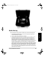
1
630045.book Page i Sunday, February 11, 2001 11:38 AM Z-Xtreme GPS Receiver System Guide for Post-Process Surveying Magellan Corporation Ashtech Precision Products 471 El Camino Real Santa Clara CA 95050-4300 Phone and Fax Numbers • Main • • • Sales • • • • Voice: 44-0118-931-9600 Fax: 44-0118-931-9601 Support • • • • US: 800-922-2401 International: 408-615-3970 Fax: 408-615-5200 Europe • • • Voice: 408-615-5100 Fax: 408-615-5200 US: 800-229-2400 International: 408-615-3980 Fax: 408-615-5200 Internet • • • [email protected] http://www.ashtech.com http://www.magellangps.com 630045.book Page ii Sunday, February 11, 2001 11:38 AM Copyright Notice Copyright © 2001 Magellan Corporation. All rights reserved. No part of this publication or the computer programs described in it may be reproduced, translated, stored in a retrieval system, or transmitted in any form or by any means, electronic, mechanical photocopying, recording, or otherwise, without prior written permission of Magellan. Your rights with regard to this publication and the computer programs are subject to the restrictions and limitations imposed by the copyright laws of the United States of America (“U.S.A.”) and/or the jurisdiction in which you are located. Printed in the United States of America. Part Number: 630045-01 Revision B November, 2001 Trademarks Z-Xtreme, Instant RTK, Z-Tracking, and the Ashtech logo are trademarks of Magellan Corp. Ashtech® is a registered trademark of Magellan Corp. All other products and brand names are trademarks or registered trademarks of their respective holders. ii Post-Process GPS Surveying 630045.book Page iii Sunday, February 11, 2001 11:38 AM SOFTWARE LICENSE AGREEMENT IMPORTANT: BY OPENING THE SEALED DISK PACKAGE CONTAINING THE SOFTWARE MEDIA, YOU ARE AGREEING TO BE BOUND BY THE TERMS AND CONDITIONS OF THE LICENSE AGREEMENT (“AGREEMENT”). THIS AGREEMENT CONSTITUTES THE COMPLETE AGREEMENT BETWEEN YOU (“LICENSEE”) AND MAGELLAN CORPORATION (“LICENSOR”). READ THE AGREEMENT CAREFULLY. IF YOU DO NOT AGREE WITH THE TERMS, RETURN THIS UNOPENED DISK PACKAGE AND THE ACCOMPANYING ITEMS TO THE PLACE WHERE YOU OBTAINED THEM FOR A FULL REFUND. LICENSE. LICENSOR grants to you a limited, non-exclusive, non-transferable, personal license (“License”) to (i) install and operate the copy of the computer program contained in this package (“Program”) in machine acceptable form only on a single computer (one central processing unit and associated monitor and keyboard) and (ii) to make one archival copy of the Program for use with the same computer. LICENSOR and its third-party suppliers retain all rights to the Program not expressly granted in this Agreement. OWNERSHIP OF PROGRAMS AND COPIES. This License is not a sale of the original Program or any copies. LICENSOR and its third-party suppliers retain the ownership of the Program and all copyrights and other proprietary rights therein, and all subsequent copies of the Program made by you, regardless of the form in which the copies may exist. The Program and the accompanying manuals (“Documentation”) are copyrighted works of authorship and contain valuable trade secret and confidential information proprietary to the LICENSOR and its third-party suppliers. You agree to exercise reasonable efforts to protect the proprietary interests of LICENSOR and its third-party suppliers in the Program and Documentation and maintain them in strict confidence. USER RESTRICTIONS. The Program is provided for use in your internal commercial business operations and must remain at all times upon a single computer owned or leased by you. You may physically transfer the Program from one computer to another provided that the Program is operated only on one computer at a time. You may not operate the Program in a time-sharing or service bureau operation, or rent, lease, sublease, sell, assign, pledge, transfer, transmit electronically or otherwise dispose of the Program or Documentation, on a temporary or permanent basis, without the prior written consent of LICENSOR. You agree not to translate, modify, adapt, disassemble, decompile, or reverse engineer the Program, or create derivative works of the Program or Documentation or any portion thereof. TERMINATION. The License is effective until terminated. The License will terminate without notice from LICENSOR if you fail to comply with any provision of this Agreement. Upon termination, you must cease all use of the Program and Documentation and return them and any copies thereof to LICENSOR. GENERAL. This Agreement shall be governed by and construed in accordance with the Laws of the State of California and the United States without regard to conflict of laws and provisions thereof and without regard to the United Nations Convention on Contracts for the International Sale of Goods. Unless modified in writing and signed by both parties, this warranty is understood to be the complete and exclusive agreement between the parties, superseding all prior agreements, oral or written, and all other communications between the parties relating to a warranty of the Product. No employee of Magellan or any other party is authorized to make any warranty in addition to those made in this document. This warranty allocates the risks of product failure between Magellan and the buyer. This allocation is recognized by both parties and is reflected in the price of the goods. The buyer acknowledges that it has read warranty, understands it, and is bound by its terms. This limited warranty is governed by the laws of the State of California, without reference to its conflict of law provisions or the U.N. Convention on Contracts for the International Sale of Goods. To the extent the foregoing provisions differ from the terms of the sales contract between the buyer and Magellan Corporation, the sales contract will take precedence. The sales contract contains procedural qualifications and other contractual terms relating to the foregoing provisions. iii 630045.book Page iv Sunday, February 11, 2001 11:38 AM DISCLAIMER OF WARRANTIES AND LIMITATION OF LIABILITY LICENSOR AND ITS THIRD-PARTY SUPPLIERS MAKE NO WARRANTIES OR REPRESENTATIONS, EXPRESS OR IMPLIED, REGARDING THE PROGRAM, MEDIA, DOCUMENTATION, RESULTS OR ACCURACY OF DATA AND HEREBY EXPRESSLY DISCLAIM ANY WARRANTIES OF MERCHANTIBILITY AND FITNESS FOR A PARTICULAR PURPOSE AND NONFRINGEMENT. LICENSOR AND ITS THIRD PARTY SUPPLIERS DO NOT WARRANT THE PROGRAM WILL MEET YOU REQUIREMENTS OR THAT ITS OPERATION WILL BE UNINTERRUPTED OR ERROR-FREE. LICENSOR, its third-party suppliers, or anyone involved in the creation or delivery of the Program or Documentation to you shall have no liability to you or any third-party for special, incidental, indirect or consequential damages (including, but not limited to, loss of profits or savings, downtime, damage to or replacement of equipment or property, or recovery or replacement of programs or data) arising from claims based in warranty, contract, tort (including negligence), strict liability, or otherwise even if LICENSOR and its third-party have been advised of the possibility of such claim or damages. The liability of LICENSOR and its third-party suppliers for direct damages shall not exceed the actual amount paid for the program license. Some States do not allow the exclusion of limitation of implied warranties or liability for incidental or consequential damages, so the above limitations or exclusions may not apply to you. MANUAL DISCLAIMER THIS MANUAL IS PROVIDED “AS IS”; MAGELLAN MAKES NO WARRANTIES TO ANY PERSON OR ENTITY WITH RESPECT TO THE SUBJECT MATTER OR USE OF INFORMATION CONTAINED HEREIN OR ANY DERIVATIVES THEREOF OR ANY SERVICES OR LICENSES. MAGELLAN DISCLAIMS ALL IMPLIED WARRANTIES, INCLUDING, WITHOUT LIMITATION, WARRANTIES OF MERCHANTABILITY AND FITNESS FOR A PARTICULAR PURPOSE AND NONINFRINGEMENT. FURTHER, MAGELLAN DOES NOT WARRANT, GUARANTEE, OR MAKE ANY REPRESENTATIONS REGARDING THE USE, OR THE RESULTS OF THE USE, OF THIS MANUAL IN TERMS OF CORRECTNESS, ACCURACY, RELIABILITY, OR OTHERWISE. THIS PUBLICATION AND FEATURES DESCRIBED HEREIN ARE SUBJECT TO CHANGE WITHOUT NOTICE. U.S. GOVERNMENT RESTRICTED RIGHTS The Program and Documentation are provided with RESTRICTIVE RIGHTS. Use, duplication, or disclosure by the Government is subject to restrictions as set forth in subdivision (c)(1)(ii) of the Rights in Technical Data and Computer Software clause at DFARS 252.227-7013 or subdivision 9(c)(1) and (2) of the Commercial Computer Software - Restricted Rights 48 CFR 52.227.19, as applicable. Should you have any questions concerning the License Agreement or the Limited Warranties and Limitation of Liability, please contact Magellan Corporation in writing at the following address: 471 El Camino Real, Santa Clara, CA 95050-4300 iv Post-Process GPS Surveying 630045.book Page v Sunday, February 11, 2001 11:38 AM Table of Contents Chapter 1. Introduction . . . . . . . . . . . . . . . . . . . . . . . . . . . . . . . . . . . . . . . . . . . 1 The Global Positioning System (GPS) . . . . . . . . . . . . . . . . . . . . . . . . . . . . . . 2 Surveying with GPS . . . . . . . . . . . . . . . . . . . . . . . . . . . . . . . . . . . . . . . . . . . . 2 Post-process GPS Surveying . . . . . . . . . . . . . . . . . . . . . . . . . . . . . . . . . . . . . 3 Post-process Data Collection . . . . . . . . . . . . . . . . . . . . . . . . . . . . . . . . . 3 Static Data Collection . . . . . . . . . . . . . . . . . . . . . . . . . . . . . . . . . . . . 3 Kinematic Data Collection . . . . . . . . . . . . . . . . . . . . . . . . . . . . . . . . . 4 Post-process Data Processing . . . . . . . . . . . . . . . . . . . . . . . . . . . . . . . . 4 Applications . . . . . . . . . . . . . . . . . . . . . . . . . . . . . . . . . . . . . . . . . . . . . . . . . . 5 Limitations . . . . . . . . . . . . . . . . . . . . . . . . . . . . . . . . . . . . . . . . . . . . . . . . . . . 5 Ashtech Z-Xtreme Survey System . . . . . . . . . . . . . . . . . . . . . . . . . . . . . . . . . 6 Chapter 2. System Components . . . . . . . . . . . . . . . . . . . . . . . . . . . . . . . . . . . . 7 Hardware . . . . . . . . . . . . . . . . . . . . . . . . . . . . . . . . . . . . . . . . . . . . . . . . . . . . 7 GPS Receiver . . . . . . . . . . . . . . . . . . . . . . . . . . . . . . . . . . . . . . . . . . . . . 7 Z-Xtreme Receiver . . . . . . . . . . . . . . . . . . . . . . . . . . . . . . . . . . . . . . 7 GPS Antenna . . . . . . . . . . . . . . . . . . . . . . . . . . . . . . . . . . . . . . . . . . . . . 8 Geodetic IV . . . . . . . . . . . . . . . . . . . . . . . . . . . . . . . . . . . . . . . . . . . . 9 Choke Ring Antenna . . . . . . . . . . . . . . . . . . . . . . . . . . . . . . . . . . . . 10 Handheld Computer . . . . . . . . . . . . . . . . . . . . . . . . . . . . . . . . . . . . . . . 10 Compaq Aero Pocket PC . . . . . . . . . . . . . . . . . . . . . . . . . . . . . . . . 11 Power System . . . . . . . . . . . . . . . . . . . . . . . . . . . . . . . . . . . . . . . . . . . 11 Internal Power . . . . . . . . . . . . . . . . . . . . . . . . . . . . . . . . . . . . . . . . . 11 External Power . . . . . . . . . . . . . . . . . . . . . . . . . . . . . . . . . . . . . . . . 12 Internal to External Power Conversion Kit . . . . . . . . . . . . . . . . 12 Cable-to-User-Supplied Power Source . . . . . . . . . . . . . . . . . . . 14 Software . . . . . . . . . . . . . . . . . . . . . . . . . . . . . . . . . . . . . . . . . . . . . . . . . . . . 14 Field Application Software . . . . . . . . . . . . . . . . . . . . . . . . . . . . . . . . 14 Survey Control CE 15 v 630045.book Page vi Sunday, February 11, 2001 11:38 AM Post-Processing Software . . . . . . . . . . . . . . . . . . . . . . . . . . . . . . . .15 Ashtech Solutions . . . . . . . . . . . . . . . . . . . . . . . . . . . . . . . . . . .15 Chapter 3. Connecting System Hardware . . . . . . . . . . . . . . . . . . . . . . . . . . . . 17 GPS Receiver – GPS Antenna . . . . . . . . . . . . . . . . . . . . . . . . . . . . . . . . . . .17 Handheld Computer – GPS Receiver . . . . . . . . . . . . . . . . . . . . . . . . . . . . .19 GPS Receiver – Receiver Power System . . . . . . . . . . . . . . . . . . . . . . . . . .20 Chapter 4. Survey Preparation & Execution . . . . . . . . . . . . . . . . . . . . . . . . . . 23 Static Survey . . . . . . . . . . . . . . . . . . . . . . . . . . . . . . . . . . . . . . . . . . . . . . . .25 Kinematic Survey . . . . . . . . . . . . . . . . . . . . . . . . . . . . . . . . . . . . . . . . . . . . .31 Kinematic Initialization . . . . . . . . . . . . . . . . . . . . . . . . . . . . . . . . . . . . . 35 Point Observation . . . . . . . . . . . . . . . . . . . . . . . . . . . . . . . . . . . . . . . . . 38 Continuous Kinematic . . . . . . . . . . . . . . . . . . . . . . . . . . . . . . . . . . . . . . 39 Stop&Go Kinematic . . . . . . . . . . . . . . . . . . . . . . . . . . . . . . . . . . . . . . . 39 Chapter 5. Troubleshooting . . . . . . . . . . . . . . . . . . . . . . . . . . . . . . . . . . . . . . . 41 GPS receiver does not track satellites . . . . . . . . . . . . . . . . . . . . . . . . . 42 1. Is the GPS receiver powered up? . . . . . . . . . . . . . . . . . . . . . . . .42 2. Is the GPS antenna connected to the receiver? . . . . . . . . . . . . .43 3. A component may be malfunctioning. . . . . . . . . . . . . . . . . . . . . .43 4. You may have a malfunctioning GPS receiver. . . . . . . . . . . . . . .43 GPS Receiver Is Not Recording Data. . . . . . . . . . . . . . . . . . . . . . . . . . 43 1. Is the GPS receiver tracking satellites? . . . . . . . . . . . . . . . . . . . .44 2. Is the data card installed in the GPS receiver? . . . . . . . . . . . . . .44 3. Is the data card full? . . . . . . . . . . . . . . . . . . . . . . . . . . . . . . . . . .44 4. A component may be malfunctioning. . . . . . . . . . . . . . . . . . . . . .44 Index . . . . . . . . . . . . . . . . . . . . . . . . . . . . . . . . . . . . . . . . . . . . . . . . . . . . . . . . .47 vi Post-Process GPS Surveying 630045.book Page vii Sunday, February 11, 2001 11:38 AM List of Figures Figure 2.1. Figure 2.2. Figure 2.3. Figure 2.4. Figure 2.5. Figure 2.6. Figure 3.1. Figure 3.2. Figure 3.3. Figure 3.4. Figure 3.5. Figure 4.1. Figure 4.2. Figure 4.3. Figure 4.4. Figure 4.5. Figure 4.6. Figure 4.7. Figure 4.8. Z-Xtreme GPS Receiver . . . . . . . . . . . . . . . . . . . . . . . . . . . . . . . . . . 8 Geodetic IV Antenna without and with Groundplane . . . . . . . . . . . . . 9 Choke Ring Antenna . . . . . . . . . . . . . . . . . . . . . . . . . . . . . . . . . . . . 10 Compaq Aero Handheld Computer . . . . . . . . . . . . . . . . . . . . . . . . . 11 Typical Internal Power Source. . . . . . . . . . . . . . . . . . . . . . . . . . . . . 12 Internal Power Source with External Conversion Kit . . . . . . . . . . . . 14 GPS Antenna Cable with TNC Connectors . . . . . . . . . . . . . . . . . . . 18 Cable Connected to Z-Xtreme Receiver and Geodetic IV Antenna. 18 Computer Connection Cable . . . . . . . . . . . . . . . . . . . . . . . . . . . . . . 19 Aero Handheld Pouch . . . . . . . . . . . . . . . . . . . . . . . . . . . . . . . . . . . 20 Z-Xtreme Connected to External Power . . . . . . . . . . . . . . . . . . . . . 21 Kit Bag . . . . . . . . . . . . . . . . . . . . . . . . . . . . . . . . . . . . . . . . . . . . . . . 24 Inside View of Kit Bag . . . . . . . . . . . . . . . . . . . . . . . . . . . . . . . . . . . 25 Conventional and Fixed-Height Tripods . . . . . . . . . . . . . . . . . . . . . 27 Measuring HI (Height of Instrument) of GPS Antenna. . . . . . . . . . . 28 Z-Xtreme Survey System Performing a Static Survey. . . . . . . . . . . 31 Geodetic IV GPS Antenna on Rover Pole . . . . . . . . . . . . . . . . . . . . 32 Compaq Aero Handheld Mounted on Rover Pole . . . . . . . . . . . . . . 33 Rover System Ready to Survey . . . . . . . . . . . . . . . . . . . . . . . . . . . 35 vii 630045.book Page viii Sunday, February 11, 2001 11:38 AM viii Post-Process GPS Surveying 630045.book Page 1 Sunday, February 11, 2001 11:38 AM 1 Introduction Although difficult to believe, it has been nearly 20 years since precise positioning using the Global Positioning System (GPS) was demonstrated. In a relatively short time, this capability was put to commercial use with the introduction of the Macrometer V-1000 GPS receiver. Although the Macrometer was unwieldy, temperamental, and very expensive ($150,000 each), its ability to geodetically position points at an accuracy of 1-2 parts-per-million of point separation (1mm per 1 kilometer), without the benefit of line-of-sight between the points, was a tremendous asset. This was the birth of surveying with GPS. From its beginning in the early 1980s to the mid 1990s, GPS surveying went through a tremendous evolution. Equipment become much more affordable, reliable, and manageable in size and weight. But through this entire period, two important characteristics remained the same; accuracy and the surveying method used to achieve this accuracy. The method was post-process GPS surveying. With post-process GPS surveying, data is collected and later processed on a computer to produce the final results, i.e. positions of all points surveyed. This method can be equated to using a conventional theodolite and EDM to collect a sequence of angles and distances between points, later computing the coordinates of the surveyed points. Until the mid 1990s, post-process was the only method available to determine survey-grade positions using GPS. A new method was then introduced call RealTime Kinematic (RTK). With the RTK method, point positions are determined immediately during data collection. This method can be equated to using a total station to collect a sequence of angles and distances between points, with the total station computing the coordinates of these points as the data is collected. RTK GPS surveying has a number of advantages. The results of your survey are known immediately. Also, with the ability to determine your position in real-time comes the ability to stakeout. Balancing the advantages of RTK are some disadvantages. RTK-enabled GPS systems are more expensive, in some cases Introduction 1 630045.book Page 2 Sunday, February 11, 2001 11:38 AM considerably so. RTK systems are somewhat more complex, requiring management of a communication link between GPS receivers. Finally, RTK GPS surveying is slightly less accurate than post-process. Even with the introduction of RTK GPS surveying in the mid 1990s, post-process GPS surveying has continued to be the most popular method of surveying with GPS. It remains the most accurate and reliable method to survey with GPS. The Global Positioning System (GPS) Let’s take a quick look at what makes this all possible, the Global Positioning System (GPS). GPS consists of three primary components, satellites, groundbased control and monitoring stations, and receivers. The control and monitoring stations’ main purpose is to monitor and maintain the satellites. These stations are invisible to the user. You need know nothing else about them except that they exist to ensure that the satellites are functioning properly. Satellites make up the second primary component of GPS. The full satellite constellation is defined as 24 satellites, although at the time of this writing 27 are currently operational. Each satellite is in an orbit approximately 20,000 km above the earth’s surface and has an orbital period of slightly less than 12 hours. On board each satellite is a radio transceiver. The transceiver receives information and instructions from the control station, and transmits information about its identity, location, time, etc. Each satellite is capable of transmission on two separate frequencies, L1 at 1575.42 MHz and L2 at 1227.60 MHz. While you do not have to be concerned with the control and monitoring stations, you are required to have knowledge regarding the location, geometry, and number of satellites available during your data collection. These important factors dictate the reliability and accuracy of a GPS survey. GPS receivers receive and store transmissions from the GPS satellites. This is their primary function, and for some receivers, their only function. In addition to reception and storage of satellite transmissions, some receivers perform additional functions such as compute and display receiver position in various datums and grid systems, output raw data and computed position through serial ports, display satellite availability information, etc. Surveying with GPS A GPS surveying system consists of at least two GPS receivers. The receivers collect data simultaneously to determine the location of one receiver relative to 2 Post-Process GPS Surveying 630045.book Page 3 Sunday, February 11, 2001 11:38 AM It’s important to remember that GPS observations result in vectors defining the relationship between the points observed. That is, a vector is the result of a GPS observation, not the coordinates of the surveyed points. To determine coordinates of surveyed points, a set of coordinates must first be supplied for one of the points. Based on this set of coordinates and the GPS vectors observed for all other points, coordinates for the other points can be computed. In this manner, coordinates for the newly surveyed points are determined. Similar to a conventional traverse, your initial set of coordinates can originate from a known control point incorporated into your survey. Alternatively, assumed coordinates can used. Post-process GPS Surveying Post-process GPS surveying can be broken down into two primary tasks, data collection and data processing. Let’s examine each task in detail. Post-process Data Collection Data collection can be performed using two different methods; static and kinematic. Following is a description of each method. Static Data Collection As the name implies, static data collection is stationary in nature. The GPS systems simultaneously collect raw data from all available satellites while remaining stationary on their respective points. Data collection continues at these locations for an amount of time dependent upon distance between the receivers, satellite geometry, and obstruction conditions at the data collection locations (for example, trees or building blocking some of the sky). When data collection is complete at these specific points, the GPS systems may move to a new set of points to begin another static data collection session. In most cases, one GPS system will remain on its current point in order to link the previous set of points to the new set of points. After data collection is complete, data is downloaded to a computer for post-processing. Processing will compute vectors to determine the position of all points observed. Introduction 3 Introduction the other(s). The positional relationship between the receivers is presented in the form of a vector, i.e. (delta X, delta Y, delta Z) or (delta N, delta E, delta H) between the receivers. This is a 3-dimensional relationship. It is analogous to a conventional observation of (horizontal angle, vertical angle, slope distance). Vectors are produced between all combinations of GPS receivers used during the survey. 630045.book Page 4 Sunday, February 11, 2001 11:38 AM Static data collection produces the most accurate and reliable results due to the amount of data collected during each observation. The disadvantage is in productivity. Long observations at each point reduce the number of points that can be collected in a day. Kinematic Data Collection With kinematic data collection, one of the GPS receivers in the system is designated as the base and remains stationary throughout the survey. All surveyed points are determined relative to the base. Once operational, the base system simply collects and stores raw data from all the available satellites. The other GPS receiver(s) is designated as the rover. Again, as the name implies, kinematic data collection is dynamic in nature. The operator of the rover system moves around the project site collecting data on items of interest. While moving around the project site, the operator will stop for a short period of time to position a specific item, such as a manhole. Occupation time of the point can range from 6 seconds to 60 seconds. Once finished, the operator moves on the next point. Also, the operator can position linear features, such as the centerline of a road, by simply walking along the centerline and instructing the rover system to store a position every five seconds, for example. The result is a trail of points defining the centerline. To facilitate the mobility required to utilize the kinematic method of data collection, the rover system is designed to be man-portable, usually carried in a backpack. The user interfaces with the rover system through a handheld computer/data collector. While it is obvious that kinematic data collection has the advantage of high productivity, there are disadvantages. Accuracies are not as good as with static data collection. In addition, the rover system must maintain lock on GPS satellites as it moves around the project area. Loss of lock requires the user to return to one of the last successfully established points for initialization. Post-process Data Processing Post-process GPS surveying requires that collected GPS data be later processed to obtain results. Processing is accomplished by software included with the system. Processing normally occurs on a PC back at the office, but can also be performed on a laptop in the field. To accomplish the post-processing, data is downloaded from each GPS receiver into the computer. The processing software utilizes this data to calculate vectors between all GPS receivers operating simultaneously. The vectors define the 3dimensional relationship between the GPS receivers. From these vectors, coordinates are determined for all points in the project, based on the coordinates 4 Post-Process GPS Surveying 630045.book Page 5 Sunday, February 11, 2001 11:38 AM Applications Post-process GPS is well suited for most surveying tasks. Systems are being used today for control establishment, boundary surveys, and mapping applications such as topographic, planimetric, and as-built surveys. Post-process GPS is also very efficient for volumetric measurements such as stockpiles and gravel pits. In many cases, a GPS system will be vastly more productive in these types of surveys than a conventional total station, with the added benefit that a GPS system can be operated by only one person. Limitations GPS surveying systems have limitations that affect their ability to perform some of the survey tasks discussed above. Being aware of these limitations will ensure successful results from your GPS surveys. The main limitation is not confined to post-process GPS but is a limitation of the GPS system in general. As discussed earlier, GPS depends on reception of radio signals transmitted by satellites approximately 20,000 km from earth. Being of relatively high frequency and low power, these signals are not very effective at penetrating objects that may obstruct the line-of-sight between the satellites and the GPS receiver. Virtually any object that lies in the path between the GPS receiver and the satellites will be detrimental to the operation of the system. Some objects, such as buildings, can completely block the satellite signals. Therefore, GPS can not be used indoors. For the same reason, GPS cannot be used in tunnels or under water. Other objects such as trees can partially obstruct or reflect/refract the signal, so that reception of GPS signals is very difficult in a heavily forested area. In some cases, enough signal can be observed to compute a rough position, but in virtually every case, the signal is not clean enough to produce centimeter-level positions. Therefore, GPS is not effective in a forest. This is not to say that GPS surveying systems can only be used in areas with wide-open view of the sky. GPS can be used effectively and accurately in partially obstructed areas. The trick is to be able to observe, at any given time, enough satellites to accurately and reliably compute a position. At any given time and Introduction 5 Introduction of one or more known points. If the survey included any redundant observations (closed loops, repeat observations), then a least-squares adjustment can be performed to help identify any blunders in the data and improve on the final point positions. The capability to perform a least-squares adjustment is included with the post-processing software package. 630045.book Page 6 Sunday, February 11, 2001 11:38 AM location, 7-10 GPS satellites may be visible and available for use, although the GPS system does not require this many satellites to function. Accurate and reliable positions can be determined with five satellites properly distributed throughout the sky. Therefore, an obstructed location can be surveyed if at least five satellites can be observed. This makes GPS use possible along a tree line or against the face of a building, but only if that location leaves enough of the sky open to allow the system to observe at least five satellites. Ashtech Z-Xtreme Survey System The Z-Xtreme Survey System is Ashtech’s most advanced post-process survey system. The system includes all required components to perform post-process GPS surveys. The Z-Xtreme Survey System is built around the Ashtech ZXtreme dual-frequency GPS receiver. Being a dual-frequency receiver (utilizes satellite signals on both L1 and L2 frequencies), the Z-Xtreme makes your GPS system more versatile and productive compared to a post-process GPS system based on a single-frequency GPS receiver. A dual-frequency system requires shorter observation times on point for static surveys, requires less time to initialize, less effort to remain initialized during kinematic surveys, and will maintain the highest level of accuracy even when surveying points separated by 20 kilometers or more. There is no more advanced post-process survey system than one based on the Z-Xtreme dual-frequency GPS receiver. 6 Post-Process GPS Surveying 630045.book Page 7 Sunday, February 11, 2001 11:38 AM 2 System Components A GPS surveying system is made up of a number of components that, at first glance, may seem a bit overwhelming. On the contrary, setup of a GPS system is not a complicated task. The trick is understanding the purpose of each component in the system and how they relate to each other. With this understanding, connectivity of the hardware components, and when and how to use the software components, becomes logical and straight-forward. Hardware A GPS surveying system includes a number of hardware components, each with a specific function. The Z-Xtreme survey system offers options for many of the components, each with specific advantages. Choosing the right component will depend on the users needs and environment in which the system is to be used. In this section, each of the major components of the Z-Xtreme system is presented. If options exist for a specific component, each option is discussed. GPS Receiver The GPS receiver is the component of the system that processes and stores the satellite signals. A GPS surveying system requires at least two GPS receivers. Z-Xtreme Receiver The Z-Xtreme Survey system is built around the Z-Xtreme dual-frequency GPS receiver shown in Figure 2.1. System Components 7 630045.book Page 8 Sunday, February 11, 2001 11:38 AM Figure 2.1. Z-Xtreme GPS Receiver The Z-Xtreme supports an integral battery, removable PC card memory, and optional internal radio. It is capable of functioning as the base or rover in RTK and post-processed surveys. The integrated display and control panel supports the ability to perform some survey tasks without a handheld computer. Environmentally, the receiver meets MIL-STD-810E specifications for wind-driven rain and dust. GPS Antenna In order for the GPS receiver to receive satellite signals, it must utilize an antenna. The GPS receiver antenna is the actual collection point of the satellite signals. It is also the point for which the position of the rover system is computed. Therefore, to determine the location of a feature, the GPS receiver antenna must be placed over this feature. The horizontal position of the feature is determined by the location of the center of the antenna. The vertical position of the feature is determined by the location of the center of the antenna minus the known height of the antenna above the feature. Each GPS receiver in the system will have one GPS receiver antenna. The Z-Xtreme system offers a choice between two different GPS receiver antennae for the base system, the Geodetic IV antenna, and the choke ring antenna. Obstruction conditions will dictate which antenna is appropriate. 8 Post-Process GPS Surveying 630045.book Page 9 Sunday, February 11, 2001 11:38 AM Geodetic IV The Geodetic IV antenna, Figure 2.2, is the standard antenna offered. System Components Figure 2.2. Geodetic IV Antenna without and with Groundplane The Geodetic IV is small, lightweight, and meets the needs of most users. It is available with an optional groundplane attachment, which is effective in reducing noise created by satellite signals reflecting off of nearby obstructions. The technical name for this noise is multipath. Using the groundplane attachment will reduce the effects of multipath on the data collected. In order to be effective at reducing the effects of multipath, the groundplane attachment significantly increases the size and weight of the antenna. For this reason, the groundplane attachment is not recommended for use on a kinematic rover. If points for static data collection or placement of a kinematic base are located in areas where obstructions, such as metal buildings, may cause multipath, the groundplane attachment is a recommended option. System Components 9 630045.book Page 10 Sunday, February 11, 2001 11:38 AM Choke Ring Antenna The choke ring antenna, Figure 2.3, is the ultimate antenna for multipath rejection. Figure 2.3. Choke Ring Antenna For points located in harsh multipath environments, the choke ring antenna would be advisable. An example of a harsh multipath environment would be the top of a building which houses large metal compressors and air conditioning units. These structures will reflect satellite signals which the antenna may pick up. The choke ring antenna is designed to function in the most demanding multipath environments. A significant drawback to the choke-ring antenna is its size and weight, making the antenna unwieldy for mobile use. For this reason, choke-ring antennas are normally used only in surveys requiring the highest level of accuracy. Handheld Computer A handheld computer is an optional component of the Z-Xtreme Survey System. It serves as a more advanced interface to the Z-Xtreme GPS receiver. Although the Z-Xtreme has a built-in interface, it is limited in its capabilities. The handheld computer, running field application software (discussed below), expands on the receiver interface, providing more control and functionality. If the kinematic data collection method is intended to be utilized, it is highly recommended that one handheld computer be included with the system. 10 Post-Process GPS Surveying 630045.book Page 11 Sunday, February 11, 2001 11:38 AM Compaq Aero Pocket PC The Z-Xtreme Survey System offers, as an option, the Compaq Aero Pocket PC, Figure 2.4, a low-cost yet reliable handheld computer. Although not designed for use in harsh environments, the Aero comes with an environmental pouch that protects the computer, allowing it to be used in rain. The Aero Pocket PC operates under a Windows CE operating system. System Components Figure 2.4. Compaq Aero Handheld Computer Power System All GPS receivers in the system require a power source. A number of options are available for powering the Z-Xtreme GPS receiver. Each is described below: Internal Power Each Z-Xtreme receiver in the ZX SuperStation will include one internal battery for power. Each battery will operate the receiver for approximately 10 hours at room System Components 11 630045.book Page 12 Sunday, February 11, 2001 11:38 AM temperature. For most users, the available power from the internal battery will be sufficient. Figure 2.5 shows a typical internal battery. Figure 2.5. Typical Internal Power Source External Power For extended operation, an external power source is available as an option with the Z-Xtreme System. Internal to External Power Conversion Kit A kit can be purchased that allows the use of an internal battery as an external power source. The kit includes an extra internal battery, and a combined pouch and cable that allows connection of the internal battery to the external power port of the Z-Xtreme receiver (Figure 2.6). With an internal battery and this external 12 Post-Process GPS Surveying 630045.book Page 13 Sunday, February 11, 2001 11:38 AM power source, the receiver should function un-interrupted for approximately 20 hours at room temperature. System Components System Components 13 630045.book Page 14 Sunday, February 11, 2001 11:38 AM Figure 2.6. Internal Power Source with External Conversion Kit Cable-to-User-Supplied Power Source In addition to the external power source, an optional cable is available to allow use of a vehicle battery for extended operation periods. Also available is a cable to power the GPS receiver from a cigarette lighter port. Software As with hardware, a GPS survey system includes a number of software components used both in the office and in the field. The Z-Xtreme Survey System offers options for some of the software components. Each component, including options, is discussed below. Field Application Software The field application software resides in the handheld computer/data collector. As with the handheld computer, this is an optional component to the Z-Xtreme Survey System. The field application software offers an enhanced interface to the Z-Xtreme receiver, supporting additional status information and operational capabilities not available through the integrated interface of the receiver. As stated with the handheld computer, if the Z-Xtreme Survey System is intended to be used in the kinematic data collection mode, then it is highly recommended that one handheld computer and one copy of field application software be included in the system. 14 Post-Process GPS Surveying 630045.book Page 15 Sunday, February 11, 2001 11:38 AM The Z-Xtreme Survey System offers, as an option, the following field application software. Survey Control CE Survey Control CE was designed specifically for use with Ashtech post-process survey systems. The software guides you through the steps required to perform surveys using both static and kinematic data collection methods. Survey Control CE is a Windows CE-based software which runs on the Compaq Aero Pocket PC. With post-process GPS surveying, data is first collected in the field and then postprocessed in the office to compute positions of occupied points. The postprocessing software performs this task. In addition, the post-processing software includes tools to examine satellite availability at any given time, to download data from the GPS receivers, and to create export formats and reports of survey results. The Z-Xtreme Survey System includes the following post-process software package. Ashtech Solutions Ashtech Solutions includes all functionality required to support post-processing of data collected using receivers in the Z-Xtreme surveying system. Using Ashtech Solutions, you can examine satellite availability prior to field operations (Mission Planning utility), transfer data between the GPS receivers and office computer, process raw data to produce vectors between surveyed sights, adjust vectors to produce accurate and reliable positions, export, and create reports of survey results. This is all accomplished through a very user-friendly software environment. This concludes the presentation of hardware and software components which make up the Z-Xtreme Survey System. Next, we will examine the relationship between the hardware components. System Components 15 System Components Post-Processing Software 630045.book Page 16 Sunday, February 11, 2001 11:38 AM 16 Post-Process GPS Surveying 630045.book Page 17 Sunday, February 11, 2001 11:38 AM 3 Connecting System Hardware At this point, you should have an understanding of the function of each hardware component of a GPS survey system and how the components relate to each other. In order for the different components to function as a system, they must communicate. This requires that the components be connected for both communication and power. Here we will examine the connectivity of the GPS system hardware components. Below is presented a list of all connections required to make the GPS survey system function. GPS Receiver – GPS Antenna The GPS receiver requires an antenna in order to observe the data being transmitted by the satellites. Therefore, the GPS antenna must be connected to the GPS receiver. This connection is made through a coaxial cable ranging in length from 3 to 30 meters. This cable serves two purposes, it supplies power to the GPS antenna from the receiver, and it sends the satellite signals observed by the antenna to the receiver. Figure 3.1 shows a typical GPS antenna cable with a TNC connector on each end. Connecting System Hardware 17 630045.book Page 18 Sunday, February 11, 2001 11:38 AM Figure 3.1. GPS Antenna Cable with TNC Connectors The GPS antenna cable connects to the Z-Xtreme via a TNC type connector found on the back panel of the receiver. The proper connector is labeled GPS. The other end of the cable connects to the GPS antenna via either a TNC type or N type connector depending on which antenna used, as shown in Figure 3.2. A TNC connector is found on the Geodetic IV antenna. An N type connector is found on the choke ring. Figure 3.2. Cable Connected to Z-Xtreme Receiver and Geodetic IV Antenna The GPS antenna can be connected to the receiver at any time before or after the receiver is powered on. Make sure the connection at both the receiver and antenna is tight and not cross-threaded. 18 Post-Process GPS Surveying 630045.book Page 19 Sunday, February 11, 2001 11:38 AM Handheld Computer – GPS Receiver The optional handheld computer must communicate with the Z-Xtreme GPS receiver to serve as an interface to the receiver. This is accomplished via an RS232 cable such as the one shown in Figure 3.3. The computer communication cable connects to the Z-Xtreme via one of the three serial ports on the back panel of the receiver. These three ports are grouped together and labeled SERIAL PORTS. Although any one of the three ports will accept the connection to the handheld, it is recommended that the handheld be connected to port A. Connecting Hardware Figure 3.3. Computer Connection Cable Connection of the computer communication cable to the handheld is made via a standard 9-pin serial connector. The Compaq Aero must be in its environmental pouch in order to connect it to the Z-Xtreme receiver (Figure 3.4). The handheld can be connected to the receiver at any time during the equipment setup and data collection process. Connecting System Hardware 19 630045.book Page 20 Sunday, February 11, 2001 11:38 AM Figure 3.4. Aero Handheld Pouch GPS Receiver – Receiver Power System Supplying power to the GPS receiver can be accomplished in two ways. The ZXtreme receiver has a battery integrated into the receiver for power. This connection does not require a cable. The battery is simply inserted into the receiver. If the GPS system is to function unattended for a period of time not supported by the internal battery, an external battery can be used (Figure 3.5). External power is applied to the Z-Xtreme by either connecting the battery cable connected to the optional external power kit, or the cable for a user-supplied power source to the POWER port on the back of the receiver. 20 Post-Process GPS Surveying 630045.book Page 21 Sunday, February 11, 2001 11:38 AM Figure 3.5. Z-Xtreme Connected to External Power The external power source can be connected at any time without concern of the internal battery. Connecting System Hardware 21 Connecting Hardware This concludes our review of the hardware component connectivity for the ZX SuperStation. We are now ready to examine the setup and execution procedures for performing a survey. 630045.book Page 22 Sunday, February 11, 2001 11:38 AM 22 Post-Process GPS Surveying 630045.book Page 23 Sunday, February 11, 2001 11:38 AM 4 Survey Preparation & Execution The previous chapters laid the ground work for understanding the purpose of each component of the Z-Xtreme Surveying system and the relationship between components. This understanding of the functionality and connectivity of the system components will prove invaluable during survey preparation and execution. Let’s put this new found knowledge to good use. This chapter will step through the general process of preparing for and executing a survey with the Z-Xtreme Surveying System. Specific details on how to utilize the Z-Xtreme interface or the field application software to perform these steps are not presented here. Those details can be found in the manuals for the Z-Xtreme receiver and the field application software. Previously, we discussed the static and kinematic methods of performing postprocess GPS surveying. Since the two methods require different procedures in equipment setup and data collection, each is discussed separately below. Before proceeding any further, let’s examine how your Z-Xtreme system is packaged. Your Z-Xtreme system consists of at least two Z-Xtreme receivers. Each Z-Xtreme receiver and accompanying components (antenna, cables, power source, etc) resides in a dedicated transport case. All components required to perform your survey can be housed in the case, with the exception of the optional Geodetic IV antenna ground plane and tripod/rover pole. In each transport case you will find a bag, referred to as the kit bag, housing all the components, as shown in Figure 4.1. Survey Preparation & Execution 23 630045.book Page 24 Sunday, February 11, 2001 11:38 AM Figure 4.1. Kit Bag In the kit bag you should find the Z-Xtreme GPS receiver, Geodetic IV antenna with tribrach adapter, antenna cable, HI measurement device, and internal battery. There is additional room in the kit bag for miscellaneous items such as a tribrach, and optional external power supply. A second smaller accessories bag may be included with the kit bag in the transport case to hold certain accessories such as components required to support a pole-mounted rover configuration. The kit bag comes with shoulder straps so it can be used as a backpack. When configuring a rover kinematic system, the kit bag will be used to carry the components on the operator’s back. The shoulder straps are also useful when a short hike is required to access the location of a survey point. The Z-Xtreme receiver is mounted in the kit bag is such a way as to make it possible to leave cables, such as antenna and handheld cables, connected to the receiver. This allows for quick setup when arriving on a point (Figure 4.2). 24 Post-Process GPS Surveying 630045.book Page 25 Sunday, February 11, 2001 11:38 AM Figure 4.2. Inside View of Kit Bag Static Survey Prior to leaving the office to perform a GPS survey, check the following items: 2. Check to ensure that the batteries are charged. 3. Using the Mission Planning module of the post-processing software, check the satellite availability for the time period when data is to be collected. Ensure that satellite geometry is sufficient to support good GPS surveying. Satellite geometry is measured using a calculated value call Dilution of Precision (DOP). A number of different DOP values exist, the most common of which is Position Dilution of Precision (PDOP). The Mission Planning software will give PDOP values for the time periods in which data is intended to be collected. Avoid collecting data during periods where PDOP values are larger than 4 (the lower the number the better). Refer to the documentation accompanying the post-processing software for more details on PDOP and how to use the Mission Planning software to determine when data should be and should not be collected. Survey Preparation & Execution 25 Surveying 1. Check through the GPS system to ensure all components are present to successfully perform the survey. 630045.book Page 26 Sunday, February 11, 2001 11:38 AM 4. Ensure that each operator of a GPS receiver has blank GPS observation logs to utilize during data collection. Fill out one sheet for each observation of each point. Observation logs will be discussed in more detail later in this section. The post-processing software supports the ability to print blank observation logs for use during data collection. With the previous checklist completed, field data collection can begin. When collecting data using the Static method, each Z-Xtreme receiver will follow precisely the same steps in equipment setup and survey execution. These steps are presented below. 1. Determine if point location is suitable for GPS observations As discussed earlier, obstructions between the GPS antenna and the GPS satellites interfere with data collection. The best results are obtains while observing points that have clear view to the sky. When obstructions are present, observation times need to increase to obtain the same level of accuracy. With enough obstructions, it becomes impossible to obtain enough quality data to determine an accurate position for the point. If the exact location of the point to be surveyed is flexible, select a location that contains the least amount of obstructions. If the location is not flexible and is obstructed, extend the observation time for the point. With a severely obstructed point, it may be necessary to observe a pair of points offset from the point of interest. The position of the point of interest can later be established through conventional means using the offset points. Determining if a location is suitable for GPS observations is far from an exact science. Successes and failures will eventually give a user a feel for the suitability of a location. 2. Position GPS antenna over point to be surveyed The GPS antenna is the data collection point for GPS observations, i.e. the computed position for the point will be the location of the GPS antenna. Therefore, it must be precisely positioned over the point to be surveyed. The two most common mounts for the receiver antenna are a conventional tripod and a fixed height GPS tripod (Figure 4.3). Either is sufficient for the task but the fixed height tripod is recommended since it eliminates the possibility of incorrectly determining the instrument height of the antenna. 26 Post-Process GPS Surveying 630045.book Page 27 Sunday, February 11, 2001 11:38 AM Conventional Fixed-Height Figure 4.3. Conventional and Fixed-Height Tripods 3. Measure and record instrument height (HI) of GPS antenna Remember that measurements of satellite data are made at the center (horizontally and vertically) of the GPS antenna. Yet the location of the point to be surveyed is not at the center of the antenna but below it on the ground. The HI allows the computed position of the antenna center to be transferred to the ground point. It is critical that the HI of the antenna above the monument is measured accurately. A tool to measure the HI is included with each GPS receiver (Figure 4.4). Surveying Survey Preparation & Execution 27 630045.book Page 28 Sunday, February 11, 2001 11:38 AM Figure 4.4. Measuring HI (Height of Instrument) of GPS Antenna Different GPS antennae will have different HI measurement points. For the Geodetic IV, the HI measurement point is the top of the ground plane. 4. Connect system components With the remaining system components residing in the field pack, connect all components as listed below. Some of these connections will already be made. Check these connections to ensure the connectors are seated properly. Refer to the previous chapter on how to establish these connections. • • • GPS antenna ↔ GPS receiver External GPS receiver power ↔ GPS receiver (optional if using internal battery) Handheld computer ↔ GPS receiver (optional) 5. Power-up system components This is simply accomplished by pressing the power button on the GPS receiver. The handheld computer is turned on using the power button on its keyboard. Check that all components are powered up. The GPS receiver has a LED to indicate that power has been applied and the receiver is on. 6. Configure GPS receiver to perform a Static survey By default, the GPS receiver is already configured to perform a static survey. When turned on, the receiver automatically begins to collect and store data in 28 Post-Process GPS Surveying 630045.book Page 29 Sunday, February 11, 2001 11:38 AM a new data file. Data will be recorded at an interval of 20 seconds, i.e once very 20 seconds, a data sample will be written to memory. This is the default factory setting for recording interval. If desired, the recording interval can be changed. For static survey method, recording intervals of 5 to 30 seconds are commonly used. The interval can be changed either through the interface on the Z-Xtreme receiver or by using the handheld computer running the field application software. Refer to the appropriate manuals for details on how to perform this task. If you want to change the recording interval, it is important to set the same recording interval for all receivers used in the survey. GPS surveying depends on simultaneous data being collected by all GPS receivers used. If one receiver is set to a recording interval of 20 seconds and the other is set to 5 seconds, there will only be common data once every 20 seconds. 7. Record point ID, descriptor, and HI Point ID and HI are important attributes of the point being surveyed. Each point in the survey requires a unique point ID. If a specific point is observed more than once during the survey, the same point ID is assigned to this point each time. Both the point ID and HI are required for each observation during data processing. There are two places where the point attribute information can be recorded (ID, descriptor, HI). One place is on an observation log sheet. For each observation, an observation log sheet should be filled out, containing the attribute information of the point being observed along with additional information about the observation. The log sheet accompanies the raw data for use during data post-processing. The post-processing software that is included with the Z-Xtreme surveying system includes the ability to print observation log sheets for use during data collection. Entry of point attribute information into the GPS receiver during data collection is optional. During data processing, point attribute information can be manually transferred from the observation log sheets into the processing software prior to processing of the data. If the attribute information is entered into the receiver during data collection, this manual entry step during data processing can be skipped. 8. Verify operation Perform the following observations to determine if the GPS system is functioning properly: Survey Preparation & Execution 29 Surveying In addition to recording the point attribute information in the observation log, attribute information can also be entered into the GPS receiver for storage. The attribute information will be stored along with the raw GPS data. This attribute information is entered via either the interface on the Z-Xtreme receiver or using the handheld and field application software. 630045.book Page 30 Sunday, February 11, 2001 11:38 AM Determine if the GPS receiver is observing satellites and storing raw data. This can be accomplished by either using the field application software running on the handheld computer or the interface on the receiver. Your Z-Xtreme receiver is now collecting static data. No further interaction with the system is required for the duration of data collection at this location. Continue data collection until it is determined that enough data has been collected to precisely position this point. The amount of data required is dependent on a number of factors including the quality of the satellite geometry (PDOP), existence or lack of obstructions, vector length (distance between this GPS receiver and others collecting data simultaneously), whether single or dual-frequency receivers are being used, etc. A conservative occupation time for the Z-Xtreme receiver is 10 minutes plus 1 minute for very kilometer of vector length. For example, if three receivers are collecting data simultaneously and the longest vector being observed is approximately five kilometers, observation time would be 15 minutes for each receiver. This is a conservative observation time. An optimistic observation time would be 5 minutes plus 1 minute for very kilometer of vector length. This would result in a 10-minute observation for a five-kilometer vector. If obstructions exist at the location of any point being surveyed at any given time, observation times should be increased. Experience will give you the ability to take in all the factors and determine an appropriate observation time for any given situation. Once data collection is completed at this location, the Z-Xtreme receiver system can be moved to the next location for another data collection session. Figure 4.5 shows what the Z-Xtreme system should look like when configured for static GPS surveying. 30 Post-Process GPS Surveying 630045.book Page 31 Sunday, February 11, 2001 11:38 AM Figure 4.5. Z-Xtreme Survey System Performing a Static Survey Kinematic Survey The base system for a kinematic survey is set up in precisely the same manner as a system set up for a static survey, with one possible exception. During kinematic data collection, it is recommended that a more frequent recording interval be utilized. Common recording intervals for kinematic data collection are 1-5 seconds. Be sure that the recording interval on all receivers are set to the same value. Survey Preparation & Execution 31 Surveying When using the kinematic method of GPS data collection, one of the GPS receiver systems is designated as the base. This system remains stationary throughout the survey while the other GPS receiver system, the rover, moves about the project area positioning objects of interest. If more than two GPS receivers are being used in the survey, you must decide on how to utilize the additional receivers. If desired, a second receiver system can be configured as a base and positioned on a point at the opposite end of the project. A second base system adds redundancy to each point established with the rover. Optionally, additional receivers can be configured as rovers, resulting in added productivity during kinematic data collection. 630045.book Page 32 Sunday, February 11, 2001 11:38 AM The rover system for a kinematic survey is set up in a slightly different manner due to the fact that kinematic data collection is dynamic in nature, i.e. the operator must be able to easily move around the project site with the rover system in order to position objects of interest. This requires that the rover system be set up in a manportable configuration, as described below. 1. Mount GPS antenna on Rover pole For kinematic data collection, the rover antenna is mounted on a fixed-height pole carried by the operator, as shown in Figure 4.6. The pole includes a level vial to assist the operator in leveling the pole and antenna over the features to be surveyed. Figure 4.6. Geodetic IV GPS Antenna on Rover Pole 2. Measure and record instrument height (HI) of GPS antenna Remember that measurements of satellite data are made at the center (horizontally and vertically) of the GPS antenna. The HI allows the computed position of the antenna center to be transferred to the ground. It is critical that the HI of the antenna above the ground is measured accurately. It can be physically measured, or the HI can be calculated based on the known fixed length of the pole plus the length of the quick-release and the thickness of the antenna from the base to the data measurement point. 3. Mount handheld computer For kinematic method of data collection, a handheld computer is highly recommended. The computer is mounted onto the pole along with the GPS 32 Post-Process GPS Surveying 630045.book Page 33 Sunday, February 11, 2001 11:38 AM antenna, as shown in Figure 4.7. A special mounting bracket for the handheld is included in the rover system. Figure 4.7. Compaq Aero Handheld Mounted on Rover Pole 4. Connect system components • • • GPS antenna ↔ GPS receiver External GPS receiver power ↔ GPS receiver (optional if using internal battery) Handheld computer ↔ GPS receiver 5. Power-up rover system This is simply accomplished by pressing the power button on the GPS receiver. The handheld computer is turned on using the power button on the keyboard. Check that all components are powered-up. The GPS receiver has a LED to indicate that the receiver is on. 6. Configure rover GPS receiver to function as a kinematic rover Survey Preparation & Execution 33 Surveying The remaining system components reside in the Kit bag. The Kit bag is designed to function as a backpack when used as a rover in kinematic mode. Connect all components in the system as listed below. Some of these connections will already be made. Check these connections to ensure the connectors are seated properly. 630045.book Page 34 Sunday, February 11, 2001 11:38 AM As with performing a static survey, the only parameter that may require to be changed is the recording interval. The recording interval is set to 20 seconds by default. As stated earlier, an interval of 1-5 seconds is normally used for kinematic data collection. The recording interval can be set using the field application software running on the handheld computer. It is very important that the recording interval on the rover is set to the save interval as the base. Refer to the documentation for the field application software for specific steps on how to set recording interval in the receiver. 7. Verify operation Perform the following observations to determine if the rover system is functioning properly: Determine if the rover receiver is observing satellites and recording data. This can be accomplished by either using the field application software running on the handheld computer or the display on the receiver. The rover system is now functioning as a kinematic rover, and ready to perform a Kinematic survey. Figure 4.8 shows what the rover system should look like once fully configured and ready to survey. 34 Post-Process GPS Surveying 630045.book Page 35 Sunday, February 11, 2001 11:38 AM Figure 4.8. Rover System Ready to Survey Now that the base and rover systems are configured, point location can begin. Using the rover system, you will move about the project area collecting data on points of interest in order to determine their position. This process involves two primary functions that you must execute repeatedly. These functions are Initialization and Point Observation. Let’s discuss each of these functions below: Prior to performing any feature location with the rover system, it must first go through an initialization process. The initialization process is required to produce highly precise positions. Prior to initialization, the rover system will compute positions at a degraded level of accuracy. The accuracy prior to initialization could be anywhere from 0.15 meters (0.5 ft) to a couple meters (several feet). The initialization process is required to fine-tune the rover system. Once initialized, the rover system will function at its specificed level of accuracy until initialization is lost. Let’s devote a few sentences here to the technical aspects of the initialization process. In order to accomplish centimeter-level positioning with GPS, you must collect enough data to calculate a set of parameters termed integer ambiguities. During the initialization process, you are collecting the data required to calculate Survey Preparation & Execution 35 Surveying Kinematic Initialization 630045.book Page 36 Sunday, February 11, 2001 11:38 AM the integer ambiguities. Once the integer ambiguities have been calculated, your current location can be determined very precisely. Solving for the integer ambiguities is the most time consuming part of GPS data collection. Once solved, the position of your currently location is instantly known. In addition, once you have calculated the integer ambiguities, they stay fixed as long as you maintain lock on at least five satellites. If you happen to lose lock on satellites due to an obstruction, and go below the five-satellite threshold, the integer ambiguities will be lost and must be calculated again, i.e. you must initialize your kinematic survey again. All data collected prior to losing the initialization is not affected by your loss of initialization. From the point of initialization forward (until initialization is lost), the rover system is continually computing positions at the 0.03 – 0.05 meter (0.10 – 0.15 ft) level. So, if you set your recording interval to 2 seconds, as you walk around the project site, every two seconds you are recording your position to this level of precision. If you stop in one location and observe for 8 seconds or more, your precision will improve to 0.01 – 0.03 meters (0.03 – 0.10 ft). Initialization of your kinematic survey can be accomplished in several ways. 1. Initialize by performing a static survey Initialization of your kinematic survey can be accomplished by performing a static survey. This is the most time consuming method of initializing a kinematic survey, requiring an observation time of 5 minutes or more depending on the distance between the base and rover systems. Following is a scenario where this type of initialization would be used. You arrive on a new project site where you need to perform a kinematic survey. There are no known points in the vicinity so you must perform a static survey in order to initialize your kinematic survey. You set up the base station on an existing point with known coordinates or an arbitrary point where approximately coordinates will be assigned. You assign a point ID of 0001 to your base point. You drive a PK into the ground, approximately 10 feet from the base point, to mark your initialization point. You assign a point ID of 0100 to your initialization point. You set your rover system up over this PK, enter the point ID, and observe this point for 5 minutes. This is sufficient data to statically position this location. You are now initialized. You can pick up your rover system and begin positioning other points. 2. Initialize on a known point Initialization of your kinematic survey can be accomplished by collecting a short amount of data on a point whose position is very well known with reference to the location of the kinematic base station. This is the quickest method for kinematic initialization, requiring approximately 10 seconds of observation time on the known point. Following is a scenario where this type of initialization would be used: 36 Post-Process GPS Surveying 630045.book Page 37 Sunday, February 11, 2001 11:38 AM You arrive on a new project site where you need to perform a kinematic survey. You set up the base station on an existing point with known coordinates or an arbitrary point where approximately coordinates will be assigned. You assign a point ID of 0001 to your base point. You drive a PK into the ground to mark your initialization point. You assign a point ID of 0100 to your initialization point. You then initialize your kinematic survey by first performing a static survey on your initialization point. Once initialized, you proceed to position new points using the kinematic mode. You successfully position 10 points when you suddenly loose lock on satellites due to an obstruction (the Z-Xtreme receiver will sound an alarm when fewer than 5 satellites are locked). You must now re-initialize your survey. You can re-initialize the survey by returning to your initialization point (0100) and observing it once again, but this time your observation needs to be only 10 seconds in duration because this point is now a known point. Your initialization point is a known point because you successfully performed a static survey on this point earlier. When you observe your initialization point the second time, you need to assign it the same point ID as your first observation (0100). By doing so, the post-processing software will know that these are observations on the same point. 3. Initialize on-the-fly Consider a scenario where this method of initialization would be useful: You have a landfill that you need to topo. Being that the project site is a landfill, most of the area has no obstructions with the possible exception of trees along the perimeter. You set up your base station in an open area. You then set up your rover system. You turn on the rover system immediately. As you finish your preparation, the rover system is collecting data for initialization Survey Preparation & Execution 37 Surveying When using a dual-frequency GPS system such as the Z-Xtreme, there is no requirement that initializations be performed while standing still at one location. It is possible to initialize your kinematic survey while moving about the project site (thus the term on-the-fly). Initialization times are about the same as with the static survey method. The advantage of the on-the-fly method over the static method is that during the 5-minute observation required to initialize, you can be moving about the project site productively locating points of interest. The post-processing software will use this data to initialize and, once initialized, will establish precise positions on the points observed during the initialization time period. There is a trick to this method though. You must collect clean data (no loss-of-lock) during the initialization period, i.e. the first 5 minutes of the observation. If loss-of-lock occurs during the initialization period, you run the risk of not being able to initialize the segment of data between the start and the loss-of-lock. Any points observed during this time period will have poor precision. For this reason, this method of initialization is best left for project sites where obstructions are a minimum. 630045.book Page 38 Sunday, February 11, 2001 11:38 AM on some arbitrary location. After two minutes, you are ready to begin locating topo points. You decide to start at the northeast corner of the landfill because it is wide open with no obstructions. It takes you approximately 1 minute to walk to the location of the first topo shot. By this time, you have already collected 3 minutes of data that will be used towards your initialization. You begin collecting topo points. In the next 2 minutes, you have collected 4 topo points without lose-of-lock. By this time, the system has collected 5 minutes of data, enough to initialize. Without hesitation, you continue with your survey. When this data is processed, the kinematic survey will initialize using the data collected during the start of the survey. Even points collected prior to initialization will result in precise positions. You successfully continue to collect topo points for approximately 30 minutes without loss-of-lock. You now are in the perimeter areas were there are trees close to the edge of the landfill. While attempting to locate topo points right on the edge of the trees, the kinematic alarm in the receiver sounds indicating that you have loss your initialization. You must now re-initialize. It is good practice to establish a re-initialization point near an area where you think you may loose lock. This is done by simply driving a PK into the ground and observing this point prior to entering into the obstructed area. If lose-of-lock occurs, you can simply observe the re-initialization point for 10 seconds to regain initialization. As an alternative, once you loose lock, you can move out of the obstructed area and collect data on other points where there are no obstructions for approximately 5 minutes, giving the system enough clean data to re-initialize. Then move back into the obstructed area to collect more points. On-the-fly initialization is an effective method for initializing your kinematic survey since there is no time wasted waiting for the system to initialize. But, you must be careful that you collect clean data during the initialization period or you run the risk of getting poor positions on some of your points. Point Observation When initialized, all data collected by the rover system will produce centimeter-level results. Whether walking around the project area or positioned over a feature, every data sample stored in memory will produce a centimeter-level position. If your recording interval is set to 2 seconds, data samples are written to memory every 2 seconds, all of which are processed by the post-processing software to generate centimeter-level positions. If you are walking around the project site, a position is calculated every 2 seconds producing a crumb-trail of where you walked. If you stop and observe a feature of interest for 10 seconds, five data samples are observed for this feature, producing a more precise position than those produced 38 Post-Process GPS Surveying 630045.book Page 39 Sunday, February 11, 2001 11:38 AM while walking. The ability to determine positions while observing a feature for a period of time and the ability to determine positions while moving around the project site results in two modes of positioning features of interest with the rover system. These two modes are termed Continuous Kinematic and Stop&Go Kinematic. Continuous Kinematic The Continuous Kinematic mode of data collection is best used when positioning linear features such as roads. The idea is to trace the feature to be positioned. As you are walking along this feature, positions are being determined at a specified interval, delineating the feature. Here is an example where this would be useful: You have an as-built survey which includes a road approximately 100 feet in length. You need to position the centerline of the road and the edge of pavement on both sides. You walk out to the centerline with the rover system. Using the handheld software, you instruct the system to determine a position every 2 seconds (a point ID is generated automatically every 2 seconds). You then walk along the centerline from beginning to end. When this data is processed, you will see the centerline of the road delineated with a position every 2 seconds for the time period which you were walking along the centerline. The Continuous Kinematic method is not as precise as the Stop&Go Kinematic method since, with Continous Kinematic, each position is determined with only one data sample, while with Stop&Go Kinematic, multiple data samples are combined to produce a position. With Continuous Kinematic, you can expect positions at the 0.03 – 0.05 meter (0.10 – 0.15 ft) level. The Stop&Go Kinematic mode of data collection is best used when positioning point features. It can also be used to position linear features by collecting multiple points to delineate the feature. Here is an example of how the method works: In the same as-built survey, you have a number of point features to locate, such as light poles and manhole covers. You position the rover pole over the point feature to be located. Using the handheld software, you instruct the system to collect 8 seconds of data at this location. The handheld software will assign the same point ID to each data sample collected. When this data is processed, all data samples collected at this location will be used to compute one position for the point feature. Survey Preparation & Execution 39 Surveying Stop&Go Kinematic 630045.book Page 40 Sunday, February 11, 2001 11:38 AM The Stop&Go Kinematic method is more precise than the Continuous Kinematic method since multiple data samples are used to compute one position for a point feature. With Stop&Go Kinematic, you can expect positions at the 0.01 – 0.03 meters (0.03 – 0.10 ft) level. If your linear features require the level of accuracy produced by the Stop&Go Kinematic method, this method can be used to position your linear features by used multiple Stop&Go observations to delineate the feature. This concludes the section on Kinematic Surveying. Although we did not discuss the exact steps required to perform a kinematic survey using the handheld software and the exact steps required to process the kinematic data, this information can be found in the documentation that accompanies each software package. 40 Post-Process GPS Surveying 630045.book Page 41 Sunday, February 11, 2001 11:38 AM 5 Troubleshooting So, you followed all the steps to prepare the Z-Xtreme Survey System to perform a survey and the system is not working. Why? Well, the problem is usually due to one of two things: a component is malfunctioning, or the system is not set up properly. Improper setup can be caused by a memory lapse on the part of the operator or a system component. Like the operator, some system components must execute a set of steps to properly configure the system. On occasion, the component may get confused and not execute the proper steps. In either case, the problem is normally remedied by either identifying the component of the system causing the problem and re-executing the steps to set up this component, or starting over with the setup process. In this section, the goal is to give you guidance in determining the cause of a problem. Commonly encountered effects of a problem are listed below. Probable causes of the effect are presented, along with a remedy. Barring a component failure, the remedies should resolve any problems encountered in preparing the ZXtreme Survey System to perform a survey. If the steps outlined in this troubleshooting section fail to get you up and running, there is a good chance that a component in your system has failed. In such an event, contact your local Ashtech dealer or Ashtech customer support for assistance. Explain the steps you have taken to attempt to remedy the problem. Customer support may have more suggestions. If not, they will arrange with you to have the component(s) returned to Ashtech for repair or replacement. You will be asked to utilize either the front panel display of the GPS receiver or the field application software running on the handheld computer to view status information or set certain parameters. Details on how to use the display or application software to perform these tasks will not be outlined in this section. Refer to the documentation for the receiver or field application software for these details. Troubleshooting 41 630045.book Page 42 Sunday, February 11, 2001 11:38 AM GPS receiver does not track satellites A satellite tracking LED on the front panel of the Z-Xtreme receiver displays the number of healthy satellites supplying good data for data collection. This information is also available through the field application software running on the handheld computer. Refer to the receiver or application software documentation for details on how to access this information. Using this feature, you find that the receiver is not tracking any satellites. Follow the procedure below to determine the cause of this problem. 1. Is the GPS receiver powered up? To determine if the receiver is powered up, check the power LED on the front panel of the receiver. If the LED is on (red or green), the receiver is on. Receiver Is Not Powered Up a. Turn on the receiver. Press and hold the power switch on the left side of the Z-Xtreme front panel. The button must be held for a few seconds since there is a delay in power on. You will see the power LED turn on and the display will show text. Go to step b) if the problem is not yet resolved. b. Check the power source. The Z-Xtreme supports both internal and external power sources. If using internal power, remove the battery and press the power level indicator button. If low, replace battery with a good one and turn on the receiver. If using external power, check to ensure the power cable is properly connected to both the battery and the receiver. If the cable is properly connected, check the power level of the external power source. If low, replace the battery with a good one and turn on the receiver. If external power source is good and the cable is connected to both the receiver and the power source, there may be a problem with the cable. If available, try a different power cable. If the new cable works, the old cable is malfunctioning. Call your local dealer or Ashtech customer support for assistance. Go to step c) if the problem is not yet resolved. c. You may have a malfunctioning GPS receiver. Call your local dealer or Ashtech customer support for assistance. Receiver Is Powered Up Go to step 2 below. 42 Post-Process GPS Surveying 630045.book Page 43 Sunday, February 11, 2001 11:38 AM 2. Is the GPS antenna connected to the receiver? Look on the back panel of the receiver for a cable connecting the receiver to the antenna. Antenna Is Not Connected Connect the GPS antenna to the receiver. On the back panel of the Z-Xtreme, connect the antenna cable to the port labeled ‘GPS’. Ensure the connection is snug and not cross-threaded. At the antenna, connect the antenna cable to the antenna. Ensure the connection is snug and not cross-threaded. Once connected, give the GPS receiver a few seconds to lock onto satellites. Antenna Is Connected Ensure proper connection The GPS antenna must be connected to the port on the back of the receiver labeled ‘GPS’. Ensure this is the case. Ensure the connection at the receiver and the antenna is tight and not crossthreaded. Go to step 3) if the problem is not yet resolved. 3. A component may be malfunctioning. You may have a malfunctioning antenna or antenna cable. Follow these steps to help isolate which component is causing the problem. a. Replace the cable with the one from the rover system. If the receiver locks onto satellites, there is a problem with the base antenna cable. Contact your local dealer or Ashtech customer support for assistance. b. If the cable swap does not help, replace the antenna with the one from the rover system. If the receiver locks onto satellites, there is a problem with base antenna. Contact your local dealer or Ashtech customer support for assistance. 4. You may have a malfunctioning GPS receiver. Call your local dealer or Ashtech customer support for assistance. A data logging LED on the front panel of the Z-Xtreme receiver indicates that data is being logged to memory by flashing once every time a data sample is logged. Examining this LED, you determine that the receiver is not logging data to memory. Follow the procedure below to determine the cause of this problem. Troubleshooting 43 Troubleshooting GPS Receiver Is Not Recording Data 630045.book Page 44 Sunday, February 11, 2001 11:38 AM 1. Is the GPS receiver tracking satellites? The GPS receiver must first be tracking satellites before it can log data to memory. Check the data logging LED on the front panel of the Z-Xtreme receiver to determine if the receiver is tracking satellites. Receiver is not tracking satellites Refer to the above troubleshooting item on satellite tracking to try and determine the problem. Receiver is tracking satellites Go to step 2 below. 2. Is the data card installed in the GPS receiver? The Z-Xtreme receiver logs data to a removable data card. The data card must be installed in the GPS receiver in order for the receiver to log data. Check to ensure that the data card is installed. If the Z-Xtreme is powered on without a data card, a warning message should appear across the receiver display. Data Card Not Installed Insert the data card into the receiver. Data Card Is Installed Go to step 3 below. 3. Is the data card full? The data logging LED on the front panel of the Z-Xtreme receiver will be solid red if the data card in the receiver is full. Check the LED to determine if the card is full. Card Is Full Delete some of the data files on the data card that have been downloaded. This can be accomplished with either the interface on the receiver or using the field application software running on the handheld computer. Card Is Not Full Go to step 4 below. 4. A component may be malfunctioning. You may have a malfunctioning data card. Try the data card in another GPS receiver. If this new receiver will not log data, the data card is malfunctioning. Replace the card. You may have a malfunctioning GPS receiver. Call your local dealer or Ashtech customer support for assistance. 44 Post-Process GPS Surveying 630045.book Page 45 Sunday, February 11, 2001 11:38 AM This concludes the troubleshooting section. If the tips given here did not help you to resolve your problem with your Z-Xtreme Survey System, please call your local dealer or Ashtech customer support for assistance. Troubleshooting Troubleshooting 45 630045.book Page 46 Sunday, February 11, 2001 11:38 AM 46 Post-Process GPS Surveying 630045.book Page 47 Sunday, February 11, 2001 11:38 AM Numerics 1227.60 MHz, 2 1575.42 MHz, 2 A ambiguities, 36 as-built surveys, 5 assumed coordinates, 3 attribute information, 29 B battery life, 11 boundary surveys, 5 D data blunders, 5 data collection, 3 data collection point, 26 data collector, 4 data processing, 3 datums, 2 default recording interval, 29 degraded accuracy, 35 delta N,E,H, 3 delta X,Y,Z, 3 display position, 2 distance between receivers, 3 DOP), 25 download data, 3, 4, 15 dual-frequency, 6, 30 C center of antenna, 8, 27 centimeter positioning, 35 checklist, 26 closed loops, 5 computed position, 2 conventional traverse, 3 Reliance Fundamentals Index E EDM, 1 environment, 8 export formats, 15 F final point position, 5 fixed height tripod, 26 Index 47 630045.book Page 48 Sunday, February 11, 2001 11:38 AM G GPS vectors, 3 grid systems, 2 N type connector, 18 H O observation times, 6, 26, 30 obstruction conditions, 3, 8 height of antenna, 8 HI, 24, 29, 32 HI tool, 27 horizontal angle, 3 horizontal position, 8 P I initial coordinates, 3 initialization, 4, 35 initialize, 6 L L1, 2 L2, 2 least-squares adjustment, 5 level pole and antenna, 32 linear features, 4 line-of-sight, 5 link previous points, 3 log sheet., 29 loss of initialization, 36 loss of lock, 4, 37 M maintain lock, 4 mapping applications, 5 MIL-STD-810E, 8 Mission Planning, 15, 25 multipath, 9 multipath rejection, 10 multiple data samples, 40 48 N PDOP, 25, 30 planimetric, 5 point attributes, 29 point ID, 29 point location, 35 point observation, 35 poor precision, 37 positioning linear features, 39 positioning point features, 39 precise position, 38 productivity, 4, 5 R raw data, 2, 3, 15, 29, 30 recording interval, 31, 34, 36 reliability and accuracy, 2 repeat observations, 5 reports, 15 rover, 4 rover position, 8 RS232, 19 S satellite constellation, 2 satellite geometry, 3, 25 satellite identity, 2 satellites available, 2, 6, 15 serial connector, 19 Post-Process GPS Surveying 630045.book Page 49 Sunday, February 11, 2001 11:38 AM set of coordinates, 3 severe obstructions, 26 slope distance, 3 stakeout, 1 status information, 14 T theodolite, 1 TNC type connector, 18 topographic, 5 transfer data, 15 tribrach adapter, 24 V vector length, 30 vectors, 3, 4, 15 vertical angle, 3 vertical position, 8 volumetric measurements, 5 W walking, 39 Windows CE, 11, 15 Index 49 630045.book Page 50 Sunday, February 11, 2001 11:38 AM 50 Post-Process GPS Surveying