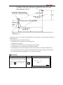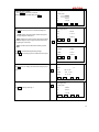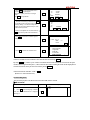
1
CONTENTS
FOREWORD
1. Features ………………………………………………………..…………………………………………..6
2. Precautions……………………………………………...………………………………………………......7
3. Nomenclature……………………………………………………………………………………………... 9
4. Key functions……………………………..…………………………………………………………….....11
5. Charger entry……………………….………………………………………………………………….......13
6. Display symbol………...………………………………………………………………………………......14
7. Mode Configuration……………………………………………………………………………………....14
PART 1 PREPARATION FOR MEASUREMENT……………………………….………18
1. Unpacking and store of the instrument ……………………………………………………………….…..18
2. Setting the instrument up…………………………………………………………………………….…....18
3. Battery dismounting, information, recharging……………………………………………………………..20
4. Reflector and prism…………………………………………………………………………………...….21
5. Mounting and dismounting the instrument from tribrach……………………………………………….….21
6. Eyepiece adjustment and object setting………………………………………………………………...….22
7. Power on/off and preparation for measurement…………………………………………………….….......23
7.1 Power on/off…………………………………………………………………………………………….23
7.2 Vertical Angle Tilt Correction ………………………………………………………………………....….23
7.3 Display Illumination………………………………………………………………………………….….25
7.4 Setting the Instrument Options…………………………………………………………………………....25
7.5 Setting Instrument Constant………………………………………………………………………………28
7.6 Setting LCD Contrast……………………………………………………………………………..…...…29
7.7 Setting Date and Time…………………………………………………………………………..………...29
7.8 Explanations…………………………………………………………………………………………....31
PART 2 BASIC MEASUREMENTS …………………………………………………..…….32
8. ANGLE MEASUREMENT………………………………………………………………………...32
8.1 Measuring the Horizontal Angle Between Two Points(Horizontal Angle 0)………………………….…32
8.1.1 Example Measuring the Horizontal Angle between Two Points….. …………………………………….33
8.2 Setting the Horizontal Circle to a Required Value …………………………………………………………34
8.2.1 Use HSET function to set a required direction value ……………………………………………………34
8.2.2Use HOLD to set a required direction value ……………………………………………………………..34
8.3 Horizontal Angle Display Selection(Right /Left)…………………………………………………….….35
8.4 Horizontal Angle Repetition ……………………………………………………………………………...36
8.5 Slope in %……………………………………………………………………………………………...38
9. DISTANCE MEASUREMENT………………………………………………………………….…38
9.1 Settings for Distance Measurement ………………………………………………………………...….. .39
9.2 Laser direction and laser plummet ………………………………………………………………….……41
1
9.3 Distance and Angle Measurement…………………………………………………………………….…..42
9.4 Review of Measured Data …………………………………………………………………………….....43
9.5 Output Data to a Computer…………………………………………………………………………….....44
10. COORDINATE MEASUREMENT……………………………………………………………....45
10.1 Entering Instrument Station Data……………………………………………………………………..…46
10.1.1 Reading in Registered Coordinate Data………………………………………………………………..48
10.2 Azimuth Angle Setting………………………………………………………………………………….49
10.2.1 Set backsight point by Angle…………………………………………………………………………..49
10.2.2 Set backsight point by coordinate………………………………………………………………….…..50
10.3 Coordinate Measurement……………………………………………………………………………….51
PART 3 ADVANCED MEASUREMENT ………………………………………………...54
11. SETTING-OUT MEASUREMENT………………………………………………………………54
11.1 Distance Setting-Out Measurement………………………………………………..………….…………55
11.2 REM Setting-Out Measurement ………………………………………………………………………..58
11.3 Coordinates Setting-Out Measurement……………………………………………………..……………60
11.4 Distance Measurement Parameters Setting …………………………………………………….………..62
12. OFFSET MEASUREMENT ………………………………………………………………………64
12.1 Single-Distance Offset Measurement ……………………………………………………………….…..65
12.2 Angle Offset Measurement ……………………………………………………………………….……67
12.3 Two-Distance Offset Measurement………………………………………………………………..…….70
13. MISSING LINE MEASUREMENT …………………………………….………………………..72
13.1 Measuring the Distance between Multiple Targets……………………………………………………...73
13.1.1 Measuring the distance between multiple targets ………………………………………………………73
13.1.2 Slope in between 2 points……………………………………………………………………………..74
13.2 Changing the Starting Point……………………………………………………………………….……75
14. REM MEASUREMENT……………………………………………………………………….…..76
15. RESECTION MEASUREMENT …………………………………………………………….…..78
15.1 Re-Observing……………………………………………………………………….………………….81
15.2 Add Known Points……………………………………………………………………………………...81
16. Area Calculation……………………………………………………………………………………...83
17. Setting out line……………………………………………………………………………….……… 86
17.1 Defining baseline …….……………………………………………………….………………………..86
17.2 set-out line (point)……………………………………………………………...………………………89
17.3 Seting out line (line)…………………………………………………………………………….……..91
18. Point projection………………………………………………………………………………………....93
18.1 Defining baseline……………………………………… ……………… …………… …………..........93
18.2 Point projection ……………………………………………………………………………….….…….94
19. ROAD DESIGN AND SETTING-OUT……………………… …… …… ……… …… ……………...96
2
19.1.1 Define Horizontal Alignment (Maximum data quantity: 30)………………………………………...….96
19.1.2 Edit Alignment……………………………………………………………………………….……...101
19.1.3 Define Vertical Curve (Maximum 30 data)………… ……………………………… …………….…103
19.1.4 Edit Vertical Curve ……………………………………………………………………………….…104
19.1.5 Inport Horizontal Alignment…………………………………………………………………………106
19.1.6 Import Vertical curve……………………………………………………………………………..…107
19.1.7 Receiving Horizontal Alignment Data………………………………………………………..…….. .108
19.1.8 Receiving Vertical Curve Data………… …… ………… … ………………… ……………… …...109
19.1.9 Deleting Horizontal alignment Data ……… … ……… ………………… ……… ………………...111
19.1.10 Deleting Vertical Curve……………………………………………………………………………111
19.2 Road Setting-out………………………………………………………………………………………112
19.2.1 Set Station Point……………………………………………………………………………….…….112
19.2.2 Setting Backsight Point……………………………………………………………………………...114
19.2.3 Setting Out…………………………………………………………………………………….…….117
19.2.4 Slope Setout………………..……………………………………………………………………….121
PART 4 DATA RECORDING ………………………………………………………………...124
20 SETTING IN MEMORY MODE……………………………………………………………...….124
20.1 JOB Selection ……………………………………………………………………………………..….125
20.1.1 Current JOB Selection …………………………………………………………………………..…...125
20.1.2 Check Memory Status……………………………………………….……………………..……..….126
20.1.3Create new working job…………………………………………………………………...…….…..127
20.1.4 Change the job name …………………………………………………………………………..……128
20.1.5 Delect Job………………………………………………………………………………………..….129
20.1.6 Coordinate Selection…………………………………………………………………………..……130
20.1.7 Job Export…………………………………………………………………………………..……….130
20.1.8 Coordinate Import……………………………………………………………………........................133
20.1.9 Comms output………………………………………………………………………………..……...133
20.1.10 Comms input………………………………………………………………………………..……..134
20.1.11 Transfer coord data to job…………………………………………………………………….…….135
20.2 Import Known Point Data…………………………………….……………………………..….……. 136
20.2.1. Input known Point Coordinate……………………………………………………………….……...136
20.2.2 Known Coordinate Data Import………………………………………………………….………….137
20.2.3 Known Coordinate Data Export…………………………………………………………….….……137
20.2.4 Entering coordinate data from an computer ……….…………………………………….……….….138
20.2.5 Sending known point data to computer…………………………………………………….………..139
20.2.6 Clearing Coordinate Data from Memory………………………………………………….…………139
20.3 Input Codes…………………………………………………………………………………..……….140
20.3.1Code import………………………………………………………………………………….……...140
3
20.3.2 Receive code……………………………………………………………………………..…….…....141
20.3.3 All clear ……………………………………………………………………………………………141
20.4 U disk mode ………………………………………………………………………………………….142
20.5 Initialization…………………………………………………………………………………….…….143
20.6 All Files ……….……………………………………………………………………….…….……….145
20.7 Setting for Grid Factor…………………………………………………………………………………145
21. DATA RECORDING IN RECORD MODE ………………………………………………...….147
21.1 Recording Instrument Station Data………………………………………………………………...…...147
21.2 Recording backsight data…………………………………………………………………………..…..149
21.2.1 Set backsight point by Angle……………………………………………………………….………...149
21.2.2 Set backsight point by coordinate………………………………………………………….……...….149
21.3 Recording Angle Measurement Data………………………………………………………..………….150
21.4 Recording Distance Measurement Data…………………………………………………………….….152
21.5 Recording Coordinates Data …………………………………………………………………….….…153
21.6 Recording distance and coordinate data………………………………………………………………..155
21.7 Recording Notes ………………………………………………………………………………….…..156
21.8 Reviewing JOB Data……………………………………………………………………………….…157
PART 5
MEASUREMENT OPTIONS SELECTION……………………………...159
22. KEY FUNCTION ALLOCATION……………………………………………………………….159
22.1 Allocation and Registration ……………………………………………………………………………160
22.1.1 Allocating functions………………………………………………………………………….………161
22.1.2 Registering an allocation …………………………………………………………………………….163
22.2 Recalling an Allocation ………………………………………………………………………………..164
23. INSTRUMENT PARAMETERS SETTING………………………………………………...….164
23.1 Changing Instrument Parameters…………………………………………………………………..…...164
PART 6 CHECKING AND ADJUSTMENT ……………………………………………...168
24.1 Plate Vial……………………………………………………………………………………….……...168
24.2 Circular Level ………………………………………………………………………………….……...168
24.3 Inclination of Reticle ………………………………………………………………………………….168
24.4 Perpendicularity of Collimation Line to Horizontal Axis (2c) ……………………….. …………………169
24.5 Vertical Index Difference Compensation……………………………………………………………….171
24.6 Adjustment of Vertical Index Difference ( i angle) and Vertical Angle 0 Datum …………………………171
24.7 The adjustment of horizontal axis error correction………………………………………………………173
24.8 Optical Plummet ……………………………………………………………………………………...174
24.9 Instrument Constant(K)……………………………………………………………………………174
24.10 Parallel Between Collimation line and Emitting Photoelectric Axis……………………………………175
24.11 Reflectorless EDM………………………………………………………………………………176
4
24.12 Tribrach Leveling Screw……………………………………………………………………………..176
24.13 Related Parts for Reflector……………………………………………………………………………176
25. SPECIFICATION ..................................................................................................................................................177
26. ERROR DISPLAYS………………………………………………………………………………..180
27. ACCESSORIES…………………………………………………………………………….…….. ..181
APPENDIX A BIDIRECTIONAL COMMUNICATION…………………………….182
1.1 Outputting Commands………………………………………………………………………….….182
1.2 Entering Command………………………………………………………………………………....189
1.3 Set Command……………………………………………………………………………………….191
APPENDIX-B CALCULATE ROAD ALIGNMENT……………………………….…192
1.1 ROAD ALIGNMENT ELEMENTS………………………………………………………………..…192
1.2 CALCULATION OF ROAD ALIGNMENT ELEMENTS…………………………………….….…194
5
FOREWORD
Thank you for purchasing KOLIDA Total Station KTS440 (RC) (R) (LC) (L) series!
This manual is applicable for KOLIDA Total Station KTS440 (RC) (R) (LC) (L) series!
KTS440R (RC) series Total Station is equipped with visible laser reflector less distance meter.
In this manual, the parts which are marked “ ” are only applicable to KTS440R (RC).
Please read the manual book carefully before operating the instruments.
1. FEATURES
1. Complete Function
KOLIDA KTS-440RC series has complete surveying program, the functions of data record and parameter setting,
is suitable for professional and construction survey.
2. Secure Digital memory card(SD card)
With the advantages of large memory storage, rapid transmission data system, removable and secure functions,
various surveying data could be easily saved in the SD card and moved into computer through the port of lap top
computer and card reader. Please do not move out the SD card when operating the data stored in it, otherwise the
surveying data can be damaged. 1 MB space in SD card may contains 15,000 data.
3. Powerful Memory Management
Very large memory and the enhanced file management system can help you easily realize the function of
addition, deletion, modification, and transmission of the data.
4. Absolute Encoding Circle
With absolute encoding system, measurement can be started immediatley after booting up the instrument. No
azimuth information is ever lost even in sudden power break.
5. Reflector less Distance Measurement
The reflectorless function of KTS440RC enables you to carry out long-distance and high-accuracy measurement
directly towards various objects of different materials and colors (like wall of building, telegraph pole, wire, cliff,
mountain, clay, wooden stake, etc.) It’s the best solution to measure the hard-reach or unreachable object.
6. Abundant Surveying Programs
KTS-440 not only has the basic surveying modes (angle, distance, coordinate measurement) but also equipped
with special surveying programs, for example, REM, Offset, MLM, Staking-out, Road Design, Point Projection,
Setout line, etc, to meet the demand of professional survey.
6
2. PRECAUTIONS
1.Never place instrument directly on the ground,as sand or dust may cause damage to the screw holes or the
centering screw on the base plate.
2. Before carry on the measurment, we need to have an overall check with the inrsrument, such as: battery,
parameters, and initial settings.
3. When working in a sun-baked (rainy or wet) day, please use the surveying umbrella to avoid damage. Besides,
do not aim the telescope at the sun without a filter.
4. When the instrument is not in use, put it in the case and keep the instrument from shock, dust and humidity.
5. If there is great difference between the temperature in working area and that in store place, leave the instrument
in the case till it is used to the temperature of outside working area
6. Clean its surface with a woolen cloth after using. If the instrument gets wet, dry it immediately.
7. Turn the power off before removing the battery, otherwise it may cause damage to internal circuit. When place
KTS into its case, firstly remove the battery and place it in the case in accordance with its layout plan. Make sure
that the inside of the carrying case and KTS are dry before closing the case.
8. No used for a long time, seperate the battery from the instrument and store them respectively. The battery should
be charged once a month.
9. Clean exposed optical parts with degreased cotton or lens tissue only!
10. During transporting, the instrument should be placed in its carrying case. It will be better to place some cushion
around the case to keep the instrument from the damage of shock.
11. If there is something wrong on the instrument, please do not disassemble the instrument unless you are a
professional technician
12. Never aim the laser beam of KTS440R (RC) Series Total Station at human eyes.
SAFETY GUIDE
Interior EDM(Visible Laser)
Warning:
The total station is equipped with an EDM of a laser grade of 3R/Ⅲa, which could be recognized by the following
labels:
On the vertical tangent screw, there is a label shows “CLASS III LASER PRODUCT”. A similar label is on the
opposite side.
This product is classified as Class 3R laser product, which is coordinated with the following standards.
IEC 60825-1:2001 “SAFETY OF THE LASER PRODUCT”.
Class 3R/Ⅲ a laser product: It is harmful to observe laser beam continuously. User should avoid sighting the laser
at the eyes. It can reach 5 times the emitting limit of Class2/ II with a wavelength of 400nm-700nm.
Warning:
Continuously looking straight at the laser beam is harmful.
7
Prevention:
Do not stare at the laser beam, or point the laser beam to others’ eyes. Reflected laser beam is a valid
measurement to the instrument.
Warning:
When the laser beam is shooting at prism, mirror, metal surface or window, the reflector laser beam is also
harmful to eyes.
Prevention:
Do not stare at the locations with laser reflection. When the reflectorless function is enabled for EDM, do not
stare beside the laser beam or prism. Collimating the prism via the telescope unit is requested only.
Warning:
Incorrect application of Class 3R laser equipment is very dangerous.
Prevention:
To avoid being hurt, you must pay particular attention to the precaution measures and keep it under control
within the distance of possible danger according to standard IEC60825-1:2001.
The following explain the key sections of the Standard:
Laser instrument of Class 3R is applicable outdoors and in construction field (measurement, defining lines,
leveling).
a) Only those persons who are trained with related course and authenticated are allowed to install, adjust, and
operate this kind of laser instrument.
b) Relevant laser warning symbols should be easily identified within the operating range.
c) Prevent any person to look straight at or use optical instrument to observe the laser beam.
d) To prevent the harm caused by laser, block the laser beam at the end of the working route. When the laser beam
exceeds the limit area (harmful distance*) and when there are motivating persons, stopping the laser beam is a
must.
e) The optical path of the laser should be set higher or lower than the line of sight.
f) When the laser instrument is not in use, take care of it properly. The person who is not authenticated is not
allowed to use.
g) Prevent the laser beam from irradiating plane mirror, metal surface, window, etc., especially beware of the
surface of plane mirror and concave mirror.
* Harmful distance means the maximum distance between the start point and the point which the laser is
weakened to a degree that doesn’t harm people.
* The harmful distance of built-in laser unit is 1000m (3300ft). When the operation is beyond this range and laser
beam is weakened to Class 1R, direct staring at laser beam is less harmful.
8
3. NOMENCLATURE
9
10
4. KEY FUNCTIONS
The KTS-440R (RC) has a 28-keys keyboard. The keyboard has a power switch key, an illumination key, 4
soft keys, 10 operating keys and 12 alphanumeric keys.
·Power ON / OFF Key
Power ON :Press POWER
Power OFF :Press POWER for 3 seconds
·Light Key
Press
·Soft Key
key to turn ON or OFF backlight.
The functions of soft keys are showed on the bottom of the display window of KTS-440R (RC) select these
functions by using F1 to F4 keys, press FNC key to view other functions in another page.
For example, the following shows the initial setting of the soft keys displayed in MEAS mode
Page 1 :
11
Name
Function
HD (SD or VD)
Start distance measurement
SHV
Select distance measurement category(change between SD, HD, VD)
HSET
Set the horizontal angle to a required value
EDM
Distance measurement parameter setting
Page 2 :
Name
Function
0SET
0 Set of horizontal angle
CRD
Start coordinate measurement
S-O
Start setting-out measurement
REC
Record observed data
Page 3 :
Name
Function
MLM
Start missing line measurement
RESEC
Start resection measurement
MENU
Display menu mode
HT
Set the height of instrument and the target
Operating Keys:
Name
Function
ESC
Cancel previous operation and return from MEAS mode to “Status Screen”
FNC
1. Change page. 2. Enable target-height inputting in staking-out, missing line, and
remote measurement.
SFT
Turn SHIFT mode ON or OFF ( switch number input and alphabet input)
BS
Delete a blank left
SP
1.Spacebar in IME(Input Method Editor)
2.Modify the distance measurement parameter.
▲
Move cursor / select options up
view the previous data in data list
▼
Move cursor / select options down
view the next data in data list
Move cursor to the left / Select another options
view the previous page in data list
Move cursor to the left / Select another options
view the next page in data list
ENT
12
Confirm to entry or save data on that line and move the cursor to the next line
Alphanumeric keys with shift mode OFF :
Name
Function
STU GHI
Alphanet input ( enter the alphanet on the top of key )
1
~
9
1
~
9
Numerical input/Selection menu item
Input decimal point :
.
.
Input symbol : \ #
Enter Auto-Compensation interface (None-Input mode)
+/-
Input minus symbol :
Input symbol :
-
* / +
Enter the laser guidance interface (None-Input mode)
5. CHARACTER ENTRY
Job names, data numbers, codes, etc are entered to KTS-440 (L)(R) using letters off the alphabet and numerals.
Change between alphabetic and numerical entry by pressing SFT key. An S is displayed on the right side of the
screen when in alphabet entry mode.
Alphabet entry mode ←SFT→ Numeral entry mode
Entry in alphabet and numeral mode is performed as follows : (Eg :Character entry JOBM2)
Procedure
⑴
Operation
Enter Alpha-numeric input mode,
each key stands for three alphabets
Alpha
and one number.
Key
Press the key, the first alphabet will
Display
Mem. Character Entry
Code: JOB
S
+
be shown on the cursor position.
OK
Press the key by four times, the
number will be shown.
Mem. CharacteEntry
Code: JOBM2
⑵ Press SFT to enter numeral input
mode.
SFT
OK
13
Mem. Character
⑶ When the entry is finished, press ENT.
Code: JOBM2
Saving
The original screen is restored.
OK
6. DISPLAY SYMBOLS
Some symbols are used in MEAS mode. Their meanings are presented below.
Symbol
Meaning
PC
Prism constant
PPM
Atmospheric correction
ZA
Zenith angle( Zenith 0°)
VA
Vertical angle( horizontal 0°/ horizontal 0°±90°)
%
Slope in %
S
Slope distance
H
Horizontal distance
V
Height difference
HAR
Horizontal angle right
HAL
Horizontal angle left
HAh
Horizontal angle hold
Tilt angle compensation ON
7. MODE CONFIGURATION
KTS440R (RC) operates in a series of modes depending on your measurement need. This section
explains the relationship between the different modes and presents tables of the menus for each mode.
·Mode Diagram
Status Display
Measuring Mode
14
Memory Mode
Setting Mode
1. Quick guide
(Measurement)
Meas.
PC
-30
PPM
0 -30
测量.
PC
S
111.3742 m
3
PPM PC
0 -30
ZA 测量.
92°36′25″
S
111.3742 m
3 0
PPM
HAR 120°30′10″ P1
ZA S 92°36′25″
111.3742
m
3
SD
SHV
HSET
EDM
HAR ZA120°30′10″
P2
92°36′25″
0SET
CRD
S-O
REC
HAR 120°30′10″
P3
MLM
RESE
HENU
HT
(Record)
REC.
7.Note
JOB01 ↑
8、查阅数据
1.Station
data
JOB01 ↑
2. Backsight data
3.Angle data
4.Distance data
5.Coord. data
↓
6.Dist.and.Coord.data
↓
ESC
ESC
(Menu mode)
MEAS
(State Screen)
Menu
2009-10-10
10:00:48
Model:KTS440(RC)
No. :S129260
Version:09.10.10
Job :A:\ JOB01. JOB
Meas
Mem.
Menu(2)
6、 后方交会
Menu(1)
1.7、角度复测
Coordinate
2.8、面积计算
Set-out
3.9、道路设计与放样
Offset-measurement
4. Missing line
5. Remote measurement
↓
↑
↓
CNFG
ESC
Mem.
(Memory)
Memory (2)
Memory (1)
1. Working job
2. Known data
2. Menu
Table :
3. Code
4. Road design
5. Format
CNFG
(Config)
1. Observation condition
2. Instrument parameters
3. Date and time
4. Communication para.
5. Unit setting
6. Key function
① MEAS mode menu
15
Name
SD (HD or VD)
SHV
Function
Distance measurement
Select distance mode (Select between slope distance, horizontal distance, height
difference)
0SET
Set horizontal angle to 0
HSET
Set known horizontal angle
R/L
Select horizontal angle right/Left
REP
Horizontal angle repetition measurement
HOLD
Horizontal angle Hold/Release
ZA/%
Switch between Zenith angle / slope in %
HT
Set the instrument height and target height
REC
Data recording
REM
REM measurement
MLM
MLM measurement
RCL
Display final measurement data
VIEW
Display observation data for the selected JOB
EDM
Setting EDM (atmospheric correction and target, distance measurement mode
setting )
COORD
Coordinates measurement
S-O
Setting-out measurement
OFFSET
Offset measurement
MENU
To menu mode
RESEC
Resection measurement
D-OUT
Output measurement result to external equipment
F/M
Switch between meters/feet
AREA
Area calculation
ROAD
Design and Set out road
PROJ
Point Projection
LINE
Line Setout
② REC Mode Menu
Name
Stn data
Backsight data
Angle data
Dist data
16
Function
Occupied station data recording
Record backsight bearing angle and coordinate data
Angle measurement data recording
Distance measurement data recording
Coord data
Dist.and Coord.
Coordinates measurement data recording
Record distance and coordinate data
Note
Note data recording
View
Review job data
③ Memory Mode
Name
JOB
Known data
Code
Define roads
U disk mode
Function
JOB selection and management
Known data input and management
Code input and management
Design of road date
connect PC
Initialize
Restore factory setting
All file
management and editing of document
Grid factor
Grid factor
17
PART 1 PREPARATION FOR MEASUREMENT
1. UNPACKING AND STORE OF INSTRUMENT
· Unpacking of instrument
Place the case lightly with the cover upward, and unlock the case, take out the instrument.
· Store of Instrument
Cover the telescope well, place the instrument into the case with the vertical clamp screw and circular level
upward (Objective lens toward tribrach), tighten the vertical clamp screw and lock the case.
2. SETTING THE INSTRUMENT UP
Place the instrument on the tripod. Level and center the instrument precisely to ensure the best performance.
Use the special center point.
Operation Refer to ”Leveling and Centering the Instrument”
1. Setting up the tripod
① Make sure the legs are spaces at equal intervals and the head is approximately level.
② Set the tripod so the center of the head is directly over the surveying point.
③ Step on the tripod shoes to make sure the tripod is firmly fixed on the ground.
2. Installing the instrument on the tripod
① Place the instrument carefully on the tripod head
② Supporting the instrument with one hand, tighten the centering screw to fix it to the screw on the base
plate of the instrument.
3. Roughly leveling the instrument by the circular level
①Turn the leveling screw A and B to move the bubble in the circular level, in which case the bubble is
located on a line perpendicular to a line running through the centers of the two leveling screw being
adjusted.
①Turn the leveling screw A and B to move the bubble in the circular level, in which case the bubble is
located on a line perpendicular to a line running through the centers of the two leveling screw being
adjusted.
18
4. Leveling by the plate level
① Rotate the instrument horizontally by loosening the Horizontal Clamp Screw and place the plate level
parallel with the line connecting leveling screw A and B, and then bring the bubble to the center of the
plate level by turning the leveling screws A and B.
② Rotate the instrument 90º(100g) around its vertical axis and turn the remaining leveling screw or leveling
C to center the bubble once more.
③ Repeat the procedures ①② for each 90º (100g) rotation of the instrument and check whether the
bubble is correctly centered in all directions.
5. Centering by using the optical plummet
1) Set tripod
Lift tripod to suitable height, ensure equal length of three legs, spread and make tripod head parallel to the ground,
and place it right above the measurement station point. Prop up tripod on the ground and fix one leg.
2) Install instrument and collimate the point
Set instrument carefully on tripod, tighten the central connecting screw and adjust optical plummet to make the
reticle distinctly. Hold the other two unfixed legs with both hands and adjust position of these two legs through
observation of optical plummet. As it approximately aims at the station point, make all three legs fixed on the
ground. Adjust three leg screws of the instrument to make optical plummet collimate precisely to the station point
3) Use circular vial to roughly level the instrument
Adjust length of three legs of tripod, make the circular vial bubble of the instrument in the middle.
19
4) Use plate vial to level the instrument accurately.
①Rotate the instrument horizontally by loosening the Horizontal Clamp Screw and place the plate vial parallel to
the line connecting leveling screw A and B, and then bring the bubble to the center of the plate vial by turning the
leveling screws A and B.
②Rotate the instrument 90℃, make it perpendicular to the connecting line of level screws A and B. Turn level
screw C to make the bubble of the plate vial in the middle.
5) Precisely centering and leveling
Through observation of optical plummet, slightly loosen the central connecting screw and move the instrument
evenly (Don’t rotate the instrument), making the instrument precisely collimating to the station point. Then tighten
the central connecting screw and level the instrument precisely again.
Repeat this operation till the instrument collimate precisely to the measurement station point.
3. BATTERY DISMOUNTING, INFORMATION, RECHARGING
·Battery Removal Caution
☆ Before taking the battery off, make sure that the power is turned off. Otherwise, the instrument can be
damage.
PROCEDURE Inserting the battery
1. Put the battery on the main body of instrument.
2. Press the locking buttons on the top of battery to lock it.
PROCEDURE Removing the battery
1. Press the clamps on the top of the battery.
Meas.
PC
PPM
2. Take off battery.
ZA
HAR
·Battery Power Remaining Display
SD
3-5:70~100﹪
-30
0
3
92°36′25″
120°30′10″
SHV
HSET
P1
EDM
Full power
2:50﹪ battery power can last for almost 1 hour
1:10~50﹪ it is better to finish measuring soon, recharge it.
0: 0~10﹪ battery can last only less than 10 minutes only
Note: ① Working time of the battery is determined by environment condition, recharging time and etc.
② The remaining energy level of battery is related to current measuring mode.
· Battery Recharging
☆ Battery should be recharged only with the charger NC-30 together with the instrument.
☆ Remove on-board battery from instrument and connect to battery charger. When the indicator lamp on the
battery charger is orange, the recharging process has begun and will be completed in about 1.5 hours. When
20
charging is complete (indicator lamp turn green), remove the battery from the charger and disconnect the
charger from its power source.
·Battery Recharging Caution
☆ The charger has built-in circuitry for protection from overcharging. However, do not leave the charger plugged
into the power outlet after recharging is completed.
☆ Be sure to recharge the battery at a temperature of 0°~ ±45 °C, Recharging may be abnormal beyond the
specified temperature range.
☆ When the indicator lamp does not light, even after connecting the battery and charger, either the battery or the
charger may be damaged.
·Battery Charging Caution
☆ Rechargeable battery can be repeatedly recharged 300-500 times. Complete discharge of the battery may
shorten its service life.
☆ In order to get the maximum service life, be sure to recharge it once a month.
4. REFLECTOR PRISMS
During distance measurement, a reflector prism needs to be placed at target place. Reflector systems come with
single prism and triple prisms, which can be mounted with tribrach on a tripod, or mounted on a prism pole.
Unique Mini prism systems allows to be set up at corners that are hard to reach.
Illustrated are the prism manufactured by KOLIDA:
5. MOUNTING AND DISMOUNTING INSTRUMENT FROM TRIBRACH
·Dismounting
When necessary, the instrument can be dismounted from tribrach. Loosen the tribrach locking screw in the locking
knob with a screwdriver. Turn the locking knob about 180 degree counter-clockwise to disengage anchor jaws, and
take off the instrument from tribrach.
21
Mounting
Insert three anchor jaws into holes in tribrach and line up the directing stub with the directing slot. Turn the locking
knob about 180 degree clockwise and tighten the locking screw with a screwdriver.
6. EYEPIECE ADJUSTMENT AND OBJECT SETTING
·Method of Object Sighting(for reference)
① Sight the Telescope to the sky and rotate the eyepiece tube to make the reticle clear.
② Collimate the target point with top of the triangle mark on the collimator. (Keep a certain distance
between eye and the collimator).
③ Make the target image clear with the telescope focusing screw.
☆ If there is parallax when your eye moves up, down or left, right, that shows the diopter of
eyepiece lens or focus is not adjusted well and accuracy will be influenced, so adjust the
eyepiece tube carefully to eliminate the parallax.
22
7. POWER ON/OFF AND PREPARATION FOR MEASUREMENT
7.1 Power ON/OFF
·Power ON
PROCEDURE
Operation
Display
Note
Type: KTS-440RC
After power on, instrument process self-check as
No:
left.
S88888
Ver.: 09.10.10
Press
POWER
Finding SD card…….
Meas.
PC
PPM
S
111.374 m
ZA
92°36′25″
HAR 120°30′10″
SD
SHV
Checking the inserted SD card
-30
0
5
P1
After Self-check, interface for measurement shows
up.
HSET EDM
·Power OFF
Hold POWER for 3seconds.
NOTE :If the battery has reached the level where it should be replaced, the symbol shown on the left is displayed
every 3 seconds. When it appears, stop all work as quickly as possible, shut off the power, and charge
the battery.
7.2 Vertical Angle Tilt Correction
When the tilt sensor works, automatic correction of vertical angle is displayed due to not level instrument. (Press
SFT and then press • ).
To ensure an exact angle measurement, tilt sensors must be turned on. You choose“ 2- axis”,
The display can also be used to level the instrument better. If the “TILT OVER” display appears the instrument is
out of automatic compensation range and must be leveled manually.
KTS440(R)(L) compensates the vertical angle readings due to inclination of the standing axis in the X direction.
23
PROCEDURE
Setting Tilt Correction
Operating Procedure
Operation
Display
MEAS.
⑴ Turn on the machine, enter MEAS screen.
PC
PPM
0
3
POWE
R
ZA
92°36′25″
HAR 120°30′10″
SD
SHV
⑶ From the status screen press CNFG to enter
the configuration setting screen.
⑷ Select “1. Obs. Condition” and press ENT
(or press numeric key 1). Use ▲or▼ key to align
the cursor to the fourth line “Tilt crn”, use
or to set the tilt correction method. Then
press ENT to finish set. There are three options
about tilt correction: There are three options:
NO, 1-axis and 2-axis.
ESC
CNFG
“1. Obs.
Condition”
+
ENT
+
▲or▼
+
or
⑸ Press ESC to return to setting screen.
ESC
KTS-440
No.S09996
Ver.2004-1.02
File:JOB01
MEAS
Config
1.
2.
3.
4.
5.
P1
EDM
HSET
2004-01-01
⑵ Press ESC to enter status screen.
-30
10:00:48
MEM
CNFG
Obs. Condition
Instr. Const
Date& time
Comms setup
Unit
Condition
C&R crn.: No
V. obs : Zenith
Tilt crn. : Yes (H& V)
Dist mode: HD
Power off : Off
↓
Config
1.
2.
3.
4.
5.
6.
Obs. Condition
Instr. Const
Date& time
Comms setup
Unit
Key function
If the instrument is not leveled, it is possible to see different results in different tilt correction settings.
Steps
24
Leveling instrument
Operation procedure
Key
Display
Tilt sensor
(1) If instrument tilts over correction range, system
launch tilt correction function.
OFF
(2)Leveling the instrument according to the related
chapter until the black point centered in the circle
X-ON
XYON
DIGIT
tilt sensor
X-ON: Only vertical angle be compensated
XYON: Both horizontal and vertical angle are
compensated
Press OFF , tilt correction will be off..
OFF
X-ON
(3)
Tilt sensor
DIGIT showing the tilt angle value respectively on
X: out of range
axis “X” and axis “Y”.
Y: out of range
XYON
DIGIT
XYON
GRAPH
2- axis
Once the“out of range ” shows on the screen, you
need to level the instrument manually until “out of
OFF
X-ON
rang”disappears.
When the electronic bubble is centered, the system
goes back to previous screen.
Note:
☆
☆
For tilt correction, refer to “7.8 Explanations: Tilt auto correction”
For contents of leveling instrument please refer to “2. Setup instrument”.
7.3 Display Illumination
·In dark places, it is possible to illuminate the display so it is easy to see.
PROCEDURE
1. Press
2. Press
Backlight Illumination ON/OFF
to turn the illumination on.
again to turn the illumination off.
7.4 Setting the Instrument Options
·In setting Mode, make sure that the concerned parameters are set in accordance with measurement conditions.
·To confirm or change the parameters options, see“19.1Changing Instrument Parameters”.
Table 1 :
25
Screen Setting
Parameter
Options(*:Factory Setting)
None *
Atmospheric Correction
K=0.14
K=0.2
Zenith 0 *
Vertical angle format
Horizontal 0
Horizontal 0±90°
Observation
Condition
None *
Tilt correction
1- axis
2-axis
Slope distance * (Sdist)
Distance Mode
Horizontal distance(Sdist)
Height difference (Vdist)
Auto Power Off
Auto power off after 30 min *
Switch ON/OFF by key
Coordinates format
N-E-Z *
E-N-Z
Minimum angle display
Minimum distance
0.1″
:
5″
:
1″ *
10″
0.1mm
1 mm*
Key Beep
On*
Off
Angle deep
On*
Off
Result of Coordinate mearsurement
Equal
in Face L/R
Unequal
Table 2 :
Screen Setting
Parameter
Baud rate
Options(*:Factory Setting)
1200 b/s * ,
2400 b/s
4800 b/s *
9600 b/s
19200 b/s *
38400 b/s
57600 b/s
,
8 Bits *
Comms Setup
Data length
7 Bits
None *
26
115200 b/s
Parity
ODD
EVEN
Stop bit
1bit *
2bits
Check sum
No *
Yes
Transfer
USB*
COM
Table 3 :
Screen Setting
Parameter
Temperature
Options(*:Factory Setting)
℃
*
℉
hPa *
Air Pressure
Unit
mmHg
inchHg
DEG *
Angle
GON
MIL
Distance
M (meters)*
Ft (feet)
27
7.5 Setting Instrument Constant
·Refer to “24.9 Instrument Constant (K)” to get the instrument constant value. Set it as following:
PROCEDURE
Operating Procedure
(1) From Status Mode Press CNFG to enter
Operation
CNFG
config mode.
⑵ Select“2. Instr. const”, press ENT (or press
2. Instr. const
+
numeric key 2)
Display
Config
1. Obs. Condition
2. Instr. const
3. Date & time
4. Comms setup
5. Unit
Instr. const:
1. V angle 0 point
2. Instr. const
3. Contrast
ENT
⑶ After selecting “2. Instr. const”, press ENT
“2.
(Press numeric key 2 is also ok) to enter
Instrument
instrument constant setting screen.
constant”
The first row is Additive constant.
The second row is Multiplication constant.
instrument constant setting screen.
30
0
mm
ppm
+
ENT
Enter
⑷ Enter the constant, press ENT, return to
Instr. const:
Constant:
Mul cons:
constant
Instr. const:
1. V angle 0 point
2. Instr. const
3. Contrast ADJ
+
ENT
Note :The constant of the instrument has been strictly set in the factory, so generally the user needs not to set this
item. If through strict measurement (ex. in standard baseline field and by special measuring organization) it is
necessary, the user can do that.
The Additive Contant is effective under Prism mode only (measuring distance with prism).
28
7.6 Setting LCD Contrast
PROCEDURE
Operating Procedure
⑴
Operation
From Status Mode Press CNFG to enter
config mode.
CNFG
ENT
“3.
Contrast adjustment
⑵ After selecting “2. Instr const”, press ENT
Instrument
(Press numeric key 2 is also ok) to enter
constant”
+
⑶ Select “3. Contrast ADJ” press ENT (Press
Contrast
numeric key 3 is also ok) to enter contrast
ADJ”
adjustment screen.
Config
1. Obs. Condition
2. Instr. const
3. Date & time
4. Comms setup
5. Unit
6.Key function
Instr. const:
1. V0/ AXIS CONST
2. V0 Adjustment
3. Collimation
4.Horizontal Axis
5. Instr. Const.
6. Contrast Adj.
“2.
instrument constant setting screen.
Display
Level : 6
+
ENT
↑
↓
Contrast adjustment
Level : 5
⑷ Press F2 or F3 to adjust contrast.
F2or F3
↑
⑸ Finished setting, press ESC or ENT return to
instrument constant screen.
ESC
(or ENT)
↓
Instr. const:
1. V0/ AXIS CONST
2. V0 Adjustment
3. Collimation
4.Horizontal Axis
5. Instr. Const.
6. Contrast Adj.
29
7.7 Setting Date and Time
·It is possible to set or revise the date and time displayed in the “Status Screen”.
PROCEDURE
Operating procedure
⑴
From Status Mode press CNFG to enter
Operation
CNFG
config mode.
⑵ Select “3. Date & time” press ENT (Press
numeric key 3 is also ok), use▲ or ▼ to select
“3. Date &
data and time options, enter the date and time by
time”
using the numerical keys. The year, month, day,
+
hour, minute, and second are all two digit
ENT
Display
Config
1. Obs. Condition
2. Instr. const
3. Date & time
4. Comms setup
5. Unit
6.Key function
Date & Time :
Date :2009-09-01
Time :143020
OK
numbers. Eg:
sep 9, 2009: 20090901
2 : 30 : 17 p.m : 143020
⑶ When entering is completed, press OK,
return to config screen.
30
OK
Config
1. Obs. Condition
2. Instr. const
3. Date & time
4. Comms setup
5. Unit
6.Key function
7.8 Explanations
Automatic tilt compensation
When the “ ” symbol is shown on the display, the vertical angles is automatically compensated for small tilt
errors using the tilt sensor.
Meas.
PC
PPM
ZA
HAR
SD
SHV
-30
0
3
92°36′25″
120°30′10″
P1
EDM
HSET
Elimination of parallax
Parallax is the relative displacement of the target image with respect to the reticle when the observer’s head is
moved slightly up and down or to the sides while looking through the telescope. Parallax will introduce reading
errors and must be eliminated before observations are taken. Parallax can be removed by refocusing the reticle.
Power-saving automatic cut-off
To save power, power to the KTS-440 is automatically cut off if it is not operated for 30 minutes. It is possible to
turn the automatic power cut-off function ON or OFF function. Refer to “23.1 Changing Instrument parameters”.
Leveling by the tilt angle display
It is possible to display the state of tilt of the instrument graphically or numerically and level the instrument. The
tilt angle correction range is ±3.5′. (As below, press SFT then press • ) If the displayed angle value exceeds ±3.5′,
the instrument needs to be leveled manually.
Tilt sensor
[XYON]
X:
-0°09′21″
Y:
-0°01′55″
OFF
X-ON
XYON
GRAPH
31
PART 2 BASIC MEASUREMENTS
· This section explains the angle measurement, distance measurement, and coordinate measurement: which three
can be performed in MEAS mode.
· Measurement data can be recorded in the internal memory. For the recording method, refer to “21. Recording in
Record Mode.”
MEAS Mode Screen :
Meas.
PC
PPM
ZA
HAR
SD
-30
0
3
92°36′25″
120°30′10″
SHV
HSET
P1
EDM
When the preparations for measurement are completed, the instrument is in MEAS mode.
8. ANGLE MEASUREMENT
·This section explains following procedures:
8.1 Measuring the Horizontal Angle Between Two Points (Horizontal Angle 0 )
8.2 Setting the Horizontal Angle to a Required value(Horizontal Angle Hold)
8.3 Horizontal Angle Display Selection (Right/Left)
8.4 Horizontal Angle Repetition
8.5 Slope in %
· When recording the measurement data, refer to “17.2. Recording Angle Measurement Data”.
· Check the following one more time before measurement:
1. The instrument is precisely leveled.
2. The battery is fully charged.
3. The vertical circle indexing has been completed.
4. The parameters are set in conformity with measurement conditions.
8.1 Measuring the Horizontal Angle Between Two Points(Horizontal Angle 0)
·To measure the included angle between two points, the horizontal angle can be set to 0 at any direction.
32
PROCEDURE
Operating Procedure
Operation
Display
Meas.
PC
PPM
⑴ Press FNC on the first page of the “MEAS
Mode Screen”.
-30
0
5
FNC
Press 0SET, then 0SET flashes ON and OFF.
ZA
92°36′25″
HAR 120°30′10″
+
0SET
SD
SHV
Meas.
⑵ Press 0SET again, the horizontal angle of the
P2
EDM
HSET
PC
PPM
-30
0
5
0SET
collimation direction is 0°00′00″.
ZA
92°36′25″
HAR
0°00′00″
OSET
CRD.
P2
REC.
S-O
8.1.1 Example Measuring the Horizontal Angle between Two Points
(1)
(2)
PROCEDURE
Operating Procedure
Operation
Display
Meas.
⑴ Using the horizontal clamp and the horizontal
PC
PPM
tangent screw, sight the backsight point. From the
MEAS mode, page 2 menu, press 0SET, 0SET
0SET
will flash, so press 0SET again, set the back sight
+
direction to 0.
ZA
89°59′25″
HAR
0°00′00″
OSET
CRD.
S-O
Meas.
Sight
(HAR) value is the included angle between 2
Foresight
points.
P2
REC
0SET
⑵ Sight the foresight point, the displayed
-30
0
3
PC
PPM
-30
0
5
ZA
89°59′25″
HAR 86°40′23″
Point
OSET
CRD.
S-O
P2
REC
33
8.2 Setting the Horizontal Circle to a Required Value
8.2.1 Use HSET function to set a required direction value
· It allows you to set the instrument sight direction to and required direction value.
PROCEDURE
Operating Procedure
Operation
Display
Set H angle
⑴ After sighting the target, from the MEAS
mode page 1, press HSET, enter the known
HAR:
direction value. The right angle and left angle are
0 00 00
5
HSET
described as [HAR] and [HAL].
OK
Set H angle
Enter the
HAR:30 25 18
known
⑵ Enter the known direction value from
Horizontal
keyboard, press ENT, the entered known value
angle value
displayed.
and press
OK
Meas.
PC
PPM
-30
0
5
ENT
ZA
92°36′25″
HAR 30°25′18″
SD
SHV
HSET
P1
EDM
☆Rules:
Press
to set the symbol of degree, minute, second.
When you correct entered data,
BS: erases the letter/ numeral to the left to the cursor.
ESC: Erase the entered data.
Stop the entry :ESC
Direction angle calculation :BS
(See “10.2Azimuth Angle Setting”)
8.2.2 Use HOLD to set a required direction value
· It is possible to use the horizontal angle hold function to set the horizontal angle of the sighting direction to a
required angle.
34
· In advance allocate the function keys to display HOLD. For the allocation method, see “18.1.1Key Function
Allocation”.
PROCEDURE
Under MEAS Mode screen, Display the desired angle of the horizontal angle.
Operating Procedure
Operation
Allocate
Display
Meas.
PC
PPM
the
⑴ Under MEAS mode screen, Display the
function
HOLD function.
keys to
ZA
89°59′54″
HAR 90°01′00″
display
HOLD
SDIST
SHV
Meas.
⑵ Use the horizontal clamp and tangent screw
to display the required direction value. Press
HOLD, the key start flashing, press HOLD
HOLD
P1
EDM
PC
PPM
HOLD
-30
0
3
+
ZA
89°59′54″
HAR
0° 0′00″
HOLD
again, the [HAR] is in the hold status.
SDIST
SHV
Meas.
⑶ Sight the target and press HOLD to unlock
-30
0
3
HOLD
P1
EDM
PC
PPM
-30
0
3
HOLD
ZA
89°59′54″
HAR
0° 0′00″
the angle, set the sighting direction to the
required direction value.
SDIST
SHV
HOLD
P1
EDM
8.3 Horizontal Angle Display Selection(Right /Left)
· It is possible to switch between Right Angle (horizontal angle clockwise) display and Left Angle (horizontal angle
counterclockwise) display.
· In advance allocate the function keys to display [R/L]. Refer to “22. Key Function Allocation”.
35
PROCEDURE
Operating Procedure
Operation
Allocate
⑴ In MEAS mode, display the screen in which
the
[HAR] is registered. Horizontal angle display
function
becomes [HAR].
keys to
Display
Meas.
-30
0
3
ZA
89°59′54″
HAR 117°31′50″
display
R/L
PC
PPM
SD
SHV
R/L
Meas.
P1
EDM
PC
PPM
⑵ Press R/L, horizontal angle display switches
-30
0
3
from [HAR] to [HAL].
HAL = 360°- HAR
ZA
89°59′54″
HAL 142°28′10″
R/L
SD
SHV
R/L
P1
EDM
8.4 Horizontal Angle Repetition
· To find the horizontal angle with greater precision, perform repetition measurement.
·In advance allocate the function keys to display [REP]. Refer to “22. Key Function Allocation”.
Backsight point
36
foresight point
PROCEDURE
Operating Procedure
Operation
⑴ In MEAS mode, press REP, Repetition BS
REP
Sighting Screen is displayed. The horizontal
+
angle is 0.
“Take BS” means to sight to backsight point.
⑵ After sighting backsight point, press OK.
Sighting
BS point
OK
Right screen is displayed. “Take FS” means to
sight to foresight point.
⑶ After sighting the foresight point, press OK,
Sighting
Right screen is displayed.
foresight
Press C E to cancel the measurement result and
measure again.
point
+
Display
Repetition
Hah
0°00′00″
Reps
0
Ave
0°00′00″
HAh
0°00′00″
Take BS
CE
OK
Repetition
Hah
0°00′00″
Reps
0
Ave
0°00′00″
HAh
0°00′00″
Take FS
CE
OK
Repetition
Hah
40°00′00″
Reps
1
Ave
40°00′00″
HAh
40°00′00″
Take BS
CE
OK
Repetition
Hah
40°00′00″
Reps
1
Ave
40°00′00″
HAh
0°00′00″
Take FS
CE
OK
Repetition
Hah
80°00′00″
Reps
2
Ave
40°00′00″
HAh
0°00′00″
Take BS
CE
OK
OK
Sighting
backsight
⑷ Sighting backsight point, press OK, right
point
screen is displayed.
+
OK
⑸ Sighting foresight point and press OK, right
screen is displayed. The cumulative value of the
Sighting
horizontal angle is displayed on the second line
foresight
(Hah), the average value of the horizontal angle
point
is displayed on the fourth line (Ave).
When continuing the repetition measurement,
+
OK
repeat step 4 and step 5.
· When the repetition measurement is completed,
press ESC.
· In repetition measurement mode, even if “Automatic Tilt Compensation On” is selected, horizontal angle
compensation will not occur.
37
· Maximum measurement frequency :10 times
· Repetition display range :3599°59′59.5″
8.5 Slope in %
·KTS-440 allows to displays the gradient as a %.
·In advance allocate the function keys to display [ZA/%]. Refer to “20. Key Function Allocation”.
PROCEDURE
Operating Procedure
Operation
Allocate
Display
Meas.
PC
PPM
the
⑴ In MEAS mode, display the screen in which
ZA/℅ is registered.
function
VA
89°59′54″
HAR 17°31′50″
key to
display
ZA/℅
SD
SHV
HSET
Meas.
PC
PPM
⑵ Press ZA/℅, the vertical angle (ZA) is
displayed as a gradient (V%)
-30
0
3
P1
ZA/%
-30
0
3
ZA/℅
V℅
HAR
0.00 ℅
17°31′50″
Press ZA/℅ again to return to the original
SD
vertical angle display.
SHV
HSET
☆
Display range : within ±100%
☆
When parameter “Vertical angle format” is set to “Horizontal 0°” or “Horizontal
P1
ZA/%
0°±90°”, “ZA” is displayed instead of “VA”.
9. DISTANCE MEASUREMENT
· This section explains the following information about distance measurement. First complete the preparations in
9.1 to 9.2 in order to perform distance measurements.
9.1
Settings for Distance Measurements
9.2
Returned Signal Checking
9.3
Distance and Angle Measurement
9.4
Review of Measured Data
9.5
Outputting the Data to a Computer
Note:
For KTS440R (RC) series Total Station, Measuring to strongly reflecting targets such as to traffic lights in infrared
38
mode should be avoided. The measured distances may be wrong or inaccurate
When the [MEASURE] key is triggered, the EDM measures the object which is in the beam path at that moment.
If e.g. people, cars, animals, swaying branches, etc. cross the laser beam while a measurement is being taken, a
fraction of the laser beam is reflected and may lead to incorrect distance values.
Avoid interrupting the measuring beam while taking reflectorless measurements or measurements using
reflective foils.
Reflectorless EDM
●Ensure that the laser beams cannot be reflected by any object nearby with high reflectivity.
●When a distance measurement is triggered, the EDM measures to the object which is in the beam path at that
moment. In case of temporary obstruction (e.g. a passing vehicle, heavy rain, snow, frog, etc.), the EDM may
measure to the obstruction.
●When measuring longer distance, any divergence of the red laser beam from the line of sight might lead to less
accurate measurements. This is because the laser beam might not be reflected from the point at which the
crosshairs are pointing. Therefore, it is recommended to verify that the R-laser is well collimated with the telescope
line of sight. (Please refer to “24.11 REFLECTORLESS EDM”)
●Do not collimate the same target with 2 total stations simultaneously.
Red Laser Distance Measurement Cooperated with Reflective Foils.
The visible red laser beam can also be used to measure to reflective foils. To guarantee the accuracy the red laser
beam must be perpendicular to the reflector foil and it must be well adjusted (refer to “24.11 REFLECTORLESS
EDM”).
Make sure the additive constant belongs to the selected target (reflector) has been input on total station.
9.1 Settings for Distance Measurement
· Perform the following settings before distance measurement.
· Atmospheric correction factor.
· Prism constant correction value.
· Distance measurement mode.
EXPLANATION
Atmospheric correction
·After setting atmospheric correction, the distance measurement result will be corrected automatically, because the
velocity of the light in air is affected by the temperature and air pressure.
Calculate the atmospheric correction factor as shown in following formula.
39
If the unit is mmHg, please convert as:
1hPa = 0.75mmHg
If the atmospheric correction is not required, set the ppm value to 0.
·The KTS series are designed so that the correction factor is 0 ppm at an air pressure of 1,013 hPa and a
temperature of 20℃.
EXPLANATION
Distance measurement mode
· The following are the measuring time and the smallest distance displayed for each measurement method when a
reflective prism is used.
·Fine Measurement
Accuracy :±(2 + 2PPM×D)mm (D is the measuring distance)
Measuring time :
3 sec
Minimum display:
1mm
·Tracking Measurement
Measuring time :
1sec
Minimum display:
10mm
· Settings for distance measurements
Operation
Press EDM in page 1 of MEAS mode.
Set the following items
1 Temperature
2 Air pressure
3 Atmospheric correction factor PPM
4 Prism constant
5 Distance measurement method
After setting these, press ENT.
· Setting method and content :
40
Display
Temp : 20 ℃
Press : 1013.0 hPa
PPM : 0.0 ppm
PC : -30 mm
Mode: Fine” s”
Reflector: NON-P
Items
Methods
Temperature
Methods 1: After entering temperature, pressure value, the atmospheric
Pressure
correction will be calculated automatically and PPM in 4 is displayed.
Method 2: Directly entering the atmospheric correction factor (ppm), after
Atmospheric correction PPM
entry, the values for [Temp], [Press] are erased.
Prism constant
Enter the prism constant correction value suited to the reflector used.
Measurement mode
Select it with
or
in following modes:
Fine“r”, Fine AVG“n=”, Fine“s”, Tracking
NOTE :Temperature entry range: -40°~ +60°(step length 1℃) or –40 ~ +140℉(step length 1℉)
Pressure entry range: 560 ~ 1066hPa (step length 1hPa) or 420 ~ 799.5mmHg (step length
1mmHg) or 16.5 ~ 31.4inchHg (step length 0.1inchHg)
Atmospheric correction PPM entry range: -999 ~ +999 PPM
(step length 1 PPM)
Prism constant PC entry range: -99mm ~ +99mm (step length 1mm)
Reflector type:KTS440R series Total Station can be set infrared laser distance measurement and unvisible
infrared distance measurement ,The reflector includes prism,non-prism and reflector sheet. You can set by
yourself according to your need.KTS440 series Total Station has the infrared distance measurement function only,
and the prism should match with the prism constant.
9.2 Laser direction and laser plummet
1. Press SFT and press +/- key to enter below screen.
Laser point
F1 Laser point ON
F2 Laser point OFF
Laser Plummet
Intensity:
2
F1
turn on Laser direction
F2
turn off Laser direction
2. Laser Plummet will automatically turn on after entering the interface.
Press▲ or ▼: to adjust the brightness of laser plummet.
Brightness value 0
: the centering device shut down.
Brightness value 4
: the maximum value.
Laser plummet will turn off automatically after quite laser direction inferface.
Note: This fuction is only available on the instruments which equipped with Laser-plummet.
41
9.3 Distance and Angle Measurement
· KTS-440 (R) (RC) supports angle measurement and distance measurement at the same time.
· For recording measurement data, see “21.4. Recording Distance Measurement Data”.
· Check the following once more before measuring a distance:
1
The KTS-440 is set up correctly over the surveying point.
2
The battery is full charged.
3
The horizontal and vertical circle indexing is completed.
4
The parameters are set in conformity with measurement conditions.
5
The atmospheric correction factor has been set, the prism constant correction value has been
set, the distance measurement mode has been selected.
6
The center of the target is correctly sight, the light intensity of the returned signal is sufficiently
high.
PROCEDURE
S/H/V selection and distance measurement
Operating Procedure
Operation
Display
Meas.
⑴ In the first page of MEAS Mode, press SHV,
to select the desired distance mode.
Each time SHV is pressed, the distance
measurement mode changes.
S: slope distance
H: horizontal distance
V: height difference
PC
PPM
S
SHV
-30
0
3
m
ZA
89°59′54″
HAR 117°31′50″
SDIST
SHV
HSET
P1
EDM
Dist.
⑵ Press SDIST, when measurement starts,
EDM information (distance mode, prism
constant correction value, atmospheric correction
factor, distance measurement method) is
represented by a flashing display.
42
SDIST
Dist
PC = -30
PPM = 0
Fine “r”
STOP
The result of repetition measurement is displayed:
Dist.
PC
PPM
-30
0
3
S
1234.569 m
ZA
89°59′54″
HAR 117°31′50″
STOP
⑶When distance measurement is completed, a
short beep sounds, and the measured distance
data (s), vertical angle (ZA), and horizontal angle
(HAR) are displayed.
During average measurement, the distance data is
displayed as S-1, S-2……
Dist.
PC
PPM
-30
0
3
S-1
1234.569 m
ZA
89°59′54″
HAR 117°31′50″
STOP
Dist.
PC
PPM
-30
0
3
⑷When repeat measurement is performed, press
STOP after displaying the measurement values
S-A
1234.568 m
ZA
89°59′54″
HAR 117°31′50″
STOP
to conclude distance measurement and display
the final results of the measurements.
SDIST
SHV
HSET
P1
EDM
During average measurement, the average value of
the distance (S-A) is displayed when the designated
number of measurements has been completed.
☆ The distance and angle which are most recently measured remain stored in the memory until the power is
turned off. It is possible to display the measured values converted into the horizontal distance, height difference,
and the slope distance by pressing SHV. For the display method, see “9.4 Review of Measured Data.”
☆ If the single measurement mode and N-times= N are selected, measurement automatically stops after
appointed measurements completed.
9.4 Review of Measured Data
· The distance and angle measured most recently are stored in the memory until the power is switched off. The
distance measurement value, vertical angle, horizontal angle, and the XYZ coordinates can be displayed, it is
possible to display the distance measurement values converted into the horizontal distance, elevation difference,
and the slope distance by pressing [SHV].
· In advance allocate the function key to display [RCL]. For the allocation method, see “20. Key Function
43
Allocation”.
PROCEDURE
Operating Procedure
Operation
Display
MEAS.
⑴ In MEAS mode, display the screen in which
[RCL] is registered, and press [RCL].
PC
PPM
S
0.156 m
ZA
34°45′09″
HAR 126°31′23″
RCL
SD
SHV
RCL (1)
S
ZA
HAR
⑵ The stored data which is most recently
measured is displayed.
-30
0
3
P1
EDM
RCL
0.156 m
34°45′09″
126°31′23″
SHV
RCL (2)
N
E
Z
-1234.856
3445.988
1223.778
SHV
⑶ Each time [SHV] is pressed, S (slope
distance), H (horizontal distance), V (height
difference) are displayed alternately.
SHV
RCL (1)
H
ZA
HAR
0.089 m
34°45′09″
126°31′23″
SHV
MEAS.
⑷ Press ESC to return to MEAS mode.
PC
PPM
-30
0
3
S
1234.456 m
ZA
34°45′09″
HAR 126°31′23″
ESC
SD
SHV
HSET
P1
EDM
9.5 Output Data to a Computer
·The data of distance measurement can be quickly output to a computer.
·In advance allocate the function key to display DOUT. For the allocation method, see “20. Key Function
Allocation.”
44
PROCEDURE
Operating Procedure
Operation
⑴In MEAS mode, display the screen in which
DOUT
DOUT is registered, press DOUT, following
Display
DOUT
1. Dist data
2. Angle data
screen is displayed.
Dist.
⑵ Use ▲▼ to select “1. Dist data,” and press
ENT (or numeric key 1) to start distance
measuring. Then distance mode, prism constant
correction value, atmospheric correction factor,
distance measurement method are represented by
a flashing display.
⑶ When distance measurement is completed, a
short beep sounds, and the measured distance
data(s), vertical angle (ZA), and horizontal
angle (HAR) are displayed. Then the
measured data begins being out put. When
repeat fine mode is selected, press STOP key
to stop the output.
Select “1.
Dist data”
Dist
+
PC
= -30
PPM
= 0
Fine[s]
ENT
STOP
Dist.
PC
-30
PPM
S
1234.569 m
ZA
89°59′54″
HAR 117°31′50″
0
3
P1
STOP
NOTE: When “2.Angle data” is selected in step 2, the angle data which is displayed on the screen can be output.
45
10. COORDINATE MEASUREMENT
· After inputting instrument height and target height, it is possible to find the 3-dimensional coordinates for the
target based on station point coordinates.
· It is possible to set the azimuth angle of a backsight station by entering the coordinates of the instrument station
and a known point (backsight station) and then sighting the backsight station to be measured.
· The following preparations are needed for coordinate measurement.
Station point coordinates setting
Azimuth angle setting
· For the coordinate measurement method, see “7.4 Setting the Instrument Options”.
10.1 Entering Instrument Station Data
· Before coordinate measurement, enter instrument station coordinates, the instrument height, target height.
· Use a tape to measure the instrument height and target height.
· It is possible to set coordinate data into instrument.
· It is possible to record the set instrument station data in the JOB which has been selected. For the JOB selection
method, see “20.1 JOB Selection”.
· It is also possible to perform coordinate measurement when MENU on the third page of the MEAS mode is
pressed to enter Menu Mode, then “1. Coordinate” is selected.
46
PROCEDURE
Operating Procedure
Operation
⑴ Press COORD in the second page of the
“MEAS mode screen”, the Coordinate
COORD
Display
Coord
1. Observation
2. Stn data
3. Back sight data
Measurement Menu Screen is displayed.
“2. Stn
⑵ Select “2. Stn Data” and press ENT (or press
Data”
numeric key 2) to enter the station data.
+
ENT
N0 :
E0 :
Z0 :
Inst. h :
Tgt. h :
READ
1234.688
1748.234
5121.579
0.000 m
0.000 m
3
REC
OK
⑶ Set the following items.
N0,E0,Z0 (instrument station coordinate),
Enter the
instrument height, target height.
station data
+
Each time you set an item, press ENT. Then
press REC to record instrument station data. For
ENT
the method of setting each item, see “17.4
N0 :
E0 :
Z0 :
Inst. h :
Tgt. H :
READ
1234.688
1748.234
5121.579
1.600 m
2.000 m
REC
3
OK
Recording Instrument Station Data”, press OK
to record in JOB.
Coordinate
1. Observation
2. Stn data
3. Back sight data
⑷ Press OK, setting complete. Coordinate
measurement menu screen is displayed.
OK
NOTE:Coordinates input range
-99999999.999
to +99999999.999 (m)
Instrument height input range
-9999.999
to
+ 9999.999 (m)
Target height input range
-9999.999 to
+9999.999 (m)
☆ Stop entry in progress: ESC (return to the coordinate measurement menu screen)
☆ Reading in the coordinate data : Press READ(See “10.1.1 Reading in Registered Data”)
☆ Saving instrument Station Data: Press REC (See“21.1 Recording Instrument Station Data”)
47
10.1.1 Reading in Registered Coordinate Data
· When you wish to read in and set coordinate data from memory, press READ in the “Instrument Station Setting
Screen.” It is possible to search for the registered data.
· Both coordinate data saved in the memory and that saved in the JOB which has been selected.
☆ Note: The designated JOB mentioned here, is not the JOB which is selected from Memory mode, but the
coordinate file which designated from Config mode “1. Obs condition”.
PROCEDURE
Operating Procedure
Operation
⑴ Press READ in the “Instrument Station
Setting Screen”, the “Coordinate Data Point
READ
Number Display screen” is displayed.
Display
Read data
Pt 1
Stn 1
Stn 2
Crd 1
↓
Stn or Crd :Coordinate data saved in the job
VIEW
which has been selected,
SRCH
⑵ Press ▲or▼ to align the cursor with the
required point number which was read in. To use
Read data
Pt :1
the point number to search for coordinate data,
press [SRCH].
SRCH
·Pt: Point number
▲ view previous data
OK
▼ view next data
turn back to previous page
go to next page
⑶ Press OK to read in the selected point and
display the coordinate data.
OK
LAST
:View other data
N :
E:
Z :
Pt:
TOP
1234.688
1748.234
5121.579
100
LAST
P1
TOP :View other data
Press the key ESC to return to previous menu
Code :
TOP
48
KOLIDA
LAST
P1
⑷ Press ENTER,the coordinate Measurement
screen is displayed.
ENTER
N0 :
E0 :
Z0 :
Inst. h :
Tgt. h :
READ REC
1234.688
1748.234
5121.579
1.600 m
2.000 m
OK
⑸Press ok, display comes back to coordinate
measurement screen.
OK
Coordinate measurement
1. Observation
2. Set station
3. set backsight
10.2 Azimuth Angle Setting
· After entering the coordinates of the instrument station point and backsight point, the backsight azimuth angle can
be calculated and set.
· Based on the instrument station coordinates and backsight station coordinates which have already been set. Sight
the backsight point, by a key operation, the azimuth angle of the backsight station will be automatically set.
10.2.1 Set backsight point by Angle
It allows you to set backsight azimuth angle by inputting angle value directly.
Steps
Operation procedures
⑴ Under coordinate measurement screen, usd▲▼
to select “3. Back sight data” PressENT (or
numeric key 3), displays as right, choose“1.
Angle”.
Key
“1.Angle”
Display
Back Sight Data
1. Angle
2. Coord.
49
⑵ Input Azimuth and press OK key.
Input angle
value
+
OK
Set Azimuth
HAR:
5
OK
Set Azimuth
OK
⑶ Sight at backsight point and press YES.
Sight BS point
HAR:
120°00′00″
NO
YES
Record BS data
Coordinate
1. Observation
2. Stn Data
3. Back sight data
⑷ Finish azimuth zetting and returns to coordinate
measurement screen.
10.2.2 Set backsight point by coordinate
You can set backsight azimuth angle by inputting backsight coordinate, the machine calculates azimuth angle by
station point coordinate and backsight coordinate.
Operation Procedure
⑴ In backsight setting menu, choose “2.coord.”.
⑵ After inputting backsight point coordinate NBS,
EBS, ZBS, after each entry press ENT, then
pressOK . To use value in memory, press Readkey.
⑶ the machine calculates backsight azimuth by
station point coordinate and backsight point
coordinate, screen shows as right.(HAR is the
backsight azimuth)
Key
“2 Coord”
Input
backsight
point
coordinate
+
ENT
+
OK
Display
Backsight data
1. Angle
2. Coord.
Back sight point
NBS :
EBS :
ZBS :
1382.450
3455.235
1234.344
READ
OK
Set Azimuth
Sight BS Point
HAR:
40°00′00″
NO
50
YES
⑷ Sight at backsight point, press YES, finish
setting and returns to coordinate measurement menu
screen.
Coordinate
1. Observation
2. Stn data
3. Back sight data
NOTE: Read coordinate value from memory.
Observation station coordinate value: Move the cursor to N0orE0orZ0 and press READ.
Backsight station coordinate value: Move the cursor to NBS or EBS or ZBS and press READ.
10.3 Coordinate Measurement
· The coordinate values of the target can be found by measuring the distance and angle to the target based the
settings of station data and azimuth angle.
The coordinate values of the target are calculated and displayed using the following formula:
Station point coordinates: (N0, E0, Z0)
Instrument height
Prism height
Height difference: Z
The coordinate difference from the instrument center to prism center: (n,e,z)
Unknown point coordinate: (N1,E1,Z1)
N1 = N0 + n
E1 = E0 + e
Z1 = Z0 + instrument height + z – prism height
51
· Measurement data can be recorded in the JOB which has been selected. For the JOB selection method, see
“20.1JOB selection”.
· Check the following once more before measuring.
1. The KTS-440 is set up correctly over the surveying point.
2. The battery is fully charged.
3. The horizontal circle and vertical circle indexing have been completed.
4. The parameters are set in conformity with measurement conditions.
5. The atmospheric correction factor and prism constant correction, distance measurement methods are set.
6. The center of the target is correctly sighted and the light intensity of the returned signal is sufficiently high.
7. The coordinate measurement preparations in 10.1 and 10.2 are completed.
PROCEDURE
Operating Procedure
Operation
Display
Coord.
⑴ Sight the target center point, select “1. OBS”
Select “1.
from the coordinate measurement menu screen,
OBS”
then press ENT (or press numeric key 1
directly).
52
ENT
+
Coord
PC
=0
PPM
=0
Fine “ r”
STOP
N :
E :
Z :
S :
HAR:
⑵ When measurement is completed, the
coordinate value and the distance of the target,
1534.688
1048.234
1121.579
1382.450 m
12°34′34″
STOP
the vertical angle, and the horizontal angle are
displayed. (If the current measurement mode is
N :
E :
Z :
S :
HAR:
set be repeat mode, press STOP key to stop
measuring and display the measurement value.)
REC
⑶ To record the coordinate data in the JOB,
press REC. Enter the following items:
1. Point number: target point number
2. Code: Codes or notes.
After each entry press ENT
3
REC
+
SAVE
N :
E :
Z :
Pt. :
Ht :
SAVE
When the cursor is on the code line, code
function key show up automatically
001:1VS
002:123
Press the code function key, code list popup,
and then press ▲▼ to select code.
Or read in the code by imputing its serial
number
For example , imput 1 and its equivalent code
could be used
VIEW
1534.688
1048.234
1121.579
1382.450 m
12°34′34″
OCC
SAVE Save the data
OBS
1534.688
1048.234
1121.579
KOLIDA
R.HT
CODE
SRCH
DEL
N :
E :
Z :
Pt. :
Ht :
SAVE
ENT :return to previous menu
3
ADD
1534.688
1048.234
1121.579
KOLIDA
R.HT
CODE
Data recording
⑷ Sight next target point and press OBS to
begin measuring. Press STN to access the
station data input screen, re-enter the station
data.
· The re-entered station data will affect next
measurement. So if the target height changes,
enter the new value before measurement.
OBS
N :
E :
Z :
S :
HAR:
1534.688
1848.234
1821.579
482.450 m
92°34′34″
STN
3
OBS
53
⑸ Press ESC to end and restore the
“Coordinate Menu Screen.”
ESC
Coord.
1. Observation
2. Stn data
3. Set H angle
☆ When recording coordinate data, note that:
The maximum entry length for point number is 14 characters.
The maximum entry length for code is 16 characters.
☆ To enter codes in advance, see Explanation “20.3 Input Codes”.
PART 3 ADVANCED MEASUREMENT
· This section explains resections, setting-out measurements, offset measurements, missing line measurements,
REM measurements, area calculation, road design and others which can be performed in MEAS Mode.
11. SETTING-OUT MEASUREMENT
·The setting-out measurement is used to set out the required point. The difference between the previously input
data to the instrument (the setting-out data) and the measured value can be displayed by measuring the horizontal
angle, distance or coordinates of the sighted point.
Display value = Difference between measured value and setting-out data
· For setting-out measurement, perform observation in face left.
· PROCEDURE:
1. Set occupied point.
2. Set backsight direction angle.
3. Input setting-out data
There are two methods:
Input distance and angle.
Input the coordinate of setting-out point (Np、Ep、Zp), the distance and the angle between occupied point and
setting-out point will be automatically calculated.
4. Perform Setting-out measurement
There is two method:
A、 From “2. S-O” screen, set above data, press OK to perform setting-out.
B、 After setting above data, return to set-out menu screen, select “1. OBS” to perform
setting-out measurement.
54
11.1 Distance Setting-Out Measurement
· The point can be found based on the horizontal angle from the reference direction and the distance from the
instrument station.
· From the menu mode, selecting “2. S-O” also can perform setting-out measurement.
PROCEDURE
(1)
(2)
Operating Procedure
Operation
Display
Meas.
PC
PPM
⑴ Sight the reference direction, press 0set twice
in the second page of MEAS Mode. The
horizontal angle of the sighting direction is 0.
0set
ZA
89°59′54″
HAR
0°00′00″
+
0set
⑵ Press S-O in the second page of “MEAS
Mode Screen”. The “Setting-Out Measurement
Menu Screen” is displayed.
-30
0
3
S-O
SD
SHV
S-O
1.
2.
3.
4.
5.
Observation
Set-out
Stn data
Set h angle
EDM
0SET
P2
EDM
55
⑶ Select “2. S-O”, then press ENT, input
following data: 1. Distance from the instrument
Select “2.
station to the position to be set out.
S-O”
2. Included angle between the reference direction
and the position to be set out.
+
ENT
After each entry, press ENT.
S-O
Np:
Ep:
Zp:
Tgt. h:
Dist:
H ang:
REC
S-O
Dist:
H ang:
1223.455
2445.670
1209.747
1.620 m
23.450 m
45°12′08″
READ
OK
23.450 m
45°12′05″
REC
⑷ Press OK, the “setting-out observation
screen” is displayed.
S.O S: the distance to the point to be set out.
OK
dHA : the horizontal angle to the point to be set
out
SO. H
H
ZA
HAR
dHA
REC
3
OK
23.450m
21.502
89°45′23″
150°16′54″
-0°00′06″
SHV
<-->
3
HD
· to stop entry, press ESC
←
↑
⑸ Press <-->. The angle to the point to be set
out is displayed on the first line. An arrow
pointing to the left or right displays which
direction the target should be moved.
<-->
15°34′28″
6.324
S
ZA
HAR
REC
6.324 m
89°45′23″
150°16′54″
SHV
<-->
←→
S
ZA
HAR
REC
0°00′00″
6.324 m
89°45′23″
150°16′54″
<-->
3
HD
⑹ Rotate the top of the instrument until the
angle in the first line is 0°. When the angle is
within a range of ±30″, both arrows are
displayed.
·Meaning of the arrows.
←: Move the target to the left looking from the
instrument station.
→: Move the target to the left looking from the
instrument station.
· Restore the setting-out observation screen: <-->
56
SHV
3
HD
S-O
⑺ Set the prism on the sight-line and sight it.
Press HD to start distance setting-out
HD
S-O
measurement.
PC = 0
PPM
=0
Fine “ S”
·Press SHV to select measurement mode.
STOP
⑻ When the observation is completed. The
distance to the point to be set out is displayed on
line 2.The movement direction of the target is
indicated by the arrows pointing upwards and
←→
↑
S
ZA
HAR
REC
0°00′00″
2.456
123.234 m
89°45′23″
150°16′54″
SHV
<-->
←→
↑↓
S
ZA
HAR
REC
0°00′00″
0.000
12.234 m
89°45′23″
150°16′54″
SHV
<-->
←→
↑↓
S
ZA
HAR
REC
0°00′00″
0.000
12.234 m
89°45′23″
150°16′54″
SHV
<-->
3
HD
downwards.
⑼ Move the prism toward and backward until
distance on line 2 is 0 m, then press SHV select
SD, VD to perform the measurement.
When it is within a range of ±1cm, both arrows
are displayed. (If repeat measurement or
SHV
tracking measurement is performed at this time,
3
HD
it is possible to display the measurement results
without any key operations while sighting the
target which was moved.)
↓: Move the prism towards your side.
↑: Move the prism away from your side.
⑽ Find the place where the distance is 0 m.
⑾ Press ESC to return to Setting-out
ESC
measurement menu screen.
S-O
1.
2.
3.
4.
5.
3
HD
Observation
S-O data
Stn data
Set h angle
EDM
· To record the coordinate of measured point: REC
57
· Select setting-out measurement mode:
Each time press SHV, setting-out measurement mode changes:
SD → HD → VD → COORD → REM
SD: slope distance setting-out measurement.
HD: Horizontal distance setting-out measurement.
VD: height difference setting-out measurement (the height difference between the instrument height mark
and the center point of prism)
COORD: coordinate setting-out measurement (refer to 11.3 Coordinate Setting-Out Measurement)
REM: Remote setting-out measurement (refer to 11.2 REM setting-out measurement)
11.2 REM Setting-Out Measurement
·To find a point where a target can not be directly installed, perform REM setting-out measurement.
PROCEDURE
Operating Procedure
Operation
Display
Dist.
⑴ Place a prism directly below or directly
above the point to be found, then use a
measuring tape to measure the prism height
Dist
SD
(height from the surveying point to the center
PC = 0
PPM
=0
Fine “S”
STOP
of prism). Sight the prism, press SD
in MEAS mode.
Meas.
PC
PPM
⑵ The measurement result is displayed (If in
repetition mode, press STOP).
S
18.678 m
ZA
89°59′54″
HAR 90°01′00″
S: the slope distance to prism
ZA: the vertical angle to prism
SD
HAR: the horizontal angle to prism
⑶ Press S-O from the second page of MEAS
mode.
58
-30
0
3
S-O
Set-out
1.
2.
3.
4.
5.
SHV
Observation
Set-out
Stn data
Backsight data
EDM
S-O
P1
EDM
⑷ Select “2. S-O data”, then press ENT, input
following data: 1. prism height 2. the setting-out
point height (the distance from the surveying
Select “2.
S-O data”
+
ENT
point to the point to be set out )
After each entry press ENT.
S-O
Np:
Ep:
Zp:
Tgt. h:
REC
1223.455
2445.670
1209.747
1.620 m
READ
S-O (2)
SO dist:
SO H set:
3
OK
23.450 m
45°12′08″
OK
⑸ Press OK.
OK
SO.H
H
ZA
HAR
dHA
REC
SO.Ht
SHV
1.828 M
1.828 M
89°45′23″
150°16′54″
-0°00′06″
<-->
HD
m
3
⑹ Press SHV, REM is displayed on the
SHV
bottom line of the screen.
⑺ Press REM to begin the setting-out, after
0.7 seconds, the distance between the
setting-out data and the measured distance is
REM
displayed on the third line. (S-O. Ht).
S
ZA
HAR
dHA
REC
SO. Ht.
S
ZA
HAR
dHA
80.123 m
89°45′23″
150°16′54″
0°00′00″
SHV
<-->
–0.002 m
80.123 m
89°45′23″
150°16′54″
-0°00′06″
REM
3
STOP
Measurement results are displayed every 0.5
seconds.
⑻ After pressing <-->, then press REM, the
displayed value is the distance from the sighted
point and the setting-out point. Two arrows
<-->
mean the required direction meaning of the
+
arrows:
REM
←
↑
H
ZA
HAR
REC
1°00′00″
-0.002
80.123 m
89°45′23″
150°16′54″
SHV
<-->
REM
↑:Move the telescope near the zenith.
↓:Move the telescope near the nadir.
59
⑼ Rotate the telescope up and down until the
value which displays on the second line is 0 m
(As it nears 0 m, both arrows are displayed ),
the point to be set out is now the center of the
←
↓
S
ZA
HAR
REC
1°00′00″
0.000
80.123 m
89°45′23″
150°16′54″
<-->
SHV
Set-out
1.
2.
3.
4.
5.
Observation
Set-out
Stn data
Back sight data
EDM
3
REM
reticle of the telescope.
⑽ Press ESC to end measurement and return
to setting-out measurement menu screen.
ESC
11.3 Coordinates Setting-Out Measurement
·This measurement is used to set out the point of a certain coordinate away from the reference point.
·After inputting the coordinates for the point to be set out, the required horizontal angle and horizontal distance and
store them in the memory. By using the horizontal angle and distance setting-out function, the required coordinate
location can be set out.
·It is possible to perform coordinates setting out measurement by selecting “2. S-O” from Menu Mode.
·It is possible to output the coordinate data previously entered and set it as the setting out coordinate.
60
·To find the Z coordinate, attach the prism to a pole, etc., with the same target height.
PROCEDURE
Operating Procedure
Operation
Set-out
1.
2.
3.
4.
5.
⑴ Press S-O from the second page of the
MEAS mode, the “Setting-out Measurement
S-O
menu screen” is displayed.
⑵ Select “3. Stn data”, then press ENT (or press
numeric key 3 directly).
Enter instrument station data (Refer to “10.1
Entering Instrument Station Data”)
“3. Stn
data”
Display
+
ENT
Enter the prism height, measure the distance
Observation
Set-out
Stn data
Back sight data
EDM
N0:
E0:
Z0:
Inst. h:
Tgt. h:
READ
123.789
100.346
320.679
1.650 m
2.100 m
REC
OK
from the center of the target to the bottom of the
pole.
⑶ After inputting station data, press OK to enter
setting-out measurement menu. Select “4. Back
sight data” and press ENT (or press numeric
key 4 directly) to enter Angle Setting screen.
(Set the bearing angle while referring to “10.2
Select
“4. Back
sight data”
+
ENT
Set-out
1.
2.
3.
4.
5.
Observation
Set-out
Stn data
Back sight data
EDM
Azimuth angle setting”. The setting-out
Measurement Menu screen is displayed.
⑷ Select “2. Set-out” and press ENT. Np, Ep,
Zp are the coordinates of the point to be set out.
After each entry, press ENT.
Stop entry in progress:ESC
Reading in data:READ
Recording data:REC
⑸ After entering above data, the required
distance and horizontal angle will be
automatically calculated and displayed on
screen. Press OK to enter the setting-out
observation screen.
“2.
Set-out”
+
ENT
OK
S-O
Np :
Ep :
Zp :
Tgt. h:
REC
REC
SO. H
H
ZA
HAR
dHA
REC
-2.193 m
0.043 m
89°45′23″
150°16′54″
-0°00′06″
SHV
<-->
1223.455
2445.670
1209.747
1.620 m
3
OK
3
REM
61
⑹ Perform the procedure from the step 5 to step
10 in “11.1 Distance Setting-out Measurement”
to find the point to be set out. To find the height
of the point to be set out, press SHV to display
CRD.. Press CRD. to begin Elevation
Setting-out Measurement.
⑺ When the measurement is completed, the
“Setting-out Observation Screen” is displayed.
Press <-->, then press CRD. to show the Setting
- out Guidance screen. The value which is
displayed on the fourth line is the height
difference to the point to be set out. The arrows
which contain 2 triangles show the required
direction to move the prism.
(If you want the difference to the point displayed
as the coordinate values, press <--> again after
measurement is completed.
⑻ Press CRD., move the prism up and down to
display the height difference value to be 0 m
(When it is near 0 m, both the arrows are
displayed. ). When the values which display on
the second, third, fourth lines are 0, the point to
be setout is found.
Meaning of arrows:
↑:Move upwards ↓ :Move downwards
Note: Press FNC on keyboard to change
target height
⑼ Press ESC to return “Setting-Out”
measurement menu screen”.
To set out the next point, repeat the procedure
from step 4.
SHV
+
CRD.
SO. N
E
Z
HAR
dHA
REC
←
<-->
+
CRD.
↓
↑
ZA
HAR
REC
→
↑
↑
CRD.
ESC
ZA
HAR
REC
Set-out
1.
2.
3.
4.
5.
0.001
-0.006
5.321
150°16′54″
0°00′02″
SHV
<-->
0°00′00″
-0.006
0.300
89°45′20″
150°16′54″
SHV
<-->
0°00′00″
0.000
0.003
89°45′20″
150°16′54″
SHV
<-->
3
CRD.
3
CRD.
3
CRD.
Observation
Set-out
Stn data
Back sight data
EDM
11.4 Distance Measurement Parameters Setting
It is possible to set distance measurement parameters here, such as temperature, pressure, atmospheric correction,
prism constant correction and distance measurement mode. The user should set above parameters before
measurement.
62
Operating Procedure
Operation
Select
“5.EDM”
⑴ Select “5.EDM” from the Set-Out menu.
⑵Select following parameters:
1. Temperature
2. Air pressure
Display
Set-Out
1. Observation
2. Set-Out data
3. Stn data
4. Set H angle
5. EDM
3
Temp : 20 ℃
Press : 1013.0 hPa
PPM : 0
PC : -30
Mode: Fine “s”
0PPM
3. Atmospheric correction value PPM
4. Prism constant correction
5. Distance measurement mode
ENT
⑶ Set all parameters and press ENT.
Set-Out
1. Observation
2. Set-Out data
3. Stn data
4. Set H angle
5. EDM
3
· Methods and contents
Items
Temperature
Pressure
Atmospheric correction PPM
Setting methods
Method ①: After entering temperature and pressure, the atmospheric
correction value will be calculated and displayed in PPM.
Method ②: Enter the atmospheric correction value PPM, now temperature
and pressure value will be cleared.
Prism constant
Enter the prism correction value for current prism
Distance mode
Press
or
to select from following modes:
Fine repetition, Fine N-time, Fine single, tracking
Note:
Temperature input range: -30°~ +60° (Foot length 1℃) or –22 ~ +140℉(Foot length 1℉)
Air pressure input range: 560 ~ 1066hPa (Foot length 1hPa) or 420 ~ 800mmHg(Foot length
1mmHg)or16.5 ~ 31.5inchHg (Foot length 0.1inchHg)
Atmospheric correction PPM input range: -999 ~ +999 PPM
(Foot length 1 PPM)
Prism constant input range: -99mm ~ +99mm (Foot length 1mm)
Reflector type:
KTS440R (RC) series Total Station can be set visible laser distance measurement and unvisible
63
laser distance measurement ,The reflector includes prism,non-prism and reflector sheet. You can set by yourself
according to your need. KTS440L (LC) series Total Station has the unvisible laser distance measurement function
only, and the prism should match with the prism constant.
12. OFFSET MEASUREMENT
· Offset measurements are performed in order to find a point where a target can not be installed directly or to find
the distance and angle to a point which can not be sighted. It is possible to find the distance and angle to a point
you wish to measure (target point) by installing the target at a location (offset point) a little distance from the
target point and measuring the distance and angle from the surveying point to the offset point.
· The target point can be found in the three ways explained below:
Diagram
Method
1. Single distance offset measurement
·When the offset point is positioned to the left or right of the
target point, make sure the angle formed by lines connecting
the offset point to the target point and to the instrument station
is approximately 90°.
· When the offset point is positioned in front of or behind the
target point, install the offset point on a line linking the
instrument station with the target point.
2. Angle offset measurement
· Install the offset point as close as possible to the target point to
its left or right.
64
3. Dual distance offset measurement
· Install the offset point A and B on a line extending from the
target point, measure A and B, then enter the distance
between B and the target point to find the target point.
·In advance allocate the function keys to display OFFSET. For the method, see “20. Key Function Allocation.”
·It is also possible to perform offset measurement when “3. Offset” is selected from Menu Mode.
·Offset measurement is performed using the measurement method used before you started up the offset
measurement.
12.1 Single-Distance Offset Measurement
·When the offset point is positioned to left or right of the target point, make sure the angle formed by lines
connecting the offset point to the target point and to the instrument station is almost 90°. When the offset point is in
front of or behind the target point, installs the offset point on a line linking the instrument station with the target
point.
65
PROCEDURE
Operating Procedure
Operation
Display
Dist
⑴ Sight the offset point then press SD in the
Dist
SD
PC = 0
PPM
=0
Fine “S”
MEAS Mode Screen.
STOP
PC
PPM
Meas.
⑵ When the measurement is completed, or
during repeat measurement, press STOP, the
slope distance from station point to offset point,
vertical angle, horizontal angle are displayed.
S
18.678 m
ZA
89°59′54″
HAR 90°01′00″
SD
⑶ In Meas Mode, display the screen in which
OFFS is registered. Press OFFS to enter the
“Offset Menu Screen” is displayed.
⑷ Select “1. Offset/Dist” then press ENT, the
Offset Observation Screen is displayed.
Select the following items:
1. Horizontal distance from the target point to the
offset point.
2. Direction of the offset point.
After each entry press ENT.
-30
0
OFFS
“1.
Offset/Dist”
+
ENT
Offset
1.
2.
3.
4.
SHV
HSET
P1
EDM
Offset/Dist
Offset/Angle
Offset/2D
Stn data
S
ZA
HAR
Dist:
Direc:
OK
10.865 m
87°58′38″
112°34′23″
2.450 m
→
3
OBS
Offset/Dist
⑸ Press OK to display the Offset Measurement
result screen. There will be different contents
under different measurement mode.
OK
+
S
ZA
HAR
REC
COORD
COORD
(or DIST)
Offset/Dist
N
E
Z
REC
66
10.865 m
87°58′38″
112°34′23″
2.345
1.234
0.569
DIST
⑹ Press REC to record the results. Set the
following items while referring to “21.4
Recording Distance Measurement data.”
1. Point number (Target point number)
2. Code (press CODE to read in code)
3. Target height (press R.HT)
After each entry press ENT.
· Maximum point number size: 14 characters
· Maximum code size input: 16 characters
*N:
*E:
*Z:
Pt.:
Code:
SAVE R.HT
10.29m
50.22m
10.4 m
10
KOLIDA
CODE
Input Tgt. h
REC
Tgt.h:
0.000m
OK
⑺ Press SAVE to record the data and return to
Offset Menu Screen.
· To return to Offset Measurement Menu screen
press ESC
SAVE
Offset
1.
2.
3.
4.
Offset/Dist
Offset/Angle
Offset/2D
Stn data
NOTE:☆In step 4, offset distance entry range: 9999.999 m, Input unit: 0.001 m
☆Direction of offset point:
→ offset point on the right of the target point
← offset point on the left of the target point
↑ offset point in the front of the target point
↓ offset point behind the target point
☆Re-observation of the offset point: OBS.
12.2 Angle Offset Measurement
· Install offset points for the target point on the right and left sides of and as close as possible to the target point. The
target height and the height of offset points should be identical.
67
PROCEDURE
Operating Procedure
Operation
Display
Dist
Dist
⑴ Sight the target of the offset points and press
SD
PC
=0
PPM
=0
Fine “S”
SD in Meas mode.
STOP
Meas.
⑵ When observation is completed or after the
measurement values are displayed during
continuous measurement, press STOP to restore
the “MEAS Mode Screen.” The slope distance,
vertical angle and horizontal angle from the
station point to offset points are displayed.
⑶ In MEAS mode, display the screen in which
OFFS is registered. Press OFFSET, the “Offset
Menu Screen” is displayed.
68
PC
PPM
-30
0
S
11.678 m
ZA
59°39′54″
HAR 90°01′00″
SD
OFFS
Offset
1.
2.
3.
4.
SHV
Offset/Dist
Offset/Angle
Offset/2D
Stn data
OFFS
P1
EDM
“2.
⑷ Select “2. Offset/Dist” and press ENT, the
“Target Point Observation Screen” is displayed.
Offset/Dist”
+
ENT
Offset/Angle.
2nd obs. ok?
S
ZA
HAR
22.200 m
76°42′05″
156°34′23″
OK
OBS
Offset/Angle.
⑸Press OK to display the Offset Measurement
Result screen.
OK
+
S
ZA
HAR
22.200 m
76°42′05″
156°34′23″
REC
DIST
CRD.
(or
DIST )
Offset/Angle.
N
E
Z
2.345
1.234
0.569
REC
CRD.
*N:
*E:
*Z:
Pt.:
Code:
SAVE R.HT
⑹ Press REC to record measurement result.
(See “21.4 Recording Distance Measurement.”)
10.29m
50.22m
10.4 m
10
KOLIDA
CODE
REC
Input Tgt. h
Tgt.h:
0.000m
OK
⑺ Press SAVE to record the data and return to
the Offset Measurement Menu Screen.
SAVE
Offset
1.
2.
3.
4.
Offset/Dist
Offset/Angle
Offset/2D
Stn data
69
12.3 Two-Distance Offset Measurement
·Install two offset points (1st target and 2nd target) on a straight line from the target point, observe the 1st target and
2nd target, then enter the distance between the 2nd target and the target point to find the target point.
☆ NOTE:
1. The offset distance of Two-distance Offset Measurement depends on the distance between offset point 2 and
target point on the line which consisted of target point, offset point 1and offset point 2.
2. Measure the distance from the target point to the 2nd target.
PROCEDURE
Operating Procedure
Operation
⑴ In Meas Mode, display the screen in which
OFFS is registered. Press OFFS to display the
OFFS
“Offset Measurement Menu Screen.”
Display
Offset
1.
2.
3.
4.
Offset/Dist
Offset/Angle
Offset/2D
Stn data
Offset/2D
⑵ Select “3. Offset/2D” and press ENT.
“3.
Offset/2D”
+
ENT
Take 1 st point.
ZA
HAR
89°47′23″
150°16′12″
OBS.
70
Dist
Dist
⑶ Sight prism 1, press OBS. to begin
measurement.
OBS.
PC = 0
PPM
=0
Fine “S”
STOP
Offset/2D
N
E
Z
⑷ When observation has been completed or
after the measurement values are displayed
during repeat measurement, press STOP to
display the “1 st Target Observation Result
Screen.” The coordinates of the 1 st are displayed.
19.234
5.098
1.234
Sure ?
NO
YES
Offset/2D
⑸ Press YES, the “2 nd Target Observation
Screen” is displayed. (If to re-observe prism 1,
Take 2 nd point.
YES
press NO)
ZA
HAR
89°47′23″
150°16′12″
OBS.
Dist.
⑹ Sight prism 2 and press OBS. to begin
Dist
OBS.
measurement.
PC = 0
PPM
=0
Fine “S”
STOP
Offset/2D
⑺after measurement finished. Press STOP to
display the “2 nd Target Observation Result
Screen.” The coordinates of the 2 nd are
displayed.
N
E
Z
9.234
5.098
1.234
Sure ?
NO
YES
Offset/2D
⑻ Press YES, the “Offset Distance Entry
B-C:
Screen” is displayed. (Discard the data and
observe the 2 nd target again: press NO)
YES
1.800
m
OK
71
Offset/2D
⑼ Enter the distance from the 2 nd target to the
target point and press ENT. The coordinates of
ENT
the target point are calculated and displayed.
(10)
9.234
5.098
1.234
REC
CRD.
N
E
Z
Pt
Code
SAVE
Press REC to input the Pt and code.
Press R.HT to input Target height.
Press CODE to read in the recorded code in
memory.
⑽ Press SAVE to save data and return to the
N
E
Z
SAVE
“Offset Measurement Menu screen.”
Offset distance entry range: ±9999.999 m
Offset
1.
2.
3.
4.
9.234 m
5.098m
1.234m
k2009
KOLIDA
R.HT
CODE
Offset/Dist
Offset/Angle
Offset/2D
Stn data
Minimum entry unit:0.001 m
· Discard the data and observe again: press ESC
· Record the result in JOB: SAVE (See “21.4 Recording Distance Measurement Data”)
13. MISSING LINE MEASUREMENT
· Missing line measurement is used to measure the slope distance, horizontal distance, and height difference to a
target from the target which is the reference (point 1) without moving the instrument.
72
· To find the height difference between 2 points, use a pole to make the target height of all the targets identical.
13.1 Measuring the Distance Between Multiple Targets
· It is possible to perform Missing Line Measurement by selecting “4. MLM” from the Menu mode.
13.1.1 Measuring the distance between multiple targets
Operating Procedure
Operation
Display
Meas.
⑴ Sight the target of the first target P1, then
press SD in Meas Mode. After the measurement
-30
0
S
11.678 m
ZA
59°39′54″
HAR 90°01′00″
SD
finished, press STOP after the measured values
are displayed to restore the “MEAS Mode
PC
PPM
SD
SHV
HSET
P2
EDM
Screen.”
MLM
⑵ Sight the target P2, then press MLM in the
third page of the “MEAS Mode Screen.”
MLM
Dist
PC = 0
PPM
=0
Fine “S”
STOP
73
⑶ When the measurement is completed, the
“Missing Line Measurement Result Screen” is
MLM
20.757 m
27.345 m
1.020 m
S
15.483 m
HAR
135°31′28″
MLM
MOVE
SD
displayed.
MLM S:Slope distance of the starting position
and 2nd target.
H:Horizontal distance of the starting position and
S
H
V
3
OBS
2nd target.
V:Height difference of the starting position and
2nd target.
S:Slope distance of the instrument station and
2nd target.
HAR:Horizontal angle of the instrument station
and 2nd target.
⑷ Sight the target P 3 and press MLM. When
the observation is completed, the slope distance,
horizontal distance, and height difference from
between starting position P1 and target point P3.
It is possible to measure the slope distance,
horizontal distance, and height difference from
starting point to any other point using the same
procedure.
· Re-observe the starting point: OBS
MLM
MLM
S
H
V
10.757 m
37.345 m
1.060 m
S
15.483 m
HAR
135°31′28″
MLM
MOVE
SD
Meas.
⑸ Press ESC to end the MLM measurement.
PC
PPM
3
OBS
-30
0
S
11.678 m
ZA
59°39′54″
HAR 90°01′00″
ESC
MLM
REC
MENU
P2
INST. H
13.1.2 Slope in between 2 points
·It is possible to display the gradient of the starting position and target as a %.
Operating Procedure
Operation
Display
MLM
⑴ Press S/% with the MLM measured values
displayed. The gradient of the two points is
displayed as a% on the second line. Then S/% is
changed to SD.
74
S/%
S
H
V
46.755℅
37.345 m
1.060 m
S
15.483 m
HAR
135°31′28″
MLM
MOVE
S/%
3
OBS
MLM
⑵ Press SD again, returns to the original screen.
SD
S
H
V
10.757 m
37.345 m
1.060 m
S
15.483 m
ZA
70°24′18″
HAR
135°31′28″
MLM
MOVE
SD
3
OBS
13.2 Changing the Starting Point
· It is possible to change the last measured point to the next starting point.
PROCEDURE
Operating Procedure
Operation
Display
MLM
46.755%
37.345 m
1.060 m
S
15.483 m
HAR
135°31′28″
MLM
MOVE
S/%
OBS
⑴ Observe the starting position and target
following the steps 1 to 3 in “Chapter 13.1.1
Measuring the distance between multiple
S
H
V
3
targets.”
Move ?
⑵ Press MOVE with the “Missing Line
Measurement Results Screen” displayed.
Press MOVE to change the last measured point
MOVE
S
ZA
HAR
15.483 m
70°24′18″
135°31′28″
NO
YES
to the starting point.
75
MLM
⑶ Press YES, the last target measured becomes
the new starting position. Refer to “13.1.1
Measuring the Distance Between Multiple
Targets”, perform missing line measurement of
the next target point.
YES
S
ZA
HAR
MLM
15.483 m
70°24′18″
135°31′28″
MOVE
S/%
OBS
14. REM MEASUREMENT
· An REM measurement is a function used to measure the height to a point where a target can not be directly
installed, for example a power cable, bridge, etc.
· The height of the target is calculated using the following formula.
Ht = h1 + h2
h2 = Sinθz1 × Ctgθz2 – Scosθz1
· When an REM measurement is performed, the initial measurement is performed after 0.7 seconds and later
measurements are performed at 0.5 second intervals no matter which distance measurement method is selected.
· In advance allocate the function keys to display REM. For the allocation method, see “20. Key Function
Allocation.”
· It is also possible to perform REM measurement when “5. REM” is pressed under the Menu Mode.
76
PROCEDURE
Operating Procedure
Operation
⑴ Set the prism directly under or directly over
the object and measure the target height with a
tape measure.
HT
Display
Height
Tgt.h. :
Inst. h. :
1.650 m
2.000 m
Press HT on the third page of “MEAS Mode
Screen”. The “Height Setting Screen” is
OK
displayed.
Dist.
⑵ Enter the prism height and press OK, sight
the prism. Press SD on the first page of the
MEAS Mode to begin distance measurement.
Dist
OK
+
SD
PC = 0
PPM
=0
Fine “S”
STOP
(The Distance mode may be either SD, HD, or
VD).
Meas.
distance measurement result is displayed.
SD
⑸ Press STOP to end the REM measurement
operation.
· Re-observe the target (distance measurement):
OBS (Afterwards returns to step 2.)
· Start REM measurement: REM
-30
0
S
11.678 m
ZA
59°39′54″
HAR 90°01′00″
⑶ When the observation is completed, the
⑷ Sight the target, display the screen in which
REM is registered. Press REM to begin the
REM measurement. 0.7 seconds later, the height
from the surveying point to the target is displayed
in HT. Afterwards, the measurement values are
completed every 0.5 seconds.
PC
PPM
REM
REM
Ht.
S
ZA
HAR
SHV
HSET
0.052 m
13.123 m
89°23′54″
117°12′17″
P2
EDM
3
STOP
STOP
REM
Ht.
S
ZA
HAR
REM
0.052 m
13.123 m
89°23′54″
117°12′17″
3
OBS
77
Meas.
⑹ Press ESC to return to the measurement
mode screen.
Maximum angle of measurement possible: ±89°
Max. measurement distance (Ht.): ±9999.999 m
PC
PPM
-30
0
S
11.678 m
ZA
59°39′54″
HAR 90°01′00″
ESC
SD
Note:
To change target height, press FNC key
SHV
REM
P2
EDM
15. RESECTION MEASUREMENT
· Resection is used to determine the coordinates of the instrument station by performing multiple measurements of
points whose coordinate values are known.
Entry
Output
Ni、Ei、Zi: coordinates of known point
Hi : Observed horizontal angle
N0,
E0,
Vi :Observed vertical angle
coordinates
Z0:
station
point
Di :Observed distance
·The KTS-440 (R)(RC) can calculate the instrument station coordinates by observing 2 to 4 known points.
1. When the distance can be measured, at least 2 known points are required.
2. When it not possible to measure distance, at least 3 known points are required.
· It is also possible to perform resection measurement by selecting “6. Resection” in the menu mode.
78
· It is possible to read in a coordinate data registered in advance.
· It is possible to record set known point coordinate data or calculated instrument station data in the JOB which has
been selected. For the JOB selection method, see “16.1 JOB Selection”.
· The target height set here returns to its previously set value after the resection process is completed.
PROCEDURE
Operating Procedure
Operation
⑴ Press RESEC in the third page of Meas
Mode.
Enter coordinate values for the 1 st known point
and press ENT.
RESEC
Display
Resection
Pt. 1
N
E
Z
0.000 m
0.000 m
0.000 m
READ
· Stopping an entry in progress: ESC
3
REC
OK
· Reading in data: READ
· Record data: REC
⑵ When coordinate entry for the 1 st point has
Enter
been completed, press OK. The “2 nd Point
coordinate
Setting Screen” is displayed.
values
· Repeat step 1 to enter the coordinates of all the
Resection
Pt. 2
N
E
Z
MEAS
0.000 m
0.000 m
0.000 m
READ
REC
3
OK
known point.
⑶ When all required known points have been
set, press MEAS.
⑷ Sight the 1 st known point, press ANG for
angle measurement only. Or press DIST for
angle and distance measurement. When DIST is
selected, the “Observation Start Screen” is
displayed.
⑸ When the measurements are completed, of
when STOP is pressed after the measurement
values are displayed during repeat measurement.
· When ANG has been selected, the distance can
not be displayed.
·If adopt the result, enter the target height of the
first known point and press YES. Then go to
observe next known point.
· Discard the result, press NO.
MEAS
Resection
N
4456.343
E
4321.890
Z
215.557
Sight Pt. 1
ANG.
Resection
Dist
DIST
3
DIST
PC = 0
PPM
=0
Fine “S”
STOP
Resection
YES
Or NO
S
ZA
HAR
Tgt. h
Pt. 1
353.324 m
21°34′50″
78°43′12″
: 1.560 m
NO
YES
79
⑹ Repeat steps 4 to 5 in the same way from the
second point. When the minimum quantity of
observation data required for the calculation is
present, CALC is displayed.
Press YES to automatically start calculations
after observations of all known points are
completed.
·Re-measure the point: NO
·Measure next point: YES
·Calculate occupied station: CALC
CALC
(or YES
Or NO)
⑺ Calculate the station point coordinate, when it
is finished, the result is displayed.
·When distance resection is performed, upper
screen is displayed.
dHD(The horizontal distance between 2 known
points) = measured value – calculated value
dZ=(the coordinate of new point Z which is
calculated from the known point A) - (the
coordinate of new point Z which is calculated
from the known point B)
·When angle resection is performed, nether
screen is displayed.
@N,@E are the difference between “the
coordinate which calculated from point 1, 2, 3”
and “the coordinate which calculated from point
1, 2, 4”, Z0 coordinate is 0.
Resection
Pt. 3
S
153.324 m
ZA
61°14′50″
HAR
98°40′12″
Tgt. H : 1.560 m
CALC
NO
N0
E0
Z0
dHD
dZ
ROBS
56.343
21.890
15.557
0015 mm
0012 mm
ADD
REC
N0
E0
Z0
@N
@E
ROBS
56.343
21.890
0.000
0015 mm
0012 mm
ADD
REC
YES
OK
OK
Take the third point.
⑻ Press OK to adopt measuring result, the result
is recorded as station coordinate. It restores “the
Bearing Angle Setting Screen.”
OK
Set bearing angle
HAR
98°40′12″
NO
Meas.
⑼ Press YES to set bearing angle and return to
measurement screen.
YES
PC
PPM
-30
0
S
1234.456 m
ZA
34°45′09″
HAR 126°31′23″
YES
DIST
SHV
HSET
P1
EDM
·Abandon the results and stop measuring: ESC
·Abandon the results and re-measure: RE_OBS (See 15.1 Re-observing”)
·Abandon the results and add known points: ADD
·Adopt the results and record in JOB: REC (Refer to“21.4 Recording Distance Measurement Data”)
(To set direction angle press OK, otherwise press ESC)
80
15.1 Re-Observing
·It is possible to perform re-measuring from the first known point or only the last known point.
PROCEDURE
Operating Procedure
Operation
Display
Re-OBS
1. Start point
2. Last point
⑴
In the “Resection Result Screen,” press
ROBS
ROBS.
⑵ Select “1. Last point” or “2. Last point” and
press ENT. The following procedures are same
with the procedures after the steps 4 in “15.
RESECTION MEASUREMENT.”
Select
+
ENT
Resection
Pt. 1
N
4456.343
E
4321.890
Z
215.557
Take the first point.
ANGLE
3
DIST
15.2 Add Known Points
PROCEDURE
Operating Procedure
⑴ Press ADD in the “Resection Result Screen”.
Operation
ADD
Display
N0
E0
Z0
dHD
dZ
ROBS
56.343
21.890
15.557
0015 mm
0012 mm
ADD
REC
OK
81
⑵
When the former known points are not observed,
right upper screen is displayed.
When the observation for former known points is
finished, and some known points are in adding,
Resection
Pt 4
N
4116.343
E
4021.840
Z
200.557
Please take the fourth point
ANGLE
Resection
N
E
3
DIST
Pt 4
0.000 m
0.000 m
0.000 m
Z
3
neither screen is displayed.
MEAS
READ
REC
OK
☆When there is a known point not yet measured; perform measurement using the same procedure beginning with
step 3 in “Chapter 15. Resection Measurement.”
☆When a known point is to be added, perform measurement using the same procedure beginning with step 1 and
2 in “Chapter 15. Resection Measurement.”
EXPLANATION
·In some cases it is impossible to calculate the coordinates of an unknown point (instrument station) if the
unknown point and three or more known points are arranged on the edge of a single circle.
·An arrangement such as that shown on the left is desirable.
▲:Unknown point
●:Known point
·Sometimes it is impossible to perform a correct calculation in
a case such as that on the left.
82
· When they are on the edge of a single circle, take the
following measures.
· Move the instrument station as close as possible to the center
of the triangle.
·When the distance between known points are fixed. When
distance between station point and known points are
increased, their included angle are lessened, the known points
can easily be on the edge of a single circle. It is impossible to
calculate the coordinates of the instrument station if the
included angle between the known points is too small.
16. Area Calculation
It is also possible to calculate the area of land enclosed by three or more known points on a line by manually
inputting or reading the coordinates of the points.
Coordinates(Known value):P1 (N1, E1)
Area (calculated value):S
P2 (N2, E2)
P3 (N3, E3)
P4 (N4, E4)
P5 (N5, E5)
· Number of specified coordinate points: 3~20
· Area is calculated by observing the points on a line enclosing an area in order or reading in the previously
registered coordinates in order.
83
※NOTE:
· If two or less points are used to measure an area, and error will occur.
· Be sure to observe (or recall) points on an enclosed area in a clockwise or anticlockwise direction. For example,
the area specified by entering (or recalling) point numbers 1, 2, 3, 4, 5 or 5, 4, 3, 2, 1 implies the same shape.
· Every point used during calculation can be gotten by measuring or reading from memory.
PROCEDURE
Operating Procedure
Operation
Menu(2)
6. Resection
7. Repetition
8. Area
9. Roads
⑴ In the page 2 of the menu, select “8. Area”.
⑵
Every point use during calculation can be gotten
by measuring or reading from memory.
Sight
Point 1
For example
Measuring point 1:
Sight the first point on the line enclosing the area
and press OBS. to start measuring. The result will
be displayed.
⑶ Press OK to enter the value of point 1 in
“pt_01”.
84
Display
+
01:
02:
03:
04:
05:
READ
↑
3
OBS.
OBS.
N:
E:
Z:
S
HAR:
OK
OK
01:pt_01
02:
03:
04:
05:
READ CACL
40.028 m
-10.002 m
0.076 m
2.043 m
20°45′22″
MEAS
3
3
MEAS
01:pt_01
02:
03:
04:
05:
READ CACL
⑷ Repeat steps from 2 to 3 until all points have
been measured. Points on an enclosed area are
observed in a clockwise or anticlockwise
direction. Coordinates value also can be read
from memory.
For example: read in coordinates value from
memory as point 2.
Pt
1
Crd 2
Crd 3
Crd 4
Crd 5
VIEW
Pt : Known values in memory
Crd / Stn: coordinates value which stored in
designated JOB files.
↓
SRCH
NO
EO
ZO
VIEW
⑹ Move the cursor to the third point, if the
coordinates is gotten by measuring, it displays
“pt_03”. If the coordinates is read from memory,
it displays the point number. (For example: 6)
510.000
206.000
123.000
Pt :
H
TOP
ST002
1.600 M
LAST
01:pt_01
02:6
03:pt_03
04:
05:
READ
When known points amount is enough to be used
in area calculation (at least 3 points), CALC key
will be displayed.
To read in coordinate data in known data and
read in Station point, observation point, in
working jobs, press READ
Points:
⑺ Press CALC to calculate and display the
result.
CALC
MEAS
5
0.338 m. sq
0.0000 ha
0.0001 acre
3.64 ft. sq
CALC
END
P1
3
NEXT
⑻ Press END to end calculation and return to
menu screen. Press NEXT to re-enter area
calculation.
MEAS
READ
Press READ to display the point list in memory.
⑸ In the known points list, select the point
number which corresponding for point 2 and
press VIEW to read the point in.
3
Menu(2)
6. Resection
7. Repetition
8. Area
9. Roads
END
↑
85
Note:It is also possible to perform area measurement by pressing AREA key under MEAS mode when AREA
function is allocated in soft key. For the method, refer to “20. Key function allocation”.
17. Setting-out line
Setting-out line is used for setting out a required point at a designated distance from the base line and for finding
the distance from the baseline to a measured point.
17.1 Defining Baseline
You need to define the base line before setting out straight line. You can define a baseline by inputting two points’
coordinates. The scale factor value is the difference between the input coordinate and the observed coordinate.
· When not observing first or second points, scale factor is set to “1”.
· Defined baseline can be used in both setting-out line measurement and point projection.
Procedure
Key
(1)Under the measurement mode, define the
See 20“key
function of LINE into the soft Key
function
allocation”
86
Screen display
Meas.
PC -30
PPM 0
S
4.583m
ZA
92 36’ 25”
HAR
PROJ
30 25’ 18”
LINE
HSET
EDM
(2)Select LINE
Set out line
1 Stn data
2 back sight data
LINE
3 define baseline
4 point
5 line
(3)Select “1. Stn data.” The station data can be
NO:
0.000
manually input or read in by pressing READ key
Set
EO:
0.000
and pressOK, return to the “Set-Out Line screen.”
Stn data
ZO:
0.000
Inst.h:
0.000mm
Tgt.h:
0.000mm
READ
(4)
Select “3. Define Baseline”.
It is possible to press READ, to read in the
known data which is stored in memory,
REC
OK
Define baseline( start point 1)
define
Nb1:
1.686 m
baseline
Eb1:
1.128 m
Or manually input: input the start point and
Zb1:
-0.132m
end point data and press ENT.
READ
REC
OK
Difine baseline ( destination point 2 )
Nb2:
1.885 m
Eb2
0.860 m
Zb2:
-0.119m
READ
(5)
MEAS
OK
Measure 1st Point
Press MEAS to measure base point
If there is no demand for measuring the start point
and destination point of the baseline, then ignore the
REC
MEAS
procedure 6.7.8. and go to procedure 9
Nb1:
1.686
Eb1:
1.128
Zb1:
-0.132
Tgt.h.:
1.630
OBS
(6)Aim at the start point and press OBS , it shows
the measurement result.
If the repetition measurement mode is turned on,
press STOP to stop it and it shows the measured
value.
Measure 1 st Pt.
OBS
N:
1.726m
E:
1.003m
Z:
-0.137m
HAR
30 10’ 23”
NO
YES
87
Measure 2nd Point
(7)Press YES to confirm the result.
Press NO to re-measure the start point.
YES
Nb2:
1.886
Eb2:
0.860
Zb2:
-0.119
Tgt.h.:
1.630m
OBS
(8)Sight the end point, press OBS., the result will
The result of Observation
be displayed.
N:
1.907
E:
0.723
press STOP to terminate measurement and it
Z:
-0.124
shows the value.
HAR
If the repetition measurement mode is turned on,
OBS
20 45’ 22”
NO
YES
Define Baseline (1)
Bearing:
306°32′36″
Calculated HD:
0.334 m
Measured HD :
0.334 m
(9)
Press YES to use the measurement results of the
second point. The distance between the two
measured points, the distance calculated from
inputting the coordinates of two points and the scale
factors are displayed.
OK
YES
P1
Define baseline (2)
X scale :
0.000000
Y scale :
0.000000
Slope :
3.910 %
OK
SY=1
(10)
Set out line
Press OK to define the baseline. The “Set-out
Line” screen is displayed.
Press Sy=1 to set scale factor Y to 1.
Press [1:**] to change the grade display mode
1 Stn data
1:** = elevation : horizontal distance
2 back sight data
3 define baseline
4 point
5 line
88
SY=SX
P2
17.2 Setting-out Line (Point)
Setting-out line point measurement can be used to find the required point coordinate by inputting the length and
offset based on the baseline.
· Before performing setting-out line point, the baseline must be defined.
Procedure
key
Display
set out line
(1)Select “4 point”.
point
1 Stn data
2 back sight data
3 define baseline
4 point
5.line
(2) Set the following items:
Length: Distance along the baseline from the first point to the
position at which a line extending from the required point
intersects the baseline at right angles(X direction).
Offset: Distance from the required point to the position at
which a line extending from the required point intersects the
baseline at right angles (Y direction).
Set-Out Line (PT)
Input length
and offset
Length
Offset
3
3.251 m
1.458 m
OK
89
(3)
Press OK. The coordinate value of the required point is
calculated and displayed.
(to enter the second page, press F4).
· REC: records the coordinate value as a known point data.
(Refer to “21. Recording in Record Mode”)
Press S-O to perform setting-out measurement of the required
point.(Refer to“11. Setting-Out Measurement”)
Set out line (PT)
OK
Np:
26.307
Ep:
-30.142
Zp:
1.432
S-O
REC
Set out line (PT)
Dist:
Angle:
Tg. h:
S-O
90
P1
40.212 m
310°51′36″
1.650 m
REC
P2
17.3 Setting-out Line (Line)
Setting-out line line measurement is used to measures the horizontal distance and vertical distance from the
required point to the baseline.
The base line should be defined before seting out the straight line.
Procedure
Display
Key
(1)Select “5. Line” in the “Set-Out Line Menu.
set out line
1. Stn data
2. back sight data
5.line
3. define baseline
4. point
5. line
(2) Enter the offset value.
Offset: How much to move the baseline. Right
side indicates positive value and left side
indicates negative value.
When not setting offset value, go to step ⑶.
Set-out line ( L)
Enter length and offset
Offset :
1.458 m
OBS
91
(3)
Set-out line ( L)
Sight the target and press OBS.
If the repetition measurement mode is turned on,
Sight target
+
OBS
N:
2.219m
E:
1.115m
Z:
-0.097m
press STOP to terminate it and it shows
HAR
27 43’ 58”
measurement value..
R. HT
NO
(4) Press YES to use the measurement results.
Displays the difference between the measured
point and the baseline.
Set-out line ( L)
·Offline: the offset value from the occupied point
and the line to be set out. A positive value
indicates that the point is on the right of the
line. A minus value indicates that the point is on
the left of the line.
·Cut: The height difference between the occupied
point and the baseline. A positive value
indicates the point is above the baseline. A
positive value indicates the point is below the
baseline.
YES
OFF.L:
2.219m
d.E1ev:
1.115m
Length:
OBS
YES
·Length: Distance along the baseline from the
first point to the measured point.
-0.097m
REC
P2
Set-out line ( L)
N:
2.219m
E:
1.115m
Z:
-0.097m
OBS
REC
P1
· Press NO to observe the target again.
⑸ Sight the next target and press OBS to
continue the measurement.
· PressREC to record the measurement results.
92
Set-out line ( L)
Sight the next target +
N:
2.219m
OBS
E:
1.115m
Z:
-0.097m
HAR
27 43’ 58”
R. HT
NO
YES
18. Point projection
Point projection is used for projecting a point onto the baseline. The point to project can be either measured or
input. Displays the distances from the first point and point to project to the position at which a line extending from
point to project intersects the baseline at right angles.
18.1 Defining baseline
Defined baseline can be used in both setting-out line measurement and point projection.
procedure
Operation
(1)
Display
Meas
Under the measuring mode , define the
allocate
function of point projection onto the key
PROJ
Select PROJ
-30
PPM
PROJ
(2)
PC
ZA
92 36’ 25”
HAR
30 25’ 18”
LINE
HSET
0
EDM
Point projection
PROJ
1.
Stn data
2.
back sight data
3.
define baseline
4.
point projection
5.
EDM
(3)
Input the Station data and difine the base
line.
93
Define base line(1)
Please take “17.1 define baseline “as a
AZ:
reference.
236 18’35”
Hcalc:
3.606 m
Hmeas:
3.606 m
OK
P1↓
Define base line(2)
ScaleX:
1.000000
ScaleY:
1.000000
Grade:
-166.410%
OK
(4)
Sy=1
Sy=Sx
P2↓
Point projection
Press OK to complete defining baseline
Coord. Point
and move to point projection
measurement. Refer to “18.2 Point
OK
Projection”.
N:
0.0000 m
E:
0.0000 m
Z:
0.000 m
READ
MEAS
REC.
OK
18.2 Point projection
The base line should be defined before point projection
Procedure
(1)Define the basic line
key
Display
Point projection
1 Stn data
Please take “17.1 define baseline “as a reference.
2 back sight data
3 define baseline
4 point projection
5.EDM
(2)Select “4. point projection”
Point projection
Coord. Point
N:
0.0000 m
E:
0.0000 m
Z:
0.000 m
READ
94
MEAS
REC
OK
(3) Enter the point coordinate.
· Press MEAS to measure the coordinate.
Point projection
· When recording the coordinate data, press REC.
N:
1.686 m
E:
1.128 m
Z:
-1.132 m
Coord. Point
READ
(4)
Press OK, the following items are calculated and displayed.
MEAS
REC
OK
Point projection (1)
Np:
1.145 m
·Length: Distance along the baseline from the first point to
the projected point (X direction).
Ep:
1.717 m
Zp:
3.435 m
·Offset: Distance from point to project to the position at which
a line extending from point of project intersects the base line
at right angles. (Y direction)
HT
S-O
P1
OK
·d. Elev: Elevation between the baseline and the projected
point.
Point projection (2)
·PressHT to set instrument height and target height.
· Press REC to record the projection coordinate as known point.
Length:
1.542 m
Offset:
1.347 m
d.Elev:
- 3.558 m
HT
(5)
Press S-O to move to setting-out measurement of the projected
point.
REC
S-O
REC
S-O
P2
So.H
m
H-O
m
ZA:
100 ° 59’ 52”
HAR:
324° 32”36”
dHA
78 ° 16’ 36”
REC
SHV
<-->
HD
Point projection
(6)
Press ESC, repeat steps from step 3.
ESC
Coord. Point
N:
1.686 m
E:
1.128 m
Z:
-1.132 m
READ
MEAS
REC
OK
95
19. ROAD DESIGN AND SETTING-OUT
It is possible to perform designated point setting-out base on the chainage and offset which are determined by
road design.
The Road Design menu contains the alignment design functions.
19.1.1 Define Horizontal Alignment (Maximum data quantity: 30)
Horizontal alignment data can be edited manually or downloaded from computer. Horizontal alignment
consisted of following elements: start point, straight line, circular curve and transition curve.
PROCEDURE
Operating Procedure
Operation
MENU
⑴ From page 2 on MENU, select “9. Roads.”
⑵ Slect “1. Define Roads” in the “Roads Menu”
and select “1. Define HZ AL.”
+“9. Roads”
Display
Menu(2)
6. Resection
7. Repetition
8. Area
9. Roads
↑
Roads
1. Define Roads
2. Set-Out Roads
Select“1.Define
HZ AL”
Roads(1)
1. Define HZ AL
2. Edit HZ AL
3. Define VT AL
4. Edit VT AL
5. HZ AL IMPORT
↓
⑶ Enter the start point information: chainage, N
coordinate, E coordinate, and pressOK.
It is also allows you to press READ to read in
the coordinate which is stored in memory.
Enter chainage,
N, E coordinate
+
OK
96
Start Point
CH:
N :
E :
READ
1000.000
3
1000.000 m
1050.000 m
OK
Define HZ AL
Chain:
AZ:
⑷ After entering start point information, the
“Main Line input Screen” is displayed.
3
1000.000
0°00′00″
1
STR
ARC
TRNS
PT
(Main line input screen)
The main line input screen displays current chainage and the bearing angle (the tangent line from the chainage) and
the function key (For creating new line). System provides four functions: defining straight line, circular curve,
transition curve, point. Select a function key, enter the detailed information of the chainage, the alignment elements
will be created. Press ENT key, the new chainage and bearing angle will be calculated automatically and the main
alignment screen will be restored. Now other line style can be defined. Press ESC to exit current screen. To modify
the element which entered in advance, you should enter the “Edit Alignment” option; the new elements can be
added only in the end of the original alignment file.
Straight line
When the start point or other line style is well-defined, it allows you to define straight line. A straight line consists
bearing angle and distance, the distance value can not be minus.
Operating Procedure
Operation
Display
Define HZ AL
⑴ Press STR key in the “Input Process Screen”,
the “Define Straight Screen”.
STR
Chain:
AZ:
STR
⑵Enter the bearing of straight line, press ENT
key to access next entry option, after straight
length, press ENT key.
⑶ PressOK to record this alignment data, and
display the bearing angle and the chainage in
the end of straight line
Now, other alignments can be defined.
When the straight line is in the middle of the
road, the bearing is calculated from the original
elements. To change this bearing angle, input a
new angle manually.
Enter
bearing
+
ENT
Enter
length
+
ENT
1000.000
0°00′00″
1
ARC
3
TRNS
PT
Straight
AZ:
Distance:
0.0000
0.000 m
OK
Define HZ AL
OK
Chain
AZ:
: 1020.000
4°25′00″
2
STR
ARC
3
TRNS
PT
97
Circular Curve
Press ARC key in the “Main line Input Screen”, the circular curve can be defined. Circular curve consists of Arc
length and Radius. The rule of radius value: along the forward direction of the curve.When the curve rotates to
right, the radius value is positive. When the curve rotates to left, the radius value is minus. The arc length can not be
minus.
Operating Procedure
Operation
Display
Define HZ AL
⑴ Press ARC key in the “Input Process
Screen”,the “Define Arc” is displayed.
ARC
Chain:
AZ:
STR
⑵ Enter radius and arc length, then press ENT
to record this data.
Enter
Arc
radius and
Radius:
Arc length
arc length
3
1000.000
0°00′00″
1
ARC
TRNS
PT
0.000 m
0.000 m
+
ENT
OK
Define HZ AL
⑶ PressOK to record the alignment data.
OK
Chain: 1020.000
AZ:
75°37′11″
3
2
STR
Transition curve
98
ARC
TRNS
PT
Press TRNS key in the “Main Line Input Screen”, the transition curve can be defined. Transition curve consists of
the minimum radius and arc length. The rule of radius value: along the forward direction of the curve.When the
curve rotates to right, the radius value is positive. When the curve rotates to left, the radius value is minus. The arc
length can not be minus.
Operating Procedure
Operation
Display
Define HZ AL
⑴ Press TRNS key in the “Input Process
Screen.”
TRNS
Chain : 1000.000
AZ : 0°00′00″
1
STR
⑵ Enter the minimum radius and Spiral length
of transition curve, and press ENT.
ARC
Enter the
Transition
minimum
Radius:
Spiral length:
radius and
3
TRNS
PT
0.000 m
0.000 m
arc length
OK
+
ENT
Define HZ ZL
⑶ Press OK to record the data and restore the
main screen. If press ESCkey, it will restores
the main input screen without saving.
OK
Chain:
AZ :
1028.000
83°15′32″
2
STR
ARC
3
TRNS
PT
PT (Point, intersection point)
Press PT key in the “Main line input screen”, the point can be defined. A point element consists of coordinates,
radius and clothoid parameter A1 and A2. Radius, A1 and A2 can not be minus. If radius is entered, an arc is
99
inserted with the specified radius. If clothoid parameter A1 or A2 is entered, a clothoid is inserted between straight
and arc with the specified length.
Operating Procedure
Operation
Display
Define HZ AL
⑴Press PT key in the “Main line input screen”
⑵ It allows to enter N, E coordinate, radius and
A1, A2 manually, and press ENT. Or press
READ to read in the coordinates stored in
memory.
PT
enter N, E
coordinate,
radius and
A1, A2
Chain:
AZ:
1000.000
0°00′00
1
STR
ARC
N
E
R
A1
A2
3
TRNS
PT
0.000 m
0.000 m
0.000 m
0.000
0.000
:
:
:
:
:
READ
OK
+
ENT
Define HZ AL
⑶ Press OK to record data, and restore the main
screen. Press ESC to restore the main screen
without saving.
OK
3
Chain : 1046.000
AZ: 153°15′32″
2
STR
ARC
TRNS
PT
[NOTE]:When you want to enter A1, A2 from clothoid length L1, L2, the following equations are used:
100
Any changes to the alignment must be done using the edit alignment option.
19.1.2 Edit Alignment
To edit the alignment select Edit Alignment from the menu.
PROCEDURE
Operating Procedure
Operation
⑴ Select “2 Edit HZ AL” from the “ROADS”
menu.
Display
Roads(1)
1. Define HZ AL
2. Edit HZ AL
3. Define VT AL
4. Edit VT AL
5. HZ AL IMPORT
↓
Start Point
⑵ The first alignment data in memory is
displayed.
CH :
N :
E :
READ
1046.000
201.000 m
102.000 m
NEXT
LAST SRCH
Straight
⑶ Press NEXT to find the alignment data to be
edited.
AZ:
Distance:
PREV
48.3000
56.678 m
NEXT
SRCH
P1↓
Straight
⑷ Enter new data, press ENT to store the
modified data and to enter next point. Press
ESC to exit without saving.
AZ:
Distance:
PREV
91.5631
40..000 m
NEXT
SRCH
P1↓
PREV: Press this key to display the previous point data.
NEXT: Press this key to display the previous point data.
SRCH: Press this key to search for data, after pressing this key, enter the required chainage and press ENT, the
data for the chainage will be displayed.
101
STRT: Press this key to go to the strart of the file.
END: Press this key to go to the end of the file.
P1 : Press this key to go to page 2.
Use SRCH to edit alignment data
Operating Procedure
Operation
Display
Start Point
⑴ In the “Edit alignment” screen, press SRCH
key.
SRCH
CH :
N :
E :
PREV
⑵ Enter the required chaiage.
Enter the
1046.000
200.000 m
100.000 m
NEXT
SRCH
P1
Search HZ AL
Chain: 1111.561
chainage
OK
⑶
Search alignment
Invalid chainage!
A:
If the entered chainage is not existed in memory,
an error message will be displayed. After several
seconds, it restores previous screen which
SRCH is displayed.
Start Point
CH :
N :
E :
B:
If the entered chainage is existed in memory,
its information will be displayed.
PREV
1046.000
200.000 m
100.000 m
NEXT
Radius:
Arc:
PREV
102
SRCH
P1
Edit arc
20.000 m
20.000 m
NEXT
SRCH
P1
Edit arc
Enter new
⑷ Enter new data and press ENT to record.
data +
ENT
Radius:
Arc :
PREV
10.000 m
20.000 m
NEXT
SRCH
P1
19.1.3 Define Vertical Curve (Maximum 30 data)
A vertical curve consists of series of intersection points. The intersection point consists of a chainage, elevation and
curve length.The sart and end intersection points must be a zero curve length.
Chainage
1000
1300
1800
2300
Elevation
50
70
60
90
0
300
300
0
Curve length
Intersection points can be entered in any order. After entering a point data, press ENT to save it and go to enter next
one. Press ESC to exit without saving.
PROCEDURE
Operating Procedure
Operation
Select “3. Define
⑴
Select “3. Define VT AL” from Roads menu.
VT AL”
Display
Roads(1)
1. Define HZ AL
2. Edit HZ AL
3. Define VT AL
4. Edit VT AL
5. HZ AL IMPORT
↓
103
Define VT AL
Enter chainage,
⑵ Enter chainage, elevation and curve length.
elevation and
curve length.
3
1000.000
50.000 m
0.000 m
CH:
Elevation:
Len.:
OK
Define VT AL
⑶ PressOK to record the data. Then enter next data.
CH:
Elevation:
Len.:
OK
1000.000
3
50.000 m
0.000 m
OK
19.1.4 Edit Vertical Curve
To modify the curve data, the procedure is same with editing alignment data.
PROCEDURE
Operating Procedure
⑴ Select “4. Edit VT AL” from Roads menu.
Operation
Display
Roads(1)
1. Define HZ AL
2. Edit HZ AL
3. Define VT AL
4. Edit VT AL
5. HZ AL IMPORT
↓
(2)The first curve data in memory is displayed.
Edit VT AL
CH.:
Elevation:
Len.:
PREV
⑶ Press PREV or NEXT to find the required
curve data.
104
1000.000
50.000 m
0.000 m
NEXT
3
SRCH
P1
STRT
END
Edit VT AL
CH:
Elevation:
Len.:
READ
P1
PREV
SRCH
NEXT
1106.000
200.000 m
100.000 m
3
P1
Edit VT AL
⑷ Enter new data, press ENT to record the
modified data and go to enter next point. Press
ESC to exit without saving.
CH.:
Elevation:
len.:
PREV
1100.000
3
200.000 m
10.000 m
NEXT
SRCH
P1
It is possible to use SRCH function to edit vertical data.
Operating Procedure
⑴ Press SRCH key in the “Edit VT AL” screen.
Operation
Display
Edit VT AL
CH.:
Elevation:
Len.:
SRCH
PREV
1000.000
50.000 m
0.000 m
NEXT
SRCH
3
P1
Search VT AL
⑵ Enter the chainage of the required curve.
Chainage: 1100.000
Enter the
chainage
⑶
A:
If the entered chainage is not existed in memory,
the first vertical curve data will be displayed.
A:
Search alignment
Invalid chainage!
B:
B:
If the entered chainage is existed in memory,
its information will be displayed.
Edit VT AL
CH.:
Elevation:
Len.:
PREV
1100.000
50.000 m
0.000 m
NEXT
SRCH
3
P1
Edit curve
⑷ Enter new data and press ENT to record, then
go to enter next point.
To exit without saving, press ESC
Chain:
Elevation:
Curve lengt:
PREV
1100.000
3
200.000 m
10.000 m
NEXT
SRCH
P1
105
19.1.5 Import the Horizontal alignment
This function requires SD card. It is to transfer a horizontal alignment data from SD card to local disk or SD card.
This function can not be performed to transfer data in local disk.
procedure
key
Display
Define road(1)
(1)Select “5. HZ AL Import” from “Define
1.
Define HZ AL
Road menu”.
2.
Edit HZ AL
3.
Define VT AL
4.
Edit VT AL
5.
HZ AL Import
(2)Input the HZ AL file name or press
File import
LIST to read in the file from SD card.
the format for the file is “TXT”
OK
Job :
LIST
(3)If the horizontal line data already exist in
OK
HZ AL Import
the memory. You would be informed whether
overwrite it or not.
YES
Overwrite File?
YES : start importing
NO : Exit
NO
(4) After transmission it returns into “Define
Import HZ AL
YES
Road “menu.
From : B: \ 2. TXT
To: : A:\ JOB1. HAL
EXIT
Finishing
106
19.1.6 Import the Vertical curve (vertical alignment)
The princelpe is same to the last chapter.
procedure
key
Display
Define road (2)
(1) Select “6. VT AL Import” from the
second page of “Define Roads” menu.
6.
VT AL Import
7.
Receive HZ AL
8.
Receive VT AL
9.
Delete HZ AL
10. Delete VT AL
(2)Input the VT AL file name or press
File import
LIST to read in the file from SD card.
The format for the file is “.TXT”.
OK
Job :
LIST
(3)If the horizontal line data already exist in
OK
VT AL Import
the memory. You would be informed whether
overwrite it or not.
Overwrite File?
YES : start importing
NO : Exit
(4) After transmission it returns into “design
YES
NO
YES
VT AL Import
road” menu
From : B: \ 2. TXT
To: : A:\ JOB1. VCL
EXIT
Finishing
107
19.1.7 Receiving Horizontal Alignment Data
The horizontal alignment can be transferred from computer to instrument by using alignment elements. The
default definition should be included. The default definition consists of the start chainage and the point’s coordinate.
Alignment element consists of point, straight line, arc and transition curve.
The format for each record:
KEYWORD
START
STRAIGHT
ARC
nnn, nnn [,nnn]
Chainage,E,N
Bearing,distance
Radius,arc length
SPIRAL
radius,length
PT
E,N,Radius, A1,A2
(A1,A2: length)
Example 1:
START
1000.000,1050.000,1100.000
STRAIGHT
25.000,48.420
SPIRAL
20.000,20.000
ARC
20.000,23.141
SPIRAL
20.000,20.000
STRAIGHT
148.300,54.679
Example 2:
START
1000.000,1050.000,1100.000
PT
1750.000,1300.000,100.000,80.800
PT
1400.000,1750.000,200
PT
1800.000,2000.000
Before downloading data, make sure that the receiving software in computer and the instrument are in the same
parameters setting.
To transfer data from computer, you should have corresponding program, the required format for data can be
provided by the software, and the data can be sent in any parameter method.
108
PROCEDURE
Operating Procedure
Operation
Display
Define road(1)
1 define HZ A L
(1) Select “ 7. Receive HZ AL ” in the “Define
2 Edit
HZ AL
Roads” screen.
3 Define VT AL
4 Edit
5 HZ
VT AL
AL Import
Define road(2)
6 VT AL Import
7 Receive HZ
AL
8 Receive VT
AL
9 Delete
HZ
AL
10 Delete
VT
AL
Receive HZ AL
(2)Start receiving software in computer, when the
KTS displays “Ready? ”, press OK.
(if you select USB communication then it shows
“initializating USB”)
Ready?
OK
OK
(3) If any alignment data is existed in memory, it
will display “Overwrite file?” Press YES to begin
receiving, press NO to exit.
If there is no alignment data, see step 3.
Receive HZ AL
YES
Overwrite file?
NO
YES
Receive HZ AL
⑷ Start receiving. To stop receiving, press
STOP.
Tansfer :
JOB:
USB
A:\ JOB1. HAL
Receiving
STOP
19.1.8 Receiving Vertical Curve Data
The vertical curve data can be transferred from computer to instrument by using character point and chainage. The
vertical curve data shoud consists of elevation, curve length. The start and end curve length should be 0.
109
Data format:
Chainage, elevation, length
For example:
1000.000,50.000,0.000
1300.000,70.000,300.000
1800.000,70.000,300.000
2300.000,90.000,0.000
PROCEDURE
Operating Procedure
Operation
Display
Define road(2)
6 VT AL Import
(1)Select “8. Receive VT AL” in the “define
7 Receive HZ
AL
Roads” screen.
8 Receive VT
AL
9 Delete
HZ
AL
10 Delete
VT
AL
↓
Receive VT AL
(2)Start the receiving software in computer, when
the KTS displays “Ready? ”, press OK.
(if you select USB communication then it shows
“initializating USB”)
Ready?
OK
OK
Receive VT AL
⑶If any curve data is existed in memory, it will
display “Overwrite file?” Press YES to begin
receiving, press NO to exit.
If there is no alignment data, see step 4
YES
Overwrite file?
NO
YES
Receive VT AL
⑷Start receiving. To stop receiving, press STOP.
Tansfer :
JOB:
USB
A:\ JOB1. VCL
Receiving
STOP
110
19.1.9 Deleting Horizontal alignment Data
The alignment data in memory can be deleted.
PROCEDURE
Operating Procedure
Operation
Display
Define road(2)
6 VT AL Import
(1) Select “9. Delete HZ AL” in the “Roads”
screen.
⑵ When “Alignment delete?” is displayed,
press YES, the data will be deleted, the screen
restore the Roads screen.
To exit, press NO.
YES
7 Receive HZ
AL
8 Receive VT
AL
9 Delete
HZ
AL
10 Delete
VT
AL
HZ Alignment
Delete?
NO
YES
19.1.10 Deleting Vertical Curve
The alignment data in memory can be deleted.
PROCEDURE
Operating Procedure
Operation
Display
Define road(2)
6 VT AL Import
⑴
Select “10. Delete VT AL” in the
7 Receive HZ
AL
“Roads” screen.
8 Receive VT
AL
⑵When “Vertical curve delete?” is displayed,
press YES, the data will be deleted, the screen
restore the Roads screen.
To exit, press NO.
YES
9 Delete
HZ
AL
10 Delete
VT
AL
VT Alignment
Delete?
NO
YES
111
19.2 Road Setting-out
It is possible to perform alignment setting-out for the designated point by using the chainage and offset which is
ensured in road design.
For and alignment setout a horizontal alignment must have been uploaded (Refer to 19.1.5 Reiceiving alignment)
or entered manully (Refer to 19.1.1 Define alignment).
The vertical alignment is optional, but is required to compute cut and fill.
Rule:
Offset left: the horizontal distance from the left stake point to the center line.
Offset right: the horizontal distance from the right stake point to the center line.
Elevation difference: Left (right) is the elevation difference between left (right) stake and the center line point.
19-2
19.2.1 Set Station Point
It allows you to set station point by reading from memory (N, E, Z coordinate) or entering manually by keyboard
(chainage and offset).
112
PROCEDURE
Operating Procedure
⑴ From the “Roads” menu select “2. Set-Out
Roads”. Then select “1. Stn data.”
Operation
Display
Roads
1. Define Roads
2. Set-Out Roads
Select“1.
Stn data”
Set out roads
1. Stn data
2. Angle
3. Coord.
4. Set-Out
5. EDM
Stn data
CH
Offs
Inst .H
⑵ The “Stn data” screen is displayed.
0.000
0.000 m
0.000 m
READ
⑶
A:
Enter the chainage, offset, instrument height of
the station point.
OK
A:
Stn data
CH
Offs
Inst. H
Enter the
chainage,
1000.000
20.000 m
1.560 m
offset,
B:
To read in coordinate data from memory,
pressREAD.
↑
↓
←
→
view the last data
view the next data
view the last page
view the next page
instrument
READ
OK
height
B:
READ
Pt
Pt
Pt
Pt
1
2
3
4
VIEW
SRCH
113
A:
⑷
A:
The point coordinate is calculated on the basis
of the entered chainage and offset.
It the vertical curve data of the chainage is
existed in memory, the elevation of the point
will be displayed. If the curve is not existed, the
elevation display with 0.
N0:
E0:
Z0:
Pt.
Inst. H
SAVE
1000.000
1000.000
0.000 m
100.000
1.560m
READ OK
B:
N:
E:
Z:
PT. :
Tgt. H:
TOP
B:
The coordinate of the read point is displayed.
To check the coordinate data in memory, press
VIEW.
⑸ Press OK to finish the setting and return to
the “Set-Out Screen.”
OK
100.253
120.027
21.045
2
2.000m
P1
LAST
Set out roads
1. Stn data
2. Set H angle
3. Set Back Sight Pt
4. Set Out
5. EDM
19.2.2 Setting Backsight Point
Program provides two methods for setting backsight point: Entering it manually, setting it by using coordinate.
1)Setting backsight point by using angle
PROCEDURE
Operating Procedure
Operation
Select “2.
⑴Select “2. Angle” from the “Set Out Roads”
menu.
114
angle”
Display
Set out roads
1. Stn data
2. Angle
3. Coord
4. Set Out
5. EDM
Set Azimuth
Enter
(2)Enter the bearing angle and press OK.
HAR:0.0000
bearing
angle
OK
Set Azimuth
Sight BS Point
(3) Press YES to record the data
HAR
0° 00’ 00”
NO YES
⑶ PressOK, the screen restore the “Set Out
Roads Screen.”
OK
Set out roads
1. Stn data
2. Angle
3. Coord
4. Set Out
5. EDM
2)Setting backsight point by using coordinate
It allows you to set backsight point by reading from memory (N, E, Z coordinate) or entering manually by
keyboard (chainage and offset).
PROCEDURE
Operating Procedure
⑴ Select “3. Coord.” in the “Set Out Roads
Screen.”
Operation
Select “3.
Coord.”
Display
Set out roads
1. Stn data
2. angle
3. coord
4. Set Out
5. EDM
Set Back Sight Pt
⑵ The “Set Back Sight Pt Screen” is displayed.
Chain
Offs.
READ
0.000
0.000 m
OK
115
⑶
A:
Enter the chainage, offset of the backsight
point.
A:
Set Back Sight Pt
Enter the
chainage,
Chain
Offs.
1000.000
20.000 m
offset
READ
OK
B:
B:
To read in coordinate data from memory,
pressREAD.
READ
Read data
Pt 1
Pt 2
Pt 3
Pt 4
Crd. 4
Stn 1
VIEW
↓
SRCH
A:
Set Back Sight Pt
⑷
A:
The point coordinate is calculated on the basis
of the entered chainage and offset.
It the vertical curve data of the chainage is
existed in memory, the elevation of the point
will be displayed. If the curve is not existed, the
elevation display with 0.
NBS:
EBS:
ZBS:
80.436 m
217.326 m
10.090 m
READ
B:
The coordinate of the read point is displayed.。
OK
B:
N:
E:
Z:
PT. : 1
Tgt.h. :
TOP
102.253
110.027
21.045
2.000m
LAST
P1
Set H angle
⑸ To accept the bearing angle, press YES , to
reset the angle press NO .
Sight ?
YES
HAR:
332°23′45″
NO
116
YES
Set out roads
1. Stn data
2. angle
3. coord
4. Set Out
5. EDM
(6) Return to set-out road s menu.
19.2.3 Setting Out
After Setting station point and backsight point, it is possible to perform Setting Out measurement.
PROCEDURE
Operating Procedure
⑴Select “4. Set Out” in the “Set Out Roads
Screen.”
Operation
Select “4.
Set Out”
Display
Set out roads
1. Stn data
2. Set H angle
3. Set Back Sight Pt
4. Set Out
5. EDM
Alignment Setout
StartC
Incre.
Offs. L
Offs. R
HtDi.L
HtDi.R
⑵Enter the start stake number, increment, the
horizontal distance from side stake points to
center line (Offset L: the horizontal distance
from left stake point to center line. Offset L: the
horizontal distance from left stake point to
center line.) and the height difference from the
side stake to center line.
0.000
0.000
0.000 m
0.000 m
0.000 m
0.000 m
OK
Alignment Setout
⑶ Press ENT, the chainage and offset screen is
displayed.
ENT
Chain:
Offs:
HtDi:
Tgt.h:
LOFS
1000.000
0.000
0.000
0.000 m
ROFS
+CHG
3
P1
-CHG
SLOPE
(Main set out screen )
117
⑷ Press LOFS(orROFS) to set out the left (or
Alignment Setout
right) side stake, the corresponding chainage,
offset, height difference will be displayed in
the screen.
It is possible to enter the chainage and offset
manually.
Offset is minus: the offset point is at the left
side of center line.
Offset is positive: the offset point is at the right
side of center line.
Chain:
Offs:
HtDi:
Tgt.h:
LOFS
1000.000
-2.150
-0.150
2.000 m
ROFS
+CHG
3
P1
-CHG
Alignment Setout
⑸ When the required chainage and offset is
displayed, press ENT to confirm them. When
the cursor is in the bottom of the screen, press
ENT, the coordinate of the point to be set out is
displayed, press OK.
Np:
Ep:
Zp:
8.888 m
199.200 m
80.000 m
OK
⑹ When the “Set Out screen” is displayed,
sightthe prism, press SHV key to display the
CRD key.
SO.H:the distance to the point to be set out
dHA :the horizontal angle difference to the
point to be set out
Set Out
SHV
SO.H
H-0
ZA
HAR
dHA
REC
m
m
SHV
96°15′29″
331°14′35″
-36°14′35″
<-->
HD
Set Out
Set Out
⑺ Sight the prism and press CRD.
When the measurement is finished, the
“Setting-Out Obsevation screen” is displayed.
118
PSM = 0
PPM = 0
Fine’s’
STOP
CRD
Set Out
SO. N
E
Z
ZA
HAR
dHR
REC.
-2.369
8.044
-79.672
96°15′29″
331°13′46″
-36°14′35″
SHV
<-->
CRD.
⑻ Press <--> then press CRD. To display the
“SetOut guide screen.”
The angle value which displays on the seond
line is the difference of the measured angle
value and the required set-out value. The
arrow indicates the instrument should be
turned to which direction.
The distance value which displays on the third
line is the difference between the measured
value and the required distance setout value.
The arrow indicates the direction which the
prism should be moved to.
The height difference of the point to be set out
is displayed on the fourth line, The arrow
indicates the direction which the prism should
be moved to.
(If to show the values in coordinates format,
press <--> when the measurement is finished.
<-->
+
CRD.
⑼ Rotate the EDM part of the instrument to
Set Out
←
↓
↑
S-A
ZA
HAR
REC.
Set Out
←→
make the displayed value to be 0° (the second
↓
↑
line). When the difference of the measured
S-A
ZA
HAR
REC.
angle value and the required value is within
±30″, there are two arrows displayed on
screen.
-36°13′46″
-7.882
-79.672
2.131 m
96°15′29″
331°13′46″
SHV
<-->
CRD.
0°00′00″
-7.882
-79.672
2.131 m
96°15′29″
295°00′02″
SHV
<-->
CRD.
·The meaning of arrows:
←: Move the prism to left.
→: Move the prism to right.
·Restore the “Set-Out Observation Screen”:
<-->
Set Out
⑽ Place a prism on the sight direction and sight
it.
Set Out
CRD.
Press CRD to start distance set-out
measurement.
PSM = 0
PPM = 0
Fine’s’
STOP
·Press SHV to select the Set-Out measurement
mode.
⑾ Move the prism to make the displayed value
which is displayed on the third line be 0 m,
press CRD. to start measuring.
When the difference value between the
distance set-out value and the measured value
is within ±1cm, there are two arrows displayed
Set Out
←→
↑↓
↑
S-A
ZA
HAR
REC.
0°00′00″
0.000
-79.672
12.234 m
96°15′29″
295°00′02″
SHV
<-->
CRD.
on the screen. (When the distance measuring
mode is repetition or tracking measurement, it
is possible to display the results directly after
119
sighting the prism.)
↓ : Move the prism to the station point direction.
↑ : Move the prism away to the station positon.
Set Out
←→
⑿ Press CRD., move the prism up or down to
make the displayed height difference value to
be 0 m(When the value is near to 0 m, there
are 2 arrows displayed on the screen). When all
the values which display on the 2nd, 3rd , 4th
lines are 0, the current position is the required
position. The meaning of the arrow:
↑:Move the prism up ↓:Move the prism
down
↑↓
↑↓
S
ZA
HAR
EDM
0°00′00″
0.000
0.003
12.554
96°15′29″
295°00′02″
SHV
<-->
CRD.
Alignment Setout
Chainage:
Offset:
Height diff.
Tgt. h.:
⒀Press [ESC] key to the “Chainage and Offset
Setting Screen”, set out the next point from
step 4.
LOFS
ROFS
1000.000 3
-2.150
-0.150
2.000 m
P1
+CHG
-CHG
Note:
Any time press [ESC] key to the “Chainage and Offset Setting Screen”, it is possible to input a new point and
perform setting-out. To return to previous screen, press [ESC] key on the “Point Number Screen.”
It allows to change Target Height by pressing the key FNC.
Explanation for the main set out screen:
Alignmet Setout
Chain:
Offset:
Ht Diff:
Tgt. h:
LOFS
1000.000
0.000
0.000
0.000 m
ROFS
+CHG
3
P1
-CHG
SLOPE
F1
F2
F3
F4
SLOPE: The key is used in slope set out. (Press FNC key)
LOFS: The key is use in setting out the left side stake. Press it to display the offset and the height difference
120
of the left side stake.
ROFS: The key is use in setting out the right side stake. Press it to display the offset and the height
difference of the right side stake.
+CHG: The key is use in increasing the chainage.
-CHG: The key is use in discreasing the chainage.
19.2.4 Slope Setout
Slope setting-out can be performed as part of the Alignment setout option. After defining vertical curve and
horizontal alignment in the “Define Roads Menu”, it is possible to perform slope setting-out. Press F4 (SLOPE)
key, Slope Setout will be displayed.
Slope set out
Cut L
Fill L
Cut R
Fill R
(1:N)
0.000
0.000
0.000
0.000
OK
The left and right slopes may be entered for both cut and fill. Enter the required slopes using positive numbers for
both cut and fill. The software selects the appropriate slope from the table depending on whether the situation is on
the left or right and in cut or fill.
Cut or fill is determined by the estimated level at the offset of the hinge point. If the level is above the level of the
hinge then the cut slope is used, otherwise the fill slope is used.
121
PROCEDURE
Operating Procedure
Operation
Display
Alignment Setout
⑴ Press SLOPE in the screen of alignment
setting-out chainage and offset.
SLOPE
Chain:
Offset:
HT. Diff:
Tgt.H :
LOFS
1000.000
-2.150
-0.150
2.000 m
ROFS
3
P2
SLOPE
+CHG
Slope Setout
Input slope
⑵ Input cut/fillslope, and press ENT. After
inputting slope, press OK to save the data.
+
OK
(1:N)
Cut L :
Fill L :
Cut R :
Fill R :
0.000
0.000
0.000
0.000
OK
⑶ Choose LEFT or RIGHT using function
keys.
L
or
R
Slope Setout
Choose (L ) or (R )
Cut L:
Fill L:
Cut R:
Fill R:
2.150
0.000
2.150
0.000
LEFT
RIGHT
Slope Setout
3
⑷ Enter the screen of slope setting-out.
122
S
ZA
HAR
MEAS
m
96°15′29″
295°00′02″
STOP
⑸ Sight the point that to be intercepted near the
Setout
slope, press MEAS to start slope setting-out. It
Setout
chooses proper slope from the data input in
previews PROCEDURE. Supposes the height
PSM = 0
PPM = 0
Fine “S”
STOP
of target point is level benchmark, and
calculate the point to be intercepted. The offset
Slope Setout
from measured point to calculated point is
↑
←
displayed.
S
ZA
HAR
MEAS
The indication of arrow:
↓:Move prism towards station point.
↑:Move prism away from station point.
3
7.670
-1.001
2.341 m
96°15′29″
295°00′17″
STOP
←:Seeing from station point,move prism to
the left.
→:Seeing from station point,move prism to
the right.
⑹ Move prism according to the indication of
Move
screen, press MEAS. When 2 arrows are
prism
shown in the third and fourth line of the screen,
+
it means the setting-out point is found.
⑺ Press ESC to return to the screen of choosing
slope.
Set out the next point fron STEP 4.
MEAS
Slope Setout
↑↓
←→
S
ZA
HAR
MEAS
Slope Setout
Choose (L ) or (R )
Cut L:
Fill L:
Cut R:
Fill R :
L
0.000
-0.001
2.341 m
56°10′29″
95°20′17″
3
STOP
2.150
0.000
2.150
0.000
R
1) An intersection can not be computed if the ground surface passes through the hinge point.
2) The cut is not displayed because the cut at the computed point is zero.
123
PART 4
DATA RECORDING
·This section explains JOB or memory settings which can be performed in Memory Mode and data recording
methods which can be performed in Record Mode.
· Press MEM in Date/ time Screen to enter Memory Storage screen.
Memory Mode Screen
Memory
↑
1. JOB
2. Known data
5
3. Code
4. Define roads
· To enter
Memory Mode, press MEM in
5. U Disk Mode
↓
Memory
6. Initialize
7. All File
8. Grid Factor
Record Mode Screen
1. Dist data
A:\ JOB01
2. Back sight data
↑
3. Angle data
5
4. Dist data
5. Coord data
6. Dist+Coord data
↓
· To enter Record Mode, press REC in “MEAS Mode Screen”.
· Press ESC to return to previous screen.
7. Note
8. View
20 SETTING IN MEMORY MODE
124
Memory Mode Screen
·To enter Memory Mode, press MEM in the “Status
Screen”
· In Memory Mode, it is possible to perform settings
Memory
1. JOB
2. Known data
3. Code
4. Define roads
5. U Disk Mode
↑
5
concerning JOB and memory.
· JOB selection
· Deleting a JOB
↓
· Registering Coordinate Data in Memory
Clearing Coordinate Data from Memory
· Reviewing Coordinate data
· Inputting codes
· Reviewing codes
· Outputting JOB data to the computer
20.1 JOB Selection
20.1.1 Current JOB Selection
· Before recording data, select the JOB in which it is to be recorded. The following data can be recorded in JOB.
·Measurement results
·Instrument station data
·Notes
PROCEDURE
Operating Procedure
⑴ Select “1. JOB” in the “Memory Mode
Screen” and press ENT (or press numeric key 1),
the “JOB Management Screen” is displayed.
Operation
“1. JOB”
+
ENT
Display
Mem./ JOB
1. JOB selection
2. Coord read JOB
3. JOB Export
4. Coord . import
5. comms output
JOB selection
⑵ Select “1. JOB Selection” then press ENT (or
press numeric key 1).
“1. JOB
Selection”
+
ENT
Job :
LIST
J0B1
OK
125
⑶imput the filename
JOB selection
Press ▲or ▼key to move the cursor onto the file
needs to be changed, press LIST key. All jobs
Job :
▲
or
▼
LIST
+
List
will be displayed in 4 pages, the numbers on
J0B2
OK
* JOB01
* JOB02
right side show the record amount.
ATTR
⑷
Finish the imputting and return to previous menu
20
8
SRCH
EXIT
Mem./ JOB
1. JOB selection
2. Coord read JOB
3. JOB Export
4. Coord . import
5. comms output
ENT
20.1.2 Check Memory Status and Format the Disk
Below operations are to check memory size, free space, data format.
Operation
key
display
JOB selection
(1) Enter “job selection” Screen.
Job :
J0B2
LIST
(2)
OK
Disk:A
Disk:B
LIST Enter disk list
Disk: A local disk
Disk: B SD card (does not support file
name or directory name in Chinese).
When operating the data file in the SD
card, please do not put out the SD card,
otherwise the surveying data may be lost or
be damaged.
126
LIST
ATTR
FORMAT
OK
P1
(3)
Disk:A
Filer :
Type: local disk
File Sys:
FAT 12
Used spc:
0.04 MB
ATTR to check the disk space
ESC to return to previous menu
P1
Disk:A
Free spc:
Capacity::
1.96 MB
2.00 MB
P2
(4)
Format Disk :B
FORMAT Enter the interface for
formatting
Format may del data
Sure to format?
OK Start formatting (the data will
not be recovered forever)
CE
OK
CE Cancel the operation for
formatting
20.1.3 Create new working job
To creat a new working job, the Job name can be from A-Z, or 0-9. The first character can not be Space.
Using an exsited job name is not allowed.
Procedure
Key
JOB selection
(1)
Enter the “Job Selection” screen.
Press LIST to enter disk list.
Job :
J0B2
LIST
Choose a disk for creating new
LIST
Disk:A
Disk:B
job.
Press OK to enter job list
Display
OK
OK
ATTR
SFORMAT
OK
127
(2)
JOB1.JOB
JOB2.JOB
Press P2 to enter the second
page.
[JOB]
[JOB]
Press NEW to create new list.
ATTR
SRCH
MEW
REN.
EXIT
P1
DEL
P2
(3)
New
1. New direct
2. New job
Select “2 New job” to create
new file
OK Finish the creation for new
job and return to previous menu.
New job
Dir.:
The user can create new job in
local disk and SD card.
OK
20.1.4 Change Job name
Job name can be edited through the below operation.
Procedure
(1)
Key
LIST
Enter the “Job Selection” screen.
LIST Enter disk list and choose
display
JOB selection
Job :
J0B2
LIST
a disk for creating new job.
OK
OK
Disk:A
Disk:B
OK Enter job list.
ATTR
FORMAT
OK
(2)
Enter “ page 2” by pressing P1
128
JOB1.JOB
JOB2.JOB
[JOB]
[JOB]
ATTR
SRCH
EXIT
P1
MEW
REN.
DEL
P2
(3)
Press REN. to enter the screen
REN.
for changing job name.
JOB:
JOB1
OK Finish the operation and
return to previous menu
OK
20.1.5 Delete Job
This function is to clear the data in working job.
If the data in JOB file was deleted, the filename which have been changed will restore to its default name
automatically.
Procedure
Key
(1)
Enter the “Job Selection” screen.
display
JOB selection
LIST
Job :
J0B2
LIST Enter disk list and choose a
disk for creating new job.
LIST Enter job list.
OK
LIST
Disk:A
Disk:B
ATTR
OK
FORMAT
OK
(2)
JOB1.JOB
JOB2.JOB
Enter “ page 2” by pressing P1
[JOB]
[JOB]
ATTR
SRCH
EXIT
P1
MEW
REN.
DEL
P2
(3)
DEL
Press DEL it displays the
selected job.
DEL
Delete file
JOB01.JOB
Sure to delete?
Confirm for delete it.
CE
JOB2.JOB
(4)Press OK to finish deletion
and turn back to previous menu.
OK
[JOB]
OK
MEW
REN.
DEL
P2
129
20.1.6 Coordinate Selection
Coordinates can be selected through below operation.
PROCEDURE
Operating Procedure
⑴ Select “1. JOB” in the “Memory Mode
Screen” and press ENT (or press numeric key 1),
the “JOB Management Screen” is displayed.
Operation
“1. JOB”
+
ENT
Display
Mem./ JOB (1)
1
JOB selection
2. Coord. read JOB
3. JOB Export
4. Coord. import
5. Comms Output
Coord. Read JOB
⑵
⑶
Select “2. Coord read JOB” then press
ENT (or press numeric key 2).
2. Coord
read
JOB
”
+
ENT
Input the filename to be selected.
Press ▲or ▼key to move the cursor onto the file
needs to be changed, press LIST key. All jobs
will be displayed in 4 pages, the numbers on
right side show the record amount.
Job :
J0B1
LIST
OK
JOB selection
▲
or
▼
+
LIST
Job :
J0B2
LIST
OK
* JOB01
* JOB02
ATTR
20
8
SRCH
EXIT
P1
⑷
Finish the imputting and return to previous menu
ENT
Mem./ JOB (1)
1. JOB selection
2. Coord. read JOB
3. JOB Export
4. Coord. Import
5. Comms output
20.1.7 Job Export
This operation requires SD card. It is to export working job from local disk to SD card. The exported file will be
130
transformed to .txt format.
PROCEDURE
Operating Procedure
⑴ Select “1. JOB” in the “Memory Mode
Screen” and press ENT (or press numeric key 1),
the “JOB Management Screen” is displayed.
Operation
“1. JOB”
+
ENT
Display
Mem./ JOB (1)
1
JOB selection
2. Coord. read JOB
3. JOB Export
4. Coord. import
5. Comms Output
Select a job
⑵ Select “3. JOB Export” then press ENT
(or press numeric key 3).
(3)
Then input the filename.
Or press LIST to enter Job list and choose job.
Then press ENT.
“3. JOB
Export
”
+
ENT
Job :
J0B1
LIST
OK
File output
▲
or
▼
Job:
+
LIST
LIST
JOB2
OK
* JOB01
* JOB02
ATTR
⑷
The operation as right
20
8
SRCH
EXIT
P1
From A \ job. Job
To B: \ JOB. TXT
EXIT
Finishing
(5)Finish the imputting and return to previous
menu
Mem./ JOB (1)
1
JOB selection
2. Coord. read JOB
3. JOB Export
4. Coord. import
5. Comms Output
131
20.1.8 Coordinate Import
It is to transfer a working job data from SD card to another job in local disk or in SD card.
It is not allowed to transfer between two jobs which are all exisited in Local disk.
PROCEDURE
Operating Procedure
⑴ Select “1. JOB” in the “Memory Mode
Screen” and press ENT (or press numeric key 1),
the “JOB Management Screen” is displayed.
⑵ Select “4. Coord . import” then press ENT
(or press numeric key 4)
Imput the filename.
Or press LIST to enter Job list and choose job.
Then press ENT.
(3)
Operation
“1. JOB”
+
ENT
“4.
Coord .
import”
+
ENT
Display
Mem./ JOB (1)
1
JOB selection
2. Coord. read JOB
3. JOB Export
4. Coord. import
5. Comms Output
File Import
Job:
JOB2
LIST
OK
Select a job
Create a new name for imported file
(Or press LIST to enter Job list and choose an
existed job.
Then press ENT.)
⑷
The operation as right
Job :
J0B1
LIST
OK
Coord. Import
From B: \ JOB. TXT
From A \ job. Job
EXIT
Finishing
(5)Finish the imputting and return to previous
menu
132
Mem./ JOB (1)
1
JOB selection
2. Coord. read JOB
3. JOB Export
4. Coord. import
5. Comms Output
20.1.9 Comms output
It allows to output working jobs from instrument to computer.
PROCEDURE
Operating Procedure
⑴ Select “1. JOB” in the “Memory Mode
Screen” and press ENT (or press numeric key 1),
the “JOB Management Screen” is displayed.
(2) Select “5. Comms output”
then press ENT (or press numeric key 5)
(3)Choose the job name and press ENT to start
output.
Operation
“1. JOB”
+
ENT
Display
Mem./ JOB (1)
1
JOB selection
2. Coord. read JOB
3. JOB Export
4. Coord. import
5. Comms Output
Select a job
“5. comms
output”
+
ENT
Job :
J0B1
LIST
OK
Comms output
Transfer: USB
Job: A:\ Job1. JOB
Sending
STOP
Finishing
(5)Finish the imputting and return to previous
menu
Mem./ JOB (1)
1
JOB selection
2. Coord. read JOB
3. JOB Export
4. Coord. import
5. Comms Output
133
20.1.10 Comms input
It allows user to transfer data from computer to total station and restore it in working jobs.
First, edit the coordinate data by KOLIDA data transmission software in the computer
Second, set the data communication parameters in total station and computer.
Operating Procedure
⑴ Select “1. JOB” in the “Memory Mode
Screen” and press ENT (or press numeric key 1),
the “JOB Management Screen” is displayed.
Operation
“1. JOB”
+
ENT
Enter page 2.
⑵ Select “6. Comms input” then press ENT (or
press numeric key 6).
Display
Mem./ JOB (1)
1
JOB selection
2. Coord. read JOB
3. JOB Export
4. Coord. import
5. Comms Output
Mem./ JOB (2)
6. Comms input
7. Key in Coord.
“6. Comms
input”
+
ENT
JOB selection
Job :
LIST
(3)Choose the job name and press ENT to start
input.
J0B1
OK
Comms input
Transfer: USB
Job: A \ job. Job
Receiving
STOP
(4)Finish the imputting and return to previous
menu
134
Mem./ JOB (2)
1 Comms input
2. Key in Coord.
20.1.11 Transfer coord data to job
User can imput coordinate data into working job.
Operating Procedure
⑴ Select “1. JOB” in the “Memory Mode
Screen” and press ENT (or press numeric key 1),
the “JOB Management Screen” is displayed.
Operation
“1. JOB”
+
ENT
Enter page 2
⑵ Select “7. Key in Coord.” then press ENT (or
press numeric key 7).
Display
Mem./ JOB (1)
1
JOB selection
2. Coord. read JOB
3. JOB Export
4. Coord. import
5. Comms Output
Mem./ JOB (2)
6. Comms input
7. Key in Coord.
“7. key in
coord”
+
OK
Select a job
Job :
LIST
(3)
Choose a Job name or Create a new job name.
(or press LIST to choose from local disk or SD
card).
Select a job
OK
Job :
ADD
OK
Pt 101
Pt 102
Pt 103
VIEW
(5)Input the coordinates value N E Z, point name,
and code.
J0B1
LIST
OK to Confirm.
(4)All the coordinates are listed now..
Press ADD to enter the Coordinate Data input
screen.
OK
SRCH DEL ADD
N:
0.000 m
E:
0.000 m
Z:
0.000 m
Pt.:
001
Code:
KOLIDA
REC. CODE
135
(6)After finish the imput, press REC. to record
the known point.
N:
E:
Z:
Pt.:
Code
REC
Press ESC to return to previous menu.
ADD to continue imputing new point.
100.000 m
10.000 m
1.000 m
001
KOLIDA
CODE
20.2 Known point Data Import
· It is possible to register coordinate data in memory in advance. The coordinate data which has
been registered can be output during setting for use as instrument station, backsight station, known point, and
setting-out point coordinate data.
· Coordinate data is stored in a part of the memory separated from JOB data.
· There are two registration methods: key entry and entry from an external instrument.
20.2.1. Input coordinate of known point
PROCEDURE
Operating Procedure
⑴ Select “2. Known data” in “Memory Mode
Screen” and press ENT(or press numeric key
2), the “Known Point Menu Screen” is
displayed.
⑵ Select “1. Key in coord” and press ENT, the
“Coordinate Data Entry Screen” is displayed.
Press ADD to set the following items:
N, E, Z coordinate values, point name, code.
After each entry press ENT.
Operation
“2. Known
data”
+
ENT
“1. Key in
coord”
+
ENT
+
ADD
Press REC to record the coordinate value
⑷
into memory, next it is possible to enter
other coordinate data.
After the registration of all the coordinate data
REC
+
ESC
Display
1.
2.
3.
4.
5.
6.
Key in coord
coord import
coord export
comms input
comms output
clear
N:
N:
N:
Pt.:
Code:
REC
1.
2.
3.
4.
5.
6.
Key in coord
coord import
coord export
comms input
comms output
clear
has been completed, press ESC to return to
the “Known Point Menu Screen”.
·Maximum point number size: 14 characters
NOTE:Coordinates input range: -99999999.999 to +99999999.999 (m)
136
110.000m
100.000m
10.000m
001
KOLIDA
20.2.2 Known Coordinate data import
It is to import data (.txt file) from SD card to a specified file in Local Disk.
PROCEDURE
Operating Procedure
Operation
⑴ Select “2. Known data” in “Memory Mode
Screen” and press ENT(or press numeric key
2), the “Known Point Menu Screen” is
displayed.
“2. Known
data”
+
ENT
Display
Mem./ Known
1. Key in coord
2. coord import
3. coord export
4. comms input
5. comms output
6. clear
File import
⑵ Select “2. Coord import” and press ENT, to
enter the display for coord import, input or import
the data job name. (or press LIST to choose
the .txt file in SD card).
Press OK.
⑵
“2. coord
import”
+
ENT
Job
LIST
OK
Import cood
Import starts now.
From B:\ JOB1.TXT
To
A:\ coord.PTS
QUIT
Data import accomplihed
20.2.3 Known Coordinate data export
It realizes the data transmission from local disk to the “.TXT file” in SD card.
PROCEDURE
Operating Procedure
Operation
⑴ Select “2. Known data” in “Memory Mode
Screen” and press ENT(or press numeric key
2), the “Known Point Menu Screen” is
displayed.
“2. Known
data”
+
ENT
enter the display for coord output, input or
choose the .txt file in SD card).
Press OK.
1.
2.
3.
4.
5.
6.
Key in coord
coord import
coord export
comms input
comms output
clear
File output
⑵ Select “3. coord export” and press ENT, to
import the data job name. (or press LIST to
Display
“3.Coord
export”
+
ENT
Job
LIST
OK
137
Job Export
⑶ After the export of all the coordinate data has
been completed, it returns to the “Known
From A:\ Coord.PTS
To
B:\ JOB1.TXT
Point Menu Screen”.
ESC
Data export accomplished.
20.2.4 Entering coordinate data from computer
·The format of the coordinate data is the SDR33. There are two formats, see below:
1. /Dg 123.456, -1234.123, 12.345, BE122
a
b
c
d
e
CODE[SUM]CRLF
f
Data identification code
N coordinate
E coordinate
Z coordinate
2. The coordinate format which is provided by KOLIDA software.
Point number,
,E,N,Z CRLF
First, edit coordinate format with KOLIDA communication software on computer.
·Second, set communication parameters on total station.(Refer to “23.1Changing Instrument Parameters”)
Operating Procedure
⑴ Select “2. Known data” in the “Memory
Mode Screen” and press ENT to show the
“Known Point Menu Screen”.
⑵ Select “4. Comms input” and press ENT,
the “Data Format Display Screen” is
displayed. Press ENT again, start data
reception. The received data amount is showed
on the bottom of the screen.
⑷ Data input finished, display returns toknow
data screen.
138
Operation
“2. Known
data”
+
ENT
“4.Comms
input”
+
ENT
Display
1.
2.
3.
4.
5.
6.
Key in coord
coord import
coord export
comms input
comms output
clear
Comms input
Transfer: USB
Job: A:\COORD. PTS
Receiving
STOP
1.
2.
3.
4.
5.
6.
Key in coord
coord import
coord export
comms input
comms output
clear
☆ Note:Before performing communication between KTS and other equipments, make sure that their
communication parameters should be equal.(Refer to “23.1 Changing Instrument Parameters”)
20.2.5 Sending known point data to computer
Operation Procedure
⑴ Under memory mode choose “2. Known
data”and press ENT to enter known point screen.
⑵ Choose“5. Comms output”and press
ENT.The machine starts sending known
data,then sending data amount shows in the
bottom of the screen.
Key
“2. Known
data”
+
ENT
5. comms
output
+
ENT
Display
1.
2.
3.
4.
5.
6.
Key in coord
coord import
coord export
comms input
comms output
clear
Comms output
Transfer: USB
Job: A:\COORD. PTS
Sending
STOP
1.
2.
3.
4.
5.
6.
⑷ Data output finished, display returns toknow
data screen.
Key in coord
coord import
coord export
comms input
comms output
clear
20.2.6 Clearing Coordinate Data from Memory
This operation is for deleting all coordinate data in internal memory.
Operation Procedure
⑴ Under memory mode choose “2. Known
data”and press ENT to enter known point screen.
⑵ Choose“6. clear ”and press ENT. To enter the
display for data clearing.
YES to delete, NO to cancel.
Key
“2. Known
data”
+
ENT
6. clear
+
ENT
Display
1.
2.
3.
4.
5.
6.
Key in coord
coord import
coord export
comms input
comms output
clear
Known data
Clear confirm ?
NO
YES
139
1.
2.
3.
4.
5.
6.
⑷ data clear, display returns to known data screen.
Key in coord
coord import
coord export
comms input
comms output
clear
20.3 Input Codes
·It is possible to save codes in memory.
·It is possible to read in codes registered in memory when recording instrument station data or
observation data.
PROCEDURE
Operating Procedure
⑴ Select “3. Code” in the “Memory Mode
Screen” and press ENT (or press numeric
Operation
“3. Code”
+
ENT
key 3), the “Code menu screen” is
Display
Mem./Code
1. Key in code
2. Code import
3. receive code
4. Clear list
displayed.
⑵ Select “1. Key in code” and press ENT
(or press numeric key 1 ).
(3)
ADD to input code
OK to record the code.
ESC to finish inputing
The max. length is 16 characters
“1. Key in
code”
+
ENT
ADD
OK
VIEW SRCH DEL ADD
Mem./Code
1. Key in code
2. Code import
3. receive code
4. Clear list
20.3.1 Code import
PROCEDURE
Operating Procedure
⑴ Select “3. Code” in the “Memory Mode
Screen” and press ENT (or press numeric
key 3), the “Code menu screen” is displayed.
140
Operation
“3. Code”
+
ENT
Display
Mem./Code
1. Key in code
2. Code import
3. receive code
4. Clear list
Select “2. Code import
⑶
” and press ENT (or press numeric key 2).
2. Code
import
+
ENT
File import
Job:
LIST
OK
20.3.2 Receive code
Receive the data from computer and save in specified working job.
PROCEDURE
Operating Procedure
⑴ Select “3. Code” in the “Memory Mode
Screen” and press ENT (or press numeric
key 3), the “Code menu screen” is displayed.
⑵ Select “. 3. receive code ” and press
ENT (or press numeric key 1 ).
Operation
“3. Code”
+
ENT
3.
receive
code
+
ENT
Display
Mem./Code
1. Key in code
2. Code import
3. receive code
4. Clear list
Mem./Code
1. Key in code
2. Code import
3. receive code
4. Clear list
USB initializating………….
Receive code
Transfer:USB
Job:A:|\ PCDDE. LIB
Receiving
(3)When the transfer is finished. The screen
return back to previous menu automatically
STOP
20.3.3 All clear
All code data in memory can be deleted by this operation
PROCEDURE
Operating Procedure
⑴ Select “3. Code” in the “Memory Mode
Screen” and press ENT (or press numeric
key 3), the “Code menu screen” is displayed.
Operation
“3. Code”
+
ENT
Display
Mem./Code
1. Key in code
2. Code import
3. receive code
4. Clear list
141
⑵ Select “4. Clear list” and press
ENT (or press numeric key 4 ).
4.
Clear
list
+
ENT
(3)
YES Confirm for deletion
YES
NO Undo the previous operation
Code deletion
Clear list ?
NO YES
Mem./Code
1. Key in code
2. Code import
3. receive code
4. Clear list
Road design
The designs for road data also can be carried out in memory moder, for the operation, please take chapter“19.
Road design” as reference
20.4 Memory mode
In this mode, user can manage the transferring and editing of file by PC
PROCEDURE
Operating Procedure
⑴
Select “5 U Disk Mode” in the “Memory
Mode Screen” and press ENT (or press numeric
key 5)
Operation
Display
Momory(1)
1 JOB
2 Knowm
data
3 code
4 define roads
5 U Disk Mode
5. U Disk
Mode
+
ENT
U
(2)Enter the display for connecting
Disk
Mode
Connected to PC………….
EXIT
(3)Double click “my computer”, you see the local disk I (total station) and mobile disk H (SD card).
142
(4)Double click local disk I or removable dick H, then choose the file data that you want to edit, right click it and
select the “copy command” in the popup menu.
(5)Enter removable disk H, paste the file to removable disk by selecting the copied item in the popup menu.
Moveover, the popup menu also supports the deleting and editing of file data. By pessing [ESC] on the keyboard
of KTS-440 RC, disconnects the computer and returns to data communication menu.
20.5 Initialization
·This operation restores instrument parameters to factory default settings and clear all data.
·Below settings will be restored by initialization.
① Observation condition:
Atmosphere correction, vertical angle format, tilt correction, measurement type, auto power off, coordinate unit,
minimim angle display, minimum distance display, keyboard buzzer, same (or different) result of coordinate
measurement by measuring with face left/ right.
143
②Communication setting:
Baud rate, data bit, parity, stop bit, check sum, flow control.
③Unit:
Temperature, air pressure, angle and distance unit.
④Distance measurement setting:
Temp., pressure, atmosphere correction factor (PPM), prism constant correction value (PC), distance
measurement mode.
⑤Key function:
Factory setting for key function.
·Below data will be initialized
1. data in all jobs
2. data in interior memory.
3. code in interior memory.
Operating Procedure
⑴ Select “6. initialize “and press ENT (or
press numeric key 6),
Operation
“6.initialize”
+
ENT
Memory (1)
1. JOB
2. known data
3. code
4. define roads
5. U disck mode
Memory (2)
6. initialize
7. all file
8. grid factor
Initialize
(2)
YES :Confirm for initialization.
NO: Cancel initialization.
Display
YES
Restore factory set
Are you sure ?
NO
(3)Finish initialization and return to previous
menu.
144
YES
Initialize partameter
Initializing ……..
Please waiting ……….
20.6 All documents
Operating Procedure
⑴ Select “7. All file “ in Memory Mode Screen”
and press ENT (or press numeric key 7),
Operation
7. All file
+
ENT
Display
Memory (1)
1. JOB
2. known data
3. code
4. define roads
5. U disck mode
Memory (2)
6. initialize
7. all file
8. grid factor
(2)
OK:enter the display for all file.
OK
Disk:A
Disk:B
ATTR
Format
OK
(3)Show file list
PCODE. LIB
code fixed file
COORD. PTS
known data
PCODE. LIB
[CODE]
Those two files are system file , which could not
COORD. PTS
[Know]
be deleted or changed.
JOB1.JOB
[JOB]
JOB1.JOB
job file
JOB1.HAL
[HZAL]
JOB1.HAL
horizontal alignment file
JOB1.JVCL
[VTAL]
JOB1.VCL
vertical curve file
JOB1.TXT
ATTR
SRCH EXIT
P1
text file
20.7 Setting for Grid Factor
When calculating coordinates, measured horizontal distance should be multiplied by scale factor. The raw data will
not be changed by scale factor.
Formula:
1.Height factor =
R
R
R + ELEV
:the average radius of the earth
ELEV:the average height of sea level
2.Scale factor
Scale factor:the scale factor of station point
145
3.Grid factor
Grid factor = height factor × scale factor
Distance calculation
1.Grid distance
HDg = HD × grid factor
HDg:Grid distance
HD :ground distance
2.Ground distance
HD = HDG/ grid factor
Note:1. Input range of scale factor: 0.990000 ~ 1.010000
Default value: 1.00000.
2. The input range of average altitude:-9999.8 ~ 9999.8.
Average altitude keeps 1 digit after radix point, default value is 0.
Operation procedure
Key
(1)Select “8. Grid factor” in Memory Mode
Screen” and press ENT (or press numeric key 8).
“8. Grid factor”
+
ENT
⑵ It displays current setting. Input elevation and
scale factor, press ENT key.
It gets grid factor., returns to the previous screen.
146
Input
elevation
+
ENT
Input scale
factor
+
ENT
Display
Memory (1)
1. JOB
2. known data
3. code
4. define roads
5. U disck mode
Memory (2)
6. initialize
7. all file
8. grid factor
Grid Factor
=1.000000
Elevation:
1.000m
Scale : 1.000000
5
OK
Memory (2)
6. initialize
7. all file
8. grid factor
21. DATA RECORDING IN RECORD MODE
Record Mode Screen
·To enter Record Mode, press REC in the “MEAS Mode Screen.”
·Operations concerning the regarding of data can be performed in
1. Stn data A:\JOB01
2. back sight data
3. angle data
4. dist data
5. Coord data
6. dist+ coord data
7. Note
8. view
Record Mode.
·Recording Distance Measurement Data.
·Recording Angle Measurement Data.
·Recording Coordinates Data.
A:\ JOB01 ↑
·Recording Station Point Data.
Recording backsight point Data.
↓
·Recording notes.
·Reviewing JOB data.
21.1 Recording Instrument Station Data
·It is possible to record instrument station data in a JOB.
·The items which can be recorded are the instrument coordinates, point number, codes, instrument height, operator,
date, time, weather, wind, temperature, air pressure, atmospheric correction factor, target type, prism constant
correction value, and distance measurement method.
PROCEDURE
Operating Procedure
⑴ Press REC in the second page of MEAS
Mode. The “Record Mode Screen” is displayed.
Operation
REC.
Display
. Stn data A:\JOB01
2. back sight data
3. angle data
4. dist data
5. Coord data
6. dist+ coord data
147
N0
E0
Z0
Pt. :
Inst. h:
SAVE
⑵ Select “1. Stn data” and press ENT (or press
numeric key 4), the present instrument station
data is displayed, there are a total of 4 pages.
Enter the following data items:
Instrument station coordinates
Point number
Code
Instrument height
Operator
Date and time
Weather
Wind
Distance measurement method
Temperature
Air pressure
Atmospheric correction factor
Prism constant correction value
10.364
234.897
49.098
POINT2000
1.65 m
↓
READ OK
Code
:
Name:
:
“1. Stn
data”
+
ENT
SAVE
↑
↓
OK
CODE
Date:
Time:
Weat:
Wind:
Mode:
SAVE
2010-08-07
10:14:52
Fine
Calm
Fine [S] ↓
OK
Temp.: 20 ℃
Press.: 1013.0 hPa
PPM : 0
PC : -30
SAVE
⑶ After entering all data, press OK to record the
station data and restore the “Record Mode
Screen.”
OK
0PPM
1. Stn data A:\JOB01
2. back sight data
3. angle data
4. dist data
5. Coord data
6. dist+ coord data
·Movement of the cursor between items:▲ ▼
· Entry rules:
Read in coordinate:READ
Pt. :14 numerals and letters
Code: 16 numerals and letters
Read in code:CODE
Time:pm 3:33:37
enter 153337
Date:Year 2010 month 8 day 7
enter 20100807
·Setting methods and content:
Weather:Press
Wind:Press
148
to select (clear, cloudy, light rain, rain, snow)
to select (calm, gentle, light, strong, very strong)
OK
Mode:Press
to select (Fine[r], Fine AVG [n], Fine[s], Tracking)
· To set the atmospheric correction factor to 0 ppm: 0PPM
21.2 Recording backsight data
It allows you to record backsight point data by 2 ways:
·set backsight point by angle
·set backsight point by coordinate
21.2.1 Set backsight point by Angle
It allows you to set backsight azimuth angle by inputting angle value directly.
Steps
Operation procedures
⑴ Under coordinate measurement screen, usd▲▼
to select “2. Back sight data” pٛ etting(or press
numeric key 2), displays as right, choose“1. angle”.
⑵
Input Azimuth and press OK key.
Key
“1.Angle”
Input angle
value
+
OK
Display
Back Sight Data
1. Angle
2. Coord.
Set Azimuth
HAR:
5
OK
Set Azimuth
⑶
Sight at backsight point and press YES.
YES
Sight BS point
HAR:
0°00′00″
NO
⑷ Finish azimuth zٛ ettingand returns to previous
menu
YES
1.Stn data A:\JOB01
2. back sight data
3. angle data
4. dist data
5. Coord data
6. dist+ coord data
21.2.2 Set backsight point by coordinate
You can set backsight azimuth angle by inputting backsight coordinate, the machine calculates azimuth angle by
station point coordinate and backsight coordinate.
149
Operation Procedure
⑴ In backsight setting menu, choose “2.coord.”.
⑵ After inputting backsight point coordinate NBS,
EBS, ZBS, after each entry press ENT, then
pressOK . To use value in memory, press Read Key.
Key
“2 Coord”
Input
backsight
point
coordinate
+
ENT
+
OK
⑶ the machine calculates backsight azimuth by
station point coordinate and backsight point
coordinate, screen shows as right.(HAR is the
backsight azimuth)
Display
Backsight data
1. Angle
2. Coord.
Back sight point
NBS :
EBS :
ZBS :
1382.450
3455.235
1234.344
READ
OK
Set Azimuth
Sight BS Point
HAR:
40°00′00″
NO
⑷ Sight at backsight point, press YES, finish
setting and returns to coordinate measurement menu
screen.
YES
YES
1. Stn data A:\JOB01
2. back sight data
3. angle data
4. dist data
5. Coord data
6. dist+ coord data
21.3 Recording Angle Measurement Data
·It is possible to record angle measurement data only in a JOB after entering Record Mode.
·Once the data has been recorded. REC can not be displayed in order to prevent double recording.
·It is convenient to use AUTO to perform automatic operation from angle measurement to recording.
·The items which can be recorded are the vertical angle, horizontal angle, point number, code, and target height.
PROCEDURE
Operating Procedure
⑴ Press REC on the second page of the
“MEAS Mode Screen”.
150
Operation
REC
Display
1. Stn data A:\JOB01
2. back sight data
3. angle data
4. dist data
5. Coord data
6. dist+ coord data
REC/Angle
⑵ Select “3. Angle data” and press ENT (or
press numeric key 3), the “Angle Measurement
Data Recording Screen” is displayed.
“3. Angle
data”
+
ENT
ZA
HAR
Pt. :
45°18′23″
87°23′09″
POINT2000
ANGLE
AUTO
REC/Angle
⑶ Sight the target and press ANGLE, the
measurement results are displayed on line3 and 4
(lines indicated by *) of the “Measurement Data
Display Screen”. Values with no * are the angle
measurement values displayed in real time.
⑷ Press REC to record the angle measurement
data indicated by the “*”.
Set the following items: point number, code,
target height.
After each entry press ENT.
·Maximum point number size: 14(alphanumeric)
·Maximum code size: 16 (alphanumeric)
ANGLE
REC
*ZA
76°34′17″
*HAR
64°22′10″
Pt. :
POINT2000
REC ANGLE
AUTO
*ZA
*HAR
Pt. :
Code:
Tgt. h:
SAVE
76°34′17″
64°22′10″
k2009
KOLIDA
1.67 m
CODE
REC/Angle
⑸ Press SAVE to record data. Because the same
data can not be recorded a second time. REC is
not displayed after recording.
SAVE
Pt.:
ZA
HAR
POINT2000
45°18′23″
87°23′09″
ANGLE
AUTO
REC/Angle
⑹
ANGLE :measure the angle again.
⑺ Press ESC to restore the “Record Mode
Screen.”
ANGLE
ESC
*ZA
*HAR
Pt.:
POINT2001
REC ANGLE
AUTO
1. Stn data A:\JOB01
2. back sight data
3. angle data
4. dist data
5. Coord data
6. dist+ coord data
·· Perform distance measurement to record automatically by pressing a single key: AUTO.
When this key is used, it is unnecessary to perform distance measurement in MEAS Mode. Press AUTO on the
“Record Mode Screen” to perform distance measurement and automatically record the results. When this is done,
151
the point number automatically increases from that displayed when the KTS entered Record Mode and the code
that was displayed is used unchanged. After measurement has been completed, the results are display for 2 seconds
and the screen displayed before AUTO was pressed is restored.
21.4 Recording Distance Measurement Data
·It is possible to record the most recently measured distance measurement data in a JOB. And it is possible to
perform and record distance measurements, offset measurements, etc. after entering Record Mode.
·Once the data has been recorded, REC can not be displayed in order to prevent double recording.
·It is convenient to use AUTO to perform automatic operation from distance measurement to recording.
·The items recorded are slope distance, vertical angle, horizontal angle, point number, codes, and target height.
PROCEDURE
Operating Procedure
Operation
Display
Meas.
PC -30
PPM
⑴ Perform coordinate measurement in the “MEAS Mode
Screen.”
SD
⑵ Press REC on the second page of MEAS Mode.
select “. 4. dist data” and press ENT (or press
numeric key 4), the measurement results are
displayed on lines 2 to 4. (Lines indicated by “*”)
⑷
⑷ Press REC to record the measurement data indicated by the
“*”.
Enter following items: point number, code, target height
R.HT.
· KTS automatically increments the last input number by 1 and
display it. This point number can be used to record data in the
memory or can be changed.
·Codes registered in advance can be read in by pressing CODE
152
0
S
1234.789 m
ZA
89°59′54″
HAR 90°01′00″
REC.
“4. Dist
data”
+
ENT
REC
SHV
HSET
P2
EDM
1. Stn data A:\JOB01
2. back sight data
3. angle data
4. dist data
5. Coord data
6. dist+ coord data
REC/Dist.
*S
*ZA
*HAR
Pt. :
REC
OBS
S
ZA
HAR
Pt. :
code
SAVE
10.364 m
3
76° 34′ 17″
64° 22′ 10″
2000
OFFS AUTO
10.364 m
76°34′17″
64°22′10″
2000
kolida
R.HT CODE
⑸
Check the data and press SAVE. The data is recorded and the
number of registrations possible declines by 1. Because the same
data can not be recorded a second time. REC is not displayed after
recording.
SAVE
REC/Dist.
S
ZA
HAR
Pt. :
m
3
45° 18′ 23″
87° 23′ 09″
2001
OBS.
OFFS AUTO
REC/Dist.
⑹
Press OBS. to measure the distance again in Record Mode.
Dist
OBS.
PC = -30
PPM = 0
Fine “S”
STOP
⑺ Press ESC to restore the “Record Mode Screen.”
ESC
1. Stn data A:\JOB01
2. back sight data
3. angle data
4. dist data
5. Coord data
6. dist+ coord data
· Perform distance measurement to record automatically by pressing a single key: AUTO.
When this key is used, it is unnecessary to perform distance measurement in MEAS Mode. Press AUTO on the
“Record Mode Screen” to perform distance measurement and automatically record the results. When this is done,
the point number automatically increases from that displayed when the KTS entered Record Mode and the code
that was displayed is used unchanged. After measurement has been completed, the results are display for 2 seconds
and the screen displayed before AUTO was pressed is restored.
Offset measurement in Record Mode: OFFSET
It is possible to advance through “Offset/Dist” and “Offset/Angle” by pressing OFFSET. See “12. Offset
Measurement” for the procedure.
21.5 Recording Coordinates Data
·It is possible to record codes and the measured coordinates data only in a JOB after entering Record Mode.
·Once the data has been recorded. REC can not be displayed in order to prevent double recording.
·It is convenient to use AUTO to perform automatic operation from angle measurement to recording.
·The items which can be recorded are the vertical angle, horizontal angle, point number, code, and target height.
153
PROCEDURE
Operating Procedure
Operation
Display
Meas.
⑴ Perform coordinate measurement in the
S
1234.789 m
ZA
89°59′54″
HAR 90°01′00″
0SET
CRD.
S-O
“MEAS Mode Screen.”
⑵ Press REC in the second page of the “MEAS
Mode Screen.” The “Record Mode Screen” is
REC
displayed.
⑶ Select “5. Coord. data” and press ENT, the
measurement results are displayed on lines 2 to 4
(lines indicated by *) of the “Measurement Data
Screen.”
⑷ Press REC to record the measurement data
with *.
Enter following data: Point number, code, target
height.
⑷
When the self checking is finished, Press SAVE
to record data. System will creates a new point
number by adding “1” on the base of last point
number. user can use this number directly or
create another number by himself
PC -30
PPM 0
5. Coord data
+
ENT
REC
SAVE
P2
REC.
1. Stn data A:\JOB01
2. back sight data
3. angle data
4. dist data
5. Coord data
6. dist+ coord data
REC/Coord.
*N
*E
*Z
Pt. :
REC
OBS.
10.364
234.897
49.098
POINT2000
OFFS
AUTO
N
10.364
E
234.897
Z
49.098
Pt. :
POINT2000
Code:
KOLIDA
SAVE R.HT CODE
REC/Coord.
*N
*E
*Z
Pt.:
OBS.
POINT2000
OFFS AUTO
In order to avoid duplicate record , the function
key REC will not show up until a new
measurement happens.
⑹ Press OBS to measure the coordinates again
in Record Mode.
OBS.
Coordinates
Coord. PC
=0
PPM
=0
Fine “S”
STOP
154
⑺ Press ESC to restore the “Record Mode
Screen.”
ESC
1. Stn data A:\JOB01
2. back sight data
3. angle data
4. dist data
5. Coord data
6. dist+ coord data
Perform distance measurement to record automatically by pressing a single key: AUTO.
When this key is used, it is unnecessary to perform distance measurement in MEAS Mode. Press AUTO on the
“Record Mode Screen” to perform distance measurement and automatically record the results. When this is done,
the point number automatically increases from that displayed when the KTS entered Record Mode and the code
that was displayed is used unchanged. After measurement has been completed, the results are display for 2 seconds
and the screen displayed before AUTO was pressed is restored.
· Offset measurement in Record mode: OFFSET
It is possible to advance through “Offset/Dist” and “Offset/Angle” by pressing OFFSET. See “12. Offset
Measurement” for the procedure.
21.6 Recording distance and coordinate data.
The function can measure distance and coordinate at the same time then record distance data and coordinate data
seperately in working jobs.
·Under record mode, distance measurement data and coordinate data can be saved in working jobs.
·To avoid recording data repeatedly, after recording each measured data, before measuring new data, it will not
show the REC. function.
·Following distance measurement data will be saved:vertical angle, horizontal angle,code, target height.
Following distance measurement data will be saved: N, E, Z coordinate value, point name, target height, code.
Operation Procedure
⑴ In REC. menu choose “6. Dist+ Coord. data”.
⑵ The screen shows as right diagram, the line 2,3,4
(with“*”)are measuring data.
Key
“6. Dist+
Coord data”
+
ENT
Display
1. Stn data JOB01 ↑
2. Back sight data
3. Angle data
4. Dist data
5. Coord data
6. Dist+ coord data ↓
Dist+ Coord
1201 rec
*N
100.364
*E
234.897
*Z
49.098
Pt.:
SS20004
REC.
OBS. OFFS AUTO
155
⑶ Press REC. to record measured data with“*”,
the screen shows as right diagram.
Input following data: point name, code, target
height.
Press ENT after input all data.
⑷ When the self checking is finished, Press SAVE
to record data. System will creates a new point
number by adding “1” on the base of last point
number. user can use this number directly or create
another number by himself
REC.
*N
100.364
*E
234.897
*Z
49.098
Pt.:
SS20004
CODE:
↓
SAVE R.HT CODE
SAVE
Dist+ Corrd
*N
*E
*Z
Pt.:
SS20004
OBS. OFFS
↑
AUTO
In order to avoid duplicate record , the function key
REC will not show up until a new measurement
happens.
Coordinate
⑸Press OBS to measure the coordinates again in
Record Mode.
OBS
Coord. PC = 0
PPM
Fine-S
=0
Stop
1. Stn data JOB01 ↑
2. Back sight data
3. Angle data
4. Dist data
5. Coord data
6. Dist+ coord data
↓
ESC
⑺ Press ESC to return to record mode screen.
·measure coordinate and record distance and coordinate data automatically: AUTO
By using AUTO key, it allows you to measure coordinate and record the result under record mode. The point
number will be original number plus 1, codes remain the same.After recording the result will be displayed for 2
seconds and it returns to the previous screen before pressing AUTO.
·Offset measurement under Rec. mode:OFFS
(Refer to“12. offset measurement”)
21.7 Recording Notes
·This procedure prepares note data and records it in the JOB which is selected.
PROCEDURE
Operating Procedure
⑴
Enter Page 2.
Display
7. note
8. view
Press REC in the second page of MEAS
Mode. The “Record Mode Screen” is displayed.
156
Operation
REC
⑵ Select “7. Note” and press ENT (or press
numeric key 7), the “Note Entry Screen” is
displayed and the final note data prepared is
displayed.
“7. Note”
+
ENT
REC./Note
KOLIDA
SAVE
(3) Enter the note and press SAVE to restore the
“Record Mode Screen.”
·Maximum note length: 60 characters
SAVE
7. note
8. view
21.8 Reviewing JOB Data
·It is possible to display the data within the JOB which is selected.
·In advance allocate the function key to display VIEW. Refer to “22. Key Function Allocation.”
·It is possible to search for data within the JOB to be displayed by point number, but the note data can not be
searched.
PROCEDURE
Operating Procedure
Operation
7. note
8. view
⑴ Press REC in the second page of MEAS
Mode. The “Record Mode Screen” is displayed.
⑵ Select “8. view” and press ENT, the “Point
Number Display Screen” is displayed.
·Cursor up or down: ▲or▼
·Page previous or next or
SRCH Checking by point number
DEL Delete point number
ADD Add new coordinate
REC
“8. view
+
ENT
Pt
Pt
Pt
Pt
101
102
103
104
VIEW
⑶ press VIEW and enter the display as the
picture on right.
TOP Show the first data
LAST Show the last data
Display
VIEW
SRCH DEL
ADD
N
10.364
E
100.145
Z
10.756
Pt. :
1
Code:
KOLIDA
TOP
LAST
P1
157
⑷ Press ESC to return to previous menu
ESC
Pt
Pt
Pt
Pt
101
102
103
104
VIEW
⑸ Press ESC again to restore the “Record
Mode Screen.”
158
7. note
8. view
ESC
SRCH DEL
ADD
PART 5
MEASUREMENT OPTIONS SELECTION
· This section explains the setting of keys functions of KTS-440, the setting of parameters, etc.
22. KEY FUNCTION ALLOCATION
· With the KTS-440 (L)(R), it is possible to allocate the soft keys in MEAS Mode to meet measurement conditions.
The current soft key allocations are retained forever until they are revised again, even when the power is cut off.
Two register locations are available in Internal memory card for users: user setting 1 and user setting 2. User setting
keys registered could be resumed at any time.
· It is definite to operate the KTS-440 efficiently because unique soft key allocations can be preset to suit various
applications and the ways that different operators handle the instrument.
· Press CNFG in the “Status Screen,” the “setting mode screen” is displayed. Select “6. Key Function” and press
either ENT or numeric key 6, to enter the “Key Setting Screen.”
The following operations can be performed in the “Key Allocation Mode.”
1 Obs.condition
2 Instr.const
3 Date&time
4 Comms setup
5 unit
6 Key funtction
· Key allocation
· Registration of the allocation
· Recalling the allocation
159
Existing Key Allocations
1. Setting
2. Registration
Set new allocations in Key
Allocation Mode
RECORDING
Registration
Display new key allocations
Factory setting
User setting 2
User setting 1
Call Out
3. Read in
22.1 Allocation and Registration
· It is possible to set new key allocations in the “Key Allocation Screen.”
When new key allocations are set, the content of the function keys in MEAS Mode are displayed. This allocation
is recorded in the instrument until they are set again.
It is possible to register two kinds of allocations: User setting 1 and User setting 2.
NOTE:When soft key allocations are recorded and registered, the previously recorded settings are cleared.
160
It is possible to allocate the functions displayed in the “Setting Mode Screen” to the soft keys. The following
functions can be allocated to the soft keys.
1) SD, HD, VD: Distance measurement.
2) SHV: Select distance mode (slope distance, horizontal distance, height difference)
3) 0set: Set horizontal angle to 0
4) H. ANG: Set required horizontal angle
5) R/L: Select horizontal angle right/Left
6) REP: Repetition Measurement
7) HOLD: Hold horizontal angle/ release horizontal angle
8) ZA/% : Switch between zenith angle/ slope in %
9) HT: Set the instrument height and target height
10)REC: Data recording
11)REM: REM measurement
12)MLM: Missing line measurement
13)RCL: Display final measurement data
14)View: Display observation data for the selected JOB
15)EDM: Distance measurement parameters setting (Atmospheric correction, prism constant correction, distance
measurement mode)
16)COORD: Coordinates measurement
17)S-O: Setting-out measurement
18)OFFSET: Offset measurement
19)MENU: To Menu Mode
20)RESEC: Resection measurement
21)DOUT: Output measurement results to external instrument
22)F/M: Switch between meters/feet
23)AREA: Area calculation
24)ROAD: Road measurement
25)PROJ: Point Projection
26)LINE: Straght line setout
· The following are the soft key allocations when the KTS-440 was shipped from factory.
Page 1: SD, SHV, HSET, EDM
Page 2: 0set, COORD, S-O, REC
Page 3: MLM, RESEC, MENU, HT
22.1.1 Allocating functions
· It is possible to freely allocate up to 12 kinds of functions to the soft keys. The allocated key array is saved until it
is revised again, even when the power is cut off.
161
It is possible to allocate the same keys on each page (example 1). The same function can be allocated to more than
one key on the same page (example 2). And it is also possible to allocate a function to only one key (example 3).
Example 1
P1
DIST, SHV, H. ANG, EDM
P2
DIST, SHV, H. ANG, EDM
Example 2
P1
DIST, SHV, H. ANG,, DIST
-------------------------------Example 3
P1
DIST, SHV, ----, ----
-------------------------------PROCEDURE
Operating Procedure
Operation
⑴ In Setting Mode Screen, select “6. Key
“6. Key
Function,” press ENT (or press numeric key 6),
Function”
the “Key Setting Menu Screen” is displayed.
Display
Key Func.
1. Define
2. Registration
3. Recall
+
ENT
⑵ Select “1. Define” and press ENT (or press
numeric key 1), the “Allocation Screen” is
displayed.
“1. Define”
+
ENT
P1 DIST
SHV
HSET EDM
P2 0SET
CRD.
S-O
REC
P3 MLM
RESE
MENU
HT
DIST
SHV
0SET
HSET
R/L
↑
↓
OK
⑶ Align the cursor with the keys on the left half
of the screen whose allocation is changed using
or .
⑷Align the cursor with the keys on the right half
of the screen which are to be allocated using
or .
162
or
▲or▼
Key Func.
P1 DIST
SHV
HSET EDM
P2 0SET
CRD.
S-O
REC
P3 MLM
RESE
MENU
HT
DIST
SHV
0SET
HSET
R/L
OK
P1 DIST
HSET
P2 0SET
S-O
P3 MLM
MENU
DIST
SHV
0SET
HSET
R/L
OK
SHV
R/L
CRD.
REC
RESE
HT
↑
↓
↑
↓
⑸ Press ENT to allocate the functions
designated in step 4 to the positions designated in
step 3.
⑹ Repeat steps 3 to 5 only as many times as
necessary. Press OK to record the allocations and
to restore the “Key Setting Screen.”
ENT
OK
P1 DIST
HSET
P2 0SET
S-O
P3 MLM
MENU
SHV
R/L
HOLD
REC
RESE
HT
DIST
SHV
0SET
HSET
R/L
OK
↑
Key Func.
1. Define
2. Registration
3. Recall
☆ NOTE: When DIST is allocated to key, it will display SD, HD or VD. Press SHV key to change among
them.
22.1.2 Registering an allocation
·It is possible to register two soft key arrays allocated in the “Allocation Screen” as User Registration 1 and User
Registration 2.
·The registered soft key arrays can be called and used as needed (See “18.2 Recalling Allocation”)
PROCEDURE
Operating Procedure
Operation
⑴ In Setting Mode Screen, select “6. Key
“6. Key
Function,” press ENT(or press numeric key 6),
Function”
the “Key Setting Menu Screen” is displayed.
Display
Key Func.
1. Define
2. Registration
3. Recall
+
ENT
⑵ Select “2. Registration” and press ENT (or
press numeric key 2), the “Allocation
Registration Screen” is displayed.
“2.
Registration”
+
ENT
⑶ Select either “user’1” or “user’2” as the soft
key array to be registered and press ENT.
“1.user’1”or“2.
User’2”
+
ENT
Key func.
1. User’ s 1
2. User’ s 2
Key func.
Registered to 1
Press any key
163
⑷ Press any key to restore the “Allocation
Registration Screen.” and return to “Key Setting
Screen”.
Key Func.
1. Define
2. Registration
3. Recall
Press any key
22.2 Recalling an Allocation
·It is possible to recall the soft key arrays registered for User 1 and User 2 as necessary.
NOTE: When an array is recalled, the key array is changed to the key array which has been recalled, clearing the
previous key array.
PROCEDURE
Operating Procedure
Operation
⑴ In Setting Mode Screen, select “6. Key
“6. Key
Function,” press ENT(or press numeric key 6),
Function”
the “Key Setting Menu Screen” is displayed.
Display
Key Func.
1. Define
2. Registration
3. Recall
+
ENT
⑵ Select “3. Recall” and press ENT to show the
“Allocation Recall Screen.”
⑶ Select “1. User’s 1” or “2. User’s 2” or “3.
Default” and press ENT to restore key functions.
T
This displays the functions in the recalled array in
the “MEAS Mode Screen”.
“3. Recall”
+
ENT
“1. User’s
1”
+
ENT
Key Func.
1. User’s 1
2. User’s 2
3. Default
Key Func.
1. Define
2. Registration
3. Recall
23. INSTRUMENT PARAMETERS SETTING
· This section explains the parameters which are set in Setting Mode. The set parameters are recorded until they are
revised.
23.1 Changing Instrument Parameters
· The following are the items set and their parameters.
Table 1:
164
Screen Setting
Parameter
Options(*: Factory Setting)
None *
Atmospheric Correction
K=0.14
K=0.2
Zenith 0° *
Vertical angle format
Horizontal 0°
Horizontal 0° ±90°
None*
Tilt correction
Dual-axis
Single axis
OBSERVATION
CONDITION
SD *
Distance measurement mode
HD
VD
Automatic power cut off
Auto cut off after 30 Minutes *
Switch on/off by key
Coordinates format
N-E-Z *
E-N-Z
Minimum angle value
1″ *
5″
Read-in JOB
Enter the Read-in JOB
Table 2:
Screen Setting
Parameters
Options(*: Factory setting)
1200 b/s * ,
Baud rate
Communication
Setup
2400b/s
4800 b/s * ,
9600b/s
19200 b/s
,
38400b/s
57600b/s
,
115200b/s
8 bits *
Data length
7 bits
None *
Parity
Even
Odd
Stop bit
1 bit *
2 bits
Check sum
Off *
On
165
Transfer
USB*
COM
Table 3:
Screen Setting
Parameters
Option(*:Factory setting)
Temperature
℃ *
℉
hPa *
Air pressure
mmHg
Unit
inHg
DEG *(360 degrees)
Angle
GON (400 gons)
MIL
Distance
M*
Ft
PROCEDURE
Operating Procedure
⑴ In Measurement screen, press ESC to show
the status screen.
⑵ Press CNFG under the status screen, the
Setting Mode Screen is displayed.
166
Operation
ESC
CNFG
Display
2004-01-01
KTS-440
No.S09996
Ver.2004-1.02
Job: JOB01
MEAS
10:00:48
MEM
Config (1).
1. Obs. condition
2. Instr. const
3. Date & time
4. Comms setup
5. Unit
CNFG
⑶ Select “1. Obs. condition” and press ENT to
show “Observation Condition Setting
Screen”. It is possible to check and change
the parameter settings. When “↑” or “↓” is
displayed, there are items above or below,
use ▲or▼ to scroll the screen. It is possible
to change the parameter setting of the current
line by using or key.
The following are the selected conditions.
(Those marked by an [*] are values set at the
factory)
⑷ Align the cursor with the final item after
setting is complete and press ENT. The
“Setting Mode Screen” is displayed.
⑸Select “4. Comms setup” and press ENT to
show the “Communication Conditions
Setting Screen”. It is possible to check and
change the parameter settings.
The following are the selected conditions.
(Those marked by an [*] are values set at the
factory)
⑹ Align the cursor at the final item after setting
is completed and press ENT to return to the
“Setting Mode Screen.”
Condition (1)
C&R crn: No
V. obs :
“1. Obs.
condition”
+
ENT
Zenith 0
Tilt crn. : Yes(H&V)
Dist mode: SD
↓
Power off: off
Condition (2)
Coord: E-N-Z
Ang. Reso. : 5″
Coord. Search JOB:
JOB01
ENT
↑
Config (1).
1. Obs. condition
2. Instr. const
3. Date & time
4. Comms setup
5. Unit
ENT
Baud rate: 1200b/s
Data bits: 8bits
Parity : Not set
Stop bit : 1 bit
Check sum: off
X on/X off : No
ENT
Config (1).
1. Obs. condition
2. Instr. const
3. Date & time
4. Comms setup
5. Unit
Unit
⑺ Select “5. Unit” and press ENT. It is possible
to check and revise the parameter settings. The
following are the selected conditions.
⑻ Press ENT after setting is completed, the
“Setting Mode Screen” is restored.
ENT
ENT
Temp. : ℃
Press. :mmHg
Angle : DEG
Dist :m
Config (1).
1. Obs. condition
2. Instr. const
3. Date & time
4. Comms setup
5. Unit
167
PART 6 CHECKING AND ADJUSTMENT
The instrument has been checked and adjusted strictly in the factory and can meet the quality requirement. But the
long distance transportation and the change of the environment will have great influence on internal structure of the
instrument. So before using, the instrument should be checked and adjusted according the items of this section.
24.1 Plate Vial
·Inspection
Refer to 2. Setting Up the instrument § 4. “Leveling by using the plate level”.
·Adjustment
1. If the bubble of the plate level moves from the center, bring it half way back to the center by adjusting the
leveling screw, which is parallel to the plate level. Correct the remaining half by adjusting the screw of plate level
with adjusting pin.
2. Confirm whether the bubble is in the center by rotating the instrument 180º. If not, repeat Procedure ⑴.
3. Turn the instrument 90ºand adjust the third screw to center the bubble in the plate level.
Repeat inspection and adjustment steps until the bubble remains in center with the plate level in any direction.
24.2 Circular Level
·Inspection
No adjustment is necessary if the bubble of the circular level is in the center after inspection and adjustment of the
plate level.
·Adjustment
If the bubble of the circular level is not in the center, bring the bubble to the center by using the adjusting pin or
hexagon wrench to adjust the bubble adjusting screw. Firstly loosen the screw opposite to the offset side, and then
tighten the other adjusting screw on the offset side, bringing the bubble to the center. After the bubble stays in the
center, keep the tightness of the three screws in uniform.
168
24.3 Inclination of Reticle
·Inspection
1. Aim at object A through the telescope and lock the horizontal and vertical clamp screws.
2. Move object A to the edge of the field of view with the vertical tangent screw (point A′)
3. No adjustment is necessary if object A moves along the vertical line of the reticle and point A′ still in the vertical
line.
As illustrated,A′offsets from the center and the cross hair tilts, then need to adjust the reticle.
·Adjustment
1. First remove the eyepiece cover to expose the four reticle adjusting screws.
2. Loosen the four reticle adjusting screws uniformly with an adjusting pin. Rotate the reticle around the
collimation axis and align the vertical line of the reticle with pointA′.
3.Tighten the reticle adjusting screws uniformly,Repeat the inspection and adjustment to see if the adjustment is
correct.
4. Replace the eyepiece cover.
24.4 Perpendicularity of Collimation Line to Horizontal Axis (2c)
Inspection
1. Set object A at a far distance the same height as the instrument, then level and center the instrument and turn on
the power (horizontal angle L=10°13′10″).
2. Aim at object A in left position and read the horizontal angle value (horizontal angle R= 190°13′40″).
3. Loosen the vertical and horizontal clamp screws and rotate the telescope. Aim at object A in right position and
read the horizontal angle value.
169
4.2C=L-R±180°=-30″≥±20″, adjustment is necessary.
·Adjustment
A:Adjustment by on-board program:
Operation procedure
KEY
⑴ After levelling the machine, power on, press
CNFG under date/ time screen, as right diagram
shows.
CNFG
“2. Instr.
⑵ Press ▼ key to choose“2. Instr. Const.”and press
Const.”
ENT key(or press numeric key 2),enter the
+
instrument constant setting screen.
ENT
“3.
⑶ press ▼ key to choose “3. collimation”, then
press ENT key(or press numeric key3), enter
collimation error adjustment function.
collimation”
+
ENT
Face left,
⑷ At positive position (Face left) sight at target,
press OK.
sight at target
+
Display
2007-09-10
10:00:48
Type:KTS-440R
No. :S12926
Ver.:07.09.10
Job :JOB01
MEAS
MEM
1. Obs. condition
2. Instr. Const.
3. Date& time
4. Comms setup
5. Unit
6. Key function
1. V0/Axis const.
2. V0/ Adjustment
3. Collimation
4. horizontal axis
5. Instr. Const.
6. Contrast ADJ.
Collimation
<Step-1> Front
ZA
0°21′39″
HAR
185°47′57″
OK
Face right
⑸ Rotate telescope. At the reverse position (face
right) sight at the same target precisely, press OK.
and sight at
target
+
OK
170
OK
Collimation
<Step-2> Reverse
ZA
179°38′17″
HAR
5°50′57″
OK
⑹ After adjustment, it shows “set” on the screen,
the display returns to Instrument constant menu
screen.
1. V0/Axis const.
2. V0/ Adjustment
3. Collimation
4. horizontal axis
5. Instr. Const.
6. Contrast ADJ.
B:Optical adjustment (Only for professional service technician)
1. Use the tangent screw to adjust the horizontal angle reading,
2. Take off the cover of the reticle between the eyepiece and focusing screw. Adjust the two adjusting screws by
loosening one and tightening the other. Move the reticle to aim at object A
exactly.
3. Repeat inspection and adjustment until|2C|<20".
4. Replace the cover of reticle.
24.5 Vertical Index Difference Compensation
·Inspection
1. Mount and level the instrument and make the telescope parallel with the line connecting the center of the
instrument to any one of the screws. Lock the horizontal clamp screw.
2. After turning on the power, zero the vertical index. Lock the vertical clamp screw and the instrument should
display the vertical angle value.
3. Rotate the vertical clamp screw slowly in either direction about 10mm in circumference, and the error message
“b” will appear. The vertical axis has been increased to more than 3ˊat this time and exceed the designated
compensation range.
Rotate the above screw to its original position, and the instrument display screen will show the vertical angle again,
meaning that the vertical index difference compensation function is working.
Adjustment
If the compensation function is not working, send the instrument back to the factory for repair.
24.6 Adjustment of Vertical Index Difference ( i angle) and Vertical Angle 0 Datum
Inspect this item after finishing the inspection and adjustment of Item 24.3 and 24.5.
Inspection
1. Power on after leveling the instrument. Aim at object A facing left and read the
Vertical angle value L.
2. Rotate the telescope. Aim at object B facing right and read the Vertical angle value R.
3.If the vertical angle is 0°in zenith,i=(L+R-360°)/2
If the vertical angle is0°in horizon,i= (L+R-180°)/2or (L+R-540°)/2
4.If|i|≥10″ shall set the Vertical Angle 0 Datum again.
171
·Adjustment
Operation procedure
Key
⑴After levelling the machine, power on, press
CNFG under date/ time screen, as right diagram
shows.
CNFG
Display
2007-09-10
10:00:48
Type:KTS-440R
No. :S12926
Ver.:07.09.10
Job :JOB01
MEAS
MEM CNFG
“2. Instr.
⑵ Press ▼ key to choose“2. Instr. Const.”and press
1. Obs. condition
2. Instr. Const.
3. Date& time
4. Comms setup
5. Unit
6. Key function
Const.”
+
ENT key(or press numeric key 2),enter the
ENT
instrument constant setting screen.
“2. V0/
⑶press ▼ key to choose “2.V0/ Adjustment”, then
press ENT key(or press numeric key2), enter
collimation error adjustment function.
Adjustment”
+
ENT
Face left,
⑷At positive position (Face left) sight at target,
press OK.
1. V0/Axis const.
2. V0/ Adjustment
3. Collimation
4. horizontal axis
5. Instr. Const.
6. Contrast ADJ.
sight at target
+
V0 adjustment
<Step-1> Front
ZA
0°21′49″
HAR 185°47′42″
OK
Face right
⑸Rotate telescope. At the reverse position (face
right) sight at the same target precisely, press OK.
and sight at
target
OK
V0 Adjustment
<Step- 2> Reverse
ZA
179°38′30″
HAR
5°50′15″
+
OK
OK
⑹ After adjustment, it shows “set” on the screen,
the display returns to Instrument constant menu
screen.
1. V0/Axis const.
2. V0/ Adjustment
3. Collimation
4. horizontal axis
5. Instr. Const.
6. Contrast ADJ.
4 Repeat the inspection steps to measure the Index Difference (iangle). If the Index
Difference can not meet the requirement, you should check whether the three steps of the Adjustment are right, the
sight is right and etc. Then set again according to the requirement.
5 If Index Difference can not still meet the requirement after the repeated operation, the instrument should be
returned to factory for inspection and repair.
172
NOTE: The vertical angles shown in the Vertical Angle 0 Datum are only for reference.
24.7 The adjustment of horizontal axis error correction
As the horizontal axis error only affects the angle of sight line, it can be only confirmed through observing the
target of which height is obviously lower or higher than the instrument.
To avoid the influence of collimation axis error, user must have an associated adjustment before adjusting
collimation axis.
It is unnecessary to collimate the prism or the target plane to decide the horizontal axis error. Therefore user is
enabled to launch this adjustment at any time. Select a recognizable point which is rather far away from the
instrument, and much higher or lower than the instrument, with an aim to precisely collimate the point twice.
Operation Procedure
⑴ Under Instrument constant setting
functions, choose “4. Horizontal axis” and
press ENT key (or press numeric key 4),
enter horizontal axis error correction menu.
Key
Display
“4.
Horizontal
axis”
+
1. V0/Axis const.
2. V0/ Adjustment
3. Collimation
4. horizontal axis
5. Instr. Const.
6. Contrast ADJ.
ENT
Face left and
⑵ The screen shows as right diagram, at the front
sight at target
position (face left) sight at the target
+
precisely (The obliquity is among ±10°~
SET
±45°),press SET 10 times.
10 times
Face
⑶ Rotate telescope. At the reverse position
right
and sight at
(face right) sight at the same target precisely, target
press SET 10 times.
+
SET
Horizontal axis
<Step-1> Front
±10°﹤ level﹤ 45°
ZA
337°19′00″
HAR
186°42′41″
INPUT
[00/10]
Horizontal axis
<Step-2> Reverse
±10°﹤Level﹤ 45°
ZA
202°41′09″
HAR
6°45′38″
INPUT
[10/10]
SET
SET
10 times
⑷ Setting finished, screen shows “set!”, it
returns to instrument constant screen.
1. V0/Axis const.
2. V0/ Adjustment
3. Collimation
4. horizontal axis
5. Instr. Const.
6. Contrast ADJ.
173
24.8 Optical Plummet
·Inspection
1. Set the instrument on the tripod and place a piece of white paper with two perpendicular lines, then intersect
drawn on it directly under the instrument.
2. Adjust the focus of the optical plummet and move the paper so that the intersection point of the lines on the
paper comes to the center of the field of view.
3. Adjust the leveling screws so that the center mark of the optical plummet coincides with the intersection point of
the cross on the paper.
4. Rotate the instrument around the vertical axis and at every 90°observe whether the center mark position
coincides with the intersection point of the cross.
5. If the center mark always coincides with intersection point, no adjustment is necessary.
Otherwise, the following adjustment is necessary.
Adjustment
1. Take off the protective cover between the optical plummet eyepiece and focusing knob.
2. Fix the paper. Rotate the instrument and mark the point of fall of the center of optical plummet on the paper at
every 90°. As illustrated: Point A, B, C, D.
3. Draw lines that attach AC and BD and mark the intersection point of the two lines as O.
4. Adjust the four adjusting screws of the optical plummet with an adjusting pin until the center mark coincides
with Point O.
5. Repeat the inspection and adjusting steps to be sure the adjustment is correct.
6. Replace the protective cover.
24.9 Instrument Constant(K)
Instrument constant has been checked and adjusted in the factor, K=0. It seldom changes and it is suggested to
check one or two times every year. The inspection should be made on the base line, also can be made according to
the following method.
Inspection
1. Mount and level the instrument on Point A in a plain place. Use the vertical hair to mark Point B and Point C on
the same line with the distance of 50m on the same line, and set the reflector accurately.
174
2. After setting temperature and air pressure in the instrument, measure the Horizontal Distance of AB and AC
accurately.
3. Set the instrument on Point B and center it accurately, measure the Horizontal Distance of BC accurately.
4. Then you can get the Instrument Constant:
K=AC-(AB+BC)
K should be closed to 0,If |K|>5mm, the instrument should be strictly inspected in the standard
baseline site, and adjusted according the inspection value.
Adjustment
If strict inspection approves that the Instrument Constant K has changed and is not closed to 0. If the operator
wants to adjust, should set Stadia Constant according the Constant K.
●Set the direction by using the Vertical Hair to make Point A,B,C on the same line strictly. On Point there must be
fixed and clear centering mark.
●Whether the prism center of Point B coincides with the Instrument Center is the important tache to inspect the
accuracy. So on Point B Tripod or tribrach compatible should be used. That will decrease the difference.
24.10 Parallel Between Collimation line and Emitting Photoelectric Axis
Inspection
1. Set the reflector prism 50m from the instrument.
2. Sight the center of the reflector prism with reticle.
3. Power on and enter Distance Measurement Mode. Press [MEAS] to measure.
175
Rotate the Horizontal Tangent Screw and Vertical Tangent Screw, to do electric collimation and make the light
route of EDM unblocked. In the bight zone find the center of emitting photoelectric axis.
4. Check whether the center of reticle coincides with the center of emitting photoelectric axis. If so, the instrument
is up to grade.
Adjustment
If there is great difference between the center of reticle and the center of emitting photoelectric axis, the instrument
needs repairing.
24.11 Reflectorless EDM
The red laser beam used for measuring without reflector is arranged coaxially with the line of sight of the telescope,
and emerges from the objective port. If the instrument is well adjusted, the red measuring beam will coincide with
the visual line of sight. External influences such as shock or large temperature fluctuations can displace the red
measuring beam relative to the line of sight.
●The direction of the beam should be inspected before precise measurement of distances, because an excessive
deviation of the laser beam from the line of sight can result in imprecise distance measurements
Warning
Looking straight at the laser beam should be always considered as hazardous.
Precautions:
Do not stare at the beam or point it to the other people. Measuring result might also available even the laser pass
through body.
Inspection:
A target plate is provided. Set it up between five and 20 meters away with the grey reflective side facing the
instrument. Move the telescope to face II. Switch on the red laser beam by activating the laser-point function. Use
the reticle to align the instrument with the centre of the target plate, and then inspect the position of the red laser dot
on the target plate. Generally speaking the red spot cannot be seen through the telescope, so look at the target plate
from just above the telescope or from just to the side of the target plate.
If the spot illuminates the cross, the achievable adjustment precision has been reached; if it lies outside the limits of
the cross, the direction of the beam needs to be adjusted.
●If the spot on the more reflective side of the plate is too bright (dazzling), use the white side instead to carry out
the inspection.c
24.12 Tribrach Leveling Screw
If the leveling screw becomes flexible, adjust the two adjusting screws in the leveling screw to tighten the screw
appropriately.
24.13 Related Parts for Reflector
1. The Tribrach and Adapter for Reflector
176
The plate level and optical plummet in the adapter and tribrach should be checked, refer to Chapter 24.1 and 24.7.
2. Perpendicularity of the prism pole
As illustrated, mark ‘+’ on Point C, place the tine of the prism pole on the Point C and do not move
it during the inspection. Place the two feet tine of Bipod on Point E and F on the cross lines. Adjust
the two legs to make the bubble on the prism pole centered.
Set and level the instrument on Point A near the cross. Sight tine of Point C with the center of reticle, and fix the
Horizontal Clamp Screw. Rotate the telescope upward to make D near the horizontal hair. Flex the prism pole Leg
e to make the D in the center of reticle. Then both Point C and D are on the central line of reticle.
Set the instrument on Point B on another cross lines. With the same way flexing the Leg f to make Point C and D
are on the central line of reticle.
Through the inspection by the instrument on Point A and B, Prism pole has been perpendicular. If then the bubble
offset from the center, adjust the three screws under circular vial to make the bubble centered, refer to Chapter 20.2.
Check and adjust again until the bubble is in the center of the vial from both directions.
25. SPECIFICATION
TYPE
KTS-
KTS-
KTS-
KTS-
KTS-
440RLC
440RC
440R
442LC
442L
Red visible laser
External Memory Storage
Plummet
SD card
Laser
SD card
SD card
Optical Plummet
Laser Plummet
EDM type
Coxial
Minimum display
1mm
Laser facula
Non-reflector
About 7×14 ㎜ / 20m
(only on KTS-442/5(R) )
With-reflector
About 10×20 ㎜ / 50m
Weather correction
Manually input, Auto correction
Atmosphere reflection and earth
Manually input, Auto correction
curve correction
Prism constant correction
Manually input, Auto correction
Distance unit
meter/us.feet/international feet/feet-inch
Digit display
Max:99999999.999 m
Average measuring times
The average value of 2- 9 times
Min 1 mm
Accuracy
Below is only for KTS-442/5(RC) (R)
With reflector
Distance measurement
Standard difference of accu.
Measuring time
177
Prism fine
±(2mm+2ppm·D)
<1.8s
Prism tracking
±(5mm+2ppm·D)
<0.8s
IR sheet
±(5mm+2ppm·D)
<1.2s
Non-reflector
Distance measurement
Standard difference of accu.
Measuring time
Non-prism fine
±(5mm+2ppm·D)
<1.2s
Non-prism tracking
±(10mm+2ppm·D)
<0.8s
Below is only for KTS-442/5 (LC) (L)
Distance measurement
Standard difference of accu.
Measuring time
Prism fine
±(2mm+2ppm·D)
<1.8s
Prism tracking
±(5mm+2ppm·D)
<0.8s
Prism fine ±(2mm+2ppm·D)
Only for KTS-442/5
Measuring range
Below is only for KTS-442/5 (RC) (R)
With reflector
Air condition
Standard prism
Sheet
5km
5000m
300m
20km
8000m
800m
Non-prism(white)※
Non-prism grey 0.18
300m
250m
350m
300m
Non-reflector
Air condition
Objective strongly flashes
under sunlight
Cloudy or objective under
shadow
※※ Kodak Grey Card used with exposure meter for reflected light
Below is for KTS-442/5(LC)(L) only
KTS-442(LC)(L)
KTS-445(LC) (L)
Max. range
1 prism
4.0 Km
4.0 Km
(good weather)
3 prism
5.0 Km
5.0 Km
KTS-442
KTS-445
Below is for KTS-442/5only
178
Max. range
1 prism
2.0 Km
2.0 Km
(good weather)
3 prism
2.6 Km
2.3 Km
Other parameters
KTS-442 (R)(L)
KTS-445 (R)(L)
Angle measurement
Angle measurement type
Continuous, absulute
Diameter of disc
79mm
Min. display
1″/ 5″ choosable
Accuracy
2″
Detection method
Horizontal:Dual
5″
Vertical:Dual
Telescope
Image
Erect
Length of Obj. lens
154mm
Effective aperture
Observation:45mm, measurement:50mm
Magnification
30×
View field
1°30′
Min. focusing distance
1m
Resolution power
3″
Tilt sensor
System
Liquid-electric detection/plate vial
Working range
±3′
Accuracy
6″
Vial
Plate vial
30″/2mm
Circular vial
8′/2mm
Optical plummert
Image
Erect
Magnification
3×
Focusing range
0.5m~∝
View field
5°
Display part
Type
6 lines
Data communication
Port
RS-232C
On-board battery
Power supply
Rechargable Ni-H battery
Voltage
DC 6V
179
Continuously work-time
8Hours
Size and weight
Size
160×150×330mm
weight
5.8 ㎏
26. ERROR DISPLAYS
Error message
Error explanation
Operation
Calc. Error
Error data inputting, can not be calculated
Input correct data
Memory is full!
There is no more room to enter data.
Download the data to computer, and delete
it in memory.
Not found!
The required data is not found
Confirm that data is existed, and search
again
Out of range
The tilt error of instrument exceeds 3′
precisely level the instrument
Circular Error
3 known points on a dangerous circle
Select the known point again
Range Error!
The direction of known point error.
Check the known point again
Error 01-08
Angle measurement system error
If these error messages are continuously
showed, send the instrument to KOLIDA
agents.
NOTE: If error still persists after dealing with them, contact KOLIDA or KOLIDA agents.
180
27. ACCESSORIES
● Case
1pc
●Main body
1set
●On-board battery
1pc
●Charger
1pc
●Plummet
1pc
●Correction pin
2pcs
●Fur brush
1pc
●Screwdriver
1pc
●Hexagon wrench
2pcs
●Cloth
1pc
●desiccant
1bag
●Operating manual
1pc
●Exequatur
1pc
reflector sheet(20×20 ,30×30,40×40,60×60)different size one for each
181
APPENDIX A BIDIRECTIONAL COMMUNICATION
Bidirectional communication command divides into 3 kinds: QP output command, input command, setting
command.
Note: Communication command will be available only in status mode or measurement mode.
1.1 Outputting Commands
Following commands are used in sending data from instrument to computer, relative data format will be sent with
commands, “ ” means space (20H)
·When “Check sum” in “Communication parameters setting” is set to “ON”, there are 2 bytes check sum added in
the output data.
Sending command and outputting data
Output command is send from computer to instrument.
Computer
Instrument
Computer
OK
Data output
Computer
(Check sum
Check sum
Send output command
inside)
Bad-received
No output
NG
182
Normal data processing
Well-received
· Standard command format
Check sum
The calculation of check sum starts with the first data info and ends the space before the check sum. The result
comes from the summation of hexadecimal ASCII Code of each such separate valid data, the last two significant
figures of the gained sum is check sum.
For example: 1234567
1234567
1234567
A4 CRF
Calculation: 31H + 32H + 33H + 34H + 35H + 36H + 37H + 20H … 20H = 4A4H
When check sum parameter is set “ON”, the check sum “A4” in above example will be output as a part of the data.
1) 13H (angle data request), 11H (slope distance and angle data request)
1999999
199999
[SUM] CRLF
1999999
a
b
c
d
a) Slope distance value
b) Vertical angle value
c) Horizontal angle value
d) Check sum
Note: If there are some errors occured in angle and distance measurement result, “Exxx” will be output in a),
b), c).
·Other command formats
Check sum
The calculation method is same as standard command.
For example:A–KTSxxx,
123456,
4100,
2506,
39CRF
Calculation:41H + 20H + 53H + 45H + 54H … 2CH = 539H
When check sum parameter is set to “ON”, the check sum “39” in above example will be output as a part of the
data.
1) Instrument mark output command (A)
A KTS440, S03456 , 4100[,SUM]e CRLF
a
b
c
d
a) Data identification
b) Instrument name
c) Instrument series number (8 digits)
d) Instrument ROM version (4digits)
2) Instrument parameters output command (B)
B 0, 0, 0, -30, 0, 0, 0, 0, 0, 0, 0, 0[,SUM]CRLF
a b
c
d
e
f
g
h
i
j
k
l
m
a) Data identification
183
b) Distance unit
(0:meter/1:foot)
c) Temperature and pressure unit 0: ℃ and hpa
1: ℃ and mmHg
2: ℃ and inchHg
3: ℉ and hPa
4: ℉ and mmHg
5: ℉ and inchHg
d) Earth curvature and atmospheric refraction correction constant
0: None
1: Correction (K=0.142)
2: Correction (K=0.20)
e) Prism constant (-99 ~ 99mm)
f)
Angle unit
0:360 degree
1:400Gon
2:Mil
g) Minimum angle display
0:1″
1:5″
h) Vertical angle display 0:Zenith 0°
1:Horizontal 0°
2:Horizontal 0°±90°
i)
Always be “0”
j)
Tilt correction
0:None
1:Single axis
k) Always be “0”
l)
Coordinates format
0:N,E,Z
1:E, N, Z
m) Always be “0”
3) Instrument station coordinate output command (Da)
Da 1234.567, -1234.567, -9999999.999[,SUM]CRLF
a
b
c
d
a) Data identification code
b) Instrument station point N coordinate value
c) Instrument station point E coordinate value
d) Instrument station point Z coordinate value
4)Distance and angle setting-out data output command(Db)
Db -1234.567, 359.5959[,SUM]CRLF
184
a
b
c
a) Data identification code
b) Distance Setting-out value
c) Horizontal angle setting-out value
5) Backsight point coordinate output command (Dd)
Dd -123.567, -1234.567, -1.999[,SUM]CRLF
a
b
c
d
a) Data identification code
b) Backsight point N coordinate value
c) Backsight point E coordinate value
d) Backsight point Z coordinate value
6)Instrument height, target height, temperature, pressure and ppm output command (De)
De 12.245,
a
1.500, -20, 1015, -39[,SUM]CRLF
b
c
d
e
f
b) Data identification code
c) Instrument height
d) Target height
e) Temperature
f)
Pressure
g) ppm
7)Coordinate setting-out data output command (Df)
Df
1234.567, -12.345,
a
b
9.182[,SUM]CRLF
c
d
a) Data identification code
b) N coordinate setting-out value
c) E coordinate setting-out value
d) Z coordinate setting-out value
8)Slope distance and angle value output command (Ea)
Ea
a
0000, 0, 1.500, -199, 999, 89.5959, 359.5959[,SUM]CRLF
b
c
d
e
f
g
h
a) Data identification code
b) State data
The first unit indicates distance unit:
0:Meter
185
1:Feet
The second unit indicates angle unit:
0:360 Degree
1:400 Gon
2:Mil
The third unit indicates vertical angle format:
0:Zenith 0°
1:Horizontal 0°
2:Horizontal 0°±90°
The fourth unit indicates horizontal angle format:
0: right angle
1: left angle
a) Always be “0”
b) Target height
c) ppm
d) Height difference value
e) Zenith value (Vertical angle value)
f)
Horizontal angle value
9)Horizontal distance and angle value output command (Eb)
Eb 0000, 0, 1.500, -199, 99.999, 89.5959, 359.5959 [,SUM]CRLF
a
b
c
d
e
f
g
h
g) Data identification code
h) State data (same as Ea)
i)
Always be “0”
j)
Target height
k) ppm
l)
Height difference value
m) Zenith value (Vertical angle value)
n) Horizontal angle value
10)Height difference and angle date output command (Ec)
Ea 0000, 0, 1.500, -199, 99.999, 89.5959, 359.5959 [,SUM]CRLF
a
b
c
d
o) Data identification
p) State data (same as Ea)
q) Always be “0”
r)
Target height
s)
ppm
186
e
f
g
h
t)
Height difference value
u) Zenith value (Vertical angle value)
v) Horizontal angle value
11)Coordinate data output command (Ed)
Ed 0000, 0,
a
b
1.500, -199, 123.456, 234.567, 1.234[,SUM]CRLF
c
d
e
f
g
h
a) Data identification code
b) State data (same as Ea)
c) Always be “0”
d) Target height
e) ppm
f)
N coordinate value
g) E coordinate value
h) Z coordinate value
12) Angle and angle of inclination data input command (Ee)
Ee 0000, 0, 1.500, -199, 89.5959, 359.5959, -0.0032, 0.0216[,SUM]CRLF
a
b
c
d
e
f
g
h
I
a) Data identification
b) State data (same as Ea)
c) Always be “0”
d) Target height
e) ppm
f)
Zenith value (vertical angle value)
g) Horizontal angle value
h) X angle of inclination
i)
Y angle of inclination
13)REM data output command (Ef)
Ef 0000, -299, 45.1234, 25.623[,SUM]CRLF
a
b
c
d
e
a) Data identification
b) State value(as Ea)
c) ppm
d) Zenith value (vertical angle value)
e) REM data
14)MLM measurement data output command (Eg)
187
Eg 0000, -299, 123.450, 123.456, -1.234[,SUM]CRLF
a
b
c
d
e
f
a) Data identification code
b) State data (same as Ea)
c) ppm Slope distance value between two points
d) Horizontal distance value between two points
e) Height difference value between two points
15)Slope distance setting-out data output command (Ga)
Ga 123.456, 999.999[,SUM]CRLF
a
b
c
a) Data identification code
b) Slope distance setting-out value
c) Slope distance measured value
16)Horizontal distance setting-out data output command (Gb)
Gb 123.456, 777.777[,SUM]CRLF
a
b
c
a) Data identification code
b) Horizontal distance setting-out value
c) Horizontal distance measured value
17)Height difference setting-out data output command (Gc)
Gc 123.456, 666.666[,SUM]CRLF
a
b
c
a) Data identification code
b) Height difference setting-out value
c) Height difference measured value
18)Coordinate setting-out data output command (Gd)
Gd -378.902, -248.908, -99.999, -278.902, -149.908, 0.003[,SUM]CRLF
a
b
c
a) Data identification code
b) N coordinate setting-out value
c) E coordinate setting-out value
d) Z coordinate setting-out value
e) N coordinate measured value
f)
E coordinate measured value
g) Z coordinate measured value
188
d
e
f
g
19)REM setting-out data output command (Gf)
Gf -453.903, 0.000[,SUM]CRLF
a
b
c
a) Data identification code
b) REM setting-out value
c) REM measured value
1.2 Entering Command
Following commands will be used in receiving data from computer, relative format will be given with commands,
“ ” means space (20H).
·The input angle and distance value will be displayed in unit set.
·When entering angle value, the decimal should be behind integer value of angle.
For example: Angle value 359°59′59″ should be entered as 359.5959.
Computer
Instrument
bad-received
None
send 06H (ACK)
Received
after 0.7 second
06H (ACK)
Send 15H (NAK)
Received
After 0.7 second
15H (NAK)
Send next command
Send output command
Well-received
Computer
Not sent
received
· Sending commands and outputting data
After computer sending input command (1) to instrument, instrument sends a receiving state code (ACK/NAK
communication control)
189
1.
06H(ACK)
:Data communicating succeeded, please send the next command.
2.
15H(NAK)
:Data communicating failed, please send the command again.
·Input command format:
1) Instrument parameters setting command ( /B)
/B 0,0,0, 40,0,0,0,0,0,0,0,0[,SUM]CRLF
The format is same as input command B.
2) Station coordinate input command ( /Da)
/Da 123.456,-123.456,-999.999[,SUM]CRLF
The format is same as input command Da.
3) Distance and angle setting-out data input command ( /Db)
/Db
-123.456, 359.5959[,SUM]CRLF
The format is same as input command Db.
4) Horizontal angle input command ( /Dc)
/Dc
a
359.5959[,SUM]CRLF
b
a) Data identification code
b) Horizontal angle value
5)Backsight coordinate input command ( /Dd)
/Dd 123.456, _123.456, _999.999[,SUM]CRLF
The format is same as input command Dd.
6)Instrument height, target height, temperature, pressure input command ( /De)
/De 12.345, 1.500, -20, 1015[,SUN]CRLF
a
b
c
d
e
a) Data identification code
b) Instrument height
c) Target height
d) Temperature value
e) Air pressure value
7) Coordinate setting-out data input command ( /Df)
/Df 1234.567, _12.34, 9.182[,SUM]CRLF
The format is same as input command Df.
190
8) Coordinate data input commands ( /Dg)
/Dg 123.456, -1234.123, 12.345, 12345678[,SUM]CRLF
a
a)
b
c
d
e
Data identification code
b) N coordinate
c) E coordinate
d) Z coordinate
e) Point number
9)Property code input command ( /Dh)
/Dh ABC.DEF, …, XYZ[,SUM]CRLF
a
b
a) Data identification code
b) It is possible to enter 40 pieces of property codes which contains 14 characters length into instrument
memory.
1.3 Set Command
After computer sending input command to instrument, a receiving state code will be send from instrument to
computer. (ACK/NAK communication control)
1.
06H(ACK)
:data communicating succeeded, send next command
2.
15H(NAK)
:data communicating failed, resend command
Note:Please refer to “sending commend and outputting data” section.
·Set command format
Following commands end with CRLF(0DH,0AH) or CR(0DH).
1.
Xa: Set distance measurement mode to be fine single measurement.
2.
Xb: Set distance measurement mode to be fine repeat measurement.
3.
Xc: Set distance measurement mode to be fine N-times measurement.
4. Xe: Set distance measurement mode to be tracking measurement.
5. Xh: Set the horizontal angle to 0
6. Xd: Set the last measured coordinate to occupied coordinate.
7. Xi: Set coordinate bearing angle base on the coordinates of occupied point and backsight point
8. Xk: Set the horizontal angle to right angle (HAR)
9. XL: Set the horizontal angle to left angle (HAL)
10. XO: Change the start point in MLM measurement
11. Xr: Screen backlight on
12. Xs: Screen backlight off
13. Xt: Clear all the coordinate data in memory.
191
14. Xs: Switch off screen illumination.
15. Xt: Clear all coordinates data in memory.
【APPENDIX-B】CALCULATE ROAD ALIGNMENT
The road alignment stake-out program can stake out the alignment elements including straight, arc and transition
curve..
NOTE:
1) Road alignment data can be uploaded from computer or can be entered manually.
2) Road alignment data is managed by chainage.
1.1 ROAD ALIGNMENT ELEMENTS
There are two ways to enter the alignment elements:
1) Download from PC.;
2) Manually input on the KTS440(R)(L) series total station.
How to enter the alignment data is explained below.
Alignment Element
Straight
Transition Curve
Parameter
Bearing, Distance
Radius, Length of Transition
Curve
Arc
PT
Radius, Length of Arc
N, E, radius, A1, A2
Note:When downloading from computer or selecting PT option, you do not have to calculate the
Parameter.
192
Pt
BP
North
East
Radius
(N)
(E)
(R)
1100.000
1050.000
Transition curve A1
Transition curve A2
IP1 1300.000
1750.000 100.000
80.000
80.000
IP2 1750.000
1400.000 200.000
0.000
0.000
EP
1800.000
2000.000
Example:
To enter the following data select DEF AL of ROADS in PROG menu:
Stake number
0
N
1100.000
E
1050.000
Press [ENT] and then press [F4] (PT), Enter the following data:
N
1300.000
E
1750.000
R
100.000
A1
80.000
A2
80.000
Enter the following data in the above way:
N
1750.000
E
1400.000
R
200.000
A1
0.000
A2
0.000
N
2000.000
E
1800.000
R
0.000
A1
0.000
A2
0.000
The format of the data above transmitted to computer is as follows:
START 0.000,1050.000,1100.000 CRLF
PT 1750.000,1300.000,100.000,80.000,80.000 CRLF
193
PT 1400.000,1750.000,200.000,0.000,0.000 CRLF
PT 1800.000,1800.000,2000.000 CRLF
1.2 CALCULATION OF ROAD ALIGNMENT ELEMENTS
⑴ Calculation of the length of transition curve
2
L1.2 =
A1.2
R
L1.2 : Length of transitional curve
A1.2 : parameter of transitional curve
R : radius
2
2
2
2
A1 80
L1 = R = 100 =64 m
A 80
L2 = R2 = 100 =64 m
⑵ Calculation of Deflection Angle
τ= L
2
2 A2
2
= 0.32 rad
τ = 264
⋅
1
⇒
2
80
∴
τ = -τ
1
⇒ 0.32
deg
180
π
=18°20′06″
2
⑶ Calculation of coordinate of points on transitional curve:
N = A ⋅ 2τ (1 − τ + τ − τ ....)
10 216 9360
2
4
6
E = A ⋅ 2τ ( − τ + τ − τ ....)
3 42 1320 7560
τ
3
N = 80 ⋅ 2 ⋅ 0.32 (1 −
= 64(1 −
5
(0.32)
10
7
2
+
(0.32)
216
4
6
−
(0.32)
9360
0.01024 0.01048576 0.00107341824
+
−
)
10
216
9360
= 64(1 − 0.01024 + 0.00004855 − 0.00000011)
= 64 * 0.98981
= 63.348
Similarly, the value of E is:
194
....)
3
5
7
0.32 (0.32) (0.32) (0.32)
E = 80 ⋅ 2 ⋅ 0.32 (
−
+
−
....)
3
42
1320
7560
= 64(0.10666667 − 0.00078019 + 0.0000025 − 0)
= 6.777
The example is a symmetrical transitional curve. N1=N2,E1=E2
⑷ calculate vector height ΔR
ΔR = E − R (1 − cosτ )
ΔR = 6.777 − 100(1 − cos18 °20′06″)
= 1.700
In the symmetrical transitional curve Δ R1 = Δ R2
⑸ calculate transitional point coordinate
N m = N − R sin τ =63.348-100sin18°20′06″=31.891
In the symmetrical transitional curve N m1 = N m 2
⑹ Calculation of Tangent Distance
LA
D1 = R tan( 2 ) + Δ R2 cos ec( LA) − Δ R1 cot( LA) + N m1
LA = + 111°55′47″,
cos ec =
1
sin
,
cot =
1
tan
D1 = 100 * tan(111°55′47″/ 2) +1.7(1 / sin111°55′47″)
–1.7(1 / tan 111°55′47″) +31.891
=148.06015 + 1.8326 + 0.6844 +31.891
=182.468
D1 = D2
⑺ Calculation of coordinate of point KA1
N KA1 = N IP1 − D1 ⋅ cosα 1
E KA1 = E IP1 − D1 ⋅ sin α 1
Bearing from BP to IP1
⇒
α
1
= 74°03′16.6″
N KA1 = 1300 –182.468 * cos 74°03′16.6″=1249.872 m
E KA1 =
1750 –182.468 * sin 74°03′16.6″=1574.553 m
⑻ Calculation of Arc Length
L = R ( LA − τ 1 + τ 2)
=R(111°55′47″-2 * 18°20′06″)
195
=100( 75°15′35″
π
o
180
)
=131.353 m
⑼ Calculation of the coordinate KA2
N KA 2 = N IP1 − D2 ⋅ cosα 2
E KA 2 = E IP1 − D2 ⋅ sin α 2
Bearing from IP1 to IP2
α
⇒
2
= 322°07′30.1″
N KA2 = 1300 –(-182.468) * cos 322°07′30.1″= 1444.032 m
E KA2 = 1750 –(-182.468) * sin 322°07′30.1″= 1637.976 m
⑽ calculate coordinate of feature point BC, EC of Arch length
Arch Length CL = R ⋅ IA
IA= 95°52′11″
So
CL=200 * 95°52′11″*
π
o
180
=334.648 m
Tangent length
TL = R ⋅ tan(
IA
) = 200 * tan(95°52′11″/ 2) =221.615 m
2
Calculate coordintes of each points:
N BC = N IP 2 − TL ⋅ cosα 2
E BC = E IP 2 − TL ⋅ sin α 2
N EC = N IP 2 − TL ⋅ cosα 3
E EC = E IP 2 − TL ⋅ sin α 3
Here:
α (bearing from IP1 to IP2) = 322°07′30.1″
α (Bearing from IP2 to EP) = 57°59′40.6″
2
3
N BC = 1750 - 221.615 * cos322°07′30.1″ =1575.068 m
E BC = 1400 - 221.615 * sin322°07′30.1″ =1536.058 m
N EC = 1750 –(-221.615) * cos57°59′40.6″=1867.456 m
E EC = 1400 –(-221.615) * sin57°59′40.6″=1587.929 m
See below the calculation result:
196
The coordinates and the distance are calculated as below:
1) Compute the length of straight line
straight line
BP·KA1= (1249.872 −1100.000) + (1574.553−1050) = 545.543 m
2
2
straight line KA2·BC = (1575.068−1444.032) + (1536.058−1637.976) = 166.005 m
2
2
straight line EC·EP = (2000 −1867.456) + (1800 −1587.929) = 250.084 m
2
2
Start point coordinate (BP)
N
1100.000 m
E
1050.000 m
straight line between BP and KA1
Bearing
Distance
74°03′16.6″
545.543 m
Transitional curve between KA1 and KE1
Radius
Length
-100 m (“-”sign is that curve turns left toward the end point)
64 m
Arc between KE1 and KE2
Radius
Length
-100 m (“-”sign is that curve turns left toward the end point)
131.354 m
197
Transitional curve between KA2 and KE2
Radius
Length
-100 m (“-”sign is that curve turns left toward the end point)
64 m
Straight line between KA2 and BC
Bearing
Distance
322°07′30.1″
166.004 m
Arc between Bc and EC
Radius
200 (no sign means that curve turns left toward the end point)
Length
334.648 m
Straight line between EC and EP
Bearing
Distance
198
57°59′40.6″
250.084 m