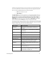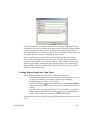
1
HydroGeo Analyst v.4.0
User’s Manual
Database Utilities, Borehole logging/reporting, 2D Mapping and
Cross Sections, and 3D Visualization
Copyright Information
© 2007 Schlumberger Water Services. All rights reserved.
No portion of the contents of this publication may be reproduced or transmitted in any form or by any means without the express written
permission of Schlumberger Water Services.
Printed in Canada
2007
Table of Contents
1. Introduction to HydroGeo Analyst ............................................. 1
Sample Applications ......................................................................................................................... 1
What’s New in HydroGeo Analyst ..................................................................................2
New Features in v.4.0 ................................................................................................................2
New Features in v.3.0 ................................................................................................................4
Data Management ............................................................................................................................. 4
Application and Project Management .............................................................................................. 5
GIS Map Manager ............................................................................................................................ 5
Cross-Section Editor ......................................................................................................................... 5
Borehole Log Plotter ........................................................................................................................ 6
HydroGeo Analyst 3D-Explorer ....................................................................................................... 6
New Features in v.2.0 ................................................................................................................6
Data models ...................................................................................................................................... 6
Data Transfer System (DTS) ............................................................................................................ 6
Map Manager .................................................................................................................................... 7
Cross-Section Editor ......................................................................................................................... 7
HGA 3D-Explorer ............................................................................................................................ 7
Query Builder ................................................................................................................................... 7
Borehole Log Plotter ........................................................................................................................ 7
General ............................................................................................................................................. 7
About HydroGeo Analyst .................................................................................................8
Data Acquisition ........................................................................................................................8
Data Entry ......................................................................................................................................... 8
Importing and Exporting Data .......................................................................................................... 8
Data Management ......................................................................................................................8
Template Manager ............................................................................................................................ 9
Customizable Lists and Standards .................................................................................................... 9
Data Querying and Filtering with the Query Builder ..................................................................... 10
Data Visualization ...................................................................................................................10
Map Manager .................................................................................................................................. 10
Cross-Section Editor ....................................................................................................................... 11
3D Subsurface Visualization with 3D Explorer ............................................................................. 11
Reporting and Printing .............................................................................................................12
Report Designer .............................................................................................................................. 12
Interface to Visual MODFLOW and other WHI Software .....................................................12
Installing HydroGeo Analyst .........................................................................................13
System Requirements ..............................................................................................................13
Installation ...............................................................................................................................13
Uninstalling HydroGeo Analyst ..............................................................................................14
Starting HydroGeo Analyst .....................................................................................................15
Updating Old Projects ....................................................................................................15
Learning to use HydroGeo Analyst ...............................................................................16
HydroGeo Analyst On-Line Help ............................................................................................17
Contents .......................................................................................................................................... 17
Copyright, Schlumberger Water Services
Index ............................................................................................................................................... 17
Search ............................................................................................................................................. 17
Favorites ......................................................................................................................................... 17
About the Interface .........................................................................................................18
Data Tabs .................................................................................................................................19
Stations List Tab ............................................................................................................................. 19
Data Query Tab .............................................................................................................................. 19
Station Data Tab ............................................................................................................................. 19
Main Menu Bar ........................................................................................................................21
Toolbar .....................................................................................................................................21
Project Browser .......................................................................................................................24
Station Groups ................................................................................................................................ 24
Station Data (Data Categories) ....................................................................................................... 24
Queries ............................................................................................................................................ 24
Crosstab .......................................................................................................................................... 25
Maps ............................................................................................................................................... 25
Cross-Sections ................................................................................................................................ 25
Reports ............................................................................................................................................ 25
3D Views ........................................................................................................................................ 25
Borehole Logs ................................................................................................................................ 25
Plots ................................................................................................................................................ 25
2. Getting Started ............................................................................ 27
Terms and Notation ........................................................................................................................ 28
Creating a New Project ..................................................................................................28
Step 1: Set Database Environment ..........................................................................................30
Select Server and Database ............................................................................................................ 30
Step 2: Create Project Dependent Tables ................................................................................31
Step 3: Set Project Properties and Location ............................................................................32
Data Management ...........................................................................................................34
Entering Data Manually ...........................................................................................................35
Example: Creating a New Station .................................................................................................. 35
Example: Entering Lithology Data ................................................................................................. 38
Example: Entering Well Construction Data ................................................................................... 40
Example: Entering Monitoring Event Data .................................................................................... 42
Importing Data using the Data Transfer System (DTS) ..........................................................44
Example: Importing Stations from an Excel File ........................................................................... 44
Example: Importing Lithology Data .............................................................................................. 51
Example: Importing Soil Chemistry Data ...................................................................................... 54
Example: Importing Water Level Data .......................................................................................... 60
Creating Station Groups ..........................................................................................................66
Example: Creating a Station Group ................................................................................................ 67
Viewing Borehole Log Plots ...........................................................................................68
Querying the Database ...................................................................................................69
Example: Querying the Database ............................................................................................70
Recalling and Executing Queries ............................................................................................74
Mapping the Data ...........................................................................................................75
Copyright, Schlumberger Water Services
Creating a Map Project ............................................................................................................75
Importing and Georeferencing a Site Map ..............................................................................77
Adding Georeference Points ........................................................................................................... 78
Adding Labels ................................................................................................................................ 81
Creating a Contour Map ..........................................................................................................82
Creating a Color Shade Map ...................................................................................................85
Defining Cross Section Lines ..................................................................................................88
Creating the Cross Section ......................................................................................................90
Interpreting and Viewing Cross-Sections .....................................................................91
Drawing Geologic Cross-Sectional Layers .............................................................................91
3D Visualization (Fence Diagrams) ........................................................................................95
Preparing Reports ...........................................................................................................97
Creating Data Reports from Grids ...........................................................................................97
3. Using HydroGeo Analyst ............................................................ 99
HydroGeo Analyst: Fundamental Concepts ..............................................................100
Introduction ...........................................................................................................................100
Station Types ................................................................................................................................ 100
Stations Table ............................................................................................................................... 101
Station Groups .............................................................................................................................. 102
Data Categories ............................................................................................................................ 104
Data Entry ..............................................................................................................................105
Station List Tab ............................................................................................................................ 105
Station Data Tab ........................................................................................................................... 106
Data Transfer System (DTS) ........................................................................................................ 106
HydroGeo Analyst Main Menu Bar ............................................................................107
Project ....................................................................................................................................108
New ............................................................................................................................................... 108
Open ............................................................................................................................................. 108
Open from Backup ....................................................................................................................... 109
Close ............................................................................................................................................. 110
Re-Open ........................................................................................................................................ 110
Import ........................................................................................................................................... 110
Export ........................................................................................................................................... 122
Properties ...................................................................................................................................... 123
Print .............................................................................................................................................. 124
Exit ............................................................................................................................................... 124
Edit .........................................................................................................................................124
Copy ............................................................................................................................................. 124
Cut ................................................................................................................................................ 125
Paste .............................................................................................................................................. 125
Find ............................................................................................................................................... 125
View .......................................................................................................................................126
Project Browser ............................................................................................................................ 126
Well Profile .................................................................................................................................. 126
Hide Selected Columns ................................................................................................................ 126
Show All Columns ....................................................................................................................... 127
Collapse All .................................................................................................................................. 127
Copyright, Schlumberger Water Services
Expand All .................................................................................................................................... 127
Refresh All .................................................................................................................................... 127
Record ....................................................................................................................................127
Add ............................................................................................................................................... 127
Delete ............................................................................................................................................ 128
Duplicate ....................................................................................................................................... 128
Post ............................................................................................................................................... 128
Filter by Value .............................................................................................................................. 128
Hide Selected (Rows) ................................................................................................................... 129
Invert Selection ............................................................................................................................. 129
Show All ....................................................................................................................................... 129
Select All ...................................................................................................................................... 129
Sort Ascending ............................................................................................................................. 129
Sort Descending ............................................................................................................................ 129
Display on Map ............................................................................................................................ 129
Settings ..................................................................................................................................130
Template Manager ........................................................................................................................ 130
List Editor ..................................................................................................................................... 130
Material Specifications ................................................................................................................. 130
Manage User Access Level .......................................................................................................... 130
Change Password .......................................................................................................................... 131
User Preferences ........................................................................................................................... 131
Tools ......................................................................................................................................132
Query Builder ............................................................................................................................... 132
Map Manager ................................................................................................................................ 132
View Cross Section ...................................................................................................................... 132
3D Interpolation ............................................................................................................................ 133
Crosstab Report ............................................................................................................................ 136
Quality Control ............................................................................................................................. 136
Unit Converter .............................................................................................................................. 137
BackUp Database ......................................................................................................................... 137
Restore Database .......................................................................................................................... 137
Manage Databases ........................................................................................................................ 137
Pumping Test Analysis ................................................................................................................. 138
Water Quality Analysis ................................................................................................................ 142
Help .......................................................................................................................................142
Contents ........................................................................................................................................ 142
About ............................................................................................................................................ 142
Template Manager ........................................................................................................143
Purpose ..................................................................................................................................143
General Description ...............................................................................................................143
List Editor ......................................................................................................................143
Creating a List .......................................................................................................................144
Adding Lists Manually ................................................................................................................. 145
Generating Lists ............................................................................................................................ 146
Importing Lists ............................................................................................................................. 146
Editing a List .........................................................................................................................147
Launching the List Editor from the Template Manager ........................................................148
Material Specifications Editor .....................................................................................149
Creating a New Soil Classification System ...........................................................................150
Modifying and Deleting a Soil Classification System ...........................................................151
Copyright, Schlumberger Water Services
Changing Soil Classifications ................................................................................................151
Unit Converter ..............................................................................................................151
Major Components .......................................................................................................152
4. Project Management ................................................................. 157
User Access Level Management ..................................................................................157
Introduction ...........................................................................................................................157
Security Document ................................................................................................................158
Managing Users and Groups .................................................................................................158
Group Properties ....................................................................................................................160
Application Level Objects ............................................................................................................ 162
Project Level Objects ................................................................................................................... 162
User Properties ......................................................................................................................164
Set Passwords ............................................................................................................................... 165
Exporting PLSD ....................................................................................................................166
Using the Project Manager ..........................................................................................166
Loading the Project Wizard .......................................................................................................... 167
Step 1: Set Database Environment ........................................................................................168
Option 1: Select Server and Database .......................................................................................... 169
Option 2: Build Connection String ............................................................................................... 170
Step 2: Create Project Dependent Tables ..............................................................................173
Selecting the Database Template for your project ....................................................................... 174
Step 3: Set Project Properties and Location ..........................................................................175
Modifying Project Properties .................................................................................................178
Connectivity ................................................................................................................................. 179
Miscellaneous Settings ................................................................................................................. 179
5. Template Manager .................................................................... 181
Understanding the Template Manager .......................................................................181
About the Interface .......................................................................................................182
Description of Toolbar Items .................................................................................................183
Template Toolbar: Global Template Options ............................................................................... 183
Tables and Fields Toolbar ............................................................................................................ 186
Working With the Template Manager .......................................................................188
Modifying Tables and View Settings ....................................................................................188
Data Categories ............................................................................................................................ 188
Table Property Settings ................................................................................................................ 189
Defining Table Relationships ....................................................................................................... 192
Modifying Fields and View Settings .....................................................................................194
Linked Fields ................................................................................................................................ 196
Managing Templates ....................................................................................................197
Creating a new template ........................................................................................................197
Creating a copy of the current template .................................................................................197
Copyright, Schlumberger Water Services
Saving a template as default template ...................................................................................198
Exporting the current template as a Database template .........................................................198
6. The Data Transfer System ....................................................... 199
Starting the DTS ........................................................................................................................... 199
Importing Data using the DTS ....................................................................................201
Choose a Data Source ............................................................................................................201
Data Transfer Package (DTP) ...................................................................................................... 201
Select the Data Source .................................................................................................................. 202
Data Mapping ........................................................................................................................205
Data Requirements ....................................................................................................................... 206
Import Order ................................................................................................................................. 207
How to Map Fields ....................................................................................................................... 207
Unit Conversion ............................................................................................................................ 209
Importing Criteria ......................................................................................................................... 209
Station Related Settings .........................................................................................................210
Projection Settings ........................................................................................................................ 211
Coordinate Exclusion Filter .......................................................................................................... 211
Add Stations to Group .................................................................................................................. 211
Data Validation Report and Finalizing the Import ................................................................213
Accepting or Rejecting Errors/Warnings ..................................................................................... 214
Accepting or Rejecting Records ................................................................................................... 214
Finalizing the Import .................................................................................................................... 214
Exporting Data using the DTS .....................................................................................215
Specify Data Source and Package .........................................................................................216
Select Tables to Export ..........................................................................................................216
Unit Conversion ............................................................................................................................ 216
Station Related Settings .........................................................................................................217
7. Queries ....................................................................................... 219
About the Interface .......................................................................................................219
Description of Toolbar Items .................................................................................................221
Query Types ..................................................................................................................221
Data Queries ..........................................................................................................................221
Station Group Queries ...........................................................................................................222
Creating Queries ...........................................................................................................222
Data Query - Example ...........................................................................................................222
Adding a field which contains a Linked List ................................................................................ 228
Advanced Data Query Options ..................................................................................................... 230
Station Group Query - Example ............................................................................................232
Query Using SQL Commands - Example .............................................................................235
Select Command ........................................................................................................................... 235
Delete Command .......................................................................................................................... 236
Managing Queries .........................................................................................................237
Copyright, Schlumberger Water Services
Editing ...................................................................................................................................237
Saving As... ............................................................................................................................237
Recalling Queries in HydroGeo Analyst .....................................................................237
Data Query Tab .....................................................................................................................238
Exporting Query Results ..............................................................................................239
Printing Query Results .................................................................................................239
Crosstab Queries ...........................................................................................................241
Introduction ...........................................................................................................................241
Creating a Crosstab Query .....................................................................................................241
Layout ........................................................................................................................................... 243
Style Sheet .................................................................................................................................... 246
Auto Format .................................................................................................................................. 246
Generating the Report ............................................................................................................247
Crosstab Table Display Settings ................................................................................................... 249
Data Marker Settings .................................................................................................................... 251
Printing Crosstab Reports ......................................................................................................252
8. Map Manager ............................................................................ 255
About the Interface .......................................................................................................256
Grouping Layers ........................................................................................................................... 258
Description of Toolbar Items .................................................................................................259
Description of Menu Items ...........................................................................................262
Project ....................................................................................................................................262
New ............................................................................................................................................... 262
Open ............................................................................................................................................. 262
Save .............................................................................................................................................. 262
Save As ......................................................................................................................................... 262
Close ............................................................................................................................................. 263
Reopen .......................................................................................................................................... 263
Export Project ............................................................................................................................... 263
Export Map ................................................................................................................................... 263
Properties ...................................................................................................................................... 264
Print .............................................................................................................................................. 265
Exit ............................................................................................................................................... 265
Layer ......................................................................................................................................265
New ............................................................................................................................................... 265
Open ............................................................................................................................................. 266
Load HGA Data ............................................................................................................................ 269
Import ........................................................................................................................................... 270
Save .............................................................................................................................................. 277
Delete ............................................................................................................................................ 277
Create Intersection ........................................................................................................................ 277
Properties ...................................................................................................................................... 277
Statistics ........................................................................................................................................ 278
Renderer ....................................................................................................................................... 279
Create Thematic Map ................................................................................................................... 283
Modify Thematic Map .................................................................................................................. 285
Create Contours ............................................................................................................................ 286
Create Gridded Data ..................................................................................................................... 289
Copyright, Schlumberger Water Services
Display Data ................................................................................................................................. 290
Edit .........................................................................................................................................297
Cut ................................................................................................................................................ 298
Copy ............................................................................................................................................. 298
Paste .............................................................................................................................................. 298
Delete ............................................................................................................................................ 298
Delete All ...................................................................................................................................... 298
Add Vertex ................................................................................................................................... 298
Delete Vertex ................................................................................................................................ 298
Copy Map to Clipboard ................................................................................................................ 299
Tools ......................................................................................................................................299
Polygon ......................................................................................................................................... 299
Rectangle ...................................................................................................................................... 299
Circle ............................................................................................................................................ 299
Line ............................................................................................................................................... 300
Point .............................................................................................................................................. 300
Text ............................................................................................................................................... 300
Information ................................................................................................................................... 300
Measure ........................................................................................................................................ 301
Define Cross-Section Line ........................................................................................................... 301
Create Cross-Section .................................................................................................................... 302
View .......................................................................................................................................302
Full Extent .................................................................................................................................... 302
Zoom In ........................................................................................................................................ 302
Zoom Out ...................................................................................................................................... 302
Zoom to Active Layer .................................................................................................................. 302
Previous Extent ............................................................................................................................. 302
Next Extent ................................................................................................................................... 302
Custom Extent .............................................................................................................................. 303
Turn on All Layers ....................................................................................................................... 303
Turn off All Layers ....................................................................................................................... 303
View BHLP .................................................................................................................................. 303
Select .....................................................................................................................................304
Pointer ........................................................................................................................................... 305
Rectangle ...................................................................................................................................... 305
Polygon ......................................................................................................................................... 305
Circle ............................................................................................................................................ 305
Line ............................................................................................................................................... 305
All ................................................................................................................................................. 306
None ............................................................................................................................................. 306
Add to Station Group .................................................................................................................... 306
Delete from Station Group ........................................................................................................... 306
Settings ..................................................................................................................................307
Cross Section ................................................................................................................................ 307
Graticule ....................................................................................................................................... 309
Code Page ..................................................................................................................................... 310
Help .......................................................................................................................................313
Contents ........................................................................................................................................ 313
Defining a Cross Section Line ......................................................................................313
Digitizing a Cross Section Line .................................................................................................... 313
Use Existing Polyline ................................................................................................................... 314
Modify Buffer Distance ................................................................................................................ 315
Copyright, Schlumberger Water Services
9. Cross Section Editor ................................................................. 317
About the Interface .......................................................................................................318
Description of Toolbar Items .................................................................................................319
Description of Menu Items ...........................................................................................322
File .........................................................................................................................................322
Save .............................................................................................................................................. 322
Close ............................................................................................................................................. 322
Export Model Layers .................................................................................................................... 322
Export Image ................................................................................................................................ 323
Print .............................................................................................................................................. 324
Exit ............................................................................................................................................... 324
Edit .........................................................................................................................................324
Delete ............................................................................................................................................ 324
Delete All ...................................................................................................................................... 324
Add Vertex ................................................................................................................................... 324
Delete Vertex ................................................................................................................................ 325
Link Vertex ................................................................................................................................... 325
Remove Links ............................................................................................................................... 325
Set Features .................................................................................................................................. 326
Change Well Width ...................................................................................................................... 328
Change Vertical Axis ................................................................................................................... 328
Change Vertical Exaggeration ...................................................................................................... 329
Copy Window ............................................................................................................................... 329
View .......................................................................................................................................329
Full Extent .................................................................................................................................... 329
Zoom In ........................................................................................................................................ 330
Zoom Out ...................................................................................................................................... 330
Previous Extent ............................................................................................................................. 330
Next Extent ................................................................................................................................... 330
View 3D ........................................................................................................................................ 330
Information ................................................................................................................................... 331
Preview BHLP .............................................................................................................................. 331
Tools ......................................................................................................................................331
Options ......................................................................................................................................... 331
Limitations .................................................................................................................................... 338
Model Layers ................................................................................................................................ 338
Update Cross Section ................................................................................................................... 340
Cross Section Info ........................................................................................................................ 340
Display BHLP .............................................................................................................................. 340
Help .......................................................................................................................................341
Contents ........................................................................................................................................ 341
Creating the Cross Section ...........................................................................................341
Drawing Cross-Section Interpretations ......................................................................342
Loading Surface Layers .........................................................................................................342
Geologic Layer Interpretations ..............................................................................................343
Editing Layers .............................................................................................................................. 345
Hydrogeologic Layer Interpretations .....................................................................................346
Translating Geologic Interpretations into Hydrogeologic Interpretations ................................... 346
Model Layer Interpretations ..................................................................................................347
Defining Model Layers ................................................................................................................. 347
Copyright, Schlumberger Water Services
Drawing Model Interpretation Layers .......................................................................................... 348
Snapping Vertices to Other Model Layer Lines ........................................................................... 350
Editing Model Layers ................................................................................................................... 351
Adding Multiple Vertices ............................................................................................................. 352
Linking Vertices between Model Layers ..................................................................................... 352
Remove Stations from Cross Sections ...................................................................................353
Querying Cross Section Interpretations .....................................................................353
Adding Annotations to the Cross Section ...................................................................354
Add Text ....................................................................................................................................... 355
Add Lines ..................................................................................................................................... 355
Add Polygons ............................................................................................................................... 356
Settings ......................................................................................................................................... 356
10. HydroGeo Analyst 3D-Explorer ............................................ 357
About the Interface .......................................................................................................357
Working with 3D Explorer ..........................................................................................358
Positioning the Panels ............................................................................................................358
Moving a Panel ............................................................................................................................. 359
Floating Panels ............................................................................................................................. 359
Docking Panels ............................................................................................................................. 359
Closing Panels .............................................................................................................................. 359
Vertical Exaggeration ............................................................................................................359
3D Navigation Tools .............................................................................................................360
Rotating the Image ....................................................................................................................... 360
Animation Controls ...................................................................................................................... 361
Time Animation ............................................................................................................................ 362
Plume Browser ............................................................................................................................. 363
Recording Animation to AVI file ................................................................................................. 364
OpenGL Settings ...................................................................................................................366
Loading Projects ....................................................................................................................366
Display Settings .............................................................................................................367
Default Settings .....................................................................................................................367
Resetting Options ......................................................................................................................... 369
Project Display Settings .........................................................................................................369
Axis Display Settings ............................................................................................................371
Sitemap Display Settings .......................................................................................................371
Surfaces Display Settings ......................................................................................................372
Isolines .......................................................................................................................................... 373
Plumes Display Settings ........................................................................................................374
Isosurfaces .................................................................................................................................... 375
Color Maps ................................................................................................................................... 377
Isoline Maps ................................................................................................................................. 379
The Color Palette .......................................................................................................................... 382
The Color Legend ......................................................................................................................... 384
Cross-Section Data Display Settings .....................................................................................384
Cross Section Settings .................................................................................................................. 385
Stations Display Settings .............................................................................................................. 385
Copyright, Schlumberger Water Services
Layer Interpretation Settings ........................................................................................................ 385
Creating Slices and Cross Sections ..............................................................................386
Creating a Vertical Slice ........................................................................................................387
Creating a Horizontal Slice ....................................................................................................388
Selecting a Cross Sectional Slice ...........................................................................................388
Deleting a Slice ......................................................................................................................389
Modifying a Slice ..................................................................................................................389
Scene Configurations ....................................................................................................389
Saving and Exporting Options .....................................................................................390
Saving Project ........................................................................................................................391
Printing the 3D Image ..................................................................................................391
11. The Report Editor ................................................................... 393
About the Interface .......................................................................................................393
Report Designer Window .............................................................................................394
Report Designer Toolbars ......................................................................................................395
Main Toolbar ................................................................................................................................ 395
Display Settings Tools .................................................................................................................. 396
Formatting Tools .......................................................................................................................... 397
General Tools ............................................................................................................................... 398
Alignment Tools ........................................................................................................................... 400
Toolbox options for General Tools .......................................................................................401
Label ............................................................................................................................................. 401
Field .............................................................................................................................................. 402
Check Mark .................................................................................................................................. 403
Image ............................................................................................................................................ 403
Line ............................................................................................................................................... 404
Shape ............................................................................................................................................ 404
Rich Text ...................................................................................................................................... 404
Frame ............................................................................................................................................ 404
Sub Report .................................................................................................................................... 404
Page Break .................................................................................................................................... 405
OLE .............................................................................................................................................. 405
Barcode ......................................................................................................................................... 405
ActiveReport ................................................................................................................................. 405
Using the Report Designer ....................................................................................................406
Report Explorer ............................................................................................................................ 406
Data Fields Explorer ..................................................................................................................... 407
Report Properties Toolbox ........................................................................................................... 407
Designer: Advanced Controls and Settings .................................................................................. 408
Report Preview Window ..............................................................................................410
Report Viewer Toolbars ........................................................................................................411
Navigation tools ............................................................................................................................ 411
Using the Report Viewer .......................................................................................................413
Saving Reports .............................................................................................................................. 413
Report Settings ..............................................................................................................413
Printing ..................................................................................................................................416
Copyright, Schlumberger Water Services
Limitations .................................................................................................................................... 416
Using non-default page dimensions ............................................................................................. 416
Creating Reports ...........................................................................................................417
Creating Reports in HydroGeo Analyst-Main Window ........................................................417
Creating Reports from a Data Grid .............................................................................................. 418
Creating Reports based on a Data Query ..................................................................................... 419
Creating Parameter Query Reports ............................................................................................... 420
Creating a Report Containing a Map Project .........................................................................422
Creating a Report Containing a Cross-Section ......................................................................422
Creating a Report Containing 3D Images ..............................................................................423
Creating a Borehole Log Report ............................................................................................423
Parameter Query Reports .......................................................................................................424
Managing Reports .........................................................................................................424
Opening an Existing Report ..................................................................................................424
Deleting a Report ...................................................................................................................424
Saving a Report .....................................................................................................................424
Saving a Report As... .................................................................................................................... 424
Exporting generated reports ...................................................................................................424
Creating and Managing Report Templates ................................................................425
Creating A Report Template ..................................................................................................426
Opening a Report Template ...................................................................................................426
Deleting a Report Template ...................................................................................................426
Setting a Report Template as Default Template ....................................................................426
Import Reports from MS Access .................................................................................427
Creating Reports with Charts .....................................................................................429
Example .................................................................................................................................430
12. Borehole Log Plotter ............................................................... 441
About the Interface .......................................................................................................442
Description of Designer Toolbar Items .................................................................................444
BHLP Columns .............................................................................................................444
Supported Column Types ............................................................................................................. 445
BHLP Default Settings ................................................................................................................. 446
Vertical Scale Column ...........................................................................................................448
Settings ......................................................................................................................................... 449
Depth-Point based Column ....................................................................................................450
Settings ......................................................................................................................................... 452
Depth-Interval based Column ................................................................................................454
Settings ......................................................................................................................................... 455
Lithology Column ..................................................................................................................456
Settings ......................................................................................................................................... 456
Well Construction Column ....................................................................................................457
Copyright, Schlumberger Water Services
Settings ......................................................................................................................................... 457
Depth Dependent Plots ..........................................................................................................465
Settings ......................................................................................................................................... 468
Picture Column ......................................................................................................................471
Designing a Borehole Log Plot .....................................................................................472
Adding Lithology Column .....................................................................................................473
Select Column Type ..................................................................................................................... 473
Edit Column Properties ................................................................................................................ 474
Specify Data Source ..................................................................................................................... 476
Add Well Construction Column ............................................................................................477
Add Plot Columns .................................................................................................................477
Add Plot Series ............................................................................................................................. 478
Re-order BHLP Columns ......................................................................................................480
Saving the Borehole Log Plot .......................................................................................480
Saving a borehole log plot design template ...........................................................................481
Exporting a borehole log plot design template ......................................................................481
Borehole Log Reports: Printing and Exporting .........................................................481
Generating a borehole log report ...........................................................................................481
13. Quality Control ....................................................................... 485
Preparing Your Data for QC Analysis .......................................................................486
Defining Quality Codes for Data .................................................................................................. 486
Data Requirements ................................................................................................................487
Define A New Lab Quality Template ..........................................................................488
Check Duplicates Settings .....................................................................................................489
Check Spiked Settings ...........................................................................................................490
Check Blanks Settings ...........................................................................................................491
Applying a Lab Quality Template ...............................................................................492
Mapping Fields ......................................................................................................................493
Generate QC Results ....................................................................................................493
Export Quality Control Analysis Results ..............................................................................495
14. Plotting ..................................................................................... 497
About the Interface .......................................................................................................498
Description of Designer Toolbar Items .................................................................................499
Viewer Window Settings .......................................................................................................500
Adding Plots ..................................................................................................................501
Add Plot .................................................................................................................................501
Field Mappings ......................................................................................................................502
Plot Settings ...................................................................................................................506
Copyright, Schlumberger Water Services
General Series Settings ..........................................................................................................506
Style and Display Settings .....................................................................................................508
Common ....................................................................................................................................... 508
Legend .......................................................................................................................................... 508
Vertical (Y) Axis .......................................................................................................................... 509
Horizontal (X) Axis ...................................................................................................................... 510
Series Type ................................................................................................................................... 510
Data Series Settings ...............................................................................................................511
Adding Lines to a Plot ..................................................................................................513
Line Settings ................................................................................................................................. 514
Saving and Exporting ...................................................................................................514
Saving Plot Page Design ........................................................................................................515
Saving Plot as Template ........................................................................................................515
Deleting Plot Templates ............................................................................................................... 515
Export Plot Page to Graphics File .........................................................................................516
Copy Plot to Clipboard ..........................................................................................................516
Export Plot Page to Document ..............................................................................................516
Printing ..................................................................................................................................516
15. Appendices ............................................................................... 517
Appendix A: HydroGeo Analyst File Types ...............................................................517
HydroGeo Analyst - Main Module ........................................................................................517
Map Manager .........................................................................................................................517
Cross Section Editor ..............................................................................................................518
3D Explorer ...........................................................................................................................518
Reports ...................................................................................................................................518
Appendix B: Project Files and Directory Structure ..................................................519
Appendix C: Using the Data Link Properties for Importing ....................................521
Appendix D: Advanced Interpolation Settings ..........................................................529
Inverse Distance ....................................................................................................................529
Natural Neighbor ...................................................................................................................530
Kriging ...................................................................................................................................531
Appendix E: Map Manager: ISO Codes .....................................................................535
Appendix F: Online GIS Data Resources ...................................................................537
Appendix G: Frequently Asked Questions (FAQ’s) ..................................................544
Copyright, Schlumberger Water Services
Preface
Schlumberger Water Services (SWS) is a recognized leader in the development and application of
innovative groundwater technologies in addition to offering expert services and professional training to
meet the advancing technological requirements of today’s groundwater and environmental
professionals.
Waterloo Hydrogeologic Software (WHS), developed by SWS, consists of a complete suite of
environmental software applications engineered for data management and analysis, modeling and
simulation, visualization, and reporting. WHS is currently sold globally as a suite of desktop solutions.
For over 18 years, our products and services have been used by firms, regulatory agencies, and
educational institutions around the world. We develop each product to maximize productivity and
minimize the complexities associated with groundwater and environmental projects. To date, we have
over 14,000 registered software installations in more than 85 countries!
Need more information?
If you would like to contact us with comments or suggestions, you can reach us at:
Schlumberger Water Services
460 Phillip Street - Suite 101
Waterloo, Ontario, CANADA, N2L 5J2
Phone: +1 (519) 746-1798
Fax: +1 (519) 885-5262
General Inquiries: [email protected]
Web: www.swstechnology.com, www.water.slb.com
Obtaining Technical Support
To help us handle your technical support questions as quickly as possible, please have the following
information ready before you call, or include it in a detailed technical support e-mail:
• A complete description of the problem including a summary of key strokes and program event
(or a screen capture showing the error message, where applicable)
• Product name and version number
• Product serial number
• Computer make and model number
• Operating system and version number
• Total free RAM
• Number of free bytes on your hard disk
• Software installation directory
• Directory location for your current project files
You may send us your questions via e-mail, fax, or call one of our technical support specialists. Please
allow up to two business days for a response. Technical support is available 8:00 am to 5:00 pm EST
Monday to Friday (excluding Canadian holidays).
Phone: +1 (519) 746-1798
Fax: +1 (519) 885-5262
E-mail: [email protected]
Training and Consulting Services
Schlumberger Water Services offers numerous, high quality training courses globally. Our courses are
designed to provide a rapid introduction to essential knowledge and skills, and create a basis for further
professional development and real-world practice. Open enrollment courses are offered worldwide each
year. For the current schedule of courses, visit: www.swstechnology.com/training or e-mail us at: [email protected].
Schlumberger Water Services also offers expert consulting and peer reviewing services for data
management, groundwater modeling, aqueous geochemical analysis, and pumping test analysis. For
further information, please contact [email protected].
Waterloo Hydrogeologic Software*
We also develop and distribute a number of other useful software products for the groundwater
professionals, all designed to increase your efficiency and enhance your technical capability, including:
• Visual MODFLOW Premium
• HydroGeo Analyst
• Aquifer Test Pro
• AquaChem
• GW Contour
• UnSat Suite Plus
• Visual HELP
• Visual PEST-ASP
Visual MODFLOW Premium
Visual MODFLOW Premium is a three-dimensional groundwater flow and contaminant transport
modeling application that integrates MODFLOW-2000, SEAWAT-2000, MODPATH, MT3DMS,
xviii
MT3D99, RT3D, VMOD 3D-Explorer, WinPEST, Stream Routing Package, Zone Budget, MGO,
SAMG, and PHT3D. Applications include well head capture zone delineation, pumping well
optimization, aquifer storage and recovery, groundwater remediation design, simulating natural
attenuation, and saltwater intrusion.
HydroGeo Analyst
HydroGeo Analyst is an information management system for managing groundwater and environmental
data. HydroGeo Analyst combines numerous pre and post processing components into a single program.
Components include, Project Wizard, Universal Data Transfer System, Template Manager, Materials
Specification Editor, Query Builder, QA/QC Reporter, Map Manager, Cross-Section Editor, HGA 3DExplorer, Borehole Log Plotter, and Report Editor. The seamless integration of these tools provide the
means for compiling and normalizing field data, analyzing and reporting subsurface data, mapping and
assessing spatial information, and reporting site data.
AquiferTest Pro
AquiferTest Pro, designed for graphical analysis and reporting of pumping test and slug test data, offers
the tools necessary to calculate an aquifer's hydraulic properties such as hydraulic conductivity,
transmissivity, and storativity. AquiferTest Pro is versatile enough to consider confined aquifers,
unconfined aquifers, leaky aquifers, and fractured rock aquifers conditions. Analysis results are
displayed in report format, or may be exported into graphical formats for use in presentations.
AquiferTest Pro also provides the tools for trends corrections, and graphical contouring water table
drawdown around the pumping well.
AquaChem
AquaChem is designed for the management, analysis, and reporting of water quality data. AquaChem’s
analysis capabilities cover a wide range of functions and calculations frequently used for analyzing,
interpreting and comparing water quality data. AquaChem includes a comprehensive selection of
commonly used plotting techniques to represent the chemical characteristics of aqueous geochemical
and water quality data, as well includes PHREEQC - a powerful geochemical reaction model.
GW Contour
The GW Contour data interpolation and contouring program incorporates techniques for mapping
velocity vectors and particle tracks. GW Contour incorporates the most commonly used 2D data
interpolation techniques for the groundwater and environmental industry including Natural Neighbor,
Inverse Distance, Kriging, and Bilinear. GW Contour is designed for contouring surface or water levels,
contaminant concentrations, or other spatial data.
xix
UnSat Suite Plus
UnSat Suite Plus seamlessly integrates multiple one-dimensional unsaturated zone flow and solute
transport models into a single, intuitive working environment. Models include SESOIL, VS2DT,
VLEACH, PESTAN, Visual HELP and the International Weather Generator. The combination of
models offers users the ability for simulating the downward vertical flow of water and the migration of
dissolved contaminants through the vadose zone. UnSat Suite Plus includes tools for project
management, generating synthetic weather data, modeling flow and contaminants through the
unsaturated zone, estimating groundwater recharge and contaminant loading rates, and preparing
compliance reports.
Visual HELP
Visual HELP is a one-dimensional, unsaturated zone flow modeling application built for optimizing the
hydrologic design of municipal landfills. Visual HELP is based on the US E.P.A . HELP model
(Hydrologic Evaluation of Landfill Performance) and has been integrated into a 32-Bit Windows
application. It combines the International Weather Generator, Landfill Profile Designer, and Report
Editor. Applications include designing landfill profiles, predicting leachate mounding, and evaluating
potential leachate seepage to the groundwater.
Visual PEST-ASP
Visual PEST-ASP combines the powerful parameter estimation capabilities of PEST-ASP, with the
graphical processing and display features of WinPEST. Visual PEST-ASP can be used to assist in data
interpretation, model calibration and predictive analysis by optimizing model parameters to fit a set of
observations. This popular estimation package achieves model independence through its capacity to
communicate with a model through its input and output files.
1
Introduction to HydroGeo Analyst
HydroGeo Analyst is the most comprehensive, and yet easy-to-use, environmental data
management system, providing data validation, analysis, and visualization. The
HydroGeo Analyst package integrates a list of flexible and customizable database
structures used around the world, complimented by state-of-the-art tools for data
interpretation, statistical analysis, GIS mapping, data charting, and two- and threedimensional visualizations.
For most environment-related projects, whether they are contaminated sites or
municipal water supply projects, there is often an abundance of data that has been
collected over the years. How many times have you had to sift through several paper
reports for that one piece of information when compiling monthly summaries on a
project? Can you be sure that you have not misplaced a report or failed to mention an
important piece of data?
The HydroGeo Analyst package addresses these and many other needs in the industry.
The system enables you to create a project specific database, or enhance and build upon
your existing database. It can collect all of your previous data and reports and
consolidate them into a powerful relational database system that can be queried and
referenced with ease.
HydroGeo Analyst (also referred to as HG Analyst, or HGA) operates as a desktop
application based on Microsoft SQL Server technology. The package supports multiple
user levels, for controlled data management, with structured access privileges for
setting up project data structures, checking out data to working sub-projects, and
submitting new or modified data.
Sample Applications
Typical applications for HydroGeo Analyst include:
•
•
•
•
•
Regional water well management
Contaminant site inventory
Regulatory compliance
Geologic cross-sections
Public access to information
1
•
•
•
•
•
Environmental site assessment
Monitored natural attenuation
Regional aquifer characterization and management
Cross-boundary data sharing
Aquifer vulnerability mapping
1.1 What’s New in HydroGeo Analyst
The main interface for HydroGeo Analyst has much of the same user-friendly look and
feel as the previous version, but with some significant improvements to features. Some
of the more significant upgrade features in the latest versions of HydroGeo Analyst are
described below.
1.1.1 New Features in v.4.0
The following new features are available in v.4.0:
Map Manager GIS
•
•
•
•
•
•
•
•
•
•
•
•
•
•
•
•
•
Detailed legend for layers with graduated or value rendering
Detailed label rendering for contours
Allow restricting contour lines within a polygon
Create contours using only selected stations
Create map layers from an intersection of two other layers
Display time series plots linked to stations on a map
Allow creating map layers with Arabic attributes
Display graticule on map
Allow creating color shaded/zones map layers, with option to clip color shading
at the boundary of a polygon
Load surfaces such as DEM, Surfer GRD, ESRI GRD
Define cross-section line from existing polyline layer
Pan/Zoom when digitizing a cross-section line
Snap cross-section line to stations when digitizing a line
Modify buffer distance for existing cross-section lines
Georeference raster images using more than two control points
Group map layers
Support for datum shifts
Cross Section Editor
•
•
•
•
2
Show vertical axis on exported image of cross section
Ability to rearrange order of legend elements
Adjust vertical axis in cross-section
Adjust vertical exaggeration in cross-section
Chapter 1: Introduction to HydroGeo Analyst
• Automatically insert vertices along the model layers
• Replace basic topographic representation with detailed high-resolution Surface
elevations from DEM, Surfer GRD, ESRI GRD files.
Borehole Log Plotter
• Improved, restructured graphical user interface
• Allow multiple casings/piezometers within a well, and display on BHLP
• Improved display settings such as the ability to use image pattern or image for
2D/3D casing.
• Support for reducer pipe fittings on well casing
• Display annular fills in boreholes and between piezometers.
• Enable/Disable live update
• For plot columns
• Allow superimposing several graphs sharing one vertical axis
• Added options to show plot axis, primary and secondary scales (log or
normal), define the range for horizontal axis (mix, max, interval),
• Show gridlines from the primary or secondary scale
• Adjust label settings
• Display a legend for the plot series.
• Improved options for displaying water levels on the BHLP
• Show min, max, earliest/latest observed sample
• Show average water level
• Customize water level symbols and labels
Time Series Charting
• Display time series graphs as bar charts
• Display X-axis data in various date/time formats
• Advanced color classification and graduated color options for bar charts
Integration with SWS products
• Export data to AquiferTest for pumping test analysis
• Export data to AquaChem for water quality analysis
• Import datalogger data from MON files
General
•
•
•
•
•
Improved environmental-imperial/metric database templates
Improved data display for Interpretation Results
Revised and updated demo project
More unit options for storing field and lab data
Support for more image export formats in 3D explorer
What’s New in HydroGeo Analyst
3
1.1.2 New Features in v.3.0
The following new features are available in v.3.0:
Data Management
Crosstab Queries
•
•
•
•
Generate advanced crosstab queries from data queries
Format columns, rows, sorting options, display (color, font) settings
Send crosstab query to a report or export to HTML and EXCEL
Display results with statistical functions: Sum, Count, Average, Max, Min,
Standard Deviation, Standard Deviation Population, Variance, Variance
Population
Quality Control (Lab Quality Assessment)
• Define one or more lab quality assessment templates
• Analyze Duplicate, Spiked and Blank samples
• Compare Relative Percent Difference and Coefficient of Variation for
Duplicate samples
• Analyze Percent Recovery for Spiked samples
• Compare Blank samples to method detection limits
• Execute a Quality analysis on a selected dataset
• Display and retrieve assessment results; records not meeting assessment
criteria will be highlighted with user-defined colors for each QC check
• Save assessment results to a MS Excel spreadsheet
Time Series Charting
•
•
•
•
•
•
•
•
•
4
Create Time Series X-Y plots based on data queries
Add legends and data marker labels to plots
Add best fit, trend, formula, or statistical lines to the plot
Display non-detect, uncertainty, or detection limits on the plot, as lines or
symbols
Display one or more water quality standard values, as a line or symbol, for
quick detection of samples that exceed the standards
Define data series ranges, and modify display properties for different data
ranges (e.g. define a data range where the data exceeds the water quality
standard values, and assign unique symbol, line, and display properties for this
data)
Interact with plots, and display multiple plot windows in the viewer window
simultaneously
Select fields for plot grouping or data series grouping
Print plots in a report, single or multiple pages
Chapter 1: Introduction to HydroGeo Analyst
• Save plot settings as templates for re-use
• Export plots to graphics format or copy plots to Windows clipboard
Application and Project Management
User Access Level Management
• Manage access rights on an application and project level
• Application Level - used to control permissions to features such as
creating new projects and deleting existing ones; and
• Project level - used to control access to individual projects and the various
modules; e.g. Data access, maps, queries, BHLP, Template Manager, etc.
• Create and manage user groups (i.e. create, edit, delete, user groups, and add,
remove, edit, users in to existing user groups)
• Project administrator can assign access rights to User Groups, for each object
(Data Management, Maps, Cross-Sections, etc.)
• Set user ID for Users, names, description, and access passwords
• Enforcement of access levels to each user group as per the specified security
document
• Store Users and User Groups in database templates, for re-use in future
projects.
GIS Map Manager
• Add or remove stations from existing cross-sections
• Display summary results on map, in a tabular format:
• modify display properties of table (color, style, fields)
• define conditions, and highlight values that violate a specified value or a
value from another field (e.g. useful for highlighting contaminant
exceedences)
Cross-Section Editor
• Remove wells from cross-sections
• Create new annotation layers (text, line, polygon); this allows adding text
labels, shapes, or lines that can that can represent faults
• Improved data management for cross-section interpretations
• Interpretations are saved to the database
• Interpretation results are now linked to the stations that were selected for
the cross-section; these stations, along with their interval data, are saved
to the database
• Interpretation results, and the wells and corresponding interval data, can
be retrieved later using Query Builder.
• Display borehole log plots (BHLP) directly on cross-sections (e.g. display
What’s New in HydroGeo Analyst
5
Geophysical plots on the cross-section, to assist in the interpretation)
Borehole Log Plotter
• Print borehole log plots to a user-defined scale, when a report is generated
• Use queries as data sources for depth, interval, or plot columns; provides for
flexible data sources
• Reorder columns by dragging and dropping in the designer view
• Allow zooming into any specified interval of a BHLP
• Added BHLP designs (templates) that are widely used around the world;
• US Army Corps of Engineers
• Standard Environmental Monitoring Well
• Geophysical / Water Supply
• Geotechnical Drilling Log
• Ontario MOT Record of Borehole
HydroGeo Analyst 3D-Explorer
• 3D Interpolation of a data source
• Specify grid dimensions and extents
• Select interpolation method: Kriging or Inverse Distance
• Generate static or transient plumes, for one or more contaminants
• 3D Plume display
• Display Plumes (Static and Transient) using Isosurface, Color map, or
and/or Isoline Map:
• Display 3D volume estimation based on the isosurface value
• Save Plume animation to .AVI file.d
• A number of defects were addressed since v.1.0
1.1.3 New Features in v.2.0
The following features were added in Version 2.0:
Data models
• New database templates. All database templates are now provided in both
metric or imperial length units
• Database fields now support images, in all data categories
Data Transfer System (DTS)
• Source files require only the Station names. It is no longer necessary to add
numeric station ID's to each record in your source table
• A number of map projection systems have been added
6
Chapter 1: Introduction to HydroGeo Analyst
Map Manager
• Improved options for contouring including user-defined contour intervals
• Added Kriging and Inverse Distance interpolation methods for creating contour
maps and gridded data sets
• A number of map projection systems have been added
Cross-Section Editor
• You can now display gridlines to aid in the interpretation
• Dummy wells can be displayed at intersecting cross sections, to aid in your
cross-sectional interpretations
• When printing a cross section, a legend for the cross section wells can now be
displayed
HGA 3D-Explorer
• You may display isolines (contour lines) for any surface that is included in the
3D project
• You may specify a cut-off for upper and lower contour values
• You may change the color from palette for surfaces
Query Builder
• You may display map ready queries in the project's projection system. When
such queries are executed, X and Y coordinates are displayed in the current
projection system
Borehole Log Plotter
• It is now possible to hide the well casing above ground surface (i.e. display a
flush mount well casing)
• Improved reporting features including displaying of borehole names in report
table of contents (TOC)
• Core logs (images) can now be added to borehole log plots from any image type
field in the database
General
• It is now possible to delete unwanted HGA SQL Server databases
• A wide list of map projection systems have been added
• A number of defects were addressed since v.1.0
What’s New in HydroGeo Analyst
7
1.2 About HydroGeo Analyst
HydroGeo Analyst is implemented through a number of modules, each performing a
specific task. This approach allows HydroGeo Analyst to be memory efficient, flexible,
and expandable. In addition, with most of its data and settings implemented in the
Extensible Markup Language (XML), there are unparalleled and unlimited possibilities
to develop third-party components to work with the software.
Some of the modules that come with HydroGeo Analyst include:
•
•
•
•
•
•
•
•
Data Transfer System
Template (Database Schema) Manager
Query Builder
GIS Map Manager
Cross-Section Editor
Borehole Log Plotter
Report Designer
3D Visualization
A brief description of each module is provided in the following sections, while a more
detailed discussion is presented in later chapters.
1.2.1 Data Acquisition
Data Entry
Most environmental data is inherently spatial, as observations are taken at specific map
coordinates over time. In HydroGeo Analyst, these sampling locations are referred to as
Stations. HydroGeo Analyst comes with standard, easy-to-use data entry grids,
equipped with drop-down combo boxes and many other features to facilitate data entry
and validation for virtually any type of Station data.
Importing and Exporting Data
The Data Transfer System (DTS) is designed to assist in the process of importing/
exporting data to/from the database. Using the DTS, station data can be imported from
practically any source, including delimited text files, MS Excel spreadsheets, MS
Access Databases, SQL Server Databases, and more.
1.2.2 Data Management
HydroGeo Analyst supports virtually any database structure, including those with
multiple levels of relationships among two or more entities. This provides an
unparalleled flexibility for projects that may have variable needs. For example, the
project database structure may need to satisfy requirements of the United States
8
Chapter 1: Introduction to HydroGeo Analyst
Environmental Protection Agency (US EPA) or Ontario’s Ministry of the Environment
(MOE).
For these and many other needs, HydroGeo Analyst comes with a number of
customizable templates implementing various commonly used database structures.
These structures include:
• Ontario’s Ministry of Environment Water Well Information System (MOE WWIS) (Metric Units)
• Ontario’s Ministry of Environment Water Well Information System (MOE WWIS) (Imperial Units)
• Generic Environmental (Metric)
• Generic Environmental (Imperial)
• US E.P.A. Region 2 (Metric)
• US E.P.A. Region 2 (Imperial)
• US E.P.A. Region 5 (Metric)
• US E.P.A. Region 5 (Imperial)
These templates also include commonly used and customizable data queries and report
templates.
Template Manager
If your database needs cannot be satisfied through one of the database templates that are
provided with HGA, you may use the Template Manager to create and customize your
own database structure. The Template Manager is provided to handle such tasks as
creating, editing, and importing database schemas for your project databases. It
provides a set of categories that allows organizing your database tables. Existing
database structures can also be imported using the Template Manager.
Customizable Lists and Standards
HydroGeo Analyst comes with a List Editor tool that allows users to create and
customize lists for any field - allowing for rapid data entry. Common examples of lists
include:
•
•
•
•
•
•
List of over 150 standard Soil Classifications with descriptions and patterns
List of common chemical names with their CAS numbers
Lab analysis test methods
Well drilling methods, construction, and casing materials
County and State Codes
Applicable standards for various purposes, regions, and agencies
A “List” in HydroGeo Analyst is equivalent to either a physical or virtual look-up table.
About HydroGeo Analyst
9
Data Querying and Filtering with the Query Builder
Data querying is an important feature for any environmental database. It provides the
ability to easily locate desired information, with only a few mouse clicks.
HydroGeo Analyst provides multiple methods of querying data out of your database
through the Query Builder. The Query Builder combines a set of tools for creating a
range of simple, to the most advanced, queries for your projects. All queries created can
be saved for later use, used to define Station Groups, or used to filter data for reporting,
plotting charts, and creating GIS maps.
1.2.3 Data Visualization
Interpretation of geologic and hydrogeologic data is made easy with the visualization
modules that are provided in HydroGeo Analyst. Using these tools, raw data can be
transformed into meaningful spatial data sets. HydroGeo Analyst offers a collection of
standard and custom modules for interpreting vast amounts of spatial data. Some of
these modules are briefly described in the following sections.
Map Manager
The Map Manager, built on ESRI’s MapObjects technology, provides a spatial view of
any set of selected data. Basemaps of the site can be quickly imported, allowing for
meaningful interpretation of borehole and well data. The Map Manager is designed in
such a way that most files required for a desired map view are generated automatically.
The Map Manager also provides a link to groundwater flow models such as Visual
MODFLOW.
The true power of GIS is harnessed when it is used for spatial analysis of multiple data
sets. These spatial data sets can be combined to provide:
•
•
•
•
•
•
Groundwater recharge flux maps
Aquifer yield capacity
Aquifer vulnerability
Contamination risk assessment
Geologic cross-sections
Completion diagrams
Contour Mapping
In addition to creating and displaying selected data on a map, the Map Manager also
allows you to create contour maps and other thematic maps for any selected data from
your database. For example, you can create and run a query that returns the maximum
concentration of a given chemical over a certain period of time, and transfer the result
to the Map Manager. Once the map with this data is created, you can create and view
10
Chapter 1: Introduction to HydroGeo Analyst
contour maps depicting the distribution of the selected chemical concentration over the
site area.
Thematic Mapping
A Thematic Map of any type of data may be created and displayed on the map view.
Thematic maps include Pie and Bar charts, with options to customize their appearance
and style.
Cross-Section Editor
Many geologic and/or hydrogeologic site investigations require a detailed analysis of
the available lithological data, and the drafting and interpretation of cross sections. The
Cross-Section editor can be used to perform these tasks.
The Cross-Section editor provides a set of easy-to-use tools to interpret subsurface data.
Geological and hydrogeological interpretations, as well as interpretations geared
towards creating model layers, can be created using the cross section module. All
model interpretations can be exported for use as modeling layers in groundwater
modeling software packages, including Waterloo Hydrogeologic’s Visual
MODFLOW.
The Cross-Section editor is seamlessly integrated with the HydroGeo Analyst 3DExplorer, a tool that combines and displays one or more cross-sections in a 3D fence
diagram view.
3D Subsurface Visualization with 3D Explorer
Once cross-sectional views of the data are created and preliminary interpretations
made, 3D Explorer can be used to create fence diagrams containing one or more of
those cross-sections. The 3D Explorer provides a unique perspective of the entire site
through its ability to display multiple cross-sections simultaneously; this perspective is
not possible when viewing individual 2D cross sections.
The 3D Explorer, in addition to displaying fence diagrams, can also be used to display
surfaces for each layer involved in the interpretation. For example, a surface depicting
static groundwater elevations over the site can be created and displayed in the 3D
Explorer. Use the 3D Explorer to import basemaps, or shapefiles containing any type of
data, and relate this to the cross-section interpretations. For example, a contour map or
DXF site map may be draped or overlain on top of multiple fence diagrams. Finally, use
the AVI recording tools to record the auto-rotation of the 3D fence diagrams for
presentation purposes.
About HydroGeo Analyst
11
1.2.4 Reporting and Printing
Report Designer
HydroGeo Analyst features a state-of-the-art report generation tool that is equipped
with a robust and easy to use runtime designer. A Report Wizard provides steps to
simplify the report creation process; the results are high-quality and professional
reports containing company headers/footers, and company logos. Reports can contain
images and data from any module (Map views, cross-section views, 3D views, data
grids, query results, charts, etc.) The final reports can be printed or saved in a number of
formats including PDF, HTML, RTF, XLS, TIF, or TXT, as well as in a binary format.
Report Templates
The Report Designer includes several pre-defined Report Templates which can be used
to quickly generate a professional report.
Borehole Log Plotting
Borehole log reports can be prepared using the Report Designer. A report for multiple
boreholes can be generated at once by selecting one or more boreholes in the database
and opening the borehole log report generator.
Borehole log reports may display information such as depth, lithology, water level,
screen locations, sample results both as values and in charts, geophysical data, and
more.
Chart Generator
HydroGeo Analyst comes with a powerful and easy-to-use charting interface that is
closely linked to the reporting component. Unlimited numbers of charts can be placed
on the reporting component’s runtime designer. The charting control can then be linked
to specific parts of the database to retrieve the source data. HydroGeo Analyst
generates an unlimited number of pages with one or more charts with a single click of
the mouse.
The charting module allows charts to include regulatory limits. As such, it allows users
to define a range of values referred to as the “Alarm Zone” that may be used to indicate
a range of values in exceedance of selected regulatory limits or intervals.
1.2.5 Interface to Visual MODFLOW and other WHI Software
ESRI GIS (*.SHP) files and databases have become two of the main sources of data for
groundwater models, and HydroGeo Analyst makes it easier to incorporate these data
formats directly into your model. HydroGeo Analyst allows you to export pumping
well and observation well data directly to your model by mapping the required data to
12
Chapter 1: Introduction to HydroGeo Analyst
the fields stored in the GIS shapefiles or the database. In addition, HydroGeo Analyst,
through the use of the cross-section editor, enables you to create and export layers
created from 3D Model interpretations of your geological data in the database.
You can directly link HGA station data with AquaChem and AquiferTest for in-depth
water quality analysis and pumping test analysis, respectively. Also, HGA is now
available as a conceptual groundwater model builder for FEFLOW.
1.3 Installing HydroGeo Analyst
1.3.1 System Requirements
Please refer to the HGA_Dongle_Install_Guide.pdf for details on the system
requirements for HydroGeo Analyst.
If you have any problems with your particular system configuration, please make sure
that you followed the installation instructions precisely. If the problem is still
unresolved, contact your hardware experts. Finally, if you are still having trouble, see
the section in Preface on How to Contact Waterloo Hydrogeologic.
1.3.2 Installation
Please refer to the HGA_Dongle_Install_Guide.pdf for details on the installation of
HydroGeo Analyst. This file can be found on your installation CD ROM, or can be
downloaded from the FTP site. The following is a brief excerpt.
HydroGeo Analyst must be installed on your hard disk before you can start to use the
software. Please read the section on system requirements at the beginning of this
section to ensure that your system meets the requirements before you start installing the
software.
Place the CD into your CD-ROM drive and the initial installation screen should load
automatically. Once loaded, an installation interface with several different tabs will be
presented.
Please take the time to explore the installation interface, as there is information
concerning other Waterloo Hydrogeologic products, our worldwide distributors,
technical support, consulting, training, and how to contact us.
From the Installation tab, you may choose from the following two buttons:
• HydroGeo Analyst User’s Manual
• HydroGeo Analyst 4.0 Installation
The User’s Manual button will display a PDF copy of the manual, which requires the
Adobe Reader to view. If you do not have the Adobe Reader, a link has been created in
the interface to download the appropriate software for free.
Installing HydroGeo Analyst
13
The Installation button will initiate the installation of the software on your computer.
HydroGeo Analyst must be installed on your hard disk in order to run. Please read the
section on hardware requirements at the beginning of this section to ensure that your
system meets the requirements before you start installing the software. Ensure that you
have administrative rights for the installation and software registration.
NOTE: If the installation interface fails to load automatically, you can:
• Open Windows Explorer, and navigate to the CD-ROM drive
• Open the Installation folder
• Double-click on the installation file to initiate the installation
Please follow the installation instructions, and read the on-screen directions carefully.
Although the HydroGeo Analyst Software needs to be installed on a local hard drive,
the location of the database will depend on:
• the expected size of the data,
• the number of anticipated users, and
• data and system security
SQL Server 2005 Express can be installed on your hard drive as part of the installation
process. If the WHI-SQL Express is installed, it will be setup as the default database
server. SQL Server 2005 Express is a database engine built and based on core SQL
Server technology.
NOTE: Previous versions of HGA have used Microsoft SQL Server Desktop Engine
(MSDE) as their main SQL Server Engine. If you are upgrading from MSDE to the
Microsoft SQL Express, please consider the following limitations when working with
backup database files:
• You cannot open a backup database created by MSDE in a HGA environment
that is using SQL Server Express.
• Likewise, you cannot restore a HGA project that is using SQL Server Express,
with a backup database that was created with MSDE.
If you have used MSDE in the past and would like to continue using it, simply do not
install SQL Express during the HGA 4.0 Installation.
Once the installation is completed, a shortcut icon will be placed on the desktop. You
will be prompted to re-boot your computer for the system changes to take effect (this is
necessary only if the WHI instance of SQL Express is installed).
1.3.3 Uninstalling HydroGeo Analyst
There may be instances where you will need to uninstall (remove) HydroGeo Analyst
from your system (e.g. if the software is to be transferred to another computer, or if you
need to reinstall it on the current computer).
14
Chapter 1: Introduction to HydroGeo Analyst
Before uninstalling the HydroGeo Analyst software package from your system, we
strongly recommend you to make backup copies of all your HydroGeo Analyst projects
and databases. These include your entire HGA project folder and all its contents.
Simply copy the Project directory, and its contents, to another directory. If you are also
uninstalling the SQL Express component, make sure to also back up the SQL Server
database(s) or else you risk permanently losing your HGA data. For more details, see
“BackUp Database” on page 137.
To uninstall HydroGeo Analyst:
•
•
•
•
Locate the Add/Remove Programs option in your Windows’ Control Panel.
Select HydroGeo Analyst as the program to be removed
Follow the on-screen instructions.
Once you are finished, re-boot your system to ensure all system files are
updated.
1.3.4 Starting HydroGeo Analyst
To launch HydroGeo Analyst, double-click on the desktop icon (as shown in
the figure on the left), or by accessing WHI Software > HydroGeo Analyst
from your Start > Programs Windows menu.
1.4 Updating Old Projects
HydroGeo Analyst v.4.0 is fully compatible with projects created in earlier versions.
The first time you open a project from v.1.0, v.2.0 or v.3.0, you will be prompted to
convert your database to the new format. A dialog similar to the one shown below will
display.
At this time, you will have the option to create a back up copy of your database, which
is highly recommended. Click the [Yes] button to create a back up copy of your
database. Otherwise, click [No] to continue with the table upgrade.
Updating Old Projects
15
In addition, it is recommended that you create a backup of the "Projects" directory
before you open projects in the new version of HydroGeo Analyst. This can be done
using the options in "My Computer", or "Windows Explorer".
NOTE: Projects from v.1.0 and v.2.0 used "Project Manager" passwords for
controlling access to the project. Once a project is upgraded to v.4.0, this password will
be ignored and replaced by a username "Admin", with no password user credential;
login with the Admin user name, then you must modify the Project Level Security
Document (PLSD) to setup the desired access levels. These options are available under
Settings / Manage User Access Levels.
NOTE: If an administrator password is lost, it cannot be retrieved. You are
recommended to keep the project administrator password in a safe place, or to create
multiple project administrators for multiple users, as a backup.
When you open a Map Project for the first time, you may encounter the following error:
"Error in getting information for project 1. The water level table is missing or doesn't
meet the HGA specification". This error occurs because water level and screen support
has been added to the cross-section editor, and this table was not mapped in Templates
from v.1.0. To fix this problem, follow the steps below:
• In the main window, load the Template Manager (Settings / Template
Manager)
• Load the Profile Settings (click on the Set Profile Settings button from the top
toolbar)
• Select the Water Level tab
• Select an appropriate table for the Water Level info (default is water_level)
• Select an appropriate field for the Level type (default is water_level_remark)
• Save and close the Template, then re-open the map project.
NOTE: Waterloo Hydrogeologic, Inc. is not responsible for any direct or indirect
damages, however caused, if project data has not been securely and independently
backed up. You are strongly encouraged to frequently back-up your HGA project
folder and the SQL Server database.
1.5 Learning to use HydroGeo Analyst
There are several ways of getting acquainted with HydroGeo Analyst, including using
the Demo Guide located on your installation CD-ROM, the Getting Started tutorial in
Chapter 2, and the On-Line Help/User’s Manual.
16
Chapter 1: Introduction to HydroGeo Analyst
Please contact Waterloo Hydrogeologic if you require further training on HydroGeo
Analyst for yourself or your company, or on other software that is developed and
distributed by Waterloo Hydrogeologic.
1.5.1 HydroGeo Analyst On-Line Help
This manual is supplied to you in two forms: as a printed book, and as an On-line Help
file. To view the On-Line help version of this manual, select Help > Contents. Some
HydroGeo Analyst windows and dialogs contain
buttons, which load the
appropriate help section for the current active component.
The HydroGeo Analyst Help window is divided into three main areas:
• A Navigation Frame on the left displays the Contents, Index, Search, and
Favorites tabs.
• A Toolbar across the top displays a set of buttons to help navigate through the
HydroGeo Analyst Help system.
• A Topic Frame on the right displays the actual Help topics included in the OnLine Help.
The tabs in the Navigation Frame provide the core navigational features as described
below.
Contents
The Contents tab displays the headings in the “Table of Contents” in the form of an
expandable/collapsible tree. Closed book icons represent Table of Contents headings
that have sub-headings.
Index
The Index tab displays the list of Help topics. You can scroll to find the index entry you
want, or you can type in the first few letters of the keyword in the text box, and the
index will scroll automatically as you type. Double-click an index entry to display the
corresponding Help topic. Alternately, you may select an index entry and then click the
Display button to open the Help topic.
Search
The Search tab is used to search the On-Line Help documents for a word or phrase of
interest. Simply type the search word(s) or phrase(s), then press <Enter> or click the
Display button.
Favorites
You can add frequently accessed Help topics to a personal list of favorites, which is
displayed in the Favorites tab. Once you have added a topic to your list of favorites,
Learning to use HydroGeo Analyst
17
you can access the topic by double-clicking it. Click Add to add the currently displayed
topic to your favorites list. Select a favorite and then click Remove to delete a topic
from your favorites list.
1.6 About the Interface
When HydroGeo Analyst is first loaded, a blank window will appear indicating no
project is loaded. To create a new project, select Project > New; to open an existing
project, select Project > Open. Once a project is loaded, the main window will appear;
the HydroGeo Analyst demo project is displayed below, with the well profile view
activated:
Menu
Bar
Data
Tabs
Toolbar
Project
Browser
Well
Profile
Data
Grids
Data Loading
Options
Status
Bar
The HydroGeo Analyst Graphical User Interface is composed of several controls:
Provides access to the various parts of the project including the
Station List, Data Query, and Station Data.
Menu Bar:
Contains menu commands with access to most features that are
available in the HydroGeo Analyst package.
Toolbar:
Contains several context sensitive short-cut buttons for the most
frequently used HydroGeo Analyst features.
Project Browser: Hosts a tree view listing some of the most common components of
Data Tabs:
18
Chapter 1: Introduction to HydroGeo Analyst
your project. These include nodes for Station Groups, Queries,
Crosstab, Maps, Cross Sections, Reports, 3D Views, Station Data,
Borehole Log Plots, and Plots
Well Profile:
Provides a borehole log plot (BHLP) view for the selected station.
Data Grids:
Contains the grids for data entry and visualization.
Data Loading Options: Provides settings for managing loading of data; this is
especially useful when managing a large number of stations and
you want to navigate through HGA without loading the entire set of
stations in the station group. See “Data Loading Options” on page
20 for more details.
Status Bar:
Displays the program status.
The following sections describe each of these components in greater detail.
1.6.1 Data Tabs
To facilitate data management, the main interface is separated into three tabs that are
described below.
Stations List Tab
This tab hosts a grid displaying a list of stations for the selected station group. Only a
few selected columns are displayed in this tab, including: Station Name, X and Y
coordinate, Elevation, and TOC (Top of Casing) elevation. The purpose of this list is to
provide an overview of multiple stations and to perform general operations based on
one or more selected stations. For a more detailed view of an individual station, the
Station Data tab should be selected.
Data Query Tab
This tab displays results from an execution of any selected data query. It can be
activated by double-clicking on any query under the Queries node on the Project
Browser, or by directly clicking on the tab itself.
In addition, through this interface, you may delete all records from a selected table.
Note: Use this feature with caution, as records will be permanently deleted from your
database.
For more details on creating and editing queries, please see Chapter 7: Queries.
Station Data Tab
This tab allows the user to enter and view the data for a single station. This tab can be
activated in two ways:
• Select a data category in the Station Data node in the Project Browser; this will
About the Interface
19
activate the selected data category and the related tables will be loaded for
viewing and/or editing.
• Click directly on the Station Data tab, and the most recently used category will
load, or the Description category will be loaded as a default.
Each table in the selected category will be displayed in a separate tab under this tab.
Each of these tabs displays data from corresponding tables filtered for the Station
selected at the top of the window. To change the active station, simply select a new
station from the combo box above the grid.
Category
selection
Station
selection
Tables
Data Loading Options
When working with environmental data, it is common that you can be dealing with
hundreds or thousands of stations. Likewise, for an individual station, there may be
hundreds or thousands of records (common examples are geophysical logs, downhole
data, or water levels recorded in a data logger). Reading this data from the database can
be a time-consuming task. In the lower-left corner of the HGA main window (below the
Project Browser) you will see the following settings:
20
Chapter 1: Introduction to HydroGeo Analyst
With the Data Loading Options, it is possible to load station groups, and data in
individual tables in smaller increments. The following options are available:
• If the Load All option is selected, then all stations will be loaded in the station
group.
• If the Incremental option is selected, and a value is defined (default = 1000)
then only the first 1000 stations in the station group will be loaded. Click on the
Refresh
button to load the subsequent increment of stations (load an
additional 1000 stations, etc.)
Currently this feature is implemented only for the station list.
For tables other than the station list, you can use
(Stop) button to stop the data
loading; pressing this button will cancel the data loading, and display only those
records that have were read from the database up to that point.
1.6.2 Main Menu Bar
The menu bar provides access to most of the features available in HydroGeo Analyst.
see “HydroGeo Analyst Main Menu Bar” on page 107 for more details.
1.6.3 Toolbar
The toolbars that appear beneath the menu bar are dynamic, changing as you move
from one window (tab) to another. Some toolbar buttons become available only when
certain tabs are in view. For example, the Add and Delete toolbar buttons are only
available when the focus is on a grid. Some toolbar buttons are available only in a
particular context; for example, the Paste button is only available after the Copy or
Cut command has been used.
The following tool buttons appear at the top of the HydroGeo Analyst main window.
For a short description of an icon, move the mouse pointer over the icon without
clicking either mouse button.
New button loads the Project Manager to create a new project.
About the Interface
21
Open button opens an existing HydroGeo Analyst project.
Print button sends the data item that is currently active to the Report
Manager. This data item could be a list of stations, data from any table, or a
query result. This feature is available only if a grid is active.
Refresh button refreshes the current view, by updating the project browser
and all opened grids.
Copy button copies selected character(s) in a grid cell to the clipboard.
Paste button pastes text from the clipboard to the active cell.
Add button adds a new record; this feature is available only if a grid is
active.
Delete button deletes the selected record; this feature is available only if a
grid is active.
Post Data button saves (posts) all changes made to the project; this button
is activated if changes to a record have been made.
Find button displays a dialog for searching in a grid with a user-specified
criteria.
Filter by Value filters the grid using the value in the active cell.
Hide Selected button shows only the selected data records (rows).
Inverse Selection button will select all records that are not selected, and
de-select all records that are currently selected.
22
Chapter 1: Introduction to HydroGeo Analyst
Sort Ascending button sorts records in ascending order based on the
selected column.
Sort Descending button sorts records in descending order based on the
selected column.
Template Manager button launches the Template Manager.
List Editor button launches the List Editor.
Material Specifications button launches the Material Specifications
Editor.
Query Builder button loads the utility for building simple and advanced
queries.
Well Profile Viewer button loads a window displaying the profile view of
the selected station. This includes data for Lithology and Well
Construction (drilling procedure, filling materials, screen and well casing
materials).
Map Manager button loads the Map Manager; by default, the most recently
used map project will be loaded.
View Cross-Section button launches the Cross Section editor and displays
the last edited cross section (if any).
Data Import button launches the DTS for importing data into the project.
Data Export button launches the DTS for exporting data from the project.
About the Interface
23
1.6.4 Project Browser
The project browser (tree) lists the following items:
•
•
•
•
•
•
•
•
•
•
Station Groups
Station Data (Data categories)
Queries
Crosstab
Maps
Cross Sections
Reports
3D Views
Borehole Logs
Plots
These items may be part of any project. Each item is organized as a node in the tree
view with one or more items under each node. If there is no item under a given node,
there will be no branches available.
Station Groups
The Station Groups node contains the Station Groups in your HydroGeo Analyst
project. By default, all projects will contain a station group named Project that lists all
stations in the database belonging to the project. All station groups that are created for a
project are listed under the Station Groups node below the Project node.
Clicking on a Station Group node will load the Station List tab, and display a limited
number of columns of data for the stations belonging to that group. Additional fields
and tables for each Station are available through the Station Data tab (discussed later in
this section).
Station Data (Data Categories)
The Station Data node displays the visible data categories under which project tables
are organized. Clicking on any of the data categories activates the Station Data tab (if
it is not already active) and displays a tab for each of the tables classified under the
selected data category. The Station Data tab displays information pertaining to the
station currently selected in the Station List tab. As mentioned earlier in this manual,
data categories are provided to enable logical groupings of your tables.
Queries
The Queries node lists all the queries that are created and available for the current
project. Double-clicking on any of the queries under this node executes the query,
activates the Data Query tab, and displays the returned results.
24
Chapter 1: Introduction to HydroGeo Analyst
Crosstab
The Crosstab node lists all the crosstab query reports that are created and available for
the current project. Double-clicking on any of the crosstab reports under this node will
load the crosstab query component, where you can modify, print, or export the report.
Maps
The Map node lists all map projects that are available (created) for the current
HydroGeo Analyst project. Double-clicking on a map project under this node loads the
Map Manager (if not already loaded) and opens the selected map project into the Map
Manager.
Cross-Sections
The Cross-Sections node lists all cross-sectional views created using the CrossSection Editor. Double-clicking on a cross-section launches the Cross-Section Editor
and loads the selected cross-section.
Reports
The Reporting component included with HydroGeo Analyst allows you to create as
many reports as needed for your project, and save the layouts for future report
generation. All the reports created for a selected project will be listed under the
Reports node. Double-clicking on any of these report layouts will open a report
template or a saved report. By default, the report will be displayed in print preview
mode, however it is a simple task to activate the report designer in order to modify the
report layout. See Chapter 11 for more details.
3D Views
The 3D Views node contains a list of available 3D views that have been created and
saved for your project. Double-clicking on a 3D view loads the selected view into the
HydroGeo Analyst 3D Explorer.
Borehole Logs
The Borehole Logs node contains a list of all Borehole Log Plot (BHLP) templates
that have been created and saved for your project. Double-clicking on a Borehole Log
loads the selected template into the BHLP viewer.
Plots
The Plots node contains a list of all plots that have been created and saved for your
project. Double-clicking on a plot will load the Plotting component.
About the Interface
25
26
Chapter 1: Introduction to HydroGeo Analyst
2
Getting Started
This chapter is a tutorial which provides instructions on how to “Get Started” quickly,
using your own data sets. There is information on how to create a new HydroGeo
Analyst project, then enter, manipulate, and visualize the data. The user is encouraged
to refer to respective chapters in this manual, for more details on each module.
The chapter is organized into the following sections:
2.1: Creating a New Project
• Database Environment
• Template Settings
• Project Settings
2.2: Data Management
• Entering Data Manually
• Importing Data Using the Data Transfer System (DTS)
• Grouping Stations
2.3: Viewing Borehole Log Plots
• Selecting a Template
• Saving and Printing
2.4: Querying the Database
• Creating a data query
• Recalling and executing queries
2.5: Mapping the Data
•
•
•
•
Creating a Map Project
Importing and GeoReferencing Site Maps
Creating Contour maps
Defining Cross Section Lines
27
2.6: Interpreting and Viewing Cross-Sections
• Creating Geological Cross Sections
• 3D Visualization of Cross Sections
2.7: Preparing Reports
• Creating Reports with Data from Project
• Creating Charts
Terms and Notation
The following terms and notations will be used in this exercise:
type:
Type in the given word or value
Click the left mouse button where indicated
Double-click the left mouse button where indicated
<Tab>
Press the Tab key on your keyboard
<Enter>
Press the Enter key on your keyboard
The bold faced type indicates menu or window items to click.
The Main Menu items are the items available at the top of the HydroGeo
Analyst Parent window.
2.1 Creating a New Project
To start HydroGeo Analyst,
Start and choose Programs > WHS> HydroGeo Analyst>HydroGeo
.
Analyst 4.0, or double-click on the desktop icon
When HydroGeo Analyst is loaded, there will be no project loaded by default. In order
to enter your station data, you either have to open an existing project or create a new
one using the Project Wizard. To create a new project, follow through the steps of the
Project Wizard as outlined below:
Project > New from the main menu, or click the
(New) button from the
toolbar.
A prompt will appear for the User name and password, in a dialog as shown in the
example below:
28
Chapter 2: Getting Started
HGA includes a default user “Admin” with no password.
You must enter a valid user name and password, for a user that has privileges for
creating new projects. HGA will then check these credentials in the security document,
to confirm that this user has these privileges. For more details on assigning user access
controls, please see Chapter 4: Application Level Objects.
If you have modified the default Admin user, or added additional users (with
permissions to create projects), then login now with the appropriate credentials.
Click [OK]
The Project Wizard window will load as shown below:
The Project Wizard contains three steps, each step appearing in a new window, with the
various settings for a new project. These include:
• Step 1: Set Database Environment: In this window, specify the server and
database to be used for the HG Analyst project, and the connection string if
necessary.
• Step 2: Create Project Dependent Tables: Select a database structure from a
list of available templates, or create a new database template.
Creating a New Project
29
• Step 3: Set Project Properties, Location, and Soil Settings: In this window,
specify the project name, project folder, project location, projection system,
units, and specify the SCS (soil) settings for the project.
The project wizard works in a sequential fashion; after defining the necessary inputs in
each window, press the [Next>] button to proceed. The [Next>] button will only
become active after the necessary fields have been defined. Required fields are
indicated by an asterisk (*).
The first window that appears is Step 1: Set Database Environment.
2.1.1 Step 1: Set Database Environment
In the first step, define the server and database settings for the new project. HydroGeo
Analyst uses Microsoft SQL Server 2005 Express to host the project database. Any MS
SQL Express server that is currently installed on any computer on your network could
be used as long as you have the appropriate access rights to it. If you are working on a
stand-alone computer, then the “server” would be the local computer using SQL
Express. Once the server is selected, select from an existing database on this server, or
create a new database.
In this example, you will create the project on the local machine. For details on building
a connection string to a MS SQL Server on a network, please refer to Chapter 4: “Step
1: Set Database Environment” on page 168.
Select Server and Database
Choose the Select Server and Database option.
Beside Server select your local machine as the Server; this will appear as
Computer_Name\WHI in the combo box.
If a separate login password is not required for the selected Server computer, be sure to
check the box beside Windows NT Integrated Authorization. Otherwise, de-select
this option, and specify a User Name and Password. This will allow HydroGeo Analyst
to automatically log on to the Server each time the project is opened
Note: If you cannot see your local WHI instance of SQL Express when creating a new
project, or opening an existing project, please refer to 15.7: Appendix G: Frequently
Asked Questions (FAQ’s) for some troubleshooting suggestions.
After the Server is selected, HydroGeo Analyst will automatically scan the Server for
valid SQL databases. These databases will then appear in the combo box beside
Database. You have the options of using an existing HydroGeo Analyst database to
host your project, or creating a new database on the specified server.
In this example, a NEW database will be created on the local machine:
30
Chapter 2: Getting Started
Beside Database, select Create New Database from the combo box.
The following dialog will appear:
type: SampleDatabase
Click [OK].
[Next>] to create the new database, and proceed to the Step 2 in the
Project Wizard.
2.1.2 Step 2: Create Project Dependent Tables
The second step in the Project wizard contains the Database Structure settings, which
includes the database template for the new project. These options are shown in the
figure below:
In this window, select from one of the pre-defined Database templates for the new
project. The template contains the necessary tables, fields, relationships, linked lists,
and reports for storing and interpreting data in the HydroGeo Analyst database. The
following templates are available, in both imperial and metric length units:
Creating a New Project
31
•
•
•
•
Environmental
US EPA Region 2
US EPA Region 5
MOE - WWIS (Ontario Ministry of Environment Water Well Information
System)
[Environmental-metric] template, from the Templates combo box, for
this example.
[Next] button to create the project dependent tables for this database.
2.1.3 Step 3: Set Project Properties and Location
The third step in the Project wizard contains general project information, as seen in the
figure below:
In this window, specify a project name, folder, and client(s).
In the first line,
type: SampleProject for the Project Name
In the next line, the Project Folder is defined. By default, the project name will be used
for the folder name, and the project will be created in the HGAnalyst/Projects folder (as
shown above). If desired, the project directory can be changed now, by clicking the
folder button
.
The next line is used to define the Client information; this field is optional, and is not
required for this exercise.
Enter the Project Location
32
Chapter 2: Getting Started
type: Waterloo, Ontario
Next, specify the Soil Specification for the project. The available soil settings include:
•
•
•
•
•
USCS (Unified Soil Classification System)
USDA (United States Department of Agriculture)
DIN 4023 (Deutsches Institut für Normung e.V.)
IAH (International Association of Hydrogeologists)
Compton
If these settings are not adequate, a new Soil Specification can be easily created. For
more details on customizing the soil settings, please refer to section 3.5: Material
Specifications Editor in Chapter 3.
DIN 4023 for this example.
There is an option to enter a Description of the project location at the bottom of this
window (not a required field).
Next, define the Project Location Settings information, such as the projection system
and coordinate settings. Under the Projection Type frame, specify the coordinate
system used for this project. You may choose from the following list:
•
•
•
•
Geographic
UTM
State Planar
Other
For this sample project,
UTM
Once the projection Type is selected, choose the Projection from the combo box on the
right side of the window. The Units will be selected automatically, based on the
selected projection type (e.g. UTM will use m, State Planer will use feet, etc.)
NAD 1983 UTM Zone 17N
[Finish] to complete the Project Wizard.
The first time the project loads, the settings for User Access Management will be
presented. As the creator of the new project, you will have Administrator rights, where
you can add/remove users, and assign access rights. For more details on this feature,
please see Chapter 4: User Access Management.
[X] button in the upper-right corner, to close the User Access
Management window.
The new project will then be created, with the necessary tables, fields, and settings.
Once this is complete, the main HydroGeo Analyst window will appear with the new
project, as shown below.
Creating a New Project
33
If necessary, the project settings can be modified at any time by selecting Properties
from the Project menu.
In addition, the database view and structure can be modified using the Template
Manager. For more details, see Chapter 5: Template Manager.
Now that the new project has been created, the station data may be entered. For
instructions on this procedure, please continue to the next section.
2.2 Data Management
There are two options for entering data into the new project:
• Manually in the grids; OR
• Importing from other sources using the Data Transfer System (DTS)
To facilitate data entry, there are two tabs available in the HydroGeo Analyst window,
located directly below the main toolbar: Station List and Station Data tab.
• Station List Tab: This tab hosts a grid displaying a list of stations for the
selected station group. Here, you can enter the basic location information for
the stations: Name, X and Y coordinate, Elevation, and TOC (Top of Casing)
elevation.
• Station Data Tab: This tab allows entering and viewing data for an individual
station. This tab can be activated either by clicking on a data category node in
34
Chapter 2: Getting Started
the Project Browser or by clicking on the tab itself, provided at least one
station is already selected. Each table in the selected Data Category will be
displayed in a separate tab under the Station Data tab. The data is displayed for
the Station selected at the top of the window. To change the active station,
simply select a new station from the list above the grid.
Now that you are familiar with the data entry options, a few brief examples are
provided below.
2.2.1 Entering Data Manually
If there are only a few stations to be entered into the project (or if you have data as a
hard copy), then the quickest method may be to manually enter the data for each station.
(If you have a large data set in a source file(s), feel free to skip ahead to the section
Importing Data using the DTS).
Example: Creating a New Station
+ beside the Station Groups node in the project browser
Project under the Station Groups node in the project browser
Record > Add from the main menu, or press the
(Add) button in the
toolbar. A new row will be added to the grid in the Station List tab. Enter
the following information for this station:
In the Name column,
type: BH1
<Tab> or <Enter> key on the keyboard, to shift the focus to the next cell.
In the X column,
type: 537381.50
In the Y column,
type: 4812036.33
In the Elevation column,
type: 347
In the TOC column,
type: 348
To post (save) the data for this record,
Record > Post from the main menu, or press the
(Post) button in the
toolbar.
Data Management
35
Using the same procedure, enter the following information for these new stations:
Name
X
Y
Elev
TOC
BH2
535780.7
4813800.1
339.1
340.1
BH3
535111.6
4813600.3
338.1
339.1
BH4
538544.4
4814890.8
350.5
351.5
BH5
533866.3
4811787.2
350.0
351.0
OW1
535915.6
4813215.3
340.5
341.5
As long as you remain in the same window, you do not need to press the Post button
after every entry. Do so to finalize the changes you have made before moving to the
next window.
Note the color of the fields you have modified is different (yellow); once you press the
Post button they return to the default state (white). This feature allows you to easily
distinguish between permanent changes, and the recent ones that have not yet been
saved to the database.
Once you are finished, remember to save the new data. The stations should now appear
in the Station List, similar to the image shown below:
As each station is added to the database, it is assigned a unique station ID value. The
station ID for the selected station can be seen in the task bar in the Station List window
(an example is circled above for station OW-1, the station ID is 6). The station ID is the
primary key; it is required in all source tables during import, so that data can be
36
Chapter 2: Getting Started
matched to the appropriate station. If your source tables do not contain station ID’s, you
may use the station names, and HGA will map the data to the appropriate station ID.
Next, you will enter additional data for one of the new stations.
BH1 from the Station List, then
Station Data tab.
The Station Data tab provides the interface for viewing/entering detailed data for an
individual station. There are several Data Categories available in HydroGeo Analyst;
Data Categories are provided to enable logical grouping of your tables. A Data
Category may be selected from the combo box at the top of the window, or from the
Station Data node in the project browser. By default, the Description data category
will be displayed, and the Location table will be activated for this station.
Selecting a new Data Category will display all the available tables and fields belonging
to the selected category. The following is a summary of the Data Categories included in
HydroGeo Analyst, along with some of the tables and fields:
Data Category
Tables and Fields
Description
Station name, world coordinates, elevation, TOC
elevation
Geologic Description
Soil description (e.g. from split-spoon soil sampling
and drilling)
Well Construction
Well casing intervals, packing depths, drilling
method, etc.
Soil Testing
Soil physical properties
Soil Sampling
Soil sampling events (chemical analysis)
Monitoring Event
Water table elevations or groundwater chemistry data
Mining and Exploration
Alteration, Mineralization, Structure, Samples,
Down Hole Survey, Down Hole Geophysics
Geophysics
Conditions, Gamma, Neutron, 64 in E-log, 16 in Elog, Density
Well History
Well installation, owner, permit to take water,
decommissioning, etc.
User Category
User-defined category, which may contain any other
data types not covered by the previous categories (eg.
Surface Water, Air Quality, etc.).
Data Management
37
The example below illustrates how to enter Lithology data in the Geologic Description
category, for several stations.
Example: Entering Lithology Data
Ensure that the Station Data tab is still selected, and BH1 is the selected station.
Geologic Description from the Data Category combo box
Under the Lithology tab, enter the following soil description information.
HINT: Use the <Tab> or <Enter> key on the keyboard, after each value, to shift to the
next column in the grid.
from (m)
to (m)
Soil_type
Description
0
5
Coarse Gravel
coarse gravel
5
10
Medium Sand
loamy sand
10
30
Gravel
sandy gravel
HINT: After each row, press the
(Add) button to add a new record to the grid.
The Soil types may be selected from the a pre-defined soil classification list (you will
recall that the DIN 4023 Soil Classification System was selected when the project was
created). Simply choose an appropriate soil type from the list.
NOTE: All depth-dependent data must be entered as “depth-to” (0-5, 5-10, 10-15, etc.),
and in ascending order.
Once the data has been entered,
Record > Post from the main menu or press the
(Post) button in the
toolbar, to save the data. The grid should be similar to the one shown
below
38
Chapter 2: Getting Started
Using the steps above, enter lithology data for the remaining boreholes.
HINT: First select the new station (BH2) from the Select Station combo box above
the grid, or return to the Station List, and select BH2 from the list, then return to the
Station Data tab.
BH2
from (m)
to (m)
Soil_type
Description
0
6.5
Coarse Gravel
coarse gravel
6.5
16
Medium Sand
loamy sand
16
22
Gravel
sandy gravel
HINT: Remember to save (post) the data, before proceeding to the next station. You
will be prompted to save your data when switching between stations if the data has not
already been posted.
Data Management
39
BH3
from (m)
to (m)
Soil_type
Description
0
4
Coarse Gravel
till-gravel
4
17
Medium Sand
loamy sand
17
30
Gravel
sandy gravel
from (m)
to (m)
Soil_type
Description
0
5
Coarse Gravel
till-overburden
5
20
Medium Sand
loamy sand
20
31.2
Gravel
sandy gravel
from (m)
to (m)
Soil_type
Description
0
8
Coarse Gravel
till-overburden
8
22
Medium Sand
loamy sand
22
30.8
Gravel
sandy gravel
BH4
BH5
HINT: Remember to save (post) the data, before proceeding to the next station.
In the next section, you will learn how to enter Well Construction data for one of the
stations.
Example: Entering Well Construction Data
In this section, you will enter well construction data for one of the boreholes. This data
will be used for creating and visualizing a Borehole Log Plot (BHLP).
Station List tab
BH1 from the list
Station Data tab
Well Construction from the Data Category combo box
40
Chapter 2: Getting Started
Enter the following well construction information:
Drilling Protocol tab (table) from the grid
type: from: 0
to: 30
diameter: 1.0
method: Hollow Stem Auger.
Next, enter the Casing information.
Casing table from the grid
You will be prompted to save the changes.
[Yes]
For this well, define the following info:
Casing interval from 0 to 30 m, Steel material, 0.5 m diameter.
Next, enter the Screen information.
Screen table from the grid
You will be prompted to save the changes.
[Yes]
For this well, define the following info:
Screen ID = 1, Screen from 15 to 30 m, 0.3 m diameter, Plastic material, Slot Number:
20,.
Next, enter the Annular Fill information.
Annular Fill table from the grid
You will be prompted to save the changes.
[Yes]
For this well, define the following info:
Data Management
41
from (m)
to (m)
filling_type
0
1
Annular Seal: Concrete
1
8
Annular Seal: Bentonite
8
13
Backfill cuttings
13
15
Annular Seal: Clay
15
30
Filter pack: Peastone
Once the data has been entered,
Record > Post from the main menu or press the
(Post) button in the
toolbar, to save the data.
The grid should appear similar to the one shown below:
Example: Entering Monitoring Event Data
In this section, you will define water level data for OW1, the monitoring well that was
defined previously in the Station List. To do so,
42
Chapter 2: Getting Started
OW1 from the combo box at the top of the window, under Select Station
First the screen details must be defined in the well construction category,
Well Construction from the Data Category combo box
Screen tab (table) from the grid
Define the following details:
Screen ID = 1, from 10 to 20 m, diameter = 0.3 m, type = plastic, slot no. 20
Now, you can define the water level.
Monitoring Event from the Data Category combo box
[Yes] to save the changes for this record.
Water Level tab (table) from the grid
Enter the following information in this grid:
For the ScreenID
1 from the combo box
In the Date column,
type: 5/5/2004
In the Time column,
type: 1:00:00 PM
In the Depth to Water Level (m) column,
Data Management
43
type: 15.33
Once the data has been entered,
Record > Post from the main menu or press the
(Post) button in the
toolbar, to save the data.
The remaining fields can be left blank. Your table should be similar to that shown in the
figure below:
As demonstrated here, it can be quite time-consuming to enter data manually. If the
source data is available in a text file, spreadsheet, or database, it is much more efficient
to import the data into the new HydroGeo Analyst project. This option is explained in
the next section.
2.2.2 Importing Data using the Data Transfer System (DTS)
HydroGeo Analyst allows data to be imported from a variety of sources, using the Data
Transfer System (DTS). A few examples are provided below.
Example: Importing Stations from an Excel File
The following example demonstrates how to import data using the DTS. You will
import some additional borehole stations to the Sample project. (The DTS will be
briefly covered in this section; for more details on this feature, please see Chapter 6:
Importing Data using the DTS).
Project > Import > Data from the main menu. This will load the Data
Transfer System as shown below:
44
Chapter 2: Getting Started
In the Choose a Data Source window, create a data package and select the source file:
Package Name, and select New Package from the combo box
type: Stations in the box that appears
[OK]
(The data package will save the DTS import settings and configuration, for quick and
easy recall later on).
button, beside the Specify Import File name field
In the Import File dialog,
Change the Files of type => Excel (.xls)
Sample_Stations.XLS file, located in the “...\Examples” folder (located
in the HG Analyst program folder). The default folder is “D:\Program
Files\HGAnalyst\Examples”.
Data Management
45
[Open]
[Next] to proceed to Step 2 of DTS
Once the data source is provided, the next step is to match a Source table with a
Destination table. The DTS provides an interface that can be used to select the
destination HydroGeo Analyst table by first selecting the data category that contains the
table and the desired destination table. Once the destination table is selected, all fields
in the table will be listed for field mapping.
The source table containing the data to be imported can be selected from the list of
tables on the left side of this window.
Under Source Table,
Sheet1$ (if it is not already selected) from the combo box
46
Chapter 2: Getting Started
The DTS makes an effort to automatically match fields from the source table with those
in the selected destination table. If the field names are exactly the same, the fields will
be mapped automatically. Unmapped fields will appear blank; this indicates that the
DTS was unable to match the source field to a field in the HydroGeo Analyst database.
Therefore, a field must be manually selected from the available list, and mapped to the
appropriate source field.
In this example, some of the fields have been detected and mapped automatically: ID,
Name, X, Y, and TOC; but the Elevation field needs to be mapped manually.
NOTE: As a minimum, each source table must contain either the Station ID or Station
name for each record. These fields are required to match the source data to the
appropriate stations in the database.
Under the Source table,
Click on the blank field directly above TOC; this field corresponds to the
Destination field Elevation. A list of available fields will appear, as seen
below.
Elev from this list; this field contains the Elevations for the stations.
NOTE: The remaining unmapped fields are not necessary for this project.
Next, define units for a few of the “length” type fields highlighted in the Source table
(Elev and TOC). To do so, locate the Unit column under the Source table, and select a
unit for the Elev field
Data Management
47
m from this list.
Repeat this for the TOC field, as shown below.
Next, select these fields for importing. Under the Use column,
Use for Elev, and
Use for TOC (and a check mark will appear beside this field)
NOTE: The units for station X,Y co-ordinates will be defined in Step 3 of the import
routine.
[Next] to proceed to Step 3 of the DTS.
The next window is the Station Related Settings. In here, select the Projection Type
and Units for the station coordinates in the source file.
48
Chapter 2: Getting Started
For this example, there is no need to change the projection, since the station coordinates
in the source are in the same projection system as the one defined for the project. This
step also allow you to specify the destination station group.
[Next] to proceed to the last step of the DTS.
The last step of the DTS is the Data Validation window, and this provides a preview of
the data to be imported. Errors or warnings, if any, will be listed along with the data.
Data Management
49
The data is checked against three conditions, namely:
• Proper Station Locations (in Lat - Long format);
• Specified conditions for each field (if any); and
• Data type compatibility.
The DTS converts station co-ordinates into latitude-longitude format, and displays the
converted values in the Preview frame. Stations are converted and stored in the
database in this format; however the station co-ordinates may be displayed in
HydroGeo Analyst in any projection system desired (for this project, stations will be
displayed in NAD 1983 UTM Zone 17 N).
By default all data marked as erroneous will not be imported. However, all warnings
are ignored by default. One or more of these error messages can be selected and the
data affected by those errors can either be rejected or accepted. Erroneous records will
not be accepted for importing unless the errors are fixed. All values causing errors are
highlighted in different colors. Red represents rejected or erroneous records; yellow
represents a warning/caution for the selected records.
Each of these problematic records can be selected and edited before it can be accepted
for importing. Once a record is edited, it can be accepted using the [Accept] feature for
records.
For this example, there should be no errors/warnings present.
[Import] to import the data.
Read the confirmation message.
50
Chapter 2: Getting Started
[OK]
[Close] to close the DTS
Example: Importing Lithology Data
In this section, you will import Lithology data from a file. This data will be later
visualized in 2D cross sections, and with the 3D Explorer.
Project > Import > Data from the main menu.
Package Name, and select New Package from the combo box
type: LithologyData
in the box that appears
[OK]
button, beside the Specify Import File name field
In the Import File dialog,
Change the Files of type => Excel (.xls)
Sample_Lithology.XLS file, located in the “...\Examples” folder (under
the installation folder). The default installation folder is “D:\Program
Files\HGAnalyst\Examples”.
[Open]
[Next] to proceed to the next window in the DTS
In the Data Mapping window, you must select a new Destination Data Category and
Table (from the right side of the window). In this case, the Lithology data will be
imported to the Geologic Description category, Lithology table. Select the appropriate
items from the combo boxes, as shown in the image below
Data Management
51
Under Destination,
Geologic Description for the new Destination Data Category
Lithology for the new Destination table
Under Source Table,
Sheet1$ (if it is not already selected) from the combo box
Next, map the fields and select appropriate units. In this example, most fields are
automatically mapped, since the field names in the source are identical to the field
names in the destination. However, the ID field must be manually mapped, and the units
must still be selected for the length field types.
m for the units for the From_ and To_ fields
Use for both these fields
[Next] to continue
The next window is Data Validation. If you mapped the fields correctly, then your DTS
window should appear similar to the one shown below:
52
Chapter 2: Getting Started
NOTE: Step 3 is not needed for this data import, since there are no station related
settings.
For this example, there should be no errors/warnings present.
[Import] to import the data.
A confirmation message appears stating that the records will be inserted to the
database.
[OK]
[Close] to close the DTS
The new lithology data should now appear in the project. To confirm, select one of the
new Boreholes from the Station List, load the Station Data, and view the Geologic
Description, Lithology table. An example, for BH10 is shown below
Data Management
53
Since the data was imported directly to the SQL Server database, it is not necessary to
Post (Save) the changes.
In the next section, you will import soil chemistry data for the boreholes.
Example: Importing Soil Chemistry Data
In this section, you will import soil chemistry data from a file.
In most of the data models provided with HGA, chemistry samples must have a sample
code (the field name is sys_sample_code in many database schemas). When importing
the chemistry data, you need to import the sys_sample_code first, in the Parent Tree of
the database (Soil_Sample table), THEN import the chemistry data chemistry data into
the Soil_Chemistry table (child table)
A unique sys_sample_code should be assigned for each sample; the same sample code
may be used for multiple parameter analysis.
Import Sample Codes
Project > Import > Data from the main menu.
Package Name, and select New Package from the combo box
54
Chapter 2: Getting Started
type: Soil sample codes in the box that appears
[OK]
button, beside the Specify Import File name field
In the Import File dialog,
Change the Files of type => Excel (.xls)
Soil_sample_codes.XLS file, located in the “...\Examples” folder
(under the installation folder). The default installation folder is
“D:\Program Files\HGAnalyst\Examples”.
[Open]
[Next] to proceed to the next window in the DTS
In the Data Mapping window, you must select a new Destination Data Category and
Table (from the right side of the window). In this case, the soil sample codes will be
imported to the Soil Sampling category, soil_samples table. Select the appropriate
items from the combo boxes, as shown in the image below
Under Destination,
Soil sampling for the new Destination Data Category
soil_samples for the new Destination table
Under Source Table,
Data Management
55
Sheet1$ (if it is not already selected) from the combo box
Next, map the fields and select appropriate units. In this example, most fields are
automatically mapped, since the field names in the source are identical to the field
names in the destination. However, the station_name field must be manually mapped,
and the units must still be selected for the length field types.
m for the units for the from_ and to_ fields
Use for both these fields
Under the Source, first row in the table,
Station_name from the combo box
[Next] to continue
[Yes] to continue, in the warning message that appears.
The next window is Data Validation. If you mapped the fields correctly, then your DTS
window should appear similar to the one shown below:
NOTE: Step 3 is not needed for this data import, since there are no station related
settings.
For this example, there should be no errors/warnings present.
[Import] to import the data.
A confirmation message appears stating that the records will be inserted to the
database.
56
Chapter 2: Getting Started
[OK]
[Close] to close the DTS
The new sample codes should now appear in the project.
Now you are ready to import the soil chemistry analysis results for these sample codes.
Import Chemistry Results
Project > Import > Data from the main menu.
Package Name, and select New Package from the combo box
type: Soil chemistry data in the box that appears
[OK]
button, beside the Specify Import File name field
In the Import File dialog,
Change the Files of type => Excel (.xls)
Soil_chemistry_data.XLS file, located in the “...\Examples” folder
(under the installation folder). The default installation folder is
“D:\Program Files\HGAnalyst\Examples”.
[Open]
[Next] to proceed to the next window in the DTS
In the Data Mapping window, you must select a new Destination Data Category and
Table (from the right side of the window). In this case, the soil chemistry data will be
imported to the Soil Sampling category, soil_chemistry table. Select the appropriate
items from the combo boxes, as shown in the image below
Data Management
57
Under Destination,
Soil sampling for the new Destination Data Category
soil_chemistry for the new Destination table
Under Source Table,
Sheet1$ (if it is not already selected) from the combo box
Next, map the fields and select appropriate units. In this example, most fields are
automatically mapped, since the field names in the source are identical to the field
names in the destination. However, the station_name field must be manually mapped,
Under the Source, first row in the table,
Station_name from the combo box
Click on the result_unit field,
Use (if not already selected)
[Next] to continue
Read the warning message that appears,
[Yes] to continue.
A second warning message will appear as shown below.
58
Chapter 2: Getting Started
[OK] to continue.
The next window is Data Validation. If you mapped the fields correctly, then your DTS
window should appear similar to the one shown below:
NOTE: Step 3 is not needed for this data import, since there are no station related
settings.
For this example, there should be no errors/warnings present.
[Import] to import the data.
A confirmation message appears stating that the records will be inserted to the
database.
[OK]
[Close] to close the DTS
The chemistry analysis results should now appear in the project. To confirm, select one
of the new Boreholes from the Station List, load the Station Data, and view the Soil
Sampling data category, Soil Chemistry table. An example, for BH10 is shown below:
Data Management
59
Since the data was imported directly to the SQL Server database, it is not necessary to
Post (Save) the changes.
Example: Importing Water Level Data
In this section, we will import water level data for each station in our HGA project.
In most of the data models provided with HGA, water levels must have an associated
Screen Id. When importing the water level data, you need to import the Screen Id first,
in the Parent Tree of the database (screen table), THEN import the water level data into
the gw_level table (child table).
Import Screen Id
Project > Import > Data from the main menu.
Package Name, and select New Package from the combo box.
type: Screen_Id in the box that appears
[Ok]
60
Chapter 2: Getting Started
In the Import File dialog,
Change the Files of type ==> Excel (.xls)
screen_id.xls file, located in the “...\Examples” folder (under the
installation folder). The default installation is “D:\Program
Files\HGAnalayst\Examples”.
[Open]
[Next] to proceed to the next window in the DTS.
In the Data Mapping window, you must select a new Destination Data Category and
Table (from the right side of the window). In this case, the screen id values will be
imported to the Well Construction category, screen table. Select the appropriate items
from the combo boxes, as shown in the image below.
Under Destination,
Well Construction for the new Destination Data Category.
Screen for the new Destination table.
Data Management
61
Under Source Table,
Sheet1 (if is it not already selected) from the combo box.
Next, map the fields and select appropriate units. In this example, most fields are
automatically mapped, since the field names in the source are identical to the field
name
m for the units for the from_ , to_ and diameter fields.
Use for these three fields.
[Next] to continue.
[Yes] to continue, in the warning message that appears.
The next window is Data Validation. If you mapped the fields correctly, then your DTS
window should appear similar to the one below:
Note: Step 3 is not needed for this data import, since there are no station related
settings.
For this example, there should be no errors/warnings present.
[Import] to import the data
62
Chapter 2: Getting Started
A confirmation message appears stating that the records will be inserted into the
database.
[Ok]
[Close] to close the DTS.
Now that the Screen Id values have been imported, you can proceed to import the water
level data.
Import Water Levels
Project > Import > Data from the main menu
Package Name, and select New Package from the combo box.
type: Water Level Data in the box that appears
[Ok]
button, beside the Specify Import File name field.
In the Import File dialog,
Change the Files of type => Excel (.xls)
water_level.xls file, located in the “...\Examples” folder (under the
installation folder). The default installation folder is “D:\Program
Files\HGAnalyst\Examples”.
[Open]
[Next] to proceed to the next window in the DTS.
In the Data Mapping window, you must select a new Destination Data Category and
Table (from the right side of the window). In this case, the water level data will be
imported to the Monitoring Event category, Water Level table. Select the appropriate
items from the combo boxes, as shown in the image below.
Data Management
63
Under Destination,
Monitoring Event for the new Destination Data Category.
gw_level for the new Destination table.
Under source Table,
Sheet1 (if it is not already selected) from the combo box.
Next, map the fields and select the appropriate units. In this example, most fields are
automatically mapped, since the field names in the source are identical to the field
names in the destination.
m for the units for the depth field.
Use for the depth field.
[Next] to continue
[Ok] to continue, in the information message that appears
64
Chapter 2: Getting Started
The next window is Data Validation. If you mapped the fields correctly, then your DTS
window should appear similar to the one shown below:
.
NOTE: Step 3 is not needed for this data import, since there are no station related
settings.
For this example, there should be no errors/warning present.
[Import] to import the data.
A confirmation message appears stating that the records will be inserted to the
database.
[Ok]
[Close] to close the DTS.
Data Management
65
The water level data should now appear in the project. To confirm, select one of the
Boreholes from the Station List, load the Station Data, and view the Monitoring
Event data category, Water Level table. An example for OW1 is shown below:
Using the HGA Lab Quality Control tools, you may now perform a quality control
assessment on your data, analyzing blanks, duplicates, and spike samples. This feature
is outside the scope of this exercise. For more details, please see Chapter 13: Quality
Control.
2.2.3 Creating Station Groups
Once the data has been successfully entered into the project, it may be convenient to
sort the stations into logical groups. Grouping stations allows for efficient management
and quick retrieval of data stored in the database.
Station groups can be created based on any criteria. Common examples include:
• Locations of the stations (e.g. locations sorted by City, Project Sites, etc.)
• Station type (e.g. Monitoring Locations, Boreholes, etc.)
• Purpose of Study (e.g. remediation, site monitoring)
All station groups created for a project are listed in the Project Browser under the
Station Groups node. Clicking any of the sub-nodes corresponding to a station group
will display the appropriate stations belonging to that group in the Station List tab.
Station Groups can be created manually or through the use of the Query Builder. The
following example demonstrates how create a station group manually, containing the
Borehole stations.
66
Chapter 2: Getting Started
Example: Creating a Station Group
To create a Station Group:
Station List tab
OW1 (ensure this row becomes highlighted, similar to the image shown
below)
Record > Invert Selection. This will highlight all the Boreholes, and de-
select the observation well (OW-1).
Right-click on any of the selected Boreholes, and select “Add Station
Group” as shown below
Data Management
67
In the dialog that appears, enter a name for the new station group.
type: Boreholes
[OK]
The selected stations will be added to the new group “Boreholes”, and this Station
Group will appear as a new node (branch) in the Project Browser. These stations will
also remain in the Project Station Group.
Once the stations in a group are displayed, a number of actions can be taken based on
the selection. For example, loading a station group and then activating the mapping
component will automatically create a GIS layer containing all stations from this group.
This option will be demonstrated later in this chapter.
2.3 Viewing Borehole Log Plots
In this section, you will see how to create a Borehole Log Plot (BHLP) for one of the
stations.
Boreholes station group
BH1 station, since this station contains data for well construction, casing,
screens, etc.
Next, locate the Borehole Logs node in the Project browser.
+ beside Borehole Logs, to expand this node
68
Chapter 2: Getting Started
Double-click on WHI1 (BHLP1), to load this Borehole Log Plot template.
The BHLP will appear, similar to the following figure.
This BHLP template contains a pre-defined structure with Lithology, Well
Construction, and Scaling information. The BHLP Report may be exported to an XML
file, printed directly, or saved in several formats including .HTM, .PDF, .XLS, etc.
For more details, please see Chapter 12: Borehole Log Plotter.
To proceed with this exercise,
[Close] button to close the BHLP window
2.4 Querying the Database
Once the data has been successfully entered into the project, the Query Builder may be
used to run queries on the station data. Queries provide the ability to search and find a
specific set of data or stations, quickly and easily. Some examples of this application
include:
• Finding stations located in a specific area of your site (search by X, Y location).
• Searching Monitoring event data, for groundwater chemistry samples which
exceed a guideline level.
• Finding all wells which exceed a specified depth
In addition, using the Query Builder you can create Data Queries that provide the data
sources for:
• Map Layers (see Chapter 8: for more details)
Querying the Database
69
• Cross section interpretation results (see Chapter 9: Querying Cross Section
Interpretations for more details)
• Quality Control Analysis (see Chapter 13: Applying a Lab Quality Template
for more details)
• BHLP columns (see Chapter 12: Specify Data Source for more details)
• Crosstab reports (see Chapter 7: Crosstab Queries for more details)
• 3D plume projects (see Chapter 3: 3D Interpolation for more details)
• Charts (see Chapter 14: Adding Plots for more details)
• Customized Reports (see Chapter 11: Creating Reports based on a Data Query
for more details)
2.4.1 Example: Querying the Database
In this example, you will create a data query that returns all stations that have soil
chemistry exceedences for PCE (Tetrachloroethylene).
Follow the directions below to build a simple query:
Tools > Query Builder from the main menu, or click on the
button
from the toolbar. The Query Builder window will load as shown below.
Data Query as the type, in the upper-left section of the window
(New Query) button in the toolbar.
70
Chapter 2: Getting Started
In the dialog that appears, enter a Name for the new query. For this example,
type: PCE_exceedences
[OK]
The Project Tree on the left side of the window contains the database structure, with the
data categories, tables, and fields. For this example, expand the Soil Sampling
category, then the Soil Chemistry table, and locate the chemical_name field.
+ beside Soil Sampling
+ beside Soil Chemistry
An example is shown below:
Click once on the field, and drag this field into the Conditions frame.
Querying the Database
71
The selected field will be added automatically to the Query Conditions. Alternately,
you may use the
(Add) button (on the bottom half of the window) to add
conditions, then define them manually.
Under the Conditions frame, select an Operator for the field. A combo-box with
several options will appear: >, >=, <=, <, =, <>, !=, !>, !<, LIKE, IS, IS NOT, &, !. For
this example,
= (equals symbol) from the combo box
Next, enter a value in the second Expression field. For this example,
Tetrachloroethylene from the combo box
In addition, add the chemical_name field to the Display fields in the upper frame.
Click once on this field, and drag this field into the Display Fields frame.
Next, you must enter the result value field. From the project tree on the left side of the
window, locate the result_value field.
Click once on the result_value field, and drag this field into the
Conditions frame.
Under the Conditions frame, select an Operator for the field. A combo-box with
several options will appear: >, >=, <=, <, =, <>, !=, !>, !<, LIKE, IS, IS NOT,
BETWEEN, &, !. For this example,
> (greater than symbol) from the combo box
Next, enter a value in the second Expression field. For this example,
type: 1
In addition, add this field to the Display fields in the upper frame.
Click once on the result_value field, and drag this field into the Display
Fields frame.
Once the fields have been added, the Query Builder display should be similar to the one
shown in the figure below.
72
Chapter 2: Getting Started
(Generate SQL Statement) button from the toolbar at the top of the
window to Generate the SQL string. If the Query string is invalid, the
violating rows will be highlighted red (indicating error) or yellow
(indicating warning).
(Execute SQL Statement) button at the top of the window to execute
the query string.
If not already active,
SQL View > Preview tab to see the results of the Query. The results
should be similar to that shown in the figure below:
Querying the Database
73
(Save Query) button to save the query
[Close] to return to the main HydroGeo Analyst window
This query will now appear as a new node under the Queries branch of the Project
Browser.
A warning message may appear, stating “Do you want to save changes made to the
Station List”.
[Yes] to save and proceed.
2.4.2 Recalling and Executing Queries
Once a query has been created, it will remain available from the main HydroGeo
Analyst interface.
A Station Group Query will appear as a branch under the Station Group node in the
project browser. The stations which satisfy the query will be automatically added to this
new Station Group.
A Data Query will appear as a new branch under the Queries node in the project
browser.
To see the results of a selected query, right-mouse click on the query and select
Execute option. The Query results will then be displayed in the Data Query tab, as
shown in the example below.
74
Chapter 2: Getting Started
With this data query, you now have the option to generate a Crosstab query report. This
feature is outside the scope of this exercise. For more details, please see Chapter 7:
Crosstab Queries for more details.
If you have time-varying data for one or more contaminants in your database, you may
generate data queries with these fields then generate Time Series charts. This feature is
outside the scope of this exercise. For an example of how to create charts, please see
Chapter 14: Adding Plots.
In the next section, you will create a map project, and display some of the boreholes on
the map.
2.5 Mapping the Data
Once the data has been entered into a HydroGeo Analyst project, quite often it is
helpful to relate this data to features on a base map, and create contour maps or
thematic maps (Pie or Bar charts) for interpreting the data. This can be done using the
Map Manager. The first step is to create a new map project.
2.5.1 Creating a Map Project
In this section, the Borehole stations will be loaded onto a new map project. To create a
new map project,
Mapping the Data
75
Tools > Map Manager or right click on the Map node, and select New.
A prompt will appear to enter a name for the new map project, as shown below
type: Sample
[OK]
A new Map window will appear. To load the stations from HydroGeo Analyst on to the
map project,
Layer > Load HGA Data from the menu in the Map Project window. The
following window will appear.
Use this option to load Station Groups or Map Ready Data Queries into your map
project.
Ensure the Boreholes Station Group is selected.
[OK]
The Borehole Stations will then be plotted on the Map in the Map Project window, as
shown below:
76
Chapter 2: Getting Started
Note: By default, Map Manager uses the projection system that is defined in the project
settings (“Step 3: Set Project Properties and Location” on page 32). You can change
the projection system by clicking on Project > Properties, and selecting a new
projection from the dropdown menu list.
In the Map Project, you may create a new map layer that contains a map image, from
any of the following sources:
• Raster Images (*.BIL, *.TIF, *.GRC, *.BMP, *.JPG, *.TGA)
• AutoCAD files (*.DWG, *.DXF), or
• MicroStation files (*.DGN)
This feature is demonstrated in the next section.
2.5.2 Importing and Georeferencing a Site Map
An example of how to import a map is provided below.
Layer > Import > Raster from the Map Project main menu.
Sample_Map.bmp file, located in the folder “D:\Program
Files\HGAnalyst\Examples”.
A warning message will appear verifying that the image must be georeferenced.
[Yes] to continue.
A prompt will appear to define a name for the new site map.
Mapping the Data
77
Enter the name: Sample_Map_GR.bmp (where GR indicates that the image will be
georeferenced).
[Save] to continue.
The Georeference window will appear as shown below.
In order to map the pixels of the image to a coordinate system, the image must have at
least two georeference points with known coordinates. A third georeference point can
be used to improve accuracy. However, for demonstration purpose, only two points will
be used in this guide. These georeference points must be assigned as described below.
Adding Georeference Points
To set the georeference point,
Click on the first map location where the world coordinates are known.
For this image, the points for X1, Y1 and X2, Y2 are marked with an * on
the map.
78
Chapter 2: Getting Started
A Georeference point window will appear prompting for the X1 and Y1 world
coordinates of the selected location. Note: The world coordinates must be in the
projection system that the map project is set to.
Enter the following coordinates for this point:
X1 = 535122
Y1 = 4812839
[OK]
Click on the second map location where the world coordinates are known. This point is
marked with an * on the map as X2, Y2, in the upper right corner.
Enter the following coordinates for this point:
X2 = 537252
Y2 = 4814712
[OK]
The image is now georeferenced. Next, in order to use the full map window, you must
maximize the extents.To do so,
Options > Full Region in the Georeference Window; the window should
now appear similar to the figure shown below
Mapping the Data
79
[OK] in the Select Region Window. This will close the Georeference
window.
[OK] in the File Attributes window.
[OK] in the Confirmation window, stating the image was georeferenced
successfully.
The Raster Image now appears as a new Map Layer in the Map Project. However, it
will appear at the top of the Layer Manager panel, and as a result, will hide the
Boreholes station group layer. Therefore, the new map layer must be moved down. To
do this,
Using the mouse, drag-and drop the SiteMap layer onto the Boreholes
layer.
After doing this, the Boreholes station group layer will be displayed on top of the site
map, as seen in the figure below.
80
Chapter 2: Getting Started
At this time, feel free to experiment with the properties of the Boreholes layer, by
modifying the symbol properties.
Adding Labels
To add labels to the Boreholes,
Layer > Renderer from the main menu of the Map Project window. The
Renderers dialog will appear.
(Add) button to add a new renderer, and the following dialog will
appear with the available Renderer types.
Mapping the Data
81
Label Renderer
[OK], and the following dialog will appear.
type: Label
for the Name
Name for the Field Name
[OK] to close the Renderer type window
[OK] again to close the Renderers window
The stations will now be identified with the appropriate label.
2.5.3 Creating a Contour Map
Contour maps may be created to quickly visualize a measured result value (soil or
groundwater concentrations) or elevations (surface or water table) data. In this
example, you will create a contour map of the surface (ground) elevations.
Boreholes layer from the Layer Manager panel to ensure that the data
layer is active. If the layer is active, it will appear with a baby-blue
background in the layer control.
82
Chapter 2: Getting Started
Layer > Create Contours from the Map Project main menu. A
Contours dialog will appear, as shown in the following figure:
Elevation from the Choose Field combo box at the top of the dialog
type: ContourMap
in the Name textbox.
Settings for the Contour Line contour type
In the Contour Line Settings dialog,
type: 2
for the Contour Interval
[Ok]
[Create]
.
Mapping the Data
83
The contour map will now show up as a new map layer in the map project. The contour
map properties may be modified, including the line thickness and color. To do so,
ContourMap layer in the Layer Manager panel, to make this active.
Layer > Properties from the menu. The following dialog will appear:
Feel free to experiment with the line properties. It may be helpful to change the color
and line thickness. Once you are finished:
[OK] to apply the new properties.
The map project with the contour map should now be similar to the one shown in the
figure below.
84
Chapter 2: Getting Started
2.5.4 Creating a Color Shade Map
Color Shade maps may be created to further visualize a measured result value (soil or
groundwater concentrations) or elevation (surface or water table) data. In this example,
you will create a color shade map of the surface (ground) elevations.
Boreholes layer from the Layer Manager panel to ensure that the data
layer is active.
Layer > Contours from the Map Project main menu. A Contours
dialog will appear, as shown in the following figure:
Mapping the Data
85
Elevation from the Choose Field combo box at the top of the dialog
Contour Line checkbox to disable this contour type.
Color Shade checkbox to enable this contour type.
type: ColorShadeMap
in the Name textbox.
Settings for the Color Shade contour type
The Color Settings Renderer allows you to define different colored zones/ranges
according to their specific interval of values. You can use the [Classify] button to set
the number of intervals. HGA will automatically divides the available range of values
into that number of equal intervals. Use the [Ramp] option to define the color palette.
You can experiment with different classifications and color schemes. For
demonstration purposes, lets keep the default settings.
[Ok] button to exit the Color Settings dialog.
86
Chapter 2: Getting Started
[Create] button
A message will display indicating that the color shade map was successfully generated.
[Ok] button
By default, the new color shade map layer will appear at the top of the Layer Manager
panel and as a result, cover up the other layers. From the Layer Manager panel,
Using the mouse, drag-and-drop the color shade layer onto the Boreholes
layer.
Disable the SiteMap_gr.bmp layer by unchecking its visibility checkbox.
When used with contour lines, the color shade map layer allows you to easily visualize
detailed information about the surface elevation in our area of study (shown below).
Mapping the Data
87
2.5.5 Defining Cross Section Lines
The Map Manager also provides an interface for drawing and defining the locations of
cross-sectional lines. Since the Map Manager provides a plan view of station data, it is
a simple task to draw lines in the location(s) of the desired cross-section(s). Cross
Section lines are defined using the CrossSection Line option. A line is drawn through
the desired stations, then a buffer distance is provided to specify which stations to
include. A large buffer distance will result in selecting stations further away from the
line; a small buffer distance means that only stations close to the line will be selected.
Only the stations within this buffer distance become highlighted and selected for the
cross section interpretation. The cross section may then be created using these selected
stations.
An example is provided below on how to define a cross-section line in the Map
Manager.
Before proceeding, hide the ContourMap, as it will no longer be needed.
ContourMap layer from the Layer Manager panel
Remove the check mark for the Visible status for this layer. This layer
will now be hidden from the view. Do the same for the ColorShadeMap
layer.
Boreholes layer from the Layer Manager panel, to ensure that this layer
is active.
88
Chapter 2: Getting Started
HINT: In order to activate the cross-section options, a layer that contains
Station data must be selected.
(Cross-Section Line) button from the toolbar
Place the mouse cursor near the top left corner of the map, and click once
with the left mouse button to start the line.
Drag the mouse across the map, to the bottom right corner of the map,
passing in between some of the stations as you draw the line.
Double click with the mouse near the bottom right corner of the map, to
finish the line. This will launch the dialog shown below:
In this dialog, specify a Name, Buffer Distance and Description
(optional). The Buffer Distance determines which stations will be
included in the cross section.
type: Sample
for the line Name.
type: 400 m
for the Buffer Distance.
type: Sample
for the Description
[OK] to accept the Line attributes.
The Cross Section line will now appear in the Map Manager, and will be labeled with
the Cross Section Line name. In addition, a new layer will appear in the Layer Manager
panel, named “CrossSectionLine”. This is a line shape layer, containing the cross
section lines for the project.
Mapping the Data
89
Those Borehole stations that lie within the 400 m Buffer Distance will be selected (as
indicated by a red circle on top of the station’s symbol) and included in the crosssection. (The Buffer Distance is projected perpendicular to the cross-section line).
2.5.6 Creating the Cross Section
Once the cross-section line is defined, the corresponding cross-section can be created:
Tools > Create Cross Section from the main menu, or click on the
Show/Create Cross Section button
on the toolbar (this button is
located beside the Cross Section line button).
A confirmation dialog will appear.
[Yes] to create the cross-section; the name assigned to the cross-section
line will be used as the cross section name.
The cross-section editor opens the selected cross-section, and displays the stations and
related information. The cross-section shows projections of the borehole’s lithologic
columns on the cross-section plane. By default, the top of model layer 1, (ground
surface topography), will be drawn in for you.
The Cross section window should be similar to the one shown below:
90
Chapter 2: Getting Started
NOTE: Yours may be slightly different depending on the location of the cross section
line, and the stations which were selected along the line.
In the Cross Section editor, locations for layers must be interpreted, and drawn
manually using lines or polygons; layer types may be Geological, Hydrogeological, or
Model. The process of drawing layers is described in the next section.
For more details on some of the other features of the Map Manager, please see Chapter
8.
2.6 Interpreting and Viewing Cross-Sections
2.6.1 Drawing Geologic Cross-Sectional Layers
Once the desired stations have been loaded into the Cross Section Editor, the layer
locations must be interpreted. To draw Geologic layers, the polygon draw tool must be
used, and the polygon must be digitized manually using the mouse.
To draw a geological cross-section layer, follow the directions below:
Click once in the box beside Geology from the Layer Manager panel, to
activate this layer, and make it editable. You should have two check
Interpreting and Viewing Cross-Sections
91
marks beside Geology, as shown in the image below; the first check mark
indicates the layer is visible; the second check mark indicates the layer is
editable (in edit mode).
Choose the
(Polygon) button from the toolbar
Place the mouse cursor near the top left corner of the map, near 340 m on
the y-axis.
Click once on the left mouse button to add a vertex and start digitizing the
polygon in the desired direction;
Add more vertices by clicking on the left mouse button at desired
locations. Move the mouse cursor to an interval on a desired station; the
mouse cursor will snap the vertex of the polygon to the nearest station
interval. A vertex can also be added anywhere on the cross-section by
clicking on the left mouse button.
HINT: When drawing interpretation polygons, use the soil patterns displayed in
the boreholes as a guideline for the layer location; however, since it is a
interpretation, it does not need to exactly match up with the interval
locations.
92
Chapter 2: Getting Started
Double click anywhere on the cross-section using the left mouse button to
close the polygon; the Geology Layer Pattern window will appear:
In the dialog that appears, enter a Name for the layer, a brief Description, and select a
soil Pattern. If the geologic layer you have just digitized in the current cross-section
has already been created, you may select it from the combo box, instead of typing a new
name. Click on the blank area beside Pattern to load the pattern options, as shown in
the following figure:
Select a pattern, (sand is located in the top-right corner of this dialog),
[OK]
[OK] once more
The polygon will be filled with this pattern; an example is shown below.
Interpreting and Viewing Cross-Sections
93
Repeat the same sequence of operations for other layers within the active cross-section.
The result will be a layered structure of the geological domain. The cross-section may
contain some gaps where polygons do not completely touch adjacent polygons; this can
be easily fixed by selecting a vertex on a polygon, and using the pointer tool to reposition the vertex. Alternately, gaps between polygons can be filled by using the Link
Vertex option. These options are explained in Chapter 9.
Once a layer is created in one cross-section, it will be available for selection in all other
cross-sections that you create for your project. Altering the properties of a given layer
will be reflected in all cross-sections.
Once the desired view has been obtained, the cross section may saved. To do so,
File > Save from the main menu, or click the
(Save) button from the
toolbar.
Then, remove the editable status for the Geology interpretation. To do this,
Edit check box beside Geology in the layer control.
For information on drawing model layers or hydrogeological interpretations, please see
Chapter 9.
In the next section, you will view the cross section in 3D Explorer.
94
Chapter 2: Getting Started
2.6.2 3D Visualization (Fence Diagrams)
The HydroGeo Analyst 3D Explorer allows for visualizing multiple cross sections in
three-dimensions, and combining cross sections for creating fence diagrams. In
addition, you may visualize transient contaminant plumes for one or more chemicals in
your project.
To load a cross section into 3D Explorer,
View > View 3D from the main menu, or click on the
(View 3D)
button from the toolbar.
In this dialog you may select which cross-sections, surfaces, or 3D plumes should be
added to the 3D project.
[OK] to accept the default settings.
This will load the 3D Explorer window, as seen in the following figure.
The Geologic Interpretations will be displayed by default. To better visualize the fence
diagram, make the following changes to the view and grid orientation:
At the top of the 3D window, locate the Vertical Exaggeration factor field.
type: 10
Interpreting and Viewing Cross-Sections
for the Vertical Exaggeration
95
<Enter> on the keyboard.
Next, rotate the grid so that you can view the fence diagram from the side. To do so,
locate the Navigation Tools at the bottom of the window (these tools contain 3 tabs
that control the Rotate, Shift and Light Position options). By default, the Rotate tab
will be selected, and will contain three slider bars, one for each of the X, Y, and Z axes.
X Slider bar and slowly drag this to the left.
Watch the 3D grid rotate as you do this. Stop when you have reached a satisfactory side
profile of the fence diagram.
Next,
Y Slider bar and slowly drag this to the right.
Watch the 3D grid rotate as you do this. Stop when you have reached a satisfactory side
profile of the fence diagram.
Finally,
Z Slider bar and slowly drag this to the right.
After rotating the grid, your 3D image should be similar to the one shown below.
96
Chapter 2: Getting Started
The full capabilities of 3D Explorer are not discussed in this chapter. For details on how
to use 3D Explorer, please refer to Chapter: 10 HydroGeo Analyst 3D-Explorer.
File > Save from the main menu to save the 3D project
Once the desired view has been loaded, the 3D image may be loaded into the Report
Editor. To do so,
File > Print from the main menu, or click the
(Print) button from the
toolbar. This will load the Report Manager, where the 3D view may be
customized, or printed as is.
In the next section, you will create a few sample reports. Before proceeding, close the
3D Explorer:
File > Exit from the main menu
2.7 Preparing Reports
The Reporting component included with the HydroGeo Analyst package allows for
creating reports containing any data from the database, in addition to charts, maps,
cross-sections, and 3D views.
2.7.1 Creating Data Reports from Grids
Select any grid, then press the print button on the toolbar. If a template is available,
there will be a prompt to select a template. For example, if you want to print the station
list,
Station List tab
(Print) button from the toolbar. A print template may be selected, if
desired.
[OK]
This will load the Report Viewer. An example is shown below.
Preparing Reports
97
(Print) button once again to print the contents as is, or view the
Report Designer to change the report format.
Please see Chapter 11: The Report Editor, for more details on printing and modifying
reports.
This concludes Chapter 2: Getting Started. Feel free to experiment with many of the
features that HydroGeo Analyst has to offer, which have not been covered in this
chapter.
To exit the program, return to the HydroGeo Analyst window, and
Project > Exit
98
Chapter 2: Getting Started
3
Using HydroGeo Analyst
The following topics will be discussed in this chapter:
HydroGeo Analyst: Fundamental Concepts:
•
•
•
•
•
•
Introduction
Station Types
Stations Table
Station Groups
Data Categories
Data Entry
HydroGeo Analyst Main Menu Bar:
•
•
•
•
•
•
•
Project
Edit
View
Record
Settings
Tools
Help
Finally, a description of the major components which make up the HydroGeo Analyst
package is provided. These components simplify the task of managing, analyzing, and
visualizing the data stored in the database, and include:
•
•
•
•
•
•
•
•
•
•
•
Template Manager
List Editor
Material Specifications Editor
Project Manager
Data Transfer System (*DTS)
Query Builder
Map Manager
Cross-Section Editor
3D Explorer
Report Editor
Borehole Log Plot (BHLP) Designer
99
• Unit Converter
3.1 HydroGeo Analyst: Fundamental Concepts
3.1.1 Introduction
HydroGeo Analyst is designed to manage databases with any structure, and any level of
referential integrity constraints. As such, a project database is not limited in the number
of tables it may contain, nor in the relationship between the tables.
A HydroGeo Analyst database is designed to store any type of environmental data.
Most environmental data is inherently spatial, as samples and observations are taken at
specific locations in the map coordinate and elevation. In HydroGeo Analyst, these
sampling sites are known as Stations.
Station Types
In HydroGeo Analyst, all data is saved and referenced to a Station. A Station is a
unique real-world location at which data collection activities are performed. Depending
on the scope, a project may contain single or multiple station types, each with its own
attributes. Typical examples of stations are explained below.
Boreholes
A borehole is a hole drilled at a site for exploration of subsurface geologic structure,
soil and rock parameters, and groundwater characteristics. Station attributes for a
borehole include: Station ID, Site ID, coordinates, elevation, depth, date of drilling,
driller name, method of drilling, number of layers, soil and rock classification used,
types of sampling, split spoon soil samples, static GW level, etc.
Pumping Wells
A pumping well is installed in a borehole, and may be used for water supply, or aquifer
test analysis. Station attributes for a pumping well include: Well ID, site ID,
coordinates, elevation, depth, date of drilling, driller name, method of drilling, number
of casing intervals, maximum casing diameter and type, minimum casing diameter and
type, number of screened intervals, screen diameter and type, type of pump, average
productivity, pumping rate, etc.
Observation/Monitoring Wells
An observation well may be used to monitor groundwater levels and groundwater
chemistry. An observation well is installed in a borehole by casing the borehole, and
developing the well. Station attributes for an observation well include: Well ID, site ID,
100
Chapter 3: Using HydroGeo Analyst
coordinates, elevation, well depth, screen locations, casing diameter and type, number
of screened intervals, screen diameter and type, water level measurements, and
groundwater chemistry analysis results.
Surface Water Observation Point
This station type may be a point on a river or a stream, equipped to take water samples
and measure river discharge and water level. Station attributes include: Station ID, site
ID, river ID, coordinates, elevation, type of observations, type of equipment, water
chemistry, flow rates, etc.
Weather Station
This station may be an observation point equipped to measure weather characteristics.
Station attributes include: Station ID, site ID, coordinates, elevation, construction date,
type of measurements, observations start, observations end, temperatures, precipitation,
solar radiation, air quality, etc.
Stations Table
The Stations Table stores all the station location information for all projects residing in
the database. All additional tables you create in your database are directly or indirectly
linked to the Stations Table.
The Station Table may contain an unlimited number of fields. Though, as a minimum,
the Station Table must contain the following fields:
•
•
•
•
•
Station ID (ID)
Station Name (Name)
Station Coordinate (X)
Station Coordinate (Y)
Station ground surface elevation (Elevation)
If plotting stations on a map or cross-section is desired, then the following fields are
required:
• Station X co-ordinate
• Station Y co-ordinate
• Station ground surface elevation (Elevation)
Station coordinates are stored in the Stations Table in latitude-longitude format by
default. However, each project may contain its own projection and coordinate system
settings, so that station locations may be entered and displayed in an alternate format
(e.g. UTM, State Planar, etc.). These options are available in the Template Editor.
Stations can be added, modified, or deleted through the Station List tab. The Station
List tab displays a limited number of fields for viewing and editing; for a more detailed
view of each station, the Station Data tab must be used; the information displayed in
HydroGeo Analyst: Fundamental Concepts
101
the Stations Table can be found in the Description Data Category within this tab, in the
Location table as shown below.
Existing station data from other databases or files can also be imported through the use
of the Data Transfer System (DTS). The DTS supports importing from text files,
spreadsheets (.XLS), and databases (e.g. MS Access Database).
One or more stations can be selected from the Stations list and grouped into logical
groupings called Station Groups. This feature is explained in the following section.
Station Groups
Most operations in HydroGeo Analyst require the selection of one or more stations in
the Station List tab. An example of such an operation is data entry. One or more stations
for which you would like to add, view and/or modify data need to be selected so that the
Station Data tab is accessible (activated).
The complete list of stations that comprise a project can be viewed in the Station List
tab by selecting the Project item, under the Station Group node in the project tree.
However, for some of the tasks commonly performed in HydroGeo Analyst, retrieving
the complete list of stations in the project may not be necessary. Moreover, retrieving
all the stations when only few of them are needed may be a time-consuming process
especially for large databases containing hundreds or thousands of stations.
The solution is to create Station Groups. Grouping stations into their logical groups
allows efficient management and quick retrieval of data stored in the database. For
instance, all stations which contain groundwater chemistry sampling data can be
grouped together under a group named as GW Sample Locations. Whenever these
102
Chapter 3: Using HydroGeo Analyst
stations need to be updated with a new groundwater sampling round, selecting the GW
Sample Locations group displays only those stations that belong to this group.
Station groups can be created based on any criteria. Common examples include:
• Locations of the stations (e.g. locations sorted by City, Project Sites, etc.)
• Station type (e.g. Monitoring Locations, Boreholes, etc.), or
• Purpose of Study (e.g. remediation, site monitoring)
There are two ways of creating Station Groups in HydroGeo Analyst:
• Directly: Select two or more stations directly in the Station List tab, rightmouse click, and select the Add to Station Group option from the pop up
menu.
• Indirectly: Using the query builder, define a more advanced search criteria,
and build a station group with those stations that satisfy the query criteria.
All station groups created for a project are listed in the Project Browser under the
Station Groups node. Clicking on any of the sub-nodes corresponding to a station
group will load the Station List tab, and display the appropriate stations belonging to
that group. An example is shown below:
If desired, selected stations can be removed from a Station group or the Station group
can be deleted as a whole.
Once the stations in a group are displayed, a number of operations can be applied based
on the selection. For example, loading a station group and then selecting the Display
on Map option from the Record menu, activates the Map Manager component and
automatically creates a GIS layer containing all stations from this group.
HydroGeo Analyst: Fundamental Concepts
103
Data Categories
The tables in a HydroGeo Analyst database can be organized into a logical grouping by
linking them to any one of the provided data categories. HydroGeo Analyst provides
nine data categories, eight of which reflect the most common data categories found for
environmental data. A ninth category, User Defined Category, can be renamed as
appropriate and used accordingly.
The Station Data categories can be accessed from two locations:
• From the Project Browser, expand the Station Data node; OR
• From the main window, select the Station Data tab and expand the Data
Category combo box (ensure that one or more stations are selected in the
Station List tab)
Each of these options is displayed in the figure below:
After a Data Category has been selected, the appropriate tables and fields belonging to
this category will be displayed in the Station Data tab.
The following is a complete list of the data categories provided in HydroGeo Analyst,
along with some of the data entities that may be linked to each category:
• Description (e.g. station name, location, coordinates, elevation, site, etc.)
• Geologic Description (e.g. lithology, soil properties, hydrogeologic
properties, etc.)
• Well Construction (e.g. drilling protocol, annular filling, monitoring points,
casing materials, well dimensions, etc.)
• Soil Testing (e.g. SPT, pocket penetrometer, vane shear test, dynamic cone)
104
Chapter 3: Using HydroGeo Analyst
• Soil Sampling (e.g. Rock Coring, Soil Chemistry results, Soil Vapor, Moisture
Content, Particle Size Distribution, Atterberg, Standard Proctor, Unconfined
Compression, Direct Shear, Odometer (Consolidation)
• Monitoring Events (e.g. weather conditions, bailing, field properties, water
quality, groundwater levels, groundwater chemistry)
• Mining / Exploration (e.g. Alteration, Mineralization, Structure, Samples,
Down Hole Survey, Down Hole Geophysics)
• Geophysics (e.g. Conditions, Gamma, Neutron, 64 in E-log, 16 in E-log,
Density)
• Well History (e.g. Pumping Rate, Pump, Screens, Top of Casing, status)
• User Defined Category
All of the above data categories may be renamed and used differently if desired. For
example, the category named Geology could be renamed to Surface Water and tables
such as Catchments, Surface Water Monitoring Locations, Rivers, etc. could be
organized under it. Placing tables under any one of these categories does not have any
effect on how the tables are stored in the database.
3.1.2 Data Entry
There are two locations in HydroGeo Analyst where data can be manually entered and/
or edited: the Station List and the Station Data tabs. If the source data is available in a
text file, spreadsheet (.XLS), or database, the data may be imported using the Data
Transfer System (DTS).
Station List Tab
The Station List tab provides an overview of the available stations in the selected
Station Group. As such, only a few basic Station attributes (name, X-coordinate, Ycoordinate, Elevation) are displayed in this tab. These fields may be modified for a
selected station; or a new station may be created here, and the values for these fields
may be defined. The Station List tab may be used to quickly enter numerous stations,
and define the basic attributes for each station.
HydroGeo Analyst: Fundamental Concepts
105
Station Data Tab
For a more detailed view of a single Station’s attributes, the Station Data tab should be
selected, and an appropriate Data category chosen. The Station Data tab provides
access to all data related to a single station. Once a Station is added to the project,
detailed information on the station can be inserted, edited, or deleted through the
Station Data tab.
Data Transfer System (DTS)
If the project database is going to store numerous stations, it may be more efficient to
import the data using the Data Transfer System (DTS). The DTS allows for importing
data from the following source types:
• Text: (.CSV)
106
Chapter 3: Using HydroGeo Analyst
• Excel 97-2000 Spreadsheet (.XLS), or
• Any OLE-DB compliant database, such as MS Access Database (.MDB), SQL
Server, etc.
The DTS can be loaded by selecting Import / Data from Project menu; the first DTS
window is shown below:
The DTS also allows exporting data from a project to one of the following formats:
• Text files (.CSV)
• Excel 97-2000 Spreadsheet (.XLS), or
• Other databases
For more details on how to import/export data using the DTS, please refer to Chapter 6:
The Data Transfer System.
3.2 HydroGeo Analyst Main Menu Bar
The HydroGeo Analyst menu items have been specifically designed for optimal
flexibility and ease of use. The items in the menu bar are context sensitive; this means
that one or more menu items may be greyed out if a specific feature is not applicable for
a particular view. The top menu allows access to all of the functionality of the project
browser (tree view) and all of the tabs.
The following menu items are available in HydroGeo Analyst:
HydroGeo Analyst Main Menu Bar
107
•
•
•
•
•
•
•
Project
Edit
View
Record
Settings
Tools
Help
The following sections describe the items which appear in the main menu.
3.2.1 Project
New
Selecting the New menu item will launch the Project Manager with the option to create
a new project. The Project Manager allows the user to select a server for the database,
select or create a database for the new project, provide project related information
(name, location, soil classification settings, etc.), and select a database structure if a
new database is to be created. The
(New) button in the toolbar performs the same
function.
When creating a new project, there will be a prompt to enter the User name and
password, in a dialog as shown in the example below:
You must enter a valid user name and password, for a user that has privileges for
creating new projects. HGA will then check these credentials in the security document,
to confirm that this user has these privileges. For more details on assigning user access
controls, please see Chapter 4: Application Level Objects.
The process of creating a new project is further explained in Chapter 4: Using the
Project Manager.
Open
The Open menu item is used to open existing HydroGeo Analyst projects. Only
projects with the extension .VBH may be opened in HydroGeo Analyst. The .VBH file
contains basic information for the project, including a connection string to the
108
Chapter 3: Using HydroGeo Analyst
HydroGeo Analyst database. The
function.
(Open) button in the toolbar performs the same
When opening a project, there will be a prompt to enter the User name and password, in
a dialog as shown in the example below:
The default User Name is Admin, with no password. Enter the desired password, then
click [OK] to continue.
NOTE: Only one user may access and modify a HydroGeo analyst project at a time.
Open from Backup
Use this option to open a back up copy of the HydroGeo analyst project and database.
This is useful if a remote client or colleague needs to open your HydroGeo Analyst
project, and SQL Server database.
A back up of the SQL Server database can be made using the BackUp Database option
(available in the Tools menu), explained later in this chapter.
A copy of the HGA project can be made by simply copying the project folder, and its
contents, using Windows explorer.
In the Backup database dialog, specify the Server. The Server can be the WHI instance
or SQL Server, provided it is on the local machine. Specify the Project to open (.VBH
file) and specify the Database BackUp File (.BAK file).
HydroGeo Analyst Main Menu Bar
109
NOTE: The user must have permissions to the “Manage Databases” and “Create
Projects” objects in the ALSD, in order to use this option.
NOTE: If you are using SQL Server 2005 Express, you cannot open a backup database
created by Microsoft SQL Server Desktop Engine 2000 (MSDE).
Close
Close the project which is currently open.
Re-Open
This menu item provides a list of projects that have been recently opened. The most
recent project will appear at the top. Simply select the desired project, and it will be
loaded into HydroGeo Analyst.
Import
Use the Import option to import data or reports into the project database; data may be
imported from source files using the Data Transfer System package.
Data (Using DTS)
This option allows data to be imported into the HydroGeo Analyst project database,
using the Data Transfer System (DTS). Data may be imported from the following
sources:
• Text: (*.CSV, *.TXT, *.ASC, *.TAB)
• MS Excel 97-2000 Spreadsheet (*.XLS), or
• Any OLE-DB compliant database such as a MS Access Database (*.MDB)
For more details on how to import data using the DTS, please refer to Chapter 6: The
Data Transfer System.
Station Data
This option allows for importing data from an LAS (Log ASCII Standard) file, a
standard format introduced by the Canadian Well Logging Society in 1989. The LAS
file contains two types of sections:
• Well Information Section: data related to the station (location, driller, etc.)
• Parameter/Curve Information Sections: descriptive and/or measured data for
one or more downhole parameters.
When importing the LAS file in HGA, the following options are available:
• Import the Well Sections and Parameter/Curve sections; use this option if you
110
Chapter 3: Using HydroGeo Analyst
want to import a new station, and one or more measured parameters for this
station. A new station will be added to the HGA database, using station details
(name, co-ordinates, etc.) in the LAS file. If the station already exists in HGA,
you will be prompted to overwrite the details, using those in the LAS source.
In addition, data from one or more parameters (Parameter Sections) may be
imported to one or more tables in your database.
• Import only Parameter sections; use this option if this station already exists in
your HGA project. HGA will read the station name in the LAS file, and attempt
to find an appropriate match in the current HGA project.
When you select this option, the following dialog will appear:
The first step requires selecting the data transfer package and data source.
A Data Transfer Package (DTP) is designed to store all settings of desired import
operations that may be repeated from time to time. For example, importing several LAS
files containing the same measured parameters. The DTP contains information about
the data source, the selected destination table(s), matching between source and
destination tables and fields, source units, and a number of other settings. You may
create an import package, or select from existing packages.
All Data Transfer Packages (if any) are listed for selection at the beginning of all data
transfer operations. If an existing package is selected, the import routine loads all
information stored in the package. The information can then be reviewed and updated
as desired before as you move through the data transfer operation.
HydroGeo Analyst Main Menu Bar
111
After selecting the package, select the Data Source; please note the following
limitations:
• HGA currently supports LAS v.2.0.
• Third dimensional data array handling is currently not supported
• Multiple log runs is currently not supported
When you are finished, click the [Next>] button in the lower right corner to proceed to
the next step. The next step is Data Mapping.
The next step in the data transfer operation is to match a source table with a destination
table.
You may map the entire LAS file (including the Well Section), or just downhole
parameters; if you do not include the well section, you must have the appropriate
station already created in your HGA project. HGA will read the station name in the
LAS file, and attempt to find an appropriate match in the current HGA project. If one is
found, you may proceed. Otherwise, you must include the well section, or terminate the
import routine and return to HGA and create the appropriate station (using the same
station name as found in the LAS source).
If duplicate station names are found in the HGA database, there will be a prompt to
select the appropriate station.
The Data Mapping window is divided into two frames:
• The Source well section, found on left side of the window; and
112
Chapter 3: Using HydroGeo Analyst
• The Destination HGA tables and fields, on the right side of the window
The Source frame (which contains the data to be imported) can be expanded on the left
side of the window. If the field names in the source are identical to those in the
destination, then the fields will be matched automatically. For all others, you must map
the fields using the procedure below.
The Destination frame contains the HGA database schema: all tables and fields under
their appropriate data categories. From this frame, select a Category, then a Table from
this category, and a list of fields will be displayed in the grid on the right side of the
window.
Mapping
Mapping fields from the LAS file to the HGA database is described below:
Select one field from the source file in the left frame
Select the appropriate matching field from destination in the right (by
expanding the appropriate data category and table)
Click on the Map button
Mapped fields will then be added to the Preview grid at the bottom of the window.
Repeat these steps for additional fields.
To remove the mapping for a selected field,
Select the appropriate row in the Preview grid
Click on the Delete Mapping button
Units
Due to the flexible nature of the LAS file, there may exist one or more parameters with
units that are not supported in HGA; as such, unit conversion will not be possible
during the import. Where the unit categories and units exist, HGA will attempt to do
unit conversion, and import the data. If the destination field does not support the
selected source units, there will be no conversion, and the data will not be imported. For
this reason, it may be necessary to modify the field settings for your database schema,
before proceeding with the import. For more details, see Chapter 5: Modifying Fields
and View Settings.
When you are finished, click the [Next>] button in the lower right corner to proceed to
the next step.
HydroGeo Analyst Main Menu Bar
113
If the data to be imported contains the Well Section, then some additional information
may be required in order to allow proper data transfer. The Station Related Settings
window (as shown below) will only be displayed if data is imported to the Stations
table.
Projection Settings
Define the coordinate system, the projection system, and the units for the stations in the
source file. Following successful import, the new stations will be converted to the
projection system and units defined in the HydroGeo Analyst project. A detailed
description of the coordinate and projection systems available in HydroGeo Analyst is
provided in Chapter 4. See “Step 3: Set Project Properties and Location” on page 175.
NOTE: It is important to know and select the correct project system during the import,
to prevent erroneous station co-ordinates.
The LAS file allows to specify a place holder for NULL values (common examples are
-999.0000). Wherever this value is detected in the source, HGA will insert NULL in the
destination, according to the field setting specified in the Template Manager.
When you are finished, click the [Next>] button in the lower right corner to proceed to
the next step.
114
Chapter 3: Using HydroGeo Analyst
The last step in the import involves previewing the data to be imported, and taking
appropriate actions with regards to erroneous data. The Data Validation window (as
shown below) displays all data ready to be imported. Errors or warnings, if any, will be
listed along with the data. Records with errors will not be imported. You may return to
previous steps to make any corrections to the mapping.
The data is checked against the following conditions:
• Proper Station Locations
• Data type compatibility
NOTE: All coordinates in the database are stored in latitude-longitude format (WGS
1984) for internal use, regardless of the projection system in the source file and project.
The Preview in this window displays the converted station co-ordinates. However the
station co-ordinates may be displayed in HydroGeo Analyst in any projection system
desired.
At the top of the window, each tab represents a different database table containing one
or more mapped fields.
Accepting or Rejecting Records
Any of the records in the preview window may be accepted or rejected.
To accept the selected records, click on the
To reject the selected records, click on the
HydroGeo Analyst Main Menu Bar
(Accept) button.
(Reject) button.
115
Finalizing the Import
Once you have removed or verified the errors,
[Import] button to import the data to the project.
After successfully importing the data, a confirmation window will appear, similar to the
one shown below.
To close the import routine, and return to HGA Analyst,
[OK] button in the confirmation dialog, then
[Close] button at the bottom of the window
MON Data
This option allows for importing data from a MON file, a format generated from
datalogger monitoring software such as PocketDiver, LoggerDataManager, DiverOffice
and e-SENSE. MON files consist of three sections: Logger Settings, Data Series and
Data.
The Logger Settings section contains the current settings of the logger including the
location, sample method, sample rate, serial number and available channels.
The Data Series section contains information on when field measurements were taken.
The Data section contains all the measurements for each channel, ordered by date and
time.
To import MON file data into your HGA database, follow the steps below:
• STEP 1: Select MON Data Files
• STEP 2: Map Data Fields
• STEP 3: Import Data into the Database
Please note that the MON data import procedure can accommodate multiple MON
files, simultaneously. However, for demonstration purposes, only one MON file will be
used in the following guide.
Also, before you import data from MON files into HGA, the water level values need to
be calculated with respect to the top of the well casing. This can be done through SWS
datalogger software (DiverOffice, Data Logger Manager) by performing barometric
compensation on the MON data, using the “Top of Casing” method.
116
Chapter 3: Using HydroGeo Analyst
Step 1: Select MON Data Files
The first step requires specifying a MON data source.
Click the Open Folder button
Locate and select a MON file(s), and click [Open].
The selected MON file(s) will now appear under the Select data source frame (shown
below).
HydroGeo Analyst Main Menu Bar
117
Below the Select data source frame is the MON file Information table. This table
contains the datalogger information of the selected MON file (“MON Data” on page
116).
To remove a MON file from the list, select the file and click the Delete button
.
Click [Next>] to proceed to Step 2: Data Mapping.
118
Chapter 3: Using HydroGeo Analyst
Step 2: Data Mapping
The next step in the MON data import operation is to map the MON file fields (source)
with the appropriate HGA fields (destination). To map a source field with a destination
field,
Select a source field from the MON file in the Select Section Field
frame
Select the matching destination field from the Select Table Field frame
Click the Map button.
Rules for Mapping
• The Station Name field of the Location table must be mapped.
• All destination tables and fields must already exist in the HGA database.
• All mapped channel tables (e.g. Level, Temperature, Conductivity, Oxygen) in
the database must include a Screen ID.
• All mapped tables in the database must have primary key(s) mapped.
• Data type of mapped fields must be compatible.
The mapped fields will now display in the table at the bottom of the Make Mapping
dialog. Repeat this process for additional fields.
HydroGeo Analyst Main Menu Bar
119
To remove mapping,
Select the appropriate row in the preview grid
Click the Delete button
.
Select the Save mapping to database checkbox to retain the mapping for future MON
file import operations.
Click [Next>] to proceed to Step 3: Importing Data into the Database.
Step 3: Importing Data into the Database
From the Select Channel frame, select a parameter (i.e. Level, Temperature,
Conductivity, Flowman). NOTE: A selection is not necessary if all the channels are
inactive (grey).
HGA will read the station name in each MON file, and attempt to find an appropriate
match in the current HGA project. If one is found, you may proceed. Otherwise, the
field will display a color and you must specify the appropriate destination station name.
The color displayed in the information table represents the number of station names that
can be matched with the location information in the MON file.
White: indicates that a single station name has been found.
Red: indicates that a matching station name could not be found.
Yellow: indicates that two or more matching station names exist in the database.
120
Chapter 3: Using HydroGeo Analyst
If a row is either red or yellow, click the
station name from the HGA database.
button and manually specify a destination
From the Get Station&Screen dialog, select a destination station and a screen id. Click
the List Matched button to open the List Matched dialog. This dialog will display all
the possible station and screen_id combinations that match the MON data. After
selecting, click [Ok].
Click the [Import] button to finalize the data import.
Upon clicking [Import], a progress bar will display (shown above). If the import is
successful, a confirmation message will appear, similar to the one shown below.
HydroGeo Analyst Main Menu Bar
121
Export
Use the Export option to export data from the HG Analyst project; data may be exported
to external files in various formats, using the DTS.
Export Data
This menu item will load the DTS with an option to export data from any grid, to one of
the following file formats:
• Text: (*.CSV, *.TXT, *.ASC, *.TAB)
• Excel 97-2000 Spreadsheet (*.XLS), or
• Any OLE-DB compliant database such as MS Access Database (*.MDB)
For more details on this utility, please see the DTS section in Chapter 6: The Data
Transfer System.
Export Grid
All HydroGeo Analyst data that can be displayed in any of the grids can be exported to
a number of external destinations. The data could be a station list from any station
group, a result of a query execution, or any data from the data entry tabs.
HydroGeo Analyst allows exporting data displayed in grids to various output formats
including:
•
•
•
•
•
Comma-separated text file (.CSV)
Extensible Markup Language (.XML)
MS Access Database (.MDB)
ESRI shapefile (.SHP)
Hypertext Markup Language (.HTM)
All or part of the data currently displayed in a grid can be exported. To export selected
data from a grid, the data must first be selected. Data selection can be performed by
either selecting desired rows, or using the tools provided in HydroGeo Analyst. These
tools include those that are used to filter data such as “Filter By Selection” and “Hide
selected rows”.
The selected data can then be exported by either selecting the “Export” option from the
“Project” menu, or by right-clicking in the grid and selecting the “Export” pop-up menu
122
Chapter 3: Using HydroGeo Analyst
item. Once the file dialog appears, the desired export destination can be selected by
choosing one of the file types corresponding to the supported destination listed earlier
in this section.
Properties
This menu item will load a window displaying the properties for the current project.
Once a project is created, there are options to modify some of the project settings.
These are explained below.
Connectivity
This option allows you to check the database connection settings for the current project
If the connection is lost, or the server is modified, the connectivity settings can be
redefined in the dialog shown below.
For more details on the Project Properties, please refer to Chapter 4.
Miscellaneous Settings
This dialog provides access to project coordinates and the soil classification system.
HydroGeo Analyst Main Menu Bar
123
If necessary, the project projection system or the Soil Classification may be changed in
this dialog.
Print
The Print option in the Project menu loads the selected grid into the Report Designer;
the Print option is activated only if a grid is visible and selected. The
(Print) button
in the toolbar performs the same function.
For more details on printing from the Report Designer, please refer to Chapter 11: The
Report Editor.
Exit
This menu item will close HydroGeo Analyst, and all related windows (if any are
open).
3.2.2 Edit
The Edit menu resembles the standard Windows design, including options for Cut,
Copy, Paste, and Find. Depending on the window or dialog selected, one or more items
under this menu may be grayed out. The functionality of all Edit menu items are limited
to grids. In a grid, only individual cells may be selected and copied, cut, and/or pasted
(not the entire record).
Copy
The Copy command adds the selected item to the Clipboard. Use copy to move objects
to another grid, or to copy the selected grid value to another application. Data may be
124
Chapter 3: Using HydroGeo Analyst
copied from a grid cell or from a text box; the entire record may not be copied with a
single operation. The contents of the clipboard can be inserted into a document with the
Edit / Paste command.
Cut
The Cut command moves the selected item to the Clipboard. Use cut to move objects to
a different grid, or to move the selected values to another application. Data may be cut
from a grid cell or from a text box; the entire record may not be cut with one operation.
Cut deletes the selected object after copying it to the clipboard. The contents of the
clipboard can be inserted into a grid with the Edit / Paste command.
Paste
The Paste command copies the Clipboard contents into the selected grid cell. If no field
is selected, then this menu item will be inactive. In addition, if there is no data in the
Windows clipboard, then this menu item will be inactive. Data may be pasted into a
grid cell or a text box. An entire record may not be pasted in a single operation.
Find
This menu item loads the Find window with an option to search for records which
satisfy the specified criteria. The Find window is shown below:
When the Find window is loaded, the value in the current grid cell receiving the focus
will be identified in the Find What field.
Beside Look In, select from one of the columns in the current grid. All columns which
appear in the current grid will be available for selection.
Beside Match, select from one of the following options:
Any Part of Field: Find will attempt to locate any part of the search term in the
existing records.
HydroGeo Analyst Main Menu Bar
125
Whole Field:
Find will locate records which match the whole field only.
Start of Field:
Find will locate records that match the start of the field.
The More / Less button can be used to create a simple or Advanced find. The
Advanced find provides additional Search options. Beside Search, select from Up,
Down, or All.
The Match Case option will match the case records with the defined option.
To execute a Find:
•
•
•
•
•
The
Enter a word or number in the Find What field
Select a grid column from the Look In combo box.
Select a Match option.
Specify a Search option (default is Down)
Click [Find Next]. The first record matching this criteria will be selected and
highlighted in the grid.
(Find) button in the toolbar performs the same function.
3.2.3 View
The View menu provides options for changing the appearance of the HydroGeo Analyst
window by showing/hiding selected grid columns and showing/hiding the interface
components.
Project Browser
Hides or displays the Project Browser.
Well Profile
Displays the Well Profile Viewer. The Well profile is a borehole log plot (BHLP)
viewer integrated into the Station List grid. Select any BHLP template that is created,
and select a station from the Station List. The
button in the toolbar performs the
same function. To hide the Well Profile Viewer, click View on the menu bar and then
select Well Profile.
Hide Selected Columns
When this menu item is selected, any columns that are selected in a grid will be hidden
from the current view. This can be useful for focusing on a selected criteria for a
126
Chapter 3: Using HydroGeo Analyst
selected group of stations. This item is only available if one or more columns have been
selected in an active grid.
Show All Columns
Use the Show All Columns menu item to display all columns in the active grid; this
will any hidden columns to the current view. This item is activated only if a grid is
active and one or more columns are hidden.
Collapse All
Use the Collapse All command to collapse all nodes of the project browser. The
selected active node will remain active after collapsing.
Expand All
Use the Expand All command to expand all nodes of the project browser. The selected
active node will remain active after expanding. The same function is available by rightmouse clicking on the project browser.
Refresh All
Use the View / Refresh item to refresh all nodes of the project browser, as well as the
active grid, with data from the database. It is useful to Refresh the view after making
changes to the database template, or modifying stations or station groups. You can
perform the same function by clicking the
(Refresh) button in the toolbar or by
right-clicking in the browser window and selecting Refresh All.
3.2.4 Record
The Record menu provides several options for performing activities which affect the
records (rows) within a grid. This includes stations in the Station List, and rows in the
Data Categories. These menu items are context sensitive, which means that the menu
items will perform different functions depending on which grid is active.
NOTE: The Record menu items are only available when a grid is active, and the cursor
is located within the grid.
A detailed description of each menu item is provided below.
Add
The Add option adds a record to the last row of the active grid. Records may be added
to the grids in the various Data Categories in the Station Data tab, or added as stations
in the Station List tab. You can perform the same function by pressing the
(Add)
button in the toolbar or right clicking on the grid and choosing Add.
HydroGeo Analyst Main Menu Bar
127
If the record being added is a new station, the new station will always be added to the
Project Station Group, and will also be added to any station group that is active and
selected at the time.
After a record has been added to the grid, the changes should be saved using either the
(Post Data) button in the toolbar, or the Post menu item in the Records menu.
Delete
Use the Delete option to delete the selected record(s) from a grid. A station record may
be deleted from the Stations List, or a data record (row) may be deleted from the
selected grid in any of the data categories. The
(Delete) button in the toolbar
performs the same function.
NOTE: Use caution when deleting stations from the Project station group, as they will
be permanently deleted from the database.
Duplicate
Use the Duplicate option to create a duplicate of the selected record in the active grid;
the new duplicated record will be added to the last row of the grid. This can be used to
quickly copy existing records, and make minor modifications.
After the new record has been added to the grid, the changes should be saved using the
(Post Data) button in the toolbar or the Post menu item in the Records menu.
Post
The Records / Post item saves all changes made in a grid to the database. The Post item
is activated only if the cursor is located within a grid and there has been a change made
to the grid. The
button in the toolbar performs the same function.
Filter by Value
The Filter By Value option will locate and display only those records which contain
matching values for a selected cell, in the selected column. Those records which do not
meet the criterion will be temporarily removed from the station list. Only a value from a
single cell may be selected at once. The
button in the toolbar performs the same
function.
All filtered records can be restored using the Show All menu item.
By filtering records based on a defined criterion, it will be easier to focus on a sub-set
of stations, and create specific reports, plots, and cross sections. The Filter menu items
are only available if the cursor is located within a grid.
128
Chapter 3: Using HydroGeo Analyst
Hide Selected (Rows)
Use the Hide Rows option to hide all records which are selected in a grid; all nonselected records will remain in the display. All hidden records can be restored using the
Show All menu item. The
button in the toolbar performs the same function.
Invert Selection
Use this command to select all records that are not selected, and de-select all records
that are currently selected. The
button in the toolbar performs the same function.
Show All
Use the Show All menu command to show all records in the database; this will restore
all hidden records.
Select All
Use this menu item to select all records in the grid. This item is activated only if a grid
is active.
Sort Ascending
Use the Sort Ascending option to sort records in the selected column from lowest to
highest; characters are sorted from A to Z while numbers are sorted from 1 to 9. The
button in the toolbar performs the same function.
Sort Descending
If chosen, this option will sort records in the selected column from highest to lowest;
characters are sorted from Z to A while numbers are sorted from 9 to 1. The
button
in the toolbar performs the same function.
Display on Map
This menu item allows you to create a GIS map layer for the data that is being
displayed in a grid. This data could be a list of stations in the Station List grid or the
result of a well formed query that contains sufficient information. If a GIS layer is
created using selected stations from any station group, elevation and top of casings will
be added to the layer.
Any query that has an ID (station id), x and y coordinates for the stations in addition to
any number of columns displaying desired data can be displayed on a map. Such
queries should be created using the Query Builder with the “Map Ready” option
selected.
HydroGeo Analyst Main Menu Bar
129
The GIS layer will be created with the same name as the station group or the query. If
there is an existing layer with the same name, you will be prompted to overwrite the
existing layer with the new data (refresh the layer) or cancel the operation.
When displaying stations from the Stations List grid, you have the option of selecting
one or more stations to be displayed on the map. If no records are selected but the
cursor is located within the Stations List grid, then all displayed records will be
included on the map.
For more details on the Map Manager, please see Chapter 8: Map Manager.
3.2.5 Settings
The Settings menu item provides options for modifying various HG Analyst project and
component properties. Each menu item is described below:
Template Manager
The Template Manager provides options for modifying the database settings. The
button in the toolbar can also be used to load the Template Manager.
For more details, please see Chapter 5: Template Manager.
List Editor
This menu item loads the List Editor which provides options to set, add, and/or delete
items in a list table. The
button in the toolbar performs the same function.
For more details, see the List Editor section in this chapter.
Material Specifications
This menu item loads the Material Specifications Editor which provides options for the
material (soil and geological formation) specification that is currently used by the
Project. The
button in the toolbar performs the same function.
For more details, see the Material Specifications Editor section in this chapter.
Manage User Access Level
This menu item loads the User Access Level Management System (UALM); these tools
can be used to add/edit users, user groups, and assign permissions to user groups, and
control how users access your projects and the HydroGeo Analyst application.
For more details, see Chapter 4: User Access Level Management.
130
Chapter 3: Using HydroGeo Analyst
Change Password
This menu allows you to change the project password; this feature is available for
administrators only. The following dialog will appear:
Enter the Old Password in the first line.
Enter the New Password in the second line.
Confirm the new password in the third line.
When you are finished, click [OK].
For more details, see Chapter 4: User Access Level Management.
User Preferences
In this dialog, specify the user preferences. There are several tabs explained below:
In order to use the AquiferTest analysis feature, you must first have AquiferTest 4.1
installed on the local machine, and specify where the AquiferTest.exe is located.
HydroGeo Analyst Main Menu Bar
131
In order to use the AquaChem (Water Quality Analysis) feature, you must first have
AquiferTest 5.1 installed on the local machine, and specify where the AquaChem51.ex
is located, and where the AquaChem project file (.AQC) resides.
3.2.6 Tools
The Tools menu hosts a number of menu items which provide links to the tools and
components of HydroGeo Analyst. These menu items are linked to the Project Browser,
and are accessible by selecting the appropriate node in the project browser. The
following sections briefly describe each item in the Tools menu.
Query Builder
This menu item loads the Query Builder, which provides options for tasks related to
queries. In the Query Builder, there are options for creating new queries, or loading
previous queries. The
button in the toolbar performs the same function.
For more details, see Chapter 7: Queries.
Map Manager
This menu item loads the Map Manager. The Map Manager can be used for creating
and viewing site maps, creating thematic and contour maps, and defining cross section
lines. The
button in the toolbar performs the same function.
For more details, see Chapter 8.
View Cross Section
This menu item loads the Cross Section Editor. This component can be used for
defining and displaying geological, hydrogeological, and model layer cross sections.
The
button in the toolbar performs the same function.
For more details, see Chapter 9: Cross Section Editor.
132
Chapter 3: Using HydroGeo Analyst
3D Interpolation
HydroGeo Analyst 3D-Explorer is now able to display and animate 3D volumetric
plumes of one or more soil or groundwater contaminants. The plume is generated using
the 3D Interpolator tool, then displayed with the 3D Explorer. The following section
describes how to interpolate 3D points data in order to create 3D plumes; for details on
viewing the plume, see Chapter 10: Plumes Display Settings.
The 3D Plume generation starts with a data set; the data set must be generated by
building and executing a data query with the Query Builder. The data query should
contain the data set your are interested in analyzing, along with the fields required by
the 3D Interpolation. The following are required fields for the 3D interpolation, and as
such, must be fields that are present in your data query:
•
•
•
•
•
X
Y
Z (elevation of sampling point)
Value (concentration value for one or more contaminants)
Sample Date (if transient plume display is desired)
Once you have created a data query, you may create a 3D-Interpolated volume (plume)
of the data. To access the 3D Interpolation tools, select Tools / 3D Interpolation from
the main menu, and the following dialog will appear:
In the 3D Interpolation window, specify the various settings related to the grid size,
HydroGeo Analyst Main Menu Bar
133
extents, and data mappings.
3D Plume Project Name: Define the plume project name. One plume project can
contain multiple plumes (e.g. for one or more contaminants)
Grid Region:
Define the various properties relating to the grid size:
• X Value: select a field to be used for the X axis
• # of nodes: define the number of grid nodes in the X direction
• X min, X max: define the minimum and maximum X values for the interpolated
grid; by default, these will be read from the data source, however you may
modify these values if necessary
Similar parameters exist in the Y and Z directions.
The Z value should be a field that represents the depth or elevation at which the data
value (sample) was observed. If you want to display the plume on the same elevation
scale as your cross-sections (where data is displayed as above mean sea-level) you may
need to convert your sample depths to sample elevations. This can be done in the query
builder, by adding a calculated display field, as shown below:
The last display field in the screenshot above, combines the sample elevation, and the
screen depth (from) fields; the screen depth is subtracted from the station elevation (or
station TOC elevation if desired), using the Expression below:
station.elevation-chem_test_sample0.screen_from_
and entering Z for the Alias. Executing this query, will produce the results shown
below:
134
Chapter 3: Using HydroGeo Analyst
The last column displays the calculated sample elevations (Z). This value should be
mapped to Z in the 3D Interpolation to generate your plume.
NOTE: It is recommended that the X, Y, and Z fields all be displayed with the same
length units.
Interpolation method: Available interpolation methods include:
• Krigging (default), and
• Inverse distance
[Advanced Settings]: Press this button to see advanced settings for the selected
interpolation method. For more details, see “Appendix D: Advanced Interpolation
Settings” on page 529.
• Interpolate log values: This option will interpolate the log values of the data
points and then invert the log value distribution. This option is useful when
interpolating data with a high degree of variance.
Add Data Source
Define the various properties relating to the data source:
• Data Source: select a field from the data query that contains the data to be
interpolated (e.g. concentration, or result value)
• Name: define a name for the parameter
• Date Field: select the field that contains the sampling date (if available)
• Date Granularity: This option controls how to accumulate the data items of
various date stamps. For example, assume you have data for the following
sample dates:
• 5 stations sampled on 03/05/99
• 6 stations sampled on 03/14/99 (could be from the same, or other stations)
• 4 stations sampled on 03/19/99
• 5 stations sampled on 03/27/99
• 6 stations sampled on 04/04/99
• 5 stations sampled on 04/15/99
HydroGeo Analyst Main Menu Bar
135
• 4 stations sampled on 04/25/99
If you select Day for date granularity, you will obtain 7 data sets to
interpolate, and
If you select Month for date granularity, you will obtain 2 data sets to
interpolate:
• 20 stations sampled on 03/01/99, and
• 15 stations sampled on 04/01/99
In this case, the first observation from a well will be selected.
If you select Year for date granularity, you will obtain only one data set, that
will essentially be a static plume. In this case, the first 1 data set.
When you have defined the settings, press the
(Add) button to add the mapped
fields; the values should then be displayed in the table at the bottom of the window.
To delete an existing 3D Plume, simply click on the
(Delete) button.
When you are finished, click on the [OK] button.
HGA will create a 3D plume file, in the “Plumes” sub-directory for your project, with
the file name provided, and the extension .nc. For example, TVOC.nc, in the directory:
D:\Program Files\HGAnalyst\Projects\Demo_Project\Plumes
To display the plume, please proceed to the instructions in Chapter 9: View 3D.
In addition, HGA will save the gridded 3D results to a .TXT file using the same file
name, and in the same “Plume” sub-directory.
NOTE: Currently there is no method of opening plume projects in the Interpolation
tool, to make modifications. Therefore, it is suggested that you save the data query so
the 3D project can be quickly re-created.
Crosstab Report
This menu item loads the Crosstab query component, where you can generate crosstab
query reports from your existing data queries. Ensure that you have a valid data query
selected in the Queries node in the HGA browser, before selecting this option.
For more details, please see Chapter 7: Crosstab Queries.
Quality Control
This menu item loads the Quality Control component; with these tools, you can manage
Lab Quality Control templates, and perform a quality control assessment.
For more details, please see Chapter 13: Quality Control.
136
Chapter 3: Using HydroGeo Analyst
Unit Converter
Use the Unit Converter to convert commonly used units from one form to another. For
more details on this tool, please see the Unit Converter section in this chapter.
BackUp Database
Use this option to create a backup copy of the SQL Server database used by the current
project. A backup of the database is helpful, in order to preserve data, or to detach and
send the database to colleagues or WHI Technical support.
Select this menu item and provide a name and directory path for the file. It will be
saved with the .BAK extension.
If the entire project is to be backed up, simply make a copy of the HGA project folder;
however, if you have map projects in another directory, then copy these additional
folders as well.
NOTE: Backup and restore works only if you are running HGA on the system that also
hosts the server; the server can be MSDE or SQL Server.
NOTE: SQL Server does not permit saving the back up copy of the database to a
mapped network drive; it can be saved only to a local drive.
Restore Database
Use this option to restore the SQL Server database, in case of accidental data deletion,
or loss due to mechanical failure.
Before selecting this option, ensure that the appropriate HydroGeo Analyst project is
open. Then, select the Restore Database option, and locate the .BAK file, which was
created using the Tools / Backup database option.
NOTE: If you are using SQL Server 2005 Express, you cannot restore a database that
was backed up using Microsoft SQL Server Desktop Engine 2000 (MSDE).
Manage Databases
Use this option to remove unwanted databases from the local or network instances of
WHI SQL Express. This option is available when HGA is first loaded, and no projects
have been opened. The following dialog shows the options that are available.
HydroGeo Analyst Main Menu Bar
137
In this dialog, select the Server and the Database that you would like to delete. Once the
database is selected, a list of projects using the selected database will be listed at the
bottom; the project list is read-only, and displayed in order to assist you to decide if the
selected database can be safely deleted.
Click on the
button to delete the selected database.
Click on the
button, to compress the file size of the database, to save disk space.
After the database has been compressed, you may continue to work with it.
NOTE: Use caution when deleting databases, since the data cannot be recovered once
deleted, and there is no “undo” option unless you have taken a backup.
Deleting a database does not remove all the files that are related to the projects using
the deleted database.
NOTE: Databases may be removed only from the WHI SQL Express instance.
Databases from other instances of SQL Express or on a SQL Server cannot be removed
through HGA.
Pumping Test Analysis
Use this feature to analyze pumping test data in AquiferTest. For this feature, you must
have one or more data queries that contains the required fields for a pumping test
analysis, namely:
• Well Name
• X Co-ordinate (for both Pumping Wells and Observation Wells)
• Y Co-ordinate (for both Pumping Wells and Observation Wells)
138
Chapter 3: Using HydroGeo Analyst
•
•
•
•
•
Pumping Start
Pumping End
Pumping Rate
Observed time
Observed depth to water level
Additional fields may also be mapped and the data sent to AquiferTest; these include:
• Well Elevation
• Screen Diameter
• Borehole Diameter
The following section describes these settings:
In the first tab, define the project units you would like to use for AquiferTest, and
populate the Pumping Test information.
HydroGeo Analyst Main Menu Bar
139
In the Pumping Wells tab, select the data query that contains the required fields for this
module, for your pumping test analysis. Then, in the grid below, map the appropriate
field to each required field. If the unit for the field is defined in the database template,
then the unit will be automatically populated. Otherwise, this will be left blank. If
needed, you can manually enter a conversion factor, to convert the data from the HGA
source, to the AquiferTest project target units.
NOTE: For station X,Y co-ordinates, the AquiferTest project units must be the same as
the unit system used for the HGA project (for example, if your HGA project is using
UTM, set the AquiferTest units as meters; for some State Plane, set the AquiferTest
units as feet). Currently, there is no conversion for these units.
140
Chapter 3: Using HydroGeo Analyst
In the Pumping Rates tab, the workflow is the same as earlier mentioned. In this tab,
you must map the well name, pumping rate, and the start and end interval.
HydroGeo Analyst Main Menu Bar
141
In the Observation Wells tab, the workflow is the same as earlier mentioned. In this tab,
you must map the well name, X,Y coordinate, and the observation date/time and
observed depth to water level
Once all the required fields are defined, click the Analyze button to send the data to
AquiferTest. For more details on how to use AquiferTest, please refer to the
AquiferTest User’s Manual.
Water Quality Analysis
Use this feature to analyze water quality data in AquaChem. Select a few stations (or a
station group) from the station list, then select the menu item, and AquaChem will
launch, with the selected stations. For more details on how to use AquaChem, please
refer to the AquaChem User’s Manual
When using AquaChem with HGA, keep in mind that AquaChem is intended only for
its presentation and calculation features. Data entry and maintenance operations should
be performed centrally through the HGA interface and not the AquaChem interface.
The operations that must be performed in HGA include:
•
•
•
•
Creating or modifying parameters
Importing data
Creating new samples or modifying sample information
Creating new stations or modifying station information.
Also, the following operations are unavailable in AquaChem:
• Creating a new database (instead the .aqc file can be simply copied and
distributed)
• Compressing the database ( if required, this can be done by opening the
database in the MS Access environment)
3.2.7 Help
Contents
Displays the HydroGeo Analyst On-line Help.
About
Displays the HydroGeo Analyst Info dialog. This contains the HydroGeo Analyst
version number and information on how to contact Waterloo Hydrogeologic, Inc.
142
Chapter 3: Using HydroGeo Analyst
HydroGeo Analyst Components
3.3 Template Manager
3.3.1 Purpose
The Template Manager provides the tools to modify the HydroGeo Analyst database
structure, and define user-level views.
3.3.2 General Description
The Template Manager captures the schema of the database and displays database and
user settings. The following features are available to all users:
•
•
•
•
•
Adding and deleting tables/fields
Altering the properties of each table and field
Grouping tables under logical data categories
Defining visibility of tables and/or fields
Defining user level table and/or field names, units, and data formats (where
applicable).
Some of the features in the Template Manager are available only for database
administrators (referred to as Power Users in the context of HydroGeo Analyst). These
features include all operations that alter the database schema and table and field
designs. Features that are accessible only to Power Users include:
• Adding/deleting tables and/or fields, defining primary keys, defining
relationships between tables
• Save user templates as a new database schema structure
• Export user templates to a stand alone XML file
• Set any selected user template as the default template for all new users
• Rename fields, add fields to data categories, and modify the field formats
• All features that are available to all users
For more details, please refer to Chapter 5: Template Manager.
3.4 List Editor
The HydroGeo Analyst package includes a List Editor tool that provides the ability to
create and customize lists for any field - allowing for efficient and effective data entry.
A list in HydroGeo Analyst may be considered as a lookup table.
Template Manager
143
Linked Lists contain a specific list of values that may be used to supply a list of
potential values for one or more fields. Linked lists are especially convenient if the
number of values for a field is fixed and limited. Linked Lists may be created manually,
generated from existing data in the project, or may be imported from an external source
(text, spreadsheet, or another database).
In HydroGeo Analyst, there are several examples of linked lists. One example can be
found in the “Soil Sampling” category, in the Soil Chemistry table. A combo box
populated with a list of chemicals is provided for each cell under the “Chemical Name”
field (column). Simply click on the combo box in any cell under this column, and a list
of chemical names is displayed for the selection. This field is linked to a list of
chemicals. This eliminates the step of having to re-enter chemical names in this field
for each sample and minimizes any error that may occur as a result.
Below are some examples of using linked lists that you may create for the
demonstration project:
[1]
In the “Stations” table located under the “Description” category, it may be
useful to create a field named “County” or “Municipality”, in order to
organize stations (wells). Often stations for the project lie within a specific
county or municipality. It is easier to create this list (that may be expanded
as desired), and link it to the “County” or “Municipality” field. Then, when
it is necessary to enter data for the stations, the County may be selected
from a list contained within a combo box; this eliminates the task of
continually re-typing the same values.
[2]
In the “Geologic Description” category, Lithology table, it may be
convenient to define a Linked List for the Soil Color field. The list may
contain generic soil colors (ex. light-brown, dark-brown, black, grey, etc.).
When the time comes to enter data for this field, the color may be selected
from this linked list contained within a combo box, instead of re-entering
the same values.
If the selected field contains a linked list, then a combo box arrow will appear on the
right side of the field. Click on this arrow to view the available list items for the
field.
3.4.1 Creating a List
Lists (lookup tables) can be created using the List Editor which can be launched by
selecting the List Editor menu option from the Settings menu or simply by clicking on
the
(List Editor) button on the toolbar.
The List Editor can also be loaded from the Template Manager as described under the
section “Launching the List Editor from the Template Manager” on page 148, below. In
the Template Manager, select the field for which a list is desired, then click the [Edit
144
Chapter 3: Using HydroGeo Analyst
List] button to load the List Editor. This will allow for creating/editing a list for the
selected field.
The following figure depicts an instance of the List Editor.
The List Editor window contains the following parts:
• The Tables combo box: Allows you to select the table containing the field for
which a list is to be created or modified.
• Fields: Allows you to select a field for which a list is to be created or modified.
• List Items: Displays the list for the selected field if available. Each list item
may have a Name, Image, and Description.
Adding Lists Manually
To create the list for a particular field, follow the steps below:
•
•
•
•
Select the Table and Field for which a List is to be created.
Click the
(Add) button to add a list item
In the first column, enter a Name for the list item.
If necessary, define a Picture for the list item. Click in the Picture column, and
a dialog will appear with options to load the desired graphics for the list item.
• Click in the “Check box” under the Include column in order to make this list
item available to HydroGeo Analyst. List items can be turned on/off as desired
List Editor
145
•
•
•
•
in order to limit the amount of items displayed in HydroGeo Analyst. For
example, a list of chemical names, only certain groups of chemicals may be
needed at times. In those circumstances, the list can be shortened by turning off
all unnecessary groups of chemicals.
Enter a Description for the list item, if necessary.
Repeat these steps to add additional list items, until the desired list is created
Click the
button to save the list
Once the list has been created, use the Template Manager to link this list to the
selected field. See the section “Launching the List Editor from the Template
Manager” on page 148, for more details.
Generating Lists
List items may also be generated using existing data. The data could be an existing
value in the current database for the selected field, or could be a list from an external
source. To extract all existing unique entries from the current database for the selected
field:
• Using the procedure described above, load the List Editor, and select the
appropriate table and field for the list.
• Click on the
(Import from current database) button at the bottom of the
window. The List Editor extracts all unique entries that have already been
entered (if any) into the current database under the selected field. Once this is
completed, a verification dialog will appear displaying the number of entries
returned for this field.
• Click [Yes] to import these values to the list.
• Edit the list as desired by adding or removing items.
• Click the
button to save the list
• Once the list has been created, use the Template Manager to link this list to the
selected field. See the section “Launching the List Editor from the Template
Manager” on page 148, for more details.
Importing Lists
The list items may also be imported from an external data source. To do so,
• Using the procedure described above, load the List Editor, and select the
appropriate table and field for which a list is to be imported.
• Click on the
(Import from external database) button at the bottom of the
window. The following dialog will appear.
146
Chapter 3: Using HydroGeo Analyst
• Click the “Data source” button
in the upper-right corner of the dialog.
• The Data Link Properties dialog will appear. Select the desired data source.
For help using the Data Link Properties, please refer to Appendix B.
• Click [OK] on the Data Link Properties dialog to close.
• Click on the “Refresh” button
to refresh the dialog with information from
the selected data source. A list of tables (if any are available) will appear in the
“Tables” combo box.
• Select the Table that contains the list to be imported.
• Select the Field (column) in this table which contains the Values for the list.
• Select the Field (column) that contains the Description if necessary.
• The list items for this field will appear in the preview frame in the lower half of
the window.
• Once satisfied with the content of the list, click on the [OK] button to start
importing the list.
(Save) button to save the list items.
• In the List Editor window, press the
• Once the list has been created, use the Template Manager to link this list to the
selected field. See the section “Launching the List Editor from the Template
Manager” on page 148, for more details.
3.4.2 Editing a List
The following editing options are available in the List Editor:
• Delete a list item by selecting it and pressing the
(Delete) button.
• Move the list item by selecting it and dragging it up or down to a new position
in the list.
List Editor
147
• Edit the list item by selecting it and making necessary changes.
• Once the editing is complete, click the
(Save) button to save changes.
3.4.3 Launching the List Editor from the Template Manager
The List Editor can also be launched from the Template Manager. The Template
Manager allows you to link a selected field to a list of distinct values that may be used
as values for the field.
To link a list to a selected field,
• Select Settings / Template Manager or click the
button from the toolbar.
The Template Manager window will load.
• From the tree view on the left side, select the appropriate Data Category, and
select the appropriate table and the desired field.
• Locate the View Settings options in the lower half of the window, as indicated
in the figure below:
• Select a “General List” from the “Get Values from List” combo box.
• If the field should be fixed to contain only values from the list, enable the option
Allow Values only from List, by placing a check mark in the check box.
• If the list items should be read-only in the field, then place a check mark in the
box beside Read-Only.
(Edit List) button to load the List Editor to edit the
• If necessary, press the
list.
148
Chapter 3: Using HydroGeo Analyst
• Press the
(Save) button to save the changes to the template, and close.
The list items should now show up for the selected field (column) in HydroGeo
Analyst. Fields that contain a linked list will contain an arrow with a combo box on
the right side of the field. Simply click on this arrow to see the list items available for
the field.
NOTE: If you want to re-use these lists in a new HGA project, you must save the
current database template. Then, create a new project with this database template, and
the lists will be included. For details on saving database templates, see Chapter 5:
Exporting the current template as a Database template.
3.5 Material Specifications Editor
The Material Specifications Editor provides options for editing material specifications,
specifically creating/editing soil classifications for your project. This Editor displays a
list of standard soil specifications shipped with HydroGeo Analyst, and allows the
display of the soil type names and patterns for each classification.
The Material Specifications Editor may be launched from two locations:
• Select the Material Specifications option from the Settings menu, or click on
the
button in the toolbar.
• In the Project Wizard, click the
button provided in Step 4 (Provide Project
Settings).
The Material Specifications Editor will appear, as shown in the following screenshot:
The left side of the window displays the soil types belonging to the selected Soil
Classification System (SCS) (which may be chosen from the combo box in the upper
left corner). The right side of the window provides the interface for editing an existing
Material Specifications Editor
149
custom material specification or creating a new one.
In the lower-left corner of the window, there are four buttons:
• Use the
button to modify the selected SCS
• Use the
button to delete the SCS
• Use the
button to set the selected SCS as the project default
• Use the
button to export the SCS
In the lower-right corner, there are several buttons that control the soils belonging to a
SCS:
• Use the
button to create a New SCS
• Use the
button to save the SCS
• Use the
button to add a new soil
• Use the
button to delete the selected soil
• Use the
button to move the selected soil type up
• Use the
button to move the selected soil type down
3.5.1 Creating a New Soil Classification System
To create a new Soil Classification system (SCS), follow the steps below:
• Click the
(New) button.
• Enter a name for the SCS.
• You may now proceed to create or add soil types to this SCS. Soil types may
be added manually, or copied from an existing SCS.
To add new soil types manually,
• Press the
(Add) button (in the lower right corner)
• Enter a Name for the new soil type, and select a Pattern. To select from one of
the available patterns, select the [...] button beside the soil type, and choose
from one of the pre-existing images for the soil pattern. To use your own image,
right mouse click on the picture field, select “Get Own Picture”, and locate the
image file.
To copy one or all soil types from an existing SCS into the new SCS, use the following
buttons:
• Choose the desired SCS from the left side of the window.
• To copy a single soil type, use the
button.
• To copy all soil types, use the
button.
Use the following buttons to arrange the order of the soil types within the selected SCS.
• To move the selected soil type up, use the
button.
• To move the selected soil type down, use the
button.
To delete the selected soil type within a SCS, press the
150
button.
Chapter 3: Using HydroGeo Analyst
Press the
(Save) button to save the current SCS settings.
NOTE: If you want to re-use this new SCS in a new project, you must save the current
database template. Then, create a new project with this database template, and the SCS
will be available. For details on saving database templates, see Chapter 5: Exporting the
current template as a Database template.
3.5.2 Modifying and Deleting a Soil Classification System
To modify an SCS, select the desired SCS, then use the
edit window on the right.
button to load this into the
To delete an SCS, select the desired SCS, then use the
corner of the window.
button on the lower-left
NOTE: Only user-defined Soil Specifications can be modified or deleted. The Default
Specifications USDA, USCS, DIN 2043, Compton's, IAH may not be modified
or deleted from the project.
3.5.3 Changing Soil Classifications
Once a project has been created, it is recommended that the SCS not be changed; the
reason for this is that existing cross sections with defined geology will be impacted by
changing the soil names and patterns. However, if it is necessary to change the SCS,
this may be done in the Miscellaneous Settings dialog, available under the Project /
Properties menu.
3.6 Unit Converter
The Unit Converter may be used to convert commonly used units from one form to
another. Select Tools / Unit Converter from the menu, and the following dialog will
appear.
Unit Converter
151
To use the Unit Converter,
•
•
•
•
Select a unit category from the left side panel;
Select a unit for this category.
Then, select a unit category from the right side panel;
Select a unit for this category.
The conversion factor will appear in the fields at the top of the dialog.
3.7 Major Components
The major components of HG Analyst have separate chapters devoted to an in-depth
discussion of the features and capabilities of each component. The following
components are discussed at length in subsequent chapters:
[1]
Project Manager: The Project Manager provides a wizard for creating a new
HydroGeo Analyst project and an interface for modifying the properties and
settings of existing projects.For existing projects, the Project Manager can be
called to see the project properties. When a new project is created, the Project
Manager is called in the form of a Wizard. To load the Project Wizard for new
projects, select Project / New from the main menu. The wizard displays several
windows in an easy-to use interface, as described below.
• Database Environment: In this window, specify the database which will be
used for the HG Analyst project, and the necessary connection string.
• Database Template Properties: Select a database structure from a list of
available templates; or create a new database template
• Project Information: In this window, specify the project name, project folder,
and clients
• Project Settings: Specify the project location, projection system, units, and
specify the SCS (soil) settings for the project.
For more details, please refer to Chapter 4.
[2]
Template Manager: The Template Manager provides tools to modify the
HydroGeo Analyst database structure, and define user-level views. The Template
Manager captures the schema of the database and displays database and user
settings. Some of the features in the Template Manager are available only for
database administrators (referred to as Power Users in the context of HydroGeo
Analyst). These features include all operations that alter the database schema and
table and field designs. Features that are accessible only to Power Users include:
• Adding/deleting tables and/or fields, defining primary keys, defining
relationships between tables
• Save user templates as a new database schema structure
• Export user templates to a stand alone XML file
152
Chapter 3: Using HydroGeo Analyst
• Set any selected user template as the default template for all new users
• Rename fields, add fields to data categories, and modify the field formats
• All features that are available to all users
For more details, please refer to Chapter 5: Template Manager.
[3]
Data Transfer System: The Data Transfer System (DTS) provides an easy-to-use
interface for importing data into, or exporting data from, a HydroGeo Analyst
project. The DTS in HydroGeo Analyst is designed to allow for efficient data
transfer between the database and external applications. Data may be quickly
imported into new or existing projects from various formats. When creating a new
project, it may be necessary to import data from other sources into the HG
Analyst database. Data may exist in sources such as MS Access, SQL server,
Oracle databases, or in text files or spreadsheets. The DTS is designed to import
data from these sources into the HG Analyst Project database. In addition, data
may be exchanged (import and/or export) between the project database and
various other data sources during the lifetime of the project. Such imports/exports
in most cases will involve the project database and other sources such as
spreadsheets, delimited text files, and even other databases such as MS Access.
The current version of the DTS is designed to:
• Import data into the HG Analyst database from such sources as:
• Spreadsheets (e.g. Excel, Quattro Pro, Lotus 123)
• Delimited Text files (e.g. Comma, Tab delimited text files)
• Other databases (e.g. from one or more tables in a MS Access database)
• Export selected data to destinations such as:
• Spreadsheets (e.g. Excel, Quattro Pro., Lotus 123)
• Text files
• Other databases (e.g. to a table in a MS Access database)
• Export one or more HydroGeo Analyst tables to an external database (MS
Access, SQL Server)
For more details, please refer to Chapter 6: The Data Transfer System.
[4]
Query Builder: The Query Builder provides the tools for creating and managing
station groups and simple or advanced data queries. Within a HydroGeo Analyst
project, it may be necessary to perform different types of queries for data filtering,
management, and creating customized charts, maps, cross-sections, and reports.
The Query Builder provides the tools for such tasks. A few examples of queries
are provided below:
•
•
•
•
Major Components
Select wells drilled later than 1995 and earlier than 2000.
Select wells with discharge over 250 gpm.
Select boreholes deeper than 150 feet, and penetrating a sandy-gravel layer
Select boreholes with the overburden thickness more than 10 m
153
The Query Builder is capable of creating two types of queries:
• Station Group Queries: Used to sort HydroGeo Analyst stations into logical
groups;
• Data Queries: Used for creating specialized reports or map layers
For more details, please refer to Chapter 7: Queries.
[5]
Map Manager: The Map Manager is an easy-to-use GIS tool for mapping
HydroGeo Analyst station data. The mapping component associated with
HydroGeo Analyst is designed to provide a tool for overlaying and displaying site
maps, so that station data may be related to surficial base map features. The Map
Manager allows site maps to be imported from various formats, including *.DXF,
*.BMP, *.JPF, *.GIF, and ESRI Shape (*.SHP) files from other applications. In
addition to loading base maps, the Map Manager tool also provides the following
options:
• Georeference and import raster image maps;
• Create Annotation layers for drawing and labeling;
• Display Station Groups or Station Queries from the HydroGeo Analyst project
as a Map Layer in the Map Project;
• Create contour maps of selected fields (eg. Elevation, GW Elevation,
concentrations);
• Create Thematic Maps: Bar and Pie Charts of selected fields;
• Send maps to the Report Editor for printing
• Created girded data file (.GRD)
For more details, please refer to Chapter 8: Map Manager.
[6]
Cross Section Editor: The Cross-Section Editor provides an interface for
viewing two-dimensional geological cross sections for borehole data, and
creating and interpreting cross section layers. Cross sectional layers can be
digitized using conventional GIS drawing tools. Once the cross-sections have
been defined, the images may be loaded into the Report Editor for printing; or the
cross-section image may be exported to a graphics file format. Additionally, one
or more cross sections may be sent to the 3D Explorer, for viewing site lithology
in a fence diagram format.The Cross-Section Editor allows for three types of
layer interpretations:
• Geologic: layers that define the geologic layers (eg. sand, clay, till, bedrock,
etc.) for the displayed stations.
• Hydrogeologic: layers that define the hydrogeologic layers (eg. Aquifer1,
Aquitard1, Upper Unconfined, etc.) for the displayed stations.
• Model: layers that define unique model layers (eg. Model Layer 1, Model Layer
154
Chapter 3: Using HydroGeo Analyst
2, etc.) for the displayed stations. Model layers may be used in numerical
groundwater flow models.
For more details, please refer to Chapter 9: Cross Section Editor.
[7]
3D Explorer: The HG Analyst 3D Explorer provides a three-dimensional view of
one or more cross-sections defined in the Cross Section Editor. Specifically, this
can be used to display multiple cross sections in the form of fence diagrams using
a variety of three-dimensional graphical formats. Additionally, base maps may be
displayed for relating the fence diagrams to surface features. The graphical tools
and presentation formats available are specifically designed for viewing geology
and hydrogeology data. The HydroGeo Analyst 3D-Explorer uses state-of-the-art
3D graphics technology to display your data and sampling results using:
•
•
•
•
•
•
•
2D and 3D views of the grid
Bitmap overlays on surfaces
Enhanced label positioning and controls
Light source position control
Transparent objects
Animation sequence pausing and looping
Auto-rotate tools to continuously rotate the model image around the X, Y, Z
axis
• ...and much more.
For more details, please refer to Chapter 10: HydroGeo Analyst 3D-Explorer.
[8]
Report Editor: The Report Editor provides an interface to create reports and
report templates containing a variety of data from a HydroGeo Analyst project.
The Report Editor included with the HydroGeo Analyst package is used to create
professional reports containing data, and/or 2D and 3D-views you have generated
with your projects. Reports can be printed, or exported to conventional formats
(.RTF, .PDF, .HTML, etc.).
The Report Editor provides the following features:
•
•
•
•
•
Create and save Report Layout Templates
Create and Manage Reports
Import Reports
Design and Preview Reports
Save, Export, and Print Reports
In addition, the Report Editor:
• Provides an easy-to-use Office-like designer environment
• Supports VBScript and JScript events and expressions
• Provides Barcode control
Major Components
155
• Allows report bookmarks and internet hyperlinks
For more details, please refer to Chapter 11: The Report Editor.
[9]
BHLP Designer: The Borehole Log Plot designer provides the tools for
designing borehole logs plots for your station data. The number of columns, and
their order of display, is flexible and can be modified in an existing borehole log
plot template, or a brand new template can be created. Borehole log plots can be
created for one or more boreholes at once based on a desired borehole log plot
design template. Once the design is acceptable, a borehole log report can be
generated through the use of the Report Editor, for one or multiple
boreholes.Information related to a borehole that may be displayed through the
plotter includes:
•
•
•
•
•
Lithology information for each formation
Description of the geologic formation
The depth and or elevation of each layer
Well construction details (casing, screens, annular fill)
Charts that display one or more data types collected at various depths in the
well including those resulting from geophysical investigations
• Symbols showing sample locations, groundwater levels, etc.
• ...and much more, using Data Tables and Query Results
For more details, please refer to Chapter 12: Borehole Log Plotter
156
Chapter 3: Using HydroGeo Analyst
4
Project Management
Project Management is an essential component of any environmental project.
HydroGeo Analyst provides the tools you need to manage user access to your projects,
selecting database schemas, and geographical details.
The first section of this chapter, 4.1: User Access Level Management, describes tools
for managing how users access your HGA projects.
The second section, 4.2: Using the Project Manager, describes the process of creating
new projects, and the options available.
4.1 User Access Level Management
4.1.1 Introduction
The User Access Level Management (UALM) component allows protecting both file
based data (e.g. model inputs, outputs, etc.) as well as database based data (e.g. data
stored in HGA). The following features are available:
• Create and manage user groups (i.e. create, edit, delete, user groups)
• Manage users in user groups (i.e. add, remove, edit users in existing user
groups)
• Assign access rights to User Groups for each object (Data Management, Maps,
Cross-Sections, etc.)
• Set user ID, names, description, and access passwords for users
• Enforce access levels for each user group as per the specified security
document
• Store Users and User Groups in database templates, for re-use in future
projects.
HydroGeo Analyst has two levels of user access management:
• Application Level - used to control high level features such as creating new
projects and managing databases; and
• Project level - used to control access to individual modules within a project; e.g.
User Access Level Management
157
Data access, maps, queries, BHLP, etc.
NOTE: HGA enforces user access to HGA projects only. The SQL Server database that
stores the HGA data can be accessed by any user, using Enterprise Manager, provided
they have the permissions. SQL Server Enterprise Manager provides similar tools that
allows for user access management, and should be utilized as needed.
4.1.2 Security Document
The user access management settings are stored in a Security Document. This is a
document that contains user groups, users, system security policies, access rights to
application and project level objects. This document is created using the User Access
Level Management component and is managed by HGA.
In HGA, there are two types of security documents:
• Application Level Security Document (ALSD) - used to control access to high
level features such as managing databases, creating new projects, and the user
access management.
• Project Level Security Document (PLSD) - used to control access to individual
projects as well as the data and modules within this project.
The settings for the ALSD are encrypted and saved in the ALSD.whi file, which is
copied to your HGA installation directory during the installation (default is \Program
Files\HGAnalyst). The ASLD contains one default user group (Administrators) and one
user (Admin) with no password. After installation, the Administrator can launch HGA,
login with the default user credentials and customize the default Administrator user and
Administrators user group.
NOTE: At least one user must belong to the Administrator user group at all times.
If you are working on a network, and you want other users to have the same ALSD
settings that you have defined, then these users must have the same ALSD.whi file in
their HGA installation folder. Simply copy the file to the target machine, and overwrite
when prompted.
The settings for the PLSD are saved in the PLSD table, which is an encrypted table, and
is created for each HGA project.
4.1.3 Managing Users and Groups
The User Access Level Management (UALM) module is loaded from the main window
of HGA, by selecting Settings / Manage User Access Levels from the main menu.
If you load the User Access Management component and there is no project opened,
then you will be able to modify the options for managing Application Level objects.
If you load the User Access Management component and a project is currently opened,
then you will be able to modify options for managing Project Level objects.
158
Chapter 4: Project Manager
In both cases, the following main window will appear:
The UALM window contains the tools for managing users and groups.
The left side of the window displays a tree with the available Groups and Users.
The main section of the window displays a table containing Name and Descriptions
for the selected Group or User.
In the upper-left corner, you will find a toolbar with several context-sensitive buttons;
When Groups is highlighted in the tree view, the controls apply to Groups;
When Users is highlighted in the tree view, the controls apply to Users.
•
•
•
•
Use the
(Add) button to add a new Group or User
Use the
(Edit) button to edit the selected Group or User
Use the
(Delete) button to delete the selected Group or User
Use the
(Set Password) button to set the password for a User; this control
is only enabled when a User is selected in the tree view
• Use the
(Help) button to load the Help details
User Access Level Management
159
4.1.4 Group Properties
The UALM allows you to set permissions to the various modules in HydroGeo Analyst,
through the Group Properties. To load these options:
• Select Groups from the tree view in the main UALM window
• Click on the
(Add) button to add a new Group, or
• Click on the
(Edit) button to edit the properties for a selected Group
When there is no HGA project loaded, the Group Properties dialog (for Application
Level objects) will appear:
When a project is open, the Group Properties dialog (for Project Level objects) will be
displayed as shown below:
160
Chapter 4: Project Manager
The Name and Description for the Group can be defined by the administrator; the
Creation Date is a read-only field, that is filled automatically by HGA; the time stamp
will be read from the computer’s CPU at the time of creating the group.
The Privileges to the various HGA objects are described further below. In HGA, an
object is any item that requires access control. An object could be a dialog, a database,
a table in a database, a file, a template, etc. An object may be classified into a group
based on common properties such as a number of access levels (e.g. a database and a
dialog may have different levels). Objects that have the same list of access levels may
be grouped together. For instance, all objects that require only two levels of control
(e.g. Full or Read-only access) may be grouped together.
In HGA, objects are sorted in two groups:
• Application Level
• Project Level
Simply place a check-mark in the appropriate access levels, for each object, or use the
Select All option to enable full privileges for all objects. By default, the Administrator
User Group will have full access to all objects and the ALSD.
NOTE: The level of access to an object are defined on a user-group level and not for
each individual user.
User Access Level Management
161
Application Level Objects
The Administrator may control user access to the following application level objects:
• Databases
• Projects
• User Access Level
Application Level Objects can only be modified when HGA is running, and NO project
is opened. The Group Properties for Application Level Objects are shown below
Databases: you may assign rights for Manage, which allows deleting databases and
projects.
Project: you may assign rights for Creating Projects.
User Access Level: you may assign rights for Managing user access levels. Users with
this privilege will be able to modify the Project Level objects, when a project is opened.
Project Level Objects
Settings for Project Level objects can only be defined when the project is opened. The
Group Properties for Project Level Objects are shown below:
162
Chapter 4: Project Manager
The administrator may control user access to the following application level objects:
Objects
Access levels
Backup Database
Restore Database
Allow (Yes or No)
User Access Level settings
Manually Add/Remove data
DTS-Import Data
Import Station Data
DTS-Export data
Template Manager
Database views (Templates),
e.g. Environmental template
Queries
Quality Control
User Access Level Management
Read, Write, Delete, and Execute
163
Objects
Access levels
3D-Explorer
Borehole logs
Charts
Cross-Sections
Cross-Tab Queries
List Editor
Map Manager
Material Specifications Editor
Reports
Read, Write, and Delete
Project Properties
Read and Write
When you are finished, click [OK] to save the settings for the Group, and close the
dialog.
4.1.5 User Properties
The UALM allows the administrator to add and edit the properties for the various Users
in the project. To load these settings,
• From the main UALM window, select one user under the Users node in the tree
view
• Click on the
(Add) button to add a new User, or
• Click on the
(Edit) button to edit the properties for the selected User
The following User Properties dialog will appear:
164
Chapter 4: Project Manager
Define the User personal and contact information, including: User name, First Name,
Last Name, Description, EMail, Phone, Password, and Confirm Password.
Belonging to Groups: Select the User groups to which the User should belong.
When you are finished, click [OK] to save the settings for the user, and close the dialog.
HINT: Be sure to keep your password in a safe-place, as it will be needed each time the
project is accessed.
Set Passwords
The administrator may also set passwords for various users in the project. To load this
setting,
• From the main UALM window, select one user under the Users node in the tree
view
• Click on the
(Set Password) button.
The following dialog will appear:
User Access Level Management
165
Enter the New Password in the first line.
Confirm the new password in the second line.
Click [OK] when you are finished, to apply the new password, and close the dialog.
NOTE: If an administrator password is lost, it cannot be retrieved. You are
recommended to keep the project administrator password in a safe place, or to create
multiple project administrators for multiple users for both the projects and on an
application level, as a backup.
4.1.6 Exporting PLSD
Once you have defined a security document for a project (users, user groups, access
rights), these are saved to the project database. These settings can be re-used in future
projects, by exporting the current database template. Upon exporting, the PLSD will be
saved, and will be included in new projects created with this specific database template.
For more details on exporting database templates, see Chapter 5: Exporting the current
template as a Database template.
4.2 Using the Project Manager
This chapter presents information on how to create new projects, and modify the
properties of existing projects. HydroGeo Analyst is designed to manage databases
storing data for multiple projects. A project in HydroGeo Analyst refers to a set of data
with common elements. Some of these common elements may be location, nature of the
data, or the purpose for which the data is collected and stored.
A project can be created in an existing HydroGeo Analyst database in which case it will
be able to share some of the available existing data. For instance if the new project is
created in an existing database containing all groundwater monitoring locations in a
Province/State where the project is located, the project may share all or part of the
information stored in this database.
166
Chapter 4: Project Manager
A project can also be created in a completely new database; in this case, HydroGeo
Analyst provides a step-by-step Project Wizard that assists with the project creation
process.
Loading the Project Wizard
The Project Wizard can be launched in two ways:
• Select Project / New from the HydroGeo Analyst Main Menu; OR
• Click on the
(New) button on the HydroGeo Analyst toolbar
A prompt will appear for the User name and password, in a dialog as shown in the
example below:
HGA includes a default user “Admin” with no password.
If you have modified this user, or added additional users (with permissions to create
projects), then login now with the appropriate credentials.
The Project Wizard will then appear. The Project Wizard contains three steps, each step
appearing in a new window, with the various settings for a new project. These include:
• Step 1: Set Database Environment: In this window, specify the server and
database to be used for the HG Analyst project, and the connection string if
necessary.
• Step 2: Create Project Dependent Tables: Select a database structure from a
list of available templates, or create a new database template.
• Step 3: Set Project Properties, Location, and Soil Settings: In this window,
specify the project name, project folder, project location, projection system,
units, and specify the SCS (soil) settings for the project.
The project wizard is designed in a sequential fashion; after defining the necessary
inputs in each window, press the [Next>] button to proceed. The Next button will only
become activated after the necessary fields have been defined. These required fields are
indicated by an asterisk (*).
Using the Project Manager
167
4.2.1 Step 1: Set Database Environment
The Set Database Environment window (shown below) is the first step in the Project
Wizard, and provides the controls needed to select a MS SQL Server and create/select a
database for the new project.
HydroGeo Analyst requires a MS SQL server to host the project database. A server can
be any computer on your network which has MS SQL Server 2005 Express installed, or
an installation of WHI-SQL Express installed. The WHI-SQL Express can be installed
on your hard drive as part of the installation process. If the WHI-SQL Express is
installed, it will be setup as the default database server. This will allow your local
computer to act as a server for new projects. The MS SQL Server 2005 Express is a
data engine built, and based, on core MS SQL Server technology.
If you are working on a stand-alone computer, then the MS SQL server would be your
computer, and the server name would be the name of your computer (as it appears in
your General System Properties) followed by the abbreviation “WHI”. For example, if
your computer’s name is “John”, the MS SQL Server name would be John\WHI.
Once the server is selected, select from an existing database on this server, or create a
new database.
HydroGeo Analyst allows you to:
(1) Select from a list of known servers and create/select a database; OR
(2) Build a Connection String to an existing database on a server
NOTE: The current version of HydroGeo Analyst supports MS SQL Server 2005
Express, MSDE and later; other SQL Servers (such as Oracle, DB2, Sybase,
Terradata, etc.) are not supported. The current supported language is T-SQL,
168
Chapter 4: Project Manager
SQL-92 standard; other dialects (such as SQL-99, PL/SQL, Watcom SQL,...)
are not supported.
Any existing database which satisfies a few basic requirements can be selected for your
project. These requirements mainly have to do with tables and/or fields with reserved
names. For example selecting a database that has a table named “Station” will not be
accepted by HydroGeo Analyst unless this table satisfies the requirements of HydroGeo
Analyst’s “Station” table. The “Station” table must contain the following required fields
each with a specific data type:
•
•
•
•
•
ID
Name
X-Coordinate
Y-Coordinate and
Elevation (ground surface)
If this table structure exists in the database and satisfies these requirements, then it may
be used to store the “Station” information.
Option 1: Select Server and Database
If the Select Server and Database radio button is selected, you will be prompted for a
Server name and a Database name. You must specify a server in order for a database to
be created. As mentioned earlier, this may be any computer located on your network
(LAN), which has a MS SQL Server 2005 Express installation, or WHI SQL Express.
If you do not have a network connection, only your computer name will appear in the
list of servers. (e.g. Computer_Name\WHI)
Choose a server from the Server list at the top of the dialog. After the Server
is selected, HG Analyst will automatically scan the Server for valid SQL
databases. These databases will then appear in the combo box beside
Database.
If there is an integrated login for the server, check the box beside “Windows
NT Integrated Authorization”. If a unique password and ID are required, deselect this option, and enter the Windows User Name and Password for the
Server computer. This will allow HG Analyst to automatically log on to the
Server each time you modify the database residing on the specified machine.
Note: If you cannot see your local WHI instance of SQL Express when creating a new
project, or opening an existing project, please refer to 15.7: Appendix G:
Frequently Asked Questions (FAQ’s) for some troubleshooting suggestions.
Next, select a Database on this Server:
Database combo box. To create a new database, select Create New Database
from this list. Enter a name for the database, in the window shown below, then
click [OK].
Using the Project Manager
169
[Next] button in the lower right corner of the Project Wizard window to
proceed.
HydroGeo Analyst will then test the connection to the server, and scan the database to
see if the required tables exist in this file. For new databases, HG Analyst will create the
required tables. Please be patient during this process.
NOTE: When using SQL Express, the database will be created in the default directory:
\Program Files\Microsoft SQL Server\MSSQL$WHI\Data\,
with the file extension “.mdf”. Be cautious when un-installing SQL Express, as this
may result in the loss of your data.
If the server connection and database are valid, the next window in the Project Wizard
will be displayed. Otherwise, there will be a warning notification regarding the server
or database. If this is the case, please select another server or database for your project,
or verify whether the connection exists.
Option 2: Build Connection String
If the Build Connection String radio button is selected in the Database Environment
window, there will be an option to locate an MS SQL Server, and build a connection to
a database on a network server.
Build Connection String radio button from the Database Environment
window.
(Build connection string) button (located in the lower right corner)
and the following Data Link Properties dialog will appear:
170
Chapter 4: Project Manager
The Data Link Properties dialog box is the standard Windows system interface for
configuring connection strings to data sources. This dialog box provides all of the
properties that the selected OLE DB provider supports. You also can open this dialog
box by double-clicking a universal data link (.udl) file in Windows Explorer.
The Data Link Properties dialog box contains four tabs: Provider, Connection,
Advanced, and All. The settings available on the latter three tabs depend upon the
Provider selected.
The Provider tab of the Data Link Properties dialog box is used to select the
appropriate OLE DB provider for the type of data you want to access.
NOTE: HG Analyst currently supports only a Microsoft OLE DB provider for MS
SQL Server, as specified in the Provider tab.
Use the Connection tab of the Data Link Properties dialog box to specify where your
data is located and how to connect to it using an OLE DB provider. The connection
information can be represented using a common string format.
Note that the fields displayed on this tab depend upon the OLE DB Provider selected.
For example, if you select the OLE DB Provider for Oracle, the Connection tab
displays fields for the server name and login. If you select the OLE DB Provider for
SQL Server, then the server name, type of authentication, and database must be entered.
In the Connection tab, there will be options to specify the server and database settings.
1. Select or enter a server name. Choose a server from the Server list at
the top of the dialog. The list will display all computers on the LAN that
Using the Project Manager
171
have MS SQL Server 2005 Express support. If the current machine is not
networked, then the list will display the name for the current computer,
provided the WHI SQL Express instance is installed.
2. Enter information to log on to the server. If the selected server
requires security validation, enter the windows login information, (user
name and password).
3. Select the database on the server. If it is preferred to create a new
database, then leave this field blank.
4. Press the [Test Connection] button in the lower corner of this dialog,
to ensure that a valid connection to this Server exists.
The additional tabs in the Data Link Properties window include:
Advanced: includes default network settings.
All: view and edit all OLE DB initialization properties available for the OLE DB
provider. Properties can vary depending on the selected OLE DB provider.
For more details, press the [Help] button in the Data Link Properties dialog, to view an
on-line help for this component.
Click [OK] once the Data Link settings have been defined to return to the
Project Wizard. The Connection String will now appear in the Database
Environment window. An example is shown below:
[Next] to proceed.
172
Chapter 4: Project Manager
HG Analyst will then test the connection to the server. If a database was selected in the
Data Link Properties, then HG Analyst will scan and validate the database to see if
the required tables exist. If no database was selected, then there will be a prompt to
define a name for the new database, as shown below:
type: Name of the new database
[OK]
For new databases, HG Analyst will create the required tables. Please be patient during
this process.
If the server connection and database are valid, the next window in the Project Wizard
will be displayed. Otherwise, there will be a warning notification regarding the server
or database. If this is the case, please select another server or database for your project,
or verify the connection to the selected server.
The next step is to select or create the Database Template for the project.
4.2.2 Step 2: Create Project Dependent Tables
The next window in the Project wizard contains the Database Structure settings. This
includes tables, fields, and relationships. In this window, choose from one of the
existing database templates, or create a new one, as shown in the figure below:
Using the Project Manager
173
Selecting the Database Template for your project
In this window, you may select from a pre-defined Database structure, or create a new
database structure for the project. For your convenience, there are several Database
structures included with HGA, which include the necessary tables for storing and
managing environmental data. These include:
• WHI's own Environmental Database Template (designed for groundwater data
management, expands U.S. EPA Regions 2 & 5 standards),
• Ontario's Ministry of Environment's (MOE) Water Well Information System
(WWIS) Template (designed for management of water well records), and
• U.S EPA Regions 2 & 5 Environmental Data Models (designed for
environmental data management
All templates are available in both metric and imperial length units.
In most cases, one of these database structures should be adequate for your projects. If
not, you may use the Create New Template option to create a new structure, containing
only the Stations table. Then, after the project is created, you may use the Template
Manager, to create and define the required tables and fields for your project. For more
details on this feature, see Chapter 5: Creating a new template.
If you select to Create a new template, a prompt will appear for a name for the new
template.
174
Chapter 4: Project Manager
The template will be created, and will contain only the required table for an HG Analyst
database. This is the Station Table, with the following fields:
•
•
•
•
•
•
Name
ID
X Coordinate
Y Coordinate
Elevation
TOC (Top of Casing)
If you select one of the existing Database structures, you will see a list of the tables
included with this template, and the corresponding fields, under the Database
Structure Preview. Take a few moments to review this database structure.
[Next] to create the project tables, and proceed to the next step in the
wizard.
Creating Projects in Existing Databases
At the top of this window, there is a list of Projects in the selected Database. This option
is only available if an existing database was selected in Step 1. If so, you may choose
from the available HydroGeo Analyst projects on this database, and select a database
template from an existing project. If a NEW database was created in Step 1, the projects
picklist will be inactive.
[Next] to create the project tables, and proceed to the next step in the
wizard.
The database settings may be modified AFTER the project has been created, using the
Template Manager. For more details, please see Chapter 5: Template Manager.
The next step is to define the Project Properties and Location settings.
4.2.3 Step 3: Set Project Properties and Location
The Set Project Properties and Location window, (as shown below) contains general
project information, such as project name, folder, location, and soil settings:
Using the Project Manager
175
In the first line, enter a project name. This may be any combination of numbers and
letters, but should not contain spaces (use _ or - to substitute for spaces). The project
name will be used to define the HG Analyst project folder. As the name is entered, an
identical folder name will be created, and will appear in the Project Folder field.
You may modify the project directory, by clicking the folder button
following dialog will appear:
, and the
Select a new directory, then click [OK] to continue.
The next step is to define the Client for the project. (Client information is not a required
field for new projects). The Client information is selected from a list saved in the
current database; to select a client from the list, press the
(Edit) button to load the
Client List dialog:
176
Chapter 4: Project Manager
In this window, define the client applicable to the project. A list of clients may be
defined in this window, for use in future projects. Follow the steps below:
(Add) button (in the lower left corner) to add a new client
For each Client name, enter the Company name, address, and contact info. A logo may
also be defined for each client. Once this is complete,
(Save) button to save changes to a client
[OK] to load the selected client into the project manager for this project.
Other functions in the Client window are summarized below:
• Use the
• Use the
• Use the
button to remove the selected client from the list
button to edit the selected client
button to undo the edits for the selected client
Under the Logo frame,
• Use the
• Use the
• Use the
button to load a new graphics for the logo
button to paste a file from the clipboard for the logo
button to remove the selected logo file
Once back in the Project Wizard, the next step is to define the project location and
projection system.
In the next line, enter your Project Location and specify the Soil Classification
Settings (SCS). The soil classifications will be used to represent soil materials in the
cross sections and borehole plots in the program. One of the existing SCS’s may be
selected, or a new SCS may be easily created. The available soil settings include:
Using the Project Manager
177
•
•
•
•
•
USCS (Unified Soil Classification System)
USDA (United States Department of Agriculture)
DIN 4023 (Deutsches Institut für Normung e.V.)
IAH (International Association of Hydrogeologists)
Compton
Simply choose the desired soil settings from the combo box. To customize or create a
soil classification, press the
button to load the Material Specification Editor. For
more details on customizing the soil settings, please refer to Chapter 3: Material
Specifications Editor.
You may also enter a Description of the project in the field below the Soil
Specifications (optional).
Finally, under the Projection Type frame you must specify the coordinate system used
for this project. You may choose from the following list:
•
•
•
•
Geographic
UTM
State Planar
Others
Once the projection Type is selected, choose the Projection from the combo box on the
right side of the window. The Units will be selected automatically, based on the
selected projection type (e.g. UTM will use m, State Planer will use feet, etc.)
Once you have specified the required settings, you will see that the [Finish] button at
the bottom of the window will become active. This indicates that you have entered the
necessary input fields for a new project, and you can finish the Project Wizard, and
create your new project.
[Finish] to create the project and close the Project Wizard.
A new project will be created, with the necessary tables, fields, and settings. Please be
patient during this process. The new project should then appear in the main HGA
window.
The first time the project loads, the settings for User Access Management will be
presented. As the creator of the new project, you will have Administrator rights, where
you can add/remove users, and assign access rights. For more details on this feature,
please see “User Access Level Management” on page 157.
You may return to the Project Manager settings window at any time, if you need to
modify any of the project settings defined above. To do so, select Project / Properties
from the main menu of HydroGeo Analyst. This is explained in the following section.
4.2.4 Modifying Project Properties
Once a project is created, there are certain settings and properties that may be modified;
some critical settings may be available as read-only.
178
Chapter 4: Project Manager
To view the project properties, select Project / Properties from the main menu of
HydroGeo Analyst. In this menu, there are two options: Connectivity and
Miscellaneous Settings.
Connectivity
This option allows you to check the database connection settings for the current project.
If the connection is lost, or the server is modified, the connectivity settings can be
redefined in the dialog shown below.
Miscellaneous Settings
This dialog provides access to project coordinates and soil classification system.
Using the Project Manager
179
If the projection system is changed, existing station coordinates will be converted into
the new projection system.
If the Soil Classifications System is changed, existing cross sections with defined
geology will be impacted. It may be necessary to reassign geological soil types with the
new soil classification system, and recreate the cross sections.
180
Chapter 4: Project Manager
5
Template Manager
The Template Manager is one of the most powerful tools provided with HydroGeo
Analyst. It allows you to edit the structure of your database as well as set an unlimited
number of user-level views of the database. The Template Manager provides the tools
to:
•
•
•
•
•
•
•
•
•
•
•
Add/delete tables
Add/delete fields
Alter the properties of each table/field
Group tables under logical data categories
Edit table designs (define primary keys, relationships between tables, etc.)
Save user templates
Export user templates to a stand-alone XML file
Create and edit linked fields
Set any selected user template as the default template for all new users;
Set visibility of tables and/or fields
Setting user level table and/or field names, display units (where applicable),
and data formats (where applicable)
5.1 Understanding the Template Manager
HydroGeo Analyst comes with a number of standard environmental database structure
templates that are currently in use around the world. When creating a new database for
your project, you have the option of either using one of these database templates, or
creating your own. If the latter is selected, the template manager can be used to create
the new database structure from scratch.
All database structure templates that come with HG Analyst also come with their
respective report and borehole log plot (BHLP) templates. As such, if one of the
existing database templates is selected during the project creation, these templates will
be copied to your project by default. You can later edit them or even remove them from
your project if desired.
The Template Manager allows you to modify the current user view, as well as create an
Understanding the Template Manager
181
unlimited number of additional user views. For example, a geologist working on the
project may only need to view tables that are related to geological investigation data.
The Template Manager allows you to hide all unwanted tables and/or fields from such
users and display only a smaller set of relevant tables and/or fields.
All user modifications to the database views can be saved either in the currently active
template, or as a new name. All such modifications to the project’s database are
automatically reflected in all copies of user settings. The Template Manager allows you
to export the currently active database structure as a new database structure, for use in
creating similar projects.
More information on the detailed options that are available in the Template Manager is
provided later in this chapter.
5.2 About the Interface
The Template Manager may be loaded from HydroGeo Analyst in several ways:
• Select Settings / Template Manager from the Main Menu;
• Click on the
(Template Manager) button from the toolbar.
The Template Manager window is shown in the figure below:
Template Toolbar
Database
Templates
Tree View
Settings
Window
Tables/Fields
Toolbar
182
Chapter 5: Template Manager
The Template Manager window contains the following items:
• The Template Toolbar: Contains toolbar buttons that affect templates as a
whole
• The Database Templates: Contains a list of the available database templates.
• The Tree View: Contains a view of all data categories, tables, and fields for the
selected template.
• The Settings Window: Contains the interface for editing tables and fields.
• The Tables/Fields Toolbar: Contains toolbar buttons that affect the selected
field or table.
5.2.1 Description of Toolbar Items
The Template Manager provides two groups of toolbar items:
• The Template Toolbar (Upper Toolbar): consists of buttons that affect
database templates as a whole.
• The Tables/Fields Toolbar (Lower Toolbar): consists of buttons that affect
the selected field / table, in the selected template.
Template Toolbar: Global Template Options
The buttons on the upper toolbar (located at the top of the window, immediately beside
the list of Database templates) contains buttons that allow copying an existing template,
saving changes made to the current template, exporting the current template as a
database structure template, and deleting the current template. The functions of the
buttons are described below.
The Copy Template As... button allows you to make a copy of the selected
template. Clicking on this button displays a dialog where a name for the
new user template can be entered.
The Delete Template button removes the current template from the
collection of templates available for the project, and loads the default
template in its place.
The Save Template button saves all changes made to the current user
template.
About the Interface
183
Profile Settings
The Set Profile Settings button allows you to provide information that
will be used for displaying well profiles (BHLP) in HydroGeo Analyst, as
well as the Map Manager and the Cross Section Editor. Clicking on this
button launches the window shown below, that can be used to specify
which tables and fields are to be used to obtain information related to
geology and well construction details.
This window contains several tabs:
•
•
•
•
•
•
•
•
Lithology
Drilling
Casing
Screen
Filling
Hydrogeology
Water Levels
Pump
For each category, provide the table and the field that stores the patterns to be used in
all the graphical displays. For example, in the Lithology tab, select a table which
contains the Lithology information for your project; then select a field from this table
which contains the Soil Description information. The information provided in this
window will be used when displaying profile diagrams in HydroGeo Analyst. The
184
Chapter 5: Template Manager
geological data and the corresponding patterns will also be displayed in the cross
section editor, and in the 3D Explorer.
Only tables with the following parameters can be displayed in this dialog:
Lithology: Tables must have two fields with type DOUBLE (from_, to_) and one field
with type STRING (soil_type)
Drilling: Tables must have three fields with type DOUBLE: (from_, to_, diam_), and
one field with type STRING (method)
Casing: Tables must have three fields with type DOUBLE (from_, to_, diam_) and one
field with type STRING (ex. material)
If it’s desired to have multiple well casings, or nested piezometers, you must also define
two additional fields:
• Casing ID: field type LONG (used to distinguish different well casings)
• Parent ID: field type LONG (required only if a well casing exists within a
parent casing; if so, for the selected well casing, set the ParentID equal to the
CasingID of the parent casing)
Screen: Tables must have three fields with type DOUBLE (from_, to_, diam_) and one
field with type STRING (ex. material)
If you have multiple well casings, you must add an additional field:
• CasingID: field type LONG (used to distinguish different well casings). This
allows to assign multiple screens to multiple well casings.
Filling: Tables must have two fields with type DOUBLE (from_, to_) and one field
with type STRING (ex. material)
Hydrogeology: Tables must have two fields with type DOUBLE (from_, to_) and one
field with type STRING (ex. formation name)
Water Level: Tables must have one fields with type DOUBLE (depth_) and one field
with type STRING (ex. comments). In the Water Level tab, you may also select the
reference datum for measuring depth to water levels: select “Ground Surface Elevation,
or Top of Casing”
Pump: Tables must have two fields with type DOUBLE (from_, to_) - two time fields
named: 'start_' and 'end_' with type: 'DATE/TIME stamp'; - one description field with
type: 'STRING' (ex. comments);
NOTE: The depth-point and depth-interval information (from, to fields) are depths and
not elevations. As such, the BHLP and Cross Section editor require that data be entered
as “depth to” and not an elevation above sea level or a benchmark.
About the Interface
185
The Save as DB Template button allows you to save all changes made to a
new user template. A separate dialog will be displayed where the name for
the template will be provided.
The Use as Project Default option allows you to set this
template as the default when the project is opened.
Tables and Fields Toolbar
A second toolbar is provided below the “Database Browser” (Tree View). The items on
this toolbar allow manipulating the database through the “Database Browser”. A
description of each of the items on this toolbar is given below.
The Add button allows adding tables and fields to the database depending
on which node in the “Database Browser” is currently selected. For
example, if a data category is active at the time this button is selected, a
table will be added in that data category. Similarly, if a table is active when
the “Add” button is selected, then another table will be added to the same
category. A field will be added if this button is pressed while any field in
the desired table is active. Both tables and fields are added at the end of the
list. By default, the Template Manager names the new table/field as
“type_##”/ “fld_##” where “##” stands for a number generated for the
added item.
When a new table is created, press the Add button again (while the table is
receiving the focus) to add the first field to the table.
The Delete button allows deleting the selected node. This button is
activated when either a table or a field is currently selected. Data
categories, as well as some required tables (e.g. the Station table) and fields
(e.g. required fields ID, X, Y, Elevation, etc.), may not be deleted.
The Add Linked Fields button is activated whenever a field is selected in
the “Database Browser”. If this option is selected, the dialog shown below
will be displayed requesting the user to provide the fields that should be
linked.
186
Chapter 5: Template Manager
The concept of linked fields is introduced in HydroGeo Analyst in order to enhance
data integrity. If two or three fields are linked together, HydroGeo Analyst tracks
changes made to values under one field, and makes appropriate changes to all other
linked fields as appropriate. Currently, a maximum of three fields can be linked
together.
Linking three fields may be useful in storing data such as chemistry results, (e.g.
chemical names, result values, and result units). If such fields are linked, you may
change the result unit for any record and automatically see the result converted to the
new unit. This avoids the problem of changing result units without converting the result
values to the appropriate unit.
At times it may be necessary to link only two fields. For example when storing depth
related data with variable units, an additional field to store the unit for each record is
required. In those circumstances the two fields can be created as linked fields
enhancing data integrity.
The Set Primary Key button is activated only when a table is active and
receiving the focus. It allows defining the primary key for the table. If
selected a separate dialog (as shown below) will be displayed, where one or
more fields can be selected to form the primary key for the table.
About the Interface
187
The Apply Changes button allows you to save all changes made to the
current user template.
The Move Down button moves any selected table or field one level down
in the Database Browser (tree view). Tables and fields will be displayed in
HydroGeo Analyst in the order they are shown in the database browser.
The Move Up button moves any selected table or field one level up in the
Database Browser (tree view). Tables and fields will be displayed in
HydroGeo Analyst in the order they are shown in the Database Browser.
5.3 Working With the Template Manager
5.3.1 Modifying Tables and View Settings
The Template Manager displays all user tables under their logical categories.
Information on categories, as well as tables and fields, can be displayed by clicking on
the desired item. A description of the interface that is provided to view or edit these
items is provided in the following sections.
Data Categories
As mentioned earlier in this document, a fixed number of data categories are provided
in HydroGeo Analyst in order to help group similar information. There are nine predefined categories, and one user-defined category. The categories are created based on
those groups that are common in environmental data management systems. These
categories include:
•
•
•
•
•
•
•
•
•
188
Description (information related to site and stations)
Geologic Description (information related to subsurface geology)
Well Construction (information related to drilling methods, casing, filling, etc.)
Soil Testing (information related to geological investigations such as
penetrometer tests)
Soil Sampling (information related to soil investigations such as soil vapor,
coring, etc.)
Monitoring Events (sampling for chemical information, as well as water levels
and any other data resulting from monitoring events)
Geophysics (resistivity and gamma readings)
Well History (historical information on wells)
Mining/Exploration (results from any mining and exploration activities)
Chapter 5: Template Manager
• User Category
Any of these categories can be renamed as desired and used to store any information.
Selecting a category in the Template Manager displays an interface where the name of
the category can be renamed, both in the database as well as in the template (view)
settings.
Table Property Settings
Information related to all user tables can be edited through the Template Manager. The
Template Manager allows all users to set the visibility status of any selected table. To
make a table visible or hidden, check or un-check the tick boxes that are provided in
front of the table name, in the Project Browser.
Adding Tables
A table can be added by selecting a data category in which the table is to be created, and
then either by clicking on the
(Add) button at the bottom of the window, or by right
mouse clicking, and selecting the “Add table” pop-up menu item.
A table can be created based on any one of the provided data (table) types, depending
on the nature of the data to be stored in the table.
Working With the Template Manager
189
Based on the nature of environmental data and the purpose for which the data is
collected, there are generally eight table types (as shown in the following table).
No.
Setting, Discretization
Purpose
Required Fields
1
Global
General
ID
2
Global, Time
Monitoring
Events
Date and Time
3
Depth, Interval
Sample
collection
Start Depth, End Depth
4
Depth, Point
Sample
collection
Depth
5
Depth, Interval, Time
Monitoring
events
Monitoring Point ID
Start Depth, End Depth
Date, Time
6
Depth, Interval, Time
Exploration
events
Examination Point ID
Start Depth, End Depth
Date, Time
190
Chapter 5: Template Manager
No.
Setting, Discretization
Purpose
Required Fields
7
Depth, Point, Time
Monitoring
events
Monitoring Point ID
Start Depth, End Depth
Date, Time
8
Depth, Point, Time
Exploration
events
Examination Point ID
Start Depth, End Depth
Date, Time
NOTE: The depth-point and depth-interval information (from, to fields) are depths and
not elevations. As such, the BHLP and Cross Section editor require that data be entered
as “depth to” and not an elevation above sea level or a benchmark.
The Table Types are listed on the right side of the Table Settings window. When the
desired Table type is selected from this frame, HydroGeo Analyst lists some of the
most commonly used tables, wherever applicable, as Example tables. For example, if a
depth-interval data type is selected, tables such as Lithology, well drilling, well casing,
etc. will be listed in the “Example tables”. Select a sample table to view the structure,
including the required fields colored in blue. Selecting any one of the sample tables and
clicking on the “Save” button at the bottom creates the table with all the required fields.
After a table is added, as many fields as desired can be added to the table. In addition,
all settings such as defining or refining the primary key and relationship to other tables
can be undertaken.
Importing Tables
A new table can also be created based on a table structure read from any OLE-DB
supported database. To import a table source structure, right-click on a data category,
select the “Import table structure” option from the pop-up menu, and the following
window will appear.
Working With the Template Manager
191
• Click on the
button to build a connection string to an existing database or
file. The Data Link properties dialog will be displayed. For assistance on using
the Data Link Properties, please see Appendix C: Using the Data Link
Properties for Importing.
• Once the data source is selected, click on the
Refresh button.
• Select the Table from this database, and the field which should be used as the
StationID, from the respective picklists. A preview will appear in the lower half
of the window.
• Click [OK] to begin the import.
The Template Manager creates the new table by importing all fields and their settings
into HydroGeo Analyst. The created table will have the “General” structure. The
Template manager does not attempt to capture primary key settings, so this must be
defined after the table and its fields are imported. In addition, as with any table, the user
has the option to modify the properties of the table. All newly imported tables
automatically become child tables to the Stations table.
Deleting Tables
A table can be deleted by selecting it from the project browser, and then either by
clicking on the
(Delete) button at the bottom of the window, or by right-clicking,
and selecting the “Delete table” pop-up menu item.
NOTE: The stations table is required in all projects, and may not be deleted. However,
it is possible to modify some of the fields in this table, with the exception of the station
ID, name, and X,Y co-ordinates.
Defining Table Relationships
Once the primary key is set for the selected table, a relationship between the current
192
Chapter 5: Template Manager
table and other tables in the database can be established. To create relationships, in the
“Table is PARENT to...” grid, select one or more tables to which the current table
would be a parent table. Then for each table, select one or more fields that will serve as
a Foreign key in each table. An example is shown below.
The number of fields that need to be selected as a foreign key depends on the number of
fields making up the primary key in the current table. In tables where the primary key
consists of only one field, the cell where foreign keys are to be entered displays a
combo box with the list of all fields in the selected table that have similar properties to
the primary key in the current table. Only one field from the list can be selected as a
foreign key.
In cases where the primary key is composed of two or more fields, a button is shown in
the cell where the foreign key is to be entered and clicking on this button launches a
separate dialog similar to the one given below.
In the above dialog, a matching field must be provided for each field in the primary key
Working With the Template Manager
193
of the current table. The selected matching fields will form a foreign key in the child
table.
When entering data into child tables, HydroGeo Analyst limits the values for the fields
in the foreign key to only those that are present in the primary key of the parent table.
This is done by using the distinct list of values in the primary key as a pick list.
All parent tables to the current table, if any, are listed along with the primary and
corresponding foreign keys, in the read-only grid “Table is CHILD to...” located
towards the bottom of the main window. An example is shown below.
In this example, the Water Level table is child to the screen and station tables.
NOTE: The Template Manager does not allow changing the units for a primary key
field. If this is necessary, you must first break the table relationship.
5.3.2 Modifying Fields and View Settings
For any selected table, the Template Manager provides the necessary interface to
specify the field properties. An interface similar to that shown below is displayed
whenever a field is selected in the “database browser”.
194
Chapter 5: Template Manager
The “Database Settings” section of the interface allows all users to define:
• Field name (this name will be used only for identification in the SQL Server
database)
• Data type
• Unit Category (applicable for “Double” data types only)
• Units (applicable for “Double” data types only)
The following field types are available:
• Long: Field must contain an integer value
• String: Text or numbers, use for descriptive items
• Double: Real numbers, used for storing measured values (such as
measurements or concentrations)
• Bit: Field contains a tick box.
• Image: Field can be used to store a raster image
• DataStamp: Field contains date value
• TimeStamp: Field contains a time value
• DateTimeStamp: Field contains a date and time value
The “View Settings” section of the interface allows all users to define:
•
•
•
•
•
•
A name for the selected field
A Default value
Data display format
Unit for data entry whenever applicable
Validation (Depth) rules
A list of values to be used for the field.
Working With the Template Manager
195
The name for the field provided in the View Settings is the one that will be displayed in
HydroGeo Analyst. Whenever the field’s data type allows, a unit for data entry can be
set to something different from that which is in the database. For instance, if a well
depth is set to use the British Imperial system of units (e.g. feet) in the database, and the
new data to be entered is in the metric unit system (e.g. meters), the unit in the “View
Settings” section can be set to be in the metric system. All data entered in this system
will be converted to the appropriate unit system used in the database.
The Template Manager also allows providing validation rules for the selected field. If
provided, these rules will be used to protect the user from entering erroneous data into
the database. In HydroGeo Analyst, all data that does not comply with these rules is
highlighted with a yellow background.
In some cases, it may be convenient to pre-define a list of values for some fields. For
example, instead of typing chemical names for each record, you may want to pick from
a pre-defined list. In order to link to a field’s data source to a list:
• Select the “General list” option from the “Get values from list” combo box;
• Click on the “Edit List” button. This will display the “List Editor”. The List
Editor provides the tools for populating a list of potential values for the selected
field. For more details, please see Chapter 3: List Editor.
• Select the “Allow values only from list” option to strictly limit the values for
the selected field to those in the list. If this option is not selected, then it will be
possible to either pick a value from a list or manually enter a new one, for this
field.
NOTE: Recall that if a field is defined as a foreign key, a pick list will automatically be
created for it based on values in the primary key in the parent table. As such, any
list created following the steps outlined in this section will be overridden.
Linked Fields
The Properties of linked fields can be modified through an interface provided in the
Template Manager. Clicking any of the fields in the Linked Fields set activates an
interface similar to the one shown in the following figure.
196
Chapter 5: Template Manager
As with other standard fields, there is a number of view settings that can be modified by
all users. These settings include:
•
•
•
•
•
The names of one or more fields involved in the linked fields set;
The default unit
A default value
Data display format
An option to link the first field in a three-field linked fields to a list.
5.4 Managing Templates
5.4.1 Creating a new template
A new database template may be created during the project creation phase, using the
Project Wizard. The new template will contain only the Stations table. The template can
be further enhanced using the procedures listed above. It is not possible to create a new,
blank template using the Template Manager.
5.4.2 Creating a copy of the current template
Once a project is created based on a selected database template, a copy of the database
template will be added to the database for use as a user template. As such, the first time
the Template Manager is opened it will only display this one user template.
Managing Templates
197
As discussed earlier in this chapter, multiple user templates can be created from this
copy. All users have the ability to make a copy of this template, modify, and save view
settings in this newly created user template.
To create a copy of the current template, select the
(Copy Template As) button at
the top of the window. A dialog will appear prompting for a template name and
description. Once a name is provided for the new template, all changes will be saved to
this template.
5.4.3 Saving a template as default template
Saving a template as the default template makes that user template the default for all
users. When HydroGeo Analyst opens your project, it will utilize this default template
for view settings.
To set the template as default, select the “Use as Project Default” option at the top of
the window.
5.4.4 Exporting the current template as a Database template
Any user template can also be exported to a database template. This feature allows you
to modify the database schema and save it for future use.
To export the selected user template to a database template, click on the
(Save as a
database template) button. A dialog will appear prompting for a template name and
description. Once a name is provided for the new template, all changes will be saved to
this template. The template will be saved with the extension .XML, and the
corresponding lists and templates will be saved in an .MDB file. The Templates are
saved in the folder: ..\Program Files\HGAnalyst\Templates\.
In addition to the current database schema, the following entities are saved to the
database template, upon exporting:
•
•
•
•
•
•
198
Report templates
BHLP templates
Plot templates
User-defined Soil Classification Systems (SCS)
Lists (defined in the List Editor)
Project Level Security Document (PLSD): defined with the User Access
Management)
Chapter 5: Template Manager
6
The Data Transfer System
The Data Transfer System (DTS) is a flexible tool used for importing and exporting
data into and out of a HydroGeo Analyst project. When starting a new project, it may be
necessary to import data from other sources into the HG Analyst database. Data may
exist in such sources as Text Files, MS Excel or other spreadsheets, MS Access, SQL
servers, or Oracle databases. The DTS is designed to import data from such sources into
the HGA database.
In addition, data may be exchanged (import and/or export) between the HG Analyst
database and various other data sources during the lifetime of a project. Such imports/
exports in most cases will involve the HG Analyst database and other sources such as
spreadsheets, delimited text files, and other database formats such as MS Access.
The DTS is designed to:
1) Import data into the HG Analyst database from such sources as:
• Spreadsheets (e.g. Excel, Quattro Pro, Lotus 123)
• Delimited Text files (e.g. Comma separated text files)
• Other databases (e.g. from one or more tables in a MS Access database)
2) Export selected data to destinations such as:
• Spreadsheets (e.g. Excel, Quattro Pro., Lotus 123)
• Text files
• Other databases (e.g. to a table in an MS Access database)
3) Export one or more HG Analyst tables to an external database (MS Access, SQL
Server)
This chapter describes in detail the Data Transfer System (DTS) provided with
HydroGeo Analyst.
Starting the DTS
The DTS can be used for both importing and exporting data. In HG Analyst, the DTS
may be launched as follows:
199
Project / Import / Data from the main menu, or click on the Data Import
button
on the main toolbar
Project / Export / Data from the main menu or click on the Data Export
button
on the main toolbar
The DTS Export Process is explained in “Exporting Data using the DTS” on page 215.
The first window in the DTS Import Process is shown in the figure below:
In most cases, the DTS Import procedure will include four steps:
• Data Source: Specify the source file and package options
• Data Mapping: Map source fields to destination fields
• Station Related Settings: Specify projection system and units for the new
stations being imported
• Data Validation: Validate the source data, and provides an error analysis report
Each step will appear in a new window. After specifying the required settings in each
step, click the [Next>] button in the bottom corner to proceed. The [Next>] button is
activated only after the required information has been defined in the current window.
The following few sections present a detailed description of each window of the DTS.
200
Chapter 6: The Data Transfer System
6.1 Importing Data using the DTS
The DTS allows importing data from various sources into any HG Analyst database
table. The DTS allows importing data only for selected fields in the selected destination
table; however some tables have required fields (such as ID, from, to, etc.) which must
be mapped in order for each record to be imported.
To load the DTS for importing data,
Project / Import / Data from the main menu
The first window of the DTS will be displayed as shown below.
The figure shown above depicts the interface that is provided to specify the data source
for importing.
6.1.1 Choose a Data Source
The first step in the DTS Import process is to select a data package and the data source
file.
Data Transfer Package (DTP)
A Data Transfer Package (DTP) is designed to store all settings of desired import/
export operations that may be repeated from time to time. For example, importing lab
analysis results to the database, which follow a consistent format. The DTP contains
Importing Data using the DTS
201
information about the data source, the selected destination table, matching between
source and destination tables and fields and a number of other settings.
All Data Transfer Packages (if any) are listed for selection at the beginning of all data
transfer operations. If an existing package is selected, the DTS loads all information
stored in the package. The information can then be reviewed and updated as desired
before as you move through the data transfer operation.
At the beginning of the import/export operation you can select the option which saves
the changes you made to the package in each step of the procedure.
A new data transfer package can also be created in which case all information provided
to the DTS during a specific data transfer operation will be saved to the package once
the transfer operation is completed successfully.
Select the Data Source
Once a data package is selected or created, the data source can be defined. The format
of the source file must be “Records as Rows”, which means each new record must be in
a new row; in addition, if the file contains Header information, the Header must be in
the first row. If the source format is a database, then in most cases these requirements
will be satisfied. However, if Excel or Text formats are used, ensure that the necessary
formatting is completed before using the DTS. A few examples are shown below.
The following example demonstrates an Excel file containing station location data; note
the format (records as rows), and the header information in the first row:
202
Chapter 6: The Data Transfer System
The following example demonstrates a .CSV file, containing lithology information for
a few stations; note the format, and the header information in the first row:
NOTE: It is recommended that you have a header in the first row of your source file, to
simplify data mapping in Step 2.
The method of selecting a data source mainly depends on the type of the data source.
There are two options:
• Specify Import File Name (quick and easy for text files, spreadsheet, and MS
Access Database data sources on a local or network machine); OR
• Build a Connection String to a file using the standard Universal Data Link
(UDL) properties dialog. (More appropriate for data sources on a server or
network computer).
Specify Import File Name
To specify a file directly, select the radio button beside the “Specify Import File
Name” option, then click on the
(Open file) button to load the following dialog:
Importing Data using the DTS
203
•
•
•
•
•
Select the appropriate file type
Browse to the folder containing the file
Highlight the desired file
Click [Open]
Click the [Next>] button in the lower right corner to proceed to the next step
Build a Connection String
To build a connection string, select the radio button beside the “Build Connection
String” option, then click on the
(Build Connection String) button to load the
following dialog:
204
Chapter 6: The Data Transfer System
The Data Link Properties dialog box is the standard Windows system interface for
configuring connection strings to data sources. This dialog box exposes all of the
properties that the selected OLE DB provider supports.
The Data Link Properties dialog box contains four tabs: Provider, Connection,
Advanced, and All. The settings available on the latter three tabs depend upon the
Provider selected.
The Provider tab of the Data Link Properties dialog box is used to select the
appropriate OLE DB provider for the type of data you want to access.
Use the Connection tab of the Data Link Properties dialog box to specify where your
data is located, and how to connect to it using an OLE DB provider. The connection
information can be represented using a common string format. This tab opens by
default when you double-click a data connection in Server Explorer.
Note that the fields displayed on this tab depend upon the OLE DB Provider selected.
For example, if you select the OLE DB Provider for Oracle, the Connection tab
displays fields for the server name and login. If you select the OLE DB Provider for
SQL Server, then the server name, type of authentication, and database must be
furnished.
For more information about the Data Link API, visit msdn.microsoft.com (open the
MSDN Library Online and then the Platform SDK to find the MDAC SDK, which
contains the Data Link API Reference) or see “Appendix C: Using the Data Link
Properties for Importing” on page 521.
Once the connection string has been defined, click [OK] to accept it
• Click the [Next>] button in the lower right corner to proceed to the next step.
The next step is Data Mapping.
6.1.2 Data Mapping
The next step in the data transfer operation is to match a source table with a destination
table.
The Data Mapping window is divided into two frames:
• The Source table and fields, found on left side of the window; and
• The Destination tables and fields, on the right side of the window
The Data Mapping window is displayed below.
Importing Data using the DTS
205
The Source database table (which contains the data to be imported) can be selected
from the list of tables, available on the left side of the window. Note that if the data
source is a text file or a spreadsheet, only one table will be available for importing. The
DTS makes an effort to automatically map fields from this table with those in the
selected destination table. If the field names are identical, then the fields will be
matched automatically. Unmapped fields will appear blank; this indicates that the DTS
was unable to match the source field to a field in the HydroGeo Analyst database
template. Therefore, a field must be manually selected from the available list, and
mapped to the appropriate source field.
The Destination frame contains the data categories and tables in the current database
structure. From this frame, select a Category, then a Table from this category, and a list
of fields will be displayed in the grid on the right side of the window.
Data Requirements
In the previous version of HGA, the DTS required all source tables to contain a numeric
Station ID, in order to map data to the correct stations in the stations table. The benefit
of this design is that the database could support duplicate station names; the
disadvantage was that in many situations, numeric station ID was not available, and had
to be manually added to the source tables, either by-hand or through the use of queries.
Although numeric Station IDs are still the ideal unique identifiers for stations, this is no
longer a requirement. You may now use Station names as a unique identifier in source
tables, in order to map data to the correct stations. When you import stations, and only
the Station Name is mapped, the following confirmation message will appear before
Step 3 in the DTS:
206
Chapter 6: The Data Transfer System
When importing additional data from child tables, and the source files contain only the
station names, the DTS will search for the appropriate Station IDs in the station table
(based on station names) and map the data to appropriate stations.
In the case where there are duplicate station names, please see the explanation listed in
“Duplicate Stations” on page 211.
Import Order
NOTE: When importing, be sure to import data for the parent tables before the child
ones. For example, Stations must be present in the database, before you can import
chemistry or lithology data for these stations. Likewise, for soil or groundwater
chemistry data, you must first define or import the Sys_Sample_codes, in the parent
table, then run through the DTS again to import the sample results into the correct
fields.
How to Map Fields
Follow the directions below to map fields in the source table to a destination table:
Select the Destination Category from the list on the right side of the
window
Select a Destination Table from the list on the right side of the window
Select the Source Database Table from the list on the left side of the
window
Under the Source Table,
Click once in the Name column of a blank field across from the
destination field where you wish to import the data. A list of available
fields will appear, as seen in the example below:
Importing Data using the DTS
207
Select the appropriate source field from the list. In the example shown
above, the appropriate field is Elev, since it should be mapped to the field
Elevation in the Station destination table.
Select the appropriate Unit for the field, if applicable. Fields that are
shaded orange require a unit selection.
NOTE: The units for station X,Y co-ordinates will be defined in Step 3 of the import
routine.
Check the Use box beside the appropriate field, to include this field for
importing.
Repeat this for other fields, until all necessary fields have been mapped to fields in the
Destination table.
NOTE: As a minimum, one field in the source table must be mapped to the primary
key field in the destination table. The primary key field is shaded in green, and
is typically the first field in the destination table. The primary key is the Station
ID (ID)
[Next] to proceed to the next step in the DTS.
Some of the additional features and options available in the Data Mapping window are
explained below.
208
Chapter 6: The Data Transfer System
Unit Conversion
The DTS allows conversion of data from source units to the unit specified for each
corresponding destination field. If a destination field with a matching source field has a
unit, the DTS requires that a unit be selected for the source field before proceeding with
the data import operation. A unit can be selected from the list of units available for the
specific unit category.
Importing Criteria
The DTS allows specifying a simple criteria (condition) for each field that is selected to
be imported. The criteria will be used to filter the source data. For example, you can
import data only for a specified station (i.e. Elevation > 300 or Name == OW-1 and so
forth). If a criterion is specified based on a field with numeric data types, it should be
compared against values that have been converted to the destination field’s unit.
This version of the DTS supports only one condition per field. The condition should be
provided through an operator (==, <, >, != or <>) followed by the value for the
condition. For instance in the above example, if importing data only for the station
‘OW-1’ is desired, the condition should simply be stated as ‘== OW-1’. Similarly, if
data for all stations except ‘OW-1’ are to be imported, the criteria should be provided as
‘<>OW-1’ or ‘!=OW-1’.
NOTE: For the “equals” operator, you must enter a double equal sign, with no spaces
(i.e. ==).
The DTS understands the syntax described in the following table:
Operation
Operator
Comments
Equal to
==
Not equal
!=
Greater than
>
For numeric fields only
Less than
<
For numeric fields only
Greater than or Equal to
>=
For numeric fields only
Less than or equal to
<=
For numeric fields only
Rules
Spaces are allowed before and after the operators. For example:
<= 10
Importing Data using the DTS
209
>= 10
== 10 (note that the equal sign is two equal signs together with no spaces in between)
However, spaces between operators is not allowed. For example:
<= 10 is correct
== 40
< = 10 is not correct
= = 40 is not correct (there is a space between the two = signs.
Those records not satisfying the import criterion will be highlighted in yellow under the
preview window and a warning message will be shown at the top. In order to filter these
records, select the corresponding warning and click on the “Reject” button just below
the control that lists warnings and errors. See section 6.1.4 on page 213 for details.
6.1.3 Station Related Settings
If the data to be imported contains information for new stations, some additional
information may be required in order to allow proper data transfer. The Station
Related Settings window (as shown below) will only be displayed if data is imported
to the Stations table.
210
Chapter 6: The Data Transfer System
Projection Settings
The DTS requires you to define the coordinate system, the projection system, and the
units for the stations in the source file. Following successful import, the new stations
will be converted to the projection system and units defined in the HydroGeo Analyst
project. A detailed description of the coordinate and projection systems available in
HydroGeo Analyst is provided in Chapter 4. See “Step 3: Set Project Properties and
Location” on page 175.
NOTE: It is important to know and select the correct project system during the import,
to prevent erroneous station co-ordinates.
Coordinate Exclusion Filter
The DTS also provides the option to indicate excluded coordinates. Excluded
coordinates could be coordinates used as place holders in the source file, in cases where
coordinates are unknown. For example, the value -9999 may be entered if the X or Y
coordinate does not exist or is unknown. If this is the case, these coordinate values
should be entered in the appropriate field. In the screen shot shown above, the value 9999 is entered for both X and Y coordinates. In this case, stations with these values
will be excluded from the import. These coordinates could also represent erroneous
coordinates.
Add Stations to Group
Another feature provided in the “Settings” tab of the DTS is that of grouping new
stations as desired. The DTS lists all station groups available for the project. All newly
imported stations will be added to the “Project” station group by default. If selected
these stations will also be inserted in one or more of the station groups listed in this tab.
You can also enter a name of a new station group in the last row, and the stations will be
inserted to this new group, if desired.
Duplicate Stations
Since Stations can use an ID as the unique identifier, the DTS allows you to store
stations with duplicate names in your database. Duplicate Station names are common in
larger projects, that may involve stations from various sites.
If you attempt to import duplicate station names, or import a station name which
duplicates one already existing in the database, the DTS will present the following
interface:
Importing Data using the DTS
211
If the DTS finds one or more stations in destination with same name as in source, they
will be displayed and managed in this table.
All Stations in the Source table with conflicting names in destination will be listed in
the left grid, sorted alphabetically by station names. The right grid displays all stations
in the Destination (in your project database) whose names are the same as the station
selected on the left; Stations will be sorted by ID in ascending order. In the right side of
the table, you can select only one station to match to the station selected on the left side.
The left grid will contains the column Operations that will display combo boxes for
each row. The combo boxes contain three options:
• Append: Import the station as a new station in the destination table
• Update: Map the correct station ID in the destination table to a Station name in
the source table
• Reject: Reject the station. The DTS will not import rejected stations
By default, the operation will be set to Append (i.e. duplicate stations will be imported
as new stations).
If Update is selected for a station on the left grid, the right grid will display the first
potentially duplicate station. Using the right grid, you may select the appropriate
destination station to be updated. If the destination contains more than 1 station with the
same name, you must choose the appropriate one, by selecting the appropriate radio
button.
Above the left grid, you will see the All Stations combo box with four items (Append,
Update, Reject and blank). This combo box will control the group operations, and allow
you to apply the same operation to all stations listed on the left grid. The default
selection in this combo box will be the Append option.
212
Chapter 6: The Data Transfer System
Above the right grid, the Filter controls can manipulate what stations will be displayed
in the destination (right grid). By default, all stations with the same name will be
displayed. However, you may select any field, an operation (e.g. =, >, Like, Is Not,…)
and a criteria that will be used to retrieve stations from the destination. This feature
allows you to locate Stations that may be already in the database, but with names that
were misspelled or entered incorrectly (e.g. MW-1, MW_1, MW1, etc.).
6.1.4 Data Validation Report and Finalizing the Import
The last step in the DTS involves previewing the data to be imported, and taking
appropriate actions with regards to erroneous data. The Data Validation window (as
shown below) displays all data ready to be imported. Errors or warnings, if any, will be
listed along with the data.
The data is checked against three conditions, namely:
• Proper Station Locations
• Specified conditions for each field (if any)
• Data type compatibility
NOTE: All coordinates in the database are stored in latitude-longitude format,
regardless of the projection system in the source file and project. The Preview in this
window displays the converted station co-ordinates. However the station co-ordinates
may be displayed in HydroGeo Analyst in any projection system desired.
Importing Data using the DTS
213
Accepting or Rejecting Errors/Warnings
The records that fail to satisfy each of the above conditions will be indicated in the
“Errors and Warnings” table. By default all data marked as erroneous will not be
imported. However, all warnings are ignored by default. One or more of these error
messages can be selected, and the data affected by those errors can either be rejected or
accepted. Note that only data with a warning message may be accepted. Erroneous
records will not be accepted for importing unless the errors are fixed. The values that
cause the errors are highlighted in different colors.
Records shaded red indicate Errors that must be addressed before the Import can
continue.
Records shaded yellow indicate a Warning or Caution, with a corresponding message.
To accept the posted warning messages, and import these records, select the items and
click the
(Accept) button.
To reject the posted warning messages, and ignore these records from the import, select
these items and click on the
(Reject) button.
To view the error report, click on the
(Display log file) button.
Accepting or Rejecting Records
Any of the records in the preview window may be accepted or rejected.
To accept the selected records, click on the
To reject the selected records, click on the
(Accept) button.
(Reject) button.
Finalizing the Import
Once you have removed or verified the errors,
[Import] button to import the data to the project.
After successfully importing the data, a confirmation window will appear, similar to the
one shown below.
214
Chapter 6: The Data Transfer System
If all desired data transfer operations are done, the DTS can be closed by clicking on the
[Close] button. If, however, that is not the case the [Back] button can be selected to go
back to previous tabs and specify a new data source and/or table for importing.
To close the DTS, and return to HG Analyst,
[Close] button at the bottom of the DTS window.
6.2 Exporting Data using the DTS
HydroGeo Analyst supports exporting data to other destinations in two ways:
• The first and more direct way of exporting data uses a gridded data format. This
option is available under the Project menu, Export / Grid. The current active
grid can be saved in .CSV, .XML, .MDB, .SHP, or .HTM formats.
• The second method of exporting data allows data transfer from one or more
selected tables to practically any OLE DB supported destination. These
destinations may include MS Access database, SQL Server database, Oracle
databases and many others. A dialog similar to that used for importing data into
HG Analyst database is launched whenever this feature is requested.
To export data using the DTS, select the menu option Project / Export / Data, and the
following window will appear:
Exporting Data using the DTS
215
6.2.1 Specify Data Source and Package
Similar to data importing, the first step in the data transfer operation is to provide the
desired destination. The Destination can be provided either as a file name (wherever
applicable) or as a connection string. First a data package must be selected, or a new
one created, from the Package Name field in the first line. Then, select a folder, a file
format, and enter a filename. Once this has been defined,
[Next] to proceed to the next step in the DTS.
6.2.2 Select Tables to Export
The second window (as shown below) requires you to select the tables to export.
In addition to selecting the source and destination tables, this interface also allows
selecting the desired destination fields to which data from the selected table will be
exported.
Unit Conversion
By default, the data from those fields with units will be exported in the same units as
the source. However, any unit from the same unit category can be selected, and the
appropriate conversions will be made by the DTS. For instance a ground surface
elevation that is stored in metres in the database can be exported in feet in the
destination table.
Once the mapping is complete,
216
Chapter 6: The Data Transfer System
[Next] to proceed to the next step in the DTS.
6.2.3 Station Related Settings
Similar to the import procedure, if you export station data, you must specify the
projection type and projection for the stations in the exported file.
Once this is complete,
[Export] button, and
[Close] button to complete the process.
Exporting Data using the DTS
217
218
Chapter 6: The Data Transfer System
7
Queries
This chapter provides a detailed description of the Query Builder and Crosstab queries.
Within a HydroGeo Analyst project, it may be necessary to perform different types of
queries for data filtering, reporting, and management. A few examples of data queries
are provided below:
•
•
•
•
•
Select wells drilled later than 1995 and earlier than 2000
Select wells with discharge over 500 gpm
Select boreholes deeper than 150 feet
Select boreholes where the overburden thickness exceeds 20 feet
Locate groundwater concentration exceedances for BTEX
In the Query Builder window, the query fields and conditions can be quickly defined.
Once the queries have been created, they may be easily accessed from the Project
Browser, where each new query will appear as a new node. Using the Query Builder, it
is possible to create two types of queries:
• Station Group Queries, and
• Data Queries
Each query type is discussed later in this chapter.
Additionally, once a query is created, it is possible to generate a CrossTab Query using
the query data. Crosstab Queries are discussed in section 7.8 on page 241.
7.1 About the Interface
The Query Builder may be loaded from HydroGeo Analyst in several ways:
• Select Tools > Query Builder from the main menu;
• In the toolbar, click on the
(Query Builder); OR
• In the Query branch of the Project Browser, right-click on an existing query,
and select New or Edit.
The Query Builder window is shown below. This display shows the options for a Data
Query.
About the Interface
219
Toolbar
Display
Fields
Query
Type
Query
List
Available
Fields
Conditions
Source
Conditions
Advanced Grouping
Options
NOTE: The Query Builder window is context sensitive. The window will
contain different settings depending on the selected Query type.
The Query Builder window contains the following items:
• Display Fields*: Select the display fields for the query
• Toolbar: Contains short-cut buttons to most of the functions in the Query
Builder
• Query Type: Choose from a Station Group Query or a Data Query
• Query List: Select an existing query from the list
• Available Fields: Select fields for the query from the tables in the database.
• Conditions: Displays the Query conditions
• Source Conditions: Select the source options for the query.
• Advanced Grouping Options*: Specify grouping and sorting options.
NOTE: *These options are available for Data Queries only.
220
Chapter 7: Queries
7.1.1 Description of Toolbar Items
The toolbar provides access to most functions of the Query Builder. Toolbar buttons are
context sensitive; if there are no options available, the respective toolbar button(s) will
become inactive, indicated by a “greyed-out” appearance.
New button creates a new query.
Delete button deletes the selected query.
Save Query button saves the query.
Save As button saves the query under a new name.
Generate SQL Statement button generates the SQL statement and
tests the query.
Execute SQL Statement button executes the selected query string.
7.2 Query Types
7.2.1 Data Queries
Data Queries can provide a more detailed look at the data, and can be used for
quantifying and qualifying any field in the HGA database.
In addition, many of the visualization and data analysis components require data
sources as data inputs. Using the Query Builder, you can generate Data Queries that
provide the data sources for:
• Map Layers (see Chapter 8: for more details)
• Cross section interpretation results (see Chapter 9: Querying Cross Section
Interpretations for more details)
• Quality Control Analysis (see Chapter 13: Applying a Lab Quality Template
for more details)
• BHLP columns (see Chapter 12: Specify Data Source for more details)
• Crosstab reports (see Chapter 7: Crosstab Queries for more details)
Query Types
221
• 3D plume projects (see Chapter 3: 3D Interpolation for more details)
• Charts (see Chapter 14: Adding Plots for more details)
• Customized Reports (see Chapter 11: Creating Reports based on a Data Query
for more details)
To create a Data Query, select the Data Query radio button from the upper-left section
of the Query Builder window. Then, define the necessary conditions, generate the SQL
statement, and execute the query. Once the query has been created and saved, the query
will appear as a new node in the project browser, under the Queries node.
For more information on how to build a Data Query see “Data Query - Example” on
page 222.
7.2.2 Station Group Queries
Station Group Queries provide the foundations for new Station Groups; these queries
can be built and executed for the purpose of organizing the stations into specialized
groups.
To create a Station Group Query, select this option from the upper-left section of the
Query Builder window. Then, define the necessary conditions, generate the SQL
statement, and execute the query. Once the query has been created and saved, the query
will appear as a new node in the project browser, under the Station Groups node.
NOTE: Station Group Queries do not have options for modifying the display
fields, or advanced grouping options.
For more information on how to build a Station Group Query see “Station Group Query
- Example” on page 232.
7.3 Creating Queries
7.3.1 Data Query - Example
Follow the steps below to create a data query.
• If the Query Builder is not yet loaded, select the Query Builder option from the
Tools menu.
• Select Data Query as the type, in the upper left corner of the window.
• In the toolbar, click on the
(New) button, and the following window will
appear:
222
Chapter 7: Queries
• Enter a Name for the new query (e.g. “TOC Exceeds 320m” for this example),
and a Description (optional).
• Click [OK]
NOTE: Query names should contain alphanumeric characters only. Do not use
characters such as <, >, \, (,), etc.
• In the lower-left corner of the Query Builder window, select the Source
Conditions. The options are Station Group, Project, and Database. If Station
Group is selected, then a second combo box will become active. From here,
select the appropriate station group to query. If Project is selected, then all
stations in the current project will be queried. If Database is selected, then the
query will be applied to the entire database.
• Expand the tree on the left side of the window.
• Locate the desired data category, table, and field. For this example, select the
Description category, then the Location table, and locate the TOC field. An
example is shown below:
Creating Queries
223
• Click once on the field, and drag this field into the blank Conditions field,
under the Expression column. The selected field will be added automatically
to the Query Conditions. (Alternately, you may use the
(Add) button (on
the bottom half of the window) to add conditions, then define them manually).
• Under the Conditions, select an Operator for the field. A combo-box with
several options will appear: >, >=, <=, <, =, <>, !=, !<, !>, LIKE, IS, IS NOT,
&, !. For this example, select “>”.
• Enter a value in the second Expression field. For this example, type 320.
224
Chapter 7: Queries
• Next, add this field to the Display Fields. To do so, double-click on the TOC
field in the Project Tree, and it will be added automatically as a new row in the
Display Fields. Or, press the
(Add) button (located below the Display
Fields). Then, select the TOC field, and drag this field into the blank field.
• For each Display Field, there are Aggregate sorting Functions. Select from
AVG, COUNT, MAX, MIN, STDEV, STDDEVP, SUM, VAR, VARP (These
functions are explained on page 231). Otherwise, leave blank to apply no
aggregate options.
• For each Display Field, Order options may be specified. Select from ASC
(Ascending) or DES (Descending), or none.
• Once the fields have been added, the Query Builder display should be similar
to the one shown in the figure below.
NOTE: The Map and BHLP Ready option ensures that the query will contain the
required fields, enabling it to be plotted on a Map Manager/BHLP project. The required
fields are Station ID, X and Y, and Station Name. If this option is checked, the required
fields must be added, and cannot be modified.
NOTE: The Query Builder allows you to create map-ready queries in the project's
projection system. When the queries are executed, X and Y coordinates are displayed in
the lat-long format; however when the query is executed (through the main HGA
window), or exported (to CSV, MS Access or .XML), the X and Y coordinates will be
displayed in the current projection system.
• Press the
(Generate SQL Statement) button at the top of the window to
Generate the SQL string. If the query string is invalid, the violating rows will
be highlighted red (indicating error) or yellow (indicating warning).
• Press the
(Execute SQL Statement) button at the top of the window to
Creating Queries
225
execute the query string.
• Select the SQL View / Preview tab to see the results of the query. The results
of this query are shown in the window below:
• Press [Close] to return to the main HydroGeo Analyst window.
• Click [Yes] when a prompt to save the query appears.
The new data query will now appear as a new node under the Queries node in the
Project Browser.
If additional Conditions are required for a more advanced query, follow the steps
below:
• Create a new Query.
• Under Conditions, press the
(Add) button. Using the same procedure
described above, select a field from the tree, and drag and drop this into the new
Expression field.
• Select an Operator and Expression value for the Condition.
• Repeat this step until all Conditions have been specified.
• The Conditions must now be linked with an additional operator. On the right
side of the window, the Operator column can be expanded, and one of the
following options may be selected: AND, OR.
• If it is necessary to enclose one or more conditions, double click in the outer
fields surrounding the query condition, and parentheses ( ) will be added to the
query condition. An example is shown below:
226
Chapter 7: Queries
Enclosing the two or more conditions in parentheses allows you to further refine the
query criteria. Use AND or OR operators inside and outside the groupings to combine
the conditions so as to obtain the best results. For the example above, the query will
return all stations in which at least one lithology interval begins below 30 meters AND
contains clay, OR if the stations have at least one lithology interval that begins below
50 m AND contains Silt.
• Press the
(Generate SQL Statement) button at the top of the window to
Generate the SQL string. If the query string is invalid, the violating rows will
be highlighted red (indicating error) or yellow (indicating warning).
• Press the
(Execute SQL Statement) button at the top of the window to
execute the query string.
• Press the
(Save) button to save the query.
• Select the SQL View / Preview tab to see the results of the query. The results
of this query are shown in the figure below:
Creating Queries
227
You will see that the display fields show only the ID, Name, X, and Y. If desired,
additional fields may be added to the display fields, using the steps listed above.
The query may now be accessed from the project tree, under the Queries node.
If the user is familiar with SQL string structure, the query string may be directly edited
in the SQL View / Preview tab. Follow the steps listed above to execute the query.
Adding a field which contains a Linked List
If a field is added to the Conditions which contains a Linked List, then the Expression
field for the Condition may be chosen from a linked list. An example is illustrated
below.
For example, it may be necessary to do a chemical exceedance query, such as Vinyl
Chloride > 10 ug/l. The chemical name Vinyl Chloride may be selected from the combo
box, since this chemical name is part of a linked list. See the example shown below.
228
Chapter 7: Queries
Likewise, if a date is necessary for one of the Expression fields, simply double click on
the date field, or press the [...] button, and a mini calendar will appear as shown below:
Select the appropriate date, then click [OK] and the date will be added to the conditions.
NOTE: To add the date to your query you can scroll through the calendar in increments
of months. If the date you desire is too far in the past, it may be easier to type in the date
manually, in the format compliant with your regional settings.
Creating Queries
229
Advanced Data Query Options
Data Queries may contain Advanced Grouping and Sorting options, providing a more
detailed search of the database. To add grouping options, press the [Advanced] button
at the bottom of the Query Builder window, and options will appear as shown below:
Under Group by List, any field may be added for additional grouping options. For
example, if the Query Results are to be grouped by County or City, simply select this
field, and drag and drop the field into the Group By List. Additional rows may be
added to the Group options, by right-clicking and selecting Add Row.
Once the Group By conditional options have been specified, an aggregate function
must be defined for the Display Fields; a common aggregate option must be selected for
each Display Field, as shown below:
230
Chapter 7: Queries
Under the Having frame, a condition may be applied to the Group By field. For
example, if the query results are grouped by the field County, it may be necessary to
locate the MAX result in each county, or the total COUNT in each County. To do so,
right-click in the Having frame, and select Add Row
• Specify a Function (select from Aggregate options listed below):
• AVG: Returns the average value of a numeric expression evaluated over
a set.
• COUNT: Returns the number of items in a collection.
• MAX: Returns the maximum value of a numeric expression evaluated
over a set.
• MIN: Returns the minimum value of a numeric expression evaluated over
a set.
• STDEV: Returns the sample standard deviation of a numeric expression
evaluated over a set.
• STDDEVP: Returns the population standard deviation of a numeric
expression evaluated over a set.
• SUM: Returns the sum of a numeric expression evaluated over a set.
• VAR: Returns the sample variance of a numeric expression evaluated
Creating Queries
231
•
•
•
•
•
•
•
•
over a set, using the unbiased population formula.
• VARP: Returns the population variance of a numeric expression
evaluated over a set, using the biased population formula.
(Reference: http://msdn.microsoft.com/library/)
Specify a Group Field; the group field must be selected from one of the fields
specified in the Group By List.
Select an Operator and a corresponding Value.
Repeat for additional conditions.
Multiple conditions must be linked by selecting an appropriate Operator:
AND, OR.
Press the
(Generate SQL Statement) button at the top of the window to
Generate the SQL string. If the query string is invalid, the violating rows will
be highlighted red (indicating error) or yellow (indicating warning).
Press the
(Execute SQL Statement) button at the top of the window to
execute the query string
Select the SQL View / Preview tab to see the results of the query.
Click [Close] to exit the Query Builder and click [Yes] when prompted to save
changes
NOTE: For Data Queries, if aggregation options are selected, then the same
fields in the Display Fields must also appear in the Group By options.
7.3.2 Station Group Query - Example
A Station Group query is used to segregate stations that meet specified criteria into a
separate station group. The stations groups that are generated using a query are called
“Dynamic” because the station compliment of these groups may change as new data is
entered for the stations. The stations groups that are user defined are referred to as
“Static” because they do not change unless the user makes the changes manually.
Follow the steps below to create a Station Group query.
• If the Query Builder is not yet loaded, select the Query Builder option from the
Tools menu.
• Select Station Group Query as the type.
• In the toolbar, click on the
(New) button.
232
Chapter 7: Queries
• In the dialog that appears, enter a Name for the new query (e.g. TOC Elevation
Exceeds 325 m)
• In the lower-left corner of the Query window, select the Source Conditions.
The options are Station Group, Project, and Database. If Station Group is
selected, then the combo box below will become activated. From here, select
the appropriate Station Group to query. If Project is selected, then all stations
in the project will be queried. If Database is selected, then the query will be
applied to the entire database.
• Expand the tree on the left side of the window.
• Locate the desired data category, table, and field. For this example, select the
Description category, then the Location table, and locate the TOC field. An
example is shown below:
• Click once on the field, and drag this field into the blank conditions field, under
the Expression column. The selected field will be added automatically to the
Query Conditions. (Alternately, you may use the
(Add) button (on the
bottom half of the window) to add conditions, then define them manually).
• Under the Conditions, select an Operator for the field. A combo-box with
Creating Queries
233
•
•
•
•
•
several options will appear: >, >=, <=, <, =, LIKE, IS, IS NOT, etc. For this
example, select >.
Enter a value in the second Expression field. For this example, type 325.
Repeat this step for additional conditions. Link multiple conditions by
specifying an additional Operator; choose from AND, OR.
Press the
(Generate SQL Statement) button at the top of the window to
generate the SQL string. If the Query string is invalid, the violating rows will
be highlighted red (indicating error) or yellow (indicating warning).
Press the
(Execute SQL Statement) button at the top of the window to
execute the query string.
Select the SQL View / Preview tab to see the results of the Query. The results
of this query are shown in the window below:
• Press the
(Save) button to save the query
• Press [Close] to return to the main HydroGeo Analyst window.
The new station group query will now appear as a new node under the Station Group
node in the Project Browser. The stations group query (dynamic station group) can be
distinguished from a user-defined station group (static station group) by a modified
icon:
- Static
- Dynamic
NOTE: There are no options to modify the list of Display Fields for Station
Group queries. The default display fields are: ID, Name, X, Y, Elevation, and
TOC. In addition, there are no advanced options for Station Group queries.
234
Chapter 7: Queries
7.3.3 Query Using SQL Commands - Example
If you are familiar with Structured Query Language syntax commands, you can
retrieve, manage and manipulate your data through the SQL View/Preview tab, using
SQL statements. For example, two commands that are commonly used include the
Select command and the Delete command. Both of these commands are described
below.
Select Command
The Select Command retrieves data from tables in a database and is usually followed
by a “where” clause. For example, if you want to create a query to show all chemistry
results where the chemical name is benzene, you would enter the following SQL
statement into the SQL View/Preview tab:
SELECT * FROM chem_test_results0 WHERE chemical_name = ‘Benzene’
• Next, click the Execute Query
below).
button to display the query results (shown
NOTE: The table names (e.g Chemistry Results) specified in the SQL statement must
be entered as they appear in the database (e.g chem_test_results0). You can check the
Creating Queries
235
table names by referring to the Template Manager .
Delete Command
The Delete Command can be used to remove records from the database. For example,
if you want to delete all records from the Chemistry Results table with the chemical
name benzene, enter the following SQL statement into the SQL View/Preview tab:
DELETE FROM chem_test_results0 WHERE chemical_name = ‘Benzene’
• Next, click the Execute Query
below).
button to display the query results (shown
NOTE: Once you click the Execute Query button, all the data that is specified in the
SQL statement will be permanently deleted from the database. Because there is no undo
function, it is recommended that you use the select command before a delete command,
to ensure that you have the selected the correct records.
The Delete command can also be executed through the “Data Query Tab” (page 238).
236
Chapter 7: Queries
7.4 Managing Queries
After queries have been created, they may be easily modified, saved, or deleted within
the Query Builder. As mentioned previously, once a query has been created, it will
appear in the appropriate node in the Project Browser.
7.4.1 Editing
To quickly load a Data Query into the Query Builder, right-click on an existing query in
the Project Browser (under the Queries node or Station Group node), and select Edit or
Edit (Dynamic).
Once in the Query Builder, make the necessary changes to the query, generate a new
SQL statement, execute it, and Save.
7.4.2 Saving As...
One method of quickly creating multiple queries with similar conditions, is to use the
Save As option, (press the
(Save as) button in the toolbar). To do so, define all the
necessary inputs for a query. Then, Save As the query under a new name. Then, simply
make the required changes to the new query, and execute and Save. This is convenient
for many cases. For example, if the only difference between the queries is in the Value
field. (Query #1, find all stations where Vinyl Chloride > 10 ppm. Query #2, find all
stations where Vinyl Chloride > 500 ppm). By duplicating the first query using the
Save As option, the second query can quickly be created by making a small change to
only the Value field.
7.5 Recalling Queries in HydroGeo Analyst
Once queries have been created, they will be available from the main HydroGeo
Analyst interface.
A Station Group query will appear as a new branch under the Station Group node in the
project browser. The stations which satisfy the query will be automatically added to this
new Station Group.
A Data query will appear as a new branch under the Queries node in the project
browser. To see the results of the selected query, right-click on the query and select
Execute Query option. The query results will then be displayed in the Data Query tab,
as described below.
Managing Queries
237
7.5.1 Data Query Tab
The Data Query tab in the HydroGeo Analyst main window provides an interface for
executing the queries and searches.
In the Data Query window, the following options are available:
To execute an existing query,
• Select the desired query from the Queries node in the tree
• Right-mouse click on this query, and select Execute
To see desired data from a selected table,
• Select a Station Group from the combo box, and any table from the Database
Tables combo box
• Press the
(Execute Query) button at the bottom of the window, and the grid
will be populated with all records which satisfy this query. For example, select
the Boreholes station group, and view all Lithology data that belong to this
group.
In addition, through this interface, you may delete all records from a selected table.
This is useful if you mistakenly import numerous records to the wrong table.
To delete records from a selected station group and table,
238
Chapter 7: Queries
• Select a Station Group from the combo box, and any table from the Database
Tables combo box
• Press the
(Execute Query) button at the bottom of the window, and the grid
will be populated with all records which satisfy this query.
• Press the
(Delete) button.
Note: Use this feature with caution, as records will be permanently deleted from your
database.
7.6 Exporting Query Results
Data Query results may also be sent to the Map Manager or to a Report. To load the
results of a Data Query into a map project, select the Record / Display on Map menu
option. To load the Data Query results grid into the Report Manager, see section 7.7 on
page 239 below.
The data displayed in the grid may be exported to an external file, or to the Report
Manager. Right mouse click on the grid and select Export Grid, or use the menu
command Project / Export / Grid and the following dialog will appear.
Select the appropriate file format and enter a file name, then press [Save].
7.7 Printing Query Results
Using the WHI Report Editor, you may insert Query results into a report template, for
fast and easy printing. To send the query results to the report editor:
• Select Project / Report from the main menu; or
Exporting Query Results
239
• Click on the print button
on the toolbar.
In the Reporting component, the query may be saved or printed.
For more information, please refer to Chapter 11: The Report Editor.
240
Chapter 7: Queries
7.8 Crosstab Queries
7.8.1 Introduction
Crosstab queries are special types of queries that allow you to store your data in a
normalized manner in your database, but generate and display pivoted, denormalized
outputs from that data. In other words, crosstab queries let you format existing data
queries, by rotating rows to columns to see different summaries of the source data for
easier analysis and reporting.
Suppose you want to display a pivoted view of your chemistry results, whereby each
row represents a different sample at each station, and each column represents results for
each analyte. Another common example within the environmental industry is to show
analyte names, reporting units, and regulatory limits along the left column, while
sample names, date and/or depth ranges are shown along the top row, and result values
and qualifiers shown in the intersecting cells. Storing your data in such a way in a table
would break the first normal form, which disallows repeating groups. Crosstab queries
provide a solution to this problem.
HydroGeo Analyst uses a state-of-the art crosstab component that is easy-to-use to
produce dynamic crosstab queries and reports. The data in your crosstab reports can be
highlighted with the format you specify, allowing you to flag values that are outside
user-defined range values (for example above guideline levels). Once you are satisfied
with the crosstab query you created, you may save the query for later use, send it to a
printer, or export it to either an Excel spreadsheet, PDF or an HTML format. All
formatting details will also be printed and/or exported.
7.8.2 Creating a Crosstab Query
The crosstab query starts with a data query, which can be designed using the Query
Builder. See “Data Query - Example” on page 222 for more details. The data query
should contain the desired data set, along with the desired fields you want to display in
crosstab format. For example, if you want to generate a crosstab report of groundwater
chemistry results over time, at several stations, you may want to include the following
fields:
•
•
•
•
•
•
•
•
Crosstab Queries
station name
sample name or code
screen location
sample date
chemical parameter(s)
result value (concentration)
units
method detection limit
241
Once you have created a data query, you are ready to create a Crosstab query. This can
be done in several ways:
• Select the desired Data Query from the Queries node in the HGA project
browser, then select Tools / Crosstab Report from the main menu; or
• Right-mouse click on the Data Query, and select Crosstab Report from the
pop-up menu.
A dialog will appear prompting you for a name for the Crosstab report; enter a name
then click [OK].
The DataCube Wizard window will then open, as shown in the following screenshot:
The DataCube Wizard window contains two tabs with options that can be configured.
• Layout: Select which fields from your data query should be used in the crosstab
report.
• Style Sheet: Specify the style settings for the crosstab report.
Each tab is described in detail below.
242
Chapter 7: Queries
Layout
The layout tab consists of a Source field list which contains all the fields from your
data query. There are also four DataCube fields: Inactive Fields, X dimension Fields
(rows), Y dimension fields (columns) and Facts fields.
X Dimension Fields are the fields selected from a data source or created by a user for
column dimension formation
Y Dimension Fields are the fields selected from the source field list or created by the
user for row dimension formation
Facts fields are those fields that will be used to produce the values in the pivot table
cells. Fact fields can be selected from the source field list or created by the user.
Inactive fields will appear as headers in your crosstab report, but will not affect pivot
table formation. Use these headers to apply filters to your crosstab data.
You can organize the crosstab report by dragging fields from the Source field list and
dropping them into the DataCube fields, where they will appear in the view at runtime.
Multiple source fields can be added to any frame.
You can modify each field list, using the following buttons:
•
•
•
•
Move a field up one position in the list
Move a field down one position in the list
Add a field to the list
Delete a field from the list
Field Property Editor
You can change the properties of each field, using the Field Property Editor (shown
below). By default, the editor is divided into two sections: Appearance and Data. You
can organize the settings in Alphabetical Order by selecting
.
Crosstab Queries
243
Each property is described below:
Caption: Change the caption of a field item.
Format: Assign a field data output format string. For example, you can use this
property to specify the number of decimal places to show (e.g. Type 0.00 to show
values to two decimal places).
ShowPercent: Show field data as percent.
ShowProgress: Represent field data as a progress bar for each cell. In order to set this
property, the ShowPercent property must be enabled.
Total Label: Assign a header for a field total.
Width: Change the cell width of the field.
Aggregate: Assign a data aggregation type for a field. This property only applies to the
Fact fields. The following aggregation types are available: Sum, Count, Min, Max,
Avg, Standard Deviation, Estimate of Standard Deviation, Variance, Estimate of
Variance, Median, Skewness, Kurtosis.
DisplayExpression: Use the Expression Editor (shown below) to create an
expression property for a field header.
Expression: Use the Expression Editor to create an expression property for a field.
244
Chapter 7: Queries
Expression Editor
The Expression Editor allows you to construct logical and arithmetic expressions for
determining values for both facts fields and dimension fields, in your cross-tab report.
The editor provides a list of source fields from the data query, and various Operators
and mathematical Functions. You can define the expression by simply arranging the
source fields and operators/functions into the space below, using the drag-and-drop
with the mouse.
Once the expression has been defined, click [Ok].
The following buttons are available in the Expression editor.
•
Check Expression: Use this button to Verify that the expression does not
contain any syntax errors.
Open Expression: Use this button to Open an existing expression from a
•
text file.
•
Save Expression: Use this button to Save an expression in text file
format.
FieldType: Assign a field type to a field. Choose from Fact Only, Dimension only and
Both.
SortOrder: Assign a field data sorting order. Choose from Ascending or Descending.
Crosstab Queries
245
Style Sheet
The Style Sheet tab in the DataCube wizard allows you to define the appearance
properties for the crosstab report.
Report
Elements
Style Preview
Properties
The Report Elements list contains all the report elements that can be customized. The
Properties dialog is context sensitive and allows you to change the appearance
properties for the selected report element. The changes made will then be shown in the
Style Preview frame.
Click [Ok] to accept the style settings.
Auto Format
The crosstab component contains a variety of color scheme templates that can be
applied to your crosstab report. To access the color scheme templates, open the Auto
, located
Format dialog (shown below) by clicking on the Auto Format button
above the Layout tab.
Here you can select a color scheme template from the Styles list and preview its
properties.
246
Chapter 7: Queries
Once you have selected a template, click [Ok] to apply the template to your crosstab
report.
7.8.3 Generating the Report
Once the layout and style settings have been defined, click the [OK] button in the
DataCube Wizard dialog to generate the report. A table will be generated with the
query results, as shown in the following screenshot:
At the top of the crosstab results table window, there is a toolbar with several buttons
that control options for editing, printing, exporting, and modifying the display
properties of the query. Each button is described below:
Crosstab Queries
247
•
•
•
•
•
•
Use the
button to save the crosstab report.
Use the
button to print preview the report.
Use the
button to define the page settings.
Use the
button to set the printing options.
Use the
button to print the crosstab report.
Use the
button to export the report to an HTML file. A dialog will appear,
where you can specify a directory and filename for the .HTML file.
• Use the
button to export the report to an MS Excel file. A dialog will appear,
where you can specify a directory and filename for the .XLS file.
• Use the
to export the report to an PDF file. A dialog will appear, where you
can define the page and export settings, and the filename for the .PDF file.
Note: HTML, Excel and PDF export features do not support gradient coloring.
As a result, report elements that contain a gradient appearance will export as a
solid color.
• Use the
button to open the DataCube Wizard. Here you can modify the
crosstab query format and style, as described in the previous section.
• Use the
button to define/modify data markers for the data points. See “Data
Marker Settings” on page 251 for more details.
• Enable the
button to have the crosstab report automatically refresh when
changes are made to the format or style.
• Use the
button to manually refresh the crosstab report when the automatic
refresh is disabled, and changes are made to the format or style.
• Use the
button to access the electronic help document.
The Crosstab results window provides flexible management of the columns and fields.
• Click on the + button to expand the full results
• Click on the - button to collapse the view, for an overview of the results.
• Using conventional drag-and-drop, you can shift columns to the left or right, or
rows up or down, or move fields from rows into columns, or from columns into
rows.
• Right-click on a field header to access additional options. These options are
contextual and affect only the field that was selected.
• Accent - Sort results in ascending order
• Decent - Sort results in descending order
• Collapse All - Collapse the view
• Expand All - Expand the view
• Align Field Width - Automatically align a field width to the widest
display value within the field.
• Move to facts - Move a field into facts
• Move to rows - Move a field into the rows dimension
• Move to columns - Move a field into columns dimension
• Move to ignore - Ungroup a field from pivot table calculation.
• Group settings - Open the Groups Editor widow (see below).
248
Chapter 7: Queries
Groups Editor
The Groups Editor window (shown below) allows you to combine multiple field
items, and display them as a single field item in the cross tab report. For example, if
your crosstab report contains a “countries” field, you may wish to group its field items
by continent (e.g. North America, Europe, South America etc.).
To create a group,
• Click the Add button to insert a new group item. The group item will appear as
a tree node under the Groups frame. Here you can specify a group name.
• From the Items frame, select a field item and click the [>>] button to add the
field item to the group. Similarly, you can use the [<<] button to remove an item
from a group. Note: A field item can only belong to one group.
The [Edit] button allows you to modify the name of a selected group. Use the [Delete]
button to remove a group from the groups list. Clicking the [Clear] button will remove
all groups from the groups list.
Once the groups have been defined, select [Ok].
Crosstab Table Display Settings
You may show/hide data from the crosstab report, using tools built into the crosstab
component. Each data field that is displayed as a row or column, includes this
functionality. Click on the
button beside the field, and you will see options similar
Crosstab Queries
249
to those shown below:
For each data field, you will see the results returned. In the example above, the query
returned seven instances of station name, but if the selected field was chemical names,
then you would see all the chemical names that are included in the data query results.
You can show/hide data from the selected field, using one of two methods: By Value or
By Condition. Each method is described below.
Filter By Value
When this filter option is selected, you can manually specify which field values to
show/hide by selecting/unselecting the desired value checkboxes. The following
buttons are available:
Select all field values
Unselect all field values
Invert selected field values
Filter by Condition
When this filter option is selected, the Filter by Condition frame will become active.
button. Within the
Here you can access the Expression Editor by clicking on the
Expression Editor, define a filter condition. For example, this method would be useful
for a Date field when you would like to only show the dates that fall within a particular
time period (e.g between Jan 1 and June 1). Please see “Expression Editor” on page 245
for more information on using the Expression Editor.
250
Chapter 7: Queries
Once the filter settings have been defined, click [Ok] to apply them to your crosstab
report.
Data Marker Settings
• Use the
button to load the Data Markers Editor, where you can highlight
data in the crosstab report.
In the Data Markers Editor window, there are several options available for setting the
display properties of data fields, and defining colors for conditions.
Click the
(Add) button to add a condition. Next, define the condition and specify
the color scheme in the following fields:
•
•
•
•
Fact Field: select a data field from the list.
Minimum: define a value for the lower limit
Maximum: define a value for the upper limit
Cell Style: define the display properties for the condition, including the
BackColor, Alignment, Font Styles, ForeColor, Gradient Style, GradientBack
Color and Progress Bar Color.
When you have defined the settings, press the
Apply Changes button.
To delete an existing condition, simply select the appropriate row in the table, and click
on the
(Delete) button.
When you are finished, click on the [OK] button.
Crosstab Queries
251
The values should then be colored accordingly in the crosstab report.
Edit Value Markers
To edit a value marker, simply double-click on the desired item from the list of
markers. Now you may make changes to the cell style properties or the Min/Max
values.
Once the changes have been made, click the
Apply Changes button.
7.8.4 Printing Crosstab Reports
Crosstab reports can be easily printed directly from the crosstab component. Before
printing, you may want to first define the page and print settings. These settings are
described below.
Page Settings
From the report window, click the
(shown below).
Page Setup button to open the page setup dialog
Here you can define the paper size, paper source, page margins and page
orientation.
Once these settings are defined, click the [Ok] button to return to the report window.
Print Settings
From the Report window toolbar, click the
Settings dialog (shown below).
252
Print Options button to open the Print
Chapter 7: Queries
The following options are available:
• Ignore Colors: Show/Hide report color scheme. If selected, the report will
print in grey-scale.
• Dimensions on every page: Show/Hide row and column headings on all
pages after the first page.
• Field captions on every page: Show/Hide field captions on all pages after the
first page.
• Title on every page: Show/Hide report title on all pages after the first page.
Click [OK] to save the settings and return to the report window.
Print Preview
Finally, you can preview the page settings for your crosstab report using Print Preview.
From the report window, click the
window (shown below).
Crosstab Queries
Print Preview button to the open the preview
253
The Print Preview window contains a toolbar that allows you to modify the view
settings. The following buttons are available:
•
•
•
•
•
•
•
Use the
Use the
Use the
Use the
Use the
Use the
Use the
button to print directly from the Print Preview window.
button to zoom in and zoom out of the Print Preview window.
button to view just one page
button to view two pages at once
button to view three pages at once
button to view four pages at once
button to view six pages at once
You can scroll through the pages, using the Page vertical scroll bars, located in the topright corner of the print preview window.
Click [Close] from the Toolbar to return to the Report window.
Printing Report
To send your report to a printer, click on the
254
Print button.
Chapter 7: Queries
8
Map Manager
The GIS Map Manager is built on ESRITM Map Objects technology and is packed with
an abundance of GIS mapping features that seamlessly connect your project maps with
the HydroGeo Analyst database. However, the GIS Map Manager goes far beyond
simple mapping, it also acts as a fundamental source for producing cross-sections,
accessing borehole logs and well construction details, and developing contour maps
(elevations, concentrations, water table, etc.). The GIS Map Manager is an integral part
of HydroGeo Analyst and is ideally suited for analyzing and presenting the spatial
orientation of your groundwater or borehole project data.
Some of the key features of the Map Manager are listed below
• Import vector maps into a map project
• Import BaseMap Layers to the Map Project (DXF, Raster and Shapefile
formats), including high resolution MrSid image files.
• Georeference and import raster image maps
• Display Station Groups or Data Queries from the HydroGeo Analyst project as
a Map Layer in the Map Project
• Edit map layers (labels, order, style, visibility)
• Draw and edit a point, line, polygon, or text on a map with Annotation tools
• Create contour, color shade and zebra maps of a desired data set
• Create Thematic Maps: Bar and Pie Charts of selected fields
• Select stations using a rectangle, polygon, circle, line, or a single point
• Create new station groups with stations selected in the map project
• Send a Map view to the Report Editor
• Export Map view as Raster images
• Create a legend for the Map Project
• Turn layers on/off and set their properties using Layer Manager
• Define locations for cross section lines
• View statistics for selected data or station group layers (Min, Max, Sum,
Standard Deviation, Mean)
• Label and symbol renderer allows for creating color ramps, gradients, shading,
etc., based on specified station data
• Line measurement tool allows for measuring the distance between two points
on the map project
255
8.1 About the Interface
Map projects are created and modified within the Map Manager application linked to
HydroGeo Analyst. The Map Manager can view and modify one map project at a time.
In addition, the map projects should be modified by only one user at a time.
A map project may have an unlimited number of map layers.
The Map Manager may be loaded from HydroGeo Analyst in several ways:
• Select Tools / Map Manager from the Main Menu of HydroGeo Analyst;
• Select Record / Display on Map, and the selected HydroGeo Analyst records
will be loaded onto a Map project;
• In the HydroGeo Analyst toolbar, click on the
(Map) button;
• From the HydroGeo Analyst Project Browser, select a map project branch from
the Map node.
Once the Map Manager window is loaded, the display should be similar to the one
shown below.
Active
Window
Menu
Bar
Toolbar
Layer
Manager
Map
Window
Layer
Information
Projection System
256
Coordinates
Scale
Chapter 8: Map Manager
The Map Manager window contains the following elements:
• Menu Bar: Contains program menu commands
• Toolbar: Contains short cut buttons to some of the most commonly used
features in the Map Manager
• Layer Manager: Manages activating a layer, visualizing, and/or editing layers.
• Map Window: Contains the visible layers for the map project.
• Layer Information: Displays the system for the selected layer.
• Coordinates: Displays the X,Y coordinates for the current mouse cursor
location, and the Map Projection system.
• Scale: Displays the scale for the map window.
• Active Window: Select between the Map Manager window and the Cross
Section Editor window.
The Layer Manager allows you to manage the layers in the map project. The icons at
the top of the Layer Manager provide some insight into the functionality.
These features include:
•
•
•
•
•
Layer Manager
Toolbar
Group Control: Expand
and collapse group layers.
Visible: Set the visibility
status of the selected layer.
Editable: Make the
selected layer editable (or
not) by checking (or
unchecking) the check box.
Currently, only those
shapefiles created in the Map
Manager are editable.
Label: Displays the
Layer name.
Symbol: Edit the
symbol identifying the layer
on the map.
The Layer Manager will contain
numerous types of layers, each
represented by a different symbol
type. In the example shown here, the
layer types, from top to bottom, are as
follows
• PointLayer: Point shapefile, represented by a point symbol. These include
station groups and data query layers imported into the map project.
About the Interface
257
• LineLayer: A line symbol indicates a cross-section line, contour line layer, or
annotation line
• PolygonLayer: Polygon shapefile, represented by a polygon symbol
• TextLayer: Text annotation layer, represented by a T symbol
• Contour Layer: Contour line layer
• Station Layers: A group layer containing several component layers
• Boreholes and Monitoring Wells: Station group layers
• vc_exceeds_1 mg per: A data query
• CrossSectionLine2: Cross section line layer
• Color Shade: A color shade layer
• Airport_color.bmp: Georeferenced raster image
• WQ Stations: A station group layer with graduated rendering
• DEM_UTM17: A surface (DEM) layer
Grouping Layers
Group Layers help organize map layers that share similar characteristics, in a map
project. For example, if your map contains a railroad layer and a highway layer, you
may choose to group these layers into a single group layer called Transportation
Network.
Group Layers behave similarly to other layers within the Layer Manager panel. If you
turn off the visibility for a group layer, the component layers will also turn off. You can
also move a group layer up or down the layer list, change its draw order and ungroup
layers as needed.
Creating a Group Layer
To create a Layer Group, follow the steps below:
• Right-click anywhere within the Layer Manager panel.
• From the pop-up menu, select Create Layer Group.
• Enter a name for the layer group.
• Click [Ok]
The new layer group will now appear in the Layer Manager panel.
258
Chapter 8: Map Manager
Adding Layers to a Group
To add a layer to a layer group, simply drag and drop the desired layer onto the layer
group.
Removing Layers from a Group
To remove a layer from a layer group, simply drag and drop the desired layer out of the
layer group.
Removing Layer Groups
To remove a layer group, follow the steps below:
• Right-click on the desired layer group.
• From the pop-up menu, select Delete.
• The component layers will ungroup and return to the root of the layer list.
All layer types, including layer groups, can be moved up and down within the Layer
Manager panel, by simply dragging and dropping the layer into a new position.
8.1.1 Description of Toolbar Items
The toolbar in the Map Manager provides access to most of the same features available
in the Main Menu. Most toolbar buttons are context sensitive, and react according to the
active layer, window, or dialog. If there are no options for the selected layer, the
respective toolbar button(s) will become inactive, indicated by a “greyed-out”
appearance.
New button creates a new map project.
Open button opens an existing map project.
Save button saves the current map project.
Print button sends the current map view to the report editor.
Selection Pointer button allows objects in the active layer to be selected.
Draw Polygon button allows a polygon to be drawn in the active layer. This
feature is active only when a polygon shapefile layer is selected and set to be
editable.
About the Interface
259
Draw Rectangle button allows a rectangle to be drawn in the selected layer.
This feature is active only when a polygon shapefile layer is visible and set to
be editable.
Draw Circle button allows a circle to be drawn in the selected layer. This
feature is active only when a polygon shapefile layer is selected and set to be
editable.
Draw Line button allows a line to be drawn in the selected layer. This feature is
active only when a line shapefile layer is selected and set to be editable.
Draw a Point button allows a point to be inserted in the selected layer. This
feature is active only when a point shapefile layer is selected and set to be
editable.
Insert Text button allows for text to be inserted on the selected layer. This
feature is active only when a text file layer is selected and set to be editable.
Information button allows the information for the selected station, or any other
object such as contour lines, to be viewed.
Measure button allows the distance between two points on the map to be
measured.
Delete Selected Object button allows the selected object (polygon, rectangle,
circle, line, point, or text) to be deleted from the active layer. This feature is
active only when an object is selected.
Add Vertex button allows a vertex to be added to the selected object (polygon,
rectangle, circle, or line). This feature is active only when an applicable object
type is selected.
Delete Vertex button allows a vertex to be deleted from the selected object
(polygon, rectangle, circle, or line). This feature is active only when an
applicable object type is selected.
Zoom In button allows zooming in on the map window. Draw a rectangle in
any direction around the area you wish to zoom in to.
260
Chapter 8: Map Manager
Zoom Out button allows zooming out from the map window.
Pan button allows panning the current map view left, right, up, or down.
Full Extent button restores the map view to the full extent of the map’s
coordinates.
Previous Extent button allows restoring the map view to the previous zoom
extent.
Next Extent button advances the map view to the next zoom extent.
Select Single button allows individual objects such as stations to be selected.
This feature is active only when a layer containing HydroGeo Analyst stations
is visible, and selected from the Layer Manager.
Select In Rectangle button allows selecting all stations within a rectangle that
is drawn by the user. This feature is active only when a layer containing
HydroGeo Analyst stations is visible, and selected from the Layer Manager.
Select In Polygon button allows selecting all stations within a polygon that is
drawn by the user. This feature is active only when a layer containing
HydroGeo Analyst stations is visible, and selected from the Layer Manager.
Select In Ellipse button allows for selecting all stations within an ellipse that is
drawn by the user. This feature is active only when a layer containing
HydroGeo Analyst stations is visible, and selected from the Layer Manager.
Select Along Line button allows for selecting all stations within a buffer
distance of a line that is drawn by the user. This feature is active only when a
layer containing HydroGeo Analyst stations is visible, and selected from the
Layer Manager.
Select All button selects all stations in the current map layer. This feature is
active only when a layer containing HydroGeo Analyst stations is visible, and
selected from the Layer Manager.
Select None button de-selects all stations in the current map layer. This feature
is active only when a layer containing HydroGeo Analyst stations is visible,
and selected from the Layer Manager, and at least one station has been
About the Interface
261
selected.
Cross Section Line button allows the location and buffer distance for cross
section lines to be defined. This feature is active only when a layer containing
HydroGeo Analyst stations is visible, and selected from the Layer Manager.
Show/Create Cross Section button allows a cross-section corresponding to a
selected cross-section line on the map to be created or viewed. This feature is
active only after a cross section line has been selected or drawn in the map
window.
BHLP button loads a Borehole Log Plot (BHLP) for the selected station.
8.2 Description of Menu Items
8.2.1 Project
New
The New item provides options for creating a new map project file. Map projects are
saved with the extension *.VMP in the project sub-directory “Map”. The new map
project will use the same projection system and extents as defined in the current
HydroGeo Analyst project.
NOTE: Each Map Project has required fields which must be present in your database
structure, as defined in the Profile Settings. For more details, see Chapter 5: Profile
Settings.
Open
Provides options for opening an existing Map Project; only files with the (*.VMP)
extension can be opened using the Map Manager.
Save
Provides an option to save the current map project file. All current Map Layers that are
displayed will be saved to the current Map Project file.
Save As
Provides the option to save a copy of the current Map Project with a different name.
262
Chapter 8: Map Manager
Close
This will close the current Map Project. If there are unsaved edits, there will be a
prompt to save changes before closing.
Reopen
A list of recently accessed map projects will be displayed beside the Reopen item. This
is an alternate method of opening map project files, instead of using the Open
command.
Export Project
Creates a copy of all layers in the current map project, for use in other applications.
In this dialog, select the layers you with to export, and define names for the layers; the
same can be done for Surfaces (if any are available). Finally, specify the Destination
Folder for the copy of the map files.
On exporting a map project, selected shapefiles will be exported in the current
projection system if selected by the user. Raster images will use the projection system
at the time the image was georeferenced.
Export Map
Provides options for exporting the current map view to a Raster Image file. Supported
file types include: Bitmaps (*.BMP), JPEGs (*.jpg), and Enhanced Meta Files
Description of Menu Items
263
(*.EMF). Enter a filename, and choose the file format, and click Save. An Export
dialog will appear with settings for the image file, as shown in the following figure:
There are several options for modifying the image:
Scale Factor: Choose a scale factor from the combo box. This factor will determine the
resolution of the exported image. The greater the factor the better the resolution will be.
Quality: Using the scroll bar, define the image quality. This option is available only if
the JPEG export format is selected. The greater the percentage the higher the quality
will be. The image size is also directly proportional to this value.
Scale Symbology: Determines if the scale factor will be applied to symbols and lines.
Export Depth: Choose the color quality for the exported image.
Palette: Determines the color palette to be applied to the exported image.
The Palette and Color Depth options are available only for bitmaps (*.BMP) and
enhanced Meta File (*.EMF).
Properties
The Map Project Properties dialog contains general settings for the map project. This
dialog is shown below:
264
Chapter 8: Map Manager
In this dialog, there are options for editing the Projection System, units, and description.
• In the Name field, a new name may be defined for the map project.
• In the Projection Type frame, there will be a list of Projection Systems
supported by Map Manager and stored in the Database. For each Projection
Type, a Projection must be defined, along with a corresponding Unit. The
default unit for each projection will be displayed.
• In the Description text box, you may define a brief description of the project.
NOTE: Projects in the Map Manager can use co-ordinate systems that differ
from those used for displaying stations in the main HGA window.
Print
Loads the map view into the Report Editor, where the report may be printed and/or
saved for later retrieval. For more information please see Chapter 11: The Report
Editor.
Exit
Exit the Map Manager and return to HydroGeo Analyst.
8.2.2 Layer
A Map Layer is a set of points, lines, polygons or a raster image that have geographic
coordinates attached to it. A Map Layer may be imported into any Map Project.
New
Provides options for creating a new map layer. A new layer may be created as one of
the following file types:
Description of Menu Items
265
•
•
•
•
ESRI Polygon shapefile (*.shp)
ESRI Line shapefile (*.shp)
ESRI Point shapefile (*.shp)
ESRI Text shapefile (*.shp)
These are Annotation Layers, meaning that they can be used to draw various shapes or
labels (text) on your map project.
The new map layer will use the projection system of the current map project. After
entering a filename for the layer, the new map layer will be created, then placed in the
Layer Manager and added to the current Map Window.
HINT: For easy maintenance, it is suggested that the shapefiles be kept in the same
folder as the current map project. By default, Map projects are created in the Map subfolder of the current Project folder.
Open
Shapefile
Provides options for opening a map layer. The Map Manager is able to open any
shapefile that has a projection system already assigned to it. These shapefiles include
all types of ESRI shapefiles (polygons, lines, points, and text). Once a map layer is
opened, it will appear in the Layer Manager, and is added to the current Map Window.
If the shapefile is not in the same projection datum as the map project, the Map
Manager will transform its coordinates based on the defined geotransformation
settings. To define the geotransformation settings go to Settings \ Config
Geotransformation. Please See “Config Geotransformations” on page 310.
Surface
Provides options for importing 3D surface layers. The following surface files are
supported:
• Surfer grid (.grd) version 6 and 7
• DEM (.DEM)
• ESRI ASCII (.asc)
• Text (.txt)
Upon selecting this option, an Open dialog will display (shown below).
266
Chapter 8: Map Manager
Locate and select a surface file, and select [Open]. The following dialog will display
where you can specify a Name, Projection Type, Projection system and
Description. The surface projection system must be the same as the projection system
defined for the Map Project. For example, if your Map Project is set to the NAD83
projection system, you must select NAD83 for the surface layer.
Once the surface layer settings have been defined, click [Ok]. The Color Settings
dialog (shown below) will appear.
Description of Menu Items
267
The Color Settings dialog allows you to define different colored zones/ranges
according to their specific interval of elevation values.
• The [Classify] button allows you to decide how many intervals you wish to
have, and HGA automatically divides the available range of values into that
number of equal intervals.
• The [Ramp] option loads the following dialog.
You can choose a monochromatic ramp that provides a range of the same color, but
with varying degrees of darkness, a dichromatic ramp that provides a spectrum between
two different colors, or a custom ramp by choosing colors for the Start Color and End
Color boxes (to load the color dialogue, click on the colored box).
Click [OK] to return to the renderer screen.
Alternatively, you may set the color for each value; simply click on the Color box under
the Color column, and the Windows Color palette will display. Select the desired color,
and click [OK] to continue. Repeat this for other values, as desired.
Adjust the Transparency option to make it possible to see layers under the color
shading/zones. The higher the value, the more transparent the layer will be. The value
must be within the range 0-100.
To display the value intervals in discrete color zones, rather than continuous shading,
select the Zebra checkbox.
Once the color settings have been defined, click the [Ok] button.
268
Chapter 8: Map Manager
A surface file with a large grid size may take several minutes to load depending on the
performance capabilities of your computer. For example, a DEM surface file that is
approximately 9mb, may take up to 10 minutes to load.
If the grid size for the selected surface file exceeds 300,000 nodes, the message shown
above will display, and you can choose to accept the original grid size or modify its
dimensions to lower the resolution and decrease the loading time.
To accept the original grid size, click [Ok]. Otherwise, click the [Modify] button to
specify a new grid size. The following dialog will be shown:
The Ncols and NRows fields represent the number of columns and number of rows for
the surface file, respectively. These fields will contain recommended values for the new
grid size. However, you can manually define a new grid size by entering the desired
values for these fields.
Click [Ok] once the new grid size has been defined.
The surface layer will then be generated and added to the Layer Manager panel.
Load HGA Data
This menu item provides options for loading HydroGeo Analyst data as a new map
layer. The data source may be a list of stations from a HydroGeo Analyst Station Group
or those resulting from a Data Query. Upon clicking on this menu item, the following
dialog will appear:
Description of Menu Items
269
In this dialog, select the data source type and choose (from the appropriate combo box),
the desired Station Group or Data Query. The data will be used to create a new Map
Layer, and the layer will be displayed in the Layer Manager as well as in the map
window. This option is available only if a map project is open. The resulting shapefiles
will be saved as follows:
• for Station groups, the shapefiles (and supporting files), will be saved to the
sub-directory Map\Selection
• for Data Queries, the shapefiles (and supporting files), will be saved to the subdirectory Map\Data
Import
This menu item provides options for importing basemap layers to the current Map
Project. Basemap images may be Raster Images (*.sid, *.bil, *.tif, *grc, *.bmp, *.jpg,
*.tga), AutoCAD files (*.dwg, *.dxf), or MicroStation files (*.dgn). Each format is
explained below.
Raster Image
A critical element of any Map Project is registering the image map with the correct real
world coordinates. This procedure is called Georeferencing. Since raster images do not
contain information on the site’s projection system or length units, these details must be
manually added using Georeferencing. Georeferencing assigns points with known
coordinates to the image; the image is then scaled and the map extents are calculated.
NOTE: The Map Manager does not provide an error trap for invalid georeferencing
points.
Georeferencing Raster Images
If a Raster image is selected from the Layer / Import menu, a message will appear
stating that the image must be georeferenced. Click [Yes] to continue, and you will be
prompted to save the georeferenced image as a new file:
270
Chapter 8: Map Manager
Enter a name for the new image. The file will be converted and saved as a bitmap
(*.BMP). This new name will be used as the map layer name in the Map Manager.
Click [Save] to continue, and the Georeference window will appear as shown in the
following figure.
In order to map the pixels of the image to a coordinate system, the image must have at
least two georeference points with known coordinates. These georeference points can
be defined using the procedure described below.
Note: The real world georeference points must have coordinates that are in the same
projection system as the Map Project. Map Manager will not make adjustments or
conversions for georeference coordinates that are in a different projection system.
To set a georeference point,
• Click on the first map location where the X and Y world coordinates are
Description of Menu Items
271
known. A Georeference point dialog will appear prompting for the X1 and
Y1 world coordinates of the selected location:
•
•
•
•
•
Enter the X1 and Y1 coordinates for this point.
Click [OK]
Click on the second map location where the world coordinates are known.
Enter the X2 and Y2 coordinates for this point.
Click [OK]
A box will appear around the map region, similar to the window shown below.
The Georeference utility will convert the Raster Image to project coordinates; in the top
right corner of the window, the two Georeference Points will be displayed. These
values cannot be modified unless one of the georeference points is deleted and a new
georeference point is assigned.
A box will appear in the map window, defining the image corners. The image region
can be modified as explained below.
To delete a georeference point,
• Click the
(Delete Point) button in the toolbar
• Select one of the georeference points to delete it.
272
Chapter 8: Map Manager
NOTE: When a georeference point is deleted, a new georeference point must be added,
since two georeference points are required to create a coordinate system.
Once the Georeference points have been defined, the map region may be modified. In
the Select Map Region window, the map region is represented by an outline of a box
with circular nodes at each corner and with arrows pointing along the X and Y axes.
The map region box can be shifted or expanded to any alignment on the site map using
the toolbar options described below. These options may also be accessed from the
Options menu on the Main Menu bar.
Resize Region Click-and-drag a corner of the map region box to stretch or
shrink the size of the map region. The new map coordinates will be updated to
display the new map region.
Rotate Region Rotate the map region
Align Rectangle Align the map region with the x-axis.
Maximize Enlarge the map region to the full extents of the basemap.
• HINT: If it is desirable to use the entire image for the map, use the Maximize option to expand the map region to the full extents.
Adding Control Points
You can validate the accuracy of the georeferenced raster, by using Control Points.
Control points are simply locations on the raster image of which real-world coordinates
are known. Real-world coordinates can be derived from geographic sources such as
topographical maps or GPS units. By comparing the georeferenced raster coordinates
with their corresponding real-world coordinates, you can determine if the raster has
been georeferenced accurately.
To add a control point,
• Click the
button from the toolbar.
• Click a location on the raster image where the real-world coordinates are
known. A dialog similar to the one shown below will display.
• Coordinates shown in the above dialog (X2, Y2) represent the interpolated
coordinates derived from the two or three specified georeference points, for that
particular location on the image. You can validate the accuracy of these
Description of Menu Items
273
coordinates by comparing them to the real-world coordinates of that location.
Note: To improve precision, you may want to Zoom In directly on the location,
before adding the control point.
• Click [Ok] to accept the Control point. You can add additional control points
by simply clicking on a different location on the raster image.
All control points are stored in a table (shown below) which can be accessed by
clicking Edit / Control Points from the menu bar.
Here you can review all of the control points. To delete a control point, simply click the
appropriate row in the table and click the [Delete Row] button. Click [Ok] to close the
table.
If there is a significant difference between the georeferenced coordinates and realworld coordinates, check the precision of the georeference points, and reassign if
necessary.
Once the georeferencing is completed, click [OK] in the Georeference window. A
confirmation dialog will appear as shown below:
Click [OK] to continue. The Raster Image will then appear as a new Map Layer in the
Map Project.
274
Chapter 8: Map Manager
CAD
The Map Manager also allows you to import CAD files into a map project file.
Supported formats include AutoCAD files (*.DXF, *.DWG), and MicroStation files
(*.DGN). CAD layers may be built in a Projection that is different from that used for
the current map project; therefore, when a CAD file is selected, the projection system
and units may need to be converted to the current projection system and units. In
addition, CAD files may contain graphic features on different layers; as such, there are
options to select the layer to import. These options are explained below.
HINT: If you are having difficulties importing your CAD drawing please try exploding
all blocks and re-saving as a dxf file before attempting to import into HGA.
Selecting Layers
When a CAD format is selected using the Layer / Import menu, navigate to the
appropriate file and open it. The following dialogue will load:
The top portion of the dialogue lists the projection system properties of the current map
project. Below this frame is a [Transform] button. This option is required only if you
are not sure that the CAD file has the same projection system as the current map
project. In this case, click [Transform] to georeference the CAD image. Once you are
done, click [OK] to return to the Import DXF dialogue.
In this dialogue, select which layers you wish to import into the map and click [OK].
Transforming Coordinates
The CAD file must contain the same units and projection system as the current map
project in order for it to be displayed properly. If there are differences, then the CAD
Description of Menu Items
275
file can be Transformed to the map project’s projection and coordinate system.
From the Import DXF dialog, click on the [Transform] button. This will launch the
Map Georeference window as shown below.
Georeference
Transformation is performed using two points on the DXF file, with known
coordinates. The Map Manager does not provide an error trap for invalid
transformations.
Follow the procedure below to import a DXF file, and use the coordinate
Transformation option:
To set the georeference point, click the Georeference button
• Click on the first map location where the world coordinates are known. A
Georeference point dialog will appear prompting for the X1 and Y1 world
coordinates of the selected location:
276
Chapter 8: Map Manager
•
•
•
•
•
•
Enter the X1 and Y1 coordinates for this point.
Click [OK]
Click the Georeference button again
Click on the second map location where the world coordinates are known.
Enter the X2 and Y2 coordinates for this point.
Click [OK]
The coordinates will be entered into the corresponding Georeference fields on the righthand side of the window.
Once this is complete, click [OK] to continue, and the CAD file will be loaded as a new
layer into the map project.
Save
Saves the selected layer.
Delete
Deletes the selected layer. A layer cannot be deleted while it is in Edit mode.
Create Intersection
With this option, you create a new map layer from the intersection of any station
(points), polyline, or polygon layer, with another polygon layer. The following dialog
will appear:
Select the desired layer, and enter a name for the new layer. Click [OK] when you are
finished, and the new layer will be added to the Layer Manager panel.
Properties
Provides options for modifying the symbol for the shapes (point, line, polygon) on the
Description of Menu Items
277
current (active) layer in the Layer Manager. The options dialog is shown below:
The dialog shown here is for point shapes. There are similar dialogs for line and
polygon shapes.
The available symbol Patterns include circle, square, triangle, cross or any symbol
from all true type fonts that may be available on your system. If the latter is selected,
you will have to select the desired font from the Font combo box and the desired
symbol from the Symbol combo box. Choose a symbol size from the combo box in the
upper right corner. Finally, the symbol Fill color may be chosen from a color palette. If
a border around the symbol is desired, select the check box beside Border and provide
a border color.
Statistics
Displays statistics for the selected data field of a selected layer. These include: Count,
Maximum, Minimum, Sum, Mean, and Standard Deviation, as shown in the figure
below.
278
Chapter 8: Map Manager
Renderer
Provides options for a Map Renderer. The Map Renderer allows assigning labels to
objects on the map layers.
A new Renderer may be added by clicking on the
(Add) button. The following
dialog will appear with the available Renderers from which you can select.
• The Graduated Renderer provides a way of classifying features into
categories or classes, by drawing different symbols for features based on
numeric attribute values and their ranges.
• The Value Renderer provides a means of representing features of a map layer
by drawing a symbol for each unique data value.
• The Label Renderer: can be used to display labels on contour maps, or to place
labels on stations or any other object.
Select the desired type, and click [OK].
For each Renderer type, there is a corresponding settings dialog, which is launched
automatically when you create a new renderer; this can also be loaded by selecting the
(Edit) button after selecting the renderer you wish to change.
Description of Menu Items
279
Graduated Renderer
Graduated Renderer allows you to graphically display station data according to their
specific interval of values. You have the option of specifying the color scheme and/or
the symbol that represents the station. To use the Graduated Renderer, select Renderer
from the Layer menu, click the
(Add) button, and choose Graduated renderer from
the available list.
The following dialogue will allow you to compose a set of symbols for different value
intervals:
Enter the Name for the renderer and choose the Field based on the values from which
you want to classify your data.
[Classify] button allows you to decide how many intervals you wish to have, and HGA
automatically divides the available range of values into that number of equal intervals.
Clicking on the symbol beside each interval will load the standard “Point Style” dialog
allowing you to choose a specific symbol and/or color for each interval (See
“Properties” on page 264). Color may also be specified as a spectrum using the Ramp
function.
280
Chapter 8: Map Manager
You can choose a monochromatic ramp that provides a range of the same color, but
with varying degrees of darkness, a dichromatic ramp that provides a spectrum between
two different colors, or a custom ramp by choosing colors for the Start Color and End
Color boxes (to load the color dialogue, click on the colored box).
This dialogue also allows you to specify the size of the symbols or, if you wish, the start
and end size for a range.
Click [OK] to return to the renderer screen. At the bottom of the Renderer dialog, there
is a toolbar with additional options. These are described below:
From left to right, the function of these buttons are:
• Add a new row to the renderer table, with a new value and symbol/color
• Delete the selected row from the renderer table
• Order the values by Ascending order
• Order the values by Descending order
• Reverse the order of the colors/symbol; lowest will be flipped to highest, and
highest will be flipped to the lowest.
When you are finished, click [OK] again to confirm the renderer settings.
Make sure the renderer you’ve created has a check mark in the “Visible” column and
click [OK] to apply the renderer.
Value Renderer
The Value renderer function is very similar to the Graduated renderer. The Value
Renderer dialog is shown below.
Description of Menu Items
281
At the top of the dialog, specify a Name for the renderer and select a Field Name for
the renderer.
The Value Renderer dialog allows for detailed symbol and label rendering. Use the
Frequency for display value vertical scroll box to set the label display frequency. You
can manually specify value symbols and their corresponding labels by clicking in the
desired symbol and label field. Alternatively, specify a default symbol and select the
Default Symbol checkbox to apply the same symbol characteristics to each value.
Use the Ramp function to specify the color scheme and size for the symbols and click
[OK] first to return to the Value renderer dialog, click [OK] again to accept the
settings. Then also
Make sure the “Visible” box is checked, and click [OK] to apply the renderer.
Label Renderer
This renderer allows you to display various labels for the selected layer (stations or
contour map, for example).
282
Chapter 8: Map Manager
Enter the Name for the renderer and choose the Field Name which will be displayed as
a label. Customize the settings as desired.
Click [OK] to accept the settings.
Make sure the “Visible” box is checked and click [OK] to apply the renderer.
You can add, delete, and edit different renderers using the toolbar located under the
renderer list.
The renderer may also apply a background to the data symbols; this background can be
modified using the standard “Point Style” dialog.
Create Thematic Map
This menu item allows the user to create a thematic map for any of the active Map
Layers containing numeric data. A thematic map shows the spatial distribution of one
or more specific data values in the form of a Pie or Bar chart. Thematic Maps can only
be drawn on layers that contain data (such as stations, contour maps, etc.). They are not
applicable to annotation layers.
A common example of the applications for a thematic map would be displaying the
distributions of multiple chemicals.
To create a Thematic Pie Chart for HG Analyst station data,
A HydroGeo Analyst Data layer from the Layer Manager, to ensure that
Description of Menu Items
283
this layer is active. (e.g. a Station Group or Data Query layer, such as
Boreholes, Monitoring Wells, etc.)
Select the menu option Map / Create Thematic Map / Pie Chart from the
Map Manager main menu.
A Thematic map window will appear as shown below:
Enter a name for the map in the Name field. This name will appear in the thematic map
list, should you choose to edit it later.
From the left panel, select the fields for map. Move fields to the right panel using the
[>] button. To move all fields, press the [>>] button.
[Next] to proceed to the next window.
In this dialog, specify the field color by clicking on the colored rectangles to the right of
284
Chapter 8: Map Manager
each field, and specify the chart size in the Max size and Min size fields. A preview
window in the lower right corner displays a preview of the true size and color of the
thematic map, as it will appear in the Map Manager.
[OK] to create the map.
The thematic map is an entity of the selected layer; when this layer is hidden, the
corresponding thematic map will also be hidden.
The Bar Chart is created in much the similar way. Choose Bar Chart from the Layer /
Create Thematic Map menu and choose which fields you wish to map. The following
dialogue will allow you to choose colors for the bars representing different fields, as
well as the max height and width of the bars.
Modify Thematic Map
Provides options for modifying the properties of an existing Pie or Bar chart.
Select the map you wish to edit by clicking on the check box beside the name you
entered for that map, and click [Modify]. The same Bar Chart dialogue will appear
allowing you to go through the procedure again and change various aspects of the chart
Description of Menu Items
285
.
Create Contours
Provides options for creating contours with data from a selected field, from the selected
points layer. Upon selecting this menu item, the following dialog will appear:
The gridded data can be represented as the following Contour Types:
• Contour lines
• Color shaded map
• Color zebra (zonations)
Select the desired Contour type, and enter a name for the layer. For each type, there are
additional settings that can be accessed by clicking on the [Settings] button. See the
sections below for more details on these settings.
Data to be contoured
• Select a Field that contains the data you want to contour.
• Define the Min and Max values, or accept the defaults
Interpolation Settings
• Under Interpolator Settings, select the interpolation method (choose from
Natural Neighbor, Inverse Distance, or Kriging).
To use the advanced interpolation settings, click the [Advanced Settings]
button, and advanced options will be displayed as shown below (for Natural
Neighbor):
286
Chapter 8: Map Manager
You may modify the interpolation settings, then click [OK] to return to the main
window. For more details, see “Appendix D: Advanced Interpolation Settings” on
page 529.
Use Only Selected Stations
When selected, the contour component will use only those stations that are selected on
the layer, as the data source for the contouring. The option is only enabled when one or
more stations are selected. If not selected, all stations on the layer will be used.
Restrict Within Domain
This option allows you to clip contours lines to a selected polygon layer.
You may select any polygon shapefile from the combo box. Then click [OK] to
continue. The calculated contours will then be clipped at the edges of the polygon.
NOTE: If the polygon is greater in extents than the selected station layer, the
contouring will end at the furthest point. Currently, extrapolation to the edge of the
polygon is not possible.
When you are satisfied with the settings, click the [Create] button to create the contour
map.
Description of Menu Items
287
Contour Line Settings
Click on the [Settings] button beside Contour Lines, and the following dialog will
appear:
• Specify Intervals; you may select to define the Contour Interval (e.g. 0.5, 1.0,
5, etc.) or the Number of Intervals (5, 10, 20, 50, etc.). You may also define
Custom Contour Lines in the grid in the lower corner. Use the + and X buttons
to add/remove contours respectively.
• Under Contour Line Settings, specify the line color, thickness, style, and label
settings. Label Renderer will add a label to the lines.
Color Shading / Zebra Map Settings
Click on the [Settings] button beside Color Shading or Zebra, and the following dialog
will appear
The Color Settings Renderer allows you to define different colored zones/ranges
according to their specific interval of values.
• The [Classify] button allows you to decide how many intervals you wish to
have, and HGA automatically divides the available range of values into that
number of equal intervals.
288
Chapter 8: Map Manager
• The [Ramp] option loads the following dialog.
You can choose a monochromatic ramp that provides a range of the same color, but
with varying degrees of darkness, a dichromatic ramp that provides a spectrum between
two different colors, or a custom ramp by choosing colors for the Start Color and End
Color boxes (to load the color dialogue, click on the colored box).
Click [OK] to return to the renderer screen.
Alternatively, you may set the color for each value; simply click on the Color box under
the Color column, and the Windows Color palette will display. Select the desired color,
and click [OK] to continue. Repeat this for other values, as desired.
Adjust the Transparency option to make it possible to see layers under the color
shading/zones. The higher the value, the more transparent the layer will be. The value
must be within the range 0-100.
The remaining options are similar to those for Graduated Renderers (Add Value, Delete
Value, Ascend, Descent, Change Color); see “Graduated Renderer” on page 280 for
more details.
When you are finished, click [OK] to return to the Contours screen.
Create Gridded Data
This feature allows you to interpolate data for the current layer, and create a grid file
(.GRD) for use in HGA 3D Explorer or other applications. For example, if you have a
station layer selected, you can create a grid file based on station elevations or TOC (top
of casing) elevations.
Select this menu item and the following dialog will appear:
Description of Menu Items
289
Enter a name for the grid file, and select a field containing the source data. Click the
[Create] button to create the file. The grid file will be created in the HGA project’s
folder, in the “Surface” sub-folder:
(for example, “D:\Program Files\HGAnalyst\Projects\Demo_Project\Surface\test.grd”)
NOTE: As with contours, you can select an interpolation method, and customize
interpolation settings by clicking on the [Advanced Settings] button.
Display Data
This feature allows you to display data in a plot or tabular format on the map, for the
current points map layer. Fields are based on points data loaded from Station Groups or
Data Queries (created using the Query Builder). You may define conditions for fields,
and highlight rows in the tables that violate the conditions. For plots, the templates are
selected from available Chart templates.
To activate this feature, first select a layer that contains points data (i.e. a data query or
a station group) from the Layer Control. When you select the Display Data option from
the Layer menu, the following dialog will appear:
290
Chapter 8: Map Manager
This dialog allows you to manage the various layouts for the map layer.
In the first column, show/hide the layout by setting the Visible status.
Define the Name in the second column.
In the third, you may optionally enter a Description.
Click on the
(Add) button to add a new layout. In the combo box that appears,
select either Tabular or Plot (shown below).
Click on the
(Delete) button to delete the selected layout.
Use the
button to move the selected layout up.
Use the
button to move the selected layout down.
Next you must define the settings for the layout.
Plots
For a Plot display, click on the [Data Settings] button and the following dialog will
appear:
Description of Menu Items
291
In the list, choose from available plot templates that were created using the chart
component. For details on how to create plot templates, please see Chapter 14: Saving
Plot as Template. In order to display the plot in the map, the following requirements in
the template must be met:
• Plot Grouping and Series Grouping must be done by station ID
• The plot template must contain data for the selected stations
The remaining settings for the plot are similar to those described in the sections
“Choose Data” tab below.
Tabular
For a tabular display, click on the [Data Settings] button and the following dialog will
appear:
In the Data Settings dialog, you select which Layer Fields from the layer should
appear as Display Fields in the layout table, as well as define the Display settings.
Select the desired fields from the left panel under Layer Fields, then move fields to the
Display Fields under the right panel using the [>] button. To move all fields, press the
292
Chapter 8: Map Manager
[>>] button. To remove fields from the Display Fields, click on the [<] or [<<] buttons
respectively. Use the
button to move the selected field up. Use the
button to
move the selected field down.
Click on the Condition tab, and you will see options for defining validation rules for
one of the selected fields, along with display settings for the table.
The Header Row Color controls the color of the first row in the layout table.
The Violation Row Color allows you to assign a color to values in the table that exceed
the violation conditions (explained below). This is useful for quickly identifying
exceedences on the map.
The Grid Line Color controls the color of the gridlines in the table.
Under the Violation Field frame, you may specify a condition for one of the display
fields. Select a Field from the combo box, then a Condition (<, >, =, etc.), and define
the Compare To settings. There are two options available:
• Compare to a Value: simply type the value in the provided text box, OR
• Compare to a Field: select another field from the data query, to compare
against.
The possibilities are limitless, but here are some examples:
• concentration > 5000 ug/l (a government guideline, or MCL) as shown in the
screenshot above
• depth to bedrock > 40 feet
• overburden thickness < 50 feet
• concentration of a chemical exceeds the criteria limit, where the criteria limit is
available in another field in the selected data query
Description of Menu Items
293
In the Choose Data tab, you can specify which stations should display the data table.
This is useful if you have a station group with numerous stations, and are interested in
displaying the data summary table only for a few stations.
Simply place a check-box beside the stations that should display the data summary
table.
If you click on the Get Selection Map button, then the Map Manager will “get” only
those stations that are selected on the map layer on the map project, and use only those
for the Display Data. This button is enabled only if you have at least one station
selected in the map layer.
Once you are finished, click [OK] to return to the layout window. From the Layout
Setting dialog, click on the [Display Settings] button in the Callout Box column, and
the following dialog will appear:
294
Chapter 8: Map Manager
In the Callout Box Settings dialog, you can modify several display properties for the
callout box. The callout box is the box, oval, or bubble, that contains the data for the
selected station. A preview is shown on the right side of the window, in the image
above. The following display settings are available:
•
•
•
•
Fill Color: set the fill color for the callout box
Outline Color: set the color for the outline of the callout box
Transparent: set the transparency; select from True or False
Box shape: select the box shape; choose from Rectangle, Round Rectangle, or
Oval
• Tip style: set the tip style; choose from Triangle or Line
• Padding: set the padding thickness. The higher the padding value, the larger
the box shape will be around the tabular values in the layout
• Shadow: display a shadow around the callout box; select from True or False
• Shadow Color: select the shadow color; only used if Shadow has been set to
True
• Offset X: set the X Offset; this parameter controls how far the callout box will
be placed horizontally from selected station.
• A positive offset will result in the callout box displayed to the right of the
station
• A value of 0 will center the call out box over the station
• A negative offset will result in the callout box displayed to the left of the
station
• Offset Y: set the Y Offset; this parameter controls how far the callout box will
be placed vertically from selected station.
• A positive offset will result in the callout box displayed below the station
• A value of 0 will center the call out box over the station
• A negative offset will result in the callout box displayed above the station
When you are finished with the Display Settings, click [OK] to return to the layout
window. Click [OK] once more to create the layout on the map, as seen in the examples
below.
Description of Menu Items
295
Example of Display Data: Chart
You can see that sample values that exceed the specified conditions (TVOC
concentration result value greater than 5000 ug/l), are shaded red for easy detection.
Example of Display Data: Plot
When stations are clustered, it may be necessary to modify the display location of the
callout boxes. You have the option to manually move individual callout boxes to a new
location to improve presentation. This is explained below.
296
Chapter 8: Map Manager
Edit Layout Setting
To edit the position of the callout box:
• Right-mouse click on the map window, and select Edit Layout from the popup menu
• Click once on any callout box to select it; the box will become highlighted in a
color outline, indicating it has been selected
• Left click on the callout box, and using your mouse, drag the box to the new
location
When you have done this, the result could be similar to the example shown below.
When you are finished with the position edits, you must right-mouse click on the map
window and turn off the Edit Layout option, to disable this feature.
To edit the remaining layout settings, including fields, violation conditions, and display
properties, simply select Layer / Display Data from the main menu, then modify the
settings as explained above.
8.2.3 Edit
The Edit menu contains standard windows functions such as Cut, Copy, and Paste
objects, as well as other options for editing shapefiles.
NOTE: Before editing a layer make sure that the Editable check box is selected. After
editing, deselect the Editable check box on the Layer Manager.
Description of Menu Items
297
Cut
Cuts the selected object to clipboard; only available if an object (polygon, rectangle,
circle, line, or text) is selected.
Copy
Copies the selected object; only available if an object (polygon, rectangle, circle, line,
or text) is selected.
Paste
Pastes the clipboard item onto the current layer.
Delete
Deletes the selected object.
Delete All
Deletes all objects from the current map layer.
Add Vertex
Provides an option to add a vertex to the selected object. To add a vertex:
• Activate the desired map layer containing an annotation object and make it
editable
• Select an object on this layer
• Click on the
(Add Vertex) button or select the Add Vertex option from the
Edit menu/
• Place the mouse cursor at the desired location; the mouse cursor will change to
a pen
• Click once with the left mouse button at this location to add a vertex
This menu item is only available when an object (polygon, circle, line or rectangle) is
selected.
Delete Vertex
Provides an option to delete a vertex from the selected object. To delete a vertex:
• Activate the desired map layer containing an annotation object, and make it
editable
• Select an object on this layer; all its vertices will be highlighted
298
Chapter 8: Map Manager
• Click on the
(Delete vertex) button or select the Delete Vertex option from
the Edit menu
• Place the mouse cursor on the vertex to be removed; the mouse cursor will
change to an “X”
• Click once with the left mouse button on this vertex to remove it from the object
This menu item is only available when an object (polygon, circle, line or rectangle) is
selected.
Copy Map to Clipboard
Copies the entire Map Window to the clipboard. The map window can then be pasted as
an image in other applications.
8.2.4 Tools
The Map Manager provides annotation tools which allow for drawing shapes and
inserting text labels on the map. The drawing tools are available in both the Tools
menu and in the Map Manager toolbar.
The options for the annotation tools allow modifying the color and style of the
annotation objects.
The annotation items are only available on map layers with the corresponding object
type (i.e. text, line, point, polygon). These are called annotation layers. For example, to
draw polygons on the map, a new map layer with the type “Polygon” must first be
created (using the Layer / New menu option), or if a polygon layer already exists it has
to be set to “edit” mode. To add text to a map layer, a new layer with the type “Text”
must first be created (using the Layer / New menu option).
The following annotation options are available:
Polygon
Provides the option to draw a polygon. This option is available only when a polygon
shapefile layer is selected and set for editing.
Rectangle
Provides the option to draw a rectangle. This option is only available if a polygon
shapefile layer is selected and set for editing.
Circle
Provides the option to draw a circle. This option is only available if a polygon shapefile
layer is selected and set for editing.
Description of Menu Items
299
Line
Provides the option to draw a line. This option is only available if a line shapefile layer
is selected and set for editing.
Point
Provides the option to add points to the map layer. This option is only available if a
point shapefile layer is selected and set for editing.
Text
Provides the option to add text labels to a map layer. This option is only available if a
text layer is selected and set for editing.
Information
Provides a dialog containing information about the selected station, or other objects
such as contour lines; an example is shown below.
To load the Information dialog,
• Select a layer containing HG Analyst station data.
• Select Information from the Tools menu, or click on the
button in the toolbar
• Click once on any station within the selected layer.
(Information)
This window will display Station ID, Name, Elevation, TOC, and any other fields
depending on the layer type. If there are stations that share the same ID, and are hidden
behind the selected station, then the scroll arrow buttons (in the lower-left corner) can
be used to view the information for other stations.
300
Chapter 8: Map Manager
NOTE: The information tool can only be used on shape layers that are visible and
active.
Measure
Provides an option to measure distances on the map window. To use this utility:
(Measure) button in
• Select Measure from the Tools menu, or click on the
toolbar.
• Place the mouse cursor at the start point for the line. The mouse cursor will
change to a cross-hair.
• Click once with the left mouse button to start the line
• Drag the mouse cursor to the end point of the line
• To add a vertex to the line, click once with the left mouse button, then continue
drawing to the new location.
• As the line is drawn, the distance from the start point to the end point (i.e. the
current mouse cursor location) is displayed in a status bar at the bottom of the
Map Manager window. This is indicated in the sample image below:
• There will be two values displayed here; The Seg value is the distance from the
current cross hair to the previous vertex location (i.e. the distance of the line
segment). The Line value is the total line distance from the start point,
including all segments.
• To finish the line and end the line measurement, double-click the left mouse
button.
Define Cross-Section Line
Allows you to create a cross section line. Make sure you are in one of the HGA data
layers before drawing a cross section line.
Please see the section “Defining a Cross Section Line” on page 313 for more details.
Description of Menu Items
301
Create Cross-Section
Loads the cross section editor, for the selected cross section line. This menu item is
activated only when a cross-section line is selected/highlighted. There are two ways to
highlight a cross-section line:
• Choose the cross-section line on the cross section line layer
• Draw a new cross section line on a station layer.
For more details on creating cross sections, please see Chapter 9: Cross Section Editor.
8.2.5 View
This menu provides options to modify the appearance and size of the Map Window,
and the layers within the map project.
Full Extent
This menu item will zoom the map window to its original full extents.
Zoom In
Provides options for zooming into a section of the map that is defined by drawing a
rectangle. Place the cursor on the map and click once to define one corner of the
rectangle, drag to a second position to define the opposite corner of the rectangle, and
release the mouse button. The selected section will be adjusted to fill the screen.
Zoom Out
Provides options for zooming out on the map. Click this menu item and the map
window will zoom out. The current screen will be zoomed out by a factor of two unless
it is already in full-extent mode.
Zoom to Active Layer
Zooms the map window dimensions to the extent of the selected map layer.
Previous Extent
Zooms the map window to the previous window dimensions.
Next Extent
Zooms the map window to the next window dimensions. Activated only after Previous
Extent has been used.
302
Chapter 8: Map Manager
Custom Extent
Allows you to manually set the zoom extents and the center of the Map Window. When
this menu item is selected, the following dialog will appear.
Provide, the desired viewable width, map scale, and X, Y coordinates of the map that
will be repositioned at the center of the map window.
As the Zoom (window width) changes, the Map Scale changes and vice versa.
The Zoom window width has equal proportions left and right of center.
TIP: When you save the map project, the view extent is saved together with the map
project. The next time the map project is opened, the view extent will be restored.
Turn on All Layers
Makes all layers visible.
Turn off All Layers
Hides all layers.
View BHLP
Allows the you to view the borehole log plot (BHLP) for any station. To view a BHLP
make sure that you are in the HGA data layer, select this option, and click on any
station. An example taken from the Demo project, is provided below:
Description of Menu Items
303
From the top of the BHLP viewer, select the template from the combo box. These
templates are defined in the main HG Analyst window, under the Borehole Logs node.
For more information, see Chapter 12: Borehole Log Plotter.
8.2.6 Select
This menu provides options for selecting or de-selecting stations on the selected layer
in the Map project. Typically, this involves stations from the HydroGeo Analyst
project. Once the station’s data points are selected, a red circle will appear on top of the
station’s symbol.
Stations may be selected on the map by:
• Clicking individually
• Drawing a polygon, box, or circle (all stations inside the object become
selected)
• Drawing a line and defining a buffer distance (all stations within the buffer
distance become selected)
Multiple station selections may be accomplished with the use of the <Ctrl> key. Simply
press and hold down the Ctrl key after making the initial selection, then use one of the
tools to select or de-select additional stations.
304
Chapter 8: Map Manager
Each selection option is described below.
Pointer
Allows to select stations one by one. When a station is selected, a red circle will appear
on top of the station’s symbol. When another station is selected, the previously selected
station is un-selected and the new station’s symbol becomes selected, indicated by a red
circle on top of the station’s symbol.
Rectangle
Allows to select stations within a drawn box. To draw a rectangle, place the cursor in
the map window, click once with the left mouse button in the area of interest and drag a
window around the area, then release the mouse button. All stations within the box will
become selected, indicated by a red circle on top of the station’s symbol.
Polygon
Allows to select stations within a drawn polygon. Place the cursor in the map window
at one point of interest, click once with the left mouse button and digitize a polygon
around the area of interest. To add a vertex to the polygon, continue to click with the
left mouse button. To close the polygon, double click the left mouse button at the final
vertex. All stations within the polygon will become selected, indicated by a red circle
on top of the station’s symbol.
Circle
Allows to select stations within a drawn circle. To draw a circle, place the cursor in the
center of the area of interest, click with the left mouse button and drag an expanding
circle around the area, then release the mouse button. All stations within the circle will
become selected, indicated by a red circle on top of the station’s symbol.
Line
Allows to select stations near a drawn line. To draw a line, place the cursor at one end
of the area of interest, click with the left mouse button, and digitize a line through the
area of interest. To add a vertex to the line, click with the left mouse at the vertex
location. To finish the line, double click the left mouse button at the final vertex
location. This will open the buffer distance window.
Description of Menu Items
305
Enter a buffer distance from the drawn line, and click [OK]. All stations within the
buffer distance of the line will become selected, as indicated by a red circle on top of
the station’s symbol. The Buffer distance extends out, perpendicular to the line
location.
All
All stations on the current Map Layer will be selected.
None
All stations that are selected on the current Map Layer will be deselected.
NOTE: Once selected, you cannot deselect individual stations.
Add to Station Group
Provides an option to add the selected stations to a HydroGeo Analyst station group.
Using one of the Selection tools mentioned above, select one or more stations, then
choose this menu item from the Select menu, and the following dialog will appear.
Stations can only be added to an existing station group.
Delete from Station Group
Remove the selected stations from a HydroGeo Analyst station group. The stations will
be removed from the station group map layer currently selected and active in the layer
306
Chapter 8: Map Manager
manager.
8.2.7 Settings
Cross Section
This dialog allows modifying the display properties of features that intersect with cross
section lines, when viewing a cross section in the Cross Section Editor. Selecting this
option launches a dialog similar to that shown in the following figure. The dialog
makes a list of all line type layers available for selection.
A cross section line may intersect with one or more cross sections, or any line type
features such as rivers and highways; in this dialog it is possible to specify the features
to be displayed on the cross-section plots. The dialog also allows you to set display
properties of these features. The following options are available:
•
•
•
•
•
Name: Name of the intersecting layer (read-only)
Field: Select a field to represent the layer (typically Name, ID, Text)
Font: Select a font for the label
Symbol: Define symbol properties for the selected layer
Angle: Define label angle
The Field column contains a list of available fields for the selected layer. This field will
be used as the label in the cross section view.
The Symbol column contains the symbol options for the selected layer. Double click
on the field in this column to load the options shown below.
Description of Menu Items
307
To show the intersections on the Cross-Section,
• Click on the Cross-Section tab.
• From the top Menu Bar click Tools, and then Update Cross Section.
The following image shows the intersections between the cross-sections:
NOTE: In order to see intersecting cross-sections in the cross-section editor, the
corresponding Map Manager project must be open.
For more details on managing intersecting layers in the cross-section editor, please see
“Intersecting Layers” on page 334.
308
Chapter 8: Map Manager
Graticule
Provides settings for the graticule (also referred to as gridlines) on the map. The
following dialog will appear:
Appearance
In the appearance frame, you can edit the line color, style, font.
Tic
Allows defining the number of minor and major tics.
Paddings
Controls the amount of buffer space between the edge of Map Manager window
display, and the labels on the axis. It may be necessary to increase this value when the
X and Y co-ordinates contain many digits
Intervals
Controls the space between the major graticule lines. You can accept the system
calculated Auto values, or enter Manual values.
Mark Text
Controls the axis labels. For each axis, you can set the visible status, rotate the label,
Description of Menu Items
309
and control the gap between the label and the axis itself.
Code Page
Use these settings to convert accented characters into a shapefile format that can be
recognized by the Map Manager. The following options are available:
From the combo-box, select the Code Page that should be used for the shapefiles in
your map project. The Map Manager provides several ISO standards. For a complete
list of which standard you should select (based on your language and regional settings)
please see “Appendix E: Map Manager: ISO Codes” on page 535.
NOTE: This option is available for new shapes files only; existing shapefiles cannot be
converted.
Click [OK] when you are finished.
Config Geotransformations
This menu item allows you to configure the geotransformation settings for a Map
Project. These settings must be defined so that Map Manager can properly convert
shapefile coordinates derived in one geographic coordinate system to values expressed
in another. Once these settings have been defined, Map Manager will make the required
transformation on-the-fly, when a shapefile is opened.
For example, if your current map project is set to North American Datum 1983 (NAD
83), and you wish to import a shapefile that was derived using the North American
Datum 1927 (NAD 27) projection, you must first configure an appropriate
geotransformation. To configure a geotransformation, follow the steps below:
Upon selecting, the following dialog will open:
310
Chapter 8: Map Manager
Click the
Add button to add a geotransformation record.
Click the empty cell located under the From Datum header. The following dialog will
appear:
Description of Menu Items
311
In the Choose Datum dialog, select the input datum from the list of projection systems.
Click [Ok]
Next, click the cell located under the To Datum header. Again, the Choose Datum
dialog will open, and you can select the output datum for the geotransformation. Click
[Ok].
Finally, click the cell located under the Geotransformation header. The following
dialog will open.
Here you can select the appropriate transformation method. Once selected, click [Ok].
Once you have configured the geotransformation, click the [Ok] button to exit. From
this point on, whenever you open a shapefile, Map Manager will refer to these settings
and make the appropriate transformation, if required.
You can define multiple transformations by repeating the steps above. Please note that
if multiple records exist for the same transformation type (e.g from NAD 27 to NAD
83), but each is assigned a different method, Map Manager will only use the first
transformation listed, for that particular transformation type.
To delete a defined geotransformation, select a record and click the
Delete button.
Click [Yes] to confirm.
312
Chapter 8: Map Manager
8.2.8 Help
Contents
Contains the contents of the Map Manager help.
8.3 Defining a Cross Section Line
Use the Map Manager to define the locations of cross section lines, which can then be
interpreted in the Cross Section editor. There are two methods for defining cross
section lines: Digitizing and Use Existing Polyline. Each method is described below.
Digitizing a Cross Section Line
• In the Map Manager, open an existing map project or create a new map project
• Select a HydroGeo Analyst data layer (i.e. station data), and ensure this is
visible and active (selected). If you do not have such a layer, you may create
one based on station groups that are available in your HydroGeo Analyst
project. To do this use the Layer > Load HGA Data option to select a station
group. The Map Manager creates a layer with stations that are available in the
group.
• Zoom-in to the area of interest (optional).
• Click the
(Cross-Section Line) button at the right end of the toolbar, or
select Tools/Define Cross-Section Line from the Main Menu.
• Place the mouse cursor at the starting point of the line, and click once with the
left mouse button.
• Click again at another location to add a vertex to the line. You may add one or
more vertices that define the cross-section line. Note: If you wish to place a
vertex beyond the extent of the current map view, click and hold the right
mouse button to pan across the map. Also, you can use the mouse wheel to
zoom in and zoom out, while defining the cross section line. \
• At the end point of the line, double-click the left mouse button to finish. This
will launch the dialog shown below:
Defining a Cross Section Line
313
• For each cross section line, specify a Name, Buffer Distance and Description.
The Buffer Distance determines which stations will be included in the cross
section; stations which lie within the buffer distance will all be selected (as
indicated by a red circle on top of the station’s symbol) and included in the
cross-section. The Buffer Distance is projected out perpendicular to the crosssection line.
• Click [OK] to accept the Line attributes.
• If necessary, selected stations can be deselected by clicking on each of them
while holding down the <Ctrl> key.
• If necessary, extra stations may be added to the selection by clicking on one or
more stations while holding down <Ctrl> key.
NOTE: Once a cross-section line has been created, stations can still be added to or
removed from the line by selecting the line, then right-clicking and choosing the Add/
Remove Stations option. Stations can then be added/removed by clicking on the
desired stations. In order to use this feature, the station layers on which the crosssection are based (e.g. Boreholes), must be set to Visible in the Layer Control.
The cross-section can then be created as follows.
• Select Tools > Create Cross Section from the Main Menu, or click on the
Cross-Section button
on the toolbar.
Click [Yes] to create the cross-section; the name assigned to the cross-section line will
be used for the cross section name.
Use Existing Polyline
You can create a cross section line from an existing polyline layer. To do so, follow the
steps below:
• Right-click the desired line segment and select Convert to Cross Section Line
from the pop-up menu.
314
Chapter 8: Map Manager
• Specify a Name, Buffer Distance and Description. The Buffer Distance
determines which stations will be included in the cross section; stations which
lie within the buffer distance will all be selected (as indicated by a red circle on
top of the station’s symbol) and included in the cross-section. The Buffer
Distance is projected out perpendicular to the cross-section line.
• Click [Ok] to accept the line settings. The Select Station Layer dialog will
display.
• Select the appropriate station layer from the dropdown list box and click [Ok].
• The following message will display:
• Click [Yes] to open the cross section in the Cross Section editor.
This will load the cross section editor. For more details on creating cross-sections, you
may refer to Chapter 9: Cross Section Editor.
Modify Buffer Distance
To modify the buffer distance of a cross-section line:
• Select the cross section layer from the Layer Manager panel.
• Select a cross-section line.
• Right-click, and select Update Buffer from the pop-up menu.
Defining a Cross Section Line
315
• From the CrossSection Line dialog, specify a new buffer distance.
• Click [Ok].
Map Manager will now regenerate the cross-section line using the new buffer distance.
Note: Buffer distances for cross sections generated in past versions of HGA cannot be
modified.
316
Chapter 8: Map Manager
9
Cross Section Editor
The Cross-Section Editor is designed with easy-to-use tools for interpreting geological
and hydrogeological data, as well as interpreting data for groundwater flow models.
Generating model layers for use as modeling layer elevations in groundwater modeling
packages such as Visual MODFLOW Pro has never been easier!
In addition, the Cross-Section Editor is seamlessly integrated with the HydroGeo
Analyst 3D-Explorer, a tool that combines and displays one or more cross-sections in a
3D fence diagram view!
The Cross-Section Editor allows for three types of data interpretations:
• Geologic (containing lithology structure data)
• Hydrogeologic (containing locations of aquifers, aquitards, etc.)
• Model (containing locations of model layer lines, which may be used in
numerical groundwater modeling)
The Cross-Section Editor provides users with the following key features:
•
•
•
•
•
•
•
•
•
•
•
•
•
•
Digitize geologic and hydrogeologic layers using the polygon draw tool
Select standard cross-section fill patterns from the Geology
Copy zones from geology layers in order to define hydrogeology zones
Display the locations of intersecting layers and other cross sections (using
symbols and labels)
Display water table location in cross section view
Dynamically view the spatial orientation of the boreholes in the Map Preview
Window - simply move the mouse over the 2D borehole to highlight its location
on the map
View the orientation of cross-sections as they relate to the Map Preview
Window
Define properties of intersecting features (other layers or cross sections)
Display screened interval in cross section view
Modify labels for lines and polygons
Zoom in/out and pan features
Launch cross-section for viewing in the HydroGeo Analyst 3D Explorer
Export cross-section view to image format
Export model layer points for use in groundwater models, including Visual
317
MODFLOW
• Send cross-sections to the Report Editor to be included in a report template
• Copy window to clipboard
9.1 About the Interface
The Cross Section Editor may be launched from HydroGeo Analyst in several ways:
• Select a cross section from the Cross Sections node, then click Tools > View
Cross Section from the HydroGeo Analyst main menu;
• Select a cross section from the Cross Sections node, then click on the Show/
Create Cross-Section button
on the toolbar;
• In the Project Browser, double click on an existing cross-section from the Cross
Sections node;
The Cross Section Editor may also be launched from the Map Manager in one of the
following ways:
• Activate the Cross-section lines layer from the layer manager, and select a
Cross section line by clicking on the desired cross-section.
• To create a new cross-section, select the Create Cross Section menu
option from the Tools menu, or click on the Show/Create CrossSection button
on the toolbar. This option will create a new crosssection based on the selected cross-section line.
• To open an existing cross-section based on an existing cross-section line,
click on the Show/Create Cross-Section button
on the toolbar. This
opens the cross-section editor with the corresponding cross-section.
• Click on the Cross-Section tab, in the upper right corner of the window (see
figure below) to activate an existing cross-section from a list of cross-sections
that are available for your project.
The Cross Section Editor window is shown in the figure below (with a cross section
loaded for demonstration purposes).
318
Chapter 9: Cross Section Editor
Menu
Active
Window
Bar
Toolbar
Cross-Sections
& Interpretations
Layers control
Cross-Section
Window
Site Map
X, Z coordinates
The Cross Section Editor window contains the following items:
• Menu Bar: Contains program menu commands
• Toolbar: Contains short cut buttons to some of the most commonly used
features in the Cross-Section Editor.
• Layer Control: Manages cross-sections, visibility, and editability of
interpretation layers. Right-click a layer to access additional options such as
Move up/Move down, View 3D and Properties.
• Cross-Section Window: Contains the cross-section view for the selected
cross-section line.
• Site Map: Displays the selected cross-section line, as it appears in the map
project. The selected stations for the cross-section are highlighted in this Map
preview window.
• Coordinates: Displays the X, Z coordinate for the current mouse cursor
location.
• Active Window: Select between the Map Manager window and the Cross
Section window.
9.1.1 Description of Toolbar Items
The Cross section editor contains a toolbar with short cut buttons to some of the
About the Interface
319
commonly used features. Most toolbar buttons are context sensitive, and react
according to the active layer, window, or dialog. If there are no options for the selected
layer, the respective toolbar button(s) will become inactive, indicated by a greyed out
appearance. For example, the option to add a vertex is active only when a polygon or a
line is selected.
Save button saves the current cross-section project.
Print button sends the current cross section view to the report editor.
Selection Pointer feature is used for selecting objects in the active
interpretation.
Draw Polygon feature is used for drawing a polygon or a rectangle in the
active layer.
Draw Line feature is used for drawing a model layer line in the selected layer.
Add Text features is used for adding annotation to the selected layer.
Delete Selected Object feature deletes the selected object (shape) from the
currently activate layer.
Add Vertex feature is used for adding a vertex to the selected object (polygon
or line). This button is activated only if an object is selected.
Delete Vertex feature is used for deleting a vertex from the selected object
(polygon or line). This button is activated only if an interpretation having at
least one object is activated, and at least one of the objects is selected.
Link Vertex feature is used for linking two vertices from two polygons or lines.
This feature is only available if an interpretation having at least two polygons
or lines is activated, and at least one of them is selected.
320
Chapter 9: Cross Section Editor
Remove Links feature is used for breaking the vertex link between two or
more polygons or lines. This button is activated only if an interpretation having
at least one object is activated, and at least one of the objects is selected. For
more information, see “Link Vertex” on page 325
Zoom In option is used to zoom in on an area of the cross-section, defined by a
rectangle.
Zoom Out option is used to zoom out from the current cross-section view.
Pan button allows the user to pan the current view left, right, up, or down.
Full Extent button restores the cross-section view to the full extents of the
Cross-Section’s coordinates.
Previous Extent button restores the cross-section view to the previous zoom
extent.
Next Extent button switches the cross-section view to the next zoom extent.
Information button displays information for the selected station. Moving the
mouse cursor overtop of a station will display the information.
View 3D button loads selected cross-section(s) into 3D Explorer.
View BHLP button loads a BHLP for the selected station.
About the Interface
321
9.2 Description of Menu Items
9.2.1 File
Save
This menu item will save all current edits for the cross-section to the current crosssection project file (.VCP).
Close
Closes the currently open cross-section.
Export Model Layers
This option allows you to export the model layer lines for all cross sections, to XYZ
text file format. These files can in turn be used to define layer elevations in
groundwater flow models, such as Visual MODFLOW. When this option is selected,
the following dialog will appear:
In this dialog, select the model layers you wish to import. Each model layer will be
exported as a separate file; for each file, you may define the name under the Export As
column.
Next select which cross sections should be considered in the export. Click the [Create]
322
Chapter 9: Cross Section Editor
button to generate the files. The files will be generated in the Model sub-folder, of the
Project folder (for example:
D:\Program Files\HGAnalyst\Projects\Demo_Project\Model\Topography.txt)
The Cross Section editor will generate the text files based on the vertex location of each
model layer line, in each cross section. For example, for model layer 1 (Topography), if
cross section AA’ contains this model line with 5 vertices, and cross section BB’ has
the same model line with 10 vertices, then the text file should contain 15 rows (if both
cross sections AA’ and BB’ are selected).
The X,Y location for each vertex corresponds to the X,Y location on the cross-section
line; the Cross-Section editor also provides the option to save the well contacts using
the station’s X,Y co-ordinates, and retrieve this info from the database. For more details
on this feature, please see “Interpretation” on page 337 and see “Querying Cross
Section Interpretations” on page 353.
Export Image
Provides options for exporting the current cross-section to a Raster Image file.
Supported file types include: bitmaps (*.BMP), Joint Photographic Experts Group
(*.jpg), and enhanced Meta Files (*.EMF). Enter a filename, and choose the desired
export format, and click [OK]. An Export dialog will appear with settings for the image
file:
There are several options for the modifying the image provided in this dialog:
Scale Factor: Choose a scale factor from the combo box. This factor will determine the
resolution of the exported image. The greater the factor the better the resolution will be.
Quality: Using the scroll bar, define the image quality. This option is available only if
the JPEGs export format is selected. The greater the percentage the higher the quality
will be. The image size is also directly proportional to this value.
Description of Menu Items
323
Scale Symbology: Determines if the scale factor will be applied to symbols and lines.
Export Depth: Choose the color quality for the exported image.
Palette: Determines the color palette to be applied to the exported image.
The Palette and Color Depth options are available only for bitmaps (.BMP) and
enhanced Metafiles (.EMF).
Print
Loads the current cross-section into the report editor’s runtime designer. Please refer to
Chapter 11: The Report Editor for more details on managing reports.
Exit
Exit the Cross Section Editor, and return to the main window of HydroGeo Analyst.
Note that this menu option also closes the map manager.
9.2.2 Edit
Delete
Deletes the selected object.
Delete All
Deletes all shapes from the currently active cross-section interpretation.
Add Vertex
Provides an option to add a vertex to the selected object. To add a vertex:
• Activate the desired cross-section interpretation (make it editable);
• Select an object that is a polygon or a line (depending on the active
interpretation type);
• Click on the
button or select the Add Vertex option from the Edit menu.
• Place the mouse cursor at the desired location; the mouse cursor will change to
a pen;
• Click once with the left mouse button at this location to add a vertex;
• Repeat the last two steps to add more vertices at other locations on the selected
object.
324
Chapter 9: Cross Section Editor
Delete Vertex
Provides an option to delete a vertex from the selected object. To delete a vertex:
•
•
•
•
Activate the desired cross-section interpretation;
Select an object that is a polygon or line;
Click on the
button or select the Delete Vertex option from the Edit menu.
Place the mouse cursor on the vertex to be deleted; the mouse cursor will
change to an “X”;
• Click once with the left mouse button on this vertex to remove it from the
object;
• Repeat the last two steps to delete more vertices from the selected object.
Link Vertex
The Link Vertex option allows for linking two vertices from two polygons or lines. It is
intended to assist in filling in gaps between adjacent polygons (or lines), thus creating
continuous interpretations. The end result is that polygons (or lines) will be able to
share a common “linked” vertex (or vertices).
To Link Vertices on polygons (or lines),
• Select the desired interpretation layer and make it editable;
• Select the polygon or line whose vertex will be linked with another vertex;
• Click the Link Vertex option from the Edit menu or click the
button from
the toolbar.
• Click on the desired vertex (source vertex) that will be linked with another one;
the color of the vertex changes to green to indicate it has been selected;
• Move the mouse cursor to the desired destination vertex, to which the
previously selected vertex will be linked. The mouse cursor will change to a red
square outline, when a vertex is identified;
• Click on this red square, and the vertices will be linked.
• The Linked Vertex will turn orange to indicate that the vertex is linked, and
shared by two or more polygons (or lines).
NOTE: “Link Vertices” option is activated only if there are at least two objects on the
layer. Once two vertices are linked, they behave as a single vertex.
Remove Links
The Remove Links option allows for separating previously linked vertices.
Description of Menu Items
325
To use this option,
• Select the interpretation layer containing at least two polygons or lines whose
one or more vertices are linked;
• Make this layer editable;
button
• Click the Remove Links option from the Edit menu or click the
from the toolbar;
• Click on one of the linked vertices in the selected polygon; linked vertices are
colored orange;
• Upon clicking on a linked vertex, the vertex will change back to blue color to
indicate that the link has been successfully removed;
• Click on the pointer button
in the toolbar;
• Place the mouse cursor on this vertex which has been separated;
• Click once on this vertex, and drag the mouse away from its position, and place
the polygon vertex in the new position (if desired);
Set Features
The Set Features option allows for modifying the display properties of most layers in
your map project and other cross sections that intersect with the current cross section. If
this option is selected from the Edit menu, a dialog similar to that shown below will be
displayed.
A cross section line may intersect with one or more features that are displayed in one or
more layers in your map project. For instance, one or more rivers from the “Rivers”
layer may intersect with a given cross section at one or more points. Other features of
importance may include roads, railway lines, lakes, etc. Features from selected map
layers that intersect with a cross-section may be displayed as a symbol and/or label on
326
Chapter 9: Cross Section Editor
the cross-section line.
NOTE: The intersecting items display options can be defined only at the time when the
cross section is created; currently, it is not possible to set these features later on, once
the cross section has been created. Also, intersecting items must be selected in Map
Manager before the cross section is created (Please see Section 8.2.7 for more details)
In the Set Features dialog, there are several options:
•
•
•
•
•
Name: Name of the intersecting layer (read-only)
Visible: Defines if the element is visible or not.
Field: Allows you to select a field to use as a label for the intersecting feature
Symbol: Allows you to select a symbol to represent the intersecting feature
Label: Allows you to set properties of the label representing the intersecting
feature
The Field column contains a list of available fields for the selected layer. This field will
be used as the label in the cross section view.
Double-click on the desired cell in the Symbol column to load the dialog where a
symbol can be selected and its properties set.
NOTE: You will only be able to change the Font and Symbol of the point if the
Pattern is set to “True type”.
The Label Properties dialog may be loaded by selecting the [...] button; the properties
that are available are shown below.
Description of Menu Items
327
Change Well Width
Provides options for increasing the display width of stations (wells and boreholes)
plotted on the cross-section.
You can change well width as it appears on the screen by a factor displayed in the
“Current width” drop-down menu. Using this factor, you can make the wells thinner or
thicker on the cross-sectional display.
Change Vertical Axis
This option allows you to extend the vertical range of the elevation axis. When this
option is selected, the following dialog will display:
328
Chapter 9: Cross Section Editor
Specify a Top value and a Bottom value. Click [Ok] to accept the new values.
Change Vertical Exaggeration
This option allows you to change the vertical exaggeration of the current cross-section.
The vertical exaggeration is simply the ratio of the vertical scale to the horizontal scale.
Specify a new vertical exaggeration and click the [Ok] button. The cross section will
then be regenerated to reflect the new vertical exaggeration.
Copy Window
Provides an option for copying the current cross section window to the Windows
clipboard. The window may then be pasted into a supporting application (such as a
document, or image editor, or slide presentation).
9.2.3 View
This menu provides options to modify the appearance and size of the Cross Section
Window.
Full Extent
This menu item will result in zooming out the cross-section window to its original full
extents.
Description of Menu Items
329
Zoom In
Provides options for zooming into a section of the cross-section that is defined by a
rectangle drawn around the desired area. Place the cursor on the cross-section and click
once to define one corner of the rectangle, drag to a second position to define the
opposite corner of the rectangle, and release the mouse button. The selected section will
be adjusted to fill the screen.
Zoom Out
Provides options for zooming out on the cross-section. Click this menu item and the
cross-section window will zoom out. The current screen will be zoomed out by a factor
of two unless it is not already in a full-extent mode.
Previous Extent
Zooms the cross-section window to the previous window dimensions.
Next Extent
Zooms the cross-section window to the next window dimensions.
View 3D
Allows you to view one or more cross sections in 3D, with the 3D Explorer. Upon
selecting this menu item, the following dialog will appear:
330
Chapter 9: Cross Section Editor
Select the Cross sections to display from the dialog, by placing a check
mark beside each cross section name. Or, to select all cross sections, place
a check mark beside the Select All check box at the top of the dialog.
Select any Surfaces you wish to be displayed with the cross sections in
the same manner. Gridded surfaces can be created in the Map Manager;
see Chapter 8: Create Gridded Data for more details.
Select any Plumes you wish to be displayed with the cross sections in the
same manner. Plumes can be created in the HGA main window; see
Chapter 3: 3D Interpolation for more details.
When you are finished,
[OK]
This will load the 3D Explorer window. For more details on how to use 3D Explorer,
please refer to Chapter 10: HydroGeo Analyst 3D-Explorer.
Information
Provides a window containing information on the selected station. After selecting this
option, you may place the mouse cursor on a particular lithologic column within a
selected station. A small text box appears displaying specific information about the
layer (layer type, top and bottom elevations, and thickness). If the station in question
has screens, the Information feature can also highlight their pertinent features.
Preview BHLP
Allows you to view the borehole log plot (BHLP) of any station in the cross section. To
view the BHLP, select this option and click on any station in the cross section.
9.2.4 Tools
Options
Allows setting line snapping options for lines drawn on the cross section. If this feature
is selected, the dialog shown below will appear.
Description of Menu Items
331
Editor Tab
In this tab, there are options for specifying the snapping buffers for the selected cross
section and its elements. The Snapping Buffers are specified in pixels. The buffer
values determine the distance to which lines and vertices will snap (i.e. join) to the
nearest line or vertex. If a low value for the Snapping Buffer is specified, the mouse
cursor must be very close to a vertex or line in order for snapping to occur. If a high
value for the Snapping Buffer is specified, then snapping will occur at a distance further
away from the destination vertex (or line).
Snapping allows for exact placement of vertices, and eliminates the need for repetitive
use of zooming in to specific locations. If the snapping is used, the vertices will be
connected (but not linked) at the desired locations.
Well Snapping Buffer
The default Well Snapping Buffer is 10 pixels. When a line is drawn, and the mouse
cursor comes within 10 pixels of another well (borehole), then the borehole will be
highlighted; upon clicking the left mouse button on this station’s lithologic interval, the
line will be automatically snapped to the closest vertex.
Boundary Snapping Buffer
The default Boundary Snapping Buffer is 5 pixels. When a line is drawn, and the mouse
cursor comes within 5 pixels of a cross-section boundary line (either the left or right),
then the boundary line will become highlighted; upon clicking the left mouse button on
this boundary line, the drawn line will be automatically snapped to this boundary line.
Vertex Snapping Buffer
The default Vertex Snapping Buffer is 5 pixels. When a vertex on a polygon is selected,
and the Link Vertex option is used, and the mouse cursor comes within 5 pixels of a
vertex on an adjacent polygon, then the vertex will become highlighted with a red box
332
Chapter 9: Cross Section Editor
outline; upon clicking the left mouse button on this vertex, the vertex on the selected
polygon will be automatically snapped to this newly selected vertex. Polygon Vertex
Snapping makes it easy to place polygons adjacent to one another, for continuous crosssection views.
Labels
Provides options for modifying the label fonts for the interpretation layers (Geology,
Hydrogeology, and Model). Simply click on the sample box beside the appropriate
label, and a Font options dialog will appear as shown below.
Define the desired font settings, then click [OK] to return to the Options dialog.
Rulers Tab
Controls the appearance settings for the axis of the cross section plot. For each ruler
(vertical and horizontal) you may define:
•
•
•
•
•
•
Foreground Color
Background Color
Marker Width
Min Tic Pixels
Tic Numbers
Font
Vertical Exaggeration
Define the vertical exaggeration scaling factor for new cross-sections. There are two
options: Default value, or User-defined (Specific). If the default option is selected, the
map manager will automatically calculate and assign the most appropriate vertical
Description of Menu Items
333
exaggeration factor.
NOTE: Please see “Change Vertical Exaggeration” on page 329 for information on
how to change the vertical exaggeration once a cross-section has been created.
Screen / Water Levels
Controls the appearance settings for how screens and water levels are displayed on the
cross section. These options are shown below
In this dialog, there are options for the view settings (color, style, etc) for both the
screen and the water levels. The “Gap between Well and Screen” controls the distance
between the station and where the screen is placed. The larger this Gap value, the
further away the screen will be from its respective station.
Intersecting Layers
During a cross-section interpretation, knowledge of other interpretations is essential. In
this dialog, you can define display options for intersecting cross sections.
334
Chapter 9: Cross Section Editor
Specify the color and line style under the Intersecting Layer Symbol frame. In the
View Intersecting While Editing frame, specify the view options for different
interpretation types. By default, all modules will be active.
The intersecting cross-sections will be visible when you set one of the interpretation
types to visible, and editable. In the example screen shot below, you can see that crosssections EE and BB along with their interval locations, are visible while interpreting
cross-section ZZ:
Scale
Specify a new view scale. More to come with GUI
Description of Menu Items
335
Grid
Set the display properties for grid lines in the 2D cross section view.
In the Grid Lines frame, set the line style, color and width, and also set visibility
settings for the horizontal and vertical grid lines. The Show on Load option will result
in the grid being displayed each time the cross-section is loaded.
336
Chapter 9: Cross Section Editor
Interpretation
Define the data storage options for cross-section interpretations.
The cross-section editor now saves the cross-section interpretations to the project
database. The interpretations are also linked to the stations that were selected for the
cross-section, and these stations, along with their interval data, are also saved to the
database. The interpretations, and the wells and corresponding interval data, can be
retrieved later, using the Query Builder. For more details, please see “Querying Cross
Section Interpretations” on page 353.
Store Soft Data Points
Whenever a layer intersects with a station at only one point, it could be because of one
of the following reasons:
• The layer truly touches the well at only one location (e.g. pinch-out), or
• There is no contact with the well
In either case, the following options are available:
• Consider the actually intersecting point as the top elevation and insert
NULL for both the thickness and bottom elevation
• Extend the depth of the station fictitiously (within the bounds of the crosssection) to determine the location of the other point. These extensions are
known as Soft Data Points. If this point can not be found within the
bound, the layer will be considered to be a zero thickness layer (with
thickness of NULL).
Save All Contacts
Some stations may be crossed by a layer but may not be involved in the interpretation
Description of Menu Items
337
(e.g. bad wells or data in those wells did not make sense, etc.) and as such, the
following options are available:
• Consider all intersection points as valid contacts; this is the option Save
All Contacts
• Only store contacts where there are vertices within the well (e.g. user
snapped to intervals or clicked within a well and created a vertex). To do
this, disable the option Save All Contacts
Limitations
Although the cross-section component currently allows creating complex, overlapping,
zig-zagging interpretations, these types of interpretations are not suitable for the
purpose of saving (and later querying) in the database. As such, the following rules/
limitations are enforced to avoid saving such results in the database:
• A given layer may not be allowed to intersect a given station more than twice.
When this rule is violated, HGA will consider the two top-most intersection
points as defining the layer
• All layers in a cross-section must be uniquely identified by the layer name.
HGA may pick the top most layer and ignore all other layers with the same
name.
• If a station is removed from a cross-section, related saved interpretations
(contacts) are removed as long as this station is not involved in any other crosssections;
• If a layer is deleted from a cross-section, all related interpretations (contacts)
are removed from all stations that are involved in the cross-section as long as
this layer does not appear in another cross-section for any of the stations
involved in the current cross-section;
• If a given well appears in more than one cross-section, interpretation results are
updated with interpretations from the cross-section that is last updated.
Model Layers
Before drawing model layers, the model layer attributes must first be defined in the
dialog shown below. Model layers can be added, deleted, or edited in this dialog.
338
Chapter 9: Cross Section Editor
In the Model Layers dialog, there are four columns:
•
•
•
•
Order: Layer order, from top to bottom (read-only)
Name: Defines the layer name
Description: Defines layer description
Pattern: Defines line properties for the model layer
In this dialog, specify the total number of model layers, and the properties for each
layer. Layers will be ordered from top to bottom; the first layer will always be Top of
Layer 1 (i.e. Ground surface), followed by Bottom of Layer 1, Bottom of Layer 2, and
so forth. The top most layer represents the top surface for the first layer while the
bottom most layer represents the bottom surface of the last layer. (i.e. each model line
defines the bottom of the model layer (excluding the top layer)).
Additional model layers may be inserted at any location, at any time.
• Press the
(Add) button to add a new model layer. The new layer will be
added ABOVE the currently selected layer.
• Press the
(Delete) button to remove the selected model layer.
• To edit an existing layer, press the
(Edit) button or double-click on the row
containing this layer.
Description of Menu Items
339
Each model layer does not need to appear in all cross sections.
NOTE: The Model Layers options are not available when the Model Layer
interpretation is set to edit mode in the layer manager.
Update Cross Section
Use this option to update the screen, water level, and intersecting layer information
displayed on the current cross section. The corresponding map project should be open
in order to update information from intersecting cross-sections.
Cross Section Info
Displays summary info for the selected cross section.
Display BHLP
Use this feature to display a borehole log plot directly on the selected cross-section;
when displaying elements such as geophysical plots and well screen intervals, the
borehole log plot can be a valuable asset when creating a cross-section interpretation.
The BHLP layout settings is shown below:
340
Chapter 9: Cross Section Editor
In the BHLP Layout Settings dialog, there are several display options available:
• BHLP Template: select the desired BHLP template from the list.
• Visible: show/hide the BHLP on the cross-section
• Horizontal Offset: set the horizontal position of the BHLP; a positive offset
will shift the BHLP to the right of the selected well; a negative offset will shift
the BHLP to the left of the selected well.
• Image Width: set the width of the BHLP image
In the grid in the middle of the dialog, select which stations should display the BHLP
on the cross-section; selecting too many stations may result in a crowded display.
9.2.5 Help
Contents
Launches HGA Help, placing the focus on the Cross Section Editor section.
9.3 Creating the Cross Section
As mentioned earlier, cross-section locations must be drawn using the Define Cross) in the Map Manager. See
Chapter 8: Defining a Cross Section Line for details on this procedure.
Section Line option, or the CrossSection Line button (
Once the cross-section line is defined, the corresponding cross-section can be created
from the Map Manager, as follows.
• In the Map Manager, select Tools > Create Cross Section from the main
on the toolbar.
menu, or click on the Show/Create Cross-Section button
• Click [Yes] to create the cross-section; the name assigned to the cross-section
Creating the Cross Section
341
line will be used as the cross section name.
• If surface layers are present in your Map Project, you will be prompted to select
a surface layer. Please see “Loading Surface Layers” section, on page 342.
• The cross-section editor opens the selected cross-section and displays the
stations and related information.
The cross-section shows projections of the borehole lithologic columns on the crosssection plane. By default, the top of model layer 1, ground surface, will be drawn in for
you. The starting point of the cross section line will appear on the left side of the cross
section window; the end point of the line will appear on the right side of the window.
Locations for layers must be interpreted, and drawn manually using lines or polygons;
layer types may be Geologic, Hydrogeologic, or Model
The process of drawing layers is described in the next section.
NOTE: Each Cross-Section has required fields which must be present in your
database structure, as defined in the Profile Settings. For more details, see
Chapter 5: Profile Settings.
9.4 Drawing Cross-Section Interpretations
Interpretation of the cross-section is a considerably creative process, however the cross
section editor makes it easy for you. Once the selected stations have been loaded into
the cross section editor, the appropriate layers must be manually drawn, and
interpreted. Start the interpretation by selecting the layer type from the layer manager.
Choose from Geologic, Hydrogeologic, or Model. Each of these is explained below.
Hydrogeologic interpretations can be copied from geologic interpretations. As such, it
is a better practice to first perform geologic interpretations of the cross-section.
9.4.1 Loading Surface Layers
Surface layers (e.g DEM, Surfer GRD) in a Map Project can be used to generate a
detailed topography model line for a cross-section.
Note: A surface layer can only be defined for a cross section line when the cross section
is being created, in the Map component of Map Manager. Please refer to the “Surface”
section, on page 266 for information on how to import a surface layer into a Map
Project. Also, please see the “Create Cross-Section” section, on page 302 for
information on how to create a cross section.
When a surface layer is present in a map project, you will be prompted to select a
surface layer when creating your cross section line. The following dialog will display:
342
Chapter 9: Cross Section Editor
This dialog contains all of the surface layers currently present in your map project.
Select a surface from the dropdown list box and click [Ok] to create the cross section.
Be sure to select a surface layer that covers the full extent of the cross-section line.
Leave this dialog blank if you do not wish to use a surface layer.
9.4.2 Geologic Layer Interpretations
This option allows for drawing interpretation layers that assist in defining the geology
(sand, clay, till, bedrock, etc) at the site. To draw Geologic interpretation layers, the
polygon draw tool must be used, and the polygon must be digitized manually using the
mouse.
Follow the directions below:
• Activate (make it editable) the Geology interpretation from the layer manager;
• Select the
(Polygon) button from the toolbar
• Place the mouse cursor at the desired location of the first vertex of the intended
geology layer;
• Click once on the left mouse button to add a vertex and start digitizing the
polygon in the desired direction;
• Add more vertices by clicking on the left mouse button at desired locations.
Move the mouse cursor to an interval on a desired station; the mouse cursor will
snap the vertex of the polygon to the nearest station interval. A vertex can also
be added anywhere on the cross-section by clicking on the left mouse button.
• Double click anywhere on the cross-section using the left mouse button to close
the polygon; the following dialog will appear:
Drawing Cross-Section Interpretations
343
• In the dialog that appears, enter a Name for the layer, a brief Description, and
select a soil Pattern. If the geologic layer you have just digitized in the current
cross-section has already been created, you may select it from the list, instead
of typing a new name. Click on the blank area beside Pattern to load the pattern
options, as shown below:
• Select a pattern, then click [OK]
Repeat the same sequence of operations for other layers within the active cross-section.
The result will be a layered structure of the geological domain. The cross-section may
contain some gaps where polygons do not completely touch adjacent polygons; this can
be easily fixed by selecting a vertex on a polygon, and using the pointer tool to re344
Chapter 9: Cross Section Editor
position the vertex. Alternately, gaps between polygons can be filled by using the Link
Vertex option. These options are explained below.
Once a layer is created in one cross-section, it will be available for selection in all other
cross-sections that you might have for your project. Altering the properties of a given
layer will be reflected in all cross-sections.
Editing Layers
Once the interpretation layers are drawn, it may be necessary to modify the positions of
one or more vertices, or fill in the gaps between any two adjacent layers, to create a
continuous layered structure.
To move a vertex,
• Select the
(pointer) tool from the toolbar
• Click on one of the vertices of the polygon
• Drag the vertex to a new location.
To add a vertex,
•
•
•
•
Select the
(pointer) tool from the toolbar
Click once anywhere on the polygon to activate the object
Select the
(Add Vertex) tool from the toolbar
Place the mouse cursor at the desired location; the mouse cursor will change to
a pen
• Click once with the left mouse button at this location to add a vertex
Geologic interpretation layers can have a free form, and do not have to conform to a
conceptual model (e.g. a sand layer may appear more than once in an individual crosssection). Layers may not have to continue from first to last borehole. However, to have
a meaningful view of your cross-sections in the 3D Explorer, you must avoid creating
overlapping interpretation layers.
When defining Geologic interpretation layers, there is an option to snap the vertices of
one polygon to adjacent polygons. For instance, if after drawing polygons and the cross
section still contains gaps, the gaps may be filled in by linking the vertices of the
polygons, using the Link Vertex option.
To use this option, please refer to the “Link Vertex” section, on page 325 in the Edit
menu.
NOTE: Moving a vertex of a selected polygon will also move the linked vertex of any
polygons (or lines) that might have been linked through the “Link Vertices” operation.
Drawing Cross-Section Interpretations
345
9.4.3 Hydrogeologic Layer Interpretations
This option allows for drawing layers that define the hydrogeologic layers (Aquifer1,
Aquitard1, Upper Unconfined Aquifer, etc.) based on relevant data in the stations that
are displayed in a cross-section. The hydrogelogic layers must be drawn using the
polygon tool.
The procedure for drawing and editing these layers is identical to drawing geologic
layers, as explained above.
The position of the hydrogeologic interpretation layers may be defined based on the
position of any Geological interpretations that may already be available. This option is
discussed below.
Translating Geologic Interpretations into Hydrogeologic
Interpretations
A hydrostratigraphic unit will generally include one or several geologic layers and the
boundaries of a hydrostratigraphic unit will usually conform with the boundaries of the
geologic layers. As such, you can copy one or more of your geologic interpretation
layers and use them as a startup for hydrogeologic interpretation layers.
To do so,
• Select the Hydrogeology option from the Layer Manager, to make this layer
visible
• Right mouse click on this interpretation layer, and select Copy from Geologic
Layers, and the following dialog will appear:
• In this dialog, select one or more geologic interpretation layers to copy
• For each layer to be copied, provide the name, pattern and description of the
346
Chapter 9: Cross Section Editor
corresponding hydrogeologic interpretation layer (Aquifer or Aquitard)
Once this is complete, the cross-section editor draws the selected hydrogeologic
interpretation layers.
9.4.4 Model Layer Interpretations
This option allows for defining the unique model layers (Model Layer 1, Model Layer
2, etc.) for the displayed stations. Model layers can be used for numerical groundwater
flow models, or for general purposes. The layer positions for model layers must be
drawn in manually with the mouse, using the Line tool.
Defining Model Layers
Before drawing model layers, the layer attributes must first be defined.
To do so,
• Select Tools > Model Layers from the main menu
This will load the Model Layers dialog as shown below.
In this dialog, you can specify the total number of model layers, and set properties for
each layer. In addition, the layers can be numbered in a particular order. Layers will be
numbered starting with 1 for the top most layer and increase with depth. The top most
layer represents the top surface for the first layer while the bottom most layer represents
the bottom surface of the last layer. (i.e. each model line defines the bottom of the
model layer). Once the layers have been defined, additional layers may be inserted at
any location, at any time.
Please refer to the section “Model Layers” section, on page 338, for more details.
Drawing Cross-Section Interpretations
347
Drawing Model Interpretation Layers
Before starting to draw model interpretation layers, please ensure that you have defined
the model layer settings explained in the previous section.
You will see that the top of layer 1 (ground surface) is drawn in automatically for each
new cross section.This layer can be modified by moving it through its existing vertices,
adding new vertices at desired locations or deleting existing vertices.
To draw model layers, follow the directions below:
• Activate the Model Interpretation Layer in the Layer Manager;
• Select the Line draw button
from the toolbar. As soon as this option is
selected, the following Model Layers dialog will appear
• In this dialog, choose the desired model layer by selecting the radio button from
the first column in this grid. Each model layer may be selected and assigned
only once. Interpretation layers that are already drawn in the cross-section are
colored in orange and are not selectable.
• Click [OK] to continue
• Place the mouse cursor at the left boundary at the desired depth of the intended
model layer; when the mouse cursor becomes close enough to the boundary
line, the cursor will snap to the boundary.
• Click once on the left boundary to add a vertex at this location, and start the line
• Slowly move the mouse cursor (to the right) across the cross-section to the
interval in the first station which represents the model layer. When the cursor
is within the specified buffer distance from the station’s lithology interval,
snapping will be activated.
• With a left mouse click, add a vertex at desired and appropriate locations both
within and outside station intervals.
348
Chapter 9: Cross Section Editor
• Continue to move the mouse cursor across the cross-section, using the left
mouse button at each station to add a vertex at the desired location for the model
layer
• At the right cross-section boundary, click once more with the left mouse button
to add a vertex and complete the line; when the mouse cursor becomes close
enough to the boundary line, the line will snap to the boundary. The selected
model line will be drawn at the specified location.
NOTE: The model line is drawn using the attributes that were defined for it at the time
it was created. Most attributes of a model interpretation layer can be modified by rightclicking on the desired model interpretation layer and choosing Properties from the
pop-up menu.
• A dialog similar to that shown below will appear.
• Provide a Description, Line Style, Line Color, Fill Pattern for the model
interpretation layer; the Name for the layer cannot be modified, as the name is
defined in the Model Layer Options dialog.
• Click [OK] to close the dialog.
• Once this is finished, repeat the same sequence of operations for other model
layers within the cross-section domain.
Restrictions on Model Layers
The following restrictions apply when drawing model interpretation layers:
• The model layer line must start at the left boundary and end at the right
boundary.
• The line must be drawn from left to right, and may not go backwards (i.e. no
Drawing Cross-Section Interpretations
349
vertices can be drawn left of a previously drawn vertex.)
• Model layer lines cannot intersect each other.
• Model layers need to be drawn in the order they are created. For instance the
bottom of model layer 3 can not be drawn between model layers one and two.
Snapping Vertices to Other Model Layer Lines
While drawing a model layer interpretation line, it is possible to snap to part of, or all
of, the vertices of an already drawn model layer line. This can be helpful for defining
geologic layers that pinch out (i.e. have zero thickness in some parts of the site).
Snapping between two selected vertices
Whenever a model layer line is drawn, and the vertex of the line is within the buffer for
a vertex of an adjacent model layer line, a blue box will appear outlining the vertex on
the adjacent line. If the mouse is clicked on this vertex, the vertex will snap to the
existing vertex. The line vertex will change to an orange color to indicate the vertex is
linked (shared) between the two model layer lines. You can link to as many vertices as
desired by repeating the above step.
However, if snapping to a series of consecutive vertices is desired, you may click on the
first and the last desired vertices. The cross-section editor will create the necessary
number of vertices on the model layer line being drawn and link them to their
respective vertices. For instance, if there are five vertices on the existing model line
layer between the selected first and last vertices, six vertices will be created on the
current model layer line. Linked vertices will move together, and can be separated if
needed. The following figure depicts an example of a model layer pinching out around
the middle of the cross-section.
350
Chapter 9: Cross Section Editor
Snapping to the end of the cross-section line
If the model layer pinches out from any given point on the cross-section to the end of
the cross-section line, the cross-section editor can draw the model line from that given
point on for you. To do this, double-click on the first vertex. The model line will
automatically be created for you. See the bottom most layer in the figure above.
In this example, the model layer pinches out at the right side of the cross section.
Editing Model Layers
Once the model interpretation layer lines are drawn, it may be necessary to modify the
positions of one or more vertices or add more vertices.
To move a vertex,
•
•
•
•
Select the
(Pointer) tool from the toolbar
Click once on the desired model layer line to activate
Click on the vertices to be moved
Drag the vertex to a new location.
To add a vertex,
Drawing Cross-Section Interpretations
351
•
•
•
•
Select the
(Pointer) tool from the toolbar
Click once anywhere on the line to activate the line
Select the
(Add Vertex) tool from the toolbar
Place the mouse cursor at the desired location on the line; the mouse cursor will
change to a pen;
• Click once with the left mouse button at this location to add a vertex
Adding Multiple Vertices
To insert multiple vertices along a model line, follow the steps below:
• From the layer manager panel, enable edit mode for the Model interpretation
layers.
• Select a model interpretation line from the cross-section.
• Right-click the line and select Insert Vertices along Line. The following
dialog will display:
You can insert multiple vertices in one of the following two ways:
• By number: inserts a specified number of vertices along the model line, at
regularly spaced intervals.
• By distance: inserts a vertex at a specified distance interval (e.g every 50
metres), along the entire model line.
Select the desired method, specify a value and click [Ok] to insert the vertices.
Other properties of model layers (such as name, pattern and description) can be edited
by using the Tools > Model Layers menu option described in the “Model Layers”
section, on page 338.
Linking Vertices between Model Layers
Once Model Layer lines are drawn, their vertices can be linked following the procedure
described in the “Link Vertex” section, on page 325 in the Edit menu.
352
Chapter 9: Cross Section Editor
9.4.5 Remove Stations from Cross Sections
When working with a cross-section in the Cross-Section tab, one or more stations can
be removed from the cross section line by right-clicking on the cross-section and
selecting the Remove Stations option. Then simply click on a station to remove it
from the cross-section. Stations can also be added to/removed from a cross section line
in the Map tab, as described in “Defining a Cross Section Line” section, on page 313.
9.5 Querying Cross Section Interpretations
In previous versions of HGA, the cross-section interpretations were saved in shapefiles
and along the cross-section line. The cross-section editor now saves the interpretation
results to the database, for various uses including:
• displaying the results of each interpretation in HGA
• querying the interpretation table for any desired surface(s) or thickness data,
that can be used for groundwater modeling applications
The final interpretation results may be queried for information such as layer thickness
at selected station(s), top elevation(s), bottom elevation(s), layer type, name and
description.
When you create a Data Query in the Query Builder, and expand the Description data
category, you will see the Interpretation Results table, as shown below:
Querying Cross Section Interpretations
353
The Interpretation Results table is read-only, and stores data from the cross-section
interpretations. By default, the following fields are included:
•
•
•
•
•
•
•
•
•
Station ID
Station Name
X (using project coordinates)
Y (using project coordinates)
Slice Name
Layer Description
Top Elevation
Thickness Below Slice
Interpretation type
Simply select the desired fields from the tree view, and move these into the Display
Fields, or Conditions as required. When you are finished, Generate and Execute the
query. An example of the results is shown in the screenshot below.
For more details on using the Query Builder, please see Chapter 7: Queries.
9.6 Adding Annotations to the Cross Section
Text labels, lines, and shapes can be added to any layer in the cross-section. To add
annotations, you must select the layer, but NOT make it active (i.e. do not check the
active (edit) check box). Once the layer has been selected, right-click and select
Annotations from the list of options. The Edit options shown in the following
354
Chapter 9: Cross Section Editor
screenshot can be used to add, edit, and delete text, lines, and polygons.
To add an annotation, select the appropriate option from the list to enter Edit mode,
then click the corresponding button from the toolbar. You can then user your mouse to
select the location to add your annotation. After adding an annotation, you will need to
click on the corresponding button again to add another annotation of the same type.
NOTE: If you are adding/editing/deleting one annotation type, you must rightclick on the selected layer and either switch between annotation types, or deselect the current annotation type, otherwise you will remain in Edit mode for
the selected annotation type. Upon deselecting/switching annotation types, you
will be prompted to save your changes.
Add Text
To add text:
•
•
•
•
Select the Edit Text option from the pop-up menu.
Click on the
Text button on the toolbar
Click on the desired text location in the cross-section window
Enter the text in the Input text window that appears.
Once a text box has been created, it can be moved by clicking-and-dragging, or edited
by double-clicking on the existing text. Text can be deleted by right-clicking on a text
box and selecting the Delete option. All text added to a layer can be deleted by rightclicking and selecting the Delete-All option.
Add Lines
To add Lines:
• Select the Edit Lines option from the pop-up menu
Draw Line button on the toolbar
• Click on the
• Click once on the desired line location in the cross-section window, and simply
drag and click to create a line with several vertices.
A vertex can be added to an existing line by right-clicking on a line and selecting the
Adding Annotations to the Cross Section
355
Add vertex option. A line can be deleted by right-clicking on a line and selecting the
Delete option. All lines added to a layer can be deleted by right-clicking and selecting
the Delete-All option.
Add Polygons
To add polygons or rectangles,
•
•
•
•
Select the Edit Polygons option from the pop-up menu
Draw Polygon or Rectangle buttons on the toolbar
Click on the
Insert the mouse cursor at the desired location
Click-and-drag the mouse to create the desired shape (double-click in the case
of a polygon to finalize the shape).
Settings
The Settings dialog for Annotations is displayed below:
For each Annotation type, you may show/hide using the Visible check box, or edit the
display properties by clicking on the preview in the Symbol column. You can modify
the standard properties for Text, Line and Polygons, as described earlier in Chapter 8.
To save the annotation changes you have made, you can either deselect/switch
annotation types, or click the Save button from the button bar.
356
Chapter 9: Cross Section Editor
10
HydroGeo Analyst 3D-Explorer
The HydroGeo Analyst 3D-Explorer is an advanced three-dimensional visualization
and animation component for displaying and presenting cross sections created with the
mapping component included with HydroGeo Analyst. Specifically, this can be used to
display multiple cross sections in the form of fence diagrams using a variety of threedimensional graphical formats. In addition, basemaps may be displayed for relating the
fence diagrams to surface features. The graphical tools and presentation formats
available are specifically designed for viewing geology and hydrogeology data.
The HydroGeo Analyst 3D-Explorer uses state-of-the-art 3D graphics technology to
display your data and sampling results using a complete selection of graphical formats,
and features. These include:
•
•
•
•
•
•
•
•
•
2D and 3D views of the grid
Station representation showing lithology
Imported Surfer Grid surfaces
Display contaminant plumes in the form of isosurfaces or color maps
DXF and Bitmap overlays on surfaces
Light source position control
Semi-transparent objects
Auto-rotate tools continuously rotate the image around the X, Y, Z axis
Record grid rotation to an AVI file.
This chapter provides a detailed description of the features and functionality of the
various options for preparing and customizing a three-dimensional presentation of your
HG Analyst data.
10.1 About the Interface
3D Explorer may be loaded from HydroGeo Analyst in several ways:
• In the Project Tree, select a project from the 3D View node
• Through the Cross Section Editor, select a cross section and choose the View
3D option from the View menu.
About the Interface
357
When the 3D Explorer window is loaded, it should appear similar to the figure shown
below.
Display Window
Menu
Bar
Toolbar
Display
Tree
Display
Settings
Navigation Panel
The 3D Explorer interface consists of the following components:
•
•
•
•
•
•
Display Window: Displays the 3D image of the selected elements.
Menu bar: Provides menu commands for most of the functions.
Toolbar: Provides shortcut buttons for some functions.
Display Tree: A tree-structured list of the available project elements.
Display Settings: Displays settings associated with each element.
Navigation Panel: Contains a set of navigation tools to control the position and
orientation of the 3D image, and adjust the light source location.
10.2 Working with 3D Explorer
10.2.1 Positioning the Panels
The Display Tree Panel and the Navigation Panel are both “dockable” panels, which
means they can be moved and/or “docked” to another location on the interface, or they
358
Chapter 10: HydroGeo Analyst 3D-Explorer
can be left as “floating” panels on your Windows desktop (i.e. not docked to any
location on the interface). These panels can either be docked on the left side of the
interface or on the bottom of the interface.
Moving a Panel
To move a panel to another location, position the cursor over the title bar. Press and
hold the left mouse button, and drag the panel by moving the cursor to another location;
then release the mouse button to “drop” the panel at the new location.
Floating Panels
Once a panel has been moved from the docked position to a floating position, a Title
Bar will appear at the top of the panel and it will behave like a separate Window. The
Display Tree Panel has an option “Stay on top”. When this is active, the panel
window will float on top of the HG Analyst 3D-Explorer interface as long as it is the
active window. When this is active, this panel will always float on top of the HG
Analyst 3D-Explorer window.
Docking Panels
Floating panels can be docked again by clicking the mouse pointer on the panel Title
Bar and dragging it to the left or bottom edge of the 3D-Explorer window. A grey
outline will appear when the mouse pointer is in the proper location and the panel is
dockable. Release the mouse button to dock the panel at the desired docking area.
Closing Panels
The panels may be removed from the 3D-Explorer interface by clicking the Close icon
[X]. The panels can be re-opened using the View options from the top menu bar.
The panels can be toggled on/off by clicking the
(Hide Navigation tools) button on the toolbar.
(Hide project browser) button and
10.2.2 Vertical Exaggeration
In HydroGeo Analyst 3D-Explorer, the vertical exaggeration factor can be changed at
any time to obtain a more desirable vertical exaggeration of the project domain. The
vertical exaggeration factor is available to provide an improved 3-dimensional view
when the scale of the X and Y axis far exceeds that of the Z axis.
When opening 3D-Explorer, the default value of exaggeration factor is set to 1. The
Exaggeration factor can be changed in two locations:
• In the Display tree, under the Project Name folder; OR
• In the toolbar, top toolbar of the HG Analyst 3D-Explorer window as shown
Working with 3D Explorer
359
below.
Simply enter a new value in the field, and press the <Enter> key on the keyboard.
10.2.3 3D Navigation Tools
The Navigation Panel should appear on your screen as shown in the figure below.
Slider Buttons
If the Navigation Panel does not appear on the screen, click View / Navigation tools
from the top menu bar. Alternately, the Navigation Panel can be loaded by clicking the
(Hide Navigation Tools) button located on the top toolbar.
The Navigation tools panel contains several tabs:
• The Rotate tab controls the rotation of the 3D image around the X, Y and Z
axes of the Display Window.
• The Shift tab controls the location of the 3D image along the X, Y and Z axes
of the Display Window.
• The Light Position tab controls the location of the light source for the 3D
image.
• The Time tab allows you to adjust the animation time when viewing Plumes
• The Plume Browser tab is used when displaying Plumes, and provides a
summary view of plume data, using planar slices or isosurfaces
Rotating the Image
The Slider Buttons are used to rotate the display window along the selected axis or
shift the view within Display Window. The X-axis is oriented horizontally left and
right across the Display Window, Y-axis is oriented vertically up and down the Display
Window, and the Z-axis is oriented into and out of the Display Window.
360
Chapter 10: HydroGeo Analyst 3D-Explorer
The image orientation and location can also be changed by
right-clicking anywhere in the 3D Display window and
selecting one of the following options:
• The Shift option allows translation of the map
region in the plane of the screen by clicking and dragging the mouse pointer in
the desired direction.
• The Rotate - Screen X and Y rotates the display around the fixed axes of the
Display Window by clicking and dragging the mouse pointer along the X or Y
direction.
• The Rotate - Model X and Y rotates the display around the 3D image axes by
clicking and dragging the mouse pointer in the desired rotation direction.
Animation Controls
The tools located on the right-hand side of the Navigation frame may be
used to continuously rotate the image around the X, Y, and Z axes, and
animate plume objects.
Simply select the desired axis and click the Play button to start
rotation.
You can record the rotation as an .AVI file by pressing the Record button. For
more details, see “Recording Animation to AVI file” on page 364 below.
The rotation can be stopped by clicking the Stop button.
The Browser check box, when selected, will activate the player controls for static
animation of the selected color map or Isosurface. For color maps, the map position will
span in a loop, along the specified plane, through the project extents. Isosurface values
will be animated similarly in a loop, however as the scroll bar moves, the isosurface
value will change.
The Time check box, when selected, will activate the player controls for time
animation. Both color maps and isosurfaces may be animated in time.
Clicking on the [Options] button displays the Animation Properties window, as
shown in the following figure:
Working with 3D Explorer
361
Automatic rotation can be performed around the Screen Axes or the Model Axes. The
AutoRotate speed may be adjusted by pressing and holding the left mouse button on
the Slider Button and setting it to the desired level.
Time Animation
The Time tab is available when displaying a transient plume. When the Time tab is
selected, the following window appears.
Time Animation Options
Clicking the [Options] button will load the Animation Properties, Time window, as
shown below:
362
Chapter 10: HydroGeo Analyst 3D-Explorer
The Number of time steps for animation value may be increased to smooth the
transition from one time to the next, or it may be decreased to make the animation
proceed faster. HGA 3D-Explorer uses interpolation in time, for the case where the time
step falls on a date where there is no data. The Start time value indicates the simulation
time when the animation will begin. The Finish time value indicates the simulation
time when the animation will end. The Animate in selected interval option is used to
animate the display element only during the specified start and finish time.
Plume Browser
The Plume Browser tab is the location where you can select from pre-defined color
maps or isosurfaces, for a preliminary assessment of the plume. As such, there are basic
options for color maps and isosurfaces. Once you have a better understanding of where
the contaminants lie, and at what time steps, you can use the more advanced options in
the Plumes node in the tree, including:
•
•
•
•
advanced isoline maps with color fill and line settings
color maps with clip at cut-off options
display color maps on cross-section lines
isosurface options, including color from palette, show borders, and display
volume estimation
When Plume Browser tab is selected, the following options will appear.
When the 3D project was created, 3D-Explorer will display the plume in the form of an
isosurface by default. The default isosurface value will be 5% of the maximum
concentration value, calculated as a result of the 3D Interpolation.
In the Plume combo box, you may select the plume data field used for visualization;
you will recall that 3D projects supports multiple plumes (for one or more
contaminants).
In the Style combo box, select the desired display element. Select from Colormap on
XY, XZ, or YZ planes, or Isosurface.
The Visible checkbox shows/hides the current plume browser display element.
To the right of these controls, you will find a scroll-bar that is used to animate the
selected display element. When a color map is selected, the scroll bar Position is used
Working with 3D Explorer
363
to “slide” the color map along the selected plane, through the project’s site domain
(from one side to the other, or in the case of an XY color map, from the top to the
bottom). When an Isosurface is selected, the scroll bar is used to span through different
isosurface Values, or shells. The 0 percent value represents the lowest possible value
for the isosurface, based on the interpolated data set, and will result in the largest
isosurface. The 100 percent value represents the highest possible value for the
isosurface, and will result in the smallest isosurface.
When you are satisfied with a view, click on the [Save Colormap] button
(or [Save Isosurface] in the case of Isosurfaces) to save this display element to the 3D
Project, under the Plumes node in the tree. By doing so, you will have access to more
advanced options for the colormap or isosurface, and this will enable displaying
multiple colormaps and/or isosurfaces.
Plume Browser Options
Clicking the [Options] button will load the Plume Browser Options window, as
shown below:
The Number of steps value may be increased to smooth the transition from one time to
the next, or it may be decreased to make the browsing proceed faster. The Start value
indicates the value at which the browser will begin (must be a value >= 0). The Finish
value indicates the value at which the browser will end (must be <= 100). The Animate
in selected interval option is used to animate the display element only during the
specified start and finish values.
Recording Animation to AVI file
HydroGeo Analyst 3D-Explorer supports recording any animation (rotation, plume
animation over time, isosurface or color map spanning) to an .AVI file, for playback
during presentations and demonstration, using any compatible .AVI file player.
364
Chapter 10: HydroGeo Analyst 3D-Explorer
To record the AVI, locate the Record button in the lower right corner of the
window. Click on this button, and a Video settings window will appear, as
shown in the following figure:
The default AVI File name is the address of the V3D folder for the current project, plus
the name of the 3D project and a sequential number of the video made for this project,
followed by the .AVI extension.
The AVI File name can be modified to any path and filename required by clicking the
[...] button beside the AVI File name field.
The Frame size setting has a selection of four options:
•
•
•
•
Full window size
640x480
320x240
Custom
If the Custom option is chosen, the Custom frame size fields (Width and Height) will
be activated, and a frame size can be defined.
The Compression setting lists the various video compression techniques available. A
higher compression setting will reduce the .AVI file size, but it will also reduce the
quality of the image.
The Frames per second setting defines the number of frames (time steps) that will be
displayed each second in the AVI file. This setting has no effect on the recording speed.
After specifying the settings, click [OK] and the recording will begin.
To stop the recording, click the Stop button.
NOTE: Recording .AVI files will require significant system resources (both RAM and
Hard disk space). It is recommended to close all non-essential programs while
recording the AVI file, and ensure the destination folder has adequate free space.
Working with 3D Explorer
365
10.2.4 OpenGL Settings
By default, the 3D-Explorer will attempt to use
the vendor provided driver included with
graphics acceleration hardware. If problems are
encountered with the vendor provided drivers
(display/performance inadequate), then 3DExplorer provides the option to use the
Microsoft Driver for Open GL.
The OpenGL settings can be modified by
selecting Settings / Options from the main
menu bar, then select the OpenGL tab.
The 3D-Explorer must be closed and re-opened before the new Open GL driver will be
used.
10.2.5 Loading Projects
To load a 3D project, select File / Open from the main menu, and navigate to a
(Open) button
directory where the desired Cross Section is located, or click the
from the toolbar. Supported files are HG Analyst Cross Section converted files, with the
extension *.3XS.
366
Chapter 10: HydroGeo Analyst 3D-Explorer
10.3 Display Settings
The Display Tree Panel should appear as shown in the
figure here. If the panel is not visible, click View / Model
tree from the main menu bar, or click the
button from
the toolbar.
The upper section of the Display Tree Panel contains a tree
structured list of the elements which can be visualized,
while the lower section of this panel contains a table of the
Display Settings for the selected display element. The
Display Tree Panel can be used to selectively view
stations, cross sections, interpretation layers, and legends,
or alter the display settings of the selected elements.
The Display Tree Panel is structured in a hierarchical
fashion where the elements within the tree can be expanded
by clicking on the “+” symbol.
Each display element listed in the Display tree has an
associated “Setting” list that can be accessed by selecting
(clicking) the display element from the tree. A brief
description of each display property is available by clicking
the mouse pointer on the display property. This produces a
tool tip (Description of the Property) in the bottom of the
Display Tree Panel (below the Setting table).
Although each display element has a different set of display
settings, there are several display settings which are
common to most display elements:
• Name - Sets the name of the display element as it appears in the Model tree
• Visible - Shows/hides the selected display element [On/Off]
The following is a brief description of the various display elements and the display
settings for each display element listed in the Display Tree.
10.3.1 Default Settings
The Default Settings are used to define how selected objects are initially displayed
when a project is first opened. If Default Settings of the selected objects are modified,
the new settings may be saved and applied to all HG Analyst 3D-Explorer projects. The
Default Settings include:
• Background Color
• Title: Color and Size
• Axis: Text Color and Size, and Line Color
Display Settings
367
• Legends: Text Color
The modified Default Settings can be saved by selecting either File/Save scene
configuration from the main menu bar or clicking the
(Save Scene Configuration)
button in the toolbar. The following Save scene configuration dialog will appear.
Using this window, the most recently viewed scene configuration can be saved by
entering a name for it.
When you close 3D-Explorer, the scene configuration you have at that moment will be
automatically saved as Default. When HG Analyst 3D-Explorer re-opens this project, it
is opened with the Default scene configuration. Any other user defined configuration
can be loaded by pressing the
from the presented list.
(Load Scene Configuration) button and selecting it
Background color sets the image background color. By
default, the Background color of the display window is
black.
Title
• Text color sets the color of the Project title text.
• Text size sets the size of the Project title text as a
fraction of the total screen size.
Axis
• Text color sets the color of the Title text.
• Text size sets the size of the Axes labels as a
fraction of the total screen size.
• Line color sets the color of the axes lines.
NOTE: For printing, it may be helpful to change the background color to white, and the
axis color to black.
368
Chapter 10: HydroGeo Analyst 3D-Explorer
Legends
• Text color sets the color of the Legend text.
Resetting Options
The currently viewed scene position can be reset to the Default Setting by selecting
Edit/Reset scene position from the top menu bar, or by clicking on the
(Reset
Scene Configuration) button in the toolbar.
NOTE: The Reset options remove all display objects except the axes, the axes labels,
and the project title.
10.3.2 Project Display Settings
The HG Analyst Project element consists of general project settings, as shown in the
figure below.
By default, the project Title is the same as the project
name, and it appears at the top of the Display Window.
This can be moved to any location within the Display
Window by clicking on the Title and dragging it to a
new location.
Background color sets the image background color. By
default, the Background color of the display window is
black.
Vertical Exaggeration sets vertical exaggeration factor
for the project.
Extend model to plume region: When you load plume
files into existing 3D projects, they may lie outside the 3D domain created based on the
cross-section extents. Use this option to re-size the 3D domain to include the plume.
Interpretation Type sets the cross-section interpretation type currently in view. Only
one interpretation type may be viewed at one time. Choose from Geology,
Hydrogeology, or Model. The default is Geology.
Station Label Properties
• Visible shows / hides station labels
• Color sets color of station labels
• Size sets size of the station labels
Title
•
•
•
•
Display Settings
Title field allows for entering a project title
Visible shows / hides the title
Text color sets the color of the Project title text. The default is white.
Text size sets the size of the Project title text as a fraction of the total screen
369
size. By default this is 0.02.
• Text Frame
• Visible shows / hides the text frame
• Line Color sets the color of the text frame
• Fill Color sets the fill color of the text frame
Time Label: these settings are applicable when displaying time-varying plumes
•
•
•
•
Title field allows for modifying the time label
Visible shows / hides the time label
Text color sets the color of the time label. The default is white.
Text size sets the size of the time label text as a fraction of the total screen size.
By default this is 0.02.
• Text Frame
• Visible shows / hides the text frame
• Line Color sets the color of the text frame
• Fill Color sets the fill color of the text frame
Legend
•
•
•
•
•
•
•
370
Visible shows / hides the legend
Title changes the legend title
Text size changes the legend text size
Text color changes the legend text color
Frame allows to decide whether there is a frame around the legend
Frame line color sets the legend frame line color
Frame fill color sets the legend frame fill color
Chapter 10: HydroGeo Analyst 3D-Explorer
10.3.3 Axis Display Settings
The Axis display element controls the appearance of
the lines and labels for the X, Y, and Z axes. The axes
are primarily used to indicate the total dimensions
(size) of the 3D image and to orient the image when it
has been rotated.
The default axes labels indicate the axes direction and
the units, but this can be customized to display
alphanumeric text.
A new name may be defined for each of the axes,
along with label size and color settings.
10.3.4 Sitemap Display Settings
The 3D-Explorer supports AutoCAD *.DXF files, and *.BMP files for site maps. The
Sitemaps category contains a list of the sitemaps used in 3D-Explorer, and control the
display settings for each individual Sitemap.
Display Settings
371
To load a site map into the project, select File / Import
Basemap, from the main menu. In cases where the sitemap
is not appearing clearly because of the colors used in the
DXF file, you can specify a fixed color to apply to all lines
and attributes of the DXF file.
The following settings are available for Site map elements.
• Name sets the image name.
• Visible shows / hides the site map image.
• Semitransparent sets the site map image as semitransparent.
• Z Level for bitmap defines an elevation for the site
map.
• Bind to surface drapes the map over a surface. If
there are no surfaces available, the only option will
be None. First, load a surface (as explained in the
following section), then select a surface for the
draped map.
10.3.5 Surfaces Display Settings
The 3D-Explorer supports Surfer Grid (.GRD) files to be used as surfaces in the 3D
project. Common surfaces may be a contour map of ground surface elevations, or a
water table contour map. Once a surface is loaded, there is an option to drape a site map
to the surface, for a truly 3D perspective.
372
Chapter 10: HydroGeo Analyst 3D-Explorer
The Surfaces category contains a list of the surfaces
used in 3D-Explorer, and control the display settings
for each individual surface.
To load a surface into the project, select File / Import
Surface from the main menu. The following settings
are available for surfaces.
•
•
•
•
Name sets the surface name.
Visible shows / hides the surface.
Color selects a color for the surface.
View selects a style for the surface: choose
from wire or solid
• Semitransparent sets the surface image as
semi-transparent.
• Color from palette assigns colors from a palette based on the surface value
(e.g. elevation, gw elevation, etc.)
Isolines
For surfaces, you may also display isolines. These settings are displayed below.
You may modify the isoline properties, intervals, and label settings.
Line properties
• Color from palette indicates each contour line will be colored according to the
contour line value, using the color palette for the selected data type.
• Color indicates the solid color used for all contour lines (used only if Color
from palette is not selected). The browse button can be used to change the
current Color setting to any RGB color.
Display Settings
373
• Width is the contour line width
• Style indicates the line style used to plot each contour line (choose from Solid,
Dashed, and Dotted).
Auto Intervals
• View shows/hides the automatic lines
• Upper Limit is the maximum data value, above which no contour lines will be
plotted
• Lower limit is the minimum contour line, below which no contour line will be
plotted
• Interval is the increment value at which contour lines will be plotted, starting
from the Lower limit value
Labels
The Labels setting is used customize the appearance of the contour labels.
• Visible shows or hides the labels
• Text color controls the color of the label
• Text size controls the size of the labels
• Decimals is the number of decimals used for each label value
• Multiple Labels enables showing multiple labels on the line
• Distance sets the distance value between each label; smaller distance values
will result in more labels
•
Box Labels allows drawing a box around each label
10.3.6 Plumes Display Settings
HGA 3D Explorer is capable of displaying and animating 3D Isosurfaces (volumetric
plumes) of soil or groundwater chemistry data. The 3D Plume must be generated from a
data query in the main HGA window before displaying it in 3D Explorer. For details on
how to generate the plume, please see Chapter 3: 3D Interpolation.
The plume can be added to the 3D Project when working in the cross-section editor; for
more details, see Chapter 9: View 3D.
You may also import a plume into an existing 3D project; to do so, select File / Import
Plume from the main menu.
The plume may be visualized with one of the display formats shown below, when you
right-mouse click on any data plume in the model tree.
374
Chapter 10: HydroGeo Analyst 3D-Explorer
• Add isosurface (see “Isosurfaces” on page 375 for more details)
• Add color map (see “Color Maps” on page 377 for more details)
• Add isolines (see “Isoline Maps” on page 379 for more details)
Refer to the respective sections for instructions on how to create these display elements,
and for details on the display settings associated with each one.
The display settings shown below controls the global settings for all Plume display
elements.
The Name option controls the display name for the plume in the tree view.
The Palette option controls the color scale used on all Plume display elements. A
description of the Palette options is available below; see “The Color Palette” on page
382.
The Color legend settings are used to modify the appearance of the color legend as it
applies to all color map display elements. A description of the Color legend options is
available below; see “The Color Legend” on page 384.
Isosurfaces
An isosurface is a 3D planar surface defined by a constant parameter value in 3D space.
Isosurfaces are typically used for demonstrating the spatial distribution of a selected
parameter. For groundwater modeling purposes, isosurfaces are generally used for
representing the spatial distribution of concentrations.
HGA 3D-Explorer allows you to create and simultaneously display multiple isosurfaces
for the one or more plumes in your project.
Creating Isosurfaces
To create an isosurface, click on the desired plume data set in the Model tree to
highlight it, then right-click on the element and select Add Isosurface from the pop-up
menu;
Alternately, isosurfaces may be created by highlighting the desired element and
clicking the [Create isosurface] icon located above the Model tree.
This will open the Isosurface properties window, as shown in the following figure:
Display Settings
375
This window is used to set the display settings of the isosurface as described below:
• Isosurface name defines the name of the isosurface as it will appear in the
Model Tree under the selected element
• Minimum value is the calculated minimum value from the interpolated data set
• Maximum value is the calculated maximum value from the interpolated data
set
• Isosurface value is the element value for which the isosurface will be created
• Isosurface color is the user-specified color of the isosurface (double-click the
color box to customize the color)
• Show borders will display a color map of the element values on the borders
(sides) of the model domain when the isosurface intersects the edge of the
model domain
• Color from palette will use the element color palette to automatically color the
isosurface according to the specified isosurface value
Once the isosurface is created, the display settings can be accessed from the tree view.
These are shown below:
Visible check box shows/hides the isosurface.
Semitransparent check box sets the isosurface image as semi-transparent
The Volume Estimation value represents the calculated volume that the isosurface
encompasses; for lower isosurface values will result in higher Volume Estimations;
higher isosurface values will result in lower Volumes. The volume estimation works in
376
Chapter 10: HydroGeo Analyst 3D-Explorer
the following manner:
When you ran the 3D Interpolation to create the plume data set, you specify the grid
size (# grid cells in the X, Y and Z direction). The volume estimation uses the number
of grid cells, and the X,Y, and Z extents to calculate the size of each grid cell. The
interpolated concentration value is calculated for each node of the grid cell. A grid cell
in the plume grid has eight nodes with associated values (v1, v2, v3…). There are three
possibilities:
1) all values at the nodes are less than the isosurface value (a). In this case, the cell
volume is not added to plume volume estimation;
2) all values at the nodes are greater than the isosurface value (a). In this case, the entire
cell volume is added to plume volume estimation;
3) some values are greater than the isosurface value (a), and some are less. In this case
the isosurface crosses the cell (green polygon on picture), and the linearly-interpolated
portion of cell volume is added to plume volume estimation (only a part of the cell
volume is added to the plume estimation).
The volume estimation value will be in the length units for the X, Y co-ordinates
specified in the database. For example, if you use UTM, and X and Y are entered in
meters, then the volume estimation value will be in cubic meters.
Color Maps
The Color maps elements allows you to create a color-shaded map for the
concentration data, that will plot distributed colors, A color legend for the Color map
will also appear in the top left-hand corner of the Display Screen.
Creating a Color Map
To create a color map, click-on the desired element in the Model tree to highlight it,
Display Settings
377
then right-click on the element and select the Add color map option from the pop-up
menu.
Alternately, color maps may be created by highlighting the desired element and
clicking the [Create color map] icon located above the Model tree.
This will open the Select/create slices window (shown below) with a list of the
available surfaces (slices). The color map can be plotted on any of the surfaces listed, or
on cross-section lines.
If there are no slices in the list, then this window can be used to create the desired
vertical or horizontal slices to use for plotting Color maps and Contour maps. For more
details, see “Creating Slices and Cross Sections” on page 386 below.
To select a surface from the list, click on the desired surface and then click the [Select]
button.
A color map of the plume will then appear on the selected surface, and a Color map
element will be added to the Model tree under the Plumes node.
Color Map Display Settings
Once the Color map element has been added to the Model Tree, the display settings can
be customized as described below:
378
Chapter 10: HydroGeo Analyst 3D-Explorer
•
•
•
•
•
Name is the name for the color map
Visible shows or hides the color map
Max. value is the calculated maximum value for the plume
Min. value is the calculated minimum value for the plume
Upper limit is the data value above which the color map may be clipped out
(not displayed).
• Lower limit is the data value below which the color map may be clipped out
(not displayed).
• Clip at limits indicates whether the color map will clipped above the Upper
limit and below the Lower limit.
• Semitransparent sets the color map as semi-transparent
• Slice field contains a link to the Slice options; see “Creating Slices and Cross
Sections” on page 386 below for more details.
Isoline Maps
Isoline (Contour) maps are a set of lines plotted on a surface, whereby each line is
connected by a set of points having equal values of a given data type.
Creating Isoline Maps
To create a Isoline map, click-on the desired element in the Model tree, and then rightclick on the element and select the Add Isolines map option from the pop-up menu.
Alternately, contour lines may be created by highlighting the desired element and
clicking the [Create contour map] icon located above the Model tree.
This will open the Select/create slices window with a list of the available surfaces
(slices). The contour map for the selected model element can be plotted on any of the
surfaces listed, or on cross-section lines.
Display Settings
379
If there are no slices in the list, then this window can be used to create the desired
vertical or horizontal slices to use for plotting Color maps and Contour maps. For more
details, see “Creating Slices and Cross Sections” on page 386 below.
To select a surface from the list, click on the desired surface and then click the [Select]
button.
A contour map of the plume will then appear on the selected surface, and a Contour
map element will be added to the Model tree under the Plumes node.
Isoline Map Display Settings
Once the Isoline map element has been added to the Model Tree, the display settings
can be customized as described below.
Color fill will fill the space between contour lines with a solid color, where the color
between lines is scaled according to the lower contour line value
Line properties
380
Chapter 10: HydroGeo Analyst 3D-Explorer
• Color from palette indicates each contour line will be colored according to the
contour line value, using the color palette for the selected data type.
• Color indicates the solid color used for all contour lines (used only if Color
from palette is not selected). The browse button can be used to change the
current Color setting to any RGB color.
• Width is the contour line width
• Style indicates the line style used to plot each contour line (choose from Solid,
Dashed, and Dotted).
Auto Intervals
• Upper Limit is the maximum data value, above which no contour lines will be
plotted
• Lower limit is the minimum contour line, below which no contour line will be
plotted
• Interval is the increment value at which contour lines will be plotted, starting
from the Lower limit value
Custom values
The Custom Values setting is used to assign custom contour values in addition to, or in
replacement of, the regular interval contour values. Press the browse button [...] to load
the Custom contour values window, as shown in the figure below
Display Settings
381
• Click
to add a value
• Click
to insert a value
• Click
to delete a value
This setting is commonly used to set logarithmic contour interval values for
concentration data.
Labels
The Labels setting is used customize the appearance of the contour labels.
• Visible shows or hides the labels
• Text color controls the color of the label
• Text size controls the size of the labels
• Decimals is the number of decimals used for each label value
• Multiple Labels enables showing multiple labels on the line
• Distance sets the distance value between each label; smaller distance values
will result in more labels
• Box Labels allows drawing a box around each label
The labels are plotted on the top and bottom surface of a flat 3D rectangular box. The
size of the box will be automatically adjusted to fit the text size, but the Box color and
Box depth can be customized.
The Color Palette
The color Palette is used to customize the range of colors used to represent the values
of selected model elements for each display object; this includes the color maps,
isolines, and isosurfaces. The color Palette settings will govern the color scaling used
on each display object. The color Palette settings can be modified by selecting one of
382
Chapter 10: HydroGeo Analyst 3D-Explorer
the display elements, and clicking the [...] button in the Palette field of the Display
Settings table. The Palette window will appear as shown in the figure below.
The default color setting contains a gradation of seven colors, ranging from a dark blue
at the minimum value, to a dark red at the maximum value. This range of colors, and
the values associated with each, will be reflected in the Color Legend for the selected
display element.
Changing Color Values
The parameter values associated with each color can be changed by typing in a new
value, or by clicking on one of the color boxes beneath the color bar, and dragging the
arrow to a new location on the color bar.
Changing Colors
The color for each color box can be modified by selecting the color box and then
clicking the [Change color] button, or by clicking the [...] button for the color you
would like to change. Each color can be selected from an RGB 16 million color palette.
Adding Color Intervals
In order to display more than seven color increments, additional colors can be added to
the color scale by clicking on one of the colors in the color value table, and then
clicking the [Add] button. A new color entry will be added with a value midway
between the previous and next value.
Deleting a color
To remove a color increment, simply select the color from the Color Value table, and
click on the [Delete] button.
Resetting the Color Palette
The color settings can be reset to the initial default values by clicking the [Reset]
button.
Display Settings
383
The Color Legend
The Color Legend is a scale of the element values associated with each color. The
values and colors shown in the Color Legend are defined by the Color Palette settings
for the selected data type element (see previous section).
Other display settings, including Title, Text size, Text color, and Frame color, can be
customized using the display settings options, shown in the figure below.
The color legend will automatically appear in the top left-hand corner of the Display
Screen whenever a display object using the color palette is plotted (e.g. color map). It
can be moved to any other location in the Display Screen by dragging-and-dropping it
at the desired location
10.3.7 Cross-Section Data Display Settings
The Cross Section Data tree contains the properties of the cross sections loaded in the
project:
• Stations
• Interpretations
Each of these display elements contains further settings as described below.
384
Chapter 10: HydroGeo Analyst 3D-Explorer
Cross Section Settings
The Cross Section contains the name as defined in the
Cross Section Editor.The entire cross section may be set to
Visible, or hidden from view.
The Label Properties allow you to modify the following
settings:
•
•
•
•
•
•
Visible turns cross section labels on / off
Text Color changes text color
Text Size changes text size
Box Visible turns the outline box on / off
Box Depth changes the “thickness” of the label
Box Color changes the label background color
Stations Display Settings
Under the Stations node there will be a list of the
HydroGeo Analyst stations which are involved in the
selected cross section. Individual stations may be selected,
and set to Visible, or hidden.
Station label properties can be modified in the Station
Label Properties options under the Project node.
Layer Interpretation Settings
Under the Interpretations folder, there will be three separate sub-folders, one for each
of the interpretation types:
• Model
• Geology
• Hydrogeology
Display Settings
385
Under each individual Interpretation Layer, there is a list of the
soil types belonging to this layer. Each soil type has its own
settings as shown here.
The soil Name may not be modified; this name will appear in
the Legend contents. Each individual soil type may be set to
Visible or hidden from view.
10.4 Creating Slices and Cross Sections
A slice is defined as a 3D planar surface extending horizontally or vertically through
the project. There are three types of slice objects available:
• Vertical slices along the XZ or YZ plane, extending through the entire depth
of the domain
• Horizontal slices along the XY plane of the project domain
• Cross-section slices along a straight line, or an irregular polyline, through the
entire depth of the domain; these are based on cross-sections available in the
3D project
These slice objects define the locations where color maps and contour maps can be
plotted for concentration visualization.
To define the slice locations, select Objects/Surfaces from the top menu bar. A Select/
create slices window will appear, as shown in the following figure.
The Select/create slices window displays a list of the available slices which have been
previously defined. The Select/create slices window also has options to create
additional slices, or to modify/delete existing slices.
386
Chapter 10: HydroGeo Analyst 3D-Explorer
10.4.1 Creating a Vertical Slice
To create a vertical slice through the project domain, click the [Vertical] button to open
the Slice Properties window as shown in the following figure. A yellow outline of the
vertical slice will appear in the Display Screen.
The Slice type options define the planar orientation of the slice:
• Vertical XZ refers to the plane along the X-axis extending through the entire
depth of the site
• Vertical YZ refers to the plane along the Y-axis extending through the entire
depth of the site
For a Vertical XZ slice, the Slider Bar moves the vertical slice along the Y-axis, and the
Y-axis values are displayed in the fields labelled Y1 and Y2. Alternately, a Y-axis value
can be typed directly into this field.
Creating Slices and Cross Sections
387
For a Vertical YZ slice, the Slider Bar moves the vertical slice along the X-axis, and the
X-axis value is displayed in the field labelled X1 and X2. Alternately, an X-axis value
can be typed directly into this field.
When the desired location for the vertical slice has been defined, click the [Close]
button to save the vertical slice type and location.
The new vertical slice will appear in the Surfaces window.
10.4.2 Creating a Horizontal Slice
To create a horizontal slice through the domain, click the [Horizontal] button to open a
Horizontal slice properties window as shown below. A yellow outline of the
horizontal slice will appear in the Display Screen.
The Slider Bar moves the horizontal slice along the vertical Z-axis, and the
corresponding slice elevation is displayed in the field labelled “Z value”.
When the desired location for the horizontal slice has been selected, click the [Close]
button to save the slice type and location.
The new horizontal slice will appear in the Surfaces window.
10.4.3 Selecting a Cross Sectional Slice
When adding a color map or isoline map, you may also utilize cross-section lines that
were defined in the Map Manager, provided they have been added to the current 3D
project. To select a vertical cross-section through the site domain, click the [Crosssection] tab to open the Cross-section window as shown in the following figure. This
window displays a list of the available cross sections for the current 3D project.
388
Chapter 10: HydroGeo Analyst 3D-Explorer
Simply select the cross-section from the list, then click the [Select] button.
10.4.4 Deleting a Slice
If many different slices have been defined during the current session, and the list is
becoming too long and cumbersome to work with, any entry in the Surface list can be
deleted by highlighting the slice in the list and clicking the [Delete] button.
10.4.5 Modifying a Slice
The location or orientation of any slice can be modified by highlighting the target slice
in the list and clicking the [Modify] button. This will open the Slice Properties
window, where the desired changes can be made
10.5 Scene Configurations
When using 3D-Explorer to display and animate data, it is important to be able to save
the various display settings for fast and easy recall during a presentation, or for
comparing different views.
3D-Explorer is able to save the display settings by selecting File / Save Scene
(Save Scene configuration)
configuration from the top menu bar or by clicking the
button in the toolbar.
This will load the Save Scene Configuration dialog.
Scene Configurations
389
Type the desired name of the scene in the Configuration Name field and click [OK].
This scene configuration (including attributes, rotations and shifts) can be loaded
during a later session by selecting File / Load scene configuration from the main
menu bar, or by clicking the
(Load scene configuration) button in the toolbar.
10.6 Saving and Exporting Options
The displayed image can be saved by selecting File / Export Diagram from the top
menu bar, or by clicking the
(Export Image) button in the toolbar. The following
Save picture as graphics file window will appear.
In the Image Size field, opening the combo box shows a list of several different sizes
for the image size to be saved. The desired size of the image may be selected or
customized by entering new Width and Height values. The image can be saved to three
graphics formats:
•
•
•
390
GIF
Bitmaps (.bmp)
JPEG Image File (.jpg)
Chapter 10: HydroGeo Analyst 3D-Explorer
Any of these graphics formats can be imported into most word processing software
packages.
Alternately, the image may be copied to the Windows clipboard by selecting Edit /
Copy from the menu. This image can be pasted into most word processing and graphics
editing programs.
NOTE: The resolution of the graphics file image will depend on your screen
resolution and on the size of the Display Window. In order to maximize the
image quality you should maximize the Display Window to full screen.
10.6.1 Saving Project
The 3D project can be saved to file by selecting File/Save As... from the Main Menu,
or click the
(Save As) icon from the toolbar. The following Save to file dialog will
appear.
The 3D image is saved with the extension, *.3XS, and will be saved in the
\HGAnalyst\Projects\Project_Name\V3D\ folder, by default.
Save an existing project by selecting File/Save from the Main Menu, or by clicking
(Save) icon from the toolbar.
10.7 Printing the 3D Image
To print the desired 3D view select File/Print, or click the
(Print) button from the
toolbar. This will load the Report Manager, where the 3D image may be placed into a
Report template, or printed as is.
For more details on modifying images in reports, please see Chapter 11: The Report
Editor.
Printing the 3D Image
391
392
Chapter 10: HydroGeo Analyst 3D-Explorer
11
The Report Editor
The WHI Report Editor included with the HydroGeo Analyst package is used to create
professional reports containing data, and 2D and 3D-views you have generated for your
projects. This chapter presents information on how to transfer stations, grids, query
results, maps, cross-sections, borehole log plots, and 3D views into a printable report
format, which can be printed or exported for convenient transfer to your colleagues
and/or clients.
The Report Editor provides the following features:
•
•
•
•
•
Create and save Report Layout Templates
Create and Manage Reports
Import Reports
Design and Preview Reports
Save, Export, and Print Reports
In addition the report editor:
•
•
•
•
Provides an easy-to-use Office-like designer environment
Supports VBScript and JScript events and expressions
Provides Barcode control
Allows report bookmarks and internet hyperlinks
NOTE: This chapter provides a brief overview of the features that the Report Editor
offers. For more details, refer to the Active Reports on-line help file. This file is named
AR2Std.CHM, and is found in the report folder of the HG Analyst installation folder;
(The default is \Program Files\Common Files\Data Dynamics\Active
Reports\AR2Std.chm). Simply double-click on the .CHM file to load the help file.
11.1 About the Interface
The Report Editor may be launched from HydroGeo Analyst in several ways:
• Select Project / Report or click on the
(Report) button in most HydroGeo
Analyst modular windows (Map Editor, Cross Section editor, 3D Explorer, or
the main window). When this option is selected, if there are report templates
About the Interface
393
available for this module, there will be a prompt to Select a Report Template,
before proceeding.
• The Report Editor may be loaded from the Project Browser in the main
window; simply double-click on an existing Report or Report template under
the Reports node
The report editor consists of two main windows:
• The Runtime Designer (Designer) and
• The Viewer
Each component of the Report Editor comes with its own set of toolbars and icons that
perform specific tasks related to the window. The following few sections present a
detailed description of the toolbar icons for each component.
11.2 Report Designer Window
The Report Designer allows you to design the contents, as well as looks, of your
reports. All report designs can be saved and opened for editing and/or generating the
final report. A sample of the designer view is shown below (with a report template
loaded for demonstration purposes).
Property
Toolbox
Toolbar
Explorer
Layout/
Designer
Window
Fields
394
Chapter 11: The Report Editor
The designer window contains the following items:
• Property Toolbox: provides the tools that can be used to edit properties of the
report and all its sections including any controls that the report may contain.
• Toolbar: provides multiple buttons for functions in the designer
• Explorer: allows you to browse through the controls that are placed on the
currently opened report. It facilitates selecting a control for further editing.
• Layout window: provides the interface for designing the report
• Fields: allows you to select one or more data fields, for displaying data. Simply
drag and drop the selected field into the desired section of the report.
11.2.1 Report Designer Toolbars
The figure below shows a closer view of the toolbars used in the Report Designer
window:
.
The following sections describe the toolbar buttons of the designer window.
Main Toolbar
New Report: Allows you to create a new report;
Report Wizard: Allows you to create a new report using the report wizard
Import MS Access Reports: Allows you to import reports that are created in
MS Access
Open Report: Allows you to open an existing report
Report Designer Window
395
Save Report: Allows you to save the active report
Save Report As: Allows you to save the active report with another name and/
or format (i.e. as a report template, if desired)
Page Setup: Allows you to edit the page setup properties
Printer Setup: Allows you to configure printer settings
Print Report: Allows you to generate the report and send it to a printer
Preview Report: Previews the report before printing
Undo: Cancels the last operation
Cut: Cut selected text or object from the report designer
Copy: Copies selection to clipboard
Paste: Pastes contents of the clipboard to the report designer
Delete: Deletes current selection
Reorder Groups: Displays the groups order dialog
Display Settings Tools
Report Explorer: Displays/hides the control that displays all report elements
placed on each section of the report;
396
Chapter 11: The Report Editor
Fields: Displays/hides the control that displays a list of fields available for the
report
Properties: Displays/hides the properties control for the report
Toolbox: Displays/hides the toolbar hosting the toolbox icons
Grid: Displays/hides grid lines on the Designer
Script Editor: Launches the VBScript editor that may be used to enhance
report automation
Formatting Tools
Text Style: Selects a format style
Font: Selects a font for the selected object
Font Size: Sets the font size for the selected object
Bold: Sets the bold status of the selected text
Italics: Sets the italics status of the selected text
Underline: Sets the underline status for the selected text
Detailed Font: Launches a dialog that allows setting font details
Left Align: Aligns selected text on the left margin
Center Align: Centers selected text
Report Designer Window
397
Right Align: Aligns selected text on the right margin
Bulleted List: Formats the selected paragraph in the RTF control as a bulleted
list
Outdent: Outdents the selected paragraph in the RTF control as a bulleted list
Indent: Indents the selected paragraph in the RTF control as a bulleted list
Background color: Sets the background color of the selected control
Text Color: Sets the forecolor of the selected text
Line Color: Sets the line color of the selected control
Line style: Sets the line style of the selected control
Border: Sets the border style of the selected control
General Tools
To insert any of the items listed below into your report, select the item from the toolbar,
and in the designer window, draw a box in the position where you wish that object to
appear.
Select: Selects a control (object) on the Designer
Label: Allows you to put headings and labels in your report
Field: Insert it and link to a data field to display specific data from the project.
Field also allows you to put text in your report
398
Chapter 11: The Report Editor
Check box: Add a check boxes to a report; can be used to create check lists in
your report
Image: Add logos, maps, and other images to your report. You can link it to a
data field in your project, or to an image file outside of the project
Line: Add simple lines in your report
Shape: Add shapes (rectangle, square, circle,...) to the report
Rich Text Control: Add a text box with a RTF text to your report
Frame: Add a frame in and/or around the report. Similar to the square Shape
tool, however the emphasis is on the border, not fill.
Subreports: Add any number of subreports to the report. The subreport will be
limited by the width of the control, but the height will grow to accommodate
the length of the subreport.
Page Break: Add a page break in the report at a desired location
OLE Object: Add an OLE (Object Linking and Embedding) object (such as a
picture) to the report
Bar Code: Insert a bar code into the report
ADO Control: Click on it to add a ADO (ActiveX Data Object) datasource
control on the report
Chart Object: Drag it to the designer to add a chart to the report
Charts Manager: Set the properties of the selected chart
Report Designer Window
399
Well Profile: Add a borehole log plot to the report
ActiveX Controls: Add any ActiveX control that is registered on the current
computer to your report
For more information on the available options, see “Toolbox options for General
Tools” on page 401.
Alignment Tools
Bring To Front: Move the selected item to the front of the overlay view
Send to Back: Move the selected item to the back of the overlay
Align Left: Aligns selected controls to the same left coordinate of the last
selected control.
Center Align: Aligns selected controls to the same center coordinate of the last
selected control.
Right Align: Aligns selected controls to the same right coordinate of the last
selected control.
Align Top: Aligns selected controls to the same top coordinate of the last
selected control.
Align Middle: Aligns selected controls to the same middle coordinate of the
last selected control.
Align Bottom: Aligns selected controls to the bottom coordinate of the last
selected control.
400
Chapter 11: The Report Editor
Align to Grid: Aligns the selected controls to the closest grid point
Size to Same Width: makes all selected controls the same width as the last
selected control
Size to Same Height: makes all selected controls the same height as the last
selected control
Size to Same: makes all selected controls the same height and width as the last
selected control
Lock Controls: Locks all controls on the designer so that they will not be
resized or moved from their original location
11.2.2 Toolbox options for General Tools
This section is designed to help familiarize you with the different options available in
the toolbox for various tools. The Toolbox is dynamic, and changes depending on the
object currently active in the Report Designer. The vital options of select tools are
described in this section, however if you require further information, please refer to the
ActiveReport help file included with the installation in the Reports folder.
If you cannot find a description of a specific property, see the previous descriptions in
this section.
Label
Angle
Allows you to change the angle at which the text appears in the label.
ClassName
Sets the overall text style of the label caption (e.g. Heading1)
Hyperlink
Allows you to change the label into a hyperlink. To do so, enter an internet address
inside the Hyperlink field.
Report Designer Window
401
Left
Determines how far (in pixels) from the left edge of the report the object is located. You
can either enter the pixel value manually or select the object and drag it to the desired
location.
Multiline
Allows you to set whether you want the text to move to the next line when it reaches the
right border of the object (Multiline = “True”) or if you want to force the text into a
single line (Multiline = “False”).
Top
Determines how far (in pixels) from the top edge of the report the object is located. You
can either enter the pixel value manually or select the object and drag it to the desired
location.
Vertical Alignment
Allows you to set how the text is aligned in the object vertically. “Top” will start the
text at the top of the object and the cursor will move down with every new line, while
the text is stationary. “Bottom” will start the text at the bottom of the object and the
cursor will remain on the same line with every new line, while the text moves upwards.
“Middle” will start at the vertical midpoint of the object and the cursor will move down
with every new line, while the text will expand equally upwards and downwards.
Field
Custom
Allows you to change the object output format to General, Number, Currency, Date,
Time, Percentage, and Custom. It also allows you to specify the line/border style.
CanGrow
Allows you to set whether you want the text field to become larger if the entered text
does not fit within the allotted frame.
CanShrink
Allows you to set whether you want the text field to become smaller if the text does not
fill up the allotted frame.
402
Chapter 11: The Report Editor
DataField
Allows you to attach the field to a datafield in a project through a DataControl (e.g.
ADO). If the field is linked to a DataControl, select the desired data field from the dropdown menu. All fields linked to a DataControl in a current report are listed in the Fields
window under the Report Navigator tree.
SummaryDistinctField
Specify the field name of the field used in a distinct summary function.
SummaryFunction
Set the function to be used for aggregating data.
SummaryGroup
Set the name of group section for summarization.
SummaryRunning
Determines whether the summary is a running value or not.
SummaryType
Determines the type of summary to be used.
Check Mark
Value
Allows you to determine whether the starting condition of the checkmark is “True”
(checked) or “False” (unchecked).
Image
LineColor/Style/Weight
Set the properties of the lines/borders for the object.
Picture
Select the picture you wish to display in the frame. Supported graphics formats are
*.bmp, *.ico, *.cur, *.jpg, *.gif, and *.wmf.
Report Designer Window
403
SizeMode
Specify how the picture will be displayed in the frame. “Clip” will display the picture at
original size and if the frame is larger than the frame, it will be cut off. “Stretch” will
adjust the image proportions to fit the frame (even if it means distorting the picture.
“Zoom” will adjust the size of the picture until the entire image is visible in the frame
and there is the least amount of unfilled space possible.
Line
AnchorBottom
Anchors bottom of vertical lines to section bottom.
x1, y1, x2, y2
Specify the coordinates (in pixels) of the start and end of the line.
Shape
Shape
Specify which shape you wish to display - rectangle, ellipse, or rounded rectangle.
Rich Text
MaxLength
Specifies the maximum number of characters a user can enter in the control. The
default for MaxLength is 0, indicating that the text is limited only by available system
resources. Any number greater than 0 indicates the maximum number of characters.
Frame
CloseBorder
Specify whether or not the bottom border line will be displayed if the frame spans
across multiple pages.
Sub Report
ReportName
Sets/gets name for the sub-report.
404
Chapter 11: The Report Editor
Page Break
Enabled
Allows you to enable or disable the page-break.
OLE
PictureAlignment
Set the alignment of the contents within the frame.
Barcode
BarWidth
Set the width of the thinnest line in the code.
Caption
In barcode, the caption is the set of symbols (alphanumeric) you want to code.
Direction
Set the direction in which the code will be written.
EnableCheckSum
Set whether the checksum is used when the code is rendered.
ActiveReport
DocumentName
The document name appears in the print spooler and can be used to easily identify the
report.
MaxPages
Sets or returns the maximum number of pages ActiveReports will process. Once the
number of maximum pages is reached, ActiveReports will stop processing the report.
This property can be used to limit the number of output pages when running large
reports and distributing the results over a slow connection.
Report Designer Window
405
WaterMark
Adds a specified image to the report's background. The watermark image can be
positioned, sized, aligned and placed on specified pages by using the other watermark
properties.
11.2.3 Using the Report Designer
Report Explorer
The Report Explorer (as shown in the figure below) allows you to browse through the
controls of the active report and facilitates selecting controls for further editing. The
Report Explorer windows can be accessed by clicking on the Explorer icon
on the
toolbar.
Controls placed in the report
header
Controls placed in the Station
Group header
Controls placed in the detail
section of the report
The explorer provides quick access for selection of controls on the report. Selecting a
control in the Report Explorer activates the corresponding control on the report. This
makes the control ready to be formatted or moved to another location.
The explorer lists at least three nodes under the “MainReport” node, namely:
• PageHeader: refers to the page header for the current report
• Detail: refers to the section that hosts the details of the report
• PageFooter: refers to the page footer for the current report
Any item placed on the page header and footer of your report will be displayed on all
406
Chapter 11: The Report Editor
pages of the report. In addition to these sections, one or more sections named Group
Headers and a corresponding Group Footer sections, can be added to the report. In the
figure depicted above the data on the report is grouped by stations. That is, the data for
each station is displayed together. Group Headers can have their own header and footer
that will be displayed above and below each group’s data respectively.
Data Fields Explorer
For most report types, the Report Editor takes data directly from the database, based on
the design, and generates the desired report. Access to the data in the database is
provided through the connection string and SQL Statement. These inputs result in a list
of fields that are available for the current report. These fields are listed in the Fields
Explorer (as shown below) that can be displayed by clicking on the Fields icon
on
the toolbar.
Refresh the fields list
List of available fields
One or more fields in the fields explorer can be selected and dragged and dropped into
the desired section of the report if displaying data from these fields is desired.
Report Properties Toolbox
The Report Properties toolbox (as shown in the figure below) provides the tools that
can be used to edit properties of the report and all its sections including any controls
that the report may contain. This window can be accessed by clicking on the Properties
icon
on the toolbar.
Report Designer Window
407
Identification of the active control
Visualization options
Name of the Property
Property values
Description of the property
This window serves to access the properties of the controls that are present on the
report, and it contains an orderly list with the names and values of the properties of the
objects in the report, presented in the first and second column respectively.
A combo box with the list of objects whose properties can be edited is provided in the
upper part of the window. Additional information for the selected property is provided
at the bottom of this window.
Designer: Advanced Controls and Settings
Types of Controls
The runtime Report Designer allows you to add several types of controls to your
reports. These controls range from those that are currently shown on the toolbar to all
controls that are present on your computer. The types of controls that are provided on
the toolbar can be grouped as follows:
Data Access Controls: ADO data control: Provides access to the database using
information provided to it. Only one ADO control can be added to a given report. This
control can be added to the report by clicking on the “Insert ADO Data control icon
(
) on the toolbar
408
Chapter 11: The Report Editor
Data Display Controls: Controls that can be used to display information that is either
coming from the data source (database) or provided on the Report Designer. The
controls that fall into this category include:
•
•
•
•
•
•
Label
Check box
RTF Text
Graphics (Image, Line, Forms, OLE objects, Barcodes, etc.)
Page break
Sub reports
Adding Controls
Except for ADO data control, all controls can be added to the report in the desired
section. To add a control to a report:
• select the desired control by clicking on the icon on the toolbar
• position the cursor at the desired location and click-and-drag to define the size
of the control
Depending on the selected control, specific dialog boxes may be displayed requesting
information. Once the control is placed on the report, its properties could be altered by
activating the [Properties Explorer] window and modifying the desired property.
The position of the controls can be changed by selecting and moving the selection to the
desired location. Controls can be moved this way only within a given section. Cut and
paste can be used to move controls to another section.
Some controls have special properties that require the user's attention; these controls are
described below.
Altering Borders of Controls
Border properties of one or more controls can be modified by selecting the controls first
and either clicking on the
(Borders) button on the toolbar or selecting the option
from the pop-up menu.
Modifying Data Source information of the ADO data control
The ADO data control mainly uses the connection string and SQL statement as its input
to provide access to the data stored in your project’s database. Currently HydroGeo
Analyst provides basic inputs for this control.
However, advanced users may want to modify these inputs in order to produce
advanced reports that are supported by the Report Editor. One interesting feature
provided by the Report Editor is that of generating a report based on specific values.
For example, a report that displays chemical data for all stations can be modified to
only generate reports for a given station and/or chemical.
Report Designer Window
409
The SQL statement is usually composed of the following four parts:
SELECT Field1 [, Field2, Field3,...]
FROM Table Name
WHERE Condition1 [AND/OR Condition2]
ORDER BY Field1 [, Field2, Field3,...]
where the highlighted words are internal to the SQL language, and the terms in the
brackets ([]) are optional.
To modify the data source information of the ADO control in your report:
•
•
•
•
select the ADO control by clicking on the appropriate icon on the toolbar
Display the Properties explorer window if it is not already visible
Select the Custom properties option by clicking on the button next to this item
A dialog will appear. Provide or modify the desired options.
11.3 Report Preview Window
The Viewer allows you to visualize the final report as it would be printed. It can be
considered a print preview of your reports. Once your report arrives at the viewer it is
ready to be printed, saved in the native binary format of the Report Editor, or exported
to the various formats. A report preview can be generated by clicking on the
(Preview) button from the Designer window’s toolbar.
A sample of the Report viewer window is shown below (with a report template loaded
for demonstration purposes).
Report
Navigation
Toolbar
Table
of Contents
Main Body
of Report
410
Chapter 11: The Report Editor
The Report Viewer contains three main components:
• Report Navigation Toolbar: provides a number of toolbar icons that allow you
to interact with the report (described in detail below)
) on the
• Table of Contents: can be displayed by clicking on the TOC icon (
toolbar. The table of contents allows you to jump to any desired section in the
report.
• Main Body of the Report (Preview): The main body of the report displays the
final report as per the report design and data.
11.3.1 Report Viewer Toolbars
The Report Editor Viewer offers an extensive list of navigation tools; the figure below
shows the toolbars used in the Viewer window.
The following sections describe the toolbar buttons of the viewer window.
Navigation tools
Open Static Report: Opens a previously saved static report
Save Static Report: Saves the current report in the Report Editor’s native
format
Export Report: Exports the current report to the desired format
Report Designer: Displays the Report Designer window
Print Report: Sends the current report to printer
Show TOC: Displays the table of contents for the current report
Report Preview Window
411
Show Ruler: Displays a ruler
Search Text: Allows you to provide text to search for
Find Text: Searches for text provided in the “Search Text” text box
Copy Page: Copies the current page to windows clipboard
Show Single Page: Displays report one page at a time
Show Multiple Pages: Displays multiple pages of the report at once
Zoom in: Zooms in to a selected area of the report
Zoom in percent: Sets the zoom level to that selected in here
Zoom out: Zooms out the report
First Page: Moves to the first page of the report
Previous Page: Moves to the previous page in the report
Page: Moves to the page specified in this text box
Next Page: Moves to the next page in the report
Last Page: Moves to the last page in the document
Back: Moves back to the previous page in a list of recently accessed pages
412
Chapter 11: The Report Editor
Forward: Moves forward to the next page in a list of recently accessed pages
11.3.2 Using the Report Viewer
Once a report is generated and displayed on the Viewer, it can either be saved in the
Report Editor’s native binary format, printed, or exported to various formats that are
supported by the Report Editor.
Using the
•
•
•
•
•
button on the toolbar, reports can be exported to:
Portable Document Format (PDF)
Microsoft Excel
TIFF
Hyper Text Markup Language (HTML) and
Rich Text Format (RTF).
Please see “Exporting generated reports” on page 424, for more details.
Saving Reports
Saving the report design as opposed to the final report is preferable as the design
requires a smaller storage space (for most reports) and the reports that are generated
from a saved report design are dynamic - they are up to date with the data stored in your
database. However, reports that are saved from the Viewer are static, and they may not
reflect the exact content of the current data.
To save the report, press the
(Save button) from the Viewer window’s toolbar. The
Report will be saved as a .RDF file (archive file).
HydroGeo Analyst stores and manages all report designs in your project database. All
reports that are created for your project will be retrieved from the database and are
listed in the Project Browser when your project is loaded into HydroGeo Analyst.
11.4 Report Settings
The Report Settings dialog can be accessed by clicking the Page Report button
from the Main Toolbar. This dialog consists of four sections: Page Setup, Printer
Settings, Grid Settings and Styles. Each section is described below.
Report Settings
413
The Page Setup section allows you to set the page margins of your report page. Set the
Top, Bottom, Left, Right and Gutter margins by using the appropriate vertical scroll
bars. Margin values can be set in quarter increments (1440 = 1 inch). You may also
choose to mirror the margins of facing pages by selecting the Mirror Margins check
box.
The Printer Settings section allows you modify the printing options. Here you can
select the paper size from the Paper Size dropdown list box. You can manually specify
the paper size by using the Width and Height vertical scroll bars.
The Orientation frame allows you to specify the paper orientation.
414
Chapter 11: The Report Editor
You may also choose to set the options for Collate, Duplex and PaperBin by using the
appropriate dropdown list box.
Selecting Printer Default for any of the printing options will assign the default setting
of the selected printer, for that particular print option.
The Grid Settings section allows you to modify the grid appearance of the designer
window. You can set the visibility of the grid by enabling/disabling the Show Grid
checkbox. Selecting the Align Controls to Grid checkbox will automatically snap
controls to the nearest grid column. Set the number of Grid columns and Grid rows by
using the appropriate vertical scroll boxes.
You can change the units of the ruler that appears above the designer window by
clicking on either the Inches or Centimeters radio button.
Report Settings
415
The Styles section allows you to create, remove and modify text styles, which can then
be selected from the Text Style dropdown box, and applied to your text controls. Text
styles are useful for applying many text characteristics (font, size, bold, italic, underline
etc) to your text, in just one simple task.
Click the New and Delete button to create a new style and delete a current style,
respectively. The Font, Color and Misc settings in the right frame allow you to set and
modify the text characteristics of the selected style.
11.4.1 Printing
Limitations
Although the Report Designer provides a detailed interface for customizing reports
and templates, it is limited in the following ways:
• You cannot print multiple copies within one print event
• You cannot select specific pages to print
• You cannot select a page range to print
If you wish to print your reports using these settings, you can always export the report
as a PDF and print the report(s) from a PDF Reader.
Using non-default page dimensions
If you wish to print to any non-default paper size (e.g plotter paper), you must first
specify the page dimensions in three different areas within the Report Desinger. To do
so, follow the steps below:
416
Chapter 11: The Report Editor
[1]
In the Report Designer, select the Page Setup button from the main toolbar.
[2]
• Select the Printer Settings button.
• Specify the page size from the PaperSize dropdown box. Alternatively, define
the page dimensions by selecting Custom Paper Size from the PaperSize
dropdown box, and then entering the Width and Length values below.
• Click [Ok]
Select the Printer Settings button from the main toolbar.
[3]
• Select the desired plotter from the Name dropdown box.
• Again, specify the paper size.
• Click [Ok].
Manually define the page size within the Report Desinger, by increasing/
decreasing the page extents with the mouse cursor.
Now you are ready to print your report.
11.1 Creating Reports
Reports for your project can be created from the various modules within HydroGeo
Analyst including:
•
•
•
•
•
•
Data Grids
Borehole Log Plotter (BHLP)
Data Query
Map Manager
Cross-Section Editor
3D Explorer
HydroGeo Analyst comes with several prepared report templates for most database
schemas.
The first two report types listed above can be created through HydroGeo Analyst’s
main interface, while the remaining types are created only while using the respective
modules of HydroGeo Analyst. The following few sections present detailed
descriptions on creating each report type.
11.1.1 Creating Reports in HydroGeo Analyst-Main Window
The main interface of HydroGeo Analyst allows you to create reports in one of the
following two ways:
• From a Grid: create a report with the data in the selected grid
• From a selected Data Query: create a report using the results of a query
Creating Reports
417
Creating Reports from a Data Grid
Follow the directions below to create a report containing a data grid.
• Select the desired grid in HydroGeo Analyst (for example, select the Stations
List grid, or select the desired table)
• Press the Print button
from the main toolbar, or select Project / Report.
(This item is enabled only if a grid is visible and active and has at least one row
of data).
• The report will be displayed in the Preview (Viewer) window, by default. To
change to the Designer Window, press the
(Designer) button from the
toolbar. This will allow you to make any desired modifications.
The fields in the selected grid will be added to the report designer; and the ADO data
control is automatically created. An example is shown below for the Lithology table:
The layout of the report can then be modified, and unwanted fields can be removed
from the design. If the fields do not immediately show up in the Design window, press
the Refresh button in the Fields frame, as circled above. To see the ADO Data control
for the report, click on the button
(ADO button) in the Detail section of the Report
body design (also circled above). Then, right click, and select Properties. A dialog
similar to the one shown below will appear.
418
Chapter 11: The Report Editor
In the ADO properties, under Source SQL, you can see that the SQL string has been
automatically created for you, based on the table selected in HydroGeo Analyst. In this
example, the SQL string basically states: Select all fields from the Lithology table,
where the Station ID is 27, and order by Station. If you are familiar with the format, you
may modify the SQL string here, and update the report design.
After the report is saved, a node will be created in the Project Browser, under the
Reports node with the appropriate report file name. Currently HydroGeo Analyst
requires that all reports be saved under the “Reports” folder, which in turn is created
within the project folder. Although the Report Manager allows you to open reports
from any folder, only those saved under the “Reports” folder of your project will be
displayed in the project browser.
Creating Reports based on a Data Query
Follow the directions below to create a report containing a Data Query.
• Select the desired Data Query from the Queries node in the project browser (if
no queries are available, create a Query using the Query Manager).
• Execute the Query in order to see the results.
• Press the Print button
from the main toolbar, or select Project / Report.
(This item is enabled only if a grid is visible and active and has at least one row
of data.)
• The report will be displayed in the Preview (Viewer) window, by default. To
change to the Designer Window, press the
(Designer) button from the
toolbar. This will allow you to make any desired modifications.
As in the previous type of report, the report will appear in the project browser once it is
saved.
Creating Reports
419
Creating Parameter Query Reports
A parameter query forces the report component to display a dialog box that prompts
you for criteria. You can design a query to prompt you for one piece of information, for
example, a station name, or for more than one piece of information, for example, two
dates (starting date and end date). The report component will then retrieve all the
records that contain that station name or all the records that fall between those two
dates.
You can use criteria in a query to restrict the set of records that the query returns. You
can then send the query results to the report component for generating a report. If
querying the data for different records each time you generate a report is desired, you
may want the report component to prompt you for criteria to enter, for example, Station
name. A query that prompts you for criteria is called a parameter query. The following
paragraphs show you how to create a dynamic report based on parameter queries.
The following is the format of the parameter query that you can create for use in the
reporting component.
SELECT <fields> FROM <table> WHERE <value> = <% [Key Required] | [Optional
Caption | Optional Default Value] %>
The following table summarizes the parameters that are typically included in a
parameter query.
Property
Description
Default Value
Sets or returns a string expression containing the query
parameter's default value.
(Select a station|Select DISTINCT '''' + Name + ''''
as Name from station in the query shown below)
Key
Sets or returns the query parameter's key (name).
(Station.Name in the query shown below)
Caption
Sets or returns the string expression to be used as a
prompt for the query parameter. (Select a station in the
query shown below)
Value
Sets or Returns the string expression to be substituted in
the query
(Name in the query shown below)
For example the bolded expression in the following parameter query forces the report
component to display a dialog as shown below
420
Chapter 11: The Report Editor
SELECT Station.name as name, chem_test_results0.chemical_name,
chem_test_results0.sample_date, chem_test_results0.result_value,
chem_test_results0.result_unit, chem_test_results0.repORtINg_detection_limit
FROM (Station RIGHT JOIN PStation ON Station.ID = PStation.SID) LEFT JOIN
[chem_test_results0] ON (Station.id = chem_test_results0.Station)
WHERE Name = <%station.name|Select a station|Select DISTINCT '''' + Name +
'''' as Name from station %> and (chem_test_results0.chemical_name = 'Benzene'
and PStation.ID=1
An example of a Parameter Query Report is available in the Demo project; the report
name is “Conditional Report”. When you launch this report, the dialog mentioned
above, will appear, prompting you to select a station:
Select one of the stations that satisfies this query... in this case, it is one of the
Monitoring Wells (W-05 for example), and click OK. The report window will then
appear as shown in the screenshot below.
Creating Reports
421
11.1.2 Creating a Report Containing a Map Project
Follow the directions below to create a report containing one or more map layers from
the Map Manager.
• Start the Map Manager, and open a Map Project
• Show/hide the desired layers in the map project (all visible layers will appear
in the report)
• Press the Print button
from the toolbar, or select Project / Print from the
main menu.
• The report will be displayed in the Preview (Viewer) window, by default. To
change to the Designer Window, press the
(Designer) button from the
toolbar. This will allow you to make any desired modifications.
The Report Editor allows you to either create a new report for the current map project
or add it to an existing one. If you choose to add to an existing report, the report editor
adds the new map to the report. As such, multiple views of your map project(s) can be
sent to a report one by one.
Each view of your map project is created with its associated scale bar. The map project
can be resized and repositioned as desired on the runtime Report Designer. Note that
resizing a map project on the runtime Report Designer adjusts the scale that is
associated with that specific view of your map project.
As in the previous type of report, the report will appear in the project browser once it is
saved.
11.1.3 Creating a Report Containing a Cross-Section
Follow the directions below to create a report containing one cross-section created in
the Cross-Section Editor
• Start the Cross Section Editor, and open a Cross-Section
• Show/hide the desired interpretation layers in the cross-section (all visible
layers will appear in the report)
• Press the Print button
from the toolbar, or select File / Print from the main
menu.
• The report will be displayed in the Preview (Viewer) window by default. To
change to the Designer Window, press the
(Designer) button from the
toolbar. This will allow you to make any desired modifications.
The report editor allows you to either create a new report for the current cross-section
or add it to an existing one. If you choose to add the current cross-section to an existing
report, the report editor adds the new cross-section to the report. As such, multiple
cross-sections can be sent to a report one by one. In order to be able to add the current
cross-section to an existing report, you must first open the existing report.
Each cross-section is created with its associated legends and key map indicating the
422
Chapter 11: The Report Editor
cross-section location in plan view. The cross-section can be resized and repositioned
as desired on the runtime report designer.
As in the previous report types, the report will appear in the project browser once it is
saved.
11.1.4 Creating a Report Containing 3D Images
A report for your fence diagrams and 3D views can be created by following the
directions below:
• Start the 3D Explorer and open a 3D project file (.3XS), or load a 3D project
from the project browser in HG Analyst
• Create the desired 3D view
• Press the Print button
from the toolbar, or select File / Print from the main
menu.
• The report will be displayed in the Preview (Viewer) window, by default. To
change to the Designer Window, press the
(Designer) button from the
toolbar. This will allow you to make any desired modifications.
The Report Editor allows you to either create a new report for your current fence
diagram or add it to an existing report. If you choose to add to an existing report, the
report editor adds the new map to the report. As such, multiple views of your Fence
Diagram project(s) can be sent to a report one by one. In order to be able to add the
current fence diagram to an existing report, you must first open the existing report.
Each view of your Fence Diagram is created with its associated legends.
As with the previous report types, the report will appear in the project browser once it is
saved.
11.1.5 Creating a Borehole Log Report
A report for your borehole log plots can be created by following the directions below:
• Select one or more stations from the Station List
• Select then open a BHLP template from the Borehole Logs node of the Project
Browser
• From the BHLP designer, press the [Print] button.
• Select the desired report template.
• The report will be displayed in the Preview (Viewer) window, by default. To
change to the Designer Window, press the
(Designer) button from the
toolbar. This will allow you to make any desired modifications.
• Print the report as is, or save to one of the supported formats.
Creating Reports
423
11.1.6 Parameter Query Reports
For details on this option, please see “Creating Parameter Query Reports” on page 420.
11.2 Managing Reports
11.2.1 Opening an Existing Report
All reports saved in your project are listed under the “Reports” node in the Project
Browser. To open a report, you may either double-click on the desired report or select
the “Open Report” pop-up menu item by right-clicking on the desired report.
All reports are opened in the Report Designer by default. The designer displays the
report layout and allows you to modify it before generating the report. The print
preview of the report can be generated by clicking on the
(Print Preview) button on
the toolbar.
11.2.2 Deleting a Report
To delete a report that is registered with HydroGeo Analyst, select it in the project
browser, right click on it, and select Delete from the pop-up menu. The selected report
will be deleted both from the tree view, as well as from the file.
11.2.3 Saving a Report
A report can be saved at any time by clicking on the “Save” icon on the runtime report
designer. An existing report will be saved using the same file name. When saving new
reports, your will be prompted for a file name.
Saving a Report As...
To save a report with a different name and/or as a report template, click on
(Save
As) icon on the Report Designer’s toolbar. You will be prompted for a file name and
type. The report or report template will be saved to the “Reports” sub folder of the
folder storing your project related information. The report or report template will also
be saved in the project’s database, and will be made available in the appropriate node in
the project browser. The report or template can be deleted from the project browser if
you choose not to store it in the database.
11.2.4 Exporting generated reports
Once a report has been generated, it can be exported to various formats, as well as being
saved in the Report Editor’s native format. The native format stores reports with an
424
Chapter 11: The Report Editor
RTF file extension.
To export a report, click on the
(Export Report) icon on the toolbar. A dialog
similar to that shown in the figure below will be displayed.
Select the desired export format, provide a file name and path, specify settings relevant
to the format as desired and click on the [OK] button.
Reports that are saved or exported from the report viewer are not directly managed by
HydroGeo Analyst and as such will not be listed in the project browser.
11.3 Creating and Managing Report Templates
The Report Editor contains pre-defined templates which allow users to quickly and
easily create professional reports. Report templates can be edited, saved, and managed
in the Report Editor, and new templates may be created and saved for future use.
This feature allows users to have different report layout options for headers and footers
and to share them between two or more reports. This allows users to have as many
report designs as desired. For example, one or more report templates can be prepared
for each client with the specific header and footer. Another advantage of having a
report template is that if the header information using a certain template changes, the
change will automatically be applied to all reports that use the template without the
need to reopen the report. For example, if the client company's telephone number
changes, the user needs to change only the template instead of changing each report.
Each time a new report is created, previewed, or printed it will use the active report's
Creating and Managing Report Templates
425
layout unless a template is specified.
11.3.1 Creating A Report Template
The Report Editor allows you to save the active report’s design as a report template for
future use. Once you are satisfied with the design of the currently opened report’s
layout, click
(Save-As button) to save it as a report template. In the dialog that is
displayed, provide the name for the template, check the box beside “Save as template”
and click on “Save”.
The template saves the header, the footer as well as the background for the detail
section of the current report. The detail section may have background watermarks such
as “DRAFT”, “CONFIDENTIAL”, etc. at desired angles and locations. The header and
footer may contain: relevant information for your company and/or client including
logo, name, Address, Telephone, Fax, e-mail, and web site address. The user can also
configure properties such as: font, alignment, etc. for the template.
Once a report template is created, it will be listed under the “Reports” node in the
Project Browser of HydroGeo Analyst.
11.3.2 Opening a Report Template
Report templates can be opened by double clicking on them in the Project Browser of
HydroGeo Analyst. A template can also be opened using the report editor directly by
selecting the Open button
from the Designer window’s toolbar and setting the file
filter to “*.WTP”. Once a report template is opened, it can be edited and saved.
11.3.3 Deleting a Report Template
In HG Analyst, right-click on a report template in the project browser, and select the
Delete option from the menu, to delete the template. The selected template will be
deleted both from the project browser as well as from storage.
11.3.4 Setting a Report Template as Default Template
To set a selected template as the default template, right click on the template and select
the “Set as default” option from the pop-up menu in HydroGeo Analyst. The selected
template will be set as the default template.
Every time a new report is created, the default template will be used to furnish the
header and footer sections.
426
Chapter 11: The Report Editor
11.4 Import Reports from MS Access
The Report Editor allows you to import reports that are created in an MS Access 2000
database environment. This may be useful in cases where you migrate existing data
from MS-Access into HydroGeo Analyst, and want to import existing reports as well.
The MS Access Importing wizard can be activated by clicking on the
(Import
Access Report) button on the Designer’s toolbar. The wizard guides you through a
number of steps to import the desired report. These steps are explained in the following
sections.
The following figure depicts the first screen of the wizard that presents some
introductory text.
Clicking on the [Next] button displays the second dialog, requesting the MS Access
database name that will be used as a source for the reports to be imported. Provide the
database name by clicking on the Open Database button to the right of the text box, or
alternately type in the name including the full path.
Open database
Import Reports from MS Access
427
Click on the [Next] button to display the next dialog, listing all reports that are available
in the selected database. Select the desired report and click on the [Next] button to
proceed.
List of available
reports in the
selected database
The dialog shown below will be displayed. It allows you to specify some settings that
will alter the converted report. The default values are fine unless a change is desired.
Importing options
Click on the [Next] button to start converting the report to the Report Editor’s native
format. A dialog will appear displaying the progress of the report conversion. Once
conversion is completed, the dialog displays the summary report as shown in the
following figure.
428
Chapter 11: The Report Editor
Summary report
Click the [Finish] button and the converted report will be displayed in the runtime
designer. Once all desired modifications are done to the report, it can be saved using the
procedure discussed earlier.
The final report can be visualized by clicking on the
toolbar.
(Report Preview) on the
11.5 Creating Reports with Charts
Various types of charts can be added to your report, using the chart control. To add a
chart to a report, click on the
(Chart) icon on the toolbar and place it at the desired
location following the procedure outlined earlier in this chapter.
Once the chart control is placed on the runtime report designer, its properties can be set
by activating the control and clicking on the
(Charts Manager) icon on the toolbar.
The dialog shown in the figure below will be displayed.
The dialog allows you to add as many series as desired, and select the fields that will be
used as the data source for the horizontal (X) and vertical (Y) axes. (The fields are
obtained by loading a data query into the report. See the example below). Indicate
whether a series will be plotted on the primary (on the left side) or secondary (on the
Creating Reports with Charts
429
right side) vertical axis.
The properties of the chart can be set by right-clicking on the chart control and selecting
the [Properties] pop-up menu option.
When you are finished designing the chart(s), and other parts of your report, you can
generate a report preview by clicking on the corresponding icon ( ) on the toolbar.
Plots of data can be grouped by location and/or any other field by creating the necessary
grouping.
11.5.1 Example
The following example illustrates the procedure for creating a time series chart, in the
HGA Demo project. For this example, you will chart the TVOC chemical
concentrations, observed at the Monitoring Wells.
The first step is to create a data query which will contain the fields of interest. To do
this, open the Demo project, then load the Query Builder:
(For help, please see Chapter 7: Queries).
Tools / Query Builder from the main menu
Data Query radio button
(New button)
Define a name for the query in the dialog that appears.
type: Chart - TVOC
[OK]
In the lower-left corner of the Query Builder window, select the Source Conditions.
The options are Project, Station Group, and Database.
Station Groups
Monitoring Wells
Next, add the fields for the query. For charting purposes, it is not necessary to define
conditions for the fields, simply add the fields to the Display fields. Also, the
coordinates are not necessary, so the Map Ready option can be disabled.
Check the box beside Map Ready, to turn OFF this feature.
The fields for the query can be selected from the tree structure on the left side of the
window.
+ beside Monitoring Wells
+ Chemistry Results
430
Chapter 11: The Report Editor
Sample_Date. Click once on the field, and drag this field into the Display
Fields, at the top of the window.
Repeat this for Result_value field
Result_Value. Click once on the field, and drag this field into the Display
Fields, at the top of the window.
(If your data is contained in different fields and/or tables, select these fields now).
Once you are finished, the Query Builder window should be similar to the one shown
below.
(Generate SQL Statement) button at the top of the window to Generate
the SQL string. If the query string is invalid, the violating rows will be
highlighted red (indicating error) or yellow (indicating warning).
(Execute SQL Statement) button at the top of the window to execute the
query string.
SQL View / Preview tab to see the results of the query. The results of this
query are shown in the window below:
Creating Reports with Charts
431
The query will return all records containing a sample date and result value in the
Monitoring Wells station group. In this example, there are 115 records. (5 samples
collected from each of the 23 monitoring wells). The Query Builder may now be
closed.
[Close]
[Yes] to save the query.
The next step is to execute the query in HGA, and send this to the Report Editor.
Queries node in the project tree
Right-click on the chart tvoc query
Execute from the menu that appears.
The query will be executed and will be displayed in the Data Query tab.
432
Chapter 11: The Report Editor
Project / Report from the HGA main menu bar
A prompt will appear to select a Report template; this is optional.
[OK]
The report preview window will be displayed. In order to add the chart, you must return
to the report designer.
(Return to Designer) button from the toolbar. The designer window
should appear, as shown in the figure below.
Creating Reports with Charts
433
For display purposes, it will be advantageous to add a group header, to group the data
by station name. To do this,
Right-click on Detail in the report design window, as circled in the image
above.
A pop-up menu will appear.
Insert
Group Header/Footer
A new Group Header and Group Footer will appear in the Report Designer window.
GroupHeader1 in the report design window
(Properties) button from the toolbar. The Property Toolbox frame will
appear as shown below:
434
Chapter 11: The Report Editor
Locate the DataField entry in the Property Toolbox. (this is circled in the image above)
Expand the combo box beside DataField, and select Name from the list. If
there are no fields available in the list, type Name in this field. By
specifying this option, the Report Editor will group the data by the station
Name field.
The chart can now be added to the report.
GroupFooter1 in the report design window, and enlarge the space allocated
to this component (see the design below). The GroupFooter will contain the
time series chart, and as such, there must be adequate space allocated.
Creating Reports with Charts
435
The chart should be added to the GroupFooter1 section of the report design.
(Chart Object) button from the toolbar.
Using your mouse, draw a rectangle in the GroupFooter1 area of the report design, that
nearly fills the allotted space.
A sample plot image will appear as shown below.
436
Chapter 11: The Report Editor
To modify the chart settings,
(Charts Manager) button from the toolbar.
The dialog shown in the figure below will be displayed
This dialog allows you to add as many series as desired, and select the fields that will be
used as the data source for the horizontal (X) and vertical (Y) axes.
For this example, only one series is required. Use the Remove option to delete Series 2,
3, and 4.
Creating Reports with Charts
437
For Series 1, define the following settings:
For the Series Label,
type: TVOC (ug/L)
For the X Axis Field,
sample_date from the combo box
For the Y Axis Field,
result_value from the combo box
The remaining settings can be left as is.
[OK] to return to the Report Designer.
When you are finished designing the chart(s), and other parts of your report, you can
generate a report preview,
(Report Preview) button from the toolbar.
Please be patient during this process, as it may require a few minutes to pass the data
from HydroGeo Analyst to the Report Preview (the report contains approximately 25
pages). Once this is complete, you should see the preview window, with the table of
contents, as shown below.
438
Chapter 11: The Report Editor
The report preview displays the first station (W-01) by default. Since there are no
observed concentrations for this well, the time series chart is not useful in this case.
Scroll ahead a few pages to see a station which contains data. Or, select a station from
the table of contents (on the left side of the window), to see the respective time series
chart.
W-12 from the table of contents
The report preview will jump ahead to this station, and display its respective data and
time series chart.
If the report pages are cut off, return to the designer window to re-size the chart area, or
add a page break.
The Report can be saved now to be recalled later on.
(Save) button from the toolbar. The report will appear in the HGA
Project browser, under the Reports / Queries node.
Feel free to modify additional properties of the chart, by returning to the Report
Designer, right-clicking on the chart control and selecting the [Properties] option from
the menu. In the Chart properties, you may modify axis, symbol and line properties, in
addition to numerous other features. An example is shown below with some of the chart
properties enhanced. An example of the modified chart is displayed below:
Creating Reports with Charts
439
This concludes Chapter 11.
440
Chapter 11: The Report Editor
12
Borehole Log Plotter
The Borehole Log Plotter (BHLP) is a tool that can be used to display detailed
information pertaining to a well (borehole). Information related to a borehole that may
be displayed through the plotter includes:
•
•
•
•
•
Lithology information for each formation
Description of the geologic formation
The depth and or elevation of each layer
Well construction details (casing, screens, annular fill)
Charts that display one or more data types collected at various depths in the
well including those resulting from geophysical investigations
• Symbols showing sample locations, groundwater levels, etc.
In a typical borehole log report, there may be one or more instances of the items listed
above. The number of columns, and their order of display, is flexible and can be set at
the time of designing the borehole log plot and edited at any point thereafter. Borehole
log plots can be created for one or more boreholes at once based on a desired borehole
log plot design. Once the design is acceptable, a borehole log report can be generated
for any or all boreholes in the selection through the use of the Report Editor.
Borehole log reports, once generated, can be exported to various formats (including
HTML, RTF, PDF) that are supported by the Report Editor.
The borehole log plotter can also be used as a data entry assistant in HydroGeo Analyst,
by displaying well construction details as data is entered in tables that are related to the
Borehole log plot. Moreover, the borehole log plotter is an invaluable tool in the
process of making geologic and hydrogeologic interpretations of your data under the
Cross-Section Editor.
441
12.1 About the Interface
The BHLP may be launched from HydroGeo Analyst in several ways:
• Existing BHLPs can be opened from the Borehole Logs node in the Project
Browser by either double-clicking on the desired borehole log plot in the
available list, or by right-clicking and selecting the Open pop-up menu option.
• To create a new BHLP template, right-click on the Borehole Logs node (on
the Project Browser) and select the New pop-up menu option
NOTE: A station group containing at least one borehole needs to be selected in order to
launch the BHLP from the HydroGeo Analyst main interface.
The BHLP can also be launched from the Map Manager and Cross-section editors by:
• Clicking on the
(View BHLP) button in the toolbar (or View > BHLP from
the menu), and clicking on a station to select it.
You may also view a BHLP in the HGA main window, by selecting View > Well Profile
from the menu, and clicking on the desired station in the station list.
The BHLP will load, and display a borehole log plot of the selected station using one of
the available BHLP templates. The template being used can be changed using the pulldown menu at the top of the BHLP window.
A typical BHLP window is shown in the following figure. Please note that a BHLP
opened through the Map Manager/Cross Section editor will not have as many options.
442
Chapter 12: Borehole Log Plotter
Available Stations
Viewer
Window
Designer Tree
Designer Toolbar
Settings
Live Update
Output Options
The BHLP dialog contains the following items:
•
•
•
•
•
•
A list of all Available Stations: Select the station for the BHLP
Designer Tree: Contains the columns and related entities for the BHLP design
Designer Toolbar: Toolbar buttons used for modifying the BHLP design
Settings: Contains the settings for the selected entity.
Viewer Window: Contains a real time view of the BHLP.
Output Options: Allow you to export, or print, one or all BHLPs
Live Update
When this feature is enabled, the Borehole Log Plot Designer will automatically refresh
(update) whenever an entity is defined or modified in the entity settings. The time it
takes for the BHLP designer to refresh, depends heavily on the volume of data being
displayed on the BHLP; a BHLP displaying a lot of data will take longer to refresh. In
this case, it may be desirable to disable the automatic refresh to avoid the extended
refresh times, when making changes to the entity settings. To do so, simply uncheck the
Live Update checkbox, make all the necessary modifications to the entity settings, and
then click the Apply button to refresh the BHLP.
About the Interface
443
12.1.1 Description of Designer Toolbar Items
The BHLP designer toolbar provides the controls and commands for the BHLP design.
The following buttons are available.
Save button saves the current borehole log plot.
Save As button saves the current borehole log plot with a new name.
Add button adds a new group, column or plot entities depending on the
currently active node. Columns may be a scale, interval, lithology, plot,
well construction, or other features.
Delete button deletes the selected group, column, or plot series.
Refresh button updates the design and displays the preview of the current
borehole log plot for the selected borehole.
Zoom in button allows you to select an interval to zoom in to, and display a
magnified portion of the BHLP.
Zoom out button returns to the original BHLP view.
12.2 BHLP Columns
The borehole log plotter supports a number of column types that can be presented on a
typical borehole log plot. A borehole log plot in HydroGeo Analyst consists of a set of
desired columns selected from the list of supported column types. The plot does not
save the data being displayed, and as such avoids data duplication. A borehole log plot
is generated in real time using a BHLP template and data for the selected borehole(s).
For each column displayed on the borehole log plot, it is possible to:
•
•
•
•
444
Specify the column type (image, text, plot, symbol, scale), as explained below
Select one or more fields of data to display in the column
Select the start and end depth for the data being displayed
Set the property of the column depending on the selected data type. For
Chapter 12: Borehole Log Plotter
example, if a depth-dependent graph is selected, it is possible to set the
properties of the graph. If a text column is selected, the font attributes can be
set.
Note that each column may utilize different data fields for its start and ending depth
information. For example, the start and ending depth information for Lithology patterns
may be different from that of the well construction, and may come from different
tables. For details on how to pre-define the data mappings for some of the BHLP
column types, please see Chapter 5: Profile Settings.
Supported Column Types
The borehole log plotter supports many data types including:
• Scale
• Lithology (eg. geologic formation details, soil patterns, descriptions, etc.)
• Plot
• Depth-dependent plots: data measured as depth-value (e.g. Geophysical
investigation results (Neutron, Resistivity, Gamma), Chemistry results,
etc.)
• Interval-dependent plots: data measured as from,to-value (e.g. core
recovery, sample technique
• Well construction (casing, screen, annular filling, etc.)
• Interval based data (e.g. well screen indicators, text, etc.)
• With text entity (e.g. comments on well drilling, observations)
• With image entity (e.g. photos of soil or split-spoon samples)
• Depth based data (e.g. symbols for water level indicator, etc.)
• With text entity (text label showing water level values)
• With image entity
• Picture (e.g. any image that should be applied to the entire BHLP column)
The column type may be selected from a pick list as shown below:
One or more instances of these column types can be displayed on a borehole log plot in
any sequence. Each column can have its own header.
BHLP Columns
445
BHLP Default Settings
There are several default view settings and properties that can be defined for the BHLP.
To load the BHLP Settings:
• Right-mouse click anywhere in the BHLP Viewer window, and select
Properties; or
• Right-click on Design in the Designer tree, and select Show Settings
The BHLP Settings window will appear, similar to the following figure:
The Header Properties frame allows you to modify the default appearance of the
column header for all BHLP columns. The following settings can be modified:
• Height - Set the default height of the header space. Select the Auto checkbox
to ensure that the header text remains visible within the header space.
• Alignment - Set the default header alignment to Center, Near (left) or Far
(right).
• Angle - Specify the default text angle. You may choose from 0°, 45° and 90°.
• Color - Specify the default text color.
• Font - Specify the default font style.
The Column Properties frame allows you to modify the default appearance for all
BHLP columns. Here you can modify the following settings:
• Column Width
• Column Color
The Depth frame allows you to set a fixed column depth. If you select the Auto
checkbox, the depth will automatically be adjusted to the depth of the “deepest” BHLP
column.
The General frame allows you to adjust the default general display settings for all
BHLP columns. The following settings can be modified:
• Fit width to page - Select this option to fit your BHLP columns to the entire
446
Chapter 12: Borehole Log Plotter
width of the BHLP Viewer Window.
• Print Scale Factor - The default setting of 0 will fit the BHLP onto your page.
However, using a whole number for the scale factor (no decimal or negative
numbers) will scale the BHLP in the following manner: A Print scale factor of
1:100 would mean that 100 “units” on the BHLP would correspond to 1 “unit”
on the printout. I.E. If your BHLP units are in Feet, then 100 Feet measured on
the BHLP would correspond to 1 Foot in the actual printed results (so on an 8
1/2” by 11” page, 100 feet measured on the BHLP would take up just over 1
page when printed in portrait mode). The scale factors must use the same units.
For more information, see “Generating a borehole log report” on page 481.
Column Options
The Column Options dialog allows you to specify unique display settings for each
column in your BHLP. In this dialog, you can modify the Header Color and Body
Color by clicking on the appropriate color box. Use the Width vertical scroll bars to
change the width of the column.
Under the Header Text frame, specify the Font, Angle and Alignment of the column
header text. Select the Word Wrap check box to ensure that the header text remains
visible within the defined column width. In the Header Text text box, specify a header
name for the BHLP column.
The Column Options dialog is available in the settings for each BHLP column, and
can be accessed by clicking the Options... button (shown below).
BHLP Columns
447
Individual column settings are described in the following sections of the manual.
12.2.1 Vertical Scale Column
Vertical Scale column displays the vertical scale on the borehole log plot. Although a
table and respective fields for the starting and ending depth could be provided for this
column, the BHLP automatically adjusts the scale column so that the scale represents
the largest column placed on the borehole log plot. One or more vertical scale columns
can be placed on a given borehole log plot.
This feature may be useful in such cases where displaying the vertical scale in more
than one unit (e.g. metres and feet), and/or a combination of Depth from a certain
reference (e.g. top of casing) and Elevation from a selected datum, is desired.
(Add) icon on the toolbar. From the combo
To create a Scale column, click on the
box, select Scale. A new Scale column will be added to the designer window.
448
Chapter 12: Borehole Log Plotter
In the Settings frame in the lower left corner of the window you can set some of the
visual details of the column.
To specify the display information for this column, expand Scale in the Designer tree
and select ScaleEntities.
Using the combo boxes, select the table and the fields from which to draw data. In the
example shown above, the Scale column will display a depth scale that goes from the
smallest “from” depth to the largest “to” depth in the Lithology table.
Settings
The Scale column settings are shown in the following screenshot. As mentioned
previously, the settings can be adjusted by right-clicking anywhere in the BHLP
window and selecting Properties, or right-clicking on the Design node and selecting
Show Settings, then selecting the Scale node from the BHLP Settings window.
BHLP Columns
449
The Scale frame allows you to show/hide the column using the Visible checkbox. To
access the Column Options dialog (page 447), click the Options... button.
The Visibility frame allows you to show/hide the contents of the column using the
Visible checkbox, modify the Display Unit, and change the Label Position. Change
the font style and background color using the Font color box and Background color
box, respectively.
The Tic Marks frame allows you to set the Interval and Color of the column
gradations. Clicking on a Color box opens a palette to select from.
12.2.2 Depth-Point based Column
The Depth-Point based column is designed to display data that has been collected at
various depths. The data can be displayed using graphics, text, or both. Water Level is
an example of data that could be displayed using a Depth-Point based column. Water
level information can be displayed through a combination of a symbol showing the
level, accompanied by a text label (e.g. showing the date at which the displayed water
level was recorded).
To create a Depth-Point based column, click the
(Add) icon. Select Depth from the
combo box that appears. A new Depth column will be added to the designer window.
450
Chapter 12: Borehole Log Plotter
Expand the Depth node in the Designer tree and select DepthEntities.
Select the data table or query, and the depth entity for the column using the combo
boxes provided.
Selecting the field for the depth entity will create markers at the depths for which data is
entered in the specified table or query. At this point you can select what is displayed
beside (or in) these markers.
Right-click in the settings field and select Add Entity.
Select from Text Entity or Image Entity from the following combo box that appears:
Adding a Text Entity will allow you to display text in the column, such as descriptions
or numeric values. An Image Entity will allow you to display a graphical
representation, such as an image, photo, or formation pattern, in addition to text.
BHLP Columns
451
In the Settings frame, select the field that contains the appropriate information for the
entity you have chosen.
Settings
The Depth-Point based column settings are shown in the following screenshot. As
mentioned previously, the settings can be adjusted by right-clicking anywhere in the
BHLP window and selecting Properties, or right-clicking on the Design node and
selecting Show Settings, then selecting the Depth node from the BHLP Settings
window.
The Depth frame allows you to show/hide the column using the Visible checkbox. You
can also set the general column settings by clicking on the Options... button (see page
447). Use the Outline checkbox to show/hide the column border line.
The Appearance tab allows you to show/hide the contents of the column using the
Visible checkbox. You can also select from the available Draw Modes, change the
Width and Height of the images or modify the appearance of symbols.
452
Chapter 12: Borehole Log Plotter
The Description tab consists of two subtabs: Appearance and Using. The Appearance
subtab allows you to show/hide the text label, change its Font, and change the position
of the label by using the horizontal and vertical Alignment dropdown boxes.
The Using subtab allows you to specify the display settings for numeric description
data. If you choose to include numeric data in your water level description, select the
Using as Numeric Data checkbox and specify the display format of the data using the
Format dropdown list box. You may choose from the following formats:
• General: use this format to display numeric data as whole numbers (e.g 1).
• Fixed: use this format to display numeric data with a specified number of
decimal places (e.g 1.000).
• Scientific: use this format to display numeric data in standard scientific
notation (e.g 1.000E+0).
For both the fixed and scientific formats, you can specify the number of decimal places
by using the Decimal places vertical scroll box.
BHLP Columns
453
12.2.3 Depth-Interval based Column
The Depth-Interval based column is designed to display data that has been collected at
various intervals. As in the case of the Depth-Point based column, the data can be
displayed using graphics, text, or both. Examples of data that could be displayed using
a Depth-Interval based column include screen locations, interval based samples and
their descriptions, etc.
To create a Depth-Interval based column, click on the
(Add) button to add a new
column and select Interval from the combo-box that appears.
A new Interval column will be added to the designer window.
Expand the Interval node and select IntervalEntities.
Select the data table or query and the fields for the top and bottom entity. In this
column, the data table or query is any data source that contains “from-to” interval data,
and the top and bottom entities are mapped to these “from” and “to” fields.
As in the Depth column, once the intervals have been established, the value field has to
be defined. To do so, right-click anywhere in the Settings frame and select Add Entity.
Select Text Entity or Image Entity from the combo-box, depending on the type of data
you wish to display.
454
Chapter 12: Borehole Log Plotter
A new entity will be added to the Settings frame. Using the combo-box provided,
select the field that contains the value (or image) you wish to display.
Settings
The Depth-Interval based column settings are shown in the following screenshot. As
mentioned previously, the settings can be adjusted by right-clicking anywhere in the
BHLP window and selecting Properties, or right-clicking on the Design node and
selecting Show Settings, then selecting the Interval node from the BHLP Settings
window.
The Interval frame allows you to show/hide the column using the Visible checkbox.
You can also set the general column settings by clicking the Options.. button (see page
447). The Border Line Visibility frame allows you to show/hide the column Outline
and the Grid by clicking on the appropriate check box.
The Pattern (Symbol) frame allows you to show/hide the pattern, modify the Width,
and change the Image Draw Mode.
The Description frame allows you to show/hide the description, and modify the Text
Font. If you choose to display numeric data, select the Use numeric format check box.
BHLP Columns
455
Please refer to the Depth-Point Based Column (page 450) section for more information
on this option.
12.2.4 Lithology Column
The Lithology column is specifically designed to display geologic formation details. It
allows the use of soil (lithologic) patterns together with an optional description for each
formation.
To add a Lithology column, click the
combo-box provided.
(Add) button and select Lithology from the
A new Lithology column will be added. In the Designer tree, expand the Lithology
node and select LithologyEntities. Using the combo-boxes provided, select the data
table, top, bottom, image, and text entities.
Lithology column is a specialized version of the Interval column, which is described
on page 454.
Settings
The Lithology column settings are shown in the following screenshot. As mentioned
previously, the settings can be adjusted by right-clicking anywhere in the BHLP
window and selecting Properties, or right-clicking on the Design node and selecting
Show Settings, then selecting the Lithology node from the BHLP Settings window.
The Lithology frame allows you to show/hide the column using the Visible checkbox.
You can also set the general column settings by clicking the Options.. button (see page
447). The Border Line Visibility frame allows you to show/hide the column Outline
and the Grid by clicking on the appropriate check box.
456
Chapter 12: Borehole Log Plotter
The Pattern (Symbol) frame includes a Visible checkbox which allows you to show/
hide the lithology patterns, and a Width (%) vertical scroll box which allows you to set
the width of the lithology pattern as a percentage of the total column width.
Under the Description frame, you can modify the visibility and font style of the
descriptive text by selecting the Visible check box and Color box, respectively.
12.2.5 Well Construction Column
The Well Construction column is the most comprehensive data column in the
Borehole Log Plot. It displays data from various sources in your database including:
•
•
•
•
•
•
•
•
•
•
Drilling details
Lithology
Annular filling
Casing and screens
Centralizers
Cap
Pump locations
Water Level
Pump
Scale
Information for the above items, and in some cases the images for patterns, are taken
directly from the database.
To add a Well Construction column, click the
Construction from the combo box provided.
(Add) icon and select Well
Some of the entities have been selected for you. When the new Well Construction
column appears in the BHLP Designer, it will display Lithology, Drilling, Casing,
Screen, Annular Filling, and Scale data for the selected station, if it has been entered
into your database. Other entities (such as pump locations) have to be entered manually.
To specify the desired entity, expand the Well Construction node and locate the
specific sub-node. Use the combo-boxes provided to set the data table and fields.
Settings
The Well Construction column settings are shown in the following screenshot. As
mentioned previously, the settings can be adjusted by right-clicking anywhere in the
BHLP window and selecting Properties, or right-clicking on the Design node and
selecting Show Settings, then selecting the Well Construction node from the BHLP
Settings window.
BHLP Columns
457
The Well Construction frame allows you to show/hide the column using the Visible
checkbox. You can also set the general column settings by selecting the Options...
button (see page 447)
General
The Visibility frame allows you to show/hide the various components of the Well
Construction column.
Drilling
The Drilling tab allows you to define the appearance settings for the annular filling.
Use the Border frame to set the Visibility, border Width and border Color. The Line
Style dropdown box allows you to select between a Rough (irregular) border to a
Straight (flush) border.
458
Chapter 12: Borehole Log Plotter
The Filling frame includes a Show checkbox which allows you to set the visibility of
the annular filling. You can display the annular filling in one of two ways: Use Image
or Use Color. The use image option will use the images defined in the List Editor to
display the filling. Otherwise, select use color, and specify a color from the color box.
Casing
The Casing Settings frame allows you to define the well casing source color, view,
and order, and label settings.
Under the Appearance frame, select how to display the well casing.
• Select the View (2D or 3D)
• Casing Order (left to right, right to left, centered, etc.)
• Define Label properties
NOTE: In order to define well casings within another parent casing, you must define
the parent casing value in the Casing table. If you do not have this field, it must be
added to your data structure. If you want well casings draw individually (not within a
parent casing), define a value of 0 for the Parent_casing_ID.
Under the Customization frame, define color source for the casing (Draw Border, Use
• Draw Border
• Use Default Color
• Use Material Image color (use this option if your well casing materials were
selected from a list defined in the list editor, and each list item has a
corresponding color)
• Use Material Image (will use an image from the database, for the well casing;
if you select this option, you must add an Image Entity to the Well
Construction/Drilling/Casing entities, as shown below, and map to an image
field in the database)
BHLP Columns
459
• Define color for the casing cap and mount
NOTE: In order to see the well casing and screens in the appropriate locations, you
must add and map the appropriate entities as explained below:
In the BHLP settings, right-mouse click, and select Add Entity. You may add and map
any of the following entities:
• Image: use this option if you want to display an image of the well casing on the
BHLP; you must select a field from the casing table, that contains an image.
• Text: use this option if you want to display a descriptive label of the casing, on
the BHLP; you must select a field from the casing table, that is a string, and
contains the descriptive information on the casing type/material
• IDEntity: select the field that contains the Casing ID
• ParentID: use this option if you want to display well casings nested within
another casing, or on their own. You must select a field from the casing table,
that is field type double, and contains values for the parent casing ID
SortBy: use this option if you want well casings to be ordered in a particular fashion on
the BHLP. You must select a field from the casing table, that is field type double, and
460
Chapter 12: Borehole Log Plotter
contains values for the well casing orders.
Screen
Under the Appearance frame, select how to display the well screen.
• Use Default color
• Use Material Image color (use this option if your well screen materials were
selected from a list defined in the list editor, and each list item has a
corresponding color)
• Draw Border, and
• Fill Full (2D-View only) (use this option to apply a solid color to the well
screen)
Under the Label frame, define the text settings for the screen labels.
NOTE: In order to see the well screens in the appropriate locations, you must add and
map the appropriate entities as explained below:
In the BHLP settings, right-mouse click, and select Add Entity. You may add and map
any of the following entities:
• Image: use this option if you want to display an image of the well screen on the
BHLP; you must select a field from the screens table, that contains an image.
• Text: use this option if you want to display a descriptive label of the screen, on
the BHLP; you must select a field from the screen, that is type string, and
contains the descriptive information on the screen type/material
• ParentID: use this option to define what casing each screen belongs to. You
must select a field from the screen table, that is field type double, and contains
values for casing ID (in most cases, select the Casing ID)
BHLP Columns
461
Lithology
The Appearance frame allows you to change the position of the lithology images
layers within the cell construction column. Choose from Right, Left, Both (on each
side of the well drilling).
The Border frame allows you to define the lithology border settings. You can set the
visibility using the Show checkbox, change the width of the border using the Width
vertical scroll boxes (0-10), and change the color of the border using the color box.
Water Level
The Symbols tab allows you to define the symbol to represent one or more water level
measurements on the plot.
462
Chapter 12: Borehole Log Plotter
Under the Appearance frame, you can specify the water level position for multicasing
wells from the dropdown list box. You can also select the type of symbol to represent
the water level positions.
• Select the Use Marker option, and you can select from a list of symbol markers,
where the size, style, and line and fill colors can be defined.
• Select the Use Font option, and you can select from available fonts, size, color,
etc. After the Font is selected, load the Character Map to see the available
characters for the selected font.
Simply click on the desired character, then click [OK] to return.
Under the Data/Labels tab, the Data to Display frame allows you to select which water
level(s) to represent on the BHLP. Choose from the following options:
• All
• First
• Last
BHLP Columns
463
• Min
• Max
• Average
The color of each option can be changed by clicking on the corresponding color box.
Finally, the Labels frame allows you to specify the Visibility, Font and Alignment
settings for the data labels.
NOTE: In order to see the water level dates displayed beside the symbol, you must
map the appropriate Well Construction \ Drilling \ Water Level Entity fields as shown
below; the data source may be a table or query.
Reducer
Under the Reducer tab, the appearance frame allows you to modify the display
settings for pipe fittings that connect casings of different diameters (shown below).
Select Use Casing Color to use the predefined casing color or select Use Default
Color, and specify a different color. Use the Angle vertical scroll bars to change the
reducer angle.
464
Chapter 12: Borehole Log Plotter
NOTE: The reducer angle must be within the range of 5º - 89º. Also, the reducer is not
drawn to scale and is intended for visualization purposes only.
Scale
The Scale tab allows you to modify the scale within the Well Construction column. The
settings for this scale are identical to those described in “Vertical Scale Column” on
page 448.
12.2.6 Depth Dependent Plots
The Plot column is designed to display various types of depth dependent graphs. It
supports both the Depth-Interval as well as the Depth-Point based data types. The
following are some example data that may be displayed using this column type:
•
•
•
•
BHLP Columns
Geophysical investigation results
Analytical results (chemical concentration)
Analytical results for soil physics (moisture content, bulk density, etc.)
Soil testing results (pocket Penetrometer, SPT)
465
Various plot settings are available. For Depth-Point based graphs, the plot column
supports the following plot types:
• Points
• Connected vertices (line graphs) with or without points
• Bar charts
For depth-interval plots, the area under the plot may be filled in.
(Add) icon and select Plot from the combo-box
To create a Plot column, click the
provided. A new Plot column will be created in the BHLP Designer window. To create
specific plots within this column, select the newly added Plot sub-node from the
Designer tree and click the
(Add) button again. The Add a Plot Series window
shown in the following screenshot will open.
From this window you can define the Plot Series Type, and select a plot Category and
Unit to use. The categories are based on the unit categories available in the current
database template. Enter a Label for the plot, and click [OK].
Depending on whether you selected Depth or Interval for your plot, the Entities
displayed in the Settings window will be slightly different.
466
Chapter 12: Borehole Log Plotter
Depth
Interval
In the first row of the table, under the Name column, select the data source for the plot.
There are two options available: Data Table or Queries
If Data Table is selected, then in the Value column, you will see a list of Data tables
from your database schema, for which you may select one table.
If Queries is selected, then in the Value column, you will see a list of Data Queries
available in your HGA project, for which you may select one table. The advantage of
using Data Queries, is that the fields may originate from one or several tables in your
database.
The Caption corresponds to the text you entered in the Label text box of the Add a
Plot Series window.
You can add several plot series - depth and interval - to one plot column. All lines and
shapes will be drawn in the default color and will be semi-transparent, so that when
they overlay each other, every plot is visible.
Be careful, however, with displaying plots with vastly different scales on the same plot
column. The plots will be shown on the same scale, relative to each other, so it may
appear that one of the plots is hidden from view.
BHLP Columns
467
Settings
The Plot column settings are shown in the following screenshots. As mentioned
previously, the settings can be adjusted by right-clicking anywhere in the BHLP
window and selecting Properties, or right-clicking on the Design node and selecting
Show Settings, then selecting the Plot node from the BHLP Settings window.
The settings for the Plot node are shown in the following screenshot.
The Plot frame allows you to show/hide the column using the Visible checkbox. You
can modify the general column settings by clicking the Options... button (see “Column
Options” on page 447)
The Settings for the Plot Area sub-node are shown in the following screenshots:
In the General tab, specify the background color and page background color. Under the
series frame, you can set the order of the plots (to have one plot above/below the other).
468
Chapter 12: Borehole Log Plotter
In the Horizontal Axis tab (shown above), you can modify the axis appearance and
scale settings. For both the Primary and Secondary Scales there are settings for
Normal or Log, as well as showing the gridlines and defining the color. Finally, you
can define the axis range for each scale; accept the default Auto option, in which case,
the data min and max will be read, and used as the min and max for the axis. Or, deselect this option and enter user-defined Min, Max, and Interval values.
In the Vertical Axis tab (shown above), you can modify the appearance settings of the
vertical axis. For both the Left and Right axis, axis labels can be enabled/disabled by
selecting the Show Labels checkbox. You can also change the label color by clicking
on the Color box, and change the font by clicking on the Font box. Label Direction
can be modified by making a selection from the combo box; choose from horizontal or
vertical direction.
BHLP Columns
469
Under the Legend tab, there are settings that control the Visibility, and the Background
and Outline visibility and color.
The specific settings for the Depth sub-node are shown in the following screenshot:
Plot, Line, and Symbol options can be configured, and the Depth Series can be shown/
hidden using the Visible checkbox. You can also set the Horizontal Scale for the plot
series; choose from Primary or Secondary axis.
470
Chapter 12: Borehole Log Plotter
The specific settings for the Interval sub-node are shown in the following screenshot:
The Interval Series can be shown/hidden, and the Fill color and Transparency can be
set.
12.2.7 Picture Column
The Picture column settings are shown in the above screenshot. As mentioned
previously, the settings can be adjusted by right-clicking anywhere in the BHLP
window and selecting Properties, or right-clicking on the Design node and selecting
Show Settings, then selecting the Picture node from the BHLP Settings window.
The Picture frame allows you to show/hide the column using the Visible checkbox.
You can also set the general column settings by clicking the Options.. button (see page
447).
The Pattern (Symbol) frame allows you to show/hide the image pattern, modify the
Width, and change the Image Draw Mode.
BHLP Columns
471
The Description frame allows you to show/hide the description, and modify the Text
Font. If you choose to display numeric data, select the Use numeric format check box.
Please refer to the Depth-Point Based Column (page 450) section for more information
on this option.
12.3 Designing a Borehole Log Plot
In HydroGeo Analyst, only the borehole log plot templates are stored. This is done so
that the data for the plots will not be duplicated. HydroGeo Analyst reads the necessary
data for a borehole log plot from the database when displaying the plot.
To design a borehole log plot template, select at least one borehole in the Station List
grid. Alternately, activating a Station Group suffices for this purpose, as all boreholes
are assumed selected if there is no specific selection made in the grid.
Once a station group containing the desired boreholes is opened, and at least one
borehole is selected, right-click on the Borehole Logs node on the Project Browser.
Select the New pop-up menu option, as shown in the following screenshot, to design a
new template.
In the New BHLP Design window that appears, enter a name for the new borehole log
design.
Note that the background color of the text box turns red if you type the name of an
existing borehole log design, indicating that you cannot have two BHLP’s with the
same name. Modify your new template name slightly, and the [OK] button will be reenabled.
In the Borehole Log Designer window that opens, the borehole(s) you have selected
previously will be made available in the Select Station combo box at the top-left of the
borehole log designer. You can now add the desired elements to the empty BHLP
template, as shown in the following screenshot.
472
Chapter 12: Borehole Log Plotter
12.3.1 Adding Lithology Column
To add a column to the BHLP, right-click on the Design node in the tree view, and
(Add) button in the toolbar.
select the Add column menu option, or click the
Select Column Type
Select the desired column type from the pop-up menu, and press [OK] button.
Designing a Borehole Log Plot
473
A node identifying the column will be added to the tree view under the Design node.
For some columns, such as Lithology and Well Construction, the BHLP attempts to
obtain data for the borehole that is currently selected in the combo box, and displays a
preview in the viewer. An example is shown below for a new Lithology column:
Edit Column Properties
Column properties (Entities) can be set by expanding the Design node and clicking on
the sub-node to be updated. For example, to modify a Lithology column, expand the
Design node, and select Lithology from the tree, as shown in the following screenshot:
474
Chapter 12: Borehole Log Plotter
Column properties are divided into two groups. The first group of properties is common
to all columns, and can be accessed by clicking on the main node for that column.
These properties include the Visible option, and Header related settings.
The next group of properties can be accessed by clicking on the sub-node of the column
node. This group of properties varies between column types, and generally provides the
controls through which data to be displayed on the column will be selected. For our
Lithology example, select Lithology Entities from the tree as shown in the following
screenshot:
In some cases, the BHLP may not be able to identify the default data source for the
selected column type, and as a result there may not be a preview. In this event, you can
Designing a Borehole Log Plot
475
manually select the data source or query results for the column using the Data Table/
Queries property. In the case of Lithology, select the Lithology Entities node, as
shown in the previous screenshot.
Specify Data Source
First select if you want to use a Data table or a Query as the Data Source. Then, choose
the respective table or data query from the list provided in the combo box next to this
property, as indicated in the following screenshot. All fields from the selected table or
query will be available for mapping to the required data fields in the column. Update
each Data Field as necessary. The Data Fields required for a Lithology column are
circled in the following figure.
Note: The depth-point and depth-interval information (from, to fields) are depths,
not elevations. Therefore, the BHLP requires that data be entered as “depth to” and
not an elevation above sea level or a benchmark.
Note: When Queries are selected for the data source, all Queries in your HGA
project will be listed in the corresponding pull-down menu.
476
Chapter 12: Borehole Log Plotter
Using a Query instead of a Data Table provides more flexibility in the type of
information that can be added to a BHLP. For more information on developing a
Query to use in a BHLP, please see Chapter 7: Queries. Please be aware that not all
queries will be appropriate for use in a BHLP, and that in some cases (e.g.
Lithology) a query cannot replace a data table. As well, queries cannot be used if
images are to be added.
NOTE: When a Query returns more than 1 record for a selected station (e.g. timevarying concentrations, at a single borehole, over various depths), the BHLP will
automatically use the first result value in the query. If using another value is
desired, then the Data Query should be modified with the appropriate conditions.
12.3.2 Add Well Construction Column
Next, add another column type to the BHLP by right-clicking on the Design node and
selecting Add Column. In this example, Well Construction has been added, to produce
the design shown in the following screenshot:
12.3.3 Add Plot Columns
To add a plot column to your BHLP, right-click on the Design node, and add a Plot
column. Once the Plot column has been added, the Plot Series options must be defined.
Designing a Borehole Log Plot
477
Add Plot Series
To add a plot-series, right-click on the Plot column in the Design tree. Alternately, you
can click on the
(Add) button on toolbar after having highlighted Plot in the
Design tree. Select the Add Plot Series option, as shown in the following screenshot.
The Add a Plot Series window will open, as shown in the following screenshot.
478
Chapter 12: Borehole Log Plotter
Choose the Plot Series Type, enter Plot Properties as required, then click [OK] to
create the plot column.
Next, the Plot Entities must be defined. Click on the Plot Entities sub-node to expand
the Entities options, as shown in the following figure.
For a Depth Plot, you must define the following:
• A Data Source; this may originate from a Data Table or a Data Query. Select
the format you wish to use, then select the respective table or query from the
combo-box
• A Data Field for the DepthEntity (select the field containing depth values from
the pull-down menu)
• A Data Field for the ValueEntity (select the field containing the values you
want to plot from the pull-down menu)
For an Interval Plot column, you must define the following:
• A Data Source; this may originate from a Data Table or a Data Query. Select
the format you wish to use, then select the respective table or query from the
combo-box
• A Data Field for the TopEntity (select the “from” field of the data table from
the pull-down menu)
• A Data Field for the BottomEntity (select the “to” field of the data table from
the pull-down menu)
• A Data Field for the ValueEntity (select the field containing the values you
want to plot from the pull-down menu)
Once you have entered all required information, click the (Refresh) button to see the
data on the plot column. An example is shown in the following screenshot.
Designing a Borehole Log Plot
479
12.3.4 Re-order BHLP Columns
If you have added several columns to your borehole log plot, and you would like to
change the order in which they appear, you can simply click on one of the sub-nodes
under the Design node in the tree to highlight it, then click-and-drag the folder to a new
position in the folder list. The BHLP will be re-organized to reflect the order of the subnodes under the Design node.
12.4 Saving the Borehole Log Plot
Once the desired BHLP design is obtained, there are several saving and exporting
options available.
• The BHLP template can be saved, to be recalled later on
• The BHLP image itself may be exported to a Report or an external file
• The BHLP image may be printed
480
Chapter 12: Borehole Log Plotter
12.4.1 Saving a borehole log plot design template
To save a BHLP template:
• Click on the
(Save) button on the BHLP designer toolbar.
To save a copy of a BHLP template with a new name,
• Click on the
(Save As) button on the BHLP designer toolbar.
12.4.2 Exporting a borehole log plot design template
It is possible to export the design and data composing a borehole log plot. This is
helpful if the user wants to create an XML file from the database. To do so, click on the
Export button at the bottom of the Designer window, and select from one of the export
options, as shown below.
You can either Export the Current Borehole, or Export all boreholes in your project,
using the current BHLP template. The exported file will be saved in .XML format.
Note: To export a BHLP report to a file, please see below.
12.5 Borehole Log Reports: Printing and Exporting
12.5.1 Generating a borehole log report
A BHLP report may be generated from within the BHLP designer, and either printed or
saved to an external file.
With the Borehole Log Designer window open, click on the Print button at the bottom
of the BHLP designer window, and select from one of the print options, as shown in the
following screenshot.
NOTE: If you select Print all boreholes, a report will be generated for each
station in the current selection; please be aware that this may take some time. If you
want to print a BHLP for just the selected station, use the Print current borehole
Borehole Log Reports: Printing and Exporting
481
option.
You will be prompted to Select a Template for generating your report, as shown in the
following screenshot. You can either select from the existing templates, or leave the
selection blank and create a new report template yourself.
An example report (loaded with the bhlp-portrait template) is shown in the following
figure:
If you have set a Print Scale factor (please see “BHLP Default Settings” on page 446
for more information), by default the scale will appear in the lower-left corner of the
BHLP report. Alternately, you can use the Report Designer (please see Chapter 11: The
Report Editor) to add a label named “Scale” in your header/footer information. The
default label will automatically be removed if a label named “Scale” is added.
482
Chapter 12: Borehole Log Plotter
The BHLP Report may be printed directly by clicking on the
(Print) button, saved
to a report archive file by clicking on the
(Save) button, or exported to one of
several file formats, including .RTF, .PDF, .HTML, .XLS, and .TIF, by clicking the
(Export) button.
If you would like to modify an existing report template, or if you did not select an
existing template and are creating your own report, you can modify the report design to
suit your needs.For more details on designing and modifying a report, please see
Chapter 11: The Report Editor.
Borehole Log Reports: Printing and Exporting
483
484
Chapter 12: Borehole Log Plotter
13
Quality Control
When collecting, analyzing, and interpreting environmental data, Quality Control (QC)
can come in many forms and fashions. HydroGeo Analyst supports a Lab Quality
Control component, that allows users to verify the accuracy of the analysis results
reported by a laboratory.
As part of a data collection process, duplicate samples, blank (control) samples, and
spiked samples are added to sample sets; these samples are sent to a laboratory, along
with the original field samples, to be analyzed in a controlled environment, using
constant techniques, instruments, and personnel. The objective is to identify any
sources of contamination that may originate from the lab analysis, and provide some
assurance to the client, that the data is valid, and representative of your site conditions.
HydroGeo Analyst has integrated a Lab Quality Analysis component that allows users
to:
• Define one or more lab quality assessment templates
• Analyze Duplicate, Spiked and Blank samples
• Compare Relative Percent Difference and Coefficient of Variation for
Duplicate samples (for more details, see “Check Duplicates Settings” on
page 489).
• Analyze Percent Recovery for Spiked samples (for more details, see
“Check Spiked Settings” on page 490).
• Compare Blank samples to method detection limits (for more details, see
see “Check Blanks Settings” on page 491).
• Execute a Quality analysis on a selected dataset
• Display and retrieve assessment results; records not meeting assessment
criteria will be highlighted
• Save assessment results to a MS Excel spreadsheet
This chapter is divided into the following sections, to help you prepare your data, and
execute a QC Analysis:
•
•
•
•
“Preparing Your Data for QC Analysis” on page 486
“Define A New Lab Quality Template” on page 488
“Applying a Lab Quality Template” on page 492
“Generate QC Results” on page 493
485
13.1 Preparing Your Data for QC Analysis
Your QC Blank, duplicate, and spiked samples should be entered in the same table and
fields as your original samples.
If a Duplicate sample was collected at an existing station, then create a new sample ID
(Sys_sample_code), and assign the appropriate Quality Code (D). You must also define
a common batch ID for duplicates to indicate that they belong together. If you want to
compare the duplicate to its original sample, you must add the appropriate Original
Sample Quality Code (O), to each original sample.
If a Blank sample was collected, it can be added as a new station and sample, or as a
new sample, to an existing station. Create a new sample ID (Sys_sample_code), and
assign the appropriate Quality Code (B).
For Spiked samples, you must add two types of samples codes and results:
• The first will be a sample that contains the known spiked concentration, for
each parameter. Create a new sample ID (Sys_sample_code), and assign the
appropriate Quality Code, ST (for Theoretical Spiked concentration). Create a
new sample for every spiked sample and enter the amount of constituent that
has been added for every spiked parameter.
• Next, add the analyzed spiked sample as a new sample. Create a new sample
ID (Sys_sample_code), and assign the appropriate Quality Code, SM (for
Measured Spiked concentration). Create a new sample for every spiked sample
and enter the measure amount of constituent that was recovered, for every
spiked parameter.
Both the measured sample and the sample holding the theoretical concentrations should
be assigned a common batch # (Batch ID), which relates the samples to each other.
Defining Quality Codes for Data
When importing/adding sample data, quality codes need to be added to indicate the
type of sample, in order to be used in a Lab Quality Analysis. The following are the
codes required by HGA:
Sample Type
486
Quality Code
Duplicate Original
O
Duplicate Measured
D
Spiked Theoretical
ST
Spiked Measured
SM
Chapter 13: Quality Control
Sample Type
Quality Code
Blank measured
B
Using the Template Manager, you can create a field that will store the quality codes.
This field may be added to any table, but typically it is found in the Chem_sample
table, with the Sys_sample_code.
These quality codes are saved in the file:
...\Program Files\HGAnalyst\Whi.QualityAC.dll.config
If necessary, the codes may be changed to reflect the codes used in your data. Simply
use a text editor to open the .config file, and modify the quality codes under the section:
<QualityCodes>.
13.1.1 Data Requirements
Quality Control starts with a data set; before you can apply a quality control template,
you must generate a data set, by building and executing a data query with the Query
Builder. The data query should contain the data set your are interested in analyzing,
along with the fields required by the Quality Control component.
The following are required fields for the Lab Quality validation, and as such, must be
fields that are present in your data query:
• Station ID: located in the Station table
• Sample ID: also referred to as the Sys_sample_code, this is typically found in
the Monitoring Event > Chem Sample table, or the Soil Sampling > Soil
Sample table.
• Batch Identifiers: Samples that are prepared and/or analyzed together with the
same process and personnel, using the same lot(s) of reagents, within a
specified time period, should be assigned the same Batch ID. Both the
measured sample and the sample holding the theoretical concentrations should
be assigned a common batch number, which relates the samples to each other.
• Detection Limit: Method detection limit, typically found in the
Chemistry_Results or Soil_Chemistry table.
• Parameter Name: contains the parameter being analyzed; typically found in the
Chemistry_Results or Soil_Chemistry table with the results
• Parameter Identification Information: contains meta data about the parameter;
typically found in the same table as the parameter name
• Parameter Values: The measured or observed value for the selected chemical
or parameter. Typically found in the Chemistry_Results or Soil_Chemistry
Preparing Your Data for QC Analysis
487
table
• Quality Code Identifiers: Used to identify the sample type. Typically found
with the Sample ID, in the Monitoring Event > Chem Sample table, or the Soil
Sampling > Soil Sample table. see “Defining Quality Codes for Data” on page
486 for more details
The following fields are not required, but are helpful for easily identifying samples in
the results page:
• Station Name: located in the Station table
• Sample Name: this is typically found in the Monitoring Event > Chem Sample
table, or the Soil Sampling > Soil Sample table.
• Sample Date
• Units
• Unit conversion factors
13.2 Define A New Lab Quality Template
To create a new lab quality analysis template, click Tools > Quality Control from the
Main Menu, then select the Manage Lab QC Templates option. The Lab Quality
window will open, as shown in the following figure:
To create a new template, click the [Add] button, and enter a name for the template. The
newly created template will then appear in the Lab Quality Templates list. To
configure your template, click on the [+] to expand the template tree. As shown in the
488
Chapter 13: Quality Control
following example screenshot, the three Check types (Duplicate, Spikes, and Blanks)
will be listed. To activate a Check type, click in the checkbox beside it.
The Template Description field is filled in by default with a verbal description of the
Settings used for the template. You can modify the Template Description with any text
you would like to use by simply typing over the existing text.
Each Check type has its own Settings, which can be adjusted by clicking on the Check
type to highlight it. The Settings will then appear to the right. Settings for each Check
type are described in the following sections.
13.2.1 Check Duplicates Settings
A field duplicate is a QC sample which is used to determine the precision associated
with all or part of the sample collection and measurement process. Field duplicates are
two independent samples which are collected, as nearly as possible, from the same
point in space and time. The two field duplicate samples are collected from the same
source, using the same type of sampling equipment. Ideally, analyte concentrations in
the duplicate sample should be identical, or very close, to the original sample to which
it is being compared. The following settings are available:
Define A New Lab Quality Template
489
• Relative percent difference less than: This criteria is used to compare how
close the result from a duplicate sample (D) is to the true, original field sample
(O). It is expressed as either a positive difference (the sample result is higher
than the true value) or negative difference (the sample result is lower than the
true value). When used with duplicate samples, the Relative Percent Difference
measures precision - the lower the value, the more precise the results must be
to be considered acceptable. It can also measure accuracy, when one of your
results is the true value (such as the quality control lab results for a split
sample), or the actual concentration of a known or unknown sample.
• Coefficient of Variation (CV) less than: The standard deviation as a
percentage of the average. The CV is a unitless quantity indicating the
variability around the mean, in relation to the size of the mean. When used with
duplicate samples, the CV measures precision - the lower the value, the more
precise the results.
• Highlighting: If a record is identified as not meeting the Template criteria
specified above, it will be highlighted according to the settings entered in this
frame. By default, the record’s Background Color will be changed to yellow.
However, the user has the option to modify the Font, the Background Color,
and the Border Color of the record by clicking on the appropriate button(s).
13.2.2 Check Spiked Settings
A matrix spike is an aliquot of sample that is spiked with a known concentration of
target analyte(s) prior to sample preparation. Ideally, there should be 100% recovery of
the spiked concentration (or very close to this). The following settings are available.
490
Chapter 13: Quality Control
• Minimal Percent Recovery: The percentage of the substance added to a spiked
sample that is detected. It is the difference between the concentration detected
in the spiked sample and that detected in the un-spiked sample, divided by the
concentration of the substance added to the spiked sample. Minimal Percent
Recovery measures accuracy - the higher the percent recovery, the greater the
accuracy must be to be considered acceptable.
NOTE: The analysis assumes that the sample that is being spiked is a blank,
and does not contain any detectable concentrations of any of the
contaminants. You may not use a field original sample for a spiked sample
analysis.
• Highlighting: The options are the same as described in “Check Duplicates
Settings” on page 489.
13.2.3 Check Blanks Settings
A blank is a quality control sample used to detect and identify contaminants introduced
to samples during the measurement process. A laboratory blank is an analyte-free
matrix that is carried through all or part of the analytical process for identifying
contamination introduced during analysis. Types of laboratory blanks include method
blanks (carried through the entire preparation and analysis sequence), calibration
blanks (matrix-matched reagent water used for calibration), and storage blanks (placed
in sample storage areas). In the field, an analyte-free matrix is carried through a portion
of the field process to identify contamination introduced during field or transportation
operations. Types of blanks associated with the field are trip blanks (these accompany
samples through the transportation process), equipment rinsates (collected after
decontamination), and field blanks (collected on-site during the sampling event).
Ideally, analysis of the blank samples should return no detectable concentrations of any
of the analytes; i.e. concentrations are below the method detection limit (MDL).
Define A New Lab Quality Template
491
• The detection limit for contaminants can be specified in HGA, and must be
added to your data query.
• Highlighting: The options are the same as described in “Check Duplicates
Settings” on page 489.
Once you have defined the settings for your analysis Template, you can create another
template by clicking the [Add] button, delete an existing template by clicking the
[Remove] button, or accept/reject your changes and return to the HGA main program
window.
You are now ready to apply the lab quality template to your data.
13.3 Applying a Lab Quality Template
NOTE: An example of a Lab Quality Data query is available in the HGA Demo
project; select the QC_Lab_Analysis query in the Queries node, and feel free to
follow along with the instructions below.
To apply a Lab Quality Template, follow the instructions below:
• Select and highlight the appropriate Data Query from the Queries node in the
HGA Browser.
• From the main menu, click Tools > Quality Control and select the Perform
Lab QC Assessment option; the following dialog will appear:
492
Chapter 13: Quality Control
.
From the Select and configure a template window select from the list of Lab Quality
Templates.
Once a template has been selected, the Template Description field will be completed
with the description entered when the template was created. The next step is to map the
fields in your data query, to the fields required by the QC component.
13.3.1 Mapping Fields
In the Data Source frame, the Data Entity must be matched to the Data Source for all
required fields; required fields are marked with a “*”, and are also listed in previous
section. In most cases, HGA will be able to automatically detect and map the fields,
however if you have created custom fields, or renamed existing fields in your database
structure, you may need to browse through the list and select the appropriate Data
Source in your project (using the pull-down menus) that corresponds with a Data
Entity.
NOTE: A field in your query must be mapped to each of the required fields, as listed
above; see the section “Data Requirements” on page 487 for more details.
13.4 Generate QC Results
Once all required fields have been matched in the template, the [OK] button will
become active. Clicking [OK] will run the Lab Quality Analysis, and once completed
the Lab Quality Validation window will appear. If your template included more than
one Check Type, you can use the pull-down menu in the upper left corner, to switch
Generate QC Results
493
between each type, and the Lab Quality Validation Results table will automatically
update.
The results for Blanks analysis are displayed in the screenshot below:
Records that exceed the method detection limit will be highlighted with the color and
font specified in the Template.
The results for Spiked sample analysis are displayed below.
This analysis compares the spiked measured (SM) sample to the spiked theoretical (ST)
sample, for each parameter with available spiked values, and calculates the Percent
Recovery. Records that are less than the specified Percent Recovery will be highlighted
with the color and font specified in the Template.
494
Chapter 13: Quality Control
The results for Duplicates analysis are displayed below.
This analysis compares all concentrations measured in the duplicate measured (D)
sample to its duplicate original (O) sample, and calculates the Percent Difference and
the CV. Records that exceed the specified Percent Difference, or exceed the specified
Coefficient of Variation will be highlighted with the color and font specified in the
Template.
13.4.1 Export Quality Control Analysis Results
To export the results of your Lab Quality Analysis to a MS Excel spreadsheet, click the
[Export Results] button, and enter a filename for your exported data.
Generate QC Results
495
496
Chapter 13: Quality Control
14
Plotting
The plotting component in HydroGeo Analyst allows users to create hydrochemistry
and statistical plots of data stored in the HydroGeo Analyst database. The plotting
provides the following features:
•
•
•
•
•
•
•
•
•
•
•
•
•
•
Create Time Series X-Y plots using data from data queries.
Display X-Y plots as a line or bar chart.
Add legends and data marker labels to plots
Add best fit, trend, formula, or statistical lines to the plot
Interact with plots, and display multiple plot windows in the viewer window
simultaneously
Display non-detect, uncertainty, or detection limits on the plot, as lines or
symbols
Display one or more water quality standard values, as a line or symbol, for
quick detection of samples that exceed the standards
Define data series ranges, and modify display properties for different data
ranges (e.g. define a data range where the data exceeds the water quality
standard values, and assign unique symbol, line, and display properties for this
data)
Select fields for plot grouping or data series grouping
Modify display properties, including axis, labels, symbols, legends, and
intervals
Print plots to a single or multiple pages
Save plot settings as templates for re-use
Export plots to graphics format
Copy plots to Windows clipboard
497
14.1 About the Interface
Once you have created and selected a data query, you may create a plot with the data
set. The plot component may be launched from HydroGeo Analyst in several ways:
• To create a new Plot Page Design, right-click on the Plots node (on the Project
Browser) and select New from the pop-up menu
• Existing plots can be opened from the Plots node in the Project Browser by
either double-clicking on the desired plot in the available list, or by rightclicking and selecting the Open pop-up menu option.
NOTE: A data query containing the required fields (see below) must be selected in
order to launch the plots mode from the HydroGeo Analyst main interface.
A typical plot window is shown in the following figure.
Plot Page
Design
Viewer
Window
Designer
Toolbar
Plot Settings
& Data Source
The plot window contains the following items:
• Plot Page Design Tree: A list of all available plot page designs, plots, and
series such as Lines and Standards
• Designer Toolbar: Toolbar buttons used for modifying the plot design
• Plot Settings and Data Source: Contains the settings for the selected entity,
and data mappings
• Viewer Window: Contains a real time view of the plot page design
498
Chapter 14: Plotting
14.1.1 Description of Designer Toolbar Items
The plot designer toolbar provides the controls for designing the plot page. The
following buttons are available.
Save button saves the current plot design
Save As button saves the current plot design as a new name
Add button provides two options: Add Plot will prompt you to select a
template to be used; Add Default Plot will create a new plot using the
default plot template
Delete button deletes the selected plot or line series
Refresh button refreshes the design with new settings or data
Zoom in button allows you to zoom into the selected plot page; to zoom in
on selected plot data within an individual plot, refer to the section “Zoom”
on page 500 below.
Zoom out button returns to the original zoom view
Fit to Page button fits all plots to the current viewer window size
At the bottom of the window, you will find the following buttons:
The function of these buttons, from left to right, is:
Previous Page: scroll to the previous page in the plot design
Next Page: scroll to the next page in the plot design
About the Interface
499
Zoom
To zoom in on plot data in an individual plot, use the mouse cursor to draw box around
the desired data; a sample is shown in the screen shot below:
To zoom out to the original extents, right-mouse click on the plot area, and select Zoom
Out from the menu.
14.1.2 Viewer Window Settings
Under the Settings tab, you can define the settings for the plot page design:
Name controls the name of the selected plot series; this is read-only, and cannot be
modified.
The plotting component supports display and manipulation of multiple plot windows in
the viewer window.
Number of columns controls how many columns will be displayed in the viewing
window for displaying plots.
Number of rows controls how many rows will be displayed in the viewing window for
displaying plots.
500
Chapter 14: Plotting
For example, 2 columns X 2 rows means that 4 plots may be displayed simultaneously
in the viewer window.
Spacing width controls the amount of space between each plot, in the horizontal
direction.
Spacing height controls the amount of space between each plot, in the vertical
direction.
14.2 Adding Plots
The data source for the plots must originate from a Data Query; before you create a
plot, you must build and execute a data query using the Query Builder. The data query
should contain the data set your are interested in analyzing, along with the fields for a
time series plot.
The following are required fields for the Time Series plots, and as such, must be present
in your data query:
• Sample Date or Time
• Value for the parameter of interest (e.g. water level, chemical concentrations,
temperature, pH, conductivity, etc.)
The following fields are not required, but are recommended for plot and series
grouping, and to take advantage of additional plot options:
•
•
•
•
•
•
•
•
Station ID
Station Name
Chemical (Parameter) name
Measured parameter units
Non detect (ND) factor
Method detection limit (MDL)
Uncertainly factor
Water quality standard
14.2.1 Add Plot
To add a new plot to the design, click the
(Add) button in the toolbar, or right-click
on the Plot Page Design node in the tree view, and select the Add plot menu option.
The following Add plot dialog will appear:
Adding Plots
501
In the Name field enter the name of the plot.
The Type combo box contains the supported plot type; currently only Time-Series
scatter plots are supported, however future versions of HGA will support numerous
types of Geochemistry and Statistical plots.
In the Template combo box, select the desired plot template that should be applied to
the new plot. The plot template contains numerous pre-defined settings for axis, data
series, style settings, etc. If you want to re-use the same template again in the future,
select the Set as the default template check box. For details on creating plot
templates, see “Saving Plot as Template” on page 515.
Click [OK] when you are finished, to display the new plot in the viewer window. The
next step is to map the fields.
14.2.2 Field Mappings
Under the Data Source tab, you can define the field mappings for the plot, as shown in
the screenshot below:
502
Chapter 14: Plotting
Query: select the data source for the plot from the combo box; currently the data must
come from data queries.
Plot Grouping: specify a field to be used for grouping plots
Series Grouping: specify a field to be used for grouping series; at least one field must
be selected for grouping the plot series.
Time Axis: specify a field to be used for the Time (X) axis. This should be the date
field from your query.
Value Axis: specify a field to be used for the Value (Y) axis. This will be observed
result value for the parameter(s) of interest.
Units: loads the following dialog, allowing you to make unit conversions:
Select the unit category, then the units from this category. If the units' categories are not
compatible (for instance Time and Length) then the buttons are disabled.
You may also select a field to be used for the unit conversion, or create constant
conversion factor; in this case, enter the factor, and an appropriate field.
The units conversion component implements full SI units including temperature,
electric current and luminous intensity.
Label: select a field to be used for the symbol label
The next two fields are used to control non-detect results. When the query returns null
records for the result value, the method detection limit (if available and if selected) can
be displayed on the plot. Optionally, the method detection limit multiplied by the nondetect factor (ND_Factor) can be used instead of the method detection limit. For
example if an ND_Factor of 0.5 is provided, and a column containing method detection
limit values is provided, then the plot will display the method Detection Limit (DL)
value multiplied by 0.5 (the ND_Factor). If ND_Factor is left empty, then the DL will
be displayed.
ND_Factor: specify a field that contains the factor for non-detects.
Adding Plots
503
Detection Limit: select a field that contains the detection limit value
Uncertainty: select a field that contains a value for the uncertainty for the plotted
series. This will plot uncertainty bars directly on the plot
Standard: This option allows you to display water quality standards as a plot series on
the plot. This is useful for quickly identifying which values exceed the standard. When
you load the options for standards, the following dialog will appear:
Click on the [Add] button to add a standard value and select a field that contains the
standard value
Click on the [Delete] button to remove existing list items from the list.
When you are finished, click on the [Close] button.
The new standards will appear as a plot series, under the Plots node in the tree. You can
then modify the line, symbol and label properties, as shown below:
Line
Visible: show/hide the line
Width: set the line width
Color: specify the line color
Style: specify the line style (Solid, Dashed, etc.)
Marker
Visible: show/hide the markers
504
Chapter 14: Plotting
Font: Set the font for labels for the line markers
Color: specify the color
Size: Set the size of the markers along the line
Multiplier: select a field that contains a multiplier value; use this to apply a multiplier
factor to all result values on the plot
Bar Color Schema: This option allows you to define advanced bar color settings for
bar chart plots. When this option is loaded, the Bar Chart Color Settings dialog will
display (shown below).
NOTE: This dialog will only be available after you have specified Bar as the Series
Type in the Settings tab.
In this dialog you may define the color scheme by selecting the Graduated Color radio
button or the Classification radio button. These options are most useful when
displaying the charts on a map, in order to see both the trends in the data over time at a
single sample location, and the spatial distribution/trends of all sample locations.
Graduated Color: This option allows for coloring bars from the same sample date, the
same color on all bar charts. For example, if your plot data contains sample data from
three seasonal sampling rounds (spring, summer, fall), you will see 3 instances in the
grid at the bottom. A different color can be assigned to each sample date.
Upon clicking [OK], each bar in the bar chart will be colored with the specified color,
and all bar charts in the series will share the same color (where the sample date exists).
Adding Plots
505
Classification: This option allows for coloring the entire bar chart a certain color,
based on where it lies within a specified criteria. For this, you must provide a query that
contains a field that will be used for the criteria identification. When you select this
option, you must map to this field, and you will then see the min and max available for
this field (as shown below). You can then define the number of classifications (default
is 3), and the data range will be separated into equal number of parts. At this point, you
can specify the color and the label.
Upon clicking [OK], the entire bar chart will be colored with the appropriate color,
based on where it lies in this criteria
14.3 Plot Settings
Once a plot is selected and visible, there are several settings that can be modified. These
settings are sorted into several groups explained below.
14.3.1 General Series Settings
Some of the most-frequently used, general plot settings are available when you rightmouse click on a plot window (that contains a data series), and select Edit General
Settings. The following dialog will appear for line chart:
506
Chapter 14: Plotting
The following settings are available:
Line Width: specify the line width
Line Style: select the line style
Labels Visible: show/hide the data marker labels
Markers Visible: show/hide the data markers
Color: specify the color for the line
As you define the series options, the Preview frame at the bottom of the dialog
provides a live-update preview of how the data series will appear using the selected
settings.
If you have selected Bar as the series type, the following dialog will appear:
In this dialog, you can modify the following settings:
Font: Specify the label font style, size and effects
Visible: Show/Hide labels
Font Color: Specify the color of the label text
Bar Color: Specify the color of the bars
Plot Settings
507
14.3.2 Style and Display Settings
Settings such as Axis, Line, and Legend can be modified in the Settings tab as shown
below:
The following settings are available:
Common
Name: Enter the Plot name, and optionally specify a Background color
Size: Specify the Height and Width for the plot
Location (Origin): Specify the X, Y origin for the plot. The origin (0,0) is located in the
upper left corner of the plot window.
Data Filter: Set a data filter for the plot data; this is useful when the plot contains a
large number of data points, and you want to filter out repetitive or unnecessary data, or
values where this is no significant change.
Active: Use this option to enable/disable the filter
Value: Set the filter value. Any consecutive plotted data points with a value
less than this specified filter value will be hidden from the plots,
when the filter is active.
Title: Enter a Title for the plot.
Legend
The following Legend settings are available:
Visible: Show/hide the legend
Alignment: Set the Legend position; choose from the following options:
•
•
•
•
508
Top
Bottom
Left
Right
Chapter 14: Plotting
Style: Controls what data elements or series appear in the Legend; choose from the
following options:
•
•
•
•
•
Automatic
Series Names
Series Values
Last Values
Palette
Vertical space: Controls the amount of vertical space between each data element in the
legend; higher values will result in more space between each item in the legend.
Inverted Legend: Use this property to reverse the order of items in the legend. For
example, items in the order A, B, C, will be inverted to the order C, B, A, when this
property is selected.
Check boxes visible: Use this property to display a check-box beside each item in the
legend; when active, you can then use the Legend check boxes to show/hide which data
series are visible on the plot.
Font series color visible: Controls the font color for the text in the legend.
Vertical (Y) Axis
Pen width: Controls the thickness of the axis line
Visible: Shows/hides the axis on the plot
Log scale: Plots the axis values using a logarithmic scale
Max value: Controls the maximum value for the axis. By default, this value will be
calculated from the selected data set
Min value: Controls the minimum value for the axis. By default, this value will be
calculated from the selected data set
Auto max value: Restores the default automatic maximum value, which is calculated
from the selected data set.
Auto min value: Restores the default automatic minimum value, which is calculated
from the selected data set
Grid
Visible: Shows/hides gridlines on the plot
Style: Controls the grid line style; select from Solid, Dash, Dot, DashDot, or
DashDotDot
Plot Settings
509
Title
Text: Sets the title for the axis
Visible: Shows/hides the axis title
Angle: Controls the angle for the axis title; for the Y axis, it may be useful to have the
angle set at 90 degrees.
Font: Controls the font for the axis title
Tick Label
Format: Controls the decimal format for the labeled tics; enter #.00 to display 2
decimal places, to display no decimal places, simply enter 0
Angle: Controls the angle for the tick labels; for date labels, it may be useful to select
an angle of 45 or 90 degrees for improved display
Font: Controls the font for the tick labels
Horizontal (X) Axis
The Settings for the X Axis are identical to the Y axis, with the following exceptions:
• Log Scale is not available
• Min and Max values: when you define the min and max format, you must select
these values from a calendar
• You can specify a Date/Time format from the following options:
• m/d/yyyy
• MMM/yyyy
• MM/yyyy
• yyyy
• MMM
• hh:mm:ss tt (tt = AM/PM)
• hh:mm:ss
• You can set the Tick Interval by selecting one of the following options:
• Min
• Hour
• Day
• Month
• Year
Series Type
Line: displays the plot as a line chart.
Bar: displays the plot as a bar chart.
510
Chapter 14: Plotting
NOTE: You can also change the Series Type by right-clicking on any data point on and
plot, and selecting Change Series Type.
14.3.3 Data Series Settings
Data Series (Range) settings can be accessed by right-mouse clicking on any data point
on the plot, and selecting Edit Range Settings from the pop-up menu. The following
Series Settings dialog will appear:
On the left side of this dialog, there is a list of available data series for the selected plot.
You may also Add Data Range series, and specify Data Series options for this Series.
This is useful if you want to identify data on the plot that exceeds a guideline or
standard value, and assign unique symbol or label properties to this data set only.
• Click on the
• Click on the
(Add) button to add a new range
(Delete) button to delete the selected range
When you add a new Range, enter the Breaking Value; this is the upper limit for the
range. For the example shown in the screenshot above, there will be two ranges:
• Within guidelines: Values 0 - 100 (inclusive) will have unique symbol and
label properties
• Exceedences: Values greater than 100 to 120 (inclusive) will have a different
set of symbol and label properties, so they can easily be distinguished on the
plot
The Labels provides options for the data series labels:
Text: Select the Font, Color and Alignment options for the text.
Custom: There are several options available for defining custom label.
Use different label source allows you to select a field from the list, for the
labels from a list.
Plot Settings
511
Include pre-fix provides the option to attach a text string in front of each
label
Include post-fix provides the option to attach a text string at the end of each
label
NOTE: If the Label options are inactive, you must set the Labels to Visible; load the
General Series Settings, and enable the Labels Visible option.
As you define the label options, the Preview frame at the bottom of the dialog provides
a live-update preview of how the data series labels will appear using the selected
settings.
When you are finished with the Label options, you can click on the Symbol tab to
modify the symbol options as shown in the screenshot below:
The following settings are available:
Symbol marker: select the symbol marker type from the combo box
Marker Size
Height: specify the symbol height
Width: specify the symbol width
Proportional: use this option to create proportionally sized symbols, dependent upon
the result value
Min value: specify the min value for the smallest symbol size; then specify
the marker size (Height and Width) that should correspond to this value
Max value: specify the max value for the largest symbol size; then specify
the marker size (Height and Width) that should correspond to this value
As you define the label options, the Preview frame at the bottom of the dialog provides
a live-update preview of how the data series symbols will appear using the selected
settings.
512
Chapter 14: Plotting
14.4 Adding Lines to a Plot
Best fit lines, or lines calculated with user-defined formulas, can be displayed on any
plot; to do so, right-mouse clicking on any data point on the plot, and selecting Add
Line from the pop-up menu. The following Add Line dialog will appear:
Enter a line Name at the top of the dialog; this name will appear on the plot.
The following Line Types are available:
• Formula
• Best Fit
Best Fit is the default line type; when selected, the following settings are available:
Best Fit type: select from Std Deviation, Moving Average, or Exponential Moving
Average
Source Series: select the data source series to which the line should be applied
Period: enter a period value
When the Formula line type is selected, the following settings will be available:
Formula type: select from Constant, Exponential, Logarithmic, or Inverse
Source Series: select the data source series to which the line should be applied
Constant Value: When a Constant Formula Type is selected, enter a constant value for
the location of the line. This will result in a straight line drawn on the plot.
Adding Lines to a Plot
513
Click [OK] when you are finished, to draw the new line on the plot. The line series will
appear in the tree under the selected plot. The line settings can be modified as described
below.
Line Settings
When a line is selected for a plot, the Settings tab will display the appropriate Line
Settings as shown below:
Name: set the line name
Line
Visible: show/hide the line
Width: set the line width
Color: specify the line color
Style: specify the line style (Solid, Dashed, etc.)
Marker
Show / hide markers on the line using the Visible option
Font: Set the font for labels for the line markers
Color: specify the color
Size: Set the size of the markers along the line
14.5 Saving and Exporting
There are several options available for saving, exporting, and printing your plot page
design.
514
Chapter 14: Plotting
14.5.1 Saving Plot Page Design
Once you are satisfied with the current plot page design, click on the
(Save) button
on the toolbar. The new plot will appear under the Plots node in the HGA tree.
14.5.2 Saving Plot as Template
Once you have designed the current plot to your style and data needs, you can save the
design as a template for re-use in future plots. To do so:
Right-mouse click on Plots, and select Save as a plot template from the
menu
Enter a name for the plot template and
[OK]
The template will be available next time you create a new plot, in the Add Plot dialog
under the Templates combo box.
Deleting Plot Templates
Plot templates can be deleted from the main HGA window.
Right-mouse click on Plots in the HGA project browser (tree) and select Plot
Templates. The following dialog will appear:
Select the template you want to remove, then click on the
of the window.
Saving and Exporting
(Delete) button at the top
515
14.5.3 Export Plot Page to Graphics File
To export the current plot page design, right-mouse click on the plot page design node
in the tree, and select Export Plot Page to Image from the pop-up menu. The image
can be saved to the following graphics file formats:
.BMP, .JPG, .TIF, .EMF, .GIF, .PNG
Enter a filename, and choose the file format, and click Save.
14.5.4 Copy Plot to Clipboard
This option is available for individual plots in the design. To copy the selected plot, to
the windows clipboard, right-mouse click on the plot name in the tree, or right-mouse
click on the plot in the viewer, and select Copy to Windows Clipboard from the popup menu. You can then insert the plot into a graphics or word processing application for
further modifications.
14.5.5 Export Plot Page to Document
To export the current plot page design, right-mouse click on the plot design in the tree,
and select Export from the pop-up menu. The plot page design can be saved as an
.XML file.
14.5.6 Printing
Click on the [Print] button in the lower-right corner to send the current plot view to
your printer.
516
Chapter 14: Plotting
Appendices
15.1 Appendix A: HydroGeo Analyst File Types
HydroGeo Analyst uses two types of files to manage users settings of the software and
the projects its managing. The first file named as HGB.WHI is used to store general
user settings for the software. The second file “Project.VBH” is used to store general
information about your project. This file stores the project identification and
information about the location of your database and the necessary settings for
connection.
Each one of these data files must remain in the same directory as they are originally
created. These files are listed below, where projectname is the name assigned to the
project. A description of the content of each file is given below.
15.1.1 HydroGeo Analyst - Main Module
projectname.HGA
projectname.UDL
projectname.WHI
History.XML
15.1.2 Map Manager
projectname.VMP
projectname.ALS
projectname.BPW
mapname.DXF
mapname.BMP, .JPG, etc.
projectname.WDL
projectname.MAP
projectname.LYR
projectname.DBF
projectname.PRJ
projectname.SHP
projectname.SHX
projectname.XML
Appendix A: HydroGeo Analyst File Types
517
15.1.3 Cross Section Editor
projectname.VCP
projectname.DBF
projectname.SHP
projectname.SHX
projectname.XML
15.1.4 3D Explorer
projectname.3XS
projectname.BPW
projectname.BMP
15.1.5 Reports
projectname.WRP
projectname.WTP
projectname.RDF
projectname.RPX
projectname.TPX
projectname.XML
518
Appendices
15.2 Appendix B: Project Files and Directory Structure
An HGA project consists of many different files and folders related to the different
components within HGA. Please refer to the information below to determine what data
is stored in which folder:
ProjectDirectory
• Root
• Map
• Data
• Selection
• Plumes
• Surfaces
• V3D
• XSection
• XS1
• XInter
• bhlp
• XS2
• …
Root:
Project.vbh is a text file and contains the information on the connection string to the
HGA project, such as SQL server name, database catalog name, etc.
Project.vbh.bak is a backup of the .vbh file.
Map:
The map folder contains all of the shapefiles associated with the map project. In the
root, you will find MapProjectName.VMP. This is an XML file that contains details
on the map project, such as the projection system, renderers, settings, cross-section
lines, intersections, etc. Each map project has a unique .VMP file.
Selection
When you create a new map layer from an HGA station group (or selected stations), a
new points shapefile is created and saved in this directory (i.e. boreholes.shp,
boreholes.shx, boreholes.dbf).
Appendix B: Project Files and Directory Structure
519
Data
When you create a new map layer from an HGA data query, or a map project, a new
points shapefile is created and saved in this directory. (e.g. Chem_Exceedences.shp,
Chem_Exceedences.shx, Chem_Exceedences.dbf)
Plumes:
The plumes folder contains all of the files associated with the plume data once the 3D
interpolation has been conducted on a query. The created .nc files are used when
viewing the plumes in the 3D Explorer.
Surfaces:
The surfaces folder contains all of the gridded surfaces (.GRD files) created in the map
project by interpolating the current layer. The gridded surfaces can also be used in the
3D Explorer.
V3D:
The V3D folder contains all of the 3D Explorer project files. Any saved scene configurations will also be located in this folder.
• Name.3XS: This is the 3D Explorer project file. XML file format
• .BMP: any map image sent from the map project will be saved in bitmap format
(.bmp).
• .BPW: any bitmaps tagged with georeference details.
XSection:
The xsection folder contains all of the cross-section information from your project. In
the xsection folder there is a subfolder for each cross-section created in the project (i.e.
AA, BB, etc.). The subfolders contain all the shapefiles associated with the crosssection.
XInter
The XInter subfolder contains the shapefiles from the map project for the cross-section
line.
BHLP
The BHLP subfolder contains image files for any borehole log plots drawn on the cross-section.
BHLP images are saved as .EMF format.
520
Appendices
15.3 Appendix C: Using the Data Link Properties for
Importing
The Microsoft Data Link Properties dialog appears throughout HydroGeo Analyst,
whenever an option to import data or entities, or “Build a connection string” exists. A
few examples are:
• Importing lists in the List Editor
• Importing tables in the Template Manager
The following section describes briefly an example of how to Build a connection string,
and import an Excel file, using the Data Link Properties. For more details, please refer
to the context sensitive Help buttons in this module.
The example below applies to importing a list of fields in the template manager, from
an excel file.
To load the Data Link Properties window:
• Click on the Build Connection String button
appear:
. The following dialog will
• From the top of this dialog, click on the Provider tab, as shown below.
Appendix C: Using the Data Link Properties for Importing
521
• Select the Provider option. For this example, select Microsoft OLE DB
Provider for ODBC Drivers (this option allows you to choose from such
sources as Text, Excel, or Access).
• Click on the Connection tab once more, to display the original dialog.
• Under the “Specify the source of data”, select the option “Use Connection
522
Appendices
String”.
• Click on the [Build] button, and the following dialog will appear:
• In this dialog, select from a list of data sources. Since none are available, click
on the [New] button to create a new one. The following dialog will then appear.
• Select the ODBC driver format. In this example, select Microsoft Excel Driver,
as shown below:
Appendix C: Using the Data Link Properties for Importing
523
• Click [Next] to proceed, and the following dialog will appear.
• In this dialog, enter a name for the new Data Source in the Name field.
• Click [Next] to proceed.
524
Appendices
• This dialog displays a summary of the data source information.
• Click [Finish] to close the dialog, and the following ODBC Setup dialog will
appear.
• In this dialog, select the Excel version from the combo box.
• Press the [Select Workbook] button, and the following dialog will appear:
• From this dialog, browse to the drive and directory that contains the source file.
Appendix C: Using the Data Link Properties for Importing
525
• Click [OK] to select this file.
• A confirmation dialog will appear listing the Excel format and filename as
shown below.
• Click [OK] to proceed.
• Select the DataSourceName that was created.
• Click [OK] to proceed.
526
Appendices
• Click [OK] again to proceed.
• The main Data Link Properties dialog will appear once more. The connection
string to the data source will now appear in the connection string field, as shown
below.
• Next, you must select the “initial catalog to use”, from the bottom of the
Connection tab, as shown in the figure below.
Appendix C: Using the Data Link Properties for Importing
527
• Select the Excel file once more.
• Click [OK] to complete the procedure.
• The file will then be loaded into the appropriate module in HydroGeo Analyst.
528
Appendices
15.4 Appendix D: Advanced Interpolation Settings
15.4.1 Inverse Distance
The Inverse Distance Squared method is a very fast and efficient, weighted average
interpolation method. The weighting factor applied to the data depends on the distance
of the point from the grid cell, and is inversely proportional to the distance squared.
Consequently, the greater the distance the data point is from the grid node, the smaller
the influence it has on the calculated value.
The Inverse Distance Squared method for interpolation may generate patterns similar to
a “bull’s-eye” surrounding points of observations. Selecting a larger number of nearest
neighboring data points may smooth this effect, but if the bull’s eye pattern is
undesirable, then other methods of interpolation, like Natural Neighbor and Kriging,
are recommended.
The Interpolator Options for the Inverse Distance Squared method is described below.
Start X
End X
X_Nodes
Start Y
End Y
Y-Nodes
Use Log Interpolation
Restrict Min Value
Restrict Max Value
Value Min
Minimum X co-ordinate for the interpolation grid.
Maximum X co-ordinate for the interpolation grid.
Number of grid nodes in the X-direction.
Minimum Y co-ordinate for the interpolation grid.
Maximum Y co-ordinate for the interpolation grid.
Number of grid nodes in the Y-direction.
Flag to interpolate the log values of the data. This setting is
useful for where some measured values are many orders of
magnitude higher than the majority of the other values. In
such cases, the large values dominate the interpolation process and details in the low concentration zones are removed.
If this setting is selected, the log of each data value is taken
prior to performing interpolation. By interpolating the log of
the data set, small values are given more weight than otherwise.
Flag to restrict the minimum value of the interpolated data.
Flag to restrict the maximum value of the interpolation data.
Minimum value of the interpolated data. Any interpolated
data less than Value Min will be assigned a value of Value
Min.
Value Max
Maximum value of the interpolated data. Any interpolated
data greater than Value Max will be assigned a value of Value
Max.
Real Min
Real Max
Real minimum value of interpolated data.
Real maximum value of interpolated data.
Appendix D: Advanced Interpolation Settings
529
Num_Neighbors
Z_Only
Number of nearest data points to use when calculating interpolated value for each grid node.
Allows the user to select between outputting the original X
and Y values, plus the interpolated value (x,y,f(x,y)), or the
interpolated value only (f(x,y)). Note: This has no effect on
the actual contour output, and can be ignored.
15.4.2 Natural Neighbor
The Natural Neighbor method (Watson, 1994) is based on the Thiessen polygon method
used for interpolating rainfall data. The grid node for interpolation is considered a new
point, or target, for the existing data set. With the addition of this point, the Thiessen
polygons based on the existing points are modified to include the new point. The
polygons reduce in area to include the new points, and the area that is taken out from
the existing polygons is called the “borrowed area”. The interpolation algorithm
calculates the interpolated value as the weighted average of the neighboring
observations where the weights are proportional to the borrowed areas. The Natural
Neighbor method is valid only with the convex hull of the Thiessen polygon formed by
the data points, and values outside the hull extrapolation should be used with caution.
The Natural Neighbor interpolation scheme may be visualized as a taut rubber sheet
stretched to satisfy all the data points. The interpolated value at any location is a linear
combination of all Natural Neighbors of that location, and the resulting surface is
continuous with a slope that is also continuous. Combining the gradients or slopes with
the linear interpolation provides results that are more smooth, and may anticipate the
peaks and valleys between data. Singularities and other undesirable effects may be
lessened by incorporating the gradient factor.
The gradient influence on the results can be manipulated by two tautness parameters
that the user can enter. These parameters allow the interpolated surface to vary from
purely linear interpolation to one which is well rounded and has the gradient factor. In
all cases the slope discontinuities are removed and the resulting surface has slope
continuity everywhere.
The advanced settings parameters for the Natural Neighbor method are described
below:
530
Start X:
Minimum X co-ordinate for the interpolation grid.
End X:
Maximum X co-ordinate for the interpolation grid.
X_Nodes:
Number of grid nodes in the X-direction.
Start Y:
Minimum Y co-ordinate for the interpolation grid.
End Y:
Maximum Y co-ordinate for the interpolation grid.
Y-Nodes:
Number of grid nodes in the Y-direction.
Appendices
Use Log Interpolation: Flag to interpolate the log values of the data. This setting is
useful for where some measured values are many orders of
magnitude higher than the majority of the other values. In
such cases, the large values dominate the interpolation process and details in the low concentration zones are removed.
If this setting is selected, the log of each data value is taken
prior to performing interpolation. By interpolating the log of
the data set, small values are given more weight than otherwise.
Restrict Min Value:
Flag to restrict the minimum value of the interpolated
data.
Restrict Max Value:
Flag to restrict the maximum value of the interpolation
data.
Value Min:
Minimum value of the interpolated data. Any interpolated
data less than Value Min will be assigned a value of Value
Min.
Value Max:
Maximum value of the interpolated data. Any interpolated
data greater than Value Max will be assigned a value of
Value Max.
Real Min:
Real minimum value of interpolated data.
Real Max:
Real maximum value of interpolated data.
Mag_X:
X co-ordinate magnification factor
Mag_Y:
Y co-ordinate magnification factor
Mag_Z:
Z co-ordinate magnification factor
No_Value: Value assigned to nodes located outside the convex hull of the data points
(where interpolation is not performed)
Allow_Extrapolation: Is a flag to use extrapolation for nodes outside the convex hull
of the polygon formed by the data points. In this case linear regression is used to fit a
plane through the data set and calculate the interpolated value. This should be used with
caution since extrapolation is less reliable than interpolation.
Sdip: Calculate the aspect and slope at each grid node. This can be used to augment the
elevation information. The aspect is measured in degrees or radians clockwise from
north, and the slope is measured positively below the horizontal plane in degrees or
radians.
Tautness_1: Controls the influence of the gradient on the results and may be used to
smooth the interpolated surface.
Tautness_2: Controls the influence of the gradient on the results and may be used to
smooth the interpolated surface.
Appendix D: Advanced Interpolation Settings
531
Use_Gradient: Blends the gradient calculation and the linear interpolation calculation
to produce a smoother surface.
15.4.3 Kriging
Kriging is a geostatistical method that produces visually appealing maps from
irregularly spaced data. Anisotropy and underlying trends suggested in raw data can be
incorporated in an efficient manner through Kriging. The program used, called kt3d, is
available in the public domain from the Geostatistical Software Library (GSLIB),
distributed by Stanford University, and is well-documented by Deustch and Journel
(1998). The program kt3d from GSLIB performs simple Kriging, ordinary Kriging, or
Kriging with a polynomial trend, and uses the standard parameter file used by GSLIB.
If the semi-variogram components have already been modeled by the user, they can be
incorporated into the program by choosing the appropriate set of parameters in the
parameter file. The semi-variograms available include Spherical, Exponential,
Gaussian, Power, and the Hole effect models. If the variogram information is not
available, the default linear variogram with no nugget effect should be used. This
option is a special case of the Power model with the exponent equal to 1.
The Interpolator Options window for the Kriging method is shown in the following
figure, while each of the settings parameters is described below
532
Appendices
Start X
End X
X_Nodes
Start Y
End Y
Y-Nodes
Use Log Interpolation
Restrict Min. Value
Restrict Max. Value
Value Min.
Minimum X co-ordinate for the interpolation grid.
Maximum X co-ordinate for the interpolation grid.
Number of grid nodes in the X-direction.
Minimum Y co-ordinate for the interpolation grid.
Maximum Y co-ordinate for the interpolation grid.
Number of grid nodes in the Y-direction.
Flag to interpolate the log values of the data. This setting is
useful for where some measured values are many orders of
magnitude higher than the majority of the other values. In
such cases, the large values dominate the interpolation process and details in the low concentration zones are removed.
If this setting is selected, the log of each data value is taken
prior to performing interpolation. By interpolating the log of
the data set, small values are given more weight than otherwise.
Flag to restrict the minimum value of the interpolated data.
Flag to restrict the maximum value of the interpolation data.
Minimum value of the interpolated data. Any interpolated
data less than Value Min. will be assigned a value of Value
Min.
Value Max.
Maximum value of the interpolated data. Any interpolated
data greater than Value Max. will be assigned a value of Value
Max.
Real Min.
Real Max.
Min. Trimming Limit
Max. Trimming Limit
Real minimum value of interpolated data.
Real maximum value of interpolated data.
Minimum bound for the interpolated data if the Restrict Min.
Value option is not selected by the user.
Maximum bound for the interpolated data if the Restrict Max.
Value option is not selected by the user.
The Points per block along X, Points per block along Y, and Points per block along Z
values allow the user to choose Block Kriging used for interpolation, as compared to
Point Kriging. Block Kriging is based on the premise that since Kriging is a linear
algorithm, direct estimation of the block average is possible for user-defined blocks.
The default values for these parameters are 1, and in this case the default method is
Point Kriging. If Block Kriging is being used, the user needs to enter the Min. points for
block Kriging and Max. points for block Kriging.
The Octant Search option is an exhaustive search option available to make sure that
data are taken on all sides of the point being estimated, and is especially recommended
for 3D data. If the user specifies Max. points per octant to be greater than 0, an Octant
Search is employed to find the neighborhood of points for interpolation.
Appendix D: Advanced Interpolation Settings
533
The Max. radius and Min. radius defines the search distances, in user specified units, in
the maximum horizontal direction and the minimum horizontal direction for
determining the neighborhood of points for interpolation. For isotropic data, the two
radii are the same. Enter the Vertical Radius value if 3D Kriging is to be performed. If
the total number of points in the data is large (>200), computation time for Kriging may
be reduced by specifying a smaller radius for the search.
The Angle1, Angle2, and Angle3 parameters define the search ellipsoid for situations in
which anisotropy is present in the data.
The Kriging type options are
•
•
•
•
Stationary simple Kriging with SK mean
Ordinary Kriging
Nonstationary simple Kriging with means from an external file
Kriging with external drift
The following guidelines are recommended for selecting the type of Kriging.
Choose Stationary simple Kriging with SK mean, if the mean value is known and is
constant throughout the area.
Select Ordinary Kriging if the mean is not constant everywhere, and needs to be
recalculated dependent on the location of the neighborhood.
Choose Nonstationary simple Kriging with means from an external file if the mean is not
constant and has to be read from an external file.
Select Kriging with an external drift when only the trend component needs to be
estimated, and not the residual component, where the variable is assumed to be the sum
of the trend and the residual component. This option is also referred to as Universal
Kriging.
For most situations, Ordinary Kriging is recommended and is the default option.
The SK Mean defines the global mean of the data if Stationary simple Kriging is
performed.
The Drift term defines the drift components if Kriging with external drift is performed.
Nine drift components are possible:
•
•
•
•
•
•
•
•
•
534
X = linear drift in x
Y = linear drift in y
Z = linear drift in z
Xq = quadratic drift in x
Yq = quadratic drift in y
Zq = quadratic drift in z
XY = cross quadratic drift in xy
XZ = cross quadratic drift in xz
YZ = cross quadratic drift in yz
Appendices
The Variable/Trend Estimate allows the user to choose between estimating the variable
or the trend. The default is Estimate variable.
The Nugget constant quantifies the sampling and assaying errors in the data. In a
Variogram plot the nugget constant is the y-intercept value.
The Use variograms option allows the user to select the type of variogram to be used.
The Variogram models available include:
•
•
•
•
•
Spherical
Exponential
Gaussian
Power
Hole Effect
If the variogram information is not available, the default linear variogram with no
nugget effect should be used. This option is a special case of the Power model with the
exponent equal to 1.
15.5 Appendix E: Map Manager: ISO Codes
None
1250: ANSI Central Europe, Latin 2
1251: ANSI Cyrillic, Slavic
1252: ANSI Latin 1
1253: ANSI Greek
1254: ANSI Latin 5, Turkish
1255: ANSI Hebrew
1256: ANSI Arabic
1257: ANSI Baltic Rim
1258: ANSI Vietnamese
437: OEM US, Latin
708: OEM Arabic, ASMO 708
720: OEM Arabic, Transparent ASMO
737: OEM Greek, formerly 437 G
775: OEM Baltic
Appendix E: Map Manager: ISO Codes
535
850: OEM Western Europe, Latin 1
852: OEM Central Europe, Latin 2
855: OEM Russian, IBM; Cyrillic
857: OEM Turkish, IBM
860: OEM Portuguese, MS-DOS
861: OEM Icelandic, MS-DOS
862: OEM Hebrew
863: OEM Canadian Frech, MS-DOS
864: OEM Arabic
865: OEM Nordic, MS-DOS
866: OEM Russian, MS-DOS; Cyrillic II
869: OEM Greek 2, IBM Modern Greek
8859-1: ISO Latin 1; West European-Danish, Dutch, English, Faeroes, Finnish, French,
German, Icelandic, Irish, Italian, Norwegian, Portuguese, Spanish, Swedish
8859-2: ISO Latin 2; East European-Albanian, Czech, English, German, Hungarian,
Polish, Rumanian, Serbo-Croatian, Slovak, Slovene
8859-3: ISO Latin 3; Southeastern European-Afrikaans, Catalan, Dutch, English,
Esperanto, German, Italian, Maltese, Spanish, Turkish
8859-4: ISO Latin 4; North European
8859-5: ISO English & Cyrillic-Based; Bulgarian, Byelorussian, English, Macedonian,
Russian, Serbo-Croatian, Ukrainian
8859-6: ISO Arabic
8859-7: ISO English & Greek
8859-8: ISO Hebrew
8859-9: ISO Latin 5; Western European & Turkish
8859-13: ISO Latin 6; Lativan and Lithuanian
ANSI: Uses the system code page
OEM: Uses the OEM equivalent of the system code page
ISO: Uses the ISO equivalent of the system code page
BIG5: Uses the ANSI 950 code page, also known as Big5; Chinese Taiwan, HongKong
SAR, PRC
SJIS: Uses the ANSI 932 code page, also known as Shift-JIS; Japanese
536
Appendices
EUC: Uses the EUC(ISO) equivalent of the system code page
Appendix E: Map Manager: ISO Codes
537
15.6 Appendix F: Online GIS Data Resources
U.S Bureau of the Census
http://www.esri.com/data/download/census2000_tigerline/
Data: Census 2000 TIGER/Line Data
Format: Shapefile
Geographic Coverage: United States, Puerto Rico, U.S Virgin Islands, American Samoa, Guam, The Commonweath of Northern Mariana Islands, and the
Midway Islands
Datum: NAD 83
Layer: Roads, Railroads, Rivers, Lakes, Legal boundaries, Census Statistical
Boundaries etc.
NASA
ftp://e0srp01u.ecs.nasa.gov/srtm/
Data: Shuffle Radar Topography Mission (SRTM)
Format: Raster (SRTM)
Geographic Coverage: Global, SRTM1 (30m) for USA, SRTM3 (90m) World
Datum: WGS84/NAVD88
Layer: DEM
Natural Resources Canada
http://geogratis.cgdi.gc.ca/download/
Data: CGDI Warehouse
Format: Vector and Raster
Geographic Coverage: Canada
Datum: Various
Layer: Landsat, RADARSAT, Canada Atlas, Canadian Geographic Information
Systems (Land Use), National Scale Frameworks, Census Data; Ontario Land
use Cover, Canadian Conversation Areas Database, State of Canada’s Ecosystem.
CGIAR Consortium for Spatial Information (CGIAR-CSI)
http://srtm.csi.cgiar.org/
Data: Shuttle radar Topography Mission (SRTM)
Format: Geotiff or Arcinfo
Geographic Coverage: Global (90M)
Datum: WGS84/EGM96
Layer: DEM
538
Appendices
Global Land Cover Facility
http://glcfapp.umiacs.umd.edu:8080/esdi/index.jsp
Data: Land Sat. TM Images
Format: GeoTiff
Geographic Coverage: Global, Up to 30m
Datum: WGS84
Layer: Landover Images
Land Information Ontario
http://lioapp.lrc.gov.on.ca/lids/welcome.asp
Data: NRVIS Data
Format: Coverage
Geographic Coverage: Ontario, Canada
Datum: NAD83 CNT
Layer: Airport, Annotation, Building, To Scale, Building As Symbol, Concession, Contour, Crown Game Preserve; Drainage Line; Drainage Point; MNR
District; MNR Region; Municipal Park, National Wildlife Area; OBM DTM;
Park Zone Reg; Pit or Quarry; Provincial Park Zone Regulated; Railway Segment; Spot Height; Tank; Tower; Transport Line; Transport Point; Utility Line,
Utility Site; Water Edge; Water Structure; Waterboy Segment; Wooded Area.
GeoCommunity
http://data.geocomm.com/catalog/
Data: GIS Data Depot
Format: e00 format (coverage)
Geographic Coverage: Each Country; USA, each State and County.
Layer: DEM, NWI, DLG, LU/LC, and TIGER are available for free.
United States Geological Survey
http://seamless.usgs.gov/
Data: GIS Data Warehouse
Format:
Geographic Coverage: World, each country; USA, any scale and seamless:
Datum: NAD83
Layer: US National Elevation Dataset (up to 10 M), National Land Cover
Dataset, High Resolution Orthoimagery, Layer extent, Transportation, Boundaries, Hydrography.
Appendix F: Online GIS Data Resources
539
Florida Department of Environment Protection
ftp://ftp.dep.state.fl.us/pub/gis/data
Data: GIS Data
Format: Shapefile
Geographic Coverage: Florida
Datum: FDEP custom Albers projection in the HPGN datum
Layer: Environmental Data, Basemap Data
Global Forest Watch Canada Warehouse
http://www.globalforestwatch.ca/datawarehouse/datawarehouse.htm
Data: GIS
Format: Shapefile, GRID, XLS
Geographic Coverage: Canada
Datum: North American Datum of 1927
Layer: Forest related data; basemap data
GeoPlan Center, University of Florida
http://www.fgdl.org/
Data: Florida Geographic Data Library (FGDL)
Format: Shapefile
Geographic Coverage: Floridawide and County
Datum: FDEP custom Albers projection in the HPGN datum
Layer: Various
St. Johns River Water Management District
http://sjr.state.fl.us/programs/data.html
Data: GIS data
Format: Shapefile and Raster
Geographic Coverage: St. Johns River Water Management District, Florida
Datum: NAD83
Layer: Basemap, Natural Resources and Images
United States Geological Survey and USA Environmental Protection
Agency
http://nhd.usgs.gov/index.html
Data: National Hydrography Dataset
Format: Geodatabase
Geographic Coverage: USA
Layer: Surface water features such as lakes, ponds, streams, rivers, springs and
wells
540
Appendices
United States Environmental Protection Agency
http://www.epa.gov/OWOW/watershed/landcover/lulcmap.html
Data: Land Cover Digital Data
Format: Coverage
Geographic Coverage: USA Statewide
Layer: Satellite, Land Cover
National Atlas (USA)
http://www.atlas.usgs.gove/atlasftp.html
Data: National Atlas Map (Warehouse)
Format: Shapefile, Geotiff, DBF
Geographic Coverage: USA
Datum: NAD83
Layer: Agriculture, Biology, Boundaries, Climate, Environment, Geology;
History, Map Reference, People, Transportation, Water.
United States Department of Agriculture
http://datagateway.nrcs.usda.gov/
Data: Natural Resources Data (Warehouse)
Format: Shapefile and Raster
Geographic Coverage: USA
Datum: NAD83
Layer: Orthoimagery, Soils, Common Land Units, Cultural and Demographics,
Governmental Units and Place names, Elevation, Hydrography, Cadastral,
Transportation (Roads), Digital Raster Graphic (DRG) Scanned USGS quads,
Land Cover/Vegetation/Plants, Watershed boundaries (10-12 digit hydrologic
units), Wetlands and Floodplain Easements, Climate - Precipitation and Temperature, Flood hazards, USDA Office Information Profile (OIP), Applied Conservation Practices, Water Control Infrastructure/National Inventory of Dams.
Grand River Conservation Authority
http://www.grandriver.ca/index/document.cfm?Sec=63&Sub1=16&sub2=0
Data: GRCA data
Format: Shapefile and Raster
Geographic Coverage: Grand River Watershed
Datum: NAD83
Layer: Airphoto, Topographic and Thematic Data
Appendix F: Online GIS Data Resources
541
Ministry of Energy, Mines and Petroleum Resources, BC
http://www.em.gov.bc.ca/Mining/Geolsurv/MapPlace/geoData.htm
Data: Geology, Geochemistry
Format: Shapefile
Geographic Coverage: British Columbia
Datum: NAD83 and either BC Albers or Geographic (Decimal Degrees)
Layer: Geology, Geochemistry
Canadian Council on Geomatics
http://www.geobase.ca/geobase/en/index.html
Data: Geobase
Format: Shapefile and raster
Geographic Coverage: Canada
Datum: NAD83
Layer: Administrative Boundaries, DEM, Geodetic Network, Landsat,
National Road Network
Ministry of Sustainable Resource Management, BC
http://srmwww.gov.bc.ca/gis/arcftp.html
Data: Warehouse
Format: Coverage, Raster
Geographic Coverage: British Columbia
Layer: Administrative Boundaries, Hydrology, Forest and more.
Alberta Geological Survey
http://www.ags.gov.ab.ca/mapserver/map236/download/download_gis.htm
Data: Geology, Geochemistry
Format: Shapefile
Geographic Coverage: Alberta
Datum: Geographic, NAD83
Layer: Geology
Alberta Community Development
http://www.cd.gov.ab.ca/preserving/parks/lrm/index.asp
Data: Parks and Protected Areas
Format: Shapefile
Geographic Coverage: Alberta
Datum: NAD83
Layer: Parks and Protected Areas
542
Appendices
Department of Provincial Treasury
http://www.gov.pe.ca/gis/index.php3?number=77868
Data: Warehouses
Format: Shapefile and MIF (Mapinfo)
Geographic Coverage: Price Edward Island
Datum: NAD83
Layer: Administrative Boundaries, Road, Forest, Hydrology
Department of Natural Resources, Nova Scotia
http://www.gov.ns.ca/natr/meb/DOWNLOAD/UTMNAD83.htm
Data: Natural Resources Data
Format: Shapefile
Geographic Coverage: Nova Scotia
Datum: NAD83
Layer: Natural Resources
New York State GIS Clearinghouse
http://www.nysgis.state.ny.us/
Data: New York State GIS
Format: Shapefile and Raster
Geographic Coverage: New York State
Datum: NAD83
Layer: Provinces and territories, census divisions, economic regions, census
metropolitan areas and census agglomerations, census consolidated subdivisions, census subdivisions.
Ontario Geological Survey
http://www.mndm.gov.on.ca/mndm/mines/ogs/draftbedrock_e.asp
Data: Digital version of the Paleozoic bedrock of Southern Ontario compilation
map
Format: Geodatabase
Geographic Coverage: Ontario
Layer: Geology
Appendix F: Online GIS Data Resources
543
Statistics Canada
http://www12.statcan.ca/english/census06/geo/index.cfm
Data: Road Network file; Boundary files for provinces and territories, census
divisions, economic regions, census metropolitan areas and census.
Format: Shapefile
Geographic Coverage: Canada
Datum: NAD83
Layer: Road and Administrative Boundary
544
Appendices
15.7 Appendix G: Frequently Asked Questions (FAQ’s)
Waterloo Hydrogeologic Inc. maintains an online FAQ at the following internet
address:
http://www.waterloohydrogeologic.com/FAQ/faq.htm
Please consult the FAQ website and the Help / User manual as your first resource. If
you cannot find the answer, please contact technical support at Waterloo Hydrogeologic
Inc. and they will be happy to assist you. You may contact WHI at:
Waterloo Hydrogeologic Inc.
460 Phillip Street - Suite 101
Waterloo, Ontario,
CANADA, N2L 5J2
Phone: +1 (519) 746-1798
Fax: +1 (519) 885-5262
E-mail: [email protected]
Web: www.waterloohydrogeologic.com
Appendix G: Frequently Asked Questions (FAQ’s)
545
546
Appendices
INDEX
Cross-Sections 317
Cross-Tab Queries 241
Data Markers Editor 251
Expression Editor 244, 245
A
About the Interface 18
Adding Linked Fields 186
Advanced Data Query Options 230
AquaChem
Water Quality Analysis 142
AquiferTest
Pumping Test Analysis 138
B
BackUp Database 137
BHLP
Live Update 443
Reorder Columns 480
Specify Data Source 476
Use Data Query 476
Water Level Data to Display
463
C
Changing Soil Classifications 151
Charting 497
Color Shading / Zebra Map Settings 288
Connectivity 123, 179
Contour Line Settings 288
Create
Contours 286
Gridded Data 289
Creating
A Borehole Log Report 423
A Report Containing 3D Images 423
A Report Containing a Cross-Section 422
A Report for Map Projects 422
Data Query 222
Material Specification 150
New Database Template 174
Reports based on a Data Query 419
Reports from a Data Grid 418
Station Group Query 232
Cross Section
Adding Annotations 354
Change Vertical Axis 328
Vertical Exaggeration 329
D
Data Acquisition 8
Data Categories 104
Data Entry 105
Data Management 8
Data Queries 221
Data Transfer System (DTS)
Exporting Data 215
Importing 201
Starting the DTS 199
Defining Table Relationships 192
Deleting a Report 424
Deleting a Report Template 426
Display Gridlines in Cross Section 336
Display Intersecting Cross Sections 334
DTS
Import Order 207
DTS Import
Build a Connection String 204
Data Transfer Package (DTP) 201
E
Export 122
Export Grid 122
Export Model Layers 322
Export Quality Control Analysis Results 495
Exporting Data 215
F
Fence diagrams 357
Field Database Settings 195
Field types 195
Files
general 517
Find and Replace 125
Frequently Asked Questions 544
Fundamental Concepts 100
G
Georeferencing 270
Georeferencing Raster Images 270
Geotransformation 310
Graduated Renderer 545
H
Hardware Requirements 13
HydroGeo Analyst
Main Menu Bar 107
Record Options 127
Sample Applications 1
Modifying and Deleting 151
Material Specifications Editor 149
Modifying and Deleting a Material Specification 151
N
New Features
in v.3.0 4
New Projects
Build Connection String 170
Create Project Dependent Tables 173
Select Server and Database 169
Selecting the Database template for your project
Set Database Environment 168
Set Project Properties and Location 175
I
Import MON data 116
Import Reports from MS Access 427
Importing Data 201
Choose a Data Source 201
How to Map and Match Fields 207
Station Related Settings 210
Validation and Report 213
Installation 13
L
Lab Quality
Example 492
LAS Import 110
Layers
Create Intersection 277
List Editor 143
Creating a List 144
Editing a List 147
M
Manage Databases 137
Map Manager
Display Data Tables 290
Graticule 309
Import Surface Layers 266
Material Specification Editor
Changing Soil Classifications 151
Creating a New SCS 150
O
OnLine Help 16
Open database from Backup 109
Opening a Report Template 426
P
Parameter Query Reports 420
Plot Settings 506
Plots
Adding Lines 513
Data source 501
How to add Plots 501
Saving and Exporting 514
Saving plot template 515
Plume Browser 363
Plume Display Settings 374
Plume generation
Data source 133
Post Data 128
Printing Limitations 416
Project
Database Environment 168
Define Project Information 175
Select Template and Create Project Tables
Project Properties 123
Project Wizard
Creating a New Project 167
173
174
Projection Type 178
Q
Quality Control
Data source 487
Example 492
Queries
SQL Commands 235
Query Builder 219
About the Interface 219
Creating Queries 222
Duplicating Queries 237
Managing Queries 237
Query Types 221
R
Recalling Queries 237
Record Sorting Options 129
Records
Display on Map 129
Records Filtering and Selecting 128
Reducer 464
Remove Stations from Cross Section 353
Report 413
Report Settings 413
Formatting Styles 416
Grid Settings 415
Page Setup 414
Print Settings 414
Reports
Creating A Report Template 426
Restore Database 137
Rotate - Model X and Y 361
Rotate - Screen X and Y 361
S
Saving a Report 424
Setting a Report Template as Default Template 426
Station Group Queries 222
Station Groups 102
Station Types 100
Stations Table 101
T
Tabs 105
Station Data Tab 106
Station List Tab 105
Template Manager 9, 181
About the Interface 182
Adding Tables 189
Background Information 181
Creating a copy of the current template 197
Deleting Tables 192
Importing Tables 191
Linked Fields 196
Managing Templates 197
Modifying Views and Settings 188, 194
Saving a template as default 198
Table Property Settings 189
Toolbar Functionality 183
Three-Dimensional Interpolation 133
U
Uninstalling HydroGeo Analyst 14
User Access
Managing Users and Groups 158
User Access Level Management 157
User Access Management
Application Level Permissions 160
Project Level Objects 162
Set Passwords 165
User Preferences 131
V
Value Renderer 282
Volume Estimation - 3D Plumes 376
W
Well Profile 126