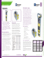
1
Opti-cal Survey Equipment Ltd
surveyequipment.com
surveyequipment.com
Sales • Hire • Repair
Opti-cal Survey Equipment Ltd is a
Fully Accredited Authorised Leica Geosystems
Distributor and Service Partner
Reading Office
Opti-cal Survey Equipment Ltd • Orpheus House • Calleva Park
Aldermaston • Reading • RG7 8TA
Tel: 01189 820 500
Fax: 01189 820 509 • [email protected]
Gatwick Office
Opti-cal Survey Equipment Ltd • Unit 3 • The Pavilions
Brighton Road • Pease Pottage • Crawley • RH11 9BJ
Tel: 01293 538 730
Milton Keynes Office
Opti-cal Survey Equipment Ltd • Field Barn • Plum Park Estate
Watling Street • Paulerspury • Towcester • NN12 6LQ
Tel: 01327 811 008
Fax: 01327 810 201 • [email protected]
surveyequipment.com
Product Catalogue
Fax: 01293 526 468 • [email protected]
product catalogue
about
About Opti-cal
opti-cal
How to OrdeR
About Opti-cal
Hire & Servicing
Support & Training
DistoTM
About Opti-cal Survey Equipment Ltd
and supplies precision measurement technology to the surveying and engineering industries. The company sell,
Lasers TPS Imaging SmartWorx
hire and service new and re-conditioned land survey and laser equipment and provide training and support.
Levels
Opti-cal Survey Equipment Ltd is a Fully Accredited Authorised Leica Geosystems Distributor & Service Partner
Over the years Opti-cal Survey Equipment Ltd have invested heavily in workforce and is now home to some
of the most experienced and highly-trained service technicians in the country. With the acquisition of Swift
Surveying Services in 2007 the company doubled its workforce and opened a new service facility at its second
office at Pease Pottage, Crawley, near Gatwick. This service centre also provides the latest test software
and test equipment enabling an extremely high standard of work to be carried out. In July 2010 they further
expanded by opening a third office and service facility near Milton Keynes.
TPS Monitoring
The company’s reputation has recently expanded into Europe and further afield which has further supported
the company’s growth.
Controllers
VAT Registration No. GB891610027
Company Registration No. 06246981
With close to 200 years of pioneering solutions to measure the world, Leica Geosystems products and services
Geosystems is best known for its broad array of products that capture accurately, model quickly, analyse easily,
and visualize and present spatial information.
iCON
Those who use Leica products every day trust them for their dependability, the value they deliver, and
Pacific Crest
are trusted by professionals worldwide to help them capture, analyse, and present spatial information. Leica
GPS & GNSS
About Leica Geosystems
Software
the superior customer support. Based in Heerbrugg, Switzerland, Leica Geosystems is a global company
with tens of thousands of customers supported by more than 3,500 employees in 28 countries and hundreds
of partners located in more than 120 countries around the world.
Cable Avoidance
Rail
E [email protected]
T 01189 820 500
About Opti-cal
3
Ancillary Items Index
About Opti-cal
Leica Accessories
2
About Opti-cal
How to Order
How
to
How to OrdeR
order
Contents
Scan Me
PRODUCT
PAGE
18
19
20
22
23
50
52
Cable Avoidance
Cable Avoidance
Precision Location
56
59
Rail
Track Measuring Device
4Site Rail
64
65
3 Orpheus House
Calleva Park, Aldermaston
@opticalsurvey
Opti-cal Survey Equipment
Reading, Berkshire
RG7 8TA.
Tel: 01189 820 500
Fax:01189 820 509
surveyequipment
GAT W I C K
3 The Pavilions
Brighton Road, Pease Pottage
Crawley, West Sussex
RH11 9BJ
Tel: 01293 538 730
Fax:01293 526 468
M i lt o n Ke y n e s
Field Barn, Plum Park Estate
Watling Street, Paulerspury
Northamptonshire
NN12 6LQ
Tel: 01327 811 008
Fax:01327 810 201
Leica Accessories
70
71
88
104
105
106
Find us on
Rail
HDS Scanning
Leica Accessories
Ancillary Items
Used Survey Equipment
Finance Options
Index
Reading
Mon - Fri
Cable Avoidance
iCON
Geomatics Software
8.00am - 5.30pm
Software
40
41
42
43
45
46
Opening Hours
At any of our office locations below.
iCON
Global Positioning Systems
Viva GS08
(GPS & GNSS)
Viva GS10
Viva GS12
Viva GS15
Leica SmartNet
GIS
In Person
Pacific Crest
34
35
36
Overseas: +441189 820 509
GPS & GNSS
Monitoring (TPS)TM30
TS30
GeoMoS
01189 820 509
Overseas: +441189 820 500
Controllers
24
26
27
28
29
30
32
01189 820 500
TPS Monitoring
Total Stations (TPS)
Flexline Plus
Viva TS11
Viva TS12
TCRP1200+
Viva TS15
Viva Imaging
SmartWorx Viva
By Fax
Lasers TPS Imaging SmartWorx
LasersGeneral
Single Grade
Dual Grade
Pipe Lasers
Machine Control Sensors
By Phone
Levels
15
16
[email protected]
surveyequipment.com
DistoTM
Digital LevelsSprinter
DNA
To order any product visit our website
Support & Training
3
5
6
7
8-9
10-12
13
14
By Email
Hire & Servicing
About Opti-cal
How to Order
Hire Rates
Servicing & Repair
Technical Support & Training
Leica DISTOTM Laser Distancemeters
Line and Dot Lasers
Optical Levels
Order On-Line
Contents
4
E [email protected]
T 01189 820 500
How to Order
5
Ancillary Items Index
All information and prices are correct at the time of publication and exclude delivery and VAT at the current rate. All prices are subject to change without notice.
With eight highly trained service technicians our service centres provide recognised top class calibration
Hire Rate Per Week
£10.00
NA 2 Precise Automatic Level
£35.00
DNA 03 Precise Digital Level (+/-0.3mm)
£65.00
Interior Laser
£45.00
Dual Grade Laser - Rugby 400
£60.00
Pipe Laser - Piper 100
£40.00
Understanding the rigors of the construction site and potential damages in transit, we will be pleased to talk
you through the potential implications of using inaccurate instrumentation and how we can assist.
We can offer replacement instruments from our hire fleet during a service to minimise down time.
Prices
Levels
Hire Rate Per Week
Basic Total Station
£60.00
Reflectorless Total Station
£85.00
TCRP1201+ One Man Total Station Kit
£250.00
Viva TS15 5" One Man Total Station Kit
£250.00
Viva TS15 1" One Man Total Station Kit
£275.00
TS30/TM30 Monitoring Total Station
£300.00
Automatic Level
£30.00
Precise Level
£40.00
Digital Level
£65.00
Lasers
Exterior Rotating Laser
£45.00
Interior Rotating Laser
£55.00
Grade Laser
£60.00
Pipe Laser
£50.00
Total Stations
Price
GPS + Glonass Full RTK Base & Rover
£600.00
Electronic Theodolite
£55.00
GPS Only Full RTK Base & Rover
£400.00
Total Station
£95.00
SmartStation (TST, SmartHandle, Antenna, GSM Module,
SmartNet, Vodafone GPRS)
£450.00
Reflectorless Total Station
£110.00
SmartStation Accessories (Excludes TST)
£250.00
Motorised Total Station
£195.00
One Man Total Station – c/w Controller Series
£225.00
SmartNet Licence & Sim
Accessories
£75.00
Hire Rate Per Week
Accessories
£10.00
Prism Station
Diagonal Eyepiece
£10.00
CAT Locator
CAT Detector
£25.00
Genny/Transmitter
Genny (To be used with CAT)
£25.00
Additional Laser Detector
£10.00
6
E [email protected]
£25.00
From £75.00
*Dependent on Make & Model
From £65.00
*Dependent on Make & Model
Available on All Makes & Models
T 01189 820 500
Hire & Servicing
7
Ancillary Items Index
Traverse Prism Station (Including Tripod)
Price
Leica Accessories
£10.00
Rail
360 Degree Mini Prism (Including 4 x poles)
Cable Avoidance
£400.00
Software
Viva SmartRover (Includes SmartNet Licence & Vodafone
GPRS data)
iCON
£350.00
Pacific Crest
Viva NetRover (Includes SmartNet Licence & Vodafone
GPRS data)
GPS & GNSS
Hire Rate Per Week
Price
Controllers
£200.00
Price
TPS Monitoring
TCRP1205+ One Man Total Station Kit
Leica GNSS & GPS Equipment
that it will provide accuracy and reliability in the workplace.
Lasers TPS Imaging SmartWorx
£35.00
Leica Total Stations
Our experience with working for equipment suppliers allow us to confidently issue certificates with the knowledge
Hire Rate Per Week
Rotating Laser - Rugby 100
Opti-cal can offer you the best service for your instrument.
Levels
Leica Laser Equipment
We also hold a large stock of Leica spare parts enabling us to complete required repairs quickly and efficiently.
DistoTM
Automatic Level
are fully accredited by Leica Geosystems, and we use only genuine components.
Support & Training
Leica Optical Levels
and repair to a wide range of survey equipment. Our technicians have been Leica factory trained, the workshops
Hire &
Hire & Servicing
servicing
Our fleet of instruments located at our offices in Reading, Gatwick and Milton Keynes
are maintained to a high quality due to the implementation of up-to-date service records
and replacement schemes.
How to OrdeR
Servicing & Repair
Nationwide next day delivery is offered as standard; however we are able to offer a same day delivery
in some circumstances. Please call to discuss equipment and pricing; long term hire rates are negotiable.
Hire Rates & Servicing
About Opti-cal
Hire Rates
Contents
About Opti-cal
Training
How to OrdeR
Technical Support
Scan Me
Over many years, Opti-cal has acquired the expertise of the
with a full range of the best products in the world, combined
with the best support people in the country.
Hire & Servicing
leaders in the surveying field. We have built a service business
In addition to technical support, we also understand that high quality training is critical and the key to unlocking
the true potential of your survey equipment. Our structured training programs will enable you to take full
advantage of your instruments capabilities, and improve your work flow, both in the field and in the office,
with the goal of increasing your productivity and giving your company a competitive advantage. Opti-cal can
offer a flexible selection of training packages to suit your company’s needs, experience and time frame.
support
&
Support & Training
Training
Training Courses
Technical Support
Learn the standard functions of your TPS instrument and be able to perform common survey tasks,
including detail and set-out surveys.
Advanced TPS (1 day)
Understand how to customise your instrument, perform advanced field coding, create / edit data export
formats and the more advanced on-board applications. Import data into Leica Geo Office (LGO), edit and
export to required format and generate jobs using design to field.
Lasers TPS Imaging SmartWorx
Our dedicated support number is available to new and existing customers: 01293 565 565.
Getting Started (1 day)
Workflow training for any Leica Total Station, including data exchange with popular CAD packages.
Levels
To this extent, we have recently invested in our support structure to expand our team, so that we can
continue to provide the level of service that our clients demand. This new support and training structure
comprises of a dedicated technical support phone line (and email) to quickly assist with your day to day
support and training needs, and backed-up by field based product experts.
Total Stations (TPS)
DistoTM
At Opti-cal, we understand the importance of supporting our extensive range of surveying products.
With a highly committed and responsive technical support and training team who can answer your questions,
whether simple or complex, and provide the required product training.
GPS/GNSS
Our online support section includes the following items for your convenience:
• Documentation – Manuals, Quick Guides & Release Notes
• Software
• Instrument Firmware
• Drivers
• Instrument Application Programs
• Simulators
• Instrument Language Files
• Recovery Software
• Format Files
• Links to Leica Support
TPS Monitoring
Getting Started (1 day)
Learn the basic concepts of GPS/GNSS positioning and the functionality of your Leica equipment, workflow
training in RTK including detail surveys, coding and export of data, and perform site transformation to gain
an understanding of coordinate systems.
Controllers
Advanced (1 day)
Explore the advanced settings of the Leica GPS/GNSS. Learn complete equipment configuration, static data
capture and basic processing, field coordinate transformation, the more advanced applications and how to
create field data reports.
GPS & GNSS
Leica Geo Office
For online support visit: surveyequipment.com/support.
Pacific Crest
Getting Started (1 day)
Workflow training in Leica Geo Office incorporating TPS/GPS data import, editing, simple processing,
and basic analysis. This course provides a detailed explanation behind the settings and functionality enabling
the user to get the most from the LGO software.
iCON
Advanced (1 day)
Develop your understanding of static post-processing, data analysis, reporting and network adjustment.
Software
Learn new troubleshooting skills. Then further explore LGO looking at precise ephemeris, internet download
and image referencing.
Cable Avoidance
Additional Courses
Introduction to RoadRunner (1 day)
Rail
This course is designed for new users of the RoadRunner application. You will be taken through the practical
procedures necessary for performing road setout within RoadRunner. The course will include an explanation
of stringlines, RoadRunner elements and task development.
Leica Accessories
All published courses may be customised to your company’s requirements, allowing you to get the most
from your training investment.
Choose between training on-site, at your office or at one of our locations. Or let us know what training
you need and we’ll do our best to accommodate.
8
E [email protected]
T 01189 820 500
Support & Training
9
Ancillary Items Index
Support & Training
Customised Company Training
Leica DISTO™ – the innovative hand-held laser meter for fast and easy distance measurements of length, squares
and volumes with the press of a button. Save time and money and emphasise your competence with modern
measuring methods. Choose from the DISTO™ D210, DISTO™ X310, DISTO™ D3A BT, DISTO™ D5 and DISTO™ D8.
Leica DISTO™ X310
The compact and handy entry-level model
has many interesting functions and is still
simple to use. Addition and subtraction,
area and volume calculations for rapid
and reliable site measurement. The last
10 results are stored.
The new Leica DISTO™ X310 is the
only laser distance meter to be dusttight and protected against water jets
– to IP65. In addition, it passes drop
tests of up to 2 m height. Thanks to the
integrated tilt sensor, it can take indirect
distance and height measurements
absolutely precisely.
£129.00
Which Leica DISTO™
isdistance
themeter
right
one
for device
me?and depending on the application,
A laser
is a hi-tech
measuring
Support & Trainingdisto
DistoTMtm Levels
Leica DISTO™ D210
Hire & Servicing
Leica DISTO™
Are you measuring indoors and outdoors?
What is your measuring application?
What is the maximum distance that you would like to measure?
How often will you be using the laser measure?
How accurate do you need to measure to?
Does your job require the ability to measure angles, or measure over obstructions?
Are you measuring slopes, heights or checking levels?
Do you need to transfer your measurement to a PDA or laptop?
How to OrdeR
DISTO
Laser
Distancemeters
About Opti-cal
Which DISTO™ is right for you?
TM
the range of Leica DISTO™ will cover the measuring task in hand.
Lasers TPS Imaging SmartWorx
£209.00
Functions
Distance measurement
min
max
Leica DISTO™ D3a
BT
Area measurement
Volume measurement
We supply the complete range of
accessories please see page 71
for a selection.
up to 100 m
up to 200 m
up to 200 m
~
~
~
~
~
~
~
~
~
~
~
~
~
~
~
~
~
~
~
~
~
~
~
~
~
~
~
~
~
~
~
~
~
~
~
360°
±45°
±45°
360°
~
~
~
~
~
~
~
Triangle function
α
£319.00
Room angle function
Painter function
Trapezium measurements
Pythagoras functions
Leica DISTO™ D5
Leica DISTO™ D8
World First: Digital Pointfinder with
4x Zoom! Designed with many functions
and features to make measuring easier,
particularly when you are working
outdoors.
The most versatile laser distance
meter in the world! Equipped with a
digital Pointfinder, high-res olution 2.4“
colour display, 360° tilt sensor and
bluetooth® technology.
£349.00
£599.00
Smart Horizontal Mode™
Double tilt measurement
Height profile measurements
a a
a/b
a/b
a/b
a/b
+
Subtraction / addition
~
~
~
digital
Digital Pointfinder
~
~
~
~
~
~
~
~
~
~
~
~
~
~
~
auto
10
E [email protected]
T 01189 820 500
Timer
Multifunctional end-piece
Laser Distancemeter DISTOTM
11
Ancillary Items Index
a/a
Leica Accessories
Stake out function
sec
For accessories see page 71
~
Height tracking
Rail
LaserDistancemeter DISTOTM
Tilt measurement
Cable Avoidance
up to 80 m
Software
up to 80 m
iCON
D8
Pacific Crest
D5
GPS & GNSS
D3a BT
Controllers
X310
TPS Monitoring
The Leica Disto D3a BT has all the
funtions of the Disto D3a. In addition
it offers the convenience of wireless,
error free data transfer to PCs and
pocket PCs.
Leica DISTO™
Accessories
Minimum / maximum measurement
D210
Setup, Switch on, Ready!
Large room? No right angles? Skewed
walls? Many details? Difficult to reach?
No cause to worry: The Leica 3D Disto
measures everything you need.Ladder?
Mobile access platform? You can leave
them back at base. No tripod on hand?
Makes no difference – simply place the
3D Disto on a table or the floor. Levelling
up? Not necessary. Photographs for the
records? No problem, the in-built camera
provides the pictures.
line &
Levels Lasers TPS
dot lasers
£149.00
Projector
Tools
Quick tools inspire the user: establish plumb, create level reference points, or precisely transfer offsets or locations.
The Leica Lino P5 projects five laser beams, which are exactly at right angles to one
another. This greatly simplifies setting out tasks and makes your interior fitting-out
more precise and efficient.
£229.00
Leica Lino L2 Cross Line Laser – The perfect alignment tool
TPS Monitoring
Right to the point. Whether ceiling grid or project layout for floors or walls – the Leica 3D Disto projects
your design onto any surface – point for point.
Leica Lino P5
Imaging SmartWorx
Whether in fully automatic or manual mode: you can measure complete rooms, walls, windows, structural
connections or stairs – from only one station point.
The time consuming and tedious drawing of lines on the wall is a thing of the past. The
Leica LINO™ L2 projects exactly, quickly and easily – allowing you to concentrate on the
job in hand.
• Measure plan position, height and distance,
in all three spatial axes
• Measure to difficult-to-reach points, such as
roof edges
• Recording information in the form of standard
tables, photos, DXF files, text files at the press
of a button
• Remote control measurements
Technical Data
Lino P3
Range
Lino P5
Lino L2
+/-1.5mm @ 5m
+/-1mm
Accuracy of plumb point @ 5m
+/-1.5mm @ 5m
–
+/-1.5mm
+/-1.5mm
Accuracy of horizontal line @ 5m
–
+/-1.5mm
Vertical accuracy @ 3m line length
–
+/-0.75mm
Beam Direction
Lino L2P5
up to 15m (depending on light conditions)
Levelling accuracy @ 5m
up,down,forward
up,down, forward
vertical,
horizontal
vertical,
horizontal
vertical,
horizontal, up,
down, right, left
Line & Dot Lasers
13
Ancillary Items Index
• Data import and export on PC and USB stick
T 01189 820 500
Lino L2+
Leica Accessories
• Pocket calculator
£319.00
Rail
• Positionally accurate representation of the
measured points in the camera display
The all in one layout and alignment tool. The Leica Lino L2P5 combines all the
advantages of the Lino dot and line lasers. It has four points and two lines which are
exactly at right angles to one another.
Cable Avoidance
• Realtime display of measurements as drawings
on the screen
Leica Lino L2P5
Software
• Plumbing of points, parallel offsetting of axis,
levelling, transferring levels from wall to wall.
Forget spirit level and measuring tapes!
£179.00
iCON
• As-built records of ceiling, floor and roof surfaces,
volumes, inclination, falls, height differences, angles
Simply perfect all along the line! The Leica Lino L2+ projects them exactly, quickly and
easily – allowing you to concentrate on the job in hand.
Pacific Crest
• Measure from one station – every visible point can
be measured by targeting with the visible laser dot
– without the need to walk to the target
Leica Lino L2+
GPS & GNSS
• Intuitive user guidance from Assistants
Controllers
£169.00
It can do everything
LaserDistancemeter DISTOTM
DistoTM
The Leica Lino P3 is excellent for plumbing up and down and transfers all the points
you need, quickly and accurately.
Room scan
E [email protected]
Support & Training
Leica Lino P3
Stay in control – in whatever shape of room. Capture and record distances, areas, inclinations, and angles
effortlessly, even for inaccessible points. Forgotten measurements and handwriting errors are things of the past.
12
Hire & Servicing
– Leica Linos project lines or points to millimeter accuracy,
leaving your hands free to get on with the job. Making your work a lot easier! They
automatically compensate for minor angular misalignments by levelling themselves over
a range of ± 4°. So you avoid errors. The top quality optics and proven Power Range
Technology™ ensure that the projected laser lines and points are highly visible and
accurate. So they are simple to understand and easy to operate.
Leica 3D Disto™
Leica 3D Disto™ Package Please call for Price
How to OrdeR
Leica 3D Disto™
About Opti-cal
Line and
Dot Lasers
About Opti-cal
Leica Optical Levels
Scan Me
Leica Runner Series
Features
Runner 24
24x
Angle Measurement
360o
Standard Deviation (per km double-run)
2.0mm
•
•
•
•
User-friendly menu
Automatic height calculation and delta height
The right levelling applications
Built-in memory
IP55
Leica Sprinter for Advanced Levelling Work
Weight
2 kg
The Sprinter is the perfect tool for advanced
construction levelling tasks. Store up to 1000
measurements, download and transfer them
for further calculations to Excel to a PC via USB.
Warranty
1 year
£154.95
Level c/w Tripod & Staff
Optical
&
Levels Lasers TPS
Digital levels
£94.95
Level Only Price
DistoTM
Dust/Water Protection
Support & Training
Magnification
Leica Sprinter Onboard Software:
Leica NA700 Levels
Features
Magnification
Weight
NA728
NA730
20x
24x
28x
30x
360o/400gon 360o/400gon 360o/400gon 360o/400gon
Standard Deviation (per km double-run)
Dust/Water Protection
NA724
2.5mm
2.0mm
1.5mm
IP57
IP57
IP57
1.0mm
IP57
1.6 kg
1.6 kg
1.7 kg
1.7 kg
2 years/3 years when registered within 8 weeks after purchase
Level Only Price
£195.00
£225.00
£295.00
£320.00
Level c/w Tripod & Staff
£254.95
£284.95
£354.95
£379.95
Magnification
32x
32x FOK eyepiece (optional): 40x
-
360o/400gon
Angle Measurement
Standard Deviation
0.7mm/km
0.7mm/km
(per km double-run)
(0.3mm with parallel-plate micrometer)
(0.3mm with parallel-plate micrometer)
IP53
Time for single measurement
<3 sec
Compensator
2.4 kg
3 year
3 year
Data storage
Level Only
£1,125.00
£1,470.00
Environmental conditions
Level c/w Tripod & Staff
£1,184.90
£1,529.90
Price (Level Only)
Magnet damped pendulum compensator (range +/- 10 min)
Magnification (optical) 24x
up to 1’000 points
Leica Accessories
2.4 kg
IP55
£695.00
£995.00
Tripods Page 73
Barcoded Staves Page 72
Optical & Digital Levels
15
Ancillary Items Index
T 01189 820 500
Standard Deviation: 0.6 mm (electronic) and 1.2 mm (optical) at 30 m
2 –100 m (electronic)
Warranty
E [email protected]
1.0/0.7* mm
With standard aluminum E-scale/Numeral staff: 2.5 mm
Single staff reading
Weight
Tripods Page 73
1.5 mm
Optical measurement
Telescope
Staves Page 72
14
IP53
Electronic measurement*
Range
Sprinter 250M
Standard deviation height measurement per 1 km double run (ISO 17123-2)
Rail
Optical & Digital Levels
Dust/Water Protection
Sprinter 150M
Height accuracies
Cable Avoidance
NAK2
• Increase Productivity
• Minimise Human Errors
• Operate in Low Light Conditions
Software
NA2
iCON
Features
Benefits:
Pacific Crest
The Leica NA2 meets all the requirements of precision levelling. As soon as it is set-up on a tripod and levelled
with the bubble, the automatic compensator ensures that the line of sight is horizontal so that each staff reading
is reliable. Leica’s top-class optical quality gives the NA2 a bright, erect high contrast image. To improve accuracy
a parallel plate micrometer can be fitted over the telescope objective. The parallel plate micrometer permits
direct readings to 0.1mm and estimated readings to 0.01mm. This makes the NA2 the ideal precise level
for deformation studies or industrial measuring tasks.
Aim and Focus: With its high-accuracy optical elements you simply aim and focus the staff as an optical level.
Push the Button: With its easy one-button operation, Leica Sprinter does not need any intensive training.
Simply push the red button to take the measurement. That’s all you need to do.
Read: Optical reading is no longer needed. The bar code on the staff determines height and distance
which is displayed on a highly visible LCD display. There will be no misreading.
Calculate: The Leica Sprinter takes on your calculations. Choose the right application in your language.
The correct results will be displayed: Delta height, Line levelling, Cut & fill, Tracking & monitoring.
Memorize: With their built-in memory for storing up to 1000 points, avoid transcription errors.
Download: With Leica Sprinters data can be downloaded to your personal computer via USB Interface.
The Sprinter Data Loader enables a smooth data transfer to Excel. Your measurements can also
be transferred to an external data collector via RS232 interface.
GPS & GNSS
Leica NA2/NAK2
•
•
•
•
•
•
Controllers
Warranty
Advanced Levelling:
TPS Monitoring
Angle Measurement
NA720
• Delta height
• Line Levelling
• Cut & fill
Imaging SmartWorx
NA700 series combines reliability, accuracy and toughness to provide optimum results for an optical level.
It’s the ideal choice for engineers and surveyors and, the ‘best in class’ optics enable you to always work
as precisely as possible, even in twilight.
Hire & Servicing
The Leica Runner series represents a great value for money automatic builder’s level. Designed to work hard
on the jobsite, they are quick to set up, simple to use and very reliable.
The Leica Sprinter Electronic Level offers everything that you would expect from
a construction instrument. It enhances user benefits with a simple user interface
and value-added functions:
How to OrdeR
Leica Sprinter
Digital Levels
The Digital Levelling Suite program has been designed in conjunction with Land Surveyors who use the Leica
DNA/SPRINTER levels on a day to day basis.
It has been designed to overcome some of the short falls with the Leica DNA/SPRINTER software, to allow easy
conversion from the raw data file to a standard Levelling Book format.
The software has been designed on the Microsoft Excel platform, thus giving the user the advantage of the
Microsoft Excel interface which most surveyors will already be familiar with.
• Compare the closing height quickly with a known
point using Quick-Closure
Link with Leica Geo Office
• Uses MS Excel
Prices:
Sprinter Only Processing
Accuracy
• Produces familiar Level Book format
• Spreadsheets all formulated
• Merge level lines together for network levelling
• QA checks on each sheet
• Data ready to print & send to client in minutes
• Export adjusted data to 3rd party software
£100.00
DNA Only Processing
£300.00
Sprinter + DNA Processing
£350.00
Controllers
LEICA DNA03
TPS Monitoring
The level option processes your levelling data
in a professional manner. The optional program
contains functions such as line calculation, adjustment
and the creation of reports. A second level option
allows to adjust a complete Level Line Network.
LEICA DNA10
0.3mm
GPS & GNSS
Standard deviation height measurement
per 1km double-run
0.9mm
1.0mm
1.5mm
Telescope magnification
Pacific Crest
Electronic measurements:
with Invar staffs
with standard staffs
24x
Compensator setting accuracy (SD)
0.3”
0.8”
iCON
Range
Electronic measurement
Optical measurement
0.01mm, 0.0001ft, 0.0005 inch
Software
1.8m - 110m
from 0.6m
0.1mm, 0.001ft
Cable Avoidance
Single, average, median, repeated single measurements
E [email protected]
£2,600.00
Tripods Page 73
T 01189 820 500
Please contact us for further information or to arrange a demonstration
Optical & Digital Levels
17
Ancillary Items Index
Barcoded & Invar Staves Page 72
Leica Accessories
£3,200.00
Rail
Measure & Record, staff height/distance, intermediate BF, aBF, BFFB, aBFFB,
onboard adjustment, quick closure, stakeout
Remark, Free code, Quick code
6000 measurements or 1650 station
Price (Level Only)
16
Imaging SmartWorx
• Clear & Simple line levelling process
Measurement programs Coding
Internal memory
• Seamless data import
• All spreadsheets have your company logo,
colours & details
• Use the complete onboard Line-Adjustment
to erase errors
Electronic measurement
Resolution height measurement
Measurement modes
Optical
&
Levels Lasers TPS
Digital levels
Features Include:
• Measure & Rec function lets you easily measure
and record height differences
DistoTM
Provided with this software is the format file required to be loaded into the Leica DNA/SPRINTER, and
instructions on how to accomplish this.
Support & Training
Leica digital levels DNA10 and DNA03 cover
the entire range of applications from the construction
site to the 1st order levelling tasks. The practice
oriented solutions in the integrated measurement
programs, the large display and the alphanumeric
keyboard help to keep track of your work, make it
faster and more productive.
Hire & Servicing
Digital level data processing – the answer you’ve been waiting for!
How to OrdeR
Leica DNA Digital Levels
• Up to a 50% time saving when compared
with conventional levels.
Optical & Digital Levels
About Opti-cal
Leica DNA Digital Levels
Digital Levelling Suite – DNA &
Sprinter Processing Software
Leica Rugby 260SG
The simple one-button Construction Laser
A highly accurate, general construction laser
with singlegrade capability. A rugged general
construction laser with great accuracy, LCD grade
readout and semi-automatic grade with bump alert.
The Rugby 50 provides value where ever it is used.
Work gets done faster and more accurately, providing
savings in labour, time and materials.
Price
£545.00
(NiMH Batt Pack & Charger)
£995.00
Leica Rugby 270SG
Lasers TPS
lasers
Laser Level Kit c/w Tripod & Staff
£945.00
Levels
£495.00
Laser Level, Detector & Bracket
(NiMH Batt Pack & Charger)
DistoTM
Price
Laser Level, Detector & Bracket
(Dry Cell Battery Pack)
Support & Training
Rugged, reliable, accurate. The Leica Rugby 50 is the
affordable “little brother” of the popular Leica Rugby 100.
Hire & Servicing
Leica Rugby 50
How to OrdeR
Leica Single Grade Lasers
About Opti-cal
Leica Laser Levels
Leica Rugby 100
High power, incredibly tough, automatic leveling,
rotational laser ideal for all site work applications.
The Rugby 100 is an automatic self-levelling rotating
laser for general construction.The Rugby 100
automatically levels in under 30 seconds, has a simple
four-switch keypad that controls all the functions,
plus a low-battery indicator.
Imaging SmartWorx
A fully automatic, single grade laser. For the general
construction contractor that needs a level or single
slope for flat work, site preparation, septic installation,
trenching and more.
Laser Level, Detector & Bracket
(NiMH Batt Pack & Charger)
£1,395.00
Laser Level Kit c /w Tripod & Staff
£1,445.00
TPS Monitoring
Price
Controllers
Leica Rugby 320SG
GPS & GNSS
Long Range Single Grade Laser with a -5 to +25%
grade capability and a 900m operating diameter.
Pacific Crest
Price
Laser Level Kit c/w Tripod & Staff
£660.00
Laser Level, Detector & Bracket
(NiMH Batt Pack & Charger)
£1,795.00
Laser Level Kit c /w Tripod & Staff
£1,845.00
Working Range
300m
300m
Features
Rugby 260SG
Rugby 270SG
Rugby 320SG
Accuracy
+/- 2.6mm @ 30m
+/- 1.5mm @ 30m
Working Range
600m
700m
900m
Elevation Alert
Yes
Yes
Accuracy
+/- 1.5mm @ 30m
+/- 1.5mm @ 30m
+/- 1.5mm @ 30m
Self-Leveling
Horizontal
Horizontal
Grade Range
+/- 10% (x-axis)
+/- 10% (x-axis)
+/- 15% (x-axis)
Dust/Water Protection
IP55
IP56
Self-Leveling
Horizontal
Horizontal/Grade
Horizontal/Grade
Manual Grade Capacity
–
Yes
Dust/Water Protection
IP67
IP67
IP57
Two Year plus knockdown warranty
Yes
Yes
Yes
2 years with registration
18
E [email protected]
Tripods Page 73
T 01189 820 500
Levelling Staves Page 72
Tripods Page 73
Lasers
19
Ancillary Items Index
Levelling Staves Page 72
Leica Accessories
Rugby 100
Rail
Rugby 50
Cable Avoidance
Features
Warranty
Lasers
Price
Software
£610.00
iCON
Laser Level, Detector & Bracket
(NiMH Batt Pack & Charger)
About Opti-cal
Leica Laser Receivers
Leica Rugby 280DG
How to OrdeR
Leica Dual Grade Lasers
Hire & Servicing
The Rod Eye Basic
Multipurpose Plus. A horizontal, vertical and dual grade
laser for any exterior or interior application. “Plus”
with fully automatic, dual grade capability. It has a
bright red beam, plumb beam, scan mode, horizontal
and vertical selfleveling, plus dual grade up to 15%
in both axes. Available with a two-way remote control,
the Rugby 280DG fits well in any construction plan.
The Rod Eye Basic is a great receiver for those
looking for value at a low price. Offering two accuracy
settings, high/low audio output and a 150 m range,
Support & Training
the Rod Eye Basic is a quality receiver that is ready
to work for you.
Price
£1,695.00
Rod Eye Basic with Bracket
Laser Level Kit c/w Tripod & Staff
£1,745.00
£105.95
DistoTM
Laser Level, Detector & Bracket
(NiMH Batt Pack & Charger)
Levels
Leica Rugby 410DG Laser Level
The Rugby 410 Dual Grade Laser is automatic and self
leveling for jobs of any size, large or small. It can be
used for any application involving precise grade.
• Large easy to see LCD display
• On Screen menus
• Variable head speeds
The Rod Eye Plus is a full featured receiver
LED’s, nine channel arrow display and audio output
provide the user with all the information needed
Laser Level Kit c/w Tripod & Staff
£2,345.00
to lock on the laser beam and get the job done right.
Rod Eye Plus with Bracket
£149.95
Leica Rugby 420DG Laser Level
The Rod Eye Digital
The Rod Eye Digital is the top of the line receiver
rejection. The Digital has a 127 mm (5 inch) pickup
and provides the Digital with the best accuracy
in the industry.
Laser Level Kit c/w Tripod & Staff
£2,345.00
£225.00
Rugby 420DG
Working Range
700m
800m
1100m
Accuracy
+/- 1.5mm @ 30m
+/- 1.5mm @ 30m
+/- 1.5mm @ 30m
Grade Range
+/- 15% ( both axis)
-5 to +25% in either axis
-5 to +15% in both axis
-5 to +25% in either axis
-5 to +15% in both axis
Self-Leveling
Horizontal+Vetical+Grade
Horizontal+Grade
Horizontal+Grade
Dust/Water Protection
IP57
IP57
Two Year plus knockdown warranty
Yes
Yes
Rod Eye Basic
Rod Eye Plus
Rod Eye Digital
Working Radius
150m
450 m
450 m
Detection Height
36 mm
50 mm
127 mm
Detection Accuracies
Two
Three
Five
IP57
Audio Volumes
Two
Two
Three
Yes
Arrow Display
Five channels
Nine channels
Twenty-one channels
LED Display
No
Yes, five channels
Yes, five channels
Warranty
One year
Two years
Three years
Tripods Page 73
T 01189 820 500
Lasers
21
Ancillary Items Index
Receivers at a glance
Leica Accessories
Rugby 410DG
Rail
Rugby 280DG
Cable Avoidance
Features
Software
Rod Eye Digital with Bracket
iCON
£2,995.00
E [email protected]
Pacific Crest
window which is the result of truly unique technology
Laser Level & Detector Kit
(NiMH Batt Pack & Charger)
20
GPS & GNSS
with digital readout, 0.5 mm accuracy, and strobe
Price
Levelling Staves Page 72
Controllers
Long Range Dual Grade Laser the Rugby 420 Dual
Grade Laser is automatic and self leveling for jobs
of any size, large or small. It can be used for any
application involving precise grade.
• Operating range of 1,100m diameter
• Simple to operate – only 5 buttons
• Direct Grade Entry, or Manual mode
• Ideal for use with machine control equipment
Lasers
TPS Monitoring
£2,995.00
Imaging SmartWorx
with proven performance in the field. Three bright
Price
Laser Level & Detector Kit
(NiMH Batt Pack & Charger)
Lasers TPS
lasers
The Rod Eye Plus
Rock solid Construction, outstanding performance in a compact package.
Ideal for use with backhoes and mini-excavators,
Built with a rugged aluminium housing, these pipe lasers perform powerfully even in tough jobsite conditions.
The Leica Piper is the only pipe laser that fits inside a 100 mm (four inch) pipe.
the Agatec MR240 offers the convenience of a
Hire & Servicing
Agatec MR240 Machine Receiver
How to OrdeR
Leica Piper 100/200
About Opti-cal
Leica Pipe Lasers
Machine
Control Sensors
machine-mounted display at an economical price.
Support & Training
It features LED indicators to show the position
•Automatic grade compensation
of cutting edge in relation to laser reference beam.
•Long battery life
Three indicators in coarse mode, up to five in fine
•Bright, powerful beam
mode. Equipped with magnet mount with extra
strong rare earth magnets.
•Alignmaster™ – Automatic target recognition (Piper 200)
DistoTM
•Large, easy to read display
Levels
• Accurate grade information for
all visual machine control applications
• Extra strong rare earth magnets
• Rugged design, waterproof
Lasers TPS
lasers
Imaging SmartWorx
Package Includes:
MR240 Machine Receiver
Alkaline batteries
TPS Monitoring
Carry Case
Package Price £450.00
Package as shown
Controllers
Agatec MR360R 360
Machine Mounted Receiver
The MR360R offers accurate grade information
GPS & GNSS
for all visual machine control applications. Large 360
degree detection windows pick up any rotating laser,
Piper 200
Beam
Highly visible red beam
Highly visible red beam
Display
Large, easy to read LCD display
Large, easy to read LCD display
Alignmaster*
No
Yes
Line and Grade Locks
Yes
Yes
grade readings, saving money by reducing over
Wide Line Adjustment
Yes
Yes
or under-cutting.
Self-levelling
Over full range
Over full range
Grade entry
Direct or by digit
Direct or by digit
Package Includes:
Remote control
Yes, wireless
Yes, wireless
MR360R Rechargeable Receiver with Magnet
Housing
Rock solid metal
Rock solid metal
Battery pack
Rechargeable Lithium-Ion
Rechargeable Lithium-Ion
Waterproof
100%
100%
Suction Cup (for MD360R Mount)
Warranty *Extendable to 5 years total
2 Years*
2 Years*
MR360R User Manual
Price
£1,695.00
£1,895.00
Pacific Crest
from any angle.
Built-in vertical indicator monitors angle of the stick,
signalling if it’s plumb or under or over-extended.
iCON
Vertical position ensures consistent and accurate
Software
Cable Avoidance
or Clamp Mount
Rail
110/240V Charger for MR360R
MD360R Remote Display
Lasers
Carry Case
22
E [email protected]
T 01189 820 500
Sensor
In Cab Display
Package Price £1,200.00
Lasers
23
Ancillary Items Index
Piper 100
Leica Accessories
Features
About Opti-cal
How to OrdeR
Leica Flexline
Plus Total Station
Scan Me
are immediately apparent with the extra-large, built-in colour & touch display.
• Low learning curve due to guided workflows
• Easy to understand graphics and icons
• Icons to quickly verify instrument status
• Fast navigation inside the software via touchscreen, tabs and icons
• High resolution colour display to show all information without misinterpretation
• Larger font size for fast and clear readability
• Fast operation through graphic guidance
Levels
DistoTM
The FlexLine family of Total Stations provide you with complete flexibility and performance. Simply select one
of the pre-configured products, or compose your own Total Station by using the flexibility of adding specific
hardware and software options to a base model. The choice is yours, and performance is guaranteed.
The new Leica FlexField plus software is without a doubt a highlight of the FlexLine plus. Its advantages
Support & Training
To ensure that you stay one-step-ahead, Leica Geosystems has developed a new generation of Total Stations
using latest technology, the Leica FlexLine. For the first time, hardware and software options can be simply
selected so that the FlexLine Total Station exactly meets your requirements.
FlexField plus Onboard Software
Hire & Servicing
For basic to advanced users with
the need for flexibility and performance.
Leica FlexLine TS02 – Ideal Today, Perfect Tomorrow
Lasers Tps
TPS Imaging SmartWorx
The ideal Total Station for standard measurement tasks. Designed
especially for mid-to-low accuracy applications. It comes complete
with a standard set of application software that guides you through
your daily work.
*Colour Screen on TS09 plus only
Leica FlexLine TS06 plus – Flexibility that counts
The Leica FlexLine TS09plus Communication Side Cover enables cable-free connection to any data collector
via Bluetooth®, for example the field-controllers Leica Viva CS10 or Leica Viva CS15 with SmartWorks Viva
software. The USB-stick enables the flexible transfer of such data as GSI, DXF, ASCII, LandXML and CSV.
Leica Geosystems – mySecurity
mySecurity gives you total peace of mind. If your instrument is ever stolen, a locking
mechanism is available to ensure that the device is disabled and can no longer be used.
1" angular accuracy
Display with graphics and display illumination
Black & White
high resolution
Black & White
high resolution
Q-VGA Color &
Touch
Full alpha-numerical keyboard with function keys
X
3
3
Second Keyboard
O
O
O
Keyboard illumination
X
X
3
Electronic Guide Light
X
O
3
USB Type A and mini B
X
3
3
Bluetooth® Wireless
X
3
3
FlexField plus
(standard)
FlexField plus
(advanced)
FlexField plus
(full)
TPS
3 Included
O Option
X Not available
TPS
25
Ancillary Items Index
LEGEND:
Leica Accessories
T 01189 820 500
500 m included
500 m included
/ 1000 m option / 1000 m option
400 m option
Rail
E [email protected]
Other Accessories From Page 76
O
1.5 mm
+ 2 ppm
Cable Avoidance
24
Traverse Kits Page 75
O
1.5 mm
+ 2 ppm
Reflectorless measurement range
Onboard software (package content)
Detail Kits Page 74
X
1.5 mm
+ 2 ppm
Software
Instrument only from £6,495.00
1”,2”,3” & 5”
iCON
The Leica FlexLine TS09plus Manual Total Station is ideal for
mid- to high-accuracy applications.The brilliant colour display with
touch operation, offer the highest performance and ease of use.
Equipped with all FlexLine features from removable USB memory,
Bluetooth® wireless technology, Emitting Guide Light to a complete
range of application software, your TS09 guarantees maximum
performance. If more convenient, use Bluetooth® wireless
technology to connect any data collector, e.g. the Leica CS10/15.
Enhanced measurement accuracy to prism
1”,2”,3”, 5”
& 7”
TS09plus
Pacific Crest
3”, 5” & 7”
TS06plus
GPS & GNSS
TS02
Accuracies Available
Leica FlexLine TS09 plus – Performance Guaranteed
Controllers
For complete flexibility a Total Station that is ready for any
challenge. Designed for mid accuracy applications. As standard,
an alpha-numerical keyboard and a complete set of application
software is included. If more convenient, use Bluetooth® wireless
technology to connect any data collector, e.g. the Leica CS10/15.
For additional flexibility, a wide range of options ensures that you
can always count on your TS06 Total Station.
Instrument only from £4,995.00
TPS Monitoring
Instrument only from £3,295.00
Leica Viva TS12
Total Station
The Leica Viva TS11 is the most advanced manual
total station with the inclusion of advanced imaging
functionality and the Leica SmartWorx Viva easy-to-use
onboard software.
The Leica Viva TS12 Performance Robotic package
is a cost effective all in one solution enabling the user
to begin efficient, cost effective one person engineering
or surveying today.
Leica Viva TS11 raises productivity to the next level
with imaging and Leica SmartWorx Viva software.
The unique capturesketch- link functionality enables high
resolution total station images to be captured, enhanced
with sketching and then linked to any point of interest.
Costly revisits can be avoided to significantly improve
productivity. Every vision on every scale becomes reality
with ease.
Best-in-class Search-Lock-Measure
Levels
Options Available:
Controllers
Key Facts:
The ergonomic and light weight Leica CS10 Radio field
controller with the fully integrated Intenna technology offers
a long range, secure and fast wireless connectivity to your
TS12 total station. With the Leica GRZ4 360° prism
and a light weight pole users profit from a comfortable
to carry solution for a full working day.
TPS Monitoring
Leica Viva SmartStation
GS12/GS15
Lasers Tps
TPS Imaging SmartWorx
Leica Viva CS10 Radio Controller
Angular accuracyPinPoint (Non Prism)
1’’ (0.3 mgon), 2’’ (0.6 mgon),
R30 / R400 / R1000
3’’ (1 mgon), 5’’ (1.5 mgon)
Leica Viva Imaging
TS
DistoTM
Leica Viva TS12 uses years of experience to optimally
find, lock and measure to prisms with a single key press.
With the unique PowerSearch sensor any prism type
is found within seconds regardless of location.
Options Available:
Support & Training
Leica Viva TS12 Total Station
Hire & Servicing
Leica Viva TS11 Manual Total Station
Scan Me
Angular accuracyPinPoint (Non Prism)Prism Lock
2”(0.6 mgon), 3” (1 mgon) or 7” (2 mgon)
Angular Measurement
0.1’’ (0.1 mgon)
Compensation
Quadruple axis compensation
R400 or R1000
ATR, PowerSearch
GPS & GNSS
Display resolution
Pacific Crest
Distance Measurement
Standard Accuracy
1 mm + 1.5 ppm
PinPoint Non Prism Accuracy
2 mm + 2 ppm
Display resolution
0.1 mm
Magnification
SD card, USB stick
Internal Battery
Operating Time
5 – 8 h (GEB221)
E [email protected]
Manual Total Station From
£7,995.00
Other Accessories From Page 76
T 01189 820 500
Detail Kits Page 74
Leica TS12
Performance Package from
Traverse Kits Page 75
£13,995.00
Other Accessories From Page 76
TPS
27
Ancillary Items Index
Traverse Kits Page 75
TS11
Leica Accessories
Internal Battery
Detail Kits Page 74
TPS
1 GB (nonvolatile NAND Flash) /
SmartWorx Viva LT is designed
with simplicity in mind using
clear graphics, logical menu
structures, non-technical
terminology and simplified
workflows.
Rail
Internal memory / Memory devices
30 x
Cable Avoidance
Leica SmartWorx Viva LT
for Simplicity in the Field
General
26
Software
Up to 5400m
iCON
Prism Range
How to OrdeR
Scan Me
About Opti-cal
Leica Viva TS11
Total Station
About Opti-cal
Leica TPS1200+
Scan Me
Scan Me
Furthermore, Leica Viva TS15 features the easy-to-use
Leica SmartWorx Viva onboard software. The Leica Viva
TS15 adds a high resolution camera to further enhance
total station productivity. In addition, the TS15 now also
includes new grid scanning functionality. It is now easily
possible to graphically define an area to be scanned
on the total station view shown on the display. The total
station will then rapidly scan the object to measure
a true grid with survey accuracy.
There are many advantages to using Leica one-man
technology, money saved in not having to employ an
assistant, in total control of all your own work, and
a dramatic increase in productivity.
Options Available:
Angular accuracy
1’’ (0.3 mgon), 2’’ (0.6 mgon),
3’’ (1 mgon), 5’’ (1.5 mgon)
Options Available:
Angular accuracyPrism LockPinPoint (Non Prism)
1’’ (0.3 mgon), 2’’ (0.6 mgon),
ATR, PowerSearch
R30 / R400 / R1000
3’’ (1 mgon), 5’’ (1.5 mgon)
PinPoint (Non Prism)
R400 / R1000
Leica Viva Imaging
TS & CS Controller
Leica Viva SmartStation
GS12/GS15
Total Station From
Angular Measurement
Display resolution
0.1’’ (0.1 mgon)
Quadruple axis compensation
0.1’’ (0.1 mgon)
Compensation
Compensation
Centralized dual axis compensator
Distance Measurement
Distance Measurement
Prism Range
Up to 5400m
1 mm + 1.5 ppm
Standard Accuracy
1 mm + 1.5 ppm
PinPoint Non Prism Accuracy
2 mm + 2 ppm
PinPoint Non Prism Accuracy
2 mm + 2 ppm
Display resolution
0.1 mm
Display resolution
0.1 mm
General
General
Magnification
40mm
Operating Time
5 – 8 h (GEB221)
28
E [email protected]
T 01189 820 500
SD card, USB stick
Internal Battery
Internal Battery
Operating Time
5 – 8 h (GEB221)
Detail Kits Page 74
Traverse Kits Page 75
Other Accessories From Page 76
TPS
29
Ancillary Items Index
Reconditioned TPS1200 Packages are also available
please call us on 01189 820 500
1 GB (nonvolatile NAND Flash) /
Leica Accessories
Free objective aperture
Internal memory / Memory devices
30 x
Rail
30 x
Cable Avoidance
Standard Accuracy
£16,495.00
Software
Up to 5400m
Robotic Package From
iCON
Prism Range
TS15
Pacific Crest
Display resolution
£9,995.00
GPS & GNSS
Angular Measurement
TPS
TS15
Controllers
Key Facts:
Key Facts:
TPS Monitoring
Prism Lock
ATR, PowerSearch
Magnification
Lasers Tps
TPS Imaging SmartWorx
Combine your TPS1200+ with a Leica Viva CS10/15
to give you a powerful surveying or setting out system.
Levels
The Leica Viva TS15 is a state-of the- art total station
that provides advanced imaging functionality combined
with dynamic tracking capabilities for one-person surveying
or setting out.
DistoTM
Packed with features, built for speed, accuracy,
ease-of-use and reliability Leica TPS1200+ total
stations carry out even the most complex tasks,
better and more efficiently than ever before.
Support & Training
Leica TS15 – Robotic total station
Hire & Servicing
Leica 1200+ Total Station
How to OrdeR
Leica Viva TS15
Total Station
About Opti-cal
How to OrdeR
Leica
Viva Imaging
Enrich your Surveying Workflow
Hire & Servicing
Support & Training
The Viva TPS TS11 I and TS15 I Imaging Total
Stations have been designed to include imaging
functionality for Image Assisted Surveying and
Documentation. Through high quality optics, images
from 2 m to infinity are transferred as sharp images
to a high resolution 5 Megapixel CMOS camera.
A dedicated image processing board precisely
calculates the exact exposure time and white balance
settings for capturing optimal camera images of the
total station live view. In order to support 20 Hz live
streaming, new high-speed slip rings were designed
and a state-of-the-art multimedia image processing
unit was integrated to instantly transfer images from
the telescope to the total stations high resolution
VGA display.
DistoTM
Levels
Viva
Lasers TPS
Imaging SmartWorx
imaging
Visualize
Overlay points and features directly on the live
image to exactly see the survey data. Use the
overlay to show position and visualize features
to be set-out.
TPS Monitoring
Controllers
Sketch
Any new or captured image can be enhanced
through sketching with any colour, line style
and width to uniquely transfer valuable information.
GPS & GNSS
Pacific Crest
Panorama
iCON
Simply define a region, or 360° view,
and the total station will automatically stitch
images into a panoramic view.
Software
Cable Avoidance
Image assisted Surveying
With live streaming of the total station view,
simply tap on the display and the total station
will turn and measure to the desired target.
Immediately visualize measured objects as you go.
Rail
Leica Accessories
Viva Imaging
30
E [email protected]
T 01189 820 500
Viva Imaging
31
Ancillary Items Index
Please contact us to arrange a demonstration
of a Leica Viva Imaging Total Station
About Opti-cal
Whether you want to stake-out
an object on a construction site
or you need accurate measurements
of a tunnel, bridge or road; whether
you want to carry out a topographic
survey or calculate the volume of a
stockpile – you need reliable and precise
data SmartWorx Viva is the answer.
Reference Line
• Staking of linear and area objects: Lines, arcs,
areas and simple alignments
• Staking of slopes relative to lines and arcs
On-Board Volume Calculation
• Quick, Accurate in field calculation
• No need to return to office
• Grid scan on surface + volumes application
• Clear graphical assistance within the applications
• Easy to understand & intuitive
• Improved ease of use & productivity
• Powerful Applications for any requirements
• Import: ASCII, DXF, LandXML
Survey Cross Sections
• Define automatic coding of a cross section
• Ideal for measuring road, rail or river cross sections
where repetitive coding is needed
Survey
Sets of Angles (TPS only)
• User definable screens
• Smart & Quick Coding
• On Screen Image Sketch Notes
• 3D Point Overlay (Imaging)
• Ideal application when many repeated measurements
to the same targets are needed – dams, quarries,
building facades etc
• Measure Hidden points with BT Disto™
• Measure, compute and adjust traverses including
survey observations
Pacific Crest
iCON
Software
• Ideal application for measuring into catch pits,
drainage lines and other inaccessible places
Cable Avoidance
Reference Plane / Face Scan
• Ideal application for building facade or quarry face measuring
RoadRunner – Road, Rail, Tunnel
Rail
Leica Accessories
• Ideal applications to specifically handle the demands
of complex alignment based projects
• Clear graphical displays allowing the user full field
data control
E [email protected]
T 01189 820 500
us to discuss any requirements you may have.
SmartWorx Viva
33
Ancillary Items Index
Other applications are available please contact
32
GPS & GNSS
• See live cut & fill values
Controllers
• Allows hidden points to be measured with a total station
using a hidden point rod
DTM Stakeout
• Measure multiple rounds of angles and distances
TPS Hidden Point (TPS only)
• Pick Control and Working Job
to to keep data clean
• Stakeout 3D Terrain Models
smartworxTPS Monitoring
viva
Traverse (TPS only)
Lasers TPS Imaging SmartWorx
• Comprehensive reporting / cut sheets
• Export: Custom ASCII, DXF, LandXML,
FBK, RW5, RAW
• Customise Stake-Out Screen
Levels
• Simple and modern graphics
DistoTM
Support & Training
Stake-Out
SmartWorx Viva
• Ideal for marking/surveying grids
• Dedicated applications to measure surfaces
of an undefined shape (e.g. gravel hill)
• Select Points from Map/List
Hire & Servicing
• Viva software on all platforms,
One common learning curve for Viva GPS & TPS
How to OrdeR
Leica
SmartWorx Viva Software
Long Service Intervals
Long Range ATR
Up to 3000 m with 7mm accuracy
Leica GeoMoS
Combine with GeoMoS software and other sensors
to provide the complete monitoring solution.
Performance that counts
Achieving both high performance and high
accuracy is challenging. The Leica TS30
has reached a level of performance, whereby
high accuracy surveying can be achieved
in an easy, fast and reliable way, regardless
of the project demands.
Angular accuracy – 0.5”
Pinpoint EDM accuracy
0.6 mm ± 1 ppm to prism
2 mm ± 2 ppm to any surface
Automatic Target Recognition
(ATR) accuracy – 1”
GPS & GNSS
Leica TS30 accuracy – the facts:
tps
TPS Monitoring Controllers
monitoring
Target View
Narrows the field of view to detect the correct prism out of multiple prisms
Lasers TPS Imaging SmartWorx
Theft protection and keyboard lock
Surveyors take great pride in accuracy. The Leica TS30
delivers impressive performance in individual disciplines.
But most importantly it is a champion in perfectly combining
angle measurement, distance measurement, automatic
target recognition and motorisation. The accuracy
of the Leica TS30 is in a league of its own, a true
companion for surveyors with pride.
Levels
Pride in accuracy
DistoTM
Zero Noise Pollution
to install the TM30 in urban areas
Support & Training
The Leica TS30 total station is unique. This total station
redefines precise surveying by offering unmatched accuracy
and quality. Never again will surveyors with demanding tasks
need to make compromises, the TS30 total station is ready
for any challenge. The TS30 is designed for when only 0.5”
accuracy is acceptable.
Hire & Servicing
Continuous operation
The TM30 meets the challenge of 24 hours,
7 days a week monitoring applications.
It is designed to withstand the roughest use
in the most severe environments. The TM30
will operate throughout a wide temperature range
and is protected against wind driven rain, sand
and dust. The sensor is fully operational in bright
sunlight and complete darkness.
How to OrdeR
The Leica TM30 is designed to meet the highest
accuracy standards. High precision measurements,
combined with automatic, fast and silent operation
ensures that the TM30 detects the smallest
movement in all monitoring applications. This powerful
combination of speed and accuracy allows engineers
to effectively and cost efficiently measure and control
the health of vital infrastructure. The combination
of SmartEye vision technology and unique direct drive
technology provides faster, more precise and longer
range measurements than ever before.
About Opti-cal
Leica TS30
Leica TM30
Please call 01189 820 500 for more information
34
E [email protected]
T 01189 820 500
It will operate throughout a wide temperature
range and is protected against wind driven rain,
sand and dust. The TS30 can operate for extremely
long intervals without suffering from wear and tear.
on the Leica TM30 & TS30 instruments
TPS Monitoring
35
Ancillary Items Index
TPS Monitoring
Automatic Target Recognition
(ATR) accuracy – 1”
Leica Accessories
Long service intervals
Leica TS30 is designed to withstand the roughest
use in the most severe environments.
Rail
Pinpoint EDM accuracy
0.6 mm ± 1 ppm to prism
2 mm ± 2 ppm to any surface
Cable Avoidance
Angular accuracy – 0.5” or 1”
Software
Fastest Start-to-Finish Workflow
iCON
Leica TM30 accuracy – the facts:
Pacific Crest
World’s best Dynamic Tracking Performance
New direct drives using Piezo technology were
developed specifically for the TS30 to achieve
maximum acceleration and speed whilst still
retaining accuracy.
About Opti-cal
Leica GeoMoS offers the ability to connect geodetic (Total Stations and GNSS sensors) and geotechnical
sensors to understand the reasons of any detected movement and to improve the prediction of failure.
• Total Stations: Leica TS15, TM30, TS30, TPS1100, TPS1200, TPS1200Plus, TCA1201M,
TPS1800 and TCA2003 Series
• GNSS sensors: Leica GS10, GR10, GPS System 1200, GMX900 Series, GPS System 500
• Connection to Leica GNSS Spider for advanced GNSS monitoring
• Levels: Leica DNA and Leica Sprinter
• Tilt sensors: Leica Nivel20 and Nivel200 Series
• Meteorological sensor (e.g. temperature, pressure)
DistoTM
Support & Training
Each monitoring project has specific measurement and accuracy requirements. The Leica GeoMoS software
provides a highly flexible automatic deformation monitoring system that is able to combine geodetic,
geotechnical and meteorological sensors to match the needs of your monitoring project, whether it is large
or small, temporary or permanent.
Sensor Connections
Hire & Servicing
The Leica Automatic Deformation Monitoring System
How to OrdeR
Leica GeoMoS
Levels
Leica GeoMoS stores all measurements and results in an open SQL database. The data can
be accessed both locally and remotely, using Leica GeoMoS Analyzer, Leica GeoMoS Adjustment
or third party software.
Multi-Purpose
Leica GeoMoS is a multi-purpose automatic deformation monitoring software that can be used for:
Communication
• Structural deformation monitoring (e.g. dams, tunnels, bridges, high-rise buildings, construction)
• Landslide and settlement detection (e.g. mining, rock falls, volcano slopes, subsidence)
• Automated surveys (e.g. continuous, automated measurements)
Leica Geosystems offers communication solutions via the new Leica M-Com series or standard accessories.
The Leica M-Com series offers easy installation, reliable communication and the connection of multiple sensors
and external devices.
• And many more...
GPS & GNSS
In addition to the traditional serial based communication Leica GeoMoS also includes a direct TCP/IP
communication interface to support Ethernet technology and mobile networks.
tps
TPS Monitoring Controllers
monitoring
The Leica GeoMoS software is highly customizable allowing you to purchase only the functionality you require.
The sensor license concept means that the software scales with the number and type of sensors you have
connected. Additional functionality can easily be added later should your needs change.
Lasers TPS Imaging SmartWorx
• An interface to Campbell Scientific dataloggers, that can support most commercially available
geotechnical sensors to measure environmental effects and conditions (e.g. extensometers,
piezometers, strain gauges, inclinometers, thermometers, barometers, rain gauges,
and many more)
Scalable and flexible
Pacific Crest
The Leica GeoMoS software is comprised of two main applications called
Monitor and Analyzer.
iCON
Leica GeoMoS Adjustment is an add-on software that allows the user
to make decisions based on statistically optimized and validated data.
Software
• Monitor is the online application responsible for the sensor control,
collection of data, computation and event management.
Cable Avoidance
• Analyzer is the offline application responsible for the analysis,
visualization and post-processing of the data.
• Adjustment is the application responsible for the network adjustment,
deformation analysis and network simulation.
Rail
Leica Accessories
The Leica GeoMoS software is highly customizable allowing you to purchase only the functionality you require.
The sensor license concept means that the software scales with the number and type of sensors you have
connected. Additional functionality can easily be added later should your needs change.
36
E [email protected]
T 01189 820 500
Please call us on 01189 820 500 for more information on Leica
GeoMoS Monitoring Solutions and how they can work for your project
TPS Monitoring
37
Ancillary Items Index
TPS Monitoring
Leica GeoMoS stores all measurements and results in an open SQL database. The data can be accessed both
locally and remotely, using Leica GeoMoS Analyzer, Leica GeoMoS Adjustment or third party software.
About Opti-cal
Scan Me
State of the art technology
The Leica CS25 is equipped with state of the art
technology, running a Windows® 7 Ultimate OS allows
you to trade in your desktop PC for a rugged tablet,
having it with you wherever your work is.
• 64 GB SSD hard drive, eliminating internal
moving parts
–
Survey, coding and linework
• 17.8 cm/7 inch sunlight readable touchscreen
• Integrated GPS, 3G modem, WiFi and Bluetooth®
–
Wide range of apps for all surveying and staking tasks
• Ultra-rugged design – IP65, MIL-STD-810G
Lasers TPS Imaging SmartWorx
–
Advanced coordinate system handling
Levels
With clear graphics, non-technological terminology and
simplified workflows SmartWorx Viva is incredibly easy to use.
DistoTM
Simply productive surveying software
Support & Training
Leica Viva CS10 Controller
Leica CS25 – Take the Office to the Field
Built for the field
Designed for extreme environments, you can always
rely on your CS10 & CS15. Comfortable in the hand,
and easy-to-use for all tasks.
–
IP67 and operating temperature -30 to 60° C
–
Tactile, fully illuminated, rubber keypad (numeric
on CS10, alphanumeric QWERTY on CS15)
26 alpha-numeric keys
Price
From £2,750.00
CS10 3.5G GNSS WLAN
From £3,495.00
CS10 TPS/GNSS WLAN
From £3,495.00
• Built for the most demanding field environments
but nevertheless light-weight and compact
• Built to operate in extreme temperatures
• All-day-batteries, easily hot-swappable
Flexible communication and data handling
Stay connected with a wide range of communication
and data storage options.
Your CS10 & CS15 is ready for all challenges.
–
Fully integrated wireless Intenna technology
(Bluetooth®, WLAN, TPS Radio)
Leica Viva CS15 Controller
Designed for extreme environments – ultra-rugged,
reliable and light-weight.
–
Choice of 2 connector modules
Designed for versatility
Integrate the Leica CS25 tablet computer into
the Leica Geosystems family of mobile solutions.
Choose the field software, GNSS accuracy and
the setup (pole or backpack) to suit your workflow
and budget.
• Ready-to-use with Leica Zeno Field, Leica
MobileMatriX (for GNSS as well as TPS)
–
Data storage using SD Card, CF Card,
USB memory stick
• Ready-to-use with the Leica GNSS
SmartAntenna – the Leica Zeno GG02plus
• Use Leica Zeno Connect to embed custom
applications into Leica CS25 and Leica Zeno
GG02plus
Cable Avoidance
The Viva CS10 3.5G and CS15 3.5G field controllers can
be supplied with a fully integrated high-speed 3.5G modem
to connect to RTK reference networks and allow mobile
broadband internet connectivity for field-to-office data transfer.
Software
3.5G Modem
iCON
RS232 module: RS232, USB A host, USB mini AB OTG,
7-pin connector, power
Pacific Crest
Lemo module: Lemo (USB and serial), USB A host,
7-pin connector, power
Viva
Controllers GPS & GNSS
Controllers
CS10 GNSS
–
Colour, VGA touch screen, illuminated
Built for the field
TPS Monitoring
Model
–
2 Megapixel camera (perfectly placed for taking
pictures when in hand or mounted on pole)
Work how you like
Full 65 key QWERTY keyboard
Viva Controllers
From £2,995.00
CS15 3.5G GNSS WLAN
From £3,995.00
CS15 TPS/GNSS WLAN
From £3,495.00
CS15 3.5G TPS/GNSS WLAN
From £4,295.00
38
E [email protected]
–
Ideal for use with all Leica Viva Series
–
Perfectly designed to be used with SmartWorx Viva
surveying software
–
Powerful ARM core processor for many
software applications
T 01189 820 500
CS25 Ruggedized Win7
(Professional Edition)
Ultra-Mobile PC
P.O.A
Controller Accessories Page 84
Batteries Page 80
Chargers Page 81
Viva Controllers
39
Ancillary Items Index
CS15 GNSS
Total Stations and GNSS sensors
Price
Leica Accessories
Price
Model
Rail
Model
Designed as part of the Leica Viva series, but versatile
to work with many instrument and software combinations.
Hire & Servicing
The CS10 and CS15 Leica Viva are the ideal partner for Leica Total
Stations and GNSS instruments. They can be combined with both
TPS and GNSS instruments to provide a fully integrated seamless
surveying system partnered with Leica SmartWorx Viva surveying
software, data collection has never been so easy.
How to OrdeR
Leica Viva Controllers
About Opti-cal
Leica Viva
GNSS GS10
How to OrdeR
Leica Viva GS08
GNSS NetRover
Scan Me
Leica Viva GS10 – Versatile, Rugged and Precise
Leica Viva NetRover integrates the latest technology from Leica Geosystems, the world’s leading measurement
solutions provider. All the components of Viva NetRover work seamlessly together, creating a lightweight
and cable-free network rover.
The Leica GS10 gives any user the complete flexibility of a powerful modular solution without compromising
on performance. Systems can be customised to suit individuals needs such as long term installations.
Hire & Servicing
Leica Viva GS08 NetRover
Support & Training
Turn-on & Measure
DistoTM
Leica Viva NetRover helps you to complete your measurement
tasks. Just turn-on and a connection is made to your
local reference network. With full support of RTCM 3.1
transformation message, positions are automatically supplied
in local coordinates. Viva NetRover is always ready to measure!
Levels
Quick to learn
Lasers TPS Imaging SmartWorx
We know you want easy to use software. We therefore
designed SmartWorx Viva LT with simplicity in mind using
clear graphics, logical menu structures, non-technical
terminology and simplified workflows. You and your field
crews will be up to speed in a minimum of time.
Designed for networks
Proven GNSS technology
Built on years of knowledge and experience, the Leica GS10 delivers the hallmarks
of Leica GNSS – reliability and accuracy.
Controllers
• SmartCheck – RTK data-processing to guarantee correct results
• SmartTrack – advanced four constellation tracking of all GNSS satellites
today and tomorrow
gps &
GNSS
GPS & GNSS
• SmartRTK – delivers consistent results in all networks
Pacific Crest
Work as you want to
The Leica GS10 is designed to suit any surveying task.
Number of Channels
72 channels
• Exchangeable communication devices for field base stations and RTK rovers
with removable SIM cards
Satellite Tracking
GPS & Glonass
Horizontal: 5 mm + 0.5 ppm
• Fully scalable sensor allows you to buy only what you need today and upgrade
with additional functionality as you need it
RTK Static Mode
Horizontal: 5 mm + 0.5 ppm (rms)
Vertical: 10 mm + 0.5 ppm (rms)
RTK Moving Mode
Horizontal: 10 mm + 1 ppm (rms)
Vertical: 20 mm + 1 ppm (rms)
• Integrated web server to configure the logging of Leica
or RINEX raw data and measure with one button press
in the field
Data Storage
1 GB internal flash, SD-card slot, CF-card
The Leica GS10 is built for the most demanding environments.
Environmental Specification
IP67
• IP67 protection against dust and immersion to 1m
Operation Time
7 hours
Leica Viva GS08 NetRover
• Built for extreme temperatures of -40°C to +65°C
Battery Charging
2 Hours
£10,995
Weight of pole setup
2.80 kg
Cable Avoidance
Rugged
Please call for more information and pricing
GPS & GNSS
41
Ancillary Items Index
T 01189 820 500
Leica Accessories
Inc SmartNet Low User Licence & Sim Card
Rail
E [email protected]
Software
40
iCON
GPS & GNSS
TPS Monitoring
The future proof GNSS receiver
provides best in class network
performance. The field
controller includes 3.5G
mobile broadband for
high-speed connection
to the reference network,
internet and your office.
Work with confidence
in your equipment
and maximise
your productivity.
About Opti-cal
Leica Viva
GNSS GS15
How to OrdeR
Leica Viva
GNSS GS12
Scan Me
Leica GS15 – Integrated Performance GNSS Receiver
• Triple Frequency – GPS, Glonass, Galileo
• 120 Channels
• Leica patented SmartTrack+ technology
Built on years of knowledge and experience, the Leica GS12 delivers
the hallmarks of Leica GNSS – reliability and accuracy.
• Excellent low elevation tracking
• Leica SmartNet Compatible
• Minimum acquisition time
• SmartCheck – RTK data-processing to guarantee correct results
DistoTM
• Minimum acquisition time
Support & Training
Proven GNSS technology
• IP67 Protection
• SmartTrack – advanced four constellation tracking of all GNSS
satellites today and tomorrow
• On-Board Raw Data Logging
Levels
Hire & Servicing
Leica Viva GS12 offers complete freedom of choice.
From a GNSS Rover up to an integrated GNSS solution with
a Leica Viva Total Station (Leica Viva SmartPole or Leica Viva
SmartStation), the GS12 provides a solution to all applications.
• Removable SD Card
• SmartRTK – delivers consistent results in all networks
Light Weight and full functionality
Lasers TPS Imaging SmartWorx
• Fully Integrated UHF/GPRS Modem
• Hot Swappable Batteries
The Leica GS12 delivers ultimate ergonomics through extreme light weight.
• Weight of only 1kg for ergonomic handling with ideal balance
• Full GNSS compatibility: GPS, GLONASS, Galileo and Compass
• Fully scalable sensor allows you to buy only what you need today
and upgrade with additional functionality as you need it
Proven GNSS technology
• IP67 protection against dust and immersion to 1m
• Built for extreme temperatures of -40°C to +65°C
• Withstands 2m pole topple over test
Built on years of knowledge and experience, the Leica
GS15 delivers the hallmarks of Leica GNSS – reliability
and accuracy.
• Complete cable free operation
Controllers
The Leica GS12 is built for the most demanding environments.
TPS Monitoring
Rugged
Leica Viva GNSS is a complete range of versatile
GNSS solutions for you. From completely integrated,
to totally modular solutions; Viva GNSS provides
a system to master all of your tasks.
gps &
GNSS
GPS & GNSS
• SmartCheck – RTK data-processing
to guarantee correct results
GNSS Technology
Satellite signals tracking (current)
GPS: L1, L2, L2C, L5 (C/A, P, C Code)
GLONASS: L1, L2 (C/A, P narrow Code)
Satellite signals tracking (future)
Galileo, Compass
RTK Kinematic (phase)
Moving mode after initialization
Horizontal: 10 mm + 1 ppm (rms)
Vertical: 20 mm + 1 ppm (rms)
Post Processing (phase)
Static with long observations
Horizontal: 3 mm + 0.1 ppm (rms)
Vertical: 3.5 mm + 0.4 ppm (rms)
gps & GNSS
42
E [email protected]
From £14,995.00
T 01189 820 500
• Integrated web server to configure the
logging of Leica or RINEX raw data and
measure with one button press in the field
Item
Price
Rugged
Leica Viva GNSS
SmartRover
From £14.995.00
The Leica GS15 is built for the most demanding
environments.
Leica Viva GNSS
Base & Rover
From £26,995.00
GPS & GNSS
43
Ancillary Items Index
GS12 SmartRover
• Fully scalable sensor allows you to buy
only what you need today and upgrade
with additional functionality as you need it
Leica Accessories
Horizontal: 5 mm + 0.5 ppm (rms)
Vertical: 10 mm + 0.5 ppm (rms)
• Exchangeable communication devices for field
base stations and RTK rovers with removable
SIM cards
Rail
RTK Rapid static (phase)
Static mode after initialization
The Leica GS15 is designed to suit any surveying task.
Cable Avoidance
Measurement Performance
Work as you want to
Software
120 channels
• SmartRTK – delivers consistent results
in all networks
iCON
Number of Channels
Pacific Crest
• SmartTrack – advanced four constellation
tracking of all GNSS satellites today
and tomorrow
About Opti-cal
Leica SmartNet
Scan Me
• Utility Mapping & Archaeology
• Construction, Machine Control and Agriculture
• GIS, Asset Management
Leica SmartNet Benefits
• Same accuracy as a local base station
• High-speed initialisation for RTK solutions
TPS Monitoring
Quality
Controllers
• Redundancy – multiple reference stations,
not just one
• Reliability – full mirroring
of network services
gps &
GNSS
GPS & GNSS
• Quality assurance –
Network integrity monitoring
Leica GR25
Pacific Crest
Productivity
The Leica GR25 is a next generation GNSS
reference station platform going far beyond
traditional Reference Station receivers, serving
many purposes and applications. With integrated
internal and external device management, multi-user
management, high end security, modular
and scalable design, the new GR25 GNSS Reference
Server will grow with your needs and keep your
GNSS applications and networks fully up to date.
• Performs 1-3cm RTK surveys with one rover
• Eliminates daily base station set-up
& potential errors
• Far exceeds range of conventional RTK systems
Software
• Reduces dependency on ground control monuments
iCON
• “Always on” 24/7 monitored service
• Full backup systems
• Immediate SMS text updates on the status
of OSNet, OSI & OSNI stations
• Free RINEX downloads from the SmartNet
web site
T 01189 820 500
• Allows subscribers to easily work
in various locations
RTK Unlimited
£2,000.00
90614
RTK Limited Access (40hrs p/m)
£1,200.00
£750.00
GB RTK Annual Subscriptions
GB DGPS Annual Subscriptions
88364
DGPS Unlimited
90615
DGPS Limited Access (40hrs p/m)
GPS & GNSS
£450.00
45
Ancillary Items Index
Please call for more information regarding Reference Networks
88363
Leica Accessories
Rail
Availability
Cable Avoidance
• Convert your existing base station into a
productive rover
Designed for numerous permanent and
semi -permanent GNSS network installations
and monitoring applications. Including RTK
and static networks, single base station, field
campaigns, structural monitoring, atmospheric
and seismic studies and offshore positioning.
GPS & GNSS
Lasers TPS Imaging SmartWorx
• Surveying & Engineering
Levels
Typical Applications:
Leica GR10 is a next generation GNSS
reference station receiver that combines
the latest state-of-the-art technologies with
a streamlined “plug and play” workflow. Designed
for a wide variety of GNSS reference station
applications, the Leica GR10 offers new levels
of simplicity, reliability and performance. With
a focus on ease of use and efficiency, the GR10 helps
streamline day to day operation and administration.
E [email protected]
DistoTM
SmartNet is basically a 24/7, accurate, reliable, robust, traceable and repeatable National GPS Network
solution, based on a common datum, for the entire positioning community of Great Britain & Ireland. Users
of SmartNet can expect centimetre level Network RTK accuracies, through to sub-metre DGPS; or raw data
for post processing.
Proven GNSS technology
44
Support & Training
What is SmartNet?
Hire & Servicing
Do you need fast, accurate, traceable and reliable OS Co-ordinates? If so
then Leica SmartNet is the correction service for you. SmartNet is available
to anyone with any make of GPS/GNSS receiver that can accept RTK or
DGPS corrections broadcast by GSM or GPRS (Mobile phone Internet).
Reference station solutions are
ideal for long term installations
on site providing all your GNSS
positioning requirements.
Correction data can be simply
distributed to all users such
as surveyors, engineers
and machines across site
maintaining a precise control
network and keeping costs
down.
How to OrdeR
Leica GNSS
Reference Networks
Zeno Field
Simplicity in your own hands
Leica Zeno Field is an OEM version of ArcPad 10 and provides in addition to the well known ArcPad™
functionality: GNSS raw data logging, easy handling of GNSS configurations (such as DGPS settings), feature
accuracy management and an automated workflow between the field and office. Together with Zeno Office
easily manage feature quality over time and benefit from automated import and export functions to a wide
range of different formats such as ArcGIS geodatabase, shapefile, dxf, dgn, and dwg.
Support & Training
Leica Viva Zeno 10/15
Hire & Servicing
With innovative and integrated solutions whatever your GIS
requirements we can supply a solution to meet your needs,
both hardware and software.
How to OrdeR
GIS Software
About Opti-cal
Leica GIS Solutions
• ArcPad 10 OEM integrated, with fast visualization & drawing speed
• Real-Time differential correction made easy
• Logging of raw data for post-processing to increase accuracy
• State-of-the-art field mapping tools
Simplicity in your own hands
• Various field controller supported
High quality measurement engine and proven
antenna technology provide the highest quality
measurement data.
• Full support for Zeno 10/15’s internal camera
• QuickCapture toolbar for simple use
• L1 GPS, GLONASS, SBAS sensor
Zeno Connect
• Post processing accuracy 5 mm + 0.5 ppm (2D)
• DGPS accuracy <0.4 m
Integrate Leica hardware with 3rd party Software to receive NMEA messages from the Zeno SmartAntennas
to provide your own custom solution.
• Leica MDB and RINEX raw data logging
DistoTM
The Leica Zeno GIS series offers an ideal set of tools
for anyone who needs more accurate data in a GIS
database. All GNSS post-processing is automated;
GIS and GNSS technologies are seamlessly combined
in one easy solution.
Levels
TPS Monitoring
• Configure RTK, stream RTK NMEA from GS05/06, GG01 and GG02plus
Leica Zeno Office
• Store detailed GNSS quality information in a GIS database
• Integration of surveying measurements in a GIS database
• GPS
• Glonass (Option)
• Galileo ready
• Cablefree
• Geodesy and Land Surveying
• Lightweight (1 kg) and ultra-rugged: IP67, -40° - 60°C
• Utility market and Power Supply Industry
• Proven surveying technology for the GIS market
• Forestry and geologic mapping
• Highly precise 1 cm + 2 ppm
• Agricultural Mapping
• And excellent GNSS tracking in rough conditions
• Environmental Data collection
• 7h battery life, with simple exchange concept
• Map Completion
more information on Leica GIS products
GIS
47
Ancillary Items Index
T 01189 820 500
Leica Accessories
E [email protected]
Rail
46
Cable Avoidance
Leica MobileMatriX is a field solution for the interactive processing, visualization and maintenance of feature
and survey data. Leica MobileMatriX directly integrates survey related data collection and processing functionality
into ArcGIS®. Leica MobileMatriX is the perfect software for feature data collection and management
and computation and storage of survey data based around the geodatabase from ESRI.
Software
• 72 channel GNSS SmartAntenna
iCON
Leica MobileMatriX – Mobile Mapping and Data Collection Software
Please call us on 01189 820 500 for
GIS
GPS & GNSSgis
Pacific Crest
Leica GG02 plus – The most precise GNSS/GIS
• Automated field-office workflows: EasyIn and EasyOut
Controllers
Leica Zeno Office on ArcGIS™ provides a set of tools for managing and processing GNSS and surveying data
within ArcGIS Desktop, all from directly within your familiar environment. Leica Zeno Office is a software package
to maintain, manage and post-process GIS, GNSS and surveying data. With Leica Zeno GIS you get much more
done in a busy day and have full trust in the accuracy of your GNSS data.
Lasers TPS Imaging SmartWorx
Features & Functionality
ADL Vantage ADL Battery / Charger Kit
Advanced high speed wireless data link built
to survive the rigours of GNSS/RTK surveying
and precise positioning.
• Battery, bag, tripod clip + connector wire
• 9’ SAE-to-SAE cable
• Charger, 12V, 3A
• Multi-function user interface
• Charger power cord and plug adaptors
• Configurable Transmit Power 0.1-4.0 Watts
• Battery manual
• Heavy-Duty Construction
• Charger manual
• High Over-the-Air Link Rate
• Configurable Transmit Power
Price £290.00
• Advanced 40 MHz Bandwidth
ADL Vantage Field Accessory Kit Includes:
• Software-Derived Channel Bandwidth
• Battery, bag, tripod clip + connector wire
ADL Vantage Radio from £1,070.00
• 9’ SAE-to-SAE cable
• Charger, 12V, 3A
ADL Vantage Pro
• Charger Power Cord and plug adaptors
This sophisticated 35 Watt radio utilizes Pacific Crest’s
latest generation Advanced Data Link (ADL) technology
while remaining backward compatible with existing
Pacific Crest, Trimble and other radios.
• Battery manual
• Charger manual
• NMO-to-TNC adaptor Cable (9 ft )
• Tripod Clip for radio
• Configurable Transmit Power from 2-35 Watts
• Radio/cable carrying case with strap
• Multi-function user interface
• Heavy-Duty Construction
Price £420.00
• Fully water- and dustproof
Levels
Lasers TPS Imaging SmartWorx
TPS Monitoring
Price £300.00
Controllers
• Software-Derived Channel Bandwidth
DistoTM
• Advanced 40 MHz Bandwidth
Support & Training
ADL Vantage – Tripod with Bag
• 19200 Over-the-Air Link Rate
without range degradation
Hire & Servicing
ADL Vantage
How to OrdeR
Pacific Crest Accessories
About Opti-cal
Pacific Crest Radios
GPS & GNSS
ADL Vantage Pro Radio from £2,195.00
ADL Uplink
Part Number
Elevated Feed Antenna, 5 dB Gain,
NMO connector, 38”/96.5cm
£83.00
• Nomad computer and PCC software
• Fully automated operation
High-Gain Antenna Kit - 5 dB gain antenna
+ Antenna transport quiver
£65.00
• Solution for locations with weak
cell phone coverage
Elevated Feed Antenna Cable
(TNC to NMO) 8 m / 25 ft
£115.00
48
E [email protected]
T 01189 820 500
£29.95
We can supply the full range of Pacific Crest Accessories.
Please contact us for further information
Pacific Crest
49
Ancillary Items Index
If you would like to discuss any Pacific Crest product in more detail
please call us.
Leica Accessories
1/2-Wavelength TNC-M Duck Antenna,
8.5”/21.6cm
Rail
Elevated Feed Antenna Cable
(TNC to NMO) 2.8 m / 9 ft
Cable Avoidance
£115.00
• Extents GNSS Network coverage
using radios
• Offers solution to cut Cell phone cost
Software
• Repeats NTRIP GNSS Network data
in combination with radio
iCON
£65.00
ADL Uplink System from £2,990.00
Pacific Crest
Price
Elevated Feed Antenna, Unity Gain,
NMO connector, 18”/45.7cm
Pacific
Pacific Crest
Crest
The ADL Uplink combines a ruggedized handheld
computer with a software program that automatically
downloads Internet-based RTK corrections and streams
them to a radio for rebroadcast into areas of poor
cell coverage.
iCON Instruments:
One-person operation, saving time and increasing productivity when carrying out layout tasks and
as-built checks.
• Intuitive to use and navigate through
• Large easy to use buttons
• All information displayed graphically wherever possible
• Modern look and feel (Smart phone style)
• Optimized for easy viewing
• Import and Export data from generic file formats
• Easily move data between Field, Office and Machine
Lasers TPS Imaging SmartWorx
Leica iCON gps 60 –
• Ergonomically designed for unmatched user experience
Levels
• One-button keyboard for simple operation
• Unique PowerSearch option for fast prism acquisition
• Ready to use in 3D machine control
• Easy hand-over control from rover to machine control and vice versa
• Available in 2”, 5” versions
• PowerSearch option
• 250m option (reflectorless)
• Worlds simplest Construction Positioning interface
DistoTM
Support & Training
Leica iCON robot 50 –
Improving your performance with intelligent software
applications, workflow and an innovative user interface,
iCON build’s intuitive user interface provides you with highest
accuracy and flexibility for your daily tasks.
Hire & Servicing
Fully understanding construction carried us beyond the ordinary. Leica iCON is more than
a new product line and a software package, it enables you to enhance your performance,
and increase your profitability through perfecting your construction workflow.
iCON Software
How to OrdeR
Scan Me
About Opti-cal
Leica iCON
Intelligent Construction
Available as either iCON Build or Site there is a software package which meets your needs which ever
sector you work in.
Versatile Smart Antenna for multi-purpose positioning tasks.
Feature Snap Shot:
Sketching
TPS Monitoring
• No controller required for base station set-up means you need less hardware.
• Future-proof satellite tracking. Works with all existing and future satellite systems.
• Unique communication flexibility, featuring integrated radio, modem and Bluetooth®
• Multi-purpose GPS solution. Can be used as construction site GNSS Base, Rover
or NetRover, in supervisor vehicle on site and entry level machine control mounted
inside a machine.
Build your digital copy of the design within seconds. Extend and modify existing data to the reality on site.
Layout
Simply pick points, lines or arcs for your layout from the map screen.
Create as-built checks of structures for your records. Collect points, lines or arcs in one go with immediate
graphical representation.
Rugged, mobile tablet PC with enhanced connectivity and functionality.
• Ideal for larger graphic visibility
• 7” display 1024x600 resolution
• IP 65, -20°C to +65°C
• Integrated BT & WLAN
• L1 GPS
Volumes and Cut & Fill
GPS & GNSS
Measure surfaces and calculate volumes or check elevation.
Pacific Crest
Controllers
As-Built
Leica iCON CC60/61 –
iCON Software
iCON
Leica iCON CC50 –
Lightweight, handy PDA for easy and efficient field work.
• Long-range Bluetooth® up to 350m
• Sunlight visible VGA display
Cable Avoidance
Leica Builder Range –
Rail
For anybody working on or around a site with the need of a simple, intuitive, yet innovative,
long-lasting and powerful measuring tool. From a basic theodolite to a reflectorless total
station with wireless communication the Leica Builder range can fit all measuring tasks.
Leica Accessories
iCON
50
E [email protected]
T 01189 820 500
iCON
51
Ancillary Items Index
Please call us on 01189 820 500 for more information
on the iCON and Builder instruments
About Opti-cal
One Office Software for all your instruments
Support & Training
Seamlessly import and combine data from all your instruments
to produce the final results. Manage and combine your data
with Leica Geo Office to ensure you get the best results.
• GNSS instrument support
• TPS instrument support
• Level instrument support
DistoTM
Levels
Best-in-class Processing Options
• GNSS data processing using SmartCheck techniques
• TPS processing – from simple station updates to complex traverses
• Level processing
• Combined network adjustments
• COGO calculations, Datum transformations and Volume calculations
Lasers TPS Imaging SmartWorx
Years of experience in the fields of surveying and GNSS data
processing resulted in the world’s most powerful processing options.
TPS Monitoring
All components integrated in one software
• Flexible Reporting
• Flexible Import and Export
• Combine GNSS and terrestrial data with
an integrated Least Squares Adjustment
• Tools for GPS, TPS and levels
• Benefit from volume calculations being instantly
updated whenever coordinates change
• Coordinate transformations
• GNSS Post Processing
• Network Adjustment
• Surfaces and Volumes
• Data management
• View and Edit
• TPS Processing
Pacific Crest
GPS & GNSS
• Use GNSS processing to automatically
update SmartStation setups
Controllers
Price
Leica Geo Office TPS Bundle (Node locked). Includes LandXML Import/Export,
COGO calculations and TPS data-processing.
P.O.A
778067
Leica Geo Office GNSS RTK Bundle (Node locked).
Includes LandXML Import/Export and COGO calculations.
P.O.A
778068
Leica Geo Office GNSS-PP Bundle (Node locked). Includes LandXML Import/Export, COGO
calculations, L1/L2 GNSS processing, GLONASS, RINEX Import and Datum & Map.
P.O.A
778069
Leica Geo Office Level Bundle (Node locked). Includes Level processing and Adjustment 1D.
P.O.A
778070
Leica Geo Office Professional Bundle (Node locked). Includes all options.
P.O.A
Leica Accessories
778066
Rail
Module Description
software
Item No.
geomatics
iCON
Software Cable Avoidance
Please note Leica Geo Office can be customised to suit
your requirements. Please contact us for more details
52
E [email protected]
T 01189 820 500
Geomatics Software
53
Ancillary Items Index
Geomatics Software
Leica Geo Office enables you to manage your project in an
integrated way. No need to transfer data between the various modules.
Hire & Servicing
Your Vision: one integrated Office Software with Leica Geo Office
use the most powerful tools all integrated in one common software
to finalize your work faster today and tomorrow.
How to OrdeR
Leica
Geo Office
About Opti-cal
Scan Me
4Site Survey software for AutoCADTM removes the tedium of extracting data
from your survey equipment and transferring it into CAD to create drawings.
As n4ce Survey with the addition of Graphical Editing, including
Multi-Point and Feature Identification, DTM creation with Contours,
Groups, Multi-Surface Sections, and Complex Prism Volumes and
Isopachytes. Image Registration.
4Site Office (desktop) allows down loading, formatting and processing
of survey data, whilst
Point and Feature editing, including Delete, Move and Insert.
4Site Survey links directly to your instrument for infield recording turning
4Site into an advanced digitiser. This allows you to take drawings out into
the field, for setting out and comparisons with as built. All data is stored
and processed internally in CAD.
A 3D Viewer allows interactive visualisation of the DTM,
with coloured Groups.
Survey – For those who want to import and process their survey data
and export it to third-party CAD software.
As n4ce Lite with additional Design Tools for Model and CAD Editing.
additional Sectioning and Volume options with Group Depths with
Model Merging, Combining and Grid Models. Partitions with Key Plans.
Introducing Dedicated CAD Backcloths with Tables, Hatching,
Dimensioning and other CAD functions for preparing professional
presentations.
Point Height Text Filtering, point List and Design using Profile Templates;
Bench and Batter; Densification and much more…
Beach and River Surveys
Applications for River Sections and Beach Surveys extends
n
4ce into a specialist design package.
£2250.00
Full of detail for the discerning user wanting advanced functionality
and quality presentations.
I/O filters are available for all popular instruments formats including
Leica, Pentax, Sokkia, Topcon and Trimble.
Pacific Crest
n
4ce Used in Housing Layouts
GPS & GNSS
Designer – Also adds specialist applications for Geological Modelling,
Mining, Railways Surveys, Alignment Design and more.
n
4ce Survey
An ideal partner to third-party Modelling or CAD packages.
E [email protected]
Fully Layered Code Table
and Project Tree
£550.00
T 01189 820 500
Multi-surface Modelling with draped aerial photography and 3D viewing.
Visibility Analysis with zoned line of sight. Specialist LiDAR processing
and editing tools.
Suited to Earthworks Contractors, Design Engineers and Rail
Surveyors wanting precise quantities and specialist applications.
Rail Surveys
£2750.00
Geomatics Software
55
Ancillary Items Index
54
Horizontal and Vertical Alignment Design. Ideal for Rail Survey
Analysis, Pipelines and Road Layouts.
Leica Accessories
Use Point Extraction from CAD for setting out from design drawings.
Bore Holes, Lidar & Grid Modelling, Alignment Design, Haul Roads,
Surcharging, Cut/Fill Balancing with Bulking Factors & Trending.
Rail
Transfer formats including Star*Net, AutoCADTM DXF and Bentley
MXTM GENIO.
geomatics
Software Cable Avoidance
software
As n4ce Professional with specialist applications for Geological Modelling,
Earthworks, Mining, Rail Surveys from Trolleys with overlap checking
and Offsets.
LS Network Adjustment, Reduction & Error Checking Building
Elevation Surveys.
Automatic feature generation from a Fully-layered database and user
defined Code Table. Including Point, Line, Symbols, Shape and Text
definitions. Spreadsheet and Graphics displays.Comma Codes, Dimensions,
Helmert Co-ordinate Transformations and user-defined XYZ/CSV filters.
4ce Designer
iCON
n
n
4ce Survey Import and process your survey data for exporting
it to third-party software. Import your survey data from Total Stations
and GPS directly in to n4ce.
Geomatics Software
4ce Professional
Controllers
Professional – Uses advanced section and volume options, and advanced
CAD editing tools to drastically speed up survey plotting.
n
£1250.00
TPS Monitoring
Lite – Includes powerful graphical editing options, including the ability
to create DTMs, contours and sections.
Field to Finish solutions for site engineers and surveyors with limited needs.
Lasers TPS Imaging SmartWorx
4Site AutoCAD TM Software
A true Geomatics Software Toolbox, with data at your finger tips!
Modelling and 3D Views in n4ce
Bitmap Images, like logos and photos can be introduced
to Drawings for final presentations.
Levels
Data appears on a Project Tree, like 4ce, for easy access and editing.
A CodeTable, converts coded data into objects such as Points, Lines,
Shapes, Blocks and Annotation.
DistoTM
A simple CAD editor allow the creation of detail including finished
Drawings with View Ports using Paper Space and Model Space.
n
Turn your Total Station into a digitiser, working in AutoCAD™!
Support & Training
n
Hire & Servicing
4ce Lite
4Site
How to OrdeR
Geomatics Software from AiC
About Opti-cal
Cable Avoidance
Data Acquisition / Logging
• Date and time of survey
• StrikeAlert / Swing warning statuses
• Angle of use
• Audio status
• Bargraph readout • Sensitivity control setting
• Depth measurements made
• Battery status
• Last / next calibration date
Pacific Crest
2
iCON
Based on 8 hours use per day, 5 days per week.
eCert™ – remote calibration validation
C.A.T4
£495.00
£569.95
C.A.T4+
£575.00
£649.95
eC.A.T4
£625.00
£699.95
eC.A.T4+
£695.00
£769.95
Genny4
£445.00
£519.95
Cable Avoidance
57
Ancillary Items Index
Leica Accessories
T 01189 820 500
With
Strike
Alert
Rail
Depth estimation requires use with Genny or Sonde
For a complete maintenance package, Radiodetection also
offers exhaustive factory-backed service and recalibration
options including full mechanical integrity inspection and
function testing.
Standard
Unit
Model
cable
Cable Avoidance
avoidance
eCert™ remote calibration testing offers an innovative
calibration option intended to form part of an annual service
regime. Activated through the C.A.T Manager PC software,
eCert provides a fast, thorough and convenient test of the
key locating circuitry within C.A.T4, and validates the results
against the original factory calibration using an internet
connection to Radiodetection. Following an eCert test pass,
a Radiodetection Calibration Certificate for that C.A.T4 can
be printed or saved.
Software
Cable Avoidance
GPS & GNSS
E [email protected]
Controllers
56
• Mode of use: Genny / Power /
Radio signal strengths
• Dynamic Overload Protection /
signal overload status
The Genny4 provides a class-first simultaneous dualfrequency signal output. Alongside the familiar 33kHz
signal for general purpose locates, the Genny4
transmits a specialised Small Diameter Locate
frequency which facilitates location of utilities such
as telecoms and street lighting, including spurs. For
difficult locates, the Signal Boost function enables the
Genny4 signals to travel further and deeper, and couple
onto utilities more easily.
C.A.T4’s Dynamic Overload Protection feature
automatically filters out high levels of interference,
allowing operators to continue working even in
electrically noisy areas such as substations and under
high-voltage cables – and requires no input from
the operator.
TPS Monitoring
All C.A.T4 units are equipped with Radiodetection’s
proprietary eCert™ technology, which provides a
comprehensive assessment of the unit’s hardware
and software using an internet connection to
Radiodetection,and can be used to extend the validity
of the C.A.T4’s calibration certificate on-demand.
Lasers TPS Imaging SmartWorx
Factors logged include:
Levels
eC.A.T4™ series units feature on-board data
acquisition to aid in identifying training needs, while
the SWING™ warning alerts the operator to incorrect
usage patterns, encouraging corrective action.
DistoTM
The C.A.T4 Avoidance Mode™ lets the operator check
an intended excavation area for Power, Radio and
Genny4 signals, and pinpoint located utilities, in a single
scan. The bargraph ‘tidemark’ enables the user to
quickly spot and zero-in on a buried conductor.
As a safety critical tool, C.A.T4 and Genny4 offer
a number of features designed to support safe
working and help to drive utility strike rates down.
Support & Training
Detect more, detect faster
Dig more safely
Hire & Servicing
In an ever more regulated
industry, the next generation
of Cable Avoidance Tools,
C.A.T4™ and Genny4™, build
on over 30 years of Cable
Avoidance expertise to enable
operators to find more buried
utilities, faster.
On-board memory allows over
a year’s worth of data2 to be stored
on eC.A.T4 series products. This
data can be backed-up to a PC at
any time, giving virtually unlimited
record keeping for the life of the
product. Retrieved data can be
analysed, either locally or remotely,
to aid in ensuring compliance and
identifying training requirements.
records can be retrieved and collated
helping to increase on site safety,
whilst identifying training needs.
The EZiCAT i650 makes locating
underground cables and pipes a
simple and efficient task, increasing
your onsite safety and ultimately
saving time and money.
How to OrdeR
Scan Me
About Opti-cal
Precision Location
RD8000
Scan Me
Delivering fast, accurate, reliable and repeatable locate data.
A broad range of standard active frequencies
and rugged construction make the RD7000+
a reliable and versatile locator. The RD7000+ range
of locators are powerful successors to the industry
standard RD4000 family.
Available in 1, 3 & 10 Watt Configuration
The RD8000™PDL and PXL are powerful multifunctional pipe and cable locators
designed for use across the pipe and cable location industry. With several unique
features, the RD8000™ delivers speed, accuracy and reliability, yet remains
a cost-effective solution for any application. Designed with the latest digital
architecture and software, RD8000™ delivers a highly accurate, controllable
and reliable locate solution to service any industry, anywhere in the world.
Key Features:
RD8000 PXL
• Light weight – 28% lighter than industry standard
RD4000
• IP54 Rating – you can operate it in almost any
environment
• Transmitter and receiver feature a large, high
contrast backlit LCD screen.
Ergonomics
RD8000 PDL
Levels
As an additional feature, each model has a multimeter
function providing measurement of output voltage,
line voltage, current, impedance and power.
Available in 2 models:
DistoTM
Featuring Compass™ and dynamic overload protection,
the RD7000+ range delivers exceptional pipe and cable
location and tracing functionality, even in electrically
noisy areas.
All models are compatible with the complete range
of RD7000 and RD8000 frequencies in both
inductive and direct connect modes. The transmitters
use 8 D-cell batteries and can be powered from
a vehicle using a 12V cable plug (it is recommended
that an approved Radiodetection isolation transformer
is used).
Lasers TPS Imaging SmartWorx
Centros™
TX-3 (with or without iLOC
3 Watt Transmitter
RD7000 PL+
for Power Industry
TX-10 (with or without iLOCtm)
10 Watt Transmitter
RD8000 PXL
The RD8000PXL is the industry standard high
performance cable and pipe locator. It has a broad
range of active, passive and sonde frequencies
as well as a number of unique user features supplied
as standard.
)
Model
Price
From £955.00
TX-1
From £675.00
RD7000 DL+
From £1,055.00
TX-3
From £995.00
RD7000 PL+
From £1,195.00
TX-10
RD7000 TL+
From £1,195.00
From £1,215.00
58
E [email protected]
T 01189 820 500
Price
Radiodetection RD8000 PXL
From £1,585.00
Radiodetection RD8000 PXL iLoc
From £1,725.00
Radiodetection RD8000 PDL
From £1,825.00
Radiodetection RD8000 PDL iLoc
From £1,995.00
Radiodetection RD8000 PDL
From £1,825.00
Precision Location RD7000 and RD8000 Range
Cable Avoidance
59
Ancillary Items Index
Cable Avoidance
Please call for more information on the Radiodetection
Model
Leica Accessories
RD7000 SL+
Radiodetection’s most advanced cable and pipe
locator delivers a broader range of frequencies
and sophisticated fault-finding capabilities. It has
all the features of the RD8000PXL and a larger
range of active and passive frequencies (including
CATV and CPS) plus Current Direction (CD),
and Fault Find (FF) modes.
Rail
Price
cable
Cable Avoidance
avoidance
Model
RD8000 PDL
Software
Rechargeable battery packs available
for all models
TruDepth™
• Accurate depth readings as only indicates a locate
depth when the locator is correctly oriented directly
above the pipe/cable.
iCON
RD7000 DL+
for Water Industry
tm
eCAL™
• A Radiodetection technique that allows the operator
to validate the original factory calibration of the
RD8000
• eCAL can issue and print validation certificate
without needing to return the RD8000 to a
service center.
Pacific Crest
TX-1 (with or without iLOCtm)
1 Watt Transmitter
GPS & GNSS
RD7000 SL+
for Construction
Controllers
iLOC™
• iLOC™ is an advanced Bluetooth® link between
the RD8000 locator and transmitter
• iLOC allows the operator to control the transmitter
remotely
• Less time walking and more time locating.
Available in 3 Models:
RD7000 TL+
for Telecoms Industry
TPS Monitoring
• Over 50 software and hardware patents
• Combination of new and innovative algorithms
with established software on a high-performance
processor core
• Improves the accuracy and repeatability of
measurements
• Delivers powerful signal filtering and analysis
allowing continued operation even in the most
electrically noisy environments.
Available in 4 models:
Support & Training
Tx Transmitter Range
Hire & Servicing
Radiodetection RD7000
How to OrdeR
Precision Location
RD7000
About Opti-cal
Radiodetection Genny3
FlexiTrace
Self contained transmitters for locating underground
pipes and conduits can be connected to Drain Rods
or Cobra Reels. 6 Models with three choices
of locate frequencies.
A flexrod which is energised by transmitter
and inserted into small diameter pipes,
can trace the tip or whole rod.
Support & Training
Sondes
Hire & Servicing
Radiodetection C.A.T3
How to OrdeR
Cable Avoidance
DistoTM
Levels
C.A.T Only
£515.00
£425.00
£495.00
Genny Only
£425.00
£425.00
£425.00
C.A.T &
Genny Kit
(includes bag)
£895.00
£895.00
£925.00
Standard Sonde 33kHz
£234.00
Slim Sonde (Mighty Mouse)
£296.00
£821.00
Flexitrace
Signal Clamps
Cobra Rods
Used to apply signal to pipe or cable without
need to disconnect or interrupt supply.
Can be used in-conjunction with a sonde for
tracing available in 9mm or 11mm Diameter Rod
and are supplied complete with Wheel sets for
ease of transportation.
C.A.T3+
£1,375.00 £1,375.00 £1,470.00
Builders Kit
(includes bag)
C.A.T3+
Electricians Kit £1,260.00 £1,260.00 £1,335.00
(includes bag)
iCON
Software
• Avoidance Scan – Search in Power, Radio and
Genny modes simultaneously for improved safety
and faster surveys.
C.A.T3+
Pacific Crest
• Optimized locate – Operates effectively in
congested sites, and sites with overhead cables.
C.A.T3V
GPS & GNSS
• Precision locate – Improved pinpointing
of buried services and exceptionally fast sound
and meter response.
C.A.T3
Controllers
Key features
KIT
TPS Monitoring
The Radiodetection C.A.T3 and Genny3 has become
the industry standard pipe and cable avoidance tool,
recognized as the leader across all industry segments
providing performance, ruggedness and reliability,
together with affordability and low cost of ownership.
The Genny can be used to apply a distinctive signal
that the C.A.T can detect.
C.A.T3V
C.A.T3+
Power
3
3
3
Rail
3
3
3
3
3
Genny
3
3
3
Small Signal Clamp (50mm)
£186.00
Mini Frame 4.5mm 30,50,80m
From £110.00
3
Standard Signal Clamp (100mm)
£186.00
Ferret Frame 6mm 30 to 120m
From £149.00
Compact Frame 9mm 50 to 100m
From £200.00
Large Frame 11mm 100 to 250m
From £345.00
StrikeAlert™
Optional
Optional
Meter with Backlight
3
3
60
E [email protected]
Signal Clamp Extension Rod
T 01189 820 500
£22.00
Cable Avoidance
61
Ancillary Items Index
3
Leica Accessories
Radio
AvoidanceScan™
Active Depth
Cable Avoidance
cable
Cable Avoidance
avoidance
• Strike Alert – Alerts the user to shallow power
cables by flashing an alert icon.
C.A.T3
Lasers TPS Imaging SmartWorx
C.A.T3 (Cable Avoidance Tool) is an advanced cable
avoidance tool delivering world class performance
from a powerful digital processing platform can detect
signals naturally radiating from metallic services
or the Genny3 can be used to apply a distinctive
signal that the C.A.T3 can detect.
With the unique LOGiCAT Software, records can be retrieved and collated helping
to increase on site safety, whilst identifying training needs. The EZiCAT i650
makes locating underground cables and pipes a simple and efficient task,
increasing your onsite safety and ultimately saving time and money.
EZiCAT i600/650 New Features
500i locator has been specifically designed to reduce human error during the location
tracing is available when using the EZiTRACE 8/33 signal generator.
Levels
Both the EZiCAT i600 and i650 record and store detection information whilst in use. The locators start
to record information every second after completion of the initial start-up routine. These records (logs) are stored
in the locator’s memory and can be retrieved and transferred via Bluetooth to a PC for analysis. The locators
are capable of storing approximately 80 hours of records.
will prevent damage to underground services during excavation projects. Active signal
Lasers TPS Imaging SmartWorx
Bluetooth Wireless Connectivity
£485.00
Both the EZiCAT i600 and i650 locators have the added benefit of Bluetooth wireless connectivity. It allows
the EZiCAT to integrate seamlessly with mobile mapping technology to log survey data, in addition to enabling
wireless Bluetooth data transfer.
EZiCAT 550i locator
Depth Indication (i650 only)
When using the EZiCAT in conjunction with the EZiTRACE or Sonde in 8 or 33 kHz modes, operators can
determine the depth of the buried utility, providing a clear advantage when conducting ground surveys.
Contains the same functionality as the EZiCAT 500i, however it offers the added
benefit of service depth estimation, when used in conjunction with the Digitex
EZiCAT Intelligent Features
8/33 signal generator or Sonde in 8/33 kHz mode.
Automatic Controls
Making the EZiCAT easy to use, requiring minimal user training.
Starts in Power Mode
Ensures the most potentially dangerous current carrying services are detected first for maximum
operator safety.
Hazard Zone
Buried utilities close to the surface pose a significant safety risk to site works. The new Hazard Zone
function provides an additional warning to the close proximity of buried services, alerting users
to the immediate danger.
Pinpoint Assist
Maintains the highest peak reading obtained on the signal strength indicator for a period of time,
allowing the operator to quickly and accurately pinpoint the service position.
Signal Strength Indicator
All EZiCAT i-Series locators feature numeric signal strength readout, specifically designed
for easy Sonde location and use with Signal generator.
In‐built Test Function
Allowing operators to test the hardware and software functionality of the EZiCAT before use.
Service Due Indicator
Wrench icon displayed after 12 months.
• Highly Visible Digital LCD Display
With built‐in light sensor, automatically enabling the backlight in dark conditions.
Bluetooth Technology
wireless connectivity, allowing them to integrate seamlessly with mobile mapping
technology to log survey data.
to easily and accurately trace the route of, or locate, an underground cable or metal
pipe that does not carry a naturally present signal. The EZiTEX t100 generates a
EZiCAT 550i
EZiCAT 550i
with Bluetooth
3
3
3
3
High contrast LCD display
EZiCAT
i600
EZiCAT
i650
High Contrast LCD Display
3
3
Automatic Pinpointing
3
3
Always Starts in 'Power Mode' for Safety
3
3
Automatic Sensitivity Adjustment
3
3
Features
3
3
5 operating modes - including Auto Mode
3
3
3
3
5 Operating Modes - including 'Auto Mode'
3
3
Hazard Zone - shallow service warning
3
3
3
3
'Hazard Zone' - Shallow Service Warning
3
3
In-built User Activated Self-Test Function
3
3
Peak Assist Function
3
3
Bluetooth Wireless Data Transfer
3
3
£695.00
£650.00
In-built user activated self test
3
3
3
3
Peak Assist Function
3
3
3
3
Bluetooth wireless data transfer
Service depth indication
E [email protected]
3
3
3
Service Depth Indication
3
Price
T 01189 820 500
3
•
•
•
•
•
•
•
•
Time and Date Information
Usage Duration
User Identification
Detection Mode Used
Service Detection
Product Fleet Management
Diagnostic Check
Management Reports
£49.95
Cable Avoidance
63
Ancillary Items Index
3
Leica Accessories
3
Rail
Automatic sensitivity adjustment
i-Series LOGiCAT Software – LOGiCAT Software
Allows you to upload stored records from
individual locators, simply upload all records
or search by date. Upload information includes:
cable
Cable Avoidance
avoidance
EZiCAT 500i
EZiCAT 500i
with Bluetooth
Software
£450.00
iCON
specific “active” signal, which can then be traced using any EZiCAT locator..
Pacific Crest
Dual Frequency Signal Generator. Designed in conjunction with the EZiCAT locators,
GPS & GNSS
EZiTEX t100 signal transmitter
Controllers
The EZiCAT i-Series locators can be purchased with the added benefit of Bluetooth
TPS Monitoring
•
•
•
•
•
•
•
£525.00
62
DistoTM
Data Logging
process. Combined with its precise and reliable service positioning, the EZiCAT 500i
Cable Avoidance
The new EZiCAT i600/650 provides a unique data capture and on board memory
function, allowing verification of the locators use and the ability to recall records
following a near miss, service strike or similar incident.
Support & Training
With its automatic controls and combined detection mode “Auto Mode” the EZiCAT
Advanced buried service location technology
Hire & Servicing
EZiCAT 500i locator
How to OrdeR
EZiCAT i-Series Locators
The EZiCAT 500i and 550i represent the latest design in cable
location technology. With state-of-the-art digital signal processing
(DSP) and intelligent software, the EZiCAT i-Series locators make
ground surveys a simple and speedy task; increasing onsite safety
and ultimately saving time and money.
Features
About Opti-cal
EZiCAT i-Series
Locators
About Opti-cal
Track Monitoring Device Software By
ABT5100 TMD
4Site Rail has been developed in partnership between Apps in CAD and Opti-cal to provide a powerful
software package to combine with the ABT5100 Track Monitoring Device. Working in a full 3D DWG based
CAD environment, specifically tailored to facilitate the quick and easy collection of survey data 4Site rail
combines powerful and easy to use tools whilst keeping the survey process simple.
4Site Rail combines the already powerful 4Site survey software to enable the user to perform a full rail survey
and not just the tracks. This means that all the other important track features such as junction boxes, electrical
conduits etc can be collected seamlessly at the same time with no need to switch controller or software.
One Solution = One Software Package = 4Site Rail
DistoTM
Key Features
• Clear simple easy to use software platform
• Unique Wizard Resection – One button Automatic Resection using Leica PowerSearch
• Short Learning Curve
• Tablet PC optimised, no requirement for stylus whilst surveying
and Opti-cal Survey Equipment
to deliver the ABT5100 Track
Measuring Device.
• Real time data and graphical views
• Leica GSI & Trimble DC Data Files supported
• Full reporting on all key operations – setups, resection, track data, etc direct to PDF
• Import/Export – MX Genio, LandXML
Real time data stream
Overlap Indication
System configuration
Measurement Range
Superelevation (Cant)
- at 1435 mm
+/- 249 mm
(+/- 10°)
Cont. system accuracy
Leica GPS
GPS1200
Power supply
TGS FX – sensors
+/- 0.8 mm
Superelevation
- stop&go mode
- kinematic mode
+/- 0.5 mm
+/- 0.5 mm
Battery life*
>6h
Cable Avoidance rail
Rail Leica Accessories
Algiz
control computer
>8h
Algiz Hot Swappable
Li-Ion battery,
rechargeable
Battery life*)
Gauge
Leica
GEB171,
battery,
rechargeable
Software
Horizontal: 5 mm + 0.5 ppm (rms)
Vertical: 10 mm + 0.5 ppm (rms)
TS30
TPS1200, TS15
TPS2000
iCON
Gauge
- for nominal gauges
Leica total stations
- motorised, ATR
- radio modem
Pacific Crest
1000, 1067,
1435, 1520/24,
1600, 1668/76
Gauge (mm)
Real time graphical stream
GPS & GNSS
System configuration
Calibration and relative mode display
Controllers
Cable free solution
Light weight
Modular system
One operating system for all survey data (Including set-up, track data and topo survey)
Can be used on Tramway
System is compatible with customers’ existing survey equipment
Complete solution developed and supported in UK
TPS Monitoring
•
•
•
•
•
•
•
Lasers TPS Imaging SmartWorx
Levels
Understanding the growing demand
for absolute track measurement
from the global survey market,
Abtus have teamed up with AiC
System Benefits:
* Depending on conditions.
System weight
Environmental specifications
ABT5100
- ready to measure
- incl. battery and computer
Working temperature range
Humidity
-10° to +50° C
- non-condensing
< 80 %
20 kg
Rail
E [email protected]
T 01189 820 500
Rail
65
Ancillary Items Index
Please call us on 01189 820 500 for more information regarding Track Monitoring Devices
64
Support & Training
Abtus have over 100 years’
experience in the design
and manufacture of railway
measurement equipment.
Specialising in lightweight, robust
products to measure and maintain
the rail-track and associated
infrastructure.
Hire & Servicing
4Site Rail
How to OrdeR
Track Measuring
Device
X/Y co-ordinate points are measured using a laser
which rotates through 360º. RouteScan is also able
to measure Track Gauge and Super-Elevation. Data
recorded by RouteScan is compatible with MS Excel™
and Clear Route™ and is easily transferred to a PC
via USB.
Structure Survey Editor™ provides a low cost solution with no annual maintenance charges plus the back up support
associated with a leading transport software provider
• Tunnels
• A range of viewing and editing tools which support .Sc0/Xml
data from an array of measurement devices
• Clear and concise editing tools
• Signals & Gantries
• Provision to view and edit multiple profiles
• Under Bridges
• Datum Plates
• Navigator window shows all selected profiles with cant
and curvature
• Six Foot & ten Foot Rail positions
• Super-Elevation and Running Gauge
Controllers
TPS Monitoring
• Platforms; including ‘true’ platform
edge position
• Allows inclusion of track geometry measurements such as cant
and radius
GPS & GNSS
• Profiles from a whole structure survey can be viewed
and edited together
A target pole set is available for the capture
of measurement postions that would otherwise
have been obstructed.
Pacific Crest
• Photographic images of structures can be associated with
structure profiles
• Multiple distance base settings
66
E [email protected]
15/+25 (on nominal)
±0.5mm
0.1mm
Range
Accuracy
Resolution
±200mm
±1.2mm
0.1mm
Length
Width
Height
Weight
1600mm
260mm
240mm
9.5kg
T 01189 820 500
• Improved quality of survey data
• Saves time analysing measurement data
• Allows a comprehensive on site assessment
• Supports .sc0/.scn data from an array of measurement devices
• Training and support available
• Low ‘one off’ purchase price
Please call 01189 820 500 for more information or to arrange a demonstration
Rail
67
Ancillary Items Index
Rail
Dimensions
Range
Accuracy
Resolution
Cable Avoidance rail
Rail Leica Accessories
Super-Elevation
Key Benefits:
Resolution
0.2-3.0m
±3mm @ 4.0m
±6mm @ 8.0m
1mm
Range
Accuracy
Software
Track Gauge
iCON
Technical Data
Point
Co-ordinates
Lasers TPS Imaging SmartWorx
Key Features:
Levels
The software editor has been designed to assist surveyors when undertaking measurements for tunnels,
bridges and platforms by providing them with a tool that lets them view, and if necessary manipulate, profile data
before undertaking any design or gauging clearance work. Data can be viewed at site and integrated with other
measurements, such as cant and curvature. Measurement points can be edited to correct spurious points caused
for example by lighting, foliage and areas of poor reflectivity.
Some of the functions of RouteScan are:
• Over Bridges
DistoTM
The ultimate structure editing tool
The unit is a lightweight 9.5kg and is provided with
a rugged box for storage and transportation to and
from site. The unit has been designed to be userfriendly, and if required additional training course
can be provided.
Support & Training
Over recent years there has been an increased requirement within the geo-spatial surveying sector to carry out
infrastructure measurement analysis across rail networks so it is essential that surveyors are equipped with an
editing tool that allows them to check, edit and view their profile data before undertaking and design or gauging
clearance work.
Hire & Servicing
Visualise your data with Structure Survey Editor™ Providing the capability to view and edit your infrastructure
measurement data, Structure Survey Editor™ is the latest package to come from Balfour Beatty Rail Technologies.
How to OrdeR
RouteScan has been developed to provide quick,
accurate structure clearance measurements relative
to the Permanent Way. The Gauge self-locates on the
track and can be operated from a position of safety
using the supplied PDA via a Bluetooth connection.
About Opti-cal
Structure Survey
EditorTM Software
ABT4650
RouteScan
About Opti-cal
How to OrdeR
Rail Accessories
Hire & Servicing
Monitoring Prism
Versatile monitoring prism which can be attached to the track side furniture
and structures without the need to drill or stick. Easily removable at the end
Support & Training
of the monitoring scheme and can be used again and again.
£55.00
DistoTM
Levels
Rail Angle Shoe
• Rail shoe for exact surveying of the rail position.
Lasers TPS Imaging SmartWorx
• Allows the operator to set a reference point on the inner
side of the rail 14mm below the top.
• Metal construction with hardened 14mm long cylinder
pin for exact setup.
• Available with Leica or 5/8” fitting
• Adjustable reach with rubber stop
TPS Monitoring
£137.00
Controllers
Platform Gauges
The Bance Platform Gauges have been designed to help set the
GPS & GNSS
platform coping stones to the track. It achieves this by measuring
both height and distance from the outside rail running edge,
Pacific Crest
on a level between both rails. It can be used to both set the
platform stones, or check and measure their actual dimensions.
The platform gauge is both rigid and stable whilst as light and
iCON
manageable as possible. By preventing any flexibility in the gauge
true accurate readings are guaranteed. It has handles and is
Software
balanced to enable one person to manoeuvre and operate it,
with clear simple and precise scale readings. The gauge can
be used with no fear of making electrical signalling contact
Rail
E [email protected]
T 01189 820 500
• Separates into 2 sections for ease of transportation
• Calibration ISO 9002 NAMAS
Description
Model
Lateral
Vertical
Standard
PLG/STD
550 - 1200 mm
50 - 1230 mm
£1,585.00
Non-Conductive
PLG/NC
550 - 1050 mm
175 - 1200 mm
£1,785.00
Price
Rail
69
Ancillary Items Index
68
Cable Avoidance rail
Rail Leica Accessories
between the two rails, so it will not affect any signalling equipment.
About Opti-cal
HDS Laser Scanning
How to OrdeR
Leica DISTOTM
Accessories
Scan Me
Building and Architectural Survey
Crime scene recording
Slope and Embankment Modelling
Manufacturing and processing facilities management
Ports, harbour and water course modelling
3D modelling for film and television productions
Visual Impact Assessment
•
Range Up to 180m
•
Field-of-View Full 360º x 270º field-of-view
•
Speed Scans at up to 50,000 points per second.
£59.00
£59.00
Leica GZM30
Target Plate
Leica GZM26
Target Plate
Stick-on target plates for placing
on ground markers.
For measurements on to poorly
reflective surfaces. Two-sided –
grey side for shorter distances
and brown for longer.
Size: 274 × 197 mm
£44.98
Size: 210 × 297 mm
• Higher Productivity Ultra-high speed scanning
and a 360x320 field-of-view combine with longer
useful range for fewer setups and less scanning time
• More Robustness Operate with confidence from
-10°C to +45°C, in harsh environments with a reliable,
“encapsulated mirror” design and a safe class 1 laser
Softbag
Protects the Leica DISTO™ against
dust and impact. With additional
compartments for operating
manual, target plates, pocket
PC etc
Stick-on target plates for fixing
on to edges and corners.
Size: 147 × 98 mm
£22.99
£29.99
Please call for further information and pricing
E [email protected]
T 01189 820 500
Leica Accessories
71
Index
70
Leica
Leica Accessories Ancillary Items
Accessories
• Better Usability A user friendly touch screen
and compact design with integrated battery and data
storage make it easy to use
Leica GZM27
Target Plate
Rail
• Better Data Quality Best combination of high
accuracy and low scan noise at longer ranges for
any phasebased scanner
£19.99
Cable Avoidance
The entry level ScanStation C5 can be upgraded over time
to meet users developing requirements.
Suitable for a set-up pole with a
diameter of 11–35 mm (0.45”–
1.35”) and the Leica TRI 100 tripod.
Handy metal tripod head for easy
and precise targeting. Rotary axis,
tilt axis and laser axis meet at
one point. This leads to minimum
deviations when using indirect
measurement. Particularly suitable
for the Leica TRI 100 tripod.
Software
Speed Up to 1 Million Points per Second
Onboard display Full Colour QVGA Touchscreen
For precise indirect measurements
with the tilt sensor from the tripod;
tilt axis and laser beam are in one
plane (elimination of tilt axis error).
iCON
•
Range up to 300 m range.
•
Leica TA360
Adapter
Pacific Crest
•
Leica LSA360
Adapter
HDS7000 Benefits
• Camera Integrated high resolution camera
for texture mapping point clouds.
£12.95
GPS & GNSS
ScanStation C5/C10 Benefits
£59.00
Controllers
The HDS7000 phase-based scanner provides important
“next level” performance features for demanding professionals,
making it the industry’s best phase-based scanner.
Red lens glasses for improved
visibility of the laser dot in bright
rooms and outdoors up to
10-15m.
TPS Monitoring
HDS7000
Today’s most popular class of laser scanner, ScanStation,
is now in a compact, all-in-one C10 platform. It includes
scanner, tilt sensor, battery, controller, data storage,
auto-adjusting video camera and laser plummet.
Quality tripod with bubble level,
very easy fine adjustment.
Extendible length from 0.70 m
to 1.74 m.
Lasers TPS Imaging SmartWorx
Leica ScanStation C5/C10
• Flexibility & Integration
Compatible with existing Leica GNSS sensors.
Laser Scanning
•
•
•
•
•
•
•
Levels
Structural and Engineering applications
Topographic surveys
Volumetric Analysis – Stockpiles etc
Road traffic accident scene
Restricted Access Surveys
Erosion monitoring
Cityscape modelling – integration of
terrestrial based scanning with airborne data
Leica GLB10
Laser
Red Glasses
DistoTM
•
•
•
•
•
•
•
Leica TRI100
Tripod
Support & Training
Applications for 3D laser scanning include:
Ideal accessories to compliment the Leica DISTOTM range
Hire & Servicing
Laser scanning is a fast, accurate, and cost-efficient method of gathering
three-dimensional data for use in 3D models and mapping. It is widely used
throughout the surveying and engineering sectors and many others where
large volumes of precision data need to be captured quickly and accurately.
About Opti-cal
Leica Tripods
Scan Me
Scan Me
BTL4D Telescopic staff 4m, with bubble
£48.00
663131
BTL5D Telescopic staff 5m, with bubble
£55.50
727587
CLR101, Telescopic Staff 4m, 4 Sections
£37.50
727588
CLR102, Telescopic Staff 5m, 4 Sections
£39.95
757761
GTL4M Telescopic staff, 4m, fibreglass
GST20-9
GST120-9
GST4
£48.00
£195.56
Controllers
For DNA Digital Levels
555638
GSL3 Pair of struts f. GPCL3/GPLE3N
£595.00
555636
GPLE2N Invar staff, 2m
£425.00
Pacific Crest
£524.95
GPS & GNSS
GPCL2 invar code lev.staff, 2m
For DNA Digital Levels
559616
GWL182N Industrial Staff, 182cm
£425.00
563733
GWCL60 Invar Code Scale, 60cm
£175.00
632313
GWCL92 Industrial Code Staff, 92cm
£525.00
For Digital Levels
Item No.
Model
Material
Leg Clamp
Top
Max Height
Price
726833
GST103
Aluminium
Screw
Flat
1.73m
£39.95
767710
CTP104
Aluminium
Quick release
Flat
1.73m
£59.95
563630
GST05L
Aluminium
Screw
Flat
1.76m
£79.95
726831
GST101
Wood
Screw
Flat
1.73m
£89.95
£1,130.00
399244
GST05
Wood
Screw
Flat
1.76m
£149.95
340 225
LumiScale with Leica sprinter bar code
£1,130.00
394752
GST20-9
Wood
Screw
Flat
1.8m
£219.95
667301
GST120-9
Wood
Screw
Flat
1.8m
£219.95
332200
GST4 Tripod Floor Star
LumiScale is a self-illuminating levelling staff for digital levels for use under unfavourable
light conditions such as underground and tunnelling construction projects.
E [email protected]
T 01189 820 500
Leica Accessories
73
Index
72
£229.95
Leica
Leica Accessories Ancillary Items
Accessories
LumiScale with Leica DNA bar code
Rail
340 222
Cable Avoidance
£325.00
Software
GWL92N Industrial Staff, 92cm
iCON
559615
Staves – Lumi Scale
GST05
£195.56
563659
Staves – Industrial Invar
GST101
For DNA Digital Levels
GTL4M Telescopic staff, 4m, fibreglass
Staves – Invar
GST05L
TPS Monitoring
757761
CTP104
For Sprinter Digital Levels
Dual Face Telescopic Staff, 4m 4 Section Metric
Staves – Barcode
GST103
Lasers TPS Imaging SmartWorx
663130
Levels
£24.95
DistoTM
Construction Telescopic Staff 5m, 5 Sections
741884
Leica Accessories
For Automatic Levels
345123-613
Staves – Barcode
Support & Training
Staves – E Type
Hire & Servicing
It is essential to achieve the best performance from your level
that you partner it with the suitable stave for the job. From
standard dumpy levels to high accuracy digital levels we can supply
the correct staff, if you are unsure of which stave to purchase
please contact us and we will advise the best solution for you.
How to OrdeR
Leica Staves
Suggested Detail Equipment
for Two-Person Operation
Basic Set with Optical Plummets
Qty
Part Number
Material Description
1
GST20-9 Wooden heavy duty tripod
385500
1
GLS11 Aluminium reflector pole
GPR121 Circular prism with holder
667718
1
GHM007 Instruments height meter
722045
1
GHT196 Distance holder for height meter
748888
2
GDF111-1 Tribrach without plummet
725566
2
GZR103 Carrier with optical plummet
641618
2
GPR111 Circular prism
667451
1
Container for GPR111/121 plummet tribrach
743460
Part Number
GST20-9 Wooden heavy duty tripod
667307
2
GDF122 Tribrach with optical plummet
667313
2
GRT144 Carrier with stub
641617
2
GPR121 Circular prism with holder
667451
1
Container for Traverse Kit
385500
1
GLS11 Aluminium reflector pole
1
GRZ4 360° Prism
667718
1
GHM007 Instruments height meter
722045
1
GHT196 Distance holder for height meter
GZR3 Precise carrier with optical plummet
641617
2
GPR121 Circular prism with holder
667451
1
Container for Traverse Kit
Professional Precise Set with Optical Plummets
£2,495.00
Part Number
Quantity
Material Description
2
GST20-9 Wooden heavy duty tripod
667304
2
GDF121 Tribrach without plummet
667316
2
SNLL121 Precise carrier with laser plummet
641617
2
GPR121 Circular prism with holder
667451
1
Container for Traverse Kit
743454
Professional Set with Laser Plummets
£2,895.00
Cable Avoidance
1
GLS12 Aluminium SmartPole, telescopic snap-lock, cm
754384
1
GRZ122 360° Prism for SmartPole
667718
1
GHM007 Instruments height meter
722045
1
GHT196 Distance holder for height meter
Leica
Leica Accessories Ancillary Items
Accessories
754391
Rail
GST20-9 Wooden heavy duty tripod
SmartPole Ready Detail Kit "360 Prism"
£1,395.00
T 01189 820 500
Leica Accessories
75
Index
E [email protected]
Software
394752
iCON
1
74
GDF121 Tribrach without plummet
2
Material Description
394752
6005356
2
428340
Pacific Crest
Qty
667304
Professional Set with Laser Plummets
Suggested Detail Equipment
for SmartPole One-Person Operation
Part No.
GST20-9 Wooden heavy duty tripod
743457
Professional Detail Kit "360 Prism"
£995.00
746920
Material Description
2
GPS & GNSS
639985
Quantity
394752
Controllers
GST20-9 Wooden heavy duty tripod
£1,395.00
TPS Monitoring
1
Professional Set with Optical Plummets
Professional Precise Set with Optical Plummets
Material Description
394752
£995.00
Material Description
2
Part Number
Qty
Quantity
394752
743456
Suggested Detail Equipment
for Standard One-Person Operation
Part No.
Basic Set with Optical Plummets
Professional Set with Optical Plummets
Standard Detail Kit "Round Prism"
£595.00
746919
GST103 Aluminium tripod
Lasers TPS Imaging SmartWorx
1
2
Levels
641617
Material Description
726833
DistoTM
394752
Quantity
Support & Training
We have put together a number of traverse kits below to go with
your Leica Total Station, please remember these can be customised
to suit your needs.
Hire & Servicing
We have put together a number of detail kits below to go with
your Leica Total Station, please remember these can be customised
to suit your needs.
How to OrdeR
Leica
Traverse Kits
Part No.
Leica Accessories
About Opti-cal
Leica Total Station
Accessory Kits
About Opti-cal
Leica Carriers
How to OrdeR
Leica Tribrachs
Hire & Servicing
Support & Training
GDF122
GDF112
GHT196
GHM007
GRT247
GZR103
GRT144
GRT146
GZR3
GZR2
SNLL121
GZS4
GAD31
Levels
GDF121
DistoTM
GDF111-1
Lasers TPS Imaging SmartWorx
Price
GDF111-1
Tribrach without optical plummet
£109.95
667304
GDF121
Tribrach without optical plummet
£154.95
667307
GDF122
Tribrach with optical plummet
£235.95
667308
GDF112
Tribrach with optical plummet
£189.95
722045
GHT196
Holder for GMH007
667718
GHM007
Instrument Height Measuring Meter
Pacific Crest
748888
GPS & GNSS
Description
Controllers
Model
TPS Monitoring
Item Number
£7.95
£24.95
Plummet
770715
GRT247
725566
Price
None
1.0mm
No
£71.95
GZR103
Optical
1.0mm
Yes
£174.95
667313
GRT144
None
1.0mm
No
£64.95
667216
GRT146
None
1.0mm
No
£69.95
428340
GZR3
Optical
0.3mm
Yes
£649.95
360532
GRZ2
None
0.3mm
Yes
£399.95
667316
SNLL121
Laser
0.3mm
No
£724.95
667244
GZS4
Height hook
667217
GAD31
Screw to Stub adapter
£106.95
£79.95
Leica Accessories
77
Index
Leica
Leica Accessories Ancillary Items
Accessories
Bubble
Rail
T 01189 820 500
Accuracy
Cable Avoidance
E [email protected]
Model
Software
Leica Accessories
iCON
76
Item Number
About Opti-cal
Leica Prisms
How to OrdeR
Leica Detail Poles
Hire & Servicing
Support & Training
GPR111
GPR121
GPR112
GPR1
GPH1P
GRZ4
GRZ122
GPZ101
GMP101
GMP104
GMP111-0
DistoTM
GPR113
Levels
GLS12
GLS111/112
Lasers TPS Imaging SmartWorx
GLS11
GZW12
Circular
2.0mm
2,500m
Circular Prism with Holder
£104.95
641618
GPR111
Circular
2.0mm
2,500m
Circular Prism with Holder
£104.95
641617
GPR121
Circular
1.0mm
3,500m
Precision Circular Prism with Holder
£199.95
726295
GPR112
Circular
2,500m
Monitoring/Mining prism
£64.95
362830
GPR1
Circular
1.0mm
3,500m
Precision circular prism
£99.95
555631
GPH1P
Circular
0.3 mm
3,500m
Precise Reflector for High Accuracy
£595.00
639985
GRZ4
360°
2mm
600m (ATR)
Suitable for all robotic TPS
£599.95
754384
GRZ122
360°
2.0mm
600m (ATR)
Can be connected to
the Leica SmartAntenna.
£899.95
Ideal for short range,
high accuracy tasks
£399.95
Includes bubble, target plate,
spike and bag.
£136.95
0 constant prism. Includes bubble,
and GLS115 mini reflector pole
£124.95
Monitoring Prism with L-Bar
for fixed installation
£124.95
GRZ101
360°
1.5mm
350m (ATR)
641662
GMP101
Mini Prism
1.0mm
2000m
642534
GMP111-0
Mini Prism
2.0mm
Long range
641762
GMP104
Mini Prism
N/A
2000m
E [email protected]
T 01189 820 500
GLS14
GSR111
Item No.
Model
Max. Height
Material
Price
385500
GLS11
2.15m
Aluminium
£109.95
754391
GLS12
2.00m
Aluminium
£124.95
667309
GLS111
2.60m
Aluminium
£159.95
667310
GLS112
3.60m
Aluminium
£154.95
403428
GZW12
1m Extension for GLS11
Aluminium
£54.95
752292
GLS30
2.00m
403427
GLS14
0.2m
667319
GSR111
Dual-strut support for all GLS
Carbon Fibre
£324.95
£49.95
Aluminium
–
£149.95
Leica Accessories
79
Index
78
GLS30/31
Leica
Leica Accessories Ancillary Items
Accessories
GPR113
Rail
753492
644327
Price
Cable Avoidance
Description
Software
Range
iCON
Accuracy
Pacific Crest
Prism Type
GPS & GNSS
Model
Controllers
Leica Accessories
TPS Monitoring
Item No.
About Opti-cal
The batteries available from Leica Geosystems are of the highest
quality in respect of temperature tolerance, recharging capability,
operating time and cycle behaviour.
Leica Geosystems chargers ensure the fastest recharging time
and the longest life span of Leica batteries.
Hire & Servicing
Leica Chargers
How to OrdeR
Leica Batteries
Support & Training
DistoTM
GEB121
GDI222
GKL112
GKL221
GKL22
GEV235
GDC221
CEV208
Lasers TPS Imaging SmartWorx
GEB111
GDI221
Levels
GKL211
Adaptor plates not included
GEB211
TPS Monitoring
Controllers
GPS & GNSS
Pacific Crest
GEB171
GLK221
GEB211, GEB212, GEB211, GEB241, GEB171
733323
GDI221
Adaptor Plate for GKL221
£39.95
733322
GDI222
Adaptor Plate for GKL221
£39.95
734753
GKL112
Suitable for: GEB111 & GEB121
£47.25
734752
GKL211
GEB221, GEB211 and GEB212, car adapter included
£96.00
636983
GKL22
5 pin batteries (except GEB171)
£60.00
HD Battery
for TPS & GPS
773755
GEV235
AC/DC-Adapter for Viva series field controller
£19.95
734389
GDC221
Car adapter for the GKL221 charger
£106.50
£279.95
749279
CEV208
External power supply unit for TPS/GPS/DNA
£120.00
667123
733269
772806
733270
754834
727367
Model
GEB111
GEB121
GEB211
GEB212
GEB221
GEB241
GEB171
Chemistry
NiMH
NiMH
Li-Ion
Li-Ion
Li-Ion
Li-Ion
NiMH
Output
6V / 2.1Ah
6V / 4.2Ah
7.4V / 2.6Ah
7.4V / 2.6Ah
7.4V / 4.4Ah
14.8 V / 4.8Ah
12V/9Ah
TPS400/800
& DNA
TPS400/
700/800
Flexline
Field controller,
Builder
Viva Controller
GNSS receiver
Viva, System
1200,Flexline,
Piper
TM30 / TS30
£34.95
£69.95
£89.95
£105.95
£109.95
£164.95
Price
E [email protected]
T 01189 820 500
£300.00
Leica Accessories
81
Index
80
Price
Leica
Leica Accessories Ancillary Items
Accessories
733271
667318
Suitable for
Rail
Model
Cable Avoidance
Item Number
Item No.
Instrument
Leica Accessories
GEB241
Software
GEB221
iCON
GEB212
About Opti-cal
Leica
TPS Accessories
How to OrdeR
Leica
Data Storage
Hire & Servicing
Losing data after a work-filled day is frustrating and expensive.
The electronic accessories from Leica Geosystems comply with
a higher standard than the commercially available accessories
that meet consumer or even industry standards. The storage
media and other data transfer products from Leica Geosystems
are qualitatively of extremely high value and reliability.
Support & Training
DistoTM
GFZ3
GDZ66
GVP102
GAD104
GAD110
RH1200
RH15
RH16
Levels
GOK6
MS1
Lasers TPS Imaging SmartWorx
MCF32/256 & 1000
MSD1000
TPS Monitoring
Controllers
GPS & GNSS
Pacific Crest
MCR7
Price
GOK6
Eyepiece for steep sights
734514
GFZ3
Diagonal eyepiece for telescope, except T100
744501
GDZ66
Back strap (2), for container (case not included)
£24.95
727589
GVP102
Soft Bag for Prism Station (Prism Station not included)
£31.95
741965
GAD104
GAD104 SmartStation Adapter for GS09/GS12
£395.00
£1,450.00
Capacity
Description
733256
MCF32
32 MB
32MB Compact Flash Card
£99.95
733257
MCF256
256 MB
256MB CompactFlash card
£99.95
745995
MCF1000
1 GB
1GB CompactFlash card
£269.95
765199
MS1
1 GB
1GB USB memory stick
£109.95
767802
GAD110
SmartStation Adapter for GS15
£395.00
767856
MSD1000
1 GB
1GB SD memory card
£209.95
741964
RH1200
1200 RadioHandle with integrated radio modem
£895.00
733258
MCFAD1
n/a
CompactFlash PC card adapter.
£24.95
772300
RH15
Viva RadioHandle with integrated radio modem
£895.00
767895
MCR7
n/a
Card reader for SD/CF cards.
£319.95
788853
RH16
Viva Long Range Bluetooth Handle
£895.00
T 01189 820 500
Leica Accessories
83
Index
E [email protected]
®
£424.95
Leica
Leica Accessories Ancillary Items
Accessories
376236
Model Number
Rail
Description
Cable Avoidance
Model
Item No.
82
Price
Item No.
Software
Leica Accessories
iCON
MCFAD1
About Opti-cal
How to OrdeR
Leica
GNSS Accessories
Leica Viva Field
Controller Accessories
Hire & Servicing
Support & Training
DistoTM
GAD32
GAD33
GAD34
GAD108
GAT1202
GAT1203
GAT2
GAT18
Levels
GVP647
GVP644
CS15 Soft Case
GHT31
Hand Strap
Lasers TPS Imaging SmartWorx
GVP643
CS10 Soft Case
CS10/15
Docking Station
TPS Monitoring
Controllers
GPS & GNSS
SPF01Anti-Glare
Screen Protectors
767904
GVP643
Soft Bag for CS10 Field Controller
767905
GVP644
767 877
Price
Model
Description
£17.50
770707
GVP647
Minipack for GNSS receiver
Soft Bag for CS15 Field Controller
£17.50
667228
GAD32
Telescopic rod with 5/8" screw
£35.95
GHT61
Hand Strap for Leica Viva Field Controller
£35.00
667219
GAD33
Arm 15cm, GPS/Gainflex antenna
£39.95
667220
GAD34
Arm 3cm telescopic rod/Gainflex antenna
£39.95
767906
CCS01
Docking Station for Leica Viva Field Controller
£102.95
767879
GHT62
Holder for Field Controller
£169.95
767790
GAD108
UHF/GSM antenna arm for GS15
743282
GAT1202
Radio Modem Antenna for radio modem 435-470MHz
£39.95
743283
GAT1203
Mobile Antenna for 900/1800MHz mobile network
£39.95
667243
GAT2
Gainflex radio antenna, frequency range 435 - 470 MHz.
£39.95
782500
GAT18
Multiband GSM/UMTS antenna for 850/1900MHz
for 900/1800MHz and 2100Mhz mobile networks
£69.95
GHT63
Poleclamp for Field Controller
£85.95
767907
SPF01
Anti-Glare Screen Protectors
£12.95
781521
GDZ69
Stylus Pen
£4.44
T 01189 820 500
Leica Accessories
85
Index
E [email protected]
£102.22
£24.95
767880
84
Price
Leica
Leica Accessories Ancillary Items
Accessories
Item No.
Rail
Description
Cable Avoidance
Model
Software
Item Number
GDZ69
Stylus Pen
iCON
Leica Accessories
GHT63
Pole Clamp
Pacific Crest
GHT62 Holder
About Opti-cal
Leica Cable Comms
& Power
Sign
Description
Device
Instrument
Art.
Sign
Description
GEB171 or
GEV208
TS02/06/09 TPS1200/1800/2003 DNA
GS10
GRX1200/GS10/GS15
CS09/GS09
GS09/GS15
TS30/GS15/CS10*/CS15*
409678
560130
733298
756365
748418
758469
GEV52
GEV97
GEV172
GEV215
GEV205
GEV219
Power cable, 1.8 m, connects TPS/TS or DNA to external battery
Power cable, 1.8 m, connects GS10 to external battery
Y-cable, 2.8 m, connects GRX/GS with two external power supplies
Y-cable, 2.0 m, connects CS09/GS09 - Batterie
Y-cable, 1.8 m, connects GS09/GS15 - GFU Batterie
Power cable, 1.8 m, connects TS30/GS15 to external battery
TCPS
TS30
771057
GEV236
Y-cable, 1.8 m, connects TS30 - TCPS - Batt
639968
GEV125
All instruments
439038
GEV71
Power cable, 4 m, connects all battery cables to 12 V car battery
Satelline 3AS
w/o housing
GS15/GS10/TPS1200
12 V car battery
Data transfer cable, 1.8 m, connects Satelline radio
w/o housing
PC-RS232 Port
TS02/06/09 TPS1200/1800/2003 DNA
TS02/06/09 TPS1200/1800/2003 DNA
GRX1200/GS10/GS15
563625
734698
733280
GEV102
GEV187
GEV160
Satelline 3AS
Epic pro (10 W)
GS09/GS10/GS15/GRX1200
762026
GEV221
Y-cable, 2 m, connects Satel - GS/GX - Batterie
636805
GEV114
733282
733297
GEV162
GEV171
Satelline 3AS
Epic pro (35 W)
GS09/GS10/GS15/GRX1200
TS30/GS10/GS15/CS10*/CS15*
GFU14
Connects Satelline to GS, for GS09 a GEV205
is additionally required
System 1200 GFU
SLR1/2/3
TS30/GS15/GS10
767803
759257
GEV231
GEV220
Data cable, 2 m, connects to PC (RS232)
Y-cable, 2 m, connects TS/TPS/DNA - PC - Batterie
Data cable, 2.8 m, connects GX port 1, 2, 3,
(port 3 not for GS15) to PC (RS232)
Data cable, 2.8 m, connects TS/GS/CS to PC (RS232)
Y-program cable, 1.8 m, for the Satelline 3AS radio modem
inside the GFU14 housing
Program adapter cable ,1.8 m, for SLR radios
Y-cable, 1.8 m, connects TS30/GS-RS232-Batterie
GS09/GS15
GS15/System500 GPS
GS15/System500 GPS
748418
767898
767897
767897
GEV233
GEV232
Y-cable, 1.8 m, connects GS09/15 - GFU - Batterie
Data cable, 0.8 m GS15/System500 to GFU
Data cable, 2.8 m GS15/System500 to GFU
TS02/06/09 TPS1200/1800/2003 DNA
GRX1200/GS10/GS15
734700
734755
GEV189
GEV195
TS30/GS10/GS15/CS10/CS15
GS10/GS15/CS10/CS15/GS09/CS09
TS02/06/09/CS10**/CS15**
758468
767899
764700
GEV218
GEV234
GEV223
System 500 GFU
TPS1200/GS10/GS15/GRX1200
TPS1200/GS10/GS15/GRX1200
767897
767898
GEV232
GEV233
2,8 m, connects System 500 GFU housings
0.8 m, connects System 500 GFU housings
GRX1200/GX1200
733283
GEV163
External Modem
GRX1200/GS10/GS15
563809
GEV113
Data cable, 2.8 m, connects GX port 1, 2, 3,
(port 3 not for GS15) to modem
Time mark receiver
GX/GRX1200
667744
GEV150
PPS output cable, 2 m
External GNSS
antenna*
GRX1200/GS10
GRX1200/GS10
GRX1200/GS10
GRX1200/GS10
GRX1200/GS10
667200
667201
636959
632372
724969
GEV141
GEV142
GEV120
GEV119
GEV194
antenna
antenna
antenna
antenna
antenna
External antenna
GS05/06
772002
GEV238
antenna cable, 1.2 m
DistoTM
Art.
Support & Training
Instrument
Hire & Servicing
Device
How to OrdeR
Leica – Prisms
Levels
772807
GEV237
USB data cable, 1.65 m, connects GS15/GS10/GS09
to CS Lemo
* with Lemo connector module
** with Mini USB connector module
E [email protected]
*or external Gainflex UHF/GSM Radio ant.
T 01189 820 500
Leica Accessories
87
Index
86
Leica
Leica Accessories Ancillary Items
Accessories
Leica Accessories
GS15/GS10/GS09
1.2 m
1.6 m
2.8 m
10 m
1.8 m
Rail
CS10*/CS15*
CS09
cable,
cable,
cable,
cable,
cable,
Cable Avoidance
Data transfer cable, 1.8 m, connects CS10/15 to TPS1200
USB data cable, 1.65 m, connects CS to GS or CS to PC (USB)
Software
GEV217
GEV234
iCON
756367
767899
Pacific Crest
TPS1200
GS15/GS10
GPS & GNSS
CS10/CS15
Controllers
Data transfer cable, 1.8 m, connects RX port to GRX1200/
GX1200
TPS Monitoring
CS09/RX1210
Serial Data transfer cable, 2 m, TS/TPS/DNA Lemo to USB
Serial Data transfer cable, 2 m, connects GX port 1, 2, 3,
(port 3 not for GS15) to PC
Serial Data transfer cable, 2 m, connects TS30/GS/CS to USB
USB data cable, 1.65 m, connects CS to GS or CS to PC (USB)
USB Data cable, 1.8 m, TS/CS Mini-USB to USB
Lasers TPS Imaging SmartWorx
PC-USB port
About Opti-cal
Scan Me
£2.75
16402
Spray Paint – Blue
£2.75
16403
Spray Paint – Green
£2.75
• Allows you to mark on virtually
any surface even if it is wet
or oily.
16404
Spray Paint – Orange
£2.75
• Available in 7 colours.
16405
Spray Paint – Yellow
£2.75
16406
Spray Paint – White
£2.75
Product Code
Description
16408
Spray Paint – Black
£2.75
12041
Paint Stick – Red
£14.50
12042
Paint Stick – Blue
£14.50
12043
Paint Stick – Green
£14.50
12044
Paint Stick – Orange
£14.50
12045
Paint Stick – Yellow
£14.50
12046
Paint Stick – White
£14.50
12048
Paint Stick – Black
£14.50
£5.25
750ml Temp Mark –
White
£5.25
12107
Permanent Marker Fine
– Black
£1.40
12108
Permanent Marker Broad
– Black
£1.40
Paint Marker
• Soft Chalk Stick
• Edding Paint Markers
with light-fast waterproof
paint for industrial applications
• 22x114mm
• Yellow, 2-4mm line
• For general purpose site
& highway marking.
• Available in 3 alternate sizes
of marking tips; broad,
medium and fine
Chalk
Price
Per Can
Description
Engineers Chalk
16101
500ml – Red Fluorescent
£3.75
• Hard Engineers Chalk
(French Chalk)
16102
500ml – Blue Fluorescent
£3.75
• 10x10x100mm
500ml – Green Fluorescent
£3.75
16104
500ml – Orange Fluorescent
£3.75
£3.75
16107
500ml – Pink Fluorescent
£3.75
16106
500ml – White Standard
£3.75
16108
500ml – Black Standard
£3.75
Product Code
Description
12306
Chalk Sticks 114mm – Box 72
Price per Box
12330
Engineers Chalk 100mm – Box 12
£2.70
12326
Engineers Chalk 100mm – Box 50
£16.00
£30.00
Product Code
Description
Price per unit
12785
Paint Marker Medium - Yellow
£3.50
12786
Paint Marker Medium - White
£3.50
Carpenter’s Pencils
• Blackedge top quality flat
carpenter’s pencils.
• A general purpose crayon for marking a variety of surfaces.
• Available in three grades soft
medium and hard.
Description
Price
19125
4 Wheel Line Applicator
19010
Hand Paint Gun
£20.00
80-8098
Spray Can Holster
£12.00
80-8099
Spray Can Holster w Pockets
£18.00
66350
50x50mm Masking Tape
60-8000
Survey Point Stencil
£10.50
Product Code
Description
60-9416
Numbers 0-9 PVC Stencils
£21.00
12375
Wax Crayon Yellow – Box 12
£6.45
£50.00
12376
Wax Crayon White – Box 12
£7.00
Software
Universal Crayon
iCON
500ml – Yellow Fluorescent
• Ideal for precision marking.
Pacific Crest
16105
• Colours available: yellow
and white.
• All suitable for carpenters
Cable Avoidance
£115.00
12600
Carpenters Pencil – Green
– Hard
Price per unit
£1.30
12601
Carpenters Pencil – Red
– Medium
£1.30
12602
Carpenters Pencil – Blue
– Soft
£1.30
89
Index
Ancillary Items
Ancillary
Ancillary Items
Items
Description
Leica Accessories
Price per Box
Product Code
Rail
£2.70
T 01189 820 500
GPS & GNSS
16103
Letters A-Z PVC Stencils
Price per unit
Controllers
Ancillary Items
750ml Temp Mark –
Yellow
Description
TPS Monitoring
E [email protected]
16425
Product Code
Price Per Can
Code
60-9417
88
Description
Price per Box
Lasers TPS Imaging SmartWorx
Paint Accessories
Code
Code
• Durable in adverse weather conditions.
• Constant and even flow.
• Can be used in all directions.
• Safety catch lid
• Easier to mark those hard to
reach places.
• Available in 500ml sizes and comes
in a range of colours.
• Six bright fluorescent colours:
Red – Blue – Green – Orange – Yellow – Pink
• Also available in two standard colours:
Black – White.
• Available with broad or fine
marking tips
• Boxed in 12.
16426
Spray-Mark
• Capable of marking on wood
glass plastic and steel.
Levels
Water based biodegradable paint.
Designed to last up to one month
in normal weather conditions or
can be washed off with water.
Ideal where you are working in sensitive
areas and do not want to leave unsightly
marks on the ground.
Available in 750ml sizes and two colours.
• Edding Permanent Markers
with tough acrylic tips.
Spray Paint – Red
Temp-Mark
•
•
•
•
• A solidified paint in stick form.
16401
DistoTM
Permanent aerosol paint in a large
750ml can.
The paint is a blend of resins solvents
and colour pigment designed to cover
with one application.
Ideal for either hand spot marking
or applicator use for line marking.
Can be used both indoors and out.
Available in a range of colours.
Permanent Markers
Description
Support & Training
•
•
•
•
•
Price Per Can
Paint Stick Markers
Code
Hire & Servicing
Spray Paint
How to OrdeR
Markers
Marking
•
Should additional washers be required
then there are 30mm diameter (209355) & 50mm diameter
(209360) available.
Description
Price
per unit
209115
50mm
£0.50
209116
75mm
£0.60
209117
100mm
£0.70
Hilti Type Nail
• For hard surface penetration.
• Complete with steel support washer.
£4.60
209355
30 x 10mm Survey Washer Use With - 32-64mm P-K Nails
£6.00
209360
50 x 10mm Survey Washer Use With - 32-64mm P-K Nails, Survey-Point Nail
£16.15
Surveyor’s Shiners
£9.00
209103
32x6mm PK Nail
£13.00
209104
38x7mm PK Nail
£17.00
Product Code
Description
209105
50x7mm PK Nail
£20.00
80-2182
33mm Surveyor's Shiners (Raised)
£27.00
209106
64x7mm PK Nail
£24.00
80-2181
57mm Surveyor's Shiners (Flat)
£40.00
•
•
Ideal in breeze block walls
and superb holding power
in asphalt surfaces.
Can be used with a 25mm diameter
support washer (code: 209350).
£11.30
Product
Code
Description
209126
32mm
£16.15
209110
60mm
Price per 250
Price per
100
£10.50
• All in a compartmented box with a hinged lid.
209090
Nail Box
£23.65
203042
Single Disk-Mark - Blue
£0.30
203005
Disk-Mark Kit - Yellow
£26.25
203002
Disk-Mark Kit - Blue
£26.25
203009
Disk-Mark Kit -Mixed
£26.25
203270
Araldite Rapid Syringe Pack
203100
Special Printing – per 500
80-2181
57mm Surveyor's Shiners (Flat)
£9.50
£285.00
£40.00
Disk-Mark Kit
Ancillary Items
91
Index
T 01189 820 500
£0.30
Ancillary
Ancillary Items
Items
Price per box
Single Disk-Mark - Yellow
Leica Accessories
Description
203045
Price
Rail
Product Code
Description
Cable Avoidance
• The 100 piece kit comprises the full range of nails available with supporting washers.
Manufactured from a tough high impact weather
resistant plastic material.
At 54mm wide and with a low profile (3mm) it
allows heavy vehicles and pedestrians to run over
the top without damage.
The Disk-Mark has a blank area allowing you to
record data.
Alternatively your company name can be pre-printed
on the disk for positive identification.
Uses: Survey work bench marks, setting-out, road
openings, resurfacing work, road & car park
marking, footpaths, identifying buildings, services
re-instatement / repair areas, trees walls,
setting out pegs and exhibitions.
The Disk-Mark is fixed to tarmac surfaces with
the 60mm helical twist hardened steel nail.
The P-K indented survey nail can also be used.
Alternatively Disk-Mark can be adhered to most
surfaces with Araldite Rapid a fast setting epoxy
resin adhesive.
Disk-Marks are also available in boxes of 100
c/w nails support washers and marker.
Software
•
•
•
•
•
•
•
•
•
Product
Code
iCON
27mm
• Used for indicating semi-permanent points with spikes or survey nails.
• Simply drive the nail you are using through the pre-marked centre.
Pacific Crest
209124
Disk-Mark
Helical Twist Nail
• Also makes a handy universal kit allowing you to have the right type
of marking nail to suit a variety of surfaces.
Ancillary Items
25 x 7mm Survey Washer Use With - 25mm P-K Nail
25x5mm PK Nail
Description
E [email protected]
209352
209102
Survey Nail Selection Box
90
£4.60
Description
Product
Code
The kit contains the following: 25mm P-K Nail x5,
32mm P-K Nail x5,38mm P-K Nail x5, 50mm P-K Nail x10,
64mm P-K Nail x10, 35mm Hilti Type Nail x5,
60 x 4mm Helical Nail x5, 50mm Survey Point x5,
75mm Survey Point x5, 100mm Survey Point x5
25mm Washer for Helical Nail x5, 25mm Washer for P-K Nail x5
30mm P-K Plated Washer x25, 50mm Steel Washer x5
25 x 5mm Survey Washer Use With - Helical Twist Tarmac
GPS & GNSS
Price per
100
209350
Controllers
• Supplied in packs of 100.
Price per 100
Product
Code
• Can also be used on their own by hand
driving them into a variety of hard surfaces.
Description
TPS Monitoring
Price per
100
Product Code
Lasers TPS Imaging SmartWorx
Product
Code
• Marking Washers to highlight marking nails etc.
• The steel washers are zinc plated for resistance to corrosion.
• Supplied in packs of 100.
Levels
DistoTM
• Available in three sizes 50mm, 75mm
and 100mm
A superior quality heavy duty hardened
steel survey nail.
Gives maximum holding power with
pin-point accuracy.
Made of especially durable steel that
is zinc plated for corrosion resistance.
Ribbed threads assure a permanent
fastening into most materials.
Once they are into masonry they won’t
work loose.
Available in five sizes to suit a variety
of applications.
Supplied in boxes of 100.
Support & Training
Survey Washer
•
•
•
•
•
•
•
Hire & Servicing
P-K Survey Nail
How to OrdeR
Marking –
Nail Washers
Survey Point Nail
• Large 20mm diameter head with central
monitoring recess
About Opti-cal
Marking –
Survey Nails
About Opti-cal
Marking –
Ground Marking
Scan Me
Perma-Mark
•
•
•
•
•
•
•
•
Price per 25
202200
300mm Survey Pegs (25)
£11.50
202205
500mm Survey Pegs (25)
£15.00
202210
1200mm Survey Pegs (25)
£29.50
202250
900mm Profile Boards (25)
£14.00
Description
305mm Red Plastic Survey Pegs
600mm Perma-Mark Complete
£16.30
10100C
1000mm Perma-Mark Complete
£17.00
Manufactured from high quality steel sheathed in a tough polyethylene material.
Designed for maximum grip in a variety of soil conditions.
Has a cadmium plated bullet point tip for accurate precision allowing
it to be driven into the hardest of soils.
Available with Flat or Raised Heads.
Product Code
Description
Price per unit
10300
300mm Ground Mark (Flat Head)
£6.30
Price per 10
10305
600mm Ground Mark (Flat Head)
£7.35
£5.50
10310
300mm Ground Mark (Raised Head)
£6.90
10315
600mm Ground Mark (Raised Head)
£7.90
TPS Monitoring
Product Code
£15.75
10060C
•
•
•
•
• Red plastic peg.
• 305 x 16mm with built in tape and line hooks for setting out.
• Supplied in packs of 10.
202001
Price per unit
Ground-Mark
Plastic Survey Stakes
350mm Perma-Mark Complete
Lasers TPS Imaging SmartWorx
Description
Description
10035C
Levels
Product Code
Product Code
DistoTM
• All are packed in bundles of 25.
Manufactured from high tensile 18mm ribbed steel for maximum ground grip
and rigidity.
Three sizes available 350mm, 600mm and 1 metre to suit all ground conditions.
Perma-Marks are simple to install: place the head in position and drive the spike
through the head. Mark the data-disk with your details and secure with the
plumbing stud.
Support & Training
A range of top quality economical softwood stakes and profile boards for general
survey projects setting out and building control work on site.
The stakes have rounded points and four sides to ensure they stay on line when
they are driven into the ground.
Wide 40 x 40mm heads make for the easy attachment of reference nails
or markers.
Three sizes are available: 300, 500 and 1200mm.
The profile boards measure 70 x 13 x 900mm.
Hire & Servicing
Wooden Survey Pegs
Controllers
Steel Survey Stakes
Econo-Mark
Top quality steel stake for general survey projects setting out and building
control work on site.
Each peg is 15 x 15 x 350mm long.
Supplied in bundles of 10.
Description
350mm Steel Survey Pegs
Price per 10
£7.80
Comprises of a heavy duty 600mm long high tensile ribbed steel bar
with a forged point for easy penetration into hard ground.
The top is capped off with a yellow Data-Disk with space to write on the station
number or preferred site data. Disk diameter 54mm.
Product Code
Description
10600
600mm Econo-Mark Complete
Pacific Crest
Product Code
202110
•
•
GPS & GNSS
•
•
•
How to OrdeR
Marking –
Ground Marking
Price per unit
£7.35
iCON
•
•
•
•
•
•
•
•
This PGM must be the sturdiest on the market.
Constructed from 3mm steel plate.
No installation kit required – only a lump hammer.
Head accepts Data-Disk and accessory adaptor.
Downward pointing lugs on head for protection and grip.
5/8” adaptor available for 5/8” and Leica adaptors.
Head Size: 80 x 80mm.
Length: 500mm
Flag-Mark - Red
£10.50
14102
Flag-Mark - Blue
£10.50
14103
Flag-Mark – Green
£10.50
14104
Flag-Mark – Orange
£10.50
14105
Flag-Mark – Yellow
£10.50
Product Code
Description
14106
Flag-Mark - White
£10.50
10500
Land-Mark Complete
T 01189 820 500
£13.50
Ancillary Items
93
Index
E [email protected]
Price per unit
Ancillary
Ancillary Items
Items
Description
14101
Leica Accessories
Product Code
92
Price per 100
Land-Mark
Rail
Ancillary Items
The flag size is 127 x 100mm.
Flag-Marks are available in six standard colours – Red, Blue, Green, Orange,
Yellow and White – allowing colour coded marking systems to be set on site.
Sold in packs of 100.
Cable Avoidance
•
•
•
Software
Flag Marks
Anchor Marks
•
The removable reference points are available in six types:
−16mm dia x10mm stainless steel levelling stud
−18mm dia x 5mm stainless steel floor levelling stud
−16mm dia Ball x 23mm steel precision monitoring ball
−22mm dia Ball x 77mm stainless steel monitoring ball
−5/8” x 10mm stainless steel accessory adaptor
−Leica style stainless steel adaptor
•
The 5/8” adaptor allows prism to be attached
•
Once the base has been fixed the reference points
can be attached or removed without affecting base position
•
Allows precise monitoring time without leaving expensive
equipment installed
•
Reference points can be removed and capped to protect
threaded insert
•
Data-Disks can be added for reference point information
•
When ordering for the first time you will require the following:
−Drill-Bit
−Base Fixing
−Base Fixing Tool
−Removable Marker
−Appropriate size Allen key.
208999
•
Stable and very durable making them ideal for
accurate X/Y/Z co-ordination.
209002
•
Stability – Resistance to horizontal and vertical
movement: The Anchor-Marks’ tubular shaft is
25mm in diameter which gives a high degree
of lateral stability.
•
Complete with a unique reversible aluminium head
allowing you to set the marker above ground
increasing visibility or flush with the surface giving
better stability and resistance to vandalism.
•
A data disk Allen key marker pen and a stainless
steel domed plumbing stud complete the outfit.
•
An installation kit is required for your first
purchase, but can be used for all future
Anchor-Mark installations.
209003
209004
209005
209006
Price
11050C
500mm Anchor Mark Complete
£26.28
11075C
750mm Anchor Mark Complete
£28.90
10210
Perma Mark Pyramid Head
£5.50
11220
Domed Alloy Marker Head
£3.70
209007
11230
Galvanised Steel Marker Head
£8.00
11240
Stainless Steel Plumbing Stud
& Data Disk
£2.70
11250
Anchor Mark Installation Kit
Code
Description
209501
19x25mm Flat Head (10)
209511
10x20mm Dome Head (10)
209521
10x30mm Dome Head (10)
£6.30
14x50mm Cross Head - Single
£3.50
209008
£52.50
Brass Markers
Price Per Unit
208999
Lipped Base Fixing
£0.90
209002
Stainless Steel Square Headed Levelling Stud
£0.90
209003
Stainless Steel Dome Head Stud
£0.90
209511 & 209521
209004
16mm Precision Steel Ball Stud
£3.25
•
Dome headed brass survey marker.
209005
M10 to 5/8" Stainless Steel Adaptor
£6.00
•
Head 10mm Shank 20 or 30 x 6mm
209006
M10 to Leica Stainless Steel Adaptor
£35.00
•
Packs of 10
209020
22mm Stainless Steel Monitoring Ball
£50.00
209007
Stainless Steel Blanking Grub Stud
£0.60
209008
Plastic Blanking Plug
£0.15
209010
Base Fixing Tool
£2.50
209011
Allen Key Level & 5/8” Adaptor
£1.70
209012/14
Allen Key Dome/ Blanking
£0.90
209612
12mm Masonry Drill Bit
£3.80
•
Ideal for scribing.
•
Head 19 x 2mm Shank 25 x 10mm.
•
Pack of 10
209534 & 209536
•
Large headed brass marker with chamfered edges.
• Ideal as boundary or general survey reference
markers.
£11.10
£5.80
•
Two tops flat or with central levelling dome.
509530
•
Shank is ribbed for grouting or gluing in position.
209534
38mm Brass Flat Marker - Single
£12.00
Head 38mm Shank 50 x 8mm
209536
38mm Brass Raised Marker - Single
£12.00
•
Ancillary Items
95
Index
T 01189 820 500
Price
Ancillary
Ancillary Items
Items
£0.80
Leica Accessories
Steel Base Fixing
Flat headed brass marker.
Rail
209001
•
Cable Avoidance
£3.50
Software
Stainless Steel Base Fixing
iCON
209000
Pacific Crest
209501
Description
E [email protected]
Description
209020
Product Code
94
Code
GPS & GNSS
Whilst markers are removable they do not disturb
the fixed base so the position is always permanent.
Easy to install.
Controllers
•
•
209001
TPS Monitoring
The internally threaded lipped anchor (208999) provides
an easy to install wall or floor fixing. The lipped feature on this
anchor helps preventing the anchor slipping back into the cavity.
A versatile and economical survey marker which
allows for a variety of permanent survey stations
to be set.
Lasers TPS Imaging SmartWorx
•
•
209000
Levels
Comprises of a 12x40mm fixed base, permanently set into
the wall or floor to which a variety of markers can be attached.
DistoTM
Adaptable monitor and reference point marker
•
Support & Training
•
Hire & Servicing
Ancillary Items
Wall Mark
How to OrdeR
Markers
About Opti-cal
Marking –
Wall & Floor Marks
About Opti-cal
How to OrdeR
PinPoint Smart Targets
Reflective Targets
Simple – safe – extremely accurate
Hire & Servicing
Leica Reflective Tapes
Use PinPoint Smart Targets to permanently document site control.
Self-adhesive, reflective tapes supplied in pack of 20 pieces.
This has created a new standard in surveying. All survey points
Description
Price per Box
736532
GZM29 – 20 x 20 mm, for measurements up to
100 m (330 ft)
£44.44
763533
GZM30 – 40 x 40 mm, for measurements up to
200 m (650 ft).
£48.89
763534
GZM31 – 60 x 60 mm, for measurements up to
250 m (800 ft).
£53.33
provide unambiguous, permanent and distinctive documentation
on all types of site.
Support & Training
Product Code
Great for backsight’s, check shots, elevation references and
monitoring situations, ‘Smart from the Start’ PinPoint markers
are the best way to take advantage of your investment in high
DistoTM
tech survey equipment.
RS10 and RS11 Smart Datum
Ideal for concrete construction and for measurement
of pre-cast sections. Available in White or Red
RS10 £4.50 per unit
Price per Sheet
Lasers TPS Imaging SmartWorx
Adhesive Retro-Reflective Target Sheets
These targets work with most EDMs and are ideal for monitoring work where you have to leave targets
in position over long periods.
Easy-to-use reflective targets, supplied on convenient adhesive-backed sheets, can be directly fixed
to measuring points.
Levels
Sokkia Reflective Targets
|
RS11 £4.50 per unit
Description
RS10N
10x10mm (400p/sheet)
£60.00
RS20N
20x20mm (100p/sheet)
£60.00
RS30N
30x30mm (49p/sheet)
£60.00
RS50N
50x50mm (16p/sheet)
£60.00
RS30 to RS41 Smart Targets
RS70N
70x70mm (9p/sheet)
£60.00
The combination target for engineers and groundworkers
RS90N
90x90mm (4p/sheet)
£60.00
Available in Grey or Red
|
Controllers
RS30 £6.30 per unit
TPS Monitoring
Product Code
RS41 £6.30 per unit
Retro-Mark
30141
25mm – Yellow – Sheet 10
£3.15
30103
10mm – Amber – Sheet 400
£44.60
30104
20mm – Amber – Sheet 100
£33.30
£33.30
£44.60
30200
20mm – Silver – Sheet 100
£33.30
30205
30mm – Silver – Sheet 49
£33.30
30210
10mm – Orange – Sheet 400
£44.60
30215
20mm – Orange – Sheet 100
£33.30
30220
30mm – Orange – Sheet 49
£33.30
E [email protected]
T 01189 820 500
Smart Angle Targets - The solution for difficult positions
Available in Grey or Red
RS80 £10.50 per unit
|
RS90 £10.50 per unit
RSAK80
Plastic adapter with RS80 Smart Angle Targets
Available in Grey or Red
RSAK80 £15.00 per unit
Ancillary Items
97
Index
96
RS80 and RS90
Ancillary Ancillary Items
Items
30mm – Amber – Sheet 49
10mm – Silver – Sheet 400
RS71 £4.85 per unit
Leica Accessories
30105
30190
|
Rail
Ancillary Items
Price
RS50 £4.85 per unit
Cable Avoidance
£22.55
Available in Grey or Red
Software
Description
25mm – Yellow – Sheet 81
The all-round targets for a variety of uses
iCON
Product Code
30140
RS50 to RS71 Smart Targets
Pacific Crest
An inexpensive range of retro-reflective targets in four colours.
These targets work with most EDMs and are ideal for monitoring work where you have to leave
targets in position over long periods.
The 25mm square fluorescent Retro-Mark Yellow is highly visible in daylight.
A single 25mm target will give a measuring range in excess of 100m with mm accuracy
and an angle of intersection of up to 60 degrees.
Greater distances can be achieved by using multiples of 5 and 9 targets which are easily
attached with the self-adhesive backing.
GPS & GNSS
•
•
•
•
•
About Opti-cal
Spirit Levels
Scan Me
Stabila 96-2 Professional Spirit Level
Stabila 81SM Boat Level
The definitive general purpose
moisture meter for building
surveying timber inspection
and a very broad range of
other applications.
•
Ultra bright display of
sixty LEDs for clear visibility.
•
Measurement range of 6 - 90%
WME for versatility.
•
•
•
•
•
•
•
•
•
•
Supplied with pouch moisture
probe calibration check device
and wood calibration table.
Extra strong ribbed frame.
Three vials – one horizontal
and two vertical.
Removable end caps – incorporating
anti-slip wall pads which allow the level
to be held firmly against a wall with one
hand without slipping.
Product Code 354200
Levels
Price £214.00
Protimeter Hygromaster – Humidity Meter
• Used in conjunction with the
detachable Hygrostick probe
is an easy to use versatile
hygrometer.
•
Embeddable hygrosticks can be
used to measure the equilibrium
RH value of walls and floors.
•
May be used with optional
surface temperature probe.
Price £210.00
•
Resolution ±1%.
Protimeter MMS – Moisture Measurement System
•
•
•
Designed for measuring
moisture conditions in buildings
to aid understanding of why damp
conditions may prevail.
Combines moisture meter and
hygrometer in one state-of-the-art
instrument for a complete moisture
surveying capability.
Also has a complete on-board
data logging facility – when
used with Protimeter Moisture
Measurement System Data Logging
Software information captured by
the Moisture Measurement System
can be transferred to a PC.
Outfit includes:
• Protimeter MMS instrument
• Surface temperature
sensor (direct contact)
• Hygrostick hygrometer
probe
• Moisture probe
• Calibration check device
(for %WME)
• Deep wall probes (140mm)
• Instruction manual
Product Code 354750
Price £337.00
Price £563.00
E [email protected]
Stabila 83S Range
•
•
•
•
•
Pressure Die-Cast Frame with 2 milled
measuring faces.
Three vials, the horizontal vial to be
viewed from 4 sides and the vertical vials
from 3 sides.
Accuracy to +-0.5mm per metre in
normal and 0.75mm/m vial down positions.
The Stabila Pocket Pro Magnetic
is a professional quality spirit level
that fits in the pocket, or can be
attached to a belt with the clip supplied.
This little compact level has strong
magnets that hold the level in place
on horizontal or vertical surfaces.
Product Code
Description
Price per Unit
STB83S-40
400mm Length
£49.95
STB83S-80
800mm Length
£59.95
STB83S-100
1000mm Length
£79.95
Product Code
Description
STB-17768
Stabila Pro Pocket
Magnetic Level
with Belt Holster
Price per Unit
£10.45
Stabila 2D Level
• Two vials set at right angles to enable all planes to be levelled in one action.
• Carry case
• Hygrostick extension lead
Product Code 354700
98
Stabila Pocket Pro Magnetic
T 01189 820 500
Product Code
Description
STB-KRW
Stabila 2D Right Angle Level
Price per Unit
£5.95
Ancillary Items
99
Index
Ancillary Items
.
Price £265.00
£115.00
Ancillary Ancillary Items
Items
Range: 7% WME to fibre saturation
and well beyond (up to 100).
Product Code 354400
£84.00
£34.79
Leica Accessories
•
2m Length
Magnetic Boat Level
with Pouch
Rail
Protimeter colour-coded LED display
in both Modes plus: LCD display in
the Measure Mode and audible
alarm in the Search Mode.
1200mm Length
26072
STB81SM-25
Cable Avoidance
•
26071
£47.25
Price per Unit
Software
A dual function instrument which
combines the proven two-pin
inspection method (the MEASURE
Mode) for surface dampness with
a non-destructive radio frequency
technique (the SEARCH Mode) for
below surface dampness.
800mm Length
Description
iCON
•
26070
Product Code
Pacific Crest
Protimeter Surveymaster – Moisture Meter
• The instrument of choice for quality
control applications across the
wood industries from the sawmill
to finished products.
• Moisture values are automatically
corrected for temperature when
the temperature probe is used.
• May be used with optional hammer
electrode (35443) for sub-surface
measurement.
Price per Unit
GPS & GNSS
Product Code 354850
Description
Controllers
Large LCD displays RH
ambient and dewpoint temperatures.
Product Code
TPS Monitoring
•
Protimeter Timbermaster – Moisture Meter
Lasers TPS Imaging SmartWorx
Product Code 354800
Price £132.00
Handy light metal casing in an especially
slim form – extremely sturdy
Super-powerful Stabila magnets provide
a secure hold
Light metal die cast profile with milled
measuring surface, 1 vertical vial,
1 horizontal vial.
DistoTM
Used to assess and monitor relative
moisture level of materials including
plaster masonry concrete and
fibreglass (GRP).
Simply hold the Aquant against
the surface of the material
under investigation.
Relative moisture levels are
measured by radio frequency
to a nominal depth of 10-20mm.
Support & Training
Protimeter Aquant – Moisture Meter
•
Hire & Servicing
Protimeter Mini – Moisture Meter
How to OrdeR
Protimeter –
Moisture Meters
• Highly flexible 13mm wide tape.
• Constructed from multiple uni-directional glass-fibre strands embedded in PVC.
• Claw end fitting.
Price per Unit
41131
30m Fisco Ranger
£24.50
41132
30m/100’ Fisco Ranger
£24.50
41151
50m Fisco Ranger
£36.60
41152
50m/165’ Fisco Ranger
£36.60
£110.00
490040
Measure-Mark HD Wheel
£140.00
49008
Bag for Measuring Wheel
£12.60
49010
Rail Track Adaptor – Pair
£73.00
Trumeter Road Measurer
Price per Unit
•
•
•
•
•
A precision measuring wheel
Folding handle and pistol grip
Clear easily read 7mm high figures in the six figure mechanical counting head
A reset lever returns the counter reading to zero at any time
Supplied complete with bag
Description
40130
30m Fisco Pacer
£43.60
40131
30m/100’ Fisco Pacer
£43.60
40150
50m Fisco Pacer
£64.05
Product Code
Description
40151
50m/165’ Fisco Pacer
£64.05
49210
Road Measure – Metric
Price per Unit
£97.00
Fisco ‘Surveyor’ Steel Tape
Trumeter Measuremeter & Trumeter Revolution
•
•
•
•
Price per Unit
40135
30m Fisco Surveyor
£49.50
40136
30m/100’ Fisco Surveyor
£49.50
40137
50m Fisco Surveyor
£73.20
40138
50m/165’ Fisco Surveyor
£73.20
38063
‘Big T’ 5m/16’
38086
‘Big T’ 8m/25’
Tough shock absorbing ergonomic
case with rubber-like outer casing.
Detachable belt clip.
Self-zeroing end-hook.
Product Code
Description
£11.30
38058
‘Tuf-Lok’ 5m
£4.60
£11.30
38059
‘Tuf-Lok’ 5m/16’
£15.10
£15.10
E [email protected]
38087
38088
£19.00
Price per Unit
‘Tuf-Lok’ 8m
‘Tuf-Lok’ 8m/25’
•
•
•
•
•
A precision measuring wheel
Folding handle and pistol grip
Clear easily read 7mm high figures in the six figure mechanical counting head
A reset lever returns the counter reading to zero at any time
Supplied complete with bag
Product Code
Description
Price per Unit
493210
Heavy Duty Rail Measuring Wheel - Metric
£375.00
493240
Heavy Duty Declutch Rail Wheel - Metric
£425.00
493250
Heavy Duty Rail Wheel – Metric/Imperial
£475.00
Feature
Benefit
Accuracy 99.5%
Reliable Measurements
£4.60
Stainless Steel
No rust or weak points
£7.55
Adjustable Handle
Height adjustment for ergonomic comfort
Declutch Option
Disconnect Counter
Dual Counter Option
Complete protection of drive mechanism
£7.55
T 01189 820 500
Ancillary Items
101
Index
100
‘Big T’ 8m
Protective Bag
Ancillary Ancillary Items
Items
‘Big T’ 5m
£53.80
49820
Leica Accessories
38062
Measuremeter Metric – Mechanical
Rail
Price per Unit
£53.80
49206
Cable Avoidance
•
•
•
Description
Price per Unit
Software
Fisco ‘Tuf-Lok’ Tape
Product Code
Measuremeter Revolution – Digital
Heavy Duty Rail Wheel
Fisco ‘Big T’ Tape
• Quick release belt clip
• Tough rubber protection
• Rubber grip tip
Description
49205
iCON
Description
Product Code
Pacific Crest
Product Code
With many unique features Measuremeter Revolution should be the first choice
for all your distance measuring applications.
Fitted with a 1m circumference wheel you have the option of electronic or mechanical versions.
Large easy-to-read display or LCD
Accuracy: ±1%
GPS & GNSS
Heavy duty, high specification open frame tape designed for the professional user.
Extra thick Tufcote nylon coating for added protection.
Press button firm blade lock with simple lock release.
Rubber grip top handle and lower base grip.
Integral ground spike for end-hook anchoring.
Controllers
•
•
•
•
•
TPS Monitoring
Product Code
38085
Ancillary Items
Price per Unit
Measure-Mark Wheel
Lasers TPS Imaging SmartWorx
• Robust steel tape designed for use in difficult terrain and adverse conditions.
• Extra thick Tufcote nylon coating for added protection.
• ABS frame fitted with a ground spike.
Description
490010
Levels
Fisco ‘Pacer’ Steel Tape
Product Code
DistoTM
Description
Heavy-duty precision measuring wheel for reliable out-door measuring under most terrain conditions
Spoked Wheel for strength
Accurate to ±0.5%
Yellow Enamelled finish for safety
Measures to 9999.99m reading to 1cm
Optional rail track adaptor which clamps the wheel securely to rails
Reset lever for quick resetting
Robust – all metal construction
The wheel diameter of 318.5 mm gives a precise circumference of 1 metre
Support & Training
Product Code
•
•
•
•
•
•
•
•
•
Hire & Servicing
Measure-Mark Road Wheel
How to OrdeR
Measuring Wheels
Fisco ‘Ranger’ Fibreglass Tape
About Opti-cal
Measuring Tapes
How to OrdeR
Chartwell Field Books
Chartwell Field Books
• 150 and 300mm Long
• Oval or Triangular shaped in a material manufactured to comply with BS: 1347: 1985.
• Unequalled for clarity and legibility
Price per Unit
£9.15
48154
150mm No. 4 Oval Metric Scale Rule
£9.15
48302
300mm No. 2 Oval Metric Scale Rule
£13.50
48303
300mm No. 3 Oval Metric Scale Rule
£13.50
48304
300mm No. 4 Oval Metric Scale Rule
£13.50
48401
300mm Metric 'A' Triangular Scale Rule
£22.90
48410
300mm Academy Triangular Scale Rule
£10.30
Lasers TPS Imaging SmartWorx
£9.15
150mm No. 3 Oval Metric Scale Rule
Levels
150mm No. 2 Oval Metric Scale Rule
48153
the most demanding environments.
DistoTM
48152
after being subjected to extreme weather conditions. All books come with 160 pages printed with permanent
TPS Monitoring
Steel Rule
Controllers
• Steel rule with mm/cm graduations 1/16 1/32 and 1 inch markings on one side and conversion
tables on the other.
• 29mm wide 0.9mm thick.
Price per Unit
Description
2426
Collimation Level Book
Government Stamp Brass Rule
2126
Field Book – Rules/2 Centre Lines
2056
Field Book - Ruled/Graph Centre Lines
£10.70
2647
Mining Transit Book – Quadrille/Feints
£11.95
2006
Field Book – Ruled/2 Centre Lines Feints
£10.30
2416
Rise & Fall Survey Book
£10.95
2256
Field Book – Ruled/Graph Centre Lines
2142
Dimension Book – Ruled/Numbered
2206
Field Book – Ruled/Centre Lines Feints
£9.50
2026
Field Book – Ruled/2 Centre Lines
£7.60
2200
Field Book – Plain Leaves
£8.15
2106
Field Book – Ruled/Centre Lines Feints
2042
Dimension Book – Ruled/Numbered
£9.95
Leica Accessories
2242
Dimension Book – Ruled/Numbered
£9.95
Product Code
Description
45026
Stamp Brass Rule 1m/36"
Price per Unit
£3.50
• Multi-fold rule made from top quality hardwood
• Ends capped with rolled brass
Product Code
Description
45210
2m Surveyor's Rod
£24.20
45220
2m/6’ Surveyor's Rod
£24.20
E [email protected]
Price per Unit
T 01189 820 500
£9.95
£10.50
£10.50
Ancillary Items
103
Index
102
• Treated twice for extra durability
£8.45
Ancillary Ancillary Items
Items
£10.95
Software
High quality brass counter rule.
Metric graduations: 1m/36” 8ths on top edge mm figured cm on bottom edge.
Deep etched black figures and graduations.
Government stamped.
Price
iCON
•
•
•
•
£3.50
Pacific Crest
Model
Rail
300mm Scale Rule
Cable Avoidance
Description
45020
GPS & GNSS
Product Code
Fisco Surveyor’s Rods
Ancillary Items
Support & Training
Description
They provide excellent tear resistance when wet. Strength and writing surface is retained when dried even
waterproof ink. Covers can be wiped clean, fold flat, and are sewn in sections with nylon thread to withstand
48152: 1:5 1:50 1:10 1:100 1:20 1:200 1:500 1:1000
48153: 1:1 1:100 1:20 1:200 1:5 1:50 1:1250 1:2500
48154: 1:1250 1:2500 1:10000 1:10560 6”:1 mile
48302: 1:5 1:50 1:10 1:100 1:20 1:200 1:500 1:1000
48303: 1:1 1:100 1:20 1:200 1:5 1:50 1:1250 1:2500
48304: 1:1250 1:2500 1:10000 1:10560 6”:1 mile
48401: 1:1 1:10 1:2 1:20 1:5 1:50 1:100 1:200 1:500 1:1000 1:1250
48410: 1:1 1:2 1:5 1:10 1:20 1:50 1:100 1:200 1:500 1:1000 1:1250 1:2500
Product Code
Chartwell field books are made to the highest specification using quality strength paper with high cotton content.
Hire & Servicing
Scale Rules
About Opti-cal
Rules
About Opti-cal
Finance Options
Scan Me
How to OrdeR
Used Surveying Equipment
Scan Me
Hire & Servicing
Opti-cal offer a wide range of used second hand, ex demo and
reconditioned survey equipment and laser instruments, all coming
with a minimum 3 months parts and labour warranty and 1 year
calibration certificate. By purchasing reconditioned survey equipment
from us you will have fully calibrated equipment as if it were new,
saving on depreciation but not compromising on quality.
Support & Training
DistoTM
Levels
Opti-cal offer a range of plans through our partnering leasing company Academy Leasing Ltd. The following plans
Lasers TPS Imaging SmartWorx
are available by contacting Academy direct on 01942 324 455 (www.academyleasing.com).
Finance Lease
This lease plan simply funds the use of your chosen equipment. As your company leases the equipment, monthly
rentals are tax deductible. Variable payment patterns, including low initial rental, are available, so you also
benefit from low capital outlay.
After the primary period, the lease can be extended into a secondary period for a single nominal rental.
TPS Monitoring
At the end of the lease agreement you may sell the equipment (as an agent for the finance company), or return
it to the finance company to sell. A proportion of the sale proceeds, typically 95% plus, are returned to you as
Need to sell your Leica surveying equipment?
• Various Payment Patterns
• Proportionate Rebate of rentals from sale proceeds
• Nominal Secondary Rental
Hire Purchase
A traditional form of purchase finance, Hire Purchase offers ownership of the equipment. Low deposit terms
Pacific Crest
Simply contact us with the details 01189 820 500
or email [email protected]
• Low Deposit
GPS & GNSS
Trade-in options available for all surveying equipment
Controllers
We can give you a competitive quote.
a refund of rentals.
(all the VAT element payable on signing) make ownership even more accessible. The price of payment is fixed.
Interest is simply calculated on the length of the agreement and the amount financed.
• Fixed monthly payments
• Ownership
Software
iCON
At the end of the payment term, a nominal “option to purchase” amount will result in ownership of the equipment.
Cable Avoidance
Contract Hire
Contract hire is an ideal product for companies who do not want the ownership of equipment and are therefore
able to treat this as off-balance sheet funding. Your company simply hires the equipment from the Contract Hire
Rail
Company for a predetermined period at a fixed monthly rate. The Contract Hire Company retains ownership
to the Contract Hire Company.
T 01189 820 500
• No Depreciation risk
• Low Deposit
Used Equipment & Finance
105
Used
E [email protected]
• Maximum Cash-flow Benefits
& finance
104
• Off Balance Sheet
Ancillary
Items Index
Equipment
Our stock extends to external resources, and due to the high demand for second-hand, ex-demo, used and
re-conditioned surveying equipment it is advisable to check for the latest deals. If you have any specific survey
equipment requirements but cannot see what you require here, please do contact us to check availability.
Leica Accessories
Used Equipment & Finance
of the equipment, and the risks associated with them. At the end of the contract the equipment is returned
O
S
73
Geo Office
52
Aluminium Tripod
74
GeoMoS 36
Anchor Marks
95
GIS46
P
GIS Software
47
Paint Accessories
88
Signal Clamps
61
GPS Back Pack 84
Paint Marker
89
Single Grade Laser
19
GPS/GNSS Recievers 39/43
Paint Stick
89
SmartWorx Viva
32
Ground Marks 93
Pencils89
Sokkia Reflective Targets
96
Ground-Mark 93
Perma-Mark93
Sondes61
Apps in CAD Software
54/55
14
Barcoded Staves
73
H
Screen Protectors
84
SD Card
82
Servicing7
Permanent Markers
89
Spirit Levels
99
Pinpoint Smart Targets
97
Spray Mark
88
HDS Scanning 70
Pipe Lasers
22
Spray Paint
88
Brass Markers
Height Meter 76
PK Nails
90
Sprinter Digital Level
15
Helical Twist Nails 90
Platform Guages
69
Staves72
6
Power Cables
87
Structure Survey Editor
98
Power Supply
81
Software67
Precisie Levels
14
Stylus Pen
Prism Station
75
Survey Books
83
95
C
Cable Avoidance
56
Carriers77
83
Carry Straps
Hire Rates Hygrometer I
84
103
Industrial Staff 72
Chargers81
Prism Station Bag
Invar Staff 72
Survey Nails
90
Prisms78
Survey Point Nails
90
Protimeter98
Survey Software
54
Survey Stakes
92
Survey Washer
91
Surveyors Shiners
91
103
61
L
Comms Cables
86
Bar Prism 78
R
Compact Flash Card
82
Land-Mark 93
Radio Handle
83
Laser Detectors 21
Radiodetection CAT3
60
Laser Distancemeters 10
Radiodetection CAT4
56/57
Laser Level 18
Radiodetection RD7000
58
Tape Measure
Crayons89
D
T
Leica 3D Disto 12
Detail Poles
79
Radiodetection RD8000 59
Leica Reflective Targets 96
Technical Support
83
Rail Accessories 69
Leveling Software 17
Temp Mark
Rail Shoe 69
Levelling Bolts 94
Total Station
Rail Software
Line Lasers 13
Rail Wheel 15/16
Digital Level
Digital Level Software
17
Disk-Mark91
84
Machine Sensors 23
Dot Lasers
13
Marking 88
Dual Grade Laser
19
Measuring Wheel Dumpy Level
14
Memory 82
Mini Prisms 78
Moisture Meter 98
Econo-Mark93
Monitoring Bolts 94
Engineers Chalk
Monitoring Prism 69
E
89
101
EZiCAT62-63
F
NA2 Level 14
105
NA700 Levels 14
Finance Options
105
Nail Selection Box 90
Fisco Tapes
100
NAK2 Level 14
92
FlexiTrace
61
Repair 9
75
7
Tribrachs76
Rod Eye Sensors 21
Tripods73
RouteScan 66
Trumeter Rugby Laser Levels Ruler Runner Level 101
18-20
102
14
U
Used Surveying Equipment 104
W
Wall Mark
94
Wall Studs
94
Wooden Pegs
92
Wooden Tripods
73
Index
All trademarks are trademarks or registered trademarks of their respective owners
106
E [email protected]
T 01189 820 500
Index
107
Ancillary Itemsindex
Index
Flag Marks
Traverse Kits
Leica Accessories
Finance Options
Reflective Targets Rail
N
64
Training Courses
Cable Avoidance
Docking Station
74
Track Measuring Device
Reconditioned Equipment 104
96
24-29
TPS Accessory Kits
Software
M
101
8
88
iCON
DISTO10
65/67
100
Pacific Crest
98
GPS & GNSS
Damp Meters
Diagonal Eyepiece
Controllers
Cobra Rodding
TPS Monitoring
Chalk89
Chartwell Books
Lasers TPS Imaging SmartWorx
Batteries80
Levels
B
14
DistoTM
Automatic Level
87
Optical Level Support & Training
Aluminium Staves
Antenna84
Hire & Servicing
G
How to OrdeR
NOTES
A
Antenna Cables
About Opti-cal
INDEX
Opti-cal Survey Equipment Ltd
surveyequipment.com
surveyequipment.com
Sales • Hire • Repair
Opti-cal Survey Equipment Ltd is a
Fully Accredited Authorised Leica Geosystems
Distributor and Service Partner
Reading Office
Opti-cal Survey Equipment Ltd • Orpheus House • Calleva Park
Aldermaston • Reading • RG7 8TA
Tel: 01189 820 500
Fax: 01189 820 509 • [email protected]
Gatwick Office
Opti-cal Survey Equipment Ltd • Unit 3 • The Pavilions
Brighton Road • Pease Pottage • Crawley • RH11 9BJ
Tel: 01293 538 730
Milton Keynes Office
Opti-cal Survey Equipment Ltd • Field Barn • Plum Park Estate
Watling Street • Paulerspury • Towcester • NN12 6LQ
Tel: 01327 811 008
Fax: 01327 810 201 • [email protected]
surveyequipment.com
Product Catalogue
Fax: 01293 526 468 • [email protected]
product catalogue