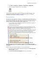
1
User's Guide
Jeppesen
55 Inverness Drive East
Englewood, CO 80112-5498
1-800-621-5377
Western Hemisphere 303-328-4274
Fax 303-328-4153
Eastern Hemisphere +49 6102 5070
Fax +49 6102 507999
http://www.jeppesen.com
Table Of Contents
Welcome ............................................................................................................ 13
JeppView Recommended Use ................................................................................... 15
Legal Notices ............................................................................................................. 15
Your Records ............................................................................................................. 19
JeppView Suggestions ............................................................................................... 19
What's New in this Version ......................................................................................... 21
Using the Help File ..................................................................................................... 25
Conventions used in this Help program ........................................................ 25
Context Sensitive Help Icon ....................................................................... 26
Installation and Activation ............................................................................... 27
System Requirements ................................................................................................ 27
JeppView Hard-Drive Space Requirements ............................................................... 29
NavSuite Global Free Hard Drive Space .................................................................... 30
NavSuite IFR Free Hard Drive Space ........................................................................ 30
What You Get ............................................................................................................30
Administrative Permissions ........................................................................................ 31
Windows 2000 and XP ............................................................................... 31
Windows Vista .......................................................................................... 32
Microsoft Windows Vista Compatibility Mode ............................................................. 32
Microsoft Windows Vista Folders ............................................................................... 33
Standard Installation .................................................................................................. 34
New JeppView Users Start Here .................................................................. 34
Existing Users Start Here ........................................................................... 35
Electronic Chart Data Disc 1 ....................................................................... 35
Electronic Chart Data Disc 2 ....................................................................... 36
Network Installation .................................................................................................... 37
Upgrading JeppView from Version 3.3 to 3.5 ................................................ 37
Initial Server Installation ........................................................................... 41
Client Installation ..................................................................................... 44
Updating Data on the Server ...................................................................... 46
Viewing the Help File for Network Installations ............................................. 47
Workstation Imaging .................................................................................................. 49
iii
JeppView User's Guide
What You Need ........................................................................................ 49
Creating a Master Image ........................................................................... 50
Installing Electronic Chart Data Disc 1 ......................................................... 50
Installing Electronic Chart Data Disc 2 ......................................................... 52
Upgrade Procedures .................................................................................................. 52
Activating JeppView for New Users ............................................................................ 56
Adding Terminal Chart Coverages ............................................................................. 60
Viewing Your Current Coverage Regions ...................................................... 60
Expanding your Regional Coverage Area ...................................................... 61
Proxy Setup ............................................................................................................... 62
Starting JeppView ...................................................................................................... 64
Opening Warning ...................................................................................... 65
Backup and Recovery ................................................................................................ 66
Backup .................................................................................................... 66
Recovery ................................................................................................. 67
Viewing Hidden Folders in Windows Vista ..................................................... 67
Deactivating JeppView ............................................................................................... 68
Removing JeppView and FliteDeck ............................................................................ 69
Keeping Your Programs Up-to-Date ................................................................ 71
JeppView Revisions ................................................................................................... 71
CD Updates ............................................................................................. 72
Updating the Program and Data Electronically .............................................. 72
The UpdatePack ........................................................................................................ 75
Creating an UpdatePack ............................................................................ 75
Updating the Target Computer ................................................................... 76
Updating Terminal Charts .......................................................................................... 77
Revision Letters and Update Letters .......................................................................... 78
Examples................................................................................................. 78
Printing a Revision Letter ........................................................................... 78
Printing an Update Letter ........................................................................... 80
JeppView Tour .................................................................................................. 81
JeppView Screen Layout ........................................................................................... 81
Default View Button.................................................................................................... 82
Tip of the Day............................................................................................................. 82
iv
Table Of Contents
ToolTips .....................................................................................................................83
Airport List Features ................................................................................................... 84
RoutePack Overview.................................................................................................. 85
Multiple Select............................................................................................................85
Notebook Features .................................................................................................... 86
Using the Notebook View ........................................................................... 86
Using the Properties Notebook ................................................................... 87
Viewing the Text Pages ............................................................................................. 87
Toolbar Overview ....................................................................................................... 87
Standard Toolbar ...................................................................................... 88
Chart Toolbar ........................................................................................... 88
Preference Toolbar .................................................................................... 89
Displaying and Hiding Toolbars ................................................................... 91
Resetting a Toolbar ................................................................................... 92
Creating a Toolbar .................................................................................... 92
Modifying Toolbars .................................................................................... 93
Deleting a Toolbar .................................................................................... 93
Arranging List Windows and Toolbars ........................................................................ 94
Toolbars .................................................................................................. 94
List Windows ............................................................................................ 95
Right-Click Menus ...................................................................................................... 97
Enroute Chart View Right-Click Menus ......................................................... 98
RoutePack Right-Click Menus ................................................................... 101
Airport List Right-Click Menus................................................................... 110
Using the Enroute Chart ................................................................................. 112
Enroute Chart Objects.............................................................................................. 113
Right-Click Menu for Enroute Chart View Objects .................................................... 113
Navigating the Map .................................................................................................. 114
Panning the Chart ................................................................................... 114
Zooming the Chart .................................................................................. 115
Centering On the Chart ........................................................................... 116
Previous and Next View ........................................................................... 117
Searching for a Navaid ............................................................................................. 117
Displaying Chart Object Properties .......................................................................... 118
v
JeppView User's Guide
Navigational Aid Information .................................................................... 119
Working with User-Defined Waypoints ..................................................................... 120
Placing a User-Defined Waypoint on the Enroute Chart ................................ 120
Modifying a User-Defined Waypoint........................................................... 121
Showing and Hiding User-Defined Waypoints ............................................. 122
Changing the Default Icon ....................................................................... 122
Deleting a User-Defined Waypoint ............................................................ 122
Electronic Ruler........................................................................................................ 123
Enroute Chart Themes ............................................................................................. 123
Selecting a Chart Theme ......................................................................... 123
Customizing Themes ............................................................................... 124
Resetting Themes ................................................................................... 125
Enroute Chart Projections ........................................................................................ 125
Chart Projections .................................................................................... 126
Using Enroute Chart View Filters ............................................................................. 126
Airport Filters ......................................................................................... 127
Obstacle Filters ...................................................................................... 128
Setting a Default Display .......................................................................................... 128
Changing the Enroute Chart Default View .................................................. 128
Displaying the Enroute Chart Default View ................................................. 129
Creating a Favorite View .......................................................................................... 129
Adding a Favorite View ............................................................................ 129
Returning to a Favorite View .................................................................... 129
Managing Favorite Views ......................................................................... 130
Thumbnail ................................................................................................................ 130
Zooming In and Out ................................................................................ 131
Changing the Theme ............................................................................... 131
Customizing the Chart Properties .............................................................. 131
Graphic Scale and Terrain Legend........................................................................... 131
Displaying and Hiding the Scale and Legend .............................................. 132
Moving the Scale and Legend ................................................................... 132
Displaying Different Units ........................................................................ 132
Changing the Graphic Scale Transparency ................................................. 132
Working with the Airport List ......................................................................... 133
vi
Table Of Contents
Airport List Overview ................................................................................................ 133
Sorting by Column Heading...................................................................... 134
Resizing Columns ................................................................................... 134
Moving Columns ..................................................................................... 134
Sorting by Distance ................................................................................ 135
Centering on an Airport ........................................................................... 135
Printing by Sort Order ............................................................................. 136
Airport Properties ..................................................................................................... 136
Distinguishing Between IFR and VFR ...................................................................... 137
Jeppesen Assigned Airport Identifiers ........................................................ 138
Airport Search .......................................................................................................... 139
Column Searching .................................................................................. 139
Searching for European VFR Airports ......................................................... 140
Favorite Airports....................................................................................................... 140
Selecting Favorite Airports ....................................................................... 140
Sorting Favorite Airports.......................................................................... 141
Filtering Favorite Airports ........................................................................ 142
Clearing the Favorite Airports Filter ........................................................... 143
Airport Filters............................................................................................................ 143
Airport List Filters ................................................................................... 145
Airport List Right-Click Menus................................................................... 145
Airport Right-Click Menu in the Airport List ................................................ 146
Airports Filter Settings Tab ...................................................................... 147
Geographic Area Tab ............................................................................... 150
Using Airport Filters with Column Sorting in the Airport List ......................... 155
Working with Terminal Charts ....................................................................... 157
RoutePack Terminal Charts Right-Click Menu ......................................................... 157
Viewing the List of Airport Terminal Charts .............................................................. 157
Understanding Terminal Chart Icons ......................................................... 158
Displaying Terminal Chart Changes ........................................................... 159
Future Effectivity ...................................................................................................... 161
Obsolete Charts ....................................................................................................... 162
Finding VFR Area Charts (Europe VFR Only) .......................................................... 163
Displaying a Terminal Chart ..................................................................................... 165
vii
JeppView User's Guide
High Quality Mode Terminal Chart Display ................................................. 166
Navigating in the Terminal Charts View.................................................................... 166
Scrolling ................................................................................................ 167
Zooming ................................................................................................ 167
Zooming to a Preset Terminal Chart Section............................................... 167
Zooming Out to Show the Full Chart ......................................................... 168
Changing Chart Orientation ...................................................................... 168
Next View/Previous View ......................................................................... 168
Terminal Chart Filters............................................................................................... 169
Terminal Chart Filter Status ..................................................................... 169
Quick Terminal Chart Filters ..................................................................... 169
Specifying Detailed Terminal Chart Filtering Criteria .................................... 170
Clearing Terminal Chart Filters in the Airport List ........................................ 173
NOTAMS View ......................................................................................................... 173
Terminal Chart NOTAMs .......................................................................... 173
RoutePacks and Route Planning ................................................................... 175
Creating RoutePacks and Routes ............................................................................ 175
RoutePack Structure ............................................................................... 176
RoutePack Wizard ................................................................................... 177
Opening and Closing the RoutePack List .................................................... 180
Creating a RoutePack .............................................................................. 180
Creating a Route .................................................................................... 185
Graphical Routing (Point and Click) ........................................................... 187
Adding a Route to a RoutePack ................................................................. 188
Modify a Route ......................................................................................................... 190
Inserting Waypoints into a Route .............................................................. 190
Appending Waypoints to a Route .............................................................. 194
Deleting Route Objects ............................................................................ 194
Replanning a Route ................................................................................. 195
Rearranging Waypoints in a Route ............................................................ 195
Reversing a Route .................................................................................. 196
Adding an Alternate Route ....................................................................... 196
Renumber Route Waypoints ..................................................................... 197
Filtering Terminal Charts in the RoutePack .............................................................. 198
viii
Table Of Contents
Setting the Chart Types for Departure, Destination, and Alternate Airports .... 198
Applying Chart Type Filters to Existing RoutePacks, Routes, and Airports ....... 200
Resetting To the Default Filter Settings ..................................................... 201
Setting the Chart Types for Other Airports ................................................. 201
Manually Selecting Terminal Charts in Your RoutePack .......................................... 202
Removing Terminal Charts From the RoutePack .......................................... 202
Redisplaying Charts in the Route .............................................................. 203
Add Other Charts to a RoutePack ............................................................................ 204
Copy and Paste ...................................................................................... 204
Drag and Drop ....................................................................................... 204
Saving and Deleting a RoutePack ............................................................................ 205
Saving a RoutePack ................................................................................ 205
Deleting a RoutePack .............................................................................. 206
Loading and Unload RoutePacks ............................................................................. 207
Loading a RoutePack ............................................................................... 207
Unloading a RoutePack ............................................................................ 207
Updating a RoutePack ............................................................................................. 208
RoutePack Properties .............................................................................................. 208
Route Properties ...................................................................................................... 209
Printing ............................................................................................................ 211
Print Overview.......................................................................................................... 211
The Fast Way to Print what you are Viewing ............................................... 211
Printing Multiple Charts for an Airport........................................................ 211
The Recommended Procedure — Printing a RoutePack Trip Kit ..................... 211
Print Options ............................................................................................................ 211
Vector Charts ......................................................................................... 212
Terminal Procedures ............................................................................... 212
Page Settings ......................................................................................... 213
Printer Guidelines .................................................................................................... 213
Starting to Print ........................................................................................................ 214
Previewing the Print Job .......................................................................... 214
When You're Ready to Print ..................................................................... 214
Printing a Trip Kit for a Route or RoutePack ............................................................. 215
Printing a Trip Kit ................................................................................... 215
ix
JeppView User's Guide
Revision Letters and Update Letters ........................................................................ 220
Examples............................................................................................... 221
Printing a Revision Letter ......................................................................... 221
Printing an Update Letter ......................................................................... 222
Jeppesen Paper for Printing Terminal Charts ........................................................... 223
Printing Items not in RoutePacks ............................................................................. 223
Printing Selected Terminal Charts ............................................................. 223
Printing Airport Charts and Information ..................................................... 225
Printing Enroute Charts ........................................................................... 227
Printing a Topic from the Airway Manual .................................................... 228
Viewing and Printing NOTAMs ................................................................... 228
Printing the Notebook ............................................................................. 229
Printing to a Fax ....................................................................................................... 229
Fax from Windows 2000 .......................................................................... 229
FAX from Windows Vista .......................................................................... 230
Fax from Windows XP.............................................................................. 230
Text Pages ....................................................................................................... 233
Viewing the Text Pages ........................................................................................... 233
Viewing the Manuals ................................................................................................ 233
Viewing the Jeppesen Airway Manual ........................................................ 233
Viewing the VFR (Bottlang) Airfield Manual ................................................ 234
Searching the Manuals ............................................................................................ 234
Search Results ....................................................................................... 235
Using the Text Viewer Toolbar ................................................................................. 235
Working with Different Languages............................................................................ 236
Working with the Images .......................................................................................... 237
Organizing Your Bookmarks .................................................................................... 238
Adding a Folder ...................................................................................... 238
Moving Bookmarks ................................................................................. 239
Renaming Bookmarks ............................................................................. 239
Removing Bookmarks.............................................................................. 239
Printing a Text Topic ................................................................................................ 240
Tools ................................................................................................................ 241
JeppView Tools........................................................................................................ 241
x
Table Of Contents
ToolTips ................................................................................................................... 241
Conversions ............................................................................................................. 241
Options .................................................................................................................... 242
Display Tab ............................................................................................ 242
Printing Tab ........................................................................................... 244
Measurements Tab ................................................................................. 245
Warnings Tab ......................................................................................... 246
Status Bar ................................................................................................................ 246
Quick Reference Guide .................................................................................. 249
Keyboard Commands in the RoutePack List ............................................................ 249
Keyboard Commands in the Airport List ................................................................... 249
Terminal Chart Issue Dates...................................................................................... 250
Troubleshooting and Getting Help ................................................................ 255
Installation................................................................................................................ 255
Updates ................................................................................................................... 257
Functionality ............................................................................................................. 260
Printing..................................................................................................................... 261
Compatibility ............................................................................................................ 263
Contacting Jeppesen ............................................................................................... 265
Sales/Customer Service........................................................................... 265
Technical Support ................................................................................... 265
Returns ................................................................................................. 265
Index ................................................................................................................ 267
xi
Welcome
Select any topic in the Table of Contents window or enter specific terms into the
Index search to view the pages that reference that subject.
The following links direct you to JeppView’s main features:
•
View the JeppView / JeppView FliteDeck Tutorial, click Help > Interactive
Training.
•
Locate terminal charts for an airport, see Working with Terminal Charts.
•
View Chart NOTAMs, see NOTAMs.
•
Print a revision letter, see Revision and Update Letters.
•
Work with enroute charts, see Utilizing the Enroute Chart.
•
Understand how RoutePacks and routes can be utilized, see Creating
RoutePacks and Routes.
•
Learn about the best ways to print the information you need, see Print
Overview, Printing a Trip Kit from a Route or RoutePack.
•
Update your Program and Data, see JeppView Revisions.
•
Need information in the Airway Manual or Bottlang Airfield Manual, see
Viewing Text Pages.
13
JeppView Recommended Use
JeppView provides the capability to view and print Jeppesen terminal charts and
enroute maps from a desktop or portable computer. It is intended for use in the
ground environment. Jeppesen recommends printing the charts that you need prior
to flight. Among an extensive selection of chart printing options, JeppView provides a
Trip Kit feature that prints charts for the route in the order that you use them during
the flight, including charts for the departure, destination, alternate, and contingency
airports.
Jeppesen also offers integrated flight planning and moving map programs for
cockpit-friendly personal computers. If you use a personal computer in the cockpit,
please refer to FAR 91.21 Portable Electronic Devices, and any other applicable state
authority policies and guidelines. Jeppesen recommends that you familiarize yourself
with all preflight planning regulations as well as recommended and required
information and flying equipment.
Legal Notices
Copyright
Copyright © 2004-2010 Jeppesen, All Rights Reserved.
Except as otherwise provided and authorized in a written agreement between both
Jeppesen and your company, Jeppesen's copyrighted information and materials may
not be processed, reformatted, reproduced, stored in a retrieval system, or
transmitted in whole or in part, in any form or by any means, whether electrical,
mechanical, photocopying, recording or otherwise, without prior written permission
of Jeppesen.
Material from the Australian Aeronautical information Publication has been used by
agreement with Airservices Australia.
Trademark
Jeppesen, Jeppesen Sanderson, and Airway Manual are registered trademarks of
Jeppesen in the U.S. and other countries.
Third Party Software
Portions of this software are copyrighted by others, as follows:
Boost - Boost Software License - Version 1.0 - August 17th, 2003. Permission is
hereby granted, free of charge, to any person or organization obtaining a copy of the
software and accompanying documentation covered by this license (the "Software")
to use, reproduce, display, distribute, execute, and transmit the Software, and to
prepare derivative works of the Software, and to permit third-parties to whom the
Software is furnished to do so, all subject to the following:
The copyright notices in the Software and this entire statement, including the above
license grant, this restriction and the following disclaimer, must be included in all
copies of the Software, in whole or in part, an all derivative works of the Software,
15
JeppView User's Guide
unless such copies or derivative works are solely in the form of machine-executable
object code generated by a source language processor.
THE SOFTWARE IS PROVIDED "AS IS", WITHOUT WARRANTY OF ANY KIND,
EXPRESS OR IMPLIED, INCLUDING BUT NOT LIMITED TO THE WARRANTIES OF
MERCHANTABILITY, FITNESS FOR A PARTICULAR PURPOSE, TITLE AND NONINFRINGEMENT. IN NO EVENT SHALL THE COPYRIGHT HOLDERS OR ANYONE
DISTRIBUTING THE SOFTWARE BE LIABLE FOR ANY DAMAGES OR OTHER LIABILITY,
WHETHER IN CONTRACT, TORT OR OTHERWISE, ARISING FROM, OUT OF OR IN
CONNECTION WITH THE SOFTWARE OR THE USE OR OTHER DEALINGS IN THE
SOFTWARE.
LibJPEG - This software is based in part on the work of the Independent JPEG
Group. Copyright © 1991-1998, Thomas G. Lane.
LibPNG - Portions Copyright © 2004 Glenn Randers-Pehrson and others
MPL 1.1 - Copyright © 2005–2007 Mozilla. All rights reserved.
NAPDrv32 - Naplps Graphics driver for Win32.
OpenSSL - This product includes software developed by the OpenSSL Project for use
in the OpenSSL Toolkit (http://www.openssl.org/). Copyright © 1998-2003 The
OpenSSL Project. All rights reserved.
PICN13 - Win32 library, attribution unknown.
Protobuf - Copyright © 2010, Jeppesen. All rights reserved. Conditions: *
Redistributions of source code must retain the above copyright notice, this list of
conditions and the following disclaimer.
* Redistributions in binary form must reproduce the above copyright notice, this list
of conditions and the following disclaimer in the documentation and/or other
materials provided with the distribution.
* Neither the name of Jeppesen nor the names of its contributors may be used to
endorse or promote products derived from this software without specific prior written
permission.
THIS SOFTWARE IS PROVIDED BY THE COPYRIGHT HOLDERS AND CONTRIBUTORS
"AS IS" AND ANY EXPRESS OR IMPLIED WARRANTIES, INCLUDING, BUT NOT
LIMITED TO, THE IMPLIED WARRANTIES OF MERCHANTABILITY AND FITNESS FOR A
PARTICULAR PURPOSE ARE DISCLAIMED. IN NO EVENT SHALL THE COPYRIGHT
HOLDER OR CONTRIBUTORS BE LIABLE FOR ANY DIRECT, INDIRECT, INCIDENTAL,
SPECIAL, EXEMPLARY, OR CONSEQUENTIAL DAMAGES (INCLUDING, BUT NOT
LIMITED TO, PROCUREMENT OF SUBSTITUTE GOODS OR SERVICES; LOSS OF USE,
DATA, OR PROFITS; OR BUSINESS INTERRUPTION) HOWEVER CAUSED AND ON ANY
THEORY OF LIABILITY, WHETHER IN CONTRACT, STRICT LIABILITY, OR TORT
(INCLUDING NEGLIGENCE OR OTHERWISE) ARISING IN ANY WAY OUT OF THE USE
OF THIS SOFTWARE, EVEN IF ADVISED OF THE POSSIBILITY OF SUCH DAMAGE.
Ragel - Copyright © 2007 Free Software Foundation, Inc, (http://fsf.org/)
RMTC32 - Resolution Mapping, Inc., map drawing dll.
Templated Unit Test Framework (TUT) - Copyright © 2002-2003 Vladimir Dozen
TinyXML - Portions Copyright © 2000-2002 Lee Thomason www.grinninglizard.com)
16
Legal Notices
Xalan - Copyright © 2007-2010 Jeppesen. Licensed under the Apache License,
Version 2.0 (the "License"); you may not use this file except in compliance with the
License. You may obtain a copy of the License at
http://www.apache.org/licenses/LICENSE-2.0. Unless required by applicable law or
agreed to in writing, software distributed under the License is distributed on an "AS
IS" BASIS, WITHOUT WARRANTIES OR CONDITIONS OF ANY KIND, either express or
implied. See the License for the specific language governing permissions and
limitations under the License.
XERCES - Copyright © 2007-2010 Jeppesen. Licensed under the Apache License,
Version 2.0 (the "License"); you may not use this file except in compliance with the
License. You may obtain a copy of the License at
http://www.apache.org/licenses/LICENSE-2.0. Unless required by applicable law or
agreed to in writing, software distributed under the License is distributed on an "AS
IS" BASIS, WITHOUT WARRANTIES OR CONDITIONS OF ANY KIND, either express or
implied. See the License for the specific language governing permissions and
limitations under the License.
zlib - Portions Copyright © 1995-2003 Jean-loup Gailly and Mark Adler.
All other product or brand names may be trademarks or registered trademarks of
their respective owners.
License Agreement
To view the license agreement, click Help > License Agreement.
17
Your Records
We suggest you record your serial number on this page for safekeeping. You may
need to provide your serial number and customer number when calling customer
service or technical support. It may also be useful in the future to have your Site Key
and Site Code available.
Serial Number (16-characters): ______________________________________
Site Key/Code: ___________________________________________________
Customer Number: ________________________________________________
Coverage Code: __________________________________________________
Notes:____________________________________________________________
__________________________________________________________________
__________________________________________________________________
__________________________________________________________________
__________________________________________________________________
__________________________________________________________________
__________________________________________________________________
__________________________________________________________________
__________________________________________________________________
__________________________________________________________________
__________________________________________________________________
__________________________________________________________________
__________________________________________________________________
__________________________________________________________________
__________________________________________________________________
__________________________________________________________________
__________________________________________________________________
__________________________________________________________________
JeppView Suggestions
We strive to provide the best possible products to meet your needs, and we value
your input in that process. If you have suggestions for product changes or
enhancements or if you would like to tell us what you like or dislike about JeppView
FliteDeck, please send an email to [email protected].
19
What's New in This Version
Version 3.7.2, Released JULY, 2010
Fixes
Terrain Overlay
Fix for terrain overlay problem in 3.7.1 update.
Version 3.7.1, Released JULY, 2010
Fixes
Terminal Chart
Update
Fix for (terminal chart installation/ update runtime and ".dll not
found" errors related to daylight savings time.
Version 3.7, Released JULY, 2010
Fixes
Terminal Charts
Tab
Shared Charts
on Network
-
A new JeppView terminal chart decluttering command fades
cultural and terrain features to visually emphasize navigation
data.
In network installations, multiple users can now view the same
chart simultaneously.
Program changes for compatibility with FliteStar 9.5.
Version 3.6.4, Released AUGUST, 2009
Fixes
Maintenance
Internal maintenance release.
Version 3.6.3, Released MARCH, 2009
Fixes
Maintenance
License update.
Version 3.6.2, Released JANUARY, 2009
Fixes
Airport
Diagrams
Fix to worldwide airport diagram display.
Version 3.6.1, Released AUGUST, 2008
Fixes
Tower
Frequencies
The tower frequency labels were fixed.
UpdatePacks
A problem with Updatepacks misreading NavData cycles and
including text was corrected.
Version 3.6.0, Released JUNE,2008
New Features
and
Improvements
Microsoft
Windows
Vista
The release of version 3.6 incorporates two changes:
o Settings previously stored in the [application].ini files are
placed in the registry during installation or moved to the
registry during an update.
o The 3.6 installer places files in directories compatible with
the Microsoft Windows Vista file directory structure. If you
have already installed JeppView on Windows XP and 2000,
you will not see any change to file locations.
If you are a current Windows XP or Windows 2000 user migrating
to Microsoft Vista and would like to know where common files will
be stored, see Microsoft Windows Vista Compatibility Mode and
Microsoft Windows Vista Folders.
JV MFD and
FliteDeck
Previous versions of JeppView MFD did not include JeppView
FliteDeck. Starting with version 3.5.3, all current JeppView MFD
subscribers have the option to install JeppView MFD during either
the initial installation, the Electronic Chart CD (Disc 2) update, or
electronic (online) update.
Version 3.5.2, Released SEPTEMBER, 2007
New Features
and
Improvements
Index
License
Agreements
Avidyne Files
Updated the JeppView and NavSuite License agreement to
acknowledge that Jeppesen uses Australia Air Services data. To view
the agreement, click Help > License Agreement.
Updated the Avidyne Extractor with new Avidyne files.
Fixes
Printing a
Revision
Letter
Fixed an application crash when printing a Revision Letter for a
RoutePack containing previously and currently updated charts.
Version 3.5.1, Released MAY, 2007
Fixes
Printing
Fixed an issue where individual terminal charts would not print after
printing a Revision Letter.
Version 3.5, Released MARCH, 2007
New Features
and
Improvements
Installation
The Electronic Chart Data (ECD) discs received in the mail have been
restructured where you must install ECD Disc 1 and 2 to receive
updated information for your terminal charts, program updates,
navigational data, and text data. If you update the data
electronically, you are not impacted with the CD update method.
Recommended Topic: JeppView Revisions
Network
Installation
If you are using JeppView in a networking environment, please see
Network Installation regarding changing the client network path to a
network drive.
European VFR
Charts
Added European VFR Charts (Bottlang charts). The visual approach
charts cover 2,100 airports and aerodromes in 29 European
countries. Customers are given the option of ordering VFR coverages
by country or by geographic regions. You may choose between
services that offer only VFR charts, only IFR charts, or both VFR and
IFR. Call Jeppesen Customer Service if you are interested in a
subscription. Recommended Topic: Distinguishing Between IFR and
VFR Airports
Printing
Options
An additional printing option has been added to the Printing tab
when clicking Tools > Options. This new option allows you to print
large European VFR area charts on multiple pages. Recommended
Topic: Printing Options
Text
Information
Text pages are now provided in XML format rather than PDF which
makes searching and accessing both IFR and VFR information much
easier. You can search keywords, bookmark pages, zoom and scroll
to quickly find text-based information. If you have a European VFR
subscription, the text for the Bottlang Airfield Manual becomes
available. Recommended Topic: Viewing the Text Pages
Favorite
Airports
Modified the Favorite Airport column in the Airport List. You can
select your favorite airports and click on the column header to
bundle them together or use the filter to hide the airports not
selected as a favorite. Recommended Topic: Favorite Airports
Terminal
Chart Filters
Moved the terminal chart check boxes that were previously in the
Airport List window to the Filter button in the Airport List window.
Recommended Topic: Terminal Chart Filters
Routing
Techniques
Added and fixed some auto routing techniques that can be used in
the RoutePack Wizard. Recommended Topic: RoutePack Wizard
Fixes
Opening
RoutePacks
with Explorer
Fixed a program crash when opening a RoutePack from Explorer.
Repair
Function
Fixed the repair function where it removed the JeppView desktop
icons and shortcuts.
Enroute Chart
Data
Fixed
•
•
•
•
•
•
•
•
•
LAND areas incorrectly attributed as water.
Usedom Island - Baltic coast of the Germany/Poland border
Various small Baltic Sea Islands belonging to Finland
Schouwen Island - Rhine delta in the Netherlands
Reunion Island - Indian Ocean near Madagascar
New Georgia Island - part of the Solomon Islands, near
Guadalcanal
Vanua Levu Island - part of the Fiji Islands
Groote Island - Gulf of Carpentaria, Northern Australia
Frederik Hendrik Island (southern half) - southwestern coast
of New Guinea
Saint Martin Island - Caribbean
Enroute Chart
Data
Fixed WATER areas incorrectly attributed as land:
• Malaysia half of the straits separating Singapore from the
Malay peninsula
• Western half of the Gulf of Pohai in China, near city of
Tientsin
Enroute Chart
Data
Fixed COUNTRIES incorrectly attributed as other countries:
• The southern half of Azerbaijan was incorrectly attributed as
Armenia
JeppView User's Guide
Terminal
Chart Filters
Moved the terminal chart check boxes that were previously in
the Airport List window to the Filter button in the Airport List
window. Recommended Topic: Terminal Chart Filters
Routing
Techniques
Added and fixed some auto routing techniques that can be
used in the RoutePack Wizard. Recommended Topic:
RoutePack Wizard
Fixes
Opening
RoutePacks
with Explorer
Repair
Function
Enroute Chart
Data
Fixed a program crash when opening a RoutePack from
Explorer.
Fixed the repair function where it removed the JeppView
desktop icons and shortcuts.
Fixed LAND areas incorrectly attributed as water.
• Usedom Island - Baltic coast of the Germany/Poland
border
• Various small Baltic Sea Islands belonging to Finland
• Schouwen Island - Rhine delta in the Netherlands
• Reunion Island - Indian Ocean near Madagascar
• New Georgia Island - part of the Solomon Islands,
near Guadalcanal
• Vanua Levu Island - part of the Fiji Islands
• Groote Island - Gulf of Carpentaria, Northern Australia
• Frederik Hendrik Island (southern half) - southwestern
coast of New Guinea
• Saint Martin Island - Caribbean
Enroute Chart
Data
Fixed WATER areas incorrectly attributed as land:
• Malaysia half of the straits separating Singapore from
the Malay peninsula
• Western half of the Gulf of Pohai in China, near city of
Tientsin
Enroute Chart
Data
Fixed COUNTRIES incorrectly attributed as other countries:
• The southern half of Azerbaijan was incorrectly
attributed as Armenia
24
Using the Help File
The JeppView help file is one of many sources to help you learn JeppView. Besides
this help file, you may also want to look at the following sources of information:
•
A JeppView and JeppView FliteDeck tutorial is available by clicking Help >
Interactive Training.
•
A JeppView User's Guide is available by clicking Start > Programs >
Jeppesen > JeppView3 > JeppView3 User's Guide. The User's Guide is
formatted in a Portable Document Format (PDF) and may be printed easily.
To use the latest version of Acrobat Reader to read the PDF, download the
latest version at http://www.adobe.com/products/acrobat/readstep2.html.
•
The JeppView resource Internet page is available at www.Jeppesen.com.
Conventions used in this Help program
"JeppView" refers to the new JeppView, version 3.0 or higher. Reference to the
previous JeppView program is "JeppView 2.x".
•
Bold text represents commands on menus (including right-click menus),
buttons, nested menu structures, and elements on a dialog box (such as tabs
and check boxes).
•
The '>' character represents nested menu structures. For example, "Click
Chart > Favorite Views > Add Favorite" describes the menu shown in the
image below.
•
Italics are used for emphasis. They are also used for names of books.
•
View refers to the five main windows in the program (Enroute Charts,
Terminal Charts, Notebook, NOTAMs, or Text), accessed by View tabs. For
example, the Enroute Charts tab displays the Enroute Charts View.
•
Text that is typed into a dialog box or other entry area appears in this
monospace font.
In electronic versions:
25
JeppView User's Guide
•
Blue or underlined text links to other Help pages, additional information and
Internet addresses related to that topic. Click the text to view additional
information.
•
Click on the blue bold text to view additional information about a topic.
•
Use the Back button at the top of your browser to return to previously-visited
topics, or the Forward button to return to the present topic after using the
Back button.
•
Context Sensitive Help Icon
• Displays a help topic for a selected item in the screen (not applicable in the
main JeppView window).
26
Installation and Activation
These instructions cover installation of JeppView and FliteDeck. These programs are
designed to work together, but they do not need to be installed on the same
computer. Your JeppView/JeppView FliteDeck license allows you to install any
combination of these two programs on up to four separate computers.
•
You may wish to install JeppView on a desktop computer for planning.
•
And install FliteDeck on a Tablet PC to take in the aircraft.
•
Or you could install both programs on the same computer.
•
You may install JeppView on a network (see your license agreement), but not
FliteDeck.
NOTE
The following instructions are for installing JeppView and FliteDeck from
the JeppView product. If you are installing JeppView and FliteDeck from
the NavSuite, please refer to the NavSuite Quick Start Guide.
This section contains the following topics:
•
System Requirements
•
What You Get
•
Administrative Permissions
•
Microsoft Windows Vista Compatibility Mode
•
Microsoft Windows Vista Folders
•
Standard Installation
•
Network Installation
•
Workstation Imaging
•
Upgrade Procedures
•
Activating JeppView
•
Checking and Adding Coverages
•
Proxy Setup
•
Starting JeppView
•
Backup and Recovery
•
Deactivating JeppView
•
Removing JeppView and FliteDeck
System Requirements
The following system requirements were set up to give you the most out of your
JeppView software. Although the program might run on systems that do not meet
27
JeppView User's Guide
these requirements, Jeppesen cannot guarantee that the program will run properly
unless the system meets these requirements.
Minimum
Recommended
PC Type
Desktop, Notebook, or Tablet PC
Desktop, Notebook, or Tablet PC
CPU
500MHz , 32-bit (x86) or higher
processor
2GHz or higher, 32-bit (x86) processor
Operating System (English Only)
•
•
Microsoft Windows® XP SP2, or XP
Tablet PC Edition SP2
•
Microsoft Windows® XP SP3 or XP
Tablet PC SP3 Edition
Microsoft Windows® Vista 32-bit:
Home Basic, Home Premium,
Business Edition, Enterprise Edition
and Ultimate Edition
RAM
256MB
1GB
Display
VGA 800 x 600, 16-bit display
VGA 1280 x 1024, 24-bit color display
VGA 600 x 800 (JeppView FliteDeck
portrait orientation)
Graphics Processor
32MB Video Card
64MB Video Card
Input Devices
Pointer device
Keyboard
Pointer device
Keyboard
CD-ROM
8x
24x or higher
Internet Connection
Broadband Internet Connection (for
online download of program updates)
Broadband Internet Connection (for
online download of program updates)
Internet Explorer 5.0 or higher
Internet Explorer 7
Printer (Optional)
300dpi
28
600dpi, 6 pages per minute, color
Installation and Activation
Free Hard Drive Space*
(U.S. 48 State Coverage)
JeppView: 2.0GB
JeppView FliteDeck: 2.1GB
Both: 2.2GB
Higher than the minimum requirement
(Europe IFR)
JeppView: 2.0GB
JeppView FliteDeck: 2.0GB
Both: 2.15GB
Higher than the minimum requirement
(Europe VFR)
JeppView: 2.0GB
JeppView FliteDeck: 2.1GB
Both: 2.2GB
Higher than the minimum requirement
(Worldwide IFR and VFR Coverage)
JeppView: 2.5GB
JeppView FliteDeck: 2.55GB
Both: 2.85GB
Higher than the minimum requirement
* Hard disk space requirements vary depending on coverage area and data installed.
In order for terminal charts to install to the hard drive, the hard drive space shown
above is needed.
JeppView Hard-Drive Space Requirements
Data Region
USA - 48 States
Europe
Worldwide
NOTE
Minimum*
Recommended
JeppView: 200MB
FliteDeck: 260MB
Both: 530MB
JeppView: 1.2GB
FliteDeck: 1.2GB
Both: 2.5GB
JeppView: 170MB
FliteDeck: 225MB
Both: 455MB
JeppView: 1.3GB
FliteDeck: 1.4GB
Both: 1.6GB
JeppView: 285MB
FliteDeck: 340MB
Both: 670MB
JeppView: 2GB
FliteDeck: 2.1GB
Both: 2.3GB
The figures above are estimates, as the data varies across update cycles.
* Minimum Requirements are for no installation of the optional data from the
Program and Electronic Chart Data CDs. They also do not take into account
RoutePack saves, Internet updates and weather file storage.
29
JeppView User's Guide
NavSuite Global Free Hard Drive Space
NavSuite Global consists of JeppView, JeppView FliteDeck, and JetPlanner.
Requirement
Minimum*
Recommended
USA - 48 States
580 MB
1.7 GB
Europe
550 MB
1.7 GB
Worldwide
875 MB
2.75 GB
NOTE
The figures above are estimates, as the data varies across update cycles.
* Minimum Requirements are for no installation of the optional data from the
Program and Electronic Chart Data CDs. They also do not take into account
RoutePack saves, Internet updates and weather file storage.
NavSuite IFR Free Hard Drive Space
NavSuite IFR consists of JeppView, JeppView FliteDeck, and FliteStar IFR.
Requirement
Minimum*
Recommended
USA - 48 States
610 MB
1.8 GB
Europe
580 MB
1.8 GB
Worldwide
910 MB
2.7 GB
NOTE
The figures above are estimates, as the data varies across update cycles.
* Minimum Requirements are obtained by not installing any optional data available
on the Program and Electronic Chart Data CDs. Terminal Charts run from the CD. It
also does not take into account of RoutePack saves and Internet updates.
What You Get
When you first purchase JeppView or JeppView FliteDeck, you get three CDs, which
must be installed in the following order:
30
•
Program CD — Contains program and basic geographic and terrain data.
Install this once on each computer.
•
Electronic Chart Data (ECD) Disc 1 — Contains Jeppesen terminal chart
data and is updated every 14 days. Install it after the Program CD installation
and update the data through the Internet.
Installation and Activation
•
Electronic Chart Data (ECD) Disc 2 — Contains program updates to
JeppView and FliteDeck, Jeppesen aeronautical data, and the text information
in the Jeppesen Airway Manual and the Bottlang Airfield Manual. This data is
updated every 14 days. Install it after the ECD Disc 1 installation and update
the data through the Internet.
IMPORTANT
NOTE
Keep your Program CD and your latest ECD Discs in a safe
place in situations where you need to install JeppView and
FliteDeck on another computer.
If you are interested in receiving ECD Disc 1 and 2 updates by mail,
please contact a Jeppesen Customer Service Representative for
information and pricing.
For initial installation on a computer, continue with one of the following:
•
Standard Installation
•
Network Installation
•
Workstation ImagingStandard Installation
•
JeppView MFD - see Standard Installation
Administrative Permissions
Before installing JeppView on Windows 2000, XP or Vista, verify that the permissions
are set sot individual users have access to full use of JeppView. Administrative
permissions are required for the initial installation of JeppView, and any program
updates that might be available when clicking File > Check for Updates or with the
CD update. Users do not need the full administrative permissions to update only
navigational data and terminal chart data.
Windows 2000 and XP
Follow these steps to confirm administrative rights on your home computer:
1. Right-click My Computer on your desktop and choose Manage from the
shortcut menu.
2. In the left pane, expand System Tools, and then click Local Users and
Groups.
3. In the right pane, double-click Groups.
4. Double-click Administrators. If your account has administrator rights, it
appears in the Members section. If your account is not listed, click Add and
enter the account name that you want to assign administrative privileges.
5. Click OK, and then reboot your computer if you have added an account.
If you are logged in without administrative rights, Windows may return the error
"The following error occurred accessing the properties of the local group
31
JeppView User's Guide
Administrators: Access is denied. The local group properties cannot be edited or
viewed at this time." If you are trying to install JeppView on a corporate computer,
please contact your network administrator for administrative permission.
Windows Vista
If you do not have administrative permissions on Windows Vista, you will receive the
following message when attempting to install or update JeppView:
If this occurs, you need to elevate your status with administrative permissions. Use
one of the following methods to gain access to the JeppView installer:
•
Log in to your computer using the local "administrator" account. Thereafter,
browse to your computer CD-ROM drive, and then double-click setup.exe.
•
Browse to your computer CD-ROM drive, right-click setup.exe, and then
select Run as administrator.
If you are installing JeppView on a corporate computer, please contact your network
administrator for administrative permission.
Microsoft Windows Vista Compatibility Mode
If you are currently using a version of JeppView that is not Vista aware (version
3.5.2 or lower) on a Windows Vista machine using the compatibility mode feature, it
is recommended that you turn off the compatibility mode and update the application
with the Vista aware Electronic Chart Data (ECD) Discs or electronically through the
Internet.
32
Installation and Activation
When using the Compatibility mode feature, Windows Vista redirects some files and
folders to other areas of your computer. For instance, if you are a standard user and
cannot write to the C:\Program Files folder, it will redirect the files and place it in the
C:\Users[User Profile] folder. Windows Vista gives the application its own private
copy of the file in the user's profile, so the application will function properly. When
files are moved randomly, the Vista aware Jeppesen applications might not be able
to find the files needed or place additional files on your computer raising the amount
of space required on your computer. It might also reduce the application's
performance and cause application conflicts.
For additional Windows Virtualization issues, visit Microsoft on the Web at
http://support.microsoft.com/default.aspx/kb/927387.
Try these steps to turn off Windows compatibility mode:
1. Ensure that the Jeppesen applications are closed.
2. Right-click the Jeppesen application icon on your desktop.
3. From the shortcut menu, click Properties.
4. Click the Compatibility tab.
5. Clear the Compatibility mode check box if it's selected.
6. Click OK.
7. Insert the Vista aware Electronic Chart Data CDs or update the application
electronically.
Microsoft Windows Vista Folders
The release of JeppView version 3.6 incorporated a new directory structure
applicable only for users that will be using the Microsoft Windows Vista operating
system. Users with Windows XP and 2000 will not see a change. Use the following
table if you are a Windows XP or Windows 2000 user migrating to Microsoft Vista to
locate where common user files are stored.
The table assumes that JeppView is installed in the default location on the C: drive.
File
CreateUpdatePack.exe
Windows 2000 and XP*
C:\Jeppesen\Common\
Utilities
Windows Vista
C:\ProgramData\Jeppesen\
Common\Utilities
Deactivate.exe
C:\Jeppesen\JeppView3
C:\Program
Files\Jeppesen\
JeppView3
Markers.ini file (userdefined waypoints)
C:\Jeppesen\JeppView3
C:\Users\[UserProfile]\
AppData\Local
C:\Jeppesen\JeppView3\
Notebook
C:\Users\[user
profile]\Jeppesen\
JeppView3\Notebook
Notebook files (.txt)
33
JeppView User's Guide
RoutePack files (.rpk)
UpdateClient.exe
C:\Jeppesen\Common\
RoutePack
C:\Users\[user
profile]\Jeppesen\
Common\RoutePack
C:\Jeppesen\JeppView3
C:\Program
Files\Jeppesen\JeppView3
* Depending on your computer setup, files might also be placed in the
[root]:\Program Files\Jeppesen\ folders.
Hidden folder
To view hidden folders, see Backup and Recovery.
Standard Installation
The following instructions are for standard installation on a computer. If you need to
install JeppView in a network environment, please see Network Installation.
•
New JeppView Users Start Here.
•
Existing Users Start Here.
•
Installing Electronic Chart Data Disc 1.
•
Installing Electronic Chart Data Disc 2.
The first time installing JeppView and JeppView FliteDeck, you must install the
program and data with the CDs. After the data is installed on the computer, update
the data through the Internet or with a CD subscription.
IMPORTANT
NOTE
Keep your initial CDs in a safe place in situations where you
need to install JeppView and FliteDeck on another computer.
The following instructions are for installing JeppView and FliteDeck
from the JeppView product. If you are installing JeppView and
FliteDeck from the NavSuite, please refer to the NavSuite Quick Start
Guide you received when you ordered the product.
New JeppView Users Start Here
If this is your first time using JeppView, or if you are currently running JeppView 2,
follow these steps. Ensure that you have administrative permissions on your
computer before starting the following steps.
Insert the Program CD into your computer CD-ROM drive. If the setup program does
not start automatically, browse to your computer CD-ROM drive and double-click
setup.exe. To install the JeppView programs on your computer, follow these steps:
1. In the Welcome screen, click Next.
2. Read the information in the Installation Overview window and click Next.
3. Read the license agreement and accept the terms, and then click Next.
34
Installation and Activation
IMPORTANT
Accept the license agreement. Because JeppView is designed
to be used on a combination of home, office, laptop, and
aircraft computers, the license agreement allows you to
install the JeppView and FliteDeck components on various
combinations of up to four computers for your own personal
use. Under no circumstances should this software be used by
more than one person at the same time.
4. In the Pilot Information dialog box, enter your name and 16-character or
alphanumeric serial number from the front of your CD album, and then click
Next.
5. Select the programs to install. You can install JeppView, FliteDeck or both.
6. Select the path in which to install JeppView and FliteDeck and click Next.
Jeppesen recommends that you use the default folder or a location where
other Jeppesen programs have previously been installed. If you want to use a
different drive or folder, click Change, and then type the path or browse to
the folder that you want.
7. Click Next through the remaining screens, accepting all default options.
8. When the installation is complete, click Finish. A dialog box appears
instructing you to insert ECD Disc 1. If your computer requires a reboot, do so
before moving to the next procedure.
Existing Users Start Here
If you changed your JeppView subscription to update your MFD system, or are
currently using JeppView v3 with a different serial number, you must deactivate your
current version. After you have deactivated JeppView, you will be provided the
opportunity to insert your new JeppView serial number. You do not need the
program CD.
To deactivate JeppView:
1. Open the JeppView program folder (the default location is
C:\Jeppesen\JeppView3).
2. Double-click deactivate.exe.
3. If prompted, select JeppView and click OK.
4. Select the check box to continue and click Next.
5. Click Yes to deactivate JeppView.
6. Select a deactivation process (we recommend that you select the Internet
(Automated) method if you have an Internet connection), and click Next.
7. Record your serial number and deactivation code, and click Finish.
8. Insert ECD Disc 1 and complete the installation.
Electronic Chart Data Disc 1
35
JeppView User's Guide
The first installation of JeppView requires ECD Disc 1 and 2. Thereafter, update the
data every 14 days through the Internet or with the CD updates received in the mail.
To install your terminal charts, follow these steps:
1. Insert ECD Disc 1 into your computer CD-ROM drive. If the setup program
doesn’t start automatically, browse to your computer CD-ROM drive and
double-click setup.exe.
2. If you deactivated a JeppView 3 serial number, enter your new serial number
and click Next.
3. JeppView MFD Users Only: If this is your first time installing ECD Disc 1,
click Yes to install JSUM. JSUM is used to assist in transferring the electronic
chart data to the media used with your MFD system.
4. JeppView MFD Users Only: If applicable, select the Run Jeppesen
Services check box and click Next. This option launches the Jeppesen
Services Update Manager (JSUM) near the end of the ECD Disc 1 update. This
option is only available if JSUM is already installed.
5. Verify the terminal chart coverage(s) listed for your serial number are the
same as what you have purchased.
A. The first time that you install ECD Disc 1 on a given computer, you may
not see any coverages. If that occurs, a box for entering a coverage code
appears near the bottom of the Setup window.
B. Type the coverage codes from the front of your JeppView CD album
(below the serial number), and then click Apply.
NOTE
Coverage codes change with each terminal chart cycle. If the
coverage code you have no longer works, or you don’t have a
coverage code, or you don’t see the coverages you need after
entering your codes, have your order number or customer number
available and contact Jeppesen Customer Service. After you have the
codes you need, complete the steps outlined below.
6. JeppView MFD Users Only: The JSUM installer and program launches, and
you can log in and begin the programming process to your media. For JSUM
information, see the JSUM help file.
7. After the update is complete, continue the installation with ECD Disc 2.
Electronic Chart Data Disc 2
To receive JeppView and FliteDeck program updates, Jeppesen aeronautical data and
text data, follow these steps:
36
Installation and Activation
1. If you haven’t already done so, insert ECD Disc 2 into the CD-ROM drive. If
the setup program doesn't start automatically, browse to your computer CDROM drive and double-click setup.exe.
2. Click Next after the welcome screen appears.
3. JeppView MFD Users Only: If you do not have FliteDeck installed, the
installer gives you the option to install it. If given the option and you want
FliteDeck, select the span class=Bold>Install FliteDeck check box and click
Next.
4. Review the installation summary, and click Next.
5. Select the following check boxes and click Next:
•
View the readme file — Displays new information regarding the
latest program update.
•
Install Jeppesen Weather Service* — This option launches the
Jeppesen Weather Service installer, allowing FliteDeck to display
weather using your XM WxWorx Satellite Weather Service. The
Jeppesen Weather Service option only appears if you are installing
FliteDeck and you did not previously install the Jeppesen Weather
Services. For additional information about using your XM WxWorx
Satellite Weather Service in FliteDeck, refer to the JeppView FliteDeck
User’s Guide and Help file.
6. Follow the remaining screens to finish the installation.
NOTE
See JeppView Revisions for information about updating your data
electronically after the initial installation. Depending on the expiration
date of the data on the CDs, you might need to update your data soon
after installing JeppView.
* XM Weather provides service to the contiguous US (all states except Alaska and
Hawaii), its territories and adjacent water. To learn of any changes to the coverage
areas, contact XM WX at 1-800-985-9200.
Network Installation
A standard license allows installation of JeppView on four computers for use by one
pilot. If you are interested in purchasing the network version of JeppView or
purchasing multiple licenses, please contact Jeppesen Customer Service for
information and pricing.
If you are an existing customer upgrading JeppView from version 3.3 to version 3.5
on a network, you will need to change the client network path to a network drive. If
you are installing JeppView on the server for the first time with JeppView 3.5,
continue to Initial Server Installation.
Upgrading JeppView from Version 3.3 to 3.5
If you update your data on the server through the Internet, the update process has
not changed. If you update your JeppView data on the server using discs received by
37
JeppView User's Guide
mail, you will receive two Electronic Chart Data Discs. Install Electronic Chart Data
Disc 1 and 2 on the server:
•
Electronic Chart Data (ECD) Disc 1 — Contains Jeppesen terminal chart
data and is updated every 14 days.
•
Electronic Chart Data (ECD) Disc 2 — Contains program updates to
JeppView and FliteDeck, Jeppesen aeronautical data, and the textual
information in the Jeppesen Airway Manual and the Bottlang Airfield Manual.
This data is updated every 14 days.
After JeppView has been updated on the server, the following steps need to take
place on each client machine:
1. After you have finished the installation process of the JeppView upgrade,
ensure that you have a shared folder on the server that points to the
Jeppesen folder.
A. On the server, right-click the program folder which could be
[root]:\Jeppesen and choose Sharing and Security.
B.
38
On the Sharing tab, click Share this folder.
Installation and Activation
C. To set a user limit other than the default Maximum Allowed, click Allow
this number of users and specify the maximum number of concurrent
users.
D. To specify which users may access the shared folder, click Permissions.
E. Select the users or groups of users who will have access to JeppView.
F. Under the Allow column, select the Change and Read check box for each
user or each group of users accessing JeppView.
G. Click OK to return to the previous screen.
H. Click OK.
2. On the client machine, map a network drive to \\<servername>\Jeppesen
where servername is the name of the server where you installed the
JeppView program.
A. Click Start > Settings > Control Panel.
B. Double-click Network Connections.
C. Click Tools > Map Network Drive.
39
JeppView User's Guide
D. In the Folder text box, enter \\<servername>\Jeppesen where
servername is the name of the server where you installed the JeppView
program.
E. Select the Reconnect at logon check box.
F. Click Finish. You should now be able to access your network drive.
3. Start JeppView on the client.
4. Read the message that appears about using a network drive instead of a
network path, and then click OK.
5. JeppView shuts down and attempts to launch the NetworkCorrectionUtility.exe
program located in the \\<servername>\Jeppesen\\JeppView3\\Utils
folder. This utility assists in remapping your JeppView server location to a
network drive.
6. In the JeppView Network Correction Utility Welcome dialog box, click
Next.
7. Read the client/server setup instructions and ensure you have completed all
the steps listed before continuing. Click Next.
40
Installation and Activation
8. Specify the network drive that contains the server JeppView3 executable.
(Z:\, where Z is the network drive). This location is on the server and not on
the local machine.
9. Click Next to complete the installation.
10. Repeat steps 2 through 8 for each client.
Initial Server Installation
Insert the JeppView program disc into the CD-ROM drive on your server. The
installer will guide you through the following steps and procedures:
1. In the JeppView Welcome screen, click Next.
2. Read the information in the Installation Overview window and click Next.
3. Accept the terms of the license agreements, and then click Next.
4. Enter your registration information and 16-character or alphanumeric number
that came with JeppView, and then click Next.
5. Select the JeppView check box only and click Next. Follow the guidelines on
the screen.
6. Select the path in which to install JeppView and click Next. Jeppesen
recommends that you use the default folder or a location where other
Jeppesen programs have previously been installed. If you want to use a
different drive or folder, click Browse, and then type the path or browse to
the folder that you want.
7. Click Next on the remaining windows accepting the default entries.
8. After the update is complete, insert ECD Disc 1.
Installing Electronic Chart Data Disc 1 on a Server
Jeppesen terminal chart data is provided on ECD Disc 1. The on-screen instructions
are similar to those for the program installer, and will guide you through the setup:
1. Click Next after the Welcome screen appears.
2. Check the coverage regions listed in the installation Setup dialog box. If you
received coverage codes from Jeppesen Customer Support for additional
regions, enter them in the field below the list box. When you are finished,
click Next.
3. After the update is complete, continue with the Installing Electronic Chart
Data Disc 2 on a Server to update your enroute data and any program
updates that might be available.
If you did not receive a serial number or coverage code, please contact Jeppesen
Customer Service.
Installing Electronic Chart Data Disc 2 on a Server
41
JeppView User's Guide
After the ECD Disc 1 is installed, place ECD Disc 2 into the CD drive. ECD Disc 2
contains updates to JeppView, Jeppesen aeronautical data, and the text for the
Jeppesen Airway Manual and the Bottlang Airfield Manual.
If the setup program does not start automatically, click Start > Run. Type
d:\setup.exe (where d: is the letter of the CD-ROM drive).
1. Click Next after the welcome screen appears.
2. Review the installation summary, and then click Next.
3. Select the ReadMe file check box to review any new information regarding
the latest program update, and then click Next. Follow the prompts on the
remaining installation windows.
Sharing the Server
After you have finished the installation process of the JeppView program CD and the
two ECD Discs, you must set up a shared folder on the server that points to the
Jeppesen folder.
1. On the server, right-click the Jeppesen folder that contains the JeppView
program files and choose Sharing and Security. The default folder is
[root]:\Jeppesen or [root]:\Program Files\Jeppesen.
2. On the Sharing tab, click Share this folder. If the server is using Microsoft
Windows Vista, click Advanced Sharing.
42
Installation and Activation
3. To set a user limit other than the default Maximum Allowed, click Allow this
number of users and specify the maximum number of concurrent users.
4. Click Permissions.
5. Select users or groups of users whom you want to grant access to JeppView.
6. Under the Allow column, select the Change and Read check box for each
user or groups of users accessing JeppView.
7. Click OK to return to the previous screen.
8. Click OK.
If the server is using Microsoft Windows Vista, you will need an
additional network share for the terminal charts and text data.
1. Browse to the [root]:\ProgramData folder.
NOTE
2. Right-click the Jeppesen folder, and click Share.
3. Select the users that will need access to JeppView.
4. Set their permissions to Read.
43
JeppView User's Guide
Activating JeppView on the Server
To receive electronic updates, you must activate JeppView on the server. After
JeppView is installed:
1. Click Start > Programs > Jeppesen > JeppView3 > JeppView3 or click
the Jeppesen JeppView icon on the desktop.
2. Follow the prompts on the JeppView activation installation windows. See also
Activating JeppView.
3. After JeppView has been activated, click File > Exit.
Client Installation
On each client system:
1. Map a network drive on the client that maps to \\<servername>\Jeppesen.
A. Click Start > Settings > Control Panel.
B. Double-click Network Connections.
C. Click Tools > Map Network Drive.
D. In the Folder text box, enter \\<servername>\Jeppesen where
servername is the name of the server where you installed the JeppView
program.
44
Installation and Activation
E. Select the Reconnect at logon check box.
F. Click Finish. You should now be able to access your network drive.
NOTE
If the server is using Microsoft Windows Vista, repeat step 1 to map to
the network share of the terminal charts and text data.
2. On the client machine, insert the JeppView program CD into the CD-ROM
drive. Click Cancel if the installer starts.
3. Double-click My Computer.
4. Right-click the drive containing the program CD and choose Explore.
5. In the CD contents, double-click the network folder.
45
JeppView User's Guide
6. Double-click JeppViewNetworkSetup.exe.
7. Click Next to start the installer.
8. Read the License Agreement, and then click Yes to install.
9. Enter the same serial number that you used to install JeppView on the server.
This must be the same serial number.
10. Read the installation summary and ensure you have completed all of the
steps listed before continuing, and then click Next.
11. Click Yes or No when asked if the server is using Windows Vista. Clicking Yes
initiates the installer to look for the additional network share of terminal
charts and text data required when the server is using Windows Vista.
12. If applicable, specify the network drive that contains the server
JeppView3.exe (Z:\, where Z is the network drive). This location is on the
server and not on the local machine. Click Next to complete the installation.
13. Select the folder where chart preference files will be stored on the local
workstation (such as C:\Jeppesen). Click Next.
14. Select where the program folder will be located (the default is
...\Jeppesen\JeppView3).
15. Installation will take a few seconds. If requested, reboot the workstation at
this point.
16. Launch JeppView on the client computer using either the Start menu or the
desktop shortcut icon.
Updating Data on the Server
46
Installation and Activation
See JeppView Revisions for information on updating your data electronically after the
initial installation. Depending on the expiration date of the data on the CD, you might
need to update your data soon after installing JeppView. You need to update the data
only on the server; not on the client machines.
Viewing the Help File for Network Installations
Microsoft released a security patch that makes it impossible to view CHM files that
are stored on a network drive (as opposed to CHM files stored on your own
computer). The help file will appear, but instead of the topic text, you will see the
error message, "this page cannot be displayed."
If you trust all of the computers on your LAN or intranet (and the people using
them), you can use the following steps to lower the restrictions on the Local Intranet
zone to allow CHM files to be displayed:
1. Click Start > Run and enter regedit. Click OK.
2. Locate and click the following subkey:
HKEY_LOCAL_MACHINE\SOFTWARE\Microsoft\HTMLHelp\1.x\ItssRestrictions
If this registry subkey does not exist, create it:
A. Right-click 1.x and choose New > Key.
47
JeppView User's Guide
B. Right-click New Key #1 and choose Rename.
C. Rename the subkey to ItssRestrictions.
3. Right-click ItssRestrictions and choose New > DWORD Value.
4. Enter MaxAllowedZone, and then press ENTER.
48
Installation and Activation
5. Right-click MaxAllowedZone and choose Modify.
6. In the Value data text box, enter 1, and click OK.
7. Click File > Exit to close the Registry Editor.
If this solution does not work for you, please visit
http://support.microsoft.com/kb/896358 for alternatives.
Workstation Imaging
These instructions cover the installation of JeppView when using an imaging process
such as Symantec™ Norton Ghost™ or Acronis True Image™ to deploy the
application on additional computers.
What You Need
The following resources are needed in order to image a workstation and deploy the
image with JeppView on other workstations:
49
JeppView User's Guide
•
Imaging software such as Symantec™ Norton Ghost™ and Acronis True
Image™.
•
JeppView Program CD.
•
Electronic Chart Data (ECD) Disc 1.
•
Electronic Chart Data (ECD) Disc 2.
Creating a Master Image
To create an image with JeppView, install the program CD only. After the program
CD is installed, you can continue with imaging the system for other workstations.
1. Insert the Program CD into your computer CD-ROM drive. The Installation
Wizard appears. (If it doesn’t, browse to your computer CD-ROM drive and
double-click setup.exe.)
2. On the Welcome screen, click Next.
3. Read the information in the Installation Overview window and click Next.
4. Read the license agreement and accept the terms, and then click Next.
5. In the Pilot Information dialog box, enter at least your name and the 16character and alphanumeric JeppView serial number, and then click Next.
6. Select whether to install JeppView, FliteDeck, or both, and then click Next.
7. Select the path to install JeppView and click Next. Jeppesen recommends
that you use the default folder, which is C:\Program Files\Jeppesen or a
location where other Jeppesen programs have been installed. If you use a
different drive or folder, click Change, and then type the path or browse to
the folder.
8. Follow the remaining on-screen installation instructions to finish the program
installation. When the installation is complete, click Finish.
9. Click Close Window when the dialog box appears that instructs you to insert
the ECD Disc 1. Do not insert ECD Disc 1. After the image has been
transferred to each workstation, you will install the ECD data on all target
machines. If the computer requires a reboot, do so before beginning the next
procedure.
10. After you have finished installing the program CD, image the workstation
using an imaging software (for example, Symantec Norton Ghost or Acronis
True Image).
11. Deploy the master image to individual workstations.
Installing Electronic Chart Data Disc 1
After you have deployed the master image to the workstations, install ECD Disc 1
and 2 on the workstations. To install terminal charts, follow these steps:
1. If the setup program does not start automatically, click Start > Run. Type
d:\setup.exe (where d: is the letter of the CD-ROM drive).
50
Installation and Activation
2. Check for the terminal chart coverages that you have purchased under your
serial number, and click Next.
A. The first time you install the ECD Disc 1 on a given computer, you might
not see any coverages. If that occurs, a box appears near the bottom of
the Setup window for entering a coverage code.
B. Type the coverage codes from the back of your JeppView CD album (below
the Serial Number), and then click Apply.
NOTE
Coverage codes change with each terminal chart cycle. If the coverage code
you have no longer works, or you don’t have a coverage code, or you don’t see
the coverages you need after entering any codes you have, have your order
number or customer number available and call Jeppesen Customer Service.
Once you have the codes you need, complete the steps outlined below.
C. If necessary, restart the ECD Disc 1 Setup program.
D. On the Coverages screen, select the I have additional Coverage Codes
check box, and then click Next. Setup displays a box into which you type
additional codes.
E. Enter any coverage codes you have, and then click Apply.
51
JeppView User's Guide
3. After the update is complete, the installer automatically closes. Continue with
Installing ECD Disc 2 to update your enroute data and any program updates
that might be available.
If you did not receive a serial number or coverage code, please contact Jeppesen
Customer Service. If you need to navigate outside your current coverage area, you
can expand your coverage instantly by contacting Jeppesen and purchasing
additional coverage codes.
Installing Electronic Chart Data Disc 2
To update the JeppView and FliteDeck programs, Jeppesen aeronautical data, and
text data, follow these steps:
1. Insert ECD Disc 2 in the CD-ROM drive.
If the setup program does not start automatically, click Start > Run. Type
d:\setup.exe (where d: is the letter of the CD-ROM drive).
2. Click Next after the JeppView Welcome screen appears.
3. Review the installation summary, and then click Next.
4. Select the following check boxes and click Next.
•
View the readme file — Displays new information regarding the
latest program update.
•
Install Jeppesen Weather Service — This option launches the
Jeppesen Weather Service installer, so that FliteDeck can display
weather using your XM WX Satellite Weather™ service. The Jeppesen
Weather Service option only appears if you are installing FliteDeck and
you have not previously installed the Jeppesen Weather Services. For
additional information about using your XM WX Satellite Weather
service in FliteDeck, refer to the JeppView FliteDeck User’s Guide or
Help file.
5. Follow the prompts on the remaining installation windows.
NOTE
See JeppView Revisions for information about updating your data
electronically after the initial installation. Depending on the expiration
date of the data on the CDs, you might need to update your data soon
after installing JeppView.
* XM Weather provides service to the contiguous US (all states except Alaska and
Hawaii), its territories and adjacent water. To learn of any changes to the coverage
areas, contact XM WX at 1-800-985-9200.
Upgrade Procedures
The following table outlines how to migrate your current JeppView subscription to
another JeppView product variant (JeppView with JeppView FliteDeck, JeppView for
MFDs, and NavSuite).
52
Installation and Activation
Currently
Installed
What You
Need
Change To
•
NavSuite IFR
• JeppView
• FliteStar IFR
JeppView
3.x
(Standard)
•
•
NavSuite Global
• JeppView
• JetPlanner
Global
• JetPlan.com
•
•
•
JeppView
3.x
(Standard)
and any
FliteStar
or
FliteMap
version
(VFR, IFR,
or
Corporate)
•
•
NavSuite IFR
•
•
Procedure
NavSuite
IFR or
Global
Serial
Number
Coverage
Code
NavSuite
Program
CD
NavSuite
Electronic
Chart Data
Disc 1
NavSuite
Electronic
Chart Data
Disc 2
1. Do not
uninstall
your
current
subscriptio
n.
2. Deactivate
JeppView
3. Back up
any
JeppView
files you
might
need.
4. Insert the
NavSuite
Program
CD and
follow the
installation
process.
5. When the
installer
asks about
overwriting
the existing
application,
click Yes.
NavSuite
IFR Serial
Number
Coverage
Code
NavSuite
Program
CD
NavSuite
Electronic
Chart Data
Disc 1
NavSuite
Electronic
Chart Data
Disc 2
1. Do not
uninstall
your
current
subscriptio
n.
2. Deactivate
JeppView
and
FliteStar.
See the
FliteStar
Help file
regarding
deactivatin
g FliteStar.
3. Back up
any
JeppView
files you
might
You Will Have
•
•
•
•
•
•
•
•
JeppView
v3.x
JeppView
FliteDeck
v3.x
FliteStar
IFR
(depending
on your
NavSuite
version)
JetPlanner
(depending
on your
NavSuite
version)
JetPlan
(depending
on your
NavSuite
version)
JeppView
v3.x
JeppView
FliteDeck
v3.x
FliteStar
IFR
53
JeppView User's Guide
need. View
the
FliteStar
Help file
regarding
files to
backup.
4. Insert the
NavSuite
Program
CD and
follow the
installation
process.
5. When the
installer
asks about
overwriting
the existing
applications
, click Yes.
•
JeppView
3.x
(Standard)
•
JeppView for
MFD
•
•
54
JeppView
MFD Serial
Number
Coverage
Code
Electronic
Chart Data
Disc 1
Electronic
Chart Data
Disc 2
1. Do not
uninstall
your
current
subscriptio
n.
2. Deactivate
JeppView.
3. Insert
Electronic
Chart Data
Disc 1 and
follow the
installation
process.
For
information
about the
JeppView
MFD install
process,
see
JeppView
MFD
Installation.
4. When
asked,
enter your
JeppView
MFD serial
number.
•
•
•
JeppView
v3.x
JeppView
FliteDeck
v3.x
Jeppesen
Services
Update
Manager
(JSUM)
Installation and Activation
•
•
JeppView
MFD
JeppView 3.x
(Standard)
•
•
•
•
JeppView
MFD
NavSuite IFR or
Global
•
•
•
JeppView
Serial
Number
Coverage
Code
JeppView
Program
CD
Electronic
Chart Data
Disc 1
Electronic
Chart Data
Disc 2
1. Do not
uninstall
your
current
subscriptio
n.
2. Deactivate
JeppView.
3. Insert the
JeppView
Program
CD.
4. In the
Program
Maintenanc
e dialog
box, select
Modify,
and then
click Next.
5. In the
Select
Component
s dialog
box, select
the
FliteDeck
check box,
and then
click Next.
6. When you
insert ECD
Disc 1,
enter your
JeppView
serial
number.
7. Follow the
installers
instructions
.
NavSuite
IFR or
Global
Serial
Number
Coverage
Code
NavSuite
Program
CD
NavSuite
1. Do not
uninstall
your
current
subscriptio
n.
2. Deactivate
JeppView
3. Back up
any
JeppView
•
JeppView
v3.x
• JeppView
FliteDeck
v3.x
• Jeppesen
Services
Update
Manager
(JSUM)
Uninstall JSUM
separately if
you no longer
need it. See
the JSUM Help
file for
information.
•
•
•
JeppView
v3.x
JeppView
FliteDeck
v3.x
FliteStar
IFR
(depending
on your
NavSuite
version)
55
JeppView User's Guide
•
Electronic
Chart Data
Disc 1
NavSuite
Electronic
Chart Data
Disc 2
files you
might
need.
4. Insert the
NavSuite
Program
CD and
follow the
installation
process.
5. When the
installer
asks about
overwriting
the existing
application,
click Yes.
•
JetPlanner
(depending
on your
NavSuite
version)
• JetPlan
(depending
on your
NavSuite
version)
• Jeppesen
Services
Update
Manager
(JSUM)
Uninstall JSUM
separately if
you no longer
need it. See
the JSUM Help
file for
information.
Activating JeppView for New Users
You must activate JeppView/JeppView FliteDeck within 30 days of installing the
program, or it will stop working. You must obtain a site key to activate JeppView and
FliteDeck on each computer on which you install either program. You can get a site
key in one of three ways:
•
Automatically, if you are connected to the Internet.
•
From the Jeppesen Web site.
•
By calling Jeppesen Customer Service.
If the two programs are installed on the same computer, only one program on that
computer needs to be activated. When you start the program, it automatically
reminds you that you need to activate the program, and informs you how many days
are left in the trial period from the time of installation. The Activation Wizard guides
you through the activation process. Read the information on the first screen and click
Next to proceed with the activation. If you want to activate later, click Start
Program.
To activate JeppView:
1. Start JeppView by doing one of the following:
56
•
Click the JeppView icon on the Windows desktop.
•
Click Start > Programs > Jeppesen > JeppView3 > JeppView3.
Installation and Activation
2. The Activation Wizard appears for first-time users. Click Next to activate
JeppView on this computer.
3. In the Site Key Method dialog box, select the method to activate JeppView.
•
If you are connected to the Internet, select From the Internet
(automated) and click Next and complete activation.
57
JeppView User's Guide
•
To contact Jeppesen by phone to activate JeppView, select Contact
Jeppesen by phone, then:
A. Call the phone number listed for your area to obtain your site key.
B. Enter the site key in the field provided.
•
To manually connect to the Jeppesen web site to activate JeppView:
A. Select Use the Jeppesen Web Site and click Next to complete
activation.
B. Open your web browser, then copy and paste the Jeppesen web
URL into the browser's address line or click
www.jepptech.com/activation.
C. The Jeppesen Site Key page appears in the browser.
58
Installation and Activation
D. Copy and paste the product serial number and the site code from
the Activation Wizard dialog box into the Jeppesen Site Key page.
Then click Get Site Key.
E. The Jeppesen Site Key web page now shows you the Site Key.
Copy this into the Activation Wizard Enter Site Key dialog box. Click
Next to complete the site activation.
NOTE
The message Unable to activate with given site key is caused by not
being logged into Windows under an administrator account. Please log in
as an Administrator and try to activate again. See Administrative
Permissions for additional information.
TIP
A site key must be generated for every computer you wish to have
JeppView on. Refer to your license agreement for many computers you can
install JeppView on without having to purchase additional site keys. If you
have used all your site keys, you can also free one up by deactivating a site
key on a computer that has JeppView installed.
Refer to your JeppView license agreement for the number of computers you can
install JeppView on at the same time. If you have problems with that computer or
you are replacing it and therefore need to install JeppView on a new PC, you will
need to deactivate JeppView on your original computer or contact Jeppesen support
for help. Remember, you can run the program for 30 days after installing it before
you need to activate it.
To configure your proxy server settings during activation, click Proxy Configuration
on the Activation Wizard Site Key Method dialog box.
59
JeppView User's Guide
Adding Terminal Chart Coverages
You can view a graphical representation of your coverage areas as well as add
coverage areas to your subscription by using the electronic update feature or the
Electronic Chart Data (ECD) Disc 1 and ECD Disc 2.
Viewing Your Current Coverage Regions
View the installed coverage area by doing one of the following:
60
•
Click Help > Coverage Areas to open the Review/Expand Subscription
dialog box. Your coverage area airports are depicted by the blue dots.
•
Click Chart > Show Coverage Area to open the Review/Expand
Subscription dialog box. Your coverage area airports are depicted by the blue
dots.
•
Press CTRL+G to open the Review/Expand Subscription dialog box. Your
coverage area airports are depicted by the blue dots.
•
Click Help > About JeppView and view the Coverage Area list box.
Installation and Activation
Expanding your Regional Coverage Area
Contact a Jeppesen Customer Service Representative to request new coverages. You
will receive a unique coverage code for each new region you add. The coverage code
is required if you will be adding the new coverages with ECD Disc 1. If you are
updating electronically, the coverage code is not required because the Jeppesen
server will add it to your account information.
Determining Additional Coverage Areas
If you are not sure which additional coverage areas you want or need:
1. Click Help > Coverage Areas.
2. Insert the latest ECD Disc 1.
3. Perform one of the following actions:
61
JeppView User's Guide
•
On the All JeppView Coverage Areas tab, enter an airport identifier and
click Airport Coverages to see which coverage areas contain that
airport.
•
Click the name of a coverage area to display the airports in that
coverage on the map.
Currently, this feature is only available with an ECD Disc 1.
Adding Coverages Electronically
Please wait at least 30 minutes from the time you contacted a Jeppesen Customer
Service Representative before initiating an electronic download of new regions. This
gives the Customer Service system time to refresh your information in the Update
Server.
To add the new coverage area electronically:
1. Click Help > Coverage Areas.
2. In the Your JeppView Coverage Areas tab, click Get Update
Electronically.
JeppView logs in to the Update Server, finds your new information, and adds the new
coverage areas to your permanent subscription.
Adding Coverages from the Electronic Chart Data CD
You can add coverage areas to your subscription from the ECD Discs. Contact
Jeppesen to request the new coverage or coverages. You will receive a unique
coverage code for each new region you are adding. The coverage code you will
receive is only applicable to the ECD Disc 1 you have available (preferably the most
recent). When you call Customer Service, tell the representative which terminal chart
revision cycle you are using. The cycle number is recorded on the Electronic Chart
Data CD label in this format: 10-2007, representing the revision number (10), and
the year (2007). Regional codes change every 2 weeks, so a code for the wrong
cycle does not work.
1. Insert ECD Disc 1 associated to the Coverage Code you received.
2. Click Help > Coverage Areas.
3. On the Your JeppView Coverage Areas tab, enter the new coverage code
in the Step 1: Validate field.
4. Click Validate. The name of the coverage area appears in the list to the right.
5. Click Load under Step 2. JeppView searches the CD and adds the requested
region.
After the update is complete, continue with installing ECD Disc 2 to update enroute
data that may be associated to the new coverage.
Proxy Setup
62
Installation and Activation
JeppView has the ability to work with standard proxy server configurations including
HTTP, HTTP Tunneling, SOCKS V4, and SOCKS V5. A proxy setup might be required
depending on your firewall to activate your program electronically and to
electronically download JeppView updates.
Contact your Systems Administrator if you are unsure of the configuration.
TIP
Check the Internet Explorer proxy settings to determine if your network
uses a proxy server. This can also often tell you the proxy address and
port of your proxy server.
If you have a firewall, make sure the IP addresses and ports are open on your
firewall. If they are blocked on your firewall, you still might not be able to connect
even after setting up the proxy server.
To set up proxy server support in JeppView, click the Proxy Configuration button
in the Activation Wizard or click Tools > Proxy Setup within JeppView. The proxy
configuration box appears. To set up proxy connections:
1. Click New.
2. Select a proxy type.
3. In the Proxy Host field, enter the address, given by your System
Administration, where your proxy is at on your network followed by a colon
and the port it resides on. This is where JeppView will send communication to
be "proxied" to the Internet. It should look something similar to
proxy.jeppesen.com:8080 where the proxy server is at proxy.jeppesen.com
and it is on port 8080.
4. In the Port(s) field, enter the ports you want the data sent to on the proxy
server. If this is an HTTP proxy, you can enter 80. All port 80 requests will
then be sent to the proxy server. If it is a SOCKS proxy and handles other
communication besides HTTP (or you are using SSL) you might need to enter
more than one proxy setup.
63
JeppView User's Guide
5. Enter the User Name and Password only if the proxy server requires
authentication (this is fairly uncommon).
6. Select the check box associated with the desired configuration on the righthand side of the dialog box.
7. Click Close.
If you are using a SOCKS proxy server that proxies all communication to the
Internet:
1. Click New.
2. Select the SOCKS proxy type.
3. Enter the address:port where the SOCKS proxy resides on your network.
4. Enter the port ranging from 1-9999.
5. Select the check box associated with the desired configuration on the righthand side of the dialog box.
6. Click Close.
JeppView will look at the first proxy server entry in the list first and apply it to all
communications through the port entered, so enter the more specific ports first. If
you create more then one proxy entry, JeppView looks at each entry and uses the
selected protocol for all communications through the entered port.
Example:
The first entry tells JeppView to send all communication going out on port 80 using
an HTTP protocol through the proxy server at proxy.jeppesen.net port 8080.
The second entry tells JeppView to send all communications going out on all other
ports (1-1999) using SOCKS Version 4 protocol through a proxy server at
proxy.jepp.net port 890.
NOTE
If you are using an HTTP proxy, first try the standard HTTP proxy
protocol. If that doesn't work, try the HTTP Tunneling protocol. Within
JeppView, different communication types (graphic weather, flight plans,
interactive, etc.) use different ports for communication, so it is possible
for some of the functionality in JeppView to work without proxy support
enabled (or with only one proxy type enabled) while others do not.
NOTE
Although JeppView supports most proxy configurations, it is possible that
your proxy configuration is not compatible with JeppView. Please call
Jeppesen Technical Support for assistance if your proxy is not working
correctly. You need to know what type of proxy configuration you have.
Also, we have had mixed success with proxy servers that require
authentication.
Starting JeppView
To start JeppView, do one of the following:
64
Installation and Activation
•
Click Start > Programs > Jeppesen > JeppView3 > JeppView3.
•
Click the Jeppesen JeppView icon on your desktop.
The first time you start either JeppView or FliteDeck on a given computer, it will
prompt you to activate the program. You have 30 days to do this. Follow the
instructions on the screen in Activating JeppView.
Opening Warning
Each time you open JeppView or FliteDeck, a message displays the effective date of
your Electronic Chart Data, the issue date of your terminal chart data, and the cycle
number of your Electronic Text Pages. Check the dates carefully. When the data
becomes obsolete, the data cycle information changes color:
•
For the NavData cycle, red signifies the data has expired and an update is
needed to ensure safety of flight.
•
For the terminal chart cycle:
o
Brick (dark red) signifies that an update is imminent and displays one to six
days after an issue of updated terminal charts. At this time, you should receive
an update in the mail or retrieve an update through the Internet.
o
Red signifies that the charts should only be used with great caution. You must
ensure that you are flying with current flight information, and comply with all
FARs regarding pre-flight planning and required or recommended flight
information. It is recommended that you use the Internet to update your chart
data as soon as possible.
If you do not want the warning message to appear, select the Don't show this
warning again check box. The warning message will not appear as long as the data
is current.
When the data goes beyond the effective or recommended dates:
•
The warning message appears regardless of selecting the Don't show this
warning again check box.
•
The Don't show this warning again check box is unavailable.
65
JeppView User's Guide
To display the warning after selecting the Don't show this warning again check
box:
1. Click Tools > Options.
2. On the Warning tab, select the Reset All Program Warnings check box.
3. Click OK.
NOTE
JeppView uses your computer clock to determine your data status.
Ensure your clock reflects the accurate date, time and time zone. To
update your data, see JeppView Revisions.
Backup and Recovery
This section describes backup and recovery procedures for JeppView. To avoid
complications, the backup and recovery procedures might only work if the JeppView
version that will be uninstalled is the same version that will be re-installed.
Backup
The following table contains a list of several files that you may want to save to
another folder before uninstalling and reinstalling JeppView3. The table assumes that
JeppView3 is installed in the default location on the C: drive.
NOTE
For Window Vista users, it might be easiest to back up the complete
C:\Users\[user profile]\Jeppesen folder. Most user files are
located in this directory.
File
Windows 2000 and XP*
Bookmarks.ini
(Text View
bookmarks)
C:\Jeppesen\JeppView3
C:\Users\[user profile]\AppData\
Local
Markers.ini
file (userdefined
waypoints)
C:\Jeppesen\JeppView3
C:\Users\[user profile]\Jeppesen\
JeppView3
Notebook
files (.txt)
C:\Jeppesen\JeppView3\
Notebook
RoutePack
files (.rpk)
C:\Jeppesen\Common\
RoutePack
Enroute chart
preference
files (.prf)
C:\Jeppesen\JeppView3\
Themes
Windows Vista
C:\Users\[user
profile]\Jeppesen\JeppView3\
Notebook
C:\Users\[user
profile]\Jeppesen\Common\
RoutePack
C:\AppData\Local\Jeppesen\JeppView3\
Themes
Hidden folder
* Depending on your computer setup, files might also be placed
in the C:\Program Files\Jeppesen\ folders.
66
Installation and Activation
To back up the files listed above:
1. Navigate to the specified folder.
2. Right-click the file name(s) and choose Copy.
3. Navigate to the folder where the file will be temporarily stored, preferably not
in the Jeppesen folder.
4. Right-click a blank spot in the designated folder and choose Paste.
5. Repeat steps 1 through 4 for each file to be backed up.
Recovery
After installing and activating JeppView, do the following:
1. Navigate to the folder where the backed-up files are stored.
2. Right-click the file name and select Copy.
3. Navigate to the appropriate folder.
4. Right-click a blank spot in the folder and choose Paste.
5. Click Yes in the Confirm File Replacement dialog box.
6. Repeat steps 1 through 5 for each file to be recovered.
Viewing Hidden Folders in Windows Vista
To enable the viewing of hidden and protected system files in Windows Vista:
1. Close all programs.
2. Click Start > Control Panel.
When the control panel opens you can either be in Classic View or Control
Panel Home view:
In the Classic view:
A. Double-click Folder Options.
B. Click the View tab.
C. Go to step 4 below.
In the Control Panel Home view:
A. Click the Appearance and Personalization link.
B. Click Folder Options > Show Hidden Files or Folders.
C. Go to step 4 below.
4. Under the Hidden files and folders section, select Show hidden files and
folders.
5. Clear the Hide extensions for known file types check box.
6. Click Apply, and then OK.
67
JeppView User's Guide
Windows Vista is configured to show all hidden files.
Deactivating JeppView
Because you may need to use JeppView on a notebook computer in addition to your
desktop computer, your license agreement permits this, as long as you are the only
person using the program(s). If more than one person needs to use the software, or
if you otherwise need additional site keys, you can purchase them by calling
Jeppesen Customer Service.
Notwithstanding the notebook computer exception to the single-computer license, if
you need to move JeppView or the NavSuite products from one computer to another,
you must first deactivate them on the computer from which you are removing it;
otherwise you may not use it on the new computer.
After you have activated JeppView or the NavSuite Products on the maximum
number of computers, you can deactivate one of them and move it to a new
computer by following one of the methods below:
•
Uninstall the program, and choose Yes when the deactivation wizard asks if
you would like to deactivate JeppView or NavSuite. See Removing JeppView
and FliteDeck.
•
Locate and run the deactivate.exe program in the folder containing your
JeppView files. If you installed JeppView in the default location, it will be in
one of the following locations:
o
C:\Jeppesen\JeppView3 (Windows 2000 and XP)
o
C:\Program Files\Jeppesen\JeppView3 (Windows 2000, XP and Vista)
NOTE
If you are installed JeppView as part of NavSuite, deactivating JeppView
also deactivates the other NavSuite products on the computer.
If the deactivation wizard presents a list of programs to deactivate, select JeppView
or NavSuite and follow the on-screen instructions:
1. Read the warning to ensure you really want to deactivate JeppView or
NavSuite. Select the check box and click Next.
2. Select how you want to deactivate JeppView or NavSuite (we strongly
recommend selecting the Automated method if you have an Internet
connection), and click Next. If you select Automated, JeppView deactivates,
and a dialog box containing the deactivation information appears.
3. After your deactivation information has been displayed, you can install
JeppView or NavSuite on the new hardware.
Although it no longer runs, JeppView or the NavSuite products are not uninstalled
from the old computer. Install the software on another computer and follow the
Activation Wizard. To reactivate the programs from a computer that previously ran
them, open the program and the Activation Wizard runs again.
Be sure to keep a copy of your serial number and site keys for each computer in case
your hard drive or computer fails and you have to replace it.
68
Installation and Activation
If you try to reactivate JeppView or NavSuite on this machine after
activating them on another computer, or activate the products on a
fifth machine without deactivating one site key, you will receive a
message from the server that your site key limit has been exceeded.
To purchase and activate additional installation of JeppView or
NavSuite, please contact Jeppesen Customer Service.
NOTE
If JeppView is inaccessible, resulting from a hard disk crash, for example, contact a
Technical Support Representative by phone or email for assistance.
Removing JeppView and FliteDeck
To remove JeppView, FliteDeck, or both applications, from your computer:
1. Open the Control Panel.
The procedure for opening the Control Panel depends on the Operating System
and if you are using the Classic view. Try one of the following:
•
Open My Computer and click the Control Panel on the left panel.
•
Click Start > Settings > Control Panel.
•
Click Start > Control Panel.
2. Choose Add or Remove Programs.
3. Click JeppView Program or Jeppesen NavSuite.
4. Select which action to perform:
•
Modify — Removes (or adds) a single program or a program option.
Click Next and follow the instructions in the Wizard. Clear the check
boxes for the components that you would like to remove from your
computer (you cannot clear both FliteDeck and JeppView). If you want
to remove both programs, click Cancel, then restart and select
Remove.
•
Remove — Removes all the programs. Click Next and follow the
instructions in the Wizard. Jeppesen highly recommends that you
choose Yes when asked about deactivating the programs. Deactivating
allows you to install and run the software on another computer (see
Deactivating JeppView for additional information).
IMPORTANT
Select Remove only if you want to uninstall both JeppView
and FliteDeck or all the programs in the NavSuite.
69
Keeping Your Programs Up-to-Date
Your JeppView service includes a one-year subscription where you can download
updates for JeppView and FliteDeck, Jeppesen terminal charts, enroute data and text
information. If you are interested in receiving CD updates in the mail, please contact
a Jeppesen Customer Service Representative for information and pricing. Jeppesen
provides a 10-week grace period in which to update your Electronic Chart Data. After
the grace period, JeppView and FliteDeck no longer display charts.
IMPORTANT
The 10-week grace period allows usage when you are away
from your home base and do not have access to the current
Electronic Chart Data CD. Use the program within the 10-week
grace period only with great caution. You must ensure that
you are flying with current flight information and comply with
all FARs regarding preflight planning and required or
recommended flight information. Jeppesen recommends that
you use the Internet to update your chart data when you do
not have access to the latest CD.
View the following topic for information about how to update your data and view
terminal chart changes:
•
JeppView Revisions
•
The UpdatePack
•
Updating Terminal Charts
•
Revision and Update Letters
JeppView Revisions
Check the effective dates of your data by selecting Help > About JeppView. The
About JeppView dialog box shows the effective and expiration dates for your
enroute data and the issue date of your terminal chart data. If the current date is
past the expiration date, you need to update your data immediately. If you selected
the full Electronic Chart Data installation, JeppView provides the ability to update
your Electronic Chart Data and program electronically through an Internet
connection.
71
JeppView User's Guide
CD Updates
You can receive updates to your JeppView enroute chart data, terminal chart data,
electronic text pages and program updates electronically as well as on CD-ROM. If
you subscribe to a CD revision service, you will receive the following CDs every 14
days:
•
Electronic Chart Data (ECD) Disc 1 — This disc contains IFR and European
VFR terminal chart data. To update your terminal chart data using a CD with a
standard installation, follow the Installing Electronic Chart Data Disc 1
instructions for each computer on which the program is installed.
•
Electronic Chart Data (ECD) Disc 2 — This disc contains updates to the
enroute chart data, JeppView / JeppView FliteDeck program and the Jeppesen
Airway Manual and Bottlang Airfield Manual. To update your programs using a
CD with a standard installation, follow the Installing Electronic Chart Data
Disc 2 instructions for each computer on which the program is installed.
NOTE
To receive ECD Disc 1 and 2 updates in the mail, please contact a
Jeppesen Customer Service Representative for information and pricing.
Updating the Program and Data Electronically
JeppView provides the ability to update your terminal chart data, enroute chart data,
Electronic Text Pages, and program updates electronically through an Internet
72
Using the Enroute Chart
connection. Check your current version number and data effective dates by selecting
Help > About JeppView. The About JeppView dialog box contains your serial
number, program version, and information about your data (effective dates,
coverage area, expiration dates, and cycle/disk number). You might want to check to
see if your data is still current before checking for updates; however it is not
necessary. Downloads appear in the list only if they update what you already have
on your hard drive. To obtain Internet updates, you need access to TCP/IP port
1984.
1. Connect to the Internet.
2. In JeppView, click Get Update in the Warning message that displays when
JeppView starts, or click File > Check for Updates.
NOTE
If you would like to check for updates without starting JeppView, you
can do an update by clicking Start > Programs > Jeppesen >
JeppView3 > JeppView3 UpdateClient.
3. If the UpdateClient presents a list of programs, select the appropriate
product.
NOTE
If you have more than one Jeppesen software application that uses the
activation system, a dialog box appears asking which product you would
like to check for updates. Select JeppView and click OK.
4. When your program information displays (serial number, site key, and site
code), click Next.
The UpdateClient connects to the Jeppesen server, checks your connection,
and compares your current data to the most recent data available on the
server.
5. In the Select Update Option dialog box, select each item you would like to
update.
If you already have the latest of any data set, the option for that item is
grayed out and you cannot select it. The notes at the bottom of the Select
Update Option dialog box indicate whether you have the latest version of each
data set.
6. After you have made your selections, click OK.
73
JeppView User's Guide
7. If you have downloaded a JeppView update in the past, a message appears
asking if you would like to delete all downloads older than ten days. Click
Yes to delete any previously downloaded updates older than ten days
located in one of the following folders which depends on your setup and
operating system:
•
C:\Users\User Profile\Jeppesen\Common\Downloads (Window
Vista)
•
C:\Jeppesen\Downloads (Windows 2000 and XP)
•
C:\Program Files\Jeppesen\Downloads (Windows 2000 and XP)
The Downloads folder is used automatically by the UpdateClient to save the
downloaded data to your hard drive and install the update on your computer.
NOTE
Microsoft's Vista® User Account Control requires you to give
permission for the update Setup to open. The UAC permissions dialog
times out after two minutes. If you step away from your computer at
this point in the update process and the Setup disappears, manually
restart the Setup and click through the UAC dialog to continue.
8. If JeppView is open, the UpdateClient automatically closes JeppView and
begins installing the new data.
74
Using the Enroute Chart
9. Follow the prompts on the remaining installation windows.
If the download is interrupted for any reason, JeppView commences downloading at
the point it stopped when reconnected.
NOTE
Download options are active only if you do not have current enroute
chart data, the most recent terminal chart revision cycle, the newest
program version of JeppView, or updated electronic text pages. All of
these updates are available on CD as well.
Approximate
Download
Speeds and
Times
Worldwide
(17MB)
North America
(9MB)
Europe(5MB)
56 Kbps
(7KB/sec)
42
minutes
22 minutes
12 minutes
384 Kbps
(48KB/sec)
8 minutes
5 minutes
3 minutes
900 Kbps
(112KB/sec)
3 minutes
1 minute, 30
seconds
1 minute
NOTE
Cable Modems/DSL/fractional T1 connections may reach the 384900+ Kbps range.
The UpdatePack
You might prefer to update your entire subscription only on your desktop PC, and
then transfer the updated information to your in-cockpit computer using a USB
memory device. The UpdatePack gives customers with multiple machines an easy
way to copy Jeppesen programs and data from one machine to another.
Before creating an UpdatePack, read through the limitations to avoid complications:
•
You can save an UpdatePack file anywhere; however, avoid keeping old
UpdatePacks anywhere in the C:\Jeppesen folder. Any existing UpdatePacks
that reside in this folder roll into your new UpdatePack, unnecessarily
increasing the file size.
•
The serial numbers of the Jeppesen software on the origin and target
machines must match. Otherwise, the UpdatePacks will not transfer data. In
the case of different coverages, the UpdatePacks still work.
•
UpdatePacks work with the following software versions or later: FliteStar/Map
v9.0, JeppView v3.0, and FliteDeck v3.0.
Creating an UpdatePack
75
JeppView User's Guide
1. Click Start > Programs > Jeppesen > Create UpdatePack.
2. Select the items that you want to add to the UpdatePack. The disk space
requirements appear in the bottom of the window. If the selected products
size seems over-large, check for older updatepacks in the directory and delete
them.
3. Type the Output filename for UpdatePack, including the drive letter if you
specify removable media (example: f:\092007-UpdatePack), or click
Browse and find the drive and folder in which to save the UpdatePack.
4. Click Create.
Updating the Target Computer
To update the data on another computer:
1. Insert the media (CD, USB drive, or other) containing the UpdatePack
executable file (example: 092007-UpdatePack.exe).
2. Open the CD or other media.
NOTE
NOTE
76
Windows XP may offer to open the media for you. If it does not, open
My Computer and locate the media.
Windows Vista requires administrative credentials if the UpdatePack contains
a JeppView program update. Administrative permissions are not needed if the
UpdatePack contains navigational, terminal charts, and text updates.
Using the Enroute Chart
3. Double-click the UpdatePack executable (example: 092007-UpdatePack.exe).
The UpdatePack dialog box appears with the following tabs:
•
Welcome — Displays the status of the data on the target computer,
compared to the data in the UpdatePack.
•
This UpdatePack — Displays the contents of the UpdatePack file with
the update cycle.
•
This Computer — Displays information about the Jeppesen programs
on the target computer, and which update cycle is installed.
•
Problems — Only appears if problems exist with the UpdatePack, and
states the problem.
4. To update the target computer, click Update.
Updating Terminal Charts
Electronically updating terminal charts follows the same rules as updating terminal
charts with a paper subscription. When you receive a CD in the mail or download an
update from the Internet, the charts in that update are effective immediately upon
receipt. There are a few exceptions where Jeppesen issues a chart before the
effective date.
In this case, you should continue to use the previous chart until the new chart
effective date.
When an airport is expanded in the Airport List to list its terminal charts, you see
both the current chart and the future effective chart. The future terminal chart has a
green symbol on the icon to represent future effectivity and displays information
about when it will become effective. On the terminal chart heading, you will also see
the revision date and the effective date. If there is no effective date, you may use
the chart upon receipt.
When a Trip Kit is printed before a terminal chart is effective, it prints both the
current and the future effective charts.
On the date of effectivity at 0901 GMT, JeppView expires the old chart, marks it
obsolete with a red dot, and displays the new chart as the current one. The old chart
and the red dot disappear the next time you update your terminal charts.
77
JeppView User's Guide
See: Displaying Terminal Chart Changes
Revision Letters and Update Letters
An Update letter differs from a Revision Letter in these ways:
•
An Update Letter lists what has changed since you last printed your
RoutePack.
•
A Revision Letter lists what has changed between the last data cycle and the
current data cycle.
•
When you print a RoutePack, a baseline print date is set for the charts. Save
the RoutePack, and the next time you open that RoutePack, your Update
Letter lists the charts that need the be reprinted, even if it has been several
cycles since the last printing.
•
If you have never printed the RoutePack, the Update Letter option is grayed
out because this option doesn't make sense if a RoutePack has not been
printed.
Examples
Revision Letter Use. You decide to print out your entire subscription and put the
charts in your Jeppesen binders. After the next JeppView update, you can select all
airports in your subscription and print out the charts in the Revision Letter, replace
those charts in your binders and your printed charts will be updated.
Update Letter Use. You only print out the charts in a RoutePack and keep these
charts on your kneeboard. After two or three JeppView updates, you can select that
RoutePack and then print out the charts in the Update Letter. This prints only the
charts from the RoutePack that have changed since the last time you printed the
RoutePack. Replace those charts on your kneeboard and your printed charts will be
updated.
Another Use of a Revision Letter. Print the charts in the RoutePack Revision
Letter if you would like to print all charts in that RoutePack that have changed since
the last revision, regardless of the printing history of the RoutePack.
JeppView prints two types of revision letters: the revision letter that applies to a
RoutePack, and the revision letter that applies to your subscription in general.
Printing a Revision Letter
A revision letter prints a list of charts that have changed since the last revision cycle.
Printing a Revision Letter for a RoutePack, Route, or Airport
To print a revision letter for a RoutePack, route, or one or more airports:
1. Open the Print dialog box by doing any of the following:
•
78
Right-click the item in the RoutePack List or Airport List and choose
Print.
Using the Enroute Chart
•
•
Select the item:
o
in the RoutePack List, click File > Print > Print [RoutePack] or
[route]
o
in the Airport List, click File > Print > Print [airport]
Select the item:
o
in the RoutePack List, click the Print toolbar drop-down arrow, and
choose Print [RoutePack] or route
o
in the Airport List, click the Print toolbar drop-down arrow, and
choose Print airport
2. In the Print dialog box, select the Revision Letter check box.
To print the charts listed in the Revision Letter, select the Only Changed
Charts check box.
3. Click Print or Print Preview.
See also Printing a Trip Kit for a Route or RoutePack.
Printing a Subscription Revision Letter
To print a Revision Letter that applies to your entire subscription:
1. Clear all airport and terminal chart filters in the Airport List.
View the filter status text at the bottom of the Airport List window to ensure
that all filters have been cleared (see Airport Filters).
2. Click anywhere in the Airport List and press CTRL+A to select all of the
airports in your coverage area.
3. Right-click and choose Print.
4. In the Printing airport dialog box, select the Revision Letter check box.
5. To print the charts listed in the Revision Letter, click the Only Changed
Charts check box.
6. Click Print or Print Preview.
Printing a Favorite Airports Revision Letter
To print a revision letter for your favorite airports:
1. Identify and select your favorite airports in the Airport List (see Favorite
Airports).
2. Click Filter in the Airport List window and select Airport Filter Settings.
3. In the Filter Settings dialog box, click the Airports tab.
4. In the Favorite Airports section, select the Show Only Favorite
(Checked) Airports check box.
5. Click OK.
6. In the Airport List, select any airport and press CTRL+A.
79
JeppView User's Guide
7. Right-click an airport, and choose Print from the shortcut menu.
8. In the Printing dialog box, select the Revision Letter check box, and then
click Print or Print Preview.
To print only terminal charts that have changed since the last Jeppesen update cycle
along with the revision letter, select the Revision Letter and Only Changed
Charts check boxes.
Printing an Update Letter
Update Letters can only be printed as part of a RoutePack. To print the Update
Letter, see Printing a Trip Kit for a Route or RoutePack.
TIP
80
If you have airports not connected to the route for which you would like to
print an Update Letter or Revision Letter, add them to the RoutePack Other
Charts folder.
Using the Enroute Chart
JeppView Tour
Now that you have installed and activated JeppView, this chapter describes the
basics of how to use the program. Although each of the following chapters focuses on
specific functionality within JeppView, a thorough understanding of this section is
important to getting the most out of the program.
Your JeppView program also includes a computer-based (CBT) tutorial. To use the
tutorial, click Help > JeppView3 Interactive Training.
This section covers the following topics:
•
JeppView Screen Layout
•
Tip of the Day
•
ToolTips
•
Airport List Features
•
RoutePacks
•
Notebook Features
•
Viewing Text Pages
•
Toolbar Overview
•
Arranging List Windows and Toolbars
•
Right-Click Menus
JeppView Screen Layout
On startup, JeppView displays toolbars docked at the top with the RoutePack List and
the Airport List window, which is docked on the left side of the screen. For more
about the RoutePack List window, see RoutePacks and Route Planning. For more
about the Airport List window, see Working with the Airport List.
Place your cursor on different areas on the image below until you see the
TIP
white hand
. When the white hand appears, left-click your mouse to
display more information on that topic.
81
JeppView User's Guide
The main JeppView window appears on the right with five view tabs across the top.
Each tab displays a different view in the main JeppView window. Click a tab to access
the set of information or features in that view. JeppView opens to the Enroute Charts
View; when this view is zoomed out, your coverage area is outlined with a black line
(unless you have worldwide coverage).
Next: Arranging List Windows and Toolbars
Default View Button
Returns the Enroute Charts View to the user-defined or application default view.
(Active in all views.)
Tip of the Day
At startup, JeppView displays a Tip of the Day.
82
Using the Enroute Chart
To disable the Tip of the Day:
•
Clear the Show tips at StartUp check box, or
•
Click Help > Tip of the Day, and clear the Show Tips at StartUp check
box.
To reactivate the Tip of the Day:
Click Help > Tip of the Day, and select the Show Tips at StartUp check
box.
ToolTips
ToolTips are popup information boxes for particular objects in the Airport List,
RoutePack List and dialog box fields.
To display a ToolTip, point to an object for at least one second. For example, to view
information about an airport, point to an airport in the Airport List.
To turn off ToolTips:
1. Click Tools > Options.
2. Clear the Enable ToolTips on Dialog Boxes check box.
NOTE
Disabling ToolTips does not affect the pop-up messages for the toolbar
buttons or within the enroute chart.
83
JeppView User's Guide
Airport List Features
The Airport List contains all the airports with terminal charts available in your
JeppView coverage area. The Airport List is the primary method for working with
your airports and their respective terminal charts.
Open and close the Airport List by clicking View > Airport List or pressing
CTRL+SHIFT+L. A check mark next to the menu command indicates that the list is
currently displayed. Click to add or remove the check mark, and hide or show the
list.
The Airport List enables you to:
84
•
Sort the airports by any of the columns.
•
Sort the airports by distance from another airport or navaid (see Sorting by
Distance From and Geographic Area Tab)
•
View a list of terminal charts for each airport in your subscription.
•
Filter terminal charts in view for each airport, based on your selected criteria.
•
Search for specific airports.
•
View terminal chart effective dates.
•
Create a list of favorite airports.
•
Select additional airport terminal charts to be printed with your Trip Kit.
•
Print charts and airport information.
•
Distinguish between IFR and European VFR Airports (if you have both IFR and
VFR subscriptions).
Using the Enroute Chart
RoutePack Overview
A RoutePack is like an electronic briefcase that contains flight information for one or
more routes with their associated airport and terminal charts, as well as a collection
of commonly used airports, charts, and routes. RoutePacks can be saved, unloaded,
and loaded back into JeppView for future use. JeppView offers you the flexibility to
create RoutePacks that accommodate your specific charting needs.
Using RoutePacks, you can:
•
Create entire routes, including multi-leg routes, and save them for future use.
•
Print enroute and terminal charts for one or multiple routes.
•
Add waypoints, including airports and navaids, to a route.
•
Delete unused or unnecessary terminal charts for a particular route or phase
of flight.
•
Add alternate airports and routes departing from any point in a main route.
•
Add, view, and print non-route airport data and terminal charts in the Other
Charts folder of a RoutePack.
•
Save time by creating and sharing RoutePacks between multiple Jeppesen
products (JeppView, JetPlanner, FliteDeck and FliteStar) that also use
RoutePacks.
See also:
Route Planning
Creating RoutePacks and Routes
Editing Routes
Multiple Select
The multiple select feature enables you to select more than one airport, terminal
chart, or route when you want to copy, paste, delete, move, save, and print.
85
JeppView User's Guide
Use the keyboard to select a sequential range of items, a non-sequential range, or all
items on an Airport List or RoutePack List.
To select a range of items:
1. Click to select an item.
2. Hold the SHIFT key, and then click another item on the list.
All items in between the two selections are selected.
To select non-consecutive items:
1. Click to select an item.
2. Hold the CTRL key, and select additional items in the list.
To select all items in the list, select any item and press CTRL+A.
NOTE
Multiple select only works for like items. For example, if you select
an airport, you can select additional airports using multiple select,
but not terminal charts or routes.
Notebook Features
JeppView provides two features that enable you to take notes electronically and
record your comments: the Notebook tab available in the main JeppView window
and the Notebook tab of the navaid Properties dialog boxes (airports, VORs,
airways, etc.).
Using the Notebook View
To open the Notebook tab, do either of the following:
•
Click the Notebook tab.
•
Click Tools > Notebook.
Use the Notebook controls, normally at the lower left of the Notebook View to work
with the Notebook. These controls can be undocked and moved around like other
JeppView objects.
The following describes the Notebook controls:
•
Add Note allows you to add entries with a date and time stamp.
To add a dated note, click Add Note, enter your comments, and then click
OK.
86
Using the Enroute Chart
Your comment appears in the main Notebook with a time and date stamp. You
can also add comments directly into the Notebook, but without clicking Add
Note, these comments do not include a date and time stamp.
•
New opens a different Notebook file. JeppView prompts you to name the file
before continuing. Type a name for your new Notebook and click OK.
JeppView clears the old Notebook and displays a blank page.
•
Open enables you to view an existing saved Notebook.
•
Save As enables you to save a copy of the current Notebook with a new file
name.
•
Print enables you to print the Notebook.
Using the Properties Notebook
You can store comments about any navaid in JeppView with the navaid Properties
dialog box. JeppView saves and maintains this information automatically with the
navaid information.
To enter comments in the airport notebook:
1. Right-click an airport on a nav aid in the enroute chart or RoutePack List, or
an airport in the Airport List, and choose Properties.
2. Click the Notebook tab.
3. Enter your comments and then click Close.
Viewing the Text Pages
JeppView includes all the text information from the front of the Jeppesen Airway
Manual and in the VFR Airfield Manual.
NOTE
You receive the Jeppesen Airway Manual if you have an IFR terminal
chart subscription. A European VFR chart subscription gives you the
VFR Airfield Manual. An IFR and a VFR chart subscription gives you
both manuals.
Please see the Text Pages section for information about:
•
Viewing the Manuals
•
Searching the Manuals
•
Using the Text Viewer Toolbar
•
Working with Different Languages
•
Working with the Images
•
Organizing Your Bookmarks
•
Printing a Topic
Toolbar Overview
87
JeppView User's Guide
JeppView displays three preset toolbars by default: Standard, Chart, and
Preferences. You can arrange or move these preset toolbars on the screen to suit
your preferences. You can also modify them to contain the buttons that you want, or
you can hide them. In addition, you can create and delete your own toolbars.
To identify a toolbar button, point to it until a ToolTip displays its name.
Standard Toolbar
The Standard toolbar contains familiar commands such as load (open), save, print,
and print preview. It also opens the JeppView Help file. Unlike most of the Chart and
Preferences toolbar buttons, Standard toolbar buttons access features for all
JeppView windows.
Open — Displays the Load RoutePack dialog box, which allows you to
load a RoutePack.
Save — Saves all RoutePacks displayed in the RoutePack List.
Print — Prints the active view. The drop-down arrow next to Print
displays a list of print commands that vary based on your current task.
Print Preview — Opens the Print Preview dialog box.
Right Click — Designed for use with touch-screen displays, this
simulates a mouse right-click. To use, click the button, and then click
where you would like to right-click.
Help — Opens the JeppView Help file.
Context Help — Displays a Help topic for the item selected on the
screen.
Chart Toolbar
Most of the buttons on the Chart toolbar access JeppView functions for the Enroute
Charts and Terminal Charts Views, although a couple remain active for all five views.
When a button is unavailable for a particular view, it appears dimmed.
88
Using the Enroute Chart
Previous View — Similar to the Back button in a browser,
Previous View navigates in reverse through previously viewed
locations and zoom levels.
Next View — Similar to the Forward button in a browser, Next
View navigates forward to display previous locations. (This
button is active only after the Previous View button has been
used.)
Zoom In — Zooms in one level.
Zoom Out — Zooms out one level.
Search — Opens the Search dialog box, which enables you to
search for an airport, navaid, or intersection on the enroute
chart. Although this button is available for all views, it searches
only on the enroute chart.
Chart Theme — Opens a drop-down list of available enroute
chart themes.
Thumbnail — Toggles between showing and hiding the
thumbnail.
Default View — Returns the Enroute Charts View to the userdefined or application default view.
Full Screen — Toggles between the default view (displaying the
RoutePack List, Airport List, and main view windows) and a
maximized view of the main window with only the Chart toolbar
remaining.
RoutePack Wizard — Opens the RoutePack Wizard dialog box,
which enables you to create a RoutePack, route, and optional
alternate routes.
Full Chart View — Zooms out to display the selected terminal
chart in its entirety.
Header View — Zooms in on the header portion of the selected
terminal chart. (This feature is not available for all terminal
charts.)
Plan View — Zooms in and centers on the graphic portion of the
selected terminal chart. (This feature is not available for all
terminal charts.)
Profile and Minimums View — Zooms in and centers on the
profile and minimums portion of the selected terminal chart.
(This feature is
Rotate Counter Clockwise 90 degrees — Rotates the selected
terminal chart 90 degrees counterclockwise.
Rotate Clockwise 90 degrees — Rotates the selected terminal
chart 90 degrees clockwise.
Preference Toolbar
89
JeppView User's Guide
This toolbar is active only for the Enroute Charts View. The buttons listed below hide
or show items on the enroute chart. Although selected, some preferences might not
appear when the chart is zoomed out
IFR Landing Facilities
VFR Landing Facilities
Low-Use Landing Facilities (including private, military, and heliports)
VORs
Enroute NDBs
Terminal NDBs
Enroute Airspace Fixes — In the Low Altitude Enroute theme, there are
some localizers also connected to formations and display when Enroute
Airspace Fixes are selected.
Terminal Fixes
Low Airways
High Airways
Terminal Airspace
Special Use Airspace
Localizers — In the Low Altitude Enroute theme, there are some localizers
also connected to formations and display when Enroute Airspace Fixes are
selected.
Marker Beacons
90
Using the Enroute Chart
Holding Patterns
Obstacles — Available in the Default theme and Euro VFR theme (see
Customizing the Enroute Chart Themes).
ARTCC/FIR/UIR boundaries (Air Route Traffic Control Center, Flight
Information Region, Upper Flight Information Region)
Grid MORAs (Minimum Off Route Altitude) — Grid MORAs provide an
obstacle clearance altitude within a lat/long grid block.
Roads
Railroads
Cities
Waterways
Surface Features such as lava flows and sandbars.
Terrain Contours
Terrain Colors
Displaying and Hiding Toolbars
To display (or hide) toolbars:
1. Click View > Customize Toolbars.
2. In the Modify Toolbars dialog box, select (or clear) the check boxes for the
toolbars you want to display (or hide). If hidden, the toolbars re-display
where they were last located.
91
JeppView User's Guide
3. Click Close to finish.
Resetting a Toolbar
Predefined toolbars can be reset to display in their original default configuration.
Customized toolbars cannot be reset.
To reset a modified toolbar to its original (predefined) state:
1. Click View > Customize Toolbars.
2. In the Modify Toolbars dialog box, click Reset. The checked toolbars display
in their default location and configuration.
3. Click Close to finish.
Creating a Toolbar
You can create your own toolbar according to your particular needs and preferences.
To create a new toolbar:
1. Click View > Customize Toolbars.
2. In the Modify Toolbars dialog box, click Create.
3. In the Create Custom Toolbar dialog box, enter a name for the new toolbar
(maximum 30 characters).
4. Click Normal Buttons (same size as default toolbar buttons) or Large
Buttons, and then click OK.
TIP
Once created, the button size on the toolbar cannot be changed.
5. In the Customize Toolbar dialog box, add buttons to the new toolbar by
doing either of the following:
•
Drag a button from the Available toolbar buttons on the left and
drop it under Current toolbar buttons on the right.
•
Click a button from Available toolbar buttons on the left and then
click Add.
6. Click Close when finished.
92
Using the Enroute Chart
The new toolbar is undocked when it appears, and is listed in the Modify
Toolbars dialog box. When a toolbar is not named, only its check box appears.
7. In the Modify Toolbars dialog box, click Close.
Modifying Toolbars
To modify a toolbar:
1. Click View > Customize Toolbars.
2. In the Modify Toolbars dialog box, select the appropriate toolbar and click
Modify.
3. In the Customize Toolbar dialog box, current toolbar buttons appear on the
right side and all available buttons appear on the left.
3. Modify the toolbar by doing any of the following:
•
To add buttons, drag them from Available toolbar buttons on the
left to Current toolbar buttons on the right, or select available
toolbar buttons and click Add.
•
To remove buttons, drag them from Current toolbar buttons on the
right to Available toolbar buttons on the left, or select the current
toolbar buttons and click Remove.
•
To change the position of a button on a toolbar, drag the current
toolbar button to its new position, or select a current toolbar button
and then click Move Up or Move Down.
4. When you are finished with your modifications, click Close.
5. Click Close in the Modify Toolbars dialog box.
TIP
A toolbar button can only appear once on any given toolbar.
Deleting a Toolbar
93
JeppView User's Guide
You can delete only customized toolbars. To delete a customized toolbar:
1. Click View > Customize Toolbars.
2. In the Modify Toolbars dialog box, select a customized toolbar and click
Delete. The system removes the deleted toolbar from the screen and from
the toolbar list.
3. Click Close.
Arranging List Windows and Toolbars
Toolbars, as well as the Airport and RoutePack List windows, can be arranged in the
application based upon your preference.
Toolbars
Toolbars can be docked, undocked, hidden and moved to different positions on the
screen. For additional information on toolbars, see Toolbar Overview.
Undocking a Toolbar
To undock a toolbar so it floats above the application window:
1. Double-click the edge of a docked toolbar.
2. While holding down the mouse button, drag the toolbar edge to a new
location.
To dock a floating toolbar in its original location, double-click on the title bar.
TIP
To keep a toolbar from docking unexpectedly, hold the CTRL key while
moving it.
Moving a Toolbar
To move a toolbar:
1. Point to the toolbar’s left edge (or the title bar if it is undocked) and press the
mouse button.
2. While holding down the mouse button, drag the toolbar to the desired
location.
94
Using the Enroute Chart
The toolbar automatically docks when moved to the edge of the screen.
Hiding a Toolbar
To hide or close a floating toolbar, click the X in the top right corner of the toolbar.
To view a hidden toolbar:
1. Click View > Customize Toolbars
2. Select the toolbar’s check box.
List Windows
The Airport List and RoutePack List can be undocked, docked, hidden, resized and
moved to different positions on the screen. For additional information about the
RoutePack List or the Airport List, see RoutePack Overview and Airport List Overview.
Undocking a List Window
Any one of the following techniques undocks the Airport List and RoutePack List
windows so that they float above the application window:
•
Double-click the double bar at the top of the list window.
•
Click the maximize button at the top of the list window.
If you want to undock and move a list window:
1. Click and hold the mouse button on the double bars of the list window.
2. While holding the mouse button, press and hold the CTRL key.
3. Move the list window to a new location, and then release the CTRL key and
the mouse button.
95
JeppView User's Guide
Docking the List Window
To dock a list window in its original location, do either of the following:
•
To keep the same size, double-click on the title bar.
•
To place the list windows in the default location with the default size, click
View > Reset List Windows. This will also place the enroute chart at the
default location.
If you want to dock a list window at a new location:
1. Click and hold the mouse button on the double bars of the list window.
2. Move the list window to a new location near the edges of the application.
3. When the list window is at the desired location and the border changes from a
shaded line to a solid line, release the mouse button.
Resizing a List Window
96
Using the Enroute Chart
If you want to reduce or expand the size of a list window:
1. Undock the list window (see Undocking a List Window).
2. Place your pointer over a corner of the list window. When the double arrow
appears, click and hold the mouse button.
3. While holding the mouse button, adjust the size of the window.
4. When the list window is at the desired size, release the mouse button.
5. If desired, dock the list window by double-clicking on the title bar.
Hiding a List Window
To hide a list window, do one of the following:
•
Click the X in the top right corner.
•
Click View > RoutePack List and View > Airport List, so that the check
mark next to the appropriate name does not appear.
•
Press CTRL+L to hide the RoutePack List.
•
Press CTRL+SHIFT+L to hide the Airport List.
To display a hidden list window:
•
Click View > RoutePack List or press CTRL+L.
•
Click View > Airport List or press CTRL+SHIFT+L.
A check mark appears on the View menu next to selected lists.
Right-Click Menus
97
JeppView User's Guide
Right-click menus throughout the program provide easy access to many JeppView
features for Airport List and RoutePack List windows, RoutePacks, routes, airports,
Enroute Chart and Terminal Chart Views, and some enroute chart objects (airports,
routes, boundaries, and navaids). Although many of these features are available
from the main menu, right-click menus are sometimes faster and easier to use.
Right-click menus, sometimes called shortcut menus, vary according to the object
selected or the location of those objects. For example, a route selected in the
RoutePack List displays a different right-click menu than a route selected on an
enroute chart. The following description of right-click menus is by no means
comprehensive, but it does provide an overview of how these features work.
To open a right-click menu, do either of the following:
•
Right-click the item.
•
Click the simulated right-click button on the standard toolbar, and then click
an item. This feature is designed for use with touch-screen displays.
To close a right-click menu, do either of the following:
•
Click outside the menu.
•
Press ESC.
The following is a list of right-click menus available in JeppView:
•
Enroute Chart View Right-Click Menus
•
RoutePack Right-Click Menus
•
Airport List Right-Click Menu
Enroute Chart View Right-Click Menus
Right-click menus in the Enroute Charts View provide easy access to JeppView
features for open areas in the chart view, routes, waypoints, and chart objects (such
as airports, navaids, and airspace). Although many features can be accessed with
menu commands, right-click menus may be faster and easier to use.
If right-clicking a location with more than one chart object (such as a navaid
collocated with an airport), the Select an Item dialog box opens. Select the desired
object from the list and then click OK.
To make an Enroute Charts View selection more accurate, zoom in.
To close a right-click menu, do either of the following:
•
Click anywhere except in the menu
•
Press the ESC key.
Right-Click Menu for Enroute Chart View Objects
To open the right-click menu for objects on the Enroute Chart View, click any object
(airport or navaid) on the Enroute Chart View window. When selected, the object
color changes to magenta.
98
Using the Enroute Chart
Find Approach
Charts
Locates the airport in the Airport List. (Available only
when the waypoint is an airport.)
Add [Airport]
Adds the selected airport and all its currently filtered
Terminal Charts to
charts to the RoutePack Other Charts folder. (Available
[RoutePack]: Other
only when the waypoint is an airport.)
Charts
Center On
Show Approaches
Within
Centers the chart view on the selected object.
Opens the Filter Setup dialog box, which filters the
Airport List to show only airports within a selected
distance from the route.
Show Distance
From Here
Displays the distance from the selected waypoint to each
airport in the Airport List, and re-sorts the list from
nearest to most distant.
Delete
Deletes user-defined waypoints from the Enroute Charts
View and the program memory.
Properties
Opens the properties dialog box for the selected
waypoint.
Right-Click Menu for Enroute Chart View Routes
To open the right-click menu for routes on the Enroute Chart View, select any route
on the Enroute Chart View window. When selected, the route color changes from
blue to magenta.
Delete
Show Approaches
Within:
Show Route
Properties
Deletes the route from the view and the RoutePack List. If
the RoutePack was not previously saved, it is
unrecoverable after this deletion.
Opens the Filter Setup dialog box, which filters the
Airport List to show only airports within the selected
distance from the route.
Expands the view to display the entire route in the
window.
Opens the Route Properties dialog box for the selected
route.
Right-Click Menu for Enroute Charts View Waypoints on a Route
99
JeppView User's Guide
To open the right-click menu for waypoints on a route in the Enroute Chart View,
click any waypoint (airport or navaid) in the view window. When selected, the
waypoint color changes to magenta.
Add Alternate
Route
Center On
Displays the Route Properties dialog box, used to
create an alternate route from the selected waypoint.
Centers the chart view on the selected waypoint.
Land/Don’t Land
at Airport
Only available when the waypoint is an airport. Allows
you to make that airport a landing point. If the airport is
already a landing point, the command changes to Don’t
Land at… and makes the waypoint a fly-over point.
Show Approaches
Within:
Opens the Filter Setup dialog box, which filters the
Airport List to show only airports within the selected
distance from the route.
Show Distance
From here
Delete
Properties
Displays the distance from the selected waypoint to each
airport in the Airport List, and re-sorts the list from
nearest to most distant.
Deletes the waypoint from the route in the Enroute
Charts View and the RoutePack List.
Opens the Properties dialog box for the selected
waypoint.
Right-Click Menu in the Enroute Chart View Open Areas
To open the right-click menu for open areas in the Enroute Chart View, select any
open space on the Enroute Chart View window.
Append Waypoints to a
Route
Stop Appending
Waypoints
100
Activates the Append Waypoints function, which
adds waypoints to the end of the specified route.
When the Append Waypoints function is active,
Stop Appending Waypoints appears. Selecting it
deactivates the Append Waypoints function.
New RoutePack
Opens the RoutePack Properties dialog box used to
create a new RoutePack.
Add Route to a
RoutePack
Opens the Route Properties dialog box to create a
new route in a RoutePack.
Using the Enroute Chart
Use view as
Geographic Area Filter
Favorite Views
Filters the Airport List to display only airports
shown within the selected Enroute Charts View.
Displays a submenu of favorite chart locations and
views.
Vector Chart Themes
Displays a submenu of predetermined chart
themes.
Reset Theme Defaults
Changes the chart to display the original elements
designated for a particular theme. (Displays only
when changes have been made to the preset
themes.)
Zoom In
Zoom Out
Full Zoom Out
Makes the view area smaller, larger, and
worldwide respectively.
Graphic Scale
Toggles on and off the Graphic Scale.
Terrain Legend
Toggles on and off the Terrain Legend. (Available
only if terrain information was installed during
installation.)
Previous View
Next View
Previous View returns you to the last view in
order. Once invoked, Next View appears, which
moves you to the next view forward in order.
Properties
Opens the Properties dialog box for the chart view.
RoutePack Right-Click Menus
Right-click menus in the RoutePack List provide easy access to many JeppView
features such as RoutePacks, routes, enroute waypoints, terminal charts, the Other
Charts folder, and alternate airports. Although many features are opened with menu
commands, right-click menus may be faster and easier to use.
RoutePack Right-Click Menu
101
JeppView User's Guide
The following table briefly describes the right-click menu of a RoutePack in the
RoutePack List. Keyboard shortcuts are noted in parentheses when available. For the
keyboard shortcut to work, the item that would normally be right-clicked must be
selected.
Add Route
(Wizard)
Add Route
(Point/Click)
Save
(CTRL+S)
Opens the Route Wizard, which helps plan a route in a
RoutePack, including departure and destination airports, as
well as optional route waypoints and alternates.
Enables you to create a route in the RoutePack by clicking the
enroute chart to set waypoints.
Saves the RoutePack under its current file name.
Save As
Enables you to save a RoutePack under a new file name or in
another location.
Unload
(CTRL+F4)
Removes the selected RoutePack from the RoutePack List. If
the RoutePack has not been saved, JeppView prompts you to
save it.
Unload All
RoutePacks
Removes all the RoutePacks from the RoutePack List. If any of
the RoutePacks have not been saved, JeppView prompts you
to save them.
Show
RoutePack
(CTRL+R)
102
Zooms the enroute chart, to display all routes in the
RoutePack.
Using the Enroute Chart
Show
Approaches
Within
Opens the geographic area filter dialog box. Enter a distance,
and a yellow outline surrounds all the routes contained in the
RoutePack. Only airports located within that filter appear in
the Airport List.
Reset to
current Chart
Type
Preferences
Applies the terminal chart filters set in the Detailed Chart
Filter Settings dialog box. This might add or remove terminal
charts from the selected route. Recommended topic: Filtering
Terminal Charts in the RoutePack
Cut
(CTRL+X)
Removes the RoutePack from the RoutePack List and places it
on the clipboard.
Copy
(CTRL+C)
Copies the RoutePack onto the clipboard.
Paste
(CTRL+V)
Moves an object (such as an airport, terminal chart, route, or
RoutePack) from the clipboard into the RoutePack.
• Pasting an airport copied from the Airport List to a
RoutePack that already contains that airport copies all the
charts into the existing airport. If all the charts are the
same, then no change occurs. New charts pasted into the
airport occur when you have deleted the charts or filtered
them out.
• If an airport that does not exist in the RoutePack is pasted
into that RoutePack, the airport and its charts are added
to the RoutePack’s Other Charts folder.
• If a terminal chart that does not exist in a RoutePack is
pasted into that RoutePack, it is added to the RoutePack’s
Other Charts folder with its airport.
• Pasting a route into a RoutePack appends that route at
the end of the RoutePack.
• Pasting a RoutePack into another RoutePack merges the
contents of the two RoutePacks, including the contents of
the Other Charts folder.
Print
Properties
(ALT+ENTER)
Opens the Print dialog box.
Displays the RoutePack Properties dialog box, a summary of
the RoutePack that includes the number of routes and
alternates that it contains, when it was last printed, and a
field that enables you to rename the RoutePack.
Route Right-Click Menu
103
JeppView User's Guide
The following table briefly describes the right-click menu of a route in the RoutePack
List. Keyboard shortcuts are noted in parentheses when available. For the keyboard
shortcut to work, the item that would normally be right-clicked must be selected.
Re-Plan This Route
(Wizard)
Enables you to re-plan an existing route in your
RoutePack using the Re-Plan Route Wizard.
Displays the Search dialog box, which enables you to
Find/Insert Waypoint search for an airport or navaid, locate it, and then
insert or append it to the route.
Append Waypoints
Stop Appending
Waypoints
Enables you to add waypoints to the end of a route by
clicking on the enroute chart. Finish adding to the
route by right-clicking the chart and choosing Stop
Appending Waypoints.
Show Route
(CTRL+R)
Zooms the enroute chart to display the selected route
on the screen.
Show Approaches
Within
Opens the geographic area Filter Setup dialog box.
Enter a distance and a yellow outline surrounds the
route covering the distance from the route you
specified. Only airports located within that area appear
in the Airport List.
Applies the terminal chart filters set in the Detailed
Chart Filter Settings dialog box. This might add or
Reset to current Chart
remove terminal charts from the selected route.
Type Preferences
Recommended Topic: Filtering Terminal Charts in the
RoutePack
Reverse Route
104
Changes the selected route by reordering the
waypoints in reverse order.
Using the Enroute Chart
Renumber Route
Waypoints
Renumbers route waypoints not associated with
airports or a navaid that might have been created out
of order (WP1, WP2, etc.). Recommended Topic:
Renumber Route Waypoints
Cut (CTRL+X)
Removes the route and places it onto the clipboard.
Copy (CTRl+C)
Creates a copy of the route and places it on the
clipboard.
Paste (CTRL+V)
Adds the contents of the clipboard to the route.
Airports, terminal charts, and routes can be pasted
into a route.
• When an airport is pasted in a route, it
becomes the destination, and its terminal
charts are added under the airport waypoint in
the route.
• When a route is pasted into another route, the
pasted route’s waypoints are appended to the
existing route.
Delete (DELETE)
Removes the route from the RoutePack.
Print
Properties
(ALT+ENTER)
Displays the Print dialog box which enables you to
print information about the route.
Opens the Route Properties dialog box, which displays
the route length and other route information, enables
you to rename the selected route, make the route
visible or hidden, or lock the route.
Airport Right-Click Menu in the RoutePack List
105
JeppView User's Guide
The following table briefly describes the right-click menu for an airport in the
RoutePack List. Keyboard shortcuts are noted in parentheses when available. For the
keyboard shortcut to work, the item that would normally be right-clicked must be
selected.
Reset to Chart
Type Preferences
The first command in the menu changes depending on the
airport podition in the route - departure, enroute waypoint,
destination, alternate, or other airport.
For additional information, see Filtering Terminal Charts in
the RoutePack
Add Alternate
Route
Find/Insert
Waypoint
Center On
106
Creates an alternate route from the selected airport to the
location that you click on the enroute chart. When Add
Alternate Route is selected, waypoints are added to the
alternate route at each location that you click in the chart.
Right-click and choose Stop Appending Waypoints to
end the alternate route creation.
Displays the Search dialog box, which enables you to
search for an airport or navaid, and then insert or append it
to the route.
Centers the enroute chart on the selected airport.
Using the Enroute Chart
Find Approach
Charts
Displays the airport at the top of the Airport List and
expands its terminal chart list.
Opens the geographic area Filter Setup dialog box. Enter a
Show Approaches distance and a yellow outline circles the airport with the
Within
radius you specified. Only airports located within that area
appear in the Airport List.
Show Distance
From Here
Calculates the distance from the selected airport and
displays that distance in the Distance From column in the
Airport List.
Cut (CTRL+X)
Removes the airport from the route or Other Charts folder
and places it on the clipboard.
Copy (CTRL+C)
Copies the airport onto the clipboard.
Paste (CTRL+V)
Places an airport from the clipboard in the route before the
selected airport. Terminal charts can be pasted into an
airport only if they belong to that airport.
Print
Delete (DELETE)
Properties
(ALT+ENTER)
Displays the Print dialog box, enabling you to print the
airport information, terminal charts, and Revision Letter.
Removes the airport from the route or RoutePack.
Displays the airport properties dialog box, which provides
information about the airport as well as runway and
communications information. You can also enter comments
about the airport in the Notebook tab on the Airport
Properties dialog box.
RoutePack Airport Terminal Chart Right-click Menu
To open the RoutePack terminal charts right-click menu, select any terminal chart in
the RoutePack List and right-click.
Cut
Copy
Removes the terminal chart from the airport and places it in the paste
buffer.
Copies the terminal chart into the paste buffer.
107
JeppView User's Guide
Inserts a terminal chart from the paste buffer in sequence before the
Paste selected chart. (A terminal chart can be pasted inserted under the
airport with which it is associated).
Delete Removes the terminal chart from the airport.
Print
Opens the Print dialog box allowing you to print the selected terminal
charts.
RoutePack Other Charts Right-Click Menu
The following table briefly describes the right-click menu of the Other Charts folder in
the RoutePack List. Keyboard shortcuts are noted in parentheses when available. For
the keyboard shortcut to work, the item that would normally be right-clicked must be
selected.
Show
Airports on
Chart
Zooms the enroute chart to display and mark all airports with a
red box. After markers have been applied, another selection—
Hide Airports—appears on the menu, enabling you to remove the
markers for these airports.
Cut
(CTRL+X)
Removes the Other Charts folder from the RoutePack and places
it on the clipboard.
Copy
(CTRL+C)
Copies the Other Charts folder onto the clipboard.
Paste
(CTRL+V)
Places airports, terminal charts, or the contents of a different
Other Charts folder into the Other Charts folder.
Delete
(DELETE)
Removes the Other Charts folder from the RoutePack.
Print
108
Opens the Printing Other Charts dialog box, allowing you to print
the airports and terminal charts in the Other Charts folder.
Using the Enroute Chart
Alternate Route Right-Click Menu
The following table briefly describes the right-click menu of an alternate route in the
RoutePack List. If a keyboard shortcut is available for an action, it will be annotated
in parentheses. For the keyboard shortcut to work, the item that would normally be
right-clicked must be selected.
Re-Plan This Route
(Wizard)
Enables you to re-plan an existing alternate route in
your RoutePack using the Re-Plan Route Wizard.
Displays the Search dialog box, which enables you to
Find/Insert Waypoint search for an airport or navaid, locate it, and then
insert or append it to the alternate route.
Enables you to add waypoints to the end of an
alternate route by clicking on the enroute chart. Finish
adding to the route by right-clicking the chart and
choosing Stop Appending Waypoints.
Zooms the enroute chart to display the selected
Show Route (CTRL+R)
alternate route on the screen.
Opens the geographic area Filter Setup dialog box.
Enter a distance and a yellow outline surrounds the
Show Approaches
alternate route covering the distance from the
Within
alternate route you specified. Only airports located
within that area appear in the Airport List.
Applies the terminal chart filters set in the Detailed
Chart Filter Settings dialog box. This might add or
Reset to current Chart
remove terminal charts from the selected alternate
Type Preferences
route. Recommended Topic: Filtering Terminal Charts
in the RoutePack
Changes the selected alternate route by reordering the
Reverse Route
waypoints in reverse order.
Append Waypoints
Stop Appending
Waypoints
109
JeppView User's Guide
Renumber Route
Waypoints
Cut (CTRL+X)
Copy (CTRl+C)
Renumbers the alternate route waypoints not
associated with airports or a navaid that might have
been created out of order (WP1, WP2, etc.).
Recommended Topic: Renumber Route Waypoints
Removes the alternate route and places it onto the
clipboard.
Creates a copy of the alternate route and places it on
the clipboard.
Paste (CTRL+V)
Adds the contents of the clipboard to the alternate
route. Airports, terminal charts, and routes can be
pasted into the alternate route.
Delete (DELETE)
Removes the alternate route from the RoutePack.
Print
Properties
(ALT+ENTER)
Displays the Print dialog box which enables you to
print information about the route.
Opens the Alternate Route Properties dialog box,
which displays the route length and other route
information, enables you to rename the selected route,
make the route visible or hidden, or lock the route.
Airport List Right-Click Menus
Right-click menus provide quick access to many JeppView features throughout the
program. For Airport List items, the menu options change depending on whether you
right-click:
•
An airport.
•
A terminal chart.
Airport Right-Click Menu in the Airport List
The following table briefly describes the right-click menu for airports in the Airport
List. If a keyboard shortcut is available for an action, it will be annotated in
110
Using the Enroute Chart
parentheses. For the keyboard shortcut to work, the item that would normally be
right-clicked must be selected.
Copy (CTRL+C)
Print
Add to Favorites
Creates a copy of the airport in the Clipboard. If more
than one airport is selected, the system copies all
selected airports (and all accompanying terminal charts)
and makes them available to paste into a RoutePack.
Opens the Print dialog box allowing you to print the
terminal charts associated with the selected airport. If
more than one airport is selected, JeppView prints charts
for all selected airports.
Adds the airport to the Favorite Airports list by selecting
the check box to the left of the airport in the Airport List.
If the airport is already a Favorite Airport and you want to
remove it, choose Remove From Favorites to clear the
favorites check box.
Add terminal charts Adds the selected airport and its associated charts to the
to RoutePack Other selected RoutePack Other Charts folder. (Available only
Charts
when a RoutePack has been created.)
Show Distance
from Here
Calculates the distance from the selected airport to every
other airport in the Airport List, and re-sorts the list from
nearest to farthest.
Show Approaches
Within
Opens the geographic area filter dialog box. Enter a
distance, and a yellow circle appears on the chart,
centered on the selected airport, with a radius equal to
that distance. Only airports located within that circle
appear in the Airport List.
Center On
Centers the Enroute Chart view on the selected airport,
marking it with a red arrow.
Properties
(ALT+ENTER)
Opens the Airport Properties dialog box, displaying
specific airport information.
Terminal Chart Right-Click Menu
The following table briefly describes the right-click menu for terminal charts in the
Airport List. Keyboard shortcuts are noted in parentheses when available. For the
keyboard shortcut to work, the item that would normally be right-clicked must be
selected.
Copy
Places the selected terminal chart onto the clipboard.
(CTRL+C)
Print
Opens the Print dialog box for the selected chart. When you select
multiple terminal charts from the same airport, the options selected
apply to all of the selected charts.
111
JeppView User's Guide
Using the Enroute Chart
The vector chart you see when you first open JeppView is a computer-generated map
drawn from tabular information in several databases. The charts included with
JeppView should not be used as a sole means of navigation. Vector charts offer fast
rendering, continuous zooming, feature display selection, and easy updates to
NavData. An example of JeppView's built-in Default theme vector chart with terrain
appears below.
NOTE
The Enroute Charts View is for reference only, and not meant to be a
replacement for paper charts. Due to decluttering constraints, some data
elements (such as segment distances) may not be available.
Certain map elements might be visible or hidden for certain themes. The high and
low enroute themes are the most controlled and correspond as closely as possible to
the printed versions, but all the themes have constraints as to which map elements
display at which zoom levels.
View the following topics to become more familiar with the functions of the enroute
chart:
•
Navigating the Map
•
Searching for a Navaid
•
Displaying Chart Object Properties
•
Working with User-Defined Waypoints
•
Electronic Ruler
112
Using the Enroute Chart
•
Customizing the Enroute Chart Themes
•
Enroute Chart Projections
•
Using Enroute Chart View Filters
•
Setting a Default Display
•
Creating a Favorite View
•
Thumbnail
•
Graphic Scale and Terrain Legend
Enroute Chart Objects
Chart objects are features that display on the Enroute Chart view window. They
include:
•
airports
•
airspace
•
airways
•
enroute markers
•
ARTCC/FIR/UIR boundaries
•
holding patterns
•
enroute airspace and terminal fixes
•
localizers
•
marker beacons
•
NDBs
•
obstacles
•
user-defined waypoints
•
VFR routing points
•
VORs and
•
routes
NOTE
Features that do not appear on current paper enroute charts do not
appear in the electronic versions either. To display chart objects, you
must have Jeppesen Electronic Chart Data installed. (With the
exception of routes and user waypoints, chart objects are Jeppesen
Electronic Chart Data elements.)
Right-Click Menu for Enroute Chart View Objects
To open the right-click menu for objects on the Enroute Chart View, click any object
(airport or navaid) on the Enroute Chart View window. When selected, the object
color changes to magenta.
113
JeppView User's Guide
Find Approach
Charts
Locates the airport in the Airport List. (Available only
when the waypoint is an airport.)
Add [Airport]
Adds the selected airport and all its currently filtered
Terminal Charts to
charts to the RoutePack Other Charts folder. (Available
[RoutePack]: Other
only when the waypoint is an airport.)
Charts
Center On
Show Approaches
Within
Centers the chart view on the selected object.
Opens the Filter Setup dialog box, which filters the
Airport List to show only airports within a selected
distance from the route.
Show Distance
From Here
Displays the distance from the selected waypoint to each
airport in the Airport List, and re-sorts the list from
nearest to most distant.
Delete
Deletes user-defined waypoints from the Enroute Charts
View and the program memory.
Properties
Opens the properties dialog box for the selected
waypoint.
Navigating the Map
The Enroute Charts View is your primary visual flight planning tool. You can view any
location within your coverage area. Unlike paper charts, JeppView enables you to
customize enroute charts, as well as display and print only the locations, zoom
levels, and chart objects you want. With JeppView, you can pan, zoom in and out,
revisit previous views, and center the enroute chart on a selected object, as well as
show or hide a variety of chart objects and features.
Panning the Chart
To pan on the enroute chart, do any of the following:
•
Press the UP, DOWN, LEFT, or RIGHT arrow keys.
•
Point to the edge (or corner) of the main window, so that the mouse pointer
becomes an arrow. Click to move in that direction.
•
To autopan, hold down mouse button. The view continues panning until you
release the mouse button.
114
Using the Enroute Chart
•
Use the mouse wheel (if available). You can access a setting for the mouse
wheel by clicking Tools > Options. In the Display tab, clear the Mouse
wheel zoom check box.
Zooming the Chart
To zoom in and out on the enroute chart, do any of the following:
•
Right-click the enroute chart and choose any of the following:
o
Zoom In
o
Zoom Out
o
Full Zoom Out
•
Click the Zoom In or Zoom Out button on the Chart toolbar.
•
Press the PLUS (+) or MINUS (-) KEY.
•
Use the mouse wheel (if available). You can access a setting for the mouse
wheel by clicking Tools > Options. In the Display tab, select the Mouse
wheel zoom check box.
•
Click the Chart menu and choose any of the following:
o
Zoom In
o
Zoom Out
o
Full Zoom Out — The Full Zoom Out feature zooms out to a
worldwide view.
o
Draw a zoom box (to zoom in only; see instructions below).
Drag Zoom
To radically change locations on the chart,
you might find it easier to use the Full Zoom
Out feature, which displays the entire world in
the Enroute Charts View, and then draw a
zoom box to zoom in on your desired location.
To use the drag zoom feature:To use the drag
zoom feature:
1. Point to the upper left corner of the
area on the enroute chart on which
you want to zoom.
2. Press and hold the mouse button and
drag the pointer down and to the right
to draw a box on the screen. The
dimensions of the zoomed-in area
appear on the sides of the zoom box
until you release the mouse button.
3. Release the mouse button when the
zoom box represents your selected area. The smaller the box you draw, the
closer you zoom in on the chart.
115
JeppView User's Guide
Keyboard
Press the PLUS key (+) and the MINUS key (-) on the keyboard to zoom in and out
on a chart. Press and release the keys to zoom incrementally.
The bar graph appears when holding either key down. The bar moves to a larger or
smaller screen width, depending on which way you are zooming. Release the key to
zoom to a particular scale.
Centering On the Chart
JeppView enables you to center the Enroute Charts View on a selected point,
waypoint, or route.
To center on a point, do either of the following:
•
Double-click an open area of the chart on which you want to center.
•
Click Chart > Center on Cursor and then click the chart where you would
like it to be centered.
To center on a waypoint:
1. Right-click a waypoint on the enroute chart, the Airport List, or the RoutePack
List.
2. Choose Center On.
To center on a RoutePack or route, do either of the following:
•
Select a RoutePack or route on the enroute chart or in the RoutePack List,
and then click Chart > Show RoutePack or Show Route, or press CTRL+R.
•
In the RoutePack List, right-click on a RoutePack or route, and then choose
Show RoutePack or Show Route.
116
Using the Enroute Chart
To center on an airport, do one of the following:
•
Double-click the airport in the Airport List or the RoutePack List.
•
Right-click an airport on the enroute chart, the Airport List, or the RoutePack
List and choose Center On.
Previous and Next View
The Previous View and Next View features, available for the Enroute Charts and
Terminal Charts Views, enable you to navigate through previously viewed locations
and zoom levels—similar to the Back and Next buttons in a web browser. If you
zoom in too close on an unfamiliar area, you can use the Previous View feature to
return to your previous location and zoom level.
To see the Previous or Next View, do one of the following:
•
Right-click an open area on the enroute chart and choose Previous View or
Next View.
•
Click the Previous View or Next View button on the Chart toolbar.
•
Press ALT+LEFT ARROW for the Previous View.
•
Press ALT+RIGHT ARROW for the Next View.
NOTE
Next View is available only after Previous View has been selected.
Searching for a Navaid
The chart search function enables you to search for airports, navaids, intersections,
and user-defined waypoints. Using the Search dialog box, you can also add the
object to a route.
To search for a chart object in the Enroute Charts view:
1. Open the Chart Search dialog box by doing either of the following:
•
Click the Search button on the Chart toolbar.
•
Click Chart > Search.
2. Click the appropriate tab for the object you are searching for or click All
Types.
3. Enter the full or partial name or identifier, and then click Find.
All chart objects that match the entered criteria appear in the search results.
117
JeppView User's Guide
Use question marks (?) to include a wildcard in your entry. For example,
River?i returns Riverside, Riverview, and so on.
4. Select the match you want from the list.
5. Click Close when you are finished with the Search.
Several other options are available in the Search dialog:
•
Locate centers the chart view on the waypoint location with a blinking red
arrow that points to the object.
•
Append adds the object to the end of a route. This is active only when a
route is selected in the RoutePack List.
•
Insert places the object in the route in sequence before the selected object
in the RoutePack List. This is active only when a waypoint is selected in the
RoutePack List.
See Inserting Waypoints into a Route and Appending Waypoints to a Route for
additional information.
Displaying Chart Object Properties
Chart objects are features that display on the Enroute Charts View window. To view
a list of chart objects, see Chart Object.
NOTE
118
Objects that do not appear on current paper enroute charts also do not
appear in the electronic versions.
Using the Enroute Chart
To select a chart object, click that object on the enroute chart. It turns pink. To view
more information about a chart object, right-click the selected object and choose
Properties.
If you click the chart where two or more items are collocated, the Select an Item
dialog box appears. Select the desired item and then click OK. To display the item’s
Properties dialog box, click Info.
Some chart objects have no additional data to display—specifically enroute markers,
marker beacons, surface features (such as roads and lakes), grid MORAs, holding
patterns, localizer feathers, and VFR reporting points. Clicking these features does
not display a properties dialog box and you cannot add them to routes. An exception
is VFR reporting points, which you can add to a route by using the drag and drop
technique. (See Inserting Waypoints into a Route).
Navigational Aid Information
Airports, navaids, and airways display different properties windows. Navaid
properties include at least a description, lat/lon location, and elevation information.
The airport properties window has the most tabs. All airport information can be
printed with a Trip Kit. Click each tab in the properties window to view the
information.
119
JeppView User's Guide
NOTE
Navaid information cannot be modified.
Use the Notebook tab to add comments.
Working with User-Defined Waypoints
User-defined waypoints enable you to define waypoints in a route or to mark
locations of interest on the chart. They can be set, modified, hidden or shown, and
deleted. User-defined waypoint characteristics appear in the waypoints Properties
dialog box, and can be customized with the following properties:
•
Icon
•
Name
•
Latitude and longitude
•
Comments
•
Altitude
•
Locked or unlocked
Placing a User-Defined Waypoint on the Enroute Chart
To place a user-defined waypoint on the enroute chart:
120
Using the Enroute Chart
1. Activate the Set Waypoint function by doing either of the following:
•
Click Tools > Drop User-Defined Waypoint.
•
Press CTRL+M.
The mouse pointer changes to a waypoint symbol.
2. Click in the enroute chart view to open the waypoint Properties dialog.
3. In the waypoint Properties dialog box, set the following characteristics:
•
Latitude and Longitude — Modify the latitude and longitude
coordinates to change the location of the waypoint or locate it more
precisely.
•
Name — Type the name of the waypoint as you want it to appear in
the Enroute Charts View.
•
Altitude — Enter an altitude in feet for this location.
•
Locked — Click the Locked check box to keep the waypoint from
being accidentally moved to a new location.
•
Comments (optional) — Add comments for the waypoint.
•
Icon — Select an icon from the list to display this waypoint in the
Enroute Charts View.
4. Click OK.
Modifying a User-Defined Waypoint
Any characteristic for a user-defined waypoint on an enroute chart can be changed.
A locked waypoint cannot by moved until it is unlocked.
To modify user-defined waypoint properties:
121
JeppView User's Guide
1. Open the Properties dialog box by doing either of the following:
•
Right-click the waypoint in the Enroute Charts view or RoutePack List
and select Properties.
•
Click Edit > User-Defined Waypoints, select the desired waypoint in
the User-Defined Waypoint dialog box, and click Properties.
2. Change any of the fields in the waypoint Properties dialog box, and then
click OK.
To change only the location of a waypoint, select it on the enroute chart and drag it
to a new location.
To unlock a waypoint, clear the Locked check box in the waypoint Properties dialog
box.
Showing and Hiding User-Defined Waypoints
To show or hide user-defined waypoints on the enroute chart:
1. Right-click an open area on the Enroute Charts View and choose Properties.
2. Click the Chart Preferences tab.
3. Click the plus sign (+) to expand the Nav Data category.
4. Select or clear the User Waypoints check box to show or hide user-defined
waypoints on the Enroute Charts view.
Changing the Default Icon
The default waypoint icon setting automatically assigns an icon to every new userdefined waypoint. Like any other waypoint property, the icon can be modified or the
default setting changed in the User-Defined Waypoints dialog box.
To change the default icon for user-defined waypoints, do either of the following:
•
Click Tools > Set Default User-Defined Waypoint, select the desired icon
in the Select Default Icon dialog box, and then click OK.
•
Click Edit > User-Defined Waypoints and then click Set Default Icon.
Select the desired icon in the User-Defined Waypoint dialog box, click OK,
and then click Close.
Deleting a User-Defined Waypoint
You can delete user-defined waypoints. You must unlock a waypoint before you can
delete it (see Modifying a User-Defined Waypoint).
•
Select the waypoint on the enroute chart and press the DELETE key.
•
Select the waypoint, right-click it, and then choose Delete.
•
Click Edit > User-Defined Waypoints, select the waypoint from the list,
and then click Delete.
122
Using the Enroute Chart
Electronic Ruler
The electronic ruler enables you to measure the bearing and distance between points
on the enroute chart. When active, JeppView draws a line from the starting point to
the pointer position with bearing, distance and terrain elevation. In the example
below, note the following:
•
024T indicates the true bearing.
•
035M indicates magnetic bearing.
•
23.79 NM indicates the distance along the ruler.
•
1000/2250 feet indicates the approximate lowest and highest terrain along
the ruler.
To measure bearing and distance between points:
1. Point to the location to measure from.
2. Hold down the SHIFT key, and then press and hold the mouse button.
3. While holding down the SHIFT key, drag the pointer to the end point.
NOTE
To display the distance and terrain measurements in a different unit, click
Tools > Options and change the Distance units on the Measurements tab.
Enroute Chart Themes
A theme is a JeppView feature that displays a particular set of chart objects and
symbols associated with that theme. JeppView provides several preset themes,
which you can customize according to your own needs.
Selecting a Chart Theme
To change the theme, do any of the following:
•
Select the theme from the drop-down list on the Chart toolbar
•
Click Chart > Vector Chart Themes and choose the desired theme.
123
JeppView User's Guide
•
Right-click an open area of the Enroute Charts view, choose Vector Chart
Themes, and then choose the desired theme.
Customizing Themes
JeppView comes with pre-set themes where certain chart elements display at specific
zoom levels. You can customize a theme displayed with a set of chart objects and
symbology at a specified zoom levels.
To customize a theme:
1. Select the preset theme that you want to customize.
2. Change the preferences (chart objects) being displayed by doing either of the
following:
•
Click the Preferences toolbar buttons to turn chart objects on and off.
(Not all chart preferences are available on the Preferences toolbar.)
•
Use the enroute chart Properties dialog box:
A. Click Chart > Properties or right-click an open area of the
enroute chart and choose Properties.
B. Click the Chart Preferences tab and then select (or clear) the
check box for each element desired.
C. To expand the list to reveal additional options, click the plus
sign (+) to the left of a preference category check box.
TIP
To view a chart element at all zoom levels, set the Zoom slider as far to the
left as possible. Because of the decluttering mechanism, some chart objects
do not display even when visible at closer zoom levels.
Your chart theme preference settings are retained until you change them or reset to
the default theme settings.
124
Using the Enroute Chart
Resetting Themes
To return a theme to the JeppView settings, do either of the following:
•
Click Chart > Reset Theme Defaults.
•
Right-click in an open area of the Enroute Charts View and choose Reset
Theme Defaults.
The Reset Theme Defaults command does not appear in the right-click
menu until changes have been made to the theme.
NOTE
Enroute Chart Projections
JeppView opens with the Mercator projection, but you can apply any of several
different map projections to the Enroute Charts View. Projections are independent of
chart themes.
To change the enroute chart projection:
1. Open the Properties dialog box by doing either of the following:
•
Right-click an open area on the enroute chart and choose Properties.
•
Click an open area on the enroute chart and click Chart > Properties.
125
JeppView User's Guide
2. Click the Projection tab.
3. Choose any projection from the Projection drop-down list. Where additional
parameters are shown, you can accept the default values or enter your own.
4. Click OK.
Chart Projections
The JeppView mapping engine is designed to display all navigation and topographic
information in eight chart projections. Characteristics of the projections are as
follows:
Lambert Conformal Conic — A conic projection commonly used in aeronautical
charts for long distances because a straight line on the map is very close to a great
circle course. Landform distortion is minimal along the defining parallels and
increases with distance from the parallels.
Mercator — A cylindrical projection commonly used for navigation because a
straight course line is also a rhumbline. Landforms are increasingly distorted with
increasing latitude.
Orthographic — A perspective projection. The earth appears as it would if viewed
from a great distance in space. This projection is useful in higher latitudes since the
entire polar landforms can be displayed accurately.
Polyconic — Like the Lambert Conformal, this conic projection is used on some
aviation and nautical charts. Polyconic is included to support raster chart overlay.
Rectangular — The Rectangular is a simple cylindrical projection with the fastest
display time of these projections.
Equidistant Conic — The simplest conic projection, it draws quickly with little
landform distortion along its defining parallels; commonly used for maps of small
countries.
Stereographic — A conformal projection useful for displaying very large areas with
minimal landform distortion at higher latitudes, commonly used in polar regions.
(Equitorial) Gnomonic — A great circle route appears as a straight line, with
increasing distortion toward the edges.
Using Enroute Chart View Filters
126
Using the Enroute Chart
Use the Display Filters tab to limit the airports and obstacles shown in the Enroute
Charts View. To filter airports and obstacles displayed in the Enroute Charts View:
1. Right-click an open area in the Enroute Charts view, and choose Properties
from the shortcut menu.
2. In the chart Properties dialog box, click the Display Filters tab.
Airport Filters
You can filter airports according to characteristics and runway length as well as fuel
and services. To declutter the screen, JeppView automatically hides some airports
depending on the zoom level (scale) of the chart. The first airports to be hidden are
those with smaller runway lengths. The enroute chart filters for airports described
here does not affect airport filters set in the RoutePack List or Airport List.
The Only show airports that options display airports with the characteristics listed.
More than one check box may be selected.
The Have a Minimum Runway Length options display airports according to their
runway length. Click either of the following:
•
The Variable Based on Scale option displays airports depending on the
zoom scale of the display. As you zoom in, the airports with shorter runways
appear.
•
The Fixed option displays airports with the minimum specified runway length
at all zoom levels. Any airport with a runway length less than that value does
not display.
The Have These Fuel Types / Services section display airports with the fuel types
and services that are selected. When no fuel types or services are selected, all
airports appear (as other filters apply).
127
JeppView User's Guide
The airport filtering criteria in the Display Filters tab coordinate with the airport
criteria in the Chart Preferences tab (also on the Properties dialog box) in the Nav
Data category, as well as some of the buttons on the Preferences toolbar.
Airports displayed in the Enroute Charts View (and controlled by the Display Filters
tab on the Properties dialog box) are from the Jeppesen Electronic Chart Data, while
airports displayed in the Airport List are from your JeppView subscription. Airport
filters on the Airport List do not determine the airports displayed in the Enroute
Charts View.
Obstacle Filters
Obstacle data is available in the VFR themes of the Enroute Charts view for reference
only. You can display or hide them by clicking the Obstacle button in the Preferences
toolbar. To set obstacle filters for those that have a measurement Above Ground
Level (AGL):
1. Right-click an open area in the Enroute Charts View, and choose Properties
from the shortcut menu.
2. Click the Display Filters tab in the chart Properties dialog box.
3. In the Obstacle Filters section, click the Height radial button and place the
minimum altitude for obstacles that you want to see. The measurement will
be in feet or meters depending on your distant measurement preference
(Tools > Options > Measurement).
4. Click Apply to view the changes.
CAUTION
The obstacle database is for reference only. Be cautious around
smaller airports where obstacle data might not be available or current.
Some obstacles display only Mean Sea Level (MSL)elevation and cannot be filtered.
See Also:
Customizing the Enroute Chart Themes
Enroute Chart Projections
Setting a Default Display
The default view refers to the enroute chart location and zoom level displayed in the
main window every time you open JeppView. When you first open JeppView, the
default view is the world. You can reset this view to display a different location upon
startup, and you can return to this default view at any time.
NOTE
A theme is not included in the default view. On startup, JeppView uses
the theme that you last viewed.
Changing the Enroute Chart Default View
128
Using the Enroute Chart
The default Enroute Charts View is what is displayed when you open JeppView. To
personalize your chart default view:
1. Navigate to the desired location and zoom level in the Enroute Charts View.
2. Click Chart > Set Default View.
This changes the default view to the current display.
Displaying the Enroute Chart Default View
To return from another view to your default view, do one of the following:
•
Click Chart > Show Default View.
•
In the Chart toolbar, click the Default View icon.
•
Press CTRL+D.
The default view does not change the theme you are working in, or change the
Airport List and RoutePack List filters. It only displays the chart over a particular area
at a specified zoom level.
To reset the list windows:
Click View > Reset List Windows. This action restores the Airport and RoutePack
List windows to their initial locations and sizes.
To display the original JeppView default (worldwide) view, do either of the following:
•
Click Chart > Full Zoom Out.
•
Right-click an open area on the enroute chart and choose Full Zoom Out.
Creating a Favorite View
The Favorite View feature enables you to return quickly to frequently used locations.
It saves the location, zoom level, and theme displayed in the Enroute Charts View.
Adding a Favorite View
To add a Favorite View:
1. Set the location, theme, and zoom level as desired.
2. Open the Edit Favorite dialog box by doing either of the following:
•
Right-click an open area on the enroute chart, choose Favorite
Views, and then choose Add Favorite.
•
Click Chart > Favorite Views > Add Favorite.
3. Enter a name and comment for the favorite view and click OK.
The system saves the zoom level, location, and theme.
Returning to a Favorite View
To retrieve a favorite view, do either of the following:
129
JeppView User's Guide
•
Right-click an open area on the enroute chart, choose Favorite Views, and
then choose a saved favorite view.
•
Click Chart > Favorite Views and choose a saved favorite view.
Managing Favorite Views
From the Favorites dialog box, you can add, delete, or load a favorite view.
To edit the list of favorite views:
1. Open the Favorites dialog box by doing either of the following:
•
Right-click an open area on the enroute chart, choose Favorite
Views, and then choose View Favorites.
•
Click Chart > Favorite Views > View Favorites.
2. Do any of the following:
•
To add the current view as favorite, click Add and enter a name and
comment for the favorite view, and then click OK.
•
To delete a favorite view, select the favorite view in the list and click
Delete.
•
To load (that is, display) a favorite view, select the favorite view in the
list and click Load.
Thumbnail
The Thumbnail is a secondary view of the enroute chart that enables you to quickly
navigate to a specific location in the main chart view. The blue box in the Thumbnail
graphic represents the area displayed in the Enroute Charts View.
To show (or hide) the Thumbnail, do either of the following:
•
Click the Thumbnail button on the Chart toolbar.
•
Select (or clear) View > Thumbnail.
130
Using the Enroute Chart
•
Press CTRL+E.
To change the area displayed on the enroute chart using the Thumbnail, do either of
the following:
•
Point to edge of the blue box inside the Thumbnail pane. The mouse pointer
changes to a four-way arrow. Drag the box to a different place on the chart.
•
Point to the corner of the blue box inside the Thumbnail pane. The mouse
pointer changes to a double diagonal arrow. Drag the box larger or smaller.
The Enroute Charts view changes to display the area inside the Thumbnail pane.
Zooming In and Out
To zoom the Thumbnail area in and out, do one of the following:
•
Right-click inside the thumbnail and choose Zoom In, Zoom Out, or Full
Zoom Out.
•
Zoom in by drawing a zoom box. For additional information, see Drawing a
Zoom Box (Drag Zoom).
Changing the Theme
The Thumbnail can display a separate enroute chart theme than what is displayed in
the main Enroute Charts View. To change the theme:
1. Right-click inside the Thumbnail and choose Vector Chart Theme.
2. Select a theme.
Customizing the Chart Properties
To customize the enroute chart within the thumbnail:
1. Right-click inside the thumbnail and choose Properties.
2. Customize the enroute chart using the available tabs. See Customizing the
Enroute Chart Themes, Enroute Chart Projections, and Using Enroute Chart
View Filters for additional information.
Graphic Scale and Terrain Legend
A Graphic Scale and a Terrain Legend are items available for display on the enroute
chart. The Graphic Scale is a ruler that displays on the enroute chart to measure
distances on the map.
The Terrain Legend is available on the enroute chart when Terrain is selected on the
Preferences toolbar.
NOTE
The Terrain Legend is available if terrain was selected during the
installation procedure.
131
JeppView User's Guide
Displaying and Hiding the Scale and Legend
To show (or hide) the Graphic Scale or Terrain Legend, right-click an
open area of the enroute chart and select (or clear) Graphic Scale or
Terrain Legend.
When the scale and legend appear on the enroute chart, you can also
hide it by right-clicking the scale or legend and selecting Hide from
the shortcut menu.
Moving the Scale and Legend
To move the Graphic Scale or Terrain Legend:
1. Point to the Graphic Scale or Terrain Legend with the mouse.
2. When the four-way arrow appears, drag the Graphic Scale or Terrain Legend
to a new location.
Displaying Different Units
The Graphic Scale can display nautical miles, statute miles or kilometers. The Terrain
Legend can display feet or meters. To change the units displayed, right-click the
scale or legend, and choose the preferred unit from the shortcut menu.
Changing the Graphic Scale Transparency
To change the transparency of the Graphic Scale, right-click the Graphic Scale, and
choose Opaque, Translucent, or Transparent from the shortcut menu.
132
Working with the Airport List
The Airport List contains all the airports available in your subscribed coverage area
and is the primary method for working with their respective terminal charts. Open
and close the Airport List by clicking View > Airport List or pressing
CTRL+SHIFT+L. A check mark next to the menu command indicates that it is
currently displayed. Click to add or remove the check mark.
This section contains the following topics regarding the Airport List:
•
Airport List Overview
•
Airport Properties
•
Distinguishing Between IFR and VFR Airports
•
Searching for a Specific Airport
•
Favorite Airports
•
Airport Filters
Airport List Overview
Each airport in the Airport List has terminal charts associated to it. These charts may
include airspace, noise, arrival, departure, and instrument approach charts.
The airport list displays all the airports within your coverage by the ICAO designator.
Click on the plus sign (+) to the left of the airport name to display that airport's
terminal charts. If the airport does not have an ICAO identifier, the IATA identifier is
used. The following information appears in the same row with the airport name:
133
JeppView User's Guide
•
Favorite Airports check box
•
Airport Name
•
City, state, province or territory, and country
•
Distance from — appears after a distance filter is selected.
Sorting by Column Heading
An arrow displays beside the column heading by which the list is currently sorted.
The arrow points up or down depending on whether the list is sorted in descending
or ascending order. JeppView normally sorts in descending order.
For example, in the image below to the left, the arrow in the ID column heading
points downward, indicating that the list is sorted by identifier in descending order
(starting with 0 and ending with Z). The image to the right shows the top of the list
when sorted in ascending order.
Sort by ID (Normal descending order) Sort by ID (Reverse ascending order)
•
To sort the Airport List by the contents of a specific column, click the column
heading.
•
To sort in reverse order, click the column heading again.
For example, click the City column heading to sort the list alphabetically by city
name, A to Z. Click City again to reverse the order, Z to A.
Resizing Columns
The width of each column can be adjusted.
You can adjust the width of each column. To do so:
1. Point to the right edge of the column heading.
2. When the pointer changes to a double arrow, drag the column to the desired
width.
Moving Columns
The sequence of the Airport List columns (from left to right) can be rearranged. To
move a column:
1. Click and hold the column heading.
2. Drag the column heading to a new location and release it.
The moved column pushes the other columns to the right.
134
Working with the Airport List
Sorting by Distance
The Distance from column enables you to sort airports according to distance from a
selected point. This column initially becomes visible at the far right in the Airport List
when you select request the distance calculation:
1. Right-click a navaid or airport on the enroute chart, RoutePack List, or Airport
List.
2. Choose Show Distance From Here.
The List shows the selected airport at the top, followed by airports listed from closest
to farthest. The distance from the selected airport to each airport displays in the
Distance from column.
Centering on an Airport
You can use the Airport List to center on an airport in the Enroute Chart view. When
you find the airport in the Airport List that you would like to center on, select the
airport and continue with one of the following actions:
•
Double click the airport in the Airport List.
•
Right-click the airport and choose Center On.
The enroute chart view centers on the airport with a red blinking arrow pointing to it.
135
JeppView User's Guide
Printing by Sort Order
You can print a selection of airports from the Airport List or all the airports in the list.
To print the Airport List:
1. Filter and sort the list in a way that groups the desired items together.
2. Do either of the following:
•
Select the airports or charts you want to print.
•
Press CTRL+A to select all the airports in the list.
3. To print, do any of the following:
•
Right-click the selection and choose Print.
•
Select the Print button from the Standard toolbar.
•
Click File > Print.
See also:
Arranging List Windows and Toolbars
Airport Properties
The Airport Properties dialog box displays general airport information,
communications and runway information, as well as a Notebook tab where you can
enter your own notes and comments about a specific airport. This information can
also be printed as part of an airport print job or Trip Kit.
136
Working with the Airport List
Use one of the following methods to view the airport properties:
•
Right-click an airport in the RoutePack List, Airport List, or on the enroute
chart and choose Properties.
•
Select an airport in the RoutePack List, Airport List, or on the enroute chart
and click Chart > Properties.
To view the information, click between the various tabs.
•
If the airport is an IFR or a European VFR airport, click Approach to display
the airport terminal charts at the top of the Airport List.
•
The Print button enables you to print airport information from one or more
tabs. You can also print airport information when printing a route or
RoutePack.
See Also: Printing
Distinguishing Between IFR and VFR
European VFR charts (formerly the Electronic Bottlang Airfield Manual) were added
with the introduction of JeppView version 3.5. If you have a European VFR chart
subscription, the Airport List displays the European VFR airport and chart icons in
green. With both IFR and VFR subscriptions, IFR airport icons appear in blue and VFR
airport icons appear in green to help distinguish between the two airport types.
137
JeppView User's Guide
Jeppesen Assigned Airport Identifiers
In cases where European VFR airports do not have assigned ICAO identifiers,
Jeppesen assigns them identifiers in the format of the two-letter country identifier
followed by two numbers. The assigned airport identifier is not official and not to be
used for official paperwork, such as filing a flight plan. The easiest way to find
airports of this nature is to enter the airport or city name in the Search field.
138
Working with the Airport List
Airport Search
The Airport List window contains an airport search function. When you enter any
portion of an airport name, identifier, city, or state in the Airport List window search
field, the first airport in the list that matches the criteria appears at the top of the
Airport List. Click the Next and Previous buttons to move to other matching
airports.
To search for an airport in the Airports List:
1. Type the desired search criteria into the search field in the Airport List
window. The first airport in the list that matches the criteria appears in the
first line of the Airport List.
2. Click the Next button. The next airport that matches the search criteria
becomes the first line of the Airport List. To find the next matching airport,
click the Next button again. When you have gone through all matches,
JeppView loops around to the first matching airport.
3. Click Previous to go through the list in reverse order.
Column Searching
Search single columns in the Airport List by using the format "Column=Search text".
For example, to search for an airport in the city of Livingston, type City=Livingston
139
JeppView User's Guide
in the search field. In this example, search results include all airports with a city
called Livingston, but do not include airports called Livingston, such as Livingston Co
Airport (KOZW) in Howell, MI.
Searching for European VFR Airports
In cases where European VFR airports do not have assigned ICAO identifiers,
Jeppesen assigns them identifiers in the format of the two-letter country identifier
followed by two numbers. The assigned airport identifier is not official and not to be
used for official paperwork, such as filing a flight plan. The easiest way to find
airports of this nature is to enter the airport or city name in the Search field.
Favorite Airports
The Favorite Airports feature is a user-defined filter that allows you to display or sort
only airports you have marked as favorite in the Airport List. The Airport List
becomes more manageable by selecting the airports you use most often.
NOTE
To help select favorite airports, use the Airport Filters to minimize your list.
Selecting Favorite Airports
To add (or remove) an airport to the favorites list:
•
Select (or clear) the Favorites check box, in the column marked with a
yellow star (
140
), to the left of an airport in the Airport List.
Working with the Airport List
•
Right-click an airport in the Airport List and select Add to Favorites or
Remove from Favorites.
•
Select an airport using the ARROW keys and then press the SPACEBAR.
•
To simultaneously add multiple airports, use the multiple select feature.
Your favorite airport selections are saved between JeppView sessions.
Sorting Favorite Airports
After you have selected your favorite airports, you can sort them where they display
as a group with the other airports. To sort the favorite airports in a group, click the
yellow star in the Airport List.
141
JeppView User's Guide
Filtering Favorite Airports
Display the selected favorite airports alone where the other airports are filtered out.
To display only favorite airports in the Airport List:
1. Click Filter in the Airport List window and select Airport Filter Settings.
2. In the Filter Settings dialog box, click the Airports tab.
3. In the Favorite Airports section, select the Show Only Favorite
(Checked) Airports check box.
4. Click OK.
The Airport List displays only your favorite airports. Note that other airport and
terminal chart filters that are in effect might further shorten the list.
142
Working with the Airport List
Clearing the Favorite Airports Filter
To clear the favorites-only filter and display the full list of airports, do either of the
following:
•
Click Filter in the Airport List window and select Enable Airport Filter to
remove the associated check mark. Use this option if you have established
airport filters you would like to use often.
•
Click Filter in the Airport List window and select Airport Filter Settings. In
the Filter Settings dialog box, do one of the following:
o
Clear the Show Only Favorite (Checked) Airport check box to clear
only the show-favorites filter.
o
Click Reset this page to clear all filters on the Airport tab.
o
Click >Reset all pages to clear all airport filters.
Even when the favorites-only filter is cleared, all favorite airports still have their
check boxes selected. You can reapply the filter at any time to restrict the list to only
those airports.
Airport Filters
The Filter Settings dialog box allows more detailed filtering of airports and terminal
charts listed in the Airport List. This section reviews how to filter airports within the
Airport List. If you would like additional information about filtering terminal charts,
see Terminal Chart Filters.
To set criteria for what airports appear in the Airport List:
143
JeppView User's Guide
1. Click Filter in the Airport List window and select Airport Filter Settings.
2. In the Filter Settings dialog box, use any options on the following tabs to set
specific airport filtering criteria:
•
•
Airports — Filters airports in the Airport List based on the following:
o
Runway length
o
Fuel and services available
o
Public, private or military airports
o
Visible terminal charts (due to terminal chart filtering)
o
Precision approaches
o
Terminal chart changes
Geographic Area — Filters airports in the Airport list based on graphical
filters in the Enroute Charts view. The following are some graphical
filters:
o
Location (airport, city, state, country)
o
Rectangle or Circle
o
Route
Airport List Filter Status
Before working with filters, you should know which airport filters are currently active
in the Airport List. A filter status appears at the bottom of the Airport List window,
indicating how many airports are in your coverage area. If a filter is in place, it
indicates how many airports are currently displayed in the Airport List. The Airport
List status also indicates whether an airport or terminal chart filter is active or
inactive. To view details about the airport filter, point to the text and view the
ToolTip. The ToolTip displays the filter details.
NOTE
If a ToolTip does not display, ensure that the Enable ToolTips on
Dialog Boxes check box is selected in Tools > Options.
Removing Airport Filters
Use one of the following techniques to remove filters set within the Filter Settings
dialog box:
•
144
Click Filter in the Airport List window and select Enable Airport Filter
removing the associated check mark. All airport filters set within the Airports
tab and Geographic Area tab of the Filter Settings dialog box become inactive.
Working with the Airport List
To reactivate the filters, click Filter and select Enable Airport Filter once
more.
•
Click Filter in the Airport List window and select Airport Filter Settings. In
the Filter Settings dialog box, do either of the following:
o
Click Reset this page to remove the airport filters for the respective tab
only, and then click OK.
o
Click Reset all pages to remove all airport filters, and then click OK.
Whenever you change the filter settings, Jeppesen recommends that you verify the
filter status.
Airport List Filters
Two types of filters can be used together to display a selected subset of airports and
terminal charts in the Airport List.
•
Terminal Chart Filters - Determine which terminal charts display in the Airport
List based on the selected criteria. At the bottom of the Airport List, click
Filter to display a series of terminal chart filtering criteria used to filter
terminal charts. The only types of terminal charts listed In the Airport List are
those that are selected.
•
Airports Filter Settings and Geographic Filter Settings - Determine which
airports to display in the Airport List.
Airport List Right-Click Menus
145
JeppView User's Guide
Right-click menus provide quick access to many JeppView features throughout the
program. For Airport List items, the menu options change depending on whether you
right-click:
•
An airport.
•
A terminal chart.
Airport Right-Click Menu in the Airport List
The following table briefly describes the right-click menu for airports in the Airport
List. If a keyboard shortcut is available for an action, it will be annotated in
parentheses. For the keyboard shortcut to work, the item that would normally be
right-clicked must be selected.
Copy (CTRL+C)
Print
Add to Favorites
Creates a copy of the airport in the Clipboard. If more
than one airport is selected, the system copies all
selected airports (and all accompanying terminal charts)
and makes them available to paste into a RoutePack.
Opens the Print dialog box allowing you to print the
terminal charts associated with the selected airport. If
more than one airport is selected, JeppView prints charts
for all selected airports.
Adds the airport to the Favorite Airports list by selecting
the check box to the left of the airport in the Airport List.
If the airport is already a Favorite Airport and you want to
remove it, choose Remove From Favorites to clear the
favorites check box.
Add terminal charts Adds the selected airport and its associated charts to the
to RoutePack Other selected RoutePack Other Charts folder. (Available only
Charts
when a RoutePack has been created.)
Show Distance
from Here
146
Calculates the distance from the selected airport to every
other airport in the Airport List, and re-sorts the list from
nearest to farthest.
Working with the Airport List
Show Approaches
Within
Opens the geographic area filter dialog box. Enter a
distance, and a yellow circle appears on the chart,
centered on the selected airport, with a radius equal to
that distance. Only airports located within that circle
appear in the Airport List.
Center On
Centers the Enroute Chart view on the selected airport,
marking it with a red arrow.
Properties
(ALT+ENTER)
Opens the Airport Properties dialog box, displaying
specific airport information.
Airports Filter Settings Tab
Besides filtering by geographic area, you can filter airports in the Airport List
according to their characteristics, such as runway length, fuel and services offered,
or types of terminal charts.
147
JeppView User's Guide
To filter airports by airport characteristics:
1. Click Filter in the Airport List window and select Airport Filter Settings.
2. Click the Airports tab
3. Select your airport filtering preferences and click OK:
•
Favorite Airports is a user-defined filter. Select the Show Only Favorites
(Checked) Airports check box to hide all airports from the Airport List not
selected as a favorite.
NOTE
148
When you display only your favorite airports, other airport and terminal
chart filters may impact the results in the Airport List.
Working with the Airport List
•
Have Minimum Runway Length field displays the runway length selected
from the drop-down list. You can select a length from the drop-down list or
enter a new length in the length field. The Airport List displays those airports
with runways as long or longer than the selected value.
•
Have visible terminal charts hides airports that do not have terminal
charts matching the selected filtering criteria. When terminal chart filters are
applied, it is not uncommon for some airports to have no terminal charts
matching the selected filtering criteria. In this case, the plus sign (+) to the
left of the airport in the Airport List disappears. See terminal chart filter
settings for additional information.
View an example of the visible terminal charts filter.
•
Have precision approaches displays only airports that have precision
approaches in the Airport List.
•
Have terminal chart changes displays only airports that have terminal
chart additions, deletions, or modifications since the last revision cycle. To
review deleted charts, ensure that the Show Deleted Charts option is
selected in the terminal chart filter options.
149
JeppView User's Guide
•
Public, Private, or Military displays one or a combination of those airport
types. When two or more criteria are selected, the filters work as an “and”
operation where the filtered airports meet all selected criteria.
•
Have These Fuel Types / Services displays only airports in the Airport List
that have selected fuel or the services available. Scroll down the list to view
additional fuel and service options.
•
The VFR Airports section is only applicable for European VFR airports.
•
Night VFR Capable displays respective Aerodromes that are Night
VFR capable. See the Aerodrome Directory for further details, airport
hours of operations, and restrictions.
•
PPR displays Aerodromes that do not have published hours of
operations. Prior permission (PPR) is required to use these
Aerodromes. See the Aerodrome Directory for detailed information
about the specific working hours and PPR procedures.
Clearing Airport List Filters
Airport filters set on the Airports tab remain in effect until the filters are cleared (or
the pages reset). See Removing Filters for information about removing the filter
attributes.
Geographic Area Tab
When a geographic area filter is set, the Airport List displays only those airports
located within that area, enabling you to display and print charts for a particular
location. You can filter the Airport List according to a geographic area in three ways,
as follows:
•
From the Geographic Area tab on the Filter Settings dialog box.
•
By using the current view of the enroute chart to display only the contained
airports in the Airport List.
150
Working with the Airport List
•
By accessing the Show Approaches Within right-click menu command from
any RoutePack, route, airport, or navaid.
Filtering Airports with the Geographic Area Tab
In the Filter Settings dialog box, the Geographic Area tab allows you to filter
airports displayed in the Airport List according to a specified location.
To view the Geographic Area tab:
1. Click Filter in the Airport List window and select Airport Filter Settings.
2. In the Filter Settings dialog box, click the Geographic Area tab.
The Geographic Area tab has many options you can use to filter airports
geographically.
Matching Locations
Match any of these locations filters airports according to entered search criteria.
Type an airport ICAO identifier (or a portion of the identifier), city, state, or country
in the appropriate text box. To enter more than one item in the State and Country
field, separate them with a comma. After you have entered the search criteria, click
OK.
JeppView displays in the Airport List only airports that match the entered search
criteria. For example, if you entered “Denver” in the City field, only airports located
in Denver appear in the Airport List. The results vary if other filters are applied.
To search for airports by territory or province, enter the abbreviation or the name in
the State field. For example, to search for airports in Quebec, enter "Quebec" or
"QC".
Filtering Airport within a Defined Area
The Are within... filter options filters airports in relation to a selected location.
When you set a geographic area filter, a yellow outline appears on the Enroute
Charts view within which the airports in the Airport List are located. The default
setting is No Geographic Area Filter, but you can use three other filtering setting
options:
•
The A rectangle bounded by option filters airports within a rectangle. Type
the appropriate latitude and longitude points for the northwest and southeast
151
JeppView User's Guide
corners. (An easier way to create a rectangular geographic filter is to use the
enroute chart. See also Using the Enroute Chart view to Apply Geographic
Filters.
•
152
A circle centered at filters airports around a chart element. Enter the
appropriate latitude and longitude center point and the radius distance. You
can also select an airport or navaid on the enroute chart to set a circle filter.
See also Using the Enroute Charts View to Apply Geographic Filters below.
Working with the Airport List
•
The A corridor of width option filters airports around a route. This is active
only when a route is displayed in the Enroute Charts View. To initially set the
corridor of width, do one of the following:
o
Right-click an airport, navaid or route in the Enroute Charts View and select
Show Approaches Within (see Using the Enroute Chart View to Apply
Geographic Filters below).
o
Right-click an airport in the Airport List or RoutePack List and select Show
Approaches Within.
o
Right-click a RoutePack or route in the RoutePack List and select Show
Approaches Within.
To modify the corridor width, edit the information in the Geographic Area tab
of the Filter Settings dialog box.
153
JeppView User's Guide
TIP
When you apply a route corridor filter, JeppView takes a “snapshot” of the
area around the route. If you modify the route, reapply the filter settings by
right-clicking the route and selecting Show Approaches Within.
All geographic filters apply a yellow border in the Enroute Charts View that depict the
boundary of the filtered area, while the Airport List contains only airports within the
selected geographic area.
Filtering Airports Using the Enroute Chart
This is often much easier than trying to type in the values for these filters as shown
above. You can return to the filter settings dialog box if needed to refine the filters
you apply graphically.
To apply a rectangle filter:
1. Zoom and pan the Enroute Charts View to show the area within which you
want airports listed in the Airport List.
2. Right-click an open area on the enroute chart and choose Use View as
Geographic Area Filter.
To set a circle or corridor filter:
1. Right-click any airport, navaid, route waypoint, or route on the enroute chart
and choose Show Approaches Within.
154
Working with the Airport List
2. In the Filter Setup dialog box, enter a distance in the Show Airports
Within field, and then click OK.
A yellow boundary on the enroute chart depicts filtered area, and the Airport List
contains only airports within the rectangle, circle or corridor. Any other airport filters
that you have defined in the Airports tab might effect the results in the Airport List.
Clearing Filters
Airport filters set on the Geographic Area tab remain in effect until the filters are
cleared (or the pages reset). See Removing Filters for information about removing
the filter attributes.
Using Airport Filters with Column Sorting in the Airport List
The Airport List is a powerful tool when airport filters, terminal chart filters, and
column sorting are used in combination. You can quickly select, copy, or print almost
any combination of airports and charts by using these features together.
For example, assume that you wanted to view or print only terminal charts with
precision approaches in the state of Colorado, with runways over 9,000 feet, in order
of distance from Denver International Airport (KDEN). To do so, you would complete
these steps:
1. Click Filter in the Airport List window and select Airport Filter Settings.
2. In the Filter Settings dialog box, click the Geographic Area tab.
3. In the State field, type Colorado.
4. Click the Airports tab, and then select the Have visible terminal charts
and Have precision approaches check boxes.
5. In the Have Minimum Runway Length drop-down menu, select 9000 ft
and then click OK.
6. Right-click KDEN in the Airport List and choose Show Distance From Here.
This sorts the airports in the Airport List according to their distance from
Denver International Airport, with KDEN at the top of the list.
7. Press CTRL+A to select all of the airports in the list.
8. Right-click in the Airport List and choose Print.
9. In the Print dialog box, select the JeppView Charts for [airport(s)] check
box, and then click Print Preview or Print.
All the terminal charts associated with the airports that match the selected criteria
are available for printing.
155
Working with Terminal Charts
The Airport List is your primary resource for viewing terminal charts within your
coverage area. If you are not familiar with the Airport List, you may want to review
the topics in Working with the Airport List.
This section contains the following topics regarding terminal charts:
•
Viewing the List of Airport Terminal Charts
•
Finding VFR Area Charts (Europe VFR Only)
•
Displaying a Terminal Chart
•
Navigating in the Terminal Charts View
•
Terminal Chart Filters
•
Viewing Terminal Chart NOTAMs
RoutePack Terminal Charts Right-Click Menu
To open the RoutePack terminal charts right-click menu, select any terminal chart in
the RoutePack List and right-click.
Cut
Copy
Removes the terminal chart from the airport and places it in the paste
buffer.
Copies the terminal chart into the paste buffer.
Inserts a terminal chart from the paste buffer in sequence before the
Paste selected chart. (A terminal chart can be pasted inserted under the
airport with which it is associated).
Delete Removes the terminal chart from the airport.
Print
Opens the Print dialog box allowing you to print the selected terminal
charts.
Viewing the List of Airport Terminal Charts
Each airport in the Airport List or RoutePack List has terminal charts associated with
it. These charts can include airspace, noise, arrival, airport, departure, and
instrument approach charts. Future, obsolete, and temporary charts might also be
included in the list. Terminal charts are sorted by number under the airport to which
they belong.
To view the list of terminal charts for an airport, do any of the following:
•
Click the PLUS SIGN (+) to the left of the airport ID.
•
Double-click an airport.
157
JeppView User's Guide
•
TIP
Select an airport and use the LEFT ARROW key to display the associated
terminal charts.
You can use these procedures in the Airport List and the RoutePack List.
The list expands to include all charts available for that airport. If terminal chart filters
are applied (see Terminal Chart Filters), only some of the terminal charts might be
listed.
Understanding Terminal Chart Icons
Each terminal chart appears in the Airport List with an icon that depicts its type as
shown in the table below. If an IFR airport has VFR charts (Europe only), you can
distinguish between the different charts by the color and chart description in the
terminal chart list.
IFR Icons
158
IFR Airport
Airport — Airport Diagrams,
Airport Info, Take-Off
Minimums, JAA Minimums,
Parking Stands & Information,
Parking Coordinates
Airspace — Class B Airspace,
Radar Minimum Altitudes, IFR
Minimum Vector Altitude
Standard Terminal Arrival Route
(USA) and Standard Instrument
Arrival (ICAO)
Working with Terminal Charts
Clearance, Radar Vectoring
Area, Control Area (CTA),
Terminal Control Area (TMA),
Climb/Descend Areas,
Approach Control Area
Standard Instrument Departure
(SID)>
Noise — Noise Abatements,
Preferred Runways and Flight
Paths
Approach — ILS, RNAV, VOR
Runways
Text — Special Notes
European VFR Icons
VFR Airport
Airport — VFR Aerodrome
Landing Chart
Airspace — VFR Area Chart
and Information, VFR Visual
Reference Points
Text — VFR General
Aerodrome Information, VFR
Text Day, VFR Text Night, VFR
Departure
Approach — VFR Approach
chart
Displaying Terminal Chart Changes
Besides the chart type, the icon depicts the effectivity of the chart. When a chart is
not current; a green or red dot indicates the chart effective status as shown below.
Terminal chart changes are one of two categories:
•
Changes that are effective immediately upon receipt of a CD or an
available download — Most chart changes are of this category. When an
airport is expanded in the Airport List to reveal its terminal charts, the dates
that appear in the City column are revision dates, and should not be confused
with an "effective" date.
The terminal charts seen below were downloaded from the Internet on January
26th. The date specified under the City column - 26 Jan 2007 - is the revision
date. The charts are effective upon receipt and appropriate to use during
flight.
159
JeppView User's Guide
•
160
Changes that become effective mid-cycle on a specified date —
Jeppesen charts use an effective date if a chart is issued before it can be
used. In this situation, you should continue to use the previous chart until the
effective date. When an airport is expanded in the Airport List to reveal its
terminal charts, you will see the current chart and the future effective chart.
The future terminal chart has a green symbol on the icon to represent future
effectivity and displays information about when it will become effective.
Working with Terminal Charts
The revision date and the effective date are also printed in the terminal chart header.
If there is no effective date, the chart is effective upon receipt.
When you print a Trip Kit before a terminal chart is effective, both the current and
the future effective charts are included.
On the effective date at 0901 GMT, JeppView expires the old chart by marking it
obsolete with a red dot, and displays the new chart as the current one. The red dot
disappears the next time you update your terminal charts.
For more information about charts with revisions, see Keeping Your Programs Up-toDate.
Future Effectivity
Terminal charts sometimes become effective between the standard chart cycle
release dates. At 0901 GMT of the effective date, the new chart icon is marked with
a green dot. The expiring mid-cycle revision chart icon is marked with a red dot. The
old chart and the red dot disappear the next time you update your terminal charts.
161
JeppView User's Guide
Obsolete Charts
Terminal charts sometimes become effective between the standard chart cycle
release dates. At 0901 GMT of the effective date, the expiring mid-cycle revision
chart icon is marked with a red dot. The new chart icon is marked with a green dot.
The old chart and the red dot disappear the next time you update your terminal
charts.
162
Working with Terminal Charts
Finding VFR Area Charts (Europe VFR Only)
To locate an area chart, search the Airport List for the city in which an airport
resides. Use the column searching to locate the area chart by entering "city=name".
For example, to find the Berlin area chart, enter city=Berlin. Click Next as
appropriate.
163
JeppView User's Guide
Another method is to minimize the list of terminal charts by using the terminal chart
detailed filtering criteria. For example, the following is a method to view airports that
have only VFR Area Charts in their terminal chart selection:
1. Click Filter > Detailed Chart Filter Settings.
2. In the Default tab, clear the selections except Airspace.
3. Double-click Airspace or click the plus sign (+) next to Airspace.
4. Clear all airspace criteria except VFR Area Charts.
164
Working with Terminal Charts
5. Click OK. Unless additional airport filters are in place, all of the airports are
still displayed in the Airport List. Those containing VFR Area Charts have a
plus sign (+) next to them.
6. To minimize the Airport List to display only the airports that have a VFR Area
Chart, click Filter > Airport Filter Settings.
7. In the Airports tab, select the Have visible terminal charts check box and
click OK.
Only those airports containing VFR Area Charts appear in the Airport List.
Displaying a Terminal Chart
The Terminal Charts View enables you to view terminal charts selected from the
Airport List. You can open the Terminal Charts view by clicking the Terminal Charts
tab or double-clicking a terminal chart in the Airport List.
TIP
If you need assistance reading IFR terminal charts, refer to the textual
information in the Jeppesen Airway Manual. If you need assistance
reading VFR Terminal charts, refer to the textual information in the VFR
Airfield Manual. Both manuals are available in the Text View.
To view a terminal chart, do one of the following:
•
While in the Terminal Charts View, click the terminal chart in the Airport List
or RoutePack List.
•
While not in the Terminal Charts View, double-click the terminal chart in the
Airport List or RoutePack List.
The main view window displays the Terminal Charts view with the selected chart.
165
JeppView User's Guide
To view another chart, do either of the following:
•
Click any terminal chart in the Airport List or RoutePack List.
•
Press the UP and DOWN arrow keys on the keyboard to move up or down the
chart list. The RIGHT arrow key acts the same as clicking the + sign and
expands the chart list for an airport. The LEFT arrow key collapses a chart list
under an airport.
High Quality Mode Terminal Chart Display
JeppView displays terminal charts on the screen in High Quality (HQ) mode by
default. HQ sharpens and thickens terminal chart characters for easier readability,
and has more shading around text. It may look fuzzy up close, but it is generally
clearer at a distance. The differences between enabling HQ mode and disabling HQ
mode are more apparent on an LCD screen than on a CRT screen.
•
To disable HQ mode, right-click in the Terminal Chart View, and then choose
High Quality Mode to clear the check mark.
•
To enable HQ, choose the High Quality Mode command again.
Navigating in the Terminal Charts View
Navigating in the Terminal Charts View is similar to navigating in the Enroute Charts
View. Scrolling and zooming function, as well as the Next and Previous functions, are
the same as for enroute charts.
For terminal charts, JeppView provides additional buttons on the Chart toolbar and
additional menu commands that set preset views of most of these charts. Click
Show Decluttered Chart to fade the colors of terrain, roads, cities, and other non-
166
Working with Terminal Charts
navigational features. The features remain visible on the chart in a lighter gray until
you select another chart or uncheck this option. Decluttering does not affect the
printed chart. Also, JeppView enables you to change the orientation of terminal
charts by rotating them 90 degrees clockwise or counterclockwise.
Scrolling
To scroll the JeppView window in the Terminal Charts View, do either of the
following:
Mouse:
1. Point to the edge (or corner) of the Enroute Charts View window. The mouse
pointer turns to an arrow.
2. Click to move in that direction. Hold down the mouse button to auto-pan. The
chart view continues scrolling until the mouse button is released.
Keyboard:
•
Press the UP, DOWN, LEFT and RIGHT ARROW keys.
Zooming
To zoom in on a terminal chart, do any of the following:
•
Right-click on the chart and choose Zoom In.
•
Click the Zoom In toolbar button.
•
Click Chart > Zoom In.
•
Press the PLUS SIGN (+) key on the keyboard.
•
Use the drag zoom feature.
To zoom out, do any of the following:
•
Choose Zoom Out from the right-click menu.
•
Choose the Zoom Out toolbar button.
•
Click Chart > Zoom Out.
•
Press the MINUS SIGN (-) key.
Zooming to a Preset Terminal Chart Section
In the Terminal Charts View, the following buttons on the Chart toolbar allow you to
be more specific about the section of a terminal chart on which you would like to
zoom in.
•
Show Header zooms in on the header portion of the terminal
chart.
167
JeppView User's Guide
•
Show Plan zooms in and centers on the graphical portion of the terminal
chart.
•
Show Profile and Minimums zooms in and centers on the profile
and minimums portion of the terminal chart. When a profile and
minimums section is not available on the chart (VFR Bottlang
charts), the Show Profile and Minimums option is not available.
These commands work only for geo-referenced charts and are not available for
airspace, arrival, departure, some airports, and noise charts.
You can also zoom to preset areas of the chart, by choosing the Show Header,
Show Plan, or Show Profile and Minimums command on either of the following
menus:
•
Terminal chart right-click menu
•
Chart menu
Zooming Out to Show the Full Chart
To return to viewing the entire chart, click the Show Full Chart command on any of
the following:
•
Terminal chart right-click menu
•
Chart menu
•
Chart toolbar
When changing locations on the terminal chart, click Show Full Chart and then
zoom back in on your desired view.
Changing Chart Orientation
To rotate a terminal chart 90 degrees clockwise or counter-clockwise, click the
Rotate 90 Degrees Clockwise or Rotate 90 Degrees Counter Clockwise
command on any of the following:
•
Terminal chart right-click menu
•
Chart menu
•
Chart toolbar
Next View/Previous View
The Next View and Previous View commands allow you to navigate forward and
backward through a history list of actions and charts displayed in the Terminal
Charts View. History includes the chart being displayed, the location on the chart,
and the zoom level.
See also:
Displaying a Terminal Chart
Printing Terminal Charts
168
Working with Terminal Charts
Terminal Chart Filters
By default, the Airport List displays every airport and terminal chart in your coverage
area. You can manage the size of the Airport List by using filters to display a subset
of airports and terminal charts.
Terminal chart filters reduce the number of terminal charts that appear in the Airport
List according to selected criteria. You can use the filter selections by clicking Filter
at the bottom of the airport list window to quickly filter the available charts, or you
can use the more powerful Detailed Chart Filter Settings to specify in detail which
airports and charts are included.
Terminal Chart Filter Status
It’s important to know what terminal chart filters are currently active in the Airport
List. A filter status appears at the bottom of the Airport List window and indicates
how many airports are in your coverage area. If a filter is in place, it indicates
whether an airport or terminal chart filter is active or inactive. To view details about
the terminal chart filter, point to the text and view the ToolTip.
NOTE
To enable ToolTips if they have been hidden, click Tools > Options, and
select the Enable ToolTips on Dialog Boxes check box.
Quick Terminal Chart Filters
In the Airport List window, click Filters and choose the type of terminal chart that
you would like to display in or hide from the Airport List. A check mark next to the
name signifies the type of chart currently displayed:
•
Show Airport Charts — Displays or hides Airport Diagrams, Airport Info,
Take-Off Minimums, JAA Minimums, Parking Stands & Information, Parking
Coordinates, and VFR Aerodrome Landing Charts.
•
Show Airspace Charts — Displays or hides Class B Airspace, Radar
Minimum Altitudes, IFR Minimum Vector Altitude Clearance, Radar Vectoring
Area, Control Area (CTA), Terminal Control Area (TMA), Climb/Descend Areas,
Approach Control Area, VFR Area Chart and Information, and VFR Visual
Reference Points.
•
Show Approach Charts — Displays or hides ILS, RNAV, VOR Runways, and
VFR Approach charts.
•
Show Arrival Charts — Displays or hides arrival charts.
•
Show Departure Charts — Displays or hides departure charts.
•
Show Noise Charts — Displays or hides Noise Abatements, Preferred
Runways and Flight Paths.
169
JeppView User's Guide
•
Show Text Charts — Displays or hides special notes.
•
Show All Charts — Displays or hides all available terminal charts.
•
Show Deleted Charts — This selection behaves differently from the others.
Select Show Deleted Chart with at least one other selection to view charts
that have been deleted from the current revision along with the current
charts. For example, when you select Show Approach Charts and Show
Deleted Charts, the system displays deleted and current approach charts.
Only terminal charts of the type selected display in the Airport List (under its
associated airport).
These selections provide a quick way to filter which charts are available. For more
precise control of chart filters, click Filter and select Detailed Chart Filter
Settings.
Specifying Detailed Terminal Chart Filtering Criteria
In the Detailed Chart Filter Settings dialog box, the Default tab allows you to filter
specific types of each terminal chart category displayed. It provides more detailed
terminal chart filtering criteria than the selections on Filter menu.
170
Working with Terminal Charts
To open the Default tab:
1. Do one of the following:
•
Click Edit > Chart Type Filter.
•
Click Filter in the Airport List window and select Detailed Chart
Filter Settings.
•
Click Filter in the RoutePack List window.
2. In the Detailed Chart Filter Settings dialog box, click the Default tab.
To view more detailed filter criteria, click the plus sign (+) to expand the criteria for
a terminal chart category. If a check box is dimmed, it means that additional filtering
criterion is set within that category.
TIP
The RNAV (GNSS) approaches can be filtered by clearing or selecting the
RNAV (GPS) option in the detailed chart type filter.
The detailed filters works in conjunction with the quick selection terminal charts on
the Filter menu. For example, when categories under Approach are cleared in the
Detailed Chart Filter Settings dialog box, a dark gray check mark appears next to the
Show Approach Charts selection in the Filter menu to indicate that additional
filtering is in effect.
171
JeppView User's Guide
When detailed terminal chart filtering is in place, choose the quick terminal chart
selections and display:
•
All types of terminal charts in the selected category (solid check mark).
•
Filtered terminal charts within that category (gray check mark).
•
None of the terminal charts in the category (no check mark).
The Show All Chart Types option also allows you to toggle between the following
three states:
•
Display all the charts in all the categories.
•
Display none of the charts in all the categories.
•
Display only the specified charts set in the Detailed Chart Filter Setting dialog
box.
When you apply terminal chart filters, some airports might have no terminal charts
that match the filtering criteria. In this case, the plus sign (+) to the left of the
airport in the Airport List disappears.
172
Working with Terminal Charts
Use the Have Visible Terminal Charts filter on the Airports tab to hide all airports
with no terminal charts that match the selected terminal chart filter criteria.
Clearing Terminal Chart Filters in the Airport List
If you no longer need your filter preferences, and would like to clear the filters and
display all charts:
1. Click Filter in the Airport List window and select Detailed Chart Filter
Settings.
2. In the Detailed Chart Filter Settings dialog box, select the Default tab.
3. Click Reset This Page to select all the check boxes.
4. Click OK. All terminal chart types (except deleted) now appear in the Airport
List.
NOTAMS View
JeppView provides terminal chart NOTAMs (also called Chart Change Notices) for a
particular airport and country as well as enroute chart NOTAMs.
Terminal Chart NOTAMs
173
JeppView User's Guide
The NOTAMS View provides access to the terminal chart NOTAMs for the airports and
countries in your coverage area. NOTAMs are automatically updated with your
terminal chart revisions.
To open the NOTAMS View:
1. Click the NOTAMS tab.
2. Select an airport in the RoutePack List or the Airport List.
•
The chart NOTAMS for the selected airport, as well as the airport’s
country, display in the view.
•
If no chart NOTAMS exist for the airport, the title in the View displays
No Chart NOTAMS for [Airport ID].
Terminal chart NOTAMS for the selected airport, as well as the airport’s country,
appear in the main view window. If no chart NOTAMs exist for the airport, JeppView
displays the message No Chart NOTAMS for [airport].
If a RoutePack was created (or updated) with a more recent version of JeppView and
transferred to another computer that does not have the same data installed, the
airport information and terminal charts in the RoutePack might be newer than that
displayed for the enroute chart NOTAMS in the Text View. Jeppesen recommends you
update all systems containing JeppView to the latest data.
See also: Keeping Your Programs Up-to-Date and Printing NOTAMs
174
RoutePacks and Route Planning
IMPORTANT
JeppView is not designed as a route planner. The routing
features in JeppView help collect Jeppesen terminal charts for
a route. If you need extensive route planning features, please
use FliteStar, JetPlanner, or contact a Customer Service
Representative for information about additional options.
This section contains the following topics:
•
Creating RoutePacks and Routes
•
Modify a Route
•
Filtering Terminal Charts in the RoutePack
•
Manually Selecting Terminal Charts in your RoutePack
•
Adding Other Charts to a RoutePack
•
Saving and Deleting RoutePacks
•
Loading and Unloading RoutePacks
•
Updating a RoutePack
•
RoutePack Properties
•
Route Properties
Creating RoutePacks and Routes
A RoutePack is like an electronic briefcase that contains flight information for one or
more routes with their associated airport and terminal charts. Generally, RoutePacks
are a collection of multiple routes, but they can also include an optional Other Charts
folder. Alternatively, a RoutePack can consist only of an Other Charts folder
containing frequently used charts available for quick access (see Adding Other Charts
to a RoutePack. RoutePacks can be saved, unloaded, and loaded back into JeppView
for future use.
A route is a collection of waypoints. At a minimum, a route contains a departure and
destination waypoint, but it can also include enroute waypoints and alternate routes.
Routes are created and stored in a RoutePack. Each airport in a route can contain all
terminal charts or a selection of terminal charts for that airport.
IMPORTANT
JeppView is not designed as a route planner. The routing features
in JeppView help collect Jeppesen terminal charts for a route. If
you need extensive route planning features, please use FliteStar,
JetPlanner, or contact a Customer Service Representative for
information about additional options.
The following sections describe how to create a RoutePack and a route:
175
JeppView User's Guide
•
RoutePack Structure — Provides an overview of how a RoutePack displays
airports, terminal charts, alternates, and other airports not associated to the
route.
•
Creating a RoutePack — Guides you through creating a RoutePack using the
RoutePack Wizard. This topic also provides methods to create just the
RoutePack, and add a route later by either using the RoutePack Wizard or by
using the point-and-click method.
•
Adding a Route to a RoutePack — Describes how to create a route in an
existing RoutePack using the RoutePack Wizard, and how to use the Enroute
Charts view to create a route by using the point-and-click method.
TIP
RoutePacks created in a Jeppesen program, such as FliteStar version v9,
FliteDeck v3 and JetPlanner v2.1 and later, can be saved and opened in
any other RoutePack-capable program.
RoutePack Structure
It is important to understand the hierarchy of the RoutePack so that you can
manipulate and use the RoutePack List to your benefit.
A RoutePack is structured to contain multiple routes and alternate routes, as well as
an Other Charts folder, which holds airports not necessarily linked to a specific route.
Terminal charts for the airports contained in the route are organized under their
associated airport in the RoutePack.
As shown in the image below, RoutePacks are organized by the following levels:
Level 1 contains RoutePacks.
Level 2 contains routes and the Other Charts folder. Each RoutePack
can have multiple routes and its own Other Charts folder.
Level 3 contains route waypoints (airports, navaids, and
waypoints) and the airports in the Other Charts folder.
Level 4 contains terminal charts (attached by a dotted
line to their airport) and alternate routes. The first
airport in the alternate route is the airport to which it is
attached.
Levels 5 contains alternate route airports and
waypoints.
Level 6 contains terminal charts for
airports in the alternate route.
176
RoutePacks and Route Planning
See also:
Loading and Unloading RoutePacks
Updating RoutePacks
Saving and Deleting RoutePacks
Adding Alternates
Adding Other Charts to a RoutePack
RoutePack Wizard
Creating a RoutePack is a method to help you gather airport charts and have them
available for reuse and printing. If you use other RoutePack compatible programs
(FliteDeck and FliteStar), the RoutePacks created in JeppView can be used in those
programs as well.
177
JeppView User's Guide
The RoutePack Wizard enables you to create a RoutePack by guiding you through a
series of dialog boxes that creates routes with alternate airports and waypoints (if
desired).
NOTE
The RoutePack Wizard opens when you first start JeppView unless you
disable it. To re-enable it, select Show this Wizard at Startup after
opening the RoutePack Wizard.
To create a RoutePack using the RoutePack Wizard:
1. Open the RoutePack Wizard by doing any of the following:
•
Click Tools > RoutePack Wizard.
•
Click the RoutePack Wizard button on the Chart toolbar.
2. Enter the airport identifiers (ICAO or IATA) for your RoutePack in the
Departure and Destination airport fields. When the airport identifier is
recognized, the airport name appears to the right of the field. If you enter a
partial entry or an unrecognized identifier, the Tab to select waypoint
command appears.
To enter the correct identifier:
A. Press TAB.
B. In the Select an Item dialog box, select the appropriate waypoint from
the list.
C. Click OK. The RoutePack Wizard dialog box opens with the correct
identifier in the field.
D. Departure and Destination are required fields. When both airports have
been entered, a green dashed route line depicting the route appears in the
Enroute Charts View.
178
RoutePacks and Route Planning
3. Although not required, you can enter the following in the Route field to help
create your route:
•
Waypoint identifiers (such as airports, navaids, or intersections) along
your route.
•
Enter LOW or HIGH to route along the low or high enroute airway
system.
•
To specify an airway, enter the Victor or Jet airway number (V220,
J151). When assigning Victor and Jet airways, you also need to assign
an airway entry, exit or Enroute Airspace Fix on both sides of the
airway. For example, PNH V280 FRAIZ. When changing from one
airway to another, the correct connector must be supplied.
•
Enter VNA in the Route field to plan a route using VORs, NDBs and
airports.
•
Enter DIRECT to plan a route or segment with a direct flight to another
waypoint (for example, LOXZ DIRECT VIC LOW LIRE, where LOXZ is
the departure airport; LIRE is the destination airport, and DIRECT VIC
LOW is entered in the Route field).
•
To enter more than one item, place a space between each one (as
shown above).
4. When route entry is complete, click Next.
5. Although not required, you can enter the identifier for an alternate airport in
the field on the left. When the identifier is entered, the name of the airport
appears to the right.
6. To add the airport as an alternate, click Add. Once an alternate has been
added, it can be deleted by selecting Remove. An unlimited number of
alternates can be added. On the enroute chart, a straight line appears from
the destination airport to any alternate airports identified.
7. When the alternates have been added, click Next.
179
JeppView User's Guide
8. Enter the RoutePack Name and Route Name fields, or use the default
names.
9. To complete the RoutePack, click Finish.
The new RoutePack and route display in the RoutePack List and graphically on the
Enroute Charts View as a blue solid line.
Opening and Closing the RoutePack List
By default, the RoutePack List box appears on the left of the screen, but you can
close, reopen, undock and move it.
To close the RoutePack List box, do any of the following:
•
Click View > RoutePack List and uncheck RoutePack List.
•
Press CTRL+L.
•
Click the X in the upper right corner of the RoutePack List box.
To reopen the RoutePack List box, do any of the following:
•
Click View > RoutePack List and uncheck RoutePack List.
•
Press CTRL+L.
•
Click View > Reset List Windows. This returns the RoutePack List, Airport
List windows, and the toolbars to their default locations.
See also:
Arranging List Windows
Creating a RoutePack
180
RoutePacks and Route Planning
Whenever you create a route, you must have a RoutePack in which to contain the
route. You can create a RoutePack in any of three ways:
•
RoutePack Wizard
•
Drag-and-drop method
•
RoutePack Properties dialog box
IMPORTANT
JeppView is not designed as a route planner. The routing features
in JeppView help collect Jeppesen terminal charts for a route. If
you need extensive route planning features, please use FliteStar,
JetPlanner, or contact a Customer Service Representative for
information about additional options.
Creating a RoutePack and Route by Using the RoutePack Wizard
The RoutePack Wizard guides you through the creation of a RoutePack, the first
route for the new RoutePack, and alternate routes.
TIP
The RoutePack Wizard opens when you first start JeppView unless you
disable it. To re-enable it, select the Show this Wizard at Startup check
box, after opening the RoutePack Wizard.
To create a RoutePack using the RoutePack Wizard:
1. Open the RoutePack Wizard by doing either of the following:
•
Click Tools > RoutePack Wizard.
•
Click the RoutePack Wizard icon on the Chart toolbar.
2. Enter the airport identifier (ICAO or IATA), airport name, or airport city name
for the first route in the RoutePack in the Departure and Destination
airport fields.
•
When the system recognizes the airport identifier, it displays the
airport name to the right of the field.
•
If multiple matches occur for what you type in, the TAB to select wpt
prompt appears. Press TAB to open the Select an Item dialog box. In
the Select an Item dialog box, select the appropriate waypoint from
the list.
o
Click OK to enter the selected waypoint into the referring field.
o
Click Info to open the Properties dialog box for the selected
waypoint.
Departure and Destination are required fields. After you enter both airports,
a green dashed line in the Enroute Charts view depicts the proposed route.
181
JeppView User's Guide
3. The following information is optional in the Route: (Optional) field:
•
Waypoint identifiers (such as airports, navaids, or intersections) along
your route.
•
Enter LOW or HIGH to route along the low or high enroute airway
system.
•
To specify an airway, enter the Victor or Jet airway number (V220,
J151). When assigning Victor and Jet airways, you also need to assign
an airway entry, exit or Enroute Airspace Fix on both sides of the
airway. For example, PNH V280 FRAIZ. When changing from one
airway to another, the correct connector must be supplied.
•
Enter VNA in the Route field to plan a route using VORs, NDBs and
airports.
•
Enter DIRECT to plan a route or segment with a direct flight to another
waypoint (for example, LOXZ DIRECT VIC LOW LIRE, where LOXZ is
the departure airport; LIRE is the destination airport, and DIRECT VIC
LOW is entered in the Route field).
•
To enter more than one item, place a space between each one (as
shown above).
3. Click Next.
4. On the second RoutePack Wizard screen (Figure 4-4), enter the alternate
airport information. If no alternates are planned for the route, click Next and
proceed to step 8.
To add an alternate airport:
•
182
Type the identifier, city, or name for the alternate airport in the field
on the right.
RoutePacks and Route Planning
•
When the system recognizes the airport identifier, it displays the
airport name to the right of the field.
•
If multiple matches occur for what you type in, the TAB to select wpt
prompt appears. Press the TAB key to open the Select an Item dialog
box.
•
To add the airport to the Alternates list, click Add. You can add an
unlimited number of alternates. Click Remove to delete the selected
alternate from the list.
6. When you’re finished adding alternates, click Next.
7. On the third RoutePack Wizard screen, type the RoutePack Name and Route
Name (or use the default names).
8. Click Finish.
The new RoutePack and route appear in the RoutePack List and on the enroute chart
as a blue solid line.
Creating a RoutePack and Route Using Drag-and-Drop
This method creates a RoutePack and the first route for the new RoutePack.
To create a RoutePack using the drag-and-drop method:
1. Select an airport from the Airport List.
2. While holding the mouse button, drag the airport to an open area in the
RoutePack List window.
3. The RoutePack Properties dialog box appears and displays information
about the RoutePack, including the number of routes, alternate airports,
waypoints, and length. Enter a name for the new RoutePack in the Name
field (or retain the default name).
183
JeppView User's Guide
4. Click OK.
5. The Route Properties dialog box appears. Enter the route name or retain
the default.
6. The new RoutePack appears in the RoutePack List. Add more airports to the
new route by dragging them from the Airport List to the RoutePack List.
•
To insert a new departure airport, drag it to the first airport in the
route.
•
To insert an enroute waypoint, drag it to the waypoint that will follow
the inserted airport.
•
To append (add it to the end of the route) an airport as the new
destination, drag it to the route name.
The new airports appear in the RoutePack List.
Creating a RoutePack Using the RoutePack Properties Dialog Box
184
RoutePacks and Route Planning
This method creates only a RoutePack, not the first route in a RoutePack. This
procedure is useful for creating a RoutePack that contains only an Other Charts
folder of frequently used charts (see Adding Other Charts to a RoutePack).
To create a RoutePack using the RoutePack Properties dialog box:
1. Open the RoutePack Properties dialog box by doing any of the following:
•
Right-click an open space in the RoutePack List window and choose
Add RoutePack.
•
Right-click an open space in the Enroute Charts View and choose New
RoutePack.
•
Click File > Add RoutePack.
The RoutePack Properties dialog box contains information about the
RoutePack, including the number of routes, alternate airports, waypoints, and
length.
2. Enter a name for the new RoutePack in the Name field (or retain the default
name).
3. Click OK.
The new RoutePack appears in the RoutePack List.
Creating a Route
A route is a collection of waypoints. At a minimum, a route contains a departure and
destination airport, but it may also include enroute waypoints and alternate routes.
185
JeppView User's Guide
Routes are created and stored in a RoutePack. There are two ways to create a route,
as described below or by using the RoutePack Wizard. A route must be contained in a
RoutePack, which is collection of one or more routes, airports, and charts.
Before creating a route, you must select or create a RoutePack to contain it.
To create a route without the Route Wizard:
1. Do any of the following:
•
Right-click a RoutePack in the RoutePack List and choose Add Route
(Point/Click).
•
Select a RoutePack in the RoutePack List, right-click in an open space
on the Enroute Charts view, and then choose Add Route to
RoutePack.
•
Select a RoutePack in the RoutePack List and then click File > Add
Route to RoutePack.
Any of these actions displays the Route Properties dialog box, which
contains information about the route such as the distance, alternate airports,
waypoints, and charts. The only thing you can enter is the route name.
2. Accept the default name or enter a new one, and then click OK.
The new route appears in the RoutePack List. The Append Waypoints function
activates in the Enroute Charts View, enabling you to point and click the
airports and waypoints along your route.
3. In the Enroute Charts view, select your departure airport.
The airport appears in the RoutePack List under the new route.
4. in the Enroute Charts view, click the route waypoints in sequence (if
applicable) and then your destination airport.
186
RoutePacks and Route Planning
When the Append Waypoints function is active, the pending route appears as a
dashed line on the Enroute Charts View. Once you select the next waypoint,
the new route appears in blue and each waypoint appears in the RoutePack
List. Waypoints other than the departure and destination are not required.
5. To finish the route, right-click in the Enroute Charts View or the RoutePack
List, and choose Stop Appending Waypoints.
Once created, you can insert, append, and delete waypoints in the route, as well as
reverse and print your new route.
Graphical Routing (Point and Click)
The point-and-click method allows you to designate any point on an enroute chart as
a route waypoint. JeppView creates a route waypoint wherever you click the enroute
chart.
To build a route visually in the Enroute Charts View, first load an existing RoutePack
or create a new RoutePack.
1. To begin, do one of the following:
•
Right-click a RoutePack in the RoutePack List and click Add Route
(Point/Click). A new route is added to the RoutePack on which you
right-clicked.
•
Right-click in the RoutePack List window and click Add Route to
'[Selected RoutePack]' (Point/Click). This adds a route to the
currently selected RoutePack in the RoutePack list.
•
Right-click in the Enroute Charts view and click Add Route to
'[Selected RoutePack]'. This adds a route to the currently selected
RoutePack in the RoutePack list.
•
Click File > Add Route to '[Selected RoutePack]'. This adds a
route to the currently selected RoutePack in the RoutePack list.
The Route Properties dialog box contains information about the route such as
the distance, alternate airports, waypoints, and charts. The only active field is
for the route name.
2. Accept the default name or type a new one in the Name field, and then click
OK. The new route appears in the RoutePack List. You can now point and
click the enroute chart to add waypoints to your route.
3. In the enroute chart, click the symbol for your departure airport. The selected
waypoint appears in the RoutePack List under your route. You can also click
any area of the enroute chart to create a new waypoint. These are
designated in the RoutePack List and on the enroute chart as WP 1, WP 2,
etc.
4. Select the route waypoints (if any) in sequence and then your destination
airport. When the Append Waypoints function is active, moving the mouse
around the chart displays a dashed line with information about the proposed
leg and waypoint.
•
012T indicates the true bearing from the last route waypoint to the
pointer.
187
JeppView User's Guide
TIP
•
015M indicates magnetic bearing.
•
67.45 NM indicates distance.
•
750/1000 ft indicates the approximate lowest and highest terrain
between the last route waypoint and the mouse pointer.
To change the distance units on the point and click display, click Tools >
Options > Measurement and select a new unit from the Distance dropdown list.
As waypoints are selected, the new route displays in blue on the enroute chart
and each waypoint appears in the RoutePack List.
5. To finish the route, do either of the following:
•
Right-click an open space on the enroute chart and choose Stop
Appending Waypoints.
•
Press ESC.
Once created, you can insert, append, and delete waypoints in the route, as well as
reverse and print your new route.
Adding a Route to a RoutePack
A route is a collection of waypoints that contains a departure and destination airport,
but it may also include enroute waypoints and alternate routes. Routes are created
and stored in a RoutePack. You can add a route to a RoutePack by using either the
point-and-click method or the Route Wizard.
Adding a Route Using the Point-and-Click Method
The point-and-click method allows you to designate any point on an enroute chart as
a route waypoint. JeppView creates a route waypoint wherever you click the enroute
chart. To create a route using the point-and-click method:
1. Open the Route Properties dialog box by doing any of the following:
188
•
Right-click a RoutePack in the RoutePack List and choose Add Route
(Point/Click). The Route will be added to the RoutePack on which
you right-click.
•
Right-click an open area in the RoutePack List and choose Add Route
to '[Selected RoutePack]' (Point/Click). This adds a route to the
RoutePack that is currently selected in the RoutePack list.
RoutePacks and Route Planning
•
Right-click in the Enroute Charts View and choose Add Route to
'[Selected RoutePack]'. This adds a route to the currently selected
RoutePack in the RoutePack list.
•
Click File > Add Route to '[Selected RoutePack]'. This adds a
route to the currently selected RoutePack in the RoutePack list.
The Route Properties dialog box contains information about the route,
including the distance, alternate airports, waypoints, and charts. The only
active field is the route name.
2. Accept the default name or type a new one in the Name field, and then click
OK. The new route appears in the RoutePack List. You can now point and
click the enroute chart to add waypoints to your route.
3. In the enroute chart, click the symbol for your departure airport. The selected
waypoint appears in the RoutePack List under your route.
4. You can also click any area of the enroute chart to create a new waypoint.
These are designated in the RoutePack List and on the enroute chart as WP
1, WP 2, and so on.
5. Select the route waypoints (if any) in sequence and then your destination
airport. When the Append Waypoints function is active, moving the mouse
around the chart displays a dashed line with information about the proposed
leg and waypoint:
•
012T indicates the true bearing from the last route waypoint to the
pointer.
•
015M indicates magnetic bearing.
•
67.45 NM indicates distance.
•
750/1000 ft indicates the approximate lowest and highest terrain in
feet between the last route waypoint and the mouse pointer.
As waypoints are selected, the new route appears in blue on the enroute chart
and each waypoint appears in the RoutePack List.
5. To finish the route, do either of the following:
•
Right-click an open space on the enroute chart and choose Stop
Appending Waypoints.
•
Press ESC.
After you create the route, you can insert or delete waypoints, and reverse, append
to, or print the new route.
Adding a Route Using the Route Wizard
189
JeppView User's Guide
The Route Wizard guides you through a series of dialog boxes to create a route with
alternate airports and waypoints (if desired). To create a route using the Route
Wizard:
1. Open the Route Wizard by doing either of the following:
•
Right-click the RoutePack name for the new route and choose Add
Route (Wizard).
•
Select the RoutePack for the new route or any route or waypoint in
that RoutePack, and then click File > Add Route to RoutePack.
2. Follow steps 2 through 6 as described in Creating a RoutePack.
3. On the third Route Wizard screen, type the Route Name (or use the default).
4. Click Finish.
Airports and terminal charts can be added to and removed from existing routes. To
edit routes, you may use the Re-plan this Route Wizard by right-clicking on the
route name in the RoutePack List, or using one of the following techniques:
•
Inserting Waypoints into a Route
•
Appending Waypoints to a Route
•
Deleting Route Objects
Modify a Route
After you create a route, you can modify it by inserting, appending, deleting, or
rearranging route waypoints. You can also reverse the route or add alternate routes
to it.
•
Inserting Waypoints into a Route
•
Appending Waypoints to a Route
•
Deleting Route Objects
•
Replanning a Route
•
Rearranging Waypoints in a Route
•
Reversing the Route
•
Adding an Alternate Route
•
Renumber Route Waypoints
Inserting Waypoints into a Route
Inserting adds a waypoint to the beginning or middle of an existing route in the
RoutePack List. (To add a waypoint to the end of a route, see Appending Waypoints
in this chapter.) When the inserted route waypoint is an airport, the system adds
that airport and all its associated terminal charts to the route.
You can insert a waypoint into an existing route in four ways:
•
Rubber-band method on the enroute chart
•
Airport List
190
RoutePacks and Route Planning
•
RoutePack List
•
Search dialog box
Using the Rubberband Method on the Enroute Chart
To insert a waypoint using the rubber-band method on the enroute chart:
1. Point to the route line on the enroute chart.
2. Press the mouse button and, while holding it, drag the route line onto the
desired waypoint.
You do not have to drag the route to an existing waypoint. If you drag it to a location
that is not an airport, navaid, or intersection; JeppView creates a new waypoint
where you release the mouse button.
The new waypoint appears on the RoutePack List and the enroute chart redraws to
reflect the new route waypoint.
TIP
To change (not insert) a waypoint using the rubber-band method, grab the
route line at a waypoint, drag it off that waypoint to a new waypoint.
Using the Airport List
You can use the Airport List to insert waypoints into a route using the drag-and-drop
or copy- and-paste methods described below.
The object in the RoutePack List that you drag or paste the airport into determines
where that airport is inserted along the route.
•
To insert a new departure airport, drag or paste it on the first airport in the
route.
•
To insert an airport as an enroute waypoint, drag or paste it onto the
waypoint that will follow the inserted waypoint.
•
To append an airport as the new destination, drag or paste it onto the route
name.
•
To add an airport to the RoutePack’s Other Charts folder, drag or past it onto
the RoutePack name (see Adding Other Charts to a RoutePack).
191
JeppView User's Guide
Dragging and Dropping Airports
To drag an airport from the Airport List to a route:
1. Point to the airport in the Airport List, and then press and hold the mouse
button.
2. Drag the airport to the RoutePack List and drop it onto the waypoint that will
follow the inserted airport.
The new airport appears in the RoutePack List along with its associated terminal
charts, and the system redraws the enroute chart to reflect the change.
Copying and Pasting Airports
To copy an airport from the Airport List and paste it into a route:
1. Copy an airport in the Airport List onto the clipboard by doing any of the
following:
•
Select the airport and press CTRL+C.
•
Right-click the airport and choose Copy.
•
Select the airport and click Edit > Copy.
2. Paste the airport into the RoutePack List onto the waypoint that will follow the
inserted airport by doing any of the following:
•
Select the waypoint and press CTRL+V.
•
Right-click the waypoint and choose Paste.
•
Select the waypoint and click Edit > Paste.
The new airport appears in the RoutePack List along with all its associated terminal
charts, and the system redraws the route on the enroute chart to reflect the change.
Using the RoutePack List
You can use the RoutePack List to insert waypoints into a route by using the same
drag-and-drop or copy-and-paste methods just described.
The object in the RoutePack List that you drop or paste the airport into determines
where that airport is inserted along the route.
Inserting Waypoints Using the Search Dialog Box
When you don’t know the exact identifier or location for the waypoint that you want
to insert into a route, JeppView helps you find it with the waypoint search function
provided in the Search dialog box. The search function enables you to search for an
airport, navaid, or intersection by entering its full or partial name, identifier, or city.
To insert a waypoint using the search function:
1. In the RoutePack List, select the waypoint that will follow the inserted
waypoint.
2. Open the Search dialog box by doing any of the following:
192
RoutePacks and Route Planning
•
Click Chart > Search.
•
Click the Search button on the Chart toolbar.
•
Right-click a waypoint in the RoutePack and choose Find/Insert
Waypoint.
3. Click the appropriate tab (All Types, Airports, Low-Use Airports, VORs,
NDBs, Airspace Fixes, or User-Defined Waypoints) for the new
waypoint.
4. In the Name field, type the full or partial name, identifier, or city for the
waypoint that you want to search for.
•
Use question marks (?) to include a wildcard in your entry. For
example, River?i matches Riverside, Riverview, and so on.
•
Click the drop-down arrow to the right of the Name field to display a
list of previous search entries.
5. Click Find. The name and location of waypoints that fit the entered criteria
appear in a list. To sort this list by waypoint or location, click the column
heading.
6. Select a waypoint from the list, and then you can perform the following
actions:
•
Click Locate to display the selected waypoint on the enroute chart.
•
Click Insert to add the waypoint in the route before the selected
waypoint. The system updates the route on the enroute chart.
•
Click Append to add the waypoint to the end of the route.
7. Click Close.
193
JeppView User's Guide
Appending Waypoints to a Route
The Append Waypoints function adds new waypoints to the end of a route. You can
append waypoints by using the enroute chart or the Search dialog box.
Appending Waypoints on the Enroute Chart
To append waypoints on the enroute chart:
1. Activate the Append Waypoints function in the enroute chart by doing
either of the following:
•
Right-click the route in the RoutePack List and choose Append
Waypoints.
•
Select a route in the RoutePack List or click the route line on the
enroute chart, and then choose Append Waypoints to [RoutePack:
Route] from either of the following:
o
Tools menu
o
Enroute chart right-click menu
2. On the enroute chart, click the waypoints that you want to append. This is the
same procedure as the point-and-click method of creating a route.
3. When you finish, do either of the following:
•
Right-click an open space on the enroute chart and choose Stop
Appending Waypoints.
•
Press ESC.
Appending Waypoints Using the Search Dialog Box
To append waypoints using the search function in the Search dialog box, the
procedure is similar to that described in Inserting Waypoints Using the Search Dialog
Box:
•
•
In the RoutePack List, select the RoutePack or route to be appended.
o
Selecting a RoutePack appends the waypoint to the first route in the
RoutePack.
o
Selecting a route appends it to that route.
In the Search dialog box, click Append.
Deleting Route Objects
JeppView enables you to delete route waypoints. You can also delete routes,
RoutePacks, airports, and terminal charts by using the same method.
To delete a route object, select a RoutePack, route, or waypoint on the enroute chart
or RoutePack List, and then do either of the following:
•
194
Right-click and choose Delete.
RoutePacks and Route Planning
•
Press the DELETE key.
NOTE
Deleting an airport from the RoutePack List also removes all terminal
charts associated with that airport.
Replanning a Route
As an alternative to modifying a route by inserting or appending waypoints, you can
replan an existing route using the Re-Plan Route Wizard, which opens the Route
Wizard with the Departure, Destination, and other current route selections are
already entered.
NOTE
Although the Departure and Destination fields are already entered in the
Re-Plan Route Wizard, the Route and Alternates fields are cleared. If
you have multiple route waypoints and alternates in the route and you
do not want to replan them, this might not be the best method.
Moreover, if the departure or destination waypoint is not an airport (that
is, it was created using the point-and-click or rubberband method
described earlier), the Re-Plan Route Wizard does not recognize it and
does not let you continue.
To replan a route using the Re-Plan Route Wizard:
1. Right-click the route in the RoutePack List and choose Re-Plan This Route
(Wizard).
The Re-Plan Route Wizard appears with the Departure and Destination fields
already entered.
2. Make changes to the departure or destination airport, and enter route
waypoints and alternates.
3. Rename the route (if desired), and then click Finish.
The route appears in the RoutePack List and on the enroute chart.
Rearranging Waypoints in a Route
You can rearrange airports and other waypoints listed in the RoutePack List in a
different order within a route. Reorder airports and waypoints by doing either of the
following:
•
Dragging a waypoint in the RoutePack List and dropping it onto the waypoint
to follow it.
•
Cutting a waypoint in the RoutePack List and pasting it onto the waypoint to
follow it.
See also:
Inserting Waypoints into a Route
Renumber Route Waypoints
195
JeppView User's Guide
Reversing a Route
JeppView enables you to quickly reverse an existing route in the Routepack. When
you plan a return trip, you can easily copy an existing trip, paste it into the
RoutePack, and then reverse it.
To reverse a route, do either of the following:
•
Right-click the route to be reversed in the RoutePack List and choose
Reverse Route.
•
Select the route to be reversed in the RoutePack List and click Tools >
Reverse Route [RoutePack: route].
The route appears in the RoutePack List as Reversed.
To add a reversed route while keeping your original:
1. Copy a route from the RoutePack List.
2. Paste the route back into the RoutePack.
You now have two identical copies of the route.
3. Reverse the second copy of the route.
Adding an Alternate Route
You can create alternate routes from any route waypoint to an alternate airport or
other user-defined waypoint. (See Working with User-defined Waypoints for more
about user-defined waypoints.)
The system stores an alternate route in the RoutePack at the same level as terminal
charts under the destination airport.
To add an alternate while creating a route using the Route Wizard, see Creating a
RoutePack. To add an alternate to an existing route, use either of the following:
•
196
RoutePack List right-click option.
RoutePacks and Route Planning
•
Re-Plan Wizard (see Replanning a Route).
To add an alternate to an existing route using the RoutePack List:
1. Right-click the route waypoint where the alternate begins, and then choose
Add Alternate Route.
The selected waypoint becomes the departure airport for the alternate route.
2. In the Route Properties dialog box, type a name for the alternate route (or
use the default name), and then click OK.
This activates the Append Waypoints function, enabling you to point-and-click
alternate waypoints on the enroute chart.
3. On the enroute chart, click the symbols or areas of the waypoints to include in
the alternate route.
The appended waypoints appear as an alternate route in the RoutePack List,
and the system draws the alternate route on the enroute chart.
4. To finish, choose Stop Appending Waypoints from any of the following:
•
Click Tools > Stop Appending Waypoints.
•
Right-click on an open area of the enroute chart and choose Stop
Appending Waypoints.
•
Press ESC.
To modify an alternate route, use the same procedure as for modifying a route (see
Modify a Route).
To delete an alternate route, do either of the following:
•
Right-click it and choose Delete.
•
Press the DELETE key.
Renumber Route Waypoints
Route Waypoints that are not associated to airports or navaid elements are
automatically assigned the name WP1, WP2, and so on, in the order that they are
created. The program will not automatically arrange the waypoints in numerical
order if the waypoints are deleted or created in a manner in which the waypoints are
not in order.
If you would like to arrange the waypoints in numerical order, right-click the route in
the RoutePack List and choose Renumber Route Waypoints.
If you assigned the waypoint a new name (right-click on the waypoint, and click
Properties), it will not be overwritten in the process of renumbering the route
waypoints.
197
JeppView User's Guide
Filtering Terminal Charts in the RoutePack
A terminal chart filter enables you to select particular types of terminal charts to be
included in your RoutePack or route, including your departure or destination airport.
This feature eliminates unwanted charts in the RoutePack or your print job. You can
filter terminal charts for a RoutePack, route, or airport in the RoutePack List. After
the settings are in place, the filters automatically work for newly created RoutePacks
and can be implemented on established RoutePacks.
This filter enables you to set your preferences once and leave the
RoutePack filter on for all future RoutePacks. To manually choose the
terminal charts to be printed with your RoutePack, see Manually
Selecting Terminal Charts in your RoutePack.
NOTE
Setting the Chart Types for Departure, Destination, and Alternate
Airports
To filter terminal charts for a RoutePack, route, or airport in the RoutePack List:
1. Open the Detailed Chart Filter Settings dialog box by doing one of the
following:
198
•
Click Edit > Chart Type Filter.
•
Click Filter in the RoutePack List window.
RoutePacks and Route Planning
•
Click Filter in the Airport List window and select Detailed Chart
Filter Settings.
The Departure, Destination, and Alternates tabs contain the same
selection of chart types, but they apply to a different part of your route. The
Default tab applies to the Airport List and can be applied to any enroute
airports you have in your RoutePack.
2. Select (or clear) the desired charts on the Departure, Destination, and
Alternates tabs.
Subcategories are available under most of the terminal chart options. These
subcategories enable you to select specific criteria. Click the plus sign (+) to
the left of the check box to expand the list. A dimmed check box means that
additional filtering criteria are set within that category. In the example above,
check boxes for one or more types of airport charts have been cleared.
Select Include terminal charts matching the Departure filter... if you
would like a duplicate set of charts for the Alternate route departure (the
alternate departure is the same as the main route destination airport).
3. When finished, click OK.
After the filters have been set, the RoutePack List window displays an active status
indicating filters are in place.
199
JeppView User's Guide
Although terminal chart preferences have been set for future RoutePacks, they have
not yet been applied to the current RoutePack List. To apply these preferences to the
current RoutePack, see Applying Chart Type Filters to Existing RoutePacks, Routes,
and Airports.
Applying Chart Type Filters to Existing RoutePacks, Routes, and
Airports
To apply terminal chart preferences to previously created RoutePacks and routes,
and to view charts for RoutePacks created in JetPlanner:
1. Right-click a RoutePack or a route in the RoutePack List to which you want to
apply the filter.
•
Resetting the chart type preferences on the RoutePack resets all the
filters for any associated routes.
•
Resetting the chart type preferences on the route resets all the filters
in place for the selected route only.
2. Click Reset to current Chart Type Preferences.
To apply terminal chart preferences to the departure or destination airport in a
previously created RoutePacks or route:
1. Right-click the airport to which you want to apply the filter.
2. Click Reset to Departure Chart Preferences or Reset to Destination
Chart Preferences.
The selected item now contains only the types of terminal charts selected in the
Chart Type Filter dialog box.
200
RoutePacks and Route Planning
Resetting To the Default Filter Settings
After filtering terminal charts in the RoutePack List, you might want to return to the
default setting for terminal chart types. You can reset chart types for departure,
destination, or alternate airports, as well as those for other enroute airports in a
route.
To reset the filters:
1. Do one of the following:
•
Click Edit > Chart Type Filter.
•
Click Filter in the RoutePack List window.
•
Click Filter in the Airport List window and select Detailed Chart
Filter Settings.
2. Click the Departure, Destination, or Alternates tab as appropriate.
3. Click the appropriate reset button:
•
Click Reset this page to reset the default terminal chart type
selections for the respective tab only.
•
Click Reset all pages to display the default terminal chart type
selections for all terminal charts (including filters you may have set for
the Airport List).
4. Click OK.
This sets the chart filter for future RoutePacks but not the present one. To reset
current RoutePack filters, repeat the steps outlined in Applying Filters to Existing
RoutePacks, Routes, and Airports.
Setting the Chart Types for Other Airports
After filtering terminal charts in the RoutePack List, you might want to return to the
default setting for terminal chart types. You can reset chart types for departure,
201
JeppView User's Guide
destination, or alternate airports, as well as those for other enroute airports in a
route.
1. Do one of the following:
•
Click Edit > Chart Type Filter.
•
Click Filter in the RoutePack List window.
•
Click Filter in the Airport List window and select Detailed Chart
Filter Settings.
2. In the Default tab, select the desired types of charts and click OK.
3. Choose one of the following actions:
•
Right-click the selected airport(s) and choose Reset to Current
Airport List Filters.
•
Right-click the RoutePack and choose Reset to Current Chart Type
Preferences.
Manually Selecting Terminal Charts in Your RoutePack
Instead of setting a filter on the RoutePack to display certain terminal charts, as
discussed in Filtering Terminal Charts in the RoutePack, you can manually remove
and select specific terminal charts by utilizing the delete function. This is useful to
ensure that you are not missing any terminal charts that might have been hidden by
the filtering system.
Removing Terminal Charts From the RoutePack
If no RoutePack filters or Terminal Charts filters are in place, you receive all available
terminal charts in your RoutePack.
Deleting terminal charts from an Airport in the RoutePack List essentially hides them,
so they are not printed. They can easily reappear by resetting the RoutePack, route,
202
RoutePacks and Route Planning
or airport, which will be discussed later. To delete a terminal chart from the
RoutePack:
1. Expand the RoutePack and the airport to display the terminal charts.
2. Select a single terminal chart or select many terminal charts for the same
airport by pressing the CTRL or SHIFT key as you select them (see Multiple
Select for additional information).
3. Do one of the following:
•
Right-click on a selected terminal chart and select Delete.
•
Press the DELETE key.
4. Click Yes to delete the selected items.
Redisplaying Charts in the Route
If you have a RoutePack filter in place, you might not see all the terminal charts
when conducting this process for a departure, destination, or alternate airport. You
might also want to ensure that no terminal chart filters are in place in the Airport List
by clicking Filter in the Airport List window and ensuring that all chart types are
displayed.
•
To display all the terminal charts that you might have removed from a route,
right-click the RoutePack or the route and choose Reset to current Chart
Type Preferences.
•
To reset your departure airport terminal charts, right-click the airport and
choose Reset to current Chart Type Preferences.
•
To reset your destination airport terminal charts, right-click the airport and
choose Reset to current Chart Type Preferences.
203
JeppView User's Guide
Add Other Charts to a RoutePack
The Other Charts folder contains additional airports and associated terminal charts
stored in the RoutePack for quick access. Whenever you select an airport in the
Airport List, drag or paste non-enroute airports or terminal charts into the
RoutePack, the Other Charts folder is automatically added to the RoutePack. Airports
in the Other Charts folder display in alphabetical order by identifier. You can create
an Other Charts folder or add airports and terminal charts to an existing folder.
To create an Other Charts folder, select a RoutePack in the RoutePack List and use
any of the following methods.
Copy and Paste
To use the copy-and-paste method:
1. Select an airport or terminal chart from the Airport List or from an existing
route in the RoutePack List.
2. Copy the selected items to the clipboard by using one of the following
methods:
•
Press CTRL+C.
•
Right-click and choose Copy.
•
Click Edit > Copy.
3. Select the RoutePack, and paste the copied items into it by using one of the
following methods:
•
Press CTRL+V.
•
Right-click the RoutePack, and choose Paste.
•
Click Edit > Paste.
Use multiple select to select more than one airport or terminal chart.
Drag and Drop
To drag an airport from the Airport List to the Other Charts folder:
204
RoutePacks and Route Planning
1. Point to the airport in the Airport List, and then press and hold the mouse
button.
2. Drag the airport to the RoutePack name and release the mouse button.
The new airport appears in the Other Charts folder along with its associated terminal
charts.
Right-Click Action
Two right-click areas allow you to add an airport to the Other Charts folder of a
route.
•
Right-click an airport in the Enroute Charts View and select Add [airport] to
[RoutePack]: Other Charts.
•
Right-click an airport in the Airport List and select Add [airport] to
[RoutePack]: Other Charts. If the airport is not already contained in the
RoutePack, the airport is displayed in the Other Charts folder with its
associated terminal charts.
Deleting Airports and Charts Directly from the Other Charts Folder
To remove the Other Charts folder or airports and terminal charts from the Other
Charts folder, you can take any of the following actions:
•
Right-click the Other Charts folder in the RoutePack List and select Delete.
This action removes the Other Charts folder and all the contents.
•
Select the Other Charts folder and press the DELETE key. This action
removes the Other Charts folder and all the contents.
•
Select an airport or terminal chart in the Other Charts folder and press the
DELETE key. This action removes only the selected item.
•
Right-click an airport or terminal chart in the Other Charts folder and select
Delete. This action removes only the selected item.
Saving and Deleting a RoutePack
JeppView enables you to save your RoutePack under its current name or a new
name. In addition, you can delete a saved RoutePack or delete one before it is
saved.
Saving a RoutePack
When you create a new RoutePack or modify an existing one, the system marks it in
the RoutePack List as (Modified) until you save it. JeppView enables you to save
your RoutePack under its current name or a new name.
Use one of the following methods to save a RoutePack under the same name:
•
Select the RoutePack and click File > Save.
•
Select the RoutePack and press CTRL+S.
205
JeppView User's Guide
•
Right-click the RoutePack and choose Save.
•
Select the RoutePack and click the Save button in the Standard toolbar.
To save a RoutePack under a different name, do either of the following:
•
Select the RoutePack and click File > Save As.
•
Right-click the RoutePack and choose Save As.
To save multiple RoutePacks at one time:
1. Right-click a blank area within the RoutePack List window.
2. Choose Save All Modified RoutePacks from the shortcut menu.
By default, RoutePacks are saved in the following locations depending on your
setup and operating system:
NOTE
•
C:\Users\[user profile]\Jeppesen\Common\RoutePack (Windows Vista)
•
C:\Program Files\Jeppesen\Common\RoutePack (Windows 2000 and XP)
•
C:\Jeppesen\Common\RoutePack (Windows 2000 and XP)
Deleting a RoutePack
You can delete a new RoutePack that has yet to be saved to your hard drive or other
media, and delete a RoutePack that has already been saved to your computer or
other media.
Deleting a RoutePack Before Being Saved to Disk
If you created a RoutePack and have not saved it, you can delete the RoutePack
from the RoutePack List window using one the following methods:
•
Close JeppView and click No when asked if you would like to save the
RoutePack.
•
Select the RoutePack in the RoutePack List and press the DELETE key. Click
No when asked if you would like to save the RoutePack.
Deleting a RoutePack File from Disk
To delete a saved RoutePack:
1. Open the Load RoutePack dialog box by doing either of the following:
•
Click File > Load.
•
Right-click an open space in the RoutePack List window and choose
Load.
•
Press CTRL+O.
3. Delete the RoutePack file by doing either of the following:
206
RoutePacks and Route Planning
•
Select the RoutePack file and press the DELETE key.
•
Right-click the RoutePack file and choose Delete.
Loading and Unload RoutePacks
The function of loading and unloading RoutePacks is similar to that of opening and
closing files. A loaded RoutePack appears in the RoutePack List, while an unloaded
RoutePack is saved but is not currently displayed. RoutePacks that were loaded the
last time JeppView was closed (and saved prior to exit) load automatically on
startup.
Loading a RoutePack
To load (or open) additional RoutePacks:
1. Open the Load RoutePack dialog box by doing one of the following:
•
Right-click an open space in the RoutePack List window and choose
Load.
•
Click File > Load.
•
Click the Load button on the Standard toolbar.
•
Press CTRL+O.
2. Select the desired RoutePack and then click Open.
The selected RoutePack appears in the RoutePack List.
NOTE
See Chart Type Filtering for RoutePacks created in JetPlanner and loaded
into JeppView.
Unloading a RoutePack
Unloading a RoutePack removes the RoutePack from the RoutePack List, but does not
erase it from your hard disk. JeppView prompts you to save changes if the RoutePack
has been modified.
To unload (that is, close) a RoutePack that currently appears in the RoutePack List,
do one of the following:
•
Right-click the RoutePack and choose Unload.
•
Select the RoutePack and click File > Unload.
•
Select the RoutePack and press CTRL+F4.
To unload all RoutePacks displayed in the RoutePack List window:
1. Right-click an open area within the RoutePack List window.
2. Choose Unload All RoutePacks from the shortcut menu.
3. Click Yes or No to save each RoutePack as it is closed.
207
JeppView User's Guide
Updating a RoutePack
When you update JeppView, RoutePacks that were created and saved in a previous
cycle need to be refreshed to obtain the latest chart information. When charts are
available that are newer than those loaded in the RoutePack, a message appears
upon opening that RoutePack. JeppView automatically updates the terminal charts
when opened. After the RoutePack is updated, the RoutePack name displays as
Modified until you save it. To save the updated charts with the RoutePack, you must
save it either by right-clicking on the RoutePack and choosing Save or by clicking
File > Save.
If you load a RoutePack that has filtered out certain charts, you might receive a
message similar to that shown below, which means that terminal charts associated
with the airports in the selected RoutePack have been updated, although they are
not contained in that RoutePack because of terminal chart filters set in the RoutePack
List (see Filtering Terminal Charts in the RoutePack). To load the charts listed in the
message, right-click the RoutePack and choose Reset to current Chart Type
Preferences. Save the RoutePack to view the charts the next time you open the
RoutePack.
See also:
JeppView Revisions
RoutePack Properties
The RoutePack Properties dialog box provides basic information about routes in the
RoutePack. Status lines below the edit fields display the dates and times the
RoutePack was first created, last changed, and last printed.
Use one of the following techniques to open the RoutePack Properties dialog box:
•
208
Right-click the RoutePack in the RoutePack List and click Properties.
RoutePacks and Route Planning
•
Select the RoutePack in the RoutePack List and choose Chart > Properties.
If you want to display the distance measurement in a different unit, click Tools >
Options > Measurements.
Route Properties
The Route Properties dialog box
provides basic route information as
well as fields to name and rename
the route, display and hide the route,
and lock the route so it cannot be
rubber-banded by mistake.
Use one of the following techniques
to open the Route Properties dialog
box:
•
Right-click the route in the
Enroute Chart View or in the
RoutePack List and click
Properties.
•
Select the route in the
RoutePack List or in the
Enroute Charts View and click
Chart > Properties.
209
Printing
Print Overview
Because JeppView's main purpose is to print charts, there are a lot of ways to print.
The Fast Way to Print what you are Viewing
You can print the content in the main view window simply by clicking the Print
button, by clicking File > Print or CTRL+P. This is a fast way to print one chart, but
doesn't give you a lot of options on how to print it.
•
An enroute chart printed with this method may not be optimally scaled. You
might have to change the chart position and zoom level and print the window
several times to get readable charts for the whole trip.
•
A terminal chart printed with this method fills a whole page. The JeppView
options for scaling and organizing printed charts are not available.
Printing Multiple Charts for an Airport
You can easily print all available terminal charts for an airport, based on how you
have set your chart filters.
Right click on an airport in the Airport List or RoutePack List and choose Print. All of
the options for controlling chart layout become available when you use this method.
The Recommended Procedure — Printing a RoutePack Trip Kit
•
•
A Trip Kit contains all the terminal charts in the RoutePack, as well as
properly sized enroute charts and additional information contained in a
RoutePack.
o
An advantage of this method is that it can give you all the charts you need
in a single step.
o
A limitation when printing a RoutePack that includes other items than
terminal charts, is that you can't use the Jeppesen paper options—those
only work with terminal charts. You can get around this limitation by
printing the two parts of the RoutePack separately, the first time selecting
only terminal charts with the desired printing options, and the second time
selecting everything else.
Because most people want to print large numbers of charts, printing Trip Kits
from RoutePacks is generally recommended, and that is the first method
shown in the Help Contents.
See also Printing a Trip Kit from a Route or RoutePack
Print Options
Before printing, ensure that you have selected exactly what you want to print.
211
JeppView User's Guide
•
•
When printing an Airport from the Airport list, make sure you have applied
the appropriate filters so you print only the charts you want.
o
Airport List Filters
o
Airport List Chart Types Tab
When printing a RoutePack, or an airport in a RoutePack, make sure you have
included only the types of charts needed in the RoutePack.
o
Filters in the RoutePack List
Next, click a Print command from one of several places within JeppView. This opens
a Print dialog box, which varies depending on whether a RoutePack or route,
terminal chart, enroute chart, or airport is selected for printing.
Vector Charts
Vector charts are your enroute charts. They are available in the Print dialog box if
you are printing a RoutePack.
See: Printing a Trip Kit from a Route or RoutePack
Terminal Procedures
These are the approach charts, airport charts, SIDS, STARs, and other pages, other
than Enroute and Area charts, that you may once have filed with a paper Airway
212
Printing
Manual subscription. Terminal Procedures are available in the Print dialog box if you
are printing either a RoutePack or an airport.
See: Printing Terminal Charts
Page Settings
You can select whether to print two charts per page, choose appropriate print layouts
for pre-punched Jeppesen paper, or print a booklet of charts. You can also choose to
print on both sides of the paper, if your printer has this capability.
Printing on Both Sides
Print on both sides enables duplex printing, if your printer and print driver support
it. This option is grayed out if your printer does not have duplex printing capability.
Select Print on both sides and JeppView automatically sets your printer to duplex
printing mode.
Printer Guidelines
Many Jeppesen enroute and terminal charts include complex or dense graphical
information that exceeds the capabilities of some printers. Due to the demanding
print requirements associated with JeppView, some printers or printer configurations
(drivers) have proven inaccurate. The following guidelines may be helpful:
•
•
•
Use the latest printer driver available for your printer. Since drivers are
frequently upgraded, contact the printer manufacturer by phone or check
their web site to find the latest driver. The following are links to some popular
printer manufacturer's web sites:
o
Hewlett-Packard
o
Epson
o
Canon
o
Xerox
o
Lexmark
Many print problems, especially problems in which the entire image has not
printed, are due to inadequate printer memory. For JeppView, use the
following guidelines:
o
Printers that load a full page of data into the printer memory, such as
Postscript and HP-GL/2 printers, require at least 2.5MB-3MB of printer
memory. Many printer manufacturers recommend 6MB printer memory for
complex graphics, especially when printing at 600 dpi.
o
Some printers, such as many inkjet and color printers, load individual
bands of data into printer memory. These printers are commonly delivered
from the manufacturer with more than enough printer memory.
In some cases, changing the printer properties improves printing
performances or eliminates problems. Try the following options (if they are
supported in the printer driver):
213
JeppView User's Guide
•
o
Change the graphics mode to Use Raster Graphics.
o
Change the True Type font option to Print True Type as Graphics.
o
Adjust the printer memory tracking to Aggressive.
o
In HP printers, disable Print Optimizations in the Advanced tab of the
printer Properties.
Older printers may not work well for JeppView due to the complex nature of
the graphics and limitations of the printer hardware and/or drivers.
Starting to Print
Before printing, make sure you have selected exactly what you want to print.
•
When printing an airport from the Airport list, make sure you have the filters
set so you print only the charts you want.
o
•
Terminal Chart Filters
When printing a RoutePack or an airport in a RoutePack, make sure you have
included only the types of charts you want in the RoutePack.
o
Filtering Terminal Charts in the RoutePack
o
Manually Selecting Terminal Charts in your RoutePack
Previewing the Print Job
The Print Preview feature displays the order and layout of charts to be printed, or the
current view to be printed. Previewing prior to printing is a good practice to avoid
surprises and wasted paper. You can easily print what you are previewing from the
preview window.
To use Print Preview, do any of the following:
•
Click the Print Preview button on the Standard toolbar.
•
Click the Print Preview button in any print dialog box.
•
Click File > Print Preview [selected item].
When You're Ready to Print
To print charts from the Print Preview window, click the Print button in that window.
If you're not in a Preview window, there are a variety of ways to begin printing.
Select any of the following:
•
The Print button on the Standard toolbar.
•
File > Print [selected item]
•
File > Print - A submenu offers additional choices).
•
The Print command from the right-click menu of any printable item
A dialog box opens, which varies depending on whether a RoutePack or route,
terminal chart, enroute chart, or airport is selected for printing.
214
Printing
Print Toolbar Button
Click the Print button to print the view currently shown in the main window. The
Print button on the Standard toolbar is also accompanied by an arrow. Click the
arrow beside the Print button to display a print menu based on the main window
display and selections made in the RoutePack List and Airport List.
NOTE
The Standard toolbar Print button is not available while in the Text View
(see Printing Text). Use the Print button on the toolbar between the
program tabs and the text tabs.
Print Command on the File Menu
The Print commands on the File menu change based on the main window display as
well as selections made in the RoutePack List and Airport List.
What do you want to print?
•
Printing a Trip Kit for a Route or RoutePack
•
Printing Terminal Charts
•
Printing Enroute Charts
•
Printing from the Text View
•
Printing NOTAMS
•
Printing the Notebook
Printing a Trip Kit for a Route or RoutePack
JeppView’s most powerful printing feature is the Trip Kit, which is a collection of
charts and information that can be printed together for a particular route or a set of
routes in a RoutePack.
TIP
To expand large European VFR Area charts over many pages rather than
being scaled to a single page, click Tools > Options and select the Allow
large charts to be divided into smaller sizes check box on the
Printing tab.
Printing a Trip Kit
Before printing a RoutePack, make sure it is filtered to contain the charts you wish to
print. For more informations, visit Filters in the RoutePack List.
To print a Trip Kit:
215
JeppView User's Guide
1. Open the Printing [RoutePack/Route] dialog box by doing any of the
following:
•
Right-click a RoutePack or route in the RoutePack List and choose
Print.
•
Select a RoutePack or route in the RoutePack List and click File >
Print [RoutePack].
•
Select a RoutePack or route in the RoutePack List and click File >
Print > Print [RoutePack] in RoutePack List or File > Print
[Route] in RoutePack List.
•
Select a RoutePack or route in the RoutePack List, click the Print
toolbar button drop-down menu and choose Print [RoutePack] in
RoutePack List or File > Print [Route] in RoutePack List.
Place your cursor on different areas on the image above until you see the
TIP
white hand, . When the white hand appears, click on the page to display
more information on that topic.
2. Select print job preferences in the Vector Charts section.
•
216
Theme refers to the type of chart (High Altitude Enroute, Low Altitude
Enroute, and so on). The default choice is the theme currently
displayed in the Enroute Charts View. The printed charts might not
reflect all of the chart elements displayed in the Enroute Chart view
Printing
due to decluttering considerations, but the program does take into
account the chart preferences.
•
Departure and Destination prints the departure and destination at a
1:250,000 scale. If selected, these charts print first in the Trip Kit.
•
Entire Route prints an overview enroute chart page displaying the
route. When Strip Charts is also selected, the overview page contains
numbered boxes representing each of the strip chart pages to be
printed. If a RoutePack with more than one route is being printed, the
system prints an overview chart page for each route.
•
Strip Charts prints your entire route in sequential pages, at one of
seventeen scales ranging from 1:2,084 to 1:134,775,469. Specify any
theme scale with any theme. Scales for printed charts are labeled:
o
(**) — Indicates the scale of the current view in the Enroute
Charts View.
o
LAE — IFR Low Altitude Enroute Charts
o
HAE — IFR High Altitude Enroute Charts
o
WAC — World Aeronautical Charts
o
SEC — VFR Sectional Charts
The amount of paper required to print the charts depends on the scale you
choose, the length of your route and your page setting selection.
NOTE
Depending on the print scale, enroute chart objects might print differently
than what appears on the screen. Use Print Preview to view the
appearance of the printed chart. To match the chart objects in Print
Preview to the onscreen view, adjust the zoom level and chart preferences.
3. Select the information that you want to print in the Terminal Procedures
section of the Printing [RoutePack] dialog box.
•
Revision Letter includes a list of all terminal charts in the RoutePack
that have changed since the last revision cycle. The Only Changed
Charts (revised) option prints only the terminal charts listed in the
Revision Letter.
o
Only Changed Charts (revised) is available only if the Revision
Letter check box is selected.
o
Only Changed Charts (revised) is unavailable if the Only
Changed Charts (updated) check box is selected under Update
Letter.
o
Only Changed Charts is not available if JeppView Charts for
[RoutePack] is selected.
217
JeppView User's Guide
•
Update Letter includes a list of all terminal charts that have changed
since the last time the RoutePack was printed and saved. Update
letters are available only when printing a RoutePack and become
available after the RoutePack has been printed and saved.
The Only Changed Charts (updated) option prints only the terminal
charts listed in the Update Letter. After these charts are printed, they no
longer appear on the update letter.
NOTE
218
o
Only Changed Charts (updated) is available only when the
Update Letter check box is selected.
o
When this option is selected, the Only Changed Charts (revised)
check box under the Revision Letter check box will become
unavailable.
o
This option is not available if the JeppView Charts for
[RoutePack] check box is selected.
After printing the RoutePack, you need to save it in order to add the timestamp to the RoutePack. The time-stamp enables JeppView to know what
cycle the RoutePack was last printed enabling the Update Letter check box
at a later cycle. See Saving and Deleting RoutePacks for additional
information.
Printing
•
NOTAMS prints terminal chart NOTAMS (the NOTAMS tab content)
associated with the selected RoutePack or route.
•
Airport Information prints airport information (General, Runway,
Communication, or Notebook) for airports in the selected RoutePack
or route.
•
JeppView Charts for [RoutePack] prints all the terminal charts for
airports in the selected RoutePack or route. This does not include
charts that have been filtered out or deleted in the RoutePack list.
4. Select the Page Settings options.
NOTE
•
If you make no selection, JeppView prints charts scaled to fill an entire
page. To print in single-page mode, clear the Two per page check
box.
•
Two per page prints two charts on each page, the same size as
standard printed charts, maximizing each chart on its half of the page,
in one of four ways:
o
Kneeboard prints with standard margins, designed for use with
chart clipboards.
o
Jeppesen Paper (2 up) prints to Jeppesen 8.5-by-11-inch paper
with 7-hole punches down the center and edge (Jeppesen part #
AJV33003) for placement in Jeppesen binders.
o
Jeppesen Paper (1 up) prints to Jeppesen 8.5-by-11-inch paper
with 7-hole punches down the left and right edges showing one
chart upside down (Jeppesen part # AJV33002) for placement in
Jeppesen binders. In the print preview orientation with duplex
printing, charts display two-up, but print correctly.
The Jeppesen Paper options are available for terminal charts and Revision
letters only. When selecting any of the options under the Vector Chart
section, NOTAMS, or Airport Information, the Jeppesen paper selections
become unavailable.
o
Booklet prints terminal charts in a sequence that allows you to
fold all the printed sheets in the middle and place the charts in an
8.5-by-5 inch booklet format. In order for the Booklet option to be
available, you must have only the following options selected:
JeppView Charts for 'RoutePack/Route', Two per page, and
Print on both sides.
219
JeppView User's Guide
TIP
To use the Jeppesen Paper or Booklet options for the charts in a
RoutePack, print the charts separately. First select only the terminal charts
and the desired options. Then select everything except the terminal charts
and use the other options.
•
Print on both sides is available only if your printer supports duplex
printing. JeppView automatically detects duplex printing capability and
sets your printer accordingly.
5. Select Print or Print Preview.
TIP
Select Print Preview to better understand how the different print options
work without wasting paper.
Revision Letters and Update Letters
An Update letter differs from a Revision Letter in these ways:
•
An Update Letter lists what has changed since you last printed your
RoutePack.
•
A Revision Letter lists what has changed between the last data cycle and the
current data cycle.
•
When you print a RoutePack, a baseline print date is set for the charts. Save
the RoutePack, and the next time you open that RoutePack, your Update
Letter lists the charts that need the be reprinted, even if it has been several
cycles since the last printing.
•
If you have never printed the RoutePack, the Update Letter option is grayed
out because this option doesn't make sense if a RoutePack has not been
printed.
220
Printing
Examples
Revision Letter Use. You decide to print out your entire subscription and put the
charts in your Jeppesen binders. After the next JeppView update, you can select all
airports in your subscription and print out the charts in the Revision Letter, replace
those charts in your binders and your printed charts will be updated.
Update Letter Use. You only print out the charts in a RoutePack and keep these
charts on your kneeboard. After two or three JeppView updates, you can select that
RoutePack and then print out the charts in the Update Letter. This prints only the
charts from the RoutePack that have changed since the last time you printed the
RoutePack. Replace those charts on your kneeboard and your printed charts will be
updated.
Another Use of a Revision Letter. Print the charts in the RoutePack Revision
Letter if you would like to print all charts in that RoutePack that have changed since
the last revision, regardless of the printing history of the RoutePack.
JeppView prints two types of revision letters: the revision letter that applies to a
RoutePack, and the revision letter that applies to your subscription in general.
Printing a Revision Letter
A revision letter prints a list of charts that have changed since the last revision cycle.
Printing a Revision Letter for a RoutePack, Route, or Airport
To print a revision letter for a RoutePack, route, or one or more airports:
1. Open the Print dialog box by doing any of the following:
•
Right-click the item in the RoutePack List or Airport List and choose
Print.
•
Select the item:
•
o
in the RoutePack List, click File > Print > Print [RoutePack] or
[route]
o
in the Airport List, click File > Print > Print [airport]
Select the item:
o
in the RoutePack List, click the Print toolbar drop-down arrow, and
choose Print [RoutePack] or route
o
in the Airport List, click the Print toolbar drop-down arrow, and
choose Print airport
2. In the Print dialog box, select the Revision Letter check box.
To print the charts listed in the Revision Letter, select the Only Changed
Charts check box.
3. Click Print or Print Preview.
See also Printing a Trip Kit for a Route or RoutePack.
221
JeppView User's Guide
Printing a Subscription Revision Letter
To print a Revision Letter that applies to your entire subscription:
1. Clear all airport and terminal chart filters in the Airport List.
View the filter status text at the bottom of the Airport List window to ensure
that all filters have been cleared (see Airport Filters).
2. Click anywhere in the Airport List and press CTRL+A to select all of the
airports in your coverage area.
3. Right-click and choose Print.
4. In the Printing airport dialog box, select the Revision Letter check box.
5. To print the charts listed in the Revision Letter, click the Only Changed
Charts check box.
6. Click Print or Print Preview.
Printing a Favorite Airports Revision Letter
To print a revision letter for your favorite airports:
1. Identify and select your favorite airports in the Airport List (see Favorite
Airports).
2. Click Filter in the Airport List window and select Airport Filter Settings.
3. In the Filter Settings dialog box, click the Airports tab.
4. In the Favorite Airports section, select the Show Only Favorite
(Checked) Airports check box.
5. Click OK.
6. In the Airport List, select any airport and press CTRL+A.
7. Right-click an airport, and choose Print from the shortcut menu.
8. In the Printing dialog box, select the Revision Letter check box, and then
click Print or Print Preview.
To print only terminal charts that have changed since the last Jeppesen update cycle
along with the revision letter, select the Revision Letter and Only Changed
Charts check boxes.
Printing an Update Letter
Update Letters can only be printed as part of a RoutePack. To print the Update
Letter, see Printing a Trip Kit for a Route or RoutePack.
TIP
222
If you have airports not connected to the route for which you would like
to print an Update Letter or Revision Letter, add them to the RoutePack
Other Charts folder.
Printing
Jeppesen Paper for Printing Terminal Charts
Jeppesen sells two special paper styles for JeppView binders. Both styles are 8.5” x
11,” with a micro-perforation down the middle.
Jeppesen # AJV33003 - 2 up printing
This paper has 7-hole punches down the center and edge for Jeppesen Paper (2 up)
printing option. JeppView prints two charts, both right-side up on the same page,
maximizing each chart on its half of the page. Margins include room on the left of
each chart (center and left edge of the page) for 7-hole punch and placement in
Jeppesen binders.
Jeppesen Paper # AJV33002 - 1 up Printing
Has 7-hole punches down the left and right edges for Jeppesen paper (1 up) printing
option. On this type of paper, JeppView prints the chart on the right upside down, so
when you separate the charts at the perforation, the left side of each chart is next to
the punched holes on the edges of the paper.
Printing Items not in RoutePacks
Printing Selected Terminal Charts
You can print terminal charts by selecting them from the Terminal Charts View,
RoutePack List, or Airport List. If you want to print terminal charts in a Trip Kit, see
Printing a Trip Kit for a Route or RoutePack.
TIP
To expand large European VFR Area charts over many pages other than
being scaled to a single page, click Tools > Options and select the Allow
large charts to be divided into smaller sizes check box on the
Printing tab.
From Terminal Charts View
To quickly print a single chart in the Terminal Charts view, do any of the following:
•
Right-click on the displayed terminal chart and click Print.
•
Click the toolbar Print button while displaying the Terminal Charts View.
•
Press CTRL+P.
223
JeppView User's Guide
•
Click File > Print > Print Terminal Chart or File > Print Preview
Terminal Chart while the terminal chart is displayed.
o
Click Print to print from the Print Preview window.
o
Click Close to exit the Print Preview window without printing.
Printing Multiple Terminal Charts
To print multiple terminal charts:
1. Select the terminal charts for the same airport by pressing the CTRL or SHIFT
key as you select them in the Airport List or RoutePack List. See Selecting
Multiple Charts.
2. Open the Printing [terminal chart] dialog box (Figure 6-2) by doing any of
the following:
•
Right-click the selected terminal chart(s) and choose Print from the
shortcut menu.
•
Click the Print drop-down menu on the Standard toolbar and select
Print '[Airport: chart]' in Airport List or Print '[Airport,...]' in
RoutePack List.
•
Click File > Print > Print [Airport...] in Airport List or Print
[Airport: terminal] in RoutePack List.
3. Select the Page Settings options.
4. When no selection is made, JeppView prints charts scaled to fill an entire
page. To print in single-page mode, clear the Two per page check box.
•
Two per page prints two charts on each page, maximizing each chart
on its half of the page, in one of four ways:
o
224
Kneeboard prints with standard margins, designed for use with
chart clipboards.
Printing
•
TIP
o
Jeppesen Paper (2 up) prints to Jeppesen 8.5-by-11-inch paper
with 7-hole punches down the center and edge (Jeppesen part #
AJV33003) for placement in Jeppesen binders.
o
Jeppesen Paper (1 up) prints to Jeppesen 8.5-by-11-inch paper
with 7-hole punches down the left and right edges showing one
chart upside down (Jeppesen part # AJV33002) for placement in
Jeppesen binders.
o
Booklet prints charts in a sequence that allows you to fold all the
printed sheets in the middle and place the charts in an 8.5-by-5inch binder. Oversize charts, such as certain arrival procedures for
large airports are printed separately for easier handling.
Print on both sides is required for the Booklet option and is available
only if your printer supports duplex printing. JeppView automatically
detects duplex printing capability and sets your printer accordingly.
Avoid wasting paper by selecting Print Preview to see how the different
print options look.
Printing Airport Charts and Information
Together with terminal charts, you can print a Revision Letter, NOTAMS, and airport
information in a single step. You control printing using the Printing [Airport] dialog
box.
TIP
To expand large European VFR Area charts over many pages other than
being scaled to a single page, click Tools > Options and select the
Allow large charts to be divided into smaller sizes check box on
the Printing tab.
To print charts and airport information for one or more airports:
1. Select the desired airport or airports using multiple select the Airport List or
RoutePack List.
2. Open the Printing [Airport] dialog box by doing any of the following:
•
Right-click a selected airport and choose Print from the shortcut
menu.
•
Click the Print drop-down menu on the Standard toolbar and choose
Print '[Airports:charts]' in Airport List or Print ‘[Airports]’ in
RoutePack List.
•
Click File > Print > Print '[Airports:charts]' in Airport List or
Print ‘[Airports]’ in RoutePack List.
3. In the Terminal Procedures section of the Printing [Airport] dialog box,
select the information that you want to print.
•
The Revision Letter option prints a list of charts that have been
modified (added, deleted, or revised) in the last revision cycle.
225
JeppView User's Guide
•
The Only Changed Charts (revised) option prints the charts listed in
the Revision Letter.
•
The NOTAMS option prints terminal NOTAMs for the airport(s - the
NOTAMS tab content).
•
The Airport Information option prints the selected airport
information types (General, Runway, Communication, or
Notebook) for the airports.
•
The JeppView Charts for [airport(s)] prints all terminal charts
selected for the airports.
4. Select page setting options as described in Printing Selected Terminal Charts.
To make the Booklet option selectable, choose all of the following options:
NOTE
•
JeppView Charts for [airport(s)]
•
Two per page
•
Print on both sides
Jeppesen Paper and Booklet options are available for terminal charts only.
These selections are unavailable when other items are selected to print.
5. Click Print or Print Preview.
Printing Charts for Multiple Airports
You can also use the Airport List columns to sort and select a group of airports and
print them together. The sorting feature makes it easier if you file terminal charts in
a Jeppesen binder. For example, to print terminal charts by state:
1. Click the State column.
2. Scroll the list to find the first airport in your state and click to select it.
3. Scroll to the last airport in the state, hold the SHIFT key and select the
airport.
226
Printing
4. This action selects all the airports in that state.
5. Right-click the selection in the Airport List and choose Print.
For more information on Airport List sorting, see Airport List Overview. For more
about filtering, see Airport Filters.
Filtering and Sorting Charts for Printing
The Airport List is a powerful tool when airport filters, terminal chart filters, and
column sorting are used in combination. You can quickly select, copy, or print almost
any combination of airports and charts by using these features together. For
example, assume that you wanted to view or print only terminal charts with precision
approaches in the state of Colorado with runways over 9,000 feet in order of
distance from Denver International Airport (KDEN). To do so, you would complete
these steps:
1. Click Filter in the Airport List window and select Airport Filter Settings.
2. In the Filter Settings dialog box, click the Geographic Area tab.
3. In the State field, type Colorado.
4. Click the Airports tab, and then select the Have visible terminal charts
and Have precision approaches check boxes.
5. In the Have Minimum Runway Length drop-down menu, select 9000 ft
and then click OK.
6. Right-click KDEN in the Airport List and choose Show Distance From Here.
This sorts the airports in the Airport List according to their distance from
Denver International Airport, with KDEN at the top of the list.
7. Press CTRL+A to select all of the airports in the list.
8. Right-click in the Airport List and choose Print.
9. In the Print dialog box, select the JeppView Charts for airport(s) check
box, and then click Print Preview or Print.
All the terminal charts associated with the airports that match the selected criteria
are available for printing.
See also:
Sorting and Printing the Airport List
Printing Enroute Charts
To print an enroute chart, display the Enroute Charts View location and zoom level,
showing or hiding the chart objects you want on the printed page, and then do one
of the following:
•
Click File > Print > Print Enroute Chart.
•
Click the toolbar Print button.
•
Press CTRL+P.
227
JeppView User's Guide
JeppView expands the area printed beyond what is displayed on the screen to fill the
entire printed page.
Printing a Topic from the Airway Manual
To print a topic from the IFR or the VFR Airway Manual:
1. Select the topic you wish to print from the table of contents in the Text View.
2. Click the Print icon in the Text Viewer toolbar.
3. The Print dialog box appears. Select your preferences and click Print.
You can only print one topic at one time. For additional information about the text
airway manuals, see Viewing Text Pages.
Viewing and Printing NOTAMs
The easiest way to print the NOTAMs you need is to select the NOTAMS check box
when you print a Trip Kit for a route or RoutePack (Print a Trip Kit from a Route or
RoutePack).
To view and print NOTAMS separately:
1. Open the NOTAMS tab.
2. Select one or more airports in the Airport List or RoutePack List. Terminal
chart NOTAMs for the selected airports and the airport country display in the
NOTAMS View.
3. To print the text in the NOTAMS View, do one of the following:
228
•
Click the Print button on the Standard toolbar.
•
Click the Print drop-down menu and choose Print Notams.
•
Click File > Print > Print Notams. View a preview by clicking File >
Print Preview Notams.
Printing
•
Select the NOTAMS check box in the Printing [airport] dialog box
(see Printing Airport Charts and Information).
Printing the Notebook
To print the Notebook View:
1. Click the Notebook tab to open the Notebook View.
2. Access the Print dialog box by doing any of the following:
• Click the Print toolbar button drop-down and select Print Notebook.
• Click File > Print > Print Notebook.
• Click File > Print Preview Notebook and then Print.
For additional information about the Notebook, see Notebook View.
Printing to a Fax
JeppView can print enroute charts to a fax if a computer is connected to a modem or
fax server and the appropriate fax drivers are in place.
Fax from Windows 2000
229
JeppView User's Guide
The Microsoft 2000 fax driver is preinstalled.
To print to the fax driver using Microsoft 2000:
1. Launch JeppView.
2. Click File > Print > Print [enroute or terminal] Chart.
3. In the Name field, select your Fax and then click OK.
4. In the Send Fax Wizard dialog box, click Next.
5. In the Recipient/Dialog Information dialog box, type your name and fax
number, and then click Add.
6. Click Next.
7. Type the appropriate information in the Cover Page dialog box and then click
Next.
8. Type the appropriate information in the Scheduling Transmission dialog
box and then click Next.
9. Click Finish.
FAX from Windows Vista
After the fax driver is installed:
1. Launch JeppView.
2. Click Print > Print [enroute or terminal] Chart.
3. Under Name, select your fax, and then click OK. The Send Fax Wizard
opens.
4. Choose Connect to fax modem or Connect to fax server on network and
click Next.
5. Select or enter the fax name and click Next.
6. Select how to receive faxes and click Next.
7. The fax dialog opens. Enter the number to send to and any other
information.
8. Enter any dialing rules for the number you are sending from.
9. Click Send.
Fax from Windows XP
After the fax driver is installed:
1. Launch JeppView.
2. Click Print > Print [enroute or terminal] Chart.
3. Under Name, select your fax, and then click OK. The Send Fax Wizard
opens.
4. Click Next. The Recipient/Dialog Information dialog box opens.
230
Printing
5. Type in your name and fax number. Click Add.
6. Click Next.
7. The Cover Page dialog box opens. Click Next.
8. Click Next in the Scheduling Transmission dialog box.
9. Click Finish.
231
Text Pages
Viewing the Text Pages
JeppView includes all the text information from the front of the Jeppesen Airway
Manual and in the VFR Airfield Manual.
NOTE
You receive the Jeppesen Airway Manual if you have an IFR terminal chart
subscription. A European VFR chart subscription gives you the VFR Airfield
Manual. An IFR and a VFR chart subscription gives you both manuals.
This section contains the following topics regarding the Text Pages:
•
Viewing the Manuals
•
Searching the Manuals
•
Using the Text Viewer Toolbar
•
Working with Different Languages
•
Working with the Images
•
Organizing Your Bookmarks
•
Printing a Topic
Viewing the Manuals
You receive the Jeppesen Airway Manual if you have an IFR terminal chart
subscription. A European VFR chart subscription gives you the VFR Airway Manual
(formerly the Bottlang Airfield Manual). With both IFR and VFR chart subscriptions
you get both manuals.
Viewing the Jeppesen Airway Manual
To find information for a specified region in the Jeppesen Airway Manual:
1. Click the Text tab.
2. Access the contents of the Airway Manual by performing one of the following
actions:
•
Click the plus sign (+) next to Airway Manual.
•
Double-click Airway Manual.
•
To expand all the topics, right-click Airway Manual or any topic in the
manual and choose Expand all. To collapse the manual, right-click
Airway Manual or any topic and choose Collapse all.
3. Select the desired category from the menu, and then choose the desired
region (if applicable).
4. Select the desired topic to appear in the right panel.
233
JeppView User's Guide
•
Use the scroll bars or the ARROW keys to move up and down in the
topic window.
•
Use the Text Viewer toolbar to increase the font size, print the topic
and move through the documents.
The Jeppesen Airway Manual is only available in English.
Viewing the VFR (Bottlang) Airfield Manual
If you have a European VFR subscription, you receive access to the VFR Airfield
Manual. The VFR Airfield Manual is organized by general information, and then by
countries.
To view information in the VFR Airfield Manual:
1. Click the Text tab.
2. Access the contents of the VFR Airfield Manual by performing one of the
following actions:
•
Click the plus sign (+) next to VFR Text.
•
Double-click VFR Text.
•
To expand all the topics, right-click VFR Text or any topic in the
manual and choose Expand all. To collapse the manual, right-click
VFR Text or any topic and choose Collapse all.
3. Select the desired country from the menu, and then choose the desired topic.
The selected topic appears in the right panel.
•
Use the scroll bars or the ARROW keys to move up and down in the
topic window.
•
Use the Text Viewer toolbar to view various parts of the manual in
French, German and English, print the topic, and move through the
documents.
Searching the Manuals
Use the Search tab to locate key words in the Jeppesen Airway Manual or the VFR
Airfield Manual. To search for a topic or a keyword:
1. Click the Search tab.
2. Enter keywords into the Search field. If you are looking for a French or
German word in the VFR Airfield Manual, ensure that you have the
appropriate language selected in the Text Viewer toolbar or select the Show
all languages button.
NOTE
Currently, phrase searches or quoted search strings are not supported.
3. If you enter multiple words and would like to find topics including all of the
words, select All words (AND). If you want to find topics that contain any
word of the words, but not necessarily in the same topic, keep Any word
(OR) selected.
234
Text Pages
4. Select the Match whole word only check box if you want to search for the
whole word and not partial words. Searching for "end" with whole words
only locates topics with "end" in them. The search engine does not search
for "end" in other words such as "descend", "intended", "endless",
"endorsed", and so on.
NOTE
The system ignores common words like "and", "to", "the", "or", "I", and
"a" if Match whole words only is selected. This does not keep them
from being highlighted on the page. These words are ignored for the
search, but not by the highlighting feature.
5. Select Airway Manual or VFR Text. You can search only one manual at a
time.
6. Click Search.
Search Results
The search results appear in the Search Results tab. To view the topics found, click
the Search Results tab and do any of the following:
1. Use the UP and DOWN arrow keys to navigate up or down the search results
list to quickly scan the page.
2. Click a topic in the Search Results tab to display that page in the window
without switching to the Table of Contents tab.
3. To view a topic and its location in the Table of Contents, select a topic and
press ENTER, or double-click a topic.
The system highlights the search terms.
The search results list is cleared when you do any of the following:
•
Conduct a new search
•
Select a new language from the toolbar
•
Close the application
Using the Text Viewer Toolbar
Previous View — Navigates through previously displayed pages at the
last known zoom level.
Next View — Activates once the Previous View action is used. It
navigates forward to view previously displayed pages at the last known
zoom level.
Up one topic — Displays the previous topic in the book.
Down one topic — Displays the next topic in the book.
Increase font size — Increases the topic font size.
235
JeppView User's Guide
Decrease font size — Decreases the topic font size.
Toggle left pane — Removes or adds the split bar between the table of
contents and the displayed topic. Removing the spit bar allows more
viewing area of the topic while displaying the split bar allows the table of
contents to appear with the topic. The splitter bar's location is saved
between JeppView sessions.
Add bookmark — Create a list of favorite topics by clicking the Add
bookmark button when viewing the desired topic. The favorite topics
appear in the Bookmarks tab.
Remove bookmark — Activates when the Bookmark tab is open and
your favorite topics are displayed. If you no longer want to display a
predefined bookmark, select the topic heading and click the Remove
bookmark button.
Print the active document — Opens the Print dialog box to print the
displayed topic.
Switch language mode to English — Displays English-only topics in
the VFR Airfield Manual.
Switch language mode to German — Displays German-only topics in
the VFR Airfield Manual.
Switch language mode to French — Displays French-only topics in
the VFR Airfield Manual.
Show all languages — Displays all topics in all available languages in
the VFR Airfield Manual.
Working with Different Languages
The Jeppesen Airway Manual displays information only in English regardless of what
language you select on the Text Viewer Toolbar.
The VFR Airfield Manual works somewhat differently because it supports multiple
languages. The VFR Airfield Manual is organized by country (France, Germany,
Austria, and so on). Information for each country is shown in the specified
languages; all of them display information in English.
•
Austria has the same information in English and German.
•
Belgium has the same information in English and French.
•
France has the same information in English and French.
•
Germany has the same information in English and German.
•
Switzerland has the same information in English, German and French.
•
All other countries in English only.
Depending on the language you select in the toolbar, some countries might not have
any topics in that language. For instance, when all languages are selected, you will
see topics available for that country in all the supported languages.
236
Text Pages
When you view the France book and change the language mode to French, you see
only the topics in French.
When viewing the France book and changing the language mode to German, there
are no topics to display.
Working with the Images
Most images within the Jeppesen Airway Manual and the VFR Airfield Manual can be
rotated, reduced and expanded for better viewing by using the small toolbar above
the image. The toolbar associated with the image works only for the image and not
237
JeppView User's Guide
for any text that surrounds the image. If you make any display changes to an image,
they automatically reset when you view another topic or close JeppView.
Rotates the image 90 degrees counter-clockwise.
Resets the rotation aspect to the default display. It does not reset the size
of the image.
Rotates the image 90 degrees clockwise.
Zooms out or reduces the size of the image.
Resets the image size to the default display. It does not reset the rotation
aspect.
Zooms in or magnifies the size of the image.
Organizing Your Bookmarks
Use the Bookmarks tab to bookmark topics that you frequently review. You can
quickly access your favorite topics by selecting them from this tab. The system
provides two methods of adding a topic to the Bookmarks tab.
Method 1:
1. Select any book or topic in the Table of Contents.
2. Click the Add bookmark button.
Method 2:
1. Right-click any book or topic in the Table of Contents.
2. Choose Add bookmark from the shortcut menu.
You can create as many bookmarks as you like. After you have added your
bookmarks, organize them in a way that best suits your needs by creating folders,
moving the bookmarks to different areas of the list, renaming bookmarks, and
removing bookmarks that you no longer use.
Adding a Folder
To add a folder into which you can move your bookmarks:
1. Click the Bookmarks tab.
2. Right-click any existing bookmark and choose Create Folder.
238
Text Pages
The system creates a new folder below the selected bookmark. At this time, you can
rename and move your folder.
Moving Bookmarks
You can move any of your bookmarks to different areas within the Bookmarks tab.
To move a bookmark:
1. Click an existing bookmark to select it.
2. While holding the mouse button, move the bookmark to the desired location.
Release the bookmark on another existing bookmark to place it in a separate
level or folder.
You can create multiple levels of bookmarks.
Renaming Bookmarks
To rename a bookmark:
1. Right-click an existing bookmark and choose Rename Item.
2. Enter a new name.
Removing Bookmarks
239
JeppView User's Guide
To remove a bookmark that you no longer need, click an existing bookmark and
perform one of the following actions:
•
Right-click the bookmark and choose Remove Item.
•
Press the DELETE key.
•
Click the Remove bookmark button.
Printing a Text Topic
To print a topic while in the Text tab:
1. View the topic you wish to print from the table of contents.
NOTE
Currently, it is not possible to selectively print parts of the text pages. You
can print only one topic at a time.
NOTE
If you increased or decreased the font size, or rotated and changed the
size of the images, it will affect the printout.
2. Click the Print button in the Text Viewer toolbar.
3. The Print dialog box appears. Select your preferences and click Print.
On the header of each printed topic, a revision date appears, indicating the last time
that the content of that particular page was updated. The date format is
YYYYMMMDD where YYYY is the year, MMM is the month of the year (JAN, FEB,
MAR), and DD is the day of the month between 01 and 31.
If a topic does not appear in the Text Viewer window, the Print button is not
available.
240
Tools
JeppView Tools
This chapter focuses on JeppView tools that have not been specifically covered in
other sections:
•
Conversions
•
Options
•
Status Bar
ToolTips
ToolTips are popup information boxes for particular objects in the Airport List,
RoutePack List and dialog box fields.
To display a ToolTip, point to an object for at least one second. For example, to view
information about an airport, point to an airport in the Airport List.
To turn off ToolTips:
1. Click Tools > Options.
2. Clear the Enable ToolTips on Dialog Boxes check box.
NOTE
Disabling ToolTips does not affect the pop-up messages for the toolbar
buttons or within the enroute chart.
Conversions
The Numeric Conversions dialog box enables you to quickly convert between
commonly used units for speed, distance, weight, temperature, and volume.
To open the conversion tool, click Tools > Conversions.
241
JeppView User's Guide
From the dropdown lists, select the measurement unit you want to convert from and
the measurement unit you want to convert to, then enter the value to convert from.
JeppView displays the conversion in the area to the left of the convert-to
measurement unit.
Options
The Options dialog box enables you to customize several JeppView settings. Four
tabs, Display, Printing, Measurement, and Warnings, determine how the
enroute and terminal charts appear, as well as how these and other JeppView
products are printed.
To open the Options dialog box from any view, click Tools > Options.
Display Tab
242
Tools
The Display tab affects how enroute charts appear in JeppView.
•
Lat/Lon Display — Controls how latitudes and longitudes are displayed.
Click the type of display and enter the desired accuracy (maximum three
decimal places).
•
Ruler Background Color — Determines the background color of the
electronic ruler (see Electronic Ruler).
•
Hide Routes that are "Collapsed" in the RoutePack List — Hides routes
in the enroute chart when the route tree is collapsed in the RoutePack List.
This option makes it easier to work with multiple routes in the same
RoutePack.
•
Enable ToolTips on Dialog Boxes — Displays ToolTips that provide a
description of or helpful information about elements on dialog boxes. Clear
the check box to disable ToolTips. Disabling ToolTips does not affect the popup messages for the toolbar buttons or within the enroute chart.
•
Display route leg information on chart — Displays magnetic course and
distance for each leg of the routes that appear on the enroute chart (see
image below).
NOTE
Depending on the length of a route leg, the system might draw its label
243
JeppView User's Guide
at a slight angle relative to the leg.
•
Mouse wheel zoom — Sets your mouse wheel to zoom in and out rather
than to scroll up and down.
Printing Tab
The Printing tab options affect how charts are printed from JeppView.
•
244
Compass Rose — Prints a Jeppesen compass rose in the top right corner of
the enroute chart, indicating North.
Tools
•
Lat/Lon Grid — Displays latitude and longitude lines on the printed enroute
charts.
•
Use Black Headers in Printout — Prints the headers on each printed page
with white text on a black background.
NOTE
When this option is cleared, the headers print as black text on a white
background. This is useful to save toner and keep thin papers from crinkling.
•
Use "Compatible Mode" Printing — This is a backup option if JeppView
printing does not work properly with your printer. Every printer is different,
and often printer drivers do not support every Windows option. If JeppView
print functions are suspended or terminated, the system selects this option
automatically.
•
Use dash line to divide a page — Refers to the dash line representing the
page center when printing two terminal charts per sheet. Some printer drivers
move the line off-center, making it more harder to judge the correct center
line for cutting or folding.
•
Show Index page in RoutePack Printouts — Prints an index page when
printing a RoutePack.
•
Allow large charts to be divided into smaller sizes — When selected, this
option prints large European VFR Area charts over many pages. In order for
JeppView to print large VFR area charts appropriately, the Two per page
check box must not be selected in the Printing RoutePack Route dialog
box. If the Allow large charts to be divided into smaller sizes option is
not selected, the large charts are scaled into a single page.
Measurements Tab
245
JeppView User's Guide
You can set the distance measurements used in JeppView to show values in the unit
type that you prefer.
The following is a list of JeppView features affected by the Distance, Speed,
Weight, Fuel, Temperature, and Pressure drop-down menus:
•
Distance: Electronic Ruler, RoutePack Properties, Route Properties, Route
Leg Information on Chart, Minimum Runway Length Filter, Obstacle Filters,
and Point and Click Routing.
•
Speed: Not applicable in JeppView.
•
Weight: Not applicable in JeppView.
•
Fuel: Not applicable in JeppView.
•
Temperature: Not applicable in JeppView.
•
Pressure: Not applicable in JeppView.
Warnings Tab
Reset All Program Warnings resets any warnings that have been turned off, such
as the data currency warning that appears each time JeppView is opened.
Status Bar
246
Tools
To hide or display the status bar, click View > Status Bar.
The Status Bar displays at the bottom of the JeppView screen and displays the
following elements:
•
current time
•
latitude/longitude
•
altitude at the cursor position,
•
distance represented across the width of the Enroute Charts View.
NOTE
In some chart projections, the screen width value may change as you
move the cursor north and south, as a function of the projection’s
distortion of the earth’s surface.
Toggle between Universal Time (UTC) and local time by clicking once on top of the
values in that particular display box. The time used in JeppView is associated to the
time set on your computer.
•
Right-click on the local time (as set in Windows Date and Time Properties) to
switch between 12/24 format.
•
Left-click on the time to switch between local time and UTC. UTC always
displays in a 24 hour format.
•
Toggle between the screen distance and latitude/longitude displays by clicking
once on top of the values in the display box on the right side of the status
bar.
Under Tools > Options > Display, set preferences for the latitude/longitude
display in either minutes and decimal minutes, or minutes and seconds. You can also
specify the number of decimal places to be shown; the maximum is three decimal
places.
247
Quick Reference Guide
Keyboard Commands in the RoutePack List
Keyboard commands are shortcuts that enable you to quickly access features using
your keyboard. Each keyboard command can be duplicated by a touch-screen or
mouse command. The keyboard commands listed here apply only to the RoutePack
List. For the commands to work, something must be selected in the RoutePack List
To do this:
Scroll through the RoutePack List
Expand the list under an item
Collapse the list under an item
Use these keys:
PAGE UP, PAGE DOWN, UP arrow, DOWN
arrow, HOME and END keys
RIGHT arrow key
LEFT arrow key
Go to the beginning or end of the
RoutePack List
CTRL+HOME or CTRL+END
Multiple Select (See Note below)
Select a range of routes, airports or
terminal charts - multiple select
Click to select an item, hold down the
SHIFT key and click another item in the
list. All items in between are selected.
Select non-consecutive routes, airports
or terminal charts
Click to select an item, hold down the
CTRL key and click the remaining items.
Select All RoutePacks, routes, airports
and charts in the list.
Select any item and press CTRL+A.
Copy and paste routes, airports, and
Select items and press CTRL+C to copy
terminal charts to other locations within
and CTRL+V to paste.
the RoutePack List
NOTE
Multiple select only works for like items within the same component. For
example, you can select multiple airports within a RoutePack, but not
terminal charts, routes, or airports within other RoutePacks.
Keyboard Commands in the Airport List
Keyboard commands are shortcuts that enable you to quickly access JeppView
features using your keyboard. Each keyboard command can be duplicated by a
touch-screen or mouse command. The keyboard commands listed here apply only to
the Airport List. For the commands to work as described, something in Airport List
must be selected.
To do this:
Use these keys:
249
JeppView User's Guide
Show or hide the Airport List
CTRL+SHIFT+L
Scroll through the Airport List
PAGE UP, PAGE DOWN, UP arrow,
DOWN arrow, HOME, and END keys
Go to the beginning or end of the list
CTRL+HOME or CTRL+END
Expand the list of terminal charts under
an airport
Highlight the airport name and press
the RIGHT arrow key.
Hide the list of terminal charts
Press the LEFT arrow key twice (once to
highlight the airport name and once to
collapse the charts).
Multiple Select (See Note below)
Select a range of airports or terminal
charts
Click to select an item, hold the SHIFT
key and click another item in the list. All
items in between are selected.
Select non-consecutive airports or charts
Click to select an item, hold the CTRL
key and click the other items in the list.
Select all airports or charts in the list
Select any item and press CTRL+A.
Copy and paste airports and terminal
charts into the RoutePack List
Select items and press CTRL+C to copy
and CTRL+V to paste.
NOTE
Multiple selection only works for like items within a component. For
example, once you begin by selecting an airport, you can select
additional airports using multiple select, but not routes, individual
charts, or airports from the RoutePack or enroute map.
Terminal Chart Issue Dates
The following table outlines the issue dates for terminal charts. All dates are shown
in the format of YYYY-MMM-DD where YYYY is the year, MMM is the month of the
year (JAN, FEB, MAR), and DD is the day of the month between 01 and 31.
NOTE
250
Terminal chart Internet downloads are typically available
48 hours before the issue date.
Quick Reference Guide
2008
Electronic Charts
Cycle
Issue Date
01-2008
2008-JAN-11
02-2008
2008-JAN-25
03-2008
2008-FEB-08
04-2008
2008-FEB-22
05-2008
2008-MAR-07
06-2008
2008-MAR-21
07-2008
2008-APR-04
08-2008
2008-APR-18
09-2008
2008-MAY-02
10-2008
2008-MAY-16
11-2008
2008-MAY-30
12-2008
2008-JUN-13
13-2008
2008-JUN-27
14-2008
2008-JUL-11
15-2008
2008-JUL-25
16-2008
2008-AUG-08
17-2008
2008-AUG-22
18-2008
2008-SEP-05
19-2008
2008-SEP-19
20-2008
2008-OCT-03
21-2008
2008-OCT-17
22-2008
2008-OCT-31
23-2008
2008-NOV-14
24-2008
2008-NOV-28
25-2008
2008-DEC-12
26-2008
2008-DEC-26
251
JeppView User's Guide
2009
Electronic Charts
252
Cycle
Issue Date
01-2009
2009-JAN-09
02-2009
2009-JAN-23
03-2009
2009-FEB-06
04-2009
2009-FEB-20
05-2009
2009-MAR-06
06-2009
2009-MAR-20
07-2009
2009-APR-03
08-2009
2009-APR-17
09-2009
2009-MAY-01
10-2009
2009-MAY-15
11-2009
2009-MAY-29
12-2009
2009-JUN-12
13-2009
2009-JUN-26
14-2009
2009-JUL-10
15-2009
2009-JUL-24
16-2009
2009-AUG-07
17-2009
2009-AUG-21
18-2009
2009-SEP-04
19-2009
2009-SEP-18
20-2009
2009-OCT-02
21-2009
2009-OCT-16
22-2009
2009-OCT-30
23-2009
2009-NOV-13
24-2009
2009-NOV-27
25-2009
2009-DEC-11
26-2009
2009-DEC-25
Quick Reference Guide
2010
Electronic Charts
Cycle
Issue Date
01-2010
2010-JAN-08
02-2010
2010-JAN-28
03-2010
2010-FEB-05
04-2010
2010-FEB-19
05-2010
2010-MAR-05
06-2010
2010-MAR-19
07-2010
2010-APR-02
08-2010
2010-APR-16
09-2010
2010-APR-30
10-2010
2010-MAY-14
11-2010
2010-MAY-28
12-2010
2010-JUN-11
13-2010
2010-JUN-24
14-2010
2010-JUL-09
15-2010
2010-JUL-23
16-2010
2010-AUG-06
17-2010
2010-AUG-20
18-2010
2010-SEP-03
19-2010
2010-SEP-17
20-2010
2010-OCT-01
21-2010
2010-OCT-15
22-2010
2010-OCT-29
23-2010
2010-NOV-12
24-2010
2010-NOV-26
25-2010
2010-DEC-10
26-2010
2010-DEC-24
253
JeppView User's Guide
After I update terminal charts, when may I use them?
Electronically updating terminal charts follows the same rules as updating terminal
charts with a paper subscription. When a CD is received in the mail or an update is
downloaded from the Internet, the charts with that update are effective immediately
upon receipt. There are a few exceptions where Jeppesen issues a chart mid-cycle,
and an effective date is needed on the chart. In this case, you should continue to use
the previous chart until the effective date.
Review Keeping Your Programs Up-to-Date.
254
Troubleshooting and Getting Help
This section outlines general troubleshooting techniques as well as common
questions. You may also want to check the Readme file for latest information.
•
Installation
•
Updates
•
Functionality
•
Printing
•
Compatibility
•
Contacting Jeppesen
Installation
I received the JeppView program and Electronic Chart Data (ECD) Discs, but
I am unable to find a regional code. How does JeppView know what regions
I want?
The serial number that you were given is associated with chart coverage of the
specific region that you requested when you ordered JeppView. When you use the
ECD installers or the electronic Update Agent, they automatically recognize your
region selections.
All you need to record for future reference is your serial number.
How do I add other regions to my subscription?
To add regions, contact Customer Service about adding the requested coverage to
your serial number. After the transaction is complete, wait at least 30 minutes, and
then initiate an electronic download.
What if I need to expand my region coverage, but am unable to connect to
the Internet?
If you are unable to electronically update, you can still expand your coverage by
using a ECD Disc subscription. Contact a Jeppesen Customer Support representative
for information and pricing. The new coverage is copied from ECD Disc 1, so you will
need to have the CD in your drive for this process.
1. Call Customer Support and indicate which terminal chart revision cycle you
are using. The cycle number is recorded on the ECD Disc 1 label in this
format: 08-2004, representing the revision number (08), and the year
(2004). Regional codes change every two weeks, so a code for the wrong
cycle does not work.
2. Click Help > Coverage Areas.
3. Type your new region code in the Validate field.
255
JeppView User's Guide
4. Click Validate; your coverage loads and associates itself with your serial
number.
See Checking and Adding Coverages for additional information.
I added a new coverage to my subscription and downloaded the update
from the Internet, but it failed to update correctly. Now I am unable to use
my previous coverage.
Try to run the setup again by clicking on the setup.exe file within the specified
download folder:
•
C:\Users\[User Profile]\Jeppesen\Common\Downloads (Window Vista)
•
C:\Jeppesen\Downloads (Windows 2000 and XP)
•
C:\Program Files\Jeppesen\Downloads (Windows 2000 and XP)
If this fails to correct the issue, delete the folder with that download and repeat the
downloading process. If JeppView does not identify any downloads available, rename
the Terminal Charts folder found at one of the following locations:
•
C:\ProgramData\Jeppesen\Common\ (Windows Vista)
•
C:\Jeppesen\Common\ (Windows 2000 and XP)
•
C:\Program Files\Jeppesen\Common\ (Windows 2000 and XP
After the folder is renamed, try to download the update again. If the problem
persists, call technical support for assistance.
I installed JeppView without a problem, but when I installed the Electronic
Chart Data CD, it indicates a different coverage area.
Check the electronic update on your JeppView subscription. The update should have
the latest and most correct information on the coverage for your subscription. If you
still do not receive the correct coverage, contact Customer Service to make certain
the information in the Jeppesen database matches the coverage you purchased.
I installed the program and Electronic Chart Data CD without a problem.
When I open the program and select a terminal chart, it says that JeppView
is unable to locate the terminal chart.
Ensure that our C: drive is not running low on disk space. (Under 250 MB is generally
considered low). If JeppView is running on C:\, you should have at least 350 MB. If
you are low on disk space, remove unused files (being careful not to delete any files
the system may need to function). Also, change your virtual memory to operate from
a different drive. If you are not familiar with deleting files or changing virtual
memory, be aware that if you delete a file the system requires to operate, it may
make your system unusable. After freeing up disk space, reinstall your terminal
charts from the Electronic Chart Data CD or the electronic download.
I have JeppView loaded on four computers. How can I load it on a newly
purchased computer?
256
Troubleshooting and Getting Help
Refer to your license agreement regarding the number of computers you can install
JeppView on. A standard JeppView license allows installation of any combination of
JeppView and FliteDeck on four computers. To install the program on a new
computer, deactivate JeppView on one of the original computers. Jeppesen Technical
Support can help you get set up as long as the use falls within the terms of the
agreement.
See Deactivating JeppView for additional information.
I got an error message stating that I have exceeded all my site keys.
You are trying to install JeppView on more computers than the license allows.
To activate the program on a new machine and have use of the installation for longer
than the 30-day limit, deactivate one of the other current JeppView programs or call
Jeppesen support for assistance. To install the program on more than four machines,
call Jeppesen Sales to order another licensed version of JeppView.
For deactivation information, see Deactivating JeppView.
Updates
I updated JeppView and FliteDeck, but now FliteStar identifies that I have
old or corrupt terminal charts and indicates I need to reinstall the terminal
charts.
If FliteStar does not recognize the updated terminal charts, there may be some files
that are locked by the update process or by JeppView. Make certain that JeppView is
not open when you try to view the charts in FliteStar. If this does not work, save
your work, reboot, and then check the terminal charts in FliteStar before starting
JeppView. If this also fails, contact a Technical Support Representative.
I updated JeppView. When I try to open the program, it says I have bad or
corrupt terminal charts and the program does not open.
This could be caused by a file being locked in memory. Try rebooting and, if that
doesn’t resolve the issue, contact a Technical Support Representative.
I have not updated JeppView on my computer for a couple of months. Do I
need to update the data with every revision CD I have received since I last
updated it?
No, use the latest ECD Discs to update the program applications, terminal charts,
enroute data and text information. The latest ECD Discs incorporate all previous
updates.
You can also update the data electronically by clicking File > Check for Updates in
JeppView. If your data is more than 10 weeks old, the download time will take longer
because you will receive a complete data set instead of just the revised information.
If I download my terminal chart data before the issue date, which charts
will I see?
257
JeppView User's Guide
Terminal chart changes fall into one of two categories:
•
Changes that are effective immediately upon receipt of a CD or an available
download—Most chart changes fall into this category. When an airport is
expanded in the Airport List to reveal its terminal charts, the dates seen in
the Country column are revision dates, not to be confused with an "effective"
date.
The terminal charts seen below were downloaded from the Internet on January
25th. The date specified under the City column - 26 Jan 2007 - is the revision
date. The charts are effective upon receipt and appropriate to use during
flight.
•
258
Changes that become effective mid-cycle on a specified date — Jeppesen
charts use an effective date if a chart is issued before it can be used. In this
situation, you should continue to use the previous chart until the effective
date. When an airport is expanded in the Airport List to reveal its terminal
charts, you will see the current chart and the future effective chart. The
future terminal chart has a green symbol on the icon to represent future
effectivity and displays information about when it will become effective. On
the terminal chart heading, you will also see the revision date and the
effective date. If there is no effective date, you may use the chart upon
receipt.
Troubleshooting and Getting Help
When a Trip Kit is printed before a terminal chart is effective, it prints the
current and the future effective chart.
On the date of effectivity at 0901 GMT, JeppView expires the old chart marking
it obsolete with a red dot, and displays the new chart as the current one. The
red dot disappears the next time you update your terminal charts.
When I get a new disk, how can I see what charts have been changed in
that recent update?
Print or view a Subscription Revision Letter from the Airport List. See Revision and
Update Letters for additional information.
After an online NavData update, the vertical obstructions look like squares
on the enroute chart, what should I do?
Try the following methods to resolve the obstruction display issue. If the first method
does not resolve the issue, go to the second method:
1. Restart the computer, launch the application and verify the obstructions
display correctly.
2. Restart the computer and browse to one of the following locations based upon
your setup and operating system:
•
C:\ProgramData\Jeppesen\Common\Fonts (Windows Vista) You will
need to show hidden files and folders on your system in order to see
the ProgramData folder.
•
C:\Program Files\Jeppesen\Common\Fonts (Windows 2000 and XP)
•
C:\Jeppesen\Common\Fonts (Windows 2000 and XP)
Right-click the JEPPESEN.TTF file and clear any attributes located at the
bottom of the General tab.
Rerun the setup.exe file in one of the following folders:
•
C:\Users\[Users Profile]\Jeppesen\Common\Downloads (Windows
Vista)
•
C:\Program Files\Jeppesen\Downloads (Windows 2000 and XP)
•
C:\Jeppesen\Downloads (Windows 2000 and XP)
You can also launch the setup with the latest ECD Disc 2. After the installation
is complete, launch the program and verify the obstructions display correctly.
3. Contact a Technical Support Representative.
After I downloaded the terminal charts update, I received an error message
stating that the files are corrupt when I try to run JeppView.
Try to run the setup again from c:\jeppesen\downloads by clicking on the
setup.exe file within the specific download folder.
259
JeppView User's Guide
If this fails to correct the issue, delete the folder with that download and repeat the
downloading process.
If JeppView does not identify any downloads available, delete or rename the
c:\jeppesen\common\terminal charts directory, and try to download the update
again.
I am unable to locate my Electronic Chart Data CDs. Can I install the
program and download the latest data?
You will need the initial ECD Discs you received with your JeppView package or the
ECD Discs you received with your revision service. Once you install the program and
update the data with your latest ECD Discs, you can check for any new updates by
clicking Start > Programs > Jeppesen > JeppView3 > JeppView3
UpdateClient or open JeppView and click File > Check For Updates.
If you are installing JeppView and do not have any ECD Discs, contact Jeppesen
Customer Support.
Functionality
We just did a transition from FliteStar to JeppView and have been unable to
print reports (Navlogs, flight plans, and so on) like we could with previous
versions of FliteStar.
JeppView is mainly designed for gathering, organizing, and printing terminal charts,
and for viewing NOTAMS and text information.
Route planning features (such as printing a Flight Plan, downloading Weather, and
creating an Aircraft Model) should be done in FliteStar. If you have FliteStar and
JeppView on the same computer, you can view and use all the JeppView features
within FliteStar, where route planning and viewing terminal charts are available in
one application.
If I add or remove a waypoint, the geographic area filter does not adjust,
even if I remove the filter and restart it.
The filter readjusts when you right-click on the route and choose Show Approaches
Within. Specify your filter setup, and click OK.
When I click on the Full Screen button on the Charts toolbar, I lose the
Preferences toolbar. How can the Preference toolbar be shown when
viewing JeppView at full screen?
To view other toolbars beside the Chart toolbar at full screen, click View >
Customize Toolbar. Modify the toolbars you would like to see by adding the Full
Screen button. Any toolbar with the Full Screen button remains in view in full screen
mode.
When I create a route in JeppView, I cannot find it in FliteDeck.
260
Troubleshooting and Getting Help
In the FliteDeck Setup Program, change the RoutePack directory in the Routes tab to
point to the directory where you save RoutePacks.
Why do I see localizers when they are turned off in the Preferences toolbar?
In the Low Altitude Enroute theme, some localizers are related to formations, and
display when Enroute Airspace Fixes are selected. If you do not want to display
formations with Enroute Airspace Fixes:
1. Right-click an open area in the enroute chart and select Properties from the
shortcut menu.
2. In the Chart Preferences tab, expand NavData and Fixes.
3. Clear the Formations check box.
Remember that clearing the Formations check boxes only hides formations at that
particular zoom level. To hide formations at any zoom level, use the Slide Bar in the
Chart Preferences tab and move the bar all the way to the right (Zoom In side).
Why are my Jeppesen Terminal Charts not displaying?
Your terminal chart data may be out of date. Click About JeppView from the Help
menu to view the currency of your JeppView terminal charts. If they are more than
10 cycles (5 weeks) out of date, JeppView no longer displays them. To update your
data, see Keeping Your Programs Up-to-Date. To view terminal chart cycle and issue
dates, see Terminal Chart Issue Dates.
Also, check your computer clock. JeppView calculates currency based on your
computer time.
How can I view different languages for the Airway Manual?
The IFR Airway Manual is only available in English.
In the Bottlang Airfield Manual, I am trying to view some topics in the
Germany section, but there are none available. How do I display the topics?
Verify that the language mode is set for All, German, or English by pressing the
appropriate language icon on the toolbar. See the Working with Different Languages
for more information.
The same holds true if you are trying to view topics in the France or United Kingdom
category. Ensure that the appropriate language is selected.
Printing
Why is the Update Letter option grayed out in the RoutePack Printing dialog
box?
If you have never printed the RoutePack, the Update Letter option is grayed out
because it only prints the changed charts from the last time the RoutePack was
printed.
261
JeppView User's Guide
How do I change the "Licensed to:" name when I print terminal charts?
If you installed JeppView with a NavSuite CD set:
1. Uninstall and deactivate JeppView.
2. Reinstall and reactivate, and enter the name you want to show as "Licensed
to:" in the Name box of the Pilot Information dialog, at the beginning of
the program CD installation.
If you installed JeppView from a JeppView/FliteDeck CD set, please contact Jeppesen
Technical Support for help creating a new registry setting.
I tried to print an enroute chart, but it only prints a blank page.
Right-click a blank area in the Enroute Charts View, choose Properties, click the
Projection tab, change the current projection, and then print your chart again. If
you were still unable to print successfully, please contact technical support to tell
them the projection you were unable to print.
How do I print or print preview in the Enroute Charts View?
With the Enroute Charts View displaying what you what to print, click the Print
button on the Standard toolbar, or click File > Print > Enroute Chart.
When I try to print a chart, it takes a significant amount of time and only
part of the page prints.
Open your printer control panel. This is done in a variety of ways depending on your
Windows version.
Click Properties, the Ports tab, and then increase the time-out for your printer.
If this does not solve the problem, contact Jeppesen support with your printer model,
Windows version, and printer driver for other possible settings. The printer driver
information prints when you print a test page.
I am unable to print my terminal charts or they do not print correctly.
262
Troubleshooting and Getting Help
The problem may be your printer driver. Locate the printer manufacturer’s Internet
site and check to see if you have the latest driver. There may be more than one
available. (Often the choices are PCL5, PCL6, and/or Postscript.) Usually, Postscript
is the best option, but it varies among printers.
I have a duplex printer, but can’t print both sides from JeppView.
JeppView automatically sets your printer to duplex mode when you select Print on
Both Sides. This only works if the printer has duplex capability and the print driver
is set up to reflect your printer's capabilities.
To check this, in the Print dialog box, click Printer Setup and then make sure
duplex mode is available and selected. If duplex mode, or something like it, is not
available, open the printer control panel and make certain that your printer driver is
configured to print in duplex mode. If this does not solve the problem, contact
Jeppesen support for assistance.
Why is the chart displayed in the Enroute Charts View page not the same
that I print? The extent of the area printed does not match the extent of the
area depicted in the Enroute Charts View.
When you print an enroute chart (using the Print button on the Chart toolbar or by
clicking File > Print > Print Enroute Chart) the center and scale of the printed
view is identical to the center and scale of the display. The printed page, however,
typically covers more square inches than the enroute display on the screen. Thus,
the coverage of the printed page is somewhat larger than what is on the screen.
The scale of the printed chart might also be different from the onscreen view, and
the decluttering mechanism changes which chart elements are shown. In this case,
zoom the screen to a scale similar to that being printed, and use the Preferences
toolbar to match the chart elements in view.
Compatibility
Does JeppView work on Windows CE? Can I view JeppView charts on my
Windows CE/Palm?
No, however, JeppView is compatible with some of the eReaders (SOLIDFX, Kindle,
and so on).
Does JeppView work on a tablet PC?
Yes.
Does JeppView work on a Macintosh?
No, the program only operates under Windows. There are software packages (for
example, Boot Camp, Virtual PC, and so on) that provide a Windows interface for
Apple Macintosh computers. Jeppesen does not support Virtual PC, but we have
reports indicating that the programs work together.
263
JeppView User's Guide
Can I use the same charts for JeppView and FlitePro?
No.
Can FliteStar read JeppView terminal charts?
Yes. If you are interested in FliteStar features, ask a Jeppesen Customer Service
Representative about the NavSuite or go the FliteStar product page at
Jeppesen.com.
I have a subscription to JeppView and one for my GPS. Can I use the same
charts on both of them?
Jeppesen offers JeppView MFD to support certain Avidyne and Garmin MFD units. For
additional information, visit Jeppesen on the Internet or contact a Customer Service
Representative for your specific unit.
264
Troubleshooting and Getting Help
Contacting Jeppesen
Jeppesen GmbH
Frankfurter Str. 233
63263 Neu-Isenburg
Germany
Jeppesen Sanderson, Inc.
55 Inverness Drive East
Englewood, CO 80112-5498
USA
You may need to provide your serial number and customer number when calling
customer service or technical support. It may also be useful in the future to have
your Site Key and Site Code available. All three items can be found by selecting
Activation Information from the Help menu.
Sales/Customer Service
Internet: www.jeppesen.com
Email: [email protected]
Western Hemisphere:
Phone: 800.621.5377
Fax: 888.271-3730
303.328.4274
303.328.4153
Eastern Hemisphere:
Phone: +49 6102 5070
Fax: +49 6102 50 7999
Technical Support
Western Hemisphere:
Phone: 800.732.2800
303.328.4587
Fax: 303.328.4135
Email: [email protected]
Eastern Hemisphere:
Phone: +49 6102 50 8270
Email: [email protected]
Returns
If you need to return an item to Jeppesen, please email the details of your situation
to [email protected].
265
Index
Sorting .................................... 129
(
(**) .......................................... 215
Airport List Filter ...........139, 144, 147
3
Airport List Overview ..................... 80
30-day ......................................... 49
Airport List Right-Click Menus ....... 142
7
Airport Properties ........................ 132
7-hole........................................ 223
Airport Right-Click Menu .............. 142
A
Airport Search ............................ 135
Accesses ............................. 109, 204
Airport Services .......................... 144
JeppView ................................. 109
Airports................ 129, 132, 142, 225
RoutePack ............................... 204
Printing ................................... 225
Activate
Airports Filter Settings Tab ........... 144
JeppView ................................... 49
Airports tab ................................ 139
Unable to .................................. 49
Airspace ..................................... 156
Activation Wizard’s ........................ 55
Airway Manual ............................ 233
Proxy Configuration .................... 55
Airway Routing ........................... 175
Add bookmark ............................ 238
AJV33002 ................................... 211
Add Note ...................................... 83
AJV33003 ................................... 211
Add Other Charts ........................ 202
all languages .........................84, 233
RoutePack ............................... 202
All words (AND) .......................... 234
Add to Favorite ........................... 136
Alternate .................................... 175
Add/Remove ............................... 230
Alternate Route ........................... 194
Adding .......................... 53, 188, 194
Alternate Routes ......................... 178
Alternate Route ........................ 194
Any word (OR) ............................ 234
Coverages ................................. 53
waypoint ................................. 188
Appending .... 100, 106, 113, 183, 185,
192, 194
Administrative Privileges .......... 23, 26
Approach ............................ 132, 156
Airport Chart Filters ..................... 141
Approaches ................................ 156
Airport Filter Settings................... 139
Area Charts ................................ 156
Airport Filter Status ..................... 139
Arrival ....................................... 156
Airport Filters ...............122, 139, 144
ARTCC/FIR/UIR ......................98, 119
Airport Information...................... 132
B
Airport List .......................... 129, 249
Black Headers ............................. 242
Blank Page ................................. 262
267
JeppView User's Guide
Booklet ...................................... 215
Corridor Filter ............................. 147
Booklet printing .......................... 211
Coverage Areas............................. 65
Bookmarks .................... 84, 233, 238
Coverages .................................... 53
Bottlang Airfield Manual ..........84, 233
Adding ...................................... 53
C
Create Folder .............................. 238
CD Updates ............................ 26, 65
Creating ................. 84, 175, 178, 183
CD-ROM ................................. 13, 30
Route ...................................... 183
Center ................................ 107, 142
RoutePack ........................ 175, 178
Enroute ............................ 107, 142
Toolbar ..................................... 84
Centering ................................... 129
CTRL key ..............................82, 249
Changing Computers ..................... 61
CTRL+A ........................ 82, 129, 249
Chart Change Notices .................. 170
CTRL+C .............................. 188, 249
Chart Filters ............................... 141
CTRL+E ..................................... 126
Chart NOTAMS ............... 84, 170, 233
Ctrl+End .................................... 249
Chart Search .............................. 113
Ctrl+Home ................................. 249
Chart Type Filter ......................... 196
CTRL+L .................................90, 178
Charts .......................... 98, 142, 196
CTRL+M ..................................... 115
RoutePack .................. 98, 142, 196
CTRL+SHIFT+L ................ 80, 90, 249
Charts, selecting multiple ............. 249
CTRL+V .............................. 188, 249
Closing ............................... 178, 204
Current Airport List Filters ............ 196
JeppView ................................. 204
Current Chart Type Preferences .... 196
RoutePack List ......................... 178
Customizing ............................... 124
Collapse all ................................. 233
Enroute Chart View Display........ 124
Collapsed Routes ......................... 242
Cycle
Columns .................................... 129
Electronic Text Pages .................. 57
Communication ........................... 132
Cycle/disk .................................... 65
Compass Rose ............................ 242
D
Compatibility ................................ 25
Deactivating ................................. 61
Compatible Mode Printing ............. 242
Declutter .................................... 122
Connections.................................. 65
Default View ................................. 78
Contacting.................................. 264
Delete Downloads ......................... 65
Jeppesen ................................. 264
DELETE key ................................ 204
Context Sensitive Help ................... 17
Deleting .......... 84, 100, 107, 192, 204
Conversions................................ 241
Route Objects .......................... 192
Copyright ....................................... 5
RoutePack ............................... 204
268
Index
toolbars .................................... 84
waypoint .......................... 100, 107
Departure Chart Preferences......... 196
Departures ................................. 156
Destination Chart Preferences ....... 196
Display Filters ............................. 122
Displays ............. 3, 98, 119, 124, 211
Enroute ............................... 3, 124
207, 208, 211, 215, 227, 229, 230,
241
center .............................. 107, 142
change .................................... 124
display .................................... 124
displays....................................... 3
print ....................................... 229
Printing ................................... 211
Right-click Menu ....................... 100
Distance
Calculate from Another Airport ... 129
Electronic Ruler ................. 118, 242
Route ...................................... 208
RoutePack ............................... 207
DOWN ARROW ............................ 161
Downloads ................................... 65
Drag Zoom .......................... 109, 163
Drag-and-drop ............................ 178
Duplex Printing ........................... 262
RoutePack ............................... 101
waypoints .......... 115, 188, 192, 194
Enroute Chart NOTAM .............84, 233
Enroute Chart Objects.................... 98
Enroute Chart Projections ............. 121
Enroute Chart Themes ................. 119
Enroute Chart View Display .......... 124
Customizing ............................. 124
Enroute Chart View Objects ............ 98
Right-Click Menu ........................ 98
E
ECD CD 1 ..................................... 26
Effective Date
NavData .................................... 57
Effective Dates.......................65, 156
Electronic Chart Data ............... 23, 26
Electronic Ruler .................... 118, 242
Electronic Text Pages ................... 228
Installing ................................... 26
Printing ................................... 228
Electronic Updates ......................... 65
E-mail ........................................ 264
Enable Airport Filter ..................... 139
English.......................... 84, 233, 236
Enroute .. 3,
100, 101,
119, 121,
183, 185,
13, 78, 79, 81, 94, 98, 99,
106, 107, 108, 109, 115,
124, 126, 142, 175, 178,
186, 188, 192, 194, 202,
Enroute Chart View Open Areas .... 100
Enroute Chart View Right-Click Menus
.............................................. 109
Enroute Chart View Routes ............. 99
Right-Click Menu ........................ 99
Enroute Charts............................ 227
Printing ............................ 227, 262
Enroute Charts View ...................... 97
Filters ..................................... 122
Objects ..................................... 98
Enroute waypoints................ 103, 183
Entire Route ............................... 215
ETP (electronic text pages) ......30, 228
European VFR Icons .................... 133
Expand all .................................. 233
269
JeppView User's Guide
F
Help ............................................ 15
Favorite Airports .................. 136, 144
Hiding ........................................ 207
Favorite Views ............................ 125
RoutePack ............................... 207
Fax ..............................211, 229, 230
Toolbars .................................... 84
Filter
Hiding Toolbars ............................. 84
Airports by Geography .............. 147
High Airways .............................. 175
Filter Settings Dialog Box ...... 144, 147
High Quality Mode ....................... 161
Filter Status................................ 139
HP printers ................................. 213
Filtering terminal charts ............... 165
I
Filters ................................. 136, 196
IATA ................................... 175, 186
Enroute Airport ........................ 196
ICAO .................................. 135, 175
Enroute Chart .......................... 122
Icons ......................................... 156
Favorite Airports ...................... 136
ID ...................................... 129, 155
Obstacle Data .......................... 122
Identifiers .................................. 135
RoutePack ............................... 196
Jeppesen Assigned ................... 135
Status ..................................... 139
IFR Icons ............................ 133, 156
Find ........................................... 113
Images ...................................... 237
Find/Insert Waypoint ....106, 113, 188,
192
Imaging ....................................... 41
Firewall ........................................ 55
French ....................................... 236
Fuel and Services ........................ 139
Fuel Types .................................. 144
Full Chart ................................... 163
Full Install .................................... 26
Full Screen ................................. 260
G
Geographic Area Tab ............ 139, 147
German ..................................... 236
Graphic Scale ............................. 127
Graphical Routing ........................ 186
Green Marker ........................65, 156
H
Hard Drive Failure ......................... 61
Header....................................... 163
270
Index page ................................. 242
Inkjet ........................................ 213
Insert Waypoint .......................... 107
Inserting ....................... 30, 113, 188
JeppView ............................. 26, 30
waypoint ........... 113, 188, 194, 202
Installation ........................ 26, 30, 41
Installation Procedure .................... 26
Installing
Updating ................................... 26
Installing/Updating ............. 30, 41, 65
Internet .......................... 49, 65, 264
Introduction ................................. 77
Issue Date.............................65, 250
Terminal Chart Data ................... 57
Index
J
Military ...................................... 144
Jeppesen .... 3, 13, 30, 49, 57, 65, 119,
211, 213, 223, 225, 264
Minimum Install ............................ 26
Contacting ............................... 264
Jeppesen Paper .............211, 215, 223
Jeppesen website .......................... 49
Jeppesen/JeppView3 ...................... 30
JeppView 2.x .................................. 3
JeppView 3.0 .................................. 3
JeppView CD ................................ 30
Modified ..................................... 206
MORAs ..................................98, 119
Mouse wheel............................... 242
multifunctional displays.................. 26
MULTIPLE AERODROME ......... 132, 175
Multiple Select .............................. 82
N
JeppView MFD ................................ 3
Navaids...... 81, 94, 98, 109, 174, 175,
186, 188
JetPlanner ........................... 196, 205
existing ................................... 188
K
NDBs ..................... 98, 119, 188, 192
Keyboard Commands ................... 249
Network Installation ...................... 30
Kneeboard........................... 215, 223
Next/Previous View ..................... 109
L
Night VFR Capable....................... 144
Languages.................................. 236
Noise ......................................... 156
Large Icons .................................. 84
Non-enroute ............................... 202
Lat/Lon Grid ............................... 242
NOTAMS ............ 3, 13, 170, 215, 228
Latitude/longitude ....................... 192
Printing ................................... 211
License Agreement .......................... 5
Select ..................................... 228
Loading RoutePacks ..................... 205
NOTAMS View ............................. 170
local time ................................... 246
Notebook ...................... 83, 132, 229
Localizers ..............................98, 119
Print ....................................... 229
Display with Enroute Airspace Fixes
........................................... 260
Locate ....................................... 113
waypoint ................................. 113
Lock .......................................... 207
RoutePack ............................... 207
Low Airways ............................... 175
M
O
Obstacle Data ............................. 122
Obstruction ................................ 122
obstructions ............................... 257
Online Update ............................... 65
Onscreen ..................................... 30
Open .. 3, 53, 101, 107, 108, 155, 175,
178, 207
Match whole word only ................ 234
pop-up ........................................ 3
Measurements ............................ 242
Review/Expand .......................... 53
MFD ............................................ 26
RoutePack . 101, 107, 108, 155, 175,
178, 207
271
JeppView User's Guide
Opening Warning .......................... 57
Properties
Displaying Chart Object Properties
........................................... 114
Other Charts Folder ..................... 202
P
Enroute Charts View ................. 122
Paper ......................................... 223
Paper for printing charts .............. 211
Pasting ...................................... 101
Proxy Setup.................................. 55
Public Airports ............................ 144
Filter ....................................... 139
RoutePack ............................... 101
Pilot-nav SIDs ............................. 156
Plan .............................163, 173, 175
Point-and-click ..................... 186, 194
Port Access................................... 65
PPR ........................................... 144
Precision Approaches ................... 144
Filter ....................................... 139
Print ............. 215, 225, 227, 228, 229
Airports ................................... 225
Electronic Text Pages ................ 228
Enroute ................................... 229
Enroute Charts ......................... 227
FAX ........................................ 229
NOTAMs .................................. 211
Notebook ................................ 229
Route ...................................... 215
RoutePack ..........................74, 220
Text View Topic ........................ 240
Print NOTAMs ............................. 228
Print Optimizations ...................... 213
Print Options .............................. 211
Printer Guidelines ........................ 213
Printing Options .......................... 242
Printing Terminal Charts............... 223
Prior Permission Required............. 144
Private Airport ..................... 139, 144
Profile and Minimums .................. 163
Projections ................................. 121
272
R
Reader®, Adobe ......................... 228
Readme file .................................. 30
view ......................................... 30
Red Marker............................65, 156
Remove bookmark ...................... 238
Remove from Favorite ................. 136
Remove Item .............................. 238
Rename Item.............................. 238
Renumber Route Waypoints... 106, 195
Reopen ...................................... 178
RoutePack List ......................... 178
Replan Routes ............................ 106
Reset Opening Warning.................. 57
Resetting ..................................... 84
Toolbar ..................................... 84
Resetting/Clearing ......................... 82
Return Policy ................................ 78
Reverse Route ............................ 194
Review/Expand Coverage ............... 53
Revision Date
Text Pages .............................. 240
Revision Letter ............... 74, 215, 220
Right-Click Menu . 94, 98, 99, 100, 108
Enroute Chart View Objects ......... 98
Enroute Chart View Routes .......... 99
Enroute Charts View ................. 100
Right-clicking .............................. 186
Index
RoutePack ............................... 186
Open ...................................... 107
River?i ....................................... 192
opening ..... 101, 108, 155, 175, 178,
207
Riverview ................................... 192
RNAV (GNSS) ............................. 165
RNAV (GPS) ............................... 165
Rotate ....................................... 163
Rotate 90 Degrees Clockwise ........ 163
Rotate 90 Degrees Counter Clockwise
.............................................. 163
Pasting.................................... 101
printing ..............................74, 220
right-clicking ............................ 186
saving .............................. 101, 204
screen ..................................... 175
Select .......................183, 204, 207
Route .... 100, 173, 183, 188, 192, 215
Unload .................................... 205
Creating .................................. 183
Updating ................................. 206
Editing a Route ........................ 188
Waypoints ............................... 192
Printing ................................... 215
RoutePack Airport Right-Click Menu107
Reversing ................................ 194
RoutePack dialog ......................... 205
Route Leg Information ................. 242
Route Objects ............................. 192
Deleting .................................. 192
Route Properties ......................... 208
Route Right-Click Menu ................ 106
Route Waypoint .......................... 195
Route Wizard .............................. 186
Route’s waypoints ................ 106, 183
Select ..................................... 183
RoutePack 81, 98, 101, 106, 107, 108,
142, 155, 174, 175, 178, 183, 185,
186, 192, 196, 202, 204, 205, 206,
207, 215
Add Other Charts ..................... 202
charts ........................ 98, 142, 196
RoutePack List 80, 82,
101, 103, 106, 107,
161, 174, 175, 178,
188, 192, 194, 202,
208, 215, 225, 228,
90, 94, 99, 100,
108, 115, 155,
183, 185, 186,
204, 205, 207,
249
Closing .................................... 178
Filters ..................................... 196
reopen .................................... 178
RoutePack List window ................... 90
RoutePack Properties ............ 178, 207
RoutePack Right-Click Menu .. 101, 103
RoutePack Structure .................... 174
RoutePack Terminal Charts Right-Click
Menu ...................................... 155
RoutePack Wizard ................ 175, 178
complete ................................. 175
RoutePacks. 80, 81, 94, 101, 103, 174,
192, 204, 205, 206, 249
Creating .................................. 178
printing ................................... 211
Deleting .................................. 204
unloading ................................ 205
Filters ..................................... 206
RoutePacks dialog box ...101, 106, 107
hiding ..................................... 207
Ruler .................................. 118, 242
Loading ................................... 205
Runway Information .................... 132
locking .................................... 207
Runway Length .................... 144, 242
273
JeppView User's Guide
Filter ....................................... 139
Standard Terminal Arrival Route ... 156
S
Starting JeppView ................... 57, 65
Sales/Customer Service ............... 264
Status........................................ 139
Save ................................... 101, 204
Status Bar .................................. 246
RoutePack ........................ 101, 204
Strip Charts ................................ 215
Schedule .................................... 250
Symbology ................................. 119
Screen Layout........................77, 175
T
RoutePack ............................... 175
TAB key ..................................... 175
Scrolling..................................... 163
TCP/IP ......................................... 65
Search ....................................... 135
Terminal Chart CD ......................... 26
Search dialog.............................. 113
Terminal Chart Changes ..........65, 139
Search Results ............................ 234
Terminal Chart Filters ........... 165, 196
Search Text Topic...................84, 233
RoutePack ............................... 196
Search/Text View ........................ 234
Terminal Chart NOTAMS ............... 170
Setup.exe .................................... 30
Terminal Chart Right-Click Menu ... 155
SHIFT key ..................... 82, 225, 249
Terminal Chart View .................... 161
Show Airport Charts .................... 165
Terminal Charts ..... 65, 144, 155, 161,
165, 223
Show Airspace Charts .................. 165
Show All Charts .......................... 165
Show Approach Charts ................. 165
Show Arrival Charts ..................... 165
Show Deleted Charts ................... 165
Show Departure Charts ................ 165
Show Noise Charts ...................... 165
Show Only Favorite ..................... 136
Show Text Charts ........................ 165
SID ........................................... 156
Site Key ................................49, 255
Sorting ...................................... 129
Airport List .............................. 129
Speeds/Times ............................... 65
squares ...................................... 257
Standard Installation ..................... 26
Standard Instrument Arrival ......... 156
Standard Instrument Departure .... 156
274
Terrain Legend............................ 127
Text .....................................84, 233
Text Pages ...................... 65, 84, 233
Revision Date........................... 240
Text Viewer ...........................84, 233
Third Party Software ........................ 5
Thumbnail .................................. 126
Tip of the Day ............................... 78
Toolbar ........................................ 84
Creating .................................... 84
Deleting .................................... 84
Hiding ....................................... 84
Resetting................................... 84
Toolbar/Text Viewer .................... 235
Toolbars .......................... 84, 90, 178
deleting..................................... 84
Hiding ....................................... 84
Index
Selecting ................................... 90
Viewing .................................30, 228
ToolTips ................................79, 241
ReadMe file ................................ 30
Trademark ..................................... 5
Terminal Chart NOTAMS ............ 170
Transfer License ............................ 61
Views .......................................... 77
TripKit ....................................... 215
Vista, Microsoft ....................... 23, 25
Add Airport Charts to Print......... 202
VNA Routing ............................... 175
U
VORs ..................... 98, 119, 188, 192
Uninstall ...................................... 61
W
Universal Time ............................ 246
Warning ....................................... 57
Universal Time (UTC) ................... 246
Warning Reset ............................ 242
Unload ....................................... 205
Waypoint dialog .......................... 115
RoutePack ............................... 205
Waypoint into ............................. 188
Unload All RoutePacks ................. 205
Insert ..................................... 188
UP ARROW ................................. 161
Waypoints 81, 98, 100, 101, 106, 107,
115, 119, 174, 175, 178, 183, 185,
188, 192, 194
Update ..................................71, 206
Update Letter ......... 74, 215, 220, 262
adding .................................... 188
UpdatePack .................................. 71
Updates ................................65, 250
Appending . 100, 106, 183, 185, 192,
194
CD ............................................ 26
Changing .......................... 115, 188
Updating .................................... 206
Deleting ........................... 100, 107
RoutePack ............................... 206
Enroute ............. 115, 188, 192, 194
User-Defined Waypoints ............... 115
Enter ...................................... 115
UTC ........................................... 246
existing ............................ 188, 192
V
inserting.................................. 188
VFR Aerodrome Landing Chart ...... 156
RoutePack ............................... 192
VFR Airports ............................... 135
Selecting ................................. 188
VFR Approach chart ..................... 156
Welcome ........................................ 3
VFR Area Chart ........................... 156
JeppView ..................................... 3
VFR Departure ............................ 156
Wildcards ............................ 188, 192
VFR General Aerodrome Information
.............................................. 156
Windows ...................................... 90
VFR Icons ............................ 133, 156
VFR Text .................................... 233
VFR Text Day .............................. 156
VFR Text Night............................ 156
Windows 2000 ............................ 230
Windows XP................................ 230
WP1 .......................................... 192
X
XM Weather.................................. 26
275
JeppView User's Guide
Z
Zoom......................................... 100
276
Zooming ............................. 109, 163