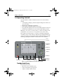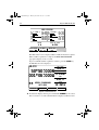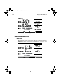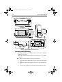
1
Distributed by Any reference to Raytheon or RTN in this manual should be interpreted as Raymarine. The names Raytheon and RTN are owned by the Raytheon Company. 81171_4.BOOK Page i Thursday, November 29, 2001 11:34 AM Raynav 300 GPS Plotter Owner’s Handbook Document Number: 81171_4 Date: 30th November 2001 81171_4.BOOK Page ii Thursday, November 29, 2001 11:34 AM 81171_4.BOOK Page iii Thursday, November 29, 2001 11:34 AM Prelim Pages iii Raynav 300 GPS Plotter Owner’s Handbook SAFETY NOTICES WARNING: NAVIGATION AID This device is intended to be used as an aid to navigation. Its accuracy can be affected by many factors, including equipment failure or defects, environmental conditions and incorrect handling or use. It is the user’s responsibility to exercise common prudence and navigational judgement. This device should not be relied upon as a substitute for such prudence and judgement. CAUTION: Do not connect/disconnect the GPS Antenna from the display unit whilst power is applied. Such action could cause irreparable damage. WAAS Satellite Differential GPS WAAS provides differential augmentation to GPS. It was designed to enhance the basic GPS service to satisfy the aviation industry’s navigation requirement for instrument flight rule navigation and landing, IFR and approach landings. WAAS has been in near continuous broadcast since December 1999 and is also available for other GPS applications such as marine navigation, surveying, agriculture and automotive systems. WAAS consists of a network of ground reference stations across the United States that monitor GPS satellite data. The master stations collect data from the reference stations and create a GPS correction message, taking into account selective availability (SA), GPS satellite orbit and clock drift, and signal delays caused by the atmosphere and ionosphere. The ‘corrected’ differential messages are then broadcast through two Geostationary Earth Orbit (GEO) satellites on the same frequency as the GPS signal. The Raymarine Raynav 300 and 301GPS receiver utilizes one of its 12 channels to ‘listen’ and decode the corrected WAAS messages. The result is a DGPS system that provides improved accuracy (<3 meters) in comparison with standard GPS (100 meters with SA, 15 m without SA) and land based DGPS (10 meters) systems. The WAAS system is shown diagrammatically in Figure i. 81171_4.BOOK Page iv Thursday, November 29, 2001 11:34 AM iv Raynav 300 GPS Plotter D4903-1 Figure i: The WAAS System Availability of the WAAS System in North America The WAAS system is presently broadcasting and being tested for aviation use. It is expected to be certified by the FAA in 2002. During this testing and certification period, continuous service is expected; however, brief signal outages may occur as refinements and upgrades are made to the system. The status of WAAS and planned outages are available on-line at the following websites: http://wwws.raytheontands.com/waas or http://www.raymarine.com Your unit is shipped from the factory in normal GPS mode. For improved accuracy provided by the WAAS system, you need to enable the WAAS capability of your unit. ➤ To enable WAAS: 1. Press the MENU key 2. Press GPS SETUP soft key 3. Press FIX MODE soft key to select SD mode. Extended Offshore Coverage Using two GEO satellites, WAAS provides augmented differential GPS coverage for most of North America. Since the WAAS differential messages are broadcast by GEO satellites, the WAAS signals cover a greater area both inland and offshore in comparison with land based DGPS systems. Coverage for North America is shown in Figure ii. 81171_4.BOOK Page v Thursday, November 29, 2001 11:34 AM Prelim Pages 135˚E 150˚E v 165˚E 180˚ 165˚W 150˚W 135˚W 120˚W 105˚W 90˚W 75˚W 60˚W 45˚W 30˚W 15˚W 0˚ 15˚E 75˚N 60˚N 45˚N 30˚N 15˚N 0˚ 15˚S D4910-1 Figure ii: WAAS Coverage Map Coverage Outside of North America Europe and Asia are developing similar systems to WAAS called EGNOS and MSAS respectively. Combined with WAAS, these systems will provide global satellite based differential GPS augmentation into the future. EGNOS is currently in the early testing and qualification phases and signal outages may occur at any time. The status of EGNOS and any planned outages are available on-line at Raymarine’s website: http://www.raymarine.com Your unit is shipped from the factory in normal GPS mode. For improved accuracy provided by the EGNOS system, you need to enable the EGNOS capability of your unit. ➤ To enable EGNOS: 1. Press the MENU key 2. Press GPS SETUP soft key 3. Press FIX MODE soft key to select SD mode. Accuracy and Continuation of Broadcast Coverage The navigational accuracy of equipment using these satellite broadcast SD signals during the testing and qualification phases is not guaranteed by Raymarine Limited or Raytheon Corporation, nor is the continuation of the broadcast SD signals the responsibility of Raymarine Limited or Raytheon Corporation. 81171_4.BOOK Page vi Thursday, November 29, 2001 11:34 AM vi Raynav 300 GPS Plotter Preface This handbook covers the Raynav 300 GPS Plotter manufactured by Raymarine. It contains important information on the installation and operation of your new equipment. In order to obtain the best results in operation and performance, please read this handbook thoroughly. Raymarine’s Product Support representatives or your authorized dealer are available to answer any questions you may have. Warranty To register your Raynav 300 GPS Plotter ownership, please take a few minutes to fill out the warranty registration card found at the end of this handbook. It is important that you complete the owner information and return the card to the factory in order to receive full warranty benefits. EMC Conformance All Raymarine equipment and accessories are designed to the best industry standards for use in the leisure marine environment. The design and manufacture of Raymarine equipment and accessories conform to the appropriate Electromagnetic Compatibility (EMC) standards, but correct installation is required to ensure that performance is not compromised. Technical Accuracy To the best of our knowledge, the information in this handbook was correct when it went to press. However, the Raymarine policy of continuous product improvement may change product specifications without notice. Consequently, unavoidable differences may occur between the product and the handbook from time to time, for which Raymarine cannot accept liability. Copyright © Raymarine Limited 2001 Raymarine® is a registered trademark of Raymarine Limited. SeaTalk® is a registered trademark of Raymarine Limited. SmartRoute is a trademark of Raymarine Limited. C-MAP® and C-MAP NT® are registered trademarks of C-Map s.r.l. 81171_4.BOOK Page vii Thursday, November 29, 2001 11:34 AM Prelim Pages vii Contents - Raynav 300 Plotter SAFETY NOTICES......................................................................... iii WAAS Satellite Differential GPS ............................................. iii Availability of the WAAS System in North America iv Extended Offshore Coverage iv Coverage Outside of North America v Accuracy and Continuation of Broadcast Coverage v Preface ........................................................................................ vi Warranty vi EMC Conformance vi Technical Accuracy vi Chapter 1: Overview .................................................................................. 1-1 1.1 Introduction..............................................................................1-1 How this Handbook is Organized ............................................1-1 1.2 Features ....................................................................................1-2 General ....................................................................................1-2 Display ....................................................................................1-2 1.3 The Plotter Display ..................................................................1-3 Plotter Functions .....................................................................1-4 1.4 Operating Controls...................................................................1-5 Trackpad and Cursor ...............................................................1-5 Dedicated Keys .......................................................................1-7 Soft Keys .................................................................................1-7 Pop-Up Menus ........................................................................1-8 Database Lists .........................................................................1-8 Chapter 2: Getting Started ....................................................................... 2-1 2.1 Introduction..............................................................................2-1 Conventions Used ...................................................................2-1 Simulator .................................................................................2-1 2.2 Power On/Off...........................................................................2-1 Changing the Lighting and Contrast ........................................2-3 2.3 Controlling the Display............................................................2-3 Selecting the Display Mode ....................................................2-4 2.4 Plotter Display Control Functions............................................2-6 Moving Around the Plotter Screen ..........................................2-6 Customizing the Display Options ...........................................2-8 Simulator Mode .......................................................................2-9 81171_4.BOOK Page viii Thursday, November 29, 2001 11:34 AM viii Chapter 3: Operation ..................................................................................3-1 3.1 Introduction..............................................................................3-1 3.2 Changing the Display Mode....................................................3-1 Data Display Pages ..................................................................3-2 GPS/Waypoint Data ................................................................3-3 Boat/Environment Data ...........................................................3-6 CDI/BDI Data .........................................................................3-9 Data Boxes ............................................................................3-10 Data Log ................................................................................3-11 3.3 Working with Waypoints........................................................3-12 Introduction ...........................................................................3-12 Placing a Waypoint ...............................................................3-13 Selecting a Waypoint .............................................................3-17 Waypoint Data Display ..........................................................3-17 Editing Waypoint Details ......................................................3-18 Erasing a Waypoint ................................................................3-19 Moving a Waypoint ...............................................................3-20 3.4 Working with Routes..............................................................3-21 Creating a New Route ............................................................3-22 Saving the Current Route ......................................................3-25 Displaying Route Information ...............................................3-26 Clearing the Current Route from the Screen ..........................3-28 Retrieve a Route from the Database ......................................3-29 Using the Route List to Erase or Name a Route .....................3-30 Editing a Route ......................................................................3-30 3.5 Following Routes and Going to Waypoints ...........................3-32 Going To an Individual Target Point ......................................3-33 Follow a Route .......................................................................3-34 Other Follow Route Options .................................................3-35 Stop Follow or Stop Goto ......................................................3-36 Target Point Arrival ...............................................................3-36 3.6 Transferring Waypoints and Routes.......................................3-37 Displayed SeaTalk Waypoints ...............................................3-37 Transferring Database Lists ...................................................3-37 3.7 Using Tracks ..........................................................................3-38 Setting Up a Track .................................................................3-39 Clearing the Current Track ....................................................3-41 SmartRoute ............................................................................3-41 Managing Tracks ...................................................................3-42 81171_4.BOOK Page ix Thursday, November 29, 2001 11:34 AM Prelim Pages ix 3.8 Man Overboard (MOB) ........................................................3-44 3.9 Alarms & Timers...................................................................3-45 3.10 Cursor Echo...........................................................................3-47 Chapter 4: Setting Up the GPS Plotter .................................................... 4-1 4.1 Introduction..............................................................................4-1 4.2 Changing the Set Up Parameters..............................................4-1 4.3 System Set Up Parameters .......................................................4-2 Bearing Mode ..........................................................................4-4 Cursor Reference .....................................................................4-4 Cursor Readout ........................................................................4-4 Day/Night ................................................................................4-4 Help .........................................................................................4-5 Soft Keys .................................................................................4-5 Key Beep .................................................................................4-5 MOB Data ...............................................................................4-5 Menu Timeout Period ..............................................................4-5 Units ........................................................................................4-5 Variation Source ......................................................................4-5 NMEA OUT Set Up ................................................................4-6 Cursor Echo .............................................................................4-6 Date and Time Settings ............................................................4-7 GPS Source .............................................................................4-7 GPS SOG/COG Filter .............................................................4-7 NMEA Input ............................................................................4-8 Language .................................................................................4-8 Simulator .................................................................................4-8 4.4 Plotter Set Up Parameters ........................................................4-8 Chart Orientation .....................................................................4-9 Waypoint Symbols ..................................................................4-9 Waypoint Numbers ..................................................................4-9 Default Waypoint Symbol .....................................................4-10 Vectors ...................................................................................4-10 Datum Selection ....................................................................4-10 4.5 GPS Set Up.............................................................................4-10 Fix Mode ...............................................................................4-11 D-GPS Set Up ........................................................................4-12 Restart GPS ...........................................................................4-13 Chapter 5: Installation .............................................................................. 5-1 5.1 Introduction..............................................................................5-1 EMC Installation Guidelines ...................................................5-1 5.2 Unpacking and Inspecting the Components ............................5-3 Items Missing? ........................................................................5-3 81171_4.BOOK Page x Thursday, November 29, 2001 11:34 AM x Registering this Product ..........................................................5-3 5.3 GPS Antenna Installation.........................................................5-4 Surface Mounting ....................................................................5-4 Pole Mounting .........................................................................5-6 5.4 Plotter Installation ....................................................................5-7 Trunnion (yoke) Mounting ......................................................5-8 Panel Mounting .......................................................................5-9 5.5 Connecting to Other Equipment.............................................5-10 5.6 Cable Running........................................................................5-11 Introduction ...........................................................................5-11 Connectors .............................................................................5-11 5.7 System Check and Initial Switch On......................................5-14 EMC Conformance ...............................................................5-14 System Check ........................................................................5-14 Initial Switch On ....................................................................5-15 Checking the Plotter Operation .............................................5-15 Chapter 6: Maintenance & Fault Finding .................................................6-1 6.1 Maintenance.............................................................................6-1 Routine Checks .......................................................................6-1 EMC Servicing and Safety Guidelines ....................................6-1 Disposal ...................................................................................6-2 6.2 Resetting the System ................................................................6-2 6.3 Problem Solving.......................................................................6-3 Appendix A: Technical Summary............................................................ A-1 Appendix B: SeaTalk and NMEA Data.....................................................B-1 Appendix C: List of Abbreviations ..........................................................C-1 GPS Antenna Mounting Template .................................... T-1 Raynav 300 GPS Plotter Mounting Template .................. T-3 Index ........................................................................................ xi 81171_4.BOOK Page 1 Thursday, November 29, 2001 11:34 AM Chapter 1: Overview 1-1 Chapter 1: Overview 1.1 Introduction This handbook describes the Raynav 300 GPS Plotter. Note: Many illustrations in this handbook show example screens. The screen you see on your display depends on your system configuration and set up options, so it may differ from the illustration. How this Handbook is Organized Chapter 1 - Overview (this chapter) provides an overview of the features and functions of the Raynav 300 GPS Plotter. You should read this chapter to familiarize yourself with the GPS Plotter. Chapter 2 - Getting Started provides an overview of the controls. It also explains how to start using the GPS Plotter. Chapters 3 - Operation provides detailed operating information for the main plotter functions - plotting waypoints and routes, following routes, using tracks, SmartRoute, Man Overboard and Data Log Mode. Chapter 4 - Setting Up the GPS Plotter provides instructions for setting up your GPS Plotter system to suit your preferences. You should read this chapter to determine how to set up your system preferences. Chapter 5 - Installation provides planning considerations and detailed instructions for installing the GPS Plotter. Chapter 6 - Maintenance & Fault Finding provides information on user maintenance and what to do if you experience problems. Appendix A lists the technical specifications for the GPS Plotter. Appendix B defines the SeaTalk and NMEA data that is transferred on integrated systems. Appendix C provides a list of abbreviations used in this handbook. An Index provides an easy lookup to specific keywords or topics. Installation Templates are included at the end of this handbook. A summary of the GPS Plotter controls and functions are provided on the Quick Reference Card supplied with your system. 81171_4.BOOK Page 2 Thursday, November 29, 2001 11:34 AM 1-2 Raynav 300 GPS Plotter 1.2 Features General The Raynav 300 GPS Plotter has a built-in GPS that provides the following navigational signals: • • • Satellite Differential GPS (eg, WAAS). Ground based Differential GPS, when used with an additional RTCM beacon receiver. Standard GPS. These are listed in order of accuracy and their availability is dependent upon your location. The Raynav 300 GPS Plotter uses the best available signal to provide optimum accuracy. The Raynav 300 GPS Plotter is waterproof to CFR46 and can be installed either above or below deck. The unit comprises • • Low profile antenna 4½ in. LCD display comprising: • Eight dedicated (labelled) control keys • Four soft keys with labels displayed on-screen • Trackpad The display and keys can be illuminated for night-time use. Display • • • • Computes position information from SDGPS, DGPS or GPS Displays and transmits SeaTalk and NMEA data Cursor echo across SeaTalk Choice of orientation: Head Up, Course Up and North Up Display Modes The GPS Plotter can display data in the following modes, cycled through by means of the DISPLAY key: • • • • • • • Default GPS/Waypoint display Boat Data (three pages) / Environment Data (two pages) Bearing & Distance Indicator (BDI) / Course Deviation Indicator (CDI) Data Boxes Data Log Plotter display Return to default GPS/Waypoint display 81171_4.BOOK Page 3 Thursday, November 29, 2001 11:34 AM Chapter 1: Overview 1-3 Those modes containing more than one page of data provide additional soft keys giving access to the sub-sets of data within each group, each cycled through with the associated soft key. 1.3 The Plotter Display When a position fix has been established, your vessel’s position, if on screen, is shown as a boat shape, pointing in the direction of the current heading (or COG if heading data is not available). If no heading or COG data is available, the vessel is shown as a circle. A status bar at the top of the screen displays the scale, with either cursor position, range and bearing or, when the cursor is homed (locked) to the vessel (by pressing FIND SHIP), vessel position, Speed Over Ground (SOG) and Course Over Ground (COG). Note: When the cursor is homed, it is ‘locked’ to the vessel and moves with it. The screen is automatically panned to keep the vessel and cursor in such a position that they are 10% from the edge of the window with the heading vector (be it shown or not) passing through the center of the window. The current route is shown and any waypoints you have placed are displayed (unless you set them to off in Set Up). Information can be viewed on-screen by positioning the cursor over a waypoint, current route or track. Functions are available to control the display as follows: • • • Zoom in/out Pan the Display Centre the Chart on the Vessel 81171_4.BOOK Page 4 Thursday, November 29, 2001 11:34 AM 1-4 Raynav 300 GPS Plotter Plotter Functions Display Functions The Raynav 300 GPS Plotter includes the following functions: • • • • • • • • • Place, Move, Erase and Edit a Waypoint Goto Waypoint or Cursor Create, Save, Name, Edit and Follow a Route Review Route and Waypoint Lists Display vessel’s track; Save and Name the Track for re-call to screen Use SmartRoute to make the current track into a route Set Up Alarms and Timers Man OverBoard (MOB) to navigate back to a missing person or object Data Log display GPS Data Pages Amongst a number of information pages, the GPS Data pages provide a series of four textual displays, selected by the associated soft key. These provide essential information associated with plotting a course for your vessel. • • • • • • • • • Fix status Steering Indication Position Latitude/Longitude Waypoint Bearing and Range Course Over Ground (COG) Speed Over Ground (SOG) Current Time Sunrise and Sunset Times Twilight Times The range of pages is detailed in Selecting the Display Mode on page 2-4. The complete range of pages is described fully in Data Display Pages on page 3-2. 81171_4.BOOK Page 5 Thursday, November 29, 2001 11:34 AM Chapter 1: Overview 1-5 1.4 Operating Controls Operation utilizes a number of buttons and on-screen controls. These include: • • • • • A trackpad providing up, down, left, right and diagonal control of an on-screen cursor. Eight dedicated (labelled) control keys. Four soft keys with labels displayed on screen. Pop-up menus, displayed on-screen, from which options are selected. Database lists, displayed on-screen, which enable editing of items. Note: The cursor is the cross-hair symbol (+) visible on the display. The trackpad moves the cursor to select a position or item on the chart. The controls are shown in Figure 1-1. They are back-lit for night-time use. When you use certain controls, a help message is displayed at the top of the screen (unless you switch help off as described in Chapter 4). The following paragraphs describe the controls and on-screen facilities. Cursor Status Bar DISPLAY key MARK key RANGE key ALARMS key Trackpad MENU key D4925_2 CLEAR key POWER key Soft keys Soft key labels Figure 1-1: Raynav 300 GPS Plotter Operating Controls Trackpad and Cursor The trackpad is used to: • • • Move the cursor around the screen Select an item from a pop-up menu Adjust a variable soft key control ENTER key 81171_4.BOOK Page 6 Thursday, November 29, 2001 11:34 AM 1-6 Raynav 300 GPS Plotter The cursor is used to: • • • • Select a position on the screen. Select and, if valid, move an item, e.g. a waypoint, on the screen. Select an area of the screen to zoom into. Pan the display. Moving the Cursor Press the corresponding edge of the trackpad to move the cursor horizontally, vertically or diagonally; the longer you press, the faster the cursor moves. The current cursor position is shown in the Status Bar at the top of the display. Note: When certain menus and soft keys are displayed, the cursor is not active. If you find that you cannot move the cursor, it may be because the unit is in one of these modes. Press CLEAR (repeatedly) until the default soft keys are displayed; the cursor should then respond. Context-Sensitive Cursor Control The cursor is context-sensitive. Some items on the screen, such as waypoints and chart objects have information associated with them. When you place the cursor over such objects, the information is displayed in a pop-up box. In addition, soft keys are displayed for certain items. For example, when you place the cursor over a waypoint, the waypoint data is displayed in a pop-up box and the waypoint soft keys are displayed. When the cursor is positioned over special features on the display a text label appears below the cursor, identifying the feature as follows: Text Label Feature BOX Data box (any type) MOB Man Over Board marker WPT Chart Waypoint COG Course Over Ground vector HDG Heading vector POS Vessel’s position RTE Route leg TIDE Tide vector 81171_4.BOOK Page 7 Thursday, November 29, 2001 11:34 AM Chapter 1: Overview 1-7 Dedicated Keys The dedicated keys: DISPLAY, MARK, RANGE, ALARMS, ENTER, CLEAR, MENU and POWER have fixed functions. Some keys can be used in two ways: • • Press: Press the key momentarily and then release it. This method is used for most key operations. Press and hold: Press the key and hold it down for the length of time stated (for example, 3 seconds), then release it. When you press a dedicated key, one of the following happens: 1. The associated operation is actioned, eg. change chart scale (RANGE). 2. A pop-up menu is displayed, providing further options. 3. A set of soft keys is displayed, providing further functions. As you press a key, a single audio beep confirms the key action. If the key-press is invalid for the current screen or mode, three rapid beeps sound. If required, you can turn these sounds off as part of your set up procedure (see System Set Up Parameters on page 4-2). Soft Keys The four keys below the screen are called soft keys because their functions change according to the operation. The soft keys are grouped into related sets and subsets providing access to the various functions. The soft key labels are displayed on the screen just above the keys. The default soft keys are displayed until you press a key, or select an item on the screen; the soft keys associated with the action are then displayed as shown in Figure 1-2. ROUTE GOTO SCREEN FIND SHIP D4897-1 Figure 1-2: Default Soft Keys Note: If the key text is greyed out, it is not currently available. When you press a soft key, one of the following happens: 1. The associated operation is actioned. 2. A sub-set of soft keys is displayed, providing further functions. 3. A pop-up menu is displayed, providing further options. As with dedicated keys, soft key operations are confirmed (or denied) by key beeps, see Dedicated Keys above. 81171_4.BOOK Page 8 Thursday, November 29, 2001 11:34 AM 1-8 Raynav 300 GPS Plotter Pop-Up Menus Pop-up menus usually provide set up options. When a pop-up menu is on-screen, a set of associated soft keys is also displayed as shown in Figure 1-3. ALARMS SET UP ARRIVAL ALARM OFF TRACK ALARM ANCHOR ALARM COUNTDOWN TIMER ALARM CLOCK 0.01nm ON OFF 00:10:00 OFF SELECT DISTANCE ALARM OFF ON D4898_2 Figure 1-3: Typical Pop-up Menu Use the trackpad to select an option from the menu, then use the appropriate soft key to set the option. For example, you can toggle the ANCHOR ALARM on/off using the soft keys. Database Lists The waypoints, routes and tracks created on the display unit are stored in database lists. You can view these lists and select items for editing as shown in Figure 1-4. WAYPOINT LIST SYMBOL POSITION NAME WPT 001 WPT 002 WPT 003 WPT 004 N 50°50^000 W 001°06^000 BRG 348°m RNG TEMP DATE 20°C 23/11/01 DEPTH 12.3m TIME 08:45:12 GOTO WAYPOINT EDIT WAYPOINT 1.00nm MAKE NEW WAYPOINT WAYPOINT TRANSFER D4906-2 Figure 1-4: Typical Waypoint List As with pop-up menus, when a database list is on-screen, a set of associated soft keys is also displayed. Use the trackpad to select an item from the list, then use the appropriate soft key to select the function. 81171_4.BOOK Page 1 Thursday, November 29, 2001 11:34 AM Chapter 2: Getting Started 2-1 Chapter 2: Getting Started 2.1 Introduction This chapter provides information, instructions and a simple familiarization exercise in using the display. Operating information is detailed in Chapter 3. Conventions Used Throughout this handbook, the dedicated (labelled) keys are shown in bold capitals; for example, ENTER. The soft key functions, menu names and options are shown in normal capitals; for example, SCREEN. Operating procedures, which may consist of a single key-press or a sequence of numbered steps, are indicated by a ➤ symbol in the margin. Simulator The plotter display unit includes a Simulator mode, which allows you to practice operating your plotter without data from a GPS antenna. You will need to use the set up options to switch the display unit to Simulator mode, see Section 2.2, Power On/Off. You can use it in either of two ways: • • Before the plotter has been installed on your vessel. In this case, you only need to connect the plotter display unit to a 12V DC power supply, fused at 1A, connecting the red core from the power lead to positive (+) and the black core to negative (-); see Cable Running on page 5-11 for full details. After the plotter has been installed on your vessel, but while in the marina or at anchor. 2.2 Power On/Off ➤ To turn the display unit on, press the POWER key. The keys light up and the introductory logo is displayed. The GPS Status screen is displayed as shown in Figure 2-1. 81171_4.BOOK Page 2 Thursday, November 29, 2001 11:34 AM 2-2 Raynav 300 GPS Plotter GPS STATUS SAT SIGNAL STATUS SAT SIGNAL STATUS LOCKED 23 LOCKED 15 IN USE 18 IN USE 09 IN USE 26 IN USE 08 LOCKED 12 LOCKED 10 LOCKED 14 LOCKED 20 LOCKED 03 LOCKED 17 FIX MODE GPS D SD HDOP FIX STATUS 1.0 D-FIX D-GPS SET UP RESTART GPS D5551_1 Figure 2-1: GPS Status Screen The GPS Status screen is displayed until a satellite fix has been acquired. When satellite acquisition is complete, the READY FOR NAVIGATION pop-up box displays for two seconds. To proceed whilst satellite acquisition continues, press the CLEAR key; the GPS Data Screen is displayed. WPT BRG SD-FIX 320°M 50°50^000N 001°06^000W WPT RNG 0.55nm COG 050°M SOG STEER STARBOARD WPT 004 ROUTE GOTO 12.0kts GPS DATA WPT DATA D4936-1 Figure 2-2: GPS Data Screen ➤ To switch the display unit off, press and hold the POWER key for at least three seconds. A 3-second countdown timer is displayed; when it reaches 81171_4.BOOK Page 3 Thursday, November 29, 2001 11:34 AM Chapter 2: Getting Started 2-3 zero the display and key backlights extinguish. If the POWER key is released within this period, power-down is cancelled. Changing the Lighting and Contrast You can change the level of backlighting and contrast for the screen and keys. The key backlighting always retains a minimal level to enable the keys to be seen at night. ➤ To change the lighting and contrast: 1. Press the POWER key to display the lighting controls (Figure 2-3). ON 42% 60% LIGHT CONTRAST D4927_1 Figure 2-3: Lighting Controls 2. Use the LIGHT soft key or trackpad left/right to select LIGHT control. • Use the LIGHT soft key to toggle lighting ON/OFF. • Use trackpad up/down to select lighting level (eight levels). 3. Press the CONTRAST soft key, or trackpad left/right, to select the CONTRAST control. Adjust the contrast setting in the same way as for the lighting (100 contrast levels). 4. Press ENTER to remove the soft key sliders and return to the default screen, with the new lighting and contrast levels retained. When the display unit is switched on, screen lighting is restored to ON if it was ON previously. Whilst the unit is switched on, the chosen lighting level is retained until it is reset. The new contrast level is retained until it is reset, even after power-off, unless it has been set either very low or very high; in this case, the contrast will be restored on power-up as follows: • • Contrast set <30% restored to 30% Contrast set >70% restored to 70% Note: Factory default settings are LIGHT OFF and CONTRAST 50%. 2.3 Controlling the Display The display is controlled by means of the cursor and control keys. Most plotter operations are started from the default soft keys displayed in the plotter screen (Figure 2-4). 81171_4.BOOK Page 4 Thursday, November 29, 2001 11:34 AM 2-4 Raynav 300 GPS Plotter ROUTE GOTO SCREEN FIND SHIP D4897-1 Figure 2-4: Default Soft Keys On completion of an action using the soft keys, press CLEAR to return to the default screen; you may need to press CLEAR several times to back-track through the soft key hierarchy. Note: If you have set up your system so that the default soft keys are not permanently displayed, press any soft key to display the labels. Selecting the Display Mode The DISPLAY key is used to select the desired display mode. The following modes can be selected. ➤ Select the following modes by repeat presses of the DISPLAY key (Figure 2-5): • GPS/Waypoint display • Boat Data (three pages)-Environment Data (two pages) • Course Deviation Indicator (CDI)-Bearing/Distance Indicator (BDI) • Data Boxes • Data Log • Plotter display • Return to GPS/Waypoint display The complete ranges of pages available in Boat and Environment Data modes are described in Chapter 3. 81171_4.BOOK Page 5 Thursday, November 29, 2001 11:34 AM Chapter 2: Getting Started 2-5 Press POWER ... after preliminary displays, the default display is shown OWN POS XTE XTE SD-FIX SD-FIX SD-FIX SD-FIX SD-FIX SD-FIX GPS data SD-FIX Waypoint data 320°M XTE WPT BRG WPT RNG WPT BRG WPT BRG 0.55nm 352°M COG SOG WPT RNG 050°M SOG 0.55nm SOG STEER STARBOARD COG SOG WPT DATA WPT 004 12.0kts SOG WPT DATA 050° SOGM WPT DATA GPS DATA 50°50^000W 001°06^000W Press DISPLAY to return to GPS/Waypoint Data STEER STARBOARD WPT 004 ROUTE GOTO Press DISPLAY to show Boat/Environment Data SOG WPT DATA WPT ktsDATA WPT DATA 12.0 GPS DATA WPT DATA WIND WIND APPARENT WIND TRUE WIND SD-FIX SD-FIX Boat data SD-FIX Environment data 6nm CSR 50°50^05W POS 001°06^00W WPT BRG WPT BRG WPT RNG WPT BRG DEPTH 12.5M 320°M SPEED 11kts DEPTH 12.5m 0.55050°M nm SOG 23.4kn COG 234°M WPT RNG COG SOG 11 SOG COG STEER STARBOARD WPT 004 kts 050°SOG M SPEED SOG WPT DATA SOG WPT DATA GPS DATA STEER STARBOARD WPT 12.0 ktsDATA WPT DATA WPT 004 ROUTE GOTO Press SCREEN DISPLAY FIND SHIP ROUTE GOTO Press Note: In any display mode press DISPLAY key for 2 seconds to return to default display. to show Plotter Display BOAT DATA ENVIROMNT DISPLAY to show CDI or BDI XTE 225°T TIME POSITION 09:00 20/12 09:30 20/12 10:00 20/12 50°50^000N 001°06^000W 50°51^000N 001°07^000W 50°52^000N 001°08^000W CMG DMG 239°m 40 4.8nm 241°m 5.2nm 240°m 4.5nm XTE 40 355°T 0.05nm WPT BRG 0.05nm 300°T 30 30 WPT BRG 20 nm 20 10 10 WPT RNG 300°T23.2nm nm WPT RNG TTG STEER STARBOARD 23.2nm04h WPT 004 ROUTE GOTO STOP LOG STEER STARBOARD WPT 004 CLEAR LOG ROUTE Press DISPLAY to show Data Log WPT RNG WPT BRG PILOT 28.7nm 124°T MANUAL TIME SPEED COG 10:40:18 17kts 124°T DEPTH POSITION 50°50^000N 001°06^000W 15.1kts 36.5ft ROUTE SOG GOTO Figure 2-5: Display Modes GOTO CDI BDI TTG 04h:12m 12m BDI BDI Press DISPLAY to show Data Boxes D4964-2 81171_4.BOOK Page 6 Thursday, November 29, 2001 11:34 AM 2-6 Raynav 300 GPS Plotter 2.4 Plotter Display Control Functions You will normally operate the GPS Plotter with the display showing one of the Navigation Data pages. The range of pages is listed in Selecting the Display Mode on page 2-4 and illustrated in Figure 2-5. The complete range of pages is described fully in Data Display Pages on page 3-2. Moving Around the Plotter Screen When using the plotter screen, the default orientation is North-Up, where the vessel moves across the screen. You will need to pan the display if your vessel moves out of the current area, or if you wish to examine or place waypoints in another area. Alternatively, you can home the cursor onto the vessel using FIND SHIP. There are four ways in which you can move around the display: • • • • Use the trackpad to pan the display. Automatically home (re-center) the vessel using the FIND SHIP soft key. Use the context-sensitive cursor to change the display center. Change the display scale to zoom out and in to a new area centered on the cursor position. This method is useful if the area you wish to see is a long distance away. Panning the Display Panning the display is useful if the area you wish to see is only just off the screen. ➤ Use the trackpad to move the cursor to the edge of the display; the display will pan across. Using FIND SHIP FIND SHIP is used to center the vessel on the screen, even if it is currently off screen: ➤ Press the FIND SHIP soft key; the following actions occur: • • • • The display is re-drawn with the vessel’s position in the center. The cursor is homed (locked) to the vessel’s position and moves with it. When the vessel moves near the edge of the screen, the display is redrawn to place the vessel and cursor at the center. Whilst homed, the status bar indicates vessel position, speed and course over ground. 81171_4.BOOK Page 7 Thursday, November 29, 2001 11:34 AM Chapter 2: Getting Started 2-7 ➤ To release the cursor from homed mode, use the trackpad to move the cursor away from the vessel’s current position. The status bar shows the current cursor position, bearing and range. The cursor no longer moves with the vessel and no redraw occurs if the vessel moves off screen. Changing the Display Center You can move the area of the display center using the context-sensitive cursor. This allows you to center your vessel in the center of the screen, or to move the display so that your vessel is displayed off-center anywhere on the screen. ➤ To move your vessel’s position off-center: 1. Move the cursor over your vessel’s position until the letters POS are displayed. 2. Press ENTER to take control of the vessel’s position. The letters POS are now in inverse video and the cursor symbol has changed to a four-way arrow. This indicates that the cursor can be used to move the display in any direction. 3. Use the trackpad to move the cursor to the required position. 4. Press ENTER to select the position and return to normal cursor control. The display is redrawn with the vessel’s position at the cursor. Alternatively, you can press CLEAR to abandon the move and leave the display (and vessel) in its former position. ➤ To center the display: 1. Use the trackpad to move the cursor to the vessel’s position. The cursor text POS is displayed. 2. Press CLEAR. The display pans to show your vessel’s position is in the center of the screen. Changing the Display Scale The RANGE key allows you to change the display scale so that you can see a smaller or larger area on the screen. You can change the display scale: • To see either a larger scale (of a smaller area) or a larger area (at a smaller scale) on the screen. • To move the display to another area, by zooming out to a smaller scale, then zooming in on another position centered on the cursor. Each time you press the RANGE key, the display scale changes to the next available setting. The status bar, shown in Figure 2-6, indicates the distance from top to bottom of the screen, in nautical miles. 81171_4.BOOK Page 8 Thursday, November 29, 2001 11:34 AM 2-8 Raynav 300 GPS Plotter 6nm VES 43°27^05N POS 001°02^83W SOG 23.4kts COG 234°M D4902-1 Figure 2-6: Status Bar ➤ To change the scale rapidly, press and hold top or bottom of the RANGE key. The distance indicator at the left-hand side of the status bar is updated whenever you change the display scale. ➤ To zoom in to a larger-scale (more detailed) display: 1. Use the trackpad to position the cursor in the area you wish to see in larger scale. 2. Press the bottom of the RANGE key to zoom into the area. The display, centered on the cursor, is enlarged to show a larger scale and the distance indicated in the status bar is updated. ➤ To zoom out to a smaller-scale (less detailed) display, press the top of the RANGE key as many times as required, up to the maximum scale of 1200nm. Customizing the Display Options The SCREEN soft key enables the following screen display options to be set on or off: • Cursor Box (CRSR BOX) • Grid (GRID) • Personalized (CUSTOM) The factory default for these options is ON. Switching the Cursor Data Box On/off The cursor data box provides the cursor’s position in latitude/longitude and/or bearing/range.To see a full image, switch the data box off. ➤ To control the cursor data box: 1. Press the SCREEN soft key. 2. Press the CRSR BOX soft key to toggle the setting between ON and OFF. To return to the default soft key display, press CLEAR. ➤ To move the cursor box: 1. Use the trackpad to position the cursor over the box until the letters BOX are displayed. 2. Press ENTER to take control of the box, use the trackpad to move it to the required position and press ENTER again. 81171_4.BOOK Page 9 Thursday, November 29, 2001 11:34 AM Chapter 2: Getting Started 2-9 Switching Grid On/off The Plotter display can be set to show grid lines of latitude and longitude which can help determine position. ➤ To turn the grid on or off: 1. Press the SCREEN default soft key. 2. Press the CHRT GRID soft key to toggle the setting ON and OFF. 3. To return to the default soft key display, press CLEAR. Simulator Mode When simulator mode is started, your initial simulated position is wherever the cursor was last positioned. To practice using the Plotter in a particular area, use the trackpad to pan to that area, then switch simulator ON. A data box indicating SIMULATOR ON is displayed in the center of the screen (this may obscure the cursor; if necessary use the trackpad to move the cursor into view). You can use the context-sensitive cursor to move this box Note: If you use FIND SHIP when in Simulator mode, the Status Bar at the top of the screen shows SIM FIX. If real position data is available (via GPS) and the simulator is active, simulated data takes precedence. On power-up the simulator defaults to its previous setting at last power-down. Care should be taken to determine desired mode on power-up. Simulated data should never be used for navigational purposes. Any waypoints placed on the plotter in simulator mode are retained in the Waypoint List and are available for use in routes. ➤ To view a simulated display: 1. Press MENU followed by the SYSTEM SET UP soft key. The System Set Up menu pop-up is displayed. 2. Use the trackpad up/down to move the selection bar over the option SIMULATOR. The simulator soft keys are displayed. 3. Press the ON soft key to start simulation. 4. Press ENTER twice to return to the default display. 81171_4.BOOK Page 10 Thursday, November 29, 2001 11:34 AM 2-10 Raynav 300 GPS Plotter 81171_4.BOOK Page 1 Thursday, November 29, 2001 11:34 AM Chapter 3: Operation 3-1 Chapter 3: Operation 3.1 Introduction This chapter explains how to navigate with the Raynav 300 GPS Plotter. It covers the following topics: • • • • • • • • • Controlling waypoints, including placing, moving, editing and deleting waypoints. Changing the display mode. • Using a range of data pages to display navigation data. • Maintaining a Data Log of Time, Position, Course Made Good (CMG) and Distance Made Good (DMG). Working with waypoints and routes, including creating a new route, managing routes using the Route List and editing routes. Following routes and going to waypoints. Transferring waypoints and routes Using tracks, including showing tracks, track set up, saving tracks and converting a track to a route (SmartRoute). Using the Man Overboard (MOB) feature. Setting up Alarms and Timers. Cursor echo from other equipment. CAUTION: The GPS Plotter makes it easy to place a waypoint and travel towards it. However, you should always check first that the route is safe. When using the GPS Plotter in combination with a SeaTalk autopilot, the autopilot will prompt for confirmation before it steers the vessel towards the waypoint. 3.2 Changing the Display Mode The DISPLAY key is used to select the desired screen mode. The following modes can be selected: • • • • • • • Default GPS/Waypoint display Boat Data (three pages) / Environment Data (two pages) Course Deviation Indicator (CDI)/Bearing & Distance Indicator (BDI) Data Boxes Data Log Plotter display Return to default GPS/Waypoint display 81171_4.BOOK Page 2 Thursday, November 29, 2001 11:34 AM 3-2 Raynav 300 GPS Plotter The modes that contain more than one page of data provide additional soft keys which cycle through the pages. The highlighted soft key indicates the screen mode currently displayed. Note: Press the DISPLAY key for at least two seconds in any display mode to return to the GPS/Waypoint display. Data Display Pages In all graphical display pages, the steering instruction is STEER STARBOARD if the XTE is 0.01nm or more to port, STEER PORT if the XTE is 0.01nm or more to starboard or ON COURSE if XTE is less than 0.01 on either side. If no Goto or follow is in progress, the steering instruction is NOT FOLLOWING and no steering arrows are shown. The arrows either side of the steering instruction and pointing towards it are dependent on the XTE. The first arrow is shown when the difference reaches 0.01nm and the second at 0.05nm. Textual data provides Position, SOG, COG, Bearing and Range to waypoint, Time and Date, Time To Go (TTG), Steering Indicator, Sunrise, Sunset, Fix Status and XTE. Any unavailable data is replaced by dashes, one per character. When there is no GPS fix but there is a value for the last fix, this is shown instead. The waypoint name is shown unless there is no target, in which case NOT FOLLOWING is shown. If Goto cursor is in progress, GOTO CURSOR is shown. The FIX status indicates D-FIX for a differential fix, SD-FIX for a satellite differential fix, FIX for a GPS or other Fix, or NO FIX where a fix has not been acquired. If the simulator is ON, the word SIMULATOR appears after the fix status. BRG, RNG and XTE data relate to the target waypoint. Time refers to local time zone which is set in the System Set Up menu, see Chapter 4. The Time To Go (TTG) and Estimated Time of Arrival (ETA) data relate to the target waypoint (not the whole route) and are based on the Speed Over Ground (SOG) towards the target. If the Velocity Made Good (VMG) is negative, or data is not available, these fields are replaced by dashes, one per character. Sunrise and Sunset times are for today and at the vessel’s position. 81171_4.BOOK Page 3 Thursday, November 29, 2001 11:34 AM Chapter 3: Operation 3-3 GPS/Waypoint Data GPS Data The GPS Data display comprises four text data pages, selected in turn by the GPS DATA soft key. These pages are shown in Figure 3-1 to Figure 3-4. WPT BRG SD-FIX 320°M 50°50^000N 0.55 001°50^000W 050° WPT RNG nm COG STEER STARBOARD WPT 004 ROUTE GOTO M SOG 12.0kts GPS DATA WPT DATA D4936-2 Figure 3-1: GPS Data Page #1 WPT BRG SD-FIX 320°M SOG 12.5kts COG 320°M WPT RNG 0.55nm POSITION 50°50^000N 001°06^000W TIME STEER STARBOARD WPT 004 ROUTE GOTO 12:34:00 GPS DATA WPT DATA D4937-2 Figure 3-2: GPS Data Page #2 81171_4.BOOK Page 4 Thursday, November 29, 2001 11:34 AM 3-4 Raynav 300 GPS Plotter WPT BRG SD-FIX 320°M 12:34:00 23/02/00 0.55nm WPT 004 12.0kts WPT RNG COG 050°M STEER STARBOARD ROUTE GOTO SOG GPS DATA WPT DATA D4938-2 Figure 3-3: GPS Data Page #3 TWILIGHT SD-FIX 12:34:00 23/02/00 05:30 WPT 004 18:54 SUNRISE 06:43 SUNSET 18:00 STEER STARBOARD ROUTE GOTO TWILIGHT GPS DATA WPT DATA D4939-2 Figure 3-4: GPS Data Page #4 81171_4.BOOK Page 5 Thursday, November 29, 2001 11:34 AM Chapter 3: Operation 3-5 Waypoint Data The Waypoint Data display comprises three data pages, selected in turn by the WPT DATA soft key. These pages are shown in Figure 3-5 to Figure 3-7: XTE SD-FIX 320°M RNG 0.55nm BRG STEER STARBOARD WPT 004 ROUTE GOTO 0.06nm TTG 01h:00m COG 050°M SOG 12.0kts GPS DATA WPT DATA D4940-2 Figure 3-5: Waypoint Data #1 XTE SD-FIX 320°M RNG 0.55nm BRG 0.06nm TTG 01h:00m ETA 13:34:00 TIME STEER STARBOARD WPT 004 ROUTE GOTO 12:34:00 GPS DATA WPT DATA D4941-2 Figure 3-6: Waypoint Data #2 81171_4.BOOK Page 6 Thursday, November 29, 2001 11:34 AM 3-6 Raynav 300 GPS Plotter OWN POS SD-FIX 320°M RNG 0.55nm BRG STEER STARBOARD WPT 004 ROUTE GOTO 50°50^000N 001°06^000W WPT POS 50°50^000N 001°06^000W COG 050°M SOG 12.0kts GPS DATA WPT DATA D4942-2 Figure 3-7: Waypoint Data #3 Boat/Environment Data Boat Data The Boat Data display comprises three data pages, selected in turn by the BOAT DATA soft key. These pages are shown in Figure 3-8 to Figure 3-10: WPT BRG SD-FIX 12.5m SPEED 11kts DEPTH STEER STARBOARD WPT 004 ROUTE GOTO 320°M WPT RNG 0.55nm COG 050°M SOG 12.0kts BOAT DATA ENVIROMNT D4943-2 Figure 3-8: Boat Data #1 81171_4.BOOK Page 7 Thursday, November 29, 2001 11:34 AM Chapter 3: Operation 3-7 WPT BRG SD-FIX 320°M 12.5M TEMP 11°C WPT RNG DEPTH STEER STARBOARD WPT 004 ROUTE GOTO 0.55nm COG 050°M SOG 12.0kts BOAT DATA ENVIROMNT D4944-2 Figure 3-9: Boat Data #2 PILOT SD-FIX 325°M LOCK 323°M HDG STEER STARBOARD WPT 004 ROUTE GOTO AUTO RUDDER --COG 050°M XTE 0.05nm BOAT DATA ENVIROMNT D4945-2 Figure 3-10: Boat Data #3 81171_4.BOOK Page 8 Thursday, November 29, 2001 11:34 AM 3-8 Raynav 300 GPS Plotter Environment Data The Environment Data display comprises two data pages, selected in turn by the ENVIRONMT soft key. These pages are shown in Figure 3-11 and Figure 3-12. WIND WIND (TRUE) 105°STBD 32.0 kts STEER STARBOARD WPT 004 ROUTE GOTO SSW 7 RUDDER --COG 050°M HEADING 320°M BOAT DATA ENVIROMNT D4946-2 Figure 3-11: Environment Data #1 WIND WIND (APP) 105°STBD 32.0 kts STEER STARBOARD WPT 004 ROUTE GOTO SSW 7 RUDDER --COG 050°M HEADING 320°M BOAT DATA ENVIROMNT D4947-2 Figure 3-12: Environment Data #2 81171_4.BOOK Page 9 Thursday, November 29, 2001 11:34 AM Chapter 3: Operation 3-9 CDI/BDI Data The Course Deviation Indicator (CDI) / Bearing Deviation Indicator (BDI) display comprises two data pages, selected alternately by the CDI and BDI soft keys. These pages are shown in Figure 3-13 and Figure 3-14: CDI Data The CDI display shows Cross Track Error (XTE) and Distance to Waypoint presented in a ‘runway’ format as shown in Figure 3-13: XTE 355°T 0.05nm WPT BRG 300°T WPT RNG 23.2nm TTG STEER STARBOARD WPT 004 ROUTE GOTO CDI 04h:12m BDI D4932-2 Figure 3-13: CDI Display The ‘runway’ represents a 0.3nm width with the vessel symbol shown at the bottom. Individual text boxes show Cross Track Error (XTE), Bearing to Waypoint, Distance to Waypoint and Time to Go (TTG). TTG is calculated on the basis of distance to destination and Velocity Made Good (VMG) towards destination. At waypoint ranges greater than 4nm, the symbol remains at the top of the screen. As the waypoint range falls below 4nm, the symbol moves down the centre line. The checkered pattern moves down the screen to simulate movement when SOG is greater than 2 knots (0.5knots if D-FIX or SD-FIX). BDI Data The BDI graphical display shows deviation from the Bearing to Waypoint and Distance to Waypoint as shown in Figure 3-14. Individual text boxes show Cross Track Error (XTE), Bearing to Waypoint, Distance to Waypoint, Time to Go (TTG). TTG is calculated on the basis 81171_4.BOOK Page 10 Thursday, November 29, 2001 11:34 AM 3-10 Raynav 300 GPS Plotter of distance to destination and Velocity Made Good (VMG) towards destination. XTE 225°T 0.05nm 40 WPT BRG 40 30 300°T 30 WPT RNG 20 20 nm 23.2nm nm 10 10 TTG STEER STARBOARD WPT 004 ROUTE GOTO 04h:12m CDI BDI D4933-2 Figure 3-14: BDI Display The line to the waypoint symbol is shown at an angle equal to the difference between the COG and the Bearing to Waypoint to a maximum of ±15°. The waypoint symbol is the symbol of the target waypoint as shown on the display. Four range arcs are shown with automatic scaling to provide 0.4nm, 1nm, 5nm, 10nm, 25nm, 50nm, 100nm, 200nm, 400nm, 1000nm, 2000nm and 4000nm range scales. In each case the range scale has graduations at ¼, ½ and ¾ of the current scale. Data Boxes The Data Boxes display is shown in Figure 3-15. WPT RNG WPT BRG PILOT 28.7nm 124°T MANUAL TIME SPEED COG 10:40:18 17kts 124°T DEPTH POSITION 50°50^000N 001°06^000W SOG 36.5ft ROUTE 15.1kts GOTO D4934-2 Figure 3-15: Data Boxes Screen 81171_4.BOOK Page 11 Thursday, November 29, 2001 11:34 AM Chapter 3: Operation 3-11 Data Log The GPS Plotter can be set to log passage data every 30 minutes. Up to 48 log entries are held. When 48 entries have been saved, the first entries start being overwritten. If the number of log entries exceeds the table size, use the trackpad up/down to scroll the list and view further log entries. Each line in the log shows: • • • • Time of log entry Position at time of log entry Course Made Good (CMG) since last log entry Distance Made Good (DMG) since last log entry You can stop the log at any time and you can clear the log from memory. ➤ To use Data Log Mode: 1. Press DISPLAY repeatedly until the Data Log table is displayed. 2. Press the START LOG soft key to start logging; the START LOG soft key changes to STOP LOG. At 30 minute intervals, the current time, vessel’s position, distance made good (DMG) and course made good (CMG) are recorded as shown in Figure 3-16. TIME POSITION CMG DMG 09:00 20/12 09:30 20/12 10:00 20/12 50°50^000N 001°06^000W 50°51^000N 001°07^000W 50°52^000N 001°08^000W 239°m 4.8nm 241°m 5.2nm 240°m 4.5nm ROUTE GOTO STOP LOG CLEAR LOG D4924-1 Figure 3-16: Data Log Screen 3. Press the STOP LOG soft key to stop logging. 4. Press the CLEAR LOG soft key to clear all log entries. 81171_4.BOOK Page 12 Thursday, November 29, 2001 11:34 AM 3-12 Raynav 300 GPS Plotter 3.3 Working with Waypoints Introduction You can place up to 998 waypoints on the GPS Plotter. A waypoint is a position entered on the display as a reference or destination point. All waypoints placed on the GPS Plotter are stored in a waypoint database list which includes symbol, position, bearing, range and additional data. All waypoints in the database are displayed on the plotter screen, unless you set waypoint display off in the Set Up menu, as described in Plotter Set Up Parameters on page 4-8. You can select a waypoint, either graphically or from the Waypoint List, for editing. The waypoint can be placed either at the current cursor position or numerically at the current vessel’s position. Waypoints can also be entered manually as either Lat/Long coordinates or Loran TDs which are automatically converted to Lat/Long coordinates. A waypoint placed at the vessel’s position includes additional information (if available) providing depth, temperature and time when it was placed. Any type of waypoint can be included in a route. Note: You can place waypoints before you install the GPS Plotter on your vessel. When a new waypoint is placed, it uses either the factory default symbol (a cross) or an alternative symbol available from the Set Up menu, see Plotter Set Up Parameters on page 4-8. The waypoint is added to the Waypoint List and tagged with the next available number. The waypoint’s symbol and name can be edited at any time. When the cursor is positioned over a waypoint, the waypoint bearing and range are displayed in a pop-up box. Waypoints in the current route are available on other SeaTalk instruments that support current route transfer, for example, an ST80 Masterview. You can also transfer waypoints between the GPS Plotter and other NMEA or SeaTalk instruments using the Waypoint Transfer functions. This section explains how to perform the following tasks using the on-screen cursor and the waypoint list: • • • • • • Placing a Waypoint Selecting a Waypoint Displaying Waypoint data Editing a Waypoint (symbol, name & position) Erasing a Waypoint Moving a Waypoint 81171_4.BOOK Page 13 Thursday, November 29, 2001 11:34 AM Chapter 3: Operation 3-13 Placing a Waypoint ➤ To access the Place Waypoint soft keys, press MARK; the Place Waypoint soft keys are displayed as shown in Figure 3-17: PLACE WPT PLACE WPT AT CURSOR AT VESSEL WAYPOINT LIST D4905-1 Figure 3-17: Waypoint Soft Keys ➤ To place a waypoint at the cursor (plotter screen) or the vessel’s current position: 1. Press either the PLACE WPT AT CURSOR or the PLACE WPT AT VESSEL soft key. The waypoint is added to the Waypoint List and tagged using the next available number. If you place a waypoint at the cursor, the Waypoint soft keys shown in Figure 3-23 are shown. Press CLEAR to remove these softkeys. 2. Press CLEAR to remove the Place Waypoint soft keys. ➤ To place a waypoint as a latitude/longitude position using the Waypoint List: 1. Press MARK, followed by the WAYPOINT LIST soft key; the Waypoint List and associated soft keys are displayed as shown in Figure 3-18: WAYPOINT LIST SYMBOL POSITION NAME WPT 001 WPT 002 WPT 003 WPT 004 N 50°50^000 W 001°06^000 BRG 348°m RNG TEMP DATE 20°C 23/11/01 DEPTH 12.3m TIME 08:45:12 GOTO WAYPOINT EDIT WAYPOINT 1.00nm MAKE NEW WAYPOINT WAYPOINT TRANSFER D4906-2 Figure 3-18: Waypoint List and Soft Keys The list details all waypoints in alpha-numerical order. The selected waypoint is indicated by the highlight bar; its position in Lat/Long, bearing and range, date, time and, if placed at vessel, depth and temperature (if available) are shown. 81171_4.BOOK Page 14 Thursday, November 29, 2001 11:34 AM 3-14 Raynav 300 GPS Plotter 2. Press the MAKE NEW WAYPOINT soft key; the New Waypoint screen is displayed, together with its associated soft keys, see Figure 3-19. NEW WAYPOINT SYMBOL NAME WPT 005 POSITION N 50°50^000 W 001°06^000W BRG SYMBOL 124°m NAME RNG 12.6nm LAT/LONG LORAN TDs D5518-1 Figure 3-19: New Waypoint Screen 3. The new waypoint is listed at the vessel’s current position or, if not available, the cursor’s current position; The waypoint is named with the next available number. If required, edit the waypoint using the LAT/LONG, SYMBOL and NAME soft keys. Operation of these soft keys is identical to the SYMBOL, NAME and POSITION soft keys described in Editing Waypoint Details on page 3-18. 4. When editing is complete, press ENTER to place the waypoint in the waypoint list (or CLEAR to abort the operation). 5. When complete, press CLEAR as required to exit to the default display. ➤ To place a waypoint as Loran TDs: 1. Press MARK, followed by the WAYPOINT LIST soft key; the Waypoint List and associated soft keys are displayed as shown previously (Figure 3-18): 2. Press the MAKE NEW WAYPOINT followed by the LORAN TDs soft key; the WPT POSITION (LORAN TDs) screen is displayed, together with it’s associated soft keys, see Figure 3-20. 81171_4.BOOK Page 15 Thursday, November 29, 2001 11:34 AM Chapter 3: Operation 3-15 WPT POSITION (LORAN TDs) CHAIN SLAVES TD 1 TD 2 ASF 1 ASF 2 CHAIN 6731 - NELS Lessay Y - Z (24 -39) 29138.0 us 44713.8 us +0.0 +0.0 ASF1/ASF2 SET TD 1 SET TD 2 D5519-1 Figure 3-20: Waypoint Position Screen (Loran TDs) Note: You can enter Waypoints as Loran TDs which are converted to Lat/Long coordinates. You can subsequently only edit their positions as Lat/Long coordinates. 3. Edit the Loran parameters as required, using: i. the CHAIN soft key, which enables selection of both the Chain and it’s Slaves, see Figure 3-21; Press ENTER to accept the changes (or CLEAR to cancel the changes); the display returns to the Waypoint Position Screen. WPT POSITION (LORAN TDs) CHAIN SLAVES TD 1 TD 2 ASF 1 ASF 2 6731 - NELS Lessay Y - Z (24 -39) 29138.0 us 44713.8 us +0.0 +0.0 SELECT CHAIN SELECT SLAVES D5525-1 Figure 3-21: Select Chain/Slaves Screen ii. the ASF1/ASF2 soft key, which presents two soft keys for editing ASF 1 and ASF 2 parameters independently, see Figure 3-22; Press ENTER to accept the changes (or CLEAR to cancel the changes); the display returns to the Waypoint Position Screen. SET ASF 1 SET ASF 2 D5526-1 Figure 3-22: ASF 1/ASF 2 Soft Keys 81171_4.BOOK Page 16 Thursday, November 29, 2001 11:34 AM 3-16 Raynav 300 GPS Plotter iii. the SET TD 1 and SET TD 2 soft keys, which enable editing of each TD’s co-ordinate values. Note: Except for the CHAIN setting, numerical data is edited using the trackpad as described in Editing Waypoint Details on page 3-18. 4. When editing is complete, press ENTER to save the waypoint details. (or CLEAR to cancel the operation); the display returns to the New Waypoint screen. 5. Press ENTER to place the waypoint in the waypoint list (or CLEAR to abort the operation). 6. When complete, press CLEAR as required to exit to the default display. 81171_4.BOOK Page 17 Thursday, November 29, 2001 11:34 AM Chapter 3: Operation 3-17 Selecting a Waypoint Selecting a waypoint from the Waypoint List allows you to GOTO and EDIT (symbol, name, position, erase) the waypoint. The Waypoint List also provides options to make a new waypoint and transfer waypoints. Positioning the cursor over a waypoint selects that waypoint and accesses the waypoint soft keys. These keys enable you to go to (described in Following Routes and Going to Waypoints on page 3-32), edit (symbol, name, position), erase or move the waypoint. ➤ To select a waypoint using the Waypoint List: 1. Press MARK, followed by the WAYPOINT LIST soft key. The Waypoint List and associated soft keys are displayed, see Figure 3-18. 2. Use the trackpad to move the selection bar through the list to highlight the required waypoint. The selected waypoint can be edited via the displayed soft keys. ➤ To select a waypoint using the cursor: 1. Move the cursor over the waypoint, until the letters WPT are displayed. The Waypoint Data box (see Waypoint Data Display below) and the soft keys are displayed as shown in Figure 3-23: GOTO WAYPOINT EDIT WAYPOINT ERASE WAYPOINT MOVE WAYPOINT D4959_1 Figure 3-23: Waypoint Soft Keys The selected waypoint can be edited via these soft keys. Waypoint Data Display In plotter mode, waypoint data can be viewed in two ways; either using the context-sensitive cursor to select the waypoint and display the pop-up Waypoint Data Box, or by viewing waypoint details from the Waypoint List. ➤ To display the waypoint details from the Waypoint List: 1. Select the waypoint from the Waypoint List as described in Selecting a Waypoint on page 3-17. The details for the selected waypoint are displayed. Temperature, depth, date and time are included (if available) for waypoints placed at the vessel’s position. 81171_4.BOOK Page 18 Thursday, November 29, 2001 11:34 AM 3-18 Raynav 300 GPS Plotter 2. To remove the Waypoint List and return to the default soft key display, press CLEAR twice. ➤ To display the Waypoint Data Box: 1. Move the cursor over the waypoint. • The Waypoint Data Box is displayed which indicates waypoint number/name, bearing and range (or lat/lon if selected in the system set up menu, see System Set Up Parameters on page 4-2). • Whilst the cursor is over the waypoint, the waypoint soft keys are displayed, see Figure 3-23. ➤ To remove the Waypoint Data Box and soft keys either: 1. Move the cursor away from the waypoint, or... 2. Press CLEAR. Editing Waypoint Details You can change the name, symbol and position of any waypoint (except the target waypoint). ➤ To edit a waypoint: 1. Select the waypoint, using the cursor or the Waypoint List, as described in Selecting a Waypoint on page 3-17. The waypoint soft keys are displayed. 2. Press the EDIT WAYPOINT soft key. The Edit Waypoint soft keys are displayed: SYMBOL NAME POSITION ERASE WPT D4908-1 Figure 3-24: Edit Waypoint Soft Keys Note: The ERASE WPT soft key is only available via the Waypoint List. 3. To edit the symbol, press the SYMBOL soft key. Use the soft keys, shown in Figure 3-25, to highlight the required symbol, then press ENTER to confirm the selection. Press CLEAR to return to the default soft keys. SELECT SYMBOL D4909_1 Figure 3-25: Waypoint Symbol Selection 4. To edit the waypoint name, press the NAME soft key. 81171_4.BOOK Page 19 Thursday, November 29, 2001 11:34 AM Chapter 3: Operation 3-19 The NAME WAYPOINT window is displayed. 5. Use the trackpad to enter or edit the name: • Use the trackpad left/right to move the cursor to the character to be changed. • Use the trackpad top/bottom to scroll through the characters. 6. When name editing is complete, press ENTER to save the name and remove the window, or CLEAR to cancel the operation. The waypoint name replaces the waypoint number. 7. Press CLEAR to return to the default soft keys. 8. To edit the waypoint position, press the EDIT WAYPOINT soft key, followed by POSITION. The Waypoint Position pop-up box is displayed. 9. Use the soft keys to select LAT, LON, BRG or RNG. Note: If no fix has been acquired, the SET BRG and SET RNG soft keys are unavailable and grayed out. 10. Use the trackpad to edit the value: • Use the trackpad left/right to move the cursor to the character to be changed. • Use the trackpad top/bottom to scroll through the characters. • Adjust each parameter until the waypoint position is correct. 11. When position editing is complete, press ENTER to save the position or CLEAR to cancel the operation. The Waypoint Position window is removed from the screen and the default soft keys are displayed. Erasing a Waypoint In plotter mode you cannot erase the target waypoint or waypoints that are used in routes. However, you can remove a waypoint from the current route - see Editing a Route on page 3-30. If you try to erase a waypoint that is used in a saved route you are warned WAYPOINT IS USED IN A ROUTE & CANNOT BE DELETED. ➤ To delete a waypoint using the Waypoint List: 1. Select the waypoint from the Waypoint List as previously described. The Waypoint List soft keys are displayed. 2. Press the EDIT WAYPOINT soft key, followed by ERASE WPT. The waypoint is removed from the screen and the Waypoint List is updated. 81171_4.BOOK Page 20 Thursday, November 29, 2001 11:34 AM 3-20 Raynav 300 GPS Plotter 3. If the the deleted waypoint was the only waypoint in the list, the default soft keys are displayed, otherwise, press CLEAR three times to return to the default soft keys. ➤ To delete a waypoint using the cursor: 1. Move the cursor over the waypoint until the letters WPT are displayed. The waypoint soft keys are displayed. 2. Press the ERASE WAYPOINT soft key. The waypoint is removed from the screen and the Waypoint List is updated. Moving a Waypoint You can move any waypoint except the target waypoint (the waypoint you are navigating towards). You can use the Waypoint soft keys and cursor to move the selected waypoint, or you can edit the waypoint position. CAUTION: Take care when editing waypoints as it is possible to move waypoints that are used in routes stored in the Route List. ➤ To move a waypoint using the Waypoint Edit functions: 1. Select the waypoint using either the cursor or the Waypoint List as described in Selecting a Waypoint on page 3-17; the waypoint soft keys are displayed. 2. To edit the waypoint position, proceed as previously described in Editing Waypoint Details on page 3-18. ➤ To move a waypoint using the cursor: 1. Move the cursor over the waypoint, until the letters WPT are displayed. The waypoint soft keys are displayed. 2. Press MOVE WAYPOINT, the cursor changes to a four-headed arrow. 3. Move the cursor to the required waypoint position. 4. Press ENTER to set the position and return to normal cursor control or press CLEAR to cancel the operation. 81171_4.BOOK Page 21 Thursday, November 29, 2001 11:34 AM Chapter 3: Operation 3-21 3.4 Working with Routes A route is made up of a series of waypoints (maximum 50). To make a route you place a series of waypoints and/or use existing ones. When a route is created, it becomes the current route and is displayed on screen. The current route is maintained when you power-off. Only one route can be current and is displayed (if in the field-of-view) as solid lines connecting waypoints. If you are following the route, the current leg is shown as a dotted line and previous legs are removed from the screen (although the waypoints remain displayed). The current route (and its waypoints) is transferred via SeaTalk to a repeater plotter display and other instruments. You can also use the Waypoint Transfer functions to transfer the route database to a repeater display, see Transferring Waypoints and Routes on page 3-37. When you have created a route you can use the GOTO soft keys to follow the route. In addition, the GOTO default soft key provides various options as described in Section 3.5. Up to 20 routes can be saved in the route database. You can then select a route from the database list as the current route, see Retrieve a Route from the Database on page 3-29. The current route can be edited by adding and moving waypoints. The current route is always placed at the top of the database list and named CURRENT ROUTE, so you can edit the current route without affecting the original route in the database. When a route has been saved, options are provided to name or erase a route and to display route details. Route information can be used to review your passage plan by adjusting the planned Speed Over Ground (SOG). Note: On an integrated system, it is possible for the current route to be overwritten by a route from another unit; it is advisable, therefore, to save all routes. This section explains how to perform the following tasks: • • • • • • • Creating a new route. Saving the current route in the database list. Clearing the current route. Retrieving a route from the database list as the current route. Displaying route information, including the route leg data and waypoint details. Use the waypoint details to review your passage plans for different speeds. Using the database list to erase and name existing routes. Editing a route by adding, removing and moving waypoints. 81171_4.BOOK Page 22 Thursday, November 29, 2001 11:34 AM 3-22 Raynav 300 GPS Plotter Creating a New Route Note: If there is a current route, it is cleared when MAKE ROUTE is selected. If following the current route you are prompted to STOP FOLLOW. Press the YES soft key to continue, or NO to abandon route creation. If the route has not been saved you are prompted to save it. Routes can be created by either or both: • • Using the Route Building Table to select existing waypoints; this assumes that a number of waypoints already exist. Placing new waypoints on the screen using the cursor. After a route has been created, it can be edited as described in Editing a Route on page 3-30. ➤ To make a new route using the Route Building Table: Note: In the following, it is assumed that the user is starting from a data page display with the default soft keys shown (Figure 3-26). ROUTE GOTO GPS DATA WPT DATA D4921-1 Figure 3-26: Default Soft Keys (Typical) 1. Press the ROUTE soft key; the Route soft keys are displayed (Figure 3-27). MAKE ROUTE EDIT ROUTE SAVE ROUTE ROUTE LIST D4983-1 Figure 3-27: Route Soft Keys 2. Press the MAKE ROUTE soft key; the two column Route Building Table is displayed with its associated soft keys (Figure 3-28). WAYPOINTS NEW ROUTE 01 02 03 04 HARBOUR MAIN CHANNEL COWES LYMINGTON COWES GURNARD LEDGE MAIN CHANNEL NEEDLES FAIRWAY PORT SOLENT 50°50^000N 001°06^000W 50°52^230N 001°02^390W 348°m 300°m INSERT WAYPOINT 2.30nm REMOVE WAYPOINT ACCEPT ROUTE 1.00nm REVERSE ROUTE D4985-2 Figure 3-28: Route Building Table 81171_4.BOOK Page 23 Thursday, November 29, 2001 11:34 AM Chapter 3: Operation 3-23 The Route Building Table shows available Waypoints in the left hand column (in alphanumeric order). The right hand column contains the waypoints in the New Route. The number to the left of the waypoint name in the New Route column indicates its order in the route. The lower part of the table shows position, bearing and range of the highlighted waypoint. 3. Use the trackpad left/right to alternate between the two columns; the highlighted title indicates the selected column. Use the trackpad up/down to scroll through the lists. 4. Select a waypoint from the Waypoint List, go to the New Route column and select a position in the list. 5. Press the INSERT WAYPOINT soft key to place the waypoint below the selected position in the Route. 6. To remove a waypoint from the New Route column, highlight the waypoint and press the REMOVE WAYPOINT soft key. Notes: (1)A waypoint cannot be used more than once in a route; those already used are grayed out. (2)The INSERT WAYPOINT or REMOVE WAYPOINT action adds/removes the highlighted waypoint to/from the Route column, regardless of which column is selected. 3. When all waypoints have been entered, press the ACCEPT ROUTE soft key (or ENTER) to complete the route. Note: The completed route is stored in the display unit and will be re-displayed if you turn the unit off then on again. However, on an integrated system it is possible for a current route from another unit to overwrite this route; it is therefore recommended that you Save the route, as described in Saving the Current Route on page 3-25. ➤ To make a new route by placing waypoints using the cursor: Note: You can pan the display and change the scale whilst placing waypoints. 1. Use the DISPLAY key to select Plotter mode. 2. If necessary, move the cursor to the area in which you wish to make the route and select a suitable scale. 3. Press the ROUTE soft key; the route soft keys are displayed as shown in Figure 3-29. MAKE ROUTE EDIT ROUTE CLEAR ROUTE MORE¬ D4913-1 Figure 3-29: Route Soft Keys 81171_4.BOOK Page 24 Thursday, November 29, 2001 11:34 AM 3-24 Raynav 300 GPS Plotter 4. Press the MAKE ROUTE soft key; the make route soft keys are displayed as shown in Figure 3-30. PLACE WAYPOINT UNDO WAYPOINT ACCEPT ROUTE USE WPT LIST D4928-1 Figure 3-30: Make Route Soft Keys 5. Move the cursor to the position on the plotter where the first waypoint is to be placed, then press the PLACE WAYPOINT soft key; the new waypoint appears on the screen at the cursor position. A new waypoint is temporarily added to the Waypoint List with the first available waypoint number. The waypoints in the current route are re-numbered to identify the new positions. The number shown adjacent to the waypoint identifies its position in the route. Note: The cursor can be positioned on an existing waypoint - the text WPT indicates that the existing waypoint is being re-used rather than placing a new one. Press PLACE WAYPOINT to include this waypoint in the route. If you Clear the route before it is Saved, the waypoint is removed. 6. Move the cursor to the next waypoint position. A dotted line connects the cursor to the last placed waypoint. 7. Press PLACE WAYPOINT again. The waypoint is placed and the dotted line changes to a solid line. If you placed the waypoint incorrectly, you can delete the last-placed waypoint by pressing the UNDO WAYPOINT soft key. 8. Repeat steps (6) and (7) until you have placed all your waypoints. Up to 50 waypoints can be included in a route. 9. To remove a waypoint move the cursor over it and press UNDO WAYPOINT; the waypoint is removed and the cursor is placed over the previous waypoint. 10. When all waypoints have been entered, press the ACCEPT ROUTE soft key (or ENTER) to complete the route. The new route is displayed on the screen and becomes the current route, but it is not yet active. ➤ To use a combination of the Cursor and Route Building Table methods, alternate between them using the USE CURSOR/USE WPT LIST soft key. When in the plotter screen, the first waypoint of a new route is outlined with a square, indicating that it will be the target waypoint when the route is activated. If selected, the waypoint data box is displayed for the target waypoint. 81171_4.BOOK Page 25 Thursday, November 29, 2001 11:34 AM Chapter 3: Operation 3-25 Saving the Current Route You can save up to 20 named routes in the Route Database List. These routes can then be re-displayed and followed at a later date. When you save the route, all new waypoints are saved in the Waypoint List. Note: When a change to this route is attempted, eg. CLEAR ROUTE and the current route has not been saved, you are prompted to save it. ➤ To save and name the current route: 1. Press the ROUTE soft key followed by MORE to access the SAVE ROUTE soft key. 2. Press the SAVE ROUTE soft key. The Save Route List and the NAME ROUTE soft keys are displayed as shown in Figure 3-31 with the next available entry on the Route List highlighted. SAVE ROUTE 1 2 3 4 5 CURRENT ALDERNEY-SOLENT COWES-PORTSMOUTH BRAYE-CHERBOURG HOME TO COWES NO NAME NAME ROUTE? YES NO D4911-1 Figure 3-31: Save Route Soft Keys Note: The trackpad up/down can be used to select another position in the list; this can be an empty position or an existing route that you no longer require. 3. If you do not wish to name or re-name the route, press the NO soft key to clear the list. The route is saved and is listed as ROUTE NOT NAMED. 4. To name the route press the YES soft key. Use the trackpad to move the cursor right or left to the character you wish to edit. Then use the top or bottom of the trackpad to increase or decrease the letter or number. 5. Press ENTER to finish and clear the Name List, or press CLEAR to cancel the operation. To return to the default soft key display, press ENTER again. 81171_4.BOOK Page 26 Thursday, November 29, 2001 11:34 AM 3-26 Raynav 300 GPS Plotter Displaying Route Information The following route information can be displayed: • • Full route details, using the soft keys. Route leg or waypoint information, using the context-sensitive cursor. Full Route Details ➤ To display information about any route in the database: 1. Press the ROUTE soft key, followed by MORE, then press ROUTE LIST. The Route List is displayed with the selected route highlighted as shown in Figure 3-32. ROUTE LIST 1 2 3 4 5 SHOW ROUTE CURRENT ALDERNEY-SOLENT COWES-PORTSMOUTH BRAYE-CHERBOURG ROUND THE WORLD NO NAME ERASE ROUTE ROUTE INFO NAME ROUTE D4916-1 Figure 3-32: Route List and Soft Keys 2. Use the trackpad up/down to select the required route, then press the ROUTE INFO soft key. The Route Information is displayed as shown in Figure 3-33. 81171_4.BOOK Page 27 Thursday, November 29, 2001 11:34 AM Chapter 3: Operation 3-27 INFO FOR ROUTE - NEW ROUTE WPT POSITION 01 02 BRG DISTANCE TOTAL TIME °T nm nm ETA --0.0 0.0 0:00 50°50^00N 001°06^00W 50°51^00N 239 001°07^00W TIME: 14:03:39 TIME ETA HOURS ACTUAL SOG 4.5kts 4.8 4.8 0:20 DATE: 10/29/2001 PLANNED SOG 6.1kts D4930-3 Figure 3-33: Route Information Screen 3. Use the soft keys to toggle between ETA or HOURS (elapsed) time and to change the Speed Over Ground (SOG) value used in the time calculations. The current selections are highlighted. ➤ To change the SOG used for ETA calculations: 1. Press the PLANNED SOG soft key to switch to PLANNED SOG. 2. Press the up or down PLANNED SOG arrow soft keys to increment/decrement the planned SOG value. The Time values in the Route Information list are updated. 3. Press the ACTUAL SOG key to use the actual SOG value rather than a planned one. 4. Press CLEAR to remove the Route Information window, then CLEAR again to return to the route soft keys. 5. To return to the default soft key display, press CLEAR. 81171_4.BOOK Page 28 Thursday, November 29, 2001 11:34 AM 3-28 Raynav 300 GPS Plotter Route Leg and Waypoint Information ➤ To display information about a route leg, move the cursor over the leg until the letters RTE appear. The Route Leg data box is displayed, together with the Follow Route soft keys as shown in Figure 3-34. ROUTE 01 ROUTE NOT NAMED LEG 02 - 03 270°T 13.4nm FOLLOW ROUTE EDIT ROUTE CLEAR ROUTE REVERSE ROUTE D4912-1 Figure 3-34: Route Leg Data Box and Soft Keys Note: If a route is being followed, the FOLLOW ROUTE soft key changes to STOP FOLLOW. To remove the data box, move the cursor away from the route or press CLEAR. ➤ To display information about a route waypoint, move the cursor over the waypoint until the letters WPT appear. The Waypoint Data Box is displayed with the Follow Route soft keys as shown in Figure 3-35. WPT 017 60°08^21N 030°17^99W RTE 01 WPT 02 FOLLOW FROM HERE EDIT WAYPOINT REMOVE WAYPOINT MOVE WAYPOINT D4960-1 Figure 3-35: Waypoint Data Box and Soft Keys The Waypoint can be edited by means of the associated soft keys, see Editing Waypoint Details on page 3-18. To remove the data box, move the cursor away from the waypoint or press CLEAR. Clearing the Current Route from the Screen If the current route has not been saved, you have the option of saving it; if you are following the current route, you have the option to stop. ➤ To clear the current route, either: 1. Place the cursor over a route leg until the text RTE is displayed. The Route soft keys are displayed as shown in Figure 3-34. 81171_4.BOOK Page 29 Thursday, November 29, 2001 11:34 AM Chapter 3: Operation 3-29 Press the CLEAR ROUTE soft key to clear the route. or... 2. Press the ROUTE default soft key. The Route soft keys are displayed as shown in Figure 3-29: Press the CLEAR ROUTE soft key to clear the route. or... 3. If following the current route, the STOP FOLLOW soft keys are displayed as shown in Figure 3-36. ROUTE 01 ROUTE NOT NAMED LEG 02 - 03 270°T 13.4nm STOP FOLLOW EDIT ROUTE CLEAR ROUTE REVERSE ROUTE D4961-1 Figure 3-36: Stop Follow Soft Keys 4. If the route has not been saved the SAVE ROUTE soft keys are displayed as shown in Figure 3-37. SAVE ROUTE? YES NO D4915-1 Figure 3-37: Save Route Soft Keys i. To save the route in the database, press YES. ii. To clear the route, without saving it in the route database, press NO. 5. Continue as described previously in Saving the Current Route on page 3-25. The current route is cleared from the screen and the default soft keys are displayed. You can now use the ROUTE soft keys to make a route, or to show another route from the database. Retrieve a Route from the Database A route can be selected from the Route List for use as the current route. The Route List is accessed from the second set of ROUTE soft keys. 81171_4.BOOK Page 30 Thursday, November 29, 2001 11:34 AM 3-30 Raynav 300 GPS Plotter ➤ To select a route as the current route: 1. From plotter mode, press the ROUTE soft key, followed by MORE, then ROUTE LIST. The Route List is displayed with the selected route highlighted, see Figure 3-32. Note: In any mode other than plotter mode, the ROUTE LIST soft key is available without pressing the MORE... soft key. 2. Use the trackpad up/down to select the required route then press the SHOW ROUTE soft key. The Route List is removed and the selected route is shown on screen as the current route. If the current route has not been saved, you are prompted to do so. Using the Route List to Erase or Name a Route The Route List can be used to delete a route or re-name a route. ➤ To delete or re-name a route in the Route List: 1. Press the ROUTE soft key, followed by MORE, then press ROUTE LIST. The Route List is displayed. The selected route is highlighted, see Figure 3-32. Note: In any mode other than plotter mode, the ROUTE LIST soft key is available without pressing the MORE... soft key. 2. Use the trackpad up/down to select the required route and press the appropriate soft key - ERASE ROUTE or NAME ROUTE. 3. If you ERASE a route you are prompted to confirm. i. Press NO to cancel the operation, then CLEAR if you wish to remove the Route List or... ii. Press YES to erase the route from the list, then CLEAR to remove the Route List. 4. To NAME a route, use the trackpad left/right to select the character you wish to edit. Use the trackpad top/bottom to change the character. 5. Press ENTER to confirm the new name and return to the Route List or CLEAR to cancel the operation. 6. Press CLEAR twice to return to the default soft key display. Editing a Route After a route has been created, it can be edited by: • • • • • Inserting a Waypoint into the route Adding waypoints at the end of the route Removing a Waypoint Reversing a Route Moving a Waypoint as described in Section 3.3. 81171_4.BOOK Page 31 Thursday, November 29, 2001 11:34 AM Chapter 3: Operation 3-31 Note: Apart from Moving a Waypoint used in other route(s), any changes made to the route affect the current route only. The current route must always be Saved in order to keep the changes. Inserting a Waypoint into a Route The context-sensitive cursor can be used to insert one or more waypoints into the current route. However, if the route is being followed, a waypoint cannot be inserted into the current leg. ➤ To insert a new waypoint into the current route: 1. Move the cursor over the route leg into which a waypoint is to be inserted; the letters RTE appear and the Route Leg Data Box and Route soft keys are displayed, see Figure 3-34. 2. Press ENTER; the cursor changes to a four-way arrow, controlling a new waypoint. The waypoint is connected to the existing waypoints on either side with a dashed line. 3. Move the new waypoint to the required position and press ENTER to place it and return to normal cursor operation, or CLEAR to abandon the operation. The new waypoint is temporarily added to the Waypoint List and named with the first available waypoint number. The waypoints in the current route are re-numbered to identify the new positions. Note: If you clear the route without saving it, the new waypoint is removed. Adding/Removing Waypoints at the End of the Route Waypoints can be added or removed by either using the Waypoint List, see Placing a Waypoint on page 3-13, or as described below. ➤ To add waypoints to the end of the route: 1. Press the ROUTE soft key, followed by the EDIT ROUTE soft key. The Make Route soft keys are displayed (Figure 3-30) and the cursor is connected to the last-placed waypoint with a dotted line. Further waypoints can be added to the route in the same way as for a new route. 2. Move the cursor to the required location, and press PLACE WAYPOINT soft key. 3. Place as many waypoints as required and press the ACCEPT ROUTE soft key; the default soft keys are displayed. Note: If you have placed waypoint(s) incorrectly, press the UNDO WAYPOINT soft key. Repeat to remove successive waypoints from the route, including existing waypoints. 81171_4.BOOK Page 32 Thursday, November 29, 2001 11:34 AM 3-32 Raynav 300 GPS Plotter Removing a Waypoint from within the Route ➤ To remove a waypoint from within the current route: 1. Move the cursor over the required waypoint until the letters WPT appear; the waypoint soft keys are displayed. 2. Press the REMOVE WAYPOINT soft key. The waypoint is removed from the route and the route is re-numbered. Note: You can remove the last waypoint from a route, as described in Adding/Removing Waypoints at the End of the Route above. • • If the route has not been saved, the waypoint is erased. If the route has been saved, the waypoint remains on the screen, but is no longer in the route. Reversing the Route This option enables a return route to be generated from an existing route which is then followed in reverse order, with waypoints renumbered accordingly. ➤ To reverse the current route either: • Press the ROUTE soft key followed by MORE. i. Press REVERSE ROUTE. ii. Press CLEAR to return to the default soft key display. or... • Move the cursor over a route leg until the letters RTE appear; the route soft keys are displayed. i. Press the REVERSE ROUTE soft key; the current route is reversed on the screen and the waypoints are renumbered accordingly. ii. Press CLEAR to return to the default soft key display. 3.5 Following Routes and Going to Waypoints The default GOTO soft key accesses the functions to follow a route and Goto a waypoint or cursor. When a target destination is selected, the GPS Plotter calculates bearing, distance and cross track error (XTE). This information can be shown on screen and is sent on SeaTalk and NMEA for use by an Autopilot or display on a compatible SeaTalk or NMEA repeater. You can also restart the XTE from the vessel’s position and set XTE to zero at that point. When the GPS Plotter is following a route, the target destination is indicated by a square around the waypoint and a dotted line shows the 81171_4.BOOK Page 33 Thursday, November 29, 2001 11:34 AM Chapter 3: Operation 3-33 intended track, from your start point or previous waypoint, to the target waypoint. This section describes the following: • • • • • Go to an individual target point (an existing waypoint or the cursor). Follow a route either forward, or reversed. Joining a route at a selected waypoint, advancing to waypoints or restarting XTE. Stop and Restart Follow/Goto. Target Point Arrival An alarm is triggered when approaching a waypoint. This section describes what occurs when arriving at waypoints. Chapter 4 describes how to set the alarm. The GPS Plotter can also display the vessel’s actual track which can be recorded for later display. The Track function is described in Section 3.7, Using Tracks. ➤ To access the Goto/Follow soft keys, press the GOTO default soft key; the GOTO soft keys are displayed as shown in Figure 3-38. GOTO WAYPOINT GOTO CURSOR FOLLOW ROUTE D4917_1 Figure 3-38: GoTo Soft Keys Note: The soft keys differ if a follow or goto is already in progress. Going To an Individual Target Point Rather than following a route, you can go directly to a selected target point. This can be an existing waypoint (not in the current route) or the cursor position. ➤ To navigate directly to an existing waypoint: 1. Select the waypoint from the Waypoint List as described in Section 3.3. or... Using the trackpad, position the cursor over the required waypoint until the letters WPT and the waypoint soft keys are displayed as shown in Figure 3-23 2. Press the GOTO WAYPOINT soft key. Navigation to the selected waypoint begins. The soft key STOP GOTO is displayed. 81171_4.BOOK Page 34 Thursday, November 29, 2001 11:34 AM 3-34 Raynav 300 GPS Plotter 3. To return to the default soft key display, move the cursor away from the waypoint or press CLEAR. ➤ To navigate directly to the cursor position: 1. Use the trackpad to position the cursor as required. 2. Press the GOTO default soft key, followed by GOTO CURSOR. If navigation is currently in progress you are warned ALREADY FOLLOWING ROUTE. CANCEL ROUTE AND GOTO CURSOR? i. To cancel the GOTO CURSOR operation, press NO. ii. To continue with the GOTO CURSOR operation (and stop the current GOTO ROUTE), press YES. A temporary waypoint is placed as the target and navigation starts towards it. The waypoint is shown as a square with a circle and dot at its centre and is connected to the vessel’s starting position with a dashed line. The STOP GOTO soft key is displayed. Note: The temporary waypoint is not added to the Waypoint List. When the GOTO is complete or is stopped, the temporary waypoint remains on the plotter screen until either another Goto or Follow is started or it is removed. 3. To return to the default soft key display, move the cursor away from the waypoint or press CLEAR. Follow a Route Note: The current route may have been created on this display unit, or created on another unit and received on this display via SeaTalk. If a route has been reversed, or if a route on screen was being followed but stopped before completion, the target waypoint, outlined by a square box, may be different to that when the route was created. Always check the target waypoint before initiating a Follow Route action. ➤ To follow the current route: 1. Press the GOTO default soft key to display the Goto/Follow soft keys (Figure 3-38). or... Place the cursor over a route leg until the letters RTE and the route soft keys (Figure 3-34) are displayed. 2. Press the FOLLOW ROUTE soft key. Your vessel’s current position becomes the origin and the target waypoint in the current route becomes the active target; the soft keys are displayed as shown in Figure 3-39. 81171_4.BOOK Page 35 Thursday, November 29, 2001 11:34 AM Chapter 3: Operation STOP FOLLOW 3-35 GOTO CURSOR RESTART XTE WAYPOINT ADVANCE D4914-1 Figure 3-39: Follow Route Soft Keys ➤ To follow the current route in reverse using the soft keys: 1. Reverse the route as described in Reversing the Route on page 3-32. 2. Press the GOTO default soft key; the Goto/Follow soft keys are displayed. 3. Press the FOLLOW ROUTE soft key. ➤ To follow the current route in reverse using the cursor: 1. Place the cursor over the route leg until the letters RTE and the route soft keys are displayed. 2. Press REVERSE ROUTE then FOLLOW ROUTE. Other Follow Route Options You can use the soft keys to follow a route from a selected waypoint (Join a route), or if already following, you can advance to the next waypoint. You can also restart the cross track error (XTE), setting the current vessel position as the new origin. In addition, you can move a selected waypoint as described in Section 3.3, or remove a waypoint from the route as described in Section 3.4. Note: You cannot remove a waypoint from a route if it is the target. Joining a Route ➤ To start following the current route at a selected waypoint: 1. Move the cursor over the required route waypoint until the letters WPT and the waypoint soft keys are displayed. 2. Press the FOLLOW FROM HERE soft key. Your vessel follows the route, using the selected waypoint as the target point. 3. To return to the default display, move the cursor away from the waypoint or press CLEAR. Advancing to a Waypoint When you are following a route, you can advance to the next waypoint, even if you have not reached the current target waypoint: 81171_4.BOOK Page 36 Thursday, November 29, 2001 11:34 AM 3-36 Raynav 300 GPS Plotter ➤ To advance to a waypoint: 1. Press the GOTO default soft key to display the Goto/Follow soft keys. 2. Press the WAYPOINT ADVANCE soft key. The current leg of the route is abandoned and the next waypoint becomes the target. The display is updated to show the new route leg. Note: You can advance past the end of a route back to the start. Restart Cross Track Error (XTE) Whilst following a route or going to a target point, you can restart the XTE. This sets the XTE to zero and moves the origin to the actual vessel position. Restarting XTE is useful if you find the vessel off track and prefer to go straight to your target, rather than going back to the original track. ➤ To restart XTE: 1. Press the GOTO default soft key, the Follow/Goto soft keys are displayed. 2. Press the RESTART XTE soft key. The route origin moves to the vessel’s current position, resetting the XTE to zero. Stop Follow or Stop Goto ➤ To stop following the route or target point either: • If necessary, press the GOTO soft key, then press the STOP GOTO/FOLLOW soft key or... • Move the cursor over any waypoint or leg in the current route, then press the STOP GOTO/FOLLOW soft key. The dotted line from your vessel to the target waypoint disappears. If you subsequently use the FOLLOW ROUTE soft key to restart navigation, the route is followed from the point at which it was stopped. This is indicated by a square around the target waypoint. If you want to follow from another waypoint you can initiate the follow then use the WAYPOINT ADVANCE or FOLLOW FROM HERE soft key to step through the route. Target Point Arrival You can set up target alarms (see Alarms & Timers on page 3-45) to alert you when the vessel is approaching the target point. The arrival alarm is defined as an invisible circle, with a specified radius, around the target. The alarm is triggered when either of the following conditions is met: 81171_4.BOOK Page 37 Thursday, November 29, 2001 11:34 AM Chapter 3: Operation • • 3-37 The distance to the target point is less than that specified for the Arrival alarm. Your vessel reaches the closest point of approach to the target (defined by an imaginary circle around the waypoint). ➤ To cancel the Arrival alarm and go towards the next waypoint in the route, either: • Press any key or... • Wait for 10 seconds. If another leg exists, the target becomes the origin, the next waypoint becomes the target point and the two are connected by a dotted line indicating the current leg. This does not occur for a single point Goto. Any previous route leg is removed from the screen, but waypoints remain. Note: When following a route using a SeaTalk autopilot, the autopilot will not turn to the new waypoint until it is accepted at the autopilot control unit. 3.6 Transferring Waypoints and Routes Displayed SeaTalk Waypoints In an integrated system, when a route is made current on any SeaTalk equipment it is sent to all other SeaTalk equipment. This route will override any other current route. When GOTO waypoint or GOTO cursor is in operation it is considered a route. The current route can be edited on any equipment with route edit capability. Note: Waypoints transferred as part of a route are not automatically saved by the unit; however you can save the route locally, thus adding the waypoints to the local Waypoint List. Transferring Database Lists Database lists can be transferred between units by various means. The method you choose will depend on the links available (SeaTalk or NMEA) and whether you want to transfer individual waypoints or the complete Waypoint and Route List: • You can receive waypoints that are transmitted by other equipment on SeaTalk or NMEA. 81171_4.BOOK Page 38 Thursday, November 29, 2001 11:34 AM 3-38 Raynav 300 GPS Plotter • When this option is selected, any waypoints received on SeaTalk or NMEA are transferred and appended, one-by-one, to the Waypoint List. Routes received on NMEA are appended to the Route List.You can use this function to add waypoints from a PC connected via NMEA. You can send the Waypoint and Route Lists from the display unit to other instruments via NMEA using the SEND WPT LIST function. Sending the Waypoint List does not affect current routes. The NMEA link could be to a PC. Receiving Waypoints from Other Equipment ➤ To receive incoming waypoints on SeaTalk or NMEA: 1. Display the Waypoint List by pressing MARK followed by the WAYPOINT LIST soft key. Press the WAYPOINT TRANSFER soft key. 2. Press the soft key RECEIVE WPTS FROM ST/NMEA; the soft key changes to STOP RECEIVING WAYPOINTS. When waypoints are transmitted by other equipment they are added to the Waypoint List on the display unit. Routes transmitted on NMEA are appended to the Route List. 3. To disable waypoint transfer, press the soft key STOP RECEIVING WAYPOINTS. Alternatively, press CLEAR twice to close the Waypoint List. Note: Where multiple waypoints have the same position, the last waypoint sent is the only one included in the Waypoint List. Sending Waypoints to Other Equipment ➤ To send the Waypoint List on NMEA: 1. Display the Waypoint List as previously described, then press the WAYPOINT TRANSFER soft key. 2. Press the SEND WPT LIST ON NMEA soft key; the soft key changes to STOP SENDING WAYPOINTS. The Waypoint and Route Lists are transmitted from the display unit to other equipment on NMEA. 3.7 Using Tracks The Track function is used to mark, on-screen, the trail that your vessel has followed, as though it had left a visible fixed wake. 81171_4.BOOK Page 39 Thursday, November 29, 2001 11:34 AM Chapter 3: Operation 3-39 While Track is on, it is recorded in memory as the Current Track and is retained following a POWER OFF/ON. You specify the interval at which track points are created and a line is drawn on-screen between each point. The current track remains on-screen until you clear the track. Breaks in the track will be caused when any of the following occur for longer than the specified interval: the track is switched off then on; the GPS fix is lost; the plotter is switched off. Using the SmartRoute function, a track (or the last segment of a track with breaks) can be converted to and saved as a route which is automatically reversed, ready for use as your return voyage, see SmartRoute on page 3-41. A total of 4500 track points can be saved, in up to five track files (each containing a maximum of 750 points). The Current Track can be saved, named and retrieved for display at a later date. For example, you may wish to display a previous track and place waypoints along it that you can follow. You can only display one track at a time; you must clear a current track from the screen if you want to display a saved track. This section describes how to: • • • • Set up a track and specify the Track Point interval. Clear the Current Track. Manage tracks using the Track List, including Saving, Naming, Erasing and Showing a track. Convert the current track to a route. Setting Up a Track The track soft keys are used to switch the Track on and to specify the interval at which track points are placed. The time interval between track points can be set to 1s, 5s, 10s, 30s, 1min, 3min, 5min, 10min or 30minutes. The distance spacing between track points can be set to 0.1nm, 0.5nm or 1.0nm. The maximum track length is 750 points per track. When this limit is reached, track points continue to be placed, but the oldest points start to be overwritten. Track points continue to be placed until TRACK OFF is selected. When the unit is powered off, the current track (thus far) is retained in memory. Setting a short time interval between track points is best suited to navigation within a close or complex environment, eg. an estuary or marina whereas, in contrast, a greater distance interval is best suited to a long haul voyage. 81171_4.BOOK Page 40 Thursday, November 29, 2001 11:34 AM 3-40 Raynav 300 GPS Plotter Refer to the setting guide shown in Figure 3-40 to determine the best setting for your planned voyage; this is particularly important if you wish to use SmartRoute to convert your track to a route. 1 sec 12½ min 5 sec 1 hr, 2½ min 10 sec 2 hrs, 5 min TRACK INTERVAL SETTING 30 sec 6 hrs, 15 min 1 min 12 hrs, 30 min 3 min 1 day, 13 hrs, 30 min 5 min 2 days, 14 hrs, 30 min 10 min 5 days, 5 hrs 30 min 15 days, 15 hrs TRACK TIME 0.1 nm 75 nm 0.5 nm 375 nm 1.0 nm 750 nm D4948-2 TRACK DISTANCE Figure 3-40: Track Interval Setting Guide You can change the setting at any time. The setting applies only to the current track and is not saved as a stored track. Note: Track points are not ‘wasted’ when the vessel is stationary as there is a minimum distance separation, even when using a time interval setting. ➤ To set up a track: 1. From the plotter display, press the MENU key to display the set up soft keys as shown in Figure 3-41. SYSTEM SET UP¬ CHART SET UP¬ TRACK SET UP¬ GPS SET UP¬ D4918-1 Figure 3-41: Set Up Soft Keys 2. Press the TRACK SETUP soft key to display the first level Track soft keys as shown in Figure 3-42: TRACK OFF ON CLEAR TRACK MAKE INTO ROUTE MORE… D4919_1 Figure 3-42: First Level Track Soft Keys 81171_4.BOOK Page 41 Thursday, November 29, 2001 11:34 AM Chapter 3: Operation 3-41 3. Press the MORE... soft key to display the second level Track soft keys as shown in Figure 3-43. TRACK INTERVAL 1S TRACK LIST MORE¬ D4920-1 4. 5. 6. 7. Figure 3-43: Second Level Track Soft Keys Press the appropriate TRACK INTERVAL up/down soft key to set an appropriate TIME or DISTANCE interval. Press MORE to return to the first level Track soft keys. Press the TRACK OFF ON soft key to toggle tracks on/off. Your vessel’s trail will be displayed on-screen, with a line joining the points at the selected interval. To return to the default soft key display, press CLEAR. Clearing the Current Track You can clear the current track from the screen. When you select CLEAR TRACK, if the current track has not been saved, you have the option of saving it. ➤ To clear the current track: 1. Press the CLEAR TRACK soft key. 2. If the track has not been saved, the SAVE TRACK soft keys are displayed. i. To clear the track without saving it in the Track List, press NO. ii. To save the track in the list, press YES. The NAME TRACK soft keys are displayed and you should continue as described in Saving and Naming the Current Track below. The current track is cleared from the screen. 3. To return to the default soft key display, press CLEAR. SmartRoute SmartRoute enables the current track, or last segment of a track with breaks, to be converted to a route. ➤ To convert the current track into a route: 1. Select MAKE INTO ROUTE and press ENTER. The current track/last segment is converted to a new route, with the most recently placed track point as the start of the route, ie. the track is reversed. If there is an unsaved current route on screen, the option to save the route is given, see Section 3.4, Working with Routes. 81171_4.BOOK Page 42 Thursday, November 29, 2001 11:34 AM 3-42 Raynav 300 GPS Plotter 2. Check the route and, in particular, that the route deviation from the original, given in the warning box, is within navigable limits. Managing Tracks It is a staightforward task to set up a Current Track which is retained even if you switch off your display unit. In addition, up to five different tracks can be saved so that you can use them at a later date. This section explains how to perform the following tasks: • • Save and name the Current Track. Name, Erase and Show a previously saved track. Saving and Naming the Current Track Up to five named tracks can be held in the Track List. These tracks can be retrieved at a later date. ➤ To save and name the current track: 1. Press the TRACK LIST soft key. The track list pop-up and associated soft keys are displayed. 2. The next available entry on the track list is highlighted. If required, use the trackpad to select an alternative position in the list; this can be a blank slot, or an existing track that you no longer require. 3. Press SAVE TRACK. The Name Track soft keys are displayed as shown in Figure 3-44. NAME TRACK? YES NO D4922-1 4. 5. 6. 7. 8. Figure 3-44: Name Track Soft Keys To name the route press the YES soft key. i. Use the trackpad left/right to select the character you wish to edit and the trackpad top/bottom to change the character. ii. Press ENTER to finish and clear the Track List. To save the unnamed track, press the NO soft key to clear the list. The track is saved and is listed as TRACK NOT NAMED. Press ENTER to finish and clear the Track List. To return to the Track soft key display, press CLEAR. To return to the default soft key display, press CLEAR again. 81171_4.BOOK Page 43 Thursday, November 29, 2001 11:34 AM Chapter 3: Operation 3-43 Naming, Erasing and Showing a Track ➤ To name an existing track, erase a track or show a track: 1. Press the TRACK LIST soft key; the Track List is displayed. The highlight indicates the selected track. 2. Using the trackpad top/bottom, select the required track and press the SAVE TRACK, NAME TRACK or ERASE TRACK soft key. 3. To NAME a track, use the trackpad left/right to select the character you wish to edit and the trackpad top/bottom to change the character. 4. Press ENTER to finish the operation or CLEAR to cancel the name. 5. To ERASE a track you are prompted to confirm: i. Press NO to cancel the operation, then ENTER if you wish to remove the Track List. ii. Press YES to erase the track from the Track List, then ENTER to remove the Track List. 6. If you select SHOW a track when a current, unsaved track is displayed, you are prompted to save the current track. Proceed as described in Clearing the Current Track on page 3-41 or press the NO soft key to cancel the operation. The Track List is removed and the selected track is displayed. 81171_4.BOOK Page 44 Thursday, November 29, 2001 11:34 AM 3-44 Raynav 300 GPS Plotter 3.8 Man Overboard (MOB) If a person or object is lost overboard, use the Man Overboard (MOB) function to return to the location immediately. Note: To obtain an MOB position, you need either of the following: • • Position data from the GPS antenna. Heading and speed data, so that the position can be calculated by dead reckoning. Select the type of data used for the MOB position by means of the Set Up Menus (see Chapter 4). ➤ To initiate the MOB procedure, press and hold the MARK key for two seconds. The display unit performs the following tasks automatically and the plotter screen is updated accordingly: • • • 1/ 2 Switches the range scale to 1/2 nm. The MOB waypoint symbol replaces any current active waypoint and route. Displays the MOB data box, showing the bearing and distance from your vessel to the MOB waypoint position and the elapsed time since the MOB was initiated. As the vessel moves away from the MOB position, a dotted line is displayed connecting the MOB position with the vessel’s current position. nm CSR 50°50^05W POS 001°06^00W SOG 23.4kn COG 234°M MOB MOB (DR) 0.33nm BRG 162°T 00:05:24 RNG SCREEN FIND SHIP D5544-1 • • Figure 3-45: MOB Display (Plotter Screen) Sounds a 4-second alarm pattern every 30 seconds. Sends an MOB message to other units in the system, via the SeaTalk connection. 81171_4.BOOK Page 45 Thursday, November 29, 2001 11:34 AM Chapter 3: Operation • 3-45 Replaces all current waypoint data with MOB data. ➤ To cancel the MOB, press and hold the MARK key for 2 seconds. The chart is re-drawn at its previous scale, and the MOB symbol and data box are removed. Note: The MOB procedure can also be initiated or cancelled remotelyfrom other Raymarine equipment connected via SeaTalk. 3.9 Alarms & Timers The Plotter reports the following alarms which are set using the ALARMS key as detailed in Table 3-1. Table 3-1: Alarm and Timer Definitions Alarm Indicates Arrival Your vessel has arrived at the active waypoint: it has either reached the arrival circle (the radius of which is specified) or, has reached its closest point of approach (defined by a line passing through the waypoint and the perpendicular to the route leg). Off Track Your vessel has exceeded the specified distance (maximum cross track error) from the active route leg. Anchor Your vessel has drifted from its anchor position (set when the alarm was turned on) by more than the specified distance. Countdown The countdown timer has reached zero. Alarm Clock The time matches the specified alarm time. Use the ALARMS key menu to set alarms on or off and set their limits. When an alarm is triggered, the alarm buzzer sounds and a pop-up window describing the alarm is displayed. ➤ To silence the alarm and clear the message, press any key. If the alarm was generated by the Plotter, the appropriate action is taken. For example, following an arrival alarm, the next route leg is activated. External Alarms All SeaTalk system alarms (except autopilot alarms) are received and displayed on the Plotter. You can silence these alarms by pressing any key; no other action is taken by the Plotter except to silence the alarm. 81171_4.BOOK Page 46 Thursday, November 29, 2001 11:34 AM 3-46 Raynav 300 GPS Plotter Setting Alarms and Timers ➤ To set up an alarm or timer: 1. Press the ALARMS key. The Alarms Set Up list is displayed, showing the current settings as shown in Figure 3-46. ALARMS SET UP ARRIVAL ALARM OFF TRACK ALARM ANCHOR ALARM COUNTDOWN TIMER ALARM CLOCK ALARM OFF ON 0.01nm ON OFF 00:10:00 OFF SELECT DISTANCE D4898_2 2. 3. 4. 5. Figure 3-46: Alarms Set Up Menu Use the trackpad up/down to navigate through the list. As each line is highlighted, the soft keys are updated to show the current settings and controls, as shown in Figure 3-46. Use the up/down arrow soft keys to change the alarm value. For example, in the case of the arrival alarm, adjust the radius around the waypoint at which you require the arrival alarm to be triggered. Alarm distances are set in the range 0.01nm to 9.99nm, in steps of 0.01nm. The countdown timer is set in hours and minutes. The alarm clock is set in hours and minutes. If required, press the ALARM OFF ON soft key to toggle the alarm on or off. If you turn an alarm off, its value is retained and will be used when you turn the alarm on again. Note: All alarms and timers can be switched on and off, except for the Arrival Alarm which is always on. 6. Press ENTER to save the changes and clear the menu. 81171_4.BOOK Page 47 Thursday, November 29, 2001 11:34 AM Chapter 3: Operation 3-47 3.10 Cursor Echo In a plotter display, or in a system with any plotter display connected via Seatalk, you can set the display to enable cursor transfer. Cursor echo is accessed from the Set Up Menu and enables the display of a plotter cursor on other equipment, or another equipment’s cursor on the plotter display. Refer to Chapter 4 to set up cursor echo. Note: Waypoints placed at the cursor are placed at the local cursor position. The following options are provided: • • Remote Radar, Plotter or Chart Cursor (SeaTalk): displays the cursor from a radar, plotter or chart display connected via SeaTalk. Cursor Out: outputs the display’s cursor to the SeaTalk bus. When the appropriate option is switched on, the display shows both its own cursor and that of the other display. The other display’s cursor has the letters RDR or CHT appended to it, indicating its origin. This means that you could move the cursor over a target on your Pathfinder radar display and check the identity of the target by looking at the radar cursor position on the plotter. 81171_4.BOOK Page 48 Thursday, November 29, 2001 11:34 AM 3-48 Raynav 300 GPS Plotter 81171_4.BOOK Page 1 Thursday, November 29, 2001 11:34 AM Chapter 4: Setting Up the GPS Plotter 4-1 Chapter 4: Setting Up the GPS Plotter 4.1 Introduction When you have installed your system and are familiar with its basic operation, you may wish to set it up to operate according to your requirements and display information according to your preferences. This is achieved using the Set Up controls which are displayed when you press the MENU key. These settings can be changed at any time. When you have set your preferences, they are retained until you reset them; they are retained even when the unit is powered off. This chapter provides instructions for displaying and changing the factory default values to your preferences. The set up parameters are divided into four sections: • • • • System, controlling overall functionality. Plotter, controlling the plotting functions, including waypoint information and vectors. Track, detailed in Using Tracks on page 3-38. GPS, displaying the GPS Navigation Status, selecting the GPS Fix Mode or setting up a Differential GPS (DGPS). The following sections list the parameters, their possible settings and describe the function of each parameter in turn. 4.2 Changing the Set Up Parameters ➤ To set the default parameters: 1. Press the MENU key to display the Set Up soft keys shown in Figure 4-1. The options available depend upon the current operating mode; the full range of options is shown when in Plotter Mode. SYSTEM SET UP¬ PLOTTER SET UP¬ TRACK SET UP¬ GPS SET UP¬ D5552-1 Figure 4-1: Set Up Soft Keys 2. Press the soft key corresponding to the Set Up you require. The requested Set Up menu is displayed, listing the parameters and their current settings. 3. Use the trackpad up/down to move the highlight through the list. Arrows are displayed at the top/bottom right-hand corner if you can scroll the list to display further parameters. 81171_4.BOOK Page 2 Thursday, November 29, 2001 11:34 AM 4-2 Raynav 300 GPS Plotter As each line is highlighted, the soft keys are updated to show the settings available. • For parameters that have a numeric value, or more than four possible settings, a scroll list is displayed above two of the soft keys. • Some parameters are controlled by an adjustable slider that is displayed above two of the soft keys. • For some parameters, a soft key provides access to a sub-menu of further options. 4. Press the soft key corresponding to the desired setting or, for scroll lists, use the soft keys to scroll forwards or backwards through the list until the required setting is highlighted. This setting is retained when you move the selection bar on to the next parameter in the menu list. 5. When all the required values have been set, press ENTER to implement the changes and return to the set up soft keys. 6. Press CLEAR to clear the soft keys and return to the default display. You can return all the settings to their original factory settings, if required, by performing a reset as described in Chapter 6. 4.3 System Set Up Parameters The System menus and their options are listed in Table 4-1. It also shows the factory default setting and provides a space to make a note of the new default setting. Each parameter is described in the following subsections. Table 4-1: System Set Up Parameters Menu Options Factory Default BEARING MODE MAGNETIC or TRUE TRUE CURSOR REFERENCE MAG/TRUE or RELATIVE RELATIVE CURSOR READOUT OFF LAT/LONG RNG/BRG BOTH RNG/BRG DAY/NIGHT DAY or NIGHT DAY HELP OFF or ON ON SOFT KEYS OFF or ON ON KEY BEEP OFF or ON ON MOB DATA DR or POSITION DR New Default 81171_4.BOOK Page 3 Thursday, November 29, 2001 11:34 AM Chapter 4: Setting Up the GPS Plotter 4-3 Table 4-1: System Set Up Parameters (Continued) Factory Default Menu Options MENU TIME-OUT PERIOD NO TIMEOUT 10, 20, 30 SECONDS NO TIMEOUT DISTANCE UNITS NAUTICAL MILES STATUTE MILES KILOMETRES KILOYARDS NAUTICAL MILES SPEED UNITS KNOTS MILES PER HOUR KM PER HOUR KNOTS DEPTH UNITS METERS FEET FATHOMS FEET TEMPERATURE UNITS CENTIGRADE FAHRENHEIT FAHRENHEIT VARIATION SOURCE AUTO or MANUAL AUTO NMEA-OUT SET UP OFF or ON (for each sentence) ON (all) CURSOR ECHO RADAR CURSOR IN - OFF/ON CHART CURSOR IN - OFF/ON SEATALK CURSOR OUT - OFF/ON OFF OFF OFF DATE FORMAT DD/MM/YY MM/DD/YY MM/DD/YY TIME FORMAT 12 HOUR 24 HOUR 12 HOUR TIME OFFSET UTC, or local offset value: Plus or minus up to 13 hours, in whole hours UTC GPS SOURCE MASTER or REPEATER MASTER GPS SOG/COG FILTER HIGH, MEDIUM or LOW MEDIUM NMEA INPUT NMEA or RTCM NMEA New Default 81171_4.BOOK Page 4 Thursday, November 29, 2001 11:34 AM 4-4 Raynav 300 GPS Plotter Table 4-1: System Set Up Parameters (Continued) Factory Default Menu Options LANGUAGE English (UK), English (US), Danish, French, German, Dutch, Icelandic, Italian, Norwegian, Portuguese, Spanish, Swedish, Finnish English (US) Simulator OFF or ON OFF New Default Bearing Mode This is the mode (magnetic or true) of all the bearing and heading data displayed as indicated in the status bar. Cursor Reference The mode of the bearing data displayed for the cursor readout. The bearing information can be displayed in either of two forms: • • Relative: The bearing relative to your vessel’s heading. Mag/True: The actual bearing in either degrees magnetic or degrees true. This option is only available if you have heading data from a compass. If you choose this mode, the selection you made for the previous parameter (Bearing Mode), °M or °T, is displayed in the cursor (RNG/BRG) data boxes. The current units are shown for the heading value in the status bar. Cursor Readout This option controls whether the cursor data is shown in latitude and longitude or in range and bearing. Alternatively, you can show both types of readout, in separate boxes, or turn the cursor data box off. You can also turn the cursor readout box(es) on and off during normal operation, via the SCREEN default soft key (see Chapter 2). Day/Night This option allows you to change the target presentation between DAY and NIGHT modes. In normal day presentation, black targets are displayed on a white background. If NIGHT presentation is selected, the image is reversed, so that white targets are shown on a black background to reduce the intensity of the image. 81171_4.BOOK Page 5 Thursday, November 29, 2001 11:34 AM Chapter 4: Setting Up the GPS Plotter 4-5 Help When Help is set to ON, a prompt appears in place of the status bar when selecting a soft key or menu choice and when using the context-sensitive cursor. The help message is cleared when an action is selected. Soft Keys When the Soft Keys option is set to ON, the default soft keys are displayed if no other operation is in progress. When the Soft Keys option is set to OFF, the default soft keys are only displayed when a soft key is pressed and they disappear if no operation is performed for 10 seconds. Key Beep This option controls whether or not the keys sound when pressed. Note: The alarms continue to sound. MOB Data This option controls whether MOB data is based on GPS data, or on dead reckoning (DR). Dead reckoning normally provides a better indication of the course to an object in the water, on the assumption that your vessel and the object are both subject to the same tide and wind effects. Menu Timeout Period With no time-out set, menus and soft key labels remain displayed until you clear them by pressing ENTER, CLEAR or the appropriate dedicated key. Units You can set the units for speed, depth and temperature. The units set will be used to display all data, including information received from other instruments on the system. However, the distance units do not affect the instrumented range of the display, which is always in nautical miles. Variation Source The variation value is the difference between True and Magnetic direction data for heading or bearing values. The Variation Source option provides soft keys for selecting Auto or Manual variation mode, displays the current variation value for each and highlights the currently selected mode. 81171_4.BOOK Page 6 Thursday, November 29, 2001 11:34 AM 4-6 Raynav 300 GPS Plotter Auto Mode If Auto mode is selected, the value of variation is obtained automatically, normally from received data. The variation value that is used depends on the data available, and is selected in the following order of priority: 1. Variation value from the same source as the heading data: If heading data is being taken from NMEA, then variation is also taken from NMEA. If heading is taken from SeaTalk, then SeaTalk variation is used. 2. Variation value from a different source: If heading data is being taken from NMEA, but no NMEA variation is available, then variation is taken from SeaTalk. If heading is taken from SeaTalk, but no SeaTalk variation is available, then variation is taken from NMEA. 3. A calculated variation value, using position data, if no SeaTalk or NMEA value is available. 4. The current manual variation value, if no SeaTalk or NMEA value and no position data is available. Manual Mode If MANUAL mode is selected, by pressing either of the MANUAL soft keys, the local variation value can be specified according to the area in which you are operating. Press the appropriate MANUAL soft key to adjust the variation up or down, to a maximum of 30° East or West. This value is then transmitted to any other SeaTalk instruments on your system. It is retained if you turn the display off and on again. In Manual mode, incoming NMEA variation is ignored. However, if the variation is changed on another SeaTalk instrument, the new value is used and the manual value that is displayed is updated. Note: The Manual variation value defaults to 0°, so it is important to set up a value if variation is not available from an external source. NMEA OUT Set Up Each NMEA sentence can be set to either OFF or ON individually. The factory default is ON for each sentence. Cursor Echo You can set up your system so that radars, plotters and chartplotters connected via SeaTalk can display each other’s cursors. 81171_4.BOOK Page 7 Thursday, November 29, 2001 11:34 AM Chapter 4: Setting Up the GPS Plotter 4-7 Press the CURSOR ECHO soft key to display the cursor transfer soft keys. The following options can be toggled ON or OFF: • • • Radar Cursor In: displays the cursor from another radar on the plotter display or chart window (default - OFF). Chart Cursor In: displays the cursor from another plotter or chartplotter (default - OFF). SeaTalk Cursor Out: enables the output, onto SeaTalk, of the display’s own cursor (default - OFF). Note: The remote display must have SeaTalk Cursor Out enabled. If you set the options to OFF, no cursor echo information is displayed. Date and Time Settings Set your preferred date format (DD/MM/YY or MM/DD/YY) and time format (12 or 24 hour). If you wish to display local time, use the soft keys to change from UTC to the required time offset. This can be up to ±13 hours, in hourly steps. GPS Source The Raynav 305 GPS Plotter includes a built-in GPS receiver. However, it is possible to use GPS data from another GPS receiver connected via SeaTalk or NMEA. This option allows you to specifiy the source of the GPS data. Select MASTER to use the built-in GPS receiver, or REPEATER to use external GPS data. The factory default is MASTER. GPS SOG/COG Filter Select the SOG/COG filter setting as required. This can be set to HIGH, MEDIUM or LOW. The factory default is MEDIUM. The velocity vectors calculated from the GPS Signal give an instantaneous measure of speed and direction of the GPS antenna. The COG and SOG can therefore seem erratic under certain conditions. For example, when a vessel is moving slowly through rough seas, the antenna moves from side to side as well as in the direction of the vessel. The SOG/COG filter averages the velocity vectors to compensate for the oscillating motion of the vessel, giving a clearer indication of the vessel’s course and speed. Slow moving vessels, or vessels sailing in rough seas will benefit from a high setting, whereas a power boat that can quickly change speed and direction will benefit from a low setting. The filter does not affect the calculation of the GPS position. 81171_4.BOOK Page 8 Thursday, November 29, 2001 11:34 AM 4-8 Raynav 300 GPS Plotter NMEA Input Select the NMEA input setting as appropriate. This can be set to either NMEA or RTCM. RTCM input is 4800 baud only. Language Select the language in which you wish information to be displayed. The selected language will be used for screen text, labels, menus and options, but will not affect the letters displayed by the context-sensitive cursor. The language setting also affects the display format for lat/long position information. Simulator The simulator allows you to operate your Plotter without data from the antenna and/or external data sources. When the simulator is switched on, a SIMULATOR data box is displayed during operation, showing that simulation has been selected. 4.4 Plotter Set Up Parameters The PLOTTER SET UP option allows you to set up the Plotter according to your system configuration and your personal preferences. The following table lists the Plotter Set up parameters and their options, shows the factory default setting and provides a space for you to make a note of your new default setting. Each parameter is described in the following subsections. Table 4-2: Plotter Set Up Parameters Factory Default Parameter Options CUSTOMISE PLOTTER See below for details CHART ORIENTATION NORTH UP COURSE UP HEAD UP NORTH UP WAYPOINT SYMBOLS OFF ON ON WAYPOINT NUMBERS OFF ON ON DEFAULT WAYPOINT SYMBOL Fish, skull, X or anchor symbol X New Default 81171_4.BOOK Page 9 Thursday, November 29, 2001 11:34 AM Chapter 4: Setting Up the GPS Plotter 4-9 Factory Default Parameter Options HEADING VECTOR OFF, 3 MINS, 10 MINS INFINITE OFF COG VECTOR OFF, 3 MINS, 10 MINS INFINITE OFF TIDE VECTOR OFF, 10 MINS, 1 HOUR INFINITE OFF DATUM SELECTION WGS 84, LOCAL WGS 84 New Default Chart Orientation The plotter orientation is normally North Up, but can be changed to Course Up or Head Up if heading data is available. The orientation modes give the following displays: • • • North Up: The screen is displayed with north upwards. As you change heading, the ship’s heading marker moves. This is the default mode and is the only mode available if there is no heading data. Course Up: The plotter is stabilized and displayed with the currently selected course upwards. If you select a new course, the picture rotates to display the new course upwards. The reference used for the Course Up depends on the information available. The first available in the following is used: • A locked heading over a SeaTalk connection • The heading at the time Course Up was selected To update the Course Up reference whilst Course Up is the current mode, re-select Course Up from the set up menu. Head Up: The display shows the vessel’s current heading upwards. As the heading changes the image will rotate. Waypoint Symbols This setting controls whether or not the waypoints are shown on the display, with their appropriate symbols. The active waypoint, and waypoints in the current route, are always shown. Waypoint Numbers This setting controls whether or not the waypoint numbers are shown for any waypoints in the current route. 81171_4.BOOK Page 10 Thursday, November 29, 2001 11:34 AM 4-10 Raynav 300 GPS Plotter Default Waypoint Symbol This setting provides a selection of symbols for the default waypoint display. Vectors Heading, Tide and Course Over Ground vectors can be displayed as a line from your vessel. The length of the vector is determined by your choice of SOG and the time period. An infinite vector extends to the edge of the screen. • • • Heading Vector indicates your current heading. COG Vector indicates your course over ground. Tide Vector indicates the tide set. Tide information is calculated from the speed through water, compass heading plus COG and SOG. Datum Selection You can select either WGS 84 or LOCAL datum. In LOCAL mode, you are presented with a Datum Names list. Use the trackpad up/down to scroll through the list; press ENTER to select the option and close the menu. Note: When the datum (reference grid) is changed, the geographical position of waypoints remains constant. However, the latitude/longitude values change as a result of their having been calculated from a different datum. When adding waypoints numerically to the waypoint list, or via SeaTalk, NMEA, it is important that they are referenced to the same datum in which the display is to be operated. 4.5 GPS Set Up The GPS set up page provides information for the status of the tracked navigation satellites plus HDOP and satellite Fix Status. It also provides the ability to set up a Coastal GPS by manually retuning it to a different differential beacon. ➤ To select GPS Set Up: 1. Press the GPS SET UP soft key to display the GPS Navigation Status screen with associated soft keys as shown in Figure 4-2: 81171_4.BOOK Page 11 Thursday, November 29, 2001 11:34 AM Chapter 4: Setting Up the GPS Plotter 4-11 GPS STATUS SAT SIGNAL STATUS SAT SIGNAL STATUS LOCKED 23 LOCKED 15 IN USE 18 IN USE 09 IN USE 26 IN USE 08 LOCKED 12 LOCKED 10 LOCKED 14 LOCKED 20 LOCKED 03 LOCKED 17 FIX MODE GPS D SD HDOP FIX STATUS 1.0 D-FIX D-GPS SET UP RESTART GPS D5551_1 Figure 4-2: GPS Status Screen The GPS Navigation Status screen provides, for each tracked satellite, the satellite number, a graphical signal strength bar and its current usage status. Data for up to 12 satellites are shown. Positional accuracy is dependent upon certain parameters; in particular for GPS, the azimuth and elevation angles are used in a triangulation process to calculate position. HDOP (Horizontal Dilution Of Position) is a measure of this accuracy; a higher figure signifies greater error. In ideal circumstances, the figure should be in the region of 1.0. The Fix Status can indicate: • • • • FIX, where a satellite fix has been acquired. D-FIX, where a differential beacon fix has been acquired. SD-FIX, where a satellite differential fix has been acquired. NO FIX, where no fix can be acquired. Fix Mode Fix Mode provides selection of the method used to acquire a position fix. ➤ To select the required Fix Mode: 1. Press the FIX MODE soft key repeatedly to cycle through the available modes. i. Select GPS to calculate a fix using GPS data only. ii. Select D to calculate a fix using Differential GPS data from an external RTCM beacon receiver. iii. Select SD to calculate a fix using Satellite Differential data, if available. 2. Press CLEAR to exit. 81171_4.BOOK Page 12 Thursday, November 29, 2001 11:34 AM 4-12 Raynav 300 GPS Plotter D-GPS Set Up The D-GPS SET UP function is only available when a Differential GPS receiver is connected and the unit is set as a GPS Source repeater (see GPS Source on page 4-7). It provides the ability to set up an external Differential GPS, either automatically (default) or by manually retuning it to a different differential beacon. Note: If the display unit is receiving RTCM data via the NMEA input port, repeating a differential fix from another unit, the D-GPS SET UP soft key is grayed out. If receiving RTCM data, set up must be performed manually on the external DGPS receiver. ➤ To set up a D-GPS: Press the D-GPS SET UP soft key. The D-GPS SET UP screen is displayed as shown in Figure 4-3. DIFFERENTIAL GPS SET UP MODE AUTO BEACON ID 1024 BEACON FREQUENCY 287.5kHz BIT RATE 100 bps SIGNAL STRENGTH 50dB SIGNAL/NOISE RATIO (SNR) 30dB DIFFERENTIAL AGE 2 s MODE AUTO MAN SET BEACON FREQ. 287.5 kHz BIT RATE 100 bps D4966_1 Figure 4-3: D-GPS Set Up Screen D-GPS Mode ➤ To change the beacon selection mode: Press the MODE soft key to toggle between AUTO and MAN modes; the selected mode is highlighted and appears in the Set Up table. In AUTO mode, the D-GPS is set to automatic and beacon selection is made automatically by the beacon receiver. In MANual mode, the user selected beacon and bit rate are sent to the beacon receiver. Beacon ID This shows the Beacon ID of the beacon transmitter. If no beacon has been locked onto, this item states NOT LOCKED. 81171_4.BOOK Page 13 Thursday, November 29, 2001 11:34 AM Chapter 4: Setting Up the GPS Plotter 4-13 Beacon Frequency Both the menu item and associated soft keys show the currently used differential beacon’s frequency in kHz. In AUTO mode, this is the frequency received from the beacon receiver and the soft keys are disabled and grayed out. In MAN mode, this frequency is the user selected value which is sent via SeaTalk/NMEA to the beacon receiver. ➤ To set a new beacon frequency manually: Press the SET BEACON FREQUENCY soft key arrows to increment or decrement the frequency in 0.5kHz steps. The frequency range available is 287.5kHz to 325.0kHz. Bit Rate Both the menu item and associated soft keys show the currently used differential beacon’s bit rate in bps. In AUTO mode, this is the value received from the beacon receiver and the soft keys are disabled and grayed out. In MAN mode, this is the user selected bit rate which is sent to the beacon receiver. ➤ To set a new bit rate manually: Press the BIT RATE soft key repeatedly to toggle between the options 50bps, 100bps and 200bps. Signal Strength and Signal to Noise Ratio These items indicate the received signal strength and Signal to Noise Ratio (SNR) in dB, received from the beacon receiver. If the display unit is using RTCM data received via NMEA, this information is not available and the item shows dashes, one per character. The received Signal Strength and SNR are interrelated. SNR provides a measure of the quality of the received signal and is dependent upon signal strength. Differential Age Differential Age indicates the time elapsed since the last differential beacon correction update. Restart GPS This soft key enables re-acquisition of a GPS position fix. The GPS receiver performs a cold start. 81171_4.BOOK Page 14 Thursday, November 29, 2001 11:34 AM 4-14 Raynav 300 GPS Plotter 81171_4.BOOK Page 1 Thursday, November 29, 2001 11:34 AM Chapter 5: Installation 5-1 Chapter 5: Installation 5.1 Introduction This chapter provides instructions to assist in planning the installation of the Raynav 300 GPS Plotter aboard your vessel. Note: If you wish to practice using the Raynav 300 GPS Plotter before installation, you can connect it, via a 1A quick blow fuse, to a 12VDC power supply and operate it using the simulator mode, as described in Chapter 2: Getting Started. EMC Installation Guidelines All Raymarine equipment and accessories are designed to the best industry standards for use in the recreational marine environment. Their design and manufacture conforms to the appropriate Electromagnetic Compatibility (EMC) standards, but correct installation is required to ensure that performance is not compromised. Although every effort has been taken to ensure that they will perform under all conditions, it is important to understand what factors could affect the operation of the product. The guidelines given here describe the conditions for optimum EMC performance, but it is recognized that it may not be possible to meet all of these conditions in all situations. To ensure the best possible conditions for EMC performance within the constraints imposed by any location, always ensure the maximum separation possible between different items of electrical equipment. For optimum EMC performance, it is recommended that wherever possible: • Raymarine equipment and cables connected to it are: • At least 3 ft (1 m) from any equipment transmitting or cables carrying radio signals e.g. VHF radios, cables and antennas. In the case of SSB radios, the distance should be increased to 7 ft (2 m). • More than 7 ft (2 m) from the path of a radar beam. A radar beam can normally be assumed to spread 20 degrees above and below the radiating element. • The equipment is supplied from a separate battery from that used for engine start. Voltage drops below 10 V, and starter motor transients, can cause the equipment to reset. This will not damage the equipment, but may cause the loss of some information and may change the operating mode. 81171_4.BOOK Page 2 Thursday, November 29, 2001 11:34 AM 5-2 Raynav 300 GPS Plotter • Raymarine specified cables are used. Cutting and rejoining these cables can compromise EMC performance and must be avoided unless doing so is detailed in the installation manual. • If a suppression ferrite is attached to a cable, this ferrite should not be removed. If the ferrite needs to be removed during installation it must be reassembled in the same position. Suppression Ferrites The following illustration shows typical cable suppression ferrites used with Raymarine equipment. Always use the ferrites supplied by Raymarine. D3548-2 Figure 5-1: Typical Suppression Ferrites Connections to Other Equipment If your Raymarine equipment is to be connected to other equipment using a cable not supplied by Raymarine, a suppression ferrite MUST always be attached to the cable near to the Raymarine unit. 81171_4.BOOK Page 3 Thursday, November 29, 2001 11:34 AM Chapter 5: Installation 5-3 5.2 Unpacking and Inspecting the Components Unpack your Raynav 300 GPS Plotter carefully. Retain the carton and packing materials in the event that you need to return the unit for service: System Parts and Accessories Item Part No. Supplied with RN300 System E32017 Sun Cover E35008 All Active Antenna E35009 All Trunnion Mount Kit E35011 All Power Cable R38024 All TNC Coaxial Extension Cable 10m E36011 Optional Panel Mount Kit R38061 Optional Handbook 81171 All Quick Reference Card 86053 All Items Missing? If any one (or more) of the above items is missing or damaged, please contact your Raymarine dealer or our Product Support Department to obtain replacement parts. Please note that missing or damaged items cannot be replaced without proof of purchase. Registering this Product When you have checked that you have all of the listed components, please take the time to complete the pre-paid warranty registration card. This ensures that the appropriate warranty conditions will apply. 81171_4.BOOK Page 4 Thursday, November 29, 2001 11:34 AM 5-4 Raynav 300 GPS Plotter 5.3 GPS Antenna Installation The GPS Antenna is designed to receive the signals emitted from the satellites in a direct path. Ideally, the unit should be mounted horizontally in a location that is open and clear of any masts or other structures that could block line-of-sight reception of signals. The height of the GPS Antenna is not as important as it’s having a clear view horizon to horizon for optimum signal reception. In fact, the lower the unit can be mounted and have a clear view to satellites, the better. The more stable the unit, the easier it is to track satellites lower to the horizon. Note: Do mount the antenna up a mast as this will cause the antenna to swing with the vessel, leading to significant errors in COG and SOG readings. The GPS Antenna can be mounted on a pole. Alternatively, you can use a pole mounting bracket or surface mount kit. When mounting the GPS Antenna flush to a deck surface avoid areas where the unit will be trodden upon or where it may present a tripping hazard. The GPS Antenna should be separated by at least 3ft (1m) from other antennas and electronic equipment. It should not be mounted in the direct path of a Radar’s antenna beam. When planning the location for the unit, consider finding a convenient pathway for running the interconnecting cable between the GPS Antenna and the Plotter or to the rest of an integrated system. Ideally the cable should be run in a manner such that it is hidden from view and, if possible, be in a direct path to the point of connection. It is important to keep the cable separated from other cables as far as possible to prevent interference pick-up. Note: DO NOT cut the cable; an extension cable is available from your Raymarine dealer. Surface Mounting ➤ To surface mount the antenna, referring to Figure 5-2: 1. Select a suitable area which allows access to the underside of the mounting surface for fixing and, using the template supplied in this handbook, carefully drill the two 6mm (0.25in) fixing holes marked. 2. If the cable is to pass through the mounting surface drill the 6mm (0.25in) or 19mm (0.75in) centre hole depending on whether the plug is to pass through the surface or not. If the cable is to exit from the side of the GPS Antenna above the 81171_4.BOOK Page 5 Thursday, November 29, 2001 11:34 AM Chapter 5: Installation 5-5 mounting surface, remove the two plastic tabs (1) obstructing the cable channel. Note: Failure to remove the plastic tabs from within the cable channel could result in cable damage. 3. Screw the supplied brass studs (2) into the underside of the GPS Antenna. 4. Affix the supplied gasket (3) to the mounting surface ensuring that the holes match and pass the cable through the centre hole or the cable exit channel. 5. Carefully position the GPS Antenna, passing the studs through the holes in the mounting surface and secure to the mounting surface using the thumb nuts provided (4). 1 3 2 2 3 4 4 Top view Underside view Figure 5-2: Surface Mounting Arrangement D4725_1 81171_4.BOOK Page 6 Thursday, November 29, 2001 11:34 AM 5-6 Raynav 300 GPS Plotter Pole Mounting ➤ Refer to Figure 5-3: 1. Screw the pole mount base to a suitable pole or rail mount bracket, having an industry standard 1inch 14TPI thread, until secure. 2. Pass the cable through the centre hole of the pole mount base (A) or insert the cable into the side exit channel (B). 3. Check that the cable is positioned correctly and secure the GPS Antenna to the pole mount base using the two screws provided. If the cable is to exit from the side of the GPS Antenna through the side channel, remove the two plastic tabs obstructing the cable channel. Note: Failure to remove the plastic tabs from within the cable channel could result in cable damage. . D4726-2 Figure 5-3: Pole Mounting Arrangement 81171_4.BOOK Page 7 Thursday, November 29, 2001 11:34 AM Chapter 5: Installation 5-7 5.4 Plotter Installation The display unit can be mounted using the trunnion (yoke) bracket, or panel mounted using the optional Panel Mounting Kit. When planning the installation of your Raynav 300, the following points should be considered: • Convenience: The unit should be installed in a convenient position where it can be viewed straight on or with a viewing angle of less than 35°. You may wish to apply power, before you install the unit, to determine the best viewing angle prior to fixing. The mounting location should be easily accessible to allow operation of the front panel controls. • Access: There must be sufficient space behind the display unit to allow cable connections to the rear panel connectors, avoiding tight bends in the cable. • Interference: The selected location should be far enough away from devices that may cause interference, such as motors and generators (see the EMC Installation Guidelines earlier in this chapter). • Cable runs: The unit must be located near a DC power source. The power cable supplied is 1.5m, but a longer cable can be used if required. Power must be supplied via a 1A quick blow fuse or circuit breaker. Refer to Section 5.6, Cable Running. • Environment: The unit should be protected from physical damage, heat sources and excessive vibration. Although the unit is waterproof, it is good practice to mount it in a protected area away from prolonged and direct exposure to rain and/or salt spray. Refit the Sun Cover when not in use to avoid damage to the LCD screen. The dimensions of the unit, including the bracket, are shown in Figure 5-4. 81171_4.BOOK Page 8 Thursday, November 29, 2001 11:34 AM 5-8 Raynav 300 GPS Plotter 3.9 in (99 mm) 9.13 in (232 mm) 3.07 in (78 mm) 1.2 in (31 mm) 7.67 in (195 mm) 3.15 in (80 mm) 0.5 in 1 in (25 mm) 3.5 in (89 mm) (12 mm) 4.8 in (122 mm) 4.33 in (110 mm) plug clearance 2 in 2 in (51 mm) (51 mm) 6.9 in (175 mm) 7.5 in (190 mm) D4962-2 Figure 5-4: Raynav 300 GPS Plotter Dimensions Trunnion (yoke) Mounting The display unit can be conveniently mounted on a dash area, chart table, bulkhead or deckhead. Note: The gasket should be fitted to the rear of the unit to ensure EMC compliance. ➤ To trunnion mount the display unit, proceed as follows: 1. Loosen the trunnion knobs and remove the trunnion from the display unit. 2. Mark the locations of the trunnion screw holes on the mounting surface. 3. Use the screws supplied to fix the trunnion at the marked locations. 81171_4.BOOK Page 9 Thursday, November 29, 2001 11:34 AM Chapter 5: Installation 5-9 4. Secure the gasket to the rear of the unit: Remove the protective paper from the adhesive side of the gasket (this is the side that is to be affixed to the unit) then press the gasket onto the rear case, covering the screws. 5. Fit the unit to the trunnion, adjust the display angle and tighten the knobs. 6. Connect the Power/NMEA and GPS cables to the unit, avoiding tight bends in the cables. Panel Mounting CAUTION: Make sure that there are no hidden electrical wires or other items behind the location before proceeding. Make sure that there is sufficient rear access for mounting and cabling. The unit can be panel mounted, using the panel-mounting kit (accessory) available from your local Raymarine dealer. ➤ Referring to Figure 5-5, panel mount the unit as follows: 1. Check the selected location for the unit. A clear, flat area at least 7.67in (195mm) wide by 4.33in (110mm) high, with at least 5in (125mm) of clearance behind the panel, is required. 2. Unpack the (optional) panel-mounting kit. 3. Using the supplied template, trace out the display unit cut-out and mark the drilling centers for the four securing holes outside of the cut-out area. 4. To provide start holes for removing the cut-out, drill four 3/8 in (10mm) holes in each opposing corner of the cut-out area. 5. Drill out the four 3/16 in (5mm) securing holes as indicated on the template. It is recommended that a 1/16 in (1mm) pilot hole is drilled first. 6. Using a suitable saw, cut along the inside edge of the cut-out line. 7. Remove the trunnion (yoke) knobs and carefully pry off the (black) ratchet inserts from the unit case. 8. Offer up the unit to the cut-out ensuring that it fits in the cut-out area. 9. Offer up the gasket to the unit ensuring that it lines up with the brass inserts in the case. Note: The gasket must be fitted to ensure EMC compliance. 10. Remove the protective paper from the adhesive side of the gasket (this is the side that is to be affixed to the unit). 11. Press the gasket onto the unit and slide the unit into the panel cut-out. 81171_4.BOOK Page 10 Thursday, November 29, 2001 11:34 AM 5-10 Raynav 300 GPS Plotter 12. Screw the studs into the vacant holes at the rear of the unit, hand tight only. 13. Slide a spacer ferrule onto each stud. 14. Secure the unit with the thumb nuts, hand tight only. 69-2 D49 Figure 5-5: Panel Mounting 5.5 Connecting to Other Equipment The unit transmits navigation and waypoint data on NMEA1 and SeaTalk and, therefore, can be connected to an NMEA compatible autopilot or instrument repeater(s). The navigation data transmitted and received by the Plotter is detailed in Appendix B to this handbook. 1. National Marine Electronics Association (NMEA) 0183 interconnection standard, Version 2.3 April 1998. 81171_4.BOOK Page 11 Thursday, November 29, 2001 11:34 AM Chapter 5: Installation 5-11 5.6 Cable Running Introduction The minimum requirements are a power cable and a connection from the associated GPS Antenna. Additional cables will be required if you are connecting to other equipment. Consider the following points before installing the system cables: • All cables should be adequately cleated and protected from physical damage and exposure to heat. Avoid running cables through bilges or doorways, or close to moving or hot objects. • Where a cable passes through an exposed bulkhead or deckhead, a watertight gland or swan neck tube should be provided. • If an extension is required for the antenna cable it should be limited to a single extension and kept as short as possible to minimise any signal loss. • The antenna cable should not be run close to any VHF antenna feeds. Cross coupling between the cables may result in interference of the GPS receiver and possible reduction in performance. Connectors Run the following cables from the connectors provided at the rear of the plotter as shown in Figure 5-6: • ANTENNA, for connection to the associated GPS antenna. • PWR/NMEA, for DC power and NMEA inputs/outputs. • SeaTalk, using the dedicated SeaTalk connector. SeaTalk PWR/NMEA Antenna 7-1 84 D5 Figure 5-6: Raynav 300 Rear Connector Panel 81171_4.BOOK Page 12 Thursday, November 29, 2001 11:34 AM 5-12 Raynav 300 GPS Plotter Antenna Connector The ANTENNA connector provides power and RF connection to the associated GPS Antenna. CAUTION: Do not connect/disconnect the GPS Antenna from the display unit whilst power is applied. Such action could cause irreparable damage. ➤ Connect the antenna using the attached cable, as follows: 1. If not already installed, mount the GPS Antenna as described in Section 5.3. 2. Feed the cable through to the rear of the Plotter. 3. Coil up any unused cable in an appropriate safe space out of view. Do not bend the cable tighter than 4in (100mm) radius. 4. Screw the cable connector fully into its mating connector on the Plotter. 5. Ensure that the protective boot covers the connector. Note: If the supplied cable is too short, use an extension cable (Part# E36011), or consult your Raymarine dealer. It is recommended that only a single extension cable is used as each extra connector will reduce signal levels. PWR/NMEA Connector CAUTION: If you do not have a breaker in your power circuit, you must fit an in-line 1A quick-blow fuse to the positive (red) lead of the power cable. This unit is not intended for use on positive ground vessels. The Plotter is intended for use on vessels’ DC power systems operating in the range 12VDC to 24VDC (9.0VDC to 32.0VDC maximum range). A 5ft (1.5m) power cable is supplied. The power connections should be made at a DC power distribution panel through an isolator switch, a 1A circuit breaker or a 1A quick blow fuse. Check that all connections are clean and tight. The DC power system should be either: • Negative ground, with the negative battery terminal connected to the vessel’s ground. • Floating, with neither battery terminal connected to the vessel’s ground. 81171_4.BOOK Page 13 Thursday, November 29, 2001 11:34 AM Chapter 5: Installation 5-13 If a longer power cable run is required, use the supplied power cable to connect to the unit, then use a suitable connector block to connect the free end to the extension cable. The supplied power cable has a cross-section of 2.0mm2 (15 AWG). Longer power cable runs may require larger wire gauges to minimize any voltage drop in the cable. In order to determine the correct supply cable size if the power cable must be extended, estimate the length of cable between the vessel’s main power source and the connector block, then select the wire size determined by the distance as indicated in Table 5-1. Table 5-1: Maximum Power Cable Extension Lengths Power Cable Core mm2: 1.5 2.0 2.5 4.0 6.0 10.0 Equivalent AWG: 16 15 14 12 10 8 Maximum Extension (feet): 36 49 65 98 147 230 Maximum Extension (meters): 11.0 15.0 20.0 30.0 45.0 70.0 The DC power and NMEA inputs/outputs should be connected to the POWER/NMEA connector at the rear of the Plotter. The connector pin functions are detailed in Table 5-2. Table 5-2: Power/NMEA Connections Function Color Battery negative Black Battery positive Red NMEA data input (+ve) White NMEA input (-ve) -common Green Not connected Gray NMEA data out Yellow NMEA Data output common Brown Not connected Screen 81171_4.BOOK Page 14 Thursday, November 29, 2001 11:34 AM 5-14 Raynav 300 GPS Plotter ➤ Connect the power supply using the standard power cable supplied: 1. Connect the moulded power plug to the PWR/NMEA connector on the rear of the Plotter. Run the free end back to the vessel’s distribution panel or, if insufficient cable length, to a junction box. 2. Cut the cable to length and connect the red wire, via a fuse, to the +ve battery terminal and the black wire to 0V (-ve battery terminal). Protect the circuit with a 1A quick blow fuse or circuit breaker. 3. Use a suitable junction box to connect to NMEA equipment if required. 4. Cut any unused cores short or insulate and tape back. Note: If the power connections are accidentally reversed, the system will not function. Use a voltmeter to check that the input power leads are the correct polarity. SeaTalk Connector The Plotter can be connected to an existing SeaTalk system by connecting a SeaTalk cable (available from your Raymarine dealer) into the SeaTalk connector on the rear of the Plotter. The data is passed from instrument to instrument via the daisy chained cable. Note: The SeaTalk connector cannot be used to power the Plotter. Power is not supplied to other SeaTalk equipment. 5.7 System Check and Initial Switch On When you have installed your Plotter and made all the connections, you need to check your installation before using the system for navigation. If you encounter any problems, refer to Chapter 6: Maintenance & Fault Finding. EMC Conformance Always check the installation before going to sea to make sure that it is not affected by radio transmissions, engine starting etc. System Check Before performing the functional test, check that: • All connections have been made. • All connecting wires are secured and protected. 81171_4.BOOK Page 15 Thursday, November 29, 2001 11:34 AM Chapter 5: Installation 5-15 Initial Switch On To switch on the plotter: 1. Press and hold the POWER key until the unit beeps. 2. If necessary, adjust the lighting and contrast (see Chapter 2). 3. If required, change the default language settings as follows: i. Press the MENU key to display the setup function bar. ii. Press the SYSTEM SET UP soft key and press ENTER. The SYSTEM SET UP menu is displayed, listing the parameters and their current settings. The complete list, which can be scrolled through, is shown in part in Figure 5-7: SYSTEM SET UP MENU DATA BOXES BEARING MODE CURSOR DISPLAY CURSOR READOUT DAY/NIGHT HELP TRUE RELATIVE RNG/BRG DAY ON D4949-1 Figure 5-7: System Set Up Screen 4. Using trackpad up/down, select the LANGUAGE option. 5. Using left/right soft key arrows, select the required language. 6. Press ENTER to return to the setup soft keys, then CLEAR to return to the normal Plotter screen. Checking the Plotter Operation To confirm that your Plotter is operating correctly, perform the following checks: 1. Check that appropriate GPS data is displayed. 2. Press the DISPLAY key until the plotter screen is displayed. Press the trackpad left/right, up/down and check cursor movement and normal scrolling action. 3. Ensure that position data is available; use the FIND SHIP function to check that the cursor is fixed on the vessel symbol which is correctly positioned at the centre of the Plotter display, see Chapter 4: Setting Up the GPS Plotter. 81171_4.BOOK Page 16 Thursday, November 29, 2001 11:34 AM 5-16 Raynav 300 GPS Plotter 81171_4.BOOK Page 1 Thursday, November 29, 2001 11:34 AM Chapter 6: Maintenance & Fault Finding 6-1 Chapter 6: Maintenance & Fault Finding This chapter provides information on routine maintenance and on possible causes of problems you may experience with your Raynav 300 GPS Plotter. 6.1 Maintenance WARNING: The plotter contains specialized circuits only accessible to qualified service technicians - there are no user serviceable parts or adjustments and the operator should not attempt to service the equipment. The operator should not remove the rear cover. Routine Checks The plotter is a sealed unit. Maintenance procedures are therefore limited to the following periodical checks: • Wipe the display unit clean with a damp cloth. • Examine the cables for signs of damage, such as chafing, cuts or nicks. • Check that the cable connectors are firmly attached and that the connections to the vessel’s DC power are clean and tight. Note: Never use chemical or abrasive materials to clean the plotter. If the unit is dirty, wipe it with a clean, damp cloth. EMC Servicing and Safety Guidelines • Raymarine equipment should be serviced only by authorized Raymarine service technicians. They will ensure that service procedures and replacement parts used will not affect performance. There are no user serviceable parts in this Raymarine product. • Some products generate high voltages, so never handle the cables/connectors when power is being supplied to the equipment. • When powered up, all electrical equipment produces electromagnetic fields. These can cause adjacent pieces of electrical equipment to interact with one another, with a consequent adverse effect on operation. In order to minimize these effects and enable you to get the best possible performance from your Raymarine equipment, guidelines are given in the installation instructions, to enable you to ensure minimum interaction between different items of equipment, i.e. ensure optimum Electromagnetic Compatibility (EMC). 81171_4.BOOK Page 2 Thursday, November 29, 2001 11:34 AM 6-2 Raynav 300 GPS Plotter • Always report any EMC-related problem to your nearest Raymarine dealer. We use such information to improve our quality standards. • In some installations, it may not be possible to prevent the equipment from being affected by external influences. In general this will not damage the equipment but it can lead to spurious resetting action, or momentarily may result in faulty operation. Disposal When the unit reaches the end of its operational life, ensure its displosal is carried out in accordance with any local ordinances or requirements. This may include specific disposal requirements for the back-up battery on the main PCB. 6.2 Resetting the System Two types of reset are available: • Power-On Reset: When you turn the display unit off, then on again, the screen reverts to the default GPS plotter display. • Factory Reset: This resets all values back to their original factory settings. Note: Take care; Factory Reset clears all Waypoint and Route databases. At power-on, the last-used values are retained for all the options, except for those listed in Table 6-1 which are reset to the factory default each time. Table 6-1: Power-on Settings Item Power-on Setting Heading Mode North Up Alarm ON, with last used value Contrast Level Last used value or within 30% to 70% range, if last used value outside this range Backlight Level ON at the lowest level if previously ON ➤ To perform a Factory Reset: 1. Press the MENU key to access the SET UP soft keys. 2. Press the SYSTEM SET UP soft key. 3. Press and hold the MENU key until <RESET IN Xs> countdown timer is displayed. 81171_4.BOOK Page 3 Thursday, November 29, 2001 11:34 AM Chapter 6: Maintenance & Fault Finding 6-3 4. Either hold the MENU key until the countdown timer times out or release the MENU key to abort Factory Reset. When the unit is reset, it restarts as for a first time Power Up with all values reset to their original factory settings Note: The factory default settings are listed in Chapter 4. 6.3 Problem Solving Prior to packing and shipping, all Raymarine products are subjected to comprehensive test and quality assurance programs. However, should this unit develop a fault, refer to Table 6-2 to identify the most likely cause and the corrective action required to restore normal operation. If you still have a problem, contact your local dealer, national distributor or Raymarine Product Support for further advice. Always quote the product serial number. Table 6-2: Fault Finding Guide Problem Unit does not function Corrective Action 1 Make sure that the power supply cable is sound and that all connections are tight and free from corrosion. 2 Check polarity of the DC power cables for proper connection. Reconnect leads as necessary. 3 Check in-line fuse and replace as required. 4 Check vessel’s power (battery) for correct voltage readings (9.0VDC to 32.0VDC). Poor display definition Adjust contrast setting and/or backlight level. No fix Check GPS Antenna connector. Check that GPS Antenna is not obstructed. No NMEA data received Check POWER/NMEA connector and NMEA equipment. Loss of stored data eg. waypoints Return to dealer for internal battery check. Other problems Visit our website: www.raymarine.com 81171_4.BOOK Page 4 Thursday, November 29, 2001 11:34 AM 6-4 Raynav 300 GPS Plotter 81171_4.BOOK Page 1 Thursday, November 29, 2001 11:34 AM Appendix A: Technical Summary A-1 Appendix A: Technical Summary Feature Description CE Conforms to 89/336/EEC(EMC), EN60945:1997 Y2K Compliant Size 7.7in (195mm) x 4.33in (110mm) x 3.9in (99mm), excluding trunnion Weight 1.65 lb. (0.75 kg) Environmental Waterproofing To CFR46; suitable for external mounting Temp Range, Operating: -10°C to +70°C Temp Range, Storage: -40°C to +85°C Humidity 20% to 95% RH Mounting Trunnion (yoke) or panel Power Input voltage 9.0VDC to 32.0VDC with reverse polarity protection Consumption <3W @12VDC (typical) <6W @12 VDC with full backlighting. Controls 8 defined keys, 4 soft keys and trackpad Display type Film Super Twist Neumatic (FSTN) monochrome LCD 240 x 160 pixels landscape Display size 4½in (114.3mm) diagonal Interfaces PWR/NMEA NMEA 0183 V2.30 receive and transmit or RTCM input/NMEA 0183 V2.30 transmit (detailed in Appendix B ) Waypoint upload/download (WPL and RTE) SeaTalk Detailed in Appendix B ANTENNA GPS active antenna Position data GPS WAAS / EGNOS / MSAS ready GPS receiver 12-channel, Internal 1575.42 Mhz (C/A code), L1 Time to first fix <8 seconds typical <45 seconds from cold start (average) 4 gray scales, 8 levels of backlighting, 100 levels of contrast 81171_4.BOOK Page 2 Thursday, November 29, 2001 11:34 AM A-2 Raynav 300 GPS Plotter Feature Description Position accuracy Standard <15 meters 2D RMS (L1,C/A code, HDOP <2 without SA) With WAAS / EGNOS / MSAS <3 meters 2D RMS (L1,C/A code, HDOP <2 without SA) Software update From a PC serial port via the NMEA interface Memory Capacity: Waypoints: 998 max (20 routes of up to 50 waypoints) Track history: 4500 points stored in 5 files of up to 750 points each Protection: Built in Lithium battery giving ~5 years usage 81171_4.BOOK Page 1 Thursday, November 29, 2001 11:34 AM Appendix B: SeaTalk and NMEA Data B-1 Appendix B: SeaTalk and NMEA Data The following table defines the data received on the NMEA/SeaTalk ports. Data sources are listed in order of priority unless otherwise indicated. Data Received Source Vessel Position (LAT/LON) SeaTalk, GGA, RMC, RMA, GLL Speed and Course Over Ground SeaTalk, RMC, RMA, VTG Waypoint Identifier SeaTalk, RMB, APB, BWC, BWR Bearing to Waypoint SeaTalk, RMB, BWC, BWR Distance to Waypoint SeaTalk, RMB, BWC, BWR Cross Track Error (XTE) SeaTalk, RMB, XTE, APB Depth SeaTalk, DPT, DBT Apparent Wind Angle and Speed SeaTalk, MWV (relative) Boat Speed Through Water SeaTalk, VHW Total Log and Trip Log SeaTalk*, VLW Water Temperature SeaTalk, MTW Heading SeaTalk, HDG, HDM, HDT, VHW Locked Heading SeaTalk only (Autopilot / Steering Compass) Magnetic Variation SeaTalk, RMC, RMA, HDG Time (No priority) SeaTalk, ZDA, GGA, RMC, GLL, BWC, BWR Date SeaTalk, ZDA, RMC MOB data SeaTalk only Autopilot Status (Standby / Auto / Vane / Track) SeaTalk only Cursor Range and Bearing (from Radar) SeaTalk, RSD Global Alarms - Watch alarm, Wind alarm, Autopilot alarms, Radar alarms, Depth alarms. Waypoint arrival SeaTalk Only SeaTalk, RMB, APB Waypoint/Route Transfer SeaTalk, WPL, RTE Other Data: Datum (SeaTalk, DTM); Satellite Data (SeaTalk, GGA); GPS Data (SeaTalk, GGA); DGPS Data (SeaTalk, MSS, GGA); WAAS Data (SeaTalk) * Bridged to SeaTalk (not displayed) Note:If Magnetic Heading is not available, the True Heading and Variation (if available) are used to generate the magnetic heading. 81171_4.BOOK Page 2 Thursday, November 29, 2001 11:34 AM B-2 Raynav 300 GPS Plotter The following data, if available, are transmitted on the SeaTalk port: Data Output SeaTalk NMEA Out Position ✔ GGA, GLL, RMC, RMA Speed Over Ground and Course Over Ground ✔ RMC, VTG, RMA Waypoint Data ✔ RMB, APB, BWC, BWR Depth ✔ - Apparent Wind Angle and Speed ✔ - Boat Speed Through Water ✔ - Total Log and Trip Log ✔ - Water Temperature ✔ - Heading ✔ - Magnetic Variation ✔ RMC, RMA Time (UTC) ✔ RMC, BWC, BWR, GGA, GLL Date ✔ RMC MOB data ✔ - Cursor Range & Bearing ✔ - Waypoint/Route Transfer - WPL, RTE Other Data: Datum (SeaTalk, DTM); Satellite Data (SeaTalk, GGA); GPS Data (SeaTalk, GGA); DGPS Data (SeaTalk, MSS, GGA); WAAS Data (SeaTalk) 81171_4.BOOK Page 1 Thursday, November 29, 2001 11:34 AM Appendix C: List of Abbreviations C-1 Appendix C: List of Abbreviations Abbreviation Meaning BDI Bearing Deviation Indicator BTW Bearing To Waypoint CDI Course Deviation Indicator COG Course Over Ground. The actual direction of your vessel’s movement over the ground dGPS Differential Global Positioning System DR Dead Reckoning DTG Distance To Go EGNOS European Geostationary Navigational Overlay System EMC Electro-Magnetic Compatibility ETA Estimated Time of Arrival FAA Federal Aviation Administration GPS Global Positioning System HDOP Horizontal Dilution Of Precision. The multiplicative factor that modifies ranging error. It is caused solely by the geometry between your vessel and your set of satellites MOB Man OverBoard NMEA National Marine Electronics Association (interconnection standard) MSAS Multi SAtellite System SA Selective Availability SDGPS Satellite Differential Global Positioning System SOG Speed Over Ground. The rate of movement of the vessel over the ground TTG Time To Go WAAS Wide Area Augmentation System WPT Waypoint XTE Cross Track Error 81171_4.BOOK Page 2 Thursday, November 29, 2001 11:34 AM C-2 Raynav 300 GPS Plotter 81171_4.BOOK Page i Thursday, November 29, 2001 11:34 AM This equipment uses certain elements of software supplied to Raymarine by SiRF Technology Inc., to which the following licence agreement applies. Please read it carefully. SiRF LICENSE AGREEMENT IMPORTANT - READ CAREFULLY: This is a legal agreement (the “Agreement”) between SiRF Technology Incorporated, which has offices at 3970 Freedom Circle, Santa Clara, California 95054 (“SiRF”) and you. It is important that you read this document before using the software embedded in the product (the “Software”). By using the Software, you agree to be bound by these terms and conditions. 1. GRANT OF LICENSE. SiRF grants to you, subject to the terms and conditions of this Agreement, a non-exclusive, non-transferable right and license to use the Software only as part of the product in which it is embedded. You have no other rights to the Software. You may not copy, modify, disassemble, reverse engineer or decompile the Software. You agree not to remove, obliterate, or hide any copyright, trademark, confidentiality, patent or other proprietary notice, mark or legend appearing on the Software or on output generated by the Software. 5. ASSIGNMENT. This Agreement shall inure to the benefit of and be binding upon each party’s permitted successors and assigns. 6. GOVERNING LAW. The validity, interpretation, construction and performance of this Agreement shall be governed by the laws of the State of California, excluding its conflict of laws principles. 2. OWNERSHIP. The Software is licensed, not sold. All right, title and interest in and to the Software in any form be the sole property of SiRF and/or its suppliers. 3. LIMITED WARRANTY REMEDIES; DISCLAIMER; LIMITATION OF LIABILITY Limited Warranty. SiRF warrants that for a period of ninety (90) days the Software will be in substantial compliance with SiRF’s applicable written technical documentation for the Software. SiRF shall, at its option, modify or replace all non-conforming Software. The foregoing remedy for breaches of the Software warranty is your exclusive remedy, and you hereby waive all other remedies. 7. LEGAL REQUIREMENTS. You may not export, re-export, divert, transfer or disclose, directly or indirectly the Software and any related technical information or materials without complying strictly with all legal requirements. You agree to comply with all applicable federal, state and local orders, laws, regulations and ordinances, including specifically United States federal government regulations relating to use of products containing global positioning systems technology. Disclaimer of Warranties. THE SOFTWARE IS LICENSED “AS IS.” EXCEPT AS SET FORTH IN THIS SECTION 3, SiRF DOES NOT REPRESENT OR WARRANT THAT ERRORS IN THE SOFTWARE WILL BE CORRECTED OR THAT THE SOFTWARE WILL RUN UNINTERRUPTED OR ERROR-FREE. EXCEPT AS SET FORTH IN THIS SECTION 4, THERE ARE NO WARRANTIES COVERING THE SOFTWARE, EITHER EXPRESS OR IMPLIED, INCLUDING WITHOUT LIMITATION ANY WARRANTY OF DESIGN, MERCHANTABLITY, FITNESS FOR A PARTICULAR PURPOSE, OR AGAINST INFRINGEMENT. NO AGENT OF SiRF IS AUTHORIZED TO ALTER OR EXCEED THE WARRANTY OBLIGATIONS OF SiRF SET FORTH IN THIS AGREEMENT. 8. U.S. GOVERNMENT RESTRICTED RIGHTS. The Software and Documentation are provided with Restricted Rights. Use, duplication, or disclosure by the Government is subject to restrictions as set forth in this Agreement, pursuant to DFARS 227-7202-3 or subparagraphs (c)(i) and (2) of the Commercial Computer SoftwareRestricted Rights at 48 CFR 52.227-19, as applicable, or as set forth in the particular department or agency regulations or rules that provide SiRF with protection equivalent to or greater than the above-cited clause. The Manufacturer is SiRF Technology Incorporated, 3970 Freedom Circle, Santa Clara, California 95054. Limitation of Remedies and Liability. TO THE EXTENT PERMITTED UNDER APPLICABLE LAW, SiRF DISCLAIMS LIABILITY, AND SHALL NOT BE LIABLE TO YOU, FOR ANY LOSS OF PROFIT, INDIRECT, INCIDENTAL, SPECIAL, PUNITIVE, OR CONSEQUENTIAL DAMAGES ARISING OUT OF OR RELATING TO USE OF THE PRODUCT OR THE SOFTWARE. The maximum aggregate liability of SiRF arising out of this Agreement and any Product or Software, whether such liability arises from any claim based on breach or repudiation of contract, warranty, tort or otherwise, shall in no case exceed the actual price of the product whose license, use or other employment gives rise to the liability, to the extent such liability may be limited under applicable law. 9. MISCELLANEOUS. This Agreement contains the entire understanding and agreement between the parties respecting the subject matter hereof and all prior understandings, representations and agreements of the parties, whether oral or written, with respect to the subject of this Agreement are superseded in their entirety. If any provision of this Agreement shall be held by a court of competent jurisdiction to be illegal, invalid or unenforceable, the remaining provisions shall remain in full force and effect. This Agreement may not be supplemented, modified, amended, released or discharged except by an instrument in writing signed by each party's duly authorized representative. This Agreement is in the English language only, which language shall be controlling in all respects. The rights and obligations of each party to this Agreement shall not be governed by the provisions of the United Nations Convention on Contracts for the International Sale of Goods. If any action at law or in equity, including an action for declaratory relief or injunctive relief is brought to enforce or interpret the provisions of this Agreement, the prevailing party shall be entitled to reasonable attorneys' fees in addition to any other relief to which the party may be entitled. Any waiver by either party of any default or breach hereunder shall not constitute a waiver of any provision of this Agreement or of any subsequent default or breach of the same or a different kind. 4. TERM AND TERMINATION. This Agreement shall be effective on the date that you use the Software, and shall continue in effect until terminated in accordance with this Section 4. SiRF may terminate this Agreement for material breach by providing thirty (30) days written notice to you. Upon termination of this Agreement, all rights granted by this Agreement shall revert to SiRF, and you shall cease and desist all use of the Software. The following provisions of this Agreement shall survive its termination: Sections 2 through 11. 81171_4.BOOK Page ii Thursday, November 29, 2001 11:34 AM 81171_4.BOOK Page 1 Thursday, November 29, 2001 11:34 AM Installation Templates T-1 36mm (1.4in) 19mm (0.75") dia. for NMEA plug 18mm (0.7in) 36mm (1.4in) 18mm (0.7in) 6mm (0.25") dia. for cable only Cable Exit Channel 6mm (0.25") dia. 2 positions D4194-1 GPS Antenna Mounting Template Note: Access to the underside of the mounting surface must be available to allow for secure fixing. 81171_4.BOOK Page 2 Thursday, November 29, 2001 11:34 AM T-2 Raynav 300 Plotter 300/320 Template Installation Templates TOP 5.5 in (139.6 mm) Outer profile of instrument D4968-1 7.67 in (194.94 mm) 4.03 in (102.3 mm) Note: Drill 4 mm fixing holes (four postions) before cutting out shaded area. Cut out shaded area only Drill 4 mm hole (four positions) 4.33 in (109.9 mm) 3.8 in (96.3 mm) Raynav 300 GPS Plotter Mounting Template T-3 T-4 Raynav 300 GPS Plotter 81171_4.BOOK Page xi Thursday, November 29, 2001 11:34 AM Index Index A Abbreviations 1 Accessories see Parts and Accessories Adding a Waypoint to a Route 21, 31 Advance to Waypoint 35 Alarms Alarm Clock 45 Anchor 45 Arrival 37, 45 Countdown Timer 45 Dedicated Key 45 External 45 MOB 44 Off Track 45 Setting 46 Silence 45 Alarms & Timers 45 Anchor Alarm 45 Antenna 2 Installation 4 Mounting Template 1 Pole Mounting 6 Surface Mounting 4 Arrival Alarm 37, 45 B BDI Data 9 Boat Data 6 C Cable Running 11 Cancel MOB 45 CDI Data 9 Chart Scale 23 Clearing a Route 21 a Track 39, 41 Current Route 28 Context-sensitive Cursor 6 xi Controls see also Keys Lighting 3 Operating 5 Conventions Used 1 Countdown Timer Alarm 45 Creating a Route 21, 22 Current Route 21 Clearing 28 Saving 25 Cursor Context-sensitive 6 GoTo 33, 34 Homed 3 Cursor Echo 47 Chart 7 Radar 7 Remote 47 SeaTalk 7 Customizing see also Set Up Parameters Screen Display Options 8 D Data Heading 44 Position 44 Speed 44 Data Boxes Data Boxes Display 10 MOB 44 Route Leg 28 Data Display Route 21 Waypoint 17 Data Display Pages 2 BDI Data 9 Boat Data 6 CDI Data 9 Data Boxes 10 Data Log 11 Environment Data 8 GPS Data 3 Waypoint Data 5 81171_4.BOOK Page xii Thursday, November 29, 2001 11:34 AM xii Data Log 11 Database List 8 Route 20, 21, 25 Track 42 Waypoint 12, 13, 24, 33 Dedicated Keys 7 ALARMS 45 DISPLAY 4, 1 MARK 13, 17, 38, 44 MENU 40, 1 RANGE 7 Deleting a Route 21, 30 a Waypoint 19 Differential Ground based (DGPS) 2 Satellite (SDGPS) 2 Display Control Functions 6 Panning 6 Scale 6, 23 DISPLAY Key 4, 1 Display Modes 2, 1 Selecting 4 Display Unit Installation 7 Mounting Template 3 Panel Mounting 9 Trunnion (yoke) Mounting 8 Displaying Route Information 26 Waypoint Data 12 E Editing a Route 21, 30 a Waypoint 12 Waypoint Details 18 EGNOS v see also WAAS EMC Conformance 14 Servicing & Safety Guidelines 1 Environment Data 8 Erasing a Route 21, 30 a Waypoint 12, 19 External Alarms 45 F Factory Reset 2 Fault Finding 3 Find Ship 6 Fix Mode 11 Follow a Route 32, 33, 34 Stop 33, 36 G GoTo Cursor 33, 34 Stop 33, 36 Target 33 Waypoint 33 GPS Antenna Installation 4 Data Pages 4, 3 Fix Mode 11 Navigation Status Screen 11 Positional Accuracy 11 Restart GPS 13 GPS Set Up 10 H Heading Data 44 Help 5 I Inserting a Waypoint 31 Installation Antenna Pole Mounting 6 Surface Mounting 4 Cable Running 11 Display Unit 7 Panel Mounting 9 Trunnion (yoke) Mounting 8 EMC Conformance 14 81171_4.BOOK Page xiii Thursday, November 29, 2001 11:34 AM Index GPS Antenna 4 NMEA 10 System Checks 14 Integrated System 21 J Joining a Route 33, 35 K Keys Dedicated 2, 7 Soft 2, 7, 5 L Lighting Controls 3 List of Abbreviations 1 Log, Data 11 Loran TDs 12, 14 M Managing Database Lists 37 Tracks 39, 42 MARK Key 13, 17, 38, 44 MENU Key 40, 1 Menu, Pop-up 8 MOB 44 Alarm 44 Cancel 45 Data Box 44 Symbol 44 Waypoint 44 Mounting Template Antenna 1 Display Unit 3 Moving a Waypoint 12, 20, 21 MSAS v see also WAAS N Name a Route 21, 25 a Waypoint 12, 18 Navigation Data Pages 4, 3 Navigation Status Screen 11 NMEA 10 xiii O Off Track Alarm 45 Operating Controls 5 Soft Keys 5 Trackpad 6 P Panning 6 Parts and Accessories 3 Placing a Waypoint 12, 13, 23 Plotter Set Up 8 Pop-up Menus 8 Position a Waypoint 12, 18 Position Data 44 Positional Accuracy 11 POWER Key Switching Off 3 Switching On 1 Power-On Reset 2 R RANGE Key 7 Registering this Product 3 Remote Cursor Echo 47 Chart 7 Radar 7 Removing a Waypoint 21, 32 Reset System see System Reset Restart GPS 13 Restart XTE 32, 36 Retrieving a Route 21, 29 Reversing a Route 32 Route Clearing 21 Creating 21, 22 Current 21 Data Display 21 Database List 20, 21, 25 Deleting 21, 30 Editing 21, 30 Erasing 21, 30 Follow 33, 34 Following 32 81171_4.BOOK Page xiv Thursday, November 29, 2001 11:34 AM xiv Joining 33, 35 Leg 21 Naming 21, 25, 30 NMEA 38 Retrieving 21, 29 Reversing 32 Saving 21 Transfer 37 Route Building Table 22 Route Leg, Data Box 28 Routine Checks 1 S Satellite Differential 2 WAAS iii Saving a Route 21 Current Route 25 Current Track 42 Scale Chart 23 Display 6, 23 SeaTalk Cursor Echo 47, 7 Data 44, 47, 6 SeaTalk & NMEA Data 1 Selecting a Waypoint 12, 17 Display Mode 4 Servicing EMC Guidelines 1 Set Up Parameters 1 GPS Set Up 10 D-GPS Set Up 12 Beacon Frequency 13 Beacon ID 12 Bit Rate 13 D-GPS Mode 12 Differential Age 13 Signal Strength & Signal to Noise Ratio 13 Fix Mode 11 GPS Setup Restart GPS 13 Plotter 8 Datum Selection 10 Default Waypoint Symbol 10 Display Orientation 9 Vectors 10 Waypoint Numbers 9 Waypoint Symbols 9 System 2 Bearing Mode 4 Cursor Echo 6 Cursor Readout 4 Cursor Reference 4 Date Format 7 Day/Night 4 Depth Units 5 GPS SOG/COG Filter 7 GPS Source 7 Help 5 Key Beep 5 Language 8 Menu Timeout 5 MOB Data 5 NMEA Input 8 NMEA OUT 6 Simulator 8 Soft Keys 5 Speed Units 5 Temperature Units 5 Time Format 7 Time Offset 7 Units 5 Variation Source 5 Setting Up a Track 39 Alarms 46 Simulator 1, 9 SmartRoute 41 Soft Keys 7, 5 Speed Data 44 Stop Follow 33, 36 GoTo 33, 36 81171_4.BOOK Page xv Thursday, November 29, 2001 11:34 AM Index Switching Cursor Data Box On/Off 8 Grid On/Off 9 Symbol MOB 44 Waypoint 12, 18 System Reset Factory Reset 2 Power-On Reset 2 System Set Up 2 T Target 32 Arrival 33, 36 GoTo 33 Waypoint 32 Technical Summary 1 Timers Alarm Clock 45 Countdown 45 Trackpad 2, 6 Tracks 38 Clearing 39, 41 Converting to Route 41 Database List 42 Erasing 43 Interval 39 Managing 39, 42 Naming 43 Naming Current 42 Saving Current 42 Setting Up 39 Showing 43 Transfer Routes 37 Waypoints 37 W WAAS Availability Asia v Europe v USA iv xv Enable iv Satellite Differential iii Waypoint Adding to a Route 21, 31 Advance to 35 Data Display 5, 12, 17 Database List 12, 13, 24, 33 Editing 12 Editing Details 18 Erasing 12, 19 GoTo 33 Inserting 31 List 19 MOB 44 Moving 12, 20, 21 Naming 12, 18 NMEA 37 Placing 12, 13, 23 Position 12, 18 Removing 21, 32 SeaTalk 37 Selecting 12, 17 Symbol 12, 18 Transfer 12, 21, 37 Waypoint List 18 X XTE, Restart 32, 36 Z Zoom 6, 8 81171_4.BOOK Page xvi Thursday, November 29, 2001 11:34 AM xvi 81171_4.BOOK Page 1 Thursday, November 29, 2001 11:34 AM Limited Warranty Certificate Raymarine warrants each new Light Marine/Dealer Distributor Product to be of good materials and workmanship, and will repair or exchange any parts proven to be defective in material and workmanship under normal use for a period of 2 years/24 months from date of sale to end user, except as provided below. Defects will be corrected by Raymarine or an authorized Raymarine dealer. Raymarine will, except as provided below, accept labor cost for a period of 2 years/24 months from the date of sale to end user. During this period, except for certain products, travel costs (auto mileage and tolls) up to 100 round trip highway miles (160 kilometres) and travel time of 2 hours, will be assumed by Raymarine only on products where proof of installation or commission by authorized service agents, can be shown. Warranty Limitations Raymarine Warranty policy does not apply to equipment which has been subjected to accident, abuse or misuse, shipping damage, alterations, corrosion, incorrect and/or non-authorized service, or equipment on which the serial number has been altered, mutilated or removed. Except where Raymarine or its authorized dealer has performed the installation, it assumes no responsibility for damage incurred during installation. This Warranty does not cover routine system checkouts or alignment/calibration, unless required by replacement of part(s) in the area being aligned. A suitable proof of purchase, showing date, place, and serial number must be made available to Raymarine or authorized service agent at the time of request for Warranty service. Consumable items, (such as: Chart paper, lamps, fuses, batteries, styli, stylus/drive belts, radar mixer crystals/diodes, snap-in impeller carriers, impellers, impeller bearings, and impeller shaft) are specifically excluded from this Warranty. Magnetrons, Cathode Ray Tubes (CRT), TFT Liquid Crystal Displays (LCD) and cold cathode fluorescent lamps (CCFL), hailer horns and transducers are warranted for 1 year/12 months from date of sale. These items must be returned to a Raymarine facility. All costs associated with transducer replacement, other than the cost of the transducer itself, are specifically excluded from this Warranty. Overtime premium labor portion of services outside of normal working hours is not covered by this Warranty. Travel cost allowance on certain products with a suggested retail price below $2500.00 is not authorized. When/or if repairs are necessary, these products must be forwarded to a Raymarine facility or an authorized dealer at owner’s expense will be returned via surface carrier at no cost to the owner. Travel costs other than auto mileage, tolls and two (2) hours travel time, are specifically excluded on all products. Travel costs which are excluded from the coverage of this Warranty include but are not limited to: taxi, launch fees, aircraft rental, subsistence, customs, shipping and communication charges etc. Travel costs, mileage and time, in excess to that allowed must have prior approval in writing. TO THE EXTENT CONSISTENT WITH STATE AND FEDERAL LAW: (1) THIS WARRANTY IS STRICTLY LIMITED TO THE TERMS INDICATED HEREIN, AND NO OTHER WARRANTIES OR REMEDIES SHALL BE BINDING ON RAYMARINE INCLUDING WITHOUT LIMITATION ANY WARRANTIES OF MERCHANTABLE OR FITNESS FOR A PARTICULAR PURPOSE. (2) Raymarine shall not be liable for any incidental, consequential or special (including punitive or multiple) damages. All Raymarine products sold or provided hereunder are merely aids to navigation. It is the responsibility of the user to exercise discretion and proper navigational skill independent of any Raymarine equipment. Document number: 84064-8 April 2001 81171_4.BOOK Page 2 Thursday, November 29, 2001 11:34 AM Factory Service Centers United States of America UK, Europe, Middle East, Far East Raymarine Inc 22 Cotton Road, Unit D Nashua, NH 03063-4219, USA Raymarine Ltd Anchorage Park, Portsmouth PO3 5TD, England Telephone: +1 603 881 5200 Fax: +1 603 864 4756 www.raymarine.com Telephone: +44 (0)23 9269 3611 Fax: +44 (0)23 9269 4642 www.raymarine.com Sales & Order Services Telephone: +1 800 539 5539 Ext. 2333 or +1 603 881 5200 Ext. 2333 Customer Support Telephone: +44 (0)23 9271 4713 Fax: +44 (0)23 9266 1228 Technical Support Telephone: +1 800 539 5539 Ext. 2444 or +1 603 881 5200 Ext. 2444 Email: [email protected] Email: [email protected] Product Repair Center Telephone: +1 800 539 5539 Ext. 2118 Stick barcode label here Purchased from Purchase date Dealer address Installed by Installation date Commissioned by Commissioning date Owner’s name Mailing address This portion should be completed and retained by the owner.