1
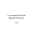
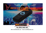
User’s Manual of BTGP38 Bluetooth GPS Receiver V3.0
User’s Manual of BTGP38 Bluetooth GPS Receiver
V3.0
User’s Manual of BTGP38 Bluetooth GPS Receiver V3.0
I Instruction to Product
1. Summary
BTGP38, a high-tech product combines the advanced Bluetooth technology and GPS
technology. Through, Bluetooth technology, you can receive GPS data through intelligent
mobile phone, PDA, laptop and desktop for location and navigation.
2. Features
(1)
(2)
(3)
(4)
(5)
(6)
(7)
(8)
Every low electricity cost and work up to maximum 20 hours
High-sense, good-performance GPS chip, receiving 16 satellites simultaneously
Accord with Bluetooth 1.2 Specification CLASS 2
Support Bluetooth serial communication Profile (SPP Profile)
Compatible with li-battery and charger of Nokia mobile (e.g.N70)
3 LED indicate statues of Bluetooth, GPS and recharging
Support the baud rate 9600bps in NMEA-0183 standard
Small-size, humanized design, portable, cute appearance
User’s Manual of BTGP38 Bluetooth GPS Receiver V3.0
3. Technical Index
General Index
Receivable frequency
L1,1575.42MHZ
C/A code
1.023MHZ
Channel
16
Sensibility
Search
-147dBm
Track
-152dBm
Precision
Location
7m CEP 90%,3m CEP 50%(SA off)
Speed
0.1 m/s
Location time
Hot startup
12s, average
Warm startup
38s, average
Cold startup
60s, average
Dynamic condition
Altitude max.
10 km
Horizontal speed
515m/s
Acceleration
Max. 4g
GPS protocol
NMEA-0183 ASIC protocol
Default NMEA GGA, GSA,GSV and RMC,(VTG,GLL and RMS optional)
9600bps baud rate,8 data bits,1 stop bit,no check bit
Bluetooth index
Bluetooth code
V1.2
Emission power
Class 2 (4dBm max)
Receiving sensibility
-80dBm(Bit error rate less than 0.1%)
Communication distance
10m typical (free space)
Profile Communication Profile
Serial Port Profile (SPP)
Power consumption
Working current
45mA typical
Working voltage
3.7V
Chargeable voltage
5.7V
Battery
Recharge time
2.5hrs typical
Working time
About 20hr, track after the charging is full
Environment
Working temperature
-10℃ to +60℃
Storage temperature
-20℃ to +85℃
User’s Manual of BTGP38 Bluetooth GPS Receiver V3.0
II Hardware Features
1. Size: 72.8(L)x45.8(W)x18.8(H)mm
2. Packing list
1. Main unit 1
2. Chargeable li-battery 1
3. User’s manual 1(or 1 CD)
4. Home charger 1
5. Car charger 1
Main unit
Battery
CD of instruction
Charger
Car charger
3. Description
Blue LED, indicates the working status of bluetooth
Green LED, indicating the working status of GPS
Red LED, indicating the working status of charging
Switch for power supply, Left for ON, Right for OFF
Power extension
4. LED status
LED
Status
Description
Green LED
On
indicates GPS position no fixed
Fast flash
Blue LED
Red LED
indicates GPS position fixed
Fast flash
indicates Bluetooth in stand-by mode
Slow flash
indicates Bluetooth in connection
Constant on
Indicates : it is under charging
Off
Charging is completed
User’s Manual of BTGP38 Bluetooth GPS Receiver V3.0
III Operation Instruction
1. Load battery
Open the cover of battery door, and load the battery in right direction. Close the battery door..
2. Charge
Plug the AC end of the charger into main power supply socket. Plug the DC charger into the
hole on the product. Then, the red LED turns on, indicating it is charging. In about 2.5hr, red
LED turns off and the charger is completed.
Note: To maximize the lifetime of the battery, please charge it continuously for at least 10 hr for
the first time.
3. Set up wireless connection
Power on, the green LED turns on, indicating the state of location. Blue LED swiftly flashes,
indicating that it enters to matching state. Now, you input search command on your Bluetooth
device (computer, PDA, mobile or laptop etc). When it searches out, select “Vsun-GPS” and
then input the code“0000”, so that the matching is complete.
4. Test on computer
After the matching is completed, the computer will prompt that there is a serial port. Write
down the number of it and open the test software in the CD. Select the said port and set the bit
rate at 9600bps. Click “Open” to open the serial port and then it will display the current locating
data.
Serial port On/Off
Satellite distributing map
Serial port number, Bit rate
Configure the serial port
Satellite locating data
Received satellite signal S/N
NMEA data
IV Application
This product can send data relating to current location and movement information to the
navigation software of intelligent mobile or PDA through Bluetooth technology and assists the
navigation software to navigate and track. For detailed operation, please see the instruction
document of navigation software.