1
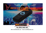
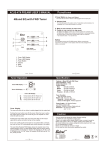
GPS Route Logger Dongle SiRF-IV with 48 Channels User’s Manual 1 General description of what GPS is and how it works GPS (Global Positioning System) is the only system today able to show you your exact position on the Earth anytime, in any weather, anywhere. GPS satellites, 24 in all, orbit at 11,000 nautical miles above the Earth. They are continuously monitored by ground stations located worldwide. The satellites transmit signals that can be detected by anyone with a GPS receiver. Using the receiver, you can determine your location with great precision. The satellites are positioned so that we can receive signals from six of them nearly 100 percent of the time at any point on Earth. You need that many signals to get the best position information. Satellites are equipped with very precise clocks that keep accurate time to within three nanoseconds- that's 0.000000003, or three billionths of a second. This precision timing is important because the receiver must determine exactly how long it take s for signals to travel from each GPS satellite. The receiver uses this information to calculate its position. Although GPS was designed for military use, many thousands of civil jams make use of it. The satellites actually broadcast two signals, one is only formilitary use, and one can be used by both military and civilians. Since GPS is passive (you only need to receive the signal), there are no restrictions on who can use the signal available to civilians. GPS technology can be used in variety of fields besides providing navigation for vehicles on the sea, in the air and on the ground. GPS applications also include keeping track of where a fleet of trucks, trains, ships or planes are and how fast they are moving; direction emergency vehicles to the scene of an accident; mapping where a city's assets are located ; and providing precise timing for endeavors that require large-scale coordination Caution Read before you start to use: Global position system (GPS) is obtained by American Ministry of National Defense, and they got the full responsibility about the preciseness and the maintenance. Any changes may cause the capacity and preciseness of GPS differed. If you use this device inside of buildings, tunnels, or any huge objects beside you, the GPS signals might be cut-off or disturbed. Please do not consider that the receiver is malfunction. The receiver operating temperature is located between – 20°C and + 60°C. For safety and lifetime of Li-polymer battery usage, do not place this device over two hours with overheated environment... 2 1. Introduction The GPS USB Dongle Receiver is a total solution of GPS receiver with SiRF-IV ; 48 channels all-in-view tracking technology. This GPS USB Dongle Receiver can communicate with other electronic devices by USB interface. The GPS USB Dongle Receiver is designed as an ultra low power consumption device, and high position accuracy. It will update the satellite position every second. This GPS USB Dongle Receiver auto-locating feature is capable of automatically determining a navigation solution without intervention. However, acquisition performance could be interfered and do cold start if the receiver were initialized with occurrence of the following events: 1) First in use 2) The GPS receiver is not in use for more than 3 months or transportation over distances further than 500 kilometers. 3) Charge Li-Polymer battery. 2. Features and Functions 1) SiRF-IV serial simultaneous time-frequency search bins. Signal detection better than -163dBm 2) Cold start < 30 seconds at –147dBm 3) Hot start < 1sec. under open sky. 4) 2.5m CEP accuracy. 5) Signal reacquisition 1 sec. 6) Acquire and track 48 satellites simultaneously 7) USB Version 1.1/2.0 8) High capacity Li-Polymer rechargeable battery. 9) Data tag (start, stop point) can be set by user Check the Package Content 3 Before you start using, please check out if your package includes the following items. If any item is damaged or missed, please contact your reseller at once. GPS USB Dongle receiver/Data Logger Device X 1 CD manual ,driver within Photo tracker product key X 1 Holder Lanyard Safety Do not allow children to play with the GPS receiver, it contains small parts that could become detached and create a choking hazard. Observe all signs that require an electrical device or RF radio product to be switched off in the designated areas. This device contains a Li-Polymer battery. Please keep it away from fire anytime (Including discarding the device) or the battery may explode. The embedded battery must be properly disposed or may be recycled, contacts your local recycling centers for disposal methods. BASIC OPERATIONS Charging the battery For the first use, the battery should be charged for about 4 hour to assure a full charge. Afterward, it takes about 2 hours to fully re-charge. Plug the charging jack of car charger or AC adapter into power jack and connect the charger properly to cigar-lighter or a main power outlet. When is in charging, the Yellow LED will be lighted up. When the battery is fully charged, the Yellow LED will be turned off. Unplug car charger or AC adapter from power jack. Power ON/OFF 4 Slid power switch to ON/OFF the power. Connect to your PC 1) Plug USB connector(1) into Laptop USB port, see Fig 1.1 Fig 1.1 2) Install USB driver, users can find the USB driver on the attached DVD (file name: GPS USB Dongle driver), the USB driver can be 5 installed for Microsoft Windows8,7, XP, Vistar system. User can easily install USB driver, the USB driver can automatically install the driver when user execute it. 3) Turn on Laptop/UMPC, please identify which COM port has been used (occupied) by USB GPS Dongle. The ways how to check COM port has been used by GPS USB Dongle are as following ; Double clicks “Control panel ( C )“ Double clicks “System” Click “hardware” Click “Hardware Manager” Double clicks “COM Port”, then user can find which COM port has been occupied by GPS USB Dongle. 4) Load your GPS mapping or routing software, along with the corresponding maps of the areas that you are occupying or plan to travel. Start the application. Make sure the application is set for the COM port that your Laptop/UMPC device will use for serial communication. Now you should be ready to use your GPS application as directed by the user documentation that came with the software. More configurations may be necessary. 5) eMap will search GPS satellites automatically, users’ current position will be showed in the eMap after 3 satellites has been searched.( In firstly use of this GPS USB Dongle, we strongly recommend you to bring your GPS USB Dongle receiver outdoor or open sky at least 15~20 minutes for sure 3D position fixed and almanac updated.). See Fig 1.1 6) How to identify GPS USB Dongle working status, please read the following description LED Indicator. LED Display 6 1 Yellow LED indicates battery is in charging. 2 Red LED indicates slow battery power. 3 The blue light on---------device is on but position is not fixed. Flashing 1sec. ON/1 sec. OFF----------position is fixed. Flashing fast---------Data tag to set point successful Power Switch ON / OFF 1 Charger/Power Status 2 Data Tag Setting 3 Concerning of Poor GPS Signal It is possible unable to receive GPS signal or signal low in these places: 7 GPS/Data Tag Setting Status (push for 1~2 second) Inside the tunnel, GPS signal is blocked. Covers above, GPS signal are blocked. Inside buildings, GPS signal is blocked. Beside some buildings, GPS signal is low or disturbed. Inside forests, or too many covers, GPS signal is low or disturbed. If you use the USB GPS Receiver inside the car, some anti-sunlight windscreen film will make the GPS signal degraded or signal blank. GPS satellite is owned by America military; sometimes they will tune-down the accuracy by some reason. In such cases, the GPS position may not fixed exactly. ★Note: Directly pluging GPS USB Dongle into the USB port may degrade GPS performance due to RF interference from notebook or UMPC. Please turn on the device and the position will be fixed quickly, then input your laptop directly. It will be better performance. 8 Used equipment must be disposed of in compliance with current environmental protection regulations. You should return it to your reseller or dispose of it in an approved recycling centre. DECLARATION: We hereby declare that this product complies with essential requirements and other related requirements, of the 1999/5/EC R&TTE directive and particularly with article 3 sections 1a, 1b and 3. 9