1
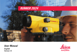
SNLL121
User Manual
Lalot01
Version 2.1
English
© Leica Geosystems
SNLL121-2.1.0en
1
Congratulations on your purchase of this
Leica instrument.
This manual contains important safety
directions (refer to chapter "Safety
directions") as well as instructions for
setting up the product and operating it.
Read carefully through the User Manual
before you switch on the product.
Product identification
The model designation and the serial number of your product can
be found on the data plate outside of the housing. Enter model and
serial number in your User Manual, and always refer to this
information when you need to contact your agency or authorized
service workshop.
Type:
2
Serial no.:
SNLL121-2.1.0en
© Leica Geosystems
Symbols used in this manual
The symbols used in this User Manual have the following
meanings:
DANGER:
Indicates an imminently hazardous situation which, if
not avoided, will result in death or serious injury.
WARNING:
Indicates a potentially hazardous situation or an
unintended use which, if not avoided, could result in
death or serious injury.
CAUTION:
Indicates a potentially hazardous situation or an
unintended use which, if not avoided, may result in
minor or moderate injury and/or appreciable material, financial
and environmental damage.
Important paragraphs which must be adhered to in
practice as they enable the product to be used in a
technically correct and efficient manner.
© Leica Geosystems
SNLL121-2.1.0en
3
Contents
Symbols used in this manual ..................................... 3
Contents ....................................................................... 4
Description of Instrument .......................................... 5
Sensor Nadir Laser plummet type SNLL121 ........................... 5
Functions ..................................................................... 6
ON/OFF ..................................................................................... 6
Function AutoOff ....................................................................... 6
Laser brightness ......................................................................... 7
Weak battery .............................................................................. 7
Replacing batteries .................................................................... 8
Setting up ..................................................................... 9
Setting up over ground point ..................................................... 9
Checking and Adjusting .......................................... 11
Care and Storage ...................................................... 13
Safety Directions ....................................................... 15
Intended use of instrument ...................................................... 15
Limits to use ............................................................................ 16
Responsibilities ........................................................................ 17
Hazards of use .......................................................................... 18
Laser classification .................................................................. 21
Electromagnetic Compatibility (EMC) ................................... 24
FCC statement (applicable in U.S.) ........................................ 25
Technical Data........................................................... 27
4
SNLL121-2.1.0en
© Leica Geosystems
Description of Instrument
Lalot03
Sensor Nadir Laser plummet type SNLL121
• For centering the tripod over ground points.
• For general-purpose plumbing.
• For mounting reflector holders and sensors.
© Leica Geosystems
SNLL121-2.1.0en
5
Functions
ON/OFF
Function AutoOff
The laser plummet is switched
off automatically after four
minutes.
Lalot05
This function is always active.
Press briefly for switching on
the laser plummet.
6
SNLL121-2.1.0en
© Leica Geosystems
Weak battery
Lalot17
Lalot06
Laser brightness
Permanent pressing changes
brightness of laser.
Lalot07
If laser beam and diode are
flashing the capacity of the
battery is too low.
Laser weak
Laser
intensive
Always have spare
batteries with you.
This will ensure that work can
be completed without
discontinuation.
The brightness adjustment
remains active even after
switching off the laser plummet.
© Leica Geosystems
SNLL121-2.1.0en
7
Replacing batteries
Lalot08c
3. Insert new batteries.
Lalot08a
1. Remove cover.
Insert batteries
correctly.
4. Insert battery holder and
close cover correctly.
Lalot08d
Lalot08b
2. Pull out battery holder and
remove batteries.
Always replace the
complete battery set.
• Do not use old and new
batteries together.
• Do not use batteries from
different manufacturers or
batteries of different types.
• For type of battery, refer to
Technical Data.
8
Pay attention to the
correct position of
the battery holder: contacts on
underside and pointing into
instrument.
SNLL121-2.1.0en
© Leica Geosystems
Setting up
Setting up over ground point
2
3
1
Lalot09a
1
Lalot09b
1
1. Set up tripod with tribrach as
vertically as possible above the
ground point.
2. Insert laser plummet into the
tribrach and switch on.
3. Turn the base screws of the
tribrach until the laser spot
coincides with the ground point.
No objects between
laser plummet and
target point.
© Leica Geosystems
SNLL121-2.1.0en
9
4. By adjusting the length of
the tripod legs level-up the
circular level.
4
5. By turning the footscrews
level-up the spirit level (midpoint). Now the tribrach is
leveled up exactly.
4
Lalot10
4
4
6. Shift the tribrach on the
tripod until the laser spot
coincides again with the ground
point. Check levelling and
repeat steps 5 and 6 of this
procedure until the required
positioning accuracy is reached.
For a precise set-up it is absolutely necessary to levelup by using the spirit level.
Always lock laser plummet in the tribrach!
10
SNLL121-2.1.0en
© Leica Geosystems
Checking and Adjusting
Under normal circumstances adjusting the laser plummet is not
necessary.
Checking by turning the instrument by 360°:
1. Install the instrument on the tripod and level up.
2. Switch on laser plummet and mark centre of the red point.
3. Turn instrument slowly by 360° and observe the red laser spot.
Checking the laser plummet must be carried out on a bright, even
and horizontal surface (e.g. sheet of paper).
Lalot11
360°
Laser spot:
diam. 2.5 mm / 1.5 m
≤ 1.0 mm / 1.5 m
If the centre of the laser spot makes a clearly circular movement or
if the centre of the spot moves away more than 1mm from the first
marked point an adjustment may be necessary. Call your nearest
Leica Geosystems service workshop.
© Leica Geosystems
SNLL121-2.1.0en
11
Depending on brightness and surface the size of the laser spot can
vary. At a distance of 1.5 m its average diameter is 2.5 mm.
The maximum diameter of the circular movement described by the
centre of the laser spot should not exceed 1 mm at a distance of
1.5 m.
Adjusting the spirit level
1.
2.
Δ
Lalot12b
Lalot12a
180°
If Δ > 1 interval the spirit level
must be adjusted
3.
Lalot12c
Δ/2
Correct half of deviation (Δ/2) using an Allen key and repeat steps
1 to 3 of this procedure until bubble is centered.
12
SNLL121-2.1.0en
© Leica Geosystems
Care and Storage
Transport:
When dispatching the equipment, always use the
complete original optional Leica Geosystems packaging. When
transporting the equipment in the field, always make sure to:
• either carry the instrument in its original optional transport case
or
• carry the tripod with its legs splayed across your shoulders,
keeping the attached laser plummet upright.
Lalot14
Lalot13
Remove batteries from the laser plummet when it is
shipped via rail, air or sea transport.
© Leica Geosystems
SNLL121-2.1.0en
13
Storage:
When storing the equipment, particularly in summer
and inside a vehicle, take the storage temperature limits (-40°C to
+ 70°C / -40°F to +158°F) into account.
Damp instruments must be unpacked. Dry the
instrument, the case, the foam inserts and the
accessories at not more than 40°C / 108°F and clean them. Do not
repack until everything is completely dry.
For long period of storage, remove batteries from the
instrument.
After a longer period of storage or transport of your
instrument, always perform the field adjustments
indicated in this manual before using the instrument.
14
SNLL121-2.1.0en
© Leica Geosystems
Safety Directions
The following directions should enable the person responsible for
the laser plummet, and the person who actually uses the
instrument, to anticipate and avoid operational hazards.
The person responsible for the instrument must ensure that all
users understand these directions and adhere to them.
Intended use of instrument
Permitted uses
The permitted uses of the laser plummet are the following:
• Centering the tripod above ground points
• General purpose plumbings
• Adjustment of reflectors and sensors
Adverse uses
• Use of the product without instruction.
• Use outside of the intended limits.
• Disabling safety systems.
• Removal of hazard notices.
• Opening the product using tools (screwdriver, etc.), unless this
is specifically permitted for certain functions.
• Modification or conversion of the product.
• Use after misappropriation.
• Use of products with obviously recognizable damages or
defects.
• Use with accessories from other manufacturers without the
prior express approval of Leica Geosystems.
• Inadequate safeguards at the surveying site (e.g. when
measuring on roads, etc.).
• Deliberate dazzling of third parties
© Leica Geosystems
SNLL121-2.1.0en
15
WARNING:
Adverse use can lead to injury, malfunction, and
material damage. It is the task of the person responsible
for the instrument to inform the user about hazards and how to
counteract them. The product is not to be used until the user has
been properly instructed how to use it.
Limits to use
Environment:
Suitable for use in an atmosphere appropriate for permanent
human habitation: not suitable for use in aggressive or explosive
environments. Use in rain is permissible for limited periods.
See chapter "Technical Data".
DANGER:
Local safety authorities and safety experts must be
contacted before working in hazardous explosive areas
or in extreme environment conditions by the person in charge of
the instrument. This includes the use of a lockable battery holder
to prevent accidental opening of the compartment.
16
SNLL121-2.1.0en
© Leica Geosystems
Responsibilities
Area of responsibility for the manufacturer of the original
equipment Leica Geosystems AG,
CH-9435 Heerbrugg (hereinafter referred to as Leica Geosystems):
Leica Geosystems is responsible for supplying the product,
including the User Manual and original accessories, in a
completely safe condition.
Responsibilities of the manufacturers of non-Leica
Geosystems accessories:
The manufacturers of non-Leica Geosystems accessories for the
laser plummet are responsible for developing, implementing and
communicating safety concepts for their products, and are also
responsible for the effectiveness of those safety concepts in
combination with the Leica Geosystems product.
Responsibilities of the person in charge of the instrument:
WARNING:
The person responsible for the instrument must ensure
that it is used in accordance with the instructions. This
person is also accountable for the training and deployment of
personnel who use the instrument and for the safety of the
equipment when in use.
The person in charge of the instrument has the following duties:
• To understand the safety instructions on the product and the
instructions in the User Manual.
• To be familiar with local regulations relating to accident
prevention.
• To inform Leica Geosystems immediately if the equipment
becomes unsafe.
© Leica Geosystems
SNLL121-2.1.0en
17
Hazards of use
Main hazards of use
WARNING:
The absence of instruction, or the inadequate imparting
of instruction, can lead to incorrect or adverse use, and
can give rise to accidents with far-reaching human, material,
financial and environmental consequences.
Precautions:
All users must follow the safety directions given by the
manufacturer and the directions of the person responsible for the
instrument.
CAUTION:
Watch out for erroneous measurements if the instrument
is defective or if it has been dropped or has been
misused or modified.
Precautions:
Periodically carry out test measurements and perform the field
adjustments indicated in the User Manual particularly after the
instrument has been subjected to abnormal use and before and
after important measurements.
WARNING:
By surveying during a thunderstorm you are at risk from
lightening.
Precautions:
Do not carry out field surveys during thunderstorms.
18
SNLL121-2.1.0en
© Leica Geosystems
WARNING:
Inadequate securing of the surveying site can lead to
dangerous situations, for example in traffic, on building
sites and at industrial installations.
Precautions:
Always ensure that the surveying site is adequately secured.
Adhere to the local regulations governing accident prevention and
road traffic.
CAUTION:
During the transport or disposal of charged batteries it is
possible for inappropriate mechanical influences to
constitute a fire hazard.
Precautions:
Remove the batteries from their compartement before they are
transported. Dispose of batteries only if they are fully flat.
CAUTION:
If the accessories used with the instrument are not
properly secured, and the equipment is subjected to
mechanical shock (e.g. blows, falling etc.), the equipment may be
damaged, safety devices may be ineffective or people may sustain
injury.
Precautions:
When setting-up the instrument, make sure that the accessories
(e.g. tripod, tribrach, etc.) are correctly adapted, fitted, secured
and locked in position.
Avoid subjecting the equipment to mechanical shock.
Never position the instrument on the tripod baseplate without
securely tightening the central fixing screw. If the screw is
loosened always remove the instrument immediately from the
tripod.
© Leica Geosystems
SNLL121-2.1.0en
19
If the product is improperly disposed of, the following
can happen:
If polymer parts are burnt, poisonous gases are
produced which may impair health.
If batteries are damaged or are heated strongly, they can explode
and cause poisoning, burning, corrosion or environmental
contamination.
By disposing of the product irresponsibly you may enable
unauthorized persons to use it in contravention of the regulations,
exposing them-selves and third parties to the risk of severe injury
and rendering the en-vironment liable to contamination.
Improper disposal of silicone oil may cause environmental
contamination.
Precautions:
The product must not be disposed with household
waste.
Dispose of the product appropriately in accordance
with the national regula-tions in force in your country.
Always prevent access to the product by unauthorized personnel.
Product specific treatment and waste management information can
be downloaded from the Leica Geosystems home page at http://
www.leica-geosystems.com/treat-ment or received from your Leica
Geosystems dealer.
20
SNLL121-2.1.0en
© Leica Geosystems
Laser classification
The laser plummet produces a visible laser beam emerging from
the underside of the instrument.
The product is a Class 2 laser product in accordance with:
• IEC 60825-1:1993 "Safety of laser products".
• EN 60825-1:1994 + A11:1996 "Safety of laser products".
The product is a Class II laser product in accordance with:
• FDA 21CFR Ch.I §1040: 1988 (US Department of Health and
Human Service, Code of Federal Regulations)
Class 2/II laser products: Do not stare into the beam or direct it
unnecessarily at other persons. Eye protection is normally afforded
by aversion responses including the blink reflex.
Description
Value
Beam divergence
0.16 mrad x 0.6 mrad
Pulse duration
c.w.
Maximum radiant power 0.95 mW
Measurement uncertainty
± 5%
WARNING:
It can be dangerous to look into the beam with optical
equipment (e.g. binoculars, telescopes)
Precautions:
Do not look directly into the beam with optical equipment.
© Leica Geosystems
SNLL121-2.1.0en
21
Labelling
Lalot16
Laser Radiation
Do not stare into beam
Class 2 Laser Product
accord. to
IEC 60825-1:1993
P0 ≤ 0.95 mW
λ = 620 - 690 nm
This device complies with part 15 of
the FCC Rules. Operation is subject to
the following two conditions:
(1) This device may not cause harmful
interference, and (2) this device must
accept any interference received,
including interference that may cause
undesired operation.
This laser Product complies
with 21CFR 1040 as applicable
22
SNLL121-2.1.0en
© Leica Geosystems
Lalot19
Type: SNLL121
Lalot15a
Lalot20
Art.No.: ......
Power: 6V=nominal, 200mA max.
Leica Geosystems AG
CH-9435 Heerbrugg
Manufactured:2004
S.No.: ......
Made in Switzerland
Laser beam
(visible)
Laser beam outlet
(visible)
CAUTION:
Only Leica Geosystems authorized workshops are
entitled to repair these products.
© Leica Geosystems
SNLL121-2.1.0en
23
Electromagnetic Compatibility (EMC)
The term "electromagnetic acceptability" is taken to mean the
capability of the instrument to function correctly in an
environment where electromagnetic radiation and electrostatic
discharges are present, and without causing electromagnetic
disturbances in other equipment.
WARNING:
Electromagnetic radiation can cause disturbances in
other equipment.
Although the laser plummet meets the strict regulations and
standards which are in force in this respect, Leica Geosystems
cannot completely exclude the possibility that other equipment
may be disturbed.
CAUTION:
Disturbances caused by electromagnetic radiation can
result in the tolerance limits for measurements being
exceeded.
Although the laser plummet meets the strict regulations and
standards which are in force in this connection, Leica Geosystems
cannot completely exclude the possibility that the laser plummet
may be disturbed by very intense electromagnetic radiation, e.g.
near radio transmitters, walkie-talkies, diesel generators, power
cables.
Check the plausibility of results obtained under these conditions.
24
SNLL121-2.1.0en
© Leica Geosystems
FCC statement (applicable in U.S.)
WARNING:
This equipment has been tested and found to comply
with the limits for a Class B digital device, pursuant to
part 15 of the FCC Rules.
These limits are designed to provide reasonable protection against
harmful interference in a residential installation.
This equipment generates, uses and can radiate frequency energy
and, if not installed and used in accordance with the instructions,
may cause harmful interference to radio communications.
However, there is no guarantee that interference will not occur in a
particular installation.
If this equipment does cause harmful interference to radio or
television reception, which can be determined by turning the
equipment off and on, the user is encouraged to try to correct the
interference by one or more of the following measures:
• Reorient or relocate the receiving antenna.
• Increase the separation between the equipment and receiver.
• Connect the equipment into an outlet on a circuit different from
that to which the receiver is connected.
• Consult the dealer or an experienced radio/TV technician for
help.
© Leica Geosystems
SNLL121-2.1.0en
25
WARNING:
Changes or modifications not expressly approved by
Leica Geosystems for compliance could void the user's
authority to operate the equipment.
Product labelling:
This device complies with part 15 of
the FCC Rules. Operation is subject to
the following two conditions:
(1) This device may not cause harmful
interference, and (2) this device must
accept any interference received,
including interference that may cause
undesired operation.
26
SNLL121-2.1.0en
Lalot21
This device complies with part 15 of the FCC Rules.
Operation is subject to the following two conditions: (1)
This device may not cause harmful interference, and
(2) this device must accept any interference received,
including interference that may cause undesired
operation.
© Leica Geosystems
Technical Data
Location of laser
in the centre; turns with
instrument
Accuracy
max. diameter of the circular
movement of the laser point:
≤ 1.0 mm / 1.5 m
Diameter of laser spot
2.5 mm / 1.5 m
Level sensitivity
30" / 2 mm
Automatic switch-off
~ 4 min. after key is last pressed
Light source, red
laser diode 620 - 690 nm
Laser class
2
Power supply
4 x 1.5V alkaline-Mn cells
Type AA (LR6, AM3, Mignon)
Protection / Sealing
IP54, in accordance with
IEC 60529 (splash-proof)
Dimensions
Height
Diameter
Weight
1080 g (2.4 lbs)
Temperature range
Operation
Storage
-20 °C (-4°F) to +50 °C (122°F)
-40 °C (-40°F) to +70 °C (158°F)
© Leica Geosystems
IEC60825-1;
EN60825-1
II FDA 21 CFR Ch.I § 1040
SNLL121-2.1.0en
153 mm
102 mm
27
Leica Geosystems AG, Heerbrugg,
Switzerland, has been certified as being
equipped with a quality system which
meets the International Standards of
Quality Management and Quality
Systems (ISO standard 9001) and
Environmental Management Systems
(ISO standard 14001).
Total Quality Management Our commitment to total customer
satisfaction
Ask your local Leica Geosystems agent for
more information about our TQM program.
664969-2.1.0en
Printed in Switzerland - Copyright
Leica Geosystems AG, Heerbrugg,
Switzerland 2006
Original text
Leica Geosystems AG
CH-9435 Heerbrugg
(Switzerland)
Phone +41 71 727 31 31
Fax +41 71 727 46 73
www.leica-geosystems.com