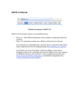
1
USER’S
MANUAL
ArboWebForest
WebUI
i
USER'S MANUAL
TABLE OF CONTENTS
Page #
1.0
GENERAL INFORMATION ...................................................................................................... 1-1
1.1
System Overview .................................................................................................................... 1-1
1.2
Organization of the Manual .................................................................................................. 1-1
2.0
SYSTEM SUMMARY .................................................................................................................. 2-1
2.1
System Configuration ............................................................................................................ 2-1
2.2
User Access Levels .................................................................................................................. 2-1
2.3
Contingencies .......................................................................................................................... 2-1
3.0
GETTING STARTED .................................................................................................................. 3-1
3.1
Opening ArboWebForest and logging In ............................................................................. 3-1
3.2
Web User Interface overview ................................................................................................ 3-2
4.0
5.0
Map Catalog ................................................................................................................................. 4-1
Map ............................................................................................................................................... 5-1
5.1 Map controls ...............................................................................................................................................5-1
5.2 Toolbar .....................................................................................................................................................5-1
5.2.1 Center map to maximum extent ................................................................................................................5-1
5.2.2 Map view control .....................................................................................................................................5-1
5.2.3 Edit feature on - off ..................................................................................................................................5-2
5.2.4 Create features..........................................................................................................................................5-2
5.2.5 Measurement tools ...................................................................................................................................5-2
5.2.6 Print to PDF .............................................................................................................................................5-3
5.2.7 Manage Workspaces ................................................................................................................................5-5
5.3 Overview Map .............................................................................................................................................5-6
6.0
Features and controls .................................................................................................................. 6-1
6.1 Layer control.................................................................................................................................. 6-1
6.2 Feature Control ............................................................................................................................. 6-2
6.3 Legend ............................................................................................................................................ 6-3
6.4 Search ............................................................................................................................................. 6-4
6.5 Online user guide ........................................................................................................................... 6-5
6.6 Coordinates .................................................................................................................................... 6-5
7.0
Editing features ............................................................................................................................ 7-1
8.0
Adding comments and attachments to features .......................................................................... 8-1
9.0
Importing and exporting data ..................................................................................................... 9-1
10.0
Changing User ID and Password .............................................................................................. 10-1
User’s Manual
Page i
11.0
Exit System ................................................................................................................................. 11-1
User’s Manual
Page ii
1.0 General Information
1.0
User’s Manual
GENERAL INFORMATION
1.0 General Information
1.0
GENERAL INFORMATION
General Information section explains in general terms the system and the purpose for which it is
intended.
1.1
System Overview
ArboWebForest is a service, which allows planning, collecting and sharing information about forest
plots. The service consist of two applications: ArboWebForest Mobile Client, ArboWebForest server and
AWF Communication agent. The ArboWebForest Mobile Client application provides electronic version
of form used in collecting plot information. The application saves data collected to database. Its
operational status is under development. ArboWebForest operates on mobile devices with Android
operating system. The ArboWebForest Server is a web map application where the locations for data
collection can be planned and made available for Mobile Clients for the data collection on the field. After
field work the measure plot data will be uploaded to the ArboWebForest Server and the data can be
reviewed and shared. The plot measurement can be downloaded from ArboWebForest server to external
analysis tools and the analysis results can be uploaded back to ArboWebForest server for dissemination
of the result.
1.2
Organization of the Manual
The user’s manual consists of five sections: General Information, System Summary, Getting Started,
Using The System, and Reporting.
General Information section explains in general terms the system and the purpose for which it is
intended.
System Summary section provides a general overview of the system. The summary outlines the uses of
the system’s hardware and software requirements, system’s configuration, user access levels and
system’s behavior in case of any contingencies.
Getting Started section explains how to get ArboWebForest and install it on the device. The section
presents briefly system menu.
Using The System section provides a detailed description of system functions.
Reporting section describes in what way information collected by the application are presented and how
to access the information.
User’s Manual
Page 1-1
2.0 System Summary
2.0
User’s Manual
SYSTEM SUMMARY
2.0 System Summary
2.0
SYSTEM SUMMARY
System Summary section provides a general overview of the system. The summary outlines the uses of
the system’s hardware and software requirements, system’s configuration, user access levels and
system’s behavior in case of any contingencies.
2.1
System Configuration
ArboWebForest web UI is a web application and application requires only web browser and internet
connection. The supported browsers are Firefox 3 or newer, Internet explorer 7 or newer and Google
Chrome. ArboWebForest is available for registered users only . The registration can be done online on
ArboWebForest home page http://www.arbowebforest.com.
2.2
User Access Levels
ArboWebForest web application is available for registered users only.
his/her own map features to him/herself only or all registered users.
2.3
User can set the visibility of
Contingencies
Current version of ArboWebForest does not contain a version control mechanism for sample plots i.e.
the same plot can be edited simultaneously in web application and in Mobile Client. The new saved
changes will always overwrite the previous changes .
User’s Manual
Page 2-1
3.0 Getting Started
3.0
User’s Manual
GETTING STARTED
3.0 Getting Started
3.0
GETTING STARTED
Getting Started section explains how to login into ArboWebForest web application.. The section also
gives an overview of ArboWebForest web user interface
3.1
Opening ArboWebForest and logging In
Start ArboWebForest by opening it’s main page http://www.arbowebforest.com. Give the username and
password you have received when you registered for ArboWebForest and press “Login
Figure 1. ArboWebForest login page
User’s Manual
Page 3-1
3.0 Getting Started
3.2
Web User Interface overview
ArboWebForest web user interface is divided in three main panels: Map catalog (1), Map (2) and
features and controls (3).
Figure 2. ArboWebForest web user interface
Map catalog panel can be closed from
button on top right corner of the map catalog panel and opened
from
button on top left corner of the window.
button on the top left corner of the Features and
Features and Controls panel can be closed from
Controls panel and opened from
button on the top right corner of the window.
User’s Manual
Page 3-2
3.0 Getting Started
Figure 2. ArboWebForest web user interface when Map Catalog and Features and Controls panels are
closed
User’s Manual
Page 3-3
4.0 Map Catalog
4.0
User’s Manual
MAP CATALOG
4.0 Map Catalog
4.0
MAP CATALOG
Map catalog, marked with label 1 in figure 2, contains background maps, areal images etc. layers
available for the ArboWebForest user. The layers are organized by theme and by clicking the theme user
can open and close the list of layers available in the theme. User can set the map layers on by selecting
the layer from Map catalog.
The order and transparency of the map layers are managed in layer control tab of Features and controls
panel. For more information on managing map layers see chapter 6.1
User’s Manual
Page 4-1
5.0 Map
5.0
User’s Manual
MAP
5.0 Map
5.0
MAP
On the top left corner of the Map area are map controls and toolbar.
5.1 Map controls
pan (scroll) map by pressing the arrows. Pan works also by moving the cursor on the map while the
left mouse button is down.
Zoom in (+), zoom out (-) by moving the slider. Zoom works also by mouse scroll when cursor in on
the map: scroll forward to zoom in and backwards to zoom out.
Window zoom: Keep the left mouse button down and press <Shift> key down to draw the area to zoom
on the map.
5.2 Toolbar
Toolbar contains tools for feature creation measurements and workspace management.
5.2.1 Center map to maximum extent
Center map to maximum extent
5.2.2 Map view control
Back to previous map view
Go to next map view
User’s Manual
Page 5-1
5.0 Map
5.2.3 Select feature on - off
Select feature on – off. When this selection is on you can view the attributes of the feature by
clicking the feature on the map. When this selection is off you cannot select feature on the map. This
tool is on by default. Additional information on editing the features is available in chapter 3.3
5.2.4 Create features
ArboWebForest supports point, line and polygon type features.
Create Point feature
After selecting Create Point Feature, show the location on the map for the feature and click the left
mouse button. Next the application requests the feature category. The feature category dictates what kind
of attributes can be given into the feature. Currently the available categories are Lidar plots, Sample plots
and Mammals. On attribute data window, user must define the visibility of the created feature (visibility
field at the end of form). User can restrict the visibility to him/herself only or allow the feature to be
visible for all ArboWebForest users.
button. The
After filling in the necessary attribute data, the feature is saved by pressing the
button cancels the creation of the feature and closes the attribute widow.
After user has created a point feature, the create point feature tool is deactivated and selection tool is
activated to allow viewing attributes of a feature or moving the map.
Create line feature
Line feature is not currently enabled
Create Area feature
After selecting Create area feature, show starting point of the first border segment on the map, draw first
segment of the border, click the left mouse button, draw the next border segment, , click the left mouse
button etc. At the end of the last border segment double click the left mouse button. Next the application
requests the feature category. The feature category dictates what kind of attributes can be given into the
feature.
On attribute data window, user must define the visibility of the created feature (visibility field at the end
of form). User can restrict the visibility to him/herself only or allow the feature to be visible for all
ArboWebForest users.
button. The
After filling in the necessary attribute data, the feature is saved by pressing the
button cancels the creation of the feature and closes the attribute widow.
After user has created an area feature, the create area feature tool is deactivated and selection tool is
activated to allow viewing attributes of a feature or moving the map.
5.2.5 Measurement tools
ArboWebForest has tools for measuring distance and area
User’s Manual
Page 5-2
5.0 Map
Measure distance
Measure distance tool gives the distance along digitized line. To start measurement, show the starting
point on the map and click the left mouse button.. Draw the first segment of the distance to be measured
and click the left mouse button. Draw then the next segment of the distance to be measured and click the
left mouse button etc. at the end of the last segment of the distance to be measured double click the left
mouse button. The distance from start to the end of the last segment of the line, measured along the
digitized line, is shown on lower left corner of ArboWebForest window.
The measure distance tool is active until user selects another tool e.g. user selects select feature on-off
switch.
Measure Area
Measure area tool gives the area of digitized polygon. To start measurement, show the first corner on the
map and click the left mouse button. Draw the first segment of the border of the polygon to be measured
and click the left mouse button. Draw then the next segment of the border of the polygon to be measured
and click the left mouse button etc. at the last corner of the polygon to be measured double click the
left mouse button. The area of the digitized polygon is shown on lower left corner of ArboWebForest
window.
The measure area tool is active until user selects another tool e.g. user selects select feature on-off
switch.
5.2.6 Print to PDF
Print to PDF tool opens a print menu where user can select the paper size and orientation, map scale
and whether the legend will be also printed to PDF map. The printing area is shown as a green rectangle
in the center of the map window (see figure 3.)
User’s Manual
Page 5-3
5.0 Map
Figure 3. Print menu and print area
By panning the map user can move the map so that the area to be printed is under the green rectangle (see
figure 4)
User’s Manual
Page 5-4
5.0 Map
Figure 4. Print menu and print area after the map is panned to correct location for the printing
5.2.7 Manage Workspaces
Manage Workspaces. User can save the current UI setup to workspace. When works space is
opened the ArboWebForest web user interface will be opened with the same map location, map layer and
feature setup as the workspace was saved. The workspace can be configured to be accessible (and
visible) only to the user him/herself or for all users. Workspace can be accessed directly using it’s web
address, making the sharing of the workspace easy.
Save workspace. When Selecting Save workspace application opens the Workspace menu
for filling in the workspace name and visibility of the workspace. When user press the
button
the workspace is created and the user is shown the web address for direct access to the workspace.
Update the current workspace. When user selects the update in Manage workspaces menu,
the application will update the current workspace with the current user interface setup.
Open workspace shows a list of workspaces available for the user. When user selects the
workspace also the web address of the selected workspace is shown. When
the selected workspace will be opened for user. When
workspace is deleted. The
User’s Manual
button is pressed
button is pressed the selected
button exits from open workspace menu without any selections.
Page 5-5
5.0 Map
5.3 Overview Map
Overview Map shows the current location on full base map. It can be opened from lower right corner of
the map. Overview Map is shown is figure 5.
Figure 5. Overview Map
User’s Manual
Page 5-6
6.0 Features and Controls
6.0
User’s Manual
FEATURES AND CONTROLS
6.0 Features and Controls
6.0
FEATURES AND CONTROLS
Features and controls section, on the right side of the ArboWebForest window contains controls for
layers and features and a search functionality. It also contain layer legend and instruction for
ArboWebForest .
6.1 Layer control
The opaqueness and order of the layers can be controlled in Layer tab shown in figure 6. The layers are
shown in top –down order .
Figure 6. Layer control
The layer order can be changed by moving the layer into the new position (move cursor on the top of the
layer panel, keep left mouse button down and drag the layer panel to a new position) as shown in figure
7.
User’s Manual
Page 6-1
6.0 Features and Controls
Figure 7. Changing the layer order
Layer opaqueness can me adjusted from the slider in layer panel (0%= transparent, 100%=opaque)
6.2 Feature Control
Which features are shown on the map is controlled in Features tab. User can select whether to look
his/her own features or also other user’s feature using pulldown menu . The visibility can also set by
feature category and feature class. The features tab is shown in figure 8.
User’s Manual
Page 6-2
6.0 Features and Controls
Figure 8. Feature control
6.3 Legend
If the Map layers contains Legend information, it is shown in legend tab for the map layers selected in
Map catalog. The Legend tab is shown in figure 9.
User’s Manual
Page 6-3
6.0 Features and Controls
Figure 9. Legend
6.4 Search
ArboWebForest has a seach functionality where user can search places by their name. Search is
available in Search tab. Search lists all names starting with the given search string. When the name is
selected in the result box, the application will center the map to the selected location.
Search tab is shown in figure 10
User’s Manual
Page 6-4
6.0 Features and Controls
Figure 10. Search
6.5 Online user guide
On Line user guide can be found in Guide tab.
6.6 Coordinates
Coordinates of the cursor position on the map are shown at the bottom of the features and controls panel
on lower right side of the window.
User’s Manual
Page 6-5
7.0 Editing Features
7.0
User’s Manual
EDITING FEATURES
7.0 Editing Features
7.0
EDITING FEATURES
Point, line and area features can be edited by setting the Select features on, pointing the feature on the
map and opening it for viewing with left mouse click.
Figure 11. Attribute window of the feature
from
User’s Manual
button (see figure 11) the feature goes into edit mode (figure 12).
Page 7-1
7.0 Editing Features
Figure 12. Attribute window in edit mode
When feature is in edit mode also the geometry of the feature (location of point feature, outline nodes of
the line/area feature) can be edited.
to view mode (shown in figure 5.).
attribute window back to view mode.
User’s Manual
revert the changes and returns attribute window back
Update will save the changes into the database and returns
closed the attribute window without saving the changes.
Page 7-2
8.0 Adding Comments and Attachments to Features
8.0
User’s Manual
ADDING COMMENTS AND ATTACHMENT S TO FEATURES
8.0 Adding Comments and Attachments to Features
8.0
ADDING COMMENTS AND ATTACHMENTS TO FEATURES
Comments and attachments can be added into map features in attribute window shown in figure 13.
Figure 13. Attribute window of the feature
The Comments are shown in comment tab of the attribute window (see figure 14).
User’s Manual
Page 8-1
8.0 Adding Comments and Attachments to Features
Figure 14. Comments tab of attribute window
Add comment link opens a comment editor , shown in figure 15 , for writing a comment. Modify link
opens the comment for editing in comment editor and delete link removes the comment.
Figure 15. Comment editor
User’s Manual
Page 8-2
8.0 Adding Comments and Attachments to Features
saves the comment and closes the comment editor.
closes the comment editor without saving the changes.
Attachments are shown in Attachment tab (see figure 16) of attribute window.
Figure 16. Attachments tab of attribute window
Download link will download the attachment to the local disk. Delete link will remove the attachment.
If attachment is a picture it can be enlarged by clicking it. Add attachment link opens a add attachment
dialog shown in figure 17.
User’s Manual
Page 8-3
8.0 Adding Comments and Attachments to Features
Figure 17. Add attachment dialog
.
Uploads and saves the attachment and closes the add attachment dialog
Resets the Description and file fields.
Closes the add attachment dialog without any changes.
User’s Manual
Page 8-4
9.0 Importing and Exporting Data
9.0
User’s Manual
IMPORTING AND EXPORTING DATA
9.0 Importing and Exporting Data
9.0
IMPORTING AND EXPORTING DATA
Importing and exporting of data can be done only by Arbonaut personel. If there is a need to add new
maps, aerial images, analysis results or import or export already existing plot data please contact
[email protected].
User’s Manual
Page 9-1
10.0 Changing User ID and Password
10.0 CHANGING USER ID AND PASSWORD
User’s Manual
10.0 Changing User ID and Password
10.0 CHANGING USER ID AND PASSWORD
User ID and password can be changed only by contacting [email protected].
User’s Manual
Page 10-1
11 Exit System
11.0 EXIT SYSTEM
User’s Manual
11 Exit System
11.0 EXIT SYSTEM
The Close Map link on the top right corner of the ArboWebForest window will closed the application
and log out the user.
User’s Manual
Page 11-1