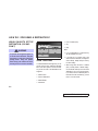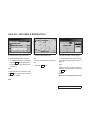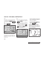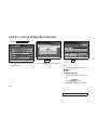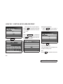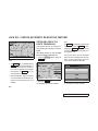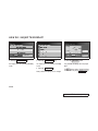
1
Thank you for purchasing an INFINITI automobile. This user’s manual is for the navigation
system only. This manual contains operating
instructions for the INFINITI Navigation System
offered in the INFINITI I35.
Please read this manual carefully to ensure safe
operation of the navigation system.
O Please read your vehicle’s owner’s manual
first.
O Do not remove this manual from the vehicle
when selling this vehicle. The next user of
this navigation system may need the
manual.
O Because of possible specification changes,
parts of this manual may not apply to your
vehicle.
O All information, specifications and illustrations in this manual are those in effect at the
time of printing. INFINITI reserves the right
to change specifications or design at any
time without notice.
Z 02.5.30/FY33.CA33 (NAVI) X
Z 02.5.30/FY33.CA33 (NAVI) X
CONTENTS
INTRODUCTION .............................................................................. 1-1
HOW DOES THE INFINITI NAVIGATION SYSTEM WORK? ............................ 2-1
WHAT FEATURES ARE AVAILABLE ON THE INFINITI NAVIGATION SYSTEM? .... 3-1
HOW DO I OPERATE THE INFINITI NAVIGATION SYSTEM? .......................... 4-1
HOW DO I PROGRAM A DESTINATION?................................................. 5-1
HOW DO I USE THE POINT OF INTEREST (POI) FEATURE? ......................... 6-1
HOW DO I USE THE ADDRESS BOOK FEATURE? ...................................... 7-1
HOW DO I USE THE AVOID AREA FEATURE? .......................................... 8-1
HOW DO I USE THE AUTOMATIC RE-ROUTING FEATURE? .......................... 9-1
HOW DO I USE THE VOICE GUIDANCE FEATURE? ................................... 10-1
HOW DO I ADJUST THE DISPLAY? ..................................................... 11-1
HOW DO I OPERATE THE AUDIO SYSTEM? ........................................... 13-1
INFORMATION ON MAP DATA DISKS .................................................. 14-1
TROUBLESHOOTING GUIDE .............................................................. 15-1
INDEX ........................................................................................ 16-1
Z 02.5.30/FY33.CA33 (NAVI) X
Z 02.5.30/FY33.CA33 (NAVI) X
1
How to use this manual ..............................
For safe operation .................................
Reference symbols.................................
Safety note ..................................................
INTRODUCTION
1-2
1-2
1-2
1-2
Z 02.5.30/FY33.CA33 (NAVI) X
INTRODUCTION
REFERENCE SYMBOLS
HOW TO USE THIS
MANUAL
This manual uses special words and icons, organized by function. Please refer to the following items and familiarize yourself with them.
FOR SAFE OPERATION
WARNING
This is used to indicate the presence
of a hazard that could cause death or
serious personal injury. To avoid or
reduce the risk, the procedures must
be followed precisely.
CAUTION
This is used to indicate the presence
of a hazard that could cause minor or
moderate personal injury or damage
to your vehicle. To avoid or reduce
the risk, the procedures must be followed carefully.
NOTE:
This indicates an item to help you understand the maximum performance of your
vehicle. If ignored, it may lead to a malfunction or poor performance.
INFO:
This indicates information necessary for efficient use of your vehicle or accessories.
DEST button
This is a button on the control panel.
View key
This is a select key on the screen. By selecting this key you can proceed to the
next function.
SAFETY NOTE
This system is primarily designed to help you
reach your destination, and also performs other
functions as outlined in this manual. However,
you, the driver, must use the system safely and
properly. Information concerning road conditions, traffic signs and the availability of services may not always be up-to-date. The sys-
1-2
Z 02.5.30/FY33.CA33 (NAVI) X
INTRODUCTION
tem is not a substitute for safe, proper,
and legal driving.
Before using the navigation system, please
read the following safety information. Always
use the system as outlined in this manual.
WARNING
O When operating the navigation
system or using the joystick
(screen function), first park the vehicle in a safe place and set the
parking brake. Using the system
while driving can distract the
driver and may result in a serious
accident. Destinations cannot be
set while the vehicle is in motion.
O Do not rely on voice guidance
alone. Always be sure that all driving maneuvers may be made
legally and safely to avoid an accident.
O Do not disassemble or modify this
system. If you do, it may result in
accidents, fire, or electrical
shock.
O Do not use this system if you notice any malfunction such as a frozen screen or lack of sound. Continued use of the system may result in accident, fire, or electrical
shock.
may lead to accidents, fire, or
electrical shock.
NOTE:
Some states/provinces may have laws
limiting the use of video screens while
driving. Use this system only where legal.
O In case you notice any foreign object in the system hardware or
spilled liquid, or notice smoke or
a smell coming from it, stop using
the system immediately and contact your nearest INFINITI retailer.
Ignoring
such
conditions
1-3
Z 02.5.30/FY33.CA33 (NAVI) X
Z 02.5.30/FY33.CA33 (NAVI) X
2
HOW DOES THE INFINITI NAVIGATION SYSTEM WORK?
What is a navigation system?..................... 2-2
About the navigation system ................ 2-2
What is GPS (Global Positioning
System)? .................................................... 2-2
Accuracy of positioning ......................... 2-2
Positioning adjustment .......................... 2-3
Receiving signals from GPS satellites ... 2-3
Display of GPS information ................... 2-3
Detailed map coverage areas for the navigation
system ......................................................... 2-4
Z 02.5.30/FY33.CA33 (NAVI) X
HOW DOES THE INFINITI NAVIGATION SYSTEM WORK?
WHAT IS A NAVIGATION
SYSTEM?
ABOUT THE NAVIGATION SYSTEM
This navigation system combines the data obtained from the vehicle (by gyro sensor) and
from GPS (Global Positioning System) satellites to calculate the current location of the vehicle. This position is then displayed on the
screen, allowing route guidance to a destination.
WHAT IS GPS (GLOBAL POSITIONING SYSTEM)?
GPS is a system developed and operated by the
U.S. government, covering the entire planet.
This navigation system receives three or more
different radio signals from NAVSTAR (GPS
satellites), orbiting the earth 13,049 miles
(21,000 km) above ground. The data from different sets of signals will be trigonometrically
calculated to obtain the position of the vehicle.
INFO:
ACCURACY OF POSITIONING
The tracking center in the US controls signals
transmitted from GPS satellites, and this control sometimes results in reduced accuracy or
no signal received at all.
INV0255
The color of the GPS Indicator
on the upper left corner of the screen indicates positioning as follows:
O Green: When positioning is possible and
accurate
O Yellow: When positioning is possible but
not accurate
O Gray: When positioning is not possible
2-2
Z 02.5.30/FY33.CA33 (NAVI) X
HOW DOES THE INFINITI NAVIGATION SYSTEM WORK?
INFO:
For approximately 3 or 4 minutes after system
remains gray,
startup, the GPS indicator
even if accurate positioning is possible.
Vehicles in these areas may not receive GPS
signals (Indicator color: gray).
INFO:
When the system judges that the vehicle position information is not accurate based on vehicle speed and gyro sensor data calculations,
the system will adjust the vehicle position information using GPS signals.
The antenna for GPS is located in the instrument panel inside the vehicle. Do not place
any object, especially mobile phones or
transceivers, on the instrument panel.
Because the strength of the GPS signals is approximately one billionth of that of TV waves;
phones and transceivers will decrease the
strength or may totally disrupt the signals.
RECEIVING SIGNALS FROM
GPS SATELLITES
DISPLAY OF GPS INFORMATION
Sometimes, satellite reception is weak. The following are places where signals tend to be
weak:
This system displays GPS information.
POSITIONING ADJUSTMENT
O Inside tunnels and parking lots in buildings
NOTE:
Directional guidance provided by the
navigation system does not take carpool
lane driving into consideration, especially when carpool lanes are separated
from other road lanes.
Please refer to “GPS information display” on
page 11-13.
O Areas with numerous tall buildings
O Under multi-layered highways
O In a dense forest
2-3
Z 02.5.30/FY33.CA33 (NAVI) X
HOW DOES THE INFINITI NAVIGATION SYSTEM WORK?
DETAILED MAP COVERAGE
AREAS (MCA) FOR THE
NAVIGATION SYSTEM
This system is designed to help you reach your
destination, and also performs other functions
as outlined in this manual. However, you, the
driver, must use the system safely and properly. Information concerning road conditions,
traffic signs and the availability of services may
not always be up-to-date. The system is not a
substitute for safe, proper, and legal driving.
Map data lovers select metropolitan areas in
the United States.
Map data consists of map CD-ROM MCA1 to
MCA9. For information about map CD-ROMs,
contact an INFINITI retailer.
Map data includes 2 types of areas: “Map coverage areas” providing all detailed road data
and other areas showing main roads only.
IMPORTANT NOTE:
NOTE:
Detailed map data is not available in
many areas and is generally limited to
select major metropolitan areas.
Waypoints and destinations cannot be
set for positions outside of a map coverage area. Once the new map CD is installed, you will need to re-program the
waypoints and final destination.
The route calculation may not be made on the
border of the map coverage area and the other
areas.
When driving from one map coverage area
(MCA) into another: No map information is
displayed on the screen when the vehicle is
driven past the mapping border into the new
area. Only the vehicle position is displayed on
the screen. The screen will become gray indicating that you are outside the MCA covered
by the mapping CD. Replace the current map
CD with the new map CD that contains the information for the new area in which you are
driving. Map information will then be displayed
on the screen for the new area.
2-4
Z 02.5.31/FY33.CA33 (NAVI) X
HOW DOES THE INFINITI NAVIGATION SYSTEM WORK?
Map Coverage Area (MCA) 1
INI0040
2-5
Z 02.5.30/FY33.CA33 (NAVI) X
HOW DOES THE INFINITI NAVIGATION SYSTEM WORK?
Map Coverage Area (MCA) 2
INI0041
2-6
Z 02.5.30/FY33.CA33 (NAVI) X
HOW DOES THE INFINITI NAVIGATION SYSTEM WORK?
Map Coverage Area (MCA) 3
INI0042
2-7
Z 02.5.30/FY33.CA33 (NAVI) X
HOW DOES THE INFINITI NAVIGATION SYSTEM WORK?
Map Coverage Area (MCA) 4
INI0043
2-8
Z 02.5.30/FY33.CA33 (NAVI) X
HOW DOES THE INFINITI NAVIGATION SYSTEM WORK?
Map Coverage Area (MCA) 5
INI0044
2-9
Z 02.5.30/FY33.CA33 (NAVI) X
HOW DOES THE INFINITI NAVIGATION SYSTEM WORK?
Map Coverage Area (MCA) 6
INFO:
Map data also contains part of the information
about the vicinity of Detroit.
INI0039
2-10
Z 02.5.30/FY33.CA33 (NAVI) X
HOW DOES THE INFINITI NAVIGATION SYSTEM WORK?
Map Coverage Area (MCA) 7
INFO:
Map data also contains part of the information
about the vicinity of Philadelphia.
INI0045
2-11
Z 02.5.30/FY33.CA33 (NAVI) X
HOW DOES THE INFINITI NAVIGATION SYSTEM WORK?
Map Coverage Area (MCA) 8
INFO:
Map data also contains part of the information
about the vicinity of New York City.
INI0046
2-12
Z 02.5.30/FY33.CA33 (NAVI) X
HOW DOES THE INFINITI NAVIGATION SYSTEM WORK?
Map Coverage Area (MCA) 9
INI0047
2-13
Z 02.5.30/FY33.CA33 (NAVI) X
Z 02.5.30/FY33.CA33 (NAVI) X
3
WHAT FEATURES ARE AVAILABLE ON THE INFINITI
NAVIGATION SYSTEM?
Route guidance............................................
Point of Interest (POI) directory ................
Address book ..............................................
Avoid area....................................................
Automatic re-route ......................................
Detour..........................................................
Birdview™....................................................
Voice guidance ............................................
Music CD playback function ......................
3-2
3-2
3-2
3-2
3-3
3-3
3-3
3-4
3-4
Z 02.5.30/FY33.CA33 (NAVI) X
WHAT FEATURES ARE AVAILABLE ON THE INFINITI NAVIGATION SYSTEM?
ROUTE GUIDANCE
The main feature of the Infiniti Navigation System is Visual and Audio Route Guidance in select detailed map coverage areas. Utilizing a
network of GPS (Global Positioning System)
satellites, the Infiniti Navigation System tracks
your location on the map and directs you where
you want to go.
Once you program a destination covered by a
detailed map, the Infiniti Navigation System
will determine a route from your current location to your destination. The moving map display and turn-by-turn voice commands helps
the driver determine upcoming turns.
This feature can be especially helpful in finding
unfamiliar locations or businesses. The system
may be unable to set a destination and/or calculate distance when a destination is outside
a detailed map coverage area. Additionally, audio route guidance may not be available if the
destination is outside a detailed map coverage
area. For more information on how to program
a destination, please refer to section 5.
you to the closest one or the closest one of your
favorite brand.
POINT OF INTEREST (POI)
DIRECTORY
For more information on how to use the Point
of Interest directory, please refer to section 6.
The Infiniti Navigation System offers an extensive Point of Interest directory in detailed map
coverage areas. This directory includes a wide
variety of destinations ranging from gas stations, ATMs, and restaurants to casinos, ski resorts, shopping centers and businesses. By accessing the Point of Interest directory, you can
search for addresses and phone numbers for
a destination, and with a press of a button, the
Infiniti Navigation System will calculate a route
to the destination.
ADDRESS BOOK
The Point of Interest directory offers many
uses. For example, the directory can be sorted
by the various types of restaurants near your
current location. If you need an ATM or gas station, the Infiniti Navigation System can point
Using the Address Book feature, you will have
the ability to store up to 50 locations into a personal directory in detailed map coverage areas.
This is especially useful for frequently visited
locations, such as your clients, relatives, or
friends. The Address Book feature will provide
you with easy access to these frequently visited
locations when setting them as your destination.
For more information on how to use your address book, please refer to section 7.
AVOID AREA
By using the Avoid Area feature, you can identify areas or freeways that you would like the
Infiniti Navigation System to avoid when plot-
3-2
Z 02.5.30/FY33.CA33 (NAVI) X
WHAT FEATURES ARE AVAILABLE ON THE INFINITI NAVIGATION SYSTEM?
ting routes. For example, if you know of a freeway or area that is always congested with traffic, you can program the Infiniti Navigation
System to plot routes that go around that particular freeway or area.
For more information on the Avoid Area feature, please refer to section 8.
fic accident. The Infiniti Navigation System has
the ability to find an alternative route using secondary roads that will return you to primary
roads after a specified number of miles.
BIRDVIEW™
For more information on the Detour feature,
please refer to section 9.
AUTOMATIC RE-ROUTE
If you miss a turn while using the Route Guidance feature, the Infiniti Navigation System will
automatically re-calculate a new route to your
destination.
For more information on the Automatic ReRoute feature, please refer to section 9.
DETOUR
If you hear about a traffic accident on the radio
that is 4 miles (6 km) ahead of you and traffic
is backing up fast, you can use the Detour function to calculate an alternative route that will
help you avoid the gridlock caused by the traf-
INV0256
The Infiniti Navigation System gives you a
choice of two map viewing styles, a normal
2-dimensional PLANVIEW map and the
3-dimensional BIRDVIEW™ map. The 3-D
BIRDVIEW™ map depicts a geographic area as
seen from an elevated perspective, so you will
get a better feel for the route ahead.
For more information on the BIRDVIEW™ feature, please refer to section 11.
3-3
Z 02.5.30/FY33.CA33 (NAVI) X
WHAT FEATURES ARE AVAILABLE ON THE INFINITI NAVIGATION SYSTEM?
VOICE GUIDANCE
For more information on the Voice Guidance
feature, please refer to section 10.
MUSIC CD PLAYBACK
FUNCTION
To playback a music CD, first remove the Mapping CD and store it in a safe place then insert
the music CD into the disc insertion slot of the
navigation system control panel.
INFO:
INV0257
Route guidance is executed using voice and
screen instruction. When the vehicle approaches an intersection where you need to
turn, the voice guidance tells you the direction
to take.
The system also has the following useful features.
O The navigation function will not operate
while a music CD is being played.
O When the map CD is reinserted, vehicle location may be temporarily incorrect.
For more information on how to use the Audio
System, please refer to section 13.
O Englarged display of intersections.
O Automatic re-routing when a vehicle is off
the course (when map is displayed).
3-4
Z 02.5.30/FY33.CA33 (NAVI) X
4
HOW DO I OPERATE THE INFINITI NAVIGATION SYSTEM?
Control panel button functions .................. 4-2
Names of the components (display
and control panel are separated.).......... 4-2
How to use the joystick and push enter
switch..................................................... 4-3
How to use the PREVIOUS button ... 4-4
How to use the keys that appear on the
display .................................................... 4-4
Opening/closing the liquid crystal
display ................................................. 4-10
Display auto open setting ................... 4-11
How to change the disc ...................... 4-12
Setting up the start-up screen............. 4-12
Clearing the memory............................ 4-13
About route guidance ................................ 4-14
Notes on route guidance...................... 4-14
About the display error ........................ 4-16
Z 02.5.30/FY33.CA33 (NAVI) X
HOW DO I OPERATE THE INFINITI NAVIGATION SYSTEM?
NAMES OF THE COMPONENTS
(Display and control panel are
separated.)
CONTROL PANEL BUTTON
FUNCTIONS
1.
button
Ejects the mapping software CD-ROM, or music CDs.
2. Joystick and [PUSH ENTER] switch; refer to
page 4-3.
INI0019A
Used to change the map display position and
to select functions.
3. ZOOM OUT / ZOOM IN button; refer
to page 11-5.
Alters the scale of the map display.
4. PREVIOUS button; refer to page 4-4.
Returns to the previous screen.
5. DEST button; refer to page 4-10.
Sets a destination using various methods.
6. SETTING button; refer to page 4-7.
Displays the [SETTINGS] screen of the navigation system.
4-2
Z 02.5.30/FY33.CA33 (NAVI) X
HOW DO I OPERATE THE INFINITI NAVIGATION SYSTEM?
7. ROUTE button; refer to page 4-8.
Displays the setting menu for route calculation.
8. VOICE button; refer to page 10-2.
Provides updated voice command at the current location.
9. VIEW button; refer to page 11-4.
Changes the map screen between BirdviewT
and Planview.
10. MAP button; refer to page 5-23.
Toggles between the intersection and the map
during route guidance. Returns the setting
screen to the map screen.
11. D/N button (Day/Night)
Changes display color brightness of the
screen.
12. ON/OFF button
Opens or closes the liquid crystal display and
turns the system OFF and ON.
13. CANCEL button; refer to page 9-5.
Cancels the operation and route guidance.
HOW TO USE THE JOYSTICK
AND PUSH ENTER SWITCH
The system’s basic operation is to select the
keys displayed on the screen.
The joystick and the PUSH ENTER switch are
used to make selections on the I35 system. No
touch screen functions are available with this
version.
Selecting and executing a key on
the screen
Select a key using the joystick on the screen
(the selected key is enclosed by a thick yellow
line), and set the selection using the PUSH ENTER switch.
INFO:
The joystick is also used to shift the map.
4-3
Z 02.5.30/FY33.CA33 (NAVI) X
HOW DO I OPERATE THE INFINITI NAVIGATION SYSTEM?
HOW TO USE THE
PREVIOUS BUTTON
HOW TO USE THE KEYS THAT
APPEAR ON THE DISPLAY
The PREVIOUS button is used for the following operations:
When the buttons on the control panel are
pressed, the display shows keys which are
used for various settings. The keys that appear
on the display when each button is pressed are
explained in this section, while the detailed operations of keys are explained in each section.
O Return to the previous screen (cancel)
When this button is pressed before completion of setup, the setup contents will be cancelled, and the previous screen will appear.
O End of setup
When this button is pressed after completion of setup, the setup contents will be updated, and the map screen will appear.
Keys that appear when the
SETTING button is pressed
WARNING
For safety, some of the functions on
the menu will be disabled while the
vehicle is moving. To use the temporarily disabled functions, park the vehicle in a safe place and shift to P or
N, and set the parking brake.
To use the navigation system more effectively,
various adjustments and setting can be performed.
INFO:
This manual specifies the timing (end of setup,
etc.) when the PREVIOUS button must be
pressed in the operation procedures. If the button is pressed at other times, the setup contents will be cancelled, and the previous screen
will appear.
This will activate various navigational functions.
O Select the SETTING button.
Save Current Location key:
INV0260
Stores the current vehicle location in the address book.
4-4
Z 02.5.30/FY33.CA33 (NAVI) X
HOW DO I OPERATE THE INFINITI NAVIGATION SYSTEM?
Display Setting key:
Please refer to “Storing current vehicle position” on page 7-2.
Changes the display brightness of the screen.
System Setting key:
Please refer to “Altering the display color” on
page 11-15.
Performs various settings of the navigation
system.
Adjusts the screen brightness.
Edit Address Book key:
Changes the names and positions of the registered locations.
Please refer to “Setting up and editing the address book” on page 7-2.
Please refer to “Adjusting the display brightness” on page 11-17.
INV0259
O Select the System Setting key on the
[SETTINGS] screen.
Guide Volume key:
Heading key:
You can set the map either to show your vehicle’s current forward direction up, or to show
North up.
Please refer to “Changing the display direction” on page 11-6.
Adjusts or turns off volume of the voice guidance.
Nearby Display Icons key:
Please refer to “Adjusting the voice guidance”
on page 10-2.
Displays five types of establishment around the
current location.
INV0480
Please refer to “Setting the nearby display
icons” on page 6-10.
4-5
Z 02.5.30/FY33.CA33 (NAVI) X
HOW DO I OPERATE THE INFINITI NAVIGATION SYSTEM?
Adjust Current Location key:
Corrects the location and direction of the vehicle icon.
Please refer to “Updating the current vehicle location and the direction” on page 11-14.
Avoid Area Setting key:
Defines areas to avoid when calculating a
route.
Please refer to “Avoid area” on page 8-2.
Beep on/off key:
Turns ON/OFF beep sound which occurs automatically.
Please refer to “Setting automatic beep sound”
on page 11-18.
Clear Memory key:
Clears all the stored memory (Address Book,
Avoid Area, Previous Dest.).
Please refer to “Clearing the memory” on page
4-13.
Display Auto Open key:
This key is used to open/close the display automatically when the power source is turned
on/off.
Please refer to “Display auto open setting” on
page 4-11.
GPS Information key:
GPS information will be displayed.
Please refer to “GPS information display” on
page 11-13.
Please refer to “Making the system guide the
route with detailed options” on page 5-17.
Tracking key:
You can choose whether to display the path
from the start to the current position.
Please refer to “Displaying the track” on page
11-11.
Keys that appear when the
DEST button is pressed
Sets destinations (final destination and
waypoints) to search for a route.
Quick Stop Customer Settings key:
Sets the user-defined [Quick Stop] POI (Point
Of Interest).
Please refer to “Quick stop” on page 5-26.
Route Priorities key:
Sets the conditions for route search.
4-6
Z 02.5.30/FY33.CA33 (NAVI) X
HOW DO I OPERATE THE INFINITI NAVIGATION SYSTEM?
Address Book key:
Use this category item if you want to go to
places stored in the address book.
Please
refer
to
“Setting
Adress Book key” on page 5-3.
with
This will activate various navigational functions.
WARNING
For safety, some of the functions on
the menu will be disabled while the
vehicle is moving. To use the temporarily disabled functions, park the vehicle in a safe place and shift to P or
N, and set the parking brake.
You can choose destinations from the last 10
destinations set.
For details, please refer to “Setting with
Previous Dest. key” on page 5-4.
Address/Street key:
Use this category item if you know the city
name, street name and house number of the
destination (waypoints).
Please
refer
to
“Setting
Address/Street key” on page 5-6.
Intersection key:
Please refer to “Setting with Intersection
key” on page 5-8.
Point of Interest (POI) key:
Previous Dest. key:
INV0261
Sets a destination using the intersection of 2
streets.
with
Use this category item if you want to go to restaurant, hotel, gas station or other facilities.
Please
refer
to
“Setting
with
Points of Interest (POI) key” on page 5-11.
City key:
Sets the destination (waypoint) on the map
screen of the area around the input city.
Map key:
Use this category item if you want to choose
the place directly on the map display.
Please refer to “Setting with Map key” on
page 5-14.
4-7
Z 02.5.30/FY33.CA33 (NAVI) X
HOW DO I OPERATE THE INFINITI NAVIGATION SYSTEM?
Please refer to “Setting with City key” on
page 5-11.
Displays the route to the destination. There are
three types of display methods.
Complete Route key:
Keys that appear when the
ROUTE button is pressed
Displays all the routes from the current location to the destination.
Sets the function which is convenient for the
route guidance to the destination.
When the ROUTE button is pressed with the
map indicating the current location displayed,
the following keys will appear on the screen.
INFO:
When no operations are executed, after a few
seconds, the keys will disappear automatically.
Please refer to “Displaying the complete
route to the destination” on page 11-9.
INV0262
Quick Stop key:
Selects the destination (waypoint) from a list of
5 commonly used POI (Points of Interest).
Please refer to “Quick stop” on page 5-26.
Turn List key:
Displays a list of the guidance points in all
the routes to the destination on a simple
map.
Please refer to “Displaying turn list” on
page 11-10.
Where am I key:
Displays the street where the vehicle is currently located, the previous intersection, and
the upcoming intersection.
Please refer to “Where am I” on page 5-29.
Route Info key:
4-8
Z 02.5.30/FY33.CA33 (NAVI) X
HOW DO I OPERATE THE INFINITI NAVIGATION SYSTEM?
Route Simulation key:
Performs a simulation drive on the map
screen by moving a vehicle icon on all the
routes from the current location to the destination.
Please refer to “Requesting the simulation
drive to the destination” on page 11-11.
Detour key:
Keys that appear when the map
is scrolled with the joystick
You can scroll the map display and get information about the area near your vehicle and the
destination using the joystick.
INFO:
O This function can be used when the original
map disc is inserted.
When the route is congested with traffic, a detour can be calculated using various distances.
O You can operate this with the map display
on.
Please refer to “Detouring from the route temporarily” on page 9-4.
O This function cannot be used when the system is calculating the route or drawing the
screen.
Edit Route key:
Resets the set destination (waypoint).
Please refer to “Making the system guide the
route with detailed options” on page 5-17.
INV0263
Heading key:
Select this key to alternate the map display between the North up and the current forward direction up.
Please refer to “Changing the display direction” on page 11-6.
Store Place key:
You can store a location with the cross pointer.
Please refer to “Storing current vehicle position” on page 7-2.
4-9
Z 02.5.30/FY33.CA33 (NAVI) X
HOW DO I OPERATE THE INFINITI NAVIGATION SYSTEM?
Dest. key:
You can store the position to the destination,
using the cross pointer. The maximum number
of destinations is six, and the last one stored
will be the final destination. (# will appear on
the map to denote the stored locations from 1
to 6.) Please refer to “Making the system guide
the route with detailed options” on page 5-17.
OPENING/CLOSING THE LIQUID CRYSTAL DISPLAY
When you use this system, make sure the engine is running.
NOTE:
If you use the system with the engine not
running (ignition ON or ACC) for a long
time, it will use up all the battery power,
making it impossible to start the engine.
How to open the Liquid Crystal
display
CAUTION
Do not place any objects on the display of the instrument panel. If you
drop any objects onto the instrument
panel, spill liquid on it, it may result
in an abnormality of the system.
1. Press the ON/OFF button.
The instrument panel opens, then the liquid
crystal display appears.
How to close the Liquid Crystal
display
CAUTION
When opening/closing the liquid
crystal display, keep hands away
from the instrument panel. It may
catch your finger, resulting in personal injury or system malfunction.
1. Press the ON/OFF button.
The liquid crystal display is stored in the instrument panel.
INFO:
When the engine is turned off (the ignition
switch is turned to off), the power supply to the
system is automatically turned off, and the liquid crystal display is stored in the instrument
panel.
4-10
Z 02.5.30/FY33.CA33 (NAVI) X
HOW DO I OPERATE THE INFINITI NAVIGATION SYSTEM?
DISPLAY AUTO OPEN SETTING
This function opens the display automatically
or manually when the ignition key is turned to
ON.
2. Select the System Setting key on the
[SETTINGS] screen.
1. Press the SETTING button.
INV0266
4. Select either the Auto or Manual key.
INV0265
3. Select the Display Auto Open key.
INV0259
INFO:
When the Manual key is selected, turn the
ignition key to ON, then press the ON/OFF
button to open the display.
When the Auto key is selected, if you press
the ON/OFF button to close the display and
then turn off the ignition switch, the display will
not open automatically when you turn on the
ignition next time. Press the ON/OFF button to
start the system.
4-11
Z 02.5.30/FY33.CA33 (NAVI) X
HOW DO I OPERATE THE INFINITI NAVIGATION SYSTEM?
HOW TO CHANGE THE DISC
INFO:
The ignition key must be in the ACC position
to insert or remove CDs.
When no disc is inserted, [No CD] will appear
on the screen.
How to eject the disc
How to insert the disc
Press the
Insert the map CD-ROM into the disc insertion
slot.
button on the main body.
The disc will be ejected automatically.
SETTING UP THE START-UP
SCREEN
When the disc is inserted to a certain point, it
will be drawn in automatically. You do not have
to push it in all the way.
INFO:
General music CDs can also be played in the
Navigation System CD slot. However, Navigation System will not operate during this time.
INV0267
When you turn the ignition key to ACC, the following warning is displayed on the screen:
Read the warning and press the joystick.
INFO:
O If you do not press the PUSH ENTER switch,
this system will not proceed to the next step
display.
O If you do not use the navigation system,
press the ON/OFF button for the display.
4-12
Z 02.5.30/FY33.CA33 (NAVI) X
HOW DO I OPERATE THE INFINITI NAVIGATION SYSTEM?
O When the engine is turned off during route
calculation and then turned on, the [CONFIRMATION OF DEST./WAYPOINT] screen
will be displayed after the [SYSTEM
START-UP] screen. When continuing the
previous route guidance, select the OK
key. To edit or delete, select the Change
key.
CLEARING THE MEMORY
All the stored data (Address Book, Avoid Area,
Previous Dest) can be cleared.
INV0259
2. Select the System Setting key on the
[SETTINGS] screen.
INV0268
3. Select the Clear Memory key.
1. Press the SETTING button.
INV0269
4. Select the Yes key.
4-13
Z 02.5.30/FY33.CA33 (NAVI) X
HOW DO I OPERATE THE INFINITI NAVIGATION SYSTEM?
NOTES ON ROUTE GUIDANCE
O The route selected by the system may not
be the shortest, nor are other circumstances
such as traffic jams considered.
INV0270
5. When the Yes key is selected, the stored
data will be cleared, and the [SYSTEM SETTINGS] screen will appear.
ABOUT ROUTE GUIDANCE
NOTE:
The navigation system does not take
driving in “CAR POOL LANES” into consideration for the guidance.
O Because of the inevitable difference in road
conditions and circumstances between the
time you use this system and the time the
information was produced from CD, there
may be discrepancies in roads and regulations. In such cases, follow the actual information available.
O During route calculation, the map will not
scroll, however the vehicle icon will move
with the actual vehicle’s movement.
O During route calculation, buttons such
as MAP , DEST , ZOOM OUT and
ZOOM IN and the joystick will be disabled.
O In some cases, after the calculation is complete, it may take some time to get the calculated route on the display.
O Waypoints that have been passed will not
be covered by the re-routing calculation.
O If you scroll the map while the suggested
route is being drawn, it may take more time
to finish drawing.
O If waypoints are set, the system is calculating plural routes between waypoints simultaneously, and the following may result.
— If one section (or more) of the routes between the waypoints is not found, none of
the route will be displayed.
— The route may not connect completely at
some waypoints.
— The route may require a U-turn close to
some waypoints.
O Route calculation may not be completed in
the following cases.
NOTE:
The navigation system does not take
4-14
Z 02.5.30/FY33.CA33 (NAVI) X
HOW DO I OPERATE THE INFINITI NAVIGATION SYSTEM?
driving in “CAR POOL LANES” into consideration for the guidance, especially
when carpool lanes are separated from
the other road lanes.
— If there is no main road within 3.1 miles (5
km) from the vehicle, a message saying so
will appear on the screen. Try requesting
route calculation when the vehicle is closer
to the main road.
— If there is no main road within 3.1 miles (5
km) from the destination or waypoint, a
message saying so will appear on the
screen. Try setting the location closer to the
main road.
— If the vehicle is too close to the destination
or if there are no branches of the roads to
the destination. A message saying so will
appear on the screen.
— If it is deemed impossible to reach the destination or waypoints because of traffic
regulations, etc.
— If there is only an extremely complicated
route to reach the destination or waypoints.
— If the destination, current vehicle position
or waypoint is within the avoid area.
— If the setting of avoid areas covers the
routes to the destination, route calculation
may not be possible.
O The following may occur when the route is
being displayed.
— Even if you are requesting calculation from
the main road, the origin of the route may
not exactly match the current vehicle position.
— Even if you are requesting calculation to the
destination on the main road, the end of the
route may not exactly match the destination.
— Even if you are requesting calculation from
the main road, the system may show a route
from another main road. This may be because the icon to show the current vehicle
position (vehicle icon) is not set accurately.
In that case, park the car in a safe place and
reset the vehicle icon, or drive on to see if
the vehicle icon appears on the main road
before requesting route calculation again.
— There are cases that the system shows a detoured route to reach the destination or
waypoints, if you set them from memory or
facility information. In order to correct this,
you will have to be careful about the traffic
direction, especially when the lanes with
different travel directions are shown separately. Such places are interchanges and
service areas.
— This system makes no distinction between
limited traffic control and total control
(blockage). It may show a detoured route
even if the road is usable.
— Even if the freeway preference is set to OFF,
the route may be set on them. To avoid this,
4-15
Z 02.5.31/FY33.CA33 (NAVI) X
HOW DO I OPERATE THE INFINITI NAVIGATION SYSTEM?
set a waypoint on another road type and request calculation.
stretch of straight road or series of curves
with a large radius.
— When the vehicle has different sizes of tires
or tire chains.
— Even if the preference is set as OFF for a
ferry line, the route may be set on it. To
avoid this, set a waypoint on a road and request calculation.
— When the vehicle is traveling in an area with
a checkerboard road system.
— When the vehicle is moved immediately after the engine is started.
— Ferry lines, except those which accept only
pedestrians, bicycles and motorcycles, are
stored in this system. When using them,
take into consideration the travel time required and operational condition to decide
whether to use them or not.
ABOUT THE DISPLAY ERROR
The following cases may affect the display accuracy of current vehicle position or travel direction. The accuracy will return to normal if
the driving conditions return to normal.
— When there is a similar road nearby.
— When the vehicle is traveling on a long
— When the vehicle is making consecutive S
curves.
— When the vehicle is at a large Y-shaped
junction.
— When the vehicle is on a loop bridge.
— When the vehicle is on a snow-covered or
unpaved road.
— When the vehicle has made several consecutive turns or traveled zigzag.
— When the vehicle is rotated on a parking lot
turntable while the ignition switch is OFF.
— Immediately after the vehicle is driven out
of a parking garage or underground parking
lot.
4-16
Z 02.5.31/FY33.CA33 (NAVI) X
5
HOW DO I PROGRAM A DESTINATION?
Various ways to set the destination (or
waypoint)..................................................... 5-2
Seven categories .................................... 5-2
Setting with Address Book key ......... 5-3
Setting with Previous Dest. key ....... 5-4
Setting with Address/Street key ........ 5-6
Setting with Intersection key ............. 5-8
Setting with Point of Interest (POI)
key........................................................ 5-11
Setting with City key ........................ 5-11
Setting with Map key ...................... 5-14
Having the system guide you to the
destinations ............................................... 5-15
Making the system guide the route with
easy operation...................................... 5-15
Making the system guide the route with
detailed options.................................... 5-17
Adjusting and deleting the pre-set destination
(waypoints)................................................ 5-23
Quick stop ................................................. 5-26
Where am I?.............................................. 5-29
Z 02.5.30/FY33.CA33 (NAVI) X
HOW DO I PROGRAM A DESTINATION?
O Point of Interest (POI)
VARIOUS WAYS TO SET THE
DESTINATION (OR WAYPOINT)
O City
O Map
INFO:
WARNING
To operate the navigation system or
to use the screen functions, first park
the vehicle in a safe place and set the
parking brake. Using the system
while driving can distract the driver
and may result in a serious accident.
O If you set destinations or waypoints, they
will be displayed with icons.
INV0271
SEVEN CATEGORIES
To set the destinations and waypoints, you can
choose from the seven categories described
below. Use these options to choose the best
way to find the route to the destinations and
waypoints.
O Address Book
O Previous Destination
O If you want to go to places close to the
stored locations or facilities, use categories
such as facility, nearby facility or memory
for easier setting.
O When using either the Point of Interest
(POI) or nearby Points of Interest categories, the names called up can be set as the
destination if you do not scroll the screen.
If you want to choose a different place on
the screen from the one called up, you will
have to scroll the screen.
O Address/Street
O Intersection
5-2
Z 02.5.30/FY33.CA33 (NAVI) X
HOW DO I PROGRAM A DESTINATION?
SETTING WITH Address Book
KEY
The [DEST. SETTING (Address book)] screen
will be displayed.
The Address Book will allow you to store locations in the memory. This is especially useful
for locations that you visit frequently.
Please refer to “Setting up and editing the address book” on page 7-2.
INV0274
INV0273
3. Select the item key of your destination
(waypoint) on the [DEST. SETTING (Address Book)] screen to display the [DEST.
SETTING] screen.
INV0272
4. To set the destination (waypoint), select
route priorities and select OK . Refer to
“Making the system guide the route with
detailed options” on page 5-17.
INFO:
Use the joystick or the
the display.
or
key to scroll
1. Press the DEST button.
2. Select the Address Book key on the
[DEST. SETTING] screen.
5-3
Z 02.5.30/FY33.CA33 (NAVI) X
HOW DO I PROGRAM A DESTINATION?
To set new destinations or waypoints from the
previous destinations.
INV0275
NOTE:
Select the Map key to display the map
screen of the area around the specified
destination (waypoint).
INV0276
O If necessary, operate the joystick to adjust
the location of the destination (waypoint).
Press the PUSH ENTER switch. The [DEST.
SETTING] screen will be displayed.
To set the destination (waypoint), refer to
“Making the system guide the route with
detailed options” on page 5-17.
SETTING WITH Previous Dest.
KEY
INV0277
1. Press the DEST button.
2. Select the Previous Dest. key on the
[DEST. SETTING] screen.
A total of 10 destinations and locations previously set will be displayed.
This system memorizes the last 10 destinations
previously chosen.
5-4
Z 02.5.30/FY33.CA33 (NAVI) X
HOW DO I PROGRAM A DESTINATION?
INV0278
INV0274
3. Select the item key of your destination
(waypoint) on the [DEST. SETTING (Previous Dest.)] screen to display the [DEST.
SETTING] screen.
4. To set the destination (waypoint), select
route priorities and select OK . Refer to
“Making the system guide the route with
detailed options” on page 5-17.
INV0279
NOTE:
Select the Map key to display the map
screen of the area around the specified
destination (waypoint).
5-5
Z 02.5.30/FY33.CA33 (NAVI) X
HOW DO I PROGRAM A DESTINATION?
There are two search methods; direct search by
the street names, and search by the street
names after a city is defined.
INV0284
INV0281
6. If necessary, operate the joystick to adjust
the location of the destination (waypoint).
Press the PUSH ENTER switch. The [DEST.
SETTING] screen will be displayed.
To set the destination (waypoint), refer to
“Making the system guide the route with
detailed options” on page 5-17.
3. A keyboard will be displayed on the [DEST.
SETTING (Address/Street)] screen. Enter
the street name you want to set.
SETTING WITH Address/Street
KEY
Sets the destination (waypoint) from the street
names and addresses that you enter.
INV0280
1. Press the DEST button.
INFO:
2. Select the Address/Street key.
It is not possible to enter names if they are not
stored in the CD-ROM.
NOTE:
The location displayed using the house
number is the vicinity of the locations
corresponding to the house numbers
stored in the data. It may differ from the
actual location.
5-6
Z 02.5.30/FY33.CA33 (NAVI) X
HOW DO I PROGRAM A DESTINATION?
INV0282
INV0283
4. Enter the street name of your destination.
For example, enter T , then U .
O If less than 5 suggested streets remain, they
will be displayed automatically.
5. Enter U , then select the List key.
The list screen of street names which have
TU at the top will appear.
O The city names and street names will be
displayed.
O Use the joystick to scroll the display.
O Press the PREVIOUS button on the
screen to display the input screen for street
names.
6. Select one street of your destination.
INV0335
7. Enter the house number.
Select the Enter key to display the [DEST.
SETTING] screen.
8. To set destination, select route priorities
and select OK . Refer to “Making the system guide the route with detailed options”
on page 5-17.
NOTE:
Select the Map key to display the map
of the area around the house number.
5-7
Z 02.5.30/FY33.CA33 (NAVI) X
HOW DO I PROGRAM A DESTINATION?
O An approximate location corresponding to the entered house number is
displayed. If necessary, correct the
location using the joystick.
INFO:
SETTING WITH Intersection KEY
For streets with no house numbers stored in
the data, the map of a typical location will be
displayed.
This will allow you to set an intersection as a
destination (waypoints).
O The location displayed by the calculation
using the house number may differ from the
actual location. In that case, correct the location using the joystick.
INV0287
INV0286
O The [DEST. SETTING] screen will appear.
INV0285
Please refer to “Making the system guide the
route with detailed options” on page 5-17.
O Press the PUSH ENTER switch.
INFO:
O Select the Dest. key.
When the city name is known, the street name
can be defined quickly using the City key.
1. Press the DEST button.
2. Select the Intersection key.
A keyboard will be displayed.
5-8
Z 02.5.30/FY33.CA33 (NAVI) X
HOW DO I PROGRAM A DESTINATION?
INV0288
INV0289
INV0290
3. Enter the first street name where the destination (waypoint) is located using the keyboard, then select list.
4. Select the first street name using the same
procedures.
5. Enter the 2nd (intersecting) street name,
then select list.
INFO:
INFO:
O For a road where lanes with different traffic
directions are shown separately, the list
shows first street name, second street
name, ...
If there are less than 5 streets which intersect
the first street, they will be displayed automatically.
O When entering a street name, enter a minor
street name as the first street and the calculation will be easier and quicker.
5-9
Z 02.5.30/FY33.CA33 (NAVI) X
HOW DO I PROGRAM A DESTINATION?
INV0291
INV0292
INV0293
6. Select the name of the second street.
O Press the PUSH ENTER switch.
The [DEST. SETTING] screen will appear.
The [DEST. SETTING] screen will appear.
INFO:
7. To set the destination, select route priorities
then select OK . Refer to “Making the system guide the route with detailed options”
on page 5-17.
If necessary, adjust the position using the joystick.
To set the destinate, refer to “Making the system guide the route with detailed options” on
page 5-17.
INFO:
To adjust the location of the destination, select
the Map key to display the map on which the
intersection is indicated.
O Select the Dest. key.
INFO:
When the city name is known, the street (intersection) name can be defined quickly using
the City key.
NOTE:
When the corresponding data does not
5-10
Z 02.5.30/FY33.CA33 (NAVI) X
HOW DO I PROGRAM A DESTINATION?
SETTING WITH
exist under the following conditions, the
street name list may not be displayed:
City KEY
Sets the destination (waypoint) on the map
screen of the area in and around the input city.
O A street name is being input after the
City key has been selected.
1. Press the DEST button.
O List is being displayed by selection of
the List key.
INV0294
SETTING WITH
Point of Interest (POI)
KEY
The Infiniti Navigation System includes a database of Point of Interest (POI) locations such
as restaurants, hotels, and supermarkets. (ref.
page 6-9.)
By using this feature, you can set a Point of
Interest location as a destination. For details on
how to use the POI feature, please refer to section 6.
INV0316
2. Select the City key on the [DEST. SETTING] screen.
5-11
Z 02.5.30/FY33.CA33 (NAVI) X
HOW DO I PROGRAM A DESTINATION?
INV0317
INV0320
INV0274
3. Enter the characters of the city name which
you wish to set as destinations (waypoints)
using the keyboard on the [DEST. SETTING
(city)] screen, then select list.
4. Select the city name of your destination
(waypoint) on the [DEST. SETTING (city)]
screen will appear the [DEST. SETTING]
screen.
5. To set the destination (waypoint), select
route priorities then select OK . Refer to
“Making the system guide the route with
detailed options” on page 5-17.
INFO:
O When the List key is selected, the data of
the currently-listed cities will be displayed.
O If less than 5 suggested cities remain, they
will be displayed automatically.
5-12
Z 02.5.30/FY33.CA33 (NAVI) X
HOW DO I PROGRAM A DESTINATION?
to “Making the system guide the route
with detailed options” on page 5-17.
INV0321
INV0322
INFO:
NOTE:
If you select the Info key in step 4, the address and telephone number of the facility will
be displayed. If you select Enter key, the
[DEST. SETTING] screen will be displayed.
To set the destination (waypoint), refer to
“Making the system guide the route with detailed options” on page 5-17.
If you select the Map key in step 6, the
map screen of the area around the
specified destination (waypoint) will be
displayed.
If necessary, operate the joystick to adjust the location of the destination
(waypoint).
Press the PUSH ENTER switch.
The [DEST. SETTING] screen will be displayed.
To set the destination (waypoint), refer
5-13
Z 02.5.30/FY33.CA33 (NAVI) X
HOW DO I PROGRAM A DESTINATION?
SETTING WITH Map KEY
This will enable you to zoom into the map for
detail and set the desired location. This works
best when you know the location geographically, or want to check the geographical surroundings on the map before setting the destinations.
INV0324
INV0325
3. Operate the joystick to choose the destination (waypoint).
4. Adjust the location using the joystick, and
press the PUSH ENTER switch.
5. Select the Dest. key.
The [DEST. SETTING] screen will appear.
INV0323
1. Press the DEST button.
2. Select the Map key.
The map of the entire area will be displayed.
5-14
Z 02.5.30/FY33.CA33 (NAVI) X
HOW DO I PROGRAM A DESTINATION?
HAVING THE SYSTEM
GUIDE YOU TO THE DESTINATIONS
WARNING
INV0326
6. Please refer to “Making the system guide
the route with detailed options” on page
5-17.
INFO:
When the OK key is selected in the [DEST.
SETTING] screen, route calculation starts. If
you want to add destinations, select the
Waypoint key.
To operate the navigation system or
to use the screen functions, first park
the vehicle in a safe place and set the
parking brake. Using the system
while driving can distract the driver
and may result in a serious accident.
The following two methods of system setting
are available for route guidance from the current location to the destination.
O For simple route guidance, destinations can
be selected directly from the map.
MAKING THE SYSTEM GUIDE
THE ROUTE WITH EASY OPERATION
Direct destination setting on the map makes it
possible to find routes to destinations easily.
This section explains the method for setting
route guidance to a destination by one
waypoint setting.
1. Shift the map using the joystick to select the
destination.
Align the waypoint to the cross point on the
screen, and press the PUSH ENTER switch.
INFO:
The destination (waypoint) settings with the
joystick cannot be performed in BirdviewT display.
O Details can be selected from the menu.
5-15
Z 02.5.30/FY33.CA33 (NAVI) X
HOW DO I PROGRAM A DESTINATION?
INFO:
O When the OK key is selected, the system
will start route calculation.
O When the PREVIOUS button is pressed
the [EDIT ROUTE] screen will appear.
3. Press the MAP button.
INV0327
2. Select the Dest. 1 key.
INV0329
The [DEST. SETTING] screen will appear.
4. Shift the map using the joystick to select the
destination.
Align the destination to the cross point on the
screen, and press the PUSH ENTER switch.
The street name of the destination will be displayed and will be set as destination 1. The
goal mark will be displayed on the map.
INV0274
INV0330
5. Select the Dest. 2 key.
5-16
Z 02.5.30/FY33.CA33 (NAVI) X
HOW DO I PROGRAM A DESTINATION?
The street name of the destination will be displayed, and will be set as destination 2. The
goal mark of destination 1 will change to the
waypoint mark, and the goal mark will be displayed at destination 2.
INV0333
INFO:
To cancel the route calculation on the screen,
select the Stop key.
INV0332
6. Select the OK key.
The [Route Calculation] screen will appear.
The map screen will reappear.
O The suggested route is indicated with a
thick blue line.
When the vehicle travels on the route, the navigation system will start voice guidance.
INV0334
When the vehicle arrives in the neighborhood
of the destination, the route guidance will end
automatically with voice guidance.
MAKING THE SYSTEM GUIDE
THE ROUTE WITH DETAILED
OPTIONS
By choosing the destination from the menu,
you can choose detailed options such as
waypoints and calculation conditions and have
the system guide you from the current position
to the destination.
5-17
Z 02.5.30/FY33.CA33 (NAVI) X
HOW DO I PROGRAM A DESTINATION?
Setting the destination
First, you will have to set the destination. For
now, choose a location from the map display.
INFO:
There are other methods to set the destination.
Please refer to “Seven categories” on page 5-2.
O Press the DEST button.
The [DEST. SETTING] screen will be displayed.
The map centering the current vehicle position
will be displayed.
INV0324
INV0336
3. Choose the destination by scrolling the
map with the joystick.
4. After setting the destination, press the
PUSH ENTER switch to display the
Dest. key on the screen.
Use the cross pointer to set the destination.
5. Select the Dest. key.
The destination will be set.
6. Set Route Priorities and select OK to calculate the route.
5-18
Z 02.5.30/FY33.CA33 (NAVI) X
HOW DO I PROGRAM A DESTINATION?
Setting Waypoints
Please refer to “Seven categories” on page 5-2.
key or
1. Select the
key on the [EDIT ROUTE] screen.
INV0274
INV0337
INFO:
O If you select the OK key at this point,
route calculation will start without any
waypoints.
After you set a destination, you can set
waypoints. For now, choose a location from the
map display.
O Select the PREVIOUS button or
Waypoint key to display the [EDIT
ROUTE] screen.
INFO:
O It is possible to display the [EDIT ROUTE]
screen by pressing the ROUTE button in
the map screen and by selecting the
Edit Route key.
O The maximum number of destinations and
waypoints that can be set is six (6).
INV0323
The [DEST SETTING] screen will be displayed.
2. Select a Waypoint/Destination using one of
the Destination selection procedures outlined earlier in this chapter.
3. Select the Dest. key.
A waypoint will be added and the Dest. setting
screen will be displayed.
5-19
Z 02.5.30/FY33.CA33 (NAVI) X
HOW DO I PROGRAM A DESTINATION?
4. Set route priorities then select OK to calculate the route.
After the setting of destinations and waypoints
is completed, set the calculation conditions
such as route type with high priorities.
INFO:
It is possible to display the [EDIT ROUTE]
screen by pressing the [ROUTE] button in the
map screen and by selecting the [Edit Route]
key.
INV0274
INV0339
INFO:
O When you select the OK key at this point,
route calculation will start without any additional waypoints.
O Select the PREVIOUS button to display
the [EDIT ROUTE] screen.
Setting the priorities for route
calculation
1. Select the Priorities key.
The screen for setting calculation conditions
will appear. The conditions with the indicator
light ON will have high priority.
INV0340
2. Select the conditions with high priorities.
Select the key on the screen to turn ON or
OFF the indicator light.
Shortest Time key:
The route to the destination is calculated so
that you can reach the destination in the short-
5-20
Z 02.5.30/FY33.CA33 (NAVI) X
HOW DO I PROGRAM A DESTINATION?
est time. In some cases, a freeway or toll road
with detours may be recommended.
NOTE:
It may not be the shortest time in all
cases.
key:
The route to the destination is calculated so
that it is the shortest distance.
NOTE:
It may not be the shortest distance in all
cases.
Minimize Toll Road key:
The route to the destination is calculated with
minimum use of toll roads.
Minimize FWY key:
The route to the destination is calculated with
minimum use of freeways.
Use Time-Restricted Roads key:
The route using time restricted roads is calculated.
INFO:
The system considers time-restricted roads as
whole-day restricted. When the key is set to
OFF, time restricted roads will not be included
in route calculation.
Auto Reroute key:
Select this key beforehand to set the auto reroute function. The route to return to the suggested route is automatically calculated again
from the location when the vehicle is off the
suggested route during route guidance.
Route calculation and guidance
WARNING
When the route is calculated with this
key ON, be sure to obey traffic regulations.
Use Ferry Route key:
Select this key if you prefer routes with ferry
lines.
INV0341
After setting all the items required, you may
proceed to route calculation for guidance. After
the route calculation is completed, the guidance will start automatically.
5-21
Z 02.5.30/FY33.CA33 (NAVI) X
HOW DO I PROGRAM A DESTINATION?
INFO:
INFO:
It is possible to display the [EDIT ROUTE]
screen by pressing the ROUTE button in the
map screen and by selecting the Edit Route
key.
O If you want to cancel the route calculation,
press the Cancel button (select the
Stop key).
Select the Route calc. key.
O If you set a place which is not suitable as
a destination, the suggested route will not
be displayed. In such a case, the OK key
will be displayed on the screen. Select the
OK key and press the MAP button. Reset a correct destination.
with all the set preferences, the system may
look up a route that does not exactly correspond to the preferences.
O To cancel the setting of destinations or
waypoints, press the ROUTE button then,
select the Edit Route key.
Enlarged intersection display
When the vehicle approaches a guide point
such as an intersection, the enlarged map of
the point will be displayed.
INV0342
Route calculation screen will be displayed.
The suggested route will be displayed with a
thick blue line. If you enter this route, the voice
guide will start.
INV0343
INV0344
O In case the route calculation is not possible
5-22
Z 02.5.30/FY33.CA33 (NAVI) X
HOW DO I PROGRAM A DESTINATION?
ADJUSTING AND DELETING
THE PRE-SET DESTINATION
(WAYPOINTS)
INFO:
O When no operation is executed with the enlarged map displayed, the map stays displayed.
Using the joystick, you can adjust the destination (waypoints).
O If route numbers are included in the map
data, route numbers will be displayed on
the left side of the screen.
1. Press the ROUTE button.
NOTE:
O When the guide point is close to the
guidance start point, the enlarged
map may not be displayed.
O The guide point name may not be displayed.
O The position of the vehicle icon (red
circle) on the enlarged map may differ from the position on the current
display.
1. Press the MAP button.
INV0345
INFO:
To display the enlarged map, press the MAP
button.
2. When the vehicle arrives at the neighborhood of the destination, the route guidance
will end automatically with voice guidance.
INFO:
INV0346
2. Select the Edit Route key.
O To alternate between the map and the enlarged screen, press the PREVIOUS button.
The map screen will appear.
5-23
Z 02.5.30/FY33.CA33 (NAVI) X
HOW DO I PROGRAM A DESTINATION?
INV0347
INV0348
3. Choose the destination (waypoints) you
want to adjust on the [EDIT ROUTE] screen.
4. The map screen will be displayed for adjusting. Use the joystick to adjust the location.
INV0349
5. Select the Adjust key.
The new destination (waypoints) will be set.
INFO:
When you move the joystick, the Adjust key
will be displayed.
5-24
Z 02.5.30/FY33.CA33 (NAVI) X
HOW DO I PROGRAM A DESTINATION?
INV0350
6. To delete the destination (waypoint),
choose the destination (waypoint) in step 3
and select the Delete key.
INV0351
7. Select the Yes key.
The pre-set destination (waypoints) will be deleted.
INV0352
8. Press the Map button to return to the map
screen.
INFO:
O To set a new destination (waypoints), refer
to “Seven categories” on page 5-2.
O If you reset the new destination (waypoints),
the older destination (waypoints) will be deleted. If you have requested a route calculation, the previous suggested route will be
deleted from memory.
5-25
Z 02.5.30/FY33.CA33 (NAVI) X
HOW DO I PROGRAM A DESTINATION?
O To delete all the suggested routes, select
the All Clear key.
INFO:
1. Press the ROUTE button.
Five categories are displayed on the screen.
The lowest one can be customized. When you
set a facility you frequently visit as a destination (waypoint), it is convenient to use the
quick stop function. Please refer to “Quick stop
customer setting” on page 5-27.
INV0354
INV0353
QUICK STOP
The system will display pre-defined POI’s
(Points of Interest) in the current vicinity of the
vehicle and the distances to them. These POI’s
can be gas stations, hotels, restaurants, ATM’s
or customer-programmed facilities. This function will operate while the vehicle is moving.
2. The display shows the [QUICK STOP]
screen.
Select the category of your choice.
INV0483
3. The cuisine selection screen is displayed
only when the RESTAURANT key is selected. Select the All key or Fast Food
key.
5-26
Z 02.5.30/FY33.CA33 (NAVI) X
HOW DO I PROGRAM A DESTINATION?
INV0355
INV0274
4. The display shows the direction and distance from the current vehicle position to
the selected facility.
Select the facility name you want to set as
a destination (waypoint).
5. The display shows the [ROUTE PRIORITIES] screen.
Set route priorities, then press the OK
key. The route calculation to the destination
will be started.
INFO:
INV0259
Quick Stop Customer Setting
1. For example, set “RESTAURANT”.
Press the SETTING button.
2. Select the System Setting key on the
[SETTINGS] screen.
If quick stop is set after the destination was set,
the system starts the route calculation to the
location as the waypoint. Five waypoints can be
registered at the same time.
5-27
Z 02.5.30/FY33.CA33 (NAVI) X
HOW DO I PROGRAM A DESTINATION?
INV0356
INV0357
INV0359
3. Select the
Quick Stop Customer Settings key on
the [SYSTEM SETTINGS] screen.
4. Select a facility you frequently visit. For example, select the RESTAURANT key.
When it is set, the screen returns to the previous screen.
Press the MAP button to return to the
map.
5. When the map is displayed, press the
ROUTE button. Then, select the
Quick Stop key, and press the PUSH
ENTER switch. The display shows the selected facility in the last row.
5-28
Z 02.5.30/FY33.CA33 (NAVI) X
HOW DO I PROGRAM A DESTINATION?
INV0360
WHERE AM I?
This key is used to find the name of the street
on which the vehicle is currently located.
1. Press the ROUTE button.
INV0361
2. The display shows the [WHERE AM I?]
screen which includes the next, current, and
previous streets. Each one shows the
streets which the vehicle is approaching,
currently running on, and those past.
Press the MAP or PREVIOUS button to
return to the map.
5-29
Z 02.5.30/FY33.CA33 (NAVI) X
Z 02.5.30/FY33.CA33 (NAVI) X
6
HOW DO I USE THE POINT OF INTEREST (POI) FEATURE?
Setting with Point of Interest (POI) key...
Setting with the List key ...................
Setting with the Category key ...........
Setting with the City key..................
Setting with the Nearby key ..............
POI categories .............................................
6-2
6-2
6-4
6-6
6-7
6-9
Z 02.5.30/FY33.CA33 (NAVI) X
HOW DO I USE THE POINT OF INTEREST (POI) FEATURE?
SETTING WITH
Point of Interest (POI)
INFO:
KEY
When names of facilities or cities are input, if
the system detects that the number of corresponding facilities or cities is five or less, the
display shows the list screen automatically.
The keys in Point of Interest (POI) are List, Category, Nearby, and City, explained below.
INV0295
SETTING WITH THE List KEY
The List key is used when you know the
names of the destinations and waypoints.
INV0294
1. Input the facility name for your destination.
INV0296
1. First press the DEST button.
2. Select the Point of Interest (POI) key on
the [DEST. SETTING (POI)] screen.
2. The display shows the screen to select a facility or Info. key.
6-2
Z 02.5.30/FY33.CA33 (NAVI) X
HOW DO I USE THE POINT OF INTEREST (POI) FEATURE?
INV0297
3. When a facility name is selected, the display
shows the [DEST. SETTING] screen to set
the destination.
Set priorities, select the OK key. The
route calculation then will be started.
When you alter the destination or set
waypoints, select the Waypoint key.
Please refer to “Making the system guide
the route with detailed options” on page
5-17.
INV0298
INFO:
When the Info. key next to the facility name
of your choice is selected in step 2, the display
shows the detailed [Address] and [Phone number] of the selected facility, and the Enter and
Map key.
INV0299
O When setting the facility as the destination,
select the Enter key. The display shows
the [DEST. SETTING] screen to set the destination.
Set priorities and select the OK key.
Then, the route calculation will be started.
When you alter the destination or set
waypoints, select the Waypoint key.
Please refer to “Making the system guide
the route with detailed options” on page
5-17.
6-3
Z 02.5.30/FY33.CA33 (NAVI) X
HOW DO I USE THE POINT OF INTEREST (POI) FEATURE?
INV0300
O When the Map key is selected in step 4,
the display shows the map. When the PUSH
ENTER switch is pressed, the display shows
the Dest. key.
INV0301
SETTING WITH THE Category
KEY
The Category key is used when you select
a facility category to set the destination.
INV0302
2. The display shows the screen to select categories.
Input a category name.
1. Select the Point of Interest (POI) key on
the [DEST. SETTING (POI)] screen.
Select the Category key.
6-4
Z 02.5.30/FY33.CA33 (NAVI) X
HOW DO I USE THE POINT OF INTEREST (POI) FEATURE?
O It may take some time to show the list, depending on categories.
INV0303
3. The display shows the category list.
Select a category name.
INFO:
When a RESTAURANT key is selected, the
screen to input the cuisine type will be displayed.
INV0304
4. The screen returns to the [DEST. SETTING
(POI)] screen.
When the category is set, the display shows
the selected category under the Category
key.
Input the facility name.
INFO:
O If you do not know the facility name you
want to go to, select the List key so that
the facility names in the category will be
listed in alphabetical order.
INV0305
5. When a facility name is input, the system
retrieves the facility name according to the
selected category and the input letters.
Then, the display shows the screen to select
a facility and Info. key.
Please refer to “Setting with the List key”
on the previous section.
6-5
Z 02.5.30/FY33.CA33 (NAVI) X
HOW DO I USE THE POINT OF INTEREST (POI) FEATURE?
INV0306
SETTING WITH THE City KEY
The City key is used to retrieve a facility from
the specified city to set the destination.
INV0307
O The display shows the screen to retrieve cities.
INV0308
O The display shows the city list.
4. Select a city of your choice.
3. Input a city name.
1. Select the Point of Interest (POI) key on
the [DEST. SETTING (POI)] screen.
Select the City key.
6-6
Z 02.5.30/FY33.CA33 (NAVI) X
HOW DO I USE THE POINT OF INTEREST (POI) FEATURE?
O It may take some time to show the list, depending on categories.
INV0309
4. The screen returns to the [DEST. SETTING
(POI)] screen.
When the city is set, the display shows the
selected city under the City key.
Input the facility name of your choice.
INFO:
O If you do not know the facility name, select
the Category key to retrieve a facility.
When the facility is set from the Category
key, the display shows the selected facility
under the Category key.
INV0311
SETTING WITH THE Nearby KEY
INV0310
5. When the facility name is input, the system
retrieves the facility name according to the
selected city and the input letters. Then, the
display shows the screen to select a facility
and Info. key.
Please refer to “Setting with the List key”
in the previous section.
The Nearby key is used to retrieve a facility
within 25 miles (40 km) from the current vehicle location.
1. Select the Point of Interest (POI) key on
the [DEST. SETTING (POI)] screen.
2. Set category according to page 6-4.
3. Select the Nearby key.
INFO:
O Facilities of selected category will be listed
6-7
Z 02.5.30/FY33.CA33 (NAVI) X
HOW DO I USE THE POINT OF INTEREST (POI) FEATURE?
in order by nearest distance.
O The Nearby key is available only when a
category is set. Set a category first.
INV0312
O When there are any nearby facilities based
on the selected category, the display shows
the list of facility names, directions and distance from the current vehicle location, and
Info keys.
Please refer to “Setting with the List key”
in the previous section.
6-8
Z 02.5.30/FY33.CA33 (NAVI) X
HOW DO I USE THE POINT OF INTEREST (POI) FEATURE?
POI CATEGORIES
AIRPORT
AMUSEMENT PARK
ATM
AUTO SERVICE & MAINTENANCE
AUTOMOBILE CLUB
BANK
BORDER CROSSING
BOWLING CENTER
BUS STATION
BUSINESS FACILITY
CASINO
CITY CENTER
CITY HALL
COLLEGE AND UNIVERSITY
COMMUNITY CENTER
COMMUTER RAIL STATION
CONVENTION/EXHIBITION CENTER
COURT HOUSE
FERRY TERMINAL
GAS STATION
GOLF COURSE
GROCERY STORE
HISTORICAL MONUMENT
HOSPITAL
HOTEL
ICE SKATING RINK
INFINITI DEALERSHIP
LIBRARY
MARINA
MOVIE THEATER
MUNICIPAL AIRPORT
MUSEUM
NIGHTLIFE
NISSAN DEALERSHIP
PARK & RIDE
PARK/RECREATION AREA
PARKING GARAGE
PARKING LOT
PERFORMING ARTS
POLICE STATION
RENTAL CAR AGENCY
REST AREA
RESTAURANT
SCHOOL
SHOPPING
SKI RESORT
SPORTS CENTER
SPORTS COMPLEX
TOURIST ATTRACTION
TOURIST INFORMATION
TRAIN STATION
WINERY
6-9
Z 02.5.30/FY33.CA33 (NAVI) X
HOW DO I USE THE POINT OF INTEREST (POI) FEATURE?
Setting the nearby display icons
Five types of facilities can be displayed on the
map using respective icons including:
–
–
–
–
–
ATM
Gas Station
Hotel
Restaurant
Rest Area
1. Press the SETTING button.
2. Select the Setting key.
INV0259
INV0313
3. Select the System Setting key on the
[SETTINGS] screen.
4. Select the Nearby Display Icons key on
the [SYSTEM SETTINGS] screen.
The [NEARBY DISPLAY ICONS] screen will be
displayed.
6-10
Z 02.5.30/FY33.CA33 (NAVI) X
HOW DO I USE THE POINT OF INTEREST (POI) FEATURE?
INV0314
INV0315
5. Select the facility you wish to display, and
press the PUSH ENTER switch.
O The icons of the selected facilities will be
displayed.
INFO:
INFO:
Every time the PUSH ENTER switch is pressed,
the indicator lights of the items are turned ON
and OFF alternately.
When the MAP button is pressed, the current
location will be displayed.
ON: To display nearby icons.
When the PREVIOUS button is pressed, the
previous screen will re-appear.
OFF: To stop displaying nearby icons.
6-11
Z 02.5.30/FY33.CA33 (NAVI) X
Z 02.5.30/FY33.CA33 (NAVI) X
7
HOW DO I USE THE ADDRESS BOOK FEATURE?
Setting up and editing the address book.... 7-2
Setting up the address book.................. 7-2
Confirming the stored locations ........... 7-4
Editing the address book ....................... 7-5
Adjusting the stored address
book entries ......................................... 7-10
Deleting stored locations ..................... 7-11
Z 02.5.30/FY33.CA33 (NAVI) X
HOW DO I USE THE ADDRESS BOOK FEATURE?
SETTING UP AND EDITING
THE ADDRESS BOOK
You can store locations in the address book for
quicker access, or name the location and set
a special icon on the map.
SETTING UP THE ADDRESS
BOOK
You can store your favorite places or the places
you frequently visit. By storing them, you can
call them quickly on the display, enabling
easier setting of these destinations.
Using various categories to store
locations
INV0363
INV0481
2. Select the Edit Address Book key.
2. Select the Save Current Location key.
Storing current vehicle position
The storing number will be displayed at the vehicle icon on the screen, and the current location of the vehicle will be stored.
1. Press the SETTING button.
You can choose various categories in the menu
to store the locations. The categories are:
Address/Street, Points of Interest (POI), Map,
Intersection, City and Previous dest.
1. Press the SETTING button.
Select the Setting key on the screen.
7-2
Z 02.5.30/FY33.CA33 (NAVI) X
HOW DO I USE THE ADDRESS BOOK FEATURE?
assigned to the newly set location.
Storing locations of your choice
INV0362
INV0455
INFO:
O If the number of the stored locations exceeds 50, a message will appear “Memory
is full. Delete old one to store new one”.
O If you store more than one location at the
same place, the location with the largest
stored number will be displayed.
O If you store the location by the location
store function, the stored name may differ,
depending on the scale used in the display.
INV0454
You can use the joystick to store desired locations.
1. Scroll the map to the desired location with
the joystick, then press the PUSH ENTER
switch. The display shows several keys on
the right of the screen.
The registered number will be displayed at that
location on the map.
INFO:
Press the MAP button or PREVIOUS button to go back to get the current vehicle display.
2. Select the Store Place key.
O The smallest and unused number will be
7-3
Z 02.5.30/FY33.CA33 (NAVI) X
HOW DO I USE THE ADDRESS BOOK FEATURE?
POI, it is quicker to use
Points of Interest (POI) key.
the
CONFIRMING THE STORED
LOCATIONS
To confirm that locations have been stored:
1. Press the SETTING button.
INV0364
The [EDIT ADDRESS BOOK] screen will be displayed.
3. Choose the storing number from the unused number list.
INV0365
Select the Setting key on the screen.
4. Store location.
Set a location to be stored in the same way as
when setting destinations (waypoints).
Please refer to “Seven categories” on page 5-2.
INFO:
O Press the MAP button to go back to get
the current vehicle display.
O The maximum number of the stored locations is 50, including your home and office.
INV0363
2. Select the Edit Address Book key.
O If you want to store places close to
7-4
Z 02.5.30/FY33.CA33 (NAVI) X
HOW DO I USE THE ADDRESS BOOK FEATURE?
EDITING THE ADDRESS BOOK
INV0366
INV0367
3. Choose the Map key next to the location
that you want to confirm.
The stored location will be displayed on the
map.
INFO:
O If you want to confirm several stored locations, select the PREVIOUS button.
O To go back to the map display, press the
MAP button.
INV0363
You can alter the names or the icons of the
stored locations.
Changing stored locations
1. You can alter the names of the stored locations.
Press the SETTING button.
7-5
Z 02.5.30/FY33.CA33 (NAVI) X
HOW DO I USE THE ADDRESS BOOK FEATURE?
2. Select the Edit Address Book key.
INV0369
INV0368
3. Choose the stored location you want to
change the name of.
4. Select the Rename key.
The change name screen will be displayed.
INV0370
5. Select the Set key after entering the new
name.
INFO:
To go back to the map display, press the
MAP button.
Changing the icons
1. You can display the icon at a stored location.
Press the SETTING button.
The [SETTINGS] screen will be displayed.
7-6
Z 02.5.30/FY33.CA33 (NAVI) X
HOW DO I USE THE ADDRESS BOOK FEATURE?
INV0363
2. Select the Edit Address Book key.
INV0371
3. Choose a stored location where you want to
set the icon.
INV0372
4. Select the Landmark Icon key.
INV0373
5. Choose an icon.
7-7
Z 02.5.30/FY33.CA33 (NAVI) X
HOW DO I USE THE ADDRESS BOOK FEATURE?
The left one on the key is a planview icon and
the right one on the key is a BirdviewT icon.
O If you alter the icon of the stored location,
the icon on the map will also change.
The icon of the stored location will be set.
INV0374
INFO:
O To go back to the screen displaying the current vehicle position, press the
MAP button.
O If you press the PREVIOUS button, the
screen will go back to the one in procedure
5.
7-8
Z 02.5.30/FY33.CA33 (NAVI) X
HOW DO I USE THE ADDRESS BOOK FEATURE?
Legend of icons which can be set for the stored locations
INV1755
7-9
Z 02.5.30/FY33.CA33 (NAVI) X
HOW DO I USE THE ADDRESS BOOK FEATURE?
ADJUSTING THE STORED
ADDRESS BOOK ENTRIES
You can easily adjust the point of the stored
location by using the joystick.
1. Press the SETTING button.
The [SETTINGS] screen will be displayed.
INV0376
3. Choose the Map key next to the stored
location you want to adjust.
INV0377
4. Use the joystick to set the new location.
INV0363
2. Select the Edit Address Book key.
7-10
Z 02.5.30/FY33.CA33 (NAVI) X
HOW DO I USE THE ADDRESS BOOK FEATURE?
DELETING STORED LOCATIONS
You can delete the stored locations you no
longer need from system memory.
1. Press the SETTING button.
The [SETTINGS] screen will be displayed.
INV0378
INV0379
5. Press the PUSH ENTER switch (Select the
Adjust key).
3. Select the location you want to delete.
The location is updated, and the screen goes
back to the one in step 5 after the update message is shown.
INFO:
To go back to the screen displaying the current
vehicle position, press the MAP button.
INV0363
2. Select the Edit Address Book key.
INV0380
4. Select the Delete key.
7-11
Z 02.5.30/FY33.CA33 (NAVI) X
HOW DO I USE THE ADDRESS BOOK FEATURE?
INV0381
5. The system will ask for a confirmation. If
correct, select the Yes key. The location
will be deleted, and the screen goes back
to the one in step 3 after the deletion message is shown.
INFO:
To go back to the screen displaying the current
vehicle position, press the MAP button.
7-12
Z 02.5.30/FY33.CA33 (NAVI) X
8
HOW DO I USE THE AVOID AREA FEATURE?
Avoid area.................................................... 8-2
Setting avoid areas ................................ 8-2
Altering and deleting the avoid areas .... 8-5
Z 02.5.30/FY33.CA33 (NAVI) X
HOW DO I USE THE AVOID AREA FEATURE?
AVOID AREA
SETTING AVOID AREAS
Setting avoid areas will give you a route around
certain areas.
INFO:
If the vehicle icon is in the avoid area, route
calculation cannot be completed.
1. Press the SETTING button.
INV0382
INV0383
3. The display shows the [SYSTEM SETTINGS] screen.
4. The display shows the [AVOID AREA SETTING] screen.
Select the Avoid Area Setting key.
Select a key which is not set as an avoid area.
INFO:
It is possible to set up to 10 areas.
INV0259
2. Select the System Setting key.
8-2
Z 02.5.30/FY33.CA33 (NAVI) X
HOW DO I USE THE AVOID AREA FEATURE?
INV0384
INV0386
5. The display shows categories which can be
used to set an avoid area.
6. The display shows the map which centers
the area to be set as an avoid area.
For example, use the Map key to set an avoid
area.
Use the ZOOM IN or ZOOM OUT button
to adjust the map reduction scale.
Select the Map key.
INV0387
7. Use the joystick to adjust the location.
Then press the PUSH ENTER switch.
INFO:
Area size: Max. 5 x 5 miles (8 x 8 km)
INFO:
For setting with other categories, please refer
to “Seven categories” on page 5-2.
8-3
Z 02.5.30/FY33.CA33 (NAVI) X
HOW DO I USE THE AVOID AREA FEATURE?
ENTER switch. The area size is altered by
three scales.
INV0388
INV0390
Select the Set key.
8. The display shows the keys on the right of
the screen.
INFO:
O If you want to avoid the freeway in that area,
key to turn on the green inselect the
dicator on the key. (Indicator ON: avoid,
OFF: do not avoid)
O When altering the size of the avoid area, select the Area key, then press the PUSH
INV0389
O The avoid area is set, and the grid will be
displayed on the screen.
INFO:
O Please refer to “Making the system guide
the route with detailed options” on page
5-17.
If the route guidance is not set, the display
shows the current vehicle location.
The grid color will be displayed in green or
blue.
(Avoid Freeway ON: green, OFF: blue)
If the route guidance is set, the display shows
the [DEST. SETTING] screen.
8-4
Z 02.5.30/FY33.CA33 (NAVI) X
HOW DO I USE THE AVOID AREA FEATURE?
ALTERING AND DELETING THE
AVOID AREAS
Renaming the avoid areas
3. Select the System Setting key.
Setting with the selected location key
When the stored avoid area is selected, the
avoid area can be renamed or deleted.
1. Press the SETTING button.
INV0393
2. Select the System Setting key.
INV0382
4. The display shows the [SYSTEM SETTINGS] screen.
5. The display shows the [AVOID AREA SETTING] screen.
Select a key which is set as an avoid area.
Select the Avoid Area Setting key.
INV0259
8-5
Z 02.5.30/FY33.CA33 (NAVI) X
HOW DO I USE THE AVOID AREA FEATURE?
Enter the area name using the keyboard.
When the Set key is selected, the avoid area
is renamed, and the screen returns to the previous screen.
Deleting the avoid areas
1. Select the Delete key on the screen in
step 6 under “Re-naming the avoid areas”.
INFO:
INV0394
6. Select the Rename key.
When the Back Space key is selected, the
cursor moves back to the previous letter. When
the Space key is selected, the cursor proceeds to make one space.
INV0397
2. Select the Yes key.
The avoid area is deleted.
If the route guidance is set, the display shows
the [DEST. SETTING] screen.
INV0395
7. The display shows the keyboard.
INV0396
INFO:
When the No key is selected, the avoid area
8-6
Z 02.5.30/FY33.CA33 (NAVI) X
HOW DO I USE THE AVOID AREA FEATURE?
will not be deleted, and the screen returns to
the previous screen.
Setting with Map key
When the stored avoid area is selected, the
avoid area can be adjusted or deleted.
1. Press the SETTING button.
2. Select the Setting key.
INV0382
4. The display shows the [SYSTEM SETTINGS] screen.
INV0398
Please refer to “Making the system guide the
route with detailed options” on page 5-17.
Select the Avoid Area Setting key.
O If the route guidance is not set, the display
shows the current vehicle location.
INV0259
Adjusting the stored avoid areas
3. Select the System Setting key.
8-7
Z 02.5.30/FY33.CA33 (NAVI) X
HOW DO I USE THE AVOID AREA FEATURE?
INV0399
5. The display shows the [AVOID AREA SETTING] screen.
Select the Map key of stored avoid areas.
INV0400
6. Use the joystick to adjust the location.
Then press the PUSH ENTER switch.
INV0401
7. The display shows the keys on the right of
the screen.
Select the Set key.
INFO:
O If you want to avoid the freeway in that area,
key to turn on the green inselect the
dicator on the key. (Indicator ON: avoid,
OFF: do not avoid)
O When altering the size of avoid area, select
the Area key, then press the PUSH
8-8
Z 02.5.30/FY33.CA33 (NAVI) X
HOW DO I USE THE AVOID AREA FEATURE?
ENTER switch. The area size is altered by
three scales.
INV0403
INV0402
8. The avoid area is set, and the grid is displayed on the screen.
If the route guidance is set, the display shows
the [DEST. SETTING] screen.
9. Please refer to “Making the system guide
the route with detailed options” on page
5-17.
If the route guidance is not set, the display
shows the current vehicle location.
INV0404
Deleting the stored avoid areas
1. Select the Delete key on the screen in
step 7 under “Adjusting the stored avoid areas”.
8-9
Z 02.5.30/FY33.CA33 (NAVI) X
HOW DO I USE THE AVOID AREA FEATURE?
INV0405
2. Select the Yes key.
The avoid area is deleted.
If the route guidance is set, the display shows
the [DEST. SETTING] screen.
INV0406
3. Please refer to “Making the system guide
the route with detailed options” on page
5-17.
If the route guidance is not set, the display
shows the current vehicle location.
INFO:
When the No key is selected, the avoid area
will not be deleted, and the screen returns to
the previous one.
8-10
Z 02.5.30/FY33.CA33 (NAVI) X
9
HOW DO I USE THE AUTOMATIC RE-ROUTING FEATURE?
Re-routing when the vehicle is off the
suggested route...........................................
Automatic re-routing ..............................
Manual re-routing ..................................
Detouring from the route temporarily ........
Turning off route guidance temporarily ......
9-2
9-2
9-3
9-4
9-5
Z 02.5.30/FY33.CA33 (NAVI) X
HOW DO I USE THE AUTOMATIC RE-ROUTING FEATURE?
RE-ROUTING WHEN THE
VEHICLE IS OFF THE SUGGESTED ROUTE
When you have strayed from the suggested
route during the route guide, you can request
a re-route from the current location. You can
request either automatic or manual re-routing.
AUTOMATIC RE-ROUTING
This setting will re-route automatically if the
driver turns off the suggested road. The auto
re-route will bring the vehicle to the destination. You will have to set the system for automatic re-routing.
INV0407
2. Select the Edit Route key.
The [EDIT ROUTE] screen will appear.
INV0408
3. Select the Priorities key.
1. Press the ROUTE button.
INV0482
When the indicator light in the Auto Reroute
9-2
Z 02.5.30/FY33.CA33 (NAVI) X
HOW DO I USE THE AUTOMATIC RE-ROUTING FEATURE?
is off, press the Auto Reroute key. The indicator light will be ON.
4. Press the MAP button.
The map screen will reappear, and the system
will start route calculation automatically.
INFO:
O When optional routes are not found, the
original route will be displayed.
O When the vehicle runs off the suggested
route with the automatic re-routing function
set off (the indicator lights in the items are
OFF), press the ROUTE button to display
the Reroute key.
When the Reroute key is selected, the
system will start route calculation from the
current location.
O When the vehicle runs off the suggested
route with the automatic re-routing function
set on, route calculation will be tried a few
times so that the vehicle goes back to the
original route. However, if the vehicle stays
off the route, the system will calculate a new
route.
Then select the Reroute key.
The system calculates the route from the
current vehicle location to the destination.
MANUAL RE-ROUTING
When the automatic re-routing function is canceled, the route calculation can be started by
manual operation.
This function is very effective when you turn off
the suggested route intentionally, and have the
system calculate a new route.
INV0410
INV0409
1. Press the ROUTE button.
9-3
Z 02.5.30/FY33.CA33 (NAVI) X
HOW DO I USE THE AUTOMATIC RE-ROUTING FEATURE?
DETOURING FROM THE
ROUTE TEMPORARILY
INFO:
If you encounter a traffic jam, you can ask the system to calculate a detour with the pre-set distance.
NOTE:
The detour function is only available
when a destination has been set.
INV0411
1. Press the ROUTE button to display the
Detour key.
INFO:
The Detour key is displayed only when going
on the suggested road. The Detour key is replaced by the Reroute key only when the auto
re-route is set off, and when the vehicle is off
the suggested route.
The route info, detour, edit route, and ROUTE
CALC keys are not displayed when the destination is not set, route guidance is turned off,
or the vehicle reaches the destination.
O The Reroute key is alternated with the
Detour key only when the automatic rerouting function is turned off, and the vehicle is off the suggested route during the
route guidance. The Detour key is ordinarily displayed on the screen.
O When the destination (waypoint) is altered,
a new route should be calculated first. Otherwise, the re-routing function will not be
available.
INV0412
INV0413
2. Select the Detour key.
The [DETOUR] screen will be displayed.
3. Set distance for detour calculation.
9-4
Z 02.5.30/FY33.CA33 (NAVI) X
HOW DO I USE THE AUTOMATIC RE-ROUTING FEATURE?
The system will start to find a detour according
to the distance set from the current location.
The [CONFIRMATION] screen will be displayed.
INFO:
O If the alternative route cannot be found in
finding a detour, the previous route before
calculation will be displayed.
O If the vehicle is traveling at high speed, the
suggested detour may start from the point
the vehicle has already passed.
TURNING OFF ROUTE
GUIDANCE TEMPORARILY
You can turn off the route guide temporarily
when you do not need it.
INV0416
INV0415
3. Select the Yes key.
The map screen will appear, and the suggested
route will disappear.
INFO:
1. Press the CANCEL button.
O Even when the route guidance is cancelled,
the routes which have been found are
stored.
The [CONFIRMATION] screen will be displayed.
O To restart route guidance, press the
VOICE button.
Keys will be displayed on the screen.
2. Select the Cancel key.
9-5
Z 02.5.30/FY33.CA33 (NAVI) X
Z 02.5.30/FY33.CA33 (NAVI) X
10
HOW DO I USE THE VOICE GUIDANCE FEATURE?
About voice guidance ............................... 10-2
Basics of voice guidance ..................... 10-2
Adjusting the guide volume ................. 10-2
Directions given and the distance to the
road points........................................... 10-3
Notification of an intersection on an
ordinary road........................................ 10-3
Notification of consecutive intersections
on an ordinary road ............................. 10-3
Notification of an entrance to a
freeway................................................. 10-3
Notification of a freeway junction ........ 10-3
Notification of an exit from a
freeway................................................. 10-3
Z 02.5.30/FY33.CA33 (NAVI) X
HOW DO I USE THE VOICE GUIDANCE FEATURE?
ABOUT VOICE GUIDANCE
WARNING
To operate the navigation system or
to use the screen functions, first park
the vehicle in a safe place and set the
parking brake. Using the system
while driving can distract the driver
and may result in a serious accident.
BASICS OF VOICE GUIDANCE
The Voice Guidance will verbally tell you which
direction to turn when the vehicle approaches
the intersection in which you have to make a
turn to reach the destination.
NOTE:
The navigation system does not take
driving in “CAR POOL LANES” into consideration for the guidance, especially
when carpool lanes are separated from
the other road lanes.
ADJUSTING THE GUIDE VOLUME
O There may be some cases in which
the voice guidance and the actual
road conditions do not correspond.
This may be because of the discrepancy between the actual road and the
information on the CD or because of
the vehicle’s speed.
O In case the content of the voice guidance does not match the actual road
conditions, follow the information
obtained from traffic signs or notices
on the road.
INV0417
1. Press the SETTING button.
2. Select the Setting key.
3. When turning on/off the voice guidance, select the Guide Volume key, and press the
PUSH ENTER switch. When the
Guide Volume key is illuminated by the
green indicator, it is activated. When turning up/down the voice guidance, select the
Guide Volume key, and tilt the joystick
10-2
Z 02.5.30/FY33.CA33 (NAVI) X
HOW DO I USE THE VOICE GUIDANCE FEATURE?
to the right/left. The voice will become
louder/softer.
DIRECTIONS GIVEN AND THE
DISTANCE TO THE ROAD
POINTS
Depending on the road types, the direction will
differ.
INFO:
Depending on the vehicle speed, the distance
may vary.
NOTIFICATION OF AN INTERSECTION ON AN ORDINARY
ROAD
“In a half mile, right turn.”
“In a half mile, right turn.”
“In a quarter mile, right turn, then right turn.”
“Right turn, then right turn.”
NOTIFICATION OF AN EXIT
FROM A FREEWAY
NOTIFICATION OF AN ENTRANCE TO A FREEWAY
“In about two miles, exit on your right.”
“In about one mile, freeway entrance on your
right (left) onto (road number and direction).”
“Freeway entrance on your right onto (road
number and direction).”
“In about one mile, exit on your right, then turn
right.”
“Exit on your right, then turn right.”
NOTIFICATION OF A FREEWAY
JUNCTION
“In about two miles, keep to the right onto (road
number and direction).”
“Right turn ahead.”
“In about one mile, keep to the right onto (road
number and direction), then keep to the right
onto (road number and direction).”
NOTIFICATION OF CONSECUTIVE INTERSECTIONS ON AN
ORDINARY ROAD
“Keep to the right onto (road number and direction), then keep to the right onto (road number and direction).”
“In a quarter mile, right turn.”
“Keep to the right onto (road number and direction).”
10-3
Z 02.5.30/FY33.CA33 (NAVI) X
Z 02.5.30/FY33.CA33 (NAVI) X
11
Screen Information — Planview display... 11-2
Screen Information — Birdview™ display... 11-2
Switching between Birdview™ and Planview
displays...................................................... 11-3
Zooming in and out of the map................ 11-5
Changing the display direction (in Planview
display) ...................................................... 11-6
Scrolling the map ...................................... 11-8
Displaying the complete route to the
destination ................................................. 11-9
Displaying turn list .................................. 11-10
Requesting the simulation drive to the
destination ............................................... 11-11
Displaying the track ........................... 11-11
GPS information display.......................... 11-13
Updating the current vehicle location
and the direction ............................... 11-14
Changing the display color...................... 11-15
Adjusting the display brightness............. 11-17
Setting automatic beep sound ................ 11-18
Characteristics of liquid crystal display .. 11-19
HOW DO I ADJUST THE DISPLAY?
Maintenance of the display ..................... 11-19
Z 02.12.11/FY33.CA33 (NAVI) X
HOW DO I ADJUST THE DISPLAY?
SCREEN INFORMATION —
PLANVIEW DISPLAY
Map scale:
This display indicates the scale on the current
map.
Vehicle icon:
This icon indicates your vehicle and the direction of travel.
calculation is not started after you set the destination, it will show the direction and approximate straight distance to the destination.
SCREEN INFORMATION —
BIRDVIEW™ DISPLAY
GPS indicator:
This will tell you the strength of the GPS signal
received.
INV0419
Direction key:
This indicates and sets the direction of the map
on the display.
Please refer to “Changing the display direction” on page 11-6.
Please refer to “Accuracy of positioning” on
page 2-2.
:
INV0422
This will indicate the approximate distance of
route and traveling time to the destination. This
indicator will appear when you set the destination with the route guidance ON.
:
When the route guidance is OFF or when route
11-2
Z 02.5.30/FY33.CA33 (NAVI) X
HOW DO I ADJUST THE DISPLAY?
SWITCHING BETWEEN
BIRDVIEW™ AND PLANVIEW
DISPLAYS
Map scale:
This display indicates the scale on the current
map.
Birdview™ screen displays the view from
above, looking down toward the direction the
vehicle is traveling. This combines the detailed
display close to the vehicle and the long distance view in one screen.
By using the ZOOM OUT
ZOOM IN
buttons, you can change the scale of the map.
Height and distance on Birdview™ display
Distance
between grids
Depth of distance
512,000 feet
160 miles
approx. 2,240
miles
128,000 feet
40 miles
approx. 560 miles
64,000 feet
20 miles
approx. 280 miles
32,000 feet
10 miles
approx. 140 miles
16,000 feet
4.0 miles
approx. 70 miles
8,000 feet
2.0 miles
approx. 35 miles
4,000 feet
1.0 mile
approx. 17-1/2
miles
2,000 feet
1/2 mile
approx. 8-3/4
miles
1/4 mile
approx. 4-3/8
miles
Height of view
1,000 feet
INV0423
<Example> Height of view: 1,000 feet
INV0420
INV0424
<Example> Height of view: 16,000 feet
11-3
Z 02.5.30/FY33.CA33 (NAVI) X
HOW DO I ADJUST THE DISPLAY?
INFO:
Some locations or buildings may be labeled
differently in Planview display and Birdview™
display.
About Birdview™ display
The destination (waypoint) cannot be set in
Birdview™ display.
INV0421
Set them in Planview display.
O It always appears with the current forward
direction up.
INI0036
Every time the VIEW button is pressed, the
displays will alternate between the Birdview™
and the Planview.
O When the system is re-drawing the display
in Birdview™ display, the distance the vehicle travels becomes longer, and/or the
degree the vehicle turns becomes larger
than in the Planview display in order to
complete re-drawing.
O The names of the roads and locations may
differ, depending on where the name appear
on the screen.
11-4
Z 02.5.30/FY33.CA33 (NAVI) X
HOW DO I ADJUST THE DISPLAY?
O In order to avoid complication of the map,
all road names are not always shown on the
screen. When the display re-draws the map,
a road name which is shown on the previous screen may not appear on the new
screen.
The chosen map scale will be displayed on the
left side of the screen.
ZOOMING IN AND OUT OF
THE MAP
Scale level on the Planview display
Use the ZOOM OUT / ZOOM IN button to
change the scale of the display and height view.
Nine map scales are available from the most
detailed (1 : 10,000) to the widest (1 : 20.48
million).
Each time the ZOOM IN button is pressed,
the map scale will change one level to display
a more detailed map.
Each time the ZOOM OUT button is pressed,
the map scale will change one level to display
a map that shows a wider area.
INFO:
By pressing the button repeatedly, you can skip
the levels to reach the map of desired scale.
Map scale
1 : 20.48 million
1 : 5.12 million
1 : 1.28 million
1 : 320,000
1 : 160,000
1 : 80,000
1 : 40,000
1 : 20,000
1 : 10,000
Actual distance
160 miles
40 miles
10 miles
2.5 miles
1 mile
1/2 mile
1/4 mile
1/8 mile
1/16 mile
INV0425
<Example> Most detailed level (1: 10,000)
Scales on the BirdviewT is listed on page 11-3.
INV0426
<Example> The widest level (1: 20.48 million)
11-5
Z 02.5.30/FY33.CA33 (NAVI) X
HOW DO I ADJUST THE DISPLAY?
CHANGING THE DISPLAY
DIRECTION (IN PLANVIEW
DISPLAY)
<Display with North up>
How to use the keys on the screen
Move the joystick on the map screen, and press
the PUSH ENTER switch to display the
Heading key.
INV0428
key) to alterSelect the Heading key (
nate the map displays between the North up
and the current forward direction up.
INV0429
<Display with the forward direction up>
INV0427
11-6
Z 02.5.30/FY33.CA33 (NAVI) X
HOW DO I ADJUST THE DISPLAY?
INV0431
In case of SETTING button
1. Press the SETTING button.
INV0259
INV0433
2. Select the System Setting key on the
[SETTINGS] screen.
3. Select the Heading key on the [SYSTEM
SETTINGS] screen.
The [HEADING] screen will be displayed.
11-7
Z 02.5.30/FY33.CA33 (NAVI) X
HOW DO I ADJUST THE DISPLAY?
display setting, the [CURRENT LOCATION]
screen will appear.
When the PREVIOUS button is pressed,
the previous screen will re-appear.
While the vehicle is traveling, a single operation will move a fixed amount of the screen.
SCROLLING THE MAP
2. Press the MAP button to go back and
show the current vehicle position.
You can manually scroll the map to check the
places of your choice.
INFO:
You can also select the PREVIOUS button
to go back.
INV0434
4. Select the Heading Up
North Up key.
INFO:
key or the
The map is displayed as follows:
Heading Up : The map shows the current
forward direction up.
North Up : The map shows North up.
INFO:
O When the key is selected, the green indicator light will light up.
O When the MAP button is pressed after the
INV0435
1. Operating the joystick.
INV0436
The map scrolls to the same direction as the
joystick.
11-8
Z 02.5.30/FY33.CA33 (NAVI) X
HOW DO I ADJUST THE DISPLAY?
DISPLAYING THE COMPLETE
ROUTE TO THE DESTINATION
INV0438
2. Select the Route Info key.
3. Select the Complete Route key.
INV0439
The complete suggested route to the destination will be displayed.
INV0437
You can request to display the complete suggested route to the destination.
1. Select the ROUTE button.
Keys will be displayed on the screen.
11-9
Z 02.5.30/FY33.CA33 (NAVI) X
HOW DO I ADJUST THE DISPLAY?
DISPLAYING TURN LIST
A list of destinations, waypoints and guide
points will be displayed. Guidance will be
made at each guide point about which direction
to turn.
The distance between the guide points and the
required time will also be displayed.
INV0440
INV0437
2. Select the Route Info key.
It may take time to prepare the turn list. In such
cases, the Turn List key will be highlighted
and you can not select it until calculation is
completed.
INFO:
You can display the list of guide points to the
destination during route calculation.
O In the turn list, turning points more than 60
miles (100 km) away from the current vehicle location will not be displayed.
1. Select the ROUTE button.
O When calculated routes include a freeway,
information about freeway entrances and
exits will also be displayed.
INV0441
3. Select the Turn List key.
11-10
Z 02.5.30/FY33.CA33 (NAVI) X
HOW DO I ADJUST THE DISPLAY?
REQUESTING THE SIMULATION DRIVE TO THE DESTINATION
voice guidance on the suggested route to the
destination.
4. Press the MAP button to go back to the
map display.
You can simulate driving the entire suggested
route to the destination on the screen.
INFO:
1. Select the ROUTE button.
Keys will be displayed on the screen.
INV0442
If you select the Pause key, simulation is
paused. If you select the key again, the simulation will restart.
DISPLAYING THE TRACK
3. Select the Route Simulation key.
You can have the system track the road you
have taken, and display it with indication mark
(j).
1. Press the SETTING button.
2. Select the Setting key.
INV0437
2. Select the Route Info key.
INV0443
The screen will display a simulated drive with
11-11
Z 02.5.30/FY33.CA33 (NAVI) X
HOW DO I ADJUST THE DISPLAY?
INV0259
3. Select the System Setting key on the
[SETTINGS] screen.
INV0444
4. Select the Tracking key.
INV0446
6. Press the MAP button.
The location of the vehicle will be displayed.
INFO:
O You can select the On key to display the
locus indicator (j), and the Off key to get
rid of it.
O The indicator (j) may be spaced differently,
according to the scale of the map.
INV0445
5. Select the On key.
O If you re-set the current vehicle location, the
indicator (j) will be cleared.
11-12
Z 02.5.30/FY33.CA33 (NAVI) X
HOW DO I ADJUST THE DISPLAY?
GPS INFORMATION DISPLAY
The following GPS information will be displayed on the screen: latitude, longitude, altitude, signal reception, and satellite locations.
1. Press the SETTING button.
INV0447
INV0259
2. Select the System Setting key on the
[SETTINGS] screen.
INV0448
3. Select the GPS Information key.
INFO:
GPS information will be displayed.
O The satellite with a strong enough signal
will be indicated in green.
O The display will read, [3-dimensional positioning], [2-dimensional positioning], or
[positioning impossible], depending on the
signal strength. (Altitude will not be displayed in 2-dimensional positioning.)
O When the MAP button is pressed, the
[CURRENT LOCATION] screen will appear.
When the PREVIOUS button is pressed,
11-13
Z 02.5.30/FY33.CA33 (NAVI) X
HOW DO I ADJUST THE DISPLAY?
the [SYSTEM SETTING] screen will appear.
UPDATING THE CURRENT VEHICLE LOCATION AND THE
DIRECTION
If the vehicle icon does not indicate the correct
location or the direction does not match the actual road, you can adjust them on the map
screen.
1. Press the SETTING button.
INV0449
INV0450
3. Select the Adjust Current Location key
on the [SYSTEM SETTINGS] screen.
4. Align the correct location to the cross point
on the map using the joystick, and select
the Set key. The current location will be
corrected, and the direction adjustment
screen will appear.
INV0259
2. Select the System Setting key on the
[SETTINGS] screen.
11-14
Z 02.5.30/FY33.CA33 (NAVI) X
HOW DO I ADJUST THE DISPLAY?
not go back to the right road after traveling
approximately 6-1/4 miles (10 km), update
the vehicle location.
INV0451
5. Adjust the direction using the
key.
and
The arrow on the display shows the direction
of the vehicle icon.
6. Select the Set key.
INV0452
INFO:
O It is not possible to update the vehicle location when the vehicle is moving.
INV0465
O Depending on the driving conditions, the
vehicle icon may not exactly correspond to
the actual location of the vehicle. To verify
position, refer to map books or check actual
landmarks.
CHANGING THE DISPLAY
COLOR
O If you notice that the system is displaying
a different road from the one the vehicle is
actually traveling, and the vehicle icon does
The display shows the [SETTINGS] screen.
You can change the display color.
1. Press the SETTING button.
11-15
Z 02.5.30/FY33.CA33 (NAVI) X
HOW DO I ADJUST THE DISPLAY?
INV0259
INV0456
INV0457
2. Select the System Setting key.
3. Select the Display Setting key.
5. Press the PREVIOUS button.
The display shows the [SYSTEM SETTINGS]
screen.
The display shows the [DISPLAY SETTING]
screen.
The [SYSTEM SETTINGS] will be displayed.
4. Select the Background key.
The D/N button is used to change the display
color the same way as the Background key.
When pressed, the display color is changed.
INFO:
11-16
Z 02.5.30/FY33.CA33 (NAVI) X
HOW DO I ADJUST THE DISPLAY?
ADJUSTING THE DISPLAY
BRIGHTNESS
You can choose the best brightness for the display.
INFO:
O You can have two different settings of
brightness for the display, both for the
headlights on and off.
O When the headlights are turned on, the
original factory setting will turn to the
brightness suitable for night (dim screen.)
1. Press the SETTING button.
INV0259
INV0456
2. Select the System Setting key.
3. Select the Display Setting key.
The display shows the [SYSTEM SETTINGS]
screen.
The display shows the [DISPLAY SETTING]
screen.
4. Select the Contrast key.
11-17
Z 02.5.30/FY33.CA33 (NAVI) X
HOW DO I ADJUST THE DISPLAY?
SETTING AUTOMATIC BEEP
SOUND
You can set the automatic beep sound. (Activated during automatic rerouting, etc.)
1. Press the SETTING button.
INV0458
INV0459
5. When the joystick is tilted to the right, the
screen will brighten; to the left, the screen
will darken.
3. Select the Beep on/off key.
The display shows the [BEEP ON/OFF] screen.
6. Press the PREVIOUS button.
The screen returns to the [SYSTEM SETTINGS]
screen.
INV0259
2. Select the System Setting key on the
[SETTINGS] screen.
11-18
Z 02.5.30/FY33.CA33 (NAVI) X
HOW DO I ADJUST THE DISPLAY?
CHARACTERISTICS OF LIQUID
CRYSTAL DISPLAY
O If the temperature inside the vehicle is especially low, the display will stay relatively
dim or tend to be slow in the movement of
the images. These conditions are normal;
when the temperature rises, the display will
function normally.
INV0477
4. When turning on/off the beep sound, select
the On or Off key.
The selected key ( On or Off ) will turn to
green.
INFO:
Press the MAP button to show the map of
the current vehicle location.
O You may notice darker or brighter dots in
the display; this is inherent in monitor displays and is not malfunction.
O You may also notice a remnant of the previous display image on the screen. This afterimage is inherent in displays and is not
abnormal.
INFO:
The screen may become distorted by strong
magnetic fields.
MAINTENANCE OF THE DISPLAY
CAUTION
O To clean the display, never use a
rough cloth, alcohol, benzine,
thinner, any kind of solvent, or paper towel with chemical cleaning
agent. They will scratch or deteriorate the panel.
O Do not splash any liquid such as
water or car fragrance on the display. Contact with liquid will
cause the system to malfunction.
If you need to clean the display screen, use a
dry soft cloth. If additional cleaning is necessary, use a small amount of mild detergent with
a soft cloth. Never soak the exterior with water
or detergent.
11-19
Z 02.5.30/FY33.CA33 (NAVI) X
Z 02.5.30/FY33.CA33 (NAVI) X
13
HOW DO I OPERATE THE AUDIO SYSTEM?
CD care and cleaning ................................
Control panel .............................................
Listening to the music CD ...................
Operating the audio system ................
13-2
13-2
13-2
13-3
Z 02.5.30/FY33.CA33 (NAVI) X
HOW DO I OPERATE THE AUDIO SYSTEM?
when they are not being used.
WARNING
The CD player should not be adjusted
while driving so full attention may be
given to vehicle operation.
CD CARE AND CLEANING
SIH0082
O To clean a disc, wipe the surface from the
center to the outer edge using a clean, soft
cloth. Do not wipe the disc using a circular
motion.
Do not use a conventional record cleaner or
alcohol intended for industrial use.
O A new disc may be rough on its inner and
outer edges. Remove the rough edges using
the side of a pen or pencil as illustrated.
1. REPEAT key; refer to page 13-3.
CONTROL PANEL
2. OFF key; refer to page 13-3.
When a music CD is inserted into the system,
the operation screen will appear automatically.
3.
key (play); refer to page 13-3.
4.
key (stop); refer to page 13-3.
INFO:
5.
While a music CD is playing, the navigation
system cannot be used.
key (fast-forward/rewind); refer to page 13-3.
6.
key (skip forward/back); refer
to page 13-3.
INV0474
O Handle a CD by its edges. Never touch the
surface of the disc. Do not bend the disc.
LISTENING TO THE MUSIC CD
O Always place the discs in the storage case
1. Press the
button on the main unit to
13-2
Z 02.5.30/FY33.CA33 (NAVI) X
HOW DO I OPERATE THE AUDIO SYSTEM?
eject the inserted map CD-ROM.
INFO:
If the ejected CD-ROM is left as it is, it will be
retracted automatically for protection.
2. Insert a music CD to the insertion slot.
When the music CD is inserted to a certain
extent, it will be retracted automatically. The
operation screen will appear, then the system will start playback.
NOTE:
O An 8 cm music CD (single) can be
also used without an adapter. Do not
use an adapter because it may cause
failure.
O Store the ejected map CD-ROM in a
case.
INFO:
Sound volume, quality, and balance can be adjusted in the audio section.
OPERATING THE AUDIO SYSTEM
How to play/stop the music CD
O To stop playback, select the
the screen.
key on
O To restart playback, select the
the screen.
key on
O To change the initial screen to the music CD
screen (when the ignition key is turned to
the ON or ACC position), press the MAP
button.
How to fast-forward/rewind
songs
O When the key selection is released, the system will restart playback from the current
position.
INFO:
O When the key is selected continuously, the
speed will increase.
O During fast-forward and fast-rewind, the
system produces a small sound.
How to repeat a song
Select the
key to repeat a song to which
you are listening.
How to skip songs
O To start fast-forward, select the
on the screen.
key
O To start fast-rewind, select the
on the screen.
key
O Every time the
key is selected on the
screen, the system advances by one song,
then starts playback.
O Every time the
key is selected on the
screen, the system goes back by one song,
then starts playback.
O The system skips songs for the number of
13-3
Z 02.5.30/FY33.CA33 (NAVI) X
HOW DO I OPERATE THE AUDIO SYSTEM?
the key selection count.
How to use the RANDOM function
O To restart the navigation, replace the inserted music CD with the map CD-ROM.
Every time the REPEAT key is selected on the
screen, the screen shifts in the order of DISC
REPEAT, TRACK REPEAT and RANDOM.
DISC REPEAT: All songs are replayed in the order of the songs.
TRACK REPEAT: A song is replayed repeatedly.
RANDOM: Songs are replayed in random order
automatically.
How to turn off the power supply
Select the OFF key on the screen.
INFO:
O When the MAP button is pressed, the
system will restart playback.
13-4
Z 02.5.30/FY33.CA33 (NAVI) X
14
How to order map data CD-ROM
updates ......................................................
How to handle the CD-ROM......................
About the navigation map CD-ROM ....
Legend of the icons used on the
map ......................................................
Abbreviations definition list.......................
INFORMATION ON MAP DATA DISKS
14-2
14-2
14-2
14-4
14-6
Z 02.5.30/FY33.CA33 (NAVI) X
INFORMATION ON MAP DATA DISKS
HOW TO ORDER MAP DATA
CD-ROM UPDATES
To order map data CD-ROM updates, please
contact the Infiniti Navigation Helpdesk at
1-800-662-6200 or visit the Infiniti website at
www.infiniti.com.
ABOUT THE NAVIGATION
MAP CD-ROM
1. This navigation map CD-ROM has been
prepared by ZENRIN CO., LTD. under license from Navigation Technologies Corporation. ZENRIN CO., LTD. has added,
processed and digitized data based on the
digital road map data of Navigation Technologies Corporation. Due to the production timing of the map data, some new
roads may not be included in this map data
or some of the names or roads may be different from those at the time you use this
CD-ROM.
this CD-ROM may be different from those
at the time you use this CD-ROM due to the
data production timing. When driving your
vehicle, follow the actual traffic control
signs and notices on the roads.
3. Reproducing or copying this map software
is strictly prohibited by law.
Produced and published by ZENRIN CO., LTD.
© 2002 ZENRIN CO., LTD.
© 2002 Navigation Technologies.
All rights reserved.
2. Traffic control and regulation data used in
14-2
Z 02.5.30/FY33.CA33 (NAVI) X
INFORMATION ON MAP DATA DISKS
Legend of the icons used on the map
INV0475
14-3
Z 02.5.30/FY33.CA33 (NAVI) X
INFORMATION ON MAP DATA DISKS
Legend of the 3D icons
INV1183
14-4
Z 02.5.30/FY33.CA33 (NAVI) X
INFORMATION ON MAP DATA DISKS
ABBREVIATIONS DEFINITION LIST
Word
ACCESS
ACRES
ALLEY
APPROACH
AVENUE
BEACH
BEND
BLUFF
BOULEVARD
BRIDGE
BROOK
BYPASS
BYWAY
CANYON
CAUSEWAY
CENTER
CHASE
CIRCLE
CLIFFS
CLUB
CORNER
COURT
COVE
Abbreviation
ACCS
ACRS
ALY
APPR
AVE
BCH
BND
BLF
BLVD
BRG
BRK
BYP
BYWY
CYN
CSWY
CTR
CHSE
CIR
CLFS
CLB
COR
CT
CV
Word
CREEK
CRESCENT
CROSSING
CURVE
DALE
DRIVE
ESTATES
EXPRESS
EXPRESSWAY
EXTENSION
FERRY
FIELD
FIELDS
FLATS
FORD
FREEWAY
GARDENS
GATEWAY
GLEN
GROVE
HAVEN
HEIGHTS
HIGHWAY
Abbreviation
CRK
CRES
XING
CURV
DL
DR
EST
EXP
EXPY
EXT
FRY
FLD
FLDS
FLTS
FRD
FWY
GDNS
GTWY
GLN
GRV
HVN
HTS
HWY
Word
HILL
HILLS
HOLLOW
JUNCTION
KEY
KNOLL
KNOLLS
LANDING
LANE
LOCK
MANOR
MEADOWS
MILL
MOUNT
MOUNTAIN
OVERPASS
PARKWAY
PASSAGE
PINES
PLACE
PLAZA
POINT
PROMENADE
Abbreviation
HL
HLS
HOLW
JCT
KY
KNL
KNLS
LNDG
LN
LCK
MNR
MDWS
ML
MT
MTN
OPAS
PKWY
PSGE
PNES
PL
PLZ
PT
PROM
14-5
Z 02.5.30/FY33.CA33 (NAVI) X
INFORMATION ON MAP DATA DISKS
Word
RANCH
RIDGE
ROAD
SHORES
SPRINGS
SQUARE
STREET
SUBDIVISION
SUMMIT
TERRACE
TRACE
TRACK
TRAIL
TUNNEL
TURNPIKE
VALLEY
VIADUCT
VIEW
VILLAGE
VISTA
Abbreviation
RNCH
RDG
RD
SHRS
SPGS
SQ
ST
SUBD
SMT
TER
TRCE
TRAK
TRL
TUNL
TPKE
VLY
VIA
VW
VLG
VIS
14-6
Z 02.5.30/FY33.CA33 (NAVI) X
15
TROUBLESHOOTING GUIDE
Customer assistance ................................. 15-2
Basic operations................................... 15-3
Vehicle icons ........................................ 15-4
Map CD-ROM....................................... 15-6
Destination, waypoints or menu contents
cannot be chosen or set ...................... 15-6
Voice guidance..................................... 15-8
Route calculation.................................. 15-9
Z 02.5.30/FY33.CA33 (NAVI) X
TROUBLESHOOTING GUIDE
CUSTOMER ASSISTANCE
For assistance or inquiries about the Infiniti
Navigation System, please contact:
The Infiniti Navigation Helpdesk at 1-800-6626200 Or Visit the Infiniti website at
www.infiniti.com
15-2
Z 02.5.30/FY33.CA33 (NAVI) X
TROUBLESHOOTING GUIDE
BASIC OPERATIONS
Symptom
Possible cause
Remedy
When the ON/OFF button is pressed, the liquid The temperature near the display is very high.
crystal display does not open.
Lower the temperature inside the vehicle, then
press the ON/OFF button again.
No image comes on.
The brightness adjustment is at the lowest setting.
Increase the brightness setting.
No map comes on the screen.
No map CD-ROM is inserted, or it is inserted
upside down.
Insert the CD-ROM correctly.
Press the MAP button.
No voice guide is available.
or
The volume is not high enough.
The volume is not set correctly or turned off.
The screen is too dim. The movement is slow.
The temperature in the vehicle is low.
There are darker or brighter dots in the display. It is inherent to displays.
Adjust the volume.
Wait for the temperature to rise.
This is not abnormal.
O Stored location in the address book and other memory functions may be lost if the car’s battery is disconnected or becomes discharged for a long
time.
If this should occur, service the car’s battery as necessary and re-enter the address book information.
15-3
Z 02.5.30/FY33.CA33 (NAVI) X
TROUBLESHOOTING GUIDE
VEHICLE ICONS
Symptom
Possible cause
Remedy
The location names differ, between Planview
and BirdviewT.
This is because the displayed information is
reduced so that the screen does not become
too crowded. There is also a chance that
names of the roads or locations will be repeatedly displayed. The name appearing on the
screen may be different because of the processing procedure.
This should not be regarded as abnormal.
The vehicle icon is not shown correctly.
The vehicle may have moved with the ignition
off, for example on a ferry boat or car transporter.
Drive the vehicle with GPS on for some distance.
The screen does not switch to night screen
even after turning the headlights on.
The last setting is the daytime screen, when
you turned on the lights the last time.
Turn the headlights on again, go to [DISPLAY
SETTING] screen and set it to the night
screen.
The map does not scroll even when the vehicle The display is not switched to the map screen.
is traveling.
Press the MAP button.
The vehicle icon does not show up.
The display is not switched to the map screen.
Press the MAP button.
GPS indicator on the screen remains gray.
GPS signals are not received because the vehicle is indoors or in the shade of buildings.
Move the vehicle to outdoors with a clear view
of the sky.
GPS signals are not received because some
objects are placed on the instrumental panel.
Remove the objects from the instrumental
panel.
GPS satellites are in poor locations.
Wait for the satellites to move to better locations.
15-4
Z 02.5.30/FY33.CA33 (NAVI) X
TROUBLESHOOTING GUIDE
VEHICLE ICONS
Symptom
Possible cause
The location of vehicle icon does not match the Driving on slippery road surface
actual position.
Driving on slanted area
Remedy
If the position marker does not move to the
correct position even after the vehicle has
been driven approximately 10 km (6 miles),
adjust the current location. If necessary, adjust
the moving speed of the vehicle.
Rough or violent driving
If the position marker does not move to the
correct position even after the vehicle has
been driven approximately 10 km (6 miles),
adjust the current location.
GPS indicator remains gray.
Check the GPS indicator on the screen to see
if it remains gray.
If the vehicle has tire chains errors (gain or
loss) may result in calculating the speed from
the speed pulse.
It will move by driving the vehicle for 30 minutes (in case it is running at 18-3/4 miles/hour
(30 km/h)). If you still notice errors, adjust moving speed.
The map data has an error or is incomplete (if
the location error happens always in the same
area).
Wait for the update of the Map CD-ROM.
15-5
Z 02.5.30/FY33.CA33 (NAVI) X
TROUBLESHOOTING GUIDE
MAP CD-ROM
Symptom
The message “Error” appears after operation.
Possible cause
Map CD-ROM is soiled or partially damaged.
Remedy
Check the CD-ROM and wipe it clean with a
soft cloth.
If you see any damage, replace the CD-ROM.
DESTINATION, WAYPOINTS OR MENU CONTENTS CANNOT BE CHOSEN OR SET
Symptom
Turn list is not displayed.
In re-routing, the waypoints are not included in
the calculation.
Possible cause
Remedy
Route search does not occur.
Set designation areas and perform route
search.
Car marker does not appear on recommended
route.
Drive on the recommended route.
Route guide is OFF.
Turn the route guide ON.
The system has judged that the vehicle has
already passed the point.
If you want to go to that point again, edit the
route again.
15-6
Z 02.5.30/FY33.CA33 (NAVI) X
TROUBLESHOOTING GUIDE
DESTINATION, WAYPOINTS OR MENU CONTENTS CANNOT BE CHOSEN OR SET
Symptom
Route information is not displayed.
Possible cause
Route calculation has not yet been requested.
Remedy
Set the destination and request route calculation.
The vehicle icon is not on the suggested route. Drive the vehicle along the suggested route.
Route guidance is off.
Turn the route guidance on.
Route is not calculated automatically.
The vehicle is not running on a route that can
be calculated from.
Enter the route that can be calculated from.
Alternatively, you can calculate the route
manually. In this case, the entire route will be
calculated again.
It is impossible to request a detour.
Your vehicle is not running on the suggested
route.
Restart route calculation or join the suggested
route.
The detour found is the same as the previous
suggestion.
The system took many conditions into consideration, but the same result was obtained.
This is not abnormal.
Only 5 waypoints can be set.
The number of waypoints exceeds 5.
It is impossible to set more than 5 waypoints.
Some items in the menu cannot be selected.
The vehicle is moving.
Park the vehicle in a safe place and select the
marks relevant to the suggested route.
15-7
Z 02.5.30/FY33.CA33 (NAVI) X
TROUBLESHOOTING GUIDE
VOICE GUIDANCE
Symptom
The voice guidance is not available.
Possible cause
Voice guidance is only available at certain in-
Remedy
This is not abnormal.
tersections marked with . In some cases, the
guidance is not available even when the vehicle should make a turn.
The guidance content does not correspond to
the actual condition.
The vehicle is off the suggested route.
Go back to the suggested route or request
route calculation again.
Voice guidance is set OFF.
Turn the voice guidance ON.
Route guidance is set OFF.
Turn the route guidance ON.
The content of the voice guidance may vary,
depending on the types of junctions to make
turns on.
Follow the actual rules and regulations.
15-8
Z 02.5.30/FY33.CA33 (NAVI) X
TROUBLESHOOTING GUIDE
ROUTE CALCULATION
Symptom
Possible cause
Remedy
Although the system is set with the moving direction as the preference, it does not find the
route by matching the preference.
There is no route found in that direction.
Route is not indicated.
There is no road that can be found by this sys- Reset the destination close to the road distem close to the destination.
played with orange, or wider roads. Especially
with roads which have separate lanes for opposite directions, be careful in setting the destination or waypoints on it, because results may
differ depending on the lane you choose.
This is not abnormal.
The starting point to the destination is too
close.
Set more distant destinations.
The route is not displayed continuously at
waypoints, for example, that are not calculated
routes from the vehicle’s current position.
Suggested routes may be displayed sporadically near waypoints as route calculation is
done at each waypoint.
This is not abnormal.
The suggested route the vehicle has traveled
is erased.
Suggested routes are stored in memory by the
blocks; if the vehicle travels past waypoint 1,
the former data will be erased.
This is not abnormal.
15-9
Z 02.5.30/FY33.CA33 (NAVI) X
TROUBLESHOOTING GUIDE
ROUTE CALCULATION
Symptom
Possible cause
Remedy
An unusual or complicated route is suggested.
If there are restrictions (such as one-way trafTry moving the starting point or destination
fic) on roads close to the starting point or desti- slightly.
nation, the system may suggest a detoured
route.
The landmark description does not correspond
to the actual one.
It may be caused by insufficient or outdated
information on the CD-ROM.
Exchange the Map CD-ROM for a later version.
The suggested route does not connect exactly
to the starting point, waypoints, or destination.
There is no data for route calculation closer to
these points.
Set these points on the main road displayed in
thick orange. Please note that in some cases
even main roads may lack the data for route
calculation.
15-10
Z 02.5.30/FY33.CA33 (NAVI) X
16
A
Destination (Deleting) ................................................. 5-23
INDEX
I
Destination (Setting) ................................................... 5-18
Address book (Editing)................................................. 7-5
Detour ........................................................................... 9-4
Icon (Changing)............................................................ 7-6
Address book (Setting)................................................. 7-2
Display auto open setting........................................... 4-11
Icon (Legend)............................................ 7-9, 14-4, 14-5
Address/Street ............................................................... 5-6
Display (Brightness) ................................................. 11-17
Information on screen (Planview/Birdview™)............. 11-2
Audio System.............................................................. 13-2
Display (Color) ......................................................... 11-15
Intersection.................................................................... 5-8
Automatic beep sound.............................................. 11-18
Display (Direction)...................................................... 11-6
Automatic rerouting ...................................................... 9-2
Display (Error) ............................................................ 4-16
Avoid areas (Editing) .................................................... 8-5
Display (Maintenance) .............................................. 11-19
Avoid areas (Setting) .................................................... 8-2
E
B
Enlarged intersection display...................................... 5-22
Birdview™ display ...................................................... 11-2
G
C
GPS (Global Positioning System) ................................ 2-2
Clear memory ............................................................. 4-13
GPS information ....................................................... 11-13
Complete route ........................................................... 11-9
H
J
Joystick and PUSH ENTER switch ............................... 4-3
L
Liquid crystal display (LCD) ...................................... 4-10
M
Manual re-routing......................................................... 9-3
Map CD-ROM............................................................. 14-2
Map coverage areas...................................................... 2-4
D
Heading ....................................................................... 11-6
Destination (Adjusting) ............................................... 5-23
Z 02.5.30/FY33.CA33 (NAVI) X
INDEX
N
S
Voice guidance (Notes) .............................................. 10-2
Nearby display icons .................................................. 6-10
Safe operation ............................................................... 1-2
W
Safety note .................................................................... 1-2
P
Play the music CD ..................................................... 13-2
Point of Interest (POI) .................................................. 6-2
Preferences for route calculation................................ 5-20
Scrolling the map ....................................................... 11-8
Simulation drive........................................................ 11-11
Storing current vehicle location ................................... 7-2
Quick stop................................................................... 5-26
Quick stop customer settings..................................... 5-27
R
Waypoint (Deleting) .................................................... 5-23
Waypoint (Setting) ...................................................... 5-19
Where am I? ............................................................... 5-29
T
Z
Tracking .................................................................... 11-11
Zoom in (IN) ............................................................... 11-5
Troubleshooting .......................................................... 15-2
Zoom out (OUT) ......................................................... 11-5
Previous Dest. ............................................................. 5-4
Q
Waypoint (Adjusting) .................................................. 5-23
Turn list .................................................................... 11-10
U
Updating the current vehicle location and the
direction .................................................................... 11-14
Reference symbols........................................................ 1-2
Route calculation and guidance ................................. 5-21
V
Route guidance ........................................................... 4-14
Voice guidance ........................................................... 10-2
16-2
Z 02.5.30/FY33.CA33 (NAVI) X
KEY
Contrast key ...................................... 11-17
Minimize Toll Road key...................... 5-21
Address Book key ................................. 5-3
Dest. key ............................................. 5-18
Nearby Display Icons key ................... 6-10
Adress/Street key .................................. 5-6
key............................................. 5-19
Nearby key ............................................ 6-7
Adjust Current Location key ............. 11-14
Detour key............................................. 9-4
North Up key....................................... 11-8
All Clear key ....................................... 5-26
Display Auto Open key ....................... 4-11
OFF key............................................... 13-3
Area key ........................................ 8-4, 8-9
Display Setting key ........................... 11-17
Pause key.......................................... 11-12
Auto Reroute key................................. 5-21
Edit Address Book key.......................... 7-6
Point of Interest (POI) key.......... 5-29, 6-2
Avoid Area Setting key ......................... 8-2
Edit Route key....................................... 9-2
Previous key........................................ 5-20
Avoid Freeway key ........................ 8-4, 8-8
GPS information key......................... 11-13
Previous Dest. key ................................ 5-4
Background key................................. 11-16
Guide Volume key............................... 10-2
Priorities key ....................................... 5-20
Beep on/off key................................. 11-18
Heading Up key .................................. 11-8
Quick Stop Customer Settings key..... 5-28
Cancel key............................................. 9-5
Heading key ........................................ 11-6
Quick Stop key.................................... 5-26
Category key ......................................... 6-4
Intersection key ..................................... 5-8
Rename key........................................... 7-6
City key (DEST SETTING)................... 5-11
Landmark Icon key................................ 7-7
REPEAT key......................................... 13-3
Clear Memory key............................... 4-13
Map key .............................................. 5-13
Reroute key ........................................... 9-3
Complete route key............................. 11-9
Minimize FWY key.............................. 5-21
Route Calc. key................................... 5-22
16-3
Z 02.5.30/FY33.CA33 (NAVI) X
Route key .............................................. 4-8
key................................................. 13-3
Route Simulation key........................ 11-11
key................................................. 13-3
Save Current Location key.................... 7-2
/
key ................................... 13-3
Setting key ............................................ 4-4
/
key ................................... 13-3
key................................................. 5-21
Joystick and PUSH ENTER switch ........... 4-3
BUTTON
Shortest Time key ............................... 5-20
ON/OFF ................................................. 4-3
Store Place key ..................................... 7-3
....................................................... 4-2
System Setting key ............................... 4-5
VOICE .................................................... 9-5
Tracking key...................................... 11-12
ROUTE ................................................... 4-8
Turn List key..................................... 11-10
MAP .................................................... 5-23
Use Ferry Route key ........................... 5-21
DEST ................................................... 4-10
Use Time Restricted Roads key.......... 5-21
ZOOM OUT/ZOOM IN ......................... 11-5
View key.............................................. 11-4
VIEW .................................................... 11-4
Voice key............................................. 10-4
D/N ........................................................ 4-3
key...................................... 5-19
PREVIOUS ............................................. 4-4
Where am I? key................................. 5-29
CANCEL ................................................ 9-5
16-4
Z 02.5.30/FY33.CA33 (NAVI) X