1
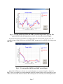
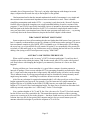
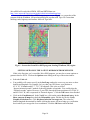
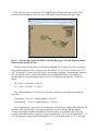
longitude. As in the previous method for gathering NED data, specify the upper and lower limits
for latitude and longitude, plus and minus 0.1° of the station’s position.
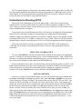
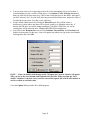
Fig A7 — Input bounding box. Use decimal degrees to enter bounding latitudes and
longitudes; that is, plus or minus 0.1 degrees of the station’s position.
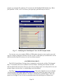
When you’ve finished defining the bounding box (be careful to specify West longitudes in the
US as negative numbers), click the Draw Area button and choose “Elevation” data from the next
list.
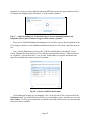
Now, click the Next button to bring up the “USGS Available Data for download” screen.
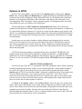
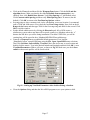
Check “National Elevation Dataset (1 arc second) Pre-packaged Float format,” otherwise known
as “GridFloat.” (Do not check the “1/3 arc second” format unless you want to download some
huge files with that unnecessary amount of resolution.)
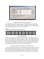
Fig A8 — Choose GridFloat data format.
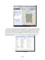
Click Next again to bring up your shopping “Cart” on the left side of the screen and click the
Checkout button. You will be asked to provide your e-mail address, twice, and then you can click
Place Order. You’ll be given instructions to open the e-mail that will be sent to you automatically
when your data is available.
Page 25