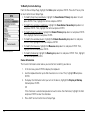
1
DELORME
Earthmate GPS PN-20
®
GPS for wherever you go
OFF-ROAD…
ON-ROAD…
ON-WATER
Updated for 1.5 Firmware Release
User Manual
Table of Contents
Getting Started............................................................................................................................................................................2
Basic Functions...........................................................................................................................................................................9
Scenarios................................................................................................................................................................................... 11
The Satellites Page...................................................................................................................................................................20
The Map Page...........................................................................................................................................................................23
The Compass Page...................................................................................................................................................................37
The Trip Info Page.....................................................................................................................................................................39
The Find Page...........................................................................................................................................................................42
The Waypoints Page.................................................................................................................................................................50
The Routes Page.......................................................................................................................................................................55
The Tracks Page........................................................................................................................................................................60
The Sun/Moon Page.................................................................................................................................................................64
The Tide Page...........................................................................................................................................................................66
The Hunt/Fish Page..................................................................................................................................................................67
The Device Setup Page.............................................................................................................................................................68
Appendix A: Page Function Table............................................................................................................................................. 74
Appendix B: Specifications.......................................................................................................................................................78
Appendix C: Waypoint Symbols...............................................................................................................................................82
Glossary....................................................................................................................................................................................85
Index..........................................................................................................................................................................................88
Getting Started
Tips:
•Setting the correct battery
type will optimize the battery’s performance. For more
information on selecting battery type, see To Modify the
System Settings on page 68.
• Because the Earthmate GPS
PN-20 has a real-time clock
that requires power even
when the device is powered
off, your batteries are constantly in use. If you use
your Earthmate GPS PN-20
sporadically (for example,
more than a month between
uses), remove the batteries
for long-term storage and
then reinsert them when you
want to use the device.
Thank you for purchasing the DeLorme Earthmate GPS PN-20. This versatile and compact GPS
receiver lets you create tracks of your travels, create routes so you never get lost, find points of
interest, and more!
This manual provides instructions for using all of the functionality available on the Earthmate GPS
PN-20. Most of the chapters are based on pages, which are the main screens on the Earthmate
GPS PN-20. Each chapter describes the features of that particular page and the menu options that
are available from that page. In addition, this manual also discusses basic functions (such as map
panning, battery information, map data information, and more), as well as frequently asked questions, warranty information, and so on.
Step 1 — Installing the Batteries
The Earthmate GPS PN-20 is a battery-powered device. It can be powered by one rechargeable
Lithium-ion (Li-ion) battery or two AA batteries (NiCd, NiMH, alkaline, or lithium).
To install the batteries, unscrew the D-rings on the back of the Earthmate GPS PN-20 until you can
remove the battery cover. Then, insert the batteries according to the polarity symbols found inside
the battery compartment. Position the battery cover on the Earthmate GPS PN-20 and re-screw the
D-rings into the Earthmate GPS PN-20.
Step 2 — Turning On the Earthmate GPS PN-20
Tip: If the Earthmate GPS
PN-20 does not turn on,
ensure that the batteries are
inserted into the device properly and that they are mostly or
fully charged.
2
The Power button is located at the bottom-right corner of the button area. To turn on the Earthmate
GPS PN-20, press and hold the Power button for 1.5 seconds. The first page that displays on the
screen after you turn on the Earthmate GPS PN-20 is the Satellites Page. Your GPS status displays
in the upper-left corner of the Satellites Page. If you press the PAGE button, the Map Page displays
on the screen. The map will not center on your current location until you have achieved a 2-D or 3-D
fix. The default view when a GPS fix cannot be obtained is your last GPS position.
If it is taking a long time for the device to obtain a 2-D or 3-D fix, verify it has a clear view of the sky.
Be sure that trees, buildings, and other obstacles are not blocking the Earthmate GPS PN-20. If the
device still cannot obtain a 2-D or 3-D fix, press the QUIT button to return to the Satellites Page,
press the MENU button, highlight the Set Current Location option, and then press ENTER. The
Map Page automatically displays. Pan the map to your current location and press ENTER.
To turn off the Earthmate GPS PN-20, press the Power button and then press the ENTER button to
confirm you want to turn the Earthmate GPS PN-20 off.
Getting Started
Step 3 — Using the Buttons on the Earthmate GPS PN-20
The buttons on the Earthmate GPS PN-20 give you access to all of the functions on the device.
Each button has a unique purpose:
In/Out
Use the IN and OUT button to zoom in or zoom out on the map.
• Press the IN (left) side of the button once to zoom the map in one level and show more detail.
• Press and hold the IN side of the button to zoom the map in to its maximum level.
• Press the OUT (right) side of the button once to zoom the map out one level and show less detail.
• Press and hold the OUT side of the button to zoom the map out to its maximum level.
• Press IN and OUT to scroll back and forward through a list.
Page
Use the PAGE button to scroll through the enabled pages on the Earthmate GPS PN-20. The default
page button sequence is:
• Satellites
• Map
• Compass
• Trip Info
• Route Directions (available when navigating)
Tip: Use the Device Setup/
Page Order settings to add,
remove, or reorder the pages
that display when you press
the PAGE button. For more information, see the To Modify
the Page Order Settings
section on page 71.
For an overview of what you can view and do on each page, as well as each page’s menu functions,
see Appendix A on page 74.
Menu
The MENU button provides access to many functions. Some menus are divided into top and bottom
sections that are separated by a line. The items in the top section are specific to the active page.
The items in the bottom section are standard menu options that are available from any page.
3
Find
The Find button is labeled with a magnifying glass. Use it to search for a point of interest, waypoint,
address, coordinate, and more. You can search for a location based on its name or its proximity to
the current map center.
Mark Waypoint
The Mark button is labeled with a push pin. Use it to mark a waypoint at your current GPS location
or the cursor location (when panning). Once you mark a location, you can edit the waypoint name,
coordinates, and elevation; provide comments about the waypoint; view the waypoint on the map;
navigate to the waypoint; average the waypoint for greater accuracy; save the waypoint; or delete
the waypoint.
Arrow Keypad
You can use the arrow keypad to:
• Move the map cursor left, right, up, or down.
• Pan the map by moving the cursor on the edge of the map.
• Highlight options in menus or lists. Press down to move to the next entry, press up from the
first entry to go to the last entry, or down from the last entry to go to the first entry. Press and
hold to quickly scroll through a menu or list.
• Highlight characters on the keyboard screen.
Enter
You can use the ENTER button to:
• Select a menu entry or on-screen button/field.
• Get information about a point on the map. Press the ENTER button at any time when viewing
the Map Page to see detailed information, if available.
Quit
The function of the QUIT button varies depending on the current status of the Earthmate GPS PN-20.
You can use the QUIT button to cancel actions, such as panning, for keyboard entry, to delete
individual points when measuring distance, and so on. If you are performing an action, pressing the
QUIT button moves you backward through the page sequence.
4
Power
Use the Power button to turn the Earthmate GPS PN-20 on and off, to change the backlight settings, or to reset the Earthmate GPS PN-20:
• To turn the Earthmate GPS PN-20 on, press and hold the Power button until the Welcome
screen displays.
• To turn the Earthmate GPS PN-20 off, press the Power button. When you see the “Press
ENTER to power down” message, press the ENTER button to confirm that you want to turn
off the Earthmate GPS PN-20. If you do not want to turn the Earthmate GPS PN-20 off, wait
five seconds or press the QUIT button.
• To change the backlight intensity percentage, press and hold the Power button (for approximately two seconds if the device is powered on) until you see the backlight screen display.
Press the arrow keypad to the left to move the slider and decrease the backlight intensity.
Press the arrow keypad to the right to move the slider and increase the backlight intensity.
Each level of intensity represents a 10% interval (100% is the maximum backlight intensity,
10% is the minimum backlight intensity).
• To turn the backlight off, press and hold the Power button for three seconds (while the device
is powered on) until the backlight shuts off.
Note: The backlight turns on any time you press a button unless you turned it off using the
Device Setup menu. For more information, see the To Modify the Display Settings section on
page 68.
• When you charge the Earthmate GPS PN-20, the backlight intensity is automatically reduced
to decrease charging time.
• To reset the Earthmate GPS PN-20 when it is on, press and hold the Power button for seven
seconds.
Getting Started
Press ENTER to confirm that
you want to turn the device off
Tip: Decrease the backlight
timer to help conserve battery
life.
Step 4 — Transferring Map Data to the Earthmate GPS PN-20
Your Earthmate GPS PN-20 comes equipped with an overview-level base map showing world and
U.S. coverage. While this provides a great view of a large area, chances are that you will want a
detailed view of a smaller area for hiking, geocaching, and other activities. You can transfer more
detailed maps to the Earthmate GPS PN-20 using:
5
• Compatible DeLorme Mapping Software—Instructions for sending maps to your Earthmate
GPS PN-20 vary by application. For more information, see the mapping application’s Help
system for instructions on sending maps to your Earthmate GPS PN-20.
• Online Map Cutter for Earthmate GPS PN-20—Visit http://data.delorme.com. You must
have an Internet connection to use this website. For instructions on sending maps to your
Earthmate GPS PN-20 with this online application, see the Online Map Cutter for Earthmate
GPS PN-20 Help system.
You can transfer many types of data, such as satellite imagery, aerial imagery, USGS Topo Quad
maps, NOAA nautical charts, and more. Save maps in internal memory or on a removable memory
(SD/SDHC) card in the Maps directory.
Step 5 — Use the Pages to Track, View Your Position While You Travel, and More
Note: Large maps may take
longer to transfer to the device.
This manual describes all of the functions found in each page on the Earthmate GPS PN-20. See
the Table of Contents to find the headings that are most important to you.
Tip: While it is faster to access
maps that have been saved to
internal memory, the quickest
way to transfer maps to your
device is to copy the map files
to an SD card with an SD card
reader.
About GPS
What is GPS?
The Global Positioning System (GPS) applies modern technology to the ancient art of navigation.
The U.S. Department of Defense has developed and launched a series of positioning satellites in
an orbiting “constellation.” These satellites are used as reference points much the same way stars
have been used in conventional navigation.
Using these satellites, a GPS receiver can determine your position anywhere on the globe. GPS
provides accurate information about coordinate position, elevation, speed, and direction of travel.
Many people have discovered the benefits of GPS for recording tracks and much more.
How Does GPS Work?
The GPS constellation consists of at least 24 satellites, each carrying several atomic clocks to
ensure the most accurate time possible. The satellites broadcast low-power radio waves containing
the satellite’s identity code and the exact time (to the nanosecond) that the message was sent.
When a GPS receiver picks up a satellite signal, it identifies the satellite and compares the signal
time with its own clock. The time difference represents the time it has taken for that radio wave to
6
travel from the satellite to the receiver. Since radio waves travel at the speed of light, the time difference can be used to calculate the distance from the satellite to the GPS receiver.
Getting Started
The satellite’s identity code provides the location of the satellite, and the distance to the receiver
creates a sphere of possible locations for the GPS receiver. Without more information, the receiver
knows only that it is located somewhere on that sphere.
Two additional satellites are necessary to narrow down the receiver’s position. Each of these
satellites sends a similar radio message containing time and identity information. The GPS receiver
checks the orbital location of each satellite and uses the elapsed time to create two additional
spheres of possible locations. These three spheres intersect at two points; however, one of these
points is eliminated because it is far away from the Earth’s surface. Therefore, the second point
is assumed to be correct. The data from these three satellites provides the receiver with a twodimensional location.
Data acquired from a fourth satellite pinpoints the receiver’s exact location. This additional positioning information allows the GPS receiver to calculate its elevation, which is particularly important for
GPS users in mountainous locations.
GPS Position Accuracy
Any buildings, natural structures, or heavy foliage that obstruct the GPS antenna’s view of the sky
prevent satellite signals from reaching the receiver and decrease the accuracy of your position.
Note: Placing the Earthmate
GPS PN-20 in a backpack
pocket or jacket should not
result in problems with GPS
position accuracy.
Frequently Asked Questions
Can I install non-DeLorme maps on the Earthmate GPS PN-20?
DeLorme’s professional GIS software, XMap ®, allows you to register non-DeLorme maps and
transfer them to the Earthmate GPS PN-20.
How can I improve the life of my batteries?
When the backlight is on, it consumes a large part of the battery. Changing the backlight timer to
turn off after 15 seconds could double the life of your batteries. For information on changing the
backlight timer, see To Modify the Backlight Timer on page 69.
7
Other ways to increase the life of the batteries include:
• Removing your batteries for long-term storage
• Setting the GPS Settings to Power Saving mode
• Disabling GPS while indoors
• Using batteries with higher milliamp ratings (such as Duracell Ultras, Energizer E2s, etc.)
Why are the new batteries that I put in the device the last time I used it (a month ago)
already dead?
Because the Earthmate GPS PN-20 has a real-time clock that requires power even when the device
is powered off, your batteries are constantly in use. If you use your Earthmate GPS PN-20 sporadically (more than a month between uses), remove the batteries for long-term storage and then
reinsert them when you want to use the device to improve battery life.
Why does it take so long to find satellites?
Acquiring satellite data takes longer if the batteries are low or if the Earthmate GPS PN-20 does not
have a clear view of the sky. Be sure that trees, buildings, and other obstacles are not blocking the
Earthmate GPS PN-20 when you begin tracking.
Other factors, such as if you haven’t used the device for a long time or if you’ve moved the device a
great distance from its last location, can affect the amount of time it takes to find satellites.
Note: The charging circuit in
the PN-20 was designed for
optimum operation with the
RCR-V3 Li-Ion battery sold
through DeLorme. Other RCRV3 Li-Ion batteries may work
and charge in the PN-20, but
DeLorme can make no guarantees of compatible operation.
8
How do I reset the Earthmate GPS PN-20 when it will not turn off?
You can reset the Earthmate GPS PN-20 by holding the Power button for seven seconds. If that
does not work, remove and replace the batteries to reset the Earthmate GPS PN-20.
Why won’t my Lithium-ion battery hold a charge?
The Li-ion battery is designed to last for 300-500 uses, depending on environmental conditions.
Basic Functions
Basic Functions
This chapter provides descriptions for some of the basic functions of the Earthmate GPS PN-20.
Panning the Map
There are two ways to pan the map:
• Manually pan the map by placing the cursor along the map edge and hold the arrow keypad in
the direction that you want to move the map.
• Automatically pan the map when GPS tracking/navigating. The map automatically pans in the
direction of travel when the GPS cursor travels outside of the map area.
Getting Information About a Map Object
There are two ways to get information about a map object.
• Press the arrow keypad to position your cursor over the map objects you want to learn more
about. The status bar at the bottom of the Map Page provides name information for the object.
Press ENTER to display the Info Page.
• Press Enter at any time to get information about objects that are at your current GPS location.
Note: If multiple objects are found at the cursor location, the Multiple Objects screen displays a list of the available objects at that location; objects you have created appear at the top
of the list. Use the arrow keypad to select an object and then press ENTER to view the Info
Page for that object. To save a map object as a waypoint, highlight it and select Mark.
Navigating vs. Tracking
What is the difference between navigating and tracking with the Earthmate GPS PN-20?
• You are navigating with the Earthmate GPS PN-20 when you use it to follow a route.
• You are tracking with the Earthmate GPS PN-20 when the GPS is on, but you are not following
a route.
Move your cursor to the edge
of the screen to pan the map in
that direction
Note: Manually panning the
map when simulating navigation or playing back a track will
change the focus of the map
from your GPS location to the
manually panned location.
Note: Once you have marked a
map object as a waypoint, you
can edit the waypoint details
(by highlighting the waypoint
information, pressing ENTER
and then modifying the information), view it by highlighting
View and pressing ENTER, or
create a route by highlighting
Route and pressing ENTER.
9
Using the Keyboard
Keyboard screen
Tips:
•Press OUT to quickly highlight the OK button.
•Press IN to delete one
character at a time.
•Press QUIT to cancel your
keyboard entries.
•For existing text, enter a letter to replace the highlighted
content. To keep the existing
text but move the cursor
to the beginning/end of the
text, select the option
to move the cursor to the
beginning or to move the
cursor to the end of the text.
Tip: Use multiple SD cards to
create a map library for long
trips or to have the entire state
in your pocket.
10
The keyboard is accessible when you need to enter text, such as when editing a waypoint label.
Once the keyboard displays, use the arrow keypad to highlight the letter (A–Z), number (0–9), symbol
(+, -, /, &), or punctuation (period, comma, apostrophe, exclamation point) you want to use. In addition,
the following special functions are provided:
Moves the cursor one space to the left without deleting characters.
Moves the cursor one space to the right without deleting characters.
Changes the letters from lowercase to uppercase letters (the active case is shown in the
keyboard). This function toggles to all caps mode by pressing ENTER twice.
Moves the cursor one space to the left, deleting the character that was there.
Clears the content of the text field being edited.
Accepts the changes made to the text field and closes the keyboard.
Moves the cursor one space to the right, leaving a blank space.
Moves the cursor to the next line. This option can be used to type more than one line in a
comment field.
Charging the Earthmate GPS PN-20
If you are using a DeLorme-supplied RCR-V3 Li-Ion battery, you can charge the Earthmate GPS
PN-20 battery by connecting the USB end of the cable to your computer and the other end of the
cable to the Earthmate GPS PN-20. To charge the device with the USB cable, the device must be
powered on while connected. You cannot use the Earthmate GPS PN-20 to charge rechargeable AA
batteries.
Storing Data on the Earthmate GPS PN-20
The Earthmate GPS PN-20 stores waypoints, tracks, routes, and the base map data in its internal
memory. You can save maps that are transferred to the Earthmate GPS PN-20 in internal memory
or on a removable memory (SD/SDHC) card located under the battery compartment.
Scenarios
Scenarios
You can use your Earthmate GPS PN-20 for a variety of activities, including:
• Geocaching
• Bird watching
• Biking
• Managing GIS data
• And much more!
Below are some scenarios for using the Earthmate GPS PN-20 in these situations.
Seeking a Geocache
Geocaching is a popular hide-and-seek sport for GPS users. Hiders place a cache (prizes and/or log
book) at an approved location and seekers use the hiders’ clues (coordinate information and clues
that are shared via the Internet—for some geocache locations, visit www.geocaching.com) to find
the cache. The cache usually contains a variety of prizes for the successful seeker (seekers are
encouraged to observe the “take one, leave one” policy on prizes in the cache).
Mike and his family are looking for a fun weekend activity that they can enjoy in the great outdoors.
A coworker tells Mike about geocaching and they decide to try the activity with their new Earthmate GPS PN-20.
Before they leave for their adventure, they visit www.geocaching.com to find a cache in their area.
Once they find a cache, they use their compatible DeLorme mapping program to see the geocache
on the map and then download a map package of the area.
1.
2.
3.
4.
5.
6.
Visit www.geocaching.com and select the geocache you want to try to find.
Save the geocache’s .loc file to your computer.
Open your DeLorme program and click the Draw tab.
Click File to open the draw file editing area.
Click Import. The Import Draw File dialog box displays.
From the Files of type drop-down list, select LOC file (*.loc).
11
Navigate to the geocache
7. Browse to the location where you saved the .loc file in step 2, select the file, and then click
Open. The draw objects in the imported file display. A new waypoint layer is automatically
created for the imported file.
8. Click Done to return to the Draw dialog area.
9. Click the Handheld Export tab in your software.
10. With the map centered on the geocache area, click the Select/Edit tool and then click the
grids on the map that cover the map area you want to export to the Earthmate GPS PN-20.
11. Name and save your map package.
12. Click the Exchange button on the Handheld Export tab or in the toolbar.
13. Send the geocache waypoint layer and map package to the device and then click Done.
Once the map and waypoint are loaded on the Earthmate GPS PN-20, they use the Waypoints Page
to locate the coordinate that was provided in the cache’s clue. Once the waypoint is found, they
create a route from their current position (home) to the waypoint location.
14. Press MENU and then select Waypoints.
15. Highlight the geocache waypoint in the list and then press ENTER.
16. Use the arrow keypad to highlight the Route button and then press ENTER.
17. Use the arrow keypad to highlight the Navigate button and then press ENTER.
18. Press PAGE until the Compass Page displays.
19. Use the Compass Page to find the direction of travel. The bearing arrow (large green arrow)
points in the direction of the next stop in the route. Use the bearing arrow to determine the
correct direction of travel towards the waypoint.
Once they arrive at the cache, they take a trinket from the cache and leave a pencil they bought
while on a recent trip to Niagara Falls. Then they update the waypoint symbol on the Earthmate
GPS PN-20 to the geocache found symbol. When they return from their adventure, they visit the
cache’s page on www.geocaching.com and enter a log about their experience.
Hiding a Geocache
Mike and his family had so much fun on their first geocache outing, that they decide to create a
geocache of their own!
12
The family decides to hide the cache along a public trail approximately 10 miles from their home.
Before they can add the cache to geocaching.com, they must get a very accurate coordinate for
the location where they’re hiding the cache. To do so, they must mark a waypoint at the geocache
location and then use the Averaging function on the Earthmate GPS PN-20. When a waypoint is
averaged, a series of GPS readings for the waypoint’s location is recorded and averaged to increase
the positional accuracy of the waypoint.
1. Ensure you have a 3-D signal at the location of the geocache.
2. Press the Mark button. A waypoint is placed at the current GPS location.
3. Highlight the default waypoint symbol and press ENTER. Use the arrow keypad to select the
geocache hidden symbol and press ENTER.
4. Highlight the default label and press ENTER. Enter the new label “Our First Geocache” using
the keyboard, highlight OK, and press ENTER.
5. Highlight the Comment field and press ENTER. Enter the comment information (“Hid cache
under pile of sticks”) using the keyboard, highlight OK, and press ENTER.
6. Highlight the Avg button and press ENTER. The GPS status, coordinates, elevation, number
of readings at the location, and estimated accuracy display. The positional accuracy of the
way-point is increased by the number of recordings. A small estimated accuracy number
indicates that the waypoint is very close to its actual coordinates.
7. Highlight the OK button and press ENTER.
8. Use the arrow keypad to highlight the Save button and then press ENTER.
Once the geocache location point is averaged, they visit www.geocaching.com and create a new
geocache with the averaged coordinate.
Scenarios
Marking the “Our First Geocache” waypoint
Bird Watching
The Earthmate GPS PN-20 is a perfect companion for bird watching. With aerial imagery loaded on the
Earthmate GPS PN-20, bird watchers can see clearings, tree cover, geological features, and more. In
addition, they can use the waypoint function to mark waypoints on the map when they see particular
types of birds. They can also use the track functionality to create a breadcrumb trail while they’re traveling to their bird watching spot and then follow that track back to their vehicle so they do not get lost.
13
Safety Tip: Be sure to bring
a map and compass with you
on your expedition in case the
batteries in your Earthmate
GPS PN-20 are low.
Editing the track settings
Tip: Use the Time option if
you want to record a lot of
detail. Use the Distance option
if you are going to make many
steps along the way.
14
In the scenario below, Tom, a bird watcher, uses the Earthmate GPS PN-20, aerial imagery, and the
Earthmate GPS PN-20 Online Map Center to prepare for his expedition.
Before Tom leaves for his trip, he uses the Earthmate GPS PN-20 Online Map Center to download
additional map data so he can get satellite and aerial views of the area where he’ll be. This is helpful
to Tom because he has heard that the bird population is greater near the swamp land. With the aerial
and satellite data available from the Online Map Center, Tom can see the geological formations in his
bird watching area before he leaves, giving him a greater idea of where he should spend his day.
1. Visit http://data.delorme.com to download the area where you will be bird watching.
Once the map of the location is saved on the Earthmate GPS PN-20, Tom leaves for his bird watching trip. When he arrives at the location, he parks his truck, turns on the Earthmate GPS PN-20,
waits until he gets a 2-D or 3-D fix, places a waypoint to represent the parking lot, modifies his
tracking settings, and then turns on Track recording.
2. Press and hold the Power button to turn on the Earthmate GPS PN-20.
3. Press the Mark button on the device to place a waypoint at the parking lot location and press
ENTER.
Note: To choose a different symbol, scroll to the top of the Waypoints screen to highlight the
waypoint symbol and press ENTER. Use the arrow keypad to find and highlight the symbol
you want.
4. Press MENU, highlight the Tracks option, and press ENTER.
5. Press MENU, highlight the Edit Track Settings option, and press ENTER.
6. Highlight the Record Points By drop-down list and press ENTER.
7. Highlight the Time option and press ENTER.
8. Highlight the Recording Interval text field and press ENTER. Use the arrow keypad to
increase/decrease each digit. Press ENTER after each digit is changed.
9. If the On button is not activated, highlight the button and then press ENTER to activate it.
OR
If the On button is already activated, go to step 10.
Tom continues his journey to the bird-watching spot. While he’s walking, he notices an eagle in a
tree and wants to use his Earthmate GPS PN-20 to mark a waypoint at the bird location.
10. While at the spot of the tree, press the Mark button.
11. Scroll to the top of the Waypoints screen to highlight the waypoint symbol and press ENTER.
Use the arrow keypad to find and highlight the bird icon and press ENTER.
12. Scroll to the label text field (to the right of the bird icon) and press ENTER. Use the arrow
keypad to highlight the letter E and press ENTER. Repeat this step for each letter in the word
“Eagle.” When you’re finished, highlight OK and press ENTER.
13. Scroll to highlight the Save button and press ENTER.
When he arrives at the desired bird watching spot, he saves his track log, turns off the GPS device,
and spends the day bird watching.
14. Press MENU, select Tracks, and press ENTER.
15. Scroll to highlight the Save button and press ENTER.
16. Press the Power button to turn off the Earthmate GPS PN-20. Press ENTER when prompted.
When he’s finished for the day, he turns the GPS device back on, waits until he gets a 2-D or 3-D
fix, and then follows his track to where he started—ensuring he won’t get lost. The process of following his initial track creates a new route that he can use to navigate back to the parking lot.
17. Press and hold the Power button to turn on the Earthmate GPS PN-20.
18. Press MENU, select Tracks, and press ENTER.
19. Select the track that was saved earlier that day and press ENTER.
20.Scroll to highlight the Follow button and press ENTER.
Tom follows the route directions on the map screen and reaches his start location without getting lost.
Scenarios
Marking the “Eagle” waypoint
Mountain Biking
The Earthmate GPS PN-20 is also a perfect companion while mountain biking.
Carla and Jordan are preparing for a ride at Slickrock Bike Trail. Before they go, they download data
of the Moab, Utah, region with their compatible DeLorme software program. They create a route
that starts and finishes at the trailhead and includes three stops: Shrimp Rock, Upper Shrimp Rock,
and Mt. View Cave. Then they export the data of the region, as well as the route they created, to
15
Navigating a route
Editing track details
16
their Earthmate GPS PN-20. Once they arrive at the trail, they mount their GPS devices onto their
bikes, power them on, and select the route they plan to use for navigation.
1. Press MENU, highlight the Routes option, and press ENTER.
2. Highlight the route and press ENTER. The map displays.
3. Highlight the Navigate button and press ENTER. The map displays.
4. Press MENU, highlight the Tracks option, and press ENTER.
5. Ensure the On button is activated. If it is not, highlight the On button and press ENTER to
activate it.
6. To view the location in real time, press QUIT to display the Map Page.
The GPS device not only tells them where they are in real time but also keeps a record (track) of
everywhere they’ve been. Once they’ve finished the trail, they decide to save the track so that they
can see where they’ve ridden.
7. Press MENU, highlight the Tracks option, and press ENTER.
8. Highlight the Save button and press ENTER.
Since they might want to visit this track again later, they decide to name the track with the trail name
and assign it the same color that they assign all of the trails they’ve ridden. They also use the comments feature in the Tracks screen to note if they thought the trail was easy, moderate, or difficult.
9. Highlight the Track text field and press ENTER to name the track “GW Forest” using the
keyboard. Then, highlight OK and press ENTER.
10. Highlight the Color block and press ENTER. Use the arrow keypad to highlight the color blue
and press ENTER.
11. Highlight the Comment text field, press ENTER, and assign a difficulty comment using the
keyboard. Then, highlight OK and press ENTER.
12. Highlight the View button and press ENTER to see a snapshot of where you went on the trail.
When they arrive home, they download the track and waypoint information into their DeLorme software so they can see a larger view of where they were. They finish by saving the track information
in their mountain biking library project.
Mapping Assets in the Field
Scenarios
Up-to-date maps are often critical to efficiently manage and maintain company assets. You may
need several layers of information to locate and update information about these assets in the field,
such as road, topographic, and historic maps, as well as high-resolution aerial imagery and GIS layers. The Earthmate GPS PN-20 is ideally suited to handle these needs; you can transfer virtually any
type of data from DeLorme software onto the device for use in the field, and then use the Earthmate
GPS PN-20 to map new assets and the conditions of existing assets. You can then bring this information back into the office to update the central database.
The division managers of a utility company are responsible for overseeing the bimonthly update of
the spatial database for each division. They must collect information regarding new line locations,
conditions, and areas requiring repair or replacement to update the database and assist in planning
for the next month’s maintenance schedule.
The company uses the Earthmate GPS PN-20 with DeLorme’s professional XMap® GIS software
to perform the updates. Each division is divided into quadrants with crews of two assigned to each
quadrant. Each crew has an Earthmate GPS PN-20 and is responsible for uploading the maps and
data they need on the device before heading out into the field. This data includes an updated copy of
the quadrant’s GIS utility line layer, road and topographic maps, waypoints of pole mile markers, highresolution aerial imagery downloaded from the state GIS department, and digitally scanned paper
maps of utility line schematics. These maps are geo-registered to the DeLorme map using XMap.
Preparing data for and transferring data onto the Earthmate GPS PN-20
1. Open XMap, set up a subscription to the central database, and obtain an updated copy of the
utility layer for the division.
2. Load the GIS layer into the GIS tab and use the spatial query tool to isolate the line objects
within a particular quadrant.
3. From the ImageReg tab, open the digital image of the schematic map for the quadrant. Use
the GIS line layer as reference to place points on the digital image that correspond to points
on the DeLorme map. Then, process the image to geo-register it to the map.
4. Visit the state GIS website and download any digital aerial imagery in .sid or .tiff format that
corresponds to the quadrant. Use the Map Data tab to load the imagery into XMap.
17
5. From the Handheld Export tab, center the map on the quadrant and customize the handheld
grid size to best fit the area. Then, click the Select/Edit tool and select the grids on the map
that cover the quadrant.
6. Click the Options button and select the check box next to each dataset to transfer to
the Earthmate GPS PN-20. For high-resolution aerial imagery, select XMap Raster Data
Snapshot. For topographic, road, and GIS data, select XMap USA Topographic Data. For
scanned historic maps, select the ImageReg Data series. Customize the display ranges of
the datasets based on your preferences.
7. Name and save the map package. Then, click the Exchange button on the Handheld Export
tab or in the toolbar. Send the mile marker waypoint layer and saved map package containing
the road, topographic, historic, and aerial imagery maps to the device and then click Done.
Using the Earthmate GPS PN-20 in the field
With all the data transferred to the Earthmate GPS PN-20, the field crew for each quadrant is ready
to head into the field to update and verify the utility data. One field crew is responsible for updating
a quadrant with significant additions and changes to the existing infrastructure. They have a list of
mile marker ranges where these changes took place.
1. Use the Routes option on the Earthmate GPS PN-20 to create a route from the field office
(current GPS location) to the utility waypoint mile marker next to the service road entrance.
2. Once the field crew arrives at the entrance, the worker with the Earthmate GPS PN-20 directs the driver to each mile marker on the list where utility additions and modifications were
made. They use the bearing and distance information for each waypoint to navigate along
the service road. Once they are parallel to a mile marker, they set out on foot to the pipeline,
using the aerial imagery, topographic, and GIS data to give them field reference.
3. Once the line locations are located, the crew collects pertinent waypoints and tracks on the
Earthmate GPS PN-20 to record information about the line. They use the various waypoint
symbols on the Earthmate GPS PN-20 to represent different features, such as areas in need
of service or areas where there are dangerous trees that need to be removed. When they
come across an area where the GIS data does not correlate with the location of the utility line
in the field, they record a track for that length of segment and drop waypoints at each line vertex.
18
4. When the field crew is finished, they return to the office and download the waypoints and
tracks to XMap. Then they review the data to update any labels that need clarification and put
additional notes for the points using the MapNote feature in the Draw tab.
5. Once they are finished with the review, they synchronize their field data to the central database using the synchronize feature in XMap.
6. The next day, the database manager responsible for the division reviews their synchronized
data against the corporate GIS layer and updates the corporate layer within XMap.
Scenarios
19
The Satellites Page
Viewing the Satellites Page
Once you turn on the Earthmate GPS PN-20, the Satellites Page displays. The Satellites Page informs
you of your current GPS status, the number of satellites the Earthmate GPS PN-20 is acquiring data
from, the signal strength, and the GPS accuracy (available only when a 2-D or 3-D fix is obtained).
Satellites Page
Tip: If it is taking a long time
for the device to obtain a 2-D
or 3-D fix, verify it has a clear
view of the sky. Be sure that
trees, buildings, and other
obstacles are not blocking the
Earthmate GPS PN-20. If the
device still cannot obtain a
2-D/3-D fix, press PAGE until
the Satellites Page displays,
press MENU, highlight the Set
Current Location option, and
then press ENTER. The Map
Page displays automatically.
Pan the map to your current
location and press ENTER.
20
GPS and WAAS Status
GPS status displays in the upper-left corner of the page and displays the following, depending on
your satellite acquisition status:
• GPS Off—The GPS is disabled.
• No Fix—The GPS cannot find sufficient satellite data to determine your current GPS position.
• 2-D—The GPS connection is successful, but the connection quality is not quite as sufficient
as a 3-D fix. This usually indicates insufficient data for an accurate location because only three
satellites are being used or signals from the satellites are poor. Move your receiver to another
location until you get better reception.
• 3-D—The GPS receiver is receiving sufficient satellite data to determine your location.
If WAAS displays in the upper-right corner of the page, the Earthmate GPS PN-20 has obtained a
WAAS connection. WAAS provides up to five times greater position accuracy than a regular 2-D or
3-D connection. WAAS is available only in North America.
Satellite Constellation and Signal Graph
Both the satellite constellation and the satellite signal graph display visible satellites and their identifying numbers, which are assigned by the Department of Defense.
In the satellite constellation, satellite-shaped icons display each satellite’s position in the sky relative
to the device’s current position.
In the satellite signal graph, each satellite is represented as a bar that is sized according to signal
strength. Longer bars have greater strength and shorter bars have less strength.
The icons in the satellite constellation and the lines in the signal graph are color coded based on the
quality of the data they are transmitting:
• Red—Indicates your GPS receiver is tracking the satellite, but it is not receiving data from it.
• Green—Indicates your GPS receiver is tracking the satellite, ephemeris data is available, and
the satellite is being used for navigation.
• Blue—Indicates your receiver is tracking the satellite, ephemeris data is available, the satellite
is being used for navigation, and the satellite has WAAS corrections available.
GPS Accuracy
The GPS accuracy displays in the lower-left corner of the screen in feet or meters, depending on
the measurement preferences you assigned in the Device Setup Page (see To Modify the Units
Settings on page 72 for more information). GPS accuracy is represented on the map by a circle with
a radius equal to the GPS accuracy, allowing you to see a representation of your accuracy in relation
to your map scale. The accuracy of the Earthmate GPS PN-20 is +/- 10 meters.
Battery Indicator
The battery indicator is a graphic representation of the current available battery power:
• Four green bars—Indicates a full charge.
• Three green bars—One quarter of the battery power has been used.
• Two yellow bars—One half of the battery power has been used.
• One red bar—Three quarters of the battery power has been used. Once the battery has
reached 5% of its total battery power, a low battery warning displays.
The Satellites Page
Note: WAAS was developed
by the Federal Aviation
Administration to enhance
the accuracy—usually to
within three meters of actual
position—of GPS receivers
by providing a modified GPS
signal. After calculating the error factor at ground control stations throughout the U.S., the
corrected signal is transmitted
to two geostationary satellites
that in turn transmit the GPS
signal back to Earth.
While the Li-Ion battery is charging, the battery indicator graphic is animated and the word “Battery” is replaced with “Charging.” Once the battery is fully charged, the battery indicator graphic
displays four static green bars and the word “Charging” is replaced with “External” until the charging cable is removed.
Battery indicator label changes
to “external” when charging
21
Note: If you do not choose
the correct battery type in the
Device Setup Page, the battery
indicator may not provide accurate information. See To Modify
the System Settings on page
68 for more information.
Notes:
•You can also disable the
GPS using the Device Setup/
System menu option. Select
Disable GPS from the GPS
Settings drop-down list.
•When GPS has been
disabled, you can enable it
by pressing MENU and then
selecting Enable GPS.
•GPS is temporarily disabled
when in simulate mode (during track playback, navigation
simulation, and so on).
•If the Earthmate GPS PN-20
is unable to acquire a fix after
approximately ten minutes,
you will see the following
message, “Would you like
to disable the GPS or continuesearching for satellites?”
Select Disable to disable
GPS or Continue to allow
the Earthmate GPS PN-20 to
keep searching for satellites.
22
To Disable GPS
There are many features on the Earthmate GPS PN-20 that do not require a GPS fix. You can turn
off the GPS connection using the Disable GPS option in the Satellites menu.
1. From the Satellites Page, press MENU.
2. Use the arrow keypad to highlight Disable GPS.
3. Press ENTER. GPS OFF displays in the upper-left corner of the screen and all satellites are
removed from the constellation display.
The Map Page
The Map Page
Viewing the Map Page
If a 2-D or 3-D fix is obtained, the Map Page displays the map data that is available for your current
GPS location. If a GPS fix cannot be obtained, the location of your last GPS fix displays on the map.
The color of the GPS arrow depends on your GPS signal.
• A flashing red arrow indicates that the Earthmate GPS PN-20 cannot obtain a GPS signal.
• A blue arrow indicates that the device is in Track Playback mode or Simulate Navigation mode.
• A yellow arrow indicates a 2-D fix.
• A green arrow indicates a 3-D fix.
Below the map are information fields. The information displayed in these fields varies based on the
selections you choose (for more information, see To Change the Information Fields on page 25).
The scale is located above the information fields. A north arrow is also available in the upper-right
corner of the screen; this is available only when Heading Up is selected as the map orientation (or
Course Up is selected when navigating). Note: Raster maps rotate in 90° headings.
To View Map Data
The Earthmate GPS PN-20 comes standard with a base map showing high-level world and U.S.
coverage. You cannot remove the base map from memory.
Several data types are compatible with the Earthmate GPS PN-20:
• High-resolution Cities
• Color Aerial Imagery
• Aerial Imagery (DOQQ)
• USGS Quads (3DTQ)
• NOAA Nautical Charts
• Satellite Imagery
• DeLorme Topographic Data
• World base data
Map Page
Tip: You can also choose to
hide the information fields to
make the map area larger (for
more information, see To Hide
the Information Fields on page
24) or change the number of
information fields that display
(for more information, see To
Arrange the Information Fields
on page 24).
23
The list above shows the default layering of the data types from top to bottom. To change the data
layering, see Layering Your Data on page 31.
To Show/Hide the Information Fields
You can hide the information fields to enlarge the map area.
1. From the Map Page, press MENU.
2. Use the arrow keypad to highlight Info Fields.
3. Press ENTER. The Info Fields Setup screen displays.
4. Use the arrow keypad to highlight Hide Info Fields. Press ENTER. The information fields are
hidden.
Arrange Info Fields menu option
24
Note: If Show Info Fields displays, the information fields are hidden. Press ENTER to display
the information fields.
To Arrange the Information Fields
You can change the information fields to display as one wide field, one wide field and two narrow
fields, four narrow fields, two wide fields, or two narrow fields.
1. From the Map Page, press MENU.
2. Use the arrow keypad to highlight Info Fields.
3. Press ENTER. The Info Fields Setup screen displays.
4. Use the arrow keypad to highlight Arrange Info Fields.
Note: If Show Info Fields displays, the information fields are hidden. Press ENTER to display
the information fields and repeat steps 2 and 3.
5. Press ENTER
6. Use the arrow keypad to select the information field style you want to view.
7. Press ENTER.
To Change the Information Fields
You can customize the information fields to display the information that is most important to you.
You may want to change the information that displays based on the type of activity you are doing.
Note: The information fields change when navigating.
1. From the Map Page, press MENU.
2. Use the arrow keypad to highlight Info Fields.
3. Press ENTER. The Info Fields Setup screen displays.
4. Use the arrow keypad to highlight Change Info Fields.
Note: If Show Info Fields displays, the information fields are hidden. Press ENTER to display
the information fields and repeat steps 2 and 3.
5. Press ENTER.
6. Use the arrow keypad to highlight the information field you want to change.
7. Press ENTER. The available information field options display.
8. Use the arrow keypad to select the information field.
9. Press ENTER.
10. Press QUIT to exit Change Info mode.
The available information fields include:
Information Field Option
Back on Course
Battery Life
Description
The direction of travel needed to return to the route while
continuing in the direction of the destination. Expressed in
degrees.
The percentage of battery power that remains for the Earthmate GPS PN-20.
The Map Page
Change Info Fields menu option
Notes:
•The information fields you
select may be abbreviated
on the screen. For example,
Velocity Made Good displays
as VMG.
•When information is not
available (for example, the
Distance to Finish information field is only pertinent
when navigating), dashes
(- -) display in the applicable
field.
Note: The primary coordinates are shown whenever
coordinates are displayed (for
example, when panning).
25
Information Field Option
Bearing
Coordinates: Primary
Coordinates: Secondary
Course
Device Odometer
Distance to Finish
Distance to Next Stop
Distance to Next Turn
Elevation
Elevation: Maximum
Elevation: Minimum
26
Description
The direction of travel from the current location to the destination (finish or next stop). Expressed in degrees. Displays
a green arrow pointing in the direction of the next waypoint
or route point. The arrow is grayed out when no movement
is reported by the device. It is green when the device is
moving.
The coordinates for the current GPS location, cursor position,
or map center in the primary format. The default is Lat/
Lon. You can change the format in Device Setup>
Units>Coordinates: Primary.
The coordinates for the current GPS location, cursor position,
or map center in the secondary format. The default is
UTM/UPS. You can change the format in Device Setup>
Units>Coordinates: Secondary.
The direction of travel on a route from the starting location to
the destination (finish or next stop). Expressed in degrees.
The total distance traveled in all trips.
The distance from the current location to the route finish.
The distance from the current location to the next stop in the route.
The distance from the current location to the next turn in the route.
The altitude (height) above or below sea level. Expressed in
distance.
The maximum elevation achieved. Expressed in distance.
This field may be reset when you clear Trip Info.
The minimum elevation achieved. Expressed in distance.
This field may be reset when you clear Trip Info.
Information Field Option
ETA at Finish
ETA at Next Turn
ETA at Next Stop
Finish
GPS Accuracy
GPS Status
Heading
Moonrise/Moonset
Next Stop
Next Turn
Next Turn Arrow
Off Course
Speed
Description
The Estimated Time of Arrival at the route finish. Expressed
as hours:minutes AM/PM. ETA is based on the current
device time, not on the local time at the destination.
The Estimated Time of Arrival at the next turn in the route.
Expressed as hours:minutes AM/PM. ETA is based on the
current device time, not on the local time at the turn.
The Estimated Time of Arrival at the next stop in the route
Expressed as hours:minutes AM/PM. ETA is based on the
current device time, not on the local time at the next stop.
The Finish label as it appears in the route directions.
The calculated accuracy of the GPS. Expressed in distance.
The current status of your GPS device. No Fix, 2-D, or 3-D.
The current direction of travel. Expressed in degrees.
The time of day at which the moon will rise and set.
Expressed as hours:minutes AM/PM. This information is
calculated for the specific geographic area where the GPS
has acquired a 3-D fix.
The label for the next stop as it appears in the route directions.
The label for the next turn as it appears in the route directions.
Also displays an arrow showing the direction of the turn/
route direction information.
The arrow representing the next turn as it appears in the
route directions. No label text displays.
The perpendicular distance between the current location
and the route. Expressed in distance.
The current rate of travel for the device. Expressed in
distance per unit of time.
The Map Page
27
Information Field Option
Speed: Average
Speed: Maximum
Speed: Moving Average
Sunrise/Sunset
Time/Date
Time to Finish
Time to Moonrise/set
Time to Next Stop
Time to Next Turn
28
Description
The average speed of the device including stop time.
Expressed in distance per unit of time. This field may be
reset when you clear Trip Info.
The maximum speed achieved. Expressed in distance per
unit of time. This field may be reset when you clear Trip
Info.
The average speed of the device excluding stop time.
Expressed in distance per unit of time. This field may be
reset when you clear Trip Info.
The time of day at which the sun will rise and set. This
information is calculated for the specific geographic area
where the GPS has acquired a 3-D fix. Expressed as
hours:minutes AM/PM.
The time of day and date based on the current GPS location;
accounts for Daylight Saving Time and time zone adjustments.
Time is expressed as hours:minutes AM/PM and date is
expressed as day-month-year (for example, 01-JAN-08).
The calculated time to the route finish based on road
classifications and default speed settings.
The time remaining until the moon rises and sets. This
information is calculated for the specific geographic area
where the GPS has acquired a 3-D fix.
The calculated time to the next stop in the route based on
road classifications and default speed settings.
The calculated time to the next turn in the route based on
road classifications and default speed settings.
Information Field Option
Time to Sunrise/set
Trip: Odometer
Trip: Time Moving
Trip: Time Stopped
Trip: Time Total
Velocity Made Good
Vertical Speed
Description
The time remaining until the sun rises and sets. This information
is calculated for the specific geographic area where the
GPS has acquired a 3-D fix.
The total distance the GPS device has been moving. This
information may be reset when you clear Trip Info.
The total time the GPS device has been moving. This
information may be reset when you clear Trip Info.
The total time the GPS has been tracking but not moving.
This information may be reset when you clear Trip Info.
The total time the GPS has been tracking, both moving and
stopped. This information may be reset when you clear Trip Info.
The component of the current speed that is in the direction
of the route destination. Expressed in distance per unit of time.
The current rate of vertical travel for the device. Expressed
in distance per unit of time.
The Map Page
To Reset the Information Fields
The Map menu offers a Restore Info Defaults option that allows you to change the custom settings
you made to the Show Info Fields, Arrange Info Fields, and Change Info Fields drop-down lists back
to their default settings.
Option
Show Info Fields
Arrange Info Fields
Change Info Fields
Default Setting
Selected
2 narrow fields (when tracking)
4 narrow fields (when navigating)
Speed, Heading (when tracking)
Next Turn, Dist to Finish, Time to Turn, Dist to Turn
(when navigating)
29
Use the steps below to reset the information fields to their default settings.
1.
2.
3.
4.
From the Map Page, press MENU.
Use the arrow keypad to highlight Info Fields.
Press ENTER. The Info Fields Setup screen displays.
Use the arrow keypad to highlight Restore Info Defaults.
Note: If Show Info Fields displays, the information fields are hidden. Press ENTER to display
the information fields and repeat steps 2 and 3.
5. Use the arrow keypad to highlight.
6. Press ENTER. The information fields return to their default settings.
Turn Imagery On/Off
You can turn on imagery to display it on the map or turn it off if you do not want to display it on the map.
1. From the Map Page, press MENU.
2. If Turn Imagery On is highlighted, imagery is turned off. Press ENTER to turn on imagery.
OR
If Turn Imagery Off is highlighted, imagery is turned on. Press ENTER to turn off imagery.
To Measure Distance and Area
Your Earthmate GPS PN-20 has a measurement tool that allows you to measure the distance of a
line or perimeter and area of a polygon.
Measuring distance on the map
Tip: Press QUIT to delete the
last measurement point. To
delete the entire measurement object, press QUIT until
all measurement points are
deleted from the map.
30
1. From the Map Page, press MENU.
2. Use the arrow keypad to highlight Measure Distance and press ENTER.
3. Use the arrow keypad to move the cursor to the area on the map where you want to place
the first point of the line/polygon.
4. Press ENTER to place the first point of the line/polygon on the map.
5. Repeat steps 3 and 4 for each point in the line/polygon you want to measure. The Pan Location Information that displays in the upper-right corner of the screen changes to display the
heading from the last measurement node to your current GPS location, the leg distance, as
well as the total distance from the last measurement node to the first measurement node. It
displays the area once you close a polygon.
Note: Lines must contain at least two points. To make a polygon, you must close the shape
by placing the last point on top of the first point. Hovering the cursor over the start location
snaps to the point and closes the object when you press ENTER to commit the point.
To Set Up the Map
Use the Map Setup option to customize the map by defining data type layering, showing/hiding map
packages, and choosing map orientation, POI detail, how waypoints display on the map, and scale.
Layering Your Data
You can use the Data Layering menu option to prioritize the order in which to display the many
different data types available for use on the Earthmate GPS PN-20. Data layers at the top of the list
display first when available. For example, if you have DeLorme Topographic Data and Aerial Imagery (DOQQ) coverage for the same area, the data type with the highest priority displays on the map
based on the default Data Layering settings. The default order is as follows:
1. Draw Layers
2. Custom Raster (XMap® only)
3. ImageReg (XMap only)
4. High-resolution Cities
5. Color Aerial Imagery
6. Aerial Imagery (DOQQ)
7. USGS Quads (3DTQ)
8. NOAA Nautical Charts
9. Satellite Imagery
10. Custom Vector (XMap only)
11. DeLorme Topographic Data
12 Base Map
The Map Page
Map Setup menu options
Data Layering menu options
31
Modify the default layering order with the Data Layering option in the Map Setup screen.
1. From the Map Page, press MENU.
2. Use the arrow keypad to highlight Map Setup.
3. Press ENTER. The Map Setup screen displays.
4. Use the arrow keypad to highlight the Data Layering button.
5. Press ENTER. The Data Layering screen displays a list of all of the data types loaded on the
Earthmate GPS PN-20. The data type at the top of the list has the highest priority. The data
type at the bottom of the list has the lowest priority.
6. Use the arrow keypad to highlight the data type that you want to move up or down in the list.
7. Once the data type you want to move is highlighted, press the arrow keypad and highlight
the up or down arrow key to the right of the data types.
8. Press ENTER to move the data type. If you want to move the data type more than one level
away from its current state, press ENTER as many times as it takes to move the data type so
it is in the order you want it.
9. Press the arrow keypad to the left to return to the layering list.
10. Repeat steps 6-9 for each data type you want to reorder in the list.
Showing/Hiding Maps Exported From a Compatible DeLorme Mapping Program
After you import a map from a compatible DeLorme mapping program, you can view or hide it on
the Earthmate GPS PN-20 using the Data Management option. You may want to hide a map to see
what is underneath it; for example, raster maps are displayed above vector maps. To change the
priority of how maps are displayed, see Layering Your Data on page 31.
Data Management menu
options
32
1. From the Map Page, press MENU.
2. Use the arrow keypad to highlight Map Setup and press ENTER.
3. Highlight Data Management and press ENTER. The Data Management screen displays the
maps that have been downloaded to the Earthmate GPS PN-20. A map is shown if its check
box is selected and is hidden if its check box is cleared.
4. Use the arrow keypad to highlight the map you want to hide or show. Information about the
map, including the types of data, displays in the bottom section of the screen. If you want to
view more information about the map, press MENU, use the arrow keypad to highlight Data
Detail, and press ENTER. The name, zoom level, scale information, save date, data types,
and version information display. Press QUIT to return to the Data Management screen.
5. If the check box next to the map is selected and you want to hide the map from view, press
ENTER to clear the check box and hide the map.
OR
If the check box next to the map is cleared and you want to show the map on the screen,
press ENTER to show the map.
6. Optional: To view the map’s center on the screen, press MENU, use the arrow keypad to
highlight View Map, and press ENTER.
Changing the Map Orientation
You can change the map orientation based on your preference as you move, but note that raster
maps rotate in 90° headings. Choose to make the map display:
• North Up—North is always represented at the top of the map screen.
• Heading Up—The direction in which you are traveling is always represented at the top of the
map screen. Displays the North Arrow in the upper-right corner of the map screen.
• Course Up—The direction of the finish of your route is always represented at the top of the map
screen. Displays the North Arrow in the upper-right corner of the map screen when navigating.
The Map Page
Note: If you want to permanently remove the map from
the Earthmate GPS PN-20,
press MENU, use the arrow
keypad to highlight Data
Detail, and press ENTER.
Then, use the arrow keypad to
highlight the Delete button,
and press ENTER.
Note: You cannot use the Find
Page to search hidden maps.
You can modify the map orientation using the Orientation drop-down list in the Map Setup screen.
1. From the Map Page, press MENU.
2. Use the arrow keypad to highlight Map Setup.
3. Press ENTER. The Map Setup screen displays.
4. Use the arrow keypad to highlight the Orientation drop-down list and press ENTER.
5. Use the arrow keypad to highlight North Up, Heading Up, or Course Up and press ENTER.
Orientation menu option
33
Changing the Map Style
You can change the map style using the Map Style drop-down list in the Map Setup screen. Topo
View displays all topographic data as it was saved in the map package; this is the default view.
Street View hides the contours and land cover for a clean road map and faster map panning.
1. From the Map Page, press MENU.
2. Use the arrow keypad to highlight Map Setup.
3. Press ENTER. The Map Setup screen displays.
4. Use the arrow keypad to highlight the Map Style drop-down list and press ENTER.
5. Use the arrow keypad to highlight Street View or Topo View and press ENTER.
Hybrid map
POI Detail menu option
34
Showing Hybrid Maps
You can show points, lines, and labels on top of imagery. If you select this option, it changes the
draw order for the data layers but does not change the order listed on the Data Layering page. The
view is changed only from zoom level 13 through zoom level 19.
1. From the Map Page, press MENU.
2. Use the arrow keypad to highlight Map Setup.
3. Press ENTER. The Map Setup screen displays.
4. To show hybrid maps, under Map Style, highlight Show Hybrid Maps and press ENTER to
select the check box. If you do not want to show hybrid maps, clear the check box.
Changing the Level of POI Detail
Several compatible data types contain points of interest (such as trails, mountains, accommodations,
restaurants, and more) that display as symbols on the map. With the POI Detail option in the Map
Setup screen, you can choose to hide all POIs, show only major POIs, or show all POIs. Changing this
level of map detail is helpful when there are multiple point of interest symbols cluttering the map.
1. From the Map Page, press MENU.
2. Use the arrow keypad to highlight Map Setup.
3. Press ENTER. The Map Setup screen displays.
4. Use the arrow keypad to highlight the POI Detail drop-down list and press ENTER.
5. Use the arrow keypad to highlight Hide POIs, Show Major POIs, or Show All POIs and
press ENTER.
Showing/Hiding Waypoint Symbols
The Hide Waypoint Symbols option lets you show or hide waypoint symbols on the map.
1. From the Map Page, press MENU.
2. Use the arrow keypad to highlight Map Setup.
3. Press ENTER. The Map Setup screen displays.
4. Use the arrow keypad to highlight the Hide Waypoint Symbols drop-down list and press
ENTER.
5. Select the option you want to use and press ENTER.
Using Small Waypoint Symbols
The Small Waypoint Symbols option lets you reduce the waypoint symbol size above a specific
scale to reduce map clutter.
1. From the Map Page, press MENU.
2. Use the arrow keypad to highlight Map Setup.
3. Press ENTER. The Map Setup screen displays.
4. Use the arrow keypad to highlight the Small Waypoint Symbols drop-down list.
5. Press ENTER.
6. Use the arrow keypad to highlight a symbol option or Never (to never use small waypoint
symbols) and press ENTER.
Setting the Scale
The scale option lets you set the type of scale you want to use on your maps.
1. From the Map Page, press MENU.
2. Use the arrow keypad to highlight Map Setup.
3. Press ENTER. The Map Setup screen displays.
4. Use the arrow keypad to highlight the Scale drop-down list.
5. Press ENTER.
6. Use the arrow keypad to highlight Bar, Zoom, or Ratio and press ENTER.
The Map Page
Small Waypoint Symbols menu
option
Scale menu options
35
Default Settings in the Map Setup Screen
The Map Setup screen default settings are as follows:
Option
Data Layering
Orientation
POI Detail
Waypoint Detail
Small Waypoint Symbols
Scale
36
Default Setting
GIS Layers (XMap only)
Draw Layers
Custom Raster (XMap only)
ImageReg (XMap only)
High-Resolution Cities
Color Aerial Imagery
Aerial Imagery (DOQQ)
USGS Quads (3DTQ)
NOAA Nautical Charts
Satellite Imagery
Custom Vector (XMap only)
DeLorme Topographic Data
Heading Up
Show All POIs
Show Waypoints
Never
Bar
The Compass Page
The Compass Page
Viewing the Compass Page
The Compass Page is a graphic representation of a traditional floating needle compass. Its appearance differs if you are navigating a route or tracking.
The compass rotates so that the heading is always up. You can choose to direct the bearing arrow
when you are navigating so that it points in the direction of the next stop on the route or it points
you back on course if you leave the route.
To Direct the Route Arrow
Follow these steps to change the route arrow direction.
1. From the Compass Page, press MENU.
2. Use the arrow keypad to highlight Direct Route Arrow.
3. Press ENTER.
4. Use the arrow keypad to select the Direct to Next Waypoint or Back on Course.
5. Press ENTER.
To Arrange the Information Fields
You can change the information fields to display as one wide and two narrow fields, four narrow
fields, or two wide fields.
1. From the Compass Page, press MENU.
2. Use the arrow keypad to highlight Arrange Info Fields.
3. Press ENTER.
4. Use the arrow keypad to select the information field style you want to view.
5. Press ENTER.
Compass Page
To Change the Information Fields
You can customize the information fields to display the information that is most important to you.
You may want to change the information that displays based on the type of activity you are doing.
Note: The information fields change when navigating.
37
1.
2.
3.
4.
5.
6.
7.
8.
Note: The Earthmate GPS
PN-20 does not have a magnetic compass and can determine
heading only while moving.
38
From the Compass Page, press MENU.
Use the arrow keypad to highlight Change Info Fields.
Press ENTER.
Use the arrow keypad to highlight the information field you want to change.
Press ENTER. The available information field options display.
Use the arrow keypad to select the information field.
Press ENTER.
Press QUIT to exit Change Info mode.
To Restore the Information Fields to their Default Settings
Use the steps below to reset the information fields to their default settings.
1. From the Compass Page, press MENU.
2. Use the arrow keypad to highlight Restore Info Defaults.
3. Press ENTER.
The Trip Info Page
The Trip Info Page
Viewing the Trip Info Page
The Trip Info Page includes eight information fields that occupy the entire screen (three information
fields display if the Earthmate GPS PN-20 is in large text mode). You can customize each field with
one of the many available information field options (see page 25 for a table of the information field
options).
To Change the Information Fields
You can customize the information fields to display the information that you want to see. You may
want to change the information that displays based on the type of activity you are doing.
Note: The information fields change when navigating.
1.
2.
3.
4.
5.
6.
7.
8.
From the Trip Info Page, press MENU.
Use the arrow keypad to highlight Change Info Fields.
Press ENTER.
Use the arrow keypad to highlight the information field you want to change.
Press ENTER. The available information field options display.
Use the arrow keypad to select the information field or move to another field.
Press ENTER.
Press QUIT to exit Change Info mode.
Trip Info Page
To Show Large Text
Use the Show Large Text option to view large information fields. The information fields vary depending on if you are tracking or navigating.
1. From the Trip Info Page, press MENU.
2. Use the arrow keypad to highlight Show Large Text.
Note: The Show Large Text option is a toggle option that changes to Show Small Text
when the large text option is activated.
3. Press ENTER.
39
4.
Show Large Text menu option
Reset Trip Values menu option
40
To change which information fields display in large text:
a) Press MENU, highlight the Change Info Fields option, and press ENTER.
b) Use the arrow keypad to highlight the information field to change.
c) Press ENTER. The available information fields display.
d) Use the arrow keypad to select the information field to add.
e) Press ENTER.
f) Repeat steps b–e for each information field you want to change.
To Reset the Trip Information
Use the Reset Info option in the Trip Info menu to start a new trip and reset the odometer, speed
information, or elevation information.
1. From the Trip Info Page, press MENU.
2. Use the arrow keypad to highlight Reset Info.
3. Press ENTER.
4. To reset the trip odometer, time moving, time stopped, and time total, use the arrow keypad
to highlight Reset Trip Values. Press ENTER to select the check box. Press ENTER again to
clear it.
OR
To reset the average speed, maximum speed, and moving average values, use the arrow
keypad to highlight Reset Speeds. Press ENTER to select the check box. Press ENTER again
to clear it.
OR
To reset the minimum and maximum elevation information, use the arrow keypad to highlight
Reset Elevations. Press ENTER to select the check box. Press ENTER again to clear it.
OR
To reset the device odometer, use the arrow keypad to highlight Reset Device Odometer.
Press ENTER to select the check box. Press ENTER again to clear it.
Note: Resetting Trip Values resets the trip odometer for the current Trip Info reading, while
resetting Device Odometer resets the cumulative odometer for all trips on the device.
5. Highlight Reset Now and press ENTER.
To Restore the Information Fields to their Default Settings
Use the steps below to reset the information fields to their default settings.
1. From the Trip Info Page, press MENU.
2. Use the arrow keypad to highlight Restore Info Defaults.
3. Press ENTER.
The Trip Info Page
Tip: Interested in seeing how
far you’ve traveled for a month,
season, or year? If so, restore
all of the options except the
Device Odometer to keep track
of your total mileage
41
Notes:
•Press a button during a search
to halt the search process.
Select Continue Search to
resume the search process.
•To refine a Find By Name
search, enter as much search
criteria as possible. Leave the
Name field blank to find all results for the search category
in a specified area.
•Find search results vary
based on the map data type
you are searching within.
•To view the 10 most recent
Find search results, select
Recent Finds from the Show
drop-down list in the Find
Page.
•The Find Page retains your
most recent search parameters.
Waypoint search results
42
The Find Page
Using the Find Page
You can use the Find button (the one with a magnifying glass) to search for addresses, roads, cities,
points of interest, waypoints, coordinates, and more. There are two Find search options: Find Near
Map Center, which is the default setting, or Find By Name.
Use the Find Near Map Center search option to search for categories of information, such as
geographic features, waypoints, points of interest, and more, near your current map center. The
number of search results returned is based on available search results, not on distance. Find Near
Map Center searches stop after 200 search results are found.
Use the Find By Name search option to search for a specific location, such as a specific address or
point of interest. To narrow your search results, you can choose either the Name Contains or Name
Begins With option to search for results that contain or begin with certain characters.
In the Find menu, the option you are currently using is highlighted. The available options are preceded by “Switch to.”
To Find a Waypoint
1. Press the Find button. The Find Page displays.
2. For a Find Near Map Center search, use the arrow keypad to highlight the Show field, press
ENTER, select Waypoints, and press ENTER.
OR
For a Find By Name search, use the arrow keypad to highlight the Name field and press ENTER. To enter the name, highlight each letter of the name on the keyboard and press ENTER
after each consecutive letter. Then, highlight OK and press ENTER.
3. Use the arrow keypad to highlight the Symbol field and press ENTER.
4. Use the arrow keypad to highlight the symbol type you want to search for and press ENTER.
For a complete list of all of the symbol types, see Appendix C on page 82.
5. Use the arrow keypad to highlight the search result that you want to find and press ENTER.
6. To delete the waypoint, use the arrow keypad to highlight the Delete button and press ENTER. A confirmation message displays. Use the arrow keypad to highlight the OK button and
press ENTER to delete the waypoint from the Earthmate GPS PN-20.
OR
To center the map on the location, use the arrow keypad to highlight the View button and
press ENTER.
OR
To create a route from your current location to the search result, use the arrow keypad to
highlight the Route button and press ENTER. For more information, see To Create a Route on
page 55.
To Find a Point of Interest
1. Press the Find button. The Find Page displays.
2. Press MENU.
3. For a Find Near Map Center search, use the arrow keypad to highlight the Show field, press
ENTER, select Points of Interest, and press ENTER.
OR
For a Find by Name search, use the arrow keypad to highlight the Name field and press ENTER. To enter the name, highlight each letter of the name on the keyboard and press ENTER
after each consecutive letter. Then, highlight OK and press ENTER.
Narrow this search by completing one or more of the remaining fields. Highlight the field and
press ENTER to use the keyboard to enter the search information. Then, highlight OK and
press ENTER.
4 To further narrow your search, use the arrow keypad to highlight the Category field and
press ENTER. A list of point of interest categories displays. To select a category, use the arrow keypad to highlight the category and press ENTER.
5. Use the arrow keypad to highlight the search result that you want to find and press ENTER.
6. To save the location as a waypoint, use the arrow keypad to highlight the Mark button and
press ENTER. Use the arrow keypad to update the label, coordinates, elevation, and comments. Press ENTER after you edit each group of information.
OR
The Find Page
Searching for points of interest
with the Find Page
Note: Not all map data types
include natural features.
Searching for natural resources
with the Find Page
43
To center the map on the location, use the arrow keypad to highlight the View button and
press ENTER.
OR
To create a route from your current location to the search result, use the arrow keypad to
highlight the Route button and press ENTER. For more information, see To Create a Route on
page 55.
To Find Natural Features
Selecting a natural resource
category
Natural resource search results
44
1. Press the Find button. The Find Page displays.
2. Press MENU.
3. For a Find Near Map Center search, use the arrow keypad to highlight the Show field, press
ENTER, select Natural Features, and press ENTER.
OR
For a Find by Name search, use the arrow keypad to highlight the Name field and press ENTER. To enter the name, highlight each letter of the name on the keyboard and press ENTER
after each consecutive letter. Then, highlight OK and press ENTER.
Narrow this search by completing one or more of the remaining fields. Highlight the field and
press ENTER to use the keyboard to enter the search information. Then, highlight OK and
press ENTER.
4. To further narrow your search, use the arrow keypad to highlight the Category field and
press ENTER. A list of natural feature categories displays. To select a category, use the arrow
keypad to highlight the category and press ENTER.
5. Use the arrow keypad to highlight the search result that you want to find and press ENTER.
6. To save the location as a waypoint, use the arrow keypad to highlight the Mark button and
press ENTER. Use the arrow keypad to update the label, coordinates, elevation, and comments. Press ENTER after you edit each group of information.
OR
To center the map on the location, use the arrow keypad to highlight the View button and
press ENTER.
OR
To create a route from your current location to the search result, use the arrow keypad to
highlight the Route button and press ENTER. For more information, see To Create a Route on
page 55.
To Find an Address
1. Press the Find button. The Find Page displays.
2. Press MENU.
3. For a Find Near Map Center search, use the arrow keypad to highlight the Show field, press
ENTER, select Addresses, and press ENTER.
OR
For a Find by Name search, use the arrow keypad to highlight the Street Name field and
press ENTER. To enter the address name, highlight each letter of the name on the keyboard
and press ENTER after each consecutive letter. Then, highlight OK and press ENTER.
Narrow this search by completing one or more of the remaining fields. Highlight the field and
press ENTER to use the keyboard to enter the search information. Then, highlight OK and
press ENTER.
4. Use the arrow keypad to highlight the search result that you want to find and press ENTER.
5. To save the location as a waypoint, use the arrow keypad to highlight the Mark button and
press ENTER. Use the arrow keypad to update the label, coordinates, elevation, and comments. Press ENTER after you edit each group of information.
OR
To center the map on the location, use the arrow keypad to highlight the View button and
press ENTER.
OR
To create a route from your current location to the search result, use the arrow keypad to
highlight the Route button and press ENTER. For more information, see To Create a Route on
page 55.
The Find Page
Searching for an address with
the Find Page
45
To Find a Coordinate
1. Press the Find button. The Find Page displays.
2. Use the arrow keypad to highlight the Show field, press ENTER, and then select Coordinates.
3. To find location values, use the arrow keypad to highlight the position field and then press
ENTER. Use the arrow keypad to highlight the coordinate letters/numbers you want to
change and use the keypad again to move the letter/number up or down.
4. Press ENTER.
5. Use the arrow keypad to highlight the search result and press ENTER.
6. To save the location as a waypoint, use the arrow keypad to highlight the Mark button and
press ENTER. Use the arrow keypad to update the label, coordinates, elevation, and comments. Press ENTER after you edit each group of information.
OR
To center the map on the location, use the arrow keypad to highlight the View button and
press ENTER.
OR
To create a route from your current location to the search result, use the arrow keypad to
highlight the Route button and press ENTER. For more information, see To Create a Route on
page 55.
To Find a Street/Trail
1. Press the Find button. The Find Page displays.
2. Press MENU.
3. For a Find Near Map Center search, use the arrow keypad to highlight the Show field, press
ENTER, select Streets/Trails, and press ENTER.
OR
For a Find by Name search, use the arrow keypad to highlight the Name field and press
ENTER. To enter the street/trail name, highlight each letter of the name on the keyboard and
press ENTER after each consecutive letter. Then, highlight OK and press ENTER.
46
Narrow this search by completing one or more of the remaining fields. Highlight the field and
press ENTER to use the keyboard to enter the search information. Then highlight OK and
press ENTER.
4. Use the arrow keypad to highlight the search result that you want to find and press ENTER.
5. To save the location as a waypoint, use the arrow keypad to highlight the Mark button and
press ENTER. Use the arrow keypad to update the label, coordinates, elevation, and comments. Press ENTER after you edit each group of information.
OR
To center the map on the location, use the arrow keypad to highlight the View button and
press ENTER.
OR
To create a route from your current location to the search result, use the arrow keypad to
highlight the Route button and press ENTER. For more information, see To Create a Route on
page 55.
The Find Page
To Find a City
1. Press the Find button. The Find Page displays.
2. Press MENU.
3. For a Find Near Map Center search, use the arrow keypad to highlight the Show field, press
ENTER, select Cities, and press ENTER.
OR
For a Find by Name search, use the arrow keypad to highlight the Name field and press
ENTER. To enter the city name, highlight each letter of the name on the keyboard and press
ENTER after each consecutive letter. Then, highlight OK and press ENTER.
Narrow this search by completing one or more of the remaining fields. Highlight the field and
press ENTER to use the keyboard to enter the search information. Then highlight OK and
press ENTER.
4. Use the arrow keypad to highlight the search result that you want to find and press ENTER.
5. To save the location as a waypoint, use the arrow keypad to highlight the Mark button and
47
press ENTER. Use the arrow keypad to update the label, coordinates, elevation, and comments. Press ENTER after you edit each group of information.
OR
To center the map on the location, use the arrow keypad to highlight the View button and
press ENTER.
OR
To create a route from your current location to the search result, use the arrow keypad to
highlight the Route button and press ENTER. For more information, see To Create a Route on
page 55.
To Find Draw or GIS Layers
These options are available if you have a draw or GIS layer enabled; GIS layers are available only in
XMap. For more information, see To View Map Data on page 23.
1. Press the Find button. The Find Page displays.
2. Use the arrow keypad to highlight the Show field, press ENTER, and then select Draw Layers
or GIS Layers.
3. To find location values, use the arrow keypad to highlight the position field and then press
ENTER. Use the arrow keypad to highlight the coordinate letters/numbers you want to
change and use the keypad again to move the letter/number up or down.
4. Press ENTER.
5. Use the arrow keypad to highlight the search result and press ENTER.
6. To save the location as a waypoint, use the arrow keypad to highlight the Mark button and
press ENTER. Use the arrow keypad to update the label, coordinates, elevation, and comments. Press ENTER after you edit each group of information.
OR
To center the map on the location, use the arrow keypad to highlight the View button and
press ENTER.
OR
To create a route from your current location to the search result, use the arrow keypad to
highlight the Route button and press ENTER. For more information, see To Create a Route on
page 55.
48
To Find Recent Search Results
You can view a history of your past ten search results.
1. Press the Find button. The Find Page displays.
2. Press MENU.
3. Use the arrow keypad to highlight the Show field, press ENTER, select Recent Finds, and
press ENTER.
4. Use the arrow keypad to highlight the search result you want to find and press ENTER.
5. To save the location as a waypoint, use the arrow keypad to highlight the Mark button and
press ENTER. Use the arrow keypad to update the label, coordinates, elevation, and comments. Press ENTER after you edit each group of information.
The Find Page
49
The Waypoints Page
Using the Mark Button
You can use the Mark button (the button with a push pin) on the Earthmate GPS PN-20 to mark a
waypoint at your current GPS location or, if panning, at the cursor position. If you are not panning
and your are not using GPS, the current map center is used. After you add a waypoint, you can
customize the waypoint name, coordinates, and comments. The default waypoint name is Wpt
followed by a 3-digit number (starting with 001) that increases by one for each new waypoint. If you
edit the name, numbering begins from 001 for the new name. Your most recent name is used until
you change it.
Use the Waypoint Detail Menu to view comment details, delete the waypoint, center the map on
the waypoint, move the waypoint to the current GPS location, or create a route to the waypoint. To
view the Waypoint Details menu, press MENU from a Waypoint Details page.
Use the Waypoint Details Page
to customize the waypoint label,
symbol, comments, coordinates, and more
Note: If you panned to the
location where you marked the
waypoint, elevation information is not available.
Tip: Select to enter more
than one line of text in a
comment.
50
To Mark a Waypoint
Press the Mark button to place a waypoint. The Waypoint Details Page displays.
• To use a waypoint symbol other than the default red pin, use the arrow keypad to highlight
the default waypoint symbol and press ENTER. Then, use the arrow keypad to browse to the
symbol you want and press ENTER.
• To change the waypoint label, use the arrow keypad to highlight the default label and press ENTER. Use the arrow keypad to enter the new label text. Then, highlight OK and press ENTER.
• To change the coordinate location of the waypoint, use the arrow keypad to highlight the Coordinates field and press ENTER. Then, use the arrow keypad to highlight the number in the
coordinate information you want to change. Use the arrow keypad to increase/decrease the
number. Press ENTER when finished.
• To change the elevation of the waypoint, use the arrow keypad to highlight the Elevation field
and press ENTER. Then, use the arrow keypad to highlight the number in the elevation value
you want to change. Use the arrow keypad to increase/decrease the number. Press ENTER
when finished.
• To change the date and time that you added the waypoint, use the arrow keypad to highlight
the Time/Date field and press ENTER. Then, use the arrow keypad to highlight the number in
the time/date information you want to change. Use the arrow keypad to move the number up
or down. Press ENTER when finished.
• To add comments relating to the waypoint, use the arrow keypad to highlight the Comments
field and press ENTER. Use the keyboard to enter up to 800 characters of comment text.
Then, highlight OK and press ENTER.
Note: If the comment length exceeds the comment area, press MENU and highlight View
Comment Details to display the entire comment.
• To save the waypoint to the Earthmate GPS PN-20, use the arrow keypad to highlight the Save
button and press ENTER.
To Average a Waypoint
When a waypoint is averaged, a series of GPS readings for the waypoint’s location is recorded and
averaged to increase the positional accuracy of the waypoint. You can average a waypoint only at
your current GPS location.
Note: You can also use the Waypoint Detail Menu to begin averaging the selected waypoint. If the
waypoint has already been averaged, the Readings and Estimated Accuracy continue to update,
giving you historical information.
1. Mark a waypoint at your current GPS location but do not save it (for more information, see To
Mark a Waypoint on page 50).
2. Use the arrow keypad to highlight the Avg button and press ENTER. The GPS status,
coordinates, elevation, number of readings at the location, and estimated accuracy display.
The more readings you record, the greater the positional accuracy of the waypoint. A small
estimated accuracy number indicates that the waypoint is very close to its actual coordinates.
3. Highlight the OK button and press ENTER.
4. Highlight the Save button and press ENTER.
To View a List of Waypoints
1. From the Waypoints Page, use the arrow keypad to highlight the waypoint you want to view
on the map. The Bearing information field displays the bearing from your current GPS location
or cursor position to the selected waypoint. It includes an arrow that points in the direction of
The Waypoints Page
Averaging a waypoint
Waypoints list
51
the waypoint, based on the current GPS heading. The Distance information field displays the
distance from your current location to the selected waypoint.
2. Press ENTER to view the waypoint details.
3. Highlight the View button and press ENTER.
To Edit a Waypoint
Find the waypoint you want to edit using the Waypoints Page, Find search functionality, or by
selecting a waypoint on the map. Use the arrow keypad to highlight the waypoint you want to edit
and press ENTER.
• To change the symbol of the waypoint, use the arrow keypad to highlight the waypoint symbol
and press ENTER. Then, use the arrow keypad to browse to the symbol you want and press
ENTER.
• To change the waypoint label, use the arrow keypad to highlight the default label and press
ENTER. Use the keyboard to enter the new label text. Then, highlight OK and press ENTER.
• To change the coordinate location of the waypoint, use the arrow keypad to highlight the Coordinates field and press ENTER. Then, use the arrow keypad to highlight the number in the
coordinate information you want to change. Use the arrow keypad to move the number up or
down. Press ENTER when finished.
• To change the elevation of the waypoint, use the arrow keypad to highlight the Elevation field
and press ENTER. Then, use the arrow keypad to highlight the number in the elevation value
you want to change. Use the arrow keypad to move the number up or down. Press ENTER
when finished.
• To change the date and time when you added the waypoint, use the arrow keypad to highlight
the Time/Date field and press ENTER. Then, use the arrow keypad to highlight the number in
the time/date information you want to change. Use the arrow keypad to move the number up
or down. Press ENTER when finished.
• To add or change comments relating to the waypoint, use the arrow keypad to highlight the
Comments field and then press ENTER. Use the keyboard to enter up to 800 characters of
comment text. Then, highlight OK and press ENTER.
52
Note: If the comment length exceeds the comment area, press MENU and highlight View
Comment Details to display the entire comment.
Your edits are automatically saved. Press QUIT to return to the Waypoints Page.
To Create a Route to a Waypoint
1. Find the waypoint you want to navigate to using the Waypoints Page, Find search functionality, or by selecting a waypoint on the map.
2. Use the arrow keypad to highlight the waypoint that you want to navigate to and press ENTER.
3. To create a route to the waypoint from your current GPS location, use the arrow keypad to
highlight the Route button and press ENTER. Then, in the Route screen, highlight the Navigate button and press ENTER to calculate the route.
The Waypoints Page
To Center a Waypoint on the Map
1. Find the waypoint you want to center the map on using the Waypoints Page or Find search
functionality.
2. Use the arrow keypad to highlight the waypoint that you want to view and press ENTER.
3. Use the arrow keypad to highlight the View button and press ENTER.
To Move a Waypoint to the Current GPS Location
1. From the Waypoints Page, use the arrow keypad to highlight the waypoint that you want to
delete and press ENTER.
2. Use the arrow keypad to highlight Move to GPS Location and press ENTER.
3. Use the arrow keypad to highlight the Yes button and press ENTER to move the waypoint.
To View Waypoint Details
1. From the Waypoints Page, use the arrow keypad to highlight the waypoint that you want to
delete and press ENTER.
2. Use the arrow keypad to highlight View Waypoint Details and press ENTER.
3. Use the arrow keypad to highlight the Yes button and press ENTER to move the waypoint.
53
To Delete a Waypoint
1. From the Waypoints Page, use the arrow keypad to highlight the waypoint that you want to
delete and press ENTER.
2. Use the arrow keypad to highlight the Delete button and press ENTER. A confirmation message displays.
3. Use the arrow keypad to highlight the Yes button and press ENTER to delete the waypoint
from the Earthmate GPS PN-20.
To Delete Waypoints by Symbol
1. From the Waypoints Page, press MENU.
2. Use the arrow keypad to highlight the Delete by Symbol button and press ENTER. A list of
waypoint symbols displays.
3. Use the arrow keypad to highlight the symbol you want to delete. Press the enter button to
select the check box and press ENTER.
4. Use the arrow keypad to Highlight the Delete button and press ENTER. A confirmation message displays.
5. Use the arrow keypad to highlight the Yes button and press ENTER to delete the waypoints
with that symbol from the Earthmate GPS PN-20.
To Delete All Waypoints
1. From the Waypoints Page, press MENU.
2. Use the arrow keypad to highlight the Delete all Waypoints button and press ENTER. A
confirmation message displays.
3. Use the arrow keypad to highlight the Yes button and press ENTER to delete all waypoints
from the Earthmate GPS PN-20.
54
The Routes Page
The Routes Page
Using the Route Page
There are many ways to create routes on the Earthmate GPS PN-20. You can create a route:
•
•
•
•
•
From your current GPS location to a waypoint.
From your current GPS location to a Find search result.
Between two waypoints.
Between two Find search results.
Between a waypoint and a Find search result.
Once you have created a route, you can view the route and its directions, edit the route, delete the
route, and more.
To Create a Route
1. From the Routes Page, use the arrow keypad to highlight the New button and press ENTER.
2. To name the route (the default name is New Route; once you add a point, the default name
changes to To <destination>), use the arrow keypad to highlight the Route Name field and
press ENTER. Use the keyboard to name the route. Then, highlight OK and press ENTER.
3. To add a route point, use the arrow keypad to highlight Add Point and press ENTER.
To use the Find functions to add a point, highlight Use Find and press ENTER (for more information, see The Find Page section that starts on page 42). After you find the point, highlight the
result, press ENTER, and then highlight Add and press ENTER to add the search result as a
point in the route.
OR
To select a route point that is on the map, highlight Use Map and press ENTER to pan to the
location on the map that you want to use as a route point. Once you move the cursor to the
location you want, press ENTER. Pan to place additional points using the map or press QUIT
to return to the Route Creation Page.
Repeat this step for each point you want to include in your route.
4. Optional: If you do not want to include your current GPS position as a route point, use the
Routes Page
Note: Active routes display in
the Routes Page with red text.
Creating a new route
55
arrow keypad to highlight Current Position and press ENTER. Use the arrow keypad to
highlight Remove and then press ENTER.
5. Use the arrow keypad to highlight the Calculation Method drop-down list and press ENTER.
Then, highlight Road or Direct and press ENTER.
6. Highlight the Navigate button and press ENTER to calculate the route. If the calculation is
successful, the route is highlighted on the Map Page.
Tip: To exit Navigation mode,
press MENU, use the arrow
keypad to highlight Stop Navigating, and then press ENTER.
Road route with two points
56
To View a Route
1. From the Routes Page, use the arrow keypad to highlight the route you want to view.
2. Press ENTER.
3. Use the arrow keypad to highlight View and press ENTER. The route displays on the Map
Page and the map is in pan mode.
4. To stop displaying the map, press QUIT to return to the Route Details page. The View button
has changed to Hide. Highlight Hide and press ENTER.
OR
From any default page (except the Satellite Page), press MENU, highlight Hide Route, and
then press ENTER.
To Simulate a Route
You can preview a route on the map using the Simulate Navigation feature. The route is highlighted on
the map and the device beeps at each applicable turn.
1. From the Routes Page, use the arrow keypad to highlight the route that you want to simulate
and press ENTER.
2. Press MENU, highlight the Simulate Navigation option, and then press ENTER. The message, “Simulate Navigation will turn off Track Recording mode” displays. Highlight OK and
press ENTER. The cursor goes into simulate mode and plays the route on the map.
3. To end simulation, press MENU, highlight the Stop Simulation option, and press ENTER.
To Get Back on Track When Off Course
1. Ensure you are navigating against a route.
2. Press MENU, highlight the Back on Track option, and press ENTER. The route recalculates
based on your current position and adds that location to the route itinerary.
To Edit a Route
From the Routes Page, use the arrow keypad to highlight the route that you want to edit and press
ENTER.
• To rename the route, use the arrow keypad to highlight the Route Name field and press ENTER. Use the keyboard to enter the new name text. Then, highlight OK and press ENTER.
• To add a route point, use the arrow keypad to highlight Add Point and press ENTER.
To use the Find functions to add the point, highlight Use Find and press ENTER (for more information, see The Find Page section that starts on page 42). After you find the point,
highlight the result, press ENTER, and then highlight Add and press ENTER to add the search
result as a point in the route.
OR
To select a route point that is on the map, highlight Use Map and press ENTER to pan to the location on the map that you want to use as a route point. Once you move the cursor to the location you want, press ENTER, and then press QUIT to return to the Routes Page.
• To change the calculation method, use the arrow keypad to highlight the Calculation Method
drop-down list and press ENTER. Then, highlight Road or Direct and press ENTER.
• To immediately navigate against the edited route, highlight the Navigate button and press
ENTER.
OR
If you do not want to navigate against the edited route, press QUIT.
To View Route Directions
Route directions are available only when navigating against a route. If you are already navigating,
highlight the Directions button and press ENTER to view the directions.
1. From the Routes Page, highlight a route that you want to navigate and press ENTER.
2. Highlight the Navigate button and press ENTER.
3. Press PAGE until the Route directions information displays.
The Routes Page
Route Directions (only available
when navigating)
57
To Reverse a Route
1. From the Routes Page, use the arrow keypad to highlight the route that you want to reverse.
2. Press ENTER.
3. Press MENU.
4. Use the arrow keypad to highlight Reverse Route and press ENTER. The route is reversed.
To Delete a Route
1. From the Routes Page, use the arrow keypad to highlight the route that you want to delete.
2. Press ENTER.
3. Press MENU.
4. Use the arrow keypad to highlight Delete Route and press ENTER. The route is deleted.
To Delete All Routes
1. From the Routes Page, press MENU.
2. Use the arrow keypad to highlight the Delete All Routes option and press ENTER.
To Hide a Route
Once you view a route, you can hide it.
1. From any default page (except the Satellite Page), press MENU.
2. Use the arrow keypad to highlight the Hide Route option and press ENTER.
To Edit the Route Settings
1. From the Routes Page, press MENU.
2. Use the arrow keypad to highlight the Edit Route Settings option and press ENTER.
To change the calculation method, use the arrow keypad to highlight the Calculation
Method drop-down list and press ENTER. Then, use the arrow keypad to select Direct or
Road and press ENTER. Direct calculates the route using the shortest distance between two
points. Road uses roads to calculate the route.
To change your back-on-track status, use the arrow keypad to highlight Back on Track (Direct) or Back on Track (Road) drop-down list and press ENTER. Then, use the arrow keypad
to select Automatic, Prompt, or Off and press ENTER.
58
For Direct, choose Automatic to continuously recalculate from the current GPS location to
the next stop in the route. Choose Prompt to alert you when you are off track; you can then
choose to recalculate or ignore. When the route recalculates, the route highlight is cleared
from the start to the current GPS location. The original route is not modified; you can select it
again to restore it.
For Road, choose Automatic to recalculate from the threshold specified in the Back on Track
Threshold option. Choose Prompt to alert you when you are off track; you can then choose to
recalculate or ignore. When the route recalculates, the current GPS location is inserted as a
stop in the existing route. The route highlight displays from the start to the current GPS location and then to the destination.
To change your back-on-track threshold, use the arrow keypad to highlight the Back on Track
Threshold drop-down list and then press ENTER. Then, use the arrow keypad to select the
threshold distance and press ENTER.
To change the compass navigation arrow setting for direct routes, use the arrow keypad to
highlight the Compass Navigation Arrow drop-down list and press ENTER. Select Direct to
Next Waypoint or Back on Course and press ENTER.
To restore the route edit settings to their factory-set defaults, use the arrow keypad to highlight the Restore Defaults button and press ENTER.
The Routes Page
Route menu
Tip: Setting the back-on-track
threshold to a large value
prevents excessive prompts.
Setting the back-on-track
threshold to a small value
provides a quicker notification
when you are off course.
Tip: Direct to Next Waypoint
points the compass arrow
in the direction of the next
waypoint; this is the best
option when you are trying to
get to the next waypoint with
the shortest distance. Back on
Course points the compass
arrow to the highlighted route.
This is the best option when
you are trying to stay on the
route highlight.
59
The Tracks Page
Using the Tracks Page
Note: Visible tracks display in
the Tracks Page with red text.
You can view only one track
at a time.
Your Earthmate GPS PN-20 is set by default to record GPS tracks. That means the device creates
a track, or “breadcrumb trail,” of your travels until you turn recording off. The appearance of the
breadcrumb trail is based on your GPS status.
• When you have a 3-D fix, your track displays as a green line.
• When you have a 2-D fix, your track displays as a yellow line.
• When the GPS cannot acquire a fix, no points are placed on the map. Points are again placed
once a 2-D or 3-D fix is established. If a GPS connection was established and lost, a red line
indicates the last GPS location.
The Tracks Page lets you save, clear, or follow the current track, or view/follow an existing track.
To Turn GPS Track Recording On/Off
From the Tracks Page:
Tracks Page
60
To turn GPS track recording on, highlight the On button and press ENTER. The button appears
indented.
OR
To turn GPS track recording off, highlight the Off button and press ENTER.
To Save the Active Track
Once you save the active track, a new track is created.
1. From the Tracks Page, use the arrow keypad to highlight the Save button and press ENTER.
The Track Details Page displays.
2. To rename the track (the default name is in the date/time format: DD-MON-YY, HHMMSS
and ends with “A” for AM or “P” for PM), highlight the Track field and press ENTER. Use the
keyboard to enter the track name text. Then, highlight OK and press ENTER.
3. To change the track display color, highlight the Color field and press ENTER. Select a color
with the arrow keypad and press ENTER.
4. To add a comment to your track, highlight the Comments field and press ENTER. Use the
keyboard to enter the comment text. Then, highlight OK and press ENTER.
5. To view the track, highlight the View button and press ENTER. Note: The View button
toggles with the Hide button.
OR
To follow and create a direct route along the track, highlight the Follow button and press
ENTER.
OR
To delete the track, highlight the Delete button and press ENTER.
To Follow a Track Back to Where It Started
1. From the Tracks Page, use the arrow keypad to highlight the track you want to create a route
from and press ENTER.
2. Use the arrow keypad to highlight the Follow button and press ENTER. The track is reversed
and a route is created so you can follow your footsteps and return to where you started the
track.
To Clear the Active Track
1. From the Tracks Page, use the arrow keypad to highlight the Clear button and press ENTER.
The active track is cleared from the Earthmate GPS PN-20.
2. Press QUIT to return to the previous Page.
To Delete a Saved Track
1. From the Tracks Page, use the arrow keypad to highlight the track to delete and press ENTER.
2. Highlight the Delete button and press ENTER. The track is deleted from the Earthmate GPS
PN-20.
To View a Saved Track
1. From the Tracks Page, use the arrow keypad to highlight the track to view and press ENTER.
The Track Details Page displays. Track logs that display with red text are visible on the map.
2. Highlight the View button and press ENTER. The entire track displays on the map.
3. To stop viewing the track, return to the Track Details Page, use the arrow keypad to highlight
the active track, and press ENTER. Highlight the Hide button and press ENTER.
The Tracks Page
Track Details
Tip: Select to enter more
than one line of text in a
comment.
Tip: View a saved track when
you want a reference from a
previous trip but do not want
to create a route.
61
Tip: Use a small interval to
record a detailed track of a
new trail. Use a large distance
interval to record your location
during a long trip.
Tracks menu
Tip: Select Start Recording
New Track to save a detailed
track of a specific path. Select
the Overwrite Points option if
you are interested in knowing
only where you have traveled
most recently.
62
To Customize the Logging Preferences
Use the following steps to designate if you want the device to log GPS points based on time or distance intervals. Logging based on a short time interval provides the most detailed results but also
quickly adds many points. Logging based on distance takes much longer to fill the track, allowing
you to record a great distance (10 feet is the shortest distance interval available).
1. From the Tracks Page, press MENU.
2. Highlight Edit Track Settings and press ENTER.
3. Highlight the Record Points by drop-down list and press ENTER.
4. Highlight Time or Distance.
5. Press ENTER.
6. Highlight the Recording Interval field and press ENTER.
7. Use the arrow keypad to increase/decrease the recording interval value. If you selected Time
in step 4, the recording interval is expressed in seconds. If you selected Distance in step 4,
the recording interval is expressed in feet.
8. Highlight the When Track is Full drop-down list and press ENTER.
9. Highlight Overwrite Points, Stop Recording, or Start Recording New Track. This option
determines how the device reacts when the track reaches its maximum number of points. If
you select the Overwrite Points option, the oldest points in the track are replaced with new
points. If you select Stop Recording, the device stops recording points when it is full. If you
select Start Recording New Track, the device saves the track and starts recording a new
track.
10. Press QUIT to return to the Tracks Page.
To Enable or Disable the Reset Info Screen
The Reset Info screen allows you to synchronize your Trip Info with a track when you press Save or
Clear on the Track Details Page. This feature is enabled by default.
1. From the Tracks Page, press MENU.
2. Highlight Edit Track Settings and press ENTER.
3. To enable the Reset Info screen if the check box is cleared, highlight the Prompt to Reset
Trip Info check box and press ENTER.
OR
To disable the Reset Info screen if the check box is selected, highlight the Prompt to Reset
Trip Info check box and press ENTER.
4. Press QUIT.
The Tracks Page
To Delete All Saved Track Logs
When the Reset Info screen is enabled, you can reset trip values, speeds, elevations, and the
device odometer.
1. When the Reset Info Page displays:
Use the arrow keypad to highlight the item you want to reset. Press ENTER to select the
check box. Press ENTER again to clear the check box.
2. Highlight the Reset Now button and press ENTER.
To Delete All Saved Track Logs
You can use the Track menu to delete all of the track logs you have saved on your device.
1. From the Tracks Page, press MENU.
2. Highlight Delete All Tracks and press ENTER. A confirmation message displays.
3. Highlight Yes to delete all the tracks and press ENTER.
Reset Trip Info
63
The Sun/Moon Page
Using the Sun/Moon Page
Use the Sun/Moon Page to view the sunrise/sunset and moonrise/moonset information and the
moon phase information for your current GPS location. The current date and time displays at the top
of the screen.
To Set the Time
Note: Setting the time in the Sun/Moon Page affects only the Sun/Moon Page values, not the
device’s time information.
1. From the Sun/Moon Page, use the arrow keypad to highlight the Time field and press ENTER.
2. Use the arrow keypad to highlight the time field to change. Press the arrow keypad up or
down to move the number up or down.
3. Press ENTER.
Sun/Moon Page
To Set the Date
Note: Setting the date in the Sun/Moon Page affects only the Sun/Moon values, not the device’s
date information.
1. From the Sun/Moon Page, use the arrow keypad to highlight the Date field and press ENTER.
2. Use the arrow keypad to highlight the date field to change. Press the arrow keypad up or
down to move the number up or down.
3. Press ENTER.
To View the Sun/Moon Graphics
The Sun/Moon graphics that display in the center of the Sun/Moon Page reflect the current sun/
moon conditions based on the time and date settings.
The graphic on the left shows the current position of the sun/moon in relation to a compass. The
graphic on the right shows where the sun/moon is currently as it moves overhead from east to west.
64
To View the Sun and Moon Rise/Set Information
The Sun/Moon rise and set information is found underneath the Sun/Moon graphics. The information displays the time that both the sun and moon will rise and set based on the current time and
date settings. The Sun information is on the left and the moon information is on the right. The rise
information displays on the top and the set information displays on the bottom. If the sun or moon
does not rise or set on a specific date, dashes (- -) display in the applicable information fields.
The Sun/Moon Page
To View the Moon Phase Information
The moon phase information is based on the current time and date settings. It displays the name of
the current moon phase as well as a graphic representation of it.
To Reset the Sun/Moon Page’s Time/Date
If you have modified the time or date in the Sun/Moon Page, you can reset it to the device’s time
and date information using the steps below.
1. From the Sun/Moon Page, press MENU.
2. Highlight Reset Time and Date and press ENTER. The Time and Date fields update to the
device time and date.
Tip: You can pan the map to
another geographic location
and then view the Sun/Moon
Page to see the information
for that area.
65
The Tide Page
Using the Tide Page
Tide Page
Tip: You can pan the map to
another geographic location
and then view the Tide Page
to see the information for
that area.
Use the Tide Page to view high and low tide information based on a specific time, date, and tide
station.
To Get Tide Information for a Particular Time and/or Date
Setting the time or date in the Tide Page affects only the Tide Page’s time or date, not the device’s
time or date.
1. Ensure the Tide Page is open.
2. To get tide information for a particular time, use the arrow keypad to highlight the Time field
and press ENTER. Use the arrow keypad to highlight the time field to change. Press the arrow keypad up or down to move the number up or down. When finished, press ENTER.
3. To get tide information for a particular date, use the arrow keypad to highlight the Date field
and press ENTER. Use the arrow keypad to highlight the date field you want to change. Press
the arrow keypad up or down to move the number up or down. When finished, press ENTER.
4. Highlight the Tide Station drop-down list and press ENTER. The list of available tide stations
displays. Highlight the station and press ENTER.
Once you select a tide station, the High Tide and Low Tide fields display the tide information
for the selected date and time. The graph at the bottom of the screen shows the high and
low tide information for the entire day (midnight to midnight). The red dot in the tide graph
indicates the time as selected in the Tide Page.
To Reset the Tide Page’s Time and Date
If you modified the time or date in the Tide Page, you can reset it to the device’s time/date information.
1. From the Tide Page, press MENU.
2. Highlight Reset Time and Date and press ENTER. The Time and Date fields update to the
device time and date.
66
The Hunt/Fish Page
The Hunt/Fish Page
Using the Hunt/Fish Page
Use the Hunt/Fish page to view a prediction of the type of day it will be for hunting or fishing, the
best times to hunt or fish, and good times to hunt or fish for your current GPS location.
To Set the Date
Note: Setting the date in the Hunt/Fish Page affects only the Hunt/Fish Page’s date, not the device’s
date.
1. From the Hunt/Fish Page, use the arrow keypad to highlight the Date field and press ENTER.
2. Use the arrow keypad to highlight the date field to change. Press the arrow keypad up or
down to move the number up or down.
3. Press ENTER.
To Reset the Hunt/Fish Page’s Date
If you modified the date in the Hunt/Fish Page, you can reset it to the device’s date.
1. From the Hunt/Fish Page, press MENU.
2. Highlight Reset Date and press ENTER. The Date field updates to the device time and date.
The Hunt/Fish Page
Tip: You can pan the map to
another geographic location
and then view the Hunt/Fish
Page to see the information
for that area.
67
The Device Setup Page
Tip: When viewing the Device
Setup preferences, you can
highlight the Restore Factory
Defaults option and then press
ENTER to return all of the Earthmate GPS PN-20 settings to
their “out-of-the-box” status.
GPS Setting Options:
Normal: GPS acquires satellites and updates map once
per second.
Power Saving: Reduces the
backlight to 10% intensity and
changes the backlight timer to
15 seconds.
Disable GPS: GPS is inactive
while all other functions are
available, appropriate for
indoor use prior to departure.
68
Use the Device Setup Page options to modify the default settings on the Earthmate GPS PN-20,
such as the battery type, backlight settings, and more.
Modifying the Device Preferences
To Modify the System Settings
To update GPS settings, WAAS status, battery type, and/or USB power setting, from the Device
Setup Page, highlight the System option and press ENTER. Press QUIT at any time to return to the
Device Setup Page.
• To update the GPS settings, highlight the GPS Setting drop-down list and press ENTER.
Select Normal, Power Saving, or Disable GPS and press ENTER.
• To update the WAAS Status, highlight the WAAS drop-down list and press ENTER. Select
the Enabled option to enable WAAS use or select the Disabled option to disable WAAS use.
Then, press ENTER.
Note: In most cases, a WAAS signal provides greater accuracy than a non-WAAS signal.
• To update the battery type, highlight the Battery Type drop-down list and press ENTER.
Select the battery type you are using and then press ENTER.
• To update the USB power setting, highlight the USB Power drop-down list and press ENTER.
Select the Enabled option to enable power from the USB port or select the Disabled option
to disable USB power.
To Modify the Display Settings
To update the device’s color scheme, backlight intensity, and/or backlight timer, from the Device
Setup Page, highlight the Display option and press ENTER. Press QUIT at any time to return to the
Device Setup Page.
• To modify the color scheme, highlight the Color Scheme drop-down list and press ENTER.
Highlight the color scheme you want and press ENTER.
• Spring (green)
• Summer (yellow)
• Autumn (orange)
• Winter (blue)
• Midnight (high contrast—black/gray/dark blue; helpful for nighttime use)
• To modify the backlight intensity, highlight the Backlight Intensity slider and press the arrow
keypad to the right to increase the intensity level or to the left to decrease the intensity.
• To modify the backlight timer, highlight the Backlight Timer drop-down list and press ENTER.
Highlight the time interval you want and press ENTER.
Note: Decreasing the Backlight Timer helps conserve battery life.
To Modify the Interface Settings
Use the following steps to change the serial port and USB settings on the device. The setting you
choose will depend on the type of cable you use to connect the device to your computer, your
computer’s operating system, and if you are trying to access information on a removable media
(SD) card.
1. From the Device Setup Page, highlight the Interface option and press ENTER.
2. If you are connecting the device to your computer via a serial cable, highlight Enable Serial Port and press ENTER to select the check box. If the Enable Serial Port check box is
selected, it indicates that the serial port connection is activated.
To clear the check box if it is selected, highlight Enable Serial Port and press ENTER.
OR
If you are connecting the device to your computer via a USB cable, highlight the USB Setting drop-down list and press ENTER. Then, highlight DeLorme or one of the Mass Storage
options and press ENTER.
Notes:
• Mac and Linux users should always select one of the Mass Storage options for the USB
setting (depending on if you are saving data on internal or removable memory).
• If you want to access the files on your SD card and you do not have an SD card reader,
select Mass Storage: SD/MMC Card as the USB setting.
• Select DeLorme if you are using the device with compatible DeLorme mapping software.
3. Press QUIT to return to the Device Setup Page.
The Device Setup Page
Display menu options
69
Sound menu options
70
To Modify the Sound Settings
To modify the device’s button press sound, message sound, power sound, turn alert sound, and/
or the volume of all sounds, from the Device Setup Page, highlight the Sound option and press
ENTER. Press QUIT at any time to return to the Device Setup Page.
• To modify the button press sound, highlight the Button Press drop-down list and press ENTER. Highlight the sound type you want and press ENTER.
• To modify the message sound, highlight the Message drop-down list and press ENTER. Then,
highlight the sound type you want and press ENTER.
• To modify the Power sound, highlight the Power drop-down list and press ENTER. Then,
highlight the sound type you want and press ENTER.
• To modify the turn alert sound, highlight the Turn Alert drop-down list and press ENTER.
Then, highlight the sound type you want and press ENTER.
• To modify the volume of all sounds, highlight the Volume slider control and press the arrow
keypad to the right to increase the volume (or to the left to decrease the volume).
• To mute the sound, highlight the Mute field and press ENTER. Note: This does not mute the
warning sound when power is critically low. To enable sound again when the check box is
selected, highlight the Mute field and press ENTER to clear the check box.
To Modify the Page Order Settings
To change the page order, add a page to the page button sequence, or hide a page, from the Device
Setup Page, highlight the Page Order option and press ENTER. Press QUIT at any time to return to
the Device Setup Page.
• To change the page order, highlight the page you want to move up or down in the list. Use the
arrow keypad to highlight the up button to move a page up or the down button to move a page
down. Then, press ENTER. Repeat this step for each page you want to reorder.
• To add a page to the Page button sequence, highlight the Menu Option you want to add as a
page. Then, press ENTER to select the check box next to the menu option. A selected check
box indicates the option displays as a page. Repeat this step for each standard menu option
that you want to add as a page.
• To hide a page, highlight the page you do not want to view with the Page button (active pages
have a selected check box) and press ENTER to clear the check box. Repeat this step for each
page you want to hide.
Note: The Map Page cannot be hidden from the Page button sequence.
To Modify the Time Settings
To modify the device’s time format, time zone, and/or Daylight Saving Time preferences, from the
Device Setup Page, highlight the Time option and press ENTER. Press QUIT at any time to return
to the Device Setup Page.
• To modify the time format, highlight the Time Format drop-down list and press ENTER. Then,
highlight Local 12 Hour or Local 24 Hour and press ENTER.
• To modify the time zone, highlight the Zone drop-down list and press ENTER. Then, highlight
the time zone you want and press ENTER.
Note: Select the Automatic option to allow the device to update the time zone based on your
current GPS location.
• To enable the Daylight Saving Time option, highlight the Daylight Saving field and press
ENTER to select the check box.
The Device Setup Page
Page Order menu options
Time menu options
71
Units menu options
To Modify the Units Settings
From the Device Setup Page, highlight the Units option and press ENTER. Press QUIT at any time
to return to the Device Setup Page.
• To modify the primary coordinates, highlight the Coordinates: Primary drop-down list and
press ENTER. Then, highlight the format and press ENTER.
• To modify the secondary coordinates, highlight the Coordinates: Secondary drop-down list
and press ENTER. Then, highlight the format and press ENTER.
• To modify the primary datum, highlight the Datum: Primary drop-down list and press ENTER.
Then, highlight the format and press ENTER.
• To modify the secondary datum, highlight the Datum: Secondary drop-down list and press
ENTER. Then, highlight the format and press ENTER.
• To modify the measures, highlight the Measures drop-down list and press ENTER. Then,
highlight the format and press ENTER.
• To modify the bearing, highlight the Bearing drop-down list and press ENTER. Then, highlight
the format and press ENTER.
Owner Information
The Owner Information screen allows you to enter text to identify your device.
1. In the text area, press ENTER to display the keyboard.
2. Use the keyboard to enter up to 255 characters on six lines. Then, highlight OK and press
ENTER.
3. To display the information when you turn on the device, highlight the Display at Startup
field and press ENTER.
OR
If the check box is selected and you do not want to show the information, highlight the field
and press ENTER to clear the check box.
4. Press QUIT to return to the Device Setup Page.
72
About this Device
The Device Setup Page
The About This Device screen displays the serial, build, and version numbers for your Earthmate
GPS PN-20. This screen contains the serial number you need when downloading maps for the
device.
1. From the Device Setup Page, highlight the About This Device option and press ENTER.
2. Press QUIT to return to the Device Setup Page.
Restore Setup Defaults
If you want to restore all of the Device Setup preferences without going through each Device Setup
option and selecting the Restore Setup Defaults option, use the steps below.
To Restore the Device Setup Defaults
1. From the Device Setup Page, highlight the Restore Setup Defaults option and press ENTER.
2. Press QUIT to return to the Device Setup Page.
Restore Factory Defaults
The Restore Factory Defaults option in the Device Setup screen restores all of the settings on the
Earthmate GPS PN-20 to their “out-of-the-box” status and also deletes all tracks, routes, waypoints, etc.
73
Appendix A: Page Function Table
This table provides an overview of what you can view/do on each page, as well as each page’s
menu functions:
74
With this Page...
You Can...
And Use the Page’s MENU to...
Satellite
View the:
• GPS Status
• WAAS Status
• GPS accuracy
• Satellite constellation
• Satellite signal graph
• Battery indicator
• Disable/Enable GPS
• Set the current location
Map
View:
• Various types of map data
• The scale for the current map
• The North arrow (only available
when Heading Up is selected
as the map orientation and the
map is not Course or North Up)
• Your current GPS status
• Your direction of travel
• Turn imagery on or off
• Show/hide/arrange/change/restore
information fields
• Measure the distance/area of a userdrawn line/polygon
• Show/hide map packages
• Layer map data
• Change the map orientation/style
• Change the level of POI detail
• Show/hide waypoints
• Use small POI symbols on the map
• Change the map scale type
• Stop navigation (if in Navigation mode)
Compass
View heading/bearing information
• Change the Direct Route Arrow
• Hide/arrange/change information fields
• Stop navigation (if in Navigation mode)
With this Page...
You Can...
And Use the Page’s MENU to...
Trip Info
View user-selected information
• Change/reset information fields
• Show large text in the information
fields (which displays three large
fields)
• Reset trip values
• Stop navigation (if in navigation mode)
Find Button
• Find a waypoint
• Find a POI
• Find a natural feature
• Find an address
• Find a coordinate
• Find a street/trail
• Find a city
• Find draw layers
• Find GIS layers (XMap)
• View the search history
• Set your search options to Find By
Name or Find Near Map Center
• If Find By Name is the chosen method,
can narrow the search with Contains or
Begins With parameters
Waypoints
• Mark a waypoint on the map
• View a list of waypoints
• Edit a waypoint
• Navigate to a waypoint
• Center a waypoint on the map
• Delete a waypoint
• Delete waypoints on the device
• Move waypoint to GPS location
• Average a waypoint
• View comment details
Appendix A
75
76
With this Page...
You Can...
And Use the Page’s MENU to...
Routing
• Create a route
• Rename a route
• Edit a route
• View route directions
• Reverse a route
• Delete a route
• Delete all routes on the device
• Edit the route settings
• View a route
• Simulate a route
• Get back on track when navigating
• Stop navigation (if in Navigation mode)
Tracks
• Turn tracking off
• Save a track
• Return to the track start
• Clear the current track
• Delete an existing track
• View an existing track
• Navigate to a track start
• Delete all tracks
• Start/stop track playback
Sun/Moon
• See the device time
• See the device date
• View sun/moon rise/set
information
• View moon phase information
Reset the Sun/Moon time/date
Tide
View tide info bar for particular
time/date
Reset the Tide time/date
Hunt/Fish
View optimum predicted times
for hunting and fishing
Reset the date
With this Page...
You Can...
And Use the Page’s MENU to...
Device Setup
You must use the MENU functions to modify the device settings
• Turn the GPS on/off
• Turn WAAS status on/off
• Select a battery type
• Select a color scheme
• Select the color contrast
• Select the backlight intensity
• Select the backlight timer
Appendix A
• Change the serial port status
• Change USB settings
• Selecting sounds
♦ Button Press
♦ Alarm
♦ Power
♦ Turn Alert
♦ All sounds
• Modify Page Order
♦ Change
♦ Add a Page
♦ Hide a Page
• Modify Time
♦ Time format
♦ Time zone
♦ Daylight Saving Time
77
With this Page...
Device Setup
continued
78
You Can...
And Use the Page’s MENU to...
• Modify Units
♦ Primary Coordinates
♦ Secondary Coordinates
♦ Datum
♦ Measures
♦ Bearing
Appendix B: Specifications
Appendix B
Physical Specifications
Case: IPX-7 waterproof, impact resistant
Size: 5.25” x 2.43” x 1.5”
Weight: 0.33 lb
Technical Specifications
General
• NMEA-compliant 12-channel receiver
• WAAS-enabled (SBAS)
• Low-power baseband and RF chip set (RF chip based on the ultra-low-power silicon-germanium
BiCMOS process)
• Warm start: < 38 seconds
• Hot start: < 3 seconds
• Power: full power: 165mW; Sleep mode: < 55mW
• Maximum Velocity: 1000 knots
• Advanced high-sensitivity algorithms for superior tracking in urban environments
• Weak signal tracking down to -145dBm
• Proprietary Kalman filter for enhanced position accuracy
• Superior noise rejection for high EMI environments
• Operating temperature range -20 ºC to +75 ºC
• Storage temperature range -55 ºC to +100 ºC
• Built-in antenna
FCC Certification
This equipment has been tested and found to comply with the limits for a class B digital device,
pursuant to Part 15 of the FCC rules. These limits are designed to provide reasonable protection
against harmful interference in a residential installation. This equipment generates, uses, and can
79
radiate radio frequency energy and, if not installed and used in accordance with the instructions,
may cause harmful interference to radio communications. However, there is no guarantee that interference will not occur in a particular installation. If this equipment does cause harmful interference
to radio or television reception, which can be determined by turning the equipment off and on, the
user is encouraged to try to correct the interference by one or more of the following measures:
• Reorient or relocate the receiving antenna.
• Increase the separation between the equipment and the receiver.
• Connect the equipment into an outlet on a circuit different from that to which the receiver is
connected.
• Consult the dealer or an experienced radio/TV technician for help.
Caution
Any changes or modifications not expressly approved by the grantee of this device could void the
user’s authority to operate the equipment.
FCC RF Radiation Exposure Statement
This equipment complies with FCC RF radiation exposure limits set forth for an uncontrolled
environment. This equipment should be installed and operated with a minimum distance of 20 cm
between the radiator and your body.
CAUTION
Danger of explosion if battery is incorrectly replaced. Replace only with the same or equivalent type
recommended. Dispose of used batteries according to the manufacturer’s instructions.
Warning
Do not damage the rechargeable Lithium-ion battery. A damaged battery can cause an explosion or
fire, and can result in personal injury and/or property damage, and so on.
Limited Warranty
DeLorme warrants that your Earthmate GPS PN-20 will be free from defects in materials and
workmanship for 1 year from the date of purchase. If your Earthmate GPS PN-20 fails in normal
use, DeLorme will, at its sole option, either repair or replace the unit. DeLorme reserves the right to
80
either repair or replace the unit with a new or refurbished unit at its sole discretion.
Such repairs or replacements will be made at no charge for labor or materials; however, the customer will be responsible for any shipping charges incurred to send the device to DeLorme. The repaired or replaced product will be warranted for 90 days from the date of return shipment, or for the
balance of the original warranty, whichever is longer. This warranty does not cover failures due to
abuse, misuse, accidents, or unauthorized disassembly or modification. Any repairs not performed
by DeLorme will void this warranty.
DELORME DISCLAIMS ANY LIABILITY FOR ANY SPECIAL, INDIRECT, INCIDENTAL, OR CONSEQUENTIAL DAMAGES, INCLUDING, BUT NOT LIMITED TO, LOSS OF REVENUES OR PROFITS,
EVEN IF DELORME HAS BEEN ADVISED OF THE POSSIBILITY OF SUCH DAMAGES.
THIS LIMITED WARRANTY CONTAINED HEREIN IS IN LIEU OF ALL OTHER EXPRESS WARRANTIES. ANY AND ALL IMPLIED WARRANTIES, INCLUDING ANY IMPLIED WARRANTIES OF
MERCHANTABILITY OR OF FITNESS FOR A PARTICULAR PURPOSE, SHALL LAST FOR 1 YEAR.
This warranty gives you specific legal rights and you may also have other rights which vary from
state to state. Some states do not allow the exclusion or limitation of relief such as incidental or
consequential damages, or limitations on how long an implied warranty lasts, so the above limitations or exclusions may not apply to you.
This warranty applies to the original purchaser of the product ONLY.
REMINDER: Be sure to retain the sales receipt proving the date of your original purchase. This will
be needed if warranty service is ever required. DeLorme reserves the right to refuse warranty if a
receipt is not provided or if the receipt is incomplete/illegible.
Appendix B
Service Plan
Before a product can be returned, you must contact DeLorme Support at 207-846-8900 to determine if a return is necessary and request a Return Material Authorization (RMA) tracking number.
The following information must be provided to obtain warranty service:
• A copy of the sales receipt from the original retailer
• The serial number of the Earthmate GPS PN-20
• The Return Material Authorization (RMA) tracking number that you received when you called
DeLorme Support
81
• Your return shipping address
• Your daytime telephone number
If you have contacted DeLorme Support and have been instructed to send the device in for warranty service, send the unit to:
DeLorme Earthmate GPS PN-20
Service Department
2 DeLorme Drive
Yarmouth, ME 04096 USA
For the latest warranty and repair information, visit www.delorme.com/gpsrepair.
Copyright Information
Fonts used are derived from the DejaVu fonts which are derived from Bitstream Vera, Copyright
©2003 by Bitstream, Inc. All Rights Reserved.
DeLorme Contact Information
Technical Support
Visit www.delorme.com/support to access the DeLorme Technical Support Knowledge Base, get
answers to frequently asked questions, or for additional support information. If you cannot find
an answer to your problem on the site, please call 207-846-8900 to speak to a Technical Support
representative. Note: DeLorme Technical Support does not provide product training.
Customer Service
For general questions about returns, order status, or problems with shipments, phone
800-511-2459 (Monday thru Friday) or e-mail us at [email protected].
Direct Sales
To place additional orders, phone 800-561-5105.
82
Appendix C
Appendix C
Waypoint Symbols
American Flag
Birch Tree
Danger
Anchor
Bird Tracks
Deciduous Tree
Animal Tracks
Bird
Deer Tracks
Arrow, Down-left
Boat Launch
Deer
Arrow, Down-right
Bridge
Dining
Arrow, Down
Building
Diver Down
Arrow, Left
Buoy
Dog Sledding
Arrow, Right
Camera
Downhill Skiing
Arrow, Up-left
Camper
Drinking Water
Arrow, Up-right
Canoeing
Duck
Arrow, Up
Car
Evergreen Tree
Ballpark
Cave
Exclamation
Beach
Cemetery
Exit
Bear
Church
Fire Hydrant
Bicycling
Cross-country Skiing
Fire
Binoculars
Dam
First Aid
83
Waypoint Symbols
84
Fish
Jeep
Public Airport
Fishing Pole
Kayaking
Radio Tower
Flower Garden
Lighthouse
Railroad Crossing
Four-wheel ATV
Lodging
Restroom
Gas Station
Military Airport
Sailboat
Geocache Found
Military Base
School Bus
Geocache
Mining
School
Glider Area
Money
Shelter
Golf Course
Moose
Shipwreck
Health Facility
Motor Home
Shooting
Heliport
Mountain
Shower
Hiking
Parking
Snowmobile
House
Picnic Table
Stop
Ice Fishing Trap Set
Police
Swimming
Ice Fishing Trap Up
Post Office
Telephone
Ice Skating
Powerboat
Tent
Information
Private Airport
Toll Booth
Waypoint Symbols
Tow Truck
Traffic Light
Truck
Tunnel
Appendix C
Push Pin
(available in red, dark
red, yellow, dark yellow,
green, dark green, blue,
dark blue, turquoise, dark
turquoise, gray, and dark
gray)
Small Dot
(available in red, dark
red, yellow, dark yellow,
green, dark green, blue,
dark blue, turquoise, dark
turquoise, gray, and dark
gray)
Dot
(available in red, dark
red, yellow, dark yellow,
green, dark green, blue,
dark blue, turquoise, dark
turquoise, gray, and dark
gray)
Green Star
Waterskiing
Flag
(available in red, dark red,
yellow, dark yellow, green,
dark green, blue, dark blue,
turquoise, dark turquoise,
gray, and dark gray)
Red X
Turquoise Circle
Yellow Square
85
Glossary
Back on Course—The direction of travel needed to return to the course.
Base Map—A low-detail map that comes pre-loaded on the Earthmate GPS PN-20.
Battery Life—The percentage of battery life that is left on the device.
Bearing—The direction of travel from the current location to the destination.
Coordinates—The current GPS location, cursor position, or map center.
Course—The direction of travel from the starting location to the destination.
Device Odometer—The total distance traveled in all trips.
Differential GPS (DGPS)—A technique to improve GPS accuracy that uses pseudo-range errors
recorded at a known location to improve the measurements made by other GPS receivers within
the same general geographic area. For more information, see WAAS.
Distance to Finish—The distance from the current location to the route finish.
Distance to Next Stop—The distance from the current location to the next stop in the route.
Distance to Next Turn—The distance from the current location to the next turn in the route.
Elevation—The height above or below sea level.
Elevation (Maximum)—The maximum elevation achieved.
Elevation (Minimum)—The minimum elevation achieved.
ETA at Finish—The estimated time of arrival at the route finish.
ETA at Next Turn—The estimated time of arrival at the next turn.
ETA at Next Stop—The estimated time of arrival at the next stop.
86
GPS—See What is GPS on page 6.
Glossary
GPS Accuracy—The calculated accuracy of the GPS.
GPS Status—The current status of your GPS device (No Fix, 2-D, 3-D, etc.).
Heading—The current direction of travel.
Latitude—Position north or south of the equator in degrees; degrees, minutes; or degrees, minutes, seconds.
Longitude—Position east or west of the prime meridian in degrees; degrees, minutes; or degrees,
minutes, seconds.
Mark—The action of placing a waypoint on the map.
Orientation—The alignment of a map relative to the points of the compass.
Scale—The relationship between the extent of features in the real world and the size at which they
are portrayed on the map. On the Earthmate GPS PN-20, you can choose Bar, Zoom, or Ratio.
Speed—The current rate of travel for the device.
Speed (Average)—The average speed of the device including stop time.
Speed (Maximum)—The maximum speed achieved.
Speed (Moving Average)—The average speed of the device excluding stop time.
Time to Finish—The calculated time to the route finish based on the road classifications and
default speed settings.
Time to Moonrise/set—The time remaining until the moon rises and sets.
Time to Next Stop—The estimated time to the next stop in the route based on the road classifications and speed settings.
87
Time to Next Turn—The estimated time to the next turn in the route based on road classifications
and speed settings.
Time to Sunrise/set—The time remaining until the sun rises and sets.
Trip Odometer—The total distance the GPS device has been moving.
Trip Time Moving—The total time the GPS device has been moving.
Trip Time Stopped—The total time the GPS device has been tracking but not moving.
Trip Time Total—The total time the GPS device has been tracking, both moving and stopped.
Velocity Made Good—The component of the current velocity (speed) that is in the direction of the
destination.
Vertical Speed—The current rate of vertical travel for the device.
Waypoints—Marked positions with specific coordinates.
Wide Area Augmentation System (WAAS)—A program developed by the Federal Aviation
Administration to enhance the accuracy of GPS receivers, usually to within three meters of actual
position, by providing a modified GPS signal. After calculating the error factor at ground control stations throughout the U.S., the corrected signal is transmitted to two geostationary satellites that in
turn transmit the GPS signal back to earth. For more information, see Differential GPS (DGPS).
88
Index
A
About this Device................................73
Arrow Keypad........................................4
Averaging a waypoint.......................... 51
B
Back on track.......................................56
Backlight..........................................5, 69
Base map..............................................5
Basic functions.................................9-10
Batteries
Charging..................................10, 21
Compatible Types...........................2
Improving battery life...................7-8
Indicator.........................................21
Installing..........................................2
Updating battery type...................68
Begins With.........................................42
C
Charging the device......................10, 21
Compass Page.............................. 37-38
Contacting DeLorme...........................81
Contains..............................................42
Creating a route...................................55
D
Data Detail..................................... 32-33
Data Layering.................................31-32
Data Management........................ 32-33
Device Setup Page........................ 68-73
Disabling GPS...............................22, 68
Index
E
Editing
Route settings...............................58
Routes...........................................57
Track settings................................62
Waypoints.....................................52
Enable Serial Port................................69
Enter button..........................................4
Exchange data...................................5, 6
F
Find button............................................4
Find By Name......................................42
Find Near Map Center.........................42
Find Page...................................... 42-49
Finding
Addresses.....................................45
Cities........................................ 47-48
Coordinates...................................46
Draw Layers..................................48
Natural features....................... 44-45
89
Points of interest..................... 43-44
Search results................................49
Streets/trails............................ 46-47
Waypoints............................... 42-43
Frequently asked questions...............7-8
G
Glossary........................................ 85-87
GPS
Disabling........................................22
How GPS works...........................6-7
Modifying GPS Settings................68
Position accuracy...................... 7, 20
Signal........................................20-21
Status............................................20
What is GPS....................................6
H
Hunt/Fish Page...................................67
I
In/Out button.........................................3
Information Fields
Arranging.......................................24
Changing.......................................25
Descriptions............................ 25-29
Restoring................................. 29-30
Showing........................................24
90
K
Keyboard...............................................9
M
Map cursor............................................4
Map Data..................................... 5-6, 23
Map Page...................................... 23-36
Map Setup...........................................31
Mark button...........................................4
Marking a waypoint................... 4, 50-51
Mass Storage......................................69
Measuring distance/area............... 30-31
Menu button.........................................3
Menu Options................................74-76
Modifying
Display..................................... 68-69
GPS Settings.................................68
Interface........................................69
Page Order....................................71
Sound............................................70
System..........................................68
Time...............................................71
Units..............................................72
N
Navigating.............................................9
O
Orientation..........................................33
P
Page button...........................................3
Page order...........................................71
Pages..............................................74-77
Panning the map...............................4, 9
POI detail.............................................34
Power button....................................2, 5
Q
Quit button............................................4
R
Resetting the device.............................8
Restoring
Factory defaults ........................ 7.32
Information Fields.........................30
Map Setup information.................31
Route settings...............................58
Setup defaults...............................73
Sun/Moon time and date..............64
Trip values.....................................40
Route directions..................................57
Routes Page.................................. 55-59
Routes
Creating................................... 55-56
Deleting.........................................58
Editing..................................... 58-59
Reversing......................................58
Simulating......................................56
Viewing....................................56, 57
Index
S
Satellites Page............................... 20-22
Scenarios........................................ 11-19
SD card............................................6, 10
Serial number......................................73
Service Plan.................................. 80-81
Set Current Location.............................2
Show small/large text.........................39
Simulating a route...............................56
Small waypoint symbols.....................33
Sounds................................................70
Specifications......................................78
Storing data......................................... 10
Sun/Moon
Moon phase information...............65
Resetting the time/date................65
Rise/set information......................65
Setting the time/date....................64
Sun/moon graphics.......................64
Sun/Moon Page............................ 64-65
Symbols........................................ 82-84
91
T
Tide Page............................................66
Time settings......................................71
Tracking.................................................9
Tracks
Clearing.........................................61
Deleting...................................61, 63
Following.......................................61
Recording......................................60
Saving...................................... 60-61
Setting preferences.......................62
Viewing..........................................61
Tracks Page................................... 60-63
Transferring maps to the device....... 5-6
Trip Info Page................................ 39-41
U
USB Setting................................... 68-69
V
View
Maps.............................................23
Routes...........................................56
Route directions............................57
Sun/Moon information............ 64-65
Tide information............................66
Tracks............................................61
Volume..........................................70
92
W
WAAS...................................... 20-21, 68
Warranty........................................ 79-80
Waypoints
Averaging...................................... 51
Centering the map on...................53
Creating a route from....................53
Deleting................................... 53-54
Editing...........................................52
Marking.........................................50
Moving..........................................53
View list......................................... 51
Waypoints Page............................ 50-54
Z
Zooming the map in/out........................3