1
Global Mapper User's Manual
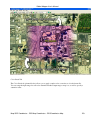
line features completely contained within each selected area and add the counts for each area to the attribute
list for the area as LINE_COUNT and POINT_COUNT attributes. This can be handy for doing something
like counting all of the points within the loaded areas, then setting up the drawing style for the areas based on
the new POINT_COUNT attribute on the Area Styles tab of the Options dialog for the layer that the areas are
in, so you can color based on how many points were in each area.
Converting Areas with Islands to Single Vertex List
If one or more area features with separate islands/holes within them are selected, the Create Single Vertex List
Area From Selected Area(s) With Islands option will appear in the Advanced Feature Creation sub-menu of
the right-click menu. When selected, this option will connect all of the islands/holes within the selected parent
areas into a single vertex list and replace the original parent/island area with a new area that contains just that
single vertex list. This is useful for converting areas with islands into a form that software that cannot handle
areas with holes can make use of.
Connect Points to Selected Lines with Shortest Path Line
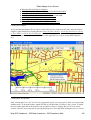
If one or more points and one or more lines are selected, the Connect Selected Points to Selected Lines with
New Lines option will appear in the Advanced Feature Creation sub-menu of the right-click menu. When
selected, this option will create a line segment from each point to the closest point on any of the selected lines
features.
Map GPS Coordinates - GPS Map Coordinates - GPSCoordinates Map
204