1
TTrraacckkR
Raannggeerr U
Usseerr M
Maannuuaall
______________________________________________________________________________________
Section 26 – UBD Street
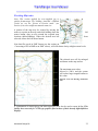
Directory Mapping
Map Version
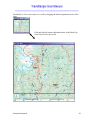
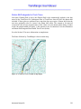
TrackRanger 5 and above supports UBD Australia City Streets Version 3.
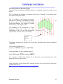
The following cites / regions are covered by the UBD maps:
o Adelaide
o Brisbane
o Canberra
o Darwin
o Hobart
o Melbourne
o Perth
o Sydney
o Central Coast NSW
o Newcastle
o Wollongong
It has the ability to search by Map, Suburb, Street, and a number of facilities, generally
including the following:
o Airports
o Beaches, Lakes, Water
o Bowling clubs
o Caravan / Tourist Parks
o Cemetries
o Churches
o Clubs
o Coach
o Fire Stations
o Golf courses/Driving ranges
o Guides
o Hospitals
o Hotels
o Local Government offices
o Libraries
o Lookouts
o Masonic centres
o Motor Registries
o Nursing Homes
o Parks, Reserves, Ovals etc
Advantech Design P/L
148