Download Natmap Raster 2003 User Guide

Transcript
About NATMAP Raster
Versions
Components
Map Layers
Coordinates
Creation Process
Map Image Specifications
Versions
2003 - Mapsheets and Mosaic
In 2003 two versions of NATMAP Raster were released. The differences are outlined below.
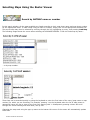
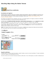
Mapsheets: all 513 1:250 000 scale NATMAPs plus three map insets are included as separate ECW files. The
1:250 000 scale maps use the Map Grid of Australia as their projection, meaning that the coordinates of the
maps are measured in metres and the maps can be used for measuring distances and areas. Pixel size is
31.75m
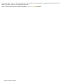
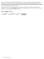
Mosaic: all 513 1:250 000 scale NATMAPs plus three map insets are joined together in one ECW file. The
coordinates are latitude/longitude, which are ideal for interfacing with GPS software, but are not suitable for
measuring distances or areas. The pixel size in metres varies depending where you are in Australia. Mosaic
also includes a single map image of all 1:1 million NATMAPs and a Landsat Satellite Image Mosaic of
Australia, both of which use latitude/longitude coordinates.
More information on coordinate systems and why the different products are suited to different applications is found
in the Coordinate Systems.
Updated features for 2003
Inclusion of over 150 new maps
All 1:250 000 scale maps are created to the same specification (i.e. have the same look and feel)
Mosaic version - all 1:250 000 scale NATMAPs joined together into one image
Inclusion of 1:1 million and Landsat satellite imagery (Mosaic only)
Popup windows for legend and climate graphs
More comprehensive User Guide, troubleshooting and Basic Help.
Features retained in 2003 from 2002
Updated maps from 2002
Image resolution of 200dpi
Access to grid coordinates
Improved georeferencing
Raster Viewer Configurator tool
Bulk exporting
Available on Windows 95, 98, 2000, XP, Me or NT4
User interface via IEv5.5 or higher
Map loading via latitude and longitude
Panning from map to map
Finding the latitude and longitude coordinates of a point on the map
Printing the entire map or the current view
Exporting the entire map or current view; JPEG, BMP, PNG, TIFF and GeoTIFF image formats are supported
Online help file that can be read on screen or printed as needed.
All other components in the two products are the same as in previous versions.
Are upgrades available?
At this stage no - if you want updated maps and/or Viewing software, you need to buy the new version.
NATMAP RASTER 2003 USER GUIDE