1
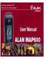
MAP 600 – User’s Manual
2. Introduction
2.1
Your MAP 600
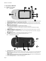
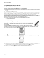
Congratulations on your purchase! Alan MAP 600 is a portable GPS receiver designed for sport and outdoor activities
that also adds the Navigator function to its classical functionalities, driving you on the traffic paths turn by turn straight to
the destination.
By selecting a destination, Alan MAP 600 will automatically calculate the ideal route, displaying it in detail on the
cartography and supplying you with a visual and acoustical indication of the turns. In case of an out of route, the new one
will be automatically recalculated.
On the display, Alan MAP 600 can show a group of icons which represents the so-called “Point of Interests”, such as
hotels, restaurants, fuel stations, museums, monuments, hospitals, department stores etc., providing you with address
and telephone number, of course besides driving you turn by turn. It is provided with an expandable memory by a
standard Compact Flash Card, which allows the cartography maps loading.
The extreme precision of the positioning and navigation data is ensured by the additional information correction obtained
by the use of the WAAS and EGNOS technology. Fully waterproof, Alan MAP 600 is suitable for the most extreme
conditions, such as outdoors or over a motorcycle use.
Please find below the main features and capabilities of your MAP 600 GPS:
•
•
•
•
•
•
•
•
•
•
•
•
•
•
•
Page 5
Reception and acquisition of up to 12 satellites.
6 user-selectable languages Menu.
GPS altitude indication, already converted to sea level altitude.
National coordinates systems most used in Central Europe and Map Datum already integrated.
Memorization of 1000 geographical references (waypoints) with associated names and graphic symbols.
Integrated cartography with 9 levels of zoom as well as display/hide of reference symbols as desired.
Possibility of memory expansion using ordinary Compact Flash cards
Ability to navigate using 50 routes and 150 waypoints for each route.
Ability to select various graphic representations of your position and direction of movement.
Automatic memorization of up to 8 + 1 tracks of your route movement.
Large backlit LCD display with adjustable contrast.
Connectable to a PC for downloading of maps and updating of operating system
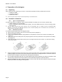
Uses two standard AA batteries, including rechargeable ones (supplied)
Multi-functional Joystick for a practical use
External antenna socket to use inside vehicles