1
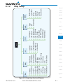
Foreword
Getting
Started
Xpdr Ctrl
Com/Nav
FPL
Direct-To
Proc
Wpt Info
Map
Traffic
Terrain
Weather
Nearest
Services/
Music
Utilities
System
Messages
Symbols
Appendix
Index
Level 10-13, 10-16
Lighting 15-32
Lightning 8-23, 11-7, 11-21, 11-42,
11-43
Limitations 9-7, 10-6, 11-11, 11-52, 15-6
LNAV 6-2, 6-14
LNAV+V 6-2, 6-14
LNAV/VNAV Approach 6-2
Load procedures in FPL 4-8
Localizer 3-13, 6-16
Local offset 15-18
Lock activation 15-12
Locking screw 1-3
Low alt 6-2
LP approach 6-2, 6-14
LPV Approach 6-2, 6-14
L/VNAV 6-14
M
Magnetic variation 15-26, 15-27
Making a phone call 13-12
Manual mag var 15-27
Map 8-1
Symbols 8-32
Map controls 8-26
Map data fields 8-20
Map Detail 8-22
Map menu 8-2
Map orientation 8-10, 11-37
Map overlay 8-3
Map panning 8-24
MAPR 6-2
Map range 8-10, 8-33, 9-15, 10-10
Map setup 8-7
Map symbols 17-1, 17-6
Map toolbar symbols 17-6
Mark on target 7-16
Mean Sea Level 10-1
Message 10-14, 10-18, 16-1
METARs 11-7, 11-19, 11-39, 11-43, 1150, 11-57
MGRS 15-28
Military grid reference system 15-28
Minimum runway length 1-12
Index-4
Miscellaneous symbols 17-7
Missed Approach 6-10
MOA 8-23, 17-8
Model descriptions 1-1
Monitoring frequency 3-12
Motion vector 9-21
Mountains 11-52
Moving map 1-3
MSAS 15-10
MSL 10-7
Music 13-1, 13-4
Mute 13-7
N
National Weather Service 11-9, 11-47
Nav angle 15-26, 15-27
Navigation database 15-5, 18-10
Navigation map 8-33
Navigation source iii
Nav range ring 8-11
NDB 7-12, 8-15, 8-23, 12-6, 17-1
Nearest airport 1-12, 1-14, 12-3, 15-19
Nearest airspace 12-8
Nearest ARTCC 12-10
Nearest frequency 3-6
Nearest FSS 12-11
Nearest intersection 12-4
Nearest NDB 12-6
Nearest User Wpt 12-7
Nearest VOR 12-5
Nearest waypoint 12-1
Nearest weather 12-12
Negative climb rate 10-14, 10-17
NEXRAD 8-5, 11-7, 11-9, 11-53
Limitations 11-11
NEXRAD Canada 11-12
Next airspace 8-24
Non-directional ownship 17-8
North up 8-10, 11-1
O
OBS 8-31, 18-5
Obstacle data 8-12, 10-2, 10-7, 10-18,
15-5, 18-11
Garmin GTN 625/635/650 Pilot’s Guide
190-01004-03 Rev. E