1
6.1.3. Manual route creation
The difference of this route creation method from previous two is what you can set a start
point and a destination point.
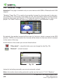
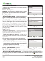
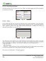
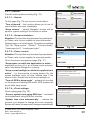
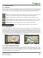
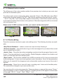
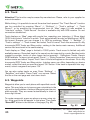
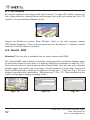
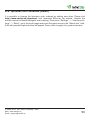
To create a route, press a map using stylus, press the “Cursor” (Fig. 86) button and “Start”
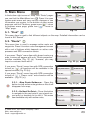
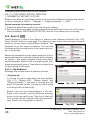
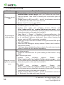
button after the menu appears (Fig. 87). Then find the destination point and press “Cursor”
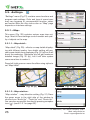
- “Go To” (Fig. 88). If you using maps supports autorouting, route will be created referring
to this data and will be the shortest or the quickest. Otherwise waypoints will be connected
with strait green lines.
Please note! If GPS-receiver is active, you cannot set the start point!
Fig. 86
Fig. 87
Fig. 88
6.1.4. Route editing
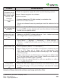
Press the maneuver window to open route editing menu. The following functions are available:
«Stop Route Guidance» - delete a route from map and stop following it.
«Go next via point» - press this button to go to the next waypoint if you missed the current
one or decided not to visit it.
«Jam in 1 km» - Press this item when navigating a route to show the program there is a traffic jam 1 km long starting at current location. Navitel Navigator analyzes the situation and
offers you alternate and more efficient path.
«Demo route» - This function available only if GPS-connection is Off. Use is to observe the
forthcoming path, U-turns and some general route information. Such full demonstration
allows you to reveal all the dangerous and unfavourable sections and correct the route if
needed.
«Show route» - Press this to show full route, including start. finish and all middle points.
The scale will be changed so you can see the route.
You can also edit a route using waypoints. Press any place on map and then press “Cursor”
while navigating a route to create a waypoint. Following buttons will appear at the bottom
of the page: “Go To”, “Insert”, “Add”, “Start”, “Info”.
42
© 2006-2010, Join Stock Company «CNT»
Web: www.navitel.su
Email: [email protected]