1
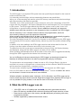
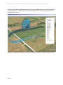
Translated by R.Whitehead 16-9-2011 (my best effort – accuracy is not guaranteed) 1. Introduction The GPS-logger is a complete GPS system that was specifically developed for the needs of model construction field. It is extremely small and light, but has outstanding features and possibilities. With up to 10 Hz sampling rate and the micro-SD memory card almost unlimited recordings with high resolution and detail are possible. Telemetry via 2.4 GHz systems with a return channel is now a firm component of the GPSLogger and fully integrated. Jeti Duplex, Multiplex M-Link and Graupner HoTT are supported by the system. The GPS-Logger detects the telemetry system used by itself, there is no configuration or special firmware needed. Since in addition a barometric (air pressure) altitude sensor with high resolution is also integrated a Vario is realized in the GPS-Logger with the telemetry in use. Likewise extensive alarms are programmable, which are announced by telemetry over the respective transmitter. When operating with Multiplex M-Link all data on the sensor bus is automatically logged by the UniLog 2 and also written to the memory card MSB Data logger. The new competition format OLC, the On Line Contest, is well supported by the GPS logger. The necessary IGC file can be created directly, without any other conversion software being needed. In addition to its own readings, the GPS-Logger can also read all the data live from the UniLog via a direct cable connection and write it to the memory card. The data from the UniLog can also be transmitted to the ground via Jeti Duplex telemetry and displayed, along with the GPS-Logger‗s own data, on the JetiBox. When operating with Multiplex M-Link all the data on the sensor bus is logged automatically through the GPS-Logger and also written to the memory card. Via our UniDisplay all values measured by the GPS-Logger can be directly viewed live. Naturally all settings and alarms can also be programmed easily by UniDisplay. The presentation and interpretation of data is made in 3D in Google EarthTM. All that is required is to convert in Google Earth TM format using our free software "SM GPS Konverter" and the also free Google Earth TM standard version. The well known software LogView www.logview.info also supports our GPS-Logger. Here, the GPS data can also be converted to Google EarthTM format. In addition the values can be shown in normal curves and much more besides. Whether sailplane, aerobatics plane, helicopter, HLG or Slowflyer, the GPS-Logger can be used in almost any sector due to its small weight and compact size. Naturally the UniLog 2 is not only suitable for flying models, it can also be used in RC-boats, RC-car etc. 2. What the GPS-Logger can do • • • • 2 of 21 10Hz GPS, and so 10 readings per second particularly good data resolution Micro SD memory card almost unlimited recording and simple selection of data Data stored in plain text on the memory card subsequent processing with many programmes possible Altitude supported by additional barometric sensor