1
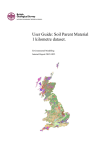
The Soil-Parent Material Database (SPM-v4):
A User Guide.
Landuse and Development Programme and Information Products
Open Report OR/08/034
BRITISH GEOLOGICAL SURVEY
LANDUSE AND DEVELOPMENT PROGRAMME AND INFORMATION PRODUCTS
OPEN REPORT OR/08/034
The soil-parent material database:
A User Guide.
The National Grid and other
Ordnance Survey data are used with
the permission of the Controller of
Her Majesty’s Stationery Office.
Licence No: 100017897/ 2009.
R. Lawley
Keywords
Soil, parent material, Regolith,
database.
Editor/Contributors
B. Rawlins., A. Tye., G. Wildman.
National Grid Reference
SW corner 0,0
Centre point 0,0
NE corner 700000,1225000
Map
Sheet na, 1:50,000 scale, National
Soil parent material
Front cover
Cover picture details, National Soil
parent material Map.
Bibliographical reference
RUSSELL LAWLEY. 2009. The Soil
parent material database: A User
Guide.. British Geological Survey
Internal Report, OR/08/034. 45pp.
Copyright in materials derived from
the British Geological Survey’s
work is owned by the Natural
Environment Research Council
(NERC) and/or the authority that
commissioned the work. You may
not copy or adapt this publication
without first obtaining permission.
Contact the BGS Intellectual
Property Rights Section, British
Geological Survey, Keyworth,
e-mail [email protected]. You may
quote extracts of a reasonable
length without prior permission,
provided a full acknowledgement is
given of the source of the extract.
Maps and diagrams in this book use
topography based on Ordnance
Survey mapping.
© NERC 2009. All rights reserved
Keyworth, Nottingham British Geological Survey 2009
BRITISH GEOLOGICAL SURVEY
The full range of our publications is available from BGS shops at
Nottingham, Edinburgh, London and Cardiff (Welsh publications
only) see contact details below or shop online at
www.geologyshop.com
The London Information Office also maintains a reference
collection of BGS publications, including maps, for consultation.
We publish an annual catalogue of our maps and other
publications; this catalogue is available online or from any of the
BGS shops.
The British Geological Survey carries out the geological survey of
Great Britain and Northern Ireland (the latter as an agency service
for the government of Northern Ireland), and of the surrounding
continental shelf, as well as basic research projects. It also
undertakes programmes of technical aid in geology in developing
countries.
The British Geological Survey is a component body of the Natural
Environment Research Council.
British Geological Survey offices
BGS Central Enquiries Desk
Tel 0115 936 3143
email [email protected]
Fax
0115 936 3276
Kingsley Dunham Centre, Keyworth, Nottingham NG12 5GG
Tel 0115 936 3241
Fax 0115 936 3488
email [email protected]
Murchison House, West Mains Road, Edinburgh EH9 3LA
Tel 0131 667 1000
email [email protected]
Fax
0131 668 2683
Natural History Museum, Cromwell Road, London SW7 5BD
Tel 020 7589 4090
Fax 020 7584 8270
Tel 020 7942 5344/45
email [email protected]
Columbus House, Greenmeadow Springs, Tongwynlais, Cardiff
CF15 7NE
Tel 029 2052 1962
Fax 029 2052 1963
Forde House, Park Five Business Centre, Harrier Way, Sowton
EX2 7HU
Tel 01392 445271
Fax 01392 445371
Maclean Building, Crowmarsh Gifford, Wallingford
OX10 8BB
Tel 01491 838800
Fax 01491 692345
Geological Survey of Northern Ireland, Colby House, Stranmillis
Court, Belfast BT9 5BF
Tel 028 9038 8462
Fax 028 9038 8461
www.bgs.ac.uk/gsni/
parent Body
Natural Environment Research Council, Polaris House,
North Star Avenue, Swindon SN2 1EU
Tel 01793 411500
Fax 01793 411501
www.nerc.ac.uk
Website www.bgs.ac.uk
Shop online at www.geologyshop.com
Foreword
This report is a user guide to the content and application of the National Soil-Parent Material
database produced by the British Geological Survey (BGS). The National Soil-Parent Material
database provides simplified descriptions of near-surface, geological materials and their
overlying soils.
Acknowledgements
A large number of individuals in BGS have contributed to the project. This assistance has been
received at all stages of the study. In addition to the collection of data, many individuals have
freely given their advice, and provided the local knowledge so important to the description of
soil-parent materials. Key staff have helped to review draft chapters of this report. Of the many
individuals who have contributed to the project we would particularly like to thank the
following:
Prof B Smith (formerly of BGS),
Dr N S Jones (formerly of BGS).
The author would like to thank.
Ms F Billin
2
Contents
FOREWORD
2
ACKNOWLEDGEMENTS
2
CONTENTS
3
1
5
1.1
BACKGROUND
What is a Soil Parent Material?
5
1.2
Technical Information
1.2.1
Data scale and scope
1.2.2
Data origin
1.2.3
Data format
6
6
6
6
1.3
6
Who should use the Soil Parent Material dataset?
1.4
Using the PMM
1.4.1
Parent material database: Map unit description
1.4.2
Parent material database: Lithological descriptions
1.4.3
Parent material database: Texture descriptions
1.4.4
Parent material database: Mineralogy
1.4.5
Parent material database: Strength and structure
1.4.6
Parent material database: Colour
1.4.7
Parent material database: Variability
1.4.8
Parent material database: Code-only versions of data
1.4.9
Parent material database: Alternative DiGMapGB-50 Lex-rock descriptors
1.4.10
Parent material database: Metadata
6
7
9
10
11
12
13
13
13
14
14
1.5
Data Limitations
15
1.6
Data history
15
2
CONTACT INFORMATION
15
Appendix 1: A brief overview of the relationship between Soils and parent materials
16
Appendix 2: Dictionaries used in the national soil parent material database
18
2a. EISB_CODE (EUROPEAN SOIL BUREAU CODES)
18
2b. SUBSTRATE
22
2c. ORIGIN_PM
23
2d. ROOT_PM
24
2e. GENESIS
25
2f. MIN_GRAIN, MAX_GRAIN, DOM_GRAIN
26
2g. GEN_GRAIN
27
3
2h. SOIL_TEXT AND SOIL_GROUP
28
2i. GRV_ABNDNC
31
2j. DOM_MNRL
32
2k. MNR_MNRL
33
2l. CACO3_RANK
34
2m. CAC03_FORM
35
2n. HARDNESS
36
2o. STRNGTH_MN AND STRNGTH_MX
37
2p. STRCTR_FRS
38
2q. STRCTR_WTH
39
2r. VARIABILITY
40
Appendix 3: Classification of soil texture
41
GLOSSARY
42
REFERENCES
42
TABLES
Table 1. General content of the PM database................................................................ 7
4
1 Background
The soil-parent material (PM) database is part of a series of GIS maps designed to help environmental
scientists and consultants assess the characteristics of the ‘near-surface’ weathered zone. In particular, the
data focuses upon the material from which top soils and subsoils (A and B horizons) develop (i.e. from
the base of pedological soil down to c. 3m).
1.1
WHAT IS A SOIL PARENT MATERIAL?
A ‘soil parent material’ is a geological deposit over, and within which, a soil develops. Typically, the
parent material is the first recognisably geological deposit encountered when excavating beneath the soil
layer. It represents the very-near-surface geology. In general, the geological deposits closer to the ground
surface are the most weathered, whilst the deeper deposits are less so. The interface between soil and
parent (geology) can vary from a sharp, clearly defined boundary, to a diffuse continuum with no
distinctive point of transition.
“The major soil groups [in the UK]… are distinguished by broad differences in the composition or origin
of the soil material” (Avery, 1979). Soil-parent materials play a vital role in determining soil-type.
Typically, parent material characteristics control three primary characteristics of their overlying soils:
1. Texture
2. Chemistry
3. Permeability-Porosity (drainage).
All three characteristics are implicitly defined in the typical geological rock/deposit descriptions provided
in BGS products. However, these characteristics are easier to use (by non-geologists) when explicitly
defined, as they are in the soil-parent material database.
Most users will use the ‘soil-parent material’ data as their core data source to help them model and
understand soil characteristics. Other datasets for terrain analysis, climate and landuse will help the user
to build true digital soil models. BGS also supplies specific data for slope accumulation, wind-blown
deposits cover, artificial deposits and geochemistry if users are particularly interested in thickened soil
profiles, soil erosion/mobilisation, gleying or unusual soil-geochemical profiles.
The soil-parent material data has attributes for the following characteristics:
•
•
•
•
•
•
•
•
Lithology
Texture
Mineralogy
Strength
Structure
Colour
Age
Variability
5
1.2
1.2.1
TECHNICAL INFORMATION
Data scale and scope
The PM database is a synthesis of several national and regional databases held by BGS, primarily
DiGMapGB-50 V4.16. The data provides national coverage for England, Scotland and Wales at a scale of
1:50,000. The PM database is a growing and developing database, which will extend its attribute content
to hold enhanced and additional information on near-surface properties of rocks, superficial deposits and
soils over time.
1.2.2
Data origin
The spatial content of the map is derived from the BGS 1:50,000 scale Geological Map of Great Britain,
known as DiGMapGB-50 (British Geological Survey. 2007) with qualitative attribution derived from the
BGS Rock Classification Scheme Volumes 1- 4 (Gillespie and Styles, 1999; Robertson, 1999; Hallsworth
and Knox, 1999; McMillan and Powell, 1999) and additional soil texture data from the BGS GBASE
survey (Ault and Mackenzie, 2006).
1.2.3
Data format
The data is supplied as vector GIS layers; either in Shape format (suitable for ESRI GIS systems) or TAB
format (suitable for MapInfo GIS systems). Other formats are available on request. The data is also
supplied with an example ESRI Map document (PM4.MXD file) or MapInfo workspace (PM4.WOR file)
to help familiarise users with the data content and its potential use. These files can be opened in their
respective GIS software and will provide a series of map images coloured and classified to highlight some
of the data content.
1.3
WHO SHOULD USE THE SOIL PARENT MATERIAL DATASET?
Anyone working in the field of environmental science (from ground engineering to climate change impact
assessment) can use the soil parent material dataset. The dataset has been designed for a diverse userbase and simply presents BGS’ geological and pedological spatial data in a manner that is more flexible
for GIS-aware environmental scientists. A basic understanding of geology and soils is recommended so
that users can fully utilise the dataset but any user with a grasp of physical geography should be able to
work with the dataset. The database sets out simplified, qualitative descriptions of PM characteristics.
Drawing together these characteristics in a meaningful way will allow users to create maps of likely soil
and ground/environment characteristics. More expert users will be able to integrate the parent material
dataset into climate, land use and terrain data to create full digital soil models.
For background information on the relationship between soils and parent materials, and the use of
environmental data in building digital soil models, please see Appendix 1.
1.4
USING THE PMM
The following sections outline the structure and content of the Soil-Parent Material (PM) database. For
each of the attribute fields provided in the PM a brief description of the data is given. Attribute fields
marked with an asterisk (*) also have a ‘lookup’ dictionary available in Appendix 2 to help users
understand the meaning of codes or definitions.
The parent material database comprises a spatial layer (a map of polygons) with each map unit being
described by fifty-three fields of attribute data. Most fields are populated with ‘plain’ text (simple text
descriptions are used as they are considered more user friendly to non specialists) however some fields
are populated with codes for ease of use within a GIS. The general structure of the attribute data is shown
in Table 1 below.
6
Table 1. General attribute content of the PM database
Fields
Content
Fields 1- 2
ESRI shapefile identifiers (not applicable for non-ESRI formats)
Fields 3 – 10
Map Unit Descriptors (e.g. PM codes, unique id)
Fields 11 - 20
Lithological descriptors (e.g. parent rock type)
Fields 21 - 28
Texture descriptors (e.g. soil texture)
Fields 29 - 33
Mineralogical descriptors (e.g. CaCO3 content)
Fields 34 – 38
Strength and structure descriptors (e.g. Hardness)
Fields 39 - 40
Colour descriptors (e.g. fresh colour)
Fields 41
variability descriptor
Fields 42 - 47
Coded versions of selected descriptors (e.g. Agecode)
Fields 48 - 49
Alternate DiGMapGB-50 descriptors (e.g. alternative Lex_rock classification)
Fields 50 - 55
Map metadata (e.g. version number)
1.4.1
Parent material database: Map unit description
Each map unit (polygon) is described by eight fields detailing its parent material type and the near surface
spatial context of the unit. The parent materials are described by a series of codes, each code representing
a combination of physical characteristics.
Several systems for classifying parent material exist across the world; most classification systems are
simplified subsets of geological descriptions of rock units. Many systems are flawed in that the PM
classification relies on inconsistent grouping of certain geological characteristics. (i.e. some PM
classification systems are based on rock genesis, others are based on knowledge of texture). The BGS PM
classification is based upon the primary origin of the material, its dominant mineralogy and its
generalised texture (grain size), see figure 1 below.
Most users will find the PM codes are sufficient to describe the parent materials and their likely soil
characteristics. However, by using combinations of data held in the other attribute fields of the dataset,
users can create a range of parent material maps varying in complexity from ‘simplistic’ to ‘detailed’
offering a number of classifications.
The PM database provides three key PM codes to describe each map objects these are: PM_CODE,
A_PM_CODE and B_PM_CODE (see below for details). These codes are all four character ‘composite’
codes and all have the following structure:
Code = SCQA
SCQA
SC
Q
A
First two characters
represent the
origin of the parent ie
“Sedimentary-Clastic”
Third character
represents the
dominant mineralogy
code “Silica-clay”
Last character
Represents the
General grainsize code
“Argillaceous”
Figure 1 The structure of the 4 character PM classification codes used by the BGS
7
The combination of origin, mineralogy and grain size will broadly define the key parent material
characteristics of any unit (and thus its overlying soil character). Further classification of parent material
properties can be made by addition of additional codes from the other 52 fields held in the database.
Typically the codes relating to age, hardness, engineering strength and minor mineralogy are useful in this
respect, allowing the user to create flexible ‘alternative classification systems to describe their parent
materials.
1.4.1.1 PM_CODE
The first (and most important) data field describes the primary PM_CODE of the unit. This primary PM
code represents the MOST LIKELY parent-material type for that map polygon. i.e. the most likely parent
material to be encountered at that location if the overlying soil was to be removed. In geological terms it
is the uppermost geological layer of material. All the descriptions detailed in Fields 6- 50 relate to this
primary PM code and its associated description of the geological unit present at surface, known as the
LEX_ROCK code (see below).
1.4.1.2 A_PM_CODE
Near-surface geology can be locally complex, an ‘Alternative’ parent material code (A_PM_CODE) is
provided for each map polygon to enable users to create variant models of soil types and to incorporate a
degree of control over ‘thin’ units near the land surface. The A_PM_CODE can be used when the primary
parent material is likely to be a thin ‘veneer’ of material (typically less than 1m thick) overlying a notably
different rock type. For example, a thin layer of Peat (PM_code: UOOP) overlying a Glacial Till deposit
will have the A_PM_CODE of the Till unit (PM_CODE: UGRX). Soils in this area could be derived
from a combination of the two parent materials because they are related by their close vertical proximity.
1.4.1.3 B_PM_CODE
Similarly, the B_PM_CODE details the parent material code of any underlying Bedrock units. This code
can be used when the map unit is derived from a superficial deposit that is less than 5m thick (ie locally
thin enough to be subject to influence from the characteristics of the underlying bedrock). The user can
assess the thinness of the superficial deposits by referring to the ‘IS_VENEER’ field (see below).
1.4.1.4 ESB_CODE*
The ESB_Code field provides the ‘most applicable’ European Soil Bureau parent material code for the
map unit. The ESB code is defined in the Georeferenced Soil database for Europe (Finke et al, 2001) and
is summarised in Appendix 2. Codes with an imprecise correlation are marked with a suffix ‘x’. Multi
lithic parent material (e.g. layered units) are represented by two or more codes separated by ‘_’. The
ESB_Code is useful for users considering integration of this database into European soil/geology
databases. See appendix 2a for its dictionary.
1.4.1.5 IS_SPRFCL
This field indicates whether the parent material for the map unit is derived from superficial deposits (T) or
bedrock (F). In the UK, superficial deposits are the product of recent glacial, fluvial or aeolian activity
and typically comprise unconsolidated materials.
1.4.1.6 OVR_BDROCK
This field indicates whether the map unit is a superficial unit directly overlying bedrock (T) or a series of
layered superficial units near surface (F). In the UK it is common for superficial units to be layered
deposits and several layers of material may exist between ground level and the bedrock at depth. Soils are
typically developed from the topmost parent material, with subordinate influence from underlying
geological units. This field may help users identify soil types indirectly influenced by underlying layers of
superficial or bedrock units, not just the uppermost unit.
8
1.4.1.7 IS_VENEER
This field indicates whether the map unit is likely to be of a type that forms a thin ‘veneer’ (generally less
than 1m thick) of material over the land surface (True) or of a type that locally thickens to a substantial
body of material (False). This field may help users identify soil types over a parent material that may be
“thin”, and therefore subject to influence from the properties of the underlying ‘associated’ parent
material; or subject to ‘ploughing through’ during tillage. This field is a synthesis of many field
observations, and general theory of sedimentology. Typically deposits such as Peat, and loess will form a
veneer, or blanket-like deposit, over the land surface, whereas alluvial or glacially derived deposits may
form deep, irregular shaped channels, hollows or hills.
1.4.1.8 PMMID
This field is a unique integer to identify individual polygons.
1.4.2
Parent material database: Lithological descriptions
Map unit lithology is described in nine data fields by a series of hierarchical dictionaries. These
dictionaries are described as follows:
1.4.2.1 SUBSTRATE*
This field defines whether the parent material is derived from Bedrock or Superficial deposits. There is an
additional classification of ‘Surficial’ deposits denoting superficial units that have a thin, blanket-like
morphology (veneer). This category of unit is important as soils form on the uppermost layers of geology,
and so any thin laterally impersistent unit can have a significant effect on soil-type. The ‘accumulated’
materials layer should also be used in conjunction with parent materials of this type. Soils developed from
bedrock units are classed as lithoskeletal soils. See appendix 2b for dictionary.
1.4.2.2 ORIGIN_PM*
This is the simplest descriptive term for each parent material type, and comprises Igneous, Metamorphic
and Sedimentary classifications. i.e. the PM has a sedimentary origin. See appendix 2c for dictionary.
1.4.2.3 ROOT_PM*
This is the next simplest descriptive term for each parent material type, and comprises subdivisions of the
Igneous,
Metamorphic
and
Sedimentary
classifications
(e.g.
Sedimentary
Clastic,
Sedimentary_carbonate). See appendix 2d for dictionary.
1.4.2.4 SUBROOT_LITHOLOGY
This is the next simplest level of lithological attribution for each parent material type and comprises a
semi textural subclassification of the PM type. (e.g. Sedimentary_Carbonate_Limestone_argillic) This
field is created by combining ROOT_PM with DOM_MNRL and GEN_GRAIN fields.
1.4.2.5 GENESIS*
This field provides a description of how the parent material was formed (e.g. Igneous intrusion). See
appendix 2e for dictionary.
1.4.2.6 GEN_PMLITH
This is a simplified geological description of the parent material and is derived from the original
DiGMapGB-50 database. In general the aim is to provide the user with as simplified a lithological
description as possible.
9
1.4.2.7 LEX_ROCK
This field is the standard DiGMapGB-50 code that describes the geological units found in Great Britain.
It provides the starting point for the parent material characterisation. It comprises a stratigraphic ‘code’
(LEX) and ‘Lithology’ code ROCK).
1.4.2.8 SYSTEM
This field is the standard DiGMapGB-50 stratigraphic ‘SYSTEM’ classification for the parent material
denoting its geochronological age (e.g. Triassic, Jurassic)
1.4.2.9 STAGE
This field is the standard DiGMapGB-50 stratigraphic ‘STAGE’ classification for the parent material
denoting its geochronological age (e.g. Toarcian, Bajocian)
Nb. The ‘age’ of the parent material has no direct influence on the soil type, however, it has been noted
that material from certain geological eras possess soil-forming characteristics that are difficult to
explicitly define. For example Triassic Mudstones weather in slightly different ways to Jurassic
Mudstones. So even if there are no explicit characteristics we can extract from the parent material data,
the ‘age’ fields can provide users with an additional factor by which to group or subdivide the parent
material types.
1.4.2.10MULTILITHIC
This field indicates if the parent material comprises two or more distinct lithologies. For example a unit
described as sandstone with interbedded mudstone IS a multilithic unit (Y). This indicates that the
overlying soils may vary significantly within the map polygon as they are derived from more than one
possible parent.
1.4.3
Parent material database: Texture descriptions
Texture is described in eight data fields by a series of dictionaries. These dictionaries are described as
follows
1.4.3.1 MIN_GRAIN*
This is a qualitative classification of the smallest grain size to be expected from the parent material. The
terms used are clay, silt, mud (generic for clay or silt), sand, gravel, and boulder for sedimentary and
metasedimentary rocks. Fine, medium and coarse for igneous and meta igneous rocks). The value is a
estimation derived from geologist’s descriptions of the finest-grained component of the parent material.
See appendix 2f for dictionary.
1.4.3.2 MAX_GRAIN*
This is a qualitative classification of the largest grain size to be expected from the parent material. The
value is a estimation derived from geologist’s descriptions of the largest-grained component of the parent
material. See appendix 2f for dictionary.
1.4.3.3 DOM_GRAIN*
This is a qualitative classification of the most common (dominant) grain size to be expected from the
parent material. The value is a estimation derived from geologist’s descriptions of the parent material, but
for heterolithic or mixed lithologies this is difficult to estimate consistently and so is classified as a
default ‘unknown’. See appendix 2f for dictionary.
10
1.4.3.4 GEN_GRAIN*
A geological description and qualitative classification of the grain sizes expected for this parent material
based upon the information in the minimum, maximum and dominant grain size fields. See appendix 2g
for dictionary.
1.4.3.5 SOIL_TEXT*
This field provides a general pedological classification of soil texture from measured samples of soils
overlying this parent material. Soil texture classes are based a UK classification of soil texture designed
by The National Soil Research Institute (Hodgson, 1997). A ternary grainsize distribution chart, depicting
the classes, is given in Appendix 3. Soil samples used to create this classification are derived from the
BGS GBASE, IMAU and GTECH databases, and particle size distributions are derived by laser
granulometry, wet and dry sieving, and sedimentation techniques. The soil parents are classified by the
dominant texture indicated by the samples when plotted on a ternary diagram. Some soil-parent material
types have no or few sample measurements. These soil-parent types are provided with an estimated
classification, based upon the principle of textural similarity between parents of similar origins and
texture. See appendix 2h for dictionary.
1.4.3.6 SOIL_GROUP*
This field provides a general description of the observed soil texture in terms of Heavy, Medium or Light
soils as broadly defined in the Defra Cross Compliance Guidance for Soil Management (Defra, 2006).
See appendix 2h for dictionary.
Additionally The parent material database stores information about gravel (stone/pebble) content. The
presence of gravel can have a dramatic effect on soil characteristics, particularly drainage and waterstorage:
1.4.3.7 GRV_CONTNT
This field is a logical flag (Y/N) to indicate that the parent material may contain gravel (‘stones’), or is
capable of weathering into a soil that will contain gravel (e.g. a bed of quartzite will decompose into a soil
that contains fragments of quartzite, where as a glaciolacustrine clay will not decompose into soil
containing gravel).
1.4.3.8 GRVE_ABNDNC*
This field provides an estimate of the abundance of gravel in the soil-parent material. See appendix 2i for
dictionary.
1.4.4
Parent material database: Mineralogy
The parent material database provides five fields of qualitative data for mineralogy, these are:
1.4.4.1 MINERALOGY
This is a free-format list of the main minerals to be found in the parent material.
1.4.4.2 DOM_MNRL*
This field is a very simplified classification of the dominant mineralogy of the parent material, dividing
the parent into broad chemical groups. For example, silica-rich, carbonate-rich, acid (igneous), basic
(Igneous). See appendix 2j for dictionary.
11
1.4.4.3 MNR_MNRL*
These are a free-format list of minerals observed in the parent that may affect soil chemistry; these
include C (Carbonate), Py (Iron sulphides), P (Phosphate), F (Iron oxides), g (Glauconite), gy (Gypsum)
etc. See appendix 2k for dictionary.
1.4.4.4 CACO3_RANK*
This field classifies all forms of carbonate content in each parent material (calcite, dolomite, siderite) as a
simple ranking of: none, low, medium or high (with unknown or variable for heterolithic and multilithic
parent units). As a general rule, soils forming over carbonate-rich rocks tend to have a high carbonate
soil-chemistry and they are buffered for alkalinity by the underlying parent. See appendix 2l for
dictionary.
1.4.4.5 CACO3_FORM*
This field details the form in which any carbonate is present in the parent material ranging from nodules,
shells and clasts, to disseminated cements and beds. (Limestones and chalks are classified as ‘host’,
signifying that the whole parent comprises carbonate material). The form of the carbonate is a useful
indicator as to how-likely a soil will retain some carbonate content, a parent with a low, nodular carbonate
content, may weather to a soil type with no residual carbonate. See appendix 2m for dictionary.
1.4.5
Parent material database: Strength and structure
The parent material database provides five fields of qualitative data for strength and structure.
The strength of the parent material will influence how easily it weathers to form a soil and whether the
soil will contain gravel or be influenced by the ‘fabric’ of the underlying parent material. The structure
of the deposit will provide indicators of how the unit will ‘decompose’ into constituent components.
1.4.5.1 HARDNESS*
This field is a very simple classification of the parent material into three categories soft, hard and very
hard. As a general guide, soft materials will form soils by disaggregating into clay, silt or sand grade
particles, Hard soils may also form sporadic gravel (and these will become abraded and rounded with
time), Very Hard parent materials will form soils with abundant gravel and these may be angular. See
appendix 2n for dictionary.
1.4.5.2 STRNGTH_MN*
This field provides classification of the minimum engineering strength of a map unit. See appendix 2o for
dictionary.
1.4.5.3 STRNGTH_MX*
This field provides classification of the minimum engineering strength of a map unit. See appendix 2o for
dictionary.
1.4.5.4 STRCTR_FRS *
This field provides a simple description of the structure of the parent material classifying the unit by its
jointing, lamination or bedding in its freshest (least weathered) state. See appendix 2p for dictionary.
1.4.5.5 STRCTR_WTH*
The field provides a simple description of the structure of the parent material, providing an indication of
the distribution of fine material versus coarse material in its weathered state.
The structure of a parent material (weathered or otherwise) influences its drainage and weathering
characteristics as well as the drainage and fabric of the overlying soils. See appendix 2q for dictionary.
12
1.4.6
Parent material database: Colour
Two classified colour values are provided; parent material can impart a colour on overlying soils.
1.4.6.1 COLOR_FRSH
This field is a free-format description of parent material colour in its freshest (least weathered) state.
1.4.6.2 COLOR_WTH
This field is a free format description of parent material colour from samples that are considered to be in
its weathered state.
1.4.7
Parent material database: Variability
A classification is provided to help the user assess the variability of a parent material. The spatial
variability of a parent material will affect the likely soil characteristics that are derived from it. As a
general rule, soil characteristics can naturally vary for any given parent type due to a range of
environmental factors, such as rainfall, or land use. If the parent material characteristics vary widely, then
the resulting overlying soils, will also have a very broad range of characteristics.
1.4.7.1 VARIABILITY*
This field provides a simple classification of high, medium and low. Low indicates that the parent is
spatially uniform across a wide area (uniform over 100’s metres), medium indicates variability at a local
scale (uniformity at 10’s of metres) whilst high variability suggests that the unit may vary at a metre
scale. For example, some Jurassic rock sequences comprise weak mudstone with sporadic interbeds of
hard limestone. The beds of limestone can often be only 20cm thick and range 1m to 20m apart, so
overlying soils can be dominated by a layer of limestone or a layer of mudstone, depending upon how the
soil has formed and the relative position of the rock layers in the landscape. The layering occurs at a scale
we can estimate to be locally highly variable. See appendix 2r for dictionary.
1.4.8
Parent material database: Code-only versions of data
The following fields are code-only versions of fields provided elsewhere in a verbose form. These fields
are of use to GIS users who wish to create simple, multi-field reclassifications of the database without
building overly complex text legends.
1.4.8.1 ORIGIN_PM
This field is a coded version of the ORIGIN_PM field.
1.4.8.2 ROOT_PM
This field is a coded version of the Root_Lithology field.
1.4.8.3 D_MIN_CODE
This field is a coded version of the DOM_MNRL field.
1.4.8.4 G_GRN_CODE
This field is a coded version of the GEN_GRAIN field.
1.4.8.5 STAGECODE
This field is a coded version of the STAGE_PLUS field
13
1.4.8.6 AGECODE
This field is a coded version of the SYSTEM Field
1.4.9
Parent material database: Alternative DiGMapGB-50 Lex-rock descriptors
The parent material database provides two alternative parent material codes for each object in the
database. These codes allow users to develop alternative ‘soil’ models based on the ‘thinness’ of near
surface units.
1.4.9.1 A_LEX_ROCK
Near-surface geology can be locally complex, ‘alternative’ DiGMapGB-50 LEX-ROCK codes are
provided for each map polygon to enable users to create variant models of geological deposits and to
incorporate a degree of control over ‘thin’ units near the land surface. The A_LEX_ROCK code can be
used when the LEX_ROCK code is likely to be a thin ‘veneer’ of material overlying a notably different
rock type. For example, a thin layer of Peat (LEX-ROCK code P_PEAT) overlying a Glacial Till deposit
will have the A_LEX_ROCK code of the Till unit (TILMP_DMTN). The deposits are ‘associated’ by
their close proximity).
1.4.9.2 B_LEX_ROCK
Similarly, the B_LEX_ROCK code details the DiGMapGB-50 Lex-Rock code of any underlying Bedrock
units. Where bedrock is at surface, the LEX_ROCK code will be the same as the A_LEX_ROCK and
B_LEX_ROCK codes. However, for areas where the surface unit is a superficial unit and is potentially
thin, or a veneer, this code can be used, to offer an alternative parent material type; (i.e. the superficial
deposits are locally thin enough to be subject to influence from the characteristics of the underlying
bedrock).
1.4.10
Parent material database: Metadata
The parent material database provides six fields of metadata associated with the scale and associated base
mapping of each map object; these are:
1.4.10.1SHEET
This field provides the name and number of the 1:50,000 scale geological sheet that the map object was
originally surveyed on.
1.4.10.2RELEASED
This field is the year of release of the geological sheet that the map object was originally surveyed on.
1.4.10.3NOM_SCALE
This field describes the nominal x-y spatial scale of the data. Most geological map data in the soil-parent
material database is captured and presented at a scale of 1:50,000.
1.4.10.4NOM_BGS_YR
This field is the year of survey of the 1:50,000 scale geological sheet that the map object was originally
surveyed on.
1.4.10.5VERSION
This field is the version number of DiGMapGB-50 data used to create the map object.
14
1.4.10.6OS_SHEET
This field is the Ordnance Survey 100km sheet name that underlies the map object.
1.5
DATA LIMITATIONS
The soil parent material dataset is derived from numerous geological maps, geochemical datasets
and archives of textual material. It is a spatial dataset designed to be used at a working scale of
1:50,000. Most geological maps were originally fitted to a particular topographic base and care
must be taken in interpretation, for example when the geological data are draped over a more
recent topography. All spatial searches against the data should be done with a minimum 50 m
buffer. Parent material maps, being derived from qualitative geological maps are by their nature,
also subject to a degree of interpretation.
1.6
DATA HISTORY
This is the first published version of the Soil Parent Material Dataset. It was first released spring 2009.
2 Contact information
For all data and licensing enquiries please contact:
Central Enquiries
British Geological Survey
Kingsley Dunham Centre
Keyworth
Nottingham
NG12 5GG
Direct tel: +44(0)115 936 3143
Fax:
+44(0)115 9363150
Email: [email protected]
15
Appendix 1: A brief overview of the relationship between Soils and parent materials
Soil formation is governed by a number of environmental parameters. These parameters were first
identified in what is known as Jenny’s equation (Jenny, 1941), or model of soil-forming factors:
Soil = f(Cl,O,R,P,T)
Where
Cl =Climate (precipitation)
O = Organic matter (Vegetation cover, Land use)
R = Relief (elevation, position in landscape)
P = parent material
T = Time
Modern databases of national scale exist for climate, land use and relief. The parent material database
compliments these by providing information detailing the physical characteristics of the soil.
soil-parent materials control three key soil characteristics:
1. Texture
2. Mineralogy (and therefore Chemistry)
3. Permeability-Porosity (drainage).
All three characteristics are implicitly defined in geological rock/deposit descriptions, but are easier to use
when explicitly defined, as in the soil-parent material database.
Texture is regarded as the most important factor. For many users it is important to determine soils that are
likely to be clay-prone (‘heavy’) from sand-prone (Light); most productive soils tend to be ‘loams’ i.e.
soils with a mixture of clay, silt and sand sized fractions. Gravel (stone/pebble) content is also a crucial
factor in soil characterisation as gravel improves soil-drainage and occludes water. The soil-parent
material database provides a range of texture classifications based upon the lithology of the parent as well
as information about likely gravel content (derived from observations of gravel content within the parent,
and the likelihood of the parent ‘forming’ gravel due to its hardness).
Mineralogy of parent materials plays a crucial role in soil formation, in terms of residual mineralogy
during the weathering process and resultant soil-chemistry. Many soils are defined the presence of
important, if relatively minor (volumetrically) mineral constituents. For example, soils derived from
carbonate-rich parent materials generally have an alkaline chemistry; some parent materials create
distinctive soils rich in glauconite or natural phosphate. The soil-parent material database has a series of
classifications as well as specific data for classifying likely mineral content.
Drainage of soils is affected by parent material type in two ways: Firstly, the texture of the parent material
type contributes to the soil-texture and thus porosity and permeability of the soil itself. Secondly, the
drainage characteristics of the parent material controls the drainage characteristics of the overlying soil by
limiting or enhance through-flow or sub-soil run off. For example, consider a soil developing over a
sandstone. If the sandstone is porous and permeable, it will be freely draining, and the overlying soil is
16
likely to be sandy and free draining (even possibly prone to drying out). However, if the underlying
sandstone is well cemented, it may be poorly draining, causing the overlying soil to become seasonally
waterlogged, gleyed or possibly peaty. Other factors such as slope play a role here, hence the importance
of combining the parent material database with other national databases for the environment.
The soil-parent material database provides a spatial framework, and attribution to allow environmental
scientists classify soil characteristics in bespoke digital soil models.
17
Appendix 2: Dictionaries used in the national soil parent
material database
2A. EISB_CODE (EUROPEAN SOIL BUREAU CODES)
The list of parent materials given below has evolved from number of approximations, using
experiences from several pilot projects. The current version includes for the first time a fourth level, i.e. that of the
subtype. To facilitate the correlation of national geological data to the list below, the list of parent materials is
preceded by a table that gives (for each of the four levels in the classification) the criteria used for subdivision. To
allow for maximum informative value within the major classes, criteria for subdivision were different between some
major classes.
Dictionary extracted from P.Finke et al. 2001.
Major Class
100 Consolidated
clastic
sedimentary
rocks
Group
110
psephite or
rudite
120
psammite or
arenite
Type
111
conglomerate
112
breccia
121
sandstone
Subtype
1111
pudding stone
1211
calcareous sandstone
1212
ferruginous
sandstone
clayey sandstone
quartzitic sandstone
/ orthoquartzite
micaceous sandstone
feldspathic
sandstone
1213
1214
1215
1216
200
Sedimentary
rocks
(chemically
precipitated,
evaporated, or
of organogenic
or biogenic
origin)
122
123
arkose
greywacke
claystone/
mudstonesiltst
one
flysch molasse
1311
1312
1411
1412
1413
sandy flysch clayey
and silty flysch
conglomeratic flysch
limestone
2111
2112
2113
2114
2115
2116
hard limestone soft
limestone marly
limestone chalky
limestone detritial
limestone
carbonaceous
limestone
lacustrine or
freshwater limestone
travertine /
calcareous sinter
cavernous limestone
cavernous dolomite
calcareous dolomite
130
pelite, agillite
lutite or
131
132
140
facies rocks
bound
141
142
210
calcareous
rocks
211
1231
2117
2118
212
dolomite
18
2119
2121
2122
feldspathic
greywacke
kaolinite bentonite
220
evaporites
230
siliceous rocks
213
214
215
marlstone
marl
chalk
221
222
223
231
gypsum
anhydrite
halite
chert,
hornstone,
flint
diatomite /
radiolarite
granite
granodiorite
diorite syenite
232
300
Igneous rocks
310
acid to
intermediate
plutonic rocks
311
312
313
314
320
basic plutonic
rocks
ultrabasic
plutonic rocks
acid to
intermediate
volcanic rocks
321
gabbro
331
332
341
342
peridotite
pyroxenite
rhyolite dacite
343
344
345
351
andesite
phonolite
trachyte
basalt
352
353
361
362
363
371
diabase
pikrite
aplite
pegmatite
lamprophyre
tuff / tuffstone
372
tuffite
volcanic
scoria
volcanic
breccia
330
340
350
basic to
ultrabasic
volcanic rocks
360
dike rocks
370
pyroclastic
rocks (tephra)
373
374
375
376
400
Metamorphic
rocks
410
420
weakly
metamorphic
rocks
acid regional
metamorphic
rocks
411
412
421
422
423
424
425
426
430
basic regional
metamorphic
rocks
431
volcanic ash
ignimbrite
pumice
(meta-)shale /
argillite slate
(meta)quartzite
phyllite mica
schist
gneiss
granulite
(sensu stricto)
migmatite
greenschist
19
2141
2142
chalk marl
gypsiferous marl
3131
3132
quartz diorite gabbro
diorite
3411
3412
obsidian quartz
porphyrite
3431
3441
porphyrite (interm.)
tephritic phonolite
3711
3712
3713
3721
3722
3723
agglomoratic tuff
block tuff
lapilli tuff
sandy tuffite
silty tuffite
clayey tuffite
4121
graphitic slate
4211
quartzite schist
4311
4312
4313
prasinite chlorite
schist talc schist
440
450
460
470
500
Unconsolidated
deposits
(alluvium,
weathering
residuum and
slope deposits)
ultrabasic
regional
metamorphic
rocks
calcareous
regional
metamorphic
rocks
rocks formed
by contact
metamorphism
432
433
441
amphibolite
eclogite
serpentinite
451
452
marble
calcschist,
skarn
461
462
463
tectogenetic
metamorphic
rocks or
cataclastic
metamorphism
marine and
estuarine sands
471
472
473
520
marine and
estuarine clays
and silts
521
522
530
fluvial sands
and
gravels
531
fluvial clays,
silts and loams
541
510
540
511
512
532
542
543
550
lake deposits
551
552
560
570
residual and
redeposited
loams
from silicate
rocks
residual and
redeposited
clays
from
calcareous
rocks
553
561
4411
greenstone
contact slate
hornfels
calcsilicate
rocks
tectonic
breccia
cataclasite
mylonite
4611
nodular slate
preQuaternary
sand
Quaternary
sand
preQuaternary
clay and silt
Quaternary
clay and silt
river terrace
sand
or gravel flood
plain sand or
gravel
river clay and
silt
5111
5121
5122
Tertiary sand
Holocene coastal
sand with shells
delta sand
5211
5212
5221
5222
Tertiary clay
Tertiary silt
Holocene clay
Holocene silt
5311
river terrace sand
5312
5321
5322
5411
5412
5413
river terrace gravel
flood plain sand
flood plain gravel
terrace clay and silt
terrace loam
floodplain clay and
silt
5431
5432
floodplain clay and
silt
floodplain loam
5611
5612
stony loam
clayey loam
river loam
overbank
deposits
lake sand and
delta sand
lake marl, bog
lime
lake silt
residual loam
562
redeposited
loam
5621
running-ground
571
residual clay
5711
5712
clay with flints
ferruginous residual
clay
5713
5714
20
calcareous clay
non-calcareous clay
572
580
slope deposits
583
redeposited
clay
slope-wash
alluvium
colluvial
deposits
talus scree
611
glacial till
612
glacial debris
621
outwash sand,
glacial sand
outwash
gravel,
glacial gravel
varves
581
582
600
Unconsolidated
glacial deposits /
glacial drift
610
620
morainic
deposits
glaciofluvial
deposits
622
630
700
800
Eolian deposits
Organic
materials
710
glaciolacustrin
e
deposits
loess
720
eolian sands
810
peat (mires)
631
711
712
721
722
811
812
820
830
900
Anthropogenic
deposits
910
920
slime and ooze
deposits
carbonaceaous
rocks
(caustobiolite)
redeposited
natural
materials
dump deposits
821
831
832
833
911
912
921
922
923
924
930
loamy loess
sandy loess
dune sand
cover sand
rainwater fed
moor peat
(raised
bog)
groundwater
fed
bog peat
gyttja,
sapropel
lignite (brown
coal)
hard coal
anthracite
sand and gravel
fill
loamy fill
rubble / rubbish
industrial ashes
and slag
industrial sludge
industrial waste
organic
materials
21
5715
5721
marly clay
stony clay
5831
6111
stratified slope
deposit
boulder clay
8111
8112
folic peat
fibric peat
8113
terric peat
2b. SUBSTRATE
PM_DIC_SUBSTRATE
SUBSTRATE
DEFINITION
BEDROCK
UNIT IS CLASSED AS BEDROCK
SUPERFICIAL UNIT IS CLASSED AS A SUPERFICIAL DEPOSIT
SURFICIAL UNIT IS CLASSED AS A SUPERFICIAL DEPOSIT WITH A THIN SURFICIAL FORM
(VENEER)
22
2C. ORIGIN_PM
PM_DIC_CORE_LITHOTYPE
CODE
IGNEOUS
METAMORPHIC
MIXED
SEDIMENTARY
DEFINITION
Rocks of igneous origin
Rocks that have been metamorphosed
Rocks of mixed origin
Rocks of sedimentary origin
23
2D. ROOT_PM
PM_DIC_ROOT_LITHOLOGY
ROO
TCO
DE
AX
IE
II
IM
IP
IT
IX
MC
ME
MI
MK
ML
MP
MT
MV
MV
MX
SC
SK
SL
SO
SP
SV
SX
UA
UC
UF
UG
UL
UM
UO
UR
UX
XX
XX
ROOT_LITHOLOGY
ANTHROPOGENIC
IGN_EXTRUSIVE
IGN_INTRUSIVE
IGN_MINERALISATION
DEFINITION
ARTIFICIAL DEPOSITS OR DISTURBED UNITS
EXTRUDED IGNEOUS ROCK
INTRUDED IGNEOUS ROCK
INJECTED MINERALISATION ASSOCIATED WITH IGNEOUS
ACTIVITY
PYROCLASTIC VOLCANOCLASTIC IGNEOUS ROCK
TUFFACEOUS VOLCANOCLASTIC IGNEOUS ROCK
IGNEOUS ROCK (MIXED GENESIS)
METAMORPHOSED SEDIMENTARY CLASTIC ROCKS
METAMORPHOSED IGNEOUS EXTRUSIVE ROCKS
METAMORPHOSED IGNEOUS INTRUSIVE ROCKS
METAMORPHOSED SEDIMENTARY CLASTIC AND CALCAREOUS
ROCKS
METAMORPHOSED SEDIMENTARY CALCAREOUS ROCKS
METAMORPHOSED SEDIMENTARY PRECIPITATE ROCKS
METAMORPHOSED ROCKS WITH A STRONG TECTONIC FABRIC
METAMORPHOSED VOLCANOCLASTIC (IGNEOUS) ROCKS
METAMORPHOSED VOLCANOCLASTIC (SEDIMENTARY) ROCKS
METAMORPHOSED ROCKS (MIXED IG-SED ORIGIN)
LITHIFIED SEDIMENTARY CLASTIC ROCK
LITHIFIED SEDIMENTARY CLASTIC AND CALCAREOUS ROCKS
LITHIFIED SEDIMENTARY CALCAREOUS ROCKS
LITHIFIED SEDIMENTARY ORGANIC ROCKS (COALS)
LITHIFIED SEDIMENTARY PRECIPITATE ROCKS
LITHIFIED SEDIMENTARY VOLCANOCLASTIC ROCKS
LITHIFIED SEDIMENTARY ROCKS (MIXED ORIGIN)
UNCONSOLIDATED SEDIMENTARY CLASTIC ROCK (AEOLIAN)
UNCONSOLIDATED SEDIMENTARY CLASTIC ROCK (FLUVIAL)
UNCONSOLIDATED SEDIMENTARY CLASTIC ROCK (GLACIOFLUVIAL)
UNCONSOLIDATED SEDIMENTARY CLASTIC ROCK (ICE-LAIN)
IGN_VOLCANOCLASTIC
IGN_VOLCANOCLASTIC
IGN_MIXED
META_SED_CLASTIC
META_IGN_EXTRUSIVE
META_IGN_INTRUSIVE
META_SED_CARBONATE_CLAS
TIC
META_SED_CARBONATE
META_SED_PRECIPITATE
META_TECTONIC
META_IGN_VOLCANOCLASTIC
META_SED_VOLCANOCLASTIC
META_MIXED
SED_CLASTIC
SED_CARBONATE_CLASTIC
SED_CARBONATE
SED_ORGANIC
SED_PRECIPITATE
SED_VOLCANOCLASTIC
SED_MIXED
UNCONSOLIDATED_AEOLIAN
UNCONSOLIDATED_FLUVIAL
UNCONSOLIDATED_GLACIOFL
UVIAL
UNCONSOLIDATED_GLACIGENI
C
UNCONSOLIDATED_GLACIOLA UNCONSOLIDATED SEDIMENTARY CLASTIC ROCK (GLACIOCUSTRINE
LACUSTRINE)
UNCONSOLIDATED_MARINE
UNCONSOLIDATED SEDIMENTARY CLASTIC ROCK (MARINEESTUARINE)
UNCONSOLIDATED_ORGANIC UNCONSOLIDATED SEDIMENTARY ORGANIC ROCKS
(ACCUMULATION OF ORGANICS)
UNCONSOLIDATED_RESIDUAL UNCONSOLIDATED SEDIMENTARY CLASTIC ROCK (RESIDUAL)
UNCONSOLIDATED_CLASTIC
UNCONSOLIDATED SEDIMENTARY ROCKS (MIXED ORIGIN)
UNKNOWN
UNKNOWN
MIXED_LITHOLOGIES
MIXED
24
2e. GENESIS
GENESIS
ARTIFICIAL
EXTRUSIVE
INTRUSIVE
MINERALISATION
VOLCANOCLASTIC
MET_GENERIC
MET_EXTRUSIVE
MET_INTRUSIVE
MET_VOLCANOCLASTIC
MET_SED
MULTIPLE
AEOLIAN
AEOLIAN(LOESSIC)
ALLUVIAL
ALLUVIAL(FAN)
ALLUVIAL(LOESSIC REWORKED)
ALLUVIAL(TERRACE)
DEFINITION
DEPOSITS LAIDDOWN OR DISTURBED BY HUMANS
EXTRUDED IGNEOUS ROCK
INTRUDED IGNEOUS ROCK
MINERALISATION BY FLUID OR CONTACT METAMORPHISM
VOLCANOCLASTIC EJECTA
REGIONAL/CONTACT METAMORPHISM
METAMORPHOSED EXTRUDED IGNEOUS ROCK
METAMORPHOSED INTRUDED IGNEOUS ROCK
METAMORPHOSED VOLCANOCLASTIC EJECTA
REGIONAL/CONTACT METAMORPHISM
MIXED METHODS OF GENESIS
WIND BLOWN
WIND BLOWN (LOESS, NOT DUNE)
FLUVIAL MATERIAL OF CURRENT OR RECENT ALLUVIAL TRACT
FLUVIAL FAN MATERIAL OF CURRENT OR RECENT ALLUVIAL TRACT
REWORKED WIND BLOWN (LOESS, NOT DUNE)
FLUVIAL TERRACE MATERIAL OF CURRENT OR RECENT ALLUVIAL
TRACT
FLUVIAL
FLUVIAL MATERIAL OF PREVIOUS OR ANCIENT ALLUVIAL TRACT
FLUVIAL(DELTAIC)
FLUVIAL-DELTAIC MATERIAL OF PREVIOUS OR ANCIENT ALLUVIAL
TRACT
FLUVIAL(LACUSTRINE) FLUVIAL-LACUSTRINE MATERIAL OF PREVIOUS OR ANCIENT ALLUVIAL
TRACT
FLUVIAL_MARINE
FLUVIAL-ESTUARINE-MARINE MATERIAL OF CURRENT OR ANCIENT
ALLUVIAL TRACT
SED_GENERIC
SEDIMENTARY GENESIS UNKNOWN
GLACIGENIC
ICE LAIN
GLACIOFLUVIAL
GLACIAL OUTWASH
GLACIOLACUSTRINE
GLACIAL LACUSTRINE OR PONDED
LACUSTRINE
FLUVIAL-LACUSTRINE MATERIAL OF CURRENT OR ANCIENT ALLUVIAL
TRACT
LACUSTRINE
FLUVIAL-LACUSTRINE MATERIAL OF CURRENT OR ANCIENT ALLUVIAL
TRACT
LAGOONAL_MARINE
LACUSTRINE-SHORELINE MATERIAL OF CURRENT OR ANCIENT
COASTLINE
LITTORAL_MARINE
BEACH OR NEAR SHORE MARINE MATERIAL OF CURRENT OR ANCIENT
COASTLINE
MARINE
OFFSHORE MARINE MATERIAL OF CURRENT OR ANCIENT COASTLINE
MIRE_OR_BOG
RAISED OR LOWLAND BOG
PEDOGENIC
PEDOGENIC
PERIGLACIAL
PERIGLACIAL
PERIGLACIAL(LOESSIC- PERIGLACIALLY REWORKED LOESS
REWORKED)
PRECIPITATION
CHEMICAL PRECIPITATION
PYROCLASTIC
SEDIMENTARY REWORKED VOLCANOCLASTIC EJECTA
WEATHERING
IN SITU WEATHERING (REGOLITH/SAPROLITE)
UNKNOWN
GENESIS NOT DETERMINED
25
2F. MIN_GRAIN, MAX_GRAIN, DOM_GRAIN
DOMINANT_GRAINSIZE Particle Diameter (mm)
BOULDER
600 +
COARSE
**
GRAVEL
MEDIUM
SAND
FINE
**
SILT
MUD
CLAY
UNKN
**
**
2.0 +
2.0 - 600
0.25 > 2
0.06 - 2.0
< 0.25
0.002 - 0.06
0 - 0.06
0 - 0.002
UNKNOWN
Igneous rock crystal size.
26
2G. GEN_GRAIN
GRAINSIZE_CODE
F
M
C
Z
S
P
V
B
A
N
R
O
T
X
L
D
GRAINSIZE_NAME
Particle Diameter (mm)
FINE
< 0.25
MEDIUM
0.25 > 2
COARSE
2.0 +
SILT
0.002 - 0.06
SAND
0.06 - 2.0
PEAT
na-DUMMY CODE
GRAVEL
2.0 - 60
BOULDER
600 +
ARGILLACEOUS
< 0.06
ARENACEOUS
0.06 - 2.0
RUDACEOUS
2.0 +
ARGILLIC - ARENACEOUS
< 2.0
ARENACEOUS - RUDACEOUS
0.06 +
MIXED (ARGILLIC-RUDACEOUS) ALL
COBBLE
60-600
CLAY
< 0.002
27
2H. SOIL_TEXT AND SOIL_GROUP
PM classification of soil sample textures and associated Defra classification of soil textures, based upon
the NSRI (UK) Soil texture triangle (Hodgson, 1997). Images show the regions of texture triangle
represented by the description. See Appendix 3 for enlarged ternary diagram.
The use of the prefix ‘e’ denotes that the database object has no specific texture data available, and so its
soil texture has been estimated from similar parent material types. Eg a soil texture code of ‘eS_SL’
denotes that the parent material type has no observed data, but is of a type similar to other parent material
that are coded as S_SL (Sand to Sandy Loam).
OBSERVED_SOI OBSERVED_SOIL_TEXTURE DESCRIPTION
L_TEXTURE
ALL
ALL
APPROXIMATE Defra
CLASS
ALL
C
CLAY
HEAVY SOILS
C_L
CLAY AND LOAM SOILS (ALL TYPES EXCEPT HEAVY MEDIUM AND
SANDY)
LIGHT (SILTY) SOILS
C_MCL
CLAY, CLAYEY LOAM AND SILTY CLAY
LOAM
HEAVY TO MEDIUM
(SILTY) SOILS
C_ML
CLAY, CLAYEY OR SILTY LOAM (LIMITED
SAND IN THE LOAMS)
HEAVY, MEDIUM
(SILTY) AND LIGHT
(SILTY) SOILS
C_S
CLAY, SAND, SANDY LOAMS, BUT
GENERALLY LESS THAN 40% SILT)
HEAVY, MEDIUM
(SANDY) AND LIGHT
(SANDY) SOILS
C_XCL
CLAYEY AND SANDY TO SILTY CLAY LOAMS HEAVY TO MEDIUM
SOILS
CL
CLAY LOAM
MEDIUM SOILS
L
LOAMY SOILS (ALL TYPES)
MEDIUM TO LIGHT
(SILTY) SOILS
MCL
CLAY LOAM TO SILTY CLAY LOAM
MEDIUM (SILTY) SOILS
ML
CLAYEY TO SILTY LOAMS (LIMITED SAND)
MEDIUM (SILTY) TO
LIGHT (SILTY) SOILS
28
TEXTURE
TRIANGLE
OBSERVED_SOI OBSERVED_SOIL_TEXTURE DESCRIPTION
L_TEXTURE
S
SANDY SOILS (SAND AND LOAMY SAND)
APPROXIMATE Defra
CLASS
LIGHT (SANDY) SOILS
S_L
SANDY AND LOAMY SOILS (LIMITED CLAY)
MEDIUM TO LIGHT
SOILS
S_SL
SANDY TO SANDY- LOAM SOIL
LIGHT (SANDY) SOILS
S_SXL
SANDY TO SANDY- LOAM AND SANDY CLAY MEDIUM (SANDY) TO
LOAM SOIL
LIGHT (SANDY) SOILS
S_SXL_L
SANDY TO CLAYEY AND SILTY LOAM SOIL
(LIMITED CLAY, MODERATE-HIGH SAND)
MEDIUM TO LIGHT
SOILS
S_XZL
SANDY AND SANDY-SILTY LOAMS (LITTLE
CLAY)
LIGHT SOILS
SC
SANDY CLAY
HEAVY (SANDY) SOILS
SCL
SANDY CLAY LOAM
MEDIUM (SANDY) SOILS
SX
SAND
LIGHT (SANDY) SOIL
SXL
SANDY CLAY LOAM TO SANDY LOAM
MEDIUM (SANDY) TO
LIGHT (SANDY) SOILS
SXL_L
SANDY, CLAYEY AND SILTY LOAMS
(MINIMUM 20%SAND)
MEDIUM TO LIGHT
SOILS
SZL
SANDY SILT LOAM
LIGHT (SILTY) SOILS
XC
CLAYEY SOILS. SANDY CLAY, CLAY AND
SILTY CLAY
HEAVY SOILS
XCL
SANDY CLAY, CLAY AND SILTY CLAY LOAM MEDIUM SOILS
XZL
SANDY TO SILTY LOAM
LIGHT SOILS
29
TEXTURE
TRIANGLE
OBSERVED_SOI OBSERVED_SOIL_TEXTURE DESCRIPTION
L_TEXTURE
ZC
SILTY CLAY
APPROXIMATE Defra
CLASS
HEAVY (SILTY) SOILS
ZCL
SILTY CLAY LOAM
MEDIUM SOILS
ZL
SILT LOAM
LIGHT (SILTY) SOILS
ZXL
SILTY CLAY TO SILTY LOAM (LESS THAN
20% SAND)
MEDIUM TO LIGHT
(SILTY) SOILS
30
TEXTURE
TRIANGLE
2I. GRV_ABNDNC
PM_DIC_STONE/CLAST_ABUNDANCE
GRAVEL_ABUNDANCE
DEFINITION
ABUNDANT
>35% CLASTIC CONTENT IN HOST
NA
NO CLASTIC CONTENT IN HOST
FEW
COMMON
UNKN
VARIABLE
5%>35% CLASTIC CONTENT IN HOST
UNKNOWN
CLASTIC CONTENT VARIES IN HOST
31
2J. DOM_MNRL
BU
LK
min
eral
ogy
CO
DE
?
A
B
C
D
E
F
G
H
I
K
L
M
N
O
P
Q
R
S
T
U
V
W
X
Z
DOM mineralogy class
UNKNOWN
ACID
BASIC
CLAYS
DOLOMITE
EVAPORITE
IRONSTONE
IRONSTONE_SILICA-CLAY
SILICA-CLAY_IRONSTONE
INTERMEDIATE
CHALK
LIMESTONE
CLAY_LIMESTONE
LIMESTONE_CLAY
ORGANIC
DOLOMITE_SILICA-CLAY
SILICA_CLAY
CLAY_SILICA
SILICA
LIMESTONE_SILICA-CLAY
ULTRABASIC
SILICA-CLAY_LIMESTONE
SILICA-CLAY_DOLOMITE
MIXED
PHOSPHATE_SILICA-CLAY
DOMINANT MINERALOGY DEFINITION
BULK MINERALOGY IS UNKNOWN
IGNEOUS ROCKS WITH HIGH SILICA (63%+)
IGNEOUS ROCKS WITH LOW SILICA (45-52%)
DOMINANT CLAY MINERALS (90%+)
DOMINANT CaMgCO3 with SOME CaCO3
PREDOMINANTLY SULPHATES AND HALIDES
DOMINANT Fe/Ca/MgCO3 with SOME CaCO3
DOMINANT Fe/Ca/MgCO3 (60%+) SUBORDINATE SILICA-CLAY (40%-)
DOMINANT SILICA-CLAY (60%+) SUBORDINATE Fe/Ca/MgCO3 (40%-)
IGNEOUS ROCKS WITH MOD SILICA (52-63%)
DOMINANT CaCO3 (90%)
DOMINANT CaCO3 with SOME CaMgCO3
DOMINANT CLAYS (60%+) SUBORDINATE CaCO3 (40%-)
DOMINANT CaCO3 (60%+) SUBORDINATE CLAY (40%-)
DOMINANT ORGANIC MATERIAL (90%+)
DOMINANT MgCaCO3 (60%+) SUBORDINATE SILICA-CLAY (40%-)
DOMINANT SILICA (60%+) SUBORDINATE CLAY (40%-)
DOMINANT CLAYS (60%+) SUBORDINATE SILICA (40%-)
DOMINANT SILICA (90%+)
DOMINANT CaCO3 (60%+) SUBORDINATE SILICA-CLAY (40%-)
IGNEOUS ROCKS WITH VERY LOW SILICA (45%-)
DOMINANT SILICA-CLAY (60%+) SUBORDINATE CaCO3 (40%-)
DOMINANT SILICA-CLAY (60%+) SUBORDINATE MgCaCO3 (40%-)
BULK MINERALOGY IS VARIABLE DUE TO LITHOLOGY
DOMINANT PO4 (60%+) SUBORDINATE SILICA-CLAY (40%-)
32
2K. MNR_MNRL
CODE
c
f
p
gy
h
o
g
d
DEFINITION
CALCITE CEMENT (CaCO3)
FERROAN CEMENTS (Fe/Ca/MgCO3)
PHOSHATIC CEMENT/MINERAL
GYPSIFEROUS CEMENT/MINERAL
HALITE CEMENT/MINERAL
ORGANIC MATERIAL
GLAUCONITIC CEMENT/MINERAL
DOLOMITE CEMENT (CaMgCO3)
33
2L. CACO3_RANK
PM_DIC_CACO3_CONTENT
CACO3_RANK
HIGH
50%+ CaCO3
LOW
<10% CaCO3
MOD
NA
NONE
UNKN
VARIABLE
DEFINITION
10>50% CaCO3
NOT APPLICABLE
NONE
UNKNOWN
VARIABLE (HETEROGENOUS DISTRIBUTION OF CaCO3)
34
2M. CAC03_FORM
PM_DIC_CACO3_FORM
CACO3_FORM
BED
CEMENT
CEMENT, CLASTS
CLASTS
DETRITAL
HOST
MATRIX
MINERAL
NA
NODULE
UNKN
DEFINITION
Unit contains beds of calcareous material (limestone/ lime-sandstone or similar)
Carbonate present as an intergranular cement
Carbonate present as an intergranular cement and as detrital clasts
Carbonate present as detrital clasts of calcareous material
Carbonate present as detrital material derived from underlying unit (altern8_pmm ranking)
Whole Unit is calcareous e.g. chalk
Unit comprises an argillic- matrix comprised of calcareous material
Carbonate present as crystals or veins of calcareous material within the host
Not Applicable
Carbonate present as nodules (calcrete) within the host
Unknown
35
2N. HARDNESS
PM_DIC_HARDNESS
CODE
VHARD
VARIABLE
VSOFT
SOFT
HARD
UNKN
DEFINITION
BREAKS ONLY WITH HAMMER, FRACTURES ACROSS GRAINS (INDURATED)
EXHIBITS VARYING HARDNESS DUE TO LITHOLOGICAL VARIABILITY
GRAINS FALL APART WITH SLIGHT PRESSURE BY HAND
MODERATELY EASY TO BREAK OFF CHIPS BY HAND/PENKNIFE
NEED HAMMER TO BREAK ROCK, FRACTURES AROUND GRAINS
UNKNOWN
36
2O. STRNGTH_MN AND STRNGTH_MX
Rocks
Term
Uniaxial Compressive
Strength (MPa)
SPT N-values
(blows/300mm
penetration)
Strength
Code
Extremely Strong
Very Strong
Strong
Moderately Strong
Moderately Weak
Weak
>200
100 - 200
50 - 100
12.5 - 50
5.0 - 12.5
1.25 - 5.0
-
ESTR
VSTR
STRO
MSTR
MWEA
WEAK
Very weak rock /
hard soil
0.60 - 1.25
>60
VWEA
0.30 - 0.60
0.15 - 0.30
0.08 - 0.15
0.04 - 0.08
<0.04
30-60
15 to 30
8 to 15
4 to 8
<4
VSTI
STIF
FIRM
SOFT
VSOF
Very Stiff
Fine Soils
Stiff
Firm
Soft
Very soft
37
2P. STRCTR_FRS
PM_DIC_STRUCTURE
STRUCTURE
DEFINITION
BEDDED
Host exhibits bedding features (1cm +)
BEDDED_MASSIVE
Host exhibits a weak or discontinuous bedding or is locally
structureless
CLEAVED_FOLIATED_BEDDED
host exhibits foliation and bedding features with cleavage
CLEAVED_LAMINATED_BEDDED
Host exhibits lamination and bedding features with cleavage
COMPLEX
Reserved for host where chemical/mineral growth/deformation
within host forms complex physical structure
FIBROUS_BEDDED
Host (normally peat) forms beds of fibrous material
FOLIATED_BEDDED
Host exhibits foliation and bedding features (typically reflecting
a layered, metamorphosed sequence)
FRACTURED
Dominant rock structure comprises fracture surfaces
(subordinate structural features may also occur)
JOINTED_BEDDED
Host exhibits bedding features (1cm +) and jointing
JOINTED_BEDDED_MASSIVE
Host exhibits jointing of a weak/discontinuous bedding or
locally massive unit
JOINTED_CLEAVED_FOLIATED
Host exhibits jointing and/or cleavage in a dominantly foliated
unit
JOINTED_CLEAVED_FOLIATED_BEDDED Host exhibits jointing and/or cleavage in a foliated and bedded
unit
JOINTED_CLEAVED_FOLIATED_MASSIVE Host exhibits jointing and/or cleavage of a
weakly/discontinuously foliated or locally massive unit
JOINTED_CLEAVED_LAMINATED_BEDDED Host exhibits jointing and/or cleavage in a laminated and bedded
unit
JOINTED_FOLIATED
Host exhibits jointing of a dominantly foliated unit
JOINTED_FOLIATED_BEDDED
Host exhibits lamination and bedding features with jointing
JOINTED_FOLIATED_MASSIVE
Host exhibits jointing of a weakly/discontinuously foliated or
locally massive unit
JOINTED_LAMINATED
Host exhibits dominant lamination features with jointing
JOINTED_LAMINATED_BEDDED
Host exhibits lamination and bedding features with jointing
JOINTED_MASSIVE
Host exhibits jointing of an otherwise massive unit
LAMINATED
Host exhibits lamination features (
LAMINATED_BEDDED
Host exhibits lamination and bedding features (typically
reflecting a layered argillic/arenaceous sequence)
LAMINATED_MASSIVE
Host exhibits a weak or discontinuous lamination or is locally
massive
UNKN
structure in unknow or lex rock unit too diverse
38
2Q. STRCTR_WTH
PM_DIC_WEATHERED_STRUCTURE
CODE
GRAVEL_(CLAST_SUPPORTED)
GRAVEL_(CLAY_MATRIX_SUPPORT
ED)
GRAVEL_(SAND_MATRIX_SUPPORT
ED)
GRAVEL_(SAND_MUD_MATRIX_SUP
PORTED)
MATRIX_CLASTIC_HETEROGENEOU
S
MUD_MATRIX(PLASTIC)
MUD_MATRIX_WITH_GRAVEL
ORGANIC_MATRIX
SAND_MATRIX
SAND_MATRIX_WITH_GRAVEL
SAND_MUD_MATRIX
SAND_MUD_MATRIX_WITH_GRAVE
L
SAND_MUD_MATRIX_WITH_REMNA
NT_GRAVEL
UNKN
DEFINITION
DISAGGREGATED GRAVEL 2.0 - 600MM IN DIAMETER,
LITTLE INTERGRANULAR MATRIX
ROCK FRAGMENTS/STONES WITH SUBORDINATE ARGILLICMATRIX
ROCK FRAGMENTS/STONES WITH SUBEQUAL ARENACOUS
MATRIX
ROCK FRAGMENTS/STONES WITH SUBORDINATE ARGILLIC
TO ARENACEOUS MATRIX
HETEROGENOUS UNIT WITH VARYING ZONES OF MATRIC
CLASTIC DOMINANCE
SOFT/PLASTIC ARGILLIC MATRIX (NO ROCK/STONE
CONTENT)
DOMINANT ARGILLIC-ARENACEOUS MATRIX WITH
SUBORDINATE ROCK FRAGMENTS/STONES
DOMINANT ORGANIC MATRIX (NO ROCK/STONE CONTENT)
ARENACEOUS MATRIX (NO ARGILLIC COMPONENT AND NO
ROCK FRAGMENT OR STONE CONTENT)
ARENACEOUS MATRIX (NO ARGILLIC COMPONENT) WITH A
SUBORDINATE ROCK FRAGMENT OR STONE CONTENT)
DOMINANT ARGILLIC-ARENACEOUS MATRIX (NO ROCK
FRAGMENTS)
DOMINANT ARGILLIC-ARENACEOUS MATRIX (SOME
ROCK/STONE CONTENT)
DOMINANT ARGILLIC-ARENACEOUS MATRIX WITH VERY
SUBORDINATE AND DEGRADED ROCK FRAGMENTS/STONES
UNKNOWN
39
2R. VARIABILITY
PM_DIC_UNIT_VARIABILITY
UNIT_VARIABILITY
DEFINITION
HIGH
UNIT IS HETEROLITHIC AT MAP OBJECT SCALE (OR IS A COLLECTION OF
DIFFERENT ROCK UNITS)
LOW
UNIT IS HOMOGENOUS AT MAP OBJECT SCALE
MOD
UNIT HAS HETEROGENEITY AT MAP OBJECT SCALE (OR IS A COLLECTION OF
SIMILAR ROCK UNITS)
UNKN
UNKNOWN
40
Appendix 3: Classification of soil texture
NATIONAL SOIL RESEARCH INSTITUTE (UK) Soil texture triangle (Hodgson, 1997).
‘© Cranfield University and for the Controller of HMSO, 2008’
Texture class
Texture name
C
CLAY
SC
SANDY CLAY
ZC
SILTY CLAY
SCL
SANDY CLAY LOAM
CL
CLAY LOAM
ZCL
SILTY CLAY LOAM
S
SAND
LS
LOAM SAND
SL
SANDY LOAM
SZL
SANDY SILT LOAM
ZL
SILTY LOAM
Some parent material types utilise combined codes to define their texture. So a parent material expected
to create soils ranging from Sandy Clay Loam to Sandy Loam is denoted by a derivative code of SXL
(covering SCL and SL).
41
Glossary
parent material
The geological deposits which immediately underlie the layers commonly known as
‘topsoil’ and ‘subsoil’.
Lex_rock: A code used within the BGS DiGMapGB-50 map database that denotes the stratigraphy (lex)
and lithology (rock) of rocks and deposits across the UK.
References
British Geological Survey holds most of the references listed below, and copies may be obtained via the
library service subject to copyright legislation (contact [email protected] for details). The library
catalogue is available at: http://geolib.bgs.ac.uk.
Ault, L, & Mackenzie, A. C., 2006. From LIMS to geochemistry database : GBASE samples analytical
data: British Geological Survey report IR/06/075.
British Geological Survey. 2006. National Superficial Thickness Model of Great Britain 1:50 000 scale
(DiGMapGB-50) data [CD-Rom]. Version 4.16. Keyworth, Nottingham: British Geological Survey.
British Geological Survey. 2007. Digital Geological Map of Great Britain 1:50 000 scale (DiGMapGB50) data [CD-Rom]. Version 4.16. Keyworth, Nottingham: British Geological Survey.
FINKE, P., ET AL. 2001. GEOREFERENCED SOIL DATABASE FOR EUROPE: MANUAL OF
PROCEDURES. VERSION 1.1
Gillespie, M & Styles, M., 1999. BGS rock classification scheme, Volume 1: Classification of igneous
rocks [2nd ed]: British Geological Survey, Research Report RR/99/006 / M.R. Gillespie & M.T. Styles. 2nd ed.
Hallsworth, C, & Knox, R.W.O'B., 1999. BGS rock classification scheme. Volume 3, classification of
sediments and sedimentary rocks: British Geological Survey, Research Report RR/99/003.
Jenny, H. 1941. Factors of Soil Formation, a System of Quantitative Pedology. McGraw-Hill, New York,
281pp
McMillan, A, & Powell, J. H., 1999. BGS rock classification scheme. Volume 4, classification of
artificial (man-made) ground and natural superficial deposits applications to geological maps and
databases in the UK: British Geological Survey, Research Report RR/99/004.
Robertson, S., 1999. BGS rock classification scheme. Volume 2, classification of metamorphic rocks:
British Geological Survey, Research Report RR/99/002.
Hodgson, J.M. 1997. Soil Survey field Handbook. Soil Survey Technical Monograph No. 5, Silsoe
Defra. 2006. Cross Compliance Guidance for Soil Management . Department for Farming and Rural
Affairs. PB11160.
http://www.rpa.gov.uk/rpa/index.nsf/vContentByTaxonomy/B0282EE0A3104193802570D1005AC787?
OpenDocument
42