1
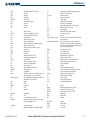
INDEX
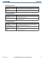
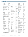
DME Information Window
DME tuning window
2-17
4-25
Go Around Mode (GA)
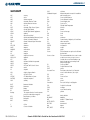
E
ECHO TOP Softkey
Electronic checklists
Emergency frequency
Endurance
Calculated
Engine Airframe Unit
Engine Display
Engine Indication System (EIS)
Engine Manifold Pressure
Entering Flight ID
Entertainment inputs
Exhaust Gas Temperature (EGT)
6-10
1-33–1-34
4-8
3-7
1-3
3-2–3-3
3-1–3-8
3-3, 3-5, 3-7
4-26
4-36
3-5
F
Flight director
Pitch modes
Roll modes
Flight ID
Flight Level Change Mode (FLC)
Flight plan
Active
Closest point to reference
Invert
Storing
Flight Plan Pages (FPL)
Frequency
COM
Nearest
VOR
Frequency spacing
Frequency transfer arrow
Frequently asked questions
Fuel
Calculations
Flow
Planning
Quantity
Range ring
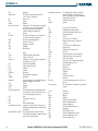
Global Positioning System (GPS)
I-2
GTX 33 Transponder
5-27–5-96,
5-34–5-96
7-3, 7-13,
7-28
4-1, 4-26
H
Heading
Heading Select Mode (HDG)
2-2, 2-11
7-16, 7-23,
7-27, 7-28
HI SENS
4-24
Horizontal Situation Indicator (HSI)
2-2, 2-10
HSI double green arrow
4-16
HSI magenta arrow
4-16
HSI single green arrow
4-16
I
7-1, 7-4–7-5
7-7–7-13
7-14–7-31
4-31
7-11, 7-26,
7-31
5-11
5-82
5-81
D-1
1-23
5-66
5-56
5-55
4-14
4-7
C-5
3-7
3-5, 3-7
5-25
3-3
5-10
IDENT function
IDENT softkey
ID indicator
Inset Map
Inset Map, PFD
Integrated Avionics Unit (IAU)
INTEG annunciation, HSI
Intercom system (ICS)
Intersection
Information
Nearest
IOI
4-31
4-26, 4-28,
4-30
4-18
5-24–5-25
2-3
1-2
2-13
4-36
5-42–5-43
5-52
6-51, A-6
J
Jeppesen aviation database
B-1
L
Land map data
LD APR softkey
Lean Display (EIS)
LEGEND Softkey
Line Replaceable Units (LRU)
LO SENS
5-5, 5-14
5-89
3-4–3-5
6-6
1-2–1-5
4-24
M
G
GDL 69/69A
GFC 700 AFCS
Glideslope Indicator
Glideslope Mode (GS)
Navigation
6-1
7-1–7-32
2-3, 2-9
7-3, 7-12,
7-18, 7-27
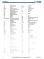
Manual Electric Trim (MET)
Map datums
Map Pages (MAP)
Map panning
Map scale
Marker beacon
7-1, 7-3, 7-19
1-27, E-1–E-2
1-21
5-17
5-16
4-24
Marker Beacon Annunciations 2-3, 2-23
MASQ processing
4-1
Measurement units, changing displayed
1-27
Menus
1-19
Message advisories
A-11, A-12,
A-13, A-14,
A-15, A-16,
A-17, A-18,
A-19
MET
A-5
Metric display, Altimeter
2-7–2-8
1-29
MFD Data Bar fields
Minimum descent altitude
2-3, 2-25
Missed approach
D-2–D-4
MKR/MUTE
4-24
Mode S
4-26, 4-27
4-26, 4-27,
Mode selection softkeys
4-29
8-6
MORE Softkey
Morse code identifier
4-18
Multi Function Display (MFD) 1-2
Controls
1-12–1-13
1-17
Softkeys
MUSIC #1
4-36
MUSIC #2
4-36
Music 1
4-36
8-6
MUTE Softkey
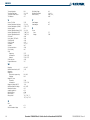
N
National Weather Service
6-22
NAV1
4-17
NAV2
4-17
Navigation (NAV) Frequency Box 2-2
Navigation Data Bar
5-21
Navigation Map
5-16–5-96,
5-31, 6-28
Setup
5-2–5-16
Navigation Mode (VOR, GPS, LOC, BC)
7-17, 7-18,
7-24, 7-25,
7-28
Navigation mode selection
4-16
Navigation source
2-12
Navigation Status Box
1-29, 2-2
4-16
Nav radio selection
NAV tuning knob
4-18
NDB
Nearest
5-53
Nearest
Garmin G1000 Pilot’s Guide for the Beechcraft A36/G36
190-00595-00 Rev. A