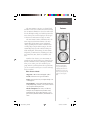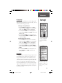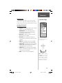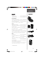
1
eTrex Summit
personal navigator
© 2000-2001 GARMIN Corporation
GARMIN International, Inc.
1200 East 151st Street, Olathe, Kansas 66062, U.S.A.
GARMIN (Europe) Ltd.
Unit 5, The Quadrangle, Abbey Park Industrial Estate, Romsey, SO51 9AQ, U.K.
owner’s
manual
and
reference
guide
GARMIN Corporation
No. 68, Jangshu 2nd Road., Shijr, Taipei County, Taiwan
www.garmin.com
Part Number 190-00193-00 Rev. D
Covers.indd
1
02/01/01, 12:26 PM
©2000-2001 GARMIN Corporation
GARMIN International, Inc.
1200 East 151st Street, Olathe, Kansas 66062 U.S.A.
Tel. 913/397.8200
Fax 913/397.8282
GARMIN (Europe) Ltd.
Unit 5, The Quadrangle, Abbey Park Industrial Estate, Romsey, SO51 9AQ, U.K.
Tel. 44/1794.519944
Fax 44/1794.519222
GARMIN Corporation
No. 68, Jangshu 2nd Road., Shijr, Taipei County, Taiwan
Tel. 886/2.2642.8999
Fax 886/2.2642.9099
All rights reserved. Except as expressly provided herein, no part of this manual
may be reproduced, copied, transmitted, disseminated, downloaded or stored in
any storage medium, for any purpose without prior written consent of GARMIN
Corporation. GARMIN Corporation hereby grants permission to download a single
copy of this manual onto a hard drive or other electronic storage medium to be
viewed for personal use, provided that such electronic or printed copy of this
manual contains the complete text of this copyright notice and provided further that
any unauthorized commercial distribution of this manual is strictly prohibited.
Information in this manual is subject to change without notice. GARMIN
Corporation reserves the right to change or improve its products and to make
changes in the content without obligation to notify any person or organization of
such changes. Visit the GARMIN website for current updates and supplemental
information concerning the use and operation of this and other GARMIN products.
Website address: www.garmin.com
GARMIN is a registered trademark and eTrex is a trademark of GARMIN Corporation and may not be used without the express permission of GARMIN Corporation.
February 2001
Covers.indd
Part Number 190-00193-00 Rev. D
2
Printed in Taiwan
02/01/01, 12:26 PM
Introduction
Registration
eTrex Summit Registration
Help us better support you by completing your
on-line registration today!
Why should you register your eTrex Summit?
• Notification of Product Updates
• Notification of New Products
• Lost or Stolen unit tracking
Connect to our website (www.garmin.com) and look
for the Product Registration link on the home page.
POWER
Thanks for choosing the GARMIN eTrex Summit. If
you have any questions or comments regarding the use
of the eTrex Summit you can visit our website or contact
our Customer Service Department M-F, 8:00-5:00 CST
(except holidays) at 1-800-800-1020.
F
If you have previously registered your GARMIN
product purchase using a mail-in registration
card, we invite you to reregister using our
NEW on-line system. Many services provided
by our new product registration system are
now being automated and reregistering your
purchase ensures you the best possible support
from GARMIN.
1
190-00193-00_0D.indd
1
02/12/01, 10:07 AM
Introduction
Table of
Contents
2
190-00193-00_0D.indd
Introduction
Registration.......................................................................... 1
Warnings and Cautions........................................................ 3
FCC Statement..................................................................... 4
Features ............................................................................... 5
Buttons ................................................................................ 6
Description .......................................................................... 7
Installing the Batteries.......................................................... 8
Getting Started
Calibrating the Electronic Compass .................................... 10
SkyView Page Basics ........................................................... 11
Map Page Basics.................................................................. 12
Pointer Page Basics ............................................................. 13
Elevation Page Basics .......................................................... 14
Menu Page Basics................................................................ 15
Creating a Waypoint ...................................................... 16-17
Heading in the Right Direction .......................................... 18
Cancelling a GOTO ............................................................ 19
Reference Section
SkyView Page Options ................................................... 20-21
Map Page Options .............................................................. 22
Pointer Page Options ..................................................... 23-25
Elevation Page .............................................................. 26-29
Mark Waypoint Page...................................................... 30-31
Waypoint Page.................................................................... 32
Review Waypoint Page................................................... 33-34
Routes ........................................................................... 35-37
Tracks............................................................................ 38-40
Calibration..................................................................... 41-43
Setup Page ..................................................................... 43-44
Display Page ....................................................................... 45
Units Page ..................................................................... 45-48
Heading Page................................................................. 50-52
System Page................................................................... 53-55
Appendicies
Appendix A — Specifications ............................................. 56
Appendix B — What is GPS?......................................... 57-58
Appendix C — Reciption Tips ............................................ 59
Appendix D — Time Offset Chart....................................... 60
Appendix E — Accessories ................................................. 61
Appendix F — Wiring Diagram.......................................... 62
Appendix G — Troubleshooting ......................................... 63
Appendix H — FAQ’s .................................................... 64-65
Appendix I — Index...................................................... 66-69
Warranty ............................................................................ 70
2
02/12/01, 10:07 AM
Introduction
WARNING: If you choose to use the eTrex Summit
in a vehicle, it is the sole responsibility of the owner/
operator of the eTrex Summit to secure the GPS unit so
that it will not cause damage or personal injury in the
event of an accident. Do not mount the eTrex Summit
over airbag panels or in a place where the driver or passengers are likely to have an impact with it in an accident
or collision.
Warnings and
Cautions
WARNING: If you choose to use the eTrex Summit in
a vehicle, it is the sole responsibility of the operator of the
vehicle to operate the vehicle in a safe manner, maintain
full surveillance of all driving conditions at all times,
and never become distracted by the eTrex Summit to the
exclusion of safe operating practices. It is unsafe to operate the eTrex Summit while you are driving. Failure by
the operator of a vehicle equipped with an eTrex Summit
to pay full attention to operating the vehicle and road
conditions while the vehicle is in motion could result
in an accident or collision with property damage and
personal injury.
CAUTION: IT IS THE USER’S RESPONSIBILITY TO
USE THIS PRODUCT PRUDENTLY. THIS PRODUCT IS
INTENDED TO BE USED ONLY AS A TRAVEL AID AND
MUST NOT BE USED FOR ANY PURPOSE REQUIRING
PRECISE MEASUREMENT OF DIRECTION, DISTANCE,
LOCATION, OR TOPOGRAPHY.
Remove the batteries from your
eTrex Summit if you don’t expect to
use it for several months. Be sure
to observe the proper polarity when
inserting the batteries. Follow the
battery manufacturer’s instructions
on the proper care and handling of
the batteries.
CAUTION: The Global Positioning System (GPS) is
operated by the government of the United States, which is
solely responsible for its accuracy and maintenance. The
system is subject to changes which could affect the accuracy and performance of all GPS equipment. Although the
eTrex Summit is a precision electronic NAVigation AID
(NAVAID), any NAVAID can be misused or misinterpreted
and, therefore, become unsafe.
3
190-00193-00_0D.indd
3
02/12/01, 10:07 AM
Introduction
FCC Compliance
Statement
The eTrex Summit complies with Part 15 of the FCC
limits for Class B digital devices. This equipment generates, uses, and can radiate radio frequency energy and, if
not installed or used in accordance with the instructions
may cause harmful interference to radio communications.
There is no guarantee that interference will not
occur in a particular instance. If this equipment does
cause harmful interference to other equipment, try to
correct the problem by relocating the equipment.
Consult an authorized GARMIN dealer or other
qualified service technician if the problem cannot be corrected. Operation is subject to the following conditions:
(1) This device cannot cause harmful interference, and (2)
this device must accept any interference received, including interference that may cause undesired operation.
The eTrex Summit does not contain any userserviceable parts. Repairs should be made only by an
authorized GARMIN service center. Unauthorized repairs
can void the warranty.
4
190-00193-00_0D.indd
4
02/12/01, 10:07 AM
Introduction
The eTrex Summit is a six ounce, 12 channel, hand
held GPS receiver. It has a built-in GPS antenna and only
five user-Buttons. All Buttons are located on either side of
the unit, allowing for simple, one-handed operation that
won’t obstruct your view of the display. It runs for up to
22 hours on two AA batteries in battery save mode.
Features
The eTrex Summit contains a full function GPS, electronic compass and barometric altimeter. The eTrex
Summit will track barometric pressure and altitude
changes, providing data never before available in such
a small package. Using the built in compass, the eTrex
Summit will provide you with a reliable heading even
while standing still. When moving, the eTrex Summit
will provide you with more data, including speed, direction of movement, time, distance to destination, and
more.
From these basic features, your eTrex Summit can
provide one more critical benefit; peace of mind, because,
with the combination of these technologies you’ll know
where you are, where you’ve been and where you’re
going. And since you’ll always know the way back home,
you can concentrate on what you set out to do and enjoy
the great outdoors.
Other features include:
Waypoints: 500 with name and graphic symbol.
NOTE: You should always
be prepared and capable of
navigating without the eTrex
Summit. It is designed to augment other forms of basic navigation, not entirely replace
them.
Tracks: Automatic track log; 10 saved tracks.
Routes: 20 Routes that let you navigate through a set
of 50 waypoints.
Trip Computer: Current speed, average speed, maximum speed, bearing, elevation, location, time of sunrise/
sunset, trip timer and trip odometer.
Elevation Computer: Total ascent, total descent,
average ascent, average descent, maximum ascent,
maximum descent, vertical speed, pressure, 12 hour
pressure trend, maximum elevation, and minimum elevation.
5
190-00193-00_0D.indd
5
02/12/01, 10:07 AM
Introduction
eTrex Summit
Buttons
The UP/DOWN Button:
• Select options on pages and menus
• Adjusts Contrast on SkyView Page
• Zoom in and out on Map Page
• Cycles through trip computer data
• Cycles through elevation computer data
The ENTER Button:
• Confirms data entry or menu selections
• Displays Options on main pages
• Pressing and holding the ENTER Button
activates the ‘Mark Waypoint’ page
The PAGE Button:
• Switches display pages.
• Allows you to quit a function.
• Pressing and holding the PAGE Button
will turn on the Electronic Compass and
display the Pointer Page.
The POWER Button:
• Turns the unit on and off
• Turns the display backlight on and off
6
190-00193-00_0D.indd
6
02/12/01, 10:07 AM
Introduction
Internal
GPS Antenna
eTrex Summit
Description
UP
Button
PAGE
Button
DOWN
Button
POWER
Button
ENTER
Button
LCD Display
(with backlight)
Compass
Sighting
Marks
External Power
and
Data Connector
Waterproof Case
Barometric
Pressure
Sensor
Battery
Compartment
7
190-00193-00_0D.indd
7
02/12/01, 10:07 AM
Introduction
Battery
Installation
Installing the Batteries
The eTrex Summit operates on two AA batteries (not
included), which are installed at the back of the unit.
To install the batteries, remove the battery cover by turning the D-ring at the back of the unit 1/4 turn counterclockwise. Insert the batteries observing proper polarity.
Attach the battery cover by turning the D-ring 1/4 turn
clockwise. The two AA batteries can last up to 16 hours
during typical use.
Lanyard Installation
Battery Cover
D-ring
8
190-00193-00_0D.indd
8
02/12/01, 10:08 AM
Getting Started
The Getting Started Section introduces you to the
basic operation of the eTrex Summit. The Reference Section shows you how to use all of eTrex Summit’s remaining features.
Here We Go
The First Step
The eTrex Summit’s GPS operates using information
gathered from satellites. To Initialize the eTrex Summit’s
GPS receiver the first time, take your eTrex Summit outside and find a large, open area that has a clear view of
the sky. Press and hold the POWER Button to turn the
unit on. You’ll see the Welcome Page for a few seconds
while the eTrex Summit performs a self-test, followed by
the SkyView Page.
F
NOTE: When you use the eTrex Summit for the
first time, it will take up to five minutes to find
your location. After the first use, eTrex Summit
only needs about 15 to 45 seconds to find your
location.
The SkyView Page
The eTrex Summit needs to receive at least three
strong satellite signals to find your location. The SkyView
Page shows you graphically eTrex Summit tracking satellites, and the strength of the satellite signals. The status is
also displayed at the top of the page.
When you see the “READY TO NAVIGATE” message
in the status box, eTrex Summit has found your location
and the GPS receiver is initialize and ready for use.
Backlighting and Contrast
If the lighting conditions make it hard for you to see
the screen, adjust the contrast or turn on the backlight.
Press and release the POWER Button from any screen to
turn on the backlight. The backlight is timed to stay on
for 30 seconds. To adjust the screen contrast, press the
PAGE Button until you see The SkyView Page. Press the
UP Button to make the screen darker, press the DOWN
Button to make the screen lighter.
The “READY TO NAVIGATE”
message must appear before
you can begin using your eTrex
Summit to navigate.
9
190-00193-00_0D.indd
9
02/12/01, 10:08 AM
Getting Started
Calibrating the
Compass
Calibrating the Electronic Compass
The eTrex Summit’s Electronic Compass needs to be
calibrated outdoors after the batteries have been changed
before using the unit for navigation. Failure to calibrate
the Electronic Compass can result in gross inaccuracy of
the compass feature.
Compass Calibration:
1. Press the PAGE Button until the MENU Page is
displayed.
2. Using the UP or DOWN Button, highlight ‘Calibrate’
and press the ENTER Button.
3. Using the UP or DOWN Button, highlight ‘Compass’
and press the ENTER Button.
The Speed Scale indicates whether
you are ‘TOO SLOW’, ‘JUST
RIGHT’ or ‘TOO FAST’.
Helpful Compass Tips
4. With ‘Start’ highlighted, press the ENTER Button to
begin the calibration.
5. Making sure that the unit is level, rotate the eTrex
Summit slowly two turns in the same direction. On
the display there will be a speed scale that indicates
whether you are rotating the unit ‘Too Fast’, ‘Too
Slow’ or ‘Just Right’. A message will be displayed
when the compass has been successfully calibrated.
1. The Electronic Compass will
need to be recalibrated outdoors every time the batteries are changed.
2. The Electronic Compass will
not be accurate when used in
a car or around items that
radiate a magnetic field.
3. When using the compass, hold
the unit as level as possible.
The more that the unit is tilted,
the less accurate the compass
will become.
F
NOTE: The eTrex Summit needs to be level
during compass calibration and use. If the unit
is tilted on either axis the compass feature will
become less accurate.
10
190-00193-00_0D.indd
10
02/12/01, 10:08 AM
Getting Started
Page Basics
Selecting a Page
All of the information needed to operate the eTrex
Summit is found on five main “pages” (or display screens).
These pages are The SkyView, Map, Pointer, Elevation and
Menu. Simply press the PAGE Button to switch between
pages.
SkyView
PAGE
PAGE
PAGE
Map
Pointer
PAGE
Elevation
Menu
SkyView Page Basics
The SkyView Page displays the eTrex Summit’s
receiver status. It also shows the strength of the satellite
signals that are being received. If the signals are weak you
may need to try a different location for better reception.
The shorter the signal strength bar, the weaker the signals.
At the top of the page the unit displays the status of the
receiver. The eTrex Summit displays the message ‘Ready
to Navigate’ when the receiver has gathered enough satellite information to begin navigation.
Status Message
Location Accuracy
(estimated)
Satellites
Satellite
Signals
“You”; Your
Location
Satellite Signal
Strength Bar
The SkyView Page
190-00193-00_0D.indd
11
11
02/12/01, 10:08 AM
Getting Started
Page Basics
Map Page Basics
Map
Orientaion
Destination
Waypoint
“You”; your
location
Path to
Destination
On the Map Page, the UP and
DOWN Buttons are used to adjust
the map scale from 200 feet to
800 miles.
Map
Scale
“Trail”
(track log)
The Map Page
The Map Page shows where you are (the animated
figure) and provides a picture of where you are going.
As you travel, the animated figure “walks” and leaves
a “breadcrumb trail” known as a Track Log. Waypoint
names and symbols are also shown on the map.
To help you better visualize the “real world”, eTrex
Summit automatically rotates the map as you move, so
that waypoints that are ahead of you are always displayed
in front of the animated figure. In the upper left corner of
the screen, the Map Orientation is displayed.
To make sure you can see your entire trip, the map
scale can be changed from 200 feet to 800 miles. To
increase the map scale, press the UP Button. This will let
you view a larger area in less detail. To decrease the map
scale, press the DOWN Button. This will show a smaller
12
190-00193-00_0D.indd
12
02/12/01, 10:08 AM
Getting Started
Page Basics
Pointer Page Basics
Waypoint (Location) Name
Time to
Destination
Straight Line
Distance to the
Destination
Current Sensor
Heading
Direction Arrow
(follow this)
Destination
Symbol
Selectable Trip
Data
On the Pointer Page, the UP and
DOWN Buttons are used to cycle
through different trip data.
Compass Ring
The Pointer Page
The Pointer Page helps guide you to a destination.
When you’re moving towards a specific destination,
the Pointer Page shows you the name of the location,
the distance, time to go and displays a direction arrow
in the Compass Ring. To navigate, simply follow the
arrow. If the arrow is pointing right, turn right until
the arrow is pointing directly ahead and you will arrive
at your destination.
The Compass Ring reflects your heading (direction
of movement). The eTrex Summit will automatically
select the correct sensor for you based on your speed.
By pressing the UP or DOWN Buttons, you can
cycle through other trip computer information such
as average speed, maximum speed, bearing, lat/lon,
elevation, time of sunrise/sunset, trip timer and trip
odometer.
F
NOTE: The direction arrow and destination
symbol only appear on the Pointer Page when
you have started a GOTO.
13
190-00193-00_0D.indd
13
02/12/01, 10:08 AM
Getting Started
Page Basics
Elevation Page Basics
Current
Elevation
Rate of
Ascent/Descent
Scale
On the Elevation Page, the UP and
DOWN Buttons are used to cycle
through a variety of user-selectable
data.
Elevation
Profile
Selectable
Data
The Elevation Page
The Elevation Page will provide the user with the
current elevation, rate of ascent/descent, and a profile
of elevation changes over distance or time. The UP or
DOWN Buttons can be used to scroll through a variety
of user selectable data including Pressure, Vertical Speed,
Max Descent, Max Ascent, Avg Descent, Avg Ascent, Total
Descent, Total Ascent, Min Elevation, Max Elevation, and
12 Hour Pressure Trend.
Press ENTER to access the
Elevation Page ‘OPTIONS’.
F
The Altimeter should be calibrated for the
greatest accuracy. See page 42 for more information on calibrating the Altimeter.
14
190-00193-00_0D.indd
14
02/12/01, 10:08 AM
Getting Started
Page Basics
Menu Page Basics
Menu Options
Time and Date
Backlight On
Indicator
Battery
Strength
The Menu Page
The Menu Page gives you access to eTrex Summit’s
more advanced features. With the Menu Page you can
create and view waypoints, create a route, save and view
track logs, calibrate the electronic compass and altimeter
or access the system setup features. Information on each
of these advanced features is included in the Reference
Section of this manual.
You can select your particular
time zone on the TIME page.
Changing the Time Zone
Let’s practice using the Menu Page and set the eTrex
Summit to display your local time.
To change the time zone:
1. Using the PAGE Button, switch to the MENU Page.
Using the UP or DOWN Button, highlight ‘SETUP’
and press ENTER. The SETUP Page appears.
2. Using the UP or DOWN Button, highlight ‘TIME’ and
press ENTER.
3. Using the UP or DOWN Button, select the ‘TIME
ZONE’ field and press ENTER.
4. Using the UP or DOWN Button, scroll through the
selections, and press ENTER when you have found
your correct time zone. Press PAGE to get back to
the page of your choice.
190-00193-00_0D.indd
15
15
02/12/01, 10:08 AM
Getting Started
Let the Fun
Begin
Discovering the Fun of GPS Navigation
Discovering the fun of using your eTrex Summit is as
easy as taking a quick walk around an open outdoor area.
In this brief exercise, you’ll mark your current location
(your home for example), travel a short distance away,
and then have the eTrex Summit guide you back to where
you started (to get the most out of this exercise, make sure
to walk for at least the time noted for each step).
Creating a Waypoint
The first step in the exercise is to mark your location
as a waypoint so you can return to it later.
The Latitude, Longitude and Elevation are displayed along the
bottom of the MARK WAYPOINT
and REVIEW WAYPOINT Pages.
F
NOTE: The eTrex Summit must be “READY TO
NAVIGATE” before you mark a waypoint.
To mark a waypoint:
1. Press and hold the ENTER Button to activate the
MARK WAYPOINT Page.
The waypoint is assigned a numeric name at the time
it is created. You could press ENTER and save the
waypoint now, but there are a couple of other things that
you should take a look at.
The eTrex Summit comes equipped with 29 different
waypoint symbols that can be displayed on the map to
help quickly identify the waypoints.
To change the waypoint symbol:
You can select from 29 symbols
to represent a waypoint on the
map.
1. On the MARK WAYPOINT Page, using the UP or
DOWN Button, highlight the small flag symbol and
press ENTER. Using the UP or DOWN Button, scroll
through the symbols and highlight the house symbol.
Press ENTER.
16
190-00193-00_0D.indd
16
02/12/01, 10:08 AM
Getting Started
As mentioned earlier the eTrex Summit will assign a
numeric name at the time a waypoint is created. The
assigned name can be easily changed to something more
meaningful to help in identifying the waypoint.
Edit Waypoint
To change the waypoint name:
1 On the MARK WAYPOINT Page, press the UP
or DOWN Button to highlight the Waypoint Name
‘001’. Press ENTER. The EDIT WAYPOINT NAME
Page appears.
2. Press ENTER. Using the UP or DOWN Button,
scroll through the letter selections. Select ‘H’ and
press ENTER. Repeat this process and finish the
word ‘HOME’.
3. Using the UP or DOWN Button, highlight the ‘OK’
field and press ENTER. The MARK WAYPOINT Page
appears.
Edit Waypoint Name
4. Using the UP or DOWN Button, highlight the ‘OK’
field and press ENTER. Your location, named HOME,
is now marked and stored in memory.
Now that you’ve marked your location, it’s time to
go for a walk. Press the PAGE Button and switch to the
Map Page. Walk in a straight line for 2-3 minutes at a
moderate pace and watch the Map Page.
Your location is shown by the figure in the middle of
the screen. As you move, watch the animated figure walk,
and a line—called a “track”—appear along the path you
have just covered. Now take a sharp right or left turn and
walk for another 2-3 minutes.
Map Page
17
190-00193-00_0D.indd
17
02/12/01, 10:08 AM
Getting Started
Follow the
Pointer
Guidance by GARMIN
It is time to let the eTrex Summit guide you back to
the waypoint we named ‘HOME’ using the GOTO function. The GOTO function provides you with a straight
line navigation path to your selected destination.
To Start a GOTO:
1. Using the PAGE Button switch to the MENU Page.
2. Using the UP or DOWN Button, highlight ‘WAYPOINTS’ and press ENTER. The WAYPOINTS Page
appears.
3. Using the UP or DOWN Button, select the tab
containing ‘HOME’ and press ENTER.
The pointer tells you what direction you should move. When the
pointer is pointing right, just
move right until the pointer is
pointing straight up and points
to the moving direction line (see
picture below).
4. Using the UP or DOWN Button, select ‘HOME’ and
press ENTER. The REVIEW WAYPOINT Page appears.
5. Using the UP or DOWN Button, highlight ‘GOTO’,
and press ENTER.3
The Compass Page appears and you’re ready to begin
navigating!
Heading in the Right Direction
The eTrex Summit will guide you back to where you
started using the Pointer Page. The pointer shows the
direction of the destination waypoint. Walk in the direction the arrow is pointing until the arrow points to the top
of the compass ring. If the arrow points to the right, you
need to go to the right. If the arrow points to the left, go
left. When the arrow is pointing straight up, you are on
the correct track!
When the pointer points straight
up as shown, you’re on track!
The destination name, distance to the destination and
time to reach your destination are displayed at the top
of the screen. The sensor that is being used, Compass
or GPS, to determine your heading is displayed above
the pointer. The speed you are traveling is shown at
the bottom of the screen. Once you are getting close to
your destination, eTrex Summit will give you the message
“ARRIVING DESTINATION”.
18
190-00193-00_0D.indd
18
02/12/01, 10:08 AM
Getting Started
You’ve Made It!
Cancelling a GOTO
Anytime you want to stop a GOTO:
1. Using the PAGE Button, switch to the POINTER Page.
Press ENTER.
2. Highlight ‘STOP NAVIGATION’ on the OPTIONS Page
and press ENTER.
Clearing a Cluttered Map Display
After you’ve used the eTrex Summit a few times, the
map display will become a bit messy from keeping track
of your every move. You can clean up the screen by clearing the track log (the lines left on the Map Page):
To clear the track log:
1. Using the PAGE Button, switch to the MENU Page.
2. Using the UP or DOWN Button, highlight
‘TRACKS’. Press ENTER.
3. You are now on the TRACKS Page. Using the UP
Button, highlight CLEAR, and press ENTER.
4. Using the DOWN Button, highlight ‘YES’. Press
ENTER.
Highlight STOP NAVIGATION
and press ENTER on the Options
Page to stop a GOTO.
5. Press the PAGE Button to select any page.
You’ve now gone through the basic operation of eTrex
Summit and you’re ready to get out there and have
some fun! To turn eTrex Summit off, press and hold the
POWER Button.
F
When you clear the Track Log you also clear
the Elevation Profile. Learn how to save the
Track Log and use it for ‘TrackbacK’ navigation
on pages 39 and 40 in the Reference Section.
19
190-00193-00_0D.indd
19
02/12/01, 10:08 AM
Reference
SkyView Page
Options
Introduction
This section will describe the features and use of the
eTrex Summit in more detail than the Getting Started
Section.
SkyView Page Options
In addition to the functions of the default SkyView
Page as described on page 11, there is an ‘OPTIONS’
menu available. To activate the ‘OPTIONS’ menu, press
ENTER with the SkyView Page displayed. There are two
options available:
• Setup Display: The Setup Display feature allows you
to change the display contrast and set the time that the
backlight will stay on.
Changing the contrast:
1. Place the highlight over the Contrast Slider, press
ENTER to activate the slider.
Normal SkyView Page
Options
2. Use the UP Button to darken the contrast or the
DOWN Button to lighten the contrast.
3. When finished press ENTER to save the setting.
Setting the (Back) Light Timeout:
1. Place the highlight over the ‘LIGHT TIMEOUT’ field
and press ENTER.
2. Choose the setting that you desire using the UP or
DOWN Button.
3. Press ENTER to save the setting.
• Advanced SkyView: When you select the Advanced
SkyView feature the eTrex Summit will display a different SkyView Page that contains more detailed information on the satellites including their position in relation
to you and the signal strength for each satellite that is
being received.
Selecting the Advanced SkyView Page:
1. Place the highlight over the ‘ADVANCED SKYVIEW’ field
and press ENTER.
20
190-00193-00_0D.indd
20
02/12/01, 10:08 AM
Reference
Receiver Status
Horizon
Directly Overhead
Advanced
SkyView Page
45° Above
Horizon
Signal Strength Indicators
Advanced SkyView Page Options
The Advanced SkyView Page also has an ‘OPTIONS’
menu. To activate the ‘OPTIONS’ menu, press ENTER
with the Advanced SkyView Page displayed. There are
three options available:
• Setup Display: This is the same as on the default
SkyView Page described on page 20.
Advanced SkyView Page
Options
• Orient Sky Northward/Orient Sky Ahead: As set
from the factory, the eTrex Summit will orient the satellite view with your current track toward the top of the
display. When you select ‘ORIENT SKY NORTHWARD’
the satellite postion will be oriented with North at the
top of the display. When ‘ORIENT SKY AHEAD’ is
active, ‘ORIENT SKY NORTHWARD’ will be the available option.
To Select Orient Sky Northward or Ahead:
1. Place the highlight over the ‘ORIENT SKY NORTHWARD’
or ‘ORIENT SKY AHEAD’ field and press ENTER.
• Normal SkyView: This options displays the default
SkyView Page.
To select Normal SkyView:
1. Place the highlight over ‘NORMAL SKYVIEW’ and
press ENTER.
21
190-00193-00_0D.indd
21
02/12/01, 10:08 AM
Getting Started
Map Page
Options
Map Page Options
In addition to the basic aspects of the Map Page that
were covered on page 12, there is a ‘MAP OPTIONS’
feature which allows you to customize the Map Page. The
following options are available:
• Orient Map Ahead/Northwards: When ‘AHEAD’ is
selected, the top of the map is oriented in the direction
you are currently moving. When ‘NORTHWARDS’ is
selected, the map is always oriented to the north.
• Auto Zoom On/Off: When ‘AUTO ZOOM’ is turned
on, the map automatically adjusts its scale to display
your entire navigating route. When it’s turned off, you
must press the UP or DOWN Buttons to select the
appropriate map scale.
Selecting ‘Orient Map Ahead’
from the Map Page options orients
the map to the direction you are
moving.
• Hide Waypoints: ‘HIDE WAYPOINTS’ will keep waypoint symbols and names from being displayed on the
Map Page.
• Stop Navigation: ‘STOP NAVIGATION’ stops any
active navigation (navigation means there is a destination waypoint or active route). This option cannot be
selected if there is no active navigation.
To select a Map Page option:
1. Press the ENTER Button on the MAP Page.
2. The Map Options Menu appears. Using the UP
or DOWN Button, highlight the desired option and
press ENTER. Once you press ENTER, the change is
made and the Options Menu disappears.
When you select ‘Orient Map
Northwards’ the figure icon is
replaced by a ‘direction’ triangle.
You will notice on the Map Page the little grey “man”.
The man stands still when you are not moving, he moves
when you move, and a blinking “?” means the eTrex
Summit has lost satellite reception (weak signals). You
should relocate the eTrex Summit or move to a place that
has a clear view of the sky.
22
190-00193-00_0D.indd
22
02/12/01, 10:08 AM
Reference
Pointer Page Options
In addition to the Pointer Page basics that were covered on page 13, several Pointer Page options are available:
Pointer Page
Options
• Sight 'N Go: This feature allows the user to visually
locate a landmark and lock it’s magnetic bearing. Once
a bearing is locked you have the option of creating a
projection waypoint or navigating along the locked bearing.
Projecting a waypoint using Sight ‘N Go:
1. Press ENTER to activate the options list.
2. Using the UP or DOWN Button, highlight ‘SIGHT ’N
GO’ and press ENTER.
3. Holding the eTrex Summit level, line up the sighting
marks on the case with a distant landmark.
4. Press ENTER to lock the magnetic bearing.
5. Using the UP or DOWN Button, select either ‘RESIGHT’ or ‘PROJECT’. If you select ‘RE-SIGHT’ you will
return to step 3. If you selected ‘PROJECT’ proceed
to step 6.
F
When using the ‘Sight ‘N Go’ or
‘Set Course’ feature of the eTrex
Summit, hold the unit level and
align the Sighting Marks on the
case with a distant landmark.
A Projection Waypoint is a waypoint created at
a specified distance from the eTrex Summit’s
current GPS location.
6. The PROJECT WAYPOINT Page will be displayed with
the Distance field highlighted. Press ENTER.
7. The EDIT NUMBER Page will be displayed. Use the
UP or DOWN Button to select the desired digit. With
the desired digit selected, press ENTER to activate
the drop down number list.
8. Using the UP or DOWN Button, select the correct
digit then press ENTER. When all digits are entered
correctly, highlight ‘OK’ and press ENTER.
Project Waypoint Page
9. To save the waypoint, highlight ‘OK’ and press
ENTER. To begin navigation to the waypoint, highlight ‘GOTO’ and press ENTER.
23
190-00193-00_0D.indd
23
02/12/01, 10:08 AM
Reference
Pointer Page
Options
• Set Course: The Set Course feature allows the user to
visually locate a landmark, lock in a bearing to the point
and begin navigation on that bearing.
When using the Set Course feature the Pointer will
point the direction you need to navigate, and display the
cross track or the amount you are off course from straight
line navigation.
Using the Set Course feature:
1. Press ENTER to activate the options list.
2. Using the UP or DOWN Button, highlight ‘SIGHT ’N
GO’ and press ENTER.
3. Holding the eTrex Summit level, line up the sighting
marks on the case with a distant landmark.
4. Press ENTER to lock the magnetic bearing.
When using the ‘Set Course’
feature, the ‘Pointer’ indicates a
direct bearing to your destination. The center of the pointer
(D-Bar) will show your cross
track (the distance you are right
or left of the desired course).
The example above shows that
you are headed toward your
destination but have drifted off
course to the left about 50 feet.
To return to your desired course
turn toward the D-Bar (right)
until the D-Bar aligns with the
pointer
5. Using the UP or DOWN Button, select ‘SET COURSE’.
Press ENTER. The eTrex Summit will begin navigation on the locked bearing
6. To end navigation, press ENTER. Using the UP or
DOWN Button, select ‘STOP NAVIGATION’ and press
ENTER.
• Big Heading/Compass: this allows the user to select
between seeing either large heading numbers or a large
compass.
• Reset Max Speed: this resets the Maximum Speed
achieved during a trip.
• Reset Trip: the trip time, trip distance (odometer) and
average speed are reset to zeros.
• Stop Navigation: stops any active navigation.
To select a Pointer Page option:
1. Press the ENTER Button on the POINTER Page.
2. The Options Menu appears. Press the UP or DOWN
Button, highlight the desired option, and press
ENTER. Once you press ENTER, the change is made
and the Options Menu disappears.
24
190-00193-00_0D.indd
24
02/12/01, 10:08 AM
Reference
You can also change the fields at the bottom of the
Pointer Page to display different data:
Pointer Page
Options
Speed—like the speedometer in your car, ‘SPEED’
tells you how fast you are going regardless of whether
or not you are on the right track.
Average Speed—the average speed traveled since last
trip reset.
Max Speed—the maximum speed traveled since last
reset.
Bearing—the compass direction between your location and destination.
Elevation—the measurement of height above mean
sea level.
Location—shows your current latitude and longitude.
Sunrise—the time of sunrise at your present location.
Pointer Page Options
Sunset—the time of sunset at your present location.
Trip Time—the total time you have traveled since the
last trip reset.
Trip Odometer—like the odometer in your car, ‘TRIP
ODOMETER’ tells you how far you’ve gone since the
last trip reset.
To change a data field:
1. On the POINTER Page, press the UP or DOWN
Button and scroll through the available options, stopping on the data you want the eTrex Summit to
display.
User-Selectable Data Field
25
190-00193-00_0D.indd
25
02/12/01, 10:08 AM
Reference
Elevation Page
Options
Elevation Page Options
In addition to the Elevation Page basics explained on
page 14, there are several options that allow the user to
customize the elevation profile display.
‘PLOT OVER TIME’ sets the elevation profile to display changes over a set period of time.
To select ‘PLOT OVER TIME’:
1. With the ELEVATION Page displayed, press ENTER
to display the options list.
2. Using the UP or DOWN Button highlight ‘PLOT OVER
TIME’ and press ENTER.
With the elevation profile set to ‘PLOT OVER TIME’
you can set the time duration using the ‘ZOOM TIME’
option. You can set the profile to display 2 minutes, 5
minutes, 10 minutes, 20 minutes, 30 minutes, 1 hour, or
2 hours of elevation data.
Set the elevation profile to plot
over distance or time.
To set Zoom Time:
1. With the Elevation Page displayed, press ENTER to
display the options list.
2. Using the UP or DOWN Button highlight ‘Zoom
Time’ and press ENTER. The display will switch back
to the elevation profile.
3. Using the UP or DOWN Button, set the time scale.
4. When you have the correct time scale selected press
ENTER.
‘PLOT OVER DISTANCE’ sets the elevation profile to
display changes over a set period of time.
To select ‘PLOT OVER DISTANCE’:
1. With the ELEVATION Page displayed, press ENTER
to display the options list.
2. Using the UP or DOWN Button highlight ‘PLOT OVER
DISTANCE’ and press ENTER.
Time Scale
26
190-00193-00_0D.indd
26
02/12/01, 10:08 AM
Reference
With the elevation profile set to ‘PLOT OVER
DISTANCE’ you can set the distance using the ‘ZOOM
DISTANCE’ option. You can set the profile to display data
over .2 miles, .5 miles, 1 miles, 5 miles, 10 miles, 15
miles or 25 miles.
Elevation Page
Options
To set Zoom Distance:
1. With the ELEVATION Page displayed, press ENTER to
display the options list.
2. Using the UP or DOWN Button highlight ‘ZOOM
DISTANCE’ and press ENTER. The display will switch
back to the elevation profile.
3. Using the UP or DOWN Button, select the time
scale.
4. When you have the desired time scale selected, press
ENTER.
Distance Scale
The elevation profiles vertical distance can be changed
using the ‘ZOOM ELEVATION’ option. The vertical elevation distance can be set to 200 feet, 400 feet, 600 feet,
800 feet, 1000 feet, 2500 feet, or 5000 feet.
To set Zoom Elevation:
1. With the ELEVATION Page displayed, press ENTER to
display the options list.
2. Using the UP or DOWN Button highlight ‘ZOOM
ELEVATION’ and press ENTER. The display will switch
back to the elevation profile.
3. Using the UP or DOWN Button, select the vertical
distance.
4. When you have the desired vertical distance selected,
press ENTER.
Vertical Distance Scale
27
190-00193-00_0D.indd
27
02/12/01, 10:08 AM
Reference
Elevation Page
Options
The ‘VIEW POINTS’ options allows you to scroll
through the stored elevation profile and view a single
point along the profile. When the pointer is stopped at
a location along the profile the elevation, time of day and
date the point was created are displayed.
View Points:
1. With the ELEVATION Page displayed, press ENTER to
display the options list.
2. Using the UP or DOWN Button highlight ‘ZOOM
ELEVATION’ and press ENTER. The display will switch
back to the elevation profile.
Using the ‘VIEW POINTS’
option you can view any point in
the elevation profile history.
3. Using the UP or DOWN Button (Up scrolls the
display left Down scrolls the display right), select the
point along the profile.
4. When finished press ENTER to exit ‘VIEW POINTS’.
‘RESET MAX ELEVATION’ resets the maximum elevation data field at the bottom of the page.
To reset the Maximum Elevation:
1. With the ELEVATION Page displayed, press ENTER to
display the options list.
2. Using the UP or DOWN Button highlight ‘RESET
MAX ELEVATION’ and press ENTER.
‘RESET ELEVATION DATA’ resets all of the data fields.
To reset the Elevation Data:
1. With the ELEVATION Page displayed, press ENTER to
display the options list.
2. Using the UP or DOWN Button highlight ‘RESET
ELEV DATA’ and press ENTER.
28
190-00193-00_0D.indd
28
02/12/01, 10:08 AM
Reference
You can also change the data field along the bottom of
the Elevation Page to display different data.
Elevation Page
Data Fields
TOTAL ASCENT—Total distance ascended.
TOTAL DESCENT—Total distance descended.
AVG ASCENT—Average rate of ascent.
AVG DESCENT—Average rate of descent.
MAX ASCENT RATE—Maximum Ascent Rate.
MAX DESCENT RATE—Maximum Descent Rate.
VERTICAL SPEED—Vertical Speed.
PRESSURE—Current Normalized or Ambient pressure based on the pressure setting in System Setup,
see page 55.
12HRS PRESSR—Tracks pressure changes over a 12
hour period.
MAX ELEVATION—Highest elevation reached.
The Elevation Page Data Field
has 11 user selectable options.
MIN ELEVATION—Lowest elevation.
To scroll through the user selectable data:
1. The UP or DOWN arrow will scroll through the
available data fields.
On the Elevation Page, the UP
and DOWN Buttons are used to
scroll through the user-selectable
data fields.
29
190-00193-00_0D.indd
29
02/12/01, 10:08 AM
Reference
Mark Waypoint
Page
Menu Page Selections
The Menu Page turns the eTrex Summit into a powerful navigation tool. With the Menu Page you can customize the display, transfer information from a computer to
eTrex Summit and back again, and manage and organize
all of your waypoints. Now let’s take a look at each of the
Menu Page selections.
Mark Waypoint Page
The MARK WAYPOINT Page allows you to create a
waypoint at the eTrex Summit’s current location or at a
location you enter in the position field. You can also
change the symbol, name and elevation.
To change the symbol:
Remember that pressing and holding the ENTER Button gives you
the ‘MARK WAYPOINT’ Page
where you can mark a waypoint.
1. Press the PAGE Button and switch to the ‘MENU’
Page. Press the UP or DOWN Button and highlight
‘MARK’. Press ENTER.
2. Press the UP or DOWN Button and highlight the
small flag and press ENTER.
3. Using the UP or DOWN Button, scroll through the
symbols. Press ENTER to save the selection.
To change the name:
1. Press the PAGE Button and switch to the ‘MENU’
Page. Press the UP or DOWN Button and highlight
‘MARK’. Press ENTER. The MARK WAYPOINT Page
appears.
2. Press the UP or DOWN Button and highlight the
numeric name and press ENTER. The EDIT WAYPOINT NAME Page will appear.
Highlight the small flag symbol
and press ENTER to activate
the symbol selections.
3. Use the UP or DOWN Button to highlight the
desired letter, press ENTER. A letter selection
window appears. Press the UP or DOWN Button to
select a new letter and press ENTER. Repeat step 3
until all letters are changed.
4. Press the UP or DOWN Button to highlight the
‘OK’ field and press ENTER. The waypoint name is
changed.
30
190-00193-00_0D.indd
30
02/12/01, 10:08 AM
Reference
To change the elevation:
1. Press the PAGE Button and switch to the MENU
Page. Press the UP or DOWN Button and highlight
‘MARK’. Press ENTER. The MARK WAYPOINT Page
appears.
Mark Waypoint
Page
2. Press the UP or DOWN Button and highlight the
‘ELEV’ field and press ENTER. The ENTER CORRECT
ELEVATION Page appears.
3. Use the UP or DOWN Button to highlight the desired
digit, press ENTER. A selection window appears.
Press the UP or DOWN Button to select a new
number and press ENTER. Repeat step 3 until all
numbers are changed.
4. Press the UP or DOWN Button to highlight the ‘OK’
field and press ENTER. The MARK WAYPOINT Page
appears with the corrected elevation displayed.
To change the location (latitude/longitude):
1. Press the PAGE Button and switch to the MENU
Page. Press the UP or DOWN Button and highlight
‘MARK’. Press ENTER. The MARK WAYPOINT Page
appears.
The ‘ENTER CORRECT ELEVATION’ Page allows you to change
the elevation for the waypoint.
2. Press the UP or DOWN Button and highlight the
‘LAT/LON’ field and press ENTER. The EDIT LOCATION Page appears.
3. Use the UP or DOWN Button to highlight the desired
letter or digit, press ENTER. A selection window
appears. Press the UP or DOWN Button to select a
new letter or number and press ENTER. Repeat step
3 until location is changed.
4. Press the UP or DOWN Button to highlight the ‘OK’
field and press ENTER. The MARK WAYPOINT Page
appears.
5. Press the UP or DOWN Button to highlight the ‘OK’
field and press ENTER. Your location with the new
latitude/longitude is now stored in memory.
The ‘EDIT LOCATION’ Page displays on-screen instructions on
how to edit the waypoint location.
31
190-00193-00_0D.indd
31
02/12/01, 10:08 AM
Reference
Waypoints Page
Waypoints Page
The Waypoints Page organizes all of your waypoints
in a organized alphabetical list. From the Waypoints Page
you can also locate the nine nearest waypoints or delete
all of the user waypoints.
To select a waypoint:
1. Press the PAGE Button and switch to the MENU
Page. Press the UP or DOWN Button and highlight
‘WAYPOINTS’. Press ENTER. The WAYPOINTS Page
appears.
2. Press the UP or DOWN Button and highlight the
alphabetical tab containing the desired waypoint.
Press ENTER. Press the UP or DOWN Button
to select the desired waypoint. Press ENTER. The
REVIEW WAYPOINT Page appears.
To view the ’NEAREST’ waypoints page:
Waypoint Page
1. On the WAYPOINTS page, press the UP or DOWN
Button and highlight ‘NEAREST’. Press the ENTER
Button. The NEAREST WAYPOINTS Page appears.
The nine closest waypoints appear in a list showing
their name and distance from your location. You can
select a waypoint from this list by pressing the UP or
DOWN Button and selecting the desired waypoint.
Once selected, press ENTER. The REVIEW WAYPOINT
Page appears allowing you to edit the waypoint if
you desire.
To delete all waypoints:
1. On the WAYPOINT Page, press the UP or DOWN
Button and highlight ‘DELETE ALL’. Press the ENTER
Button. A confirmation message box appears asking
if you really want to delete all waypoints. If you do,
press the UP or DOWN Button and highlight ‘YES’.
Press ENTER.
MAKE SURE you want to delete
all of the waypoints before you
press ENTER!
2. If you change your mind and do not want to delete
the waypoint, press the UP or DOWN Button and
highlight ‘NO’. Press ENTER (or press the PAGE
Button). The confirmation message box disappears
and all of the waypoints remain in memory.
32
190-00193-00_0D.indd
32
02/12/01, 10:08 AM
Reference
Review Waypoint Page
The Review Waypoint Page allows you to change
the waypoint symbol, name, and location (covered previously). You can also delete the waypoint, display the
waypoint on the Map Page, start a GOTO or project a new
waypoint using the selected waypoint as a reference.
Review
Waypoint Page
To delete a waypoint:
1. On the REVIEW WAYPOINT Page, press the UP or
DOWN Button and highlight ‘DELETE’. Press the
ENTER Button. A confirmation message box appears
asking if you really want to delete the waypoint. If
you do, press the UP or DOWN Button, highlight
‘YES’ and press ENTER.
2. If you change your mind and do not want to delete
the waypoint, press the UP or DOWN Button, highlight ‘NO’ and press ENTER. The confirmation message box disappears and the waypoint remains in
memory (you can also press the PAGE Button to exit).
The REVIEW WAYPOINT Page
allows you to delete a waypoint.
To start a GOTO:
1. On the REVIEW WAYPOINT Page, press the UP
or DOWN Button and highlight ‘GOTO’. Press the
ENTER Button. The ‘GOTO’ is activated with the
selected waypoint as the destination.
To view the selected waypoint on the Map
Page:
1. On the REVIEW WAYPOINT Page, press the
UP or DOWN Button and highlight ‘MAP’.
Press the ENTER Button. The selected waypoint
is displayed on a
map. You can use the UP/DOWN Buttons to zoom
in and out on the map. Press the PAGE Button and
switch back to the WAYPOINTS Page.
You can start a GOTO from the
REVIEW WAYPOINT Page.
33
190-00193-00_0D.indd
33
02/12/01, 10:08 AM
Reference
Review
Waypoint Page
Using the Project feature, the eTrex Summit can create
a waypoint at a specified distance and bearing using an
existing waypoint as a reference. You can change the
name, symbol and elevation on this page.
Projecting a Waypoint :
1. Select a waypoint on the WAYPOINT PAGE and press
ENTER.
2. Using the UP or DOWN Button, highlight the ‘PROJECT’ Button and press ENTER. The PROJECT WAYPOINT Page will be displayed and a numeric name
will be assigned to the new waypoint.
3. The distance field will be highlighted by default.
Press ENTER to display the EDIT NUMBER page.
PROJECT WAYPOINT
Page
4. With the EDIT NUMBER Page displayed, pressing the
DOWN Button will move the highlight to the next
number in the field. With the desired digit selected,
press ENTER to activate the drop down number list.
5. Using the UP or DOWN Button select the correct
number then press ENTER. When all numbers are
entered correctly, highlight ‘OK’ and press ENTER.
6. Using the DOWN Button, highlight the bearing field
and press ENTER to display the EDIT ANGLE Page.
7. With the EDIT ANGLE Page displayed, pressing the
DOWN Button will move the highlight to the next
number in the field. With the desired digit selected,
press ENTER to activate the drop down number list.
8. Using the UP or DOWN Button select the correct
number then press ENTER. When all numbers are
entered correctly, highlight ‘OK’ and press ENTER.
EDIT NUMBER
Page
9. The name, symbol and elevation can be changed
on this page as well. When all changes have been
made, highlight ‘OK’ and press ENTER to save the
waypoint. Highlight ‘GOTO’ and press ENTER to
save the waypoint and begin direct navigation to the
point.
34
190-00193-00_0D.indd
34
02/12/01, 10:08 AM
Reference
Routes
‘Route’ and Route Page
The eTrex Summit allows you to navigate using one
of three methods:
• GOTO
• Route
• TracBack
The GOTO method of navigation was briefly discussed on page 18. This section discusses the route
method. The third method, TracBack, is discussed on
page 40. In the eTrex Summit, a route is at least two
waypoints that describe the path you are going to travel.
The route feature is very convenient because it allows the
eTrex Summit to guide you from the first waypoint in the
route, to each successive waypoint until you reach your
final destination. The route feature and the GOTO feature
are comparable in that they both guide you to destination
waypoints.
The ‘ROUTE’ feature is found on
the Menu Page.
However, the route feature is more powerful because
it is more automatic. When you reach one waypoint,
the eTrex Summit automatically guides you to the next
waypoint on the route without needing to touch any
button. When you use the ‘GOTO’ feature you have
to stop and select the next waypoint before you start
moving.
When creating a route, you select waypoints from the
waypoint list and place them into a route in the sequence
that you want to navigate to them. Remember you need
at least two waypoints (up to a maximum of 50) linked
together to form a route. When you start your trip, you
activate the route feature and the receiver begins navigation toward the first waypoint in the route. You can then
use the Pointer Page to give you steering guidance.
You can use existing waypoints to
‘build’ the route.
35
190-00193-00_0D.indd
35
02/12/01, 10:08 AM
Reference
Routes
There are two ways to create a route:
1. Use existing waypoints that reside in the eTrex
Summit. Choose ‘ROUTE’ on the MENU Page, then
select ‘NEW ROUTE’. You can now add a waypoint
into the route from a list of available waypoints.
2. Plan a ‘ROUTE’ in MapSource on a PC, and upload
the ‘ROUTE’ to the eTrex Summit. See your GARMIN
dealer for more information on using MapSource
(Map Source is an optional accessory, and is not
included with the eTrex Summit).
You can insert a waypoint before
an existing waypoint in the list or
at the end of waypoint list.
In either case, you can navigate using a ‘ROUTE’ if the
route has at least two waypoints. The eTrex Summit will
not allow the ‘FOLLOW’ Button to be highlighted if there
is only one waypoint in the route. When you select the
‘FOLLOW’ Button, a list with two items is displayed letting you choose where to go. The list will always show
the FIRST (BEGINNING) and the LAST (END) waypoint
in the route. The eTrex Summit will guide you to the
selected final destination following each waypoint in the
route. There are two ways to insert a waypoint into a
route. One way is to insert the waypoint before an existing waypoint in a route. The other way is to insert the
waypoint at the end of the waypoint list in a route.
To insert a waypoint into a route:
1. Press the PAGE Button and switch to the MENU
Page. Press the UP or DOWN Button and highlight
‘ROUTE’. Press ENTER. Highlight the ‘NEW ROUTE’
Button and press ENTER. The ROUTE Page appears.
Press ENTER. The ADD WAYPOINT TO ROUTE Page
appears.
Press ‘FOLLOW’ to activate a
route.
2. Press the UP or DOWN Button to select the waypoint of your choice and press ENTER. The waypoint
you selected is placed in the first field on the ROUTE
Page. Repeat this process until all of the waypoints
you want are entered into the route list. Press PAGE
to get back to the page of your choice.
36
190-00193-00_0D.indd
36
02/12/01, 10:08 AM
Reference
Routes
To activate a route:
1. Press the PAGE Button and switch to the MENU
Page. Press the UP or DOWN Button and highlight
‘ROUTE’. Press ENTER. The ROUTE Page appears.
2. Using the UP or DOWN Button, select the route that
you wish to follow and press ENTER.
3. Press the UP or DOWN Button, highlight ‘FOLLOW’
and press ENTER. The choices are the first (beginning) waypoint and the last (end) waypoint.
4. Press the UP or DOWN Button and select the desired
destination waypoint and press ENTER. The POINTER
Page appears giving you steering guidance to the first
waypoint in the route list.
To remove a waypoint from the ‘ROUTE’ list:
1. Press the PAGE Button and switch to the MENU
Page. Press the UP or DOWN Button and highlight
‘ROUTE’. Press ENTER. The ROUTE Page appears.
Using the UP or DOWN Button select a route and
press ENTER. Using the UP or DOWN Button,
highlight the waypoint you want to remove and
press ENTER. The INSERT/REMOVE window appears.
Press the UP or DOWN Button and highlight
‘REMOVE’. Press ENTER and the waypoint is
removed from the list.
With the ‘CLEAR ALL’ Button
highlighted, press ENTER to
remove all waypoints from the
route.
To clear all route waypoints:
1. Press the PAGE Button and switch to the MENU
Page. Press the UP or DOWN Button and highlight
‘ROUTE’. Press ENTER. The ROUTE Page appears.
Using the UP or DOWN Button select a route and
press ENTER.
2. Press the UP or DOWN Button and highlight
‘DELETE’ and press ENTER. The confirmation window
appears asking you if you really want to clear all of
the route waypoints. If you do, select ‘YES’. If you
change your mind, press the UP or DOWN Button
and select ‘NO’. Press ENTER. The waypoints will
remain in the waypoint list.
The message ‘ARRIVING DESTINATION’ is displayed on
every page when you are 15
seconds from reaching the destination.
37
190-00193-00_0D.indd
37
02/12/01, 10:08 AM
Reference
Tracks
What is a Track Log?
The eTrex Summit draws an electronic breadcrumb
trail on the Map Page as you travel along. This breadcrumb trail is the ‘Track Log’. The ‘Track Log’ contains
information about each point that it plots along the way,
including time, position and elevation. After a Track Log
is saved in the unit’s memory, the eTrex Summit can use
the Track Logs information to navigate, review the saved
Track Log on the map or to review the Track Logs elevation profile.
You need to save the track log first
before you can use the TracBack
feature.
NOTE: For effective use of the
‘TRACBACK’ feature, ‘CLEAR’
the track log before starting a new
trip or after saving the track log.
To clear the track log, follow the
steps given on page 19, “Clearing
a Cluttered Map Display”.
‘TracBack’ allows you to return along a traveled path
without marking any waypoints. When you are ready to
return to where you started, eTrex Summit will take you
back by following the Track Log that you left behind.
You can save a total of ten Track Logs in the eTrex
Summit. The Track Log starts recording as soon as the
eTrex Summit gets a location fix. If you want to use the
‘Tracback’ feature it is recommend that you clear the Track
Log before you start traveling. The percentage of memory
used by the current Track Log is displayed at the top
of the Tracks page. After the Track Log is ‘CLEARED’, it
will show zero percent. When the display shows 99%,
the most recent track points will start overwriting the
beginning track points, in order to avoid losing any track
points, you should save the Track Log before it reaches
99% of memory usage.
Saved tracks can be used for navigation later. After a
Track Log is saved, the saved track will have a beginning
(BEGIN) point and an ending (END) point.
Clearing the Current ‘Track Log’:
1. With the MENU page displayed, highlight ‘TRACKS’
and press ENTER. The TRACK LOG Page will appear.
2. Highlight the ‘CLEAR’ Button and press ENTER.
3. You will be asked ‘DO YOU REALLY WANT TO CLEAR
THE TRACK LOG?’. Highlight ‘YES’ and press ENTER
to clear the current Track Log.
38
190-00193-00_0D.indd
38
02/12/01, 10:08 AM
Reference
Saving the Current ‘Track Log’:
Track Logs
1. With the MENU Page displayed, highlight ‘TRACKS’
and press ENTER. The TRACK LOG Page will appear.
2. Press the UP or DOWN Button and highlight
‘SAVE’ and press ENTER. The SAVE BACK THROUGH
window appears giving you a time frame for saving
a track or ‘ENTIRE LOG’. Press the UP or DOWN
Button and select the desired option. Press ENTER.
The saved track appears graphically on a sub page.
Press the UP or DOWN Button and select ‘OK’. Press
ENTER.
3. The track is now saved and appears in the ‘SAVED
TRACKS’ list on the TRACK LOG Page.
Renaming a Saved Track Log:
1. With the MENU Page displayed, highlight ‘TRACKS’
and press ENTER. The TRACK LOG Page will appear.
2. Place the highlight on a ‘Saved Track’ and press
ENTER.
3. On the selection page highlight ‘SHOW MAP’ and
press ENTER. The ‘Saved Track’ will be displayed on
a map. At the top of the map is a default name.
Using the UP or DOWN Button highlight the name
and press ENTER. The EDIT TRACK NAME Page will
be displayed.
4. With the EDIT TRACK NAME Page displayed, pressing
the DOWN Button will move the highlight to the
next place in the name field. When the desired place
is selected, press ENTER to activate the drop down
alpha-numeric list.
The ‘BEGIN’ point is the point
defining the starting point when
saving a track log. ‘END’ is the
last point that was saved. Each
saved track will always have a
‘BEGIN’ and ‘END’ point for
navigation. The ‘BEGIN-END’
pair imply the direction of the
saved track. If you want to
retrace the track, navigate to
‘END’. If you want to track back
to the starting point, navigate
to ‘BEGIN’.
5. Using the UP or DOWN Button select the correct
character then press ENTER. When the name is
entered correctly, highlight ‘OK’ and press ENTER.
39
190-00193-00_0D.indd
39
02/12/01, 10:08 AM
Reference
Track Logs
To delete all tracks:
1. On the TRACK LOG Page, Press the UP or DOWN
Button and highlight ‘DELETE ALL’. Press ENTER. The
verification window appears.
2. If you really want to delete all saved tracks, press
the UP or DOWN Button and highlight ‘YES’. Press
ENTER. If you change your mind, press the UP or
DOWN Button and select ‘NO’. Press ENTER. The
tracks remain in memory (or you can press PAGE to
exit at any time).
There are four options that can be selected for
a ‘SAVED TRACK’. These options are ‘TRACBACK’,
‘SHOW MAP’ ‘ELEVATION’ and ’DELETE’.
To start TracBack Navigation:
Delete All Tracks
1. With the ‘TRACK LOG’ page displayed highlight a
‘SAVED TRACK’ and press ENTER.
2. Using the UP or DOWN Button highlight ‘TRACBACK’ and press ENTER. The direction window
appears asking you if you want the destination to
be at the beginning of the track or the end of the
track (see sidebar). Press the UP or DOWN Button
and select the desired destination point. The POINTER
Page appears guiding you to the destination you
selected.
Show Map:
1. With the TRACK LOG page displayed highlight a
‘SAVED TRACK’ and press ENTER.
2. Using the UP or DOWN Button select ‘SHOW MAP’
and press ENTER. The ‘SAVED TRACK’ will be graphically displayed. When finished highlight ‘OK’ and
press ENTER.
Show Map
The ‘ELEVATION’ option displays the elevation profile
for the entire track log graphically.
40
190-00193-00_0D.indd
40
02/12/01, 10:08 AM
Reference
Calibration
Elevation:
1. With the TRACK LOG Page displayed highlight a
‘SAVED TRACK’ and press ENTER.
2. Using the UP or DOWN Button select ‘ELEVATION’
and press ENTER. The elevation profile for the
‘SAVED TRACK’ will be graphically displayed. When
finished highlight ‘OK’ and press ENTER.
To delete a saved track:
1. With the ‘TRACK LOG’ page displayed highlight a
‘SAVED TRACK’ and press ENTER.
2. Press the UP or DOWN Button and highlight
‘DELETE’. Press ENTER. A confirmation window
appears asking ‘DO YOU REALLY WANT TO DELETE
THIS TRACK?’. If you do, press the UP or DOWN
Button and highlight ‘YES’. Press ENTER. If you
change your mind, press the UP or DOWN Button
and select ‘NO’ Press ENTER (or you can press
PAGE to exit at any time). The tracks remain in
memory.
Track Log Elevation Profile
Calibrating the Compass and Altimeter
The ‘CALIBRATE’ selection on the MENU Page allows
the Electronic Compass and the Altimeter to be calibrated
for the most accurate performance.
The procedure for calibrating the Electronic Compass
was covered on page 10 but here are some helpful tips.
The Electronic Compass:
1. The compass will need to be calibrated every time
that the batteries are changed.
2. The compass will not be accurate if used in a car or
around items that radiate a magnetic field.
Calibration Page
3. When using the compass , hold the unit as level as
possible for optimum performance.
41
190-00193-00_0D.indd
41
02/12/01, 10:08 AM
Reference
Calibration
The eTrex Summit will calibrate the altimeter automatically using GPS altitude. If you know the exact current elevation or barometric pressure, you can calibrate
the altimeter manually.
Calibrating the Altimeter manually:
1. With the MENU Page displayed highlight ‘CALIBRATE’
and press ENTER.
2. Using the UP or DOWN Button highlight ‘ALTIMETER’ and press ENTER.
3. You will be asked ‘DO YOU KNOW THE CORRECT
ELEVATION’? Using the UP or DOWN Button select
‘YES’ or ‘NO’ and press ENTER.
4. If you selected ‘YES’— the ENTER CORRECT ELEVATION Page will be displayed. Pressing the DOWN
Button will move the highlight to the next number in
the elevation field. With the desired digit selected,
press ENTER to activate the drop down number list.
Using the UP or DOWN Button select the correct
number then press ENTER. When all numbers are
entered correctly, highlight ‘OK’ and press ENTER.
A message ‘CALIBRATION COMPLETED SUCCESSFULLY’ will be displayed, highlight ‘OK’ and press
ENTER to end the calibration.
5. If you selected ‘NO’—you will be asked ‘DO
YOU KNOW THE CORRECT BAROMETRIC PRESSURE’. Using the UP or DOWN Button, select ‘YES’
or ‘NO’ and press ENTER.
The eTrex Summit can automatically calibrate the altimeter using GPS altitude. For
optimum performance of the
Altimeter, you should perform
the calibration procedure
entering either the correct
elevation or barometric pressure.
6. If you selected ‘YES’— the ENTER CORRECT
PRESSURE Page will be displayed. Pressing the
DOWN Button will move the highlight to the next
number in the pressure field. With the desired digit
selected, press ENTER to activate the drop down
number list. Using the UP or DOWN Button select
the correct number then press ENTER. When all
numbers are entered correctly, highlight ‘OK’ and
press ENTER. A message ‘CALIBRATION COMPLETED SUCCESSFULLY’ will be displayed, highlight
‘OK’ and press ENTER to end the calibration.
42
190-00193-00_0D.indd
42
02/12/01, 10:09 AM
Reference
7. If you selected ‘NO’—and you are tracking satellites, you will be asked ‘DO YOU WANT TO USE CURRENT GPS ALTITUDE’? If you do highlight ‘YES’ and
press ENTER. A message ‘CALIBRATION COMPLETED
SUCCESSFULLY’ will be displayed. Highlight ‘OK’ and
press ENTER. If you don’t highlight ‘NO’ and press
ENTER. You will be prompted that ‘YOU DO NOT
HAVE ENOUGH INFORMATION’ and referred to this
manual. Highlight ‘OK’ and press ENTER to return to
the MENU Page.
Calibration
Setup Page
The Setup Page allows you to customize the eTrex
Summit. On the Setup Page you can change coordinate
systems, map datums, and distance units. You can also
change the time format, north reference, operating mode,
display contrast, and display back light timeout.
The Setup Page
Time Format
The Time Page allows you to select a 12 hour or 24
hour time format, enter the proper time zone, and choose
Daylight Savings Time. When you select 12 hour time
formatting, the clock will read like a standard clock with
12 hour AM and 12 hour PM cycles. The 24 hour option
sets the eTrex Summit to display a 24 hour cycle (Military
Time).
To change the time format:
1. Press the PAGE Button and switch to the MENU
Page. Press the UP or DOWN Button and highlight
‘SETUP’. Press ENTER. The SETUP Page appears.
2. Press the UP or DOWN Button and highlight ‘TIME’
and press ENTER.
3. Press the UP or DOWN Button and select the ‘TIME
FORMAT’ field and press ENTER.
4. Press the UP or DOWN Button, select 12 or 24 hours
and press ENTER. Press PAGE to get back to the
page of your choice.
You can choose from eight time
zones plus ‘other’.
43
190-00193-00_0D.indd
43
02/12/01, 10:09 AM
Reference
Setup Page
Time Zone
The time zone can be set to any one of eight preprogrammed zones or by entering the UTC Time Offset
value in the UTC offset field below the time zone field.
When you select the 24 hour time format, the letters ‘lcl’
(local) appear next to the time. You can find time offset
values for your longitude by following instructions and
the Time Offset Chart (Appendix D). To change the time
zone, follow the steps given on page 15.
UTC Offset
UTC stands for ‘Coordinated Universal Time’ and
replaced Greenwich Mean
Time (GMT) as the World
standard for time in 1986. It
is based on atomic measurements rather than the earth's
rotation.
When you select ‘OTHER’ for the time zone, you can
access the UTC Offset field. Using the UTC Offset field
you can enter a time offset from UTC time to manually set
the eTrex Summit to match any time zone in the world.
Daylight Savings Time
Daylight savings time can be set to ‘Automatic’ (using
the built-in almanac to automatically change the clock
settings when daylight savings goes into or out of effect).
You can choose ‘Yes’ to manually add daylight savings or
‘No’ to remain on standard time.
To change the daylight davings field:
1. Press the PAGE Button and switch to the MENU
Page. Press the UP or DOWN Button and highlight
‘SETUP’. Press ENTER. The ‘SETUP’ Page appears.
2. Press the UP or DOWN Button and highlight ‘TIME’
and press ENTER.
3. Press the UP or DOWN Button and select the ‘DAYLIGHT SAVINGS’ field and press ENTER.
The eTrex Summit can automatically select the Daylight
Savings Time mode.
4. Press the UP or DOWN Button, select ‘AUTO’, ‘YES’,
or ‘NO’ and press ENTER. Press PAGE to get back to
the page of your choice.
F
NOTE: The daylight savings time setting will
not afect the UTC offset number.
44
190-00193-00_0D.indd
44
02/12/01, 10:09 AM
Reference
Display Page
The Display Page allows you to set the display backlight timeout (on all the time, 15 or 30 seconds, and 1 or
2 minutes) and the display contrast.
Display and
Units Pages
To change the Light Timeout:
1. Press the PAGE Button and switch to the MENU
Page. Press the UP or DOWN Button and highlight
‘SETUP’. Press ENTER. The SETUP Page appears.
2. Press the UP or DOWN Button and highlight ‘DISPLAY’ and press ENTER. Press ENTER on the ‘LIGHT
TIMEOUT’ field.
3. Press the UP or DOWN Button and highlight your
selection and press ENTER. Press PAGE to get back
to the ‘SETUP’ page.
To adjust the display contrast:
1. Press the PAGE Button and switch to the ‘MENU’
Page. Press the UP or DOWN Button and highlight
‘SETUP’. Press ENTER. The ‘SETUP’ Page appears.
You can set the backlight
to stay on all the time,
but watch your battery
power!
2. Press the UP or DOWN Button and highlight ‘DISPLAY’ and press ENTER. Press the UP or DOWN
Button and highlight the ‘CONTRAST’ icon and press
ENTER.
3. Press the UP or DOWN Button and adjust the contrast and ENTER. Press PAGE to get back to the
‘SETUP’ page.
Units Page
Using your eTrex Summit with a paper map increases
the navigation power of both. If you are going to use a
map in conjunction with the eTrex Summit, you must
select the position format (grid), map datum, map units,
and north reference to match the map’s units. This is the
purpose of the Units Page. Regarding position format,
the eTrex Summit allows you to choose from more than
eighteen different grids. The eTrex Summit supports the
UTM/UPS and latitude/longitude grids because together
they cover the world.
The Units Page allows you
match the units of the eTrex
Summit to the units of a
unique paper map you may
be using.
45
190-00193-00_0D.indd
45
02/12/01, 10:09 AM
Reference
Map Datums
Position Format
The default position format (and the one most commonly used) for the eTrex Summit is latitude and longitude in degrees and minutes (hdddº mm.mmm). You may
also choose from 17 other position formats. There is also
a “User” position format which allows you to approximate
custom-designed grids. For more information on grids
and datums we recommend you visit the National Imagery and Mapping Agency at http://www.nima.mil.
To change the Position Format:
Eighteen position formats are
available in the eTrex Summit.
1. Press the PAGE Button and switch to the MENU
Page. Press the UP or DOWN Button and highlight
‘SETUP’. Press ENTER. Use the UP/DOWN Buttons
to select ‘UNITS’. Press ENTER. The UNITS Page
appears.
2. Press the UP or DOWN Button and select the ‘POSITION FRMT’ field. Press ENTER.
3. Press the UP or DOWN Button and select the desired
format. Press ENTER. Press PAGE to get back to the
page of your choice.
Map Datums
User Datum
User Grid
Data Entry Pages exist for the
User Grid Format and the User
Datum Setup. These pages allow
you to configure the eTrex Summit
for compatibility with custom
designed grids. We recommend
surfing the net for links to Garmin
user-grid and user datum information. There are also excellent
navigation and GPS articles available on-line which will enhance
your overall knowledge of GPS.
A map datum is a reference model of the earth’s shape.
Every map uses a map datum. The map datum is usually
listed in the title block of the map. If you are comparing
GPS coordinates to a paper map or other reference, the
map datum in the eTrex Summit should match the horizontal map datum used to generate the chart or other
reference.
The default datum in the eTrex Summit is WGS 84
(World Geodetic Survey, 1984). You should only change
the datum if you are using maps or charts that specify a
different datum than WGS 84. If no datum is specified,
you can select each datum applicable to your region until
you find the datum that provides the best positioning at a
known point. You may also choose the “User” datum for
use with custom-designed grids.
46
190-00193-00_0D.indd
46
02/12/01, 10:09 AM
Reference
Units of Measure
To change the Map Datum:
1. With the MENU Page displayed using the UP or
DOWN Button, highlight ‘SETUP’ and press ENTER.
2. Using the UP or DOWN Button select ‘UNITS’. Press
ENTER. The UNITS Page appears.
3. Using the UP or DOWN Button select the ‘MAP
DATUMS’ field. Press ENTER.
4. Using the UP or DOWN Button to select the desired
datum. Press ENTER.
Distance/Speed Units
The eTrex Summit lets you select statute (the default
setting), nautical, or metric units of measure for all speed
and distance readouts.
To change the Distance/Speed units:
1. With the MENU Page displayed, use the UP or
DOWN Button to highlight ‘SETUP’ and press
ENTER.
You can select statute, nautical,
or metric units of measurement
from the ‘UNITS’ page.
2. Using the UP or DOWN Button select ‘UNITS’. Press
ENTER. The UNITS Page appears.
3. Using the UP or DOWN Button select the ‘UNITS’
field. Press ENTER.
4. Press the UP or DOWN Button to select the desired
unit. Press ENTER. Press PAGE to select the page
of your choice.
Elevation/VSPD (vertical speed)
The eTrex Summit lets you select either feet or meters
for all elevation and vertical speed readings.
To Change the Elevation/VSPD Units:
1. With the MENU Page displayed using the UP or
DOWN Button highlight ‘SETUP’ and press ENTER.
2. Using the UP or DOWN Button select ‘UNITS’. Press
ENTER. The UNITS Page appears.
3. Using the UP or DOWN Button select the
‘ELEVATION/VSPD’ field. Press ENTER.
The ‘DEFAULTS’ setting will reset
the eTrex Summit units to all of its
factory settings.
4. Press the UP or DOWN Button to select ‘FEET’ or
‘METERS’. Press ENTER. Press PAGE to select the
page of your choice.
190-00193-00_0D.indd
47
47
02/12/01, 10:09 AM
Reference
Units Page
Pressure
To change Pressure units:
1. With the MENU Page displayed, using the UP or
DOWN Button highlight ‘SETUP’ and press ENTER.
2. Using the UP or DOWN Button select ‘UNITS’. Press
ENTER. The UNITS Page appears.
3. Using the UP or DOWN Button, select the ‘PRESSURE’ field. Press ENTER.
4. Press the UP or DOWN Button to select ‘INCHES’ or
‘MILLIBARS’. Press ENTER. Press PAGE to select the
page of your choice.
Angle
Pressure Units
You can set the eTrex Summit to display directional
information in ‘DEGREES’ or in ‘MILS’.
To select an Angle setting:
1. With the MENU Page displayed using the UP or
DOWN Button highlight ‘SETUP’ and press ENTER.
2. Using the UP or DOWN Button select ‘UNITS’. Press
ENTER. The UNITS Page appears.
3. Using the UP or DOWN Button select the ‘ANGLE’
field. Press ENTER.
4. Press the UP or DOWN Button to select ‘DEGREES’
or ‘MILS’. Press ENTER. Press PAGE to select the
page of your choice.
Angle Units
48
190-00193-00_0D.indd
48
02/12/01, 10:09 AM
Reference
Interface Page
Interface Page
The Interface Page allows you to connect and use
devices such as computers and differential GPS (DGPS)
beacon receivers to the eTrex Summit. Below is a description of the available formats.
Input/Output Formats
• GARMIN - the proprietary format used to exchange
waypoint, route, and track data with a PC.
• GARMIN DGPS - Allows DGPS input using a
GARMIN beacon receiver and a standard RTCM
SC-104 format and DGPS tuning.
• NMEA OUT - supports the output of standard
NMEA 0183 version 3.0 data.
• TEXT OUT - allows simple ASCII text output of
location and velocity information, without any input
capabilities.
The interface options will allow you
to use a PC to download waypoints,
routes, and track logs.
• RTCM IN - allows DGPS input using a standard
RTCM SC-104 format without any output capabilities.
• RTCM/NMEA- allows DGPS input using a standard
RTCM SC-104 format and supports the output of
standard NMEA 0183 version 3.0 data.
• RTCM/TEXT- allows DGPS input using a standard
RTCM SC-104 format and simple ASCII text output of
location and velocity information.
• NONE - Provides no interfacing capabilities.
NMEA stands for “National
Marine Electronics Association”
and RTCM stands for “Radio
Technical Commission for Maritime Services”. Both are involved in
developing technical standards for
the marine electronics industry.
49
190-00193-00_0D.indd
49
02/12/01, 10:09 AM
Reference
Heading Page
If ‘GARMIN DGPS’ or ‘RTCM/NMEA’ format is
selected, additional fields are provided to control a
GARMIN differential beacon receiver (e.g. GBR 21) directly
from your eTrex Summit. You can enter the beacon frequency and bit rate when you select ‘User’ from the Beacon
pop-up list to manually tune the receiver (you can also
‘scan’ if you don’t know what the nearby station is, but
the unit could continue scanning if reception is temporarily lost).
To select an I/O Format:
1. Press the PAGE Button and switch to the MENU
Page. Use the UP and DOWN Button and highlight
the ‘SETUP’ field. Press ENTER. The SETUP Page
appears.
While mounted in a car or on a
cycle the eTrex Summit will be
tilted enough for the Electronic
Compass to become inaccurate. The eTrex Summit will
automatically switch to a GPS
heading when you exceed 10
mph. To switch back to the
compass press and hold the
PAGE key or wait 90 seconds
after slowing below 10
2. Press the UP or DOWN Button and select the
‘INTERFACE’ field. Press ENTER. The INTERFACE
Page appears.
3. Press ENTER on the ‘I/O FORMAT’ field. Press the
UP or DOWN Button to select the desired format.
Press ENTER. Press PAGE to return to the page of
your choice.
Heading Page
The eTrex Summit will automatically switch between
the Electronic Compass and GPS to determine your heading.
The eTrex Summit needs to be held level for the Electronic Compass to provide an accurate heading. When
mounting the eTrex Summit in a car or on a cycle, the
unit will need to be tilted in order to see the display,
making the compass less accurate. eTrex Summit will
switch over, using GPS to track your heading when you
exceed 10 miles per hour. When you slow down, you can
press and hold the PAGE Button to switch back to using
the Electronic Compass.
50
190-00193-00_0D.indd
50
02/12/01, 10:09 AM
Reference
Setting the Switch Over Speed:
Heading
1. With the MENU Page displayed use the UP or DOWN
Button to highlight ‘SETUP’ and press ENTER.
2. Using the UP or DOWN Button select ‘HEADING’.
Press ENTER. The HEADING Page appears.
3. Using the UP or DOWN Button, select the ‘USE
GPS HEADING WHEN EXCEEDING’ field and press
ENTER. The EDIT NUMBER Page will be displayed.
4. Pressing the DOWN Button will move the highlight
to the next number in the speed field. With the
desired digit selected, press ENTER to activate the
drop down number list. Using the UP or DOWN
Button select the correct number then press ENTER.
When all numbers are entered correctly, highlight
‘OK’ and press ENTER.
Setting the Switch Back Period:
1. With the MENU Page displayed using the UP or
DOWN Button highlight ‘SETUP’ and press ENTER.
2. Using the UP or DOWN Button, select ‘HEADING’
and press ENTER. The HEADING Page appears.
The eTrex Summit can be set to
disable the Electronic Compass
above a user selected speed.
This helps to conserve battery
power.
3. Using the UP or DOWN Button select the ‘USE
GPS HEADING WHEN EXCEEDING’ field and press
ENTER. A list of selections will appear.
4. Using the UP or DOWN Button will move the
highlight through the list. When the desired selection
is highlighted, press ENTER.
North Reference
‘Reference’ refers to the orientation of a map’s grid.
Map makers try to align the vertical lines on a map
with ‘True North’. True North is the direction from any
location on the earth’s surface to the “North Pole”. Maps
are typically referenced to true north. Because a compass
points to magnetic north, not true north, maps indicate
the difference between true and magnetic north with
something called ‘variation’ or ‘declination’.
Set a time delay before switching
to the electronic compass when
moving at a speed slower than
the user-selectable speed.
51
190-00193-00_0D.indd
51
02/12/01, 10:09 AM
Reference
North Reference
The eTrex Summit automatically
adjusts the variation/declination.
While it shold rarely be needed
the user can manually adjust the
variation/declination.
The amount of variation/declination changes as you
move around the earth. ‘Magnetic North’ is the direction
in which a compass needle points. Due to errors introduced when map makers flatten the earth’s sphere onto
paper, not all of the grid lines drawn on the map point
exactly to the north pole, so the north indicated by the
grid lines is called ‘Grid North’. But, the difference is
usually small enough that ‘Grid’ north can be considered
the same as True North for travelling on land. If necessary,
you can correct for the difference between Grid North and
True North manually. The eTrex Summit will reflect the
North Reference setting when using the GPS or Electronic
Compass for a bearing.
F
The Electronic Compass will reflect the North
Reference setting. If you have selected ‘TRUE
NORTH’ the Electronic Compass will point
‘TRUE NORTH’ not Magnetic North.
To change the North Reference:
1. With the MENU page displayed using the UP or
DOWN Button highlight ‘SETUP’ and press ENTER.
2. Using the UP or DOWN Button to highlight ‘HEADING’ and press ENTER. The HEADING Page appears.
3. Using the UP or DOWN Button select the ‘NORTH
REF’ field and press ENTER.
4. Using the UP or DOWN Button select the desired
reference. Press ENTER. Press PAGE to return to the
page of your choice.
When you select the ‘DEFAULTS’ field and press
ENTER, the UNITS Page returns to the factory settings.
To manually set the variation or
declination, highlight the Angle
field, press ENTER and input
a new angle.
52
190-00193-00_0D.indd
52
02/12/01, 10:09 AM
Reference
System Page
System Page
The System Page shows you the current GPS mode,
Compass mode, Altimeter ‘Auto Cal’ mode, and Software
Version. You can choose from four modes of GPS operation:
• Normal
• Battery Save
• Demo (Demonstration)
• Off
Normal Mode
The GPS receiver is turned on all the time when it’s in
‘NORMAL’ mode. The NORMAL mode is more sensitive
to sudden turns or change of speed/acceleration.
Battery Save
When the eTrex Summit is in ‘BATTERY SAVE’ mode,
the GPS receiver is optimized to conserve power.
Turn the GPS receiver off to conserve power when using as a compass or developing a pressure
trend.
Demo Mode
The ‘DEMO’ mode is designed for dealers to show the
features and functions of the eTrex Summit to potential
customers inside a closed building where satellite reception is not possible. There is no navigation possible in
‘DEMO’ mode.
If you select the ‘DEMO’ mode, a window appears at
the bottom of the screen asking you to verify that you
want to turn the GPS off (the unit will stop tracking
satellites, not power off). To do so, press ENTER.
Turning the GPS Receiver ‘Off’
Turning the GPS receiver ‘OFF’ will conserve battery
power if you want to use the eTrex Summit as a compass
or develop a ‘Pressure Trend’ on the Elevation Page.
When the unit is in ‘DEMO’
mode, a warning will appear
indicating that the GPS receiver
is turned off.
53
190-00193-00_0D.indd
53
02/12/01, 10:09 AM
Reference
System Page
To Select an operating mode:
1. With the MENU Page displayed, highlight ‘SETUP’ and
press ENTER. The SETUP Page appears.
2. Using the UP or DOWN Button highlight ‘SYSTEM’
and press ENTER. The SYSTEM Page appears.
3. Using the UP or DOWN Button highlight the ‘GPS’
field and press ENTER. The Option List will appear.
4. Using the UP or DOWN Button highlight the desired
mode and press ENTER.
Compass
The eTrex Summit will allow you to turn the Electronic Compass on and off. Turning the compass off when
not needed will help conserve battery power.
Turning the compass On/Off:
Press and hold the PAGE key
to activate the compass and
display the Pointer Page
1. With the MENU Page displayed highlight ‘SETUP’ and
press ENTER. The SETUP Page appears.
2. Using the UP or DOWN Button, highlight ‘SYSTEM’
and press ENTER. The SYSTEM Page appears.
3. Using the UP or DOWN Button, highlight the ‘COMPASS’ field and press ENTER.
4. Using the UP or DOWN Button, highlight the desired
mode and press ENTER.
Altimeter
The Altimeter can use GPS altitude to perform an
automatic calibration. While this is not as accurate as
the calibration procedure described on page 42, it can be
useful in the event that you do not know your current
elevation or the barometric pressure.
Turning ‘AUTO CAL’ On/Off:
1. With the MENU Page displayed highlight ‘SETUP’ and
press ENTER. The SETUP Page appears.
Auto Calibrate
2. Using the UP or DOWN Button, highlight ‘SYSTEM’
and press ENTER. The SYSTEM Page appears.
3. Using the UP or DOWN Button, highlight the ‘ALTIMETER’ field and press ENTER.
54
190-00193-00_0D.indd
4. Using the UP or DOWN Button highlight the desired
mode and press ENTER.
54
02/12/01, 10:09 AM
Reference
System Page
Pressure
You can set the eTrex Summit to display either normalized pressure or the local ambient pressure in the
Elevation Page cycle field. The normalized pressure is
referenced against the last calibrated altititude or pressure.
To select a pressure for display:
1. With the MENU Page displayed, highlight ‘SETUP’
and press ENTER. The SETUP Page appears.
2. Using the UP or DOWN Button, highlight ‘SYSTEM’
and press ENTER. The SYSTEM Page appears.
3. Using the UP or DOWN Button, highlight the ‘PRESSURE’ field and press ENTER.
4. Using the UP or DOWN Button, highlight the desired
pressure and press ENTER.
Language
The eTrex Summit can display in 12 languages.
The eTrex Summit can display
in 12 different languages.
To select a language:
1. With the MENU Page displayed, highlight ‘SETUP’
and press ENTER. The SETUP Page appears.
2. Using the UP or DOWN Button, highlight ‘SYSTEM’
and press ENTER. The SYSTEM Page appears.
3. Using the UP or DOWN Button, highlight the ‘LANGUAGE’ field and press ENTER.
4. Using the UP or DOWN Button, highlight the desired
selection and press ENTER.
Software Button
The Software Page shows the eTrex Summit’s current
software version. To update the eTrex Summit’s software,
visit the GARMIN web site www.garmin.com.
Defaults Button
The ‘DEFAULTS’ Button resets all of the ‘SYSTEM’
setting to the factory defaults.
The System Page shows you the
software version, allowing you
to update from GARMIN’S web
site.
55
190-00193-00_0D.indd
55
02/12/01, 10:09 AM
Reference
Appendix A
Specifications
Physical
Case:
Fully-gasketed, high-impact plastic alloy, waterproof to IPX7 standards (waterproof to 1 meter for 30 minutes)
Size:
4.4”H x 2”W x 1.2”D
Weight:
Approx. 5.3 ounces (150g) w/batteries
Temperature Range:
5° to 158°F (-15° to 70°C)3 (operating)
Performance
Receiver:
Differential-ready, 12 parallel channel
Acquisition time:
Approx. 15 seconds (warm start)
Approx. 45 seconds (cold start)
Approx. 5 minutes (First Time/AutoLocate™)
Update Rate:
1/second, continuous
Position Accuracy:
1-5 meters (3-15 ft) with DGPS corrections1
15 meters (49 ft) RMS2
Velocity Accuracy:
0.1 knot RMS steady state
Dynamics:
Performs to specifications to 6 g’s
Interfaces:
NMEA 0183 (versions 2.00-3.0), RTCM 104 (for DGPS corrections)
and RS-232 for PC interface
Antenna:
Built-In
Compass:
accuracy; ± 5 degrees3, resolution; 1 degree
Altimeter:
accuracy; ± 10 feet3, resolution;1 foot
Power
Input:
Two 1.5-volt AA batteries4
Battery Life:
Up to 16 hours of typical use5
Specifications subject to change without notice.
1
With optional GARMIN Differential Beacon Receiver Input (such as GARMIN GBR 21).
2
Subject to accuracy degradation to 100m 2DRMS under the U.S. DOD Selective Availability program.
3.
Subject to proper user calibration.
4
The temperature rating for the eTrex Summit may exceed the usable range of some batteries. Alkaline batteries can
rupture at high temperatures. External power can only be applied using the GARMIN Auto Power Adapter (P/N
010-10203-00) or PC Interface Cable with Auto Power Adapter P/N 010-10268-00; this cable contains a voltage
regulator). Modifications or other applications will void the product warranty.
5
Alkaline batteries lose a significant amount of their capacity as temperature decreases. Use lithium batteries
when operating the eTrex Summit in below-freezing conditions. Extensive use of screen backlighting
will drastically reduce battery life.
56
190-00193-00_0D.indd
56
02/12/01, 10:09 AM
Appendicies
The global positioning system is a satellite-based navigation system consisting of a network of 24 orbiting NAVSTAR satellites that are eleven thousand nautical miles in
space and in six different orbital paths. The satellites are
constantly moving, making two complete orbits around
the Earth in less than 24 hours.
Appendix B
What is GPS?
A Little Satellite Info:
• The first GPS satellite was launched in February, 1978.
• Each satellite weighs about 2,000 pounds and is 17
feet across with the solar panels extended.
• Transmitter power is only 50 watts, or less!
• Each satellite transmits two signals, L1 and L2. Civilian
GPS uses the ‘L1’ frequency of 1575.42 MHz.
• Each satellite is expected to last approximately 10
years. Replacements are constantly being built and
launched into orbit. The GPS program is currently
funded with replacements through 2006.
The orbital paths of these satellites take them between
roughly 60 degrees North and 60 degrees South latitudes.
What this means is you can receive satellite signals anywhere in the world, at any time.
One of the biggest benefits over previous land-based
navigation systems is GPS works in all weather conditions. No matter what your application, when you need it
the most, your GPS receiver will keep right on working.
So what information does a GPS satellite transmit?
The GPS signal contains a ‘pseudo-random code’, ephemeris (pronounced: ee-fem-er-is) and almanac data. The
pseudo-random code identifies which satellite is transmitting—in other words, an I.D. code. We refer to satellites
by their PRN (pseudo-random number), from 1 through
32, and this is the number displayed on a GPS receiver
to indicate which satellite(s) we are receiving. Ephemeris
data contains important information such as satellite
status (healthy or unhealthy), and the current date and
time. The almanac data tells the GPS receiver where each
GPS satellite should be at any time throughout the day.
Each satellite transmits almanac data that provides orbital
information for all of the satellites in the GPS network.
190-00193-00_0D.indd
57
57
02/12/01, 10:09 AM
Appendicies
Appendix B
What is GPS?
Appendices
By now the overall picture of how GPS works should
be getting much clearer. Each satellite transmits a message
which essentially says, “I’m satellite #X, my position is
currently Y, and this message was sent at time Z.” Of
course, this is a gross oversimplification, but you get the
idea. Your GPS receiver reads the message and saves the
ephemeris and almanac data for continual use. Now, to
determine your position, the GPS receiver compares the
time a satellite signal was transmitted with the time it was
received by the GPS. The time difference tells the GPS
receiver how far away that particular satellite is. If we
add distance measurements from a few more satellites,
we can triangulate our position. This is exactly what a
GPS receiver does. With a minimum of three or more
satellites, your GPS can determine a latitude/longitude
position—what’s called a 2D position fix. With four or
more satellites, a GPS receiver can determine a 3D position fix which includes latitude, longitude, and altitude.
By continuously updating your position, a GPS receiver
can also accurately provide speed and direction of travel
(referred to as ‘ground speed’ and ‘ground track’).
How accurate is your GPS? There are several things
that can have an affect on GPS accuracy, satellite geometry, multipath errors, atmospheric delay, and the United
States Department of Defense just to mention a few. The
descriptions of these items are covered in depth on our
web site www.garmin.com. In general you can expect
your GPS to be accurate from 60 to 255 feet depending
on the number of satellites available and their geometry.
58
190-00193-00_0D.indd
58
02/12/01, 10:09 AM
Appendices
Appendicies
Satellite Reception Tips
Appendix C
Reception Tips
If the eTrex Summit has problems receiving satellite
signals, you will be prompted to answer some questions.
A. You are using the eTrex Summit indoors:
1. The message ‘TROUBLE TRACKING SATELLITES. ARE
YOU INDOORS NOW?’ will appear. Press the UP or
DOWN Button and highlight ‘YES’. Press ENTER.
The message will disappear.
OR:
2. Go outside. The eTrex Summit will keep tracking.
B. You are not indoors and you have not
moved hundreds of miles/km since you last
used your eTrex Summit:
1. The message ‘TROUBLE TRACKING SATELLITES. ARE
YOU INDOORS NOW?’ will appear. Press the UP or
DOWN Button and highlight ‘NO’. Press ENTER.
Clouds and weather do not
affect the operation of the eTrex
Summit!
2. eTrex Summit then asks: ‘HAVE YOU MOVED HUNDREDS OF MILES/KM SINCE LAST USE?’. Press the
UP or DOWN Button, highlight ‘NO’. Press ENTER.
3. eTrex Summit asks: ‘IS TODAY dd-mmm-yy?’ If you
answer ‘YES’ (the date matches the current date)
the eTrex Summit will continue tracking satellites and
switch to the Satellite Page.
4. If you answer NO (the date is incorrect), the eTrex
Summit will do an ‘AUTOLOCATE’ and switch to the
Satellite Page.
‘AUTOLOCATE’ forces the
eTrex Summit to search for any
available satellite(s) to determine its (your) location.
C. You are not indoors and you have moved
hundreds of miles/km since you last used
your eTrex Summit:
1. The message ‘TROUBLE TRACKING SATELLITES. ARE
YOU INDOORS NOW?’ will appear. Press the UP or
DOWN Button and highlight ‘NO’. Press ENTER.
2. eTrex Summit then asks: ‘HAVE YOU MOVED HUNDREDS OF MILES/KM SINCE LAST USE?’. Press the
UP or DOWN Button and highlight ‘YES’. Press
ENTER.
3. eTrex Summit will do an “AUTOLOCATE” and switch
to the Satellite Page.
190-00193-00_0D.indd
59
59
02/12/01, 10:09 AM
Appendicies
Appendix D
Time Offset
Chart
The table below gives approximate UTC time offset
for various longitudinal zones. If you are in daylight
savings time, add one hour to the offset.
Offs e t
Longitudinal Zone
Offs e t
W180.0º to W172.5º
- 12
E007.5° to E022.5°
+1
W172.5º to W157.5º
- 11
E022.5° to E037.5°
+2
W157.5º to W142.5º
- 10
E037.5° to E052.5°
+3
W142.5º to W127.5º
-9
E052.5° to E067.5°
+4
W127.5º to W112.5º
-8
E067.5° to E082.5°
+5
W112.5º to W097.5º
-7
E082.5° to E097.5°
+6
W097.5º to W082.5º
-6
E097.5° to E112.5°
+7
W082.5º to W067.5º
-5
E112.5° to E127.5°
+8
W067.5º to W052.5º
-4
W052.5º to W037.5º
-3
E127.5° to E142.5°
+9
W037.5º to W022.5º
-2
E142.5° to E157.5°
+10
W022.5º to W007.5º
-1
E157.5° to E172.5°
+11
W007.5° to E007.5°
-0
E172.5° to E180.0°
+12
Longitudinal Zone
A simple way to determine your local time offset is how many hours you are
behind or ahead of UTC (also called ‘Greenwich’ or ‘zulu’ time) Example: EST (Eastern
Standard Time) is 5 hours behind UTC, so your offset would be -5. Adding one hour
for daylight savings would make EDT (Eastern Daylight Time) -4. Subtract an hour for
each time zone as you travel west.
Offsets for Continental U.S. would be:
EST: -5
EDT: -4
CST: -6
CDT: -5
MST: -7
MDT: -6
PST: -8
PDT: -7
60
190-00193-00_0D.indd
60
02/12/01, 10:09 AM
Appendicies
Appendices
Appendix E
Accessories
Accessories
Manuals
*Owner’s Manual.......................... Part No. 190-00193-00
*Quick Start Guide ...................... Part No. 190-00193-01
Bracket Mounts
Automotive Mounting Bracket..... Part No. 010-10274-00
Can be temporarily or permanently mounted on the dash.
Handlebar Mounting Bracket........ Part No. 010-10267-00
Allows the eTrex Summit to be mounted on handle bars.
Automotive Mounting Bracket
Cables
Cigarette Lighter Adapter ............. Part No. 010-10203-00
Provides power for eTrex Summit from a automobile cigarette lighter.
PC Interface Cable........................ Part No. 010-10206-00
Allows for serial transfer of data between a PC an eTrex Summit.
Data Cable (bare wires) ................ Part No. 010-10205-00
Handlebar Mounting Kit
Wiring harness. Connections for data input/output.
PC Cable with Cigarette Lighter ... Part No. 010-10268-00
Allows for serial transfer of data between a PC and an eTrex Summit
while providing unit power from an automobile cigarette lighter.
Cigarette Lighter Adapter
Other
Carrying Case............................... Part No. 010-10266-00
Protects the eTrex Summit when not in use (nylon, neoprene).
*Lanyard ...................................... Part No. 013-00052-00
Provides convenient method for carrying the eTrex Summit.
PC /Cigarette Lighter Adapter
*Battery Cover.............................. Part No. 011-00529-00
Instructional Video....................... Part No. 010-10281-00
MapSource® Map Data CD-ROMs
An excellent tool for creating waypoints and routes on your PC using a
background map and downloading them to your eTrex Summit.
Carrying Case
* Included with unit
61
190-00193-00_0D.indd
61
02/12/01, 10:10 AM
Appendicies
Appendix F
Wiring
Diagram
Appendices
Interface formats are selected from the SETUP Page.
The input/output lines on your eTrex Summit are RS-232
compatible, allowing easy interface to a wide range
of external devices, including PC’s, differential beacon
receivers, marine autopilots and/or a second GPS receiver.
The NMEA 0183 version 2.0 interface format is supported by the eTrex Summit and enables the unit to drive
up to three NMEA devices.
NMEA 0183 Version 3.0 Approved Sentences:
GPGGA, GPGLL, GPGSA, GPGSV, GPRMB,
GPRMC, GPRTE, GPWPL, GPBOD, HCHDG
GARMIN Proprietary Sentences:
PGRME (estimated error), PGRMM (map datum),
PGRMZ (altitude), PSLIB (beacon receiver control)
DGPS (Differential GPS) corrections are accepted in
RTCM SC-104 version 2.0 format through the ‘Data In’
line. The GARMIN GBR 21 is the recommended beacon
receiver for use with the eTrex Summit. Other beacon
receivers with the correct RTCM format may be used, but
may not correctly display status or allow tuning control
from the GPS unit.
The eTrex Summit may be hard-wired to a serial connector using the Data Cable (see page 61 for ordering
information). Refer to the wiring diagram and the eTrex
Summit unit data connection illustrated below.
The optional PC Interface Cable (010-10206-00)
Black
Green
Data
Cable
White
Data In
Data Out
Ground
Ground (-)
Data Out
Data In
Power (+)
eTrex Summit Connector
62
190-00193-00_0D.indd
62
02/12/01, 10:10 AM
Appendicies
Appendices
eTrex Summit does not turn on:
1. Check to see if the batteries are installed correctly
and that the battery terminals are clean.
F
Appendix G
Troubleshooting
NOTE: The Cigarette Lighter Adapter (part
number 010-10203-00) converts 12 VDC to 3
VDC output for the eTrex Summit. This adapter
is not interchangeable with the car power
adapters designed for the GARMIN VHF 720
and 725, GPS 170, 175, 190 and 195.
It takes more than 10 minutes to get a location fix:
1. There may be large obstacles overhead; move to a
new location with a clear view of the sky.
2. See “Satellite Reception Tips” on page 59.
eTrex Summit coordinates do not match the
location on your map:
1. Check to make sure the eTrex Summit is configured
to use the same datum as your map. See page 46.
The Electronic Compass heading is incorrect:
1. Have you changed batteries? Remember that the
compass needs to be recalibrated every time that the
batteries are changed. See page 10 for the compass
calibration procedure.
2. Are you inside or around a device that may radiate
a magnetic field? The compass will not operate properly inside or around items that radiate a magnetic
field like metal buildings or cars.
3. Is the eTrex Summit using the GPS to provide heading information? Press and hold the PAGE key to
reactivate the Electronic Compass.
63
190-00193-00_0D.indd
63
02/12/01, 10:10 AM
Appendicies
Appendix H
FAQ’s
Appendices
Can I use the eTrex Summit indoors?
No. The DEMO mode is available, but we suggest that
only dealers use it.
Do I need to subscribe to a service to use the
eTrex Summit?
No. The GPS satellites are owned by the United States
Department of Defense (DoD) and have been funded by
U.S. taxpayers’ dollars. Reception of GPS satellite signals
is free to everyone.
Does the eTrex Summit work anywhere in the world and
in any weather?
Yes.
How accurate is a GARMIN GPS?
The eTrex Summit is accurate to within 100 meters under
the DoD-imposed Selective Availability (S/A). Without
S/A, the eTrex Summit is accurate to within 15 meters.
Using differential techniques, the eTrex Summit can be
as accurate as 1-5 meters.
Why can’t I see the display in the daylight?
Adjust the contrast (see page 9).
Why can’t I interface my computer with the eTrex Summit?
Make sure that you have the correct INPUT/OUTPUT
format selected on your eTrex Summit.
What Grid Formats does the eTrex Summit Support?
o
hddd.ddddd (degrees, decimal degrees)
hdddomm.mm
o
hddd mm’ss.s
British Grid
Dutch Grid
Finnish KKJ27 Grid
German Grid
Irish Grid
Maidenhead
MGRS (Military Grid Reference System)
New Zealand
Qatar Grid
Swedish Grid
Swiss Grid
Taiwan Grid
UTM/UPS Grid
W Mayalan R
User Grid
64
190-00193-00_0D.indd
64
02/12/01, 10:10 AM
Appendicies
Appendices
Can I turn off the Track Log?
No. You can clear the track log, but it is always activated.
Remember that if you clear the track log you are also
clearing the elevtation profile.
Appendix H
FAQ’s
What does the message "NO DGPS POSITION" mean?
eTrex Summit had a differential fix and lost it.
65
190-00193-00_0D.indd
65
02/12/01, 10:10 AM
Appendicies
Appendix I
Index
Appendices
A
Accessories ...........................................................................
Activate a Route ...................................................................
Activate the Compass ...........................................................
Altimeter ..............................................................................
Auto Zoom On/Off ...............................................................
Autolocate ............................................................................
Average Ascent .....................................................................
Average Descent ...................................................................
Average Speed ......................................................................
61
37
54
54
22
59
29
29
25
B
Batteries ................................................................................. 8
Battery Save .......................................................................... 53
Bearing................................................................................. 25
Big Heading/Compass .......................................................... 24
Buttons ................................................................................... 6
C
Calibrating the Altimeter ...................................................... 42
Calibrating the Compass ........................................................ 10
Cancelling a GOTO.............................................................. 19
Change a Data Field ............................................................. 25
Change the Elevation............................................................ 31
Change the Location ............................................................. 31
Change the Symbol .............................................................. 30
Change the Waypoint Name ................................................. 17
Clear Route Waypoints ......................................................... 37
Clear a Cluttered Map .......................................................... 19
Clear the Current ‘Track Log .......................................... 19, 38
Compass .............................................................................. 54
Creating a Waypoint............................................................. 16
D
Daylight Savings Time .......................................................... 44
Delete a Saved Track............................................................. 41
Delete a Waypoint ................................................................ 33
Delete all Tracks ................................................................... 40
Delete all Waypoints ............................................................. 32
Demo Mode ......................................................................... 53
DGPS ................................................................................... 49
Display Page ......................................................................... 45
Distance Scale ...................................................................... 27
Distance/Speed Units ........................................................... 47
66
190-00193-00_0D.indd
66
02/12/01, 10:10 AM
Appendicies
E
Electronic Compass.............................................................. 54
Elevation ........................................................................ 25, 31
Elevation Computer ............................................................... 5
Elevation Page ...................................................................... 14
Elevation Page Options......................................................... 26
Elevation Profile ................................................................... 41
Elevation/VSPD .................................................................... 47
Appendix I
Index
F
FAQ’s .................................................................................... 64
Features .................................................................................. 5
G
Global Positioning System .................................................... 57
GOTO ...................................................................... 18, 33, 35
H
Heading Page ....................................................................... 50
I
Installing the Batteries ............................................................ 8
Interface Page ....................................................................... 50
Introduction ......................................................................... 20
L
Lanyard Installation.................................................................. 8
Location ............................................................................... 25
M
Main Pages ........................................................................... 11
Map Datums ......................................................................... 46
Map Display ......................................................................... 19
Map Page .............................................................................. 12
Map Page Option ................................................................. 22
Mark a Waypoint .................................................................. 16
Mark Waypoint Page ............................................................ 30
Max Speed............................................................................ 25
Maximum Ascent Rate .......................................................... 29
Maximum Descent Rate ........................................................ 29
Maximum Elevation ............................................................. 29
Menu Page ..................................................................... 15, 30
Minimum Elevation.............................................................. 29
67
190-00193-00_0D.indd
67
02/12/01, 10:10 AM
Appendicies
Appendix I
Index
N
Nearest Waypoints Page ....................................................... 32
NMEA .................................................................................. 49
Normal Mode ....................................................................... 53
North Reference ............................................................... 51-52
O
Orient Map........................................................................... 22
P
Plot Over Distance................................................................. 26
Plot Over Time..................................................................... 26
Pointer Page ......................................................................... 13
Points ................................................................................... 28
Position Format .................................................................... 46
Pressure .......................................................................... 29, 48
Pressure Units ...................................................................... 48
Projecting a Waypoint .......................................................... 34
R
Reception Tips ...................................................................... 59
Renaming a Saved Track ....................................................... 39
Reset Max Speed .................................................................. 24
Reset the Elevation Data ....................................................... 28
Reset the Maximum Elevation .............................................. 28
Route .......................................................................... 5, 35-37
S
68
190-00193-00_0D.indd
Satellite Page ........................................................................ 11
Saving the Tracklog .............................................................. 39
Select a Waypoint ................................................................. 32
Selecting a Page .................................................................... 11
Set Course ............................................................................ 24
Setup Page ............................................................................ 43
Show Map ............................................................................ 40
Sight 'N Go............................................................................ 23
Software Version................................................................... 55
Specifications ....................................................................... 56
Speed ................................................................................... 25
Stop Navigation.................................................................... 22
Sunrise ................................................................................. 25
Sunset .................................................................................. 25
Switch Back Period............................................................... 51
Switch Over Speed ............................................................... 51
Symbol........................................................................... 16, 30
System Page ......................................................................... 53
68
02/12/01, 10:10 AM
Appendicies
T
Time Format .................................................................. 43, 44
Time Offset Chart ................................................................. 60
Time Scale............................................................................ 26
Time Zone ...................................................................... 15, 44
Total Ascent .......................................................................... 29
Total Descent........................................................................ 29
TracBack ............................................................................... 35
TracBack Navigation............................................................. 40
Tracks ..................................................................................... 5
Track Logs......................................................................... 38-40
Trip Computer ....................................................................... 5
Trip Odometer ...................................................................... 25
Trip Time ............................................................................. 25
Troubleshooting ................................................................... 63
Turning the GPS Receiver ‘Off’ ............................................. 53
Appendix I
Index
U
Units of Measure .................................................................. 47
Units Page ............................................................................ 45
Using Sight ‘N Go................................................................ 23
UTC Offset ..................................................................... 44, 60
V
Vertical Distance Scale ........................................................... 27
View Points ............................................................................ 28
W
WaypointPage ...................................................................... 32
Waypoints .............................................................................. 5
What is a Tracklog ................................................................ 38
What is GPS .................................................................... 57-58
Wiring Diagram.................................................................... 62
Z
Zoom Distance ..................................................................... 27
Zoom Elevation .................................................................... 27
Zoom Time........................................................................... 26
69
190-00193-00_0D.indd
69
02/12/01, 10:10 AM
Appendicies
Warranty
GARMIN Corporation warrants this product to be free from defects in materials and workmanship for one year from the date of purchase. GARMIN will, at
its sole option, repair or replace any components which fail in normal use. Such
repairs or replacement will be made at no charge to the customer for parts or
labor. The customer is, however, responsible for any transportation costs. This
warranty does not cover failures due to abuse, misuse, accident or unauthorized
alteration or repairs.
THE WARRANTIES AND REMEDIES CONTAINED HEREIN ARE EXCLUSIVE AND IN LIEU OF ALL OTHER WARRANTIES EXPRESS OR IMPLIED,
INCLUDING ANY LIABILITY ARISING UNDER ANY WARRANTY OF MERCHANTABILITY OR FITNESS FOR A PARTICULAR PURPOSE, STATUTORY
OR OTHERWISE. THIS WARRANTY GIVES YOU SPECIFIC LEGAL RIGHTS,
WHICH MAY VARY FROM STATE TO STATE.
IN NO EVENT SHALL GARMIN BE LIABLE FOR ANY INCIDENTAL, SPECIAL, INDIRECT OR CONSEQUENTIAL DAMAGES, WHETHER RESULTING
FROM THE USE, MISUSE OR INABILITY TO USE THIS PRODUCT OR FROM
DEFECTS IN THE PRODUCT. SOME STATES DO NOT ALLOW THE EXCLUSIONS OF INCIDENTAL OR CONSEQUENTIAL DAMAGES, SO THE ABOVE
LIMITATIONS MAY NOT APPLY TO YOU.
To obtain warranty service, call the GARMIN Customer Service department
(913/397.8200) for a returned merchandise tracking number. The unit should
be securely packaged with the tracking number clearly marked on the outside of
the package, and sent freight prepaid and insured to a GARMIN warranty service
station. A copy of the original sales receipt is required as the proof of purchase
for warranty repairs. GARMIN retains the exclusive right to repair or replace the
unit or software or offer a full refund of the purchase price at its sole discretion.
SUCH REMEDY SHALL BE YOUR SOLE AND EXCLUSIVE REMEDY FOR ANY
BREACH OF WARRANTY.
70
190-00193-00_0D.indd
70
02/12/01, 10:10 AM
eTrex Summit
personal navigator
© 2000-2001 GARMIN Corporation
GARMIN International, Inc.
1200 East 151st Street, Olathe, Kansas 66062, U.S.A.
GARMIN (Europe) Ltd.
Unit 5, The Quadrangle, Abbey Park Industrial Estate, Romsey, SO51 9AQ, U.K.
owner’s
manual
and
reference
guide
GARMIN Corporation
No. 68, Jangshu 2nd Road., Shijr, Taipei County, Taiwan
www.garmin.com
Part Number 190-00193-00 Rev. D
Covers.indd
1
02/01/01, 12:26 PM