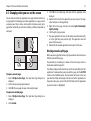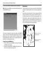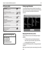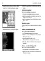
1
Raytech RNS V6.2
User’s Guide
Document Number: 81260_3
May 2010
Trademarks and registered trademarks
Autohelm, RayTech Navigator, RayTalk, Sail Pilot, SeaTalk, SeaTalkNG,
SeaTalkHS and Sportpilot are registered trademarks of Raymarine UK
Limited. Seahawk, Smartpilot, Pathfinder and Raymarine are registered
trademarks of Raymarine Holdings Limited.
Windows is a registered trademarks of Microsoft Inc.
Pentium is a registered trademark of Intel.
NVIDIA and GeForce are trademarks or registered trademarks of NVIDIA
Corp.
Maptech is a registered trademark of Maptech.
C-Map and C-Map NT+ are registered trademarks of Jeppesen.
Navionics is a registered trademark of Navionics SpA.
All other product names are trademarks or registered trademarks of their
respective owners.
Fair Use Statement
You may print no more than three copies of this manual for your own use.
You may not make any further copies or distribute or use the manual in any
other way including without limitation exploiting the manual commercially
or giving or selling copies to third parties.
Copyright ©2010 Raymarine UK Ltd. All rights reserved.
i
Contents
Contents ............................................................. i
Important information .................................... 1
Safety notices .........................................................................1
Intended use ..........................................................................1
Disclaimers .............................................................................1
The limits of electronic navigation .........................................2
About this manual..................................................................2
Conventions used...................................................................3
Product use ............................................................................3
System integration .................................................................3
Technical accuracy .................................................................3
Copyright................................................................................4
System overview and features.....................5
Introduction .......................................................................... 5
What do I get in the box? ..................................................... 5
System overview ................................................................... 6
System features .................................................................... 6
Easy marine navigation ....................................................... 6
Chart formats ...................................................................... 6
Comprehensive Weather/ Oceanographic reporting............ 7
Advanced graphical user interface ...................................... 7
Navionics Platinum chart card............................................. 7
Sailboat racing .................................................................... 7
System requirements.....................................9
Introduction .......................................................................... 9
System requirements .............................................................9
Minimum system requirements............................................9
Optimum system requirements ............................................9
Compatible displays ..............................................................9
Upgrading drivers and adapters ............................................10
Driver update .......................................................................10
DirectX .................................................................................11
Getting started ............................................... 13
Introduction ...........................................................................13
Installing RayTech .................................................................13
Installation from a CD-ROM.................................................13
Installation from the Internet ...............................................13
Starting to use RayTech .........................................................14
License keys .........................................................................15
Running RayTech for the first time.......................................16
Using RayTech on a new computer ......................................18
Continuing To Use RayTech ...................................................18
Operating modes .................................................................19
RayTech Planner only operates in ‘Simulate mode’. If you want
to change the Simulator’s automatic settings, you can tailor the
menu to suit your needs. The Simulator menu is available to edit:
19
Setting up RayTech ................................................................19
Installing instruments to RayTech ..........................................20
RayTech Tools ......................................................................21
File/Setup/Instruments feature .............................................21
Installing charts .....................................................................24
ii
RayTech RNS V6.2 - User’s Guide
C-MapNT+/PC charts from CD-ROM ....................................24
Maptech cartography ...........................................................25
Navionics cartography..........................................................25
RayTech chart installer .........................................................25
The user interface and controls .................. 27
Introduction ...........................................................................27
The screen .............................................................................27
Interface controls ...................................................................27
Drop down menus................................................................28
Toolbars ...............................................................................28
Softkeys................................................................................28
Right mouse menus..............................................................28
Pathfinder panel...................................................................29
Displaying information ..........................................................29
Selection dialog box .............................................................29
Action box............................................................................30
Data box...............................................................................30
Alert and information dialog box .........................................30
Application information box.................................................30
Changing what you see on the screen ...................................31
Moving around a split page .................................................31
Using charts..................................................... 33
Introduction ...........................................................................33
Use your charts safely ..........................................................33
The chart screen ....................................................................33
Opening a chart .....................................................................33
Moving around the chart .......................................................34
Chart panning ......................................................................34
Zooming...............................................................................34
Finding your boat on the chart.............................................34
Choosing a chart type ...........................................................34
Chart layers..........................................................................35
Chart order...........................................................................35
Chart quilting.......................................................................36
Using Platinum cartography ........................ 39
Introduction ...........................................................................39
2D cartography ....................................................................39
3D bathymetric charts..........................................................39
New 2D chart features ..........................................................40
Aerial photo overlay.............................................................40
Pilot book.............................................................................41
2D chart enhancements .........................................................42
Business services information ..............................................42
Find nearest .........................................................................42
Search port by name ............................................................43
Wrecks data .........................................................................43
Coastal roads .......................................................................44
US inland waterways ...........................................................44
3D bathymetric chart application ..........................................45
The application ....................................................................46
The controls .........................................................................46
The operating modes ...........................................................46
Using 2D and 3D charts together.........................................49
Navigating with 3D Charts...................................................49
iii
Working with waypoints ...............................51
Introduction .......................................................................... 51
What is a waypoint? ............................................................. 51
Placing a waypoint ............................................................... 51
...at the cursor’s current position......................................... 51
... at the boat’s current position .......................................... 51
... at a known position ........................................................ 51
Placing a man overboard marker .......................................... 53
Changing a waypoint symbol ............................................... 53
Navigating to a waypoint ..................................................... 54
...using the WAYPT button .................................................. 54
...using the cursor................................................................ 54
...using the waypoints list ................................................... 54
Moving a waypoint ............................................................... 54
Edit waypoint details ............................................................ 55
Organizing waypoints ........................................................... 55
Deleting a waypoint or waypoint folder ............................... 56
Waypoint recycle bin ............................................................ 56
Transferring route and waypoint data .................................. 57
Working with routes ......................................61
Introduction .......................................................................... 61
What is a route? ................................................................... 61
Creating a route .................................................................... 61
Add a waypoint to a route .................................................. 62
Deleting a waypoint ............................................................ 63
Choosing a route................................................................. 64
Following route ................................................................... 64
Monitoring the course ...........................................................64
Restart XTE ..........................................................................65
Next Leg and Previous Leg...................................................65
Using tides and currents................................ 67
Introduction ...........................................................................67
Setting the region ................................................................67
Tides ......................................................................................68
Open nearest tides ...............................................................68
Currents .................................................................................69
Open nearest currents..........................................................69
Working with radar (Non-HD Digital).......... 71
Introduction ...........................................................................71
Displaying radar in a new page .............................................71
The radar picture ...................................................................71
Changing how the radar picture is shown .............................72
Head - up (H-UP)..................................................................72
North - up (N-UP).................................................................72
Course - up (C-UP) ...............................................................72
Getting the best radar picture ...............................................72
Gain ....................................................................................72
FTC.......................................................................................73
Sea mode .............................................................................73
Gain mode ...........................................................................73
Tune.....................................................................................73
Making targets clearer ..........................................................74
Interference rejection ...........................................................74
Expansion ............................................................................74
iv
RayTech RNS V6.2 - User’s Guide
Wakes ..................................................................................74
Setting up the radar display ...................................................74
Short range scales ................................................................74
Long range scales.................................................................74
Changing the displayed range..............................................75
Marking a position on-screen ................................................75
Using radar to help avoid a collision .....................................75
Range rings ..........................................................................75
VRMs/EBLs. ..........................................................................76
Guard zones .........................................................................77
Placing a guard zone............................................................78
MARPA ..................................................................................78
Safety Notices ......................................................................78
What is MARPA?..................................................................78
Target and vector history .....................................................79
Target history .......................................................................80
MARPA targets.....................................................................80
Using the Radar (HD and SuperHD Digital) 83
Radar setup ...........................................................................83
Select scanner ......................................................................83
Scanner setup.......................................................................83
Powering on/off the various scanner operating modes ..........84
Radar range and image quality .............................................85
Range...................................................................................85
Image quality .......................................................................86
Side lobes.............................................................................86
Indirect echoes .....................................................................87
Multiple echoes....................................................................87
Blind sectors ........................................................................87
Sea clutter............................................................................87
Rain or snow clutter.............................................................88
Mutual radar interference ....................................................88
Radar window overview ........................................................89
Your position .......................................................................89
Operation modes .................................................................89
Other vessels or objects .......................................................89
Factors affecting echo strength............................................89
Using waypoints with the radar ............................................90
Radar display options ............................................................90
Orientation...........................................................................90
Setting the motion mode .....................................................92
Tuning the radar display: .......................................................93
Gain .....................................................................................93
Gain presets.........................................................................93
Manually adjusting gain settings .........................................93
Gain .....................................................................................93
Color Gain............................................................................94
Radar colors.........................................................................94
Rain clutter ..........................................................................94
Sea clutter............................................................................94
Super HD adjustments ...........................................................94
Antenna boost .....................................................................94
Power boost.........................................................................95
Tuning the radar display: ENHANCE ECHOES ........................95
Interference rejection ...........................................................95
v
Expansion............................................................................ 95
Wakes ................................................................................. 95
Radar range .......................................................................... 96
Synchronizing radar range and chart scale.......................... 96
Measuring distance, range and bearing ............................... 96
Range rings ......................................................................... 96
Bearing and range............................................................... 97
The Variable Range Marker (VRM) and Electronic Bearing Line
(EBL).................................................................................... 97
Variable Range Marker........................................................ 97
Electronic Bearing Marker ................................................... 98
Combined range and bearing.............................................. 99
Tracking a target with a VRM or EBL .................................. 99
Floating VRM and EBL......................................................... 99
Using radar to track objects .................................................. 100
Guard zones ........................................................................ 100
MARPA................................................................................ 101
Displaying vessel identity (AIS)............................................ 104
Automatic Identification System (AIS)........105
Introduction .......................................................................... 105
What is AIS? ......................................................................... 105
Classes of AIS data.............................................................. 105
What do I need to run AIS? .................................................. 106
AIS baud rate selection ......................................................... 106
Selecting the AIS function ..................................................... 107
How is AIS data displayed? .................................................. 108
AIS Target symbols.............................................................. 109
Viewing target information..................................................109
MARPA and AIS options ......................................................110
Safety messages...................................................................111
AIS Alarms .............................................................................111
AIS Layer Setup Menu ...........................................................111
Working with sonar........................................ 113
Introduction ...........................................................................113
The sonar screen ...................................................................113
Displaying sonar in a new page ...........................................113
Presets ...................................................................................114
Changing the screen view .....................................................114
Background color .................................................................114
Scrolling speed.....................................................................114
Target depth ID ....................................................................115
Improving the underwater view ............................................115
Changing the range .............................................................116
Selecting the operating frequency........................................116
Making the picture clearer ....................................................117
Gain mode ...........................................................................117
Color gain mode ..................................................................117
TVG ......................................................................................118
Color Threshold....................................................................118
Getting a clear picture of the bottom ....................................120
Getting a live image from below the boat .............................122
Isolating objects near the bottom ..........................................125
Getting a closer view ...........................................................125
Marking an on-screen position ..............................................125
vi
RayTech RNS V6.2 - User’s Guide
Measuring an object’s depth and distance ............................127
Sonar alarms ..........................................................................128
Shallow water alarm ............................................................128
Deep water alarm.................................................................128
Fish alarm ............................................................................129
Sonar data recording and playback .......................................129
RayTech advanced features.......................... 133
Introduction ...........................................................................133
Weather information .............................................................133
3rd Party GRIB (Weather) files .............................................133
Opening a 3rd party GRIB file in RayTech ............................133
Customizing 3rd party GRIB files..........................................134
Viewing a weather file in RayTech .......................................134
Configuring the Weather Layer ............................................134
Animating weather files .......................................................135
Measuring distances on a chart .............................................137
Creating and modifying databoxes ........................................139
Modifying a databox ............................................................139
Creating a databox...............................................................141
Modifying a channel.............................................................141
Using the font selector .........................................................141
Polar plotting .........................................................................143
Data collection .....................................................................143
Entering and editing data.....................................................143
Graphing and reading a polar plot .......................................147
Instrument calibration for accurate data ..............................149
DataTrak ................................................................................150
Pre-start display ....................................................................153
Route optimization ................................................................156
Navigation numbers ..............................................................159
Engine panel .........................................................................160
Using video .................................................... 163
Introduction ...........................................................................163
The user interface ..................................................................163
Troubleshooting RayTech ............................. 167
Introduction ...........................................................................167
Technical support ..................................................................177
Web support ........................................................................177
Telephone support ...............................................................177
Product information .............................................................177
Charts ..........................................................................179
Vector ..................................................................................179
Raster...................................................................................179
Aerial imagery......................................................................180
Radar ...........................................................................181
Scanner ................................................................................181
Standard range scales..........................................................182
Identifying false echo returns...............................................183
Sonar ...........................................................................187
Boat speed ...........................................................................188
Target depth ........................................................................188
Target size ...........................................................................188
Transducer frequency...........................................................188
Installation Guidelines .............................................191
vii
Suppression Ferrites ............................................................ 191
Connections to other equipment ......................................... 191
System integration ................................................................ 192
What is System Integration? ............................................... 192
NMEA basics ....................................................................... 193
RS-232 basics ...................................................................... 193
Connecting RayTech to your instruments ............................ 195
Connecting directly to an NMEA GPS.................................. 195
Connecting directly to NMEA equipped instruments........... 195
SeaTalkhs ............................................................................ 196
SeaTalk devices ................................................................... 199
RayTech SeaTalk/PC/NMEA Interface: ................................ 199
Mounting the interface box................................................. 199
RayTech SeaTalk/PC/NMEA Interface box troubleshooting . 200
Toolbars ..................................................................... 201
Main menu.......................................................................... 201
Standard toolbar ................................................................. 206
Routes and waypoints toolbar............................................. 207
Charting toolbar .................................................................. 207
Animation toolbar ............................................................... 208
Alarms toolbar .................................................................... 209
Tides/Currents toolbar ......................................................... 209
3D toolbar ........................................................................... 210
Yacht racing toolbar............................................................ 211
Pre-start toolbar .................................................................. 212
Weather toolbar .................................................................. 212
Databox toolbar .................................................................. 213
List of abbreviations................................................ 215
Glossary of terms...................................................... 217
viii
RayTech RNS V6.2 - User’s Guide
Important information
1
Important information
Safety notices
CAUTION
WARNING
Navionics CF Card Reader
Navigation aid
When this product is used within a navigation system, it is
only an aid to navigation. It’s accuracy can be affected by
many factors, including equipment failure or defects, environmental conditions and improper use or handling. It is
the user’s responsibility to exercise common prudence
and navigational judgements. This product should not be
relied upon as a substitute for such prudence and judgement. Always maintain a permanent watch so that you can
respond to situations as they develop.
WARNING
The Navionics CF card reader has been designed and
tested for home and dockside planning use only and has
not been tested to marine standards for ruggedness or
interference with other devices on board the vessel.
Raymarine cannot accept responsibility or liability for any
damage to the card reader, associated systems and equipment or compatibility issues arising from its use while
underway.
Intended use
RayTech V6.2 is intended for recreational marine use. Users should note that
only authorized government charts and associated Notices to Mariners
contain all the information required for safe navigation
Product installation
Disclaimers
This equipment must be installed and operated in accordance with the Raymarine instructions provided within
this guide. Failure to do so could result in poor product
performance, personal injury, and/or damage to your boat.
This electronic chart is an aid to navigation designed to facilitate the use of
authorized government charts, not to replace them. Only official government
charts and notices to mariners contain all of the current information needed
for the safety of navigation, and the Captain is responsible for their prudent
use.
2
RayTech RNS V6.2 - User’s Guide
This program and its charts do not excuse the user from carrying the required
official charts and documents.
Raymarine does not warrant that this product is error free or that it is
compatible with products manufactured by any person or entity other than
Raymarine.
This product utilizes digital chart data, and electronic information from the
Global Positioning System (GPS) and weather information which may contain
errors. Raymarine does not warrant the accuracy of such information and you
are advised that errors in such information may cause the product to
malfunction or give incorrect readings. Raymarine is not responsible for
damages or injuries caused by your use or inability to use the product, by the
interaction of the product with products manufactured by others, or by errors
in chart data or information utilized by the product provided by third parties.
Except for the limited warranty regarding the magnetic media contained in
the license agreement accompanying the product, this product is provided
‘AS IS’ without warranty of any kind, either express or implied, including but
not limited to the implied warranties of merchantability and fitness for a
particular purpose, and any others which may arise from course of
performance, course of dealing, or usage of trade.
Like all systems it is not perfect and any part of it can fail. GPS accuracy varies
between 2 and 50 meters.
NMEA 0183 1.0 / 1.5 only supports 2 digits of latitude and longitude, giving a
precision of approximately 60 feet.
NMEA 2.0 / 2.1 supports 3 digits of latitude and longitude, giving a precision
of approximately 6 feet.
Another limitation to the system accuracy is digital charts. These electronic
charts are made by highly skilled cartographers. Surveys on which the
cartography is based, were in some cases, made over 50 years ago. So
despite everyone’s best efforts, it may be possible to have errors in the final
product.
Lastly, RayTech software was developed by highly skilled and talented
software engineers and underwent a rigorous test and quality assurance
program before being released. However, it is possible that software issues or
malfunctions may remain undetected in the software. While Raymarine make
every effort to find, fix and repair software issues as they are discovered, this
product is specifically not promised to be issue free.
The limits of electronic navigation
This manual describes how to install and operate RayTech V6.2 marine
navigation software. It assumes that the personal computer (PC) on which
the software is to be installed meets the requirements for running this version
of RayTech, and that all peripheral equipment intended to be operated with it
is compatible and has been correctly installed.
This manual is intended for users with varying technical and
marine abilities, but assumes a general level of knowledge of
PC use and nautical terminology and practices.
This manual gives an overview of RayTech V6.2, and details the main
functions and how to operate them. There are several ways that a task can be
Experienced navigators know not to rely on a single method of navigation for
determining their position. Two or more methods should be used to
determine position and guard against errors placing you or your boat in a
dangerous position. Global Positioning System (GPS) based electronic
navigation is an amazing application of technology, but like all other
technology, has limits. A wise navigator will understand these limits and how
they affect the safety of their boat and crew.
The Global Positioning System is made up of components starting with
ground based computers to monitor and maintain the system made up of 24
satellites in orbit around the earth. The system ends at your boat’s receiver.
About this manual
Important information
completed, experiment, find the way of using RayTech that best suits your
way of working.
RayTech Planner users
RayTech Planner offers a subset of the RayTech RNS features, supporting athome PC-based waypoint and route planning. This User Guide covers both
versions of RayTech (Planner and RNS), and therefore some parts of the User
Guide do not apply to RayTech Planner users. Raymarine recommends that
RayTech Planner users focus on Chapters 1 to 9, Chapter 14 (sections 1 to 3),
Appendix A, and Appendix E.
Conventions used
In this manual the following conventions will be used:
• RayTech refers to RayTech V6.2.
• The names of keyboard keys are printed in boldface, such as Enter.
• Italics are used to show names, such as Open Chart, or softkeys such as
Find Vessel, except with notes.
• Instructions using menu options are written as menu option/submenu
option. For example, the instructions might read ‘Select File/ Layers’.
This means go to the File menu on the drop-down menus and select it. A
submenu will appear that contains the Layers option for you to select.
• ‘Click’ refers to clicking the mouse button. Unless otherwise stated, it
refers to the left mouse button once.
• ‘Right click’ refers to clicking the right mouse button once.
• ‘Double click’ means to click the left mouse button twice quickly.
Product use
You may not use this product unless you agree to the terms and conditions of
the license agreement.
3
In accepting these terms and conditions, you agree to be bound by the terms
of the license agreement and to release and hold Raymarine harmless from
and against any and all claims, obligations and liabilities with respect to the
product, except those specifically reserved in the license agreement.
If you do not agree to the terms and conditions of the license agreement, you
may return the program within thirty (30) days of the date of purchase by
following the instructions contained within the license agreement.
System integration
RayTech V6.2 has been designed to work transparently with Raymarine’s
SeaTalk or SeaTalkhs data communication networks, or any other device that
outputs data in National Marine Electronics Association (NMEA) 0183
format. These protocols allow information such as heading, wind speed and
direction, sea temperature and other information to be accessed and
displayed within RayTech. Information generated by RayTech can also be
displayed on your boat’s standard on-board instruments.
If you intend to run RayTech on a laptop computer as part of an integrated
system you should read “Installation Guidelines” on page 191 to ensure
correct connectivity into the system.
Technical accuracy
The technical information contained within this manual, to the best of our
knowledge, was correct at the time of printing. However, Raymarine cannot
accept liability for any inaccuracies or omissions it may contain.
In addition Raymarine’s policy of continuous product improvement may
change specifications without notice. As a result Raymarine cannot accept
liability for any differences between the product and the manual.
4
Copyright
Under copyright laws use of this manual is intended for the original licensee.
No portion of this manual may be reproduced or transmitted in any form by
any means, electronic or mechanical, including photocopying, recording, or
information storage and retrieval systems, for any purpose other than the
licensee’s use, without the express written permission of Raymarine, and
provided in the licensing agreement between you and Raymarine.
RayTech RNS V6.2 - User’s Guide
Chapter 1: System overview and features
5
Chapter 1: System overview and features
1.1 Introduction
This chapter introduces RayTech and covers the following:
• What’s in the box.
• System overview.
Accessories
The following accessories are available for RayTech:
Component
Raymarine Part No.
1.2 What do I get in the box?
Navionics CF Chart Reader
E86026
When you open the box containing RayTech, you will find various
components, depending on which package you have purchased.
SeaTalk to PC Interface
E85001
Serial data cable, DB-9
E86001
RayTech V6.2 Manual
81260-3
SeaTalkhs Switch
E55058
SeaTalkhs Crossover Coupler
E55060
RayTech V6.1 - Part No.E112111
Note: To upgrade the software to Raytech V6.2 you must visit the
Raymarine website (www.raymarine.com).
Component
Part No.
RayTech CD-ROM with license key decal
47001-2
RayTech User’s Manual
81260-2
Navionics CF Chart Reader
E86026
If any of the components are missing, you should contact, in the first
instance, the Raymarine dealer where you purchased your package, or
Raymarine Customer Support, the details of which can be found in the
Technical Support section of this handbook, on page 177.
6
RayTech RNS V6.2 - User’s Guide
1.4 System features
CAUTION
RayTech has been designed for ease of use and incorporates the following
features:
Navionics CF Card Reader
Easy marine navigation
The Navionics CF card reader has been designed and
tested for home and dockside planning use only and has
not been tested to marine standards for ruggedness or
interference with other devices on board the vessel.
Raymarine cannot accept responsibility or liability for any
damage to the card reader, associated systems and equipment or compatibility issues arising from its use while
underway.
RayTech takes the guesswork out of marine navigation by enabling easy and
accurate planning and plotting of simple or complex routes. These can be
stored and re-used, even changed whilst in use to take changing weather
conditions or other factors into account.
Product registration
Technical Support requires online registration at www.raymarine.com.
1.3 System overview
RayTech operates within a standard Windows environment, and enables you
to utilize the latest digital charts and Global Positioning System (GPS)
instrumentation to help you navigate your boat virtually anywhere in the
world. RayTech easily interfaces with your boats onboard navigational
systems, offering you the flexibility to allow RayTech to autopilot your boat to
any destination you chose to plot.
RayTech also incorporates the capability to download the latest weather and
oceanographic information and display it on any chart. Advanced features
are included that will enhance RayTech’s route plotting and fishfinding
performance making it an ideal choice for the serious sailor or fisherman.
Chart formats
RayTech uses the latest digitized versions of the paper charts traditionally
used in marine navigation, and supports the following chart formats:
• Navionics Silver and Gold+.
• Navionics Platinum and Platinum Plus.
• Navionics HotMaps.
• Navionics Fish ‘n’ Chip (US market only).
• C-Map NT and NT Plus.
• Maptech BSB v2.0/v3.0/v4.0 & NOAA RNC.
• Maptech PCX.
• Maptech Photo Regions and Topographical charts.
• SoftCharts Nautical charts and PhotoNavigator.
• NDI/CHS charts.
Note: Support for viewing Navionics cartography within RayTech is only
possible if the Navionics cartography is contained on a Compact
Flash card, and is served by either a Raymarine Multifunctional
display/network or a Navionics Multi-card reader.
Chapter 1: System overview and features
Comprehensive Weather/ Oceanographic
reporting
RayTech offers you the capability to import and display the latest weather
and ocean conditions, and then superimpose this information upon your
charts in several layers. For example, weather information (in GRIB format)
can be downloaded directly from third-party Internet sites (such as
www.grib.us). These files can be animated to show predicted weather
conditions over a specified period of time. Typical weather files contain
information covering a period of several days, giving you a comprehensive
presentation of atmospheric and marine conditions.
Advanced graphical user interface
RayTech is operated via an easy-to-use Graphical User Interface (GUI)
complete with many customizable toolbars, softkeys and ‘floating’ data
boxes. Using an intuitive menu hierarchy, you can display only those tools
that you commonly use, or customize screens to show you only pertinent
information, with just a few mouse clicks. RayTech’s flexible GUI enables you
to quickly and easily tailor its powerful resources to suit your needs.
Navionics Platinum chart card
Compatibility with Navionics Platinum chart card provides you with
enhanced 2D cartography features, and introduces an easy to use 3D chart
format that provides you with a graphical view of land and sea contours
around your boat. Much of the information available on a conventional chart
can be shown in three dimensions, giving you an accurate easy-to-view
image of the area around.
To read Navionics Platinum Chart cards you will need to install a Navionics
Multicard reader - Part No. E86026, or have RayTech connected via SeaTalkhs
to a Raymarine multifunction display.
7
Sailboat racing
The sail racer features are targeted towards the professional sailboat racer,
and include
• DataTrak.
• Polars.
• Route Optimization.
• Advanced weather routing.
• Pre-start display.
• Navigation numbers.
• Specialized racing toolbar.
8
RayTech RNS V6.2 - User’s Guide
Chapter 2: System requirements
9
Chapter 2: System requirements
2.1 Introduction
This section deals with making sure that your PC is ready to install and run
RayTech and details:
•
•
•
•
System requirements.
Compatible Raymarine multifunction displays.
Whether your PC is ready to install RayTech.
Upgrading drivers and adapters.
IMPORTANT - In addition to the minimum/optimum requirements you
will also require 1 or more of the following, depending on how RayTech is
to be connected to your instruments system/network:
•
•
•
Serial port - for connecting to NMEA 0183 or SeaTalk.
Ethernet port - for connecting to a Raymarine multifunction display
using SeaTalkhs.
USB or USB 2.0 port - for Navionics Multicard Reader or of Serial to
USB adapter.
2.2 System requirements
Optimum system requirements
Before you can begin installing RayTech, you need to make sure that the PC
you intend to use meets the minimum hardware requirements for running
the software. Whilst RayTech will run successfully on the minimum requirement, for best performance, the optimum requirements are recommended.
The optimum system requirements are:
The minimum and optimum requirements are:
•
•
•
•
Minimum system requirements
2.3 Compatible displays
The minimum system requirements are:
•
•
•
•
•
Pentium IV processor.
512MB RAM.
Windows XP (SP2 or later) or Windows 7 (all variants).
CD-ROM drive.
Monitor - capable of displaying 1024 x 768 resolution, 16 bit color.
Pentium IV 2GHz processor or equivalent.
2GB RAM or higher.
NVIDIA GeForce graphics card.
Windows XP SP3.
Your PC or laptop running Raytech RNS software can be connected to a
Raymarine multifunction display via SeaTalkhs. This enables you to access
additional functions, including radar and sonar. For a list of compatible
Raymarine multifunction displays refer to the Raymarine website
(www.raymarine.com/raytech).
10
RayTech RNS V6.2 - User’s Guide
2.4 Upgrading drivers and adapters
Prior to installing RayTech, Raymarine strongly recommend updating your
PC display drivers and verifying that you have the latest versions of
Microsoft DirectX and your Display adapter driver installed.
Note: It will be necessary to have the PC connected to the Internet for
these checks and updates.
Driver update
D6966_1
To ensure that your PC is current with regard to Windows operating system
patches you should execute the Windows Update utility.
D6968_1
Figure 2-1: Welcome to Windows Update.
Figure 2-2: Review Updates screen.
To run the Windows Update utility:
1. On the computer taskbar, click Start. The pop-up menu is displayed.
2. Select and click Windows Update. The PC will connect to the Microsoft
Windows Update site.
3. The Welcome screen is displayed. See Figure 2-1
4. Click Scan for Updates.
5. Your computer is scanned to find which update patches are required.
The screen updates to show the progress of the scan. When the scan is
complete the Review Updates screen is displayed. See Figure 2-2
6. Click Review and Install Updates. The available updates are displayed.
7. Click Install Now. Installation of the updates starts, with progress
being shown on screen.
8. Upon completion of the installation a dialog box appears. This will tell
you that installation is complete and that you need to restart your
computer for the updates to be activated.
9. Check Restart Now. Click OK. Your computer will restart and Windows
will be updated.
10. Repeat Steps 1-9 until all applicable updates have been installed.
Chapter 2: System requirements
11
Note: Windows update does not always update all drivers. Raymarine
recommend that you check your PC/Hardware manufacturers web
site to check for relevant driver updates.
DirectX
To ensure that you have the latest version of DirectX installed you should
run the DirectX diagnostics utility.
D6971_1
Version number
Figure 2-3: Direct X Diagnostics screen 1.
D6972_1
Display adapter details
Figure 2-4: Direct X Diagnostics screen 2.
To run DirectX diagnostics utility:
1. On the computer taskbar, click Start. The pop-up menu is displayed.
2. Select and click Run. The Run dialog box is displayed.
3. Type in, dxdiag. Click OK. The DirectX diagnostic tool will be displayed.
See Figure 2-3
4. Make a note of the version number installed on your computer.
5. Click the Display or Display 1 tab. The display adapter screen is
displayed. See Figure 2-4
6. Make a note of the display adapter name, manufacturer, chip type and
driver version installed on your computer (highlighted in the picture
above).
7. Point your Internet browser to - http:// www.microsoft.com/windows/
directx/downloads/default.asp and check the current version of DirectX.
If the version installed is not current, download and install the latest
version.
8. Point your Internet browser to the display adapter manufacturer’s site
and check the current version available. If the version installed is not
current, download the latest version.
Note: Laptop users should check their PC Manufacturers web site for relevant video driver updates.
12
RayTech RNS V6.2 - User’s Guide
Chapter 3: Getting started
13
Chapter 3: Getting started
3.1 Introduction
Having made sure that your computer meets the operating requirements
and has the latest drivers installed. See “System requirements” on page 9,
you are now ready to install and run RayTech. This section deals with:
•
•
Installing and setting up RayTech.
Installing charts.
Note: RayTech Planner does not require a licence key. See “License keys”
on page 15.
3.2 Installing RayTech
Having checked that your computer meets the operating requirements, and
upgraded its drivers and adapters as necessary your computer is now ready
for installing RayTech.
Note: If you are connecting a multifunction display to your laptop or PC
via SeaTalkhs, refer to the “Installation Guidelines” on page 191.
You are now ready to install RayTech. The installation options are:
•
•
from a CD-ROM.
from the Internet.
Note: If you are installing RayTech on a Windows 7 machine the installation process may be interupted by a User Access Control “Unknown
Publisher” warning. Click “Yes” to accept the warning and proceed
with the installation.
Installation from a CD-ROM
To install RayTech using a CD-ROM:
1. Insert the RayTech CD into the CD-ROM drive of the computer on
which you want to install the software.
2. The CD will automatically run and the Install Shield Wizard Welcome
screen appears.
3. Follow the on-screen instructions.
If the Install Shield Wizard does not automatically run:
1. Select Start/Run from the computer taskbar and type
e:\raytech\setup.exe.
(Substitute the drive letter of your CD-ROM drive for ‘e’ if it is different). After a few moments the Install Shield Wizard welcome screen is
displayed.
2. Click Install Software. The Install Shield Wizard Welcome screen is
displayed.
3. Follow the on-screen instructions.
Installation from the Internet
To install RayTech from the Internet:
1. Point your Internet browser to http://www.raymarine.com/RayTech
software.
2. Click RayTechupgrade/Download and install the application here.
3. Click Download RNS 6.2 (Registration required). The registration
screen appears.
4. Complete the registration form
14
5.
6.
7.
8.
RayTech RNS V6.2 - User’s Guide
Click Submit. The download instruction page opens.
Click Proceed to Download. The Download security dialog box appears.
Click Save. You are now prompted to select a location to save the file.
Select the location and click OK. File download begins.
D9096_1
Note: RayTech is a very large file (152MB). Dial-up connections are not
recommended for this operation. A CD-ROM can be purchased from
Raymarine if you prefer.
Figure 3-2: RayTech Startup Wizard on-screen keyboard
D9095_1
After you have downloaded the file, it must be opened onto your computer
as follows:
Figure 3-1: RayTech Startup Wizard Screen
1.
2.
3.
4.
Open the location where the file is stored.
Double-click the RayTech icon.
Click Run. The Install Shield Wizard is displayed.
Follow the on-screen instructions.
Note: Raymarine recommends that you save the downloaded installation
executable file by burning it to a CD-ROM and storing with your
RayTech documentation.
3.3 Starting to use RayTech
Now that you have successfully installed RayTech on your computer the
following steps explain how to start using the product.
Chapter 3: Getting started
15
License keys
Before using RayTech for the first time you will need to enter a license key.
Note: The license key for your Full RayTech RNS 6.1 or RayTech RNS 6.1
upgrade products can be found on the installation CD-ROM sleeve
and the inside cover of the User’s Guide.
D6912_1
Note: When initially running RayTech Planner, the RNS Startup Wizard
will prompt you for a Full RayTech RNS license number, a RayTech
RNS Upgrade license number, or to select to use RayTech Planner
only (no license required). If you have downloaded RayTech Planner
from Raymarine's website or have received a RayTech Planner CD
with a new multifunction display, or have received a RayTech
Planner CD with the Navionics Multicard Reader, you should choose
the RayTech Planner (No License) option.
Figure 3-3: RayTech mode dialog box
There are two types of license key for RayTech:
V6.x Upgrade License key - required if you are upgrading to
RayTech V6.x from an earlier version.
• V6.x License key - included when you purchase RayTech V6.x
Both keys can be purchased from http://www.raymarine.com/
RayTech.
•
Figure 3-4: RNS Network Set up Wizard
16
RayTech RNS V6.2 - User’s Guide
Entering license key segments of less than 4 characters
You may have a license key that contains segments of less than four
numbers. To enable RayTech it is necessary to enter the license key and
pad the numbers as follows, for example:
Your key is: 600-1-23-456-7-89.
This should be entered as: 0600-0001-0023-0456-0007-0089.
Running RayTech for the first time
To run RayTech for the first time:
1. Select Start/All Programs/Raymarine RayTech Navigator
from the Windows task bar. RayTech will load and the RNS Startup
Wizard is displayed. See Figure 3-1on page 14
2. Click the button next to the type of license key you want to enter.
3. Click Next. The on-screen keyboard appears. See Figure 3-2on page 14
For details of license key types refer to “License keys” on page 15.
Note: RayTech Planner users should skip to section 4.4 and refer to the
Simulator section.
4. Enter your license key using the on-screen keyboard by moving the
cursor over the required number and clicking.
5. Click Finish. The dialog box closes, and the RayTech splash screen
appears.
The splash screen closes and the RayTech mode dialog box appears “RayTech mode dialog box” on page 15.
You now have a choice of which mode RayTech opens in:
•
•
Planning - Instrument connection is not required - see “Click the
button for the mode you want RayTech to use.” on page 18.
Onboard - enables you to configure your network settings.
Chapter 3: Getting started
17
IMPORTANT: If you do not choose SeaTalkhs, make sure you have the PC
on which RayTech is running connected to your boats instruments the first
time you run RayTech in Onboard mode. The instruments must also be
switched ON.
Note: The following section shows how to configure a SeaTalkhs network.
To configure other types of network click the button next to the
network type and follow the on-screen instructions.
Important pre-requisites for Windows 7 and Windows XP
Windows 7 users must use the RayTech Network Configuration Tool
BEFORE attempting to configure the RayTech network settings. This tool
may also be used with Windows XP in the event that a manual IP address is
required due to DHCP issues.
D10747_1
Configure network settings
3. Click the button next to SeaTalkhs (Raymarine multifunction display).
4. Click the button corresponding to whether the PC is currently
connected to your onboard instruments.
5. Click Next. The following screen appears:
1. Download the RayTech Network Configuration Tool from www.raymarine.com/raytech, to a folder on your PC or laptop.
2. Follow the installation instructions that accompany the download.
Note: If your PC or laptop does not already have the .NET framework
installed you must install it before proceeding with the RayTech
Network Configuration Tool installation. The .NET installation file is
included with the RayTech Network Configuration Tool download.
To configure the RayTech network settings:
1. Follow Steps 1 through 5 of “Starting to use RayTech” on page 14.
2. Click Onboard. The RNS Network Setup Wizard appears - Figure 3-4on
page 15.
Note: If any network adapter is acquiring a network address from a DHCP
server when Raytech is booting into ‘Onboard’ mode the following
message will appear. You should then try to run Raytech once the
network adapter has completed acquiring the necessary network
address.
6. Click the button next to the PC or laptop network card that is physically
connected to the SeaTalkhs network. This card will be configured to
communicate with your Raymarine multifunction display.
7. Click Finish. The RNSNetSetup dialog box appears.
18
RayTech RNS V6.2 - User’s Guide
Using RayTech on a new computer
If you install the upgrade version of RayTech on a new computer, a dialog
box may appear after entering the upgrade key asking you to enter your
original RayTech V5.0 or V6.x license key. This should be entered in the
same way as before using the on-screen keyboard that appears. Make sure
the license key type is set to the correct version number.
8. Click OK. RayTech starts to open and the network initialization
progress box appears.
To display the license keyboard:
1. Select File/Setup. The Setup dialog box is displayed.
2. Double-click the License icon. The on-screen license entry keyboard is
displayed.
3. Enter your license key as described in“To run RayTech for the first
time:” on page 16, Steps 7 through 9.
D9097_1
3.4 Continuing To Use RayTech
You will only need to enter a license key number the first time that you use
RayTech after installing it. each time that you open RayTech, the following
dialog box will appear:
As the initialization process is carried out RayTech will open and the
Open New Page dialog box is displayed.
9. Highlight the icon for the page type you want to open and click OK.
The new page opens.
10. You can now continue to work in RayTech.
D6912_1
Note: Raymarine recommends that you register your RayTech software on
the Raymarine website. This ensures that you can recover your
license key in the event of loss or failure of your PC’s hard drive.
Click the button for the mode you want RayTech to use.
Chapter 3: Getting started
Operating modes
RayTech can be operated in either of the following modes:
•
•
19
4. Taylor the menu to suit your needs/requirements by clicking the
options, as pictured below.
Planning
Onboard
Planning
Enables you to work in a simulated mode, away from your boat if you want
to. Useful for planning and learning purposes.
Note: If you are using RayTech Planner you can NOT set the simulator
feature to “OFF”.
Note: RayTech Planner offers a subset of the RayTech RNS features,
supporting at-home PC-based waypoint and route planning. This
User Guide covers both versions of RayTech (Planner and RNS), and
therefore some parts of the User Guide do not apply to RayTech
Planner users. Raymarine recommends that RayTech Planner users
focus on Chapters 1 to 9, Chapter 14 (sections 1 to 3), Appendix A,
and Appendix E.
D10912_1
RayTech Planner only operates in ‘Simulate mode’. If you want to change
the Simulator’s automatic settings, you can tailor the menu to suit your
needs. The Simulator menu is available to edit:
1. Select File/Setup. The Set Up Dialog Box Is Displayed.
2. Select Instruments.
3. Select Simulator is ON.
Note: RayTech must be restarted for these changes to take effect.
The Vessel’s position can be edited to anywhere in the world, simply Rightmouse click, and select ‘Move Boat Here’ from the drop down menu.
Onboard
Enables you to work in real-time mode onboard your boat with data being
collected and used from all the instruments that you have connected to
RayTech.
3.5 Setting up RayTech
Once you have installed and started using RayTech, you can enter specific
information for your boat and change default settings to your personal
preferences that suit the way you work.
20
RayTech RNS V6.2 - User’s Guide
D6915_
1
To set up RayTech:
1. With RayTech running select File/Setup. The set up dialog box is
displayed.
2. Click on the icon of the setting you want to change.
3. Click OK. The dialog box for that setting will be displayed.
4. Click the action boxes and change the settings to your preferred option.
5. Click OK to close the dialog box.
6. Repeat Steps 1 through 5 for each setting you want to customize.
You can customize any of the following settings:
Units
configure the units to be used in RayTech
License
enter or change license keys
Logging
set up your data logging options
Settings
set up operational settings
Performance
set up system graphics performance settings
3D settings
set up general 3D settings
System clock
set up the current time and date
Raster chart set up
install and control raster charts
Instruments
set up RayTech to interface with your instruments
Colors
set up the colors displayed in RayTech features
Track coloring
set up the display colors for showing tracks
Night vision modes
set up how you view RayTech at night
Tides and currents
select tide and current regions
Vessel settings
set up how your own boat is displayed on screen
Databox settings
set up how databoxes and their contents
Weather set up
set up how weather information is displayed
3.6 Installing instruments to RayTech
Full functionality of RayTech requires accurate heading and position data
being received from your system instruments. You should refer to “Installation Guidelines” on page 191 for full information on successfully
connecting instruments.
Chapter 3: Getting started
21
“Running RayTech for the first time” on page 16 describes how to
configure your network and instruments. However, you may at a later date
want to change the way in which instruments are configured to RayTech.
You can choose which way you configure instruments to RayTech. This can
be either:
•
•
Network Config
Using the RayTech Tools application wizard, or,
Using the File/Setup/Instruments feature.
To use the RayTech Tools wizard:
1. Select Start/Programs/RayTech Tools/RayTech Instrument
Configuration.The Instrument Configuration wizard appears.
2. Click the button next to the network card description and follow the
on-screen instructions as described in “Running RayTech for the first
time” on page 16.
D890
The RayTech Tools Instrument Configuration wizard can be used to
configure your system instruments.
9_1
RayTech Tools
You can now set the network configuration and either automatically or
manually configure your system and instruments.
To set the network configuration:
1. Double-click Network configuration. The following dialog box appears.
File/Setup/Instruments feature
To configure RayTech and instruments:
1. Select File/Setup. The Setup dialog box is displayed.
2. Highlight the instruments icon and click OK. The configure instruments
dialog box is displayed.
2. Click OK. The dialog box closes.
3. Use the RayTech Tools wizard to configure the network. For full details
refer to “To use the RayTech Tools wizard:” on page 21.
22
RayTech RNS V6.2 - User’s Guide
To automatically configure instruments:
These instructions apply to instruments connected via an RS-232 or RS- 422
connection to your PC.
1.Double-click Automatic configuration. The auto detect progress dialog
ii. Double-click the What’s connected icon. The connection dialog box
is displayed showing what instruments are connected and have
been detected.
Note: This procedure should be carried out if you are using ST290 instruments and want to show custom channels. You cannot use
SeaTalkhs if you are using this configuration.
box is displayed.
2.Click Cancel in the Connection
Settings dialog box.
D8910_1
3.When instruments have been
detected an icon is displayed in the dialog box to show connectivity.
D8911_1
D8912_1
Network Config
4. Click Cancel to close the detected COM ports dialog box.
If you want to see what instruments are connected:
i. Double-click the SeaTalk or NMEA icon and the connection dialog
box is displayed.
To manually configure instruments:
1. Set the network configuration as described in “To set the network
configuration:” on page 21.
2. Double-click Manual Configuration. The available Com ports are
displayed.
Chapter 3: Getting started
23
D8951_1
6. Double-click the NMEA icon and the connection dialog box is
displayed.
7. Double-click the What’s connected icon. In the case of NMEA, the
NMEA connection dialog box is displayed.
8. Click either NMEA Sent or NMEA Received icon. The appropriate
sentence dialog box is displayed.
D8914_1
3. Double-click the COM port you want to configure. The instrument
selection dialog box appears.
By clicking the action box for the selected NMEA sentence it can be
toggled On or Off.
To display custom channels:
D8913_1
4. Scroll down and highlight the required instrument system. Click OK.
5. The selected system is connected and an icon appears in the dialog box
to show connectivity.
Note: Custom channels can only be displayed when connected via
SeaTalk and the system includes both an ST290 graphic display and
an ST290 DPU.
1. Set up network configuration and configure instruments as described
in “To set the network configuration:” on page 21 and “To automatically configure instruments:” on page 22 or “To manually configure
instruments:” on page 22.
24
RayTech RNS V6.2 - User’s Guide
D8915_1
D8952_1
2. Double-click the Setting up Instruments icon. The set up dialog box is
displayed.
3. Double-click Custom Channels. The custom channel dialog box is
displayed.
4. Double-click the channel that you want to customize. The channel
selection dialog box is displayed.
5. Click the action boxes to specify individual settings within that
channel.
6. Click OK. The custom channel is created and can be displayed in a
ST290 databox in the Favorites chapter.
3.7 Installing charts
This section deals with installing the different types of charts that are
compatible with RayTech.
C-MapNT+/PC charts from CD-ROM
IMPORTANT - RayTech must be exited and re-opened before attempting
to install C-Map NT+/PC Selector program. Failure to do so will prevent
your RayTech software from being able to find installed C-Map charts.
To install C-Map charts from a CD-ROM it is necessary to install the C-Map
NT+/PC Chart Selector software onto your PC. This must be installed in
accordance with the instructions on the C-Map software.
Chapter 3: Getting started
Using the C-Map NT+/PC chart selector you select the charts that you want
to install. You then purchase the relevant chart licences on-line and register
them. They are automatically detected by RayTech on start up and are
made available to the RayTech program. C-Map charts are not installed
using the RayTech chart installer.
Note: Raytech will only work with the E86008 C-Map USB C-Card reader
and not later models. This product is now discontinued.
C-Map USB C-Card reader
The USB C-Card Reader must be installed on your PC before you start
RayTech software. Failure to do so will prevent RayTech from being able to
access C-Map charts on C-cards or waypoints or routes that are stored on
the User card.
Charts inserted in the USB C-Card Reader are read in real time as long as
the card is actually inserted in the card reader. C-Map charts cannot be
downloaded to your PC for off-line viewing.
Maptech cartography
Maptech BSB V4.0 cartography
You should install and register Maptech BSB V4.0 cartography in accordance with the installation instructions contained on their software. Failure
to follow the instructions will prevent charts being installed by RayTech.
Earlier Maptech BSB cartography versions.
Versions of Maptech BSB cartography prior to V4.0 do not need to be registered prior to installation using the RayTech chart installer.
25
Navionics cartography
There are two ways in which Navionics cartography can be accessed by
RayTech:
•
•
via your SeaTalkhs system.
using the Navionics multicard reader.
SeaTalkhs system
With the PC connected to your SeaTalkhs system, and a Navionics chart
card installed in a Raymarine multifunction display, open either a new 2D
or 3D chart page. Navionics cartography can then be used with RayTech
acting as a repeater display.
Navionics multicard reader
The Navionics USB multicard reader must be installed on your PC before
you start RayTech software. Failure to do so will prevent RayTech from
being able to access Navionics charts on CF cards or waypoints or routes
that are stored on the User card.
With a Navionics chart card reader installed on the PC that is being used to
operate RayTech, and a Navionics chart card installed you can access Navionics charts.
Charts inserted in the Navionics USB multicard reader are read in real time
as long as the card is actually inserted in the card reader. Navionics charts
cannot be downloaded to your PC for off-line viewing.
RayTech chart installer
The RayTech chart installer is used for installing BSB formatted, raster,
MapTech PCX, photo and topographic charts. It will search and locate
charts that are installed on your system or a CD-ROM. To install charts
using RayTech chart installer:
26
RayTech RNS V6.2 - User’s Guide
D6917_1
1. Insert the relevant chart CD into the CD-ROM drive. The New Charts
dialog box is displayed.
D6918_1
2. Click OK. The chart installer selection dialog box is displayed.
All of the charts detected are highlighted by default.
3. Click Install. The progress of the installation of each chart will be
shown.
4. The chart installer updates the chart list.
5. Click OK. The chart installer selection dialog box closes.
Chapter 4: The user interface and controls
27
Chapter 4: The user interface and controls
4.1 Introduction
This chapter introduces the RayTech User Interface and its features and
covers:
•
• The User Interface.
• The Interface controls.
This chapter gives only a brief overview of the interface and its controls,
experiment, try pointing the cursor at different objects on the screen and
click to see what will happen.
•
4.2 The screen
You may discover features of RayTech that you didn’t know existed. Experimenting in this way will also help you to find your preferred way of using
RayTech.
To help you get started, left mouse clicks are used to select or initiate
actions. Right mouse clicks display drop-down menus. Holding down the
left mouse button and dragging the mouse diagonally will bound a chart
area. Rotating the mouse wheel will make small setting adjustments or
perform small range changes.
When you open RayTech the default screen - see page 32- will appear
containing:
•
•
•
•
Title bar - shows the software details.
Drop down menus - give access to all the main functions of RayTech.
Toolbars - give access to functions of a particular application or mode.
Pathfinder panel - shortcuts to RayTech functions:
Application display - area of the screen in which an application is
displayed.
Page selection tabs - Click a tab to display the required page from
those that are open.
• PC taskbar - accesses PC controls.
• Power key - press to turn radar transmit on or off. Press and hold to
exit RayTech.
• Softkeys - used to select function identified by the on-screen label.
The default screen and controls can be customized to your personal preferences. RayTech will retain these preferences and show them each time you
open it. They can be changed at anytime without closing the program. With
the exception of radar and sonar pages, each page and pane can be independently configured to suit your working practices.
4.3 Interface controls
The interface can be controlled using the PC mouse, touchscreen, standard
or Raymarine waterproof USB Navigation Keyboard. This section will detail
how to control the interface using the PC mouse and standard keyboard.
For details on using the Raymarine waterproof USB Navigation Keyboard
refer to page 171 of this manual.
Functions can be accessed via:
•
•
•
Drop-down menus.
Toolbars.
Softkeys.
28
RayTech RNS V6.2 - User’s Guide
• Right mouse menus.
• Pathfinder panel.
in any combination that you find easiest to use.
Softkeys
Drop down menus
To access functions from the drop-down menus, move the cursor arrow
over the required menu, highlight the function you want to use and click. If
you see downwards pointing arrows at the bottom of a drop-down menu,
this indicates that there are other, less frequently used features available.
Toolbars
Toolbars provide specific shortcuts to a function. To access a function using
a toolbar, move the cursor over the icon for the required function and click.
To display a toolbar:
1. Select View. The toolbar drop-down menu is displayed.
2. Click the toolbar you want to display.
It is checked and the toolbar appears a the top of the screen, below the
drop-down menu bar.
Right mouse menus
Clicking the right mouse button
will display a menu of functions for
a particular object such as a mark,
waypoint or chart object. Virtually
any object on the RayTech screen
will present a specific menu of
functions when you place the
cursor over it and click the right
mouse button. This is a very fast
way to find the function that you
want (even if you don’t know
exactly what it is), because you will see only those functions which are
appropriate for the object at which you are pointing.
D6923_1
D6920_1
The soft key labels change to reflect the page/pane selected and the functions available. Click the corresponding soft key to select the required
function. When you have finished using a function or making adjustments,
click BACK to return to the previous level of softkeys.
Chapter 4: The user interface and controls
29
Pathfinder panel
4.4 Displaying information
The Pathfinder panel provides shortcuts for some of the more common
functions. Just move the cursor over the required button and click. The
controls that can be found in this panel are:
Information is shown in databoxes or dialog boxes on the RayTech screen.
The different types of information boxes are illustrated in the following
section:
Selection dialog box
use to scroll through open pages
A selection dialog box allows you to access various components to carry
out a selected function or feature setting.
changes the active pane in a split page
Select File > SetUp.
displays the waypoint softkeys
(if the function bar is open)
displays the databox softkeys
(if the function bar is open)
1
zooms the page
to show a larger (OUT), or smaller (IN) area.
changes radar range
D6915_
D6925_1
displays the setup softkeys (if the function bar is open)
To make a selection from the box, either click the icon you wish to access
then click OK, or double-click the icon.
30
RayTech RNS V6.2 - User’s Guide
Alert and information dialog box
Action boxes are contained in a
selection dialog box and change a
parameter. Click an action box to
cycle through settings, or cause a drop-down menu or on-screen keyboard
to be displayed, allowing you to change the parameter as required.
Data box
A databox displays information dedicated to a
specific function, such as, navigation, VRM/
EBL’s. Because it displays dedicated information,
the contents of the box are updated in real time.
An alert and information
dialog box informs you
that
something
has
happened within the application that needs your
approval, or tells you that
you need to select an
option, usually ‘Yes’ or ‘No’. Once you have accepted the option, the dialog
box is automatically removed from the screen.
D6928_1
D6924_1
Action box
Application information box
D6927_1
D6926_1
Databoxes can be floated, moved to any position
and then docked. They can be resized, just like a
databox in any Windows program. They can be
opened and closed as required.
Application information boxes contain information about various functions,
such as route details.
Chapter 4: The user interface and controls
31
4.5 Changing what you see on the screen
You can show more than one application on a page. RayTech contains preset page options for displaying up to three applications on a page, each in
a separate pane. There is also a custom option that allows you to split a
page either horizontally or vertically and display a different application in
each pane:
2
2
3
Moving around a split page
When you open a page that has been split you need to be able to activate a
different pane within the page.
D6929_1
1
3. Click OK. A new blank page will open with the application icons
displayed.
4. Double click the icon for the application you want to open. The application will open in a full page format.
5. Right click on the page status bar and select Split Horizontally/
Split Vertically.
6. Click the split style you require.
7. The open application will move to the bottom pane (horizontal split),
or to the right hand pane (vertical split). The application icons will
appear in the new pane.
8. Double click the required application icon to open it in the pane.
To open a pre-set page:
1. Select File/Open New Page. The Open New Page dialog box is
displayed.
2. Click on the pre-set page layout required.
3. Click OK. The new page will open in the selected layout.
To open new custom page:
1. Select File/Open New Page. The Open New Page dialog box is
displayed.
2. Click Custom.
The pane that you are working in is known as the ‘active’ pane, and has a
blue border around the edge of it.
The softkeys displayed in the function bar are the top level softkeys for that
application. To make another pane active within a page, click the ACTIVE
button on the Pathfinder panel. The blue border will move to the next
pane and the softkeys will change to the top level for that application. To
change the active pane, just click the ACTIVE button until the application
you want to work in is highlighted.
32
RayTech RNS V6.2 - User’s Guide
Title bar
Drop-down menus
Toolbars
Pathfinder
panel
Databoxes
Application
display area
Page selection tabs
PC taskbar
Power
soft key
RayTech default screen
D8749_1
Soft keys
Chapter 5: Using charts
33
Chapter 5: Using charts
5.1 Introduction
RayTech utilizes chart layering technology, which permits you to simultaneously view different types of charts and maps, including navigational
charts, live radar, aerial photographs and weather data.
For full information on installing charts refer to Chapter 2 - Getting Started.
Use your charts safely
CAUTION: RayTech should not be used as a substitute for good
navigational practice nor for official government charts.
Until you are familiar with interpreting the chart display, you should take
every opportunity to compare displayed objects with visual targets, such as
buoys and coastal structures. You should practice harbor and coastal navigation during daylight and in clear weather conditions. RayTech simulator
mode will also help you gain experience.
When connected to a heading data source you can also overlay the radar
image on to the chart.
5.3 Opening a chart
To open a chart for the first time:
1. Click File/Open New Page. The open new page dialog box is
displayed.
5.2 The chart screen
The amount of detail shown varies for different chart types and areas
covered. The scale at which the chart is shown also affects the amount of
detail shown. Cartographic information is also available for objects marked
on the chart. Source details for such objects as structures, lines and open
sea areas are also available. Using the advanced functions described in
Chapter 7 - Using RayTech’s Advanced features, information on the
weather, tides and currents can be overlaid on the charts.
D875
1_1
The chart is a digitized image of the paper chart for the selected area - see
“RayTech default screen” on page 32. The chart shows objects, such as
landmasses, navigational objects and depth contours.
2. Highlight the page type that you want to open (Navionics, C-Map or
raster).
3. Click OK.
34
RayTech RNS V6.2 - User’s Guide
5.4 Moving around the chart
Finding your boat on the chart
You can move around the chart using:
Now that you have opened a chart, you will need to know where you are.
Chart panning
RayTech includes chart panning. Whenever you move the cursor near the
edge of a chart page and click, the chart will move in that direction. You
can also use the arrow keys on the keyboard to pan the chart.
Click over an object or position on a chart and the chart page or pane will
center on the location of the cursor.
Zooming
The are a number of ways to change the range, or zoom in and out of a
chart to see more or less of a given area.
Range In will show a smaller area of a chart, Range Out will show a
larger area of a chart. You can use:
Menu Item
Select Tools/ Range In or Range Out.
Keyboard
Press tab to zoom in, or Shift + tab to zoom out.
Pathfinder panel
Click the upper portion of the RANGE key to zoom
out, or the lower portion to zoom in.
Left mouse button
Click and hold the left mouse button. As you drag the
mouse, the selected area will be highlighted in gray.
Release the button and the selected area will be
zoomed in.
Right mouse button When you right click on a chart, the right click menu is
displayed. Select Range In or Range Out.
Your boat is displayed using a boat shaped icon.
To find your current position on the chart:
Click Find Vessel in the standard toolbar, or the Find vessel soft key.
The page or pane will automatically pan and the boat’s position will be
centered on the screen.
The page or pane will remain centered until you click the screen. The chart
will then re-center on the cursor’s location.
5.5 Choosing a chart type
You choose the type of chart you want to display using the charting
toolbar.
There are four primary buttons on the toolbar for controlling the type of
chart being displayed. These are:
• Raster charts.
• Vector (Navionics or C-Map).
• PhotoCharts Overlay (Navionics or raster).
• Topo Charts.
There is also a button to enable or disable radar overlay, and a button to
enable or disable chart quilting.
Note: RayTech will use raster photos over Navionics photos when both
layers have been turned on.
Chapter 5: Using charts
35
To select the chart type to be displayed:
Click the button for the type of chart you want to be displayed. The button
will highlight to indicate that chart type has been selected.
i.To make the layer more opaque, place the cursor over the right of the transparency slider and click. The value increases.
ii. To make the layer more transparent, place the cursor over the left of
the transparency slider and right-click. The value decreases.
If there is no chart type enabled, or charts are unavailable at the level of
zoom that has been selected, only an aquamarine colored background will
be visible. You can either select a chart type from the toolbar, or adjust the
zoom level, using the range buttons, until the chart is visible.
Chart layers
If you have multiple chart buttons enabled at the same time, then your
chart is layered. This means that one type of cartography is superimposed
on top of one or more other types of cartography.
D8753_1
All charting layers, except Navionics and C-Map, have a transparency
control which allows you to increase or decrease a layers transparency.
Each page or pane will default to it’s full transparency level when it is first
opened.
40% level
20% level
Chart order
In order for chart layering to work consistently, charts have been layered in
a pre-determined order.
Down
arrow
Transparency
slider
To adjust layer transparency:
1. Click the down arrow at the right of the chart type. The transparency slider is
displayed.
2. Move the cursor over the transparency slider.
•
•
•
•
•
•
•
•
•
Your chart pages are layered as follows from bottom to top:
Vector charts - Navionics or C-Map.
Raster Navigational charts.
Raster topographic charts.
Raster or Navionics aerial photography charts.
Radar overlay.*
Orbimage Satellite Sea Temperature.**
Orbimage Satellite Plankton.**
GRIB weather data.***
36
RayTech RNS V6.2 - User’s Guide
Notes:
1. * Only available if RayTech is connected to a compatible Raymarine multifunction display connected to a radar, and receiving a
heading input.
2. ** Accessed from fishing toolbar.
3. *** Accessed from weather toolbar.
The order of layers cannot be changed. If you are having trouble viewing a
chart layer, try switching off all of the other layers on the charting toolbar
until the background appears aquamarine. Then click the button of the
chart type you want to view, and the cartography will appear.
Chart quilting
When you are working with raster format navigation charts, the Quilting
button allows you the option of using a single chart image, or seamless
charting.
With quilting enabled, the system default for any opened chart window,
RayTech stitches together all of your raster cartography, connecting the
edges of the different charts together. This means that no manual intervention is required to switch charts. You simply pan to the area you wish to
see. Chart detail will be affected as you range in or out to view larger or
smaller scales.
When you are using the quilting function, the best available chart for the
area you are in will always be displayed. This information is based on your
boat’s position, the focal point of the cursor and the range scale selected.
As you pan or zoom around the chart, cartography will be continuously
displayed.
With quilting turned off, the chart at the focus of the display will be shown
alone. The scanned edges of the chart containing the latitude and longi-
tude scales, notes and chart numbers will become visible and all adjacent
charts will be hidden from view. Zooming in or out will cause the chart to
be enlarged or reduced in size.
Chapter 5: Using charts
37
Boat icon
Cursor
Status bar
Cartographic
information
available
Navigational object
Depth contour
Page tab
Default chart screen
38
RayTech RNS V6.2 - User’s Guide
Chapter 6: Using Platinum cartography
39
Chapter 6: Using Platinum cartography
6.1 Introduction
The Navionics Platinum Chart card used in conjunction with RayTech
enables you to access enhanced 2D cartography and 3D bathymetric
charts.
•
These features will give you an accurate, easy to view image of the area
around your boat, giving you confidence in knowing where you are and
what is around you, enabling you to plan in detail where you want to go.
3D bathymetric charts
Operation of these charts and their features is similar to the way in which
existing chart cards are used.
2D cartography
The Platinum chart card enhances many of the chart features found on
other Navionics chart cards and introduces new ones making additional
features available.
Enhanced features
•
•
•
•
Additional business services information - enabling you to find local
restaurants, shops and places of interest in addition to marina services.
Additional wrecks data - a new set of wrecks and their associated data.
Major coastal roads - can now be displayed on a 2D chart.
US inland waterways - enables you to view major navigable lakes, e.g.
Great Lakes, Lake Okeechobee.
New features
•
•
Panoramic photos - for many ports and marinas on the chart.
Pilot book information - an on-screen version of almanac information
for many ports.
Aerial photo overlay - enabling you to overlay the on-screen chart with
an aerial image of coastal waters and land, making it easier to identify
objects and cartographic features.
The 3D bathymetric chart application introduces an easy-to-use chart
format that provides a graphical view of land and sea contours around your
boat. Much of the information available on a conventional chart can be
shown in three dimensions, giving you an accurate, easy-to-view image of
the area around your boat that can help you plan:
• Fishing spots.
• What fishing pattern to use.
• Safe routes.
If you are in a new area or visibility is poor, 3D cartography can help to give
you the confidence to know where you are and what is around you. You
can also show active waypoints and routes on a 3D chart.
3D cartography has the following features:
•
•
•
•
•
•
•
Choice of operating modes - Active or planning.
Ability to change the view point.
360o rotation of the selected view.
Vertical exaggeration of the view.
Ability to view water depth.
Ability to indicate the area which your fishfinder transducer cone
covers (if fitted).
Ability to overlay Navionics aerial photographs.
40
RayTech RNS V6.2 - User’s Guide
6.2 New 2D chart features
You can adjust the level of visibility between the chart and the aerial
photograph.
The new 2D features of the Navionics Platinum chart card include:
• Aerial photo overlay.
• Panoramic photos.
• Pilot book information.
All of these chart features are accessed using the normal controls and softkeys of RayTech.
Aerial photo overlay
Panoramic photos
Panoramic photos are now available for many ports and marinas, enabling
you to see what the area looks like, especially valuable if you have not
visited this area before.
D7923_1
The aerial photo overlay will enables you to overlay the on-screen chart
with an aerial image of coastal waters and land, making it easier to identify
objects and cartographic features. Depending on the area that your chart
covers the aerial overlay is either full color or black and white. The level of
features and objects shown also varies dependent on the area covered.
To display aerial photo overlay:
In the Charting toolbar click Navionics Photos. Aerial photo overlay will
now be displayed.
The aerial photograph covers navigable waters and up to 3 miles inland
from the coast.
D8755_1
Chapter 6: Using Platinum cartography
The availability of these photos is shown by a camera symbol
on the chart. The symbol is placed where the photo was taken
and the angle of the shot is shown by the angle of the camera
symbol.
To view a panoramic photo:
1. Right click on the camera icon and select Navionics Object Properties.
The information dialog box appears.
2. Click Show Photo.The photo is shown in the dialog box.
41
To view the pilot book:
1. On a Navionics chart page, right-click the port services icon. The rightmouse menu is displayed.
2. Select Navionics Object Properties. The information dialog box is
displayed.
Pilot book
The pilot book is an on-screen version of a nautical almanac and contains
navigational information about ports and marinas.
3. Highlight the pilot book page reference. The Show Pilot Book soft key
is displayed.
4. Click Show Pilot Book. The pilot book opens in a new page.
Use the scroll bar at the right to scroll through the available information.
42
RayTech RNS V6.2 - User’s Guide
6.3 2D chart enhancements
The enhancements to 2D charts include the following:
•
•
•
•
Additional business services information.
Additional wrecks data.
Major coastal roads.
US inland waterways.
Business services information
The updated business services information enables you to view information such as name, address, telephone number of selected businesses and
information on places of interest by selecting an on-screen icon.
•
•
•
•
•
Waypoint.
Port or Port Services.
Tides and currents station.
Wrecks and obstructions.
Business services.
To use the find nearest feature:
In an area that is covered by a Navionics chart:
1. Right-click anywhere on a Navionics chart page. The right-mouse
menu is displayed.
2. Select Navionics Object properties. The Information dialog box is
displayed.
3. Click Find Nearest. The find nearest selection box is displayed.
Service station
Boat dealership
Restaurant
Hairdressers
Doctors
To display business services:
Select the appropriate symbol on the chart and right click. The information
will be displayed in a dialog box.
Find nearest
The Find Nearest feature provides information to enable you to find the
nearest:
D8757_1
D8756_1
Bank
4. Highlight the category you want to view.
5. Click OK. The information is displayed in the information dialog box.
Chapter 6: Using Platinum cartography
43
Search port by name
Wrecks data
The Search port by Name feature enables you to search for a specific port.
However, it will not enable you to search for a specific restaurant or chandlery name within a port.
Wrecks data provides details of wrecks that can also be found on a paper
chart.
To search by name:
In an area that is covered by a Navionics chart:
D8758_1
1. Right-click in the required area. The right-mouse menu is displayed.
2. Select Navionics Object properties. The Information dialog box is
displayed.
3. Click Search by Name. The on-screen keyboard is displayed.
4. Enter the name of the port you want to locate.
5. Click OK. The on-screen keyboard closes and the result(s) are displayed
in the information dialog box.
To display wrecks data:
1. Right click the wreck icon. The right mouse drop-down menu is
displayed.
2. Highlight Navionics Chart Object.
3. Click OK. The Wrecks information dialog box is displayed.
44
RayTech RNS V6.2 - User’s Guide
Coastal roads
When you display a chart with an aerial photo overlay major coastal interstate, state highways and other major roads are shown.
Highway/ Minor road
Interstate highway/ Motorway
D8759_1
State highway/ Major road
The ability to view roads depends upon the level of transparency that has
been selected for the aerial overlay. As the overlay visibility is decreased
the roads will fade from view.
US inland waterways
Chart coverage of major US inland waterways such as the Great Lakes and
Lake Okeechobee are now included in Platinum cartography.
Chapter 6: Using Platinum cartography
45
6.4 3D bathymetric chart application
Status bar
North arrow
Navigational object
Land mass
Underwater contours
Boat symbol
D8760_1
3D cartography screen
46
RayTech RNS V6.2 - User’s Guide
The application
The controls
To obtain the best results from your 3D cartography you should make sure
that RayTech is receiving accurate heading and position data.
Your 3D chart is operated in a similar way to a 2D chart using the appropriate soft keys and the mouse.
The 3D application - see “3D cartography screen” on page 45 - is opened
on a new page of RayTech which can be full screen or part of a page set.
Whichever way you choose to view the 3D chart, the window will always
show a status bar and a display area
The operating modes
Status bar
The status bar appears across the top of the 3D chart and contains the
following information:
•
•
•
Range - this is the horizontal distance across the screen and is
displayed in the selected system units.
Mode - shows the mode in which the application is working.
Rotation - shows in degrees true how far the on-screen view has
been rotated from your boats heading.
Display area
The display area shows the following information:
•
•
•
•
.
North arrow - gives a 3D indication of True North in relation to the
chart view (cannot be turned off).
Boat symbol - can be shown as a power or sail boat to indicate your
position n the chart.
Depth scale - shows the approximate depth below your boat (accurate depth information should be obtained from another source on
your system).
Cartographic objects - shows navigation marks, wrecks etc.
You can choose to operate the 3D chart in one of the following modes:
•
•
Active motion mode.
Planning mode.
Active motion mode
This is the default mode when you open the 3D application and there is a
valid fix. The screen shows an aerial view of the 3D chart from a position
above and slightly behind your boat looking forward. This position is the
eye-point. As your boat moves forward the chart automatically updates
and reveals the changing view ahead.
Changing the view
In active motion mode there are four view options that you can choose
from:
• Forward.
• Aft.
• Port.
• Starboard.
With each view the eye-point is changed to show a different area of the
chart.
To change the viewpoint:
1. Click Presentation.
2. Click 3D View Options.
3. Click View to until the required view is displayed.
Chapter 6: Using Platinum cartography
47
Port
Forward
2.431nm
FWD
2.431nm
ROTATE 195oT
PRT
ROTATE 106oT
Default view.
Eye point above and to starboard side of boat, looking
to port.
Eye point is above and
behind the boat, looking
forward.
FWD
D8763_1
D8761_1
Click Find Ship to return to
this view.
PRT
AFT
Starboard
Aft
2.431nm
2.431nm
AFT
STB
ROTATE 280oT
ROTATE 011oT
Eye point above and to port
side of the boat, looking to
starboard.
AFT
STB
AFT
D8764_1
D8762_1
Eye point above and in front
of the boat, looking behind
it.
48
RayTech RNS V6.2 - User’s Guide
Changing your viewpoint
Making the view clearer
There are two ways in which you can make your chart view clearer:
Softkeys
You can change your view of the chart using the following softkeys:
•
•
•
•
Rotate On - enables you to choose which point on the screen the
chart will move around.
• Eye - rotates the chart around the eye-point, maintaining a relative position to the on-screen boat.
• Center - rotates the chart around the center-of-view on the chart.
Adjust - enables you to choose how you change the view.
• Rotate - enables you to rotate the chart view through 360o. If you
want to maintain a view from a particular angle, rotate the chart
until you see the required view. The chart will automatically
update.
• Pitch - enables you to change the angle at which you view the
chart. This can be from sea level to a full aerial view. You cannot
view the chart from underwater.
Find Ship - pressing this soft key at any time enables you to return to
the default action motion mode chart view.
Presentation - enables you to view additional features.
Chart offset
The 3D chart center can be offset in a similar way to a 2D chart. You can
offset the position of the on-screen boat by 1/3 or 2/3 from the center-ofview towards the edge of the window. This has the effect of making more
of the 3D chart visible without changing the selected range.
•
•
Exaggeration.
Declutter.
Exaggeration
Sometimes it is easier to see a topographic feature on the chart by making
it more obvious., for example, this could be particularly helpful while
fishing.
Using the exaggeration feature of the 3D chart to vertically stretch objects
on the chart can achieve this making it easier to see an objects shape and
position. You can exaggerate the chart between a factor of 1 and 50 using
the Adjust Exaggeration soft key.
Declutter
Navigating in an area that shows a lot of information on the chart, such as
navigation marks, can be confusing. Depending on your chart view level it
can make features or even your own position difficult to see. The declutter
feature helps to reduce this confusion and make the chart clearer, by
removing some objects from view.
Planning mode
Planning mode enables you to view an area of the chart, different to the
one in which you are navigating. To enter planning mode, pan to the area
of the chart that you want to view. Using the right-mouse menu select,
Move Boat here. Active motion mode is automatically suspended.
All of the functions that are available in active motion mode are available
in planning mode and control of the chart is the same. However, the mode
Chapter 6: Using Platinum cartography
information in the status bar is now shown in brackets to indicate planning
mode has ben selected.
Clicking the FIND SHIP soft key reTurns the application to active motion
mode, in the default view, showing the chart in the forward looking view
at your current position.
Using 2D and 3D charts together
If the area in which you are navigating is unfamiliar to you, or visibility is
poor, working with 2D and 3D chart applications on the screen side by side
can give you extra confidence and help you to find out what is around you.
With your RayTech page set up to view the two applications together a
comprehensive view of the surrounding area is show.
As with all multiple page sets the active window is indicated by a red
border. To make any changes in an application it must be the active
window.
Navigating with 3D Charts
To navigate to a new waypoint or use a new route, you should first create
the waypoint or route on your 2D chart.
Once navigation is activated in the normal way, the 3D chart displays:
• The active waypoint using the same symbol as the 2D chart.
However, it should be remembered that a route can only be edited using a
2D chart. Any changes that you make on the 2D chart are automatically
shown on the 3D chart.
49
50
RayTech RNS V6.2 - User’s Guide
D8754_1
Navionics Platinum cartography
Chapter 7: Working with waypoints
51
Chapter 7: Working with waypoints
7.1 Introduction
Waypoints are a core feature of RayTech. They can be created while any
application is active and used by the others. They can be stored in the
system, e-mailed, archived to a memory card, or transferred to other
SeaTalk, SeaTalkhs, or NMEA compatible instrument.
2. Move the cursor to where you want to place the waypoint.
3. Click and a new waypoint will appear in the selected position.
7.2 What is a waypoint?
To place a waypoint at the boat’s current position:
1. Select Waypoint/Place Waypoint at Vessel.
2. A new waypoint will be placed at the boat’s current position.
A waypoint is a position marked on a chart, radar or sonar screen as a
reference point or as a place to go. Waypoints are represented on screen by
a symbol and their details stored in a dedicated waypoints list.
7.3 Placing a waypoint
A waypoint can be placed:
• at the cursor position
• at the boat’s position.
• at a known position.
All waypoints can be used in creating routes. When waypoints are placed
they are given a default symbol, you can change this default if required refer to “Changing a waypoint symbol” on page 53.
Note: When using RayTech as part of an integrated system, waypoints
should be named in accordance with the parameters set by your
GPS/chartplotter display.
...at the cursor’s current position
To place a waypoint at the cursor’s current position:
1. Select Waypoint/Place Waypoint at Cursor.
... at the boat’s current position
... at a known position
There are two ways that you can place a waypoint at a known position:
•
•
using the Enter Waypoint (EW) button.
using the Manage Waypoints function.
Enter Waypoint button
The Enter Waypoint can be found on the
Waypoints and Routes toolbar.
To place a waypoint at a known position using the Enter
Waypoint button:
1. Click the Enter Waypoint button on the toolbar. The on-screen
keyboard is displayed.
2. Enter the name of the new waypoint.
3. Click OK. The on-screen keyboard closes and the waypoint properties
dialog box appears.
52
•
RayTech RNS V6.2 - User’s Guide
Enter details for the waypoint as described in Steps 6 through 10 of
“To place a waypoint at a known position using the Manage Waypoint
function:” on page 52
D6937
_
5. Click Latitude. The on-screen numeric pad appears.
4. Enter the name for your new waypoint. Click OK. The waypoint properties dialog box appears.
D6934_1
D6932_1
To place a waypoint at a known position using the Manage
Waypoint function:
1. Select Waypoints/ Manage Waypoints. The folders dialog box
will appear.
2. Select the waypoint folder in which you want to locate the new
waypoint. Click OK.
3. Select New Waypoint. Click OK. The on-screen keyboard appears.
1
Manage waypoint function
6.
7.
8.
9.
Enter correct latitude. Click OK. The keypad closes.
Click Longitude. The on-screen numeric pad appears.
Enter correct longitude. Click OK. The keypad closes.
Click OK. The waypoint properties dialog box disappears and a new
waypoint is placed at the position specified.
Chapter 7: Working with waypoints
53
7.4 Placing a man overboard marker
7.5 Changing a waypoint symbol
In the unfortunate event that a member of crew, or an important piece of
equipment falls overboard, a man overboard (MOB) marker can be used to
mark the position. If a MOB marker is placed, RayTech suspends all current
navigation functions, calculates the most direct route back to the marker,
and automatically makes that the active route.
You can change a waypoint symbol from the default to any of 36 options.
To place a MOB marker:
Any of the following actions will place a MOB marker:
•
•
•
Select Waypoint/Man Overboard.
Click the MOB icon in the standard toolbar.
Click WAYPT on the Pathfinder panel. Click Man Overboard softkey.
To cancel a MOB marker:
1. Select Waypoints/Manage Waypoints.
2. Double-click the MOB folder icon. The MOB folder is displayed.
3. Right-click the MOB icon. The right-mouse menu is displayed.
4. Highlight Delete and click. The MOB marker is deleted.
D8765_1
To change a waypoint symbol:
1. Select Waypoints/Manage Waypoints. The folders selection
dialog box is displayed.
2. Highlight the folder that contains the waypoint that you want to
change.
3. Click OK. The waypoints contained in that folder are displayed.
4. Highlight the required waypoint.
5. Click OK. The waypoint properties selection dialog box for that
waypoint is displayed.
6. Click the icon action box. A drop-down menu is displayed.
7. Highlight the symbol you want to represent the waypoint.
8. Click OK. The waypoint symbol is changed to your selection.
9. Click OK. Repeat Steps 4 through 8 until you have changed all the
waypoints you want to change.
54
RayTech RNS V6.2 - User’s Guide
7.6 Navigating to a waypoint
You can navigate to an existing waypoint at any time using:
•
•
•
Waypoints button the Pathfinder panel.
Using the cursor.
Using the waypoints database list.
...using the waypoints list
1.
2.
3.
4.
Click Go To Waypoint. The route dialog box appears.
Highlight the folder the waypoint appears in and click OK.
Click the waypoint you want to go to.
Click OK. The route dialog box closes and the waypoint dialog box
appears.
1.
2.
3.
4.
5.
6.
7.
Click WAYPT on the Pathfinder panel.
Click More softkey on the function bar
Click Go to Waypoint. Waypoint dialog box appears.
Click required folder.
Click OK.
Click required waypoint.
Click OK. The waypoint is selected and the waypoint selected dialog
box appears.
D6940_1
...using the WAYPT button
5. Click OK.
7.7 Moving a waypoint
D6928_1
You can move a waypoint to a new position, or to your boat’s current
position.
8. Click OK.
...using the cursor
1. Place the cursor over the waypoint you want to go to.
2. Right-click. the right mouse menu is displayed.
3. Click Go To (name of waypoint).
To move a waypoint to a new position:
1. Place the cursor over the waypoint you want to move.
2. Press and hold the left mouse button.
3. Move the cursor to the position on the chart where you want the
waypoint moved to, then release the button. The waypoint will move
to the new location.
To move a waypoint that you are heading toward to your
boat’s current position:
Select Waypoint/ Move Destination to Vessel. The waypoint that
you are approaching is moved to your boat’s current position.
Chapter 7: Working with waypoints
55
To move a waypoint you are heading away from to your
boat’s current position:
Select Waypoint/Move Origin to Vessel. The waypoint you are
heading away from is moved to your boat’s current position.
7.8 Edit waypoint details
D6937
_1
You can change how, where and when any waypoint is displayed by
editing the Waypoint properties dialog box.
To edit a waypoints details:
1. Place the cursor over the waypoint that you want to edit.
2. Right click to display the right-mouse menu.
3. Select and click Waypoint Properties. The waypoint properties dialog
box for the selected waypoint is displayed.
4. Select and click on the details that you want to edit. The on-screen
keyboard, numeric pad or drop-down lists will be displayed as
required.
5. Click OK when you have finished editing the waypoint details. The
dialog box closes.
Note: C-Series software greater than v3.18 and E-series software greater
than v3.22 include a feature requiring that all Waypoint and Route
names start with a letter, and not a number.
7.9 Organizing waypoints
You can create as many different groups, known in RayTech as folders, of
waypoints as you need, and then manipulate the individual waypoints
within those folders. Waypoint folders can be added, deleted or renamed
just like individual waypoints. You can also swap waypoints between
folders, and send them to and retrieve them from the waypoint recycle bin.
To create a new waypoint folder:
1. Select Waypoint/Manage Waypoints. The Folders dialog box is
displayed.
2. Click New Folder. The on-screen keyboard is displayed.
3. Type in the name for the new folder. Click OK. The new folder is
created.
To add a waypoint to a folder:
1. Select Waypoints /Manage Waypoints. The Folders dialog box is
displayed.
2. Open the folder that contains the waypoint you want to add to a new
folder. The waypoints in that folder are displayed.
3. Double-click the required waypoint. The waypoint properties dialog
box is displayed.
4. Click the Folder action box. A drop-down menu displaying the folder
list is displayed.
5. Highlight the folder that you want to put the waypoint in. Click OK.
6. The waypoint is added to that folder.
56
7. Click OK. The waypoint dialog box closes.
8. Repeat steps 1 through 7 above until you have added all the required
waypoints to the new folder.
To rename a folder:
1. Select Waypoints/Manage Waypoints. The Folders dialog box is
displayed.
2. Right-click the folder that you want to rename. A drop-down menu is
displayed
3. Highlight Rename and click. The on-screen keyboard is displayed.
4. Type in the new name of the folder. Click OK. The folder is renamed.
7.10 Deleting a waypoint or waypoint folder
To delete a waypoint on-screen:
1. Place the cursor over the waypoint you want to delete.
2. Right click. The right mouse menu will be displayed.
3. Select Delete Waypoint and click.
4. The waypoint is removed from the chart.
To delete a waypoint using the waypoint list:
1. Select Waypoints/Manage Waypoints. The folders selection
dialog box is displayed.
2. Highlight the folder you want to delete the waypoint from.
3. Right click. The All waypoints in folder selection dialog box is
displayed.
4. Right click the waypoint you want to delete. A drop-down menu is
displayed.
5. Highlight Delete.
6. Click OK. The waypoint is deleted and the selection dialog box closes.
RayTech RNS V6.2 - User’s Guide
To delete a waypoint folder:
1. Select Waypoints/Manage Waypoints. The folders selection
dialog box is displayed.
2. Highlight the folder you want to delete.
3. Right click the waypoint folder you want to delete. A drop-down menu
is displayed.
4. Highlight Delete.
5. Click OK. The waypoint folder is deleted and the selection dialog box
closes.
7.11 Waypoint recycle bin
When you delete waypoints, they are placed in the waypoint recycle bin,
from which you can later retrieve them if you need to. However, it is important to remember that each time you close RayTech the recycle bin is
emptied, permanently deleting all the waypoints it contains.
To retrieve waypoints from the recycle bin:
1. Select Waypoints/Manage Waypoints. The Folders dialog box is
displayed.
2. Highlight Waypoint Recycle Bin.
3. Click OK. The contents of the recycle bin will be displayed.
4. Highlight and double-click the first waypoint that you want to retrieve.
The waypoint dialog properties box is displayed.
5. Click the Folders action box. A drop-down menu is displayed.
6. Highlight the folder that you want the retrieved waypoint to be placed
in.
7. Click OK. The waypoint is removed from the waypoint recycle bin and
placed in the selected folder.
8. Repeat Steps 1 through 7 for additional waypoints to be retrieved.
9. Click OK. Folders dialog box closes.
Chapter 7: Working with waypoints
Note: It is important to remember that each time RayTech is closed, the
recycle bin is emptied automatically, permanently deleting all the waypoints it
contains.
7.12 Transferring route and waypoint data
•
• Raymarine multifunction display file format.
e-mail - enables the transfer of data using your e-mail client.
To transfer route and waypoint data:
D8769_1
To manually empty the recycle bin:
1. Select Waypoints/Empty Waypoint Recycle Bin. A dialog box is
displayed asking you to confirm this action.
2. Click OK. The recycle bin will be emptied.
57
1. Click the Import/Export Routes and Waypoints icon or select the option
from the File menu. The import/export dialog box appears.
Route and waypoint data can be transferred both to and from RayTech.
There are several methods that you can use to transfer route and waypoint
data. The method that you use will depend on the links that are available,
these can be:
Note: If you want to transfer data using NMEA, your chartplotter should
be configured to receive this data. For full details of configuring
your display refer to the relevant manufacturer’s handbook.
•
•
Removable card - enables the transfer of data using any of the
following card types:
• Raymarine multifunction display via CompactFlash card.
• Pathfinder Plus (RL, RC, SL) displays via C-Map User Card.
• RC400 or RC435 via CompactFlash card.
File - enables the transfer of data using any of the following file types:
• Excel file.
• Comma delimited file.
• Raymarine Waypoint file.
_1
Network - enables the transfer of data using any of the following
protocols:
• SeaTalkhs.
• NMEA.
D8766
•
2. Click the relevant button for the function you want to complete.
The method of importing or exporting data follows the same procedures, the difference is in the dialog box wording. For ease of explanation the following examples show the export dialog boxes.
3. Click Next. The Export Routes and Waypoints dialog box appears.
58
RayTech RNS V6.2 - User’s Guide
D8767
_1
6. Click the required option for transferring all or selected routes and
waypoints. If you choose to transfer selected data only, the Export
Routes dialog box appears.
The left hand pane displays routes not marked for transfer. The right
hand pane displays routes which will be exported.
D8770
_1
4. Click the button for the required method of data transfer.
5. Click Next. The method selection dialog box appears.
D8768
_1
Routes can be moved between the two lists by using the Add or
Remove buttons, or by double-clicking the route name.
7. Click Next. The Export Waypoint Folders dialog box is displayed.
The left pane displays waypoint folders not marked for transfer, the
right pane displays waypoint folders which will be exported. You can
move waypoint folders between the two lists using the Add or Remove
buttons, or by double-clicking the waypoint folder.
Chapter 7: Working with waypoints
59
D8823
D8824
_1
8. Click Next. The Export Waypoints dialog box is displayed.
The left pane displays waypoints not marked for transfer. The right
pane displays waypoints which will be exported.
D8771_1
_1
If a waypoint is a member of a route or folder already marked for transfer, it will not be displayed.
9. Click Finish. The Export progress box dialog box is displayed.
60
RayTech RNS V6.2 - User’s Guide
Chapter 8: Working with routes
61
Chapter 8: Working with routes
8.1 Introduction
This chapter explains how to use RayTech to chart and plot courses. It is
intended to have you navigating in the shortest time possible and covers:
you can create several back-up routes for any destination, should inclement
weather or other circumstances dictate you take a different course.
• Creating routes.
• Editing routes.
• Monitoring a course.
The definition of terms used in working with charts and routes will be
found in Appendix A - Charts.
If you have RayTech connected to your GPS and autopilot, the route you
chart on the screen can be run automatically.
A route is a path from location A to location B, and is composed of a series
of waypoints that you place on a displayed chart. Each waypoint represents
a certain position along the path of a route. A route typically has a starting
waypoint, an ending waypoint, and as many intermediate waypoints as
you need or want.
The imaginary line between two waypoints is known as a leg. The leg of a
route that your boat is currently traveling is called the active leg. An active
leg consists of an origin waypoint (the waypoint that you have just
departed) and a destination waypoint (the waypoint you are moving
towards). In RayTech, the active leg of a route is represented by a dashed
line, and the destination waypoint blinking.
Plotting a route can be achieved with just a few mouse clicks and you can
easily edit the route after placing it on screen. Routes can be as simple or
as complex as you need, and customized for easy recognition and navigation. RayTech stores all of your favorite or most commonly used routes, and
You create a route by placing a series of waypoints between your starting
point and your destination. Each waypoint represents a certain position
along the path of a route.
Note: When using RayTech as part of an integrated system, routes should
be named and the number of waypoints used should be in accordance with the parameters set by your GPS/chartplotter display.
To create a route:
1. Click Route. The route softkeys are displayed.
2. Click Create Route. The Quick route dialog box is displayed.
D6986_1
8.2 What is a route?
8.3 Creating a route
62
RayTech RNS V6.2 - User’s Guide
Add a waypoint to a route
There are two ways that you can add a waypoint to a route:
•
•
using the Routes menu.
using the right mouse menu.
To add a waypoint using the route menu:
1. Select Routes/Edit Route. The Choose Route to Edit dialog box is
displayed.
D6935
_1
3. Click OK to accept the default name of Qr, or click Edit the route
name to enter your own. The on-screen keyboard is displayed.
4. Type in a name (up to 16 characters including spaces) for your route.
5. Click OK. The dialog box closes.
6. Move the cursor over the area where you want the route to begin.
7. Click the mouse.
8. The route is started. and the name you have chosen along with the
range and bearing of the first leg is displayed.
9. Draw the route you want to take. Click at each point you want to place
a waypoint.
D8825_1
10. When you have placed all the waypoints in the route, right click.
11. The right-mouse menu is displayed.
12. Click Finish Route. The route is finished.
2. Highlight the route you want to edit. Click OK. The Editing Route
dialog box for the selected route is displayed.
63
D6936_1
D8826_1
Chapter 8: Working with routes
3. In the Route column, highlight where you want to add a waypoint.
4. In the Waypoints column highlight the waypoint or mark you want to
add to the route.
5. Double-click the highlighted waypoint or mark. It will be added to the
route below the highlighted waypoint.
To add a waypoint to a route using the right-mouse menu:
With the route displayed
1. Place the mouse over the target waypoint for the end of the leg that
you want to place the new waypoint in.
2. Right click the waypoint. The right click menu is displayed.
3. Scroll down and highlight Split Previous Leg.
A new waypoint will be placed in the center of the previous leg of the
route.
4. Place the cursor over the new waypoint.
5. Click and hold the left mouse button.
You can now move the waypoint and drag it into position with the
mouse.
Deleting a waypoint
To delete a waypoint from a route using the right mouse
menu:
1. Place the cursor over the waypoint you want to delete and right click.
The right mouse menu is displayed.
2. Select Delete Waypoint. The waypoint is deleted, the route and route
leg information is updated.
64
RayTech RNS V6.2 - User’s Guide
To delete a Waypoint using the waypoint list:
1. Select Waypoints/Manage Waypoints. The waypoint folders
selection dialog box is displayed.
2. Highlight the folder you want to delete the waypoint from.
3. Right click. The All Waypoints in folder dialog box is displayed.
4. Right click the waypoint you want to delete. a drop-down menu is
displayed.
5. Highlight Delete.
6. Click OK. The waypoint is deleted and the dialog box closes.
To follow a route ‘from here’:
With a chart page open and a route displayed, either
Choosing a route
8.4 Monitoring the course
With a chart page open:
To choose a route:
1. Click Route/Choose Route. The Choose Route dialog box is displayed.
2. Double-click the route you want displayed. The selected route is
displayed on screen and automatically followed.
RayTech includes a setting to enable or disable the Follow Route
option.
Following route
With a chart page open and a route displayed:
To follow a route:
1. Click Route. The next level of softkeys is displayed.
2. Toggle Follow Route to On. The autopilot will alarm.
3. Engage the autopilot after carrying out the normal safety checks.
1. Toggle Follow Route to OFF.
2. Place the cursor over the waypoint you want to which you want to
travel.
3. Right click. The right mouse menu is displayed.
4. Click Go to Cursor. The waypoint name is displayed in brackets.
5. Toggle Follow Route to On. The route will be followed from the
selected waypoint.
With RayTech receiving accurate heading and position information, you
can use the Course Deviation Indicator (CDI) - see “CDI monitor” on
page 66 to monitor your course and accurately steer to a target waypoint.
The CDI gives a graphical representation of your boat’s course in a ‘rolling
road’ format.The symbol for your boat is shown on the centerline when the
boat is on course, with steering instructions for maintaining your course
shown just above the screen horizon.
As you travel towards the target waypoint, the grid representing the sea,
will move down the screen at a rate proportional to your boat’s speed.
Your target waypoint is located on the centerline of the display over the
screen horizon. As the distance to the target waypoint decreases, the
waypoint symbol will appear on the horizon and start to move down the
screen. The waypoint symbol will blink on and off and it’s name is
displayed to the right as it travels down the screen. Information on your
boat’s course is displayed above the screen horizon to indicate:
•
•
Target - waypoint name.
Speed Over Ground (SOG) - displayed in knot.
Chapter 8: Working with routes
• Range to target waypoint - displayed in nautical miles (nm).
• Course Over Ground (COG) - displayed in degrees magnetic.
• Bearing to target waypoint - displayed in degrees magnetic.
• Cross Track Error (XTE) - displayed in nm.
The XTE also gives instructions as to which way you should steer to correct
the error. These instructions are shown as arrows either side of the XTE
pointing towards the centerline. The greater the XTE, the more arrows are
shown. You should correct your course by steering in the direction indicated by the arrows.
The CDI can be displayed on its own page or as part of a custom page with
other applications. MARPA targets can also be displayed on a CDI page.
Restart XTE
CDI’s Restart XTE function gives you the option, if selected to re-center the
boat within the CDI window, zeroing all the XTE data.
Next Leg and Previous Leg
Next Leg and Previous Leg are functions available to allow you to select the
waypoint (within a route) you are aiming at while completing a ‘GOTO’. By
selecting the ‘Next Leg’ you select the next waypoint in the route you
have selected. By selecting ‘Previous Leg’ you revert to a previous
waypoint in the selected route.
65
RayTech RNS V6.2 - User’s Guide
D6988_1
66
CDI monitor
Chapter 9: Using tides and currents
67
Chapter 9: Using tides and currents
CAUTION: Tides and currents
Whilst every effort is made to ensure the accuracy of the
data used for tides and currents, this information can be
influenced by local conditions. It is therefore recommended
that consideration is given to obtaining accurate local information wherever possible
9.1 Introduction
To set the tide region:
1. Select File/New Page/Tides. A new page will open showing the
default tide information.
2. Click Presentation.
3. Click Region. The region dialog box is displayed.
Note: If you do not set your preferred region the tide and current information will default to the United States (US) region.
Tide and current data is available for many areas on the chart application
of RayTech.
The predictions displayed for Tides and Currents are sufficiently accurate
under moderate weather conditions, for the coastal areas served by the
reference station, to be used for navigation planning. However, certain
weather fronts and storms can alter tidal patterns and influence predicted
times and heights.
In addition and in common with all similar products, tidal data is calculated
algorithmically and may, in some regions, be subject to error. If exact tidal
heights or times are critical to a particular passage, Raymarine recommends that details are checked against a Tidal Almanac published by the
appropriate marine authority.
Note: RayTech uses your PC or laptop’s system clock for the date and time
associated with displaying tide or current data.
Setting the region
To make sure that the correct tide and current information is displayed, you
must set the region in which you are operating.
4. Scroll and highlight the required area. Click OK. The area is now set to
that selected.
5. Repeat Steps 1 through 4 replacing Tides with Currents to set the
correct region.
68
RayTech RNS V6.2 - User’s Guide
9.2 Tides
Tide height data - see page 62 - is a prediction for maximum and minimum
tide heights over a 24 hour period for a selected station in a selected
region.Data for sunrise and sunset is also provided.
Some regions have non-sinusoidal tide patterns, with distorted or multiple
high and low water peaks and troughs. In such regions, it is better to refer
to the graph to determine high and low water times and heights rather
than using the textual description above the graph.
Open nearest tides
The open nearest tides feature enables you to access tidal information from
the tide station nearest to a selected position.
D8773_1
As long as you have a valid global positioning system (GPS) time /date
signal being received by RayTech, the graph will automatically default to
showing today’s tides. If there is no signal then the graph will default to an
earlier date.
4. Use the cursor to select the required station name and highlight it.
5. Click OK. The station name dialog box closes and tidal information for
the selected station is displayed.
6. Click Select Date. The on-screen calendar is displayed.
To use Open Nearest Tides:
1. Right click in an area of the chart. The right-mouse menu is displayed.
2. Click Open Nearest Tides. The tidal information for the tide station
nearest your selected position will be displayed in a new page.
To display tidal height information for stations other than
the nearest:
1. Open a new page to display Tides.
2. Select View/Tides and Currents Toolbar.
3. Click Select Station. The station name dialog box is displayed.
7. Use the cursor and forward and back arrows to select the correct
month.
8. Use the cursor to select the required date.
9. Click OK. The tidal information is updated.
Chapter 9: Using tides and currents
69
9.3 Currents
Current flow data is a prediction for maximum and minimum current flow
over a 24 hour period for a selected station. Data for sunrise, sunset and
moon phase is also provided.
D8773_1
When using current information the default is always the last selected
station. As long as there is a valid GPS time/date signal being received by
RayTech, the graph will automatically default to show today’s currents. If
there is no valid signal the graph will default to an earlier date.
Open nearest currents
To use Open Nearest Currents:
1. Right click in an area of the chart. The right-mouse menu is displayed.
2. Click Open Nearest Currents. The current information for the current
station nearest your selected position will be displayed in a new page.
To display current flow information for stations other than
the nearest:
1. Open a new page to display Currents.
2. Select View/Tides and Currents Toolbar.
3. Click Select Station. The station name dialog box is displayed.
4. Use the cursor to select the required station name and highlight it.
5. Click OK. The station name dialog box closes and current flow information for the selected station is displayed.
6. Click Select Date. The on-screen calendar is displayed.
D8774_1
The open nearest tides feature enables you to access tidal information from
the tide station nearest to a selected position.
7. Use the cursor and forward and back arrows to select the correct
month.
8. Use the cursor to select the required date.
9. Click OK. The current flow information is updated.
70
RayTech RNS V6.2 - User’s Guide
Currents
D8772_1
Tides
Tides and Currents screens
Chapter 10: Working with radar (Non-HD Digital)
71
Chapter 10: Working with radar (Non-HD Digital)
10.1 Introduction
Note:
The RayTech radar functions require a connection to a SeaTalkhs
10.2 Displaying radar in a new page
Data from your SeaTalkhs Raymarine multifunction display and connected
radar scanner can be transferred and displayed (repeated) within RayTech.
The picture can be displayed on a separate page or you can overlay a radar
image on a chart.
To display radar in a new page:
1. Select FILE/Open New Page. The Open New Page dialog box will
appear.
2. Double- click the RADAR icon. The radar page will open with the
display in standby mode.
3. From the soft key bar, click the PWR button.
4. Click Radar Transmit to ON. The radar data will be repeated over the
SeaTalkhs network and displayed on the screen.
This chapter explains how to use the radar application of RayTech to find
out what is around you and to assist in collision avoidance and includes:
10.3 The radar picture
• Setting up the radar display.
• Getting the best radar picture.
• Using waypoints to mark position.
• Collision avoidance using VRM/EBLs and MARPA.
• Overlaying a radar image on a chart.
For technical information on radar refer to Appendix B -Radar.
With your radar scanner connected and the radar in transmit mode, the
radar picture provides a map-like representation of the area in which the
radar is operating.
network that includes a compatible Raymarine radar scanner AND a
compatible Raymarine multifunctional display. The multifunction
display must be designated as the data master.
Full functionality of the radar application requires heading and position
data. A fast heading sensor is also needed for operating the Mini Automatic Radar Plotting Aid (MARPA) functions and radar/chart overlay.
Until you are familiar with interpreting the radar display, you should take
every opportunity to compare the radar’s display patterns with visual
targets such as other boats, buoys, and coastal structures. You should practice harbor and coastal navigation during daylight and in clear weather
conditions.
Typically your boat’s position is at the center of the display, and its dead
ahead bearing is indicated by a heading line, known as the Ship’s Heading
Marker (SHM).
On-screen targets may be large, small, bright or faint, dependent upon the
size of the object, its orientation and surface. Be aware that the size of a
target on-screen is dependent on many factors and may not necessarily be
proportional to its physical size. Nearby objects may appear to be the same
size as distant, larger objects. With experience, the approximate size of
different objects can be determined by the relative size and brightness of
the echoes.
72
RayTech RNS V6.2 - User’s Guide
10.4 Changing how the radar picture is shown
10.5 Getting the best radar picture
The radar picture can be shown in one of three modes:
You can get a clearer radar picture by minimizing the effects of false or
multiple echoes and clarifying target presentation by using the softkeys/
controls accessed using the radar softkeys.
Head - up (H-UP)
Head -up is the default mode. The radar picture is shown with the boat’s
current heading upwards. As the heading changes the picture will rotate.
The softkeys are:
In this mode, the radar picture is stabilized and shown with North at the
top of the picture. As your boat changes its heading, the SHM will move
accordingly.This mode requires heading data input.
•
•
•
•
•
Course - up (C-UP)
Gain
In this mode the radar picture is stabilized and shown with your current
course upwards. As your boat’s heading changes, the SHM moves accordingly.This mode requires heading data input.
The effects of false echoes and clutter can be reduced by using the GAIN
soft key and its associated controls to make the overall picture clearer. The
AUTO settings usually give the best results although you can adjust these
settings if required.
North - up (N-UP)
If you select a new course, the picture will reset to display the new course
upwards.
The reference used for Course-up depends upon the information available
from the following:
•
•
•
Bearing from origin to destination, i.e. intended course. Used if a
FOLLOW or GOTO is active.
Locked heading from an autopilot. Used if autopilot is engaged, but no
FOLLOW or GOTO is active.
Instantaneous heading. Used if neither of the above is valid, the
system now reassesses the course every 5o.
To change the way in which the picture is shown:
1. Click Presentation on the soft key bar.
2. Click Radar Heading until the desired mode has been selected.
Gain.
Targets.
VRM/EBL.
Presentation.
Target Tracking.
If you use manual settings they are retained when the radar is set to
standby or if you exit RayTech.
The gain functions are:
•
•
•
•
•
FTC Mode.
Rain Mode.
Sea Mode.
Gain Mode.
Tune.
To use the gain functions:
1. Click on the soft key for the required function.
2. Click on the soft key for control options.
3. Adjust the settings as necessary.
Chapter 10: Working with radar (Non-HD Digital)
4. When you have finished, click the BACK button.
FTC
You can use the Fast Time Constant (FTC) function to remove areas of
clutter at a distance from your boat. It should be used in conjunction with
the RAIN function to obtain the best results.
When the FTC function is turned up, only the leading edge of large (rain
clutter) echoes is shown, while the effect on smaller (boat) echoes is slight.
This means that you can also use the function on shorter ranges to distinguish between two very close echoes on the same bearing, which may
otherwise merge and appear as one echo.
With the FTC function set high, the receiver is made less sensitive, and
there is a reduction of background noise and fill-in reTurns from land and
large targets. You should therefore set the control to low (or Off) when its
use is not required.
Rain mode
Your radar can see echoes from rain and snow. These reTurns from storm
areas and rain squalls consist of countless small echoes that continuously
change size, intensity and position.
You should use the rain function to reduce large clutter masses from these
reTurns around your boat
Sea mode
The sea clutter control reduces the gain level in the area near your boat,
extending for 3 to 5 nm depending on the wave and sea conditions. This
reduces sea echoes to intermittent small dots, while small targets remain
visible. Gain levels further from your boat are unchanged.
73
The sea clutter control can be set to Auto-Harbor (default), Auto-Offshore,
or manual mode. In Auto-Off-shore mode, the radar optimizes its settings
to account for the effects of sea clutter. In harbors and close proximity to
land, different auto settings may be necessary to account for land clutter.
To avoid losing small targets, set the sea clutter control to Auto-Harbor
mode. If you set the sea control to manual mode, be sure you adjust the
settings to ensure that all close small targets are visible.
Gain mode
The gain control adjusts the level of the display of signals received from the
scanner; and is the equivalent to the volume control on a radio. The gain
control can be set in either Auto or Manual mode.
In auto mode, the radar self optimizes its settings. In harbors or close proximity to land, different auto settings may be necessary to compensate for
the effects of land clutter.
In manual mode, you must adjust the settings to ensure that all close small
targets are visible, and you should check it every time you change the
range scale. On long range settings, the gain should be set to give a slight
speckle in the background of the radar picture. On shorter ranges, you may
want to reduce the gain slightly to reduce the speckle and improve target
definition. Do not set the gain too low, or you may miss small or weak
targets. The gain mode and its associated settings are retained each time
you turn the radar off.
Tune
You can use the tune control to fine-tune the receiver in the radar’s scanner
to yield maximum target reTurns on the display.
In Auto mode, the radar tunes itself automatically on all range scales. If
you decide to use manual fine-tuning, adjust it about 10 minutes after you
74
RayTech RNS V6.2 - User’s Guide
have turned the radar on to allow the magnetron to warm up. The
optimum setting varies slightly for different display ranges, depending on
the pulse width used.
sion is available. Target expansion overrides the normal pulse length,
thereby increasing the size of the target seen on the screen; however, this
is at the expense of range resolution.
Note: It is recommended that you leave the tune function in AUTO mode, to
ensure that the radar receiver is always tuned to receive the maximum signal.
Wakes
D6948_2
10.6 Making targets clearer
You can improve a target’s visibility using the
Target Tracking function controls.
The functions are:
•
•
•
•
Int Rej.
Expansion.
Wakes.
Clear Wakes.
To use the targets controls:
1. Click on the soft key for the required function.
2. Click on the soft key for control options.
3. Adjust the settings as necessary.
4. When you have finished, click the BACK button.
Interference rejection
The interference rejection (Int rej) function reduces the interference caused
by radar equipped boats operating within range of each other.
Expansion
The target expansion function makes targets easier to see by expanding
them. The radar scanner type determines the range at which target expan-
The wakes function enables you to see the direction and speed with which
targets are moving relative to your boat.
With wakes switched on, a target is displayed at the brightest level, while
its previous positions are retained at successively fainter levels on the
screen. You can select long, medium or short wakes, which retain information from previous scans at a reduced video level.
10.7 Setting up the radar display
Range control enables the radar picture to be viewed at varying scales. This
is also known as ‘zooming’ in or out. The shortest range scale gives a
maximum range of 1/8 nm, measured from the center to the top of the
radar picture. The longest range scale gives a maximum range of between
24 and 72 nm, depending upon your scanner type.
Short range scales
The short range scales provide greater detail of the radar echoes close to
your boat, and should be used as you approach coastlines, harbors or other
boats in the area.
Long range scales
The long range scales provide the best overview of your boat’s relationship
to landmasses, weather fronts, and large ship targets, in or beyond view.
Chapter 10: Working with radar (Non-HD Digital)
Changing the displayed range
Each time you click the RANGE button on the Pathfinder
panel, the range changes to the next available setting.
D8775_1
You can also change the range by clicking the range icons
in the toolbar.
10.8 Marking a position on-screen
You can mark a position on the radar screen using a waypoint (also known
as a mark) anywhere on the radar screen.
75
To place a waypoint using the Pathfinder panel:
1. Click the WAYPT button on the Pathfinder panel. The waypoint soft
key options will appear in the soft key bar.
2. Click the soft key corresponding to where you want to place the
waypoint. A waypoint will be placed in that position.
3. When you have finished, click the BACK button.
To place a waypoint using the right-mouse menu:
1. Right-click the mouse. The right-click menu will appear.
2. Click on the option for where you want to place a waypoint.
10.9 Using radar to help avoid a collision
You can use the following radar functions to help you avoid a collision:
Waypoints are placed with an ‘X’ symbol at either the cursor or boat’s position, depending upon your selection. Waypoints are stored with their
latitude, longitude and symbol; and this information is retained when the
radar is turned off.
•
•
•
•
Waypoints can be placed using the following methods:
Range rings
•
•
•
Main menu.
Pathfinder panel.
Right- mouse menu.
To place a waypoint using the main menu:
1. Select Waypoints. The drop-down menu is displayed.
2. Click Place waypoint at vessel. A new waypoint will be placed at
the boat’s position on the radar screen.
Range rings.
VRMs/EBLs.
Guard zones.
MARPA.
Range rings are concentric circles displayed on-screen and centered from
your boat at pre-set distances. The number of rings shown and their
spacing changes automatically as you change the range.
Range rings can be used as a basic method of obtaining distance information from the radar picture.
Range rings can be turned on or off as required.
To turn range rings on/off, use the right-mouse menu, select Range Rings
and click. A check mark will appear when they are selected on.
76
RayTech RNS V6.2 - User’s Guide
VRMs/EBLs.
A variable range marker (VRM) and its associated electronic bearing line
(EBL) is used to determine the range and bearing (respectively) of objects
detected by the radar.
EBL
A standard VRM is displayed as a circle with its center on your boat’s position, and its EBL is displayed as a line from the origin, to the edge of the
radar screen. Both are shown as dotted lines. If you range in or out, or
offset the center of the display, the original setting of the VRM/EBL remains
unchanged. RayTech allows two VRMs/EBLs to be displayed at the same
time.
When a VRM/EBL pair is active, their bearing and range can be displayed in
an associated databox. This is displayed by clicking the VRM/EBL Box soft
key to ON.
VRM
D6990_1
To measure the range and/or bearing of a target
or point from your boat’s position, you need to
display a VRM/EBL and edit (move) it on- screen
so that it intersects the desired target or point.
The first VRM/EBL will be placed at a location 1/3 of the current range and
0300 relative to your boat’s head. If this setting is adjusted, the display will
retain the adjustments and use them when the VRM/EBL is next turned on.
D8776_1
Using VRM/EBLs
To use a VRM/EBL to tell you how far away a target is and in
what direction it is traveling:
1. Click the VRM/EBL soft key. The soft key options for VRM/EBL 1 will
be displayed.
2. Click the VRM/EBL 1 soft key to ON. The VRM/EBL will be shown on
the radar picture with your boat at its center.
3. Click the Adjust VRM 1 soft key. The on-screen VRM will change from
a dotted to a solid line.
4. Use the cursor to adjust the VRM to its required size.
5. Click to return the VRM to a dotted line and retain the adjustment.
6. Click the Adjust EBL 1 soft key. The on-screen EBL will change from a
dotted to a solid line.
7. Use the cursor to place the EBL over the required target.
Chapter 10: Working with radar (Non-HD Digital)
77
8. Click to return the EBL to a dotted line and retain the adjustment.
Guard zones
Note: When using a VRM/EBL, you may want to turn off the range rings to
make the VRM/EBL easier to see.
Guard zones enable you to set up one or two sector or 360o zones around
your boat. Any target entering this zoned area will cause a guard alarm to
sound.
D6992_1
Guard zones are fixed with respect to the ship’s heading marker (SHM,
moving as the SHM moves. They also move if you offset the center, or if
you change the range scale, so that the area you have marked is maintained. However, a guard zone only operates when the whole zone is
displayed on the screen, or could be displayed by off-setting the center. In
addition, a guard zone is inactive for 10 seconds after it is placed or resized, to avoid inappropriate alarms during positioning.
The distance and bearing of the target is now shown in the VRM/EBL
databox. You will be able to tell in which direction the target is traveling by
watching how it moves in relation to the EBL. If it continues to travel
directly along the EBL, it indicates that it is on a possible collision course
with your boat - take the appropriate action.
Guard zone 2, circular zone
(long-dashed line)
D8777_1
To place the second VRM/EBL pair:
1. Click the MORE soft key on the VRM/EBL 1 soft key bar. The softkeys
for VRM/EBL 2 will be displayed.
2. Repeat steps 2 through 8 above. The VRM/EBL will be placed at a location 2/3 of current range and a bearing of 330o.
Guard zone 1, sector zone
(short-dashed line)
78
RayTech RNS V6.2 - User’s Guide
Placing a guard zone
10.10 MARPA
Placing and positioning guard zones on RayTech is quick and easy.
Safety Notices
1. Click the TARGET TRACKING soft key.
2. Click MONITOR IN ZONES.
3. Click Guard Zone 1 to ON. The default zone is displayed.
The default zone is a sector, 30o either side of the SHM, between 1/3
and 2/3 of the current range.
4. Click Set Up Zone 1. The set up soft keys are displayed.
You now have the option of setting a sector or circular guard zone
using the following soft keys:
• Zone shape - enables you to choose sector or circle.
• Set inner - enables you to set the distance of the inner edge of the
zone from your boat.
• Set outer - enables you to set the distance of the outer edge of the
zone from your boat.
• Set width - enables you to set the width of a sector zone each side
of the SHM.
• Set bearing - enables you to set the bearing of the zone from your
boat.
Note: The same procedures are used for setting up Guard Zone 2. The
default zone is the same as Guard Zone 1.
CAUTION: MARPA can improve collision avoidance when used
wisely. It is the user’s responsibility to exercise common
prudence and navigational judgement.
There are conditions where acquiring a target may become difficult. These
same conditions may be a factor in successfully tracking a target. Some of
these conditions are:
•
The target echo is weak. The target is very close to land, buoys or other
large targets.
• The target or your own boat is making rapid maneuvers.
• Choppy sea state conditions exist and the target is buried in excessive
sea clutter or in deep swells.
• Choppy sea state conditions exist yielding poor stability; own boat’s
heading data is very unstable.
• Inadequate heading data.
Symptoms of such conditions are that acquisition is difficult, and the
MARPA vectors are unstable; the symbol wanders away from the target,
locks on to another target or changes to a lost target symbol.
If any of these conditions are present, acquisition and tracking may need to
be re-initiated or, in some cases be impossible to maintain. Improving the
quality of the heading data will reduce the effect of the other conditions.
What is MARPA?
You can use the Mini Automatic Radar Plotting Aid (MARPA) functions for
target tracking and risk analysis. MARPA improves collision avoidance by
obtaining detailed information for up to 10 automatically tracked targets
and provides continuous, accurate and rapid situation evaluation.
Chapter 10: Working with radar (Non-HD Digital)
MARPA automatically tracks acquired targets, calculates target bearing
and range, true speed and course, Closest Point of Approach (CPA) and
Time to Closest Point of Approach (TCPA).
Each tracked target can be displayed with a vector depicting approximate
target speed (vector length) and course (vector direction). The target data
can be displayed on-screen in the MARPA Target databox, each target is
continually assessed, and you are warned if one becomes dangerous or is
lost.
Effective MARPA operation is dependent on the accuracy of your own ships
heading data, plus Speed over Ground (SOG) and Course Over Ground
(COG). The better the quality of the heading data, the better MARPA will
perform. MARPA will function without SOG and COG data, but only relative vector, CPA and TCPA are shown; target course and speed cannot be
calculated.
Risk assessment
Each target is displayed as a symbol to indicate its status:
Target is being acquired
Target is safe
Target is dangerous
Target is lost
79
Each target is monitored to determine if it will be within a certain distance
from your own boat within a certain time. If so, the target is designated as
dangerous, and you are notified with an audible alarm and a flashing onscreen ‘MARPA target (ID No.) Dangerous’ warning. Press any key to
cancel the alarm and remove the warning; however, the target is
dangerous symbol remains displayed. Both the distance (Own Vessel Safe
Zone) and the time (Time to Safe Zone) are selectable.
If a target is lost, it is either because the MARPA software has lost contact
with it, or it has moved out of range. If this occurs, you are notified with an
audible alarm and an on-screen ‘MARPA target (ID No.) lost’ warning.
Press any key to silence the alarm and remove the message and lost target
symbol from the screen.
MARPA range
MARPA target acquisition is only available at radar range scales of up to 12
nm, although tracking continues at all ranges.
If you change to a smaller range scale, targets may be beyond the range of
your scanner and will be lost. In such cases, an on-screen warning will indicate that the target is off-screen.
Target and vector history
You can display MARPA targets with a vector line showing where they will
be at a certain time in the future (assuming their present course and speed
remains unchanged). You can select a relative or true vector, and the
vector length.
Relative vector
A relative vector indicates the target’s motion relative to your own boat’s
motion. The target’s relative course and sped are calculated to produce a
80
vector that is displayed on the target only. Relative vector mode is used for
collision avoidance and threat assessment.
True vector
A true vector indicates the targets motion over ground. In this mode, true
vectors for the target and your own boat are displayed. MARPA measures
the direction in which the target and your own boat are moving over the
ground. The result is the boat’s true course and speed. Consider this
motion as if you were in a helicopter looking down watching the targets
move across the water. This mode is used as an aid to navigation.
Target history
You can also view a target’s history, which appears as a trail of dots left by
the target as it travels. You can change the display interval of these dots.
To set up target vectors and history:
1. Click Target Tracking.
2. Click MARPA Options. The MARPA options dialog box is displayed.
3. Click the action boxes to set mode and distance as required.
4. Use the BACK button to return to the top level softkeys.
MARPA targets
RayTech RNS V6.2 - User’s Guide
3. Move the cursor over the target you want to acquire and click.
The target acquired symbol will appear at the cursor’s position, and the
radar will search for a target in the location. If a target is present for several
scans, the radar locks on to it and the safe target symbol appears. The target
ID number appears at the safe target symbol. The own vessel safe zone is
also displayed.
4. Repeat Steps 1 through 3 for each target you want to acquire.
Method 2
1.
2.
3.
4.
5.
Move the cursor over the target you want to acquire.
Right click to display the right-click menu.
Highlight and click MARPA. The target options are displayed.
Highlight and click Acquire.
The target acquired symbol will appear at the cursor’s position, and the
radar will search for a target in the location. If a target is present for
several scans, the radar locks on to it and the safe target symbol
appears. The target ID number appears at the safe target symbol. The
own vessel safe zone is also displayed.
6. Repeat Steps 1 through 4 for each target you want to acquire.
Method 3
Double-click a target on the radar screen.
Acquiring MARPA targets
Cancelling a MARPA target
You can acquire up to ten targets, which are then automatically tracked by
the MARPA system. The are three ways in which a MARPA target can be
acquired.
There are two ways in which a MARPA target can be cancelled.
To acquire a MARPA target:
Method 1
1. Click Target Tracking.
2. Click Acquire Target.
To cancel a MARPA target:
Method 1
1. Click Cancel Target.
2. Move the cursor over the target you want to cancel and click.
3. The target symbol and ID will disappear from the screen and the target
is cancelled.
Chapter 10: Working with radar (Non-HD Digital)
81
4. Repeat Steps 1 and 2 for each target you want to cancel.
Method 2
1.
2.
3.
4.
Move the cursor over the target you want to cancel.
Right click to display the right-click menu.
Highlight and click MARPA. The target options are displayed.
Highlight and click Cancel One. The target is cancelled.
Viewing MARPA target data
•
•
•
•
•
Target ID.
Bearing.
Range.
Course.
Speed.
To view the MARPA database list:
1. Click the Target Tracking soft key.
2. Click the MARPA List soft key. The MARPA database list is now
displayed.
3. Click OK to remove the list from the screen without editing.
D6994_1
The MARPA database list shows information about your selected targets.
This information includes:
To edit the MARPA database list:
1. Click Delete All. This will delete all of the targets in the list; or,
2. Highlight the targets you want to delete.
3. Click Delete Selected. This will delete only the selected targets.
4. Click OK to remove the dialog box from the screen.
82
RayTech RNS V6.2 - User’s Guide
Drop down menus
Pathfinder
panel
Title bar
Toolbars
Status bar
Application
display area
D6942_1
Page
selection tabs
PC taskbar
Power
key
RayTech Radar screen
Function bar
Chapter 11: Using the Radar (HD and SuperHD Digital)
83
Chapter 11: Using the Radar (HD and SuperHD Digital)
Note: The RayTech radar functions require a connection to a SeaTalkhs
network that includes a compatible Raymarine radar scanner AND a
compatible Raymarine multifunctional display. The multifunction
display must be designated as the data master.
Digital scanners offer:
•
•
•
Improved target definition.
Full-color image.
SuperHD option. SuperHD effectively increases the transmitter
power by a factor of at least two, and reduces the beamwidth by a
similar amount. (You require a SuperHD radar for the SuperHD
options to function).
Note: The radar needs to be receiving heading and position data for full
functionality.
11.1 Radar setup
The Radar Setup Menu lets you customize the way the radar operates.
Changes you make in this menu are kept when you remove power from the
system.
Select scanner
Selects which scanner is displayed in active radar windows.
Scanner setup
The scanner setup option lets you customize various aspects of the
scanner’s behavior, such as the ‘Edit Name’ softkey, which allows you to
name individual scanners.
Short range:
Short range gives a maximum range of 3 nautical miles.
Long range
Long range provides more standard ranges. It is not possible for the long
range to be set to a range less than the short range i.e. if Short range =
3Nm then Long range cannot be less than 3Nm.
Note: There is no short range operation for Super High Definition
(SuperHD) radars.
Tune adjust
The tune adjust function is used to fine-tune the scanner’s receiver for
maximum target returns on the display, though we recommend that you
use the automatic settings.
Auto mode: (recommended)
In AUTO mode, the radar tunes itself automatically on all range scales.
This is the default mode and it is recommended that you leave the tune
function in auto mode to ensure that the radar receiver is always tuned to
receive the maximum signal.
Manual mode
If you do set the tune function to MANUAL, you will need to adjust it about
10 minutes after you have turned on the radar, as the required setting will
change after the magnetron has warmed up.
Adjust the control to obtain the maximum signal strength (indicated by the
eight-step horizontal bar). If you cannot tune the radar successfully, refer to
the Installation Guide or return the radar to Auto made.
84
Sea clutter curve
RayTech RNS V6.2 - User’s Guide
4. Click OK.
Radar echoes from waves around your boat can clutter the center of the
radar picture, making it difficult to detect real targets. Several factors can
effect the level of clutter you see, such as the mounting height of the radar,
weather and sea conditions. The sea clutter curve settings adjust the
system’s sensitivity to sea clutter. The steepest setting is 1 and the shallowest is 8. The default setting is 1.
Parking offset (Open Array scanners)
The default parking offset is 0 degrees: the scanner aligns with the
pedestal, facing forwards.
With parking offset selected you can adjust the parking offset from 0 to
358 degrees in steps of two degrees.
To open the radar setup menu
1. Make a radar application window active.
2. Click the Tools button.
3. Click Radar Setup.
Antenna size
Antenna size selection is available under the radar setup menu. This should
be set by the user.
1. Select ‘Tools’.
2. Select ‘Radar Setup’ from the drop down menu
3. Select Antenna Size, select your required antenna size from the list.
D10750_1
This setting change is only available when the digital radar is set to Off or
Standby. The changes you make are applied the next transmit cycle.
Note: Until you are familiar with interpreting the radar display, take every
opportunity to compare the radar display with your physical
surroundings. Note the location of boats, buoys and coastal structures and their corresponding echoes on the radar display. Practice
harbor and coastal navigation during daylight hours and in clear
weather conditions.
11.2 Powering on/off the various scanner
operating modes
To control the power to the radar:
1. Select the Power button.
Chapter 11: Using the Radar (HD and SuperHD Digital)
Note: When an open array antenna is fitted, the system stops the
antenna in the forward facing position when Standby mode is
selected.
Range
Radar range is limited by the height of your scanner and the height of the
target, as illustrated below:
Rmax
a1
11.3 Radar range and image quality
h
Radar operates by transmitting radio pulses, then detecting the reflections
as the pulses bounce back from objects within radar range. The reflections
are processed and displayed on-screen as ‘echoes’.
a2
Earth
Radar
Rmax = 2.23 (
Rmax
h
H
H
h + H )
maximum radar range
radar antenna height
target height
Cliff
in nautical miles
in metres
in metres
Rmax = radar horizon of antenna (a1) + radar horizon of target (a2)
D1643-3
2. Toggle the Scanner On/Off key or,
3. Toggle the Radar Transmit key to On/Off.
85
The table below gives the approximate range for various antenna and
target heights.
Antenna height
(m)
Object height
(m)
Range
(nm)
3
3
7.7
3
10
10.9
5
3
8.8
5
10
12
86
RayTech RNS V6.2 - User’s Guide
Image quality
Side lobes
Not all radar echoes are produced by valid targets. Spurious echoes may be
caused by:
Side lobe patterns are produced by small amounts of energy from the transmitted pulses that are radiated outside the narrow main beam.
• Side lobes
• Indirect echoes
• Multiple echoes
• Blind sectors
• Sea, rain or snow clutter
• Interference
Through observation, practice, and experience, you can generally detect
these conditions very quickly and use the radar controls to minimize them.
The effects of side lobes are most noticeable with targets at short range
(normally below 3 nm) and with large objects. Side lobe echoes form either
arcs on the radar screen similar to range rings, or a series of echoes
forming a broken arc (see over)...
.
Main lobe
Side
lobe
Side
lobe
Arc
True echo
Side echoes
D1638-4
Antenna
Chapter 11: Using the Radar (HD and SuperHD Digital)
87
Indirect echoes
Blind sectors
There are several types of indirect echoes, or ‘ghost’ images. These sometimes have the appearance of true echoes, but in general they are
intermittent and poorly defined.
Obstructions such as funnels and masts near the radar antenna can
obstruct the radar beam and cause radar shadows or ‘blind sectors’.
False echo
True echo
True echo
If the obstruction is relatively narrow, there will be a reduction of the beam
intensity, though not necessarily a complete cut-off. However, with wider
obstructions there can be a total loss of signal in the shadow area. There
might also be multiple echoes which extend behind the obstruction.
Blind sector effects can normally be minimized by careful selection of the
scanner site prior to installation.
Mast
or funnel
False echo
Multiple echoes
Multiple echoes are uncommon but can occur if there is a large object with
a wide vertical surface at a comparatively short range. The transmitted
signal bounces between the object and your own vessel, producing
multiple echoes. The false echoes are displayed beyond the range of the
true target echo, but on the same bearing.
Radar returns from waves around the vessel can clutter the center of the
radar picture, making it difficult to detect real targets. Such ‘sea clutter’
usually appears as multiple echoes on the display at short range, and the
echoes are not repetitive or consistent in position.
In high winds or extreme conditions, sea clutter can produce an almost
solid disc on a radar display.
True echo
D1642-3
Multiple echoes
D3968-4
Passing
ship
D1641-4
Sea clutter
88
RayTech RNS V6.2 - User’s Guide
Radar detects rain and snow. Returns from storm areas and rain squalls
consist of countless small echoes which continually change in size, intensity and position. These returns sometimes appear as large hazy areas,
depending on the intensity of the rainfall or snow in the storm cell.
This can occur when two or more radar-equipped vessels are operating
within range of each other. The interference usually appears as a spiral of
small dots from the display center, and is most marked at long ranges
D6601-2
Mutual radar interference
D3967-4
Rain or snow clutter
Chapter 11: Using the Radar (HD and SuperHD Digital)
89
11.4 Radar window overview
Radar
range
Range
ring
seperation
Orientation
Mode
Motion
Orientation
mode
Other vessels or objects
Auto
Settings
Pathfinder
panel
On-screen targets may be large, small, bright or faint, depending on the
size of the object, its orientation and surface type.
Remember that the strength of an object’s echo may not be proportional to
the physical size of the object. For example, a nearby object might produce
an echo of the same strength as a more distant, but larger object.
Data bar
With experience, the approximate size of different objects can be determined by the relative size and brightness of the echoes.
Ships
heading
marker
Ships
position
Land mass
D10778_1
Range ring
Factors affecting echo strength
•
•
•
•
Your position
By default your boat is shown at the center of the radar display and your
dead-ahead bearing is indicated by a vertical line known as the Ship’s
Heading Marker (SHM).
•
Operation modes
The radar gives excellent results in one of the four pre configured operation
modes under the Gain softkey. Select the mode that best suits your
circumstances attempting to make manual adjustments to the settings
could degrade your image. (However, this facility is available.) See page 93
for more information.
•
•
The physical size of the reflecting object.
The material from which the object is made. Metallic surfaces
reflect signals better than non-metallic.
Vertical surfaces, like cliffs, reflect the radar signal better than
sloping surfaces, like sandbanks.
High coastlines and mountainous coastal regions can be observed
at longer radar ranges. Therefore, the first sight of land may be a
mountain several miles inland from the coastline. Although the
coastline may be much nearer, it may not appear on the radar until
the vessel is closer to shore.
Some targets, such as buoys and small boats, can be difficult to
discern, because they do not present a consistent reflecting surface
as they bob about in the waves. Consequently, these echoes tend
to behave erratically on the radar screen.
Buoys and small boats often resemble each other, but boats can
often be distinguished by their motion.
Trees and shrubbery’s do not reflect radar. Thus, they can disguise
the shape of nearby land.
90
RayTech RNS V6.2 - User’s Guide
11.5 Using waypoints with the radar
You can use waypoints in the radar application for navigation (just like in
the chart application), using the WPTS/MOB button.
You can also edit waypoints from within the radar application.
Heading-Up (H-UP)
This is the default mode for the radar application.
e.g:
N
For full details on using waypoints, see Chapter 7.
11.6 Radar display options
The Presentation softkey on the radar toolbar gives you control over:
Waypoint behavior
Radar mode and orientation
Range rings
VRM/EBL behavior
Orientation
Radar orientation refers to the relationship between the radar display and
your direction of travel. There are three orientation modes:
• Head up
• North up
• Course up
These orientation modes are used in conjunction with motion modes (see
page 92) to control how your vessel’s progress is shown on screen.
N
Ship's Heading Market (SHM)
(indicating the boat's current
heading) is upwards
As your boat's heading changes:
SHM fixed upwards
Radar picture rotates accordingly
D8398_1
•
•
•
•
Chapter 11: Using the Radar (HD and SuperHD Digital)
91
North-Up (N-UP)
Course-Up (C-UP)
e.g:
e.g:
As your boat's heading changes:
Radar picture fixed (north up)
SHM rotates accordingly
N
Current course upwards
If heading data becomes unavailable while in this mode, a warning
message will be shown, the status bar shows North-Up in brackets and the
radar uses 0° heading in relative motion. When heading data becomes
available once more, North-Up mode is reinstated.
It is not possible to select Head Up mode when the motion mode is set to
True.
N
As your boat's heading changes:
Radar picture fixed
SHM rotates accordingly
D8400_1
True north at top
N
D8399_1
N
If you select a new course, the picture will reset to display the new course
upwards.
The reference used for Course-Up depends upon the information available
at a given time. The system prioritizes this information in the following
order:
1. Bearing from origin to destination (your intended course).
2. Locked heading from an Autopilot.
3. Bearing to waypoint.
4. Instantaneous heading.
If heading data becomes unavailable while in this mode a warning
message is displayed; the status bar puts Course-Up in brackets to show it
is suspended; and the radar uses 0° heading in relative motion mode.
When heading data becomes available again, Course-Up mode is
reinstated.
92
To select an orientation mode
1. Click the Presentation softkey.
2. Click Radar Mode & Orientation.
3. Choose your preferred setting under the Orientation softkey.
The selected orientation mode is displayed in the status bar.
RayTech RNS V6.2 - User’s Guide
Relative motion (RM) with optional vessel offset
When the motion mode is set to Relative, the position of your boat is fixed
on the screen and all the targets move relative to the boat.
You can specify whether the boat is fixed in the center of the window (0
offset) or offset by 1/3 or 2/3:
Setting the motion mode
Motion modes control how your progress is represented on the display. The
selected motion mode is displayed in the status bar. If no position data is
available, the status bar shows the motion mode in brackets.
• Relative motion
• True motion
The default setting is relative motion.
0 offset
1/ offset
3
2/ offset
3
D6842-2
There are two motion modes:
The default vessel-offset value is zero.
True Motion (TM)
When the motion mode is set to True, fixed radar targets maintain a
constant position and moving vessels (including your boat) travel in true
perspective to each other and to fixed landmasses on the screen. As the
boat’s position approaches the edge of the screen, the radar picture is
automatically reset to reveal the area ahead of the boat.
If heading and position data become unavailable when true motion is
selected: a warning message is shown; the display reverts to relative
motion; the status bar indicates that True Motion is selected but suspended
by showing it in parentheses (TM).
Chapter 11: Using the Radar (HD and SuperHD Digital)
93
It is not possible to select True Motion when the orientation is set to Head
Up.
Buoy is a special mode to enhance the detection of small objects like
mooring buoys. It is useful at ranges up to 3/4 nm.
To set the motion mode
1. Click the Presentation softkey.
2. Click Radar mode & Orientation.
3. Toggle between True and Relative Motion on the Motion Mode key.
Manually adjusting gain settings
To change the vessel offset
1. Click the Presentation softkey.
2. Click Radar mode & Orientation.
3. Toggle to your desired offset using the Motion Mode softkey.
4. Click Reset Vessel Offset softkey to restore default position.
11.7 Tuning the radar display:
Gain
Gain reduces the effect of false echoes and clutter. For best results, it is
recommended you retain the default AUTO setting. You can, however,
adjust gain settings manually if required.
Gain presets
There are four preset gain modes to give you the best picture in different
circumstances.
Harbor is the default mode. This setting takes account of land clutter so
that smaller targets, like navigation buoys, are not lost.
Coastal accounts for the slightly higher levels of sea clutter you might
encounter out of harbor and adjusts the radar display accordingly.
Offshore automatically adjusts for high levels of sea clutter.
The gain settings function makes the radar picture clearer by changing the
sensitivity of radar reception.
•
•
For long ranges select a sensitivity level that gives a slight
speckle in the background. Setting the gain too low can cause
weak or small targets to disappear, however.
For shorter ranges reduce the gain slightly to reduce speckle
and improve target definition.
Note: If you control gain manually, check it each time you change the
range scale.
To manually adjust gain settings
1. Click the Gain softkey.
2. Select a pre-set you want to adjust i.e. ‘Coastal Mode’.
3. Click the softkey you want to change the value for.
4. Once Man is shown, and the value percentage slider is displayed
above the softkey, use either a left mouse click for small changes (+/-1)
or a right mouse click for larger changes (+/-10).
5. Click Back to return to the top level.
The changes you make are applied to both the active window and any
other radar windows displaying this preset. Gain setting changes are kept
at system power-off.
Gain
The gain control makes the radar picture clearer by changing the sensitivity
of radar reception.
94
RayTech RNS V6.2 - User’s Guide
•
•
For long ranges - select a sensitivity level that gives a slight
speckle in the background. Be careful not to set the gain too low,
or you may miss weak or small targets.
For shorter ranges - reduce the gain slightly to reduce the
speckle and therefore improve target definition.
Note: If the gain settings are manually changed you should re-check it
every time you change the range scale.
Color Gain
The Color Gain control adjusts the intensity (color) of displayed targets, but
does not significantly adjust the number of targets displayed.
Increasing the color Gain will cause more targets to be displayed in the
same color. This may avoid some confusion as to whether a return on the
screen is a target or background noise.
Reducing the color gain may give better target detail, target discrimination
and target detection within clutter.
Radar colors
Radar returns/targets are represented as colors, in the default palette the
strongest returns are red with weaker returns being yellow, noise or clutter
is shown as aqua or blue.
Rain clutter
Radar detects echoes from rain or snow. The strength of these echoes
depends upon the altitude, range, density and size of the snow flakes or
rain droplets and appear on screen as countless small echoes continuously
changing size, intensity and position.
Turning the RAIN clutter function on suppresses the bulk effect of rain
returns from around your boat, so that recognizing other objects is easier.
Once Rain clutter is set to ON, use either a left mouse click for small
changes (+/-1) or a right mouse click for larger changes (+/-10).
Sea clutter
Radar echoes from waves around your boat can clutter the center of the
radar picture, making it difficult to detect real targets (see page 85).
Adjusting the sea mode will reduce this clutter for up to 5 nautical miles
(depending on wave and sea conditions) from your boat. This reduces sea
echoes to intermittent small dots, while small targets remain visible and
persistent. Gain levels further from your boat remain unchanged. The sea
clutter curve under Scanner Set up will effect the effectiveness of
this control (see Sea clutter curve on page 84).
11.8 Super HD adjustments
Return Color
Element displayed
Note: Only available if a SuperHD radar is fitted to your vessel.
Red
Strongest target returns
You can generally use the default AUTO settings for best results, but two
manual controls allow you to explore SuperHD’s capabilities.
Yellow
Weaker target returns
Antenna boost
Aqua/Blue
Noise or clutter
This scales the effective antenna size. At zero, the effective antenna size
matches its actual size. At 95, the effective antenna size is doubled.
Chapter 11: Using the Radar (HD and SuperHD Digital)
95
Increasing effective antenna size has the effect of separating targets that
appear merged at lower settings.
Turning interference rejection off altogether allows you to detect the presence of other radars in the vicinity.
In some circumstances, a larger effective scanner can be a drawback. In
particular, if you are in a harbor or close to land, you may see more detail
than is useful. For that reason, the AUTO settings for Harbor and Coastal
modes provide lower scale factors of about 30% and 60%.
To turn interference rejection off
1. Click the Enhance Echoes softkey from an active radar window.
2. Toggle the setting to Off on the Int Reject softkey.
Power boost
This adjusts effective transmit power. At zero, the radar operates at its
standard power (4kW or 12kW). At 90, the effective power is increased by
a factor of at least two.
Increasing power has the effect of making targets more distinct from noise.
For maximum benefit, reduce power boost to prevent saturation of strong
targets.
The default power boost setting for all AUTO modes is 90.
11.9 Tuning the radar display: ENHANCE
ECHOES
The ENHANCE ECHOES softkey gives you access to further features for
tuning the radar display.
Interference rejection
Interference rejection automatically reduces mutual radar interference
when two radar-equipped vessels are operating within range of each other.
It is switched on by default.
The strength (Normal or High) is accessed by pressing and holding the Int
Reject button when On is highlighted.
Expansion
The expansion function allows you to either override the pulse length or to
give larger returns so targets are easier to see.
To override the pulse length
1. Click the Enhance Echoes softkey from an active radar window.
2. Select Expansion softkey to turn expansion function On or Off.
Wakes
When the wakes function is switched on, you can see the direction and
speed of moving targets relative to your boat. Targets are displayed in
blue, turning to paler shades of blue as the signal diminishes.
The wakes option is a local setting which applies only to the display on
which you are working. You can choose to display wakes for a period of 10
seconds, 30 seconds, 1 minute, 5 minutes or 10 minutes.
To switch wakes display on
1. Click the Enhance Echoes softkey.
2. Toggle wakes to On using the Wakes softkey.
3. Select your preferred wakes setting with the trackpad.
4. Click OK.
96
RayTech RNS V6.2 - User’s Guide
11.10 Radar range
You can zoom in or out to view the radar display at different scales. The
scale is measured from the center to the top of the window and is
displayed in the left-hand corner of the status bar.
•
•
Short-range scales show nearby objects in greater detail, and are
most suitable as you approach coastlines, harbors, or other vessels.
The shortest range available is 1/8 nautical miles.
Long-range scales provide the best overview of the vessel’s relationship to landmasses, weather fronts and large ships within or
beyond your field of vision. The longest range available is 72 nautical
miles, depending upon the scanner fitted.
2.
3.
4.
5.
Click the Menu Pathfinder button.
Click Setup Layers.
Click Advanced Raymarine
Toggle Lock Chr/Rdr Orientation to On.
Note: Radar - Chart range synchronization is not available when the chart
motion mode is set to ‘AR’ (AutoRange).
11.11 Measuring distance, range and bearing
You can measure distance, range and bearing in the radar application.
Options for doing so are detailed in the table below.
To change the radar range
1. Zoom to your required scale using the RANGE button on the keyboard.
Functions
Distances
between points
Range from your
boat
Bearings
Synchronizing radar range and chart scale
Range Rings
Yes (approx.)
Yes (approx.)
-
The chart application includes an option to synchronize the radar range
with the chart scale.
Cursor
-
Yes
Yes
Variable Range
Markers (VRMs)
-
Yes
-
Electronic
Bearing Lines
(EBLs)
-
-
Yes
Floating VRMs
Yes
-
-
Floating EBLs
-
-
Yes
When synchronization is switched on:
•
•
•
•
The radar range in all radar windows changes to match the chart
scale.
‘Sync’ is displayed in the top left-hand corner of the chart window.
If you change the radar range, all synchronized chart views change
scale to match.
If you change the scale of a synchronized chart window, all radar
windows update to match.
To synchronize radar range and chart scale
1. Make a chart window active.
Range rings
Chapter 11: Using the Radar (HD and SuperHD Digital)
97
Range rings help you gauge the approximate distance between points at-aglance. Range rings are centered on your position and displayed on the
screen at pre-set intervals.
The number and spacing of range rings changes to suit the scale you have
set.
2. Read off the bearing and range in the databar.
Bearing and range from
your vessel to cursor
Cursor
Range - 1/4 nm
Range rings - 1/8 nm apart
Range - 3/4 nm
Range rings - 1/4 nm apart
Range - 11/2 nm
Range rings - 1/4 nm apart
D8407_1
D8402_1
e.g.
To show or hide range rings
1. Click the Presentation softkey.
2. Toggle to On or Off using the Rang Rings softkey.
Bearing and range
The radar display shows you bearing and range data to any object you
highlight.
To find the bearing and range to an object
1. Move the cursor to the object’s position.
The Variable Range Marker (VRM) and Electronic
Bearing Line (EBL)
The VRM/EBL softkey opens the toolbars shown below:
Variable Range Marker
A Variable Range Marker (VRM) is a circle of variable radius centered on
your vessel’s position.
You can use the VRM to measure the distance from your vessel to a
selected object by adjusting the radius of the marker so that it intersects
the object’s position.
98
RayTech RNS V6.2 - User’s Guide
The range is displayed on the ADJUST VRM softkey label when you highlight the VRM.
The data is also displayed if you select the EBL with the cursor.
EBL
D8408_1
D8425_1
VRM
Electronic Bearing Marker
An Electronic Bearing Line (EBL) is an on-screen marker drawn from your
position to the edge of the window.
When this line is rotated to align with a target, the bearing relative to your
current heading is measured and displayed on the ADJUST EBL softkey
label.
Chapter 11: Using the Radar (HD and SuperHD Digital)
99
Combined range and bearing
You can combine a VRM and an EBL to measure range and bearing
simultaneously:
VRM
To place a second VRM or EBL
1. Click the More softkey.
2. Click the Set Up VRM/EBL 2 softkey.
3. Proceed as with VRM/EBL previously.
Floating VRM and EBL
Target EBL
The VRM/EBL float function allows you to measure range and bearing
between any two points on the radar screen (rather than from your vessel’s
position).
D8403_1
First you move the VRM/EBL center to the position you want to measure
from. Then you change the radius of the VRM to measure distance, or
change the angle of the EBL to take a bearing.
Tracking a target with a VRM or EBL
You can tell which direction an object is travelling in by tracking its movement in relation to the EBL. If it continues travelling towards the EBL, it
could be on a collision course with your boat.
To create a VRM/EBL
1. Click the VRM/EBL softkey.
2. Toggle to On with the VRM/EBL softkey.
3. To adjust settings, click either the Adjust VRM or Adjust EBL softkey
and make changes with the cursor.
To use floating VRM
1. Create a standard VRM/EBL
2. Click the Floating VRM/EBL softkey.
3. Click the Adjust Float softkey.
4. Drag the cursor to the point you want to measure from and left mouse
click to set the position.
5. The range between the two points is shown on the Adjust VRM/EBL
data box.
To use a second floating VRM/EBL
1. Click the More softkey to select VRM/EBL 2 softkeys.
2. Click SET UP VRM/EBL 2.
3. Toggle VRM/EBL 2 to ON.
4. Repeat the steps for using a floating VRM (steps 1-8).
To unfloat a VRM or EBL
1. Click the VRM/EBL softkey.
100
RayTech RNS V6.2 - User’s Guide
2. Click the FLOATING EBL softkey (under VRM/EBL 2 if you are using
a second floating VRM or EBL).
3. Select CENTER softkey.
6nm
Head-Up
11.12 Using radar to track objects
Circular
Guard Zone
The TARGET TRACKING softkey opens the toolbars shown below:
•
•
•
Guard zones sound an alarm when an object comes within a
specified range.
MARPA displays information about tracked objects.
AIS displays the identity and voyage information of other AISenabled vessels.
To track a target
1. Click the TARGET TRACKING softkey.
2. Click the ACQUIRE TARGET softkey.
3. Highlight the object you wish to track.
The ‘target being acquired’ icon is displayed, followed by the appropriate
MARPA status icon.
D6832-2
Target tracking functions are used to help avoid collisions.
6nm
Head-Up
Relative Motion
Rings 1nm
Sector
Guard Zone
D6815_3
Note: Double clicking any object displayed on the Radar screen will set it
as a tracked (MARPA) target.
Guard zones
A guard zone is a ‘protected’ area around your vessel: as soon as an object
(like another vessel) enters the zone, it triggers an alarm on your Nav
Station. Guard zones are managed from the Monitor in Zones toolbar.
Guard zones can be either circular- or sector-guards, and you can define up
to two of them on your system.
You can adjust the sensitivity of guard zones on the Alarms Setup Menu.
Guard zones only operate when the whole zone is displayed on the screen.
To avoid inappropriate alarms, they become active ten seconds after being
placed or edited.
Chapter 11: Using the Radar (HD and SuperHD Digital)
To place a guard zone
1. Click the TARGET TRACKING softkey.
2. Click the MONITOR IN ZONES softkey.
3. Toggle ZONE 1 or ZONE 2 to ON, as appropriate.
4. Click the corresponding SET UP ZONE softkey.
5. Choose your zone shape.
6. Set the limits of the guard zone using the rotary controller.
MARPA
The Mini Automatic Radar Plotting Aid (MARPA) provides target-tracking
and risk-analysis features. MARPA obtains detailed information for up to
ten automatically tracked objects and provides continuous, accurate and
rapid situation analysis.
To use MARPA, you need a fast heading sensor.
Setting up MARPA
You can customize the following parameters from the MARPA Options
menu:
Parameter
Options
Target Vector
The vector mode a target is displayed in
TRUE
RELATIVE
Vector Length
The time period specified for drawing
length of vectors.
0.5min, 1 min, 3 min, 6min,
12min, 30 min, 60 min
101
Parameter
Target History
Plots a target’s previous position at the
specified intervals. The four most recent
position points are displayed. If True
target vectors are selected, the four
most recent vessel position points are
also displayed.
Own vessel safe zone
The safe zone is a ring, centered on your
boat, within which a target is considered
dangerous if it will enter this zone within
the time to safe zone period.
Time to safe zone
If a target enters your safe zone within
this time period, it is considered
dangerous.
Safe zone ring
Controls whether the safe zone ring is
displayed or hidden on screen
To open the MARPA Options menu
1. Click the TARGET TRACKING softkey.
2. Click the MARPAOPTIONS softkey.
3. Change MARPA options as required.
4. Click OK to set the changes.
Options
OFF, 0.5 min, 1 min, 3 min, 6
min
0.1 nm, 0.2nm, 0.5nm, 1.0
nm, 2.0nm
3 mins, 6 mins, 12 mins, 24
mins
Hidden
Visible
102
RayTech RNS V6.2 - User’s Guide
Safety notices
MARPA can improve collision avoidance when used wisely. It is the User’s
responsibility to exercise common prudence and navigational judgements.
There are certain conditions under which acquiring a target may become
difficult. Some of those conditions are:
•
•
•
•
The target echo is weak.
The target is very close to land, buoys or other large targets.
The target or your own ship is making rapid manoeuvres.
Choppy sea state conditions exist and the target is buried in excessive sea clutter or in deep swells.
• Choppy sea state conditions exist yielding poor stability.
• Inadequate heading data exists.
Symptoms of such conditions are that acquisition is difficult and the
MARPA vectors are unstable; the symbol wanders away from the target,
locks on to the wrong target or changes to a lost symbol target.
If any of these conditions are present, acquisition and tracking may need to
be re-initiated or, in some cases be impossible to maintain. Improving the
quality of the heading data will reduce the effect of the other conditions.
To acquire a target
MARPA automatically tracks acquired targets, calculates target bearing
and range, speed and course, Closest Point of Approach (CPA), and Time to
Closest Point of Approach (TCPA).
Each target tracked can be displayed with a CPA graphic which shows the
target vessel, course and speed (as a vector) and indicates the CPA. The
calculated target data can also be shown on your screen. Each target is
continually assessed and an audible alarm is sounded if a target becomes
dangerous, or is lost.
Effective MARPA operation is dependant on accurate own-ship’s heading
and speed. Speed Over Ground (SOG) and Course Over Ground (COG)
information are required to show true target course and speed. The better
the quality of the heading and speed data, the better MARPA will perform.
MARPA will function without SOG and COG in relative mode. For the best
heading data a Raymarine SMART Heading Sensor or a gyro-stabilized
autopilot is required.
Risk assessment
Each target is monitored to see if it will be within a certain distance from
your boat within a certain time. If so, the target is designated as dangerous
and an audible warning is sounded along with an on-screen warning being
shown. The target symbol changes to the dangerous target symbol and
flashes to indicate that it is a dangerous target. Pressing the appropriate
soft key will silence the alarm and remove the warning.
If a target is lost, either because the MARPA software has lost contact with
it, or because it has moved out of range, an audible alarm is sounded and
an on-screen warning appears. The on-screen symbol will change to the
target lost symbol. Pressing the appropriate soft key will silence the alarm
and remove the on-screen warning and the target lost symbol.
MARPA range
MARPA target acquisition is only available at radar range scales of up to
12nm, although tracking continues at all ranges. If you change to a smaller
range scale, targets may be beyond the range of your scanner and will be
lost. In such cases, an on-screen warning will indicate that the target is offscreen, (See over page).
Chapter 11: Using the Radar (HD and SuperHD Digital)
103
To show or hide closest point-of-approach
With a radar page open and active:
.
MARPA targets
D6810_4
1. Click DATA pathfinder softkey.
2. Click Databox Settings
3. Click MARPA Target.
4. Click Show.
You can read off the CPA data from the MARPA Data box.
Closest point of approach
Closest point-of-approach (CPA) graphics show vectors for your vessel and
a selected target. (A vector is a line showing a predicted course.) Vector
length varies with speed (settings can be changed in the MARPA Setup
Menu).
How motion modes affect CPA
In true motion mode, the vectors of your vessel and the target are shown
extended to their intersection point. The CPA is shown as a line that is
placed on your boat’s vector at the point of the CPA. The length and direction of the line indicates the distance and bearing of the target at CPA. The
text indicates CPA and TCPA. The text next to the target symbol indicates
its true course and speed.
In relative motion mode, no vector extension of your boat is shown.
The CPA line emerges from your own boat, with the target vector extension
being shown as relative, not true. The text next to the target indicates its
course and speed.
Click SHOW DETAILS to display the calculated relative course and speed.
Displaying MARPA data
All MARPA data is held in a list containing:
Vector
CPA graphic
9
D9008_1
3
•
•
•
•
•
MARPAID
Bearing
Range
True Course
True Speed
104
RayTech RNS V6.2 - User’s Guide
•
•
Displaying vessel identity (AIS)
CPA
TCPA
If you have an AIS receiver fitted to your system, you can use it to:
Target being acquired
Dangerous target
Safe target
Lost target
D7542_2
Target display
The position of MARPA objects is marked with an icon, which also indicates its MARPA status.
To view the MARPA list
1. Click the TARGET TRACKING softkey.
2. Click the MARPALIST softkey.
To cancel MARPA directly
1. Right mouse click on the Radar screen select MAPRA.
2. From the drop down menu click either Cancel One or Cancel All
softkey, as appropriate.
Note: If you have clicked Cancel One you then need to click on the target
to cancel off.
To cancel MARPA from the MARPA list
1. Open the MARPA list.
2. Select a target and Click CANCEL TARGET or CANCEL ALL TARGETS, as
required.
•
Show the position and display vessel data for other AIS-equipped
vessels within a specified range of your boat.
• Display voyage data (position, course, speed and rate of turn) of
AIS-equipped vessels.
• Display basic or detailed information for each target vessel
including safety critical target data.
• View alarm and safety related messages.
This information is displayed in the form of an overlay or as a dialog box on
your radar screen. For more information about AIS, see Chapter 12.
To overlay AIS on a radar window
1. Click the PRESENTATION softkey.
2. Toggle the AIS LAYER to ON.
(Also see Selecting the AIS function on page 107).
Chapter 12: Automatic Identification System (AIS)
105
Chapter 12: Automatic Identification System (AIS)
12.1 Introduction
Classes of AIS data
This chapter details the AIS system and how it can be used as a safety aid.
Once set up you can overlay the AIS on chart or radar windows and use it
to:
AIS data is defined as Class A or Class B. The sending and receiving of Class
A data is compulsory for larger vessels. You will therefore be able to view
all larger vessels on your AIS display. Class B data is applicable to smaller
vessels and is not compulsory. You should not therefore assume that your
AIS is displaying all smaller vessels in your area.
•
•
•
Display a target (with heading/speed vectors and rate of turn) for
any other AIS equipped vessels.
Display basic or detailed information for each target vessel
including safety critical target data.
View alarm and safety related messages.
12.2 What is AIS?
AIS uses digital radio signals to broadcast ‘real-time’ information between
vessels and shore based stations via dedicated VHF frequencies. This information is used to identify and track vessels in the surrounding area and to
provide fast, automatic and accurate collision avoidance data. AIS will
augment your radar application, as it can operate in radar blind spots and
can detect smaller AIS fitted vessels.
WARNING: Smaller vessels do not have to be fitted with AIS
and whilst it is mandatory for larger commercial vessels to
carry AIS, its use is not. You should not therefore assume that
your AIS will display ALL vessels in your area. Due prudence
and judgement should be exercised.
WARNING: AIS should be used to complement not substitute
radar.
Note: Not all AIS receivers will decode all information and not all of the
Class A vessels input all of the required AIS data. For example,
some inexpensive AIS Class B receivers do not decode and output
the ship’s name, IMO number and vessel draft/beam/length, destination etc.
106
RayTech RNS V6.2 - User’s Guide
12.3 What do I need to run AIS?
Data details
Class A
Class B
In order to run AIS, you will need:
•
Static Data
Type
Call sign
IMO number
Length and beam
GPS Antenna loctation
Voyage Related Data
Draft
Cargo information
•
•
•
Destination
ETA
Other relevant information
Dynamic Data
Ship's position
You may need to specify the 38,400 baud for the computers com port that
NMEA data is being received on.
COG
SOG
Gyro heading
If you are receiving data via SeaTalkhs from an AIS integrated Raymarine
multifunction display, you should see AIS targets by activating the AIS layer
from within the chart or radar application, to do this see see “Selecting the
AIS function” on page 107.
Rate of turn
Navigational status
Dynamic Reports
Ship's speed
Ship's status
D8966_1
Messages
Alarm
Note: To change the specified AIS targets and range see page.
A VHF antenna - this is usually supplied with the AIS system.
A GPS - to provide position data.
A Compass - although not essential, will improve speed
calculations.
12.4 AIS baud rate selection
Time
Safety
A receive only unit or a full transponder.
Note: A receiver will allow you to receive data about other vessels in your
area transmitting AIS data, but will not allow other vessels to ‘see’
you. A full transponder transmits and receives AIS data and therefore allows you to receive data about other vessels transmitting AIS
data and for other AIS equipped vessels to see and receive information about your vessel. This could include position, course, speed
and rate of turn data.
Ship's name
Systems receiving data directly from an AIS receiver on NMEA to one of the
PC’s serial comm ports, will need to set the port receiving NMEA data to
the correct AIS baud rate, which is 38400 Baud. To do this:
1. Click Setup
2. Click Instruments
Chapter 12: Automatic Identification System (AIS)
3. Click Manually Config Instruments
4. Click on the com port the AIS unit is connected to, then double click
the corresponding icon to open the protocol list.
5. Click AIS NMEA 38400 option from the list.
107
i.
Click AIS Setup for AIS setup options.Click the action box to toggle
the options.
12.5 Selecting the AIS function
AIS is a selectable layer of the chart or radar application.
To switch on AIS:
1. Click Presentation softkey.
2. Click Layers softkey.
3. Click AIS Layers softkey.
4. Click AIS Setup.
5. Click AIS targets to On.
D1075_1
1. Click Tools.
2. Click AIS
3. Click AIS Setup.
4. Click AIS targets to On.
Or from within the Chart application,
The full list of AIS setup options (default in bold):
AIS Setup Options
(Default in bold)
Show AIS Targets
On/Off
Displayed Target types
All/Dangerous
Safety Message
On/Off
Display Text
None/Vessel Name/Vessel
MMI/Name & MMSI.
108
RayTech RNS V6.2 - User’s Guide
AIS Setup Options
(Default in bold)
Show Predict Line
On/Off.
Show AIS Targets
On/Off
12.6 How is AIS data displayed?
Heading
Large
vessel
Direction
of turn
Click AIS Target List to select and display the details of individual AIS
targets.
Small
vessel
Sleeping
target
097°T
11.6kt
1.237nm
00h04m33s
D10757_1
COG/SOG
vector
Note: Select the vessel you want information displaying for, and select
‘Show Details’ (see “Viewing target information” on page 109).
Safe zone (defined by
distance or time)
Dangerous
target (flashes)
D9056_1
Safety
critical data
The AIS system displays other AIS equipped vessels in the surrounding area
as triangular targets overlaid on a chart or radar window. Up to 100 targets
are displayed. As the vessel’s status changes, the symbol for the target will
change accordingly.
Vectors can be displayed for each target. These vectors indicate the direction of travel and rate of turn of the vessel and the distance it will travel
over a specified period of time (COG/SOG vector). Targets displayed with
their vectors are referred to as ‘active targets’ and are scaled according to
the size of the vessel. The larger the vessel the larger the target. You can
either display all targets or just dangerous targets (page)
Chapter 12: Automatic Identification System (AIS)
109
AIS Target symbols
Viewing target information
Sleeping target
Target not activated, dangerous or lost.
Activated target
Target activated i.e. AIS vector displayed.
Vector line (optional) shows predicted distance travelled within
given time.
Selected target
Target selected with cursor.
Can activate the target and view detailed data.
COG/SOG
vector
Direction
of turn
Heading
You can display information relating to individual AIS targets. When you
place the cursor over the target, a pop up box appears, either click the popup box or select OK/Enter on your keyboard to show the full AIS
information.
AIS
Dangerous target
Targets within specified distance (CPA) or time (TCPA).
Dangerous target alarm sounds if en-abled.
Target flashes.
Lost target
When signal of dangerous target not received (see table below for timings).
Target in latest predicted position.
Alarms sounds if enabled.
Target flashes.
Timings for AIS Lost Target alarm
20 secs=SOG >23kt
30 secs=SOG 14-23kt
60 secs=SOG 3-14kt
6mins if SOG less than 3kt
D10758_1
Uncertain target
Calculated CPA/TCPA value uncertain.
D8523-2
Displaying AIS Predictor lines (vectors)
A target is defined as active when it has the following data displayed
graphically:
•
A COG/SOG predictor line (vector) indicating the predicted
distance that a target will travel within a given period of time.
• A heading and direction of turn indicator.
To switch the AIS VECTOR option On/Off see “Selecting the AIS function”
on page 107.
When a target is activated, its symbol is scaled according to the size of the
vessel.
110
RayTech RNS V6.2 - User’s Guide
Note: The same target vector settings apply to both Radar MARPA and
AIS targets.
MARPA and AIS options
Parameter
Safety critical target data i.e. COG, SOG, CPA and TCPA can be accessed by
holding the cursor over the vessel you want to display AIS information for,
then when the ‘OBJECT INFO’ screen appears click on it or select OK/Enter
on your keypad. You can switch this data ON or OFF from the Tools/AIS/AIS
Setup menu.:
Options (Default
in bold)
Target Vector
Shows the displayed ship’s course and speed
over the ground.
RELATIVE, TRUE
Vector Length
The time period specified for drawing length
of vectors.
0.5min, 1 min, 3 min,
6min, 12min, 30 min, 60
min
Target History
Plots a MARPA target’s previous position at
specified intervals.
OFF, 0.5 min, 1 min, 3
min, 6 min
10759_1
Displaying AIS data
AIS List
You can also view a list of AIS targets. The list provides collision avoidance
data for the highlighted target, (see “Selecting the AIS function” on page
107).
Viewing full AIS data
To display detailed AIS data for an individual target e.g. static and dynamic
and voyage related data, see “Viewing target information” on page 109
Chapter 12: Automatic Identification System (AIS)
111
Safety messages
Active alarm list
When the status of the AIS Safety Messages function is set to ON in the AIS
LayerSetupMenu(see“SelectingtheAISfunction”onpage107),
any incoming safety messages from surrounding vessels, shore stations
and mobile stations, are displayed in a pop-up box. If known, the message
will include the sending vessel’s position in lat/lon.
The active alarm list shows the status of each local alarm. This list can
either be accessed (see “Selecting the AIS function” on page 107
You now have the option to:
•
•
•
Remove the message (ACKNOWLEDGE)
Place a waypoint on your chart/radar to mark the sending vessel’s
position.
Select to GOTO the sending vessel’s position.
Note: When the simulator is operating you will not be able to receive any
safety messages.
12.7 AIS Alarms
In addition to the dangerous target alarm previously described, the system
generates an alarm when a dangerous target becomes a lost target i.e. its
signal has not been received for 20 seconds.
Your AIS receiver generates local alarms which are displayed and sounded
on your system display whenever an alarm condition exists on the unit.
Local AIS alarms
When the connected AIS unit generates an alarm, your system displays a
local alarm message.
1. Remove the message pop-up/display active alarm list:
2. Acknowledge the message at your AIS unit.
Important: An alarm remains active until it is acknowledge on the AIS
unit.
12.8 AIS Layer Setup Menu
The AIS Layer Setup Menu allows you to:
•
•
•
Select the target types displayed (ALL or DANGEROUS).
Switch the display of AIS safety messages ON/OFF.
View the list of active AIS unit alarms.
To display the AIS Layer Setup Menu:
1. Set the AIS LAYER status to ON (see “Selecting the AIS function” on
page 107).
2. Select the AIS Setup menu, toggle the action boxes to your personal
settings (see “Selecting the AIS function” on page 107)
112
RayTech RNS V6.2 - User’s Guide
Chapter 13: Working with sonar
113
Chapter 13: Working with sonar
13.1 Introduction
Note: The RayTech sonar functions require a connection to a SeaTalkhs
network that includes a compatible Raymarine DSM sonar unit AND
a compatible Raymarine multifunctional display. The multifunction
display must be designated as the data master.
Raymarine Fishfinders use sound waves (sonar) to show you what is under
your boat, find fish and show the bottom of a lake or sea. The transducer
sends high-frequency sound waves down into the water; these sound
waves strike fish, the bottom or other objects in the water and are returned
as echoes. The fishfinder interprets these echoes to produce a visual representation of what is under your boat.
When connected to a DSM30, DSM 300, or DSM400 sonar RayTech can be
used as a fishfinder repeater.
For technical information on Sonar refer to: Appendix C - Sonar.
13.2 The sonar screen
When you first view the sonar screen, a scrolling bottom graph is displayed.
This is a graphical representation of the echoes seen by the sounder
module. As time passes this image scrolls from right to left and becomes a
record of the echoes seen. Default Sonar Screen - page 131 shows a typical
sonar picture.
The images at the right of the screen are the most recent echoes. Some
echoes indicate fish and others show the bottom. Bottom structure structures, such as a reef or shipwreck will also be indicated.
The sonar screen includes a status bar displaying transducer frequency and
gain settings. The display can also show upper and lower depth limits, and
depth lines if required.
As with all of RayTech’s applications, the sonar can be customized to let
you choose how the image is displayed and what information is displayed.
For example, you can set the scroll speed of the bottom graph and the
range can be changed to adjust the depth of water displayed.
Displaying sonar in a new page
To display sonar in a separate page:
1. Select FILE/Open New Page. The Open New Page dialog box will
appear.
2. Double- click the SONAR icon. The sonar display and associated softkeys will open in a new page.
114
RayTech RNS V6.2 - User’s Guide
13.3 Presets
To change the background color:
The Sonar application has 4 labelled user configurable presets (shown as
Sonar softkeys). These help you taylor the screen to your working
requirements.
Method 1
D10793_1
1.Right mouse click the sonar screen. The
drop-down menu is displayed
2.Scroll down and highlight Palette. a
second drop-down menu appears.
3.Scroll down and check the color
required. The background color now
changes.
Method 2
View
Subsetting
None
N/A
Zoom
Split/Full Screen, Zoom Factor, Zoom Position
Bottom Lock
Select Tools/Sonar
Palette
A-Scope mode (1,2,3)
Bottom Lock (Full/Split), Bottom Lock Range,
Bottom Lock Shift.
13.4 Changing the screen view
Using the Presentation soft keys you can change the background color,
scrolling speed and whether or not the depth of fish echoes is displayed on
the screen.
Background color
The background color you select for the primary sonar page will be used on
all other sonar pages (zoom, bottom-lock and A-scope). You will probably
find that you need to change the background color in different light conditions. For example, a white background is probably easier to see in bright
sunlight, but a black background may be preferable at night.
Setup/Color
D8778_1
A-Scope
Scrolling speed
The standard sonar display is a scrolling bottom image, which shows a
graphical representation of the echoes seen by the sonar. New information
appears at the right hand side of the screen and scrolls to the left. The
speed at which the display scrolls is adjustable, but the same section of the
bottom is displayed regardless of the scrolling speed.
Chapter 13: Working with sonar
115
To change the scrolling speed:
1. Click Tools/Sonar. The sonar set up dialog box appears.
2. Click the Scroll speed action box to change the speed setting.
Section of bottom shown at higher scroll speed
Display shows
more detail
To pause the scrolling speed:
1. Click Presentation.
2. Click Scroll.
3. Toggle Scroll to Paused.
Target depth ID
Same section of bottom shown at slower scroll speed
D6998_1
Display shows
longer history
If you select a faster scroll speed, more detail is displayed, useful if you are
looking for fish, a slower scroll speed moves the information more slowly.
The sonar automatically adjusts the scroll speed, based on depth, but you
can also manually adjust the speed. If you select automatic adjustment, the
scroll speed is related to boat speed as follows:
• Less than, or equal to 0.5 kts, scroll speed is constant at 10%.
• Between 0.5 and 15 kts, scroll speed varies linearly with boat speed.
• Greater than 15 knts, the scroll speed is constant at 100%.
If you choose manual adjustment, the scroll speed is not related to the
speed of the boat over the bottom. You can also pause the display, but the
depth indication will continue to update.
You can select whether the depth is displayed for fish echoes. With the
target depth id set to On, the target depth is displayed just above each
target echo.
To turn on Target Depth ID:
1. Right mouse click on the sonar screen. The right-mouse menu is
displayed.
2. Scroll and check Fish ID. The target depths are displayed on the sonar
screen.
13.5 Improving the underwater view
The sonar automatically locates the bottom and displays the information as
a scrolling image using an appropriate scroll speed and range. To change
the view to suit your current activities and operating conditions, you can
control how the fishfinder image and depth information is displayed as
follows:
•
•
Change the displayed range; this affects all sonar pages.
View single and dual frequency sonar; this affects all sonar pages. The
sonar, by default, automatically determines the optimum frequency of
operation according to depth. You can manually select the transducer
116
•
•
frequency (50 kHz for wide coverage or 200 kHz for a narrow, detailed
view), or you can set split frequency mode to display both frequencies
in different pages.
Change the sonar display mode, for the active page, to view bottom
lock, A-scope or zoom images.
• Bottom lock provides a bottom up view. This mode is used primarily to filter out the bottom structure and thus show fish more
clearly. Bottom lock can be displayed full page, or split with the
scrolling bottom image.
• A-Scope displays a real-time image of the bottom structure and
fish directly below the transducer. The A-scope is displayed alongside the regular scrolling bottom graph.
• Zoom enlarges all or part of the bottom graph display so that you
can see more detail of the bottom structure, weeds etc. You can
select the magnification level and the zoom area. Zoom can be
displayed full page, or split with the scrolling bottom image.
Isolate fish close to the bottom using White Line and Bottom Fill in the
active pane.
Hide the depth digit in the current page.
Changing the range
The sonar automatically adjusts the display depth range, selecting the shallowest range that keeps the bottom image in the lower half of the display
page. Alternatively the RANGE button on the Pathfinder panel lets you
select the maximum depth displayed on the scrolling bottom and A-scope
images. You can also set the shift value to move the image up or down
within the current range. When auto-range is selected, the shift adjustment
is disabled and the value is ignored.
For full details of range and shift values refer to Range and shift values page 188.
To adjust the range:
D8775_1
•
RayTech RNS V6.2 - User’s Guide
1.Click RANGE on the Pathfinder panel. This sets the
adjustment to manual and the range softkeys are displayed.
2.Click RANGE to adjust the range as follows:
i.Click OUT to select a shallower range.
ii.Click IN to select a deeper range.
Selecting the operating frequency
The sonar uses dual frequency - 50 kHz and 200 kHz - to provide the
optimum image at different depths and can be used in either auto or
manual modes. The frequency setting is indicated in the status bar.
In Auto frequency the sonar automatically selects the appropriate
frequency, based on the current display range. As the depth increases, the
sonar switches from 200 kHz to 50 kHz at 250 ft. (80m). As the depth
decreases, the sonar switches from 50 kHz to 200 kHz at 150 ft(50m). This
affects all sonar widows. The Auto frequency setting is useful for automatically searching for the bottom.
In Manual frequency the following options are available:
•
•
Single frequency mode.
- In which you select the sonar frequency that is displayed in all sonar
pages.
Dual frequency mode.
- In which the transducer operates in both 50 kHz and 200 kHz
frequencies at the same time and you select the frequency that is
Chapter 13: Working with sonar
displayed in each page. This mode allows you to view both
frequencies simultaneously using multiple sonar pages.
50 kHz frequency
When using this frequency, the transducer scans a wide area. The signal
penetrates water well, so is good for use in deep water.
200 kHz frequency
When using this frequency, the transducer scans a narrower area, but
produces a more detailed view. The signal is good for finding fish that are
near the bottom or close together and is better for use in shallow water.
To change the frequency in a preset mode:
1. Click the preset to adjust (ADJUST P1).
2. Click the ‘Select Frequency’ to toggle between allowed frequencies.
Note: If you select Split Frequency, the screen is split horizontally, with the
200 kHz image in the upper pane and the 50 kHz image in the
lower pane.
13.6 Making the picture clearer
Various factors can affect the displayed image, in particular, debris and air
bubbles can cause background noise. You can minimize these effects using
the gain controls.
117
Gain mode
The gain of the display adjusts background noise by varying the echo
strength for display of the echoes. The value of the gain controls determine
the strength at which the echoes are displayed. If the gain is low only the
strongest echoes are displayed; as the gain increases, more, but weaker
echoes are displayed, such as those from air bubbles.
The gain controls should be set high enough to see fish and bottom detail,
but without too much background noise. Generally, a high gain is used in
deep/clear water; a low gain in shallow/murky water.
RayTech provides automatic or manual gain control adjustment. Automatic
adjustment is based on depth and water conditions. As conditions change
the auto-gain adjusts to display echoes with a minimum of background
noise. You can manually adjust the gain, but will need to re-adjust it as
conditions change.
Color gain mode
The color gain mode determines how echoes of different strengths are
displayed. The color gain sets the lower limit for the top color band. All
echoes with a signal strength above this value are displayed in the strongest color or shade.
These controls are:
Setting a low value produces a small band for the strongest color, but a
wide signal band for the other colors. Setting a high value gives a wide
band for the strongest color, but a small signal band for the other colors.
•
•
•
•
RayTech provides automatic or manual color gain adjustment. Automatic
adjustment displays colors based on current conditions, using as many
colors as possible, whilst minimizing noise and clutter. You can manually
adjust the color gain, but will need to re-adjust it as conditions change.
Gain mode.
Color gain mode.
TVG.
Color Threshold
118
TVG
Time Varied Gain (TVG) reduces surface clutter by reducing the gain in the
top 100 ft. of the display and is useful for reducing noise, such as that
generated by boat movement and floating debris that often appear in
shallow water. A low TVG value has little effect on gain in shallow water; a
high TVG value decreases the gain in shallow water so that only the strongest echoes are displayed. You can adjust TVG manually or automatically.
Color Threshold
Color threshold determines the amount of color you see displayed on
screen. Setting the threshold to 100% gives you the full range of colors
shown on-screen. The lower the setting the less colors are displayed.
To adjust the gain controls:
1. Click Presentation.
2. Click Gain. The gain control softkeys are displayed.
3. Click the appropriate softkey to adjust the gain control settings.
RayTech RNS V6.2 - User’s Guide
Chapter 13: Working with sonar
119
D8779_1
Bottom lock
120
13.7 Getting a clear picture of the bottom
You can get a clearer picture of the bottom using the Bottom Lock function.
The normal scrolling bottom display provides a top-down view, referenced
from the surface of the water. Bottom lock shows a water column of fixed
height, referenced from the bottom that appears flat. It removes bottom
detail to provide an image of objects directly above the bottom and is
useful when you are looking for objects or fish that are feeding close to the
bottom.
You can select the bottom lock image to be vertically split with the
scrolling bottom image, or to replace the scrolling bottom image.
The bottom lock image - see Bottom lock - page 119 - appears at the left
hand side of the screen. The bottom appears as a straight line, but some
features may extend above this line. Depth from the bottom is referenced
at the right of the split screen, with the bottom shown as zero. Actual
depth is shown in the bottom left of the screen. Bottom lock range is
adjusted using the RANGE button.
To display bottom lock image:
1. Click on the preset to change.
2. Click the Select View softkey until Bottom Lock is displayed.
3. Select the Bottom Lock softkey to display the Bottom Lock settings.
4. Click to select the way in which bottom lock is displayed.
RayTech RNS V6.2 - User’s Guide
Chapter 13: Working with sonar
121
A-Scope Mode 1
A-Scope Mode 2
A-Scope Mode 3
D8780_1
A- Scope
122
13.8 Getting a live image from below the boat
The normal scrolling bottom display shows a historical record of sonar
echoes. The A-Scope screen - see A- Scope - page 121 displays raw sonar
data direct from the transducer beam.
This gives you a real-time image of bottom structure and any fish directly
below the transducer. This function is useful in showing the strength of
echo returned from an object. A-Scope also displays the patented Bottom
Coverage width indication.
A-Scope can be displayed in three modes:
•
Mode 1 -the image is angled outward as the signal width, indicated
with dotted lines, increases with depth.
• Mode 2 - the image expands to take up the entire A-Scope pane, giving
greater detail.
• Mode 3 - the left hand side of the Mode 2 image is expanded to the
entire pane. This mode gives the greatest resolution.
If a bottom lock or zoom image is displayed, selecting A-Scope automatically switches them off. If you have split frequency images displayed, AScope is automatically displayed in both panes.
To display the A-Scope image:
1. Click on the preset to change.
2. Click the Select View softkey until A-Scope is displayed.
3. Select the A-Scope softkey to display the A-Scope settings.
4. Click to select the way in which A-Scope is displayed.
RayTech RNS V6.2 - User’s Guide
Chapter 13: Working with sonar
123
D10752_1
White line
RayTech RNS V6.2 - User’s Guide
D7004_2
124
Sonar mark
Chapter 13: Working with sonar
13.9 Isolating objects near the bottom
The white line feature - see White line - page 123 separates echoes from
objects near the bottom and the bottom itself. When white line is switched
on, the sonar displays echoes differently.
The strongest echoes are displayed in the background with a thin line on
top. All other echoes remain unchanged.
To display white line:
1. Right mouse Click on screen.
2. Click White Line to ON.
The scrolling bottom image will start to display white line from the right of
the screen.
Getting a closer view
Zoom enlarges all or part of the scrolling bottom display. You should select
automatic zoom if you want to keep the bottom in the lower half of the
display page. Alternatively you can select the level of zoom to a factor of
x2,x3, x4 or xR, proportional to the current range. You can also split the
sonar image vertically to show the zoomed area on the left of the screen
and the scrolling bottom on the right of the screen.
1.
2.
3.
4.
Click on the preset to change.
Click the Select View softkey until Zoom is displayed.
Select the Zoom softkey to display the Zoom settings.
Click to select the way in which Zoom is displayed.
13.10 Marking an on-screen position
You can use a sonar mark (sm) - see Sonar mark - page 124 to indicate a
position on the sonar image. The sm is stored in the waypoint list so that
125
you can name it, save it as a waypoint and return to the same spot. A sm is
displayed on the sonar image as a solid vertical line with the label sm
displayed at intervals along the line. The sm scrolls across the screen with
the image.
Sonar marks can be placed:
•
•
•
At your boat’s position.
At the cursor position.
At a known position.
... at the boat’s current position
To place an SM at the boat’s current position:
1. Right mouse click or
2. Select Waypoint/Place Waypoint at Vessel.
A new sm will be placed at the boat’s current position. The mark appears at
the right of the screen and scrolls with the image.
...at the cursor’s position
To place a SM at the cursor position:
1. Right mouse click or
2. Select Waypoint/Place Waypoint at Cursor.
3. Move the cursor to where you want to place the sm.
4. Click and a new sm will appear in the selected position.
at a known position
To place a waypoint at a known position:
1. Select Waypoints/ Manage Waypoints. The folders dialog box will
appear.
2. Select Up one level. Click OK.
126
RayTech RNS V6.2 - User’s Guide
D6932_1
D6934_1
3. Select Waypoints. Click OK
4. Select New Waypoint. Click OK. The on-screen keyboard appears.
D6937
_1
Figure 13-1: On-screen keyboard
5. Enter the name for your new sm. Click OK. The waypoint properties dialog
box appears.
Figure 13-2: On-screen waypoint properties dialog box
6. Click Latitude. The on-screen numeric pad appears.
Figure 13-3: On-screen numeric pad
7. Enter correct latitude. Click OK. The keypad closes.
8. Click Longitude. The on-screen numeric pad appears.
9. Enter correct longitude. Click OK. The keypad closes.
10.Click OK. The waypoint properties dialog box disappears and a new sm is
placed at the position specified.
Chapter 13: Working with sonar
127
13.11 Measuring an object’s depth and distance
Distance-behind-boat
Depth
D7018_1
VRM/EBL
You can use the Variable Range Marker (VRM) t o determine the depth and
distance- behind-the boat of an object on the display. The VRM function
can be used on the scrolling bottom image, bottom lock and zoom pages.
The VRM is displayed as a crosshair with the height and width of the
display screen. The center of the crosshair is the reference for which depth
128
and distance-behind-boat are displayed. You can use the cursor to move
the VRM over a particular object.
Depth is displayed, in system units, on the VRM. In the scrolling bottom
and zoom pages, depth is measured from the surface down. In the bottom
lock page, depth is measured from the bottom up.
Distance-behind-boat is displayed next to the vertical line at the top of the
screen. Depth is displayed above the horizontal line at the left of the
screen.
The distance-behind- boat continues to update as your boat moves.
However, the vertical line does not scroll with the scrolling bottom image.
If the display range changes, the VRM maintains the same position and
may, therefore, move out of the visible display area. When you switch on
the VRM, it is displayed at its last position, unless this is off-screen. If its
last used position is off-screen, it will be displayed in the default on-screen
position.
If you use the VRM with the sonar in split frequency or zoom modes, it will
appear in both panes.
To use the VRM:
1. Click Presentation.
2. Click VRM softkey.
3. Click VRM/EBL to ON. The crosshair will appear on screen as dashed lines.
4. Use the cursor and left mouse button to move the VRM/EBL to the required
position, the depth and distance will update as you move it.
5. When the VRM/EBL is in the required position, let go of the left mouse button. The crosshair will remain in the selected position and change to solid
lines. The depth will remain constant, but the distance-behind-boat will
continue to update as the image scrolls.
RayTech RNS V6.2 - User’s Guide
13.12 Sonar alarms
Note: If RayTech is integrated with a DSM250 or DSM300, sonar alarms
may only be utilized if the PC is connected to a Raymarine multifunction display.
You can set up alarms to warn you of:
• Shallow water.
• Deep water.
• Fish.
Each alarm can be turned on and off as required.
Shallow water alarm
The shallow water alarm can be set at any depth between 2ft (0.5 fathoms/
1 meter) and 3000ft (500 fathoms/1000 meters). You set the depth at
which the alarm triggers. When the depth is less than that set, an audible
alarm sounds and a pop-up message describing the alarm is displayed. You
cannot set the shallow alarm to a depth greater than the deep alarm. To
cancel the alarm, click any button.
Deep water alarm
The deep water alarm can be set at any depth between 2ft (0.5 fathoms/1
meter) and 3000ft (500 fathoms/1000 meters). You set the depth at which
the alarm triggers. When the depth is less than that set, an audible alarm
sounds and a pop-up message describing the alarm is displayed. You
cannot set the deep alarm to a depth shallower than the shallow alarm. To
cancel the alarm, click any button.
Chapter 13: Working with sonar
Fish alarm
If this alarm is on, an audible warning is sounded whenever the sonar
detects a fish. To cancel the alarm, click any button.
129
1. Click Tools/Sonar/Data recording. The data recording dialog box
is displayed.
You can record the information displayed on your sonar display and play it
back for reference at a later date. Playback of data is similar to RayTech
simulator mode. All of the actions taken during the recording period are
visible on the playback.
You should make sure that you have enough disk space available on the PC
to record the data. Typically, for clean signals, the disk space required is
about 160 mb per hour. So if you want to record 6 hours of data you will
need about 1 GB of disk space.
However, you should remember that while you are viewing recorded data,
live data is not being processed or saved.
To record sonar data:
With a sonar page open and data being processed:
82_
D87
13.13 Sonar data recording and playback
1
To set an alarm:
1. Click Tools menu.
2. Click Sonar.
3. Click Alarm Setup. The alarm properties dialog box is displayed.
4. Click the softkey for the alarm you want to set to ON.
5. Click the corresponding Alarm action key you want to change. The on-screen
numeric keypad is displayed.
6. Use the cursor to enter the required depth and click OK. The alarm is now
set.
7. Use the OK button to return to the top level softkeys.
2. Click the Recording file name action box. The on-screen keyboard
appears.
3. Use the keyboard to name the file.
4. Click the Recording time action box. The on-screen keypad appears.
5. Use the keypad to set the recording time.
6. Click Max Recording time to set the maximum recording time. This can
be 6,12, 18 or 24 hours. Remember that 6 hours recording requires 1
GB of disk space.
7. Click OK. The dialog box closes and the recording process starts.
Data recording can be stopped at anytime by unchecking Tools/
Sonar/Data Recording.
130
RayTech RNS V6.2 - User’s Guide
To playback recorded data:
With a sonar page open:
D87
83_
1
1. Click Tools/Sonar/Playback. The data playback dialog box is
displayed.
2. Click the Playback File Name action box. A drop down menu of available files is displayed.
3. Highlight the file that you want to view.
4. Click OK. The dialog box closes and the selected file is played back on
the sonar page.
Remember during file playback live data is not processed or saved.
Playback can be stopped at anytime by unchecking Tools/Sonar/
Playback.
Chapter 13: Working with sonar
131
Pathfinder
panel
Title bar
Drop down menus
Toolbars
Status bar
Scrolling
bottom
display
Depth
indicators
D10764_1
Page
selection tabs
PC taskbar
Power
key
Default Sonar Screen
Softkeys
132
RayTech RNS V6.2 - User’s Guide
Chapter 14: RayTech advanced features
133
Chapter 14: RayTech advanced features
14.1 Introduction
This chapter introduces and shows you how to use the advanced features
of RayTech and covers:
•
•
•
•
•
•
•
•
•
Weather information.
Measuring distances.
Creating and modifying databoxes.
Using Polars.
DataTrak.
Route Optimization.
Pre-start display.
Navigation numbers.
Engine panel.
14.2 Weather information
If the computer on which you are running RayTech is connected to the
Internet you can download weather files, and display and animate them
on-screen - “RayTech Weather screen” on page 136.
You can display information such as:
•
•
•
•
•
•
•
Air temperature.
Clouds.
Ocean currents.
Rain.
Relative humidity
Sea temperature.
Surface pressure.
• Swell.
• Swell and wind waves.
• Wind.
• Wind waves.
After you have acquired your weather files, you can fully animate them to
show the predicted weather and ocean currents over a specified period of
time. Typical weather files contain information covering a period of several
days.
1. Click cancel to end the session or Back to amend requested weather
file details.
3rd Party GRIB (Weather) files
RayTech software is designed to support weather files encoded in standard
NOAA weather GRIB format. Un-compressed GRIB files are available from
3rd party websites (such as www.grib.us). The files should be placed into
the c:\program files\raymarine\raymarine raytech navigator\grib folder. All
weather GRIB files must be in the standard ‘NOAA GRIB’ format and have a
‘.grb’ file extension.
Opening a 3rd party GRIB file in RayTech
1. Ensure the .grb file is placed in the "c:\program files\raymarine\raymarine
raytech navigator\grib" folder.
2. Select File > Layers > Advanced Routing.
3. Click the Weather File icon.
4. Use the Select A File dialog to select the desired GRIB file.
5. Click OK until your return to the main RayTech application.
134
RayTech RNS V6.2 - User’s Guide
Customizing 3rd party GRIB files
Configuring the Weather Layer
You can download the “Ugrib” application from www.grib.us and use it to
customize the weather data contained in the GRIB file. The GRIB file can
then be opened in RayTech.
To set up your weather display:
1. Select File/Layers. The RayTech layers dialog box is displayed.
2. Click the Weather Layers icon. The weather layers dialog box is
displayed.
Viewing a weather file in RayTech
To view a downloaded weather file:
1. Select View/Weather Toolbar. The weather toolbar will be displayed.
2. Click on the features that you want to display from the Weather toolbar.
These are displayed on screen as you select them.
3. Adjust the chart range as necessary to see the weather in the required area.
D10945_1
D7071_1
3. Click the action box next to the information you require, to set the
format in which it is shown.
4. Click OK until the dialog box closes.
Chapter 14: RayTech advanced features
135
Animating weather files
To animate a weather file:
1. Select View/Animation Toolbar. The animation toolbar is displayed.
a
Start
of
GRIB
End
of
GRIB
Speed
Date
b c
d e
a - Rewind
b - Play
C - Fast forward
d - Next track
e - Pause
D7025_2
2. Click the arrow at the right of the Start time box. A drop-down menu is
displayed.
3. Select the time you want the animation to start, this is typically the start of
the GRIB file.
4. Click the arrow at the right of the Finish time box. A drop-down menu is
displayed, this is typically the end of the GRIB file.
5. Select the time you want the animation to end.
6. Click to set the speed you want the animation played. The further to the right
you move the selector, the faster the animation is played.
7. Click the arrow at the right of the Date box. A drop-down menu is displayed.
8. Select the date of the animation to be played.
9. Click Play (b) to start the animation.
The animation will now start to play. You can pause, fast forward or
rewind it using the buttons at the right of the toolbar.
136
RayTech RNS V6.2 - User’s Guide
Temperature
Wind
direction/strength
Ocean
current
D8786_1
RayTech Weather screen
Chapter 14: RayTech advanced features
14.3 Measuring distances on a chart
You can measure distances to and from any point to another on a chart
using the ruler function. Simply by placing the cursor over a point, the latitude and longitude, range and bearing point to point is displayed - see
“Rulers” on page 138
To set a new ruler:
1. Scroll and zoom the chart until you can see the places on the chart that
you want to measure the distance between.
2. Select Tools/Set New Ruler, or click the ruler icon on the standard
toolbar.
3. Click on the chart to set the point you want to start measuring from.
4. Click on the chart to set the point you want to measure to.
A line will be placed between the two points showing the distance
between them and the bearing from the first point to the second. The
latitude and longitude of the second point will be displayed in the chart
status bar.
To move a ruler:
1. Click and hold the cursor over the end of the ruler that you want to
move.
2. Drag the cursor to the new point on the chart that you want to
measure to. The distance and bearing information will be updated.
To clear a ruler:
Select Tools/Clear rulers.
137
138
RayTech RNS V6.2 - User’s Guide
Distance and
bearing
D7026_1
Ruler
Rulers
Chapter 14: RayTech advanced features
139
14.4 Creating and modifying databoxes
Databoxes within RayTech can be customized to show information that you
want to see, in the order that you want to see it. This can be achieved by
either modifying an existing databox, or creating a new one, in addition,
databoxes can be floated or docked as required. This section shows you
how to do all of these functions.
To dock a databox:
With the databox and the databox toolbar displayed:
1. Click Dock. The databox selection box is displayed.
2. Highlight the databox you want to dock. Click OK.
The databox is docked at the left of the screen and the current page
resizes.
To float a databox:
With the databox and the databox toolbar displayed:
Modifying a databox
1. Click Float. The databox selection box is displayed.
•
•
•
You can modify a databox to:
Show an additional channel.
Delete an existing channel.
Re-order the channels.
To show an additional channel:
With the databox and the databox toolbar displayed:
2. Highlight the databox you want to float. Click OK.
3. Click the databox title bar and hold the left mouse button down. The
databox can now be moved to the required position.
4. When the databox is in the required position, release the mouse.
D8791_1
D8790_1
1. Click Insert Channel. The databox selection box is displayed.
140
RayTech RNS V6.2 - User’s Guide
2. Highlight the databox in which you want to show an additional
channel. Click OK. The Add Channel dialog box is displayed.
4. Highlight the required channel. Click OK. The channel is added to the
databox.
To delete an existing channel:
With the Databox and the databox toolbar displayed:
1. Click Delete Channel. The databox selection box is displayed.
2. Highlight the data box from which the channel is to be deleted. Click
OK. The channel list is displayed.
3. Highlight the channel to be deleted. Click OK. The channel is deleted
from the databox.
D8792_
1
Re-ordering channels
3. Double-click the channel icon. The channel list is displayed.
The order in which channels are displayed in a databox can be modified as
follows:
To move a channel up the displayed order:
With the databox and databox toolbar displayed:
1. Click Channel Up. The Databox selection box is displayed.
2. Highlight the databox in which the channels are to be moved. Click OK.
The channel list is displayed.
3. Highlight the channel to be moved. Click OK.
The selected channel is moved up one position in the databox.
4. Repeat Steps 1 through 3 until the channel is in the required position in
the databox.
D8793_1
To move a channel down the displayed order:
With the databox and databox toolbar displayed:
1. Click Channel Down. The Databox selection box is displayed.
2. Highlight the databox in which the channels are to be moved. Click OK.
The channel list is displayed.
Chapter 14: RayTech advanced features
141
3. Highlight the channel to be moved. Click OK.
The selected channel is moved down one position in the databox.
4. Repeat Steps 1 through 3 until the channel is in the required position in
the databox.
Creating a databox
You can create a databox to display customized data in a way to suit your
working requirements.
To create a new databox:
1. Click Add. A new databox is displayed on-screen.
2. Populate the databox as required by following procedures for adding
channels as detailed in “To show an additional channel:” on page 139.
Modifying a channel
You can modify a channel to change the style in which data is displayed.
•
•
•
Channel Title.
Channel Title font.
Channel data font.
Display the Channel title
Click the action box to select whether the channel title is displayed.
Channel title
Click the action box; the on-screen keyboard is displayed to enable you to
change the channel title.
Channel title font
Click the action box; the font selector is displayed to enable you to choose
the font style and size and color.
Channel data font
Click the action box; the font selector is displayed to enable you to choose
the font style and size and color.
Using the font selector
Data that can be changed includes:
•
Display the Channel Title.
D8795_1
D879
4_1
The on-screen font selector is used as follows:
1. In the Font column, scroll down an highlight the required font style.
142
2.
3.
4.
5.
RayTech RNS V6.2 - User’s Guide
In the Font style column, highlight the required style.
In the Size column, highlight the required font size.
In the Color box, use the drop-down menu to select font color.
Click OK. The selected font styles and color are now applied.
Chapter 14: RayTech advanced features
143
14.5 Polar plotting
Data collection
This section explains how to use RayTech’s Polars tool to analyze and finetune your boat’s performance. Intended primarily for the experienced
sailor, polar uses a group of variables (such as apparent/true/current
corrected wind angles, boat speed, heel and pitch, etc.) to determine what
heading you should set your boat on to achieve the best target boat speed
under varying wind conditions. Analysis results are displayed using several
graph plots and data matrices, which can be edited to suit your needs. A
typical polars plot screen is shown below.
The accuracy of any analysis presented by the polars tool is dependent on
the volume and accuracy of the data collected. There are two primary areas
within the polars application where you can enter and modify data:
The Polar tab - this displays the polar parameters screen, which
contains variables/ values used to plot the polar graph.
• The Data tab - this displays the data tests screen, which enables the
input of advanced, boat/weather performance-related information that
you can use to further fine-tune the analysis.
These screens come pre-loaded with default data, however, it is essential
to replace as much of this information as possible with real performance/
atmospheric -specific data. You can use RayTech’s Data Trak and Data
Logging functions to record a wide variety of performance-related data
that is ideal for use with these screens. Data from these screens can also
come from such sources as your boat’s manufacturer and local nautical
organizations.
•
Entering and editing data
Data is entered using the polar and data parameters tabs.
D7027 1
Polar parameters
Note: Baseline polars for your individual vessel may be available from the
vessel’s designer/manufacturer.
To edit the polar parameters:
1. Click Polar tab in the Polar Plot dialog box.
2. Replace as much of the default data as possible with actual data that
you have collected. You can modify the default values shown, or load
an existing polar parameters file. To modify the values shown, refer to
Step 3.
RayTech RNS V6.2 - User’s Guide
D7028 1
144
To load an existing polar parameters file:
i. Click Open in the polar parameters box. The open file dialog box
is displayed.
ii. Choose the polar parameters file (.rpl extension) that you want to
open.
iii. Click Open. The selected file will be displayed.
3. To edit individual values:
i. Click on the cell that you want to modify. The value is highlighted.
ii. Enter a new value, click outside of the cell. The new value will be
accepted.
iii. Repeat Steps i and ii for each value you want to change.
Tws
True wind speed - in knots
Bsp00
Boat speed in knots at zero degrees (sailing directly into the
wind)
TwaUp
True wind angle Upwind - in degrees
BspUp
Boat speed Upwind - in knots
Twa1
True wind angle - in degrees (first variable)
Bsp1
Boat speed - in knots (first variable)
Twa2
True wind angle -in degrees (second variable)
Bsp2
Boat speed - in knots (second variable)
TwaDn
True wind angle Downwind - in degrees
BspDn
Boat speed Downwind - in knots
Bsp180
Boat speed - in knots - at 180 degrees (sailing directly with the
wind).
4. If you want to view data without saving it, go to Step 5. If you want to
save the data that has been entered either:
5. Click Save. The file will be saved under the current file name, or,
6. Click Save As, if you want to create and name a new polar variables
file.
7. Click Apply to use the new variables in the polar plot.
8. Click the Polar Plot tab to view the new data graph.
Chapter 14: RayTech advanced features
145
Data test
The definitions for the cells in the table are:
D7029_1
To edit the data test parameters:
1. Click Data tab in the Polar Plot dialog box.
The Data test screen will be displayed. This screen will initially contain
a single row of test data; however, you can store and edit as many different test data rows as you need, each row represents a unique run
and its associated performance statistics.
2. Double-click the test data row you want to edit. The Test parameters
screen will appear.
Test
Name you have chosen for this set of test data.
Date
Date of the test run
Quality
Number assigned by you to represent the quality of the data
collected (this can be between 1 and 100)
Notes
Your comments about the test data
Mainsail
Name or code for the type of mainsail used
Headsail
Name or code for the type of headsail used
Awa
Apparent wind angle - in degrees.
Aws
Apparent wind speed - in knots
Twa
True wind angle - in degrees
Twd
True wind direction - in degrees
CorTwa
Corrected True wind angle - in degrees
CorTws
Corrected True wind speed - in degrees
CorTwd
Corrected True wind direction - in degrees
Bsp
Boat speed - in knots
Vmg
Velocity made good - in knots
Heading
Heading of boat - in degrees
Heel
Amount of heel - in degrees
RayTech RNS V6.2 - User’s Guide
Pitch
Amount of pitch - in degrees
Rudder
Amount of rudder deflection in degrees
Tab
Amount of rudder trim tab deflection - in degrees
Butt
Setting of the mast base adjustment.
Forestay
length
Length of the forestay - in meters or feet, specified by you.
Forestay
strain
Amount of load on the forestay
Set
The direction of the current - in degrees
Drift
Velocity of the current - in knots
Note: For full definitions of the terms used in the above table refer to
Appendix L - Glossary of terms.
3. Type your data into the appropriate fields, Click OK.
4. You can further refine your analysis by using filters to narrow the
number of data test rows displayed in the Data Tests screen.
5. Click Filters. The filter test screen is displayed.
6. The filter test screen enables you to display only those tests that fall
within the specific criteria you select.
D7030_1
146
The filters screen selections sort the data test rows as follows:
> = TWS
Displays only those tests having True Wind Speed greater
than or equal to the value entered.
< = TWS
Displays only those tests having True Wind Speed less than or
equal to the value entered.
> = TWA
Displays only those tests having True Wind Angle greater
than or equal to the value entered.
< = TWA
Displays only those tests having True Wind Angle less than or
equal to the value entered.
> = BSP
Displays only those tests having Boat Speed greater than or
equal to the value entered.
Chapter 14: RayTech advanced features
< = BSP
147
Displays only those tests having Boat Speed less than or equal
to the value entered.
< = Quality Displays only those tests having a quality factor less than or
Factor
equal to the value entered.
From/To
Displays only those tests corresponding to dates entered.
7. After completing data entries, Click OK. ReTurns to the data test
screen.
The polar plot screen graphs the theoretical headings your boat should
take towards specified targets (both upwind and down wind) when
encountering various wind conditions. The accuracy of these graphs
depends primarily on the volume and accuracy of the boat and weather
specific information that you have entered into the polar parameters and
data test screens. Information that has been entered will be displayed as a
polar graph in the polar plot screen. Placing the cursor in any position
along the polar plot opens a small pop-up pane that displays the wind
angle/boat speed correlation at that point.
D8796 1
Graphing and reading a polar plot
To graph a polar plot:
1. Enter all the requisite detail into the polar parameters and data test
screens as described in the previous sections.
2. Click Polar tab. The Polar Plot screen is displayed.
3. Select the required boat speed scale by clicking on the up/down
arrows, or entering the numbers direct.
4. Select the range of True Wind Speed to be plotted by clicking on the
up/down arrows, or entering the numbers direct.
148
RayTech RNS V6.2 - User’s Guide
•
•
4
2
3
8
5
6
•
7
1
D8797_1
Upwind, downwind and Vmc plot screens
To read a polar plot:
Refer to the example above and the accompanying definitions:
•
•
•
entered in the polar parameters screen. These lines are displayed in
blue.
The lines that diverge between 30o and 50o, and 130o and 160o, represent the Target Twa upwind (5) and downwind (6). These lines are
displayed in blue.
The line that scribes a semi-circle, plots the optimum heading (7) and
resultant speed relative to the Tws range you enter at the bottom of
the screen. As the Tws range is increased, additional lines are plotted
onto the graph, showing the heading you should take to make
optimum progress as wind speed increases. These lines are displayed
in black.
The co-ordinate pop-up (8) shows the current boat speed and heading,
as entered into the data test screen.
The bottom axis (1) shows boat speed range in knots. The maximum/
minimum speed and speed interval are determined on the scale
plotted.
The top axis (2) describes an arc of 180o representing the boat’s direction with respect to the wind. At 0o you are sailing directly into the
wind, at 180o you are sailing directly with the wind.
In this example the lines that lie precisely on the 70o and 110o axes
correspond to the settings of the Twa1 (3) and Twa2 (4) variables
The upwind, downwind and Velocity Made good on Course (Vmc) screens
enable you to directly analyze those aspects of the polar plot by reducing
the displayed information to only those elements.
Upwind plot
The upwind plot screen calculates the best angle and boat speed when
sailing upwind and displays:
•
•
•
Velocity Made Good (VMG) relative to Twa.
Click Vmg to view, then select Tws range to plot by clicking on the
Tws (kts)) up/down arrows or entering the numbers direct.
Boat speed relative to Tws.
Click Bsp to view.
True wind angle relative to Tws.
Click Twa to view.
Chapter 14: RayTech advanced features
Downwind plot
The downwind plot screen calculates the best angle and boat speed when
sailing downwind and displays:
•
•
•
VMG relative to Twa.
Click Vmg to view, then select the Tws range to plot by clicking on the
Tws (kts) up/down arrows or by entering the numbers directly.
Boat speed relative to Tws.
Click Bsp to view.
Twa relative to Tws.
Click Twa to view.
Vmc plot
The Vmc plot screen displays the Velocity Made good on Course towards a
specific mark or target. Although similar in concept to VMG, Vmc is equal
to VMG only when the bearing to the mark and wind direction are identical. Vmc is used when you expect the wind to change between your
present position and the target (primarily in long course racing).
In such an instance, it may be a smarter tactical move to sail toward your
target at the fastest possible speed, even if that heading isn’t directly
toward the target.
To use the Vmc plot, select the Course and true wind direction to be plotted
by clicking on the Course, Twd and Tws (kts) up/down arrows or entering
the numbers directly.
By default, course and Twd are initially derived from instrument input, but
the screen allows you to change these figures to calculate what happens if
the wind or course changes.
149
Instrument calibration for accurate data
The accuracy of data generated by your instruments and performance evaluation depends on accurate calibration. This section gives an introductory
explanation of instrument calibration, you must refer to the Manufacturer’s
manuals that came with your instruments for specific calibration procedures. The following calibration principles are explained:
•
•
•
•
•
Boat speed.
Compass.
Apparent wind angle.
True wind angle.
True wind speed.
Boat speed
Boat speed calibrations are entered directly into your instrumentation
system. While it may not be practical to check boat speed calibration on a
daily basis, you are encouraged to check this variable on a measured mile
as often as possible, as the paddle wheel impellers used to generate boat
speed data can change their physical characteristics markedly over their life
span due to the environment in which they operate. When making a
measured mile calibration, perform three consecutive runs over the known
distance, to eliminate any tidal current effects.
Compass
Compass calibration involves two procedures: deviation and heading error
calibration.
Calibrating deviation corrects compass error around different points of the
compass. Keep in mind that some instrument systems have the ability to
calibrate the compass automatically.
150
RayTech RNS V6.2 - User’s Guide
Heading error calibration ensures that the heading the compass indicate
always reflects your true heading. Calibration of this kind is usually
achieved by piloting the boat along a known line of transit. For best results,
you should have your compass swung by a professional.
Apparent wind angle
Apparent wind angle (Awa) calibration should be carried out after the
masthead wand is initially installed on your boat. The wand may not lie
exactly on the fore and aft line of the boat. Awa calibration is necessary to
compensate for this. Awa should read zero when the vane is on the centerline of your boat. If you don’t get a zero reading, you must enter an offset
value into the instrumentation system.
The amount of Awa alignment error can be established in two ways:
•
•
Take the boat heading into wind and read the Awa angle.
If the Awa value is not zero, there is a calibration error. This method is
not as accurate as the next.
• Perform two or three tacks upwind in even wind strength, then
compare the average Awa tack-to-tack using RayTech’s DataTrak
function.
Any calibration must be performed under even wind strength, as variances
will result in different Awa readings tack-to-tack. It is also important to
calibrate Awa offset in the absence of wind shear and wind gradient;
however, calibration in light air (such as a sea breeze filling in) is not
recommended.
•
•
Complete four to six tacks in steady wind conditions.
Use the ‘wand method’ of averaging the charts to ascertain the difference in Awa on each tack.
Once you have determined the Awa offset, enter it into the Masthead unit
offset parameter within your instrument system. Use half the difference
between the wind angle on each tack. This keeps the Awa symmetrical
tack-to -tack, because laylines are predicted based on the Awa.
14.6 DataTrak
With RayTech connected to your boat’s instruments you can use DataTrak
to record any of your instrument channels and display the collected data as
a time-based graph. This is useful for looking at trends, averages, real time
data and comparing instrument data. Information can be displayed in
default or customized pages.
DataTrak graphs can be resized to fixed time intervals for quick data
capture. This is invaluable to you in capturing data for target and polar
calculations or in trying to ascertain minute changes in any recorded variable over time. RayTech allows for the display of DataTrak wand times.
When capturing data from DataTrak, vertical frames can be inserted in the
chart to delineate start and end points for the data capture. These lines,
called wands, represent a particular segment of time on the graph. The
time interval is reported at the top of the graph, in the blue status bar.
You can create graphs to display the following information:
To achieve successful Awa offset calibration:
Air Temp
Used to identify air temperature.
•
Awa calibration
Used to set the alignment of the masthead wand.
BoatSpgSOG
Displays boat speed and Speed over Ground.
•
•
Choose a day with no wind shear, minimal gradient and a steady true
wind speed.
Ensure that the DataTrak function is on-line and operational.
Sail upwind at your optimum close-hauled angle.
Chapter 14: RayTech advanced features
Depth
Displays the depth below the transducer.
HdgCOG
Displays Heading and Course Over Ground.
Polar create
Used to identify good polar points.
SeaTemp
Displays sea temperature and boat speed.
Target compare
Compares your performance with your current targets.
Target create
Used to identify good target points when sailing
upwind or downwind.
Targetsp
Displays Corrected True Wind Speed, Target boat
speed and boat speed.
Target an
Displays Apparent wind angle, Target true wind angle
and Corrected true wind angle. and is used to observe
trends in wind direction and speed.
Temp depth
Displays Depth below transducer and Sea
temperature.
Tide
Used to establish tide set and drift.
True wind
Displays True wind direction and True wind speed.
Used to observe trends in wind direction and speed.
Note: DataTrak also contains a graph named - Standard - this is the standard template used by the system whenever it creates a new
DataTrak window and you should not open or use this template.
151
When you open a DataTrak page or pane, data for the selected displays are
automatically shown and the graph will scroll from right to left. The most
recent data is displayed at the right hand side of the screen.
To use DataTrak:
1. Select File/Open New Page. The open page selection dialog box is
displayed.
2. Highlight the DataTrak icon.
3. Click OK. A new page will open and the DataTrak dialog box is
displayed.
4. Highlight the graph you want to display.
5. Click OK. The selected graph is displayed. Data will automatically
appear from the right of the screen.
To open a custom DataTrak page:
1. Select File/Open New Page. The open page selection dialog box is
displayed.
2. Highlight Custom.
3. Click OK. A new page will open and application icons are displayed.
4. Double-click DataTrak. The page will open and the DataTrak dialog box
is displayed.
5. Highlight the graph you want to display.
6. Click OK. The selected graph is displayed. Data will automatically
appear from the right of the screen.
There are two methods of adding a graph to a DataTrak page.
152
To add a graph to the DataTrak page:
Method 1
Click Add Graph on the function bar. A new graph panel is added to the
DataTrak page.
Method 2
1. Right click in the graph panel of the DataTrak page. The right-mouse
menu is displayed.
2. Click Add Graph. The page splits horizontally and a new graph panel is
displayed.
To delete a graph from a DataTrak page:
1. Right-click in the graph panel of the DataTrak page to be deleted. The
right-mouse menu is displayed.
2. Click Remove Graph. The selected graph is deleted.
Adding wands
Adding the wands to DataTrak is quick and easy.
To add wands to a DataTrak graph:
1. Open a DataTrak page to display the required graphs.
2. Decide upon the section of data that you want to capture.
3. Click the graph panel at the start of the data section you want to
capture. A wand will appear.
4. Click the graph panel at the end of the data section that you want to
capture. A second wand will appear.
5. Select File/Tracks/Save to Database. The Save to database dialog
box is displayed.
6. Save the data to the Polars file.
RayTech RNS V6.2 - User’s Guide
7. You can now assess the stored data and enter it into a polar plot. Refer
to “Graphing and reading a polar plot” on page 147 above.
153
D7036_1
Chapter 14: RayTech advanced features
DataTrak
14.7 Pre-start display
The pre-start display - see “Pre-start display” on page 155 can assist you in
making a good start by:
•
Enabling you to calculate the extent and direction of any line bias.
154
•
•
•
•
RayTech RNS V6.2 - User’s Guide
Enabling you to decide which end of a line to start, taking into account
line bias, tidal strength, and the angle and direction of likely wind
shifts.
Enabling you to select a transit to ensure you know exactly where the
line is.
Enable you to position your boat on the line, and create and protect a
space to leeward.
Assisting time and distance judgement, so that your boat accelerates
at the right time, hitting the line at full speed.
To set your pre-start co-ordinates:
1. Sail to the port end of the start line and click Set Port End.
2. Sail to the starboard end of the start line and click Set Starb End.
A Pre-start page is set up showing details such as your angle and distance from the start line.
If the Pre-start dialog box indicating that your datum longitude is incorrect,
click the Yes button, close the Pre-start page and re-open it. The datum is
corrected.
Chapter 14: RayTech advanced features
155
S
D7038_1
P
Pre-start display
156
RayTech RNS V6.2 - User’s Guide
14.8 Route optimization
You can use route optimization to determine your ideal route on any chart
page based upon:
•
•
•
Ocean currents.
Wind speed and direction.
Polar characteristics of your vessel.
D8846_1
To optimize your route:
1. Create a route containing at least the origin and destination
waypoints.
2. Select File/Layers or Select Layers from the standard toolbar. The
Layers dialog box is displayed.
3. Double-click Weather Routing. The Weather Routing dialog box is
displayed.
4. Click the action boxes for Show isochrones, Show paths and Show
optimal path to ON.
5. Click OK. The Weather Routing dialog box closes.
6. Click OK. The Layers dialog box closes.
7. Select Tools/Compute Optimum Route. The optimum route is
calculated by RayTech and the route time is displayed on screen.
8. Click OK. The optimum route is displayed on the chart -see “Optimum
route” on page 157
Chapter 14: RayTech advanced features
157
Optimum route
(calculated path)
D8845_1
Isochrone
Optimum route
RayTech RNS V6.2 - User’s Guide
D7039_1
158
Navigation numbers
Chapter 14: RayTech advanced features
14.9 Navigation numbers
You can use the navigation numbers feature of RayTech - see “Navigation
numbers” on page 158 to display data collected from your boat’s instruments and adjust it in a ‘What happens if’ scenario to optimize
performance.
Using the ‘What if’ page you can make an assumption about what the wind
will do and enter this into RayTech. Alternative laylines are then calculated
and the information shown on screen allowing you to decide the best
course to take. True wind direction and speed are calculated in short (30
second) and long (10 minute) averages.
159
Screen
Information and use
What if
Permits you to enter assumptions about what the wind will
do and calculate alternative laylines
30 second (short) and 10 minute (long) averages for true
wind direction and sure wind speed
Numbers updated using current position data
Layline data displayed for data comparison
Next Leg
Time on tack - port and starboard
Tack heading - port and starboard
Leg length
Leg bearing
Target boat speed
Target true wind angle
Leg bias (true wind if heading directly at the mark)
Numbers
Used to verify that GPS and instruments are functioning
Key instrument data
Internally calculated data
Wind
Used to view wind averages over different periods, wind
trending and shift
Samples true wind direction and true wind speed in 2, 5, 10,
30, 60 and 120 minute samples
Gives overall5 minute average of true wind speed ad true
wind direction
Information available includes:
Screen
Information and use
Laylines
Boat speed - actual and target
True wind angle - actual and target
Port layline/Starboard tack - time, distance and bearing
Total - time, distance and bearing to mark
Tacking angle
Other tack heading
Mark true wind angle
Mark
Mark range
Mark bearing
Cross Track Error
Leg range
Whole route - length, distance to go, time to destination
and ETA at destination
160
RayTech RNS V6.2 - User’s Guide
Screen
Information and use
Laser
Used to view information on targets tracked with laser
rangefinders
Gives information on other boats data - range bearing,
speed, direction
Vmc
Used in large course yachting
Shows relative velocity made good on course
Compares current performance with straight line
performance to mark
Gives predicted optimal angle to sail for best speed of
advance towards a mark
To use navigation numbers:
1. Select Tools/Applications/Navigation Numbers. The navigation
numbers function is displayed.
2. Click the What if tab. The What if page is displayed.
3. Click Options and check Settings. A dialog box is displayed.
4.
5. Enter your assumption for wind speed and direction into the boxes.
6. Click OK. The updated layline predictions will be displayed on the What
if page.
14.10 Engine panel
With RayTech connected to a Raymarine multifunction display, which in
turn is connected to a suitable NMEA 2000 engine interface, the engine
panel can be used to show engine instrument data on the screen.
D8832_1
The engine panel can be configured to show data for one or two
engines.You can also customize what instruments are displayed.
To display the engine panel.
Click Tools/Applications/Engine Panel. The engine panel will open in
a new window.
To customize the engine panel:
1. Right-click the title bar. The right mouse menu is displayed.
Chapter 14: RayTech advanced features
161
3. Select and highlight the required instrument from the left hand list. The
right hand box changes to show settings for this instrument.
4. Use the drop-down menus to select scales shown on the instrument.
5. Click OK.
6. Repeat Steps 1 through 5 for each instrument.
1. Right-click the title bar. The right mouse menu is displayed.
2. Click Settings. The settings format box is displayed.
3. Click the Panel tab. The panel style format box is displayed.
D8834_1
D8833_1
2. Click Settings. The settings format box is displayed.
4. Check the required options.
5. Click OK. The engine panel has now been customized to your
preferences.
6. Minimize the engine panel using the minimize button in the title bar.
You can now either click the Engine Panel icon in the taskbar to display
the panel as required, or if the option has been checked, the panel will
display automatically if an engine alarms.
162
RayTech RNS V6.2 - User’s Guide
Chapter 15: Using video
163
Chapter 15: Using video
15.1 Introduction
If the PC on which you are running RayTech has video cameras or web
cams fitted you can display images captured by them in the video application - see “RayTech video capture” on page 165. With the cameras
positioned to cover on-board blind spots including the engine room you
can monitor the safety and security of your boat and everyone on board.
To change the video label:
With the video application open:
1. Click Presentation.
2. Click Set Up. The Video Set up dialog box appears.
If you are using RayTech as part of an integrated or SeaTalkhs system, you
must remember that video images viewed using the PC on which you are
running RayTech can only be seen on the RayTech display and not transmitted across the system to other displays.
Up to four video inputs, dependant on the type, can be viewed on your
RayTech display. You can set up the video application to cycle the display
images.
15.2 The user interface
Once you have connected cameras to RayTech, the input type is stored for
the device, so if you are using a web cam it will stay assigned as originally
specified.
You can change the input labels and set the video images to cycle as
required.
D87
85_
1
With the video application opened in a new page - see page 96, it automatically labels the video images Video 1,2,3, or 4 and sets the Cycle video
option to OFF.
3.
4.
5.
6.
7.
Click the Video 1 Label action box. The on-screen keyboard appears.
Change the label to the required name.
Click OK. The on-screen keyboard closes and the action box is updated.
Click the Video 1 Device action box. A drop-down menu appears.
Highlight Device 1 and click. The drop-down menu closes and the
action box updates.
164
8. Repeat Steps 1 through 7 for video devices 2 to 4, changing the device
numbers as applicable. These settings are retained.
To set a video cycle:
With the video application open:
1. Click Presentation/Set Up.
2. Toggle the Cycle soft key to ON.
The application will now automatically cycle through all connected
device.
To stop a video cycle:
With the video application open either click any of the video soft keys, or
by toggling the video cycle soft key to OFF.
RayTech RNS V6.2 - User’s Guide
Chapter 15: Using video
165
D8784_1
RayTech video capture
166
RayTech RNS V6.2 - User’s Guide
Chapter 16: Troubleshooting RayTech
167
Chapter 16: Troubleshooting RayTech
16.1 Introduction
This chapter will help you identify and solve most problems. It also details how to contact Raymarine for technical assistance.
Problem: Erratic mouse cursor
Possible cause
Solution
Windows recognizes instrument data as a serial mouse.
This is a feature of the Windows operating system.
Disable the serial mouse/serial ballpoint device in Windows Device
Manager.
Use a SeaLevel No.2105R serial to USB adapter in place of the PC’s serial
port or current serial port to USB adapter.
168
RayTech RNS V6.2- User’s Guide
Problem: RayTech is not connecting to any external SeaTalkhs devices
Possible cause
Solution
Incompatible mulifunction display, or compatible multifunction display
running an unsupported software version.
•
•
SeaTalkhs devices are not connected correctly.
For a list of compatible Raymarine multifunction displays refer to the
Raymarine website (www.raymarine.com/raytech).
Ensure your multifunction display is running the latest software. To find
out the software version select MENU > System Diagnostics > Software Services > Unit Info > App Version on your multifunction display.
To get latest software contact your dealer or visit www.raymarine.com.
The devices in your RayTech network must be connected as follows:
RayTech RNS 6.x PC and 1 SeaTalkhs device:
•
RayTech RNS 6.x PC <-> SeaTalkhs Cable <-> SeaTalkhs Crossover
Coupler <-> SeaTalkhs Cable <-> SeaTalkhs device.
RayTech RNS 6.x PC and 2 or more SeaTalkhs devices:
•
RayTech RNS 6.x PC <-> SeaTalkhs Cable <-> SeaTalkhs Network
Switch
Only SeaTalkhs Cable should be used to connect multifunction displays,
DSM unit, and SR100 to a SeaTalkhs Crossover Coupler or SeaTalkhs
Network Switch.
Only SeaTalkhs devices or a RayTech RNS 6.x PC should be connected to a
SeaTalkhs Crossover Coupler or SeaTalkhs Network Switch.
Chapter 16: Troubleshooting RayTech
169
Problem: RayTech is not connecting to any external SeaTalkhs devices
Possible cause
Solution
PC or laptop Network Interface Card (NIC) is not correctly connected or
configured.
•
•
•
•
•
•
If the PC requires a Local Area Connection to a non-Raymarine network
in addition to the SeaTalkhs network, an extra Network Interface Card
(NIC) should be installed to facilitate the non-Raymarine network.
Wireless Local Area Network (WLAN) network connections should be
disabled prior to starting the RayTech RNS 6.x software to prevent
possible detection of 10.x.x.x IP addresses over the WLAN. Raymarine’s
SeaTalkhs devices utilize static 10.x.x.x IP addresses. RayTech RNS 6.x
will prioritize 10.x.x.x IP address detected over the WLAN over nonwireless networks.
After RayTech RNS 6.x has established communications with the
SeaTalkhs network, then the wireless network connections can be
enabled.
Software firewalls should be disabled prior to running RayTech RNS 6.x.
RayTech RNS 6.x will attempt to disable the Windows Firewall.
However it is your responsibility to disable other third party software
firewalls (e.g. Norton, MacAfee, ZoneAlarm, Panda, etc.).
Before starting RayTech RNS 6.x, all SeaTalkhs devices and the
SeaTalkhs Network Switch (if so equipped) should be switched on.
Following boot-up of the PC, it is necessary to wait a few minutes to
permit the PC to complete the process of acquiring networks before
running RayTech RNS 6.x. The local area connection for the SeaTalkhs
network will typically report a status of “Limited or No Connectivity” or
“Connected”.
170
RayTech RNS V6.2- User’s Guide
Problem: RayTech is not connecting to any external SeaTalkhs devices
Possible cause
Solution
An incorrect Network Interface Card (NIC) is selected when running the
RayTech Network Connection wizard.
When running RayTech’s Network Connection Wizard, be certain to select
the SeaTalkhs Network Connection radio button and the proper Network
Interface Card (NIC) (that to which the SeaTalkhs cable is connected). Any
NIC with wireless in its title can typically be ruled out during this step.
After RayTech RNS 6.x has completed initializing, wait a minute or so for
RayTech to connect to the networked SeaTalkhs devices. If RayTech is
unable to connect, a static 10.x.x.x IP address should be configured:
•
•
•
•
•
•
•
•
•
•
To find out the IP address of your multifunction display, select MENU >
System Diagnostics > External Interfaces > SeaTalk HS on your multifunction display. To find out the IP addresses of your other networked
SeaTalkhs equipment, select MENU > System Diagnostics > External
Interfaces > SeaTalk HS on your multifunction display and select the
DEVICES softkey. Make a note of the IP addresses.
From the Windows Start Menu, select Start->Settings->Control Panel.
Double-click "Network Connections".
Right-click on the Local Area Connection icon to which the SeaTalkhs
network is physically connected and select Properties.
Click Internet Protocol (TCP/IP).
Click Properties.
Select the "Use the following IP address" radio button.
Enter an unused, valid 10.x.x.x IP address (e.g. 10.213.89.33).
Enter 255.0.0.0 as the Subnet mask, then click OK.
Use the Network Connections dialog to monitor the Status of the
connection. It will typically specify “Limited or No Connectivity” or
“Connected” once it has established a connection with the SeaTalkhs
network.
Chapter 16: Troubleshooting RayTech
171
Problem: RayTech is not connecting to any external SeaTalkhs devices
Possible cause
Solution
The SeaTalkhs equipment is correctly connected but not communicating.
To test the SeaTalkhs cabling, Network Switch, SeaTalkhs Crossover Coupler,
and multifunction display / DSM unit / SR100 hardware, the SeaTalkhs
network devices can be "pinged" to verify communications between the
PC and a specific SeaTalkhs device. To ping a device:
•
•
•
From the Windows Start Menu, select Start->Run.
In the Run dialog, type CMD and click OK.
Type ping 10.x.x.x, replacing 10.x.x.x with the IP address of the device.
A returned status of “Request timed out” is indicative of a communications failure necessitating troubleshooting of the SeaTalkhs Network
Switch, SeaTalkhs Crossover Coupler, cables, or the SeaTalkhs device
itself.
Problem: No instruments detected
Possible cause
Solution
A USB-serial adapter is not doing its job correctly.
Refer to adapter recommendations given in RayTech system requirements
on www.raymarine.com
The serial cable is wired incorrectly.
Refer to “Interfacing RayTech” on page 195 for information on connecting
to SeaTalk and NMEA instruments.
There is a problem with your PCs serial port.
Contact your PC manufacturer, or call Raymarine technical support for more
information.
172
RayTech RNS V6.2- User’s Guide
Problem: No instruments detected
Possible cause
Solution
RayTech is in simulator mode.
Insert license key and turn off simulator within the instrument settings
dialog.
E85001 Interface box stuck in NMEA mode.
Use SeaLevel No.2105R serial to USB adapter.
If Auto Set-up does not find SeaTalk or NMEA, is there other software (e.g.
Iridium or Nokia phone software) taking control of the port.
Disable the auto connect feature in the configuration settings of the
conflicting product. Alternatively use a different port, e.g USB, and use
recommended USB to serial adapter.
No power applied to Instruments
Apply power to your instruments, before starting RayTech.
Problem: Windows crashes (blue screen error)
Possible cause
Solution
Faulty USB-serial adapter driver software
Refer to adapter recommendations given in RayTech system requirements
on www.raymarine.com, or try updating the adapter drivers from the Manufacturers website.
Faulty graphics driver software
Update your graphics driver from the PC Manufacturers web site (for a
laptop) or graphics card Manufacturers web site (for a desktop), or set
RayTech to use Microsoft’s OpenGL from within RayTech Performance
Settings.
If you require further help in troubleshooting blue screen errors contact your
PC Manufacturer.
Chapter 16: Troubleshooting RayTech
173
Problem: RayTech crashes (Windows continues to work)
Possible cause
Solution
Faulty USB-serial adapter driver software
Refer to adapter recommendations given in RayTech system requirements
on www.raymarine.com, or try updating the adapter drivers from the Manufacturers website.
Faulty graphics driver software
Update your graphics driver from the Manufacturers web site, or set
RayTech to use Microsoft’s OpenGL from within RayTech Performance
Settings.
Graphics hardware has a problem running RayTech at the PC’s current color Try switching from 24/32 bit (16 million colors) to 16-bit (65,000 colors).
depth
Problem with RayTech configuration or display settings, or the chart library. To reset to defaults, run Raycleanup utility, by holding down ctrl as RayTech
opens. Tick in turn:
‘Clean toolbars and menus’ - this resets the layout and display to defaults.
‘Remove .ini files’ - this removes instruments and configuration: have your
license key to hand so you can re-enter it
Click clean up and try RayTech between each of the above.
Contact Raymarine Technical Support for further help.
RayTech crashes or will not run properly.
Has RayTech been installed over the top of an earlier version of RayTech
software?
Remove any RayTech programs using the Add/Remove Programs utility and
remove the file called ‘c:\windows\RayTech .ini’.
Re-install RayTech.
174
RayTech RNS V6.2- User’s Guide
Problem: Your PC slows to a halt or locks up completely
Possible cause
Solution
Instruments incorrectly set up.
Set up your instruments again, or use the Raycleanup utility to ‘Remove.ini
files’ - have your license key ready to hand so that you can re-enter it.
Contact Raymarine Technical Support for further help.
Problem with USB-serial adapter.
Refer to adapter recommendations given in RayTech system requirements
on www.raymarine.com, or try updating the adapter drivers from the Manufacturers website.
Problem with serial port.
Refer to adapter recommendations given in RayTech system requirements
on www.raymarine.com, or try updating the adapter drivers from the Manufacturers web site.
Problem: C-Map charts are not visible
Possible cause
Solution
One or more chart layers are hiding vector charts
Turn off the Raster chart layer, or make it transparent, with the raster icon
in the Charting Toolbar.
C-Map license code incorrect (If using NT+/PC charts from CD-ROM).
Updating your PC hardware or software can invalidate your chart keys.
Contact C-Map for more information.
Chapter 16: Troubleshooting RayTech
175
Problem: C-Map charts are not visible
Possible cause
Solution
C-Map NT+/PC Selector installed prior to running RayTech software.
Uninstall C-Map NT+/PC Selector. Delete C-Map registry keys from registry
HKEY-CURRENT-USER/Software.
Run RayTech. Exit RayTech.
Install C-Map NT+/PC Selector. Register C-Map NT+/PC license keys.
Run RayTech.
You are using a parallel-port version of the C-Map chart reader.
RayTech V4.x and above do not support the parallel-port C-Map card
reader., You need to use the USB C-Map C-Card reader.
176
RayTech RNS V6.2- User’s Guide
Problem: RayTech Planner
Possible cause
Solution
What is RayTech Planner?
RayTech Planner is essentially an unlicensed version of RayTech RNS software. RayTech Planner can be used to plan waypoints and/or routes at
home and export the waypoints and/or routes to a memory card (memory
card reader/writer and memory card supplied by the user) in a format that
can be used in conjunction with Raymarine Multifunctional display products. RayTech Planner permits the user to download free 3-Day Weather
Forecast GRIB files that can be animated to show storm tracks, wind, and
rain. RayTech Planner additionally permits users to access Tide and Current
data to aid in voyage planning. As RayTech Planner is an ‘at-home’ tool, it
can not be used to connect to live instruments or GPS. If you wish to
connect to live instruments and GPS, or share radar, chart and fishfinder
information from Raymarine multifunction displays or Pathfinder PLUS
displays you must upgrade to the full version of RayTech RNS.
RayTech Planner is asking me for a licence key.
When initially running RayTech Planner, the RNS Startup Wizard will prompt
you for a Full RayTech RNS license number, a RayTech RNS Upgrade license
number, or to select to use RayTech Planner only (no license required). If
you have downloaded RayTech Planner from Raymarine's website or have
received a RayTech Planner CD with a new multifunction display, or have
received a RayTech Planner CD with the Navionics Multicard Reader, you
should choose the RayTech Planner (No License) option.
These problems, possible causes and solutions are by no means exhaustive. If you have any other problems contact Raymarine Technical Support.
Chapter 16: Troubleshooting RayTech
177
16.2 Technical support
Raymarine provides a comprehensive customer support service, on the
world wide web, through our worldwide dealer network and by telephone
help line. If you are unable to resolve a problem, please use any of these
facilities to obtain additional help.
Web support
Please visit the customer
www.raymarine.com.
support
area
of
our
website
at:
The website contains Frequently Asked Questions, servicing information, email access (“Ask Raymarine”) to the Raymarine Technical Support Department and details of worldwide Raymarine agents.
Telephone support
In the USA call:
+1 603 881 5200 extension 2444
In the UK, Europe, the Middle East, or Far East call:
+44 (0)23 9271 4713
Product information
If you need to request service, please have the following information to
hand:
•
•
•
Product name.
Product identity.
License key.
• Software application version.
• Windows operating system type and Service Pack version.
You can obtain this product information using the menus within your
product.
178
RayTech RNS V6.2- User’s Guide
179
Appendix A: Charts
A.1 Introduction
A.3 Chart formats
This appendix gives additional information on charts used in RayTech and
includes:
RayTech uses the latest digitized versions of the following charts:
•
•
•
•
•
•
Chart formats.
Chart types.
Displaying chart object and source information.
Waypoints.
Routes.
Tracks.
A.2 Safety
CAUTION: The equipment should not be used as a substitute for
good navigational practice nor for official government paper
charts.
RayTech makes it very easy to place a waypoint and travel towards it.
However, you should always check first that the route is safe. If you are
using RayTech in combination with an autopilot, the autopilot will prompt
for confirmation before it steers the boat towards the waypoint.
If you have entered a route using a small scale chart, zoom in to a larger
scale to check for hazards, such as small shoals, that may not be shown on
the smaller scale charts.
Note: Until you are familiar with interpreting the chart display, you should
take every opportunity to compare the displayed objects with visual targets,
such as buoys and coastal structures. You should practise harbor and coastal
navigation during daylight and in clear weather conditions.
•
•
•
•
•
•
•
•
Navionics HotMaps, HotMaps Premium, Silver, Gold+, Platinum and
Fish ‘n’ Chip charts.
C-Map NT,NT Plus,.
C-Map NT/PC Selector charts.
Maptech NOAA/BSB.
Maptech PCX.
Maptech Photo Regions and Topographical Charts.
SoftCharts International Nautical Charts and PhotoNavigator.
NDI/HS Charts.
A.4 Chart types
Charts fall into three basic types:
Vector
A paper chart that has been digitized into a format consisting of line
segments. Vector charts can be easier to read than a rasterized chart, but
may not include the level of detail found in Raster charts. C-Map charts are
examples of a vector chart.
Raster
A paper chart that has been scanned into a high resolution image. A raster
chart has the advantage of being virtually identical to the original paper
chart from which it was scanned. Maptech NOAA/BSB and PCX charts are
examples of raster charts.
180
RayTech RNS V6.2 - User’s Guide
Aerial imagery
A high resolution, geo-referenced rasterized photograph taken from aerial
or satellite sources. You can overlay your boat’s position on such an image,
and get a visual estimation of your position with reference to actual,
photography based landmarks. Navionics aerial photographs and Maptech
Photo Region charts are examples of this type of chart.
A.5
Displaying chart object and source
information
Vector charts used with RayTech include a number of displayed objects for
which information is available, such as lights and buoys. They also contain
additional source data for structures, lines, open sea areas etc. You can use
the right mouse menu to identify an object or chart position and you can
obtain detailed information for the selected item.
Waypoints
A Waypoint is a position entered on a chart as a reference, or as a place to
go. All waypoints placed on the chart plotter are stored in a waypoint database list which includes additional information about each individual
waypoint.
Routes
A route is made up of a series of waypoints. To make a route a series of
waypoints is placed on the chart, or can be selected from the Waypoint
List.
When a route is created it becomes the current route and is displayed onscreen. The current route is maintained even when the system is poweredoff. Only one route can be current and is displayed (if it is in the field-of-
view) as solid lines connecting waypoints. If the route is being followed,
the current leg is shown as a dotted line and the previous legs are removed
from the screen (although the waypoints remain displayed).
Tracks
The track function is used to mark on-screen the trail that the vessel has
followed, as if it had left a visible wake.
While the track is switched on it is recorded in the system memory. The
interval at which track points are made and a line is drawn on-screen
between each point. The current track remains on screen, even following a
power off/on, until you clear the track.
Note: RayTech does NOT support the import or export of tracks to or from
external equipment, such as multifunction displays. RayTech
produces its own .log track files when connected to relevant
equipment (such as a device with GPS capabilities).
181
Appendix B: Radar
Introduction
Scanner
This appendix describes the basics of radar and things that can affect the
radar picture.
The radar scanner unit illuminates targets with microwave energy and then
collects the reTurns from those targets. The scanner includes a sensitive
low-noise front end receiver, and a variety of clutter attenuation controls to
maintain target resolution.
B. 1 What is radar?
Radio Detection And Ranging (RADAR) is something that is in use all
around us, although it is normally invisible. One of the most common uses
of radar at sea is to detect the presence of objects, known as ‘targets’ at a
distance, and if they are moving, detect their speed.
The scanner is adjusted and operated from the display screen. It can be
switched between transmit and stand-by modes. It also has a power-saving
timed transmit mode which pauses between bursts of transmissions.
Until you are familiar with interpreting the radar display, every opportunity
should be taken to compare the radar screen patterns with visual targets,
such as other boats, buoys and coastal structures. You should practice
harbor and coastal navigation during daylight hours and in clear weather
conditions
B. 2 Maximum radar range
Maximum radar range is essentially line of sight, so is limited by the height
of the scanner and the height of the target as illustrated below:
Rmax
a1
h
a2
Earth
H
Radar
Rmax = 2.23 (
Rmax
h
H
Cliff
h + H )
maximum radar range
radar antenna height
target height
in nautical miles
in metres
in metres
Rmax = radar horizon of antenna (a1) + radar horizon of target (a2)
D7005_1
182
RayTech RNS V6.2 - User’s Guide
The following table shows typical maximum radar ranges for various radar
antenna and target heights. Remember that although the radar horizon is
greater than the optical horizon, the radar can only detect targets if a large
enough target is above the radar horizon.
Concentric range rings are included to help in the judging of distances
on the radar picture. Their number and spacing are adjusted automatically if the range scale is changed. Range rings can also be turned off.
Standard range scales
Standard ranges that can be selected are shown in the following table:
Antenna height
(m)
Target height (m)
Maximum range
(Nm)
Maximum range
(nm)
Number of range
rings (nm)
Range ring
interval (nm)
3
3
10
0.125
2
0.0625
3
10
10.9
0.25
2
0.125
5
3
8.9
0.5
4
0.125
5
10
12.0
0.75
3
0.25
1.5
6
0.25
3
6
0.5
B. 3 Range control
The radar picture can be viewed at various scales. The shortest range scale
gives a maximum range of 1/8 nm, measured from the default center to the
top of the radar picture. The longest range scale gives a maximum range of
between 24 and 72 nm depending on the scanner.
6
6
1
12
6
2
•
24*
6
4
48*
6
8
72*
6
12
•
Long range scales provide the best overview of the boats relationship
to land masses, weather fronts and large ship targets in or beyond
view.
Short range scales provide greater detail of the radar echoes close to
the boat, and should be used as the coastline, harbors or other boats in
the area are approached.
*The maximum range depends on scanner type.
183
The number of range rings shown in the table is the number to the selected
range. Additional range rings are displayed to the edge of the radar
picture, at the standard ring interval for the current range, and are visible
when the center is offset.
in the distance. In addition, some echoes may be indirect reTurns to the
radar scanner, providing false echoes or multiple echoes.
B. 4 Interpreting the radar picture
Identifying false echo returns
Navigational echoes may be large, small bright or faint, depending not only
on the size of the object but also on its orientation and surface. Different
objects reflect the radar signals in different ways. For example, vertical
objects such as cliffs reflect signals better than sloping ones such as
sandbanks.
Not all echoes are direct reTurns to the radar antenna. Occasionally signals
appear at positions where there is no actual target. These are called false
echoes, and may be caused by side lobes, ghost images, indirect echoes or
multiple echoes.
High coastlines and mountainous coastal regions can be observed at the
longest radar range. However, the first sight of land may be a mountain
several miles inland from the coastline. The actual coastline may not
appear on the radar until the boat is close to the line of sight distance.
The radar indication may not be similar to your visual observation; a nearby
small object may appear to be the same size as a distant large object on
the radar. However, with experience the approximate size of different
objects can be determined by the relative size and brightness of the echoes.
Some targets, such as buoys and small boats, can be difficult to differentiate, since they bob and toss about in the waves and do not represent a
consistent reflecting surface. Consequently, these echoes have a tendency
to fade and brighten, and at times, to disappear momentarily. Buoys and
small boats often resemble each other, but boats can usually be distinguished by their motion.
Not all radar echoes are produced by hard navigational items. Some echoes
may be received from irregularities on the surface of the water, particularly
at close range (sea clutter), or from rain or snow either around the boat or
The effects of many false echoes can be minimized, and the target presentation clarified.
This section briefly describes the echo patterns that can be produced by
false echoes and the likely cause. It should be noted that the radar operator, through observation, practice, and experience, can generally detect
these conditions very quickly. These effects can usually be minimized using
the radar controls.
184
RayTech RNS V6.2 - User’s Guide
Side lobes
False echo
Main lobe
Side lobe patterns are produced
by small amounts of energy from
the transmitted pulses that are
radiated outside the narrow main
beam.
Side lobe
Antenna
Arc True echo
Side echoes
The effects of side lobes are most
noticeable with targets at short
ranges (normally below 3nm), and
in particular with larger objects.
Side lobe echoes form either arcs
on the radar screen similar to
range rings, or a series of echoes
forming a broken arc.
D7051_1
Indirect echoes
There are several types of indirect echoes or ghost images. These sometimes have the appearance of true echoes, but in general they are
intermittent and poorly defined.
True echo
D7052_1
Side lobe
True echo
Passing
ship
Mast
or funnel
False echo
Multiple echoes
Multiple echoes are not very common but can occur if there is a large
target with a wide vertical surface at a comparatively short range. The
transmitted signal will be reflected back and forth between the target and
your own boat, resulting in multiple echoes, displayed beyond the range of
the true target echo, but on the same bearing.
185
Sea clutter
D1642-1
D7053_1
True echo
Multiple echoes
Blind sectors or shadow effect
Obstructions such as funnels and masts near the radar antenna may
obstruct the radar beam and cause radar shadows or ‘blind sectors’. If the
obstruction is relatively narrow, there will be a reduction of the beam
intensity, though not necessarily a complete cut-off. However, for wider
obstructions there may be a total loss of signal in the shadow area. There
may also be multiple echoes which extend beyond the obstruction. Blind
sector effects can normally be minimized by careful selection of the scanner
site prior to installation.
D7054_1
Radar returns from waves around the
boat can clutter the center of the radar
picture, making it difficult to detect real
targets. Such ‘sea clutter’ usually appears
as multiple echoes on the display at short
range scales., and the echoes are not
repetitive or consistent in position. With
high winds and extreme conditions,
echoes from sea clutter may cause dense
background clutter in the shape of an
almost solid disc.
Rain clutter
The radar can see echoes from rain or
snow. ReTurns from storm areas and rain
squalls consist of countless small echoes
that continuously change size, intensity
and position. These reTurns sometimes
appear as large hazy areas, depending on
the intensity of the rainfall or snow in the
storm area.
D7055_1
186
RayTech RNS V6.2 - User’s Guide
Interference
When two or more radar-equipped boats
are operating within range of each other,
mutual radar interference can occur. This
usually appears as a spiral of small dots
from the display center. This type of interference is most noticeable at long ranges.
D7056_1
187
Appendix C: Sonar
C.1 Introduction
C.3 Bottom indications
The sonar provides a detailed underwater view that helps you to see
bottom structure and texture, underwater obstructions such as wrecks and
fish. Depth data is also provided and depth and temperature alarms can be
set.
The bottom usually produces a strong echo, enabling the sonar to see great
detail.
C.2 How the sonar works
The sonar application uses a Digital Sounder Module (DSM) to process
sonar signals from a suitable transducer and provide a detailed underwater
view.
The transducer located on the bottom of the boat sends pulses of sound
waves into the water and measures the time it takes for the sound wave to
travel to the bottom and back. The returning sound echoes are affected by
bottom structure and any other objects in their path, e.g. wrecks, reefs and
fish.
The DSM processes these echoes and sends data to the sonar which
displays a visual interpretation of the underwater view. The strength of
echoes is indicated on the display by different colors. You can use this
information to determine the bottom structure, the size of fish and other
objects in the water, e.g. debris or air bubbles.
Notes:
1. The DSM will operate at a frequency of 50 kHz and/or 200 kHz.
2. Some transducers will enable the sonar to display water temperature and/or speed data.
D7057_1
A hard bottom, such as sand, produces a thin line.
D7058_1
A softer bottom covered with seaweed produces a wide line, as the sound
waves reflect from different layers of the bottom. In this image the sonar is
getting a good echo from the bottom, so the upper layer of the bottom is
shown as dark gray.
D7059_1
An uneven bottom which is covered with rocks or coral produces a complex
display; the bottom image is irregular, with long tails pointing upward. A
wreck produces a similar image.
188
RayTech RNS V6.2 - User’s Guide
Notice that the lower layer of the image is shown as a lighter gray, indicating a weaker echo. This could mean that the upper layer is soft; some
sound waves may get through this layer and be reflected by a more solid
layer below.
The same target will appear differently when the transducer frequency is
changed. The lower the frequency, the broader the mark.
It is also possible that the sound waves are making two complete trips hitting the bottom, bouncing off the boat, the reflecting off the bottom
again. This can happen if the water is shallow, the bottom is hard, or gain
is set high.
Although weaker than bottom or other echoes, your sonar picture may be
impaired by echoes received from floating or submerged debris, air bubbles
or even your boats movement. This is known as ‘background noise ‘or
‘clutter’ and is controlled by the gain modes (gain, color gain and TVG).
Raymarine recommends that you allow your system to automatically
control the ideal sensitivity level based on depth and water conditions. You
can however adjust these settings manually if you prefer.
C.4 Displaying targets
When a target is detected, it is displayed on the sonar screen as a mark.
The size and shape of this mark is influenced by a combination of factors:
Boat speed
The shape of a target changes along with the boat speed. Slower speeds
return flatter, more horizontal marks. As your boat’s speed increases, the
target will tend to thicken and arch slightly; until at fast speeds the mark
resembles a double vertical line.
Target depth
The closer the target to the surface, the larger the mark on the screen. Individual target depths can be displayed using the Target Depth ID function.
Target size
The larger the target, the larger the return on the sonar display. However,
the size of a fish target is dependent upon the size of the fish’s swim
bladder rather than it’s overall size. Swim bladder size varies from fish to
fish.
Transducer frequency
C.5 Factors that can impair an image
C.6 Range and shift values
By default, the sonar automatically adjusts the display depth range,
selecting the shallowest range that keeps the bottom in the lower half of
the display window.
Alternatively clicking the RANGE button lets you select the maximum
depth displayed on the scrolling bottom and A-Scope images. You can also
shift the image up or down within the current range. When you select Auto
Range, the shift adjustments is reset to zero. Range adjustments affect all
sonar windows.
The range setting is indicated in the sonar status bar. The following table
shows the range and shift values that are available.
189
Range Index
Range (feet)
Shift increment
(feet)
Range
(fathoms)
Shift increment
(fathoms)
Range (meters)
Shift increment
(meters)
1
5
1
1
1
2
1
2
10
2
2
1
4
1
3
15
5
3
1
6
2
4
20
5
4
1
8
2
5
30
10
5
1
10
2
6
40
10
8
2
15
5
7
50
10
10
2
20
5
8
60
20
15
5
25
5
9
80
20
20
5
30
10
10
100
20
25
5
40
10
11
150
50
30
10
50
10
12
200
50
40
10
60
20
13
250
50
50
10
80
20
14
300
100
60
20
100
20
15
400
100
80
20
150
50
190
RayTech RNS V6.2 - User’s Guide
Range Index
Range (feet)
Shift increment
(feet)
Range
(fathoms)
Shift increment
(fathoms)
Range (meters)
Shift increment
(meters)
16
600
200
100
20
200
50
17
800
200
150
50
300
100
18
1000
200
200
50
400
100
19
1500
500
250
50
500
100
20
2000
500
300
100
600
200
21
2500
500
400
100
800
200
22
3000
500
500
100
1000
200
23
3500
500
600
100
1200
200
24
4000
500
700
100
1400
100 - 200
25
4500
500
750
50 - 100
1500
100
26
5000
500
850
100
1700
200
Installation Guidelines
191
Appendix D: Installation Guidelines
D.1 EMC installation guidelines
All Raymarine equipment and accessories are designed to best industry
standards for use in the recreational marine environment.
Their design and manufacture conforms to the appropriate Electromagnetic
Compatibility (EMC) standards, but correct installation is required to ensure
that performance is not compromised. Although every effort has been
made to ensure that they will perform under all conditions, it is important
to understand what factors could affect the operation of the product.
The guidelines given here describe the conditions for optimum EMC performance, but it is recognized that it may not be possible to meet all of these
conditions in all situations. To ensure the best possible conditions for EMC
performance within the constraints imposed by any location, always ensure
the maximum separation possible between different items of electrical
equipment.
•
•
equipment, but may cause the loss of some information and may
change the operating mode.
Raymarine specified cables are used. Cutting and rejoining these
cables can compromise EMC performance and must be avoided unless
doing so is detailed in the installation manual.
If a suppression ferrite is attached to a cable, this ferrite should not be
removed. If the ferrite needs to be removed during installation, it must
be reassembled in the same position.
Suppression Ferrites
For optimum EMC performance, it is recommended that wherever possible:
•
Raymarine equipment and cables connected to it are:
• At least 3 ft. (1m) from any equipment transmitting, or cables
carrying radio signals, e.g. VHF radios, cables and antennas. In the
case of Single Side Band (SSB) radios, the distance should be
increased to 7 ft. (2m).
• More than 7 ft. (2m) from the path of a radar beam. A radar beam
can normally be assumed to spread 20 degrees above and below
the radiating element.
• The equipment is supplied from a separate battery to that used for
engine start. Voltage drops below 10 V, and starter motor transients, can cause the equipment to reset. This will not damage the
D6626-1
The illustration shows typical
cable suppression ferrites used
with Raymarine equipment.
Always use the ferrites supplied
by Raymarine
Connections to other equipment
If your Raymarine equipment is to be connected to other equipment using a
cable not supplied by Raymarine, a suppression ferrite MUST always be
attached to the cable near to the Raymarine unit
192
RayTech RNS V6.2 - User’s Guide
D.2 System integration
This section provides an overview of system integration and the protocols
that interface with RayTech.
The following illustration shows an example of a fully-integrated SeaTalkhs
system featuring RayTech:
What is System Integration?
System integration enables various instruments and displays to communicate with each other and use the collected data to increase the
functionality of the system.
This data exchange is only possible if the data gathering is accurate, and
transfer between instruments is fast and accurate.
Fast and accurate data transfer is achieved by using a combination of the
following data protocols:
•
•
•
•
SeaTalk.
SeaTalk2.
SeaTalkhs.
National Marine Electronics Association (NMEA)0183.
SeaTalk
The SeaTalk protocol was originally developed by Autohelm (part of
Raymarine) and enables compatible instruments to be connected by a
single cable carrying power (12 volts, 150 mA) and data in/out, without a
central processor, creating a simple network.
Additional instruments and functions can be added to a SeaTalk system,
simply by plugging them into the network. Some SeaTalk equipment can
also communicate with other non-SeaTalk equipment via the NMEA 0183
standard.
SeaTalk2
SeaTalk2 protocol was developed as the Controller Area Network (CAN)
based version of SeaTalk.
SeaTalkhs
The SeaTalkhs protocol was developed by Raymarine to enable high speed
Ethernet data transfer between Raymarine multifunction displays, DSM
sonars and RayTech PCs. This Local Area Network (LAN) enables all of the
multi-function displays connected in a system to show data from any
display in the system on all the other linked Raymarine multifunction
displays. This data can be displayed in full, split and overlay screen modes.
NMEA 0183
The NMEA 0183 Data Interface Standard was developed by the National
Marine Electronics Association of America. It is an international standard
to enable equipment from many different manufacturers to be connected
together and share information.
The NMEA 0183 standard carries similar information to SeaTalk. However
it has the important difference in that one cable will only carry information
in one direction. For this reason NMEA 0183 is generally used to connect a
data receiver and a transmitter together, e.g. a compass sensor transmitting heading to a radar display.
This information is passed in ‘sentences’, each of which has a three-letter
sentence identifier. It is therefore important when checking compatibility
between items that the same sentence identifiers are supported, e.g. VTG
carries Course and Speed Over Ground data, GLL carries latitude and longitude, DBT carries water depth and MWV carries relative wind angle and
wind speed data.
Installation Guidelines
D.3 Basic NMEA and RS-232 cabling principles
This section explains some of the basic principles involved with NMEA and
RS-232 electrical connections.
Knowledge of this information is not required to connect RayTech to your
peripheral instrumentation: however, it is provided for the advanced user
as a pertinent technical background.
NMEA basics
Most marine electronic devices that output data do so over NMEA ports.
These ports are known as a ‘balanced pair’, which means that the data
signal is carried over two wires (via an RS-422 electrical layer, in computer/
datacom terminology). The signal level is determined by calculating the
voltage difference between the two wires, hence the NMEA output signal
is called a Differential Data Signal (DDS). This DDS should not be confused
with Differential Global Positioning System (DGPS), which is a GPS system
error correction method.
DDS are designed to be error-resistant by keeping the positive and negative
leads close together for the entire cable run. This means that they both pick
up the same levels of noise, which is ultimately subtracted from the signal,
preserving the signal’s data integrity.
NMEA ports typically have four connections (two for each lead); Transmit
(positive/negative) and Receive (positive/negative). Some devices may use
a single-direction port, meaning that they can transmit or receive only.
To connect one NMEA device to another:
1. Connect device A’s positive Transmit (Tx+) lead to device B’s positive
Receive (Rx+) lead.
2. Connect device A’s negative Transmit (Tx-) lead to device B’s negative
Receive (Rx-) lead.
193
IMPORTANT: When performing the above connection, make sure that you
connect the devices directly; DO NOT use the boat’s DC grounding circuit to
carry the Tx- or Rx- signal.
You may encounter a device that does not properly implement the NMEA
specification, and shares it’s Tx- lead with the device DC power ground
circuit. In this case, you must still run a cable directly between the Tx- and
Rx- leads as previously stated. DO NOT share the DC power ground circuit.
RS-232 basics
Most desktop and laptop computers have RS-232 ports. These ports use a 3
wire interface, in which the transmit and receive leads reference the same
signal ground. It is important not to confuse the RS-232 cable’s ground
with the boat’s power ground circuit. While the boat’s power ground may,
co-incidentally, be at the same level as the RS-232 signal ground, there is
no industry standard that requires this. Since the RS-232 transmit and
receive data signals reference a common signal ground to maintain their
integrity, you must connect the signal ground circuit directly between the
two RS-232 linked devices.
To wire one RS-232 device to another:
1. Connect device A’s Tx lead to device B’s Rx lead.
2. Connect device A’s Rx lead to device B’s Tx lead.
3. Connect device A’s signal ground (SGnd) lead to device B’s SGnd lead.
RS-232 uses a common ground, which differs in electrical specification
form NMEA’s transmit/receive- pair arrangement. Because of these signal
level differences, the way you interconnect an RS-232 device and an NMEA
device varies with the application.
Note: You may also encounter voltage differences when interconnecting
older RS-232/NMEA hardware. Take care to ensure the correct
connections.
194
RayTech RNS V6.2 - User’s Guide
To wire an RS-232 device to provide input to an NMEA device:
1. Connect the RS-232 device TX lead to the NMEA device RX+ lead.
2. Connect the RS-232 device SGnd lead to the NMEA device RX- lead.
•
To wire an RS-232 device to provide and receive input from
an NMEA device:
1. Connect the RS-232 device Tx lead to the NMEA device Rx+ lead.
2. Connect the RS-232 device Rx lead to the NMEA device Tx+ lead.
3. Connect the RS-232 device SGnd lead to the NMEA device Tx- and Rxleads.
There are some infrequent cases where binding the NMEA device Tx- and
Rx- leads together may cause difficulties. If you do encounter problems,
you will need to use an RS-232 to NMEA converter between the two
devices. A converter is required in rare cases, but is a good place to begin
troubleshooting if problems arise with the RS-232/NMEA connection. It
should be noted that the modern Furuno radar systems do require a
converter.
D.5 Cables and cable runs
D.4 Circuit grounding issues
D.6 Proper cable shielding
The most important issue in electrical connections is proper circuit
grounding. In addition to all of the other electrical gremlins that poor
grounding gives rise to, instrument signals are easily scrambled if they are
badly grounded. This results in erratic and unreliable displays. Installations
using both AC and DC current have a separate ground circuit for each. In
such cases, the checklist that follows will ensure that the ground circuits
are kept fully isolated:
For all but the shortest length cable runs, data cables must be shielded to
prevent them from picking up electrical noise from other devices, and to
keep them from radiating potential interference. If you encounter a data
corruption problem, a good place to begin troubleshooting is with the
cable shielding, especially on longer cable runs. Make sure the cable
shielding hasn’t been scraped off by being squeezed through a tight area.
•
•
Always use isolating transformers or a separate power-inverter to run
PC, monitors and other sensitive electronic instruments or devices.
Always use an isolating transformer with weather FAX audio cables.
•
Always use an RS-232/NMEA converter with optical isolation on the
signal lines.
Always use PC’s and other devices that are directly DC powered.
When installing system cables consider the following:
•
•
•
•
•
All cables should be adequately secured, protected from physical
damage and exposure to heat. Avoid running cables through bilges or
doorways, or close to moving or hot objects.
Acute bends must be avoided.
Where a cable passes through an exposed bulkhead or deckhead, a
watertight feed-through should be used.
Secure cables in place using tie-wraps or lacing twine. Coil any extra
cable and tie it out of the way.
Do not pull cables through a bulkhead or deckhead using a cord
attached to the connector. This could damage the connections.
D.7 Preventing interference and crosstalk
You should always run data cables:
•
as isolated as possible.
Installation Guidelines
•
as far away from high current carrying AC and DC power lines as
possible.
• as far away from antennas as possible.
While it may be convenient to bundle power and data cables together, this
causes crosstalk between them, which results in scrambled and unusable
data. If you must cross a power cable when running a data cable, try to
make the crossing as close to 90o as possible; never run power and data
cables parallel within the same bundle.
195
To connect RayTech directly to an NMEA GPS:
1. Verify that GPS NMEA output is turned ON.
2. Set the GPS datum to WGS84.
3. Using Raymarine cable, Part No.E86001, connect the leads as follows:
Cable color
GPS lead
Yellow (Rx)
If you have long cable runs planned for data cables, and are using NMEA
equipment, use a shielded twisted pair cable to eliminate the danger of
interference and crosstalk.
NMEA + output
may also be labelled Tx, Tx+, Data out +, or NMEA
OUT +.
Black (SGnd)
Not used
D.8 Interfacing RayTech
Green (Tx)
Not used
This section explains how to connect various instruments and devices that
can interface with RayTech with systems that use:
Black (SGnd)
NMEA - output
may also be labelled TX-, Data out-, NMEA- out, or
Ground.
•
•
NMEA devices.
Raymarine (SeaTalk and SeaTalkhs) devices.
Connecting RayTech to your instruments
The connection between the PC that is running RayTech and your instruments is achieved using a serial data cable, Raymarine Part No. E86001.
One end of the serial data cable connects directly to your PC’s Serial Port,
the other to the various devices.
If your PC does not have a serial port, you will require a USB/Serial adapter.
For full details of suitable adapters refer to www.raymarine.com
Connecting directly to an NMEA GPS
Connecting RayTech to a Global Positioning System (GPS) is the simplest
way to get position data.
Connecting
instruments
directly
to
NMEA
equipped
Many instrument systems are equipped to accept incoming NMEA data
from your GPS, and will output additional collected NMEA data, such as
position, heading, speed, water depth etc.
196
RayTech RNS V6.2 - User’s Guide
To connect directly to an NMEA equipped instrument system:
Connect the cables as follows:
Cable color
NMEA instrument lead
Yellow (Rx)
NMEA + output
may also be labelled Tx, Tx+, Data out +, or NMEA
OUT +.
Black (SGnd)
NMEA - Input
may also be labelled RX-, Data In -, NMEA IN-, or
Ground.
Green (Tx)
NMEA + Input
may also be labelled Rx, Rx+, Data In +, or NMEA IN +.
Black (SGnd)
NMEA - output
may also be labelled TX-, Data out-, NMEA- out, or
Ground.
D.9 Connecting Raymarine equipment
The sections that follow detail how to connect RayTech to Raymarine
SeaTalk and SeaTalkhs equipment.
SeaTalkhs
The PC on which you are running RayTech can be connected to external
SeaTalkhs equipment as part of an integrated system or as a single
repeater.
Raymarine recommends the use of a SeaTalkhs patch cable to connect your
PC or laptop to a SeaTalkhs switch.
For connecting to a single Raymarine multifunction display you will need to
purchase a SeaTalkhs Crossover Coupler, Part No.E55060. Raymarine
recommends the use of SeaTalkhs network cables to connect the Crossover
Coupler to the PC or laptop and the SeaTalkhs device.
If you want to display custom channel data from ST290 graphic displays on
RayTech, e.g. polar targets, you will need to connect RayTech to SeaTalk
using a RayTech SeaTalk/PC/NMEA interface, Part No. E85001. For full
details of this connection refer to “RayTech SeaTalk/PC/NMEA Interface:”
on page 199.
To connect a PC to an integrated SeaTalkhs system:
1. Connect the ethernet port of the PC to the SeaTalkhs network switch
using a SeaTalkhs patch cable.
2. Power the PC.
3. Open RayTech on the PC.
RayTech will now run an internal program to automatically create an IP
address and connect to the SeaTalkhs network.
4. In RayTech open a new radar page.
5. With the radar scanner powered check that you can change range on
the Raymarine multifunction display using RayTech.
If the range changes the units are communicating using SeaTalkhs.
6. You can now set up RayTech for use as you require.
To connect a PC to a single Raymarine multifunction display:
1. Connect the ethernet port of the PC to the SeaTalkhs Crossover
Coupler, using a SeaTalkhs network cable.
2. Connect the SeaTalkhs Crossover Coupler to the display using a
SeaTalkhs network cable.
3. Power the PC.
4. Open RayTech on the PC.
Installation Guidelines
197
RayTech will now run an internal program to automatically create an IP
address and connect to the SeaTalkhs network.
5. In RayTech open a new radar page.
6. With the radar scanner powered check that you can change range on
the multifunction display using RayTech.
If the range changes the units are communicating using SeaTalkhs.
7. You can now set up RayTech for use as you require.
If you need to connect the PC to an additional network you will need a
second ethernet interface on the PC.
Instruments
Video/Camera
Autopilot
External GPS
Multifunction display
DSC VHF
radio
Digital Open Array radar scanner
11.18.02
RAY240
OK
MENU
CH
16/9
HI/LO
WX
SCAN
WATCH
SQ
or
Digital Radome scanner
AIS receiver
PC or laptop
running RNS
DSM sonar
SeaTalkhs
switch
Additional
Multifunction display
Weather receiver
D11905_1
IMPORTANT: When you attempt to connect to a SeaTalkhs network if a
dynamic IP configuration server (DHCP) is detected by RayTech, the software will load but it will be unable to communicate with SeaTalkhs. A
warning to this effect will be displayed. For full details of configuring your
system under these circumstances refer to the Customer Support section at
www.raymarine.com.
Figure D-1: RayTech as part of a multi-node SeaTalkhs network.
198
RayTech RNS V6.2 - User’s Guide
RayTech RNS
Radar scanner
GPS
D8800_1
Figure D-2: SeaTalkhs Crossover Coupler
_
+
6
7
_
3
4
5
+
NMEA
_
PC running
RNS
SeaTalk
SeaTalk
+
SeaTalkhs
crossover coupler
Cable to
SeaTalk System
NMEA
RS-232
_
1
2
+
Multifunction display
RS-232
RayTech SeaTalk/PC/NMEA Interface
9 - pin cable
Part No.E85001
Part No. E86001
D8411_1
Figure D-3: RayTech SeaTalk/PC/NMEA interface box
Installation Guidelines
SeaTalk devices
199
You can connect an instrument system using the Raymarine SeaTalk data
format.
• clean and grease-free.
• easily accessible for cabling.
• reasonably well protected from physical damage.
SeaTalk devices can be connected directly to your PC or laptop using the 9pin cable, Raymarine Part No. E 86001, and the SeaTalk system using the
RayTech SeaTalk/PC/NMEA Interface, Raymarine Part No. E85001 is
detailed in the following section.
To mount the interface box:
1. Once you have found a suitable location, thoroughly clean the surface with
an alcohol based cleaner.
RayTech SeaTalk/PC/NMEA Interface:
The RayTech SeaTalk/PC/NMEA interface converts the SeaTalk data format
into RS-232 signals and vice versa. When configuring your instrument
connections within RayTech, the COM port to which SeaTalk is connected
must be set to “Raymarine Direct SeaTalk.”. The connections are shown in
RayTech SeaTalk/PC/NMEA interface box on page 198 and are listed
below:
•
•
•
9-pin cable - Part No.E86001
1. Yellow
2. Black
Cable to SeaTalk system
3. Red (+V)
4. Screen (0 V)
5. Yellow (Data)
9-pin cable - Part No. E86001
6. Black
7. Green
Mounting the interface box
To mount your SeaTalk/PC/NMEA Interface box, select a suitable location
that is:
• away from direct contact with water.
D6982_1
5.
6.
7.
8.
2.Remove the protective backing
from the SeaTalk/PC/NMEA
Interface box and firmly press on
to the mounting surface.
3.Alternatively the interface box
may be attached using the two
self-tapping screws provided.
4.Remove the top of the interface
box by gently squeezing the lid at
each end, and pulling it away from
the base.
Route all the necessary cables into the interface box.
Connect the wires as shown in the illustration above.
Secure the cables close to the interface box.
Replace the top of the box.
200
RayTech RNS V6.2 - User’s Guide
RayTech
SeaTalk/PC/NMEA
troubleshooting
Interface
box
If, after connecting your interface box, you have any problems interfacing
RayTech with your PC the following check list may help cure the problem:
Symptom
Cause
Action
RayTech
LED unlit
RayTech has not Verify that the recommended serial to
communicated
USB adapter has been used.
with the interface Run the Automatic instrument detection feature.
SeaTalk LED Not connected to
unlit
other SeaTalk
products
Check the connections between the
interface box and other SeaTalk
products
NMEA LED
unlit
1.Not connected
to PC
Check the connections between the
interface box and your PC
2.RayTech application not
running
Ensure your PC is functioning correctly
and RayTech is running. Command a
GO TO WPT to initiate transmission
from RayTech.
3.RS-232 port not
assigned to
Ensure instrument settings within
instruments
RayTech are assigned to the correct
RS-232 port.
201
Appendix E: Toolbars
This appendix gives details of the menu hierarchy used in the RayTech toolbars. They are intended as a reference guide only. Full details of individual functions are contained within the relevant chapters of this handbook.
D7060_1
Main menu
File menu
Command
Action
Command
Action
Open New Page
Displays New Page dialog box
Set up
Displays set up dialog box
Install charts
Starts chart search and installation
Tracks
Displays tracks dialog box
Import/Export Route &
Waypoints
Displays the Route and Waypoints Import/Export
dialog box
Close Pane
Closes active pane
Manage charts
Displays chart manager dialog box
Close Page
Closes the active page and the selection page
Layers
Displays layers dialog box
Exit
Exits RayTech
202
RayTech RNS V6.2 - User’s Guide
Waypoint menu
Command
Action
Command
Action
Place Waypoint at Vessel
Places a new waypoint at your boat’s
current position
Move destination to vessel
Moves the destination waypoint to your boat’s
current position
Place Waypoint at cursor
Places a new waypoint at the cursor’s
current position
Manage waypoints
Displays Waypoint dialog box
Man Overboard
Places a Man Overboard marker at your
boat’s current position
Enter Waypoint
Displays the Enter Waypoints transfer dialog box
Cancel Man Overboard
Cancels Man Overboard marker
Empty Waypoint Recycle
bin
Permanently deletes all waypoints in the waypoint
recycle bin
Move origin to vessel
Moves the waypoint you are departing to
your boat’s current position
Route menu
Command
Action
Command
Action
Follow route
Makes the selected route active and starts
sending information to your boat’s
instruments (if connected)
Go to Waypoint
Creates a route to the selected waypoint and
makes it active
Restart XTE
Resets Cross Track Error (XTE) to zero
Create Route
Enables you to create a new route
Clear route
Cancels current route and removes it from
the screen
Go to Cursor
Creates a new waypoint at the cursor and
makes it the target waypoint
203
Route menu
Command
Action
Command
Action
Next leg
Advances to the next leg of the active route
Route details
Displays the route details dialog box for the
active route
Previous leg
ReTurns to the previous leg of the active
route
Manage routes
Displays the Manage routes dialog box
Choose Route
Displays the Route dialog box
Reverse Active Route
Reverses the active route
Edit Route
Displays the Choose route to edit dialog box
Tools menu
Command
Action
Command
Action
Find ship
Centers and displays your boat on the
active chart
Databoxes
Displays the databox dialog box
Range In
Zooms in the active chart, radar, sonar or
3Dpage
Other vessel tracking
Displays Other vessel tracking dialog box
Range Out
Zooms out the active chart, radar, sonar or
3D page
Compute Optimum route
Calculates and displays the optimal route to
your destination
Heading Mode
Chose the chart orientation
Select Tide station
Displays the Tide station dialog box
Vessel Offset
Choose the vessel offset
Cache C-Map cartography
Displays the Cache C-Map cartography
dialog box
204
RayTech RNS V6.2 - User’s Guide
Tools menu
Command
Action
Command
Action
Radar
Displays the radar dialog box
GPS Status
Displays the GPS status dialog box
Sonar
Displays the sonar dialog box
Pre-start
Sets starting gun countdown timer
3D
Displays the 3D dialog box
Data Trak
Graphs live instrument data
AIS
Displays the AIS set up options
Applications
Enables you to open Polars, Engine Panel
and Navigation numbers
Set New Ruler
Sets the cursor to draw a new ruler
hsb2 info
Displays the hsb2 information dialog box
Clear Rulers
Clears all rulers from the screen
Video Capture setup
Displays Video capture devices dialog box
Command
Action
Command
Action
Customize
Displays toolbar customize dialog box
Tides/Currents toolbar
Displays or hides the corresponding toolbar
Function bar
Displays or hides the function bar
3D toolbar
Displays or hides the corresponding toolbar
Tabs
Displays or hides page selection tabs
Fishing toolbar
Displays or hides the corresponding toolbar
Standard toolbar
Displays or hides the corresponding toolbar
Yacht racing toolbar
Displays or hides the corresponding toolbar
Waypoints and Routes
Displays or hides the corresponding toolbar
Pre-start toolbar
Displays or hides the corresponding toolbar
Pathfinder panel
Displays or hides the corresponding toolbar
Weather toolbar
Displays or hides the corresponding toolbar
View menu
205
Command
Action
Command
Action
Charting toolbar
Displays or hides the corresponding toolbar
Menu toolbar
Displays or hides the corresponding toolbar
Animation toolbar
Displays or hides the corresponding toolbar
Databox toolbar
Displays or hides the corresponding toolbar
Alarm toolbar
Displays or hides the corresponding toolbar
Window menu
Command
Action
Command
Action
Select page
Displays Select page dialog box
Split horizontally
Splits the active page horizontally
Rename page
Displays the on-screen keyboard to enable
renaming of the current page
RayTech Mode
Changes the software into RayTech mode for
use with the RayTech keyboard - refer to
RayTech - Getting Started
Split vertically
Splits the active page vertically
PC Mode
Changes the software into PC mode
Help menu
Command
Action
Command
Action
Help topics
Displays index of help topics
Online support
Links RayTech to Raymarine Online
Technical Support
System Diagnostics
Displays your systems information dialog
box
Online purchase
Enables online purchase of RayTech license
keys
206
RayTech RNS V6.2 - User’s Guide
Command
Action
Command
Action
RayTech Home page
Links RayTech to Raymarine RayTech web
pages
About RayTech
Displays details of software version
Online updates
Links RayTech to downloadable software
updates
Online registration
Enables you to register RayTech online
Standard toolbar
D7061_1
Command
Action
Command
Action
New Page
Displays the Open new page dialog box
Range Out
Zooms out the active chart, radar, sonar or
3D page
Ruler
Sets the cursor to draw a new ruler
Layers
Displays the Layers dialog box
MOB
Places a Man Overboard marker at the
boat’s current position
Charting
Displays the Chart properties dialog box
Find Vessel
Centers and displays your boat on the
active chart
Set Up
Displays the Set up dialog box
Range In
Zooms in the active chart, radar, sonar or
3Dpage
Toolbars
Displays the Toolbars menu
207
Routes and waypoints toolbar
D7062_1
Command
Action
Command
Action
Goto Cursor
Creates a new waypoint at the cursor and
makes it the target waypoint
Undo waypoint
Deletes the selected waypoint
Create route
Enables you to create a new route
Edit route
Displays the Choose route to edit dialog box
Create waypoint
Sets the cursor to place a new waypoint at a
selected position
Import/Export Routes and
waypoints
Displays Route and waypoint transfer dialog
box
Enter Waypoint
Displays the on-screen keyboard
Charting toolbar
D7063_1
Command
Action
Command
Action
Raster charts
Turns on/off raster chart layer
Topo charts
Turns on/off topographical chart layer
Navionics Chart
Turns on/off Navionics chart layer
Radar Overlay
Turns on/off chart overlay with active radar
image
208
RayTech RNS V6.2 - User’s Guide
Command
Action
Command
Action
Photo Charts overlay
Turns on/off satellite photographic image
layer
Quilting
Turns on/off chart quilting
North Up
Enables change of motion mode
D7064_1
Animation toolbar
a
1
2
3
4
b c
d e
5
Command
Action
Command
Action
1
Sets playback start time
4
Displays date of animation to be played
2
Sets playback finish time
5
3
Sets playback speed
Animation controls
a - Rewind
b - Play
c - Fast forward
d - End of track
e - Pause
209
Alarms toolbar
Details and accesses alarms
D7065_1
Tides/Currents toolbar
D7066_1
Command
Action
Command
Action
Previous month
Displays data for previous month
Next day
Displays data for next 24 hours
Previous day
Displays data for the previous day
Next month
Displays data for next month
Select date
Displays date selection dialog box
Select station
Displays the Tide station dialog box
210
RayTech RNS V6.2 - User’s Guide
3D toolbar
D8803_1
BA
Command
Action
Command
Action
Move Forward
Pans the chart forward of your boat
View Forward
Eye point is above and behind the boat,
looking forward.
Move Aft
Pans the chart aft of your boat
View Aft
Eye point above and in front of the boat,
looking behind it.
Move Left
Pans the chart left of your boat
Find vessel
Centers and displays your boat on the active
chart
Move Right
Pans the chart right of your boat
Range In
Zooms in the active chart, radar, sonar or
3Dpage
View Port
Eye point above and to port side of the
boat, looking to starboard
Range Out
Zooms out the active chart, radar, sonar or
3D page
View Starboard
Eye point above and to starboard side of
boat, looking to port.
Find Ship
centers the chart around your vessel
211
Yacht racing toolbar
D7069_1
Command
Action
Command
Action
Bottom mark
Enables you to manually set racecourse
bottom mark
Next leg
Makes next leg of racecourse the active leg
Top mark
Enables you to manually set racecourse top
mark
Prev leg
Makes previous leg of racecourse the active
leg
Bottom by laser
Enables you to set racecourse bottom mark
via laser
Set leg
Sets the leg of racecourse
Top by laser
Enables you to set racecourse top mark via
laser
Americas Cup course
Displays Americas Cup course dialog box
212
RayTech RNS V6.2 - User’s Guide
Pre-start toolbar
Command
Action
Command
Set Port
Enables you to manually set the port
starting buoy position
01 - 1 minute
Set Starb
Enables you to manually set the starboard
starting buoy position
04 - 4 minutes
Port by laser
Enables you to set port start buoy position
via laser
05 - 5 minutes
Starb by laser
Enables you to set port start buoy position
via laser
10 - 10 minutes
Action
Sets start gun countdown timer to selected
interval
15 - 15 minutes
Weather toolbar
D7071_1
Command
Action
Command
Action
Pressure
Turns on/off isobars and speed layer
Temperature
Turns on/off ocean temperature layer
Wind
Turns on/off wind direction layer
Currents
Turns on/off ocean currents layer
213
Databox toolbar
D7072_1
Command
Action
Command
Action
Settings
Displays the Databox settings dialog box
Insert channel
Displays Databox selection list
Float
Enables you to float docked databoxes
Delete channel
Displays Databox list dialog box
Dock
Enables you to dock floated databoxes
Modify channel
Displays Databox list dialog box
Delete
Removes a databox
Channel Up
Displays the next level of channel selected in
the Databox selection list
Add
Creates a new databox
Channel down
Displays one level down of selected channel
in the databox selection list
Default databoxes
Restores default RayTech databoxes
214
RayTech RNS V6.2 - User’s Guide
215
Appendix F: List of abbreviations
AC
Alternating Current
AIS
Automatic Identification System
CD
Compact Disk
COG
Course Over Ground
CPA
Closest Point of Approach
DC
Direct Current
DDS
Differential Data Signal
DGPS
Differential Global Positioning System
DSM
Digital Sounder Module (FishFinder/Sonar)
EBL
Electronic Bearing Line
FTC
Fast Time Constant
GPS
Global Positioning System
GRIB
GRIdded Binary
GUI
Graphical User Interface
kHz
kilo Hertz
kts
knots
m
meters
MARPA
Mini Automatic Radar Plotting Aid
MOB
Man OverBoard
nm
nautical miles
NMEA
National Marine Electronics Association
NOAA
National Oceanographic and Atmospheric Administration
PC
Personal Computer
RAM
Random Access Memory
ROM
Read Only Memory
RX
Receive
SHM
Ships Heading Marker
sm
Sonar Mark
CDI
Course and Deviation Indicator
SOG
Speed Over Ground
SST
Sea Surface Temperature
TCPA
Time to Closest Point of Approach
216
RayTech RNS V6.2 - User’s Guide
TVG
Time Varied Gain
Tx
Transmit
USB
Universal Serial Bus
VMC
Velocity Made good over Course
VMG
Velocity Made Good
VRM
Variable Range Marker
GHz
Giga Hertz
XTE
Cross Track Error
WAYPT
Waypoint
217
Appendix G: Glossary of terms
Abbreviation
Meaning
Definition
Active route
The route on a chart which is being used for navigation.
Awa
Apparent wind angle
The angle of wind as measured by your boat’s instruments.
When the boat is stationary, Awa is equal to True wind angle (Twa). When the boat moves, Awa
is always less than Twa.
Awa is measured in degrees.
Aws
Apparent wind speed
The speed of wind as measured by your boat’s instruments.
When sailing upwind, Aws is always greater then True wind speed (Tws). When sailing downwind, Aws is always less than Tws.
Aws is measured in knots.
COG
Course over ground
Your direction of movement relative to a ground position.
CTS
Course to steer
The heading you need to maintain in order to reach your destination
Tab
Rudder tab
An adjustable section of the rudder that allows the rudder to be corrected for lee or weather
helm as appropriate.
Adjustment is measured in degrees.
Twa
True wind angle
The angle between True wind direction (Twd) and the centerline of your boat.
Twa is measured in degrees.
218
RayTech RNS V6.2 - User’s Guide
Abbreviation
Meaning
Definition
Twd
True wind direction
The magnetic direction that the wind is coming from, calculated to appear as though measured
from a stationary boat.
Twd is measured in degrees.
Vmg
Velocity made good
The boat’s speed towards or away from the Twd, used to measure performance relative to
upwind/downwind targets.