1
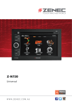
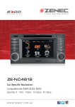
High-resolution 3D maps Topographic maps Text-to-Speech Real Junction View The high-resolution WVGA display of the Z-E3215 ensures that all maps appear crystal clear. 3D orientation points and very realistic 3D city maps make navigation in big cities even more comfortable for you. Realistic 3D landscape views lead you through complex terrains. Choose between different designs for day and night. Thanks to a light sensor, the Z-E3215 can automatically switch between day and night HMIs. The Z-E3215 also displays the names of crossroads. And if you wish, it will read out the street names to you, thanks to the integrated Text-to-Speech function – in this way you can concentrate fully on the traffic while driving. Features like the new photo-realistic Real Junction View of exit points on freeways, the Lane Assist and the Smart-zoom function at junctions and exit points facilitate orientation, particularly in complex traffic situations. Navigation Features •SD card cased 3D High Definition splitscreen navigation with map data for Australia and New Zealand. •Multisensor Dead Reckoning for accurate navigation performance when without GPS signal •Graphical user interface and voice guidance in 28 different languages •Premium POI database •2D or 3D map view with auto-zoom and realistic display of 3D terrains and 3D landmarks Reach Points Of Interests fast Intelligent destination input The Z-E3215 has a Premium POI database with more than 750,000 entries. Using the well designed search menu makes it easy to select special destinations. To select a destination, you need to enter only a few letters – the Z-E3215 completes your input and automatically proposes appropriate destinations. •Text to Speech function (TTS) •Eco and Smart Route Planning •Smart-zoom function at intersections and crossings •Tunnel mode •Real Junction View and highway mode with Real Signpost rendering •Detour Hint function •“Where-Am-I” function •Trip computer: configurable display of three additional pieces of information, with the choice of arrival time, journey time, speed, direction, height above sea level, etc. Intelligent route planning Practical trip computer So that you can optimize the route exactly as you want, you have a choice between various route calculation methods: short, fast, Eco and easy. The trip computer gives you a summary of the most important trip data, such as your average speed, arrival time or real travel time to destination. Where Am I? function Importing your Outlook contacts With the Z-E3215 you are well prepared for all emergencies. Use the “Where Am I?” function to find hospitals, police stations, ATM's, petrol stations and much more in your vicinity - all available at your finger tip. Have you saved important contacts on your computer in MS Outlook? You can easily import these contacts directly into the navigation software of the Z-E3215 by using the Naviextras Toolbox. •visual and audible warning to indicate speed limits on major roads •Latest Map Guarantee plus 1 year of complimentary navigation updates •Map updates via the online-portal: www.zenec. naviextras.com •external GPS antenna included in the delivery PAGE 05