1
INTREPID User Manual
Library | Help | Top
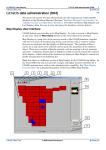
INTREPID database, file and data structures (R05)
1
| Back |
INTREPID database, file and data structures (R05)
Top
This appendix describes in detail the database, directory and file structure of
INTREPID software and data
In this chapter:
Library | Help | Top
•
The INTREPID directory structure
•
Temporary directories
•
INTREPID file names
•
INTREPID file types
•
Vector dataset file and directory structure
•
Grid dataset file and directory structure
•
INTREPID standard information (.isi) files
•
Projects—file and directory structure
•
Data Types in INTREPID datasets
•
File Masks
•
INTREPID Auxiliary files
•
INTREPID licence data
© 2012 Intrepid Geophysics
| Back |
INTREPID User Manual
Library | Help | Top
INTREPID database, file and data structures (R05)
2
| Back |
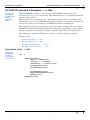
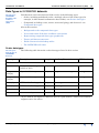
The INTREPID directory structure
Parent topic:
INTREPID
database, file
and data
structures
(R05)
The files belonging to the INTREPID package are normally stored within the
following directory structure. You can locate the directory intrepid/ and its
subdirectories anywhere in your directory tree.
the main INTREPID directory
intrepid/
bin/
contains all machine-dependent files and script
files for starting INTREPID modules
classes/
images/
class and image libraries
config/
INTREPID configuration files and the security
lock file
config/calibration_spectra/
radiometrics calibration data
help/
manuals/
Help files and documentation
algorithm/
lynxdata
Links with other software
gdads/
GDADS files and sample data
home/
(UNIX) sample login environments
sample_data/cookbook/
sample_data/examples/
sample_data/guided_tours/
Cookbook datasets
Example data
Guided Tour data
proj/
datum and projection parameter files
temp/
directory for INTREPID temporary files
kernel/
kernels for Spatial Convolution
filters/
filter definition files
sample_data/examples/ddf/
DDFs for Import
lut/
lookup files
form/
form files
font/
INTREPID font descriptions
form/
forms for the Hard Copy Composition tool
Library | Help | Top
© 2012 Intrepid Geophysics
| Back |
INTREPID User Manual
Library | Help | Top
INTREPID database, file and data structures (R05)
3
| Back |
Temporary directories
Parent topic:
INTREPID
database, file
and data
structures
(R05)
INTREPID uses a temporary directory on your hard disc for writing temporary files
during processing. The path of the temporary files directory is specified in
install.cfg The default path is install_path/temp (where install_path is
the location of your INTREPID installation. See Configuration (.cfg) files, menu and
.intrepidlock for more information about install.cfg.
When you are printing data under Windows the operating system controls the
temporary files used in the printing process. These files, therefore, are stored in the
system temporary directory (e.g., c:\temp).
INTREPID file names
Parent topic:
INTREPID
database, file
and data
structures
(R05)
Library | Help | Top
Generally speaking, you can use any name that is acceptable to your operating
system for INTREPID datasets but we recommend that you note the following:
•
We recommend that you do not use spaces in file, folder or vector dataset field
names. Use ‘_’ instead.
•
INTREPID uses the '.' character for cetain purposes. We recommend that you
don’t use it in file, folder or vector dataset field names.
•
INTREPID is file-compatible between UNIX and Windows. This means that you
can create and process the same datasets with either version of INTREPID.
There are some small issues to remember, however.
•
Windows and Mac OS are case insensitive but case preserving. For example if a
dataset is called MyGrid.ers, it will always show as MyGrid.ers. However, if
you type mygrid.ers when specifying the dataset, INTREPID locates
MyGrid.ers for you.
•
Linux and Solaris are case sensitive and case preserving. This means that
theoretically you could have two datasets existing side by side, one called
MyGrid.ers and the other called mygrid.ers.
•
To minimise risk of confusion, it may be easier to avoid capital letters and spaces
in file names.
© 2012 Intrepid Geophysics
| Back |
INTREPID User Manual
Library | Help | Top
INTREPID database, file and data structures (R05)
4
| Back |
INTREPID file types
Parent topic:
INTREPID
database, file
and data
structures
(R05)
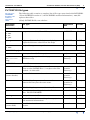
File Name/
Extension
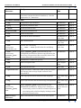
The following table contains a complete list of file types associated with INTREPID.
* From INTREPID version 3.7, the INTREPID standard information (.isi) file
replaces these files.
† Early INTREPID file, now obsolete
File Type
Associated
with
Format
INTREPID software files
*.exe
*.dll
*.so
*.jar
program (executable) file and library
INTREPID
Binary
*.hlp
help text file for online help (currently being
replaced with more advanced on-line help)
INTREPID
ASCII
menu
*.mnu
Project Manager menu specifications
INTREPID
ASCII
INTREPID project files
HISTORY
history (audit trail) file for project
project
ASCII
ntout
nt.username.
log
diagnostic report produced during process
(Windows only)
working
directory
ASCII
INTREPID vector dataset files
*.isi
INTREPID standard information file
From version INTREPID 3.7, it replaces the files
marked * in this table.
vector dataset
(outside
directory)
ASCII
*.PD
(vector header)
Header file for a vector dataset*
vector dataset
(outside
directory)
Binary
*..DIR
File Marking the presence of a vector dataset.
Dataset directory has the same name.
vector dataset
(outside its
directory)
Binary
INDEX..INDX
File Marking the presence of the index file
vector dataset
Binary
INDEX.PD
Index file synchronising the data in all of the .PD
files. DO NOT DELETE!
vector dataset
Binary
SurveyInfo
survey information file*
vector dataset
ASCII
*.PD.vec
header file for a field containing datum, projection
and statistical information*
vector dataset
ASCII
*.PD
(vector field)
data file for the index or for one field of a vector
dataset
vector dataset
Binary
Library | Help | Top
© 2012 Intrepid Geophysics
| Back |
INTREPID User Manual
Library | Help | Top
INTREPID database, file and data structures (R05)
5
| Back |
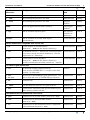
File Name/
Extension
File Type
Associated
with
Format
*..LINE
file marking the presence of a field
line dataset
Binary
*..PNT
file marking the presence of a field
point dataset
Binary
*..POLY
file marking the presence of a field
polygon
dataset
Binary
AREA
file for polygon datasets (old version)†
old polygon
dataset
Binary
*.rpt
ASCII columns import report*
line dataset
(outside its
directory)
ASCII
format
ASCII columns or Geosoft XYZ export
specifications*
vector dataset
ASCII
Vector dataset files compatible with INTREPID
*.gdb
Vector dataset in Geosoft format
(instead of ..DIR and the dataset directory)
vector dataset
Binary
*.isi
INTREPID creates a .isi file for all datasets that
it accesses (except for Oracle databases). See the
explanation of .isi above.
vector dataset
ASCII
*.jdbc
Connection to Oracle database
(instead of ..DIR and the dataset directory)
Includes information normally stored in a .isi file.
vector dataset
ASCII
INTREPID grid dataset files
*.isi
INTREPID standard information file
From version INTREPID 3.7, it replaces the files
marked * in this table.
dataset
ASCII
*.ers
*.PD.ers
Header file with ERMapper grid information. Use
this to load and save an INTREPID grid dataset
grid dataset
ASCII
*.PD
*.
Grid data file
grid dataset
Binary
*..GRID
File marking the presence of a grid dataset*
grid dataset
ASCII
*.FFT
Fast Fourier Transform and spectral domain grid
filter history (audit trail) file
grid dataset
ASCII
Grid dataset files compatible with INTREPID
*.grd
Grid dataset in Geosoft format (instead of .ers)
grid dataset
Binary
*.cdf
Grid dataset in NetCDF GMT format
(instead of .ers)
grid dataset
Binary
*.nc
Grid dataset in NetCDF format that is compatible
with JetStream (instead of .ers)
grid dataset
Binary
Library | Help | Top
© 2012 Intrepid Geophysics
| Back |
INTREPID User Manual
Library | Help | Top
INTREPID database, file and data structures (R05)
6
| Back |
File Name/
Extension
File Type
Associated
with
Format
*.isi
INTREPID creates a .isi file for all datasets that
it accesses (except for Oracle databases). See the
explanation of .isi above.
vector dataset
ASCII
INTREPID auxiliary files
*.cfg
configuration specifications
INTREPID
ASCII
*.proj
projection parameter files
INTREPID
ASCII
*.datum
datum parameter files
INTREPID
ASCII
projectionDB
projections database file
INTREPID
ASCII
*.lut
colour lookup table
INTREPID
ASCII
*.ker
convolution kernel definition
INTREPID or
your data
ASCII
*.fdf
filter definition file
INTREPID or
your data
ASCII
*.frm
in directory
specified by you
formula file containing
if – then – else specification for modifying
data
INTREPID or
your data
ASCII
*.frm
in directory
install_path
/form
(where install_path is the location of your
INTREPID installation) Window specifications for
Hard Copy Composition (Do not modify these files
or store other files in this directory.)
INTREPID
ASCII
*.asc
Radiometrics calibration spectra
INTREPID
ASCII
*.DDF
Data Description File
your import
data
ASCII
*.job
task specification file
your data
ASCII
*.spectrum.asc
report of Fourier coefficients with cycles per metre,
log of power and average depth estimate after
reverse FFT
grid dataset
ASCII
*.map
hard copy specification in MAPCOMP language
your hard copy
data
ASCII
*.leg
legend specification file for Hard Copy Composition
your hard copy
data
ASCII
*.leg
in directory
install_path/
lut
(where install_path is the location of your
INTREPID installation). Field values lookup for:
a DDF file or a
vector dataset
field
ASCII
BMRStandard
Channels
import information for AGSO vector data import
INTREPID
ASCII
Library | Help | Top
•
substituting values in ASCII columns import or
•
associating with a field to display lookup results
instead of stored value
© 2012 Intrepid Geophysics
| Back |
INTREPID User Manual
Library | Help | Top
INTREPID database, file and data structures (R05)
7
| Back |
Vector dataset file and directory structure
Parent topic:
INTREPID
database, file
and data
structures
(R05)
A vector dataset consists of a directory, a marker file ending with ..DIR and an
INTREPID standard information (.isi) file1.
Inside the directory there are
•
Two index files:
•
A marker file called INDEX..INDX
•
A data file for the index called INDEX.PD
•
A survey information file called SurveyInfo (This file is obsolete. See Vector
dataset field aliases for details.)
•
Three files for each field of the dataset:
•
A marker file for the field with the field name and an ending ..LINE, ..PNT
or ..POLY depending on the type of dataset
•
A data file with the field name and the ending .PD
•
A header file containing information such as datum, projection and statistics
with the field name and the ending .PD.vec
Line datasets have field marker files ending in ..LINE
Point datasets have field marker files ending in ..PNT
Polygon datasets have field marker files ending in ..POLY
In this section:
•
INTREPID standard information (.isi) files for vector datasets
•
Vector dataset field aliases
•
'Group by' fields
•
Traverse line numbers and types
•
Multiband vector dataset fields
•
Viewing line datasets as point datasets
•
Other vector dataset information files
•
Vector dataset examples
1.Datasets earlier than INTREPID version 3.7 have a header file ending with .PD. The
.isi file replaces this file after version 3.7.
Library | Help | Top
© 2012 Intrepid Geophysics
| Back |
INTREPID User Manual
Library | Help | Top
INTREPID database, file and data structures (R05)
8
| Back |
INTREPID standard information (.isi) files for vector datasets
Parent topic:
Vector dataset
file and
directory
structure
Data in a vector dataset INTREPID standard information (.isi) file includes:
•
Field aliases
•
Statistics
•
Datum and projection
•
Field and band header information:
•
•
Data type
•
Precision
•
‘Group by’ indicator
Report formats
See INTREPID standard information (.isi) files.
Vector dataset field aliases
Parent topic:
Vector dataset
file and
directory
structure
You may wish to use a variety of file names for the fields and have several versions of
some fields (e.g., uncorrected and corrected X and Y data). For this reason
INTREPID uses a system of aliases for file names. INTREPID may require a number
of files to take 'roles' in a process. Each 'role' is signified by an alias. The alias system
allows you to vary dataset filenames without having to laboriously specify them for
each process.
A dataset's INTREPID standard information (.isi) file1 contains a list of aliases
representing specific dataset 'roles' (such as location) and the name of the file
associated with each alias (the file which 'plays the role').
Many of the INTREPID tools use the common aliases— X, Y (location),
LineNumber, Line Type, Fiducial and FlightNumber. Some INTREPID tools,
for example, Gravity, Tie Line Levelling, and Radiometrics, include other aliases for
their own purposes. If a tool uses special aliases, its chapter will contain the relevant
details. If you develop your own software to access INTREPID datasets you may use
your own aliases.
Most INTREPID modules that access vector datasets require certain alias
definitions. If essential aliases are not defined, INTREPID may prompt you for
filenames it would normally find in the alias definition.
An alias definition for a field is an Alias = statement in the field’s Begin – End
block within the INTREPID standard information (.isi) file. (See INTREPID
Auxiliary files for a description).
1.Datasets earlier than INTREPID version 3.7 have a survey information file called
surveyinfo within the dataset directory. INTREPID maintains it for backwards
compatibility. Avoid interfering with surveyinfo.
Library | Help | Top
© 2012 Intrepid Geophysics
| Back |
INTREPID User Manual
Library | Help | Top
INTREPID database, file and data structures (R05)
9
| Back |
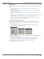
Editing aliases
You can edit the aliases of a dataset using a text editor or while using the following
tools:
•
The Project Manager (See "Managing dataset aliases" in INTREPID Project
Manager (T02)),
•
The Old Project Manager (See "Editing the dataset aliases" in INTREPID Old
Project Manager (T01)),
•
The Import tool (See "Editing the aliases" in Importing to INTREPID datasets
(T05)),
•
The Levelling tool (See "Editing aliases" in Line correction and tie levelling (T30)),
•
The Line Filters tool (See "Editing aliases" in Line Filtering (T31)),
•
The Multi-channel Spectra Processing and Correction tool (See Multi-channel
gamma ray spectrometric processing (C07)).
>> To edit the aliases of a dataset
Note: The Project Manager has a different user interface different to the one
described here. For instructions, see "Managing dataset aliases" in INTREPID
Project Manager (T02)
Library | Help | Top
1
Select the dataset and display the Dataset Alias Editor according to the
instructions for the tool you are using.
2
Choose the alias you wish to change by clicking its button. INTREPID displays a
file selection dialog box.
3
Choose the field for the alias. (See "Specifying input and output files" in
Introduction to INTREPID (R02) for information about specifying files).
4
Repeat steps 2 and 3 for any other aliases you wish to change.
5
Choose OK when you have finished.
© 2012 Intrepid Geophysics
| Back |
INTREPID User Manual
Library | Help | Top
INTREPID database, file and data structures (R05)
10
| Back |
'Group by' fields
Parent topic:
Vector dataset
file and
directory
structure
It is useful to be able to organise vector dataset data points into groups.
•
Line datasets have one group for each traverse line.
•
Gravity Point datasets have one group for each gravity station.
INTREPID creates the groups using a 'group by' field. INTREPID stores data in the
order in which it arrives from the Import tool. When you nominate a 'group by' field,
INTREPID looks for changes in this field between data points. Whenever the value of
the field changes in the import and storage order, INTREPID creates a new group.
During import INTREPID records the group as an entity independently of the value
of the 'group by' field. Therefore, as a result of changes to the data, you are able to
have adjacent groups with the same 'group by' field value. This is useful for flight
path datasets, since you can remove sections of traverse line data and convert the
remaining segments to separate lines.
If you have two 'group by' fields during import, INTREPID will create a new group
when either of them changes.
If you create a new 'group by' field after INTREPID creates the dataset (you can do
this using the Spreadsheet Editor), it can only provide additional data for each group.
It cannot have any effect on the group structure of the dataset.
INTREPID records whether a field is a ‘group by’ field in the an GroupBy =
statement in the field’s Begin – End block within the INTREPID standard
information (.isi) file. The possible values are Yes and No.
See "'Group by' fields and field aliases" in Importing to INTREPID datasets (T05) for
details about 'group by' field identification during import.
See "BREAK ON / GROUP BY line" in The INTREPID DDF format (R08) for the
notation identifying a 'group by' field in an import data definition file (DDF).
See Spreadsheet Editor (T15) for information about using 'group by' fields in the
Spreadsheet Editor.Merging gravity datasets (T56)
See Merging gravity datasets (T56) for instructions on combining datasets so that
data with matching 'group by' field values ends up in the same group in the output
dataset.
Library | Help | Top
© 2012 Intrepid Geophysics
| Back |
INTREPID User Manual
Library | Help | Top
INTREPID database, file and data structures (R05)
11
| Back |
Traverse line numbers and types
Parent topic:
Vector dataset
file and
directory
structure
INTREPID has a convention for assigning codes to different types of traverse lines.
The INTREPID tools use these codes to identify the line types. For example, the
Gridding tool will use the code to recognise and exclude tie lines from the gridding
process (See Old Gridding (T22)). INTREPID stores the line type codes in the field
with the alias LineType (See Vector dataset field aliases for an explanation of
aliases)
You may already have a convention for using line numbers to identify line types. The
following table sets out the types of traverse line, a common convention for line
number allocation and the INTREPID line type code system.
Line type
Line number convention
INTREPID line type code
Acquisition Line
< 7000
last digit 0
2
Tie Line
>= 7000
last digit 0
4
Repeat Acquisition Line
< 7000
last digit 1 for first repeat traverse,
2 for second repeat traverse, etc.
3
Repeat Tie Line
>= 7000
last digit 1 for first repeat traverse,
2 for second repeat traverse, etc.
5
Ignore this line
n/a
16384
Part of diurnal dataset
n/a
8
If your data does not have a LineType field but does have a convention for line
numbers you can use the INTREPID Spreadsheet Editor (T15) Spreadsheet tool to
derive a line type field (See Chapter 3 Spreadsheet Editor in Volume 2 for
instructions).
Multiband vector dataset fields
Parent topic:
Vector dataset
file and
directory
structure
If you have a number of Z values for each data point. you can store them in separate Z
fields or as a single multiband Z field if required. Using the INTREPID ASCII
columns import facility can import your data into either format. See The INTREPID
DDF format (R08), especially the section "Multiband fields" in The INTREPID DDF
format (R08) for details of the importing specifications and "Importing ASCII
Columns data" in Importing to INTREPID datasets (T05) for instructions.
Electromagnetic and radiometric data uses multiband fields.
The INTREPID standard information (.isi) file includes band information for
datasets. See INTREPID standard information (.isi) files for information.
Library | Help | Top
© 2012 Intrepid Geophysics
| Back |
INTREPID User Manual
Library | Help | Top
INTREPID database, file and data structures (R05)
12
| Back |
Viewing line datasets as point datasets
Parent topic:
Vector dataset
file and
directory
structure
>> To modify a line dataset for viewing as a point dataset
Create a file with the extension ..PNT in the line dataset directory. INTREPID will
not look inside this file, so it may have any content.
You can then open the dataset as a point dataset.
If you are using the Flight Path Editor, you can choose Cancel when INTREPID
prompts you for the Z fields for point colour and size if required.
Other vector dataset information files
Parent topic:
Vector dataset
file and
directory
structure
Vector datasets include a number of auxiliary files besides the INTREPID standard
information (.isi) file. INTREPID creates and maintains these files for backwards
compatibility. From version 3.7, INTREPID transfers all relevant information about
a vector dataset to the INTREPID standard information (.isi) file. It is unlikely
that you would need to examine these files or change them. This section describes the
files.
Survey information file SurveyInfo
This auxiliary file contains a complete list of the aliases in the dataset. All of its
information is also in the INTREPID standard information (.isi) file. If the dataset
existed before INTREPID 3.7, INTREPID transfers the SurveyInfo data to a new
.isi file the first time you open the dataset. You can safetly ignore SurveyInfo.
Here are some examples of survey information files.
Line dataset: The X location field is called Easting and the Y location field
Northing. The line number field is LINE, The line type field is LINETYPE, the
fiducial field is FID, the flight number field is flight and the clearance field is
rad_alt. The survey information file for this dataset would be as follows:
Alias Begin
X
Y
LineNumber
LineType
Fiducial
FlightNumber
Clearance
Alias End
=
=
=
=
=
=
=
Easting
Northing
LINE
LINETYPE
FID
flight
rad_alt
Point dataset: The X location field is called X, the Y location field Y, the point group
field is station_no, and the point type field is point_type. The survey information
file for this dataset would be as follows
Alias Begin
X
Y
PointGroup
PointType
Alias End
Library | Help | Top
=
=
=
=
X
Y
Station_no
point_type
© 2012 Intrepid Geophysics
| Back |
INTREPID User Manual
Library | Help | Top
INTREPID database, file and data structures (R05)
13
| Back |
Polygon dataset: The X location field is called lat, the Y location field long. The
survey information file for this dataset would be as follows:
Alias Begin
X
Y
Alias End
= lat
= long
Field header (.vec) information
Each field in a vector dataset has a header file with the extension .vec. The header
file has INTREPID auxiliary file structure (See INTREPID Auxiliary files for
details). INTREPID generates and modifies the header files as you create and
process the dataset fields.
From version 3.7, INTREPID extracts the important information from the .vec files
and includes it in the INTREPID standard information (.isi) file. For example, it
extracts statistics, datum and projection. Since the important information is in the
.isi file, you can generally ignore the .vec file.
You can manually edit some header file entries if required.
Here are some examples of header files.
A coordinate field from a projected dataset
DatasetHeader Begin
Version = "4.0"
DataType = Line
VectorInfo Begin
NrOfLines = 36
NrOfCellsPerLine = 1014
NrOfBands = 1
VectorInfo End
CoordinateSpace Begin
Projection = "TMAMG54"
CoordinateType = EN
Units = "METERS"
Datum = "AGD66"
CoordinateSpace End
FormatInfo Begin
Order = 6
Width = 16
Decimals = 2
FormatInfo End
DatasetHeader End
The CoordinateSpace block from a coordinate field of a dataset with geographical
coordinates
CoordinateSpace Begin
Projection = "GEODETIC"
CoordinateType = LATLONG
Datum = "AGD66"
CoordinateSpace End
Library | Help | Top
© 2012 Intrepid Geophysics
| Back |
INTREPID User Manual
Library | Help | Top
INTREPID database, file and data structures (R05)
14
| Back |
A field associated with a field values lookup file zones.leg.
DatasetHeader Begin
Version = "4.0"
DataType = Line
VectorInfo Begin
NrOfLines = 36
NrOfCellsPerLine = 1014
NrOfBands = 1
VectorInfo End
FormatInfo Begin
LUTFile = zones.leg
Order = 3
Width = 7
Decimals = 2
FormatInfo End
DatasetHeader End
See Fields associated with lookup tables for a listing of zones.leg.
A Z field for which statistics has been reported
DatasetHeader Begin
Version = "4.0"
DataType = Line
...
RasterInfo Begin
RegionInfo Begin
...
Stats Begin
NumberOfBands = 1
NumberOfNonNullCells = 28356
NumberOfNullCells = 204
MinimumValue = 1958.932983
MaximumValue = 2006.137573
MeanValue = 1972.159285
MedianValue = 1972.159285
CovarianceMatrix = 33.206414
Stats End
RegionInfo End
RasterInfo End
DatasetHeader End
DataType = This line describes the type of dataset to which the field belongs (Line
Point Polygon)
VectorInfo Begin—VectorInfo End This block describes the dimensions of the
field. The entries are self explanatory.
FormatInfo Begin—FormatInfo End This block describes the format of the field
for display in the Spreadsheet Editor. Order specifies the column order position
of the field. Width specifies the display width for the column. Decimals
describes the number of decimal places displayed for the field. You can edit the
specifications in this block if required.
Library | Help | Top
© 2012 Intrepid Geophysics
| Back |
INTREPID User Manual
Library | Help | Top
INTREPID database, file and data structures (R05)
15
| Back |
Field values lookup file specification This consists of a LUTFile = filename
statement. You do not need to specify the full path of the file or its extension,
since all such files have a required .leg extension and must reside in the
install_path/lut directory (where install_path is the location of your
INTREPID installation. Place the specification statement in the FormatInfo
Begin – FormatInfo End block. See Fields associated with lookup tables for
further information.
RasterInfo Begin—RasterInfo End If you examine statistics for the field by
double clicking it in the Project Manager, INTREPID will save a copy of the
statistics report in this block. From this time onwards, whenever the data in the
field changes, INTREPID will update this report in the header file.
Vector dataset examples
Parent topic:
Vector dataset
file and
directory
structure
Line dataset example
A line dataset called ebagoola has 7 fields—latitude, longitude,
linenumber, linetype, flightno, fiducial, magnetic. It consists of the
ebagoola..DIR and ebagoola.PD files and the ebagoola directory
ebagoola..DIR
ebagoola.isi
ebagoola/
INDEX..INDX
INDEX.PD
SurveyInfo
latitude..LINE
latitude.PD
latitude.PD.vec
longitude..LINE
longitude.PD
longitude.PD.vec
linenumber..LINE
linenumber.PD
linenumber.PD.vec
linetype..LINE
linetype.PD
linetype.PD.vec
fiducial..LINE
fiducial.PD
fiducial.PD.vec
flightno..LINE
flightno.PD
flightno.PD.vec
magnetic..LINE
magnetic.PD
magnetic.PD.vec
Point and Polygon datasets
Point and polygon datasets have a similar structure to the line dataset illustrated in
Line dataset example except that they have ..PNT and ..POLY marker file endings
instead of ..LINE
Library | Help | Top
© 2012 Intrepid Geophysics
| Back |
INTREPID User Manual
Library | Help | Top
INTREPID database, file and data structures (R05)
16
| Back |
Grid dataset file and directory structure
Parent topic:
INTREPID
database, file
and data
structures
(R05)
Grid datasets have three files with the same name but different endings:
•
INTREPID standard information (.isi) file
•
A data file with no extension or ending in .PD
•
An ERMapper header file ending in .ers
If you have turned on ARC/INFO or ERDAS IMAGINE access, INTREPID will
create grid files with header (.hdr), projection (.prj) and binary interleaved link
(.PD.bil) files when you save a grid dataset.
In this section:
•
INTREPID standard information (.isi) files for grid datasets
•
Grid dataset ERMapper header (.ers) files
•
Multiband grid datasets
•
Grid dataset example
INTREPID standard information (.isi) files for grid datasets
Parent topic:
Grid dataset
file and
directory
structure
Data in a vector dataset INTREPID standard information (.isi) file includes:
•
Data and band header information:
•
Data type
•
Precision
•
Datum and projection
•
Statistics
See INTREPID standard information (.isi) files for a general description of these
files.
Grid dataset ERMapper header (.ers) files
Parent topic:
Grid dataset
file and
directory
structure
Each grid dataset has an ERMapper header (.ers) file in INTREPID auxiliary file
format.
The information in the file enables you to open it in ERMapper.
Here is an example of a .ers file.
DatasetHeader Begin
Comments="Audit Stamp V3.1c-27/ 5/1996"
Version = "4.1"
CoordinateSpace Begin
Projection = "TMAMG54"
CoordinateType = EN
Units = "METERS"
Datum = "AGD66"
Rotation = 0:0:0
CoordinateSpace End
HeaderOffset = 512
DataSetType = ERStorage
DataType = Raster
ByteOrder = LSBFirst
Library | Help | Top
© 2012 Intrepid Geophysics
| Back |
INTREPID User Manual
Library | Help | Top
INTREPID database, file and data structures (R05)
17
| Back |
RasterInfo Begin
CellType = IEEE4ByteReal
NullCellValue = -5.0E+75
RegistrationCoord Begin
Eastings = 739961.150000
Northings = 8420039.770000
RegistrationCoord End
RegistrationCellX = 0
RegistrationCellY = 0
CellInfo Begin
Xdimension = 80.000000
Ydimension = 80.000000
CellInfo End
NrOfLines = 150
NrOfCellsPerLine = 150
NrOfBands = 1
RegionInfo Begin
Type = Polygon
RegionName = "All"
SubRegion = {
0
0
150
150
}
Stats Begin
NumberOfBands = 1
NumberOfNonNullCells = 22186
NumberOfNullCells = 314
MinimumValue = -0.2996773720
MaximumValue = 0.3520531654
MeanValue = -0.0001314568
MedianValue = -0.0001314568
CovarianceMatrix = 0.0005585500
Stats End
RegionInfo End
RasterInfo End
DatasetHeader End
Library | Help | Top
© 2012 Intrepid Geophysics
0
150
150
0
| Back |
INTREPID User Manual
Library | Help | Top
INTREPID database, file and data structures (R05)
18
| Back |
Multiband grid datasets
Parent topic:
Grid dataset
file and
directory
structure
If you have several Z values for a grid (e.g., derived from the same vector dataset) you
can store them as separate grids or as a single multiband grid. Most INTREPID tools
which produce grids as output will prompt you to specify the number of bands in the
output grid and the band number for use on this occasion. Band numbers start at 1.
Grid dataset example
Parent topic:
Grid dataset
file and
directory
structure
ebagrid.isi
(standard files)
ebagrid
ebagrid.ers
Library | Help | Top
© 2012 Intrepid Geophysics
| Back |
INTREPID User Manual
Library | Help | Top
INTREPID database, file and data structures (R05)
19
| Back |
INTREPID standard information (.isi) files
Parent topic:
INTREPID
database, file
and data
structures
(R05)
From INTREPID version 3.7, these files are INTREPID auxiliary files (see
INTREPID Auxiliary files for details). Each dataset has one. It contains parameter
values for the dataset.
When you first create a dataset, the .isi file may contain only a small amount of
information. As you use INTREPID tools with the dataset, or examine an aspect of it,
such as the aliases or the statistics, INTREPID adds more information.
The .isi files totally or partly replace some of the other auxiliary files in a dataset.
INTREPID maintains the replaced files for backwards compatibility. If you want to
change a property of the dataset, edit the .isi file rather than the replaced files.
The following sections describe the structure of .isi files and give examples.
In this section:
•
Outer block of the .isi file
•
Blocks within the .isi file
•
Example of grid dataset .isi file
•
Example of vector dataset .isi file
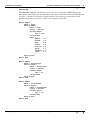
Outer block of the .isi file
Parent topic:
INTREPID
standard
information
(.isi) files
Library | Help | Top
isi :=
"MetaData Begin"
"Name =" {Resource}
"Version =" {Integer}
"UserNotes =" {String.List}
{ColumnDefinition}
{ColumnDefinition}
...
{ColumnDefinition}
{ReportFormatDefinition}
{Extensions}
"MetaData End"
© 2012 Intrepid Geophysics
| Back |
INTREPID User Manual
Library | Help | Top
INTREPID database, file and data structures (R05)
20
| Back |
Blocks within the .isi file
Parent topic:
INTREPID
standard
information
(.isi) files
The "ColumnDefinition"
ColumnDefinition :=
{Component|ResourceName} "Begin"
{SingleValuedItems}
{BandValuedItem}
...
{BandValuedItem}
{Component|ResourceName} "End"
================================================================
The "ReportFormatDefinition"
ReportFormatDefinition :=
"ReportFormat Begin"
"Name = default"
"Order =" { FieldName.List }
"Width =" { Integer.List }
"Decimals =" { Integer.List }
"DisplayNullAs =" { String.List }
"ReportFormat End"
================================================================
The "Extensions"
Extensions :=
"Extensions Begin"
...
"Extensions End"
================================================================
The "SingleValuedItems"
SingleValuedItems :=
"GroupBy =" {Boolean}
"DataType =" {DataType}
"ByteOrder =" LSBFirst | MSBFirst
"Comment =" {String.List}
"ReadOnly = " {Boolean}
"Bands = " {Integer}
================================================================
Library | Help | Top
© 2012 Intrepid Geophysics
| Back |
INTREPID User Manual
Library | Help | Top
INTREPID database, file and data structures (R05)
21
| Back |
The "BandValuedItem"
BandValuedItem :=
"Band"{BandNumber} "Begin"
"Minimum =" {Numeric}
"Maximum =" {Numeric}
"Mean =" {Numeric}
"Variance =" {Numeric}
"Samples =" {Integer}
"Nulls =" {Integer}
"Projection =" {ProjectionName}
"Datum =" {DatumName}
"BandId =" {BandId}
"Unit =" {Unit}
"Width =" {Integer}
"Decimals =" {Integer}
"DisplayNullAs =" {String}
"Alias =" {Alias}
"Band"{BandNumber} "End"
Example of grid dataset .isi file
Parent topic:
INTREPID
standard
information
(.isi) files
Library | Help | Top
MetaData Begin
Name
= table
tensor Begin
Bands
= 6
band3 Begin
Minimum =
Maximum =
Mean
=
Variance=
Samples = 4
Nulls
= 0
band3 End
tensor End
MetaData End
© 2012 Intrepid Geophysics
1.000000
6.000000
3.500000
8.333333
| Back |
INTREPID User Manual
Library | Help | Top
INTREPID database, file and data structures (R05)
22
| Back |
Example of vector dataset .isi file
Parent topic:
INTREPID
standard
information
(.isi) files
MetaData Begin
Name = BrokenHill
UserNotes = {
"This is a demo dataset"
"containing magnetics for the BrokenHill Area"
}
X Begin
Alias = { X }
Minimum = 530000.0
Maximum = 540699.0
Mean = 535399.4
Variance = 14599
Samples = 147031
Nulls = 0
Projection = "TMAMG54"
Datum = "WGS84"
X End
Y Begin
Alias = { Y }
Samples = 147031
Nulls = 0
Projection = "TMAMG54"
Datum = "WGS84"
Y end
FID Begin
Alias = { Fiducial }
FID End
LINE Begin
GroupBy = yes
ByteOrder = LSBFirst
Comment = "The Line number"
Alias = { LineNumber }
LINE End
microlevelled Begin
DataType = IEEE8ByteReal
ReadOnly = yes
BandId = mag
Unit = nT
microlevelled End
ReportFormat Begin
Name = Default
Order = { X Y FID LINE microlevelled }
Width = { 12 12 10 6 10 }
Decimals = { 0 0 0 0 2 }
DisplayNullAs = { -999 -999 -999 -999 -999 -999 }
ReportFormat End
MetaData End
Library | Help | Top
© 2012 Intrepid Geophysics
| Back |
INTREPID User Manual
Library | Help | Top
INTREPID database, file and data structures (R05)
23
| Back |
Projects—file and directory structure
Parent topic:
INTREPID
database, file
and data
structures
(R05)
For an introduction to the project directory, working directory and history file, see
"HISTORY files" in Introduction to INTREPID (R02) and "The HISTORY file location,
project directory, working directory" in Introduction to INTREPID (R02) ).
Project example
This simple project has some task and hard copy specification files, a grid dataset
(ebagoola), a line dataset (eba_mag) and a polygon dataset (region1).
project1/
project directory
HISTORY
process audit trail file
import_eba.job
a task specification file
grid_eba.job
a task specification file
eba_print.map
a hard copy specification file
ebagoola.isi
) grid dataset
ebagoola
)
ebagoola.ers
)
eba_mag..DIR
) line dataset marker file
eba_mag.isi
) line dataset header file
eba_mag/
) line dataset directory
INDEX..INDX
) line dataset index files
INDEX.PD
)
SurveyInfo
) survey information (obsolete)
latitude..LINE
) a field of the line dataset
latitude..PD
)
latitude..PD.vec
)
...
) more fields
region1..DIR
) polygon dataset marker file
region1.isi
) polygon dataset information file
region1/
) polygon dataset directory
INDEX..INDX
INDEX.PD
SurveyInfo
X..POLY
X.PD
X.PD.vec
Y..POLY
Y.PD
Y.PD.vec
Library | Help | Top
© 2012 Intrepid Geophysics
| Back |
INTREPID User Manual
Library | Help | Top
INTREPID database, file and data structures (R05)
24
| Back |
Data Types in INTREPID datasets
Parent topic:
INTREPID
database, file
and data
structures
(R05)
Grid datasets and vector dataset fields can be of the following types:
•
Scalar, including multiband scalar—multiple values of the same type (for
example, in 256 channel radiometrics data fields)—see Scalar data types
•
Compound, including vector, tensor, structural gology and observed—see
Compound data types
Also in this section:
•
Background to the compound data types
•
Vector and tensor field data coordinate conventions
•
Representing compound data types graphically
•
Tensor grid dataset structure
•
Fields associated with lookup tables
•
The INTREPID null value
Scalar data types
Parent topic:
Data Types in
INTREPID
datasets
Data type
The following table shows the scalar datatypes listed in this section.
Description
Length
Auxiliary file notation
DDF Notation
byte
Unsigned 8 bit integer
(values 0..255)
1 byte
Byte
byte
integer
(2 byte)
Signed 16 bit integer
2 bytes
Signed16BitInteger
integer*2
integer
(4 byte)
Signed 32 bit integer
4 bytes
Signed32BitInteger
integer*4
real (4 byte)
IEEE 32 bit floating point
4 bytes
IEEE4ByteReal
real*4
real (8 byte)
IEEE 64 bit floating point
8 bytes
IEEE8ByteReal
real*8
logical*
0=false, 1=true
1 byte
Logical
logical
character*
character string
variable
Character
character
Scalar
*If you wish to use logical or character data in a grid dataset, contact our technical
support service for advice.
Library | Help | Top
© 2012 Intrepid Geophysics
| Back |
INTREPID User Manual
Library | Help | Top
INTREPID database, file and data structures (R05)
25
| Back |
Compound data types
Parent topic:
Data Types in
INTREPID
datasets
Compound data types bundle a set of related scalar values that together make up a
meaningful unit of data.
This section describes notation used in the data description files (DDF) (see The
INTREPID DDF format (R08)).
The main table in this section describes the compound data types. The immediately
following table explains the column headings:
Heading
Purpose
Data type
Name of data type
Components
Names and descriptions of data type components (combined table cells)
Purpose
Purpose of data type or component
Data Type of Component
Scalar data type of component
Auxiliary file & DDF
Notation
Name for data type used in DDF and in auxiliary files such as .isi
DDF format hint
Notation used in square brackets following the field name in DDF to
identify the component. See "Field definition lines" in The INTREPID
DDF format (R08).
Compound data type definition table
Some of the components listed here are optional or alternative. The context
detemines which are present in the import data or the resulting field data
Data type and
Components
Purpose
Data Type of
Component
Date
Storing date information
Auxiliary
file & DDF
notation
DDF Format Hints
Date_type (in DDF)
Date (in .isi)
Date (in Project Manager)
Date (in dd/mm/yyyy format)
string
Date
Year
numeric
Year
Month
numeric
Month
Day
numeric
Day
Time (in hh:mm:ss.s format
string
Time
Hour
numeric
Hour
Minute
numeric
Minute
Second
numeric
Second
Julian day
(Days since 1st January)
numeric
Jday
Seconds since midnight
numeric
midnight_seconds
Complex
Library | Help | Top
Complex numbers
Complex
© 2012 Intrepid Geophysics
| Back |
INTREPID User Manual
Library | Help | Top
Data type and
Components
INTREPID database, file and data structures (R05)
26
| Back |
Purpose
Data Type of
Component
Auxiliary
file & DDF
notation
DDF Format Hints
Real part
real (8 byte)
R
Imaginary part
real (8 byte)
I
Vector
Components of a 3 dimensional vector
Vector (in DDF)
Vector (in .isi)
Vector3d (in Project Manager)
Component
3D components of a potential field
measurement
Component (in DDF)
Components (in .isi)
FieldComponents
(in Project Manager)
Gradient
3D components of a potential field gradient
Gradient
X component
real (8 byte)
Vx
Y component
real (8 byte)
Vy
Z component
real (8 byte)
Vz
Type
string
Vtype
Structural
Geology
Observation of structural geology
Structural (in DDF)
Geology (in .isi)
Geology3d (in Project Manager)
Strike of measurement (angle)
real (8 byte)
Strike
Dip of measurement (angle)
real (8 byte)
Dip
Type of rock (code or description)
string
Geo
X component of measurement
real (8 byte)
Sx
Y component of measurement
real (8 byte)
Sy
Z component of measurement
real (8 byte)
Sz
Tensor (examples)
Tensor
Gradients
Library | Help | Top
Tensor
real (8 byte)
© 2012 Intrepid Geophysics
Txx
Txy
Txz
Tyx
Tyy
Tyz
Tuv
| Back |
INTREPID User Manual
Library | Help | Top
Data type and
Components
Purpose
Observed
Measurement
INTREPID database, file and data structures (R05)
27
| Back |
Data Type of
Component
Auxiliary
file & DDF
notation
DDF Format Hints
Observed
X gradient
real (8 byte)
Ox
Y gradient
real (8 byte)
Oz
Z gradient
real (8 byte)
Oz
Strength
real (8 byte)
Ostrength
Omag
Tensors
real (8 byte)
Oxx
Oxy
Oxz
Oyx
Oyy
Oyz
Ouv
Bearing
real (8 byte)
Obearing
Type
string
Vtype
Library | Help | Top
© 2012 Intrepid Geophysics
| Back |
INTREPID User Manual
Library | Help | Top
INTREPID database, file and data structures (R05)
28
| Back |
Background to the compound data types
Parent topic:
Data Types in
INTREPID
datasets
A family of derived classes have been designed to honour all the commonly available
airborne geophysical observation packages.
Magnetic gradiometry
Specifically, for magnetic gradiometry systems, the magnetic intensity plus
•
Vertical gradient only
•
Transverse gradient (wing tip sensors)
•
Transverse & longitudinal gradient (wing tip & tail stinger)
•
All gradients (full tri-axial system)
•
All components of a field
•
Tensor gradients.
Moving platform gravity
For moving platform gravity, the vertical component if available plus
•
Full tensor gradients (Bell)
•
Vertical component plus motion monitors (L&R / ZLS)
•
2 horizontal curvature tensor (Falcon system)
•
3 gravity components (Sander)
With this approach, each variant is delegated the task of enforcing any innate
invariant relationships eg tensor and positive definite symmetric, trace invariance,
rotational invariance, boost symmetry etc.
This innate behaviour can be relied upon to carry through in any process involving a
manipulation of itself with another reading. This greatly assists the development of
algorithms which work with all the various systems in a physically consistent way.
Vector and tensor field data coordinate conventions
Parent topic:
Data Types in
INTREPID
datasets
It is conventional to think of the vertical component of gravity as pointing down. On
the other hand, Cartesian coordinates are right-handed, with East as X, North as Y
and Elevation as Z. This is often called ENU (East North Up). New generation
geophysical field data is recorded in all combinations of ENU, NED and END. END
is a left-handed system. Bell FTG tensor data has this convention. The IPHT
magnetic tensor is ENU. The Earth’s magnetic field (IGRF) is often used in NED
when the vector form is required.
INTREPID tries to alert users when confusion about this could make a big difference
in results. It is, however, important for you to be aware of your tensor data’s
coordinate system before you try to process it.
Library | Help | Top
© 2012 Intrepid Geophysics
| Back |
INTREPID User Manual
Library | Help | Top
INTREPID database, file and data structures (R05)
29
| Back |
Representing compound data types graphically
Parent topic:
Data Types in
INTREPID
datasets
INTREPID tools represent some compound data types graphically. This section
explains these techniques.
Tensor data
INTREPID tools use the Mohr circle tensor diagram for tensor data. For an
explanation of gravity tensors, see http://www.bellgeo.com/tech/
technology_theory_of_FTG.html
Rotational Components
Deviatoric
Invariant
Min.
Max.
Mid.
Principal
Components
First Invariant
2D/3D Ratio
Invariant
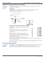
Moving platform gravity data (Observed data type)
INTREPID tools show this as a green arrow and a
black arrow.
The green arrow shows a ‘view from above’ of the
combination of the X and Y components of the
gravity field.
The length of the black arrow represents the
difference between total gravity magnitude of the
data point and the mean total gravity magnitude of
the group (traverse line).
The angle of the black arrow corresponds to the
total horizontal component of the gravity reading, This shows how far the gravity
field is away from vertical.
Since the data type also contains a field strength value, INTREPID shows this value
next to the graphic.
Tensor grid dataset structure
Parent topic:
Data Types in
INTREPID
datasets
Library | Help | Top
The ERMapper (and INTREPID) implementation of a tensor grid uses six bands wih
the interleaved by line (BIL) method to store the components, in the order
Txx,Txy,Txz,Tyy,Tyz,Tzz. Each band is labelled and has default units of Eotvos.
© 2012 Intrepid Geophysics
| Back |
INTREPID User Manual
Library | Help | Top
INTREPID database, file and data structures (R05)
30
| Back |
Moving platform gravity data (Components data type)
We represent moving platform gravity data as a red arrow with two sections at right
angles, and a black arrow.
The length of the black arrow represents the difference between total gravity
magnitude of the data point and the mean total gravity magnitude of the group
(traverse line).
The angle of the black arrow represents the total horizontal component of the gravity
reading, This indicates the direction if the gravity field away from vertical.
Structural geology data
Structural geology data types show the angle of a geological feature.
INTREPID tools show this as a green arrow and a black arrow. The green
arrow shows strike, a ‘view from above’ of the combined X and Y directions.
The black arrow shows a view from the side of the dip.
Complex data
INTREPID tools show complex data as a line segment. The angle and
length of the line segment represents real and imaginary parts as a vector.
Library | Help | Top
© 2012 Intrepid Geophysics
| Back |
INTREPID User Manual
Library | Help | Top
INTREPID database, file and data structures (R05)
31
| Back |
Fields associated with lookup tables
Parent topic:
Data Types in
INTREPID
datasets
By using integer fields with a lookup table in an auxiliary file, you can create an
'enumerate (ordinal) data type' in an INTREPID vector dataset. A field of this type
will have a set of possible values, such as words or phrases, corresponding to integer
values. Internally the field is of integer type but INTREPID always displays the
corresponding values when you view and edit the data.
For example, data in a dataset could belong to three different zones or to no zone at
all. You can have a field which internally can take the values 0..3 but which is
associated with a lookup table as follows
Lookup Begin
Name = Zones
Type = Label
Label Begin
Table = {
0 "Other"
1 "Zone A"
2 "Zone B"
3 "Zone C"
}
Label End
Lookup End
INTREPID will always display the values Other, Zone A, etc., depending on the
internal value of the field.
Fields associated with lookup files may contain values other than those in the lookup
file. INTREPID will use the actual value of the field if there is no corresponding
lookup file value.
In the Spreadsheet tool, INTREPID will use the results of the lookup as if they are
the actual data stored in the field. See "Fields associated with lookup tables" in
Spreadsheet Editor (T15) for instructions.
This feature of INTREPID provides a simple and powerful method of transforming
data using Import and Export. You can import data with one set of values, transform
it instantly using an associated lookup file, then export it with the new values
obtained from the lookup file.
Field values lookup files must reside in the install_path/lut directory (where
install_path is the location of your INTREPID installation), use the format
illustrated above and have the extension .leg.
If you import a dataset using a DDF, you can specify a field values lookup file for a
field in the DDF. INTREPID will use the values from the lookup file for the data in
the field. See "Field definition lines" in The INTREPID DDF format (R08) for details.
INTREPID records the association of a field with a lookup file in the field header
(.vec) file. See Field header (.vec) information for details. You can specify a lookup
file for a field manually by editing the field header file.
Library | Help | Top
© 2012 Intrepid Geophysics
| Back |
INTREPID User Manual
Library | Help | Top
INTREPID database, file and data structures (R05)
32
| Back |
The INTREPID null value
Parent topic:
Data Types in
INTREPID
datasets
Fields without values contain a standard INTREPID null value. When INTREPID
imports data from other formats, it assigns this value to empty cells. The following
table contains the standard values of null for each data type.
Data type
Value of null
Byte
0
Single precision integer
–32768
Double precision integer
–2147483648
Floating point (single and double)
–5.0E75
Logical
0
String
25510
File Masks
Parent topic:
INTREPID
database, file
and data
structures
(R05)
When INTREPID displays a list of files (including field files) or datasets it finds them
by listing certain file types. INTREPID recognises file types using a mask on the file
names. INTREPID often uses the ..DIR, ..LINE, ..PNT, ..POLY marker files to
locate vector data for listing. It includes the extensions of compatible dataset formats
in the masks. See INTREPID file types for an explanation of the filename extensions.
The following table lists the masks that INTREPID uses. See "Direct access by
INTREPID" in INTREPID direct access, import and export formats (R11) for more
information about formats that INTREPID can directly access and write to).
File or Dataset Type
Mask
All files
*.*
Vector datasets
*..DIR, *.gdb, *.jdbc, .shp
Point dataset fields
*..PNT
Line dataset fields
*..LINE
Polygon dataset fields
*..POLY
Grid datasets
(image formats also available—see "Image formats" in
INTREPID direct access, import and export formats (R11))
*.ers, *.grd, *.cdf, *.nc
History (process audit trail) files
*HISTORY*
Task specification files
*.job
Hard Copy specification files (MAPCOMP language)
*.map
Library | Help | Top
© 2012 Intrepid Geophysics
| Back |
INTREPID User Manual
Library | Help | Top
INTREPID database, file and data structures (R05)
33
| Back |
INTREPID Auxiliary files
Parent topic:
INTREPID
database, file
and data
structures
(R05)
INTREPID uses a system of auxiliary files for various purposes such as defining
specifications and setting parameters. These are ASCII (text) files with a standard
syntax:
•
A Begin – End block enclosing keyword=value declarations.
•
Each declaration occupies a new line.
•
There may be further Begin – End blocks nested within the outer block.
•
Lines beginning with # are 'comment' lines for you to include information for
people to read about the file. INTREPID ignores the contents of these lines. The
Comment Begin - Comment End syntax can also be used to define a block of
comment lines.
•
INTREPID treats text enclosed in { } as a single line even if you have split it into
several lines for better readability.
Here is an example
Macro Begin
Name = hpgl
Device Begin
Name = hpgl
Class = Vector
Coords Begin
dpi = 200
Coords End
#
Colour Thickness
Pens = {
White
1.0
Black
1.0
Red
1.0
Green
1.0
Yellow 1.0
Blue
1.0
Magenta 1.0
Cyan
1.0
}
Device End
Macro End
We supply a number of auxiliary files in each category with INTREPID. You can use
these files as they are or use them as templates for your own new auxiliary files. You
can edit auxiliary files with any text editor.
In this section:
Library | Help | Top
•
Dataset auxiliary files
•
Process specification files
•
Datum and projection parameter files
•
Import/Export format files
•
Convolution kernel files
•
Configuration (.cfg) files, menu and .intrepidlock
•
Lookup and legend files
© 2012 Intrepid Geophysics
| Back |
INTREPID User Manual
Library | Help | Top
INTREPID database, file and data structures (R05)
34
| Back |
Dataset auxiliary files
Parent topic:
INTREPID
Auxiliary files
INTREPID datasets have auxiliary files, mainly the INTREPID standard
information (.isi) file. See Vector dataset file and directory structure and Grid
dataset file and directory structure for details.
Process specification files
Parent topic:
INTREPID
Auxiliary files
These files describe some INTREPID process and can be used to recall a process that
has been carried out or specify a process that you require.
Task specification files
Task specification files are text files containing the specifications for tasks to be
performed by INTREPID tools.
See INTREPID task specification (.job) files (R06) for general information about
these files.
History files
History files (called HISTORY and residing in each project directory) contain an audit
trail of processes carried out on the project. Their syntax is the same as task
specification files and you can use text from them in task specification files.
See Projects—file and directory structure and INTREPID task specification (.job)
files (R06) for general information about these files.
Hard copy specification files
If you use the Hard Copy Composition tool or MAPCOMP language you will save your
work in hard copy specification files. These are text files with standard syntax and
names ending in .map. See MAPCOMP Map Specification Language (R20) for further
information.
Datum and projection parameter files
Parent topic:
INTREPID
Auxiliary files
The datum and projection parameter files specify the projections, ellipsoids and
reference points supported by INTREPID. They reside in the directory
install_path/proj (where install_path is the location of your INTREPID
installation).
See INTREPID’s supported datums and projections (R09) for further details.
Library | Help | Top
© 2012 Intrepid Geophysics
| Back |
INTREPID User Manual
Library | Help | Top
INTREPID database, file and data structures (R05)
35
| Back |
Import/Export format files
Parent topic:
INTREPID
Auxiliary files
Data Description Files (DDF)
Data Description Files contain specifications for importing ASCII files containing
data in columns into INTREPID vector datasets. See The INTREPID DDF format
(R08)for a description and "Importing ASCII Columns data" in Importing to
INTREPID datasets (T05) for instructions on the use of DDFs.
BMRStandardChannels (AGSO vector data)
BMRStandardChannels contains field names and other specifications for importing
AGSO vector data. See "Importing AGSO vector data" in Importing to INTREPID
datasets (T05) for further information.
Export format specification files
These files contain specifications for exporting a vector dataset to an ASCII (text) file
or a Geosoft XYZ file. The export format file for a dataset has standard syntax, is
called format and resides in the dataset directory.
See "Export specification files" in Exporting from INTREPID datasets (T07).
Convolution kernel files
Parent topic:
INTREPID
Auxiliary files
The convolution kernels specify spatial convolution filters for grid datasets. They
reside in the directory install_path/kernel (where install_path is the location
of your INTREPID installation)
See Spatial Convolution Grid Filters (T34) for further details.
Configuration (.cfg) files, menu and .intrepidlock
Parent topic:
INTREPID
Auxiliary files
The configuration files specify directories, colours, devices, fonts, sizes and
configurations for INTREPID. Configuration files reside in the directory
install_path/config (where install_path is the location of your INTREPID
installation). Except for the security lock file they are text files in begin – end
block format. You can edit them according to your requirements.
If you make incorrect changes to some configuration files INTREPID may not
function properly. We suggest that you seek advice from our technical support
service before editing configuration files if you are uncertain about the changes
required.
Colour specifications in these files are in a standard X11 syntax (A # followed by
three 2-digit hexadecimal numbers (for red, green and blue). For example, black is
#000000, white is #ffffff, red is #ff0000, green is #00ff00, blue is #0000ff
install.cfg
Specifies :
•
Directories used to store INTREPID files, including the directory for temporary
storage of work in progress (i.e., the 'temp' directory)
•
Aliases for program files so that
•
•
•
Library | Help | Top
Old program names still work in your task or hard copy or specification files
Programs whose names changed can still work readily after you install
INTREPID version 3.1.
Specifications of the size of your computer's RAM and the size of your swap file
(file used for virtual memory)
© 2012 Intrepid Geophysics
| Back |
INTREPID User Manual
Library | Help | Top
INTREPID database, file and data structures (R05)
36
| Back |
Config Begin
lutDir
= $(INTREPID)/lut
kernelDir = $(INTREPID)/kernel
projDir
= $(INTREPID)/proj
helpDir
= $(INTREPID)/help
ddfDir
= $(INTREPID)/ddf
fontDir
= $(INTREPID)/font
formDir
= $(INTREPID)/form
tmpDir
= $(INTREPID)/temp
ram
= 32
swap
= 100
#
#
Aliases for Intrepid tools
#
AdjustSpectra = aspectra
ConvolveImage = cfilter
Spreadsheet = dbedit
decorrugate = decor
dtrans = dtrans
Euler = euler
Export = export
flightEdit = fedit
FileManager = fmanager
Gamadj = gamadj
GridFilter = gfilter
GpsNavigationCorrection = gpsnav
Gridding = gridding
histogram = histo
hp_plot = hp_plot
Import = import
Levelling = level
LineFilter = linefil
MapComposition = mapcomp
MapPrint = mapprint
microLevel = mlevel
ProfileEdit = pedit
ProjConvert = projconv
queryindex = qindex
surveyDistance = sdist
Stitch = stitch
subsection = subset
ulevel = ulevel
vhbge = vhbge
vhbgeSpectra = vhbgesp
Config End
Library | Help | Top
© 2012 Intrepid Geophysics
| Back |
INTREPID User Manual
Library | Help | Top
INTREPID database, file and data structures (R05)
37
| Back |
intrepid.cfg
The default properties file contains window control, size, colour and font
specifications for INTREPID generally and for each INTREPID tool.
The following extract from a version of intrepid.cfg shows the specifications
covering INTREPID as a whole and examples of the specifications for two INTREPID
tools.
*gui mswin
*PopupWindow*overlay true
*PopupWindow*saveUnder on
*TransientWindow*saveUnder on
*green*background #00ff00
*blue*background #0000ff
*black*background #c2c2c2
*white*background #00ff00
*default #c2c2c2
*wheat*background #c2c2c2
*wheat*foreground #c2c2c2
*foreground #000000
*font *MS Sans Serif*bold*--14*
*background #000000
*title*foreground #333333
*brush_width 0
*double_buffered off
*flat #c2c2c2
*dark #444444
*light #dddddd
*pannerthickness 4
*thickness 4
*framethickness 2
*background #c2c2c2
*editorflat #c2c2c2
*editordark #000000
*editorlight #eeeeee
*editorframethickness 2
...
pedit*font *MS Sans Serif*bold*--14*
pedit*background #c2c2c2
pedit*geometry 650x450
pedit*double_buffered off
pedit*iconName pedit
fedit*font *MS Sans Serif*bold*--14*
fedit*background #c2c2c2
fedit*geometry 650x520
fedit*line_color black
fedit*double_buffered off
fedit*iconName flightEdit
FFT*geometry 760x650
FFT*font *MS Sans Serif*bold*--14*
FFT*background #c2c2c2
FFT*plot0 #0000ff
FFT*plot1 #ff0000
FFT*plot2 #00ff00
Library | Help | Top
© 2012 Intrepid Geophysics
| Back |
INTREPID User Manual
Library | Help | Top
INTREPID database, file and data structures (R05)
38
| Back |
FFT*plot3 #ffaa00
FFT*plot4 #ff00ff
FFT*plot5 #aa3030
FFT*mark_color #ffffff
FFT*axis_color #ffffff
FFT*tick_color #ffffff
FFT*graph_color #444444
FFT*double_buffered off
FFT*iconName gridfilter
level*font *MS Sans Serif*bold*--14*
level*background #c2c2c2
level*foreground #000000
level*double_buffered off
level*active_point_color #0000ff
level*inactive_point_color black
level*point_color #ff0000
level*line_color white
level*mark_color #0000ff
level*axis_color #ffffff
level*tick_color #ffffff
level*graph_color #696969
level*rubber_band #00ff00
level*command #c2c2c2
level*iconName level
level*geometry 800x700
...
Library | Help | Top
© 2012 Intrepid Geophysics
| Back |
INTREPID User Manual
Library | Help | Top
INTREPID database, file and data structures (R05)
39
| Back |
devices.cfg
The devices.cfg file specifies the hard copy devices which INTREPID can use.
Each print device that you use must have an entry in this file so that INTREPID can
access it. Contact our technical support service if necessary for assistance with
specifications for your devices. Here is an example of this file:
Macro Begin
Name = hpgl
Device Begin
Name = hpgl
Class = Vector
Coords Begin
dpi = 200
Coords End
Pens = {
White
1.0
Black
1.0
Red
1.0
Green
1.0
Yellow 1.0
Blue
1.0
Magenta 1.0
Cyan
1.0
}
Device End
Macro End
Macro Begin
Name = PostScript
Device Begin
Name = PostScript
Class = Raster
Coords Begin
dpi = 72
Coords End
Device End
Macro End
Macro Begin
Name = InterViews
Device Begin
Name = InterViews
Class = Raster
Coords Begin
dpi = 72
Coords End
Device End
Macro End
Library | Help | Top
© 2012 Intrepid Geophysics
| Back |
INTREPID User Manual
Library | Help | Top
INTREPID database, file and data structures (R05)
40
| Back |
Macro Begin
Name = WIN32
Device Begin
Name = WIN32
Class = Raster
Coords Begin
dpi = 300
Coords End
Device End
Macro End
mapcomp.cfg
This file contains definitions for all elements available in hard copy composition using
the INTREPID Hard Copy Composition tool. See Map composition configuration files
(R21) for further information and a listing.
menu
The menu file contains specifications for the Project Manager menu bar. It resides in
the install_path/config directory (where install_path is the location of your
INTREPID istallation). See "Customising the Project Manager menus" in
Configuring and using INTREPID (R04) for details.
.intrepidlock
For INTREPID to process your data (i.e., work in other than demonstration mode)
you must have an authorisation key file called .intrepidlock present in the
install_path/config directory (where install_path is the location of your
INTREPID istallation). We provide this file when we issue an INTREPID licence.
Lookup and legend files
Parent topic:
INTREPID
Auxiliary files
Colour Lookup Tables
The colour lookup tables assign colours to values for displaying INTREPID data. The
files reside in the install_path/lut directory and have extension .lut (where
install_path is the location of your INTREPID installation). They are ASCII (text)
files with the standard INTREPID Begin – End block syntax (see definition of the
syntax at the start of this section).
Colour lookup tables should not be confused with field values lookup files which have
extension .leg and reside in the install_path/lut directory (see below for
details).
The lookup table definition (.lut) file contains definitions of four parameters as well
as the table. Earth Resource Mapping (publishers of ERMapper) developed this
format as an open standard.
Version Version number of the lookup table. It must be within "" if it contains
spaces.
Name Name of the lookup table. It must be within "" if it contains spaces.
Description Description of the lookup table. It must be within "" if it contains
spaces.
NrEntries Number of possible values for the data being represented. This
corresponds to the number of lines in the LUT matrix.
Library | Help | Top
© 2012 Intrepid Geophysics
| Back |
INTREPID User Manual
Library | Help | Top
INTREPID database, file and data structures (R05)
41
| Back |
LUT contains the matrix of colour component levels, one row for each possible value
of the data being represented. Column 1 is the level number and columns 2, 3, 4
represent the levels of Red, Green and Blue respectively. The levels range from 0
to 65280.
You must enclose the matrix in braces { }. Each row of the matrix occupies a
separate line of the ASCII file. The place for the opening { is on the same line as
the words LUT = and the } alone on a line under the matrix. The value and levels
within the rows are separated by spaces.
Example of colour lookup table definition file
This sample is an extract from a 256 colour lookup table showing the beginning and
end of the file.
LookUpTable Begin
Version
= "1.0"
Name
= "Rainbow"
Description
= "Cray's Rainbow table"
NrEntries
= 256
LUT
= {
0
58624
0
65280
1
57600
0
65280
2
56576
0
65280
3
55552
0
65280
.
.
.
252
65280
2816
19968
253
65280
1792
20992
254
65280
768
21760
255
65280
768
21760
}
LookUpTable End
Field values lookup files
Field values lookup files associate integer field values with other data such as words.
They enable you to have 'enumerate (ordinal)' type data in INTREPID datasets. See
Fields associated with lookup tables for details.
Field values lookup files have extension .leg, consist of a simple Lookup Begin –
Lookup End block and reside in the install_path/lut directory. They should not
be confused with colour lookup tables (.lut) which reside in the same directory (see
above), or hard copy composition legend files, which also have the extension .leg (see
below).
Hard copy composition legend files
Hard copy composition legends associate values with attributes such as colour and
marker size in hard copy compositions. These are text files with standard syntax and
names ending in .leg. See Map legend files (R23) for details.
Library | Help | Top
© 2012 Intrepid Geophysics
| Back |
INTREPID User Manual
Library | Help | Top
INTREPID database, file and data structures (R05)
42
| Back |
INTREPID licence data
Parent topic:
INTREPID
database, file
and data
structures
(R05)
Use the INTREPID Licence Manager tool to manage your INTREPID licence. For
full instructions about installing INTREPID and applying your INTREPID licence,
see INTREPID Installation guide (S05).
This section explains the location of the licence data in the INTREPID installation.
Under normal circumstances you do not require this information.
Windows version
To use INTREPID in normal mode you require an authorisation key file called
.intrepidlock to be present in your install_path/config directory (where
install_path is the location of your INTREPID installation).
Depending on the time we issued your first licence, you may also require an
authorisation device ('dongle') attached to your parallel port or your USB port.
UNIX version
To use INTREPID in normal mode you require an authorisation key file called
.intrepidlock to be present in your install_path/config directory (where
install_path is the location of your INTREPID installation).
Library | Help | Top
© 2012 Intrepid Geophysics
| Back |