1
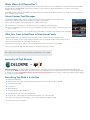
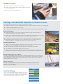
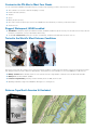
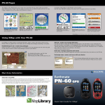
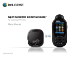
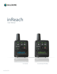
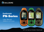
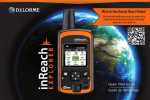
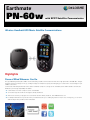
Earthmate
DE LORME
®
PN-60w
with SPOT Satellite Communicator
Wireless Handheld GPS Meets Satellite Communications
Highlights
Peace of Mind Wherever You Go
This groundbreaking bundle pairs SPOT’s renowned lifesaving Satellite Communicator with DeLorme’s high-performance PN-60w GPS. Imagine
typing freeform text messages on the go, sending messages to multiple user groups, and managing your contacts via a contact manager in your
SPOT account online.
Communicate with family and friends from locations worldwide. Cell phone coverage can be unreliable, but the SPOT Satellite Communicator
distributes your message dependably via satellite.
➤➤ Communicate even when cell phone service is unavailable
➤➤ Send custom Type & Send™ text messages to family and friends
➤➤ Allow others to track your progress on social network sites like Twitter, Facebook, and SPOTadventures.com
➤➤ Let family and friends know you’re safe when your adventures take you to challenging locations. And, in case of emergency, you can send
SOS messages with your GPS position embedded
Works Where Cell Phones Don’t
The SPOT Satellite Communicator receives custom text messages and more sent from your PN-60w GPS, and transmits them wirelessly, EVEN
OUTSIDE OF CELL PHONE RANGE. This provides a vital line of communication with friends and family when you want it, and emergency
assistance when you need it.
Using 100% satellite technology, the PN-60w with SPOT Satellite Communicator works virtually anywhere in the world, even where cell phones
don’t – all with the push of a button.
Create Custom Text Messages
The Earthmate PN-60w enables creation of custom text messages for easy transmission by the SPOT Satellite
Communicator. SPOT is a leader in personal satellite messaging communications.
➤➤ Let your spouse back home know all is well when traveling with the kids
➤➤ Tell loved ones you’re safe when your adventures take you into difficult or extreme situations
➤➤ Share your exhilaration with others as you conquer mountains, whitewater, ocean voyages, or other challenges you’ve
set for yourself
And, if you encounter problems, you can send SOS messages describing your situation, with your GPS position embedded.
Offer Your Track in Real-Time to Friends and Family
Established SPOT technology enables anyone you designate to track your travels via online topographic maps.
➤➤ No need to actively send a message; tracking is automatic as long as the SPOT Satellite Communicator is turned on
➤➤ A new tracking “breadcrumb” will display every 10 minutes
➤➤ Friends and loved ones can easily check your progress at their convenience using free online mapping
Just one more way the PN-60w with SPOT Satellite Communicator delivers peace of mind.
Note: SPOT services require an annual subscription; visit findmespot.com for details.
Innovative Hi-Tech Partners
DeLorme and SPOT, the innovative leaders in mapping and GPS technologies, bring you the world’s first handheld GPS with SPOT Satellite
Communications. SPOT provides lifesaving communications technology that allows users to communicate from remote locations around the globe.
As a result, the revolutionary Earthmate PN-60w with SPOT Satellite Communicator, offers an array of outbound messaging and GPS mapping
functionality never before available.
Everything You Need is In the Box
➤➤ Earthmate PN-60w GPS
➤➤ SPOT Satellite Communicator, specially designed and engineered to work in tandem with the PN-60w
➤➤ Topo North America 9.0
➤➤ User Manual
➤➤ Quick Start Guide
➤➤ Energizer ® Ultimate Lithium AA batteries
➤➤ USB data-transfer cable for PC-GPS data exchanges
➤➤ 5 regional discs of GPS maps from Topo North America 9.0, for use on PN-Series GPS
➤➤ Certificate for $40 worth of aerial imagery or other sample supplementary data downloads
➤➤ A sturdy, convenient neck lanyard
Why Settle for Just One Map?
The PN-60w has the amazing ability to layer multiple map and imagery types on the included Topo North America terrain and street detail.
Whatever your preferred activity, you’ll never have to settle for just one map.
DeLorme Topo North America
Find your position on up-to-date DeLorme Topo North America 9.0 maps.
➤➤ Full U.S. and Canada terrain and street detail, Mexico main roads
➤➤ U.S. trails and public recreation areas, including BLM lands
The DeLorme Map Library
For more variety and detail, low-cost subscriptions to the unique DeLorme Map Library entitle you to unlimited amounts of supplemental maps
and aerial and satellite imagery.
MapPack Subscription
➤➤ High-resolution U.S. color aerial imagery
➤➤ USGS 1:24,000 topographic quads
➤➤ NOAA nautical charts
➤➤ 1:50,000 Natural Resources Canada topographic map sheets
U.S. Color Aerial Imagery
USGS Topo Quad
NOAA Nautical Chart
DigitalGlobe® Satellite & Aerial Imagery Subscription
➤➤ Premium resolution
➤➤ Global coverage
For display on Earthmate ® PN-Series GPS receivers
Canada Topo Map
PN-60w Interface
➤➤ Intuitive, easy to use, icon-based screen navigation
➤➤ Reliable, ergonomic push-button design that enables one-handed
use, even with gloves on
➤➤ High-resolution sunlight-readable screen
Full Range of Handheld GPS Capabilities for Outdoor Activities
The PN-60w supports all popular outdoor activities, with features including:
➤➤ A highly-accurate 3-axis electronic compass that works when held in any position, moving on foot or standing still
➤➤ An elevation display that pinpoints your location
➤➤ Sensitive barometric altimeter for precise elevation readings and the ability to gauge potential weather changes
Backcountry Expeditions
➤➤ Navigate with confidence even in remote locations worldwide, knowing you have the ability to
communicate with family or emergency responders
➤➤ Whether you’ve summited a mountain, kayaked Class V rapids, or reached Angkor Wat, you can share
your exhilaration in real time with family or with the world via social network sites
➤➤ Let others track your progress via online maps – family and friends can see exactly where you are
➤➤ Get emergency help in case of injury, storms, or other major events; you can also request nonemergency assistance – for example, if you blow a tire on a remote access road
Day Hiking and Family Travel
➤➤ Cell phone coverage can be spotty in remote areas, even close to home – take worry out of the
equation when you and your family are exploring on foot or on the water
➤➤ Why make dad wait to learn about the trophy catch when mom takes the kids fishing?
➤➤ Log your family’s geocaching finds directly to Geocaching.com
➤➤ You don’t have to be off-road to be away from civilization – if your daughter’s old car breaks down on
a deserted two-lane road, it’s comforting to know she can still request assistance right from her car
Maps and Emergency Response for Boaters
The ability to display NOAA nautical charts makes the PN-60w a valuable navigator for sea kayaking and
coastal sailing. Navionics® lake maps and marine charts (sold separately on SD cards) are also supported.
And, the availability of high-resolution aerial imagery provides an accurate depiction of the natural and
manmade features near your location.
Paperless Geocaching
DeLorme has devoted significant resources toward offering a rewarding geocaching experience.
In addition to the unique value of available aerial imagery, the PN-60w delivers a wide range of
paperless geocaching capabilities.
Activity Settings
Choose one of eight pre-defined activity settings or one of two
custom settings. The device will update Info Fields and Page
Sequences to activity-specific settings. No more multiple steps
when switching activities to customize screen views
Customize the PN-60w to Meet Your Needs
You can customize the PN-60w’s Information Page for your trip so that everything you want to know is all on one screen
➤➤ Time or distance to next turn or finish (if navigating on a route)
➤➤ Distance traveled (odometer)
➤➤ Trip time
➤➤ Speed
➤➤ Battery life, GPS accuracy
➤➤ Also create custom set-ups for quick access to the PN-60w screens and features you want for your favorite activities
➤➤ and much more!
Rugged, Waterproof, WAAS-enabled
➤➤ The PN-60w is waterproof, impact- and vibration-resistant, and WAAS-enabled for superior accuracy. The SD-card slot is securely located in
the battery compartment, so all your saved data is safe and dry
➤➤ The PN-60w’s Button Lock prevents the execution of inadvertent, unwanted commands while the device is in use
Tested in the World’s Most Extreme Conditions
Ed Viesturs - American mountaineer
Tyler Fish - polar explorer
PN-Series receivers have been tested in some of the most extreme conditions on earth. They were the GPS of choice for John Huston and Tyler
Fish during their historic Victorinox North Pole 09 expedition, and Ed Viesturs took the PN-40 on his successful 2009 ascent of Mt. Everest.
➤➤ Military standard 810F for vibration and shock – also tested to function in high-vibration conditions such as the Bonneville Salt Flats
➤➤ Waterproof to the IEC 529 IPX7 standard
➤➤ Functions in high humidity, including consistent humidity levels over 90%, and in the rain
➤➤ Operating temperature range for the PN-60w is -20 degrees C to +75 degrees C
Delorme Topo North America 9.0 Included
Plan the Perfect Outdoor Experience – Anywhere in the U.S. and Canada
Topo North America 9.0 PC desktop software is an exceptionally full-featured travel planning, routing, and GPS resource. Create customized maps
with road and trail routes, and navigate worry-free in your vehicle, on foot, or on the water, anywhere from the Yukon to the Rio Grande.
➤➤
➤➤
➤➤
➤➤
➤➤
Use Topo North America to scout your trips as if you were there, with realistic 3-D and 360-degree rotation
Locate places of interest, create driving and hiking routes, identify public lands, import maps and imagery
Exchange GPS files with the PN-60w
Easily manage and edit your collected GPS files
Print maps for take-along reference
Trust the Latest Map Detail
➤➤
➤➤
➤➤
➤➤
11,000 added U.S. national forest trails
210,000 new and updated roads
U.S. Bureau of Land Management recreation lands now included
The most up-to-date map detail from Canada government sources
U.S.-Based Cartography, Engineering, Service, and Support
Photograph© Jeffrey Stevenson
DeLorme does not outsource or off-shore its development or support services. Our innovative geospatial and hardware engineering, customer care,
and technical support all originate from our New England headquarters – home to Eartha, the world’s largest rotating and revolving globe.
Details
Earthmate PN-60w GPS Details
Key Features:
➤➤
➤➤
➤➤
➤➤
Intuitive icon-based user interface for easy on-device navigation
Elevation profile cutaway views that pinpoint the user’s position
3.5 GB of user-available Flash memory
GPX support for improved waypoint, track, and geocache file management
»» No finite limitations on the quantities of each that can be saved to internal memory
»» In addition, all can be saved to and retrieved from SD cards
»» Tracks can now hold 20,000 points (versus 10,000 with earlier PN-Series models); you can edit track settings to (upon hitting 50,000
points) automatically save the active track and start another; overwrite the existing track points (oldest first); or stop track recording entirely
➤➤
➤➤
➤➤
➤➤
➤➤
Holds 100 routes (compared to 50 with earlier PN-Series models)
Power Management System optimizes battery performance
Sleep When Stationary – puts device in “doze mode” if no movement is detected for 60 seconds
Stealth Mode – mutes all audible alerts, turns off backlight
Button-Lock – prevents unwanted device activation or data input
Powerful GPS Performance Features
➤➤ High-sensitivity 32-channel STMicroelectronics Cartesio chipset and DeLorme ConstantLock™ for quick satellite acquisition and reliable signal
retention
➤➤
➤➤
➤➤
➤➤
➤➤
➤➤
➤➤
➤➤
➤➤
DeLorme predictive GPS calculates satellite positions for near instantaneous acquisition
Dual-core processor for blazing-fast performance
3-axis electronic compass performs with the PN-60w held in any position
Sensitive barometric altimeter for highly-accurate reliable altitude readings
65K bright-color TFT screen for clarity in any light conditions
On-device road routing
SDHC support up to 32 GB
Support for paperless geocaching
WAAS-enabled accuracy (to within 3 meters)
Map and Imagery Details
The Most Comprehensive GPS Detail Available
On-device data layering lets you see your GPS location with the advantage of numerous map and imagery choices. Switch among them to gain a
comprehensive view of where you are – it’s revolutionary and provides a level of geographic detail unavailable on any other handheld GPS.
Layer all these map and imagery options on your PN-60w and always have the right detail for any activity, wherever you go in the world. PN-Series
receivers also display market-leading Navionics® lake maps and marine charts (no set-up required, sold separately on SD cards).
Complete Detailed U.S. and Canada Topographic and Street Maps
(included with all PN-Series GPS purchases).
➤➤ Detailed vector-based maps created from the USGS topographic data and the latest DeLorme U.S. street and trail network
➤➤ U.S. land cover including bodies of water, wetlands, forests, mountains, glaciers, grasslands, rock cover & more
Canada Topographic Map Sheets
➤➤ Official Natural Resources Canada data
➤➤ Topographic contour lines, bodies of water, roads and trails, also significant buildings, historic sites, and other manmade features in urban areas.
➤➤ 1:50.000 scale
➤➤ Coverage for most of Canada
High-Resolution Color Aerial Imagery
➤➤ Best available resolution for many areas
➤➤ Provides on-the-ground detail for areas outside Topo North America coverage
USGS 7.5-Minute Quad Maps
➤➤ Authentic USGS 1:24,000 (7.5-min.) topo quads, scanned into a seamless database
➤➤ See roads, trails, locations of buildings, natural landmarks, and an endless variety of physical features
NOAA Nautical Charts
➤➤ The complete set of U.S. waterway charts available, including coastlines, Great Lakes, Alaska, Hawaii, many navigable rivers
➤➤ See aids to navigation, water depths, water body names, hazards, and more
Effortless Track, Waypoint, and Route Management Details
A green arrow shows your location on the screen map, and points in your direction of travel. For screen orientation, you can select north up, course
up, or heading up. The PN-60w will automatically collect a track as you travel. You can save the collected track, use it to create a route, and (when
you’re back home) convert it to a routable road or trail within Topo North America.
Create waypoints with the click of a button, select from a vast menu of symbol options for the appropriate icon and add descriptive comments.
With the PN-60w’s search capability, you can locate cities and towns, roads, trails, natural features, points of interest including businesses,
restaurants, campgrounds, and much more; any search result can be saved as a waypoint.
Create road routes or direct point-to-point routes on the device, or easily import road or trail routes from Topo North America. When navigating on a
route, the PN-60w emits audible turn alerts (your choice of numerous sounds – ring, beep, whistle, etc.).
Customize the PN-60w to Meet Your Needs
You can customize the PN-60w’s Information Page for your trip so that everything you want to know is all on one screen
➤➤ Time or distance to next turn or finish (if navigating on a route)
➤➤ Distance traveled (odometer)
➤➤ Trip time
➤➤ Speed
➤➤ Battery life, GPS accuracy
➤➤ Also create custom set-ups for quick access to the PN-60w screens and features you want for your favorite activities
➤➤ and much more!
New Custom Controls Put You in Charge
➤➤ Button-Locking – prevents accidental unit activation or data input (enabled using the Power button)
➤➤ Stealth Mode – enforces sound and light discipline
➤➤ Power-Saving Mode – increases battery life 2x, ideal for use when packing the device for occasional check-ins but not steady usage
➤➤ Low-Level Nighttime Illumination
➤➤ Project waypoints – “Look ahead” feature for sighting downrange
DeLorme Topo North America 9.0 Details
Map Detail Includes:
➤➤ Comprehensive street and topographic coverage for the U.S. and Canada
➤➤ Land cover
➤➤ Lakes and streams
➤➤ Updated U.S. trails
➤➤ State and national parks and forests
➤➤ Boat ramps, campgrounds, hunting and fishing spots, unique natural features
➤➤ Over 4 million U.S. and Canada places of interest
➤➤ Gazetteer point data descriptions from DeLorme Atlas & Gazetteer series
➤➤ Mexico main roads
Desktop Mapping and GPS Features
➤➤ Exclusive - automatic road and trail routing
➤➤ Easy GPS file exchanges with PN-60w (waypoints, tracks, routes, geocaches)
➤➤ Exclusive - convert imported tracks to routable roads or trails
➤➤ Realistic 3-D terrain views with flyovers
➤➤ Highly-defined shaded relief
➤➤ Contour lines with elevation numbers
➤➤ Split screen integration with aerial imagery, USGS and Canada topos, NOAA nautical charts, and more
➤➤ Use draw tools to add waypoints and tracks for upload to PN-60w
➤➤ Paperless geocaching, Pocket Query imports
➤➤ In-vehicle, run Topo North America 9.0 on laptop PC connected to PN-60w or other Earthmate GPS for voice-guided navigation
➤➤ Versatile print features – create handy take-along reference maps for in-vehicle, on the water, or in the field.
Specs
PN-60w Technical Specifications
Physical
➤➤ IPX7 waterproof standard
➤➤ Impact-resistant rubberized housing (Mil STD 810F)
➤➤ Device dimensions: 2.43” W x 5.25” H x 1.5” D
➤➤ Weight: without batteries: 5.35 ounces; with Li-Ion rechargeable: 6.7 oz; with 2 alkaline AAs: 7.00 oz.
Performance
➤➤ 32-channel STMicroelectronics Cartesio GPS chipset for fast, reliable satellite acquisition
➤➤ A dual-core processor for lightning quick map redraws, when panning or zooming
➤➤ Fast USB 2.0 data transfer to internal memory or SD card in device
➤➤ Proprietary Kalman filter for enhanced GPS accuracy
➤➤ Detailed onboard base map with major streets and highways worldwide, plus U.S. secondary roads
Sensors
➤➤ 3-axis electronic compass with included accelerometer performs when held in any position
➤➤ Sensitive barometric altimeter for reliably accurate altitude readings
Power
➤➤ Uses 2 AA batteries (included)
➤➤ Optional Travel Power Kit with DeLorme-supplied rechargeable Li-Ion battery
Receiver
➤➤ Super high-sensitivity 32-channel Cartesio chipset by STMicroelectronics for rapid signal acquisition
➤➤ ConstantLock™ satellite retention, even in challenging GPS environments
➤➤ Predictive GPS for near-instantaneous acquisition
Acquisition Times:
➤➤ Hot start: 5-6 seconds
➤➤ Warm start: < 45 seconds
➤➤ Cold start: < 60 seconds
➤➤ Update rate: 1/second, continuous
GPS accuracy:
➤➤ Position: < 15 meters, 95% typical
➤➤ Velocity: 0.05 meter/sec steady state
WAAS accuracy:
➤➤ Position: < 3 meters, 95% typical
Display:
➤➤ Sharp high-resolution 2.2” (220 x 176 pixels)
➤➤ 65K-color Transflective TFT screen
Memory and Storage
➤➤ 3.5 GB internal Flash memory
➤➤ Supports SDHC high-capacity SD cards – up to 32 GB
SPOT Communicator Technical Specifications
Physical Specifications
➤➤ Case: IPX-7, waterproof, impact resistant, and rugged
➤➤ Size: 2.6” x 3” x 1.25”
➤➤ Weight: 3.7 oz.
Battery Life and Usage
Use only AA Lithium batteries in your SPOT Communicator. Alkaline or other battery technologies, including rechargeable batteries, are not recommended.
In an emergency situation, if you have access to alkaline or other battery technologies, the SPOT Communicator might work but will not offer the specified
battery life or performance.
Power
➤➤ SOS mode: Up to 7 days of messages
➤➤ Type & Send mode: Up to 5 days of messages
➤➤ Track Progress mode: Up to 10 days of messages
➤➤ Standby mode: Up to 4 months
➤➤ Operational and environmental conditions can decrease the battery life achieved under normal usage conditions.
➤➤ See findmespot.com for more details regarding battery life.
Operating Conditions and Specifications
The SPOT Communicator must have an unobstructed view of the sky, either outdoors or in a glass enclosed area, such as a vehicle dashboard or sunroof.
Visit findmespot.com for more detailed information.
Coverage
SPOT works around the world, including virtually all of North America, Europe, Australia, and portions of South America, Africa, and Asia, as well as
hundreds or thousands of miles off shore of these areas. It is important that you check coverage for your destination at findmespot.com before traveling.
Premium SMS Service
Additional charges may apply in some regions. Standard text messaging charges from your mobile phone provider may also apply. Visit findmespot.com
for more information.
Troubleshooting
The SPOT Communicator performs a self-diagnostic test each time it is powered on. SPOT recommends that you send and verify a Check-in/ OK message
before each trip. This also allows you to evaluate your entire messaging system—from the operational condition of the SPOT Communicator to the
readiness of those on your contact list. See the FAQ section on findmespot.com for more information.
DeLorme Topo North America 9.0 Minimum System Requirements
Operating Systems
➤➤ Microsoft® Window ® 7 (all versions) with 1GB of RAM (2+ GB recommended)
➤➤ Windows Vista® (all versions) with 512 MB RAM (1+ GB recommended)
➤➤ Windows XP (Service Pack 2 or later) with 512 MB RAM (1+ GB recommended)
➤➤ Microsoft Internet Explorer 7.0 or later
Hardware
➤➤ 1.5 GHz or higher processor, Pentium 4, Athlon 64 or later
➤➤ 2 GB of available hard-disk space (8 GB if all map data for North America is loaded to hard drive)
➤➤ DVD-ROM Drive
➤➤ 1024 x 768 screen resolution or higher
Macintosh®
➤➤ Compatible with Intel-based Macintosh computers running Boot Camp ® for Windows XP/Vista/7
For GPS Use
➤➤ Compatible with any DeLorme Earthmate GPS receiver