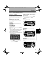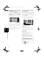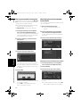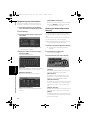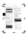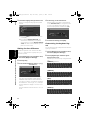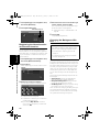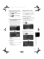
1
CRB2297A_U_English.book
Page 1
Friday, January 5, 2007
2:51 PM
Operation Manual
HDD MULTIMEDIA AV NAVIGATION SERVER
AVIC-Z2
Notice to all users:
This software requires that the navigation system is properly connected to your vehicle’s
parking brake and depending on your vehicle, additional installation may be required. For
more information, please contact your Authorized Pioneer Electronics retailer or call us at
(800) 421-1404.
CRB2297A_U_English.book
Page 2
Friday, January 5, 2007
2:51 PM
The screens shown in the examples may differ from the actual screens.
The actual screens may be changed without notice for performance and function
improvements.
CRB2297A_U_English.book
Page 1
Friday, January 5, 2007
2:51 PM
Introduction
Manual Overview
This manual provides important information you need to make full use of your new navigation system.
The beginning sections outline the navigation system and describe its basic operation. The later sections describe the details of the navigation functions.
Chapters 10 to 16 describe how to operate the AV functions. Please read these chapters when you use
a disc in the built-in DVD drive or operate the Pioneer audio equipment connected to the navigation system.
How to use this manual
Be sure to read the following descriptions
License Agreement (Page 5 to 11)
This provides a license agreement of this software. Be sure to read this before using the software.
About the Data for the Map Database (Page 11)
This provides the date when the Map Database was recorded.
Copyright (Page 11)
This provides the copyright of the Map Database.
About Gracenote® (Page 11)
This provides a license agreement and copyright of the Gracenote® music recognition service. Be sure
to read this before using this navigation system.
Finding the operation procedure from what you want to do
When you have decided what you want to do, you can find the page you need from the “Table of Contents”.
Finding the operation procedure from a menu name
If you want to check the meaning of each item displayed on the screen, you will find the necessary page
from the “Display Information” at the end of the manual.
Glossary
See the glossary to find the meaning of a term.
Index
The section at the end of this manual provides an index. See each term to find the main pages where it
is stated.
1
CRB2297A_U_English.book
Page 2
Friday, January 5, 2007
2:51 PM
Overview for each chapter
1
2
3
4
5
6
7
8
9
2
Before Using the System
For safety reasons, it is particularly important that you fully understand your navigation system before using it. Be sure to read this chapter.
Basic Operation
Please read this section if you want to operate the navigation system immediately.
It will explain the basics of this system.
This section describes the basic operations for navigation.
How to Read the Map Display
This section describes how to read the map screen, and the method of changing map view or
map scale.
Modifying Map Configurations
The behavior of your navigation system depends on the map display and guidance settings. If
you need to change any of the current settings, read the relevant section of this chapter.
Setting a Route to Your Destination
This section describes various ways to search for a destination, edit the current route conditions and operate the route during route guidance.
Registering and Editing Locations
You can register and edit the points on the map. This chapter describes how to register a
home location, favorite location or other location, and how to edit the entry in “Address
Book”.
Using Traffic Information
When Pioneer XM satellite radio tuner (GEX-P10XMT) is connected to the navigation system,
the system can acquire traffic information and perform navigation using the traffic information. This chapter describes ways of viewing traffic icons that are displayed on the map and
operation related traffic information.
Using XM Tuner and Other Information
When Pioneer XM satellite radio tuner (GEX-P10XMT) is connected to the navigation system,
variety of information other than traffic can be acquired. The navigation system can also register emergency information. This chapter describes ways of the information acquired with
XM satellite radio, registration of emergency information.
Using Hands-free Phoning
When you are using a cellular phone featuring Bluetooth® technology by connecting the
Bluetooth unit (sold separately) to the navigation system, you can operate your cellular
phone hands-free. This chapter describes the operations related to hands-free phoning.
CRB2297A_U_English.book
10
11
12
13
14
15
16
17
Page 3
Friday, January 5, 2007
2:51 PM
Modifying the General Settings for Navigation Functions
The behavior of your navigation system depends a number of general settings for navigation
functions. If you need to change any of the initial settings (default settings), read the relevant
section of this chapter.
Using the AV Source (Built-in DVD Drive and Radio)
This section describes how to use DVD-Videos, CDs, MP3 discs, and the radio.
Using the AV Source (Music Library)
You can record a music CD to the hard disk drive in the navigation system. This chapter
describes recording music and playing back the recorded music.
Using the AV Source (XM, SIRIUS)
This chapter describes the audio source operations that can be used when an XM satellite
radio tuner or SIRIUS satellite radio tuner is connected.
Using the AV Source (M-CD, iPod®, TV)
This chapter describes the audio source operations that can be used when Pioneer audio
equipment featuring IP-BUS (Multi-CD player, iPod adapter, TV tuner) is connected.
Using the AV Source (AV, EXT, AUX)
This chapter describes the audio source operations that can be used when connecting AV
equipment with an RCA connector (AV input), future Pioneer devices (external unit ), or auxiliary equipment (AUX).
Customizing the Audio Setting related with Audio Visual
Using the audio source, various audio-visual settings are available to suit your tastes. This
chapter describes how to change the settings.
Operating Your Navigation System with Voice
This section describes navigation operations, such as searching the destination and performing audio operations by voice.
Appendix
Please read the appendix to learn more about your navigation system and information such
as the availability of after-care. Please see “Display Information” at the end of this manual
to check the details for each item on the menu.
3
CRB2297A_U_English.book
Page 4
Friday, January 5, 2007
2:51 PM
Terminology
Before moving on, take a few minutes to read the following information about the conventions used in
this manual. They will help you greatly as you learn how to use your new equipment.
• Hardware buttons on your navigation system are described in ALL CAPITAL, BOLD lettering:
e.g.)
MAP button, MENU button.
• Items in the different menus or touch keys available on the screen are described in brackets [ ] and
bold:
e.g.)
[Destination], [Settings].
• Extra information, alternative usages and other notes are presented like this:
e.g.)
❒ Touch keys which are not available at this time are grayed out.
• References to sections that describe information related to the current topics are indicated like this:
e.g.)
➲ Setting the Route Options ➞ Page 34
The tab on the right corner indicates which operation the description is related to: Navigation operation or AV (Audio Visual) source operation.
For example, “NAVI” indicates that the description is related to the operation for navigation control.
“NAVI/AV” indicates that the description is related to both operation for navigation
control and AV control.
About the definition of terminology
“Front Display” and “Rear Display”
In this manual, the screen that is attached to the body of this navigation unit will be referred to as the
“Front Display”. Any additional optional screen that is purchased for use in conjunction with this navigation unit will be referred to as the “Rear Display”.
“Video image”
“Video image” in this manual indicates the moving image from DVD-Video in the built-in DVD drive or
from the equipment that is connected to this system with an AV-BUS or RCA cable, such as a TV tuner
or general-purpose AV equipment.
Color difference of the map display between day and night
Night display
The examples in this manual are illustrated using the daytime display. When driving at night, the colors
you see may differ from those shown.
4
CRB2297A_U_English.book
Page 5
Friday, January 5, 2007
License Agreement
PIONEER AVIC-Z2 - for U.S.A.
THIS IS A LEGAL AGREEMENT BETWEEN YOU,
AS THE END USER, AND PIONEER ELECTRONICS (USA) INC. (“PIONEER”). PLEASE READ THE
TERMS AND CONDITIONS OF THIS AGREEMENT
CAREFULLY BEFORE USING THE SOFTWARE
INSTALLED ON THE PIONEER PRODUCTS. BY
USING THE SOFTWARE INSTALLED ON THE PIONEER PRODUCTS, YOU AGREE TO BE BOUND
BY THE TERMS OF THIS AGREEMENT. THE
SOFTWARE INCLUDES A DATABASE LICENSED
BY THIRD PARTY SUPPLIER(S) (“SUPPLIERS”),
AND YOUR USE OF THE DATABASE IS COVERED BY THE SUPPLIERS’ SEPARATE TERMS,
WHICH ARE ATTACHED TO THIS AGREEMENT
(Refer to page 9). IF YOU DO NOT AGREE WITH
ALL OF THESE TERMS, PLEASE RETURN THE
PIONEER PRODUCTS (INCLUDING THE SOFTWARE, AND ANY WRITTEN MATERIALS) WITHIN
FIVE (5) DAYS OF RECEIPT OF THE PRODUCTS,
TO THE AUTHORIZED PIONEER DEALER FROM
WHICH YOU PURCHASED THEM. USE OF THE
SOFTWARE SHALL BE DEEMED TO BE YOUR
CONSENT TO THE LICENSE AGREEMENT.
1. GRANT OF LICENSE
Pioneer grants to you a non-transferable, non
exclusive license to use the software installed on
the Pioneer products (the “Software”) and the
related documentation solely for your own personal use or for internal use by your business,
only on such Pioneer products.
You shall not copy, reverse engineer, translate,
port, modify or make derivative works of the Software. You shall not loan, rent, disclose, publish,
sell, assign, lease, sublicense, market or otherwise transfer the Software or use it in any manner
not expressly authorized by this agreement. You
shall not derive or attempt to derive the source
code or structure of all or any portion of the Software by reverse engineering, disassembly,
decompilation, or any other means. You shall not
use the Software to operate a service bureau or
for any other use involving the processing of data
for other persons or entities.
Pioneer and its licensor(s) shall retain all copyright, trade secret, patent and other proprietary
ownership rights in the Software. The Software is
2:51 PM
copyrighted and may not be copied, even if modified or merged with other products. You shall not
alter or remove any copyright notice or proprietary legend contained in or on the Software.
You may transfer all of your license rights in the
Software, the related documentation and a copy
of this License Agreement to another party, provided that the party reads and agrees to accept
the terms and conditions of this License Agreement.
2. DISCLAIMER OF WARRANTY
The Software and related documentation are provided to you “AS IS”. PIONEER AND ITS LICENSOR(S) (for the purpose of provisions 2 and 3,
Pioneer and its licensor(s) shall be collectively
referred to as “Pioneer”) MAKES AND YOU
RECEIVE NO WARRANTY FOR THE SOFTWARE,
WHETHER EXPRESS OR IMPLIED, AND ALL
WARRANTIES OF MERCHANTABILITY AND FITNESS FOR ANY PARTICULAR PURPOSE FOR
THE SOFTWARE ARE EXPRESSLY EXCLUDED.
SOME STATES DO NOT ALLOW EXCLUSION OF
IMPLIED WARRANTIES, SO THE ABOVE EXCLUSION MAY NOT APPLY TO YOU. The Software is
complex and may contain some nonconformities,
defects or errors. Pioneer does not warrant that
the Software will meet your needs or expectations, that operation of the Software will be error
free or uninterrupted, or that all non-conformities
can or will be corrected. Furthermore, Pioneer
does not make any representations or warranties
regarding the use or results of the use of the Software in terms of its accuracy, reliability or otherwise.
3. LIMITATION OF LIABILITY
IN NO EVENT SHALL PIONEER BE LIABLE FOR
ANY DAMAGES, CLAIM OR LOSS INCURRED BY
YOU (INCLUDING, WITHOUT LIMITATION, COMPENSATORY, INCIDENTAL, INDIRECT, SPECIAL,
CONSEQUENTIAL, OR EXEMPLARY DAMAGES,
LOST PROFITS, LOST INCOME, LOST SALES OR
BUSINESS, EXPENDITURES, INVESTMENTS, OR
COMMITMENTS IN CONNECTION WITH ANY
BUSINESS, LOSS OF ANY GOODWILL, OR DAMAGES) RESULTING FROM THE USE OF OR
INABILITY TO USE THE SOFTWARE, EVEN IF PIONEER HAS BEEN INFORMED OF, KNEW OF, OR
SHOULD HAVE KNOWN OF THE LIKELIHOOD
OF SUCH DAMAGES. THIS LIMITATION APPLIES
5
CRB2297A_U_English.book
Page 6
Friday, January 5, 2007
TO ANY AND ALL CAUSES OF ACTION INDIVIDUALLY OR IN THE AGGREGATE, INCLUDING
WITHOUT LIMITATION BREACH OF CONTRACT,
BREACH OF WARRANTY, NEGLIGENCE, STRICT
LIABILITY, MISREPRESENTATION, AND OTHER
TORTS. IF PIONEER’S WARRANTY DISCLAIMER
OR LIMITATION OF LIABILITY SET FORTH IN THIS
AGREEMENT SHALL OR FOR ANY REASON
WHATSOEVER BE HELD UNENFORCEABLE OR
INAPPLICABLE, YOU AGREE THAT PIONEER’S
LIABILITY SHALL NOT EXCEED FIFTY PERCENT
(50%) OF THE PRICE PAID BY YOU FOR THE
ENCLOSED PIONEER PRODUCT.
Some states do not allow the exclusion or limitation of incidental or consequential damages, so
the above limitation or exclusion may not apply to
you. This warranty disclaimer and limitation of liability shall not be applicable to the extent that
they are prohibited by any applicable federal,
state or local law which provides that such a disclaimer or limitation cannot be waived or preempted.
4. EXPORT LAW ASSURANCES
You agree and certify that neither the Software
nor any other technical data received from Pioneer, nor the direct product thereof, will be
exported outside the United States except as
authorized and as permitted by the laws and regulations of the United States. If the Software has
been rightfully obtained by you outside of the
United States, you agree that you will not reexport the Software nor any other technical data
received from Pioneer, nor the direct product
thereof, except as permitted by the laws and regulations of the United States and the laws and
regulations of the jurisdiction in which you
obtained the Software.
5. TERMINATION
This Agreement is effective until terminated. You
may terminate it at any time by destroying the
Software. The Agreement also will terminate if
you do not comply with any terms or conditions of
this Agreement. Upon such termination, you
agree to destroy the Software.
6
2:51 PM
6. U.S. GOVERNMENT END USERS
If the Software is being acquired by or on behalf
of the United States government or any other
entity seeking or applying rights similar to those
customarily claimed by the United States government, the Data is licensed with “Limited Rights”.
Utilization of the Software is subject to the
restrictions specified in the “Rights in Technical
Data” clause at DFARS 252.227-7013, or the
equivalent clause for non-defense agencies. Pioneer Electronics (USA) Inc., 2265 East 220th
Street, Long Beach, CA 90810.
7. MISCELLANEOUS
This is the entire Agreement between Pioneer
and you regarding its subject matter. No change
in this Agreement shall be effective unless
agreed to in writing by Pioneer. Pioneer retailers
do not have the authority to change this Agreement. This Agreement shall be governed by and
construed in accordance with the internal laws of
the State of California. If any provision of this
Agreement is declared invalid or unenforceable,
the remaining provisions of this Agreement shall
remain in full force and effect.
CRB2297A_U_English.book
Page 7
Friday, January 5, 2007
PIONEER AVIC-Z2 - for Canada
THIS IS A LEGAL AGREEMENT BETWEEN YOU,
AS THE END USER, AND PIONEER ELECTRONICS OF CANADA, INC. (“PIONEER”). PLEASE
READ THE TERMS AND CONDITIONS OF THIS
AGREEMENT CAREFULLY BEFORE USING THE
SOFTWARE INSTALLED ON THE PIONEER
PRODUCTS. BY USING THE SOFTWARE
INSTALLED ON THE PIONEER PRODUCTS, YOU
AGREE TO BE BOUND BY THE TERMS OF THIS
AGREEMENT. THE SOFTWARE INCLUDES A
DATABASE LICENSED BY THIRD PARTY SUPPLIER(S) (“SUPPLIERS”), AND YOUR USE OF
THE DATABASE IS COVERED BY THE SUPPLIERS’ SEPARATE TERMS, WHICH ARE
ATTACHED TO THIS AGREEMENT (Refer to page
9). IF YOU DO NOT AGREE WITH ALL OF THESE
TERMS, PLEASE RETURN THE PIONEER PRODUCTS (INCLUDING THE SOFTWARE, AND ANY
WRITTEN MATERIALS) WITHIN FIVE (5) DAYS OF
RECEIPT OF THE PRODUCTS, TO THE AUTHORIZED PIONEER DEALER FROM WHICH YOU
PURCHASED THEM. USE OF THE SOFTWARE
SHALL BE DEEMED TO BE YOUR CONSENT TO
THE LICENSE AGREEMENT.
1. GRANT OF LICENSE
Pioneer grants to you a non-transferable, nonexclusive license to use the software installed on
the Pioneer products (the “Software”) and the
related documentation solely for your own personal use or for internal use by your business,
only on such Pioneer products.
You shall not copy, reverse engineer, translate,
port, modify or make derivative works of the Software. You shall not loan, rent, disclose, publish,
sell, assign, lease, sublicense, market or otherwise transfer the Software or use it in any manner
not expressly authorized by this agreement. You
shall not derive, or attempt to derive, the source
code or structure of all or any portion of the Software by reverse engineering, disassembly,
decompilation, or any other means. You shall not
use the Software to operate a service bureau or
for any other use involving the processing of data
for other persons or entities.
Pioneer and its licensor(s) shall retain all copyright, trade secret, patent and other proprietary
ownership rights in the Software. The Software is
copyrighted and may not be copied, even if modi-
2:51 PM
fied or merged with other products. You shall not
alter or remove any copyright notice or proprietary legend contained in or on the Software.
You may transfer all of your license rights in the
Software, the related documentation and a copy
of this License Agreement to another party, provided that the party reads and agrees to accept
the terms and conditions of this License Agreement.
2. DISCLAIMER OF WARRANTY
The Software and related documentation are provided to you “AS IS”. PIONEER AND ITS LICENSOR(S) (for the purpose of provisions 2 and 3,
Pioneer and its licensor(s) shall be collectively
referred to as “Pioneer”) MAKES AND YOU
RECEIVE NO WARRANTY FOR THE SOFTWARE,
WHETHER EXPRESS OR IMPLIED, AND ALL
WARRANTIES OF MERCHANTABILITY AND FITNESS FOR ANY PARTICULAR PURPOSE FOR
THE SOFTWARE ARE EXPRESSLY EXCLUDED.
SOME STATES DO NOT ALLOW EXCLUSION OF
IMPLIED WARRANTIES, SO THE ABOVE EXCLUSION MAY NOT APPLY TO YOU. The Software is
complex and may contain some nonconformities,
defects or errors. Pioneer does not warrant that
the Software will meet your needs or expectations, that operation of the Software will be errorfree or uninterrupted, or that all non-conformities
can or will be corrected. Furthermore, Pioneer
does not make any representations or warranties
regarding the use or results of the use of the Software in terms of its accuracy, reliability or otherwise.
3. LIMITATION OF LIABILITY
IN NO EVENT SHALL PIONEER BE LIABLE FOR
ANY DAMAGES, CLAIM OR LOSS INCURRED BY
YOU (INCLUDING, WITHOUT LIMITATION, COMPENSATORY, INCIDENTAL, INDIRECT, SPECIAL,
CONSEQUENTIAL, OR EXEMPLARY DAMAGES,
LOST PROFITS, LOST INCOME, LOST SALES OR
BUSINESS, EXPENDITURES, INVESTMENTS, OR
COMMITMENTS IN CONNECTION WITH ANY
BUSINESS, LOSS OF ANY GOODWILL, OR DAMAGES) RESULTING FROM THE USE OF OR
INABILITY TO USE THE SOFTWARE, EVEN IF PIONEER HAS BEEN INFORMED OF, KNEW OF, OR
SHOULD HAVE KNOWN OF THE LIKELIHOOD
OF SUCH DAMAGES. THIS LIMITATION APPLIES
TO ANY AND ALL CAUSES OF ACTION INDIVID7
CRB2297A_U_English.book
Page 8
Friday, January 5, 2007
UALLY OR IN THE AGGREGATE, INCLUDING
WITHOUT LIMITATION BREACH OF CONTRACT,
BREACH OF WARRANTY, NEGLIGENCE, STRICT
LIABILITY, MISREPRESENTATION, AND OTHER
TORTS. IF PIONEER’S WARRANTY DISCLAIMER
OR LIMITATION OF LIABILITY SET FORTH IN THIS
AGREEMENT SHALL OR FOR ANY REASON
WHATSOEVER BE HELD UNENFORCEABLE OR
INAPPLICABLE, YOU AGREE THAT PIONEER’S
LIABILITY SHALL NOT EXCEED FIFTY PERCENT
(50%) OF THE PRICE PAID BY YOU FOR THE
ENCLOSED PIONEER PRODUCT.
Some states do not allow the exclusion or limitation of incidental or consequential damages, so
the above limitation or exclusion may not apply to
you. This warranty disclaimer and limitation of liability shall not be applicable to the extent that
they are prohibited by any applicable federal,
state or local law which provides that such a disclaimer or limitation cannot be waived or preempted.
4. EXPORT LAW ASSURANCES
You agree and certify that neither the Software
nor any other technical data received from Pioneer, nor the direct product thereof, will be
exported outside Canada except as authorized
and as permitted by the laws and regulations of
Canada. If the Software has been rightfully
obtained by you outside of Canada, you agree
that you will not re-export the Software nor any
other technical data received from Pioneer, nor
the direct product thereof, except as permitted by
the laws and regulations of Canada and the laws
and regulations of the jurisdiction in which you
obtained the Software.
5. TERMINATION
This Agreement is effective until terminated. You
may terminate it at any time by destroying the
Software. The Agreement also will terminate if
you do not comply with any terms or conditions of
this Agreement. Upon such termination, you
agree to destroy the Software.
8
2:51 PM
6. MISCELLANEOUS
This is the entire Agreement between Pioneer
and you regarding its subject matter. No change
in this Agreement shall be effective unless
agreed to in writing by Pioneer. Pioneer retailers
do not have the authority to change this Agreement. This Agreement shall be governed by and
construed in accordance with the internal laws of
the Province of Ontario and the federal laws of
Canada applicable therein. If any provision of this
Agreement is declared invalid or unenforceable,
the remaining provisions of this Agreement shall
remain in full force and effect.
CRB2297A_U_English.book
Page 9
Friday, January 5, 2007
Terms and Conditions for the
Tele Atlas Data
THIS IS A LEGAL AGREEMENT (THE “AGREEMENT”) BETWEEN YOU, THE END USER, AND
TELE ATLAS NORTH AMERICA, INC. (“Tele
Atlas”). BY USING YOUR COPY OF THE TELE
ATLAS DATA, YOU AGREE TO THE TERMS AND
CONDITIONS OF THIS AGREEMENT.
1. Grant of License.
Tele Atlas grants you a non-transferable, nonexclusive license to use the map data and business points of interest information (the “POIs”),
(together, the “Data”) contained on these discs,
solely for personal, non-commercial use and not
to operate a service bureau or for any other use
involving the processing of data of other persons
or entities. You may make one (1) copy of the
Data for archival or backup purposes only but you
may not otherwise copy, reproduce, modify, make
derivative works, derive the structure of or reverse
engineer the Data. The Data contains confidential and proprietary information and materials,
and may contain trade secrets, so you agree to
hold the Data in confidence and in trust and not
to disclose the Data or any portions in any form,
including by renting, leasing, publishing, leasing,
sublicensing or transferring the Data to any third
party. You are prohibited from removing or
obscuring any copyright, trademark notice or
restrictive legend.
2. Ownership.
The Data is copyrighted by Tele Atlas and its
licensors and they retain all ownership rights in
the Data. You agree not to alter, remove, obliterate, or obscure any copyright notice or proprietary legend contained in or on the Data.
3. Warranty Disclaimer.
THE DATA IS PROVIDED ON AN “AS IS” AND
“WITH ALL FAULTS BASIS” AND TELE ATLAS
AND ITS SUPPLIERS EXPRESSLY DISCLAIM ALL
WARRANTIES, EXPRESS OR IMPLIED, INCLUDING BUT NOT LIMITED TO, THE IMPLIED WARRANTIES OF NON-INFRINGEMENT,
MERCHANTABILITY, SATISFACTORY QUALITY,
ACCURACY, TITLE AND FITNESS FOR A PARTICULAR PURPOSE. NO ORAL OR WRITTEN
ADVICE OR INFORMATION PROVIDED BY TELE
ATLAS OR ANY OF ITS AGENTS, EMPLOYEES OR
2:51 PM
THIRD PARTY PROVIDERS SHALL CREATE A
WARRANTY, AND YOU ARE NOT ENTITLED TO
RELY ON ANY SUCH ADVICE OR INFORMATION.
THIS DISCLAIMER OF WARRANTIES IS AN
ESSENTIAL CONDITION OF THE AGREEMENT.
4. Limitation of Liability.
TELE ATLAS SHALL NOT BE LIABLE TO YOU FOR
ANY INCIDENTAL, CONSEQUENTIAL, SPECIAL,
INDIRECT OR EXEMPLARY DAMAGES ARISING
OUT OF THIS AGREEMENT, INCLUDING LOST
PROFITS OR COSTS OF COVER, LOSS OF USE
OR BUSINESS INTERRUPTION OR THE LIKE,
REGARDLESS OF WHETHER YOU WERE
ADVISED OF THE POSSIBILITY OF SUCH DAMAGES. NOTWITHSTANDING ANYTHING TO THE
CONTRARY CONTAINED HEREIN, TELE ATLAS
SHALL HAVE NO MONETARY LIABILITY TO YOU
FOR ANY CAUSE (REGARDLESS OF THE FORM
OF ACTION) UNDER OR RELATING TO THIS
AGREEMENT.
5. Termination.
This Agreement will terminate immediately and
automatically, without notice, if you breach any
term of this Agreement. You agree that in the
event of termination of the Agreement, you shall
return the Data (including all documentation and
all copies) to Tele Atlas and its suppliers.
6. Indemnity.
You agree to indemnify, defend and hold Tele
Atlas, its Licensors, and its Suppliers (including
their respective licensors, suppliers, assignees,
subsidiaries, affiliated companies, and the
respective officers, directors, employees, shareholders, agents and representatives) free and
harmless from and against any liability, loss,
injury (including injuries resulting in death),
demand, action, cost, expense, or claim of any
kind or character, including but not limited to
attorney's fees, arising out of or in connection
with any use or possession by you of the Data.
7. U.S. Government Rights.
If you are an agency, department, or other entity
of the United States Government, or funded in
whole or in part by the United States Government, then use, duplication, reproduction,
release, modification, disclosure or transfer of
this commercial product and accompanying documentation, is restricted in accordance with the
9
CRB2297A_U_English.book
Page 10
Friday, January 5, 2007
LIMITED or RESTRICTED rights as described in
DFARS 252.227-7014(a)(1) (JUN 1995) (DOD commercial computer software definition), DFARS
227.7202-1 (DOD policy on commercial computer
software), FAR 52.227-19 (JUN 1987) (commercial
computer software clause for civilian agencies),
DFARS 252.227-7015 (NOV 1995) (DOD technical
data – commercial items clause); FAR 52.227-14
Alternates I, II, and III (JUN 1987) (civilian agency
technical data and noncommercial computer
software clause); and/or FAR 12.211 and FAR
12.212 (commercial item acquisitions), as applicable. In case of conflict between any of the FAR
and DFARS provisions listed herein and this
License, the construction that provides greater
limitations on the Government’s rights shall control. Contractor/manufacturer is Tele Atlas North
America, Inc., 11 Lafayette Street, Lebanon, NH
03766-1445. Phone: 603.643. 0330. The Data is
©1984-200_ by Tele Atlas. ALL RIGHTS
RESERVED. For purpose of any public disclosure
provision under any federal, state or local law, it
is agreed that the Data is a trade secret and a
proprietary commercial product and not subject
to disclosure.
If you are an agency, department, or other entity
of any State government, the United States Government or any other public entity or funded in
whole or in part by the United States Government, then you hereby agree to protect the Data
from public disclosure and to consider the Data
exempt from any statute, law, regulation, or code,
including any Sunshine Act, Public Records Act,
Freedom of Information Act, or equivalent, which
permits public access and/or reproduction or use
of the Data. In the event that such exemption is
challenged under any such laws, this Agreement
shall be considered breached and any and all
right to retain any copies or to use of the Data
shall be terminated and considered immediately
null and void. Any copies of the Data held by you
shall immediately be destroyed. If any court of
competent jurisdiction considers this clause void
and unenforceable, in whole or in part, for any
reason, this Agreement shall be considered terminated and null and void, in its entirety, and any
and all copies of the Data shall immediately be
destroyed.
10
2:51 PM
8. Additional Provisions with respect to
Canadian Data only.
a. No Creation of Mailing Lists.
You are prohibited from using the POIs (i) to
create mailing lists or (ii) for other such similar
uses.
b. Compliance.
You will use the POIs in compliance with all
applicable federal, state and local laws, rules
and regulations.
c. Indemnification.
You shall indemnify and hold infoUSA, Inc.
harmless against all third party claims or liability which are based in whole or in part of the
users failure to comply with such laws, rules
and regulations or which result from the use of
the POIs through you.
d. Warranty.
In addition to the Warranties contained in the
Agreement, YOU UNDERSTAND THAT THE
POIS ARE LICENSED ON AN “AS IS” BASIS
WITHOUT GUARANTEE, AND THERE ARE NO
OTHER WARRANTIES MADE WHETHER,
EXPRESS OR IMPLIED, INCLUDING WITHOUT
LIMITATION, ANY EXPRESS OR IMPLIED
WARRANTIES OF MERCHANTABILITY OR FITNESS FOR A PARTICULAR PURPOSE.
e. POIs Segregation.
You are prohibited from combining or merging
the POIs with any other POI data. The POIs
shall be maintained in such a way that they are
separately identifiable from all other POI data
at all times.
9. Miscellaneous.
This is the exclusive and complete Agreement
between Tele Atlas and you regarding its subject
matter. Nothing in this Agreement shall create a
joint venture, partnership or principal-agent relationship between Tele Atlas and you. The internal
laws of California shall govern this Agreement
and you consent to the jurisdiction of the Northern District of California or the State of California
for the County of Santa Clara. Sections 2 – 4 and
7 – 11 shall survive the expiration or termination
of this Agreement. This Agreement may be
amended, altered, or modified only by Tele Atlas.
CRB2297A_U_English.book
Page 11
Friday, January 5, 2007
2:51 PM
You may not assign any part of this Agreement
without Tele Atlas’ prior written consent. You
acknowledge and understand that the Data may
be subject to restrictions on exportation and
agree to comply with any applicable export laws.
In the event that any provision or part of a provision of this Agreement is determined to be
invalid, illegal, or unenforceable, such provision
or part thereof shall be stricken from this Agreement and the remainder of this Agreement shall
be valid, legal, and enforceable to the maximum
extent possible. Any notice under this Agreement
shall be delivered by courier to Tele Atlas North
America, Inc., Attention Contracts Department,
11 Lafayette Street, Lebanon, NH 03766 USA. The
covenants and obligations undertaken by you
herein are intended for the direct benefit of Tele
Atlas and may be enforced by Tele Atlas directly
against you.
ment number 6776 and is an authorized distributor of
selected Geomatics Canada computer files. The product
includes information copied with permission from Canadian authorities, including © Canada Post Corporation.
The use of this material is subject to the terms of a
License Agreement. You will be held liable for any unauthorized copying or disclosure of this material.”
About the Data for the Map
Database
About Gracenote®
• This database was developed and recorded up
to April 2006. Changes to streets/highways
made after that time may not be reflected in
this database.
• It is strictly prohibited to reproduce and use
any part or the whole of this map in any form
without permission from the copyright owner.
• If the local traffic regulations or conditions
deviate from this data, follow the local traffic
regulations (such as signs, indications, etc.)
and conditions (such as construction, weather,
etc.).
• The traffic regulation data used in the map
database applies only to standard sized passenger vehicles. Note that regulations for
larger vehicles, motorbikes, and other nonstandard vehicles are not included in the database.
Copyright
©1984-2007 Tele Atlas, Rel. 03/2006
Data by Info USA ©2007 All Rights Reserved.
© 2007 INCREMENT P CORP. ALL RIGHTS RESERVED
Music recognition technology and related data are provided by Gracenote®. Gracenote is the industry standard
in music recognition technology and related content
delivery. For more information visit www.gracenote.com.
CD and music-related data from Gracenote, Inc., copyright © 2000-2006 Gracenote. Gracenote Software, copyright © 2000-2006 Gracenote. This product and service
may practice one or more of the following U.S. Patents:
#5,987,525; #6,061,680; #6,154,773, #6,161,132,
#6,230,192, #6,230,207, #6,240,459, #6,330,593, and
other patents issued or pending. Some services supplied
under license from Open Globe, Inc. for U.S. Patent:
#6,304,523. Gracenote and CDDB are registered trademarks of Gracenote. The Gracenote logo and logotype,
and the “Powered by Gracenote” logo are trademarks of
Gracenote.
“NOTICE
© 2001 – 2007 Tele Atlas. All rights reserved. This material is proprietary and the subject of copyright protection
and other intellectual property rights owned or licensed
to Tele Atlas. Tele Atlas is an authorized distributor of
selected Statistics Canada computer files under Agree-
11
CRB2297A_U_English.book
Page 12
Friday, January 5, 2007
End-User License Agreement
USE OF THIS PRODUCT IMPLIES
ACCEPTANCE OF THE TERMS
BELOW.
Gracenote® MusicID® Terms of Use
This device contains software from Gracenote, Inc. of
Emeryville, California (“Gracenote”). The software from
Gracenote (the “Gracenote Software”) enables this application to do online disc identification and obtain musicrelated information, including name, artist, track, and
title information (“Gracenote Data”) from online servers
(“Gracenote Servers”) and to perform other functions.
You may use Gracenote Data only by means of the
intended End-User functions of this device.
You agree that you will use Gracenote Data, the
Gracenote Software, and Gracenote Servers for your own
personal non-commercial use only. You agree not to
assign, copy, transfer or transmit the Gracenote Software or any Gracenote Data to any third party. YOU
AGREE NOT TO USE OR EXPLOIT GRACENOTE DATA,
THE GRACENOTE SOFTWARE, OR GRACENOTE SERVERS, EXCEPT AS EXPRESSLY PERMITTED HEREIN.
You agree that your non-exclusive license to use the
Gracenote Data, the Gracenote Software, and Gracenote
Servers will terminate if you violate these restrictions. If
your license terminates, you agree to cease any and all
use of the Gracenote Data, the Gracenote Software, and
Gracenote Servers. Gracenote reserves all rights in
Gracenote Data, the Gracenote Software, and the
Gracenote Servers, including all ownership rights. Under
no circumstances will Gracenote become liable for any
payment to you for any information that you provide. You
agree that Gracenote, Inc. may enforce its rights under
this Agreement against you directly in its own name.
The Gracenote MusicID Service uses a unique identifier
to track queries for statistical purposes. The purpose of a
randomly assigned numeric identifier is to allow the
Gracenote MusicID service to count queries without
knowing anything about who you are. For more information, see the web page for the Gracenote Privacy Policy
for the Gracenote MusicID Service.
The Gracenote Software and each item of Gracenote
Data are licensed to you “AS IS.” Gracenote makes no
representations or warranties, express or implied,
regarding the accuracy of any Gracenote Data from in
the Gracenote Servers. Gracenote reserves the right to
delete data from the Gracenote Servers or to change
data categories for any cause that Gracenote deems sufficient. No warranty is made that the Gracenote Software
or Gracenote Servers are error-free or that functioning of
Gracenote Software or Gracenote Servers will be uninterrupted. Gracenote is not obligated to provide you with
new enhanced or additional data types or categories that
Gracenote may provide in the future and is free to discontinue its online services at any time.
12
2:51 PM
GRACENOTE DISCLAIMS ALL WARRANTIES EXPRESS
OR IMPLIED, INCLUDING, BUT NOT LIMITED TO,
IMPLIED WARRANTIES OF MERCHANTABILITY, FITNESS FOR A PARTICULAR PURPOSE, TITLE, AND NONINFRINGEMENT. GRACENOTE DOES NOT WARRANT
THE RESULTS THAT WILL BE OBTAINED BY YOUR USE
OF THE GRACENOTE SOFTWARE OR ANY GRACENOTE
SERVER. IN NO CASE WILL GRACENOTE BE LIABLE
FOR ANY CONSEQUENTIAL OR INCIDENTAL DAMAGES
OR FOR ANY LOST PROFITS OR LOST REVENUES.
© Gracenote 2006
Version 2.2
Other Precautions
• Part of the data cannot be acquired. The contents of the data in the Gracenote® Database
included in the hard disk drive are not 100%
guaranteed.
• The Gracenote® Database included in the hard
disk drive contains the titles for the 300 000
most frequently accessed albums worldwide
as of November 2006.
CRB2297A_U_English.book
Page 13
Friday, January 5, 2007
Table of Contents
Introduction
Manual Overview 1
How to use this manual 1
Overview for each chapter 2
Terminology 4
About the definition of terminology 4
Color difference of the map display between day
and night 4
License Agreement 5
PIONEER AVIC-Z2 - for U.S.A. 5
PIONEER AVIC-Z2 - for Canada 7
Terms and Conditions for the Tele Atlas Data 9
About the Data for the Map Database 11
Copyright 11
About Gracenote® 11
End-User License Agreement 12
Other Precautions 12
Table of Contents 13
Chapter 1
Before Using the System
Important Safety Information 19
Additional Safety Information 20
To ensure safe driving 20
Features (Characteristics of this software) 21
About XM NavTraffic Service and Pioneer
Navigation 22
Notes for Hard Disk Drive 22
Recording equipment and copyright 22
Notes when writing data to the hard disk drive at
low temperature 23
Points about recording 23
Data saved or recorded by the customer 23
Failure to operate 23
After-sales service for Pioneer products 23
Visit Our Website 23
Chapter 2
Basic Operation
Flow from Startup to Termination 25
How to Use Navigation Menu Screens 26
Displaying the Navigation menu 26
Navigation menu overview 26
Basic Navigation 27
Calculating your destination by using Address
Search 28
Checking and modifying the route 32
When the route guidance starts 33
Canceling the Route Guidance 33
Modifying the Route Calculation Conditions 34
Items that users can operate 34
2:51 PM
Checking the Current Route 35
Checking the passing streets with a list 35
Checking the entire route overview on the
map 36
Editing Waypoints 36
Adding a waypoint 36
Deleting a waypoint 37
Sorting waypoints 37
Skipping a waypoint 37
Chapter 3
How to Read the Map Display
How to Use the Map 39
Switching the view mode 39
How to view the map of the current location 39
Roads without turn-by-turn instructions 43
Changing the scale of the map 44
Scroll the map to the location you want to
see 44
Shortcut menu 45
Chapter 4
Modifying Map Configurations
Entering the Map Menu 47
Setting the Item on the Map Screen 47
Selecting the Shortcut 49
Displaying POI on the Map 50
Viewing the Map Color Legend 50
Changing the View Mode for the Navigation
Map 51
Setting the Map Color Change between Day and
Night 51
Changing the Setting of Navigation Interruption
Screen 51
Changing the Map Color 51
Chapter 5
Setting a Route to Your Destination
Searching for Points of Interest (POI)
Statewide 53
Searching for a POI directly from the name of
the facilities 53
Searching for POIs by specifying a category
first 54
Searching for POIs by specifying a city name
first 55
Finding a POI in the Vicinity 55
Searching for the facilities around the current
position 55
Searching for the facilities around the scroll
cursor 56
13
CRB2297A_U_English.book
Page 14
Friday, January 5, 2007
Searching for Your Destination by Specifying the
Telephone Number 57
Route Calculation to Your Home Location or to
Your Favorite Location 57
Selecting Destination from the Destination History and Address Book 58
Registering/deleting POI Shortcuts 58
Registering a POI shortcut 58
Deleting a POI shortcut 59
Chapter 6
Registering and Editing Locations
Registering Locations Overview 61
Registering Your Home and Your Favorite
Location 61
Registering a Location into Address Book 62
Registering a location by scroll mode 62
Registering a location by Address Book 62
Viewing the Address Book 63
Editing the entry in “Address Book” 63
Deleting the entry in “Address Book” 66
Destination History Operations 67
Deleting the entry in “Destination History” 67
Chapter 7
Using Traffic Information
Using XM NavTraffic Information 69
Viewing traffic list 69
Confirming traffic information on the map 70
Setting alternative route to avoid traffic
congestion 71
Selecting traffic information to display 72
Chapter 8
Using XM Tuner and Other Information
Using the XM Tuner to View Stock, Sports, and
Other Information 75
Displaying stock prices 75
Storing browsable information 76
Displaying favorite browsable Information 76
Checking the Reception Status of the XM
Tuner 77
Emergency Info 77
Checking the information registered as Emergency Info 77
Searching for car service in an emergency 79
Registering user information 80
Setting the Vehicle Dynamics Display 80
14
2:51 PM
Chapter 9
Using Hands-free Phoning
Hands-free Phoning Overview 83
Preparing communication devices 83
Setting up for hands-free phoning 84
Receiving a phone call 86
Making a phone call 87
Transferring the phone book 89
Registering a phone number in “Dial
Favorites” 90
Editing the entry in “Phone Book” 90
Editing the received call or dialed number
history 92
Chapter 10
Modifying the General Settings for
Navigation Functions
Entering the Settings Menu 95
Setting the Volume for Guidance and Phone 95
Customizing the Regional Settings 95
Changing the language for navigation guidance
and menu 95
Setting the time difference 96
Customizing the keyboard layout 96
Changing the unit between km and miles 97
Changing the virtual speed of the vehicle 97
Checking the Setting Related with Hardware 97
Checking the connections of leads and installation positions 97
Checking sensor learning status and driving
status 98
Correcting the installation angle 99
Checking the device and version
information 99
Checking the hard disk information 99
Registering the Home Location and Favorite
Location 100
Changing the Background Picture 100
Using the Demonstration Guidance 102
Correcting the Current Location 102
Restoring the Default Setting 102
Chapter 11
Using the AV Source (Built-in DVD
Drive and Radio)
Basic Operation 103
Switching the Audio operation screen 103
Selecting a source 103
About Steering Remote Control 104
Viewing the audio operation screen and displaying the Audio Settings menu 105
Operating a Music CD 106
Selecting [CD] as the source 106
CRB2297A_U_English.book
Page 15
Friday, January 5, 2007
About auto hard disk recording 106
Screen configuration 106
Touch key operation 107
Operating the CD-ROM (MP3 disc) 108
Selecting [ROM] as the source 108
Screen configuration 108
Touch key operation 108
Notes on playing MP3 disc 109
Operating the DVD 110
Selecting [DVD] as the source 110
Screen configuration 110
Touch key operation 111
Searching for a desired scene, starting playback from a specified time 112
Entering the numerical commands 113
Operating the Radio (FM) 113
Selecting [FM] as the source 113
Screen configuration 113
Touch key operation 114
Storing the strongest broadcast
frequencies 114
Tuning in strong signals 114
Operating the Radio (AM) 115
Selecting [AM] as the source 115
Screen configuration 115
Touch key operation 115
Storing the strongest broadcast
frequencies 116
Tuning in strong signals 116
Chapter 12
Using the AV Source (Music Library)
Music Library Recording 117
Recording all tracks in a CD 118
Recording a CD manually 118
Recording only the first track of a CD 118
Stopping CD recording 118
Notes on CD recording 119
Music Library Play 119
Selecting [LIBRARY] as the source 119
Screen configuration 119
Touch key operation 120
Creating a playlist with a customized order 122
Editing a playlist or tracks 123
Assigning another candidate for title
information 128
Chapter 13
Using the AV Source (XM, SIRIUS)
Operating the XM Satellite Radio 129
Selecting [XM] as the source 129
Screen configuration 129
Touch key operation 130
Display the Radio ID 131
2:51 PM
Selecting a channel from the XM channel list
display 131
Using “My Mix” function 132
Using the direct traffic announcement
function 133
Operating the SIRIUS Satellite Radio 133
Selecting [SIRIUS] as the source 133
Touch key operation 134
Selecting teams for Game Alert 135
Displaying game information (Game Info) 136
Using “My Mix” function 136
Using the Traffic & Weather preset function 137
Chapter 14
Using the AV Source (M-CD, iPod®,
TV)
Operating the Multi-CD Player 139
Selecting [M-CD] as the source 139
Screen configuration 139
Touch key operation 139
Operating the iPod® 141
Selecting [iPod] as the source 141
Screen configuration 141
Touch key operation 141
Browsing for a song 142
Operating the TV tuner 143
Selecting [TV] as the source 143
Screen configuration 143
Touch key operation 143
Storing and recalling broadcast stations 144
Storing the strongest broadcast stations
sequentially 144
Chapter 15
Using the AV Source (AV, EXT,
AUX)
Operating the AV Input Source (AV) 145
Selecting [AV INPUT] as the source 145
Operating the External Unit (EXT) 145
Selecting [EXT 1] or [EXT 2] as the source 145
Screen configuration 145
Touch key operation 145
Operate the external unit by using 1 key — 6
key 146
Operate the external unit by using Function 1 —
Function 4 146
Switching the automatic and manual
function 147
Operating the AUX Input Source (AUX) 147
Selecting [AUX] as the source 147
15
CRB2297A_U_English.book
Page 16
Friday, January 5, 2007
Chapter 16
Customizing the Audio Setting related with Audio Visual
AV Setting Overview 149
How to Operate the Audio Settings screen 149
Customizing the Audio Settings Items 149
Using the equalizer 149
Setting the simulated sound stage 151
Using balance adjustment 151
Using subwoofer output 152
Using non fading output 152
Adjusting loudness 152
Using the high pass filter 152
Adjusting source levels 153
Customizing the System Settings Items 153
How to view and operate the System
Settings 153
Setting up the built-in DVD drive 154
Changing the wide screen mode 155
Setting for rear view camera 156
Setting the video input 156
Switching the auxiliary setting 157
Switching the muting/attenuation timing 157
Switching the muting/attenuation level 157
Changing the voice output of the navigation
guidance 158
Switching the auto antenna setting 158
Setting the clock display on the video
image 158
Setting the CD recording mode 158
Setting the rear output and subwoofer
controller 158
Switching the 5.1ch setting 159
Other Functions 159
Selecting the video for “Rear display” 159
Operating the picture adjustment 160
Switching the backlight on or off 160
Language Code Chart for DVD 161
Chapter 17
Operating Your Navigation System
with Voice
To Ensure Safe Driving 163
Basics of Voice Operation 163
Flow of voice operation 163
To start voice operation 164
Tips for Voice Operation 165
An Example of Voice Operation 165
Search for POI in vicinity 165
Search for the playlist 166
Available Voice Commands 167
Basic commands for voice operation 168
Voice commands related to navigation 168
16
2:51 PM
Voice commands related to hands-free
phoning 170
Voice commands related to AV operation 170
After checking traffic information manually 171
Location screen (A) and (B) 171
Other Voice Commands 173
Other voice commands for navigation
operation 173
Other voice commands for AV operation 175
Category list for vicinity search 176
Appendix
Returning the Navigation System to the Default or
Factory Settings 179
Setting items to be deleted 180
If system errors frequently occur 181
Completely returning the navigation
system 181
Adjusting the Response Positions of the Touch
Panels (Touch Panel Calibration) 182
Positioning Technology 183
Positioning by GPS 183
Positioning by dead reckoning 183
How do GPS and dead reckoning work
together? 184
Handling Large Errors 185
When the positioning by GPS is impossible 185
Vehicles that Cannot Obtain Speed Pulse
Data 185
Conditions Likely to Cause Noticeable Positioning
Errors 185
Troubleshooting 188
Problems in the screen 188
Messages and How to React to Them 192
Messages for navigation functions 192
Messages for Audio Functions 196
Built-in DVD drive 196
Hard disk drive (Music Library) 197
Other sources 197
When the hard disk drive is disconnected 198
Route Setting Information 198
Route search specifications 198
Route highlighting 199
Tracking 199
Displaying POI 199
Detail Information for Playable Media 199
DVD discs and other DVD media types 199
About playing Dual Disc 200
CD-R/CD-RW discs 200
MP3 files 200
Glossary 202
Display Information 205
Navigation menu 205
Shortcut menu 208
CRB2297A_U_English.book
Page 17
Friday, January 5, 2007
2:51 PM
Menu in the Audio Screen 209
[Audio Settings] menu 209
[System Settings] menu (Page 1) 209
[System Settings] menu (Page 2) 209
Index 210
17
CRB2297A_U_English.book
18
Page 18
Friday, January 5, 2007
2:51 PM
CRB2297A_U_English.book
Page 19
Friday, January 5, 2007
2:51 PM
Chapter 1
NAVI/AV
Before Using the System
Important Safety Information
Before using your navigation system, be sure to
read and fully understand the following safety
information:
❒ The navigation features of your navigation system (and rear view camera option if purchased) are intended solely as an aid to you in
the operation of your vehicle. It is not a substitute for your attentiveness, judgment, and
care when driving.
❒ Never use this navigation system to route to
hospitals, police stations or similar facilities in
an emergency. Stop using any functions relating to the hands-free phone and please call
911.
❒ Route and guidance information displayed by
this equipment is for reference purposes only.
It may not accurately reflect the latest permissible routes, road conditions, one way streets,
road closures, or traffic restrictions.
❒ Traffic restrictions and advisories currently in
force should always take precedence over
guidance given by the navigation system.
Always obey current traffic restrictions, even if
the navigation system provides contrary
advice.
❒ Failure to set correct information about the
local time may result in the navigation system
providing improper routing and guidance
instructions.
❒ Never set the volume of your navigation system so high that you cannot hear outside traffic and emergency vehicles.
❒ To promote safety, certain functions are disabled unless the vehicle is stopped and/or the
parking brake is applied.
❒ The data encoded in the hard disk drive for the
navigation system is the intellectual property
of the provider, and the provider is responsible
for such content.
19
Before Using the System
❒ Read the entire manual before operating this
navigation system.
❒ Never allow others to use the system unless
they have read and understood the operating
instructions.
Chapter 1
• Do not attempt to install or service your
navigation system by yourself. Installation
or servicing of the navigation system by
persons without training and experience in
electronic equipment and automotive
accessories may be dangerous and could
expose you to the risk of electric shock or
other hazards.
• When a route is calculated, the route and
voice guidance for the route is automatically set. Also, for day or time traffic regulations, only information about traffic
regulations at the time when the route was
calculated is shown. One-way streets and
street closures may not be taken into consideration. For example, if a street is open
during the morning only, but you arrive
later, it would be against the traffic regulations so you cannot drive along the set
route. When driving, please follow the
actual traffic signs. Also, the system may
not know some traffic regulations.
❒ Do not operate this navigation system (or the
rear view camera option if purchased) if doing
so will divert your attention in any way from
the safe operation of your vehicle. Always
observe safe driving rules and follow all existing traffic regulations. If you experience difficulty in operating the system or reading the
display, park your vehicle in a safe location
and apply the parking brake before making
the necessary adjustments.
Page 20
Friday, January 5, 2007
2:51 PM
❒ Keep this manual handy as a reference for
operating procedures and safety information.
Additional Safety Information
❒ Pay close attention to all warnings in this
manual and follow the instructions carefully.
To ensure safe driving
❒ Do not install this navigation system where it
may (i) obstruct the driver’s vision, (ii) impair
the performance of any of the vehicle’s operating systems or safety features, including air
bags or hazard lamp buttons or (iii) impair the
driver’s ability to safely operate the vehicle.
Parking brake interlock
❒ Please remember to wear your seat belt at all
times while operating your vehicle. If you are
ever in an accident, your injuries can be considerably more severe if your seat belt is not
properly buckled.
❒ Never use headphones while driving.
Before Using the System
Chapter 1
NAVI/AV
CRB2297A_U_English.book
Certain functions (such as viewing of DVD video
and certain touch key operations) offered by this
navigation system could be dangerous and/or
unlawful if used while driving. To prevent such
functions from being used while the vehicle is in
motion, there is an interlock system that senses
when the parking brake is set and when the vehicle is moving. If you attempt to use the functions
described above while driving, they will become
disabled until you stop the vehicle in a safe place,
and apply the parking brake. Please keep the
brake pedal pushed down before releasing the
parking brake.
• To avoid the risk of damage and injury and
the potential violation of applicable laws,
the navigation system is not for use with a
“Video image” that is visible to the driver.
• In some countries or states the viewing of
“Video image” on a display inside a vehicle even by persons other than the driver
may be illegal. Where such regulations
apply, they must be obeyed.
• When applying the parking brake in order
to view “Video image” or to enable other
functions offered by the navigation system, park your vehicle in a safe place, and
keep the brake pedal pushed down before
releasing the parking brake if the vehicle
is parked on a hill or otherwise might
move when releasing the parking brake.
20
CRB2297A_U_English.book
Page 21
Friday, January 5, 2007
With an optional rear view camera, you are able
to use the navigation system as an aid to keep an
eye on trailers or to back into a tight parking spot.
• SCREEN IMAGE MAY APPEAR
REVERSED.
• USE INPUT ONLY FOR REVERSE OR
MIRROR IMAGE REAR VIEW CAMERA.
OTHER USE MAY RESULT IN INJURY
OR DAMAGE.
It is possible to operate the navigation functions
and the Audio functions by using touch panel
keys.
Variety of View Modes
Various types of screen display can be selected
for navigation guidance.
• The rear view mode is to use the navigation system as an aid to keep an eye on the
trailers, or while backing up. Do not use
this function for entertainment purposes.
Wide variety of facility information for
Points of Interest (POI) search
You can search for your destination from all
areas.
– Approximately 12 million POIs are included in
the database.
– Some POI information may not be accurate or
may become inaccurate through the passage of
time. Please directly contact the POI to verify the
accuracy of the information about the POI which
appears in this database. POI information is subject to change without notice.
Auto reroute function
If you deviate from the set route, the system will
re-calculate the route from that point so that you
remain on track to the destination.
❒ This function may not work in certain areas.
Auto CD title and MP3 file listing
Title lists are automatically displayed when a CD
or MP3 disc is played. This system provides easyto-operate audio functions that allow playback
simply by selecting an item from the list.
21
Before Using the System
Rear view camera and [Rear View]
mode
Touch panel key operation
Chapter 1
When you attempt to watch “Video image” while
driving, the warning “Viewing of front seat
video source while driving is strictly prohibited.” will appear on the screen. To watch “Video
image” on this display, stop the vehicle in a safe
place and apply the parking brake. Please keep
the brake pedal pushed down before releasing
the parking brake.
Features (Characteristics of this
software)
NAVI/AV
• Accuracy/performance of interlock may be
impacted by such factors as GPS signal
detection, speed pulse wire connectivity,
and driving habits or conditions of the
place where the vehicle is parked.
• It is strongly suggested that the speed
pulse wire be connected for accuracy of
navigation and better performance of
interlock.
• If the speed pulse wire is unavailable for
some reason, it is recommended that the
pulse generator ND-PG1 (sold separately)
be used.
2:51 PM
CRB2297A_U_English.book
Page 22
Friday, January 5, 2007
NAVI/AV
Compatible voice recognition system
Connecting the supplied microphone will enable
voice operation for both the navigation and AV
functions.
Original image assignment
You can store your own pictures on a CD-R in
JPEG format and import original images in this
navigation system. These imported images can
be set as a background or splash screen, or as a
picture in an address book or phone book entry.
Before Using the System
Chapter 1
Data communication function with XM
tuner
If you connect the optional XM tuner (GEXP10XMT) to the navigation system, you can use
traffic information as a part of the navigation
function. A separate subscription for XM
NavTraffic is required.
In addition, if you subscribe to XM Audio services, you can utilize the XM display which features station logos and category icons, improving
your XM Audio experience.
➲ “Using XM NavTraffic Information” ➞ Page 69
➲ Listening to XM Satellite Radio ➞ Page 129
❒ The icon of each broadcast station is contained in the hard disk drive based on the data
provided by XM Satellite Radio as of November 2006.
Any changes made by XM Satellite Radio in
the lineup or icon of the broadcast station in
the future may not be supported by the navigation system, and may cause the unit to display incorrect icons.
2:51 PM
About XM NavTraffic Service
and Pioneer Navigation
❒ XM NavTraffic subscription is required and is
available only in select markets. Check
www.xmnavtraffic.com for service availability,
pricing information, and other details. The
availability of XM NavTraffic data depends on
the ability of the antenna to receive a signal.
The signal may be unavailable if obstructed
(e.g., by buildings, mountains, trees, bridges,
bad weather, etc.). XM NavTraffic data also
may be unavailable or not current if the original data source is not providing data (e.g.,
scheduled or unscheduled downtime) or has
not been updated, or if there is a time lag
between the time when the original data
source is updated and when you receive the
updated XM NavTraffic data.
❒ Depending on the amount of data being transmitted in your area, it may take several minutes to display all of the available data.
❒ The information content depends on the information provided by XM NavTraffic Service,
including data refreshing and availability timing.
❒ Pioneer does not bear responsibility for the
accuracy of the information transmitted.
❒ Pioneer does not bear responsibility for
changes to information services provided by
XM, such as cancellation of the services or
subscription updates.
❒ Traffic information is not taken into account
when calculating estimated time of arrival
time or travel time for your destination.
Notes for Hard Disk Drive
Recording equipment and copyright
Recording equipment should be used only for
lawful copying and you are advised to check carefully what defines lawful copying in the country in
which you are making a copy. Copying of copyright material such as films or music is unlawful
unless permitted by a legal exception or consented to by the right owners.
22
CRB2297A_U_English.book
Page 23
Friday, January 5, 2007
Writing to the hard disk drive, such as recording
music to the music library may be disabled when
the navigation system detects abnormally low
temperatures inside the vehicle. Functionality will
become available once the temperature inside
the vehicle returns to normal.
Additionally, if the low temperature continues for
a long time, the system may be booted up with
the preliminary mode because the system can
not recognise the hard disk drive.
Points about recording
❒ The data recorded on the navigation system is
not allowed to be used without permission
from its right holder under copyright law,
except for personal entertainment.
❒ Make sure to check the recording operation
before recording and check the recorded contents after recording.
❒ Recording is not guaranteed for all CDs.
Data saved or recorded by the
customer
❒ The data saved or recorded onto this navigation system by the customer cannot be
extracted from the navigation system, and
those services cannot be accepted.
❒ The data saved or recorded onto this navigation system by the customer cannot be guaranteed during repair or service. Lost data that
was saved or recorded by the customer is not
guaranteed.
❒ Due to copyrights, the music data recorded
into the Music Library cannot be backed up
during repair or service.
After-sales service for Pioneer
products
Please contact the dealer or distributor from
which you purchased the product for after-sales
service (including warranty conditions) or any
other information. In case the necessary information is not available, please contact the companies listed below.
Please do not ship your product to the companies at the addresses listed below for repair without making advance contact.
CANADA
U.S.A
Pioneer Electronics of
Pioneer Electronics
Canada, Inc.
(USA) Inc.
CUSTOMER
CUSTOMER SUPSATISFACTION
PORT DIVISION
DEPARTMENT
P.O. Box 1760
300 Allstate Parkway
Long Beach, CA
Markham, Ontario
90801-1760
L3R OP2
800-421-1404
1-877-283-5901
For warranty information, please see the Limited
Warranty sheet included with your product.
Visit Our Website
Visit us at the following site:
In Canada
1. Register your product. We will keep the details
of your purchase on file to help you refer to this
information in the event of an insurance claim
such as loss or theft.
2. Receive updates on the latest products and
technologies.
3. Download owner’s manuals, order product catalogues, research new products, and much
more.
4. Receive notices of software upgrades and software updates.
23
Before Using the System
❒ Pioneer does not compensate for the contents
that could not be recorded or any loss of
recorded data due to a malfunction or failure
of the navigation system.
Should the navigation system fail to operate properly, contact your dealer or nearest authorized
Pioneer service facility.
Chapter 1
➲ “When the hard disk drive is disconnected” ➞
Page 198
Failure to operate
NAVI/AV
Notes when writing data to the
hard disk drive at low temperature
2:51 PM
Before Using the System
Chapter 1
NAVI/AV
CRB2297A_U_English.book
24
Page 24
Friday, January 5, 2007
2:51 PM
CRB2297A_U_English.book
Page 25
Friday, January 5, 2007
2:51 PM
Chapter 2
NAVI
Basic Operation
Flow from Startup to Termination
4
Assign a destination by using the touch
panel key and beginning route guidance,
or operating the Audio source.
At first, please confirm the positions of the following features using the “Hardware Manual”.
• MAP button
• MENU button
• AV button
• OPEN CLOSE button
1
Start the engine to boot up the system.
After a short pause, the navigation splash
screen comes on for a few seconds.
When you use the navigation system for the first
time, the [Regional Settings] screen appears.
On the [Regional Settings] screen, you can
change the language or time. (The settings can
also be changed afterward.)
2
Check the details of the caution message
and touch [OK].
You can operate the navigation system by
touching keys displayed on the screen.
The map of your surroundings is displayed.
If the route is already set, the screen changes
to route guidance mode.
➲ How to read the current position screen ➞
Page 39
➲ “Setting the time difference” ➞ Page 96
❒ To protect the LCD screen from damage,
be sure to touch the touch keys with a finger. (The stylus is supplied for special calibrations. Do not use the stylus for normal
operations.)
3
Press the MENU button.
This displays the navigation menu.
5
Basic Operation
➲ “Customizing the Regional Settings” ➞
Page 95
Chapter 2
❒ Touch keys that are not available at this
time are inactive.
➲ Specifying the address and searching the
destination ➞ Page 28
➲ Searching the destination by map ➞
Page 45
➲ Other search methods ➞ Page 53 to 58
➲ How to use audio source ➞ Page 103 to
161
Turn off the vehicle engine to terminate
the system.
The navigation system is also turned off.
❒ Until your vehicle reaches the vicinity of
the destination, the set route will not be
deleted even if the engine is turned off.
25
NAVI
CRB2297A_U_English.book
Page 26
Friday, January 5, 2007
How to Use Navigation Menu
Screens
The basic navigation is performed by using
menus.
The navigation menu is divided into four menus:
[Destination], [Information], [Map], and [Settings].
Basic Operation
Chapter 2
Displaying the Navigation menu
1
Press the MENU button.
2
To change to the menu you want to use,
touch the name of the menu displayed at
the top of the screen.
3
If you want to return to the map, press the
MENU button.
Navigation menu overview
[Destination] menu
2:51 PM
[Information] menu
Use this menu to check traffic information using
the GEX-P10XMT*1.
If you are using a cellular phone featuring Bluetooth technology by connecting the Bluetooth
unit (ND-BT1)*2 (sold separately) to the navigation system, you can configure Bluetooth settings
or check the outgoing/incoming call history. You
can also register information for emergencies.
❒ [Traffic On Route], [Traffic Events], [Traffic Flow], [Stock Info], [Set My Favorites],
and [My Favorites] can be active only when
the GEX-P10XMT*1 is connected to the navigation system.
❒ [Phone Menu] is active only when the Bluetooth unit (ND-BT1)*2 is connected to the navigation system.
You can search your destination in this menu.
You can also check or cancel your set route from
this menu.
GEX-P10XMT*1:
XM Digital Satellite Data & Audio Receiver (sold
separately). Traffic information only available for
cities where information is provided by XM
NavTraffic service. Active subscription to XM
NavTraffic is required to receive traffic information on the navigation system.
➲ Specifying the address and searching for the
destination ➞ Page 28
➲ “Emergency Info” ➞ Page 77
➲ Other search methods ➞ Page 53 to 58
➲ “Using XM NavTraffic Information” ➞ Page 69
ND-BT1*2 :
Sold separately. Use for hands-free phoning and
business card transfer via Bluetooth technology.
[Map] menu
You can change the [View Mode], or set the
items to be displayed during the navigation function.
26
CRB2297A_U_English.book
Page 27
Friday, January 5, 2007
[Settings] menu
Basic Navigation
NAVI
❒ [View Mode] can be selected only when the
vehicle position is at the current position. If
you want to select [View Mode] while scrolling the map, press the MAP button to center
the current position back on the vehicle position.
2:51 PM
• For safety reasons, you cannot use some of
these basic navigation functions while
your vehicle is in motion. To enable these
functions, you must stop in a safe place
and apply the parking brake (see page 20
for details).
Basic flow of operation
➲ Settings menu ➞ Chapter 10
2
Press the MENU button to display the
navigation menu.
3
Select the method of searching for your
destination.
4
Enter the information about your destination to calculate route.
5
Confirm the location on the map.
6
Check and decide the route.
7
Your navigation system sets the route to
your destination, and the map of your
surroundings appears.
8
After releasing the parking brake, drive
in accordance with the navigation information, subject to the important safety
instructions noted on pages 19 and 21.
Buttons you can use
The availability of a specific button or function is
indicated by its appearance. Depending on the
status of your vehicle, some buttons will be available, while others will not be.
Basic Operation
Park your vehicle in a safe place and
apply the parking brake.
Chapter 2
1
Customize the navigation functions so they can
be used easily.
Active touch key: The button is operable.
Inactive touch key: The function is not available
(e.g., operation is prohibited while driving).
27
Page 28
Friday, January 5, 2007
Calculating your destination by
using Address Search
The most frequently used function is [Address
Search], in which the address is specified and
the destination is searched. This section
describes how to use [Address Search] and the
basics of using the navigation system.
1
Press the MENU button to display the
navigation menu.
2
Touch [Destination] in the navigation
menu.
3
Touch [Address Search].
Select the method for searching the destination.
4
Touch [State code key] to select the state,
province, or territory.
If the destination is in another state, this
changes the state setting.
❒ Once the state has been selected, you only
have to change states when your destination is outside of the state that you
selected.
Basic Operation
Chapter 2
NAVI
CRB2297A_U_English.book
State code key
Selected state
:
The input text is deleted one letter at a time
from the end of the text. Continuing to touch
the button deletes all of the text.
[Back]:
Returns you to the previous screen.
28
2:51 PM
5
Input the house number and touch [OK].
Touch the characters you want to input.
❒ You can also input a prefix to the house
number.
❒ Touching [OK] with no input allows you to
specify and search for the name of the
street, city, or area first.
6
Input the street name.
When the options are narrowed down to six or
less, a list of the matching streets automatically appears.
When you enter the same characters that
were entered previously, the system automatically displays the characters that follow the
entered characters. (Auto fill-in function)
❒ When entering the characters, the system
will automatically search the database for
all possible options. If there is only one letter that could possibly follow your entry,
that letter will automatically be entered.
❒ A list appears if multiple options exist.
Select the desired one from the list and
proceed to the next step. In rare cases, you
may need to input the city name to determine the city.
CRB2297A_U_English.book
Page 29
Friday, January 5, 2007
(1)
(2)
(3)
(4)
(1) [A-B] to [U-Z] :
Use to jump to the first state, province, or territory that starts with that letter.
(2)
:
Operation of street name or city name
input screen (e.g. QWERTY keyboard)
(9)
(4)
❒ You can customize the keyboard type to be
displayed on the screen.
(7)
(1)
(3)
(10) [Street]:
Touch if you want to return the street input
mode. (This is available only when city name
is blank.)
(11) [Center]:
This can be selected when you enter a city or
area name first. Touch this button to display
the central point of the entered city or area.
Touching [OK] searches the route to the central point. Proceed to Step 9.
(11)
➲ “Customizing the keyboard layout” ➞
Page 96
(5)
(2)
Auto fill-in function
Basic Operation
(8) (10)
❒ Touch to toggle the selection.
(6)
(1) State code key :
Jump to the state selection screen. (Selected
state code is displayed.)
(2) [OK] :
Confirms the characters displayed in (4), and
proceeds to the next step.
(3) [List] :
Lists candidates based on yellow characters
in (4). Touch the desired item in the list to proceed to the next step.
(4) Text box:
Displays the characters that are entered.
(5) Keyboard:
Use to enter the text.
(6) [Back]:
Returns previous screen.
Chapter 2
Use to see the next page or previous page of
the list.
(3) State list:
Press one of these items to set it as search
area.
(4) [Back]:
Returns previous screen.
(7)
:
Deletes the input text one letter at a time from
the end of the text. Continuing to touch the
button deletes all of the text.
(8) [City]:
Touch if you want to specify the destination
city or area first. (This is available only when
(4) is blank.)
(9) [Sym.], [0-9]:
Input text with marks such as [&] or [+] or
numbers.
NAVI
Operation of state selection screen
2:51 PM
The previously entered characters are stored
for each state and each search function. The
next time a character is entered, suggested
characters will be shown. For example, if [E
220TH ST] has been entered in the past, when
you input just the letter [E], [E 220TH ST] will
be filled in automatically. The manually input
characters are displayed in yellow, and the
suggested characters are displayed in white,
so you can distinguish them. To confirm the
filled-in characters, touch [OK].
29
CRB2297A_U_English.book
Friday, January 5, 2007
2:51 PM
Touch the street from the list.
NAVI
7
Page 30
If the selected street has only one matching
location, “Route confirmation screen”
appears. Proceed to Step 9.
8
Route calculation starts.
Touch the city or area where your destination is located.
Chapter 2
When the route calculation is completed,
“Route confirmation screen” appears.
Basic Operation
When a route is not set, route calculation
starts immediately.
➲ “Checking and modifying the route” ➞
Page 32
When a route is already set, “Location confirmation screen” is shown.
➲ “Checking the location on the map” ➞
Page 31
❒ If there is no matching location, the navigation system displays “The address
does not exit. Do you want to continue
?”. When you touch [Yes], a place near the
specified location appears. In this case,
pay attention to the displayed location may
not be suitable for your intention. If you
want to try again, touch [No] to return to
the previous screen.
❒ If you did not input the house number in
Step 5, the house number input screen
appear after this step. You should input the
house number now (perform Step 5).
30
CRB2297A_U_English.book
Page 31
Friday, January 5, 2007
(3) (4)
(1)
Checking the location on the map
“Location confirmation screen”
NAVI
Operating the street list screen
2:51 PM
(1)
(2)
(3)
(2)
(5)
(1) Number of possible choices
(2)
:
❒ If you press the MAP button or MENU
button during route calculation, the calculation is canceled and the map screen
appears.
(2) Scrolling the map
The map display changes to the scroll mode.
You can fine-tune the location in the scroll
mode, and then you can set the location as
your destination or do various operations by
using the shortcut menu.
Chapter 2
➲ “Shortcut menu” ➞ Page 45
Basic Operation
Touching
or on the scroll bar scrolls
through the list and allows you to view the
remaining items.
(3)
:
If all of the characters cannot be displayed
within the displayed area, touching
to the
right of the item allows you to see remaining
characters.
(4)
:
Touching
displays a map of the place you
have selected. (Possibilities for place names
may appear with the list screen.) You can also
set a destination by touching
to the right
of the list. Touch [OK] to set the location indicated by the scroll cursor as your destination.
(5) [Back] :
Returns previous screen.
(1) Calculating the route to the destination
Route calculation starts. When the route calculation is completed, “Route confirmation
screen” appears.
(3) Setting the location as a waypoint
The location indicated by the scroll cursor will
be set as a waypoint.
➲ “Editing Waypoints” ➞ Page 36
31
CRB2297A_U_English.book
Friday, January 5, 2007
Touch [OK] to decide your route.
NAVI
9
Page 32
•
You can check the route details. You can also
recalculate the route in different conditions.
Route confirmation screen
Chapter 2
shows that ferries could not be avoided
when the setting [Avoid Ferry] is [On].
Checking and modifying the
route
Basic Operation
•
2:51 PM
(4)
(5)
(6)
(7)
(8)
(9)
(3)
(2)
•
shows that fastest route is prioritized.
•
shows that shortest route is prioritized.
•
shows that using highways and main
roads are prioritized.
shows whether the suggested route
includes freeways.
•
shows whether the suggested route
includes toll roads. The current setting
appears.
•
shows whether the suggested route
includes ferries. The current setting appears.
•
shows whether the suggested route
includes learning routes. The current setting
appears.
In addition, if the calculated route has unintended results, the following icons will be shown.
•
shows that freeways could not be avoided.
•
shows that toll roads could not be avoided
when the setting [Avoid Toll Road] is [On].
32
➲ When the route guidance starts ➞ Page 33
(5) Display multiple routes
You can select a desired route from multiple
route options. Calculated routes are shown in different colors.
(1)
(1) Route calculation condition
Shows the route has been calculated under those
conditions.
•
shows for routes that contain streets or
bridges that are subject to traffic regulations
during a certain time when the setting [Time
restrictions] is [On].
(2) Distance to the destination
(3) Travel time to destination
(4) Set the displayed route
Sets the displayed route as your route, and starts
the route guidance.
Touching
to
switch to another
route. Touching [OK] returns to the previous display.
If you set waypoints, you cannot use the multiple
route option.
❒ There can be cases that the same route is displayed even when multiple routes are
searched.
❒ In multiple route calculations, both routes
that use and avoid the freeways are calculated
independently of the setting for [Avoid Freeway].
(6) Change the route calculation condition
Modify each calculation condition, and recalculate the route.
➲ Refer to the steps after Step 3 of “Modifying
the Route Calculation Conditions” ➞ Page 34
(7) View the route profile
You can check the streets that you will travel to
reach the destination.
➲ Refer to the steps after Step 3 of “Checking
the passing streets with a list” ➞ Page 35
(8) Check the shape of route
CRB2297A_U_English.book
Page 33
Friday, January 5, 2007
➲ Refer to the steps after Step 2 of “Checking
the entire route overview on the map” ➞
Page 36
Basic items on the screen
This section describes only the basic items that
are displayed on the Map Mode screen.
NAVI
You can check the overall shape of your route and
the location of destination on the map.
2:51 PM
➲ Details of the map screen ➞ Page 39
(9) Add and edit waypoints
You can add, remove, or sort waypoints.
➲ “Editing Waypoints” ➞ Page 36
When the route guidance starts
❒ Touching
or
allows you to turn the
voice guidance on or off.
❒ If you stop at a gas station or a restaurant during the route guidance, your navigation system remembers your destination and route
information. When you start the engine and
get back on the road, the route guidance
resumes.
❒ If you deviate from the route with guidance set
to [Route View] or [Guide Mode] and enter
a street not recorded on the hard disk drive,
the screen changes to [Map Mode]. When
you return to the route, the screen returns to
the original view and resumes route guidance.
(1)
(4)
(1) Current location
(2) Distance to the destination
(3) Estimated time of arrival (default)
(4) ON/OFF key for voice guidance
Canceling the Route Guidance
If you no longer need to travel to your destination
or if you want to change your destination, follow
the steps below to cancel the route guidance.
1
Touch [Destination] in the navigation
menu, then touch [Cancel Route].
A message confirming whether to cancel the
current route appears.
2
Touch [Yes].
The current route is deleted, and a map of
your surroundings reappears.
On this screen, you can also select the following items:
[Skip]:
Skip the route to the selected waypoint, and
recalculate the route. (The skipped waypoint
will not be deleted.)
[No]:
Returns to the previous display without deleting the route.
33
Basic Operation
❒ Touching
allows you to hear the
information again.
(2) (3)
Chapter 2
Touching [OK] in “Route confirmation screen”
starts the route guidance on the displayed route.
Your navigation system gives you the following
information with the timing adjusted to the speed
of your vehicle:
— Distance to the next turning point
— Direction of travel
— Road number of the freeway
— Arrival of waypoint (If waypoints are set)
— Arrival of your destination
NAVI
CRB2297A_U_English.book
Page 34
Friday, January 5, 2007
2:51 PM
Modifying the Route Calculation
Conditions
Determine which condition takes priority for
route calculation.
You can modify the conditions for route calculation and recalculate the current route.
[Fast]*:
Calculate a route with the shortest travel time to
your destination as a priority.
1
2
Touch [Destination] in the navigation
menu, and then touch [Route Overview].
❒ [Route Overview] is displayed only when
the route is set.
Touch [Options].
[Short]:
Calculate a route with the shortest distance to
your destination as a priority.
[Main Road]:
Calculate a route that passes major arterial road
as a priority.
3
Touch the desired items to change the
route calculation conditions and then
touch [OK].
[Off]*:
Calculate a route that may include toll roads
(including toll areas).
[On]:
Calculate a route that avoids toll roads (including
toll areas).
Basic Operation
Chapter 2
Avoid Toll Road
This setting controls whether toll roads (including
toll areas) should be taken into account.
❒ The system may calculate a route that
includes toll road even if [On] is selected.
The route is recalculated, and “Route confirmation screen” appears.
When a single route is calculated, the system
searches for the route that meets these conditions as closely as possible.
❒ A single route is calculated in the following
cases:
—When a waypoint is set
—When a route is set through voice recognition
—When auto reroute is carried out
Items that users can operate
Settings marked with an asterisk (*) show that
these are default or factory settings.
Route Condition
This setting controls how the route should be calculated by taking into account the time or the distance or the main road.
34
Avoid Ferry
This setting controls whether ferry crossings
should be taken into account.
[Off]*:
Calculate a route that may include ferries.
[On]:
Calculate a route that avoids ferries.
❒ The system may calculate a route that
includes ferryway even if [On] is selected.
Avoid Freeway
This setting controls whether freeways may be
included in the route calculation.
[Off]*:
Calculate a route that may include freeways.
[On]:
Calculate a route that avoids freeways.
CRB2297A_U_English.book
Page 35
Friday, January 5, 2007
Time restrictions
This setting controls whether streets or bridges
have traffic restrictions during a certain time
should be taken into account.
❒ If you want to set your route to avoid opened
bridges, select [On].
[On]*:
Calculate a route while avoiding streets or
bridges with traffic restrictions during a certain
time.
[Off]:
Calculate a route while ignoring traffic restrictions.
You can check information about the route
between your current location and your destination.
You can select two methods:
• Checking the passing streets with a list
• Checking the entire route overview on the map
Checking the passing streets
with a list
You can check the route details.
❒ This function is not available if your vehicle
has deviated from the route.
Touch [Destination] in the navigation
menu, and then touch [Route Overview].
“Route confirmation screen” appears.
❒ [Route Overview] is displayed only when
the route is set.
2
Touch [Profile].
3
Touch
or
to scroll the list.
Scroll the list as necessary.
Basic Operation
1
• If the time difference is not set correctly,
the navigation system cannot consider
traffic regulations correctly. Set the time
difference correctly (see page 96 “Setting
the time difference”).
Learning Route
The system learns the travel history of your vehicle for each road.
This setting controls whether or not the travel history should be taken into account.
Names of the streets you are driving through
[On]*:
Calculate the route with the travel history taken
into account.
[Off]:
Calculate the route without the travel history
taken into account.
[Clear]:
Clear the current travel history.
Chapter 2
❒ The system may calculate a route that
includes streets or bridges that are subject to
traffic restrictions during a certain time even if
[On] is selected.
Checking the Current Route
NAVI
❒ The system may calculate a route that
includes freeway even if [On] is selected.
2:51 PM
Turning direction
4
Driving distance
Touch [Back].
You can return to the previous display.
❒ When a long distance route is calculated,
your navigation system may not be able to
list all roads. (In this case, the remaining
roads will be shown in the list as you drive
on.)
35
NAVI
CRB2297A_U_English.book
Friday, January 5, 2007
Checking the entire route overview on the map
You can check the entire shape of the current
route.
1
2
3
Touch [Destination] in the navigation
menu, and then touch [Route Overview].
“Route confirmation screen” appears.
❒ [Route Overview] is displayed only when
the route is set.
Touch [Detail].
2:51 PM
Editing Waypoints
You can select waypoints (locations you want to
visit on the way to your destination) and you can
recalculate the route to pass through these locations.
Adding a waypoint
Up to 5 waypoints can be selected, and selected
points can be sorted automatically or manually.
1
Touch [Destination] in the navigation
menu, and then touch [Route Overview].
2
Touch [Waypoints].
The waypoint menu screen appears.
3
Touch [Add].
Touch the screen and place the scroll cursor on the point where you want to view
the detail or the entire picture. Or zoom in
or zoom out the map scale.
The “Select Search Method” screen appears.
After searching for a point, display it on a
map, then touch [OK] to add to the waypoints. (You can add up to five waypoints in
total.)
Basic Operation
Chapter 2
Page 36
The map around the scroll cursor is zoomed in
or out so you can view the detail or the entire
picture.
4
36
Touch [Back].
The screen returns to the previous display.
❒ You can also check the overview by using
the shortcut menu if [Whole Route Overview] is selected on the [Short-Cut
Selection].
4
Touch [OK].
A route is recalculated, and “Route confirmation screen” appears.
➲ “Checking and modifying the route” ➞
Page 32
❒ If you set waypoints in the route to your
destination, the route up to the next waypoint will appear in light green. The rest of
the route will appear in light blue.
CRB2297A_U_English.book
Page 37
Friday, January 5, 2007
Deleting a waypoint
2
Touch [Waypoints].
The waypoint menu screen appears.
3
Touch [Delete], then touch the waypoint
you want to delete.
The touched waypoint will be deleted from the
list.
4
Touch [OK].
The route is recalculated, and “Route confirmation screen” appears.
➲ “Checking and modifying the route” ➞
Page 32
4
Touch [OK].
The route is calculated again, and “Route confirmation screen” appears.
➲ “Checking and modifying the route” ➞
Page 32
Skipping a waypoint
You can sort waypoints and recalculate the route.
If points are set, the next waypoint along the
route can be skipped.
1
2
3
Touch [Destination] in the navigation
menu, and then touch [Route Overview].
Touch [Waypoints].
The waypoint menu screen appears.
Touch [Sort], then touch [Automatic] or
[Manual].
1
Touch [Destination] in the navigation
menu, and then touch [Cancel Route].
2
Touch [Skip].
A new route to your destination through all
remaining waypoints, except for the skipped
waypoint, is calculated.
“Route confirmation screen” appears.
➲ “Checking and modifying the route” ➞
Page 32
[Automatic]:
You can sort the destination and waypoints
automatically. The system will show the nearest waypoint (distance in a straight line) from
the current location as waypoint 1, and sort
the other points (including your destination)
in order of distance from the waypoint 1.
37
Basic Operation
Sorting waypoints
Chapter 2
Touch [Destination] in the navigation
menu, and then touch [Route Overview].
NAVI
[Manual]:
You can manually sort destination and waypoints. Touch the destination and waypoints
on the left side of the screen in the order you
want to visit. The touched destination and
waypoints are displayed on the right side of
the screen. Touch [OK] to complete the sorting and the previous screen appears.
You can delete waypoints from the route and then
recalculate the route. (You can delete waypoints
successively.)
1
2:51 PM
Basic Operation
Chapter 2
NAVI
CRB2297A_U_English.book
38
Page 38
Friday, January 5, 2007
2:51 PM
CRB2297A_U_English.book
Page 39
Friday, January 5, 2007
2:51 PM
Chapter 3
NAVI
How to Read the Map Display
How to Use the Map
Most of the information provided by your navigation system can be seen on the map. You need to
get to know how the information appears on the
map.
Switching the view mode
How to view the map of the current location
❒ This example shows a case where [Second
Maneuver Arrow] is set to [View].
Map Mode
Displays the standard map.
(1)
(10)
(20)
There are six types of map display and two additional view modes.
• Map Mode
• Guide Mode (during route guidance only)
• Route View (during route guidance only)
• Driver’s View
• 2D Twin Map View
• 3D Twin Map View
• Vehicle Dynamics
• Rear View (Only possible when the [Camera
Input] is set to [On].)
Guide Mode
1
Press the MAP button to display a map of
the area around your current position.
Overlays two arrows onto the standard map
([Map Mode]).
2
Press the MAP button again.
3
Touch the mode name to select the mode
you want to display.
(9)
(16)
(5)
(2)
(3)
(11)
(6)
(8)
(4)
(10)
(7)
(20)
(2)
(9)
(16)
(5)
(6)
(8)
(4)
(12)(21)
(7)
Route View
❒ You can display the view mode screen by
touching [Map] in the navigation menu,
and touching [View Mode].
Displays the name of the street you will travel
along next and an arrow indicating the direction
of travel.
(1)
(10)
(2)
(20)
(9)
(13)
(5)
(15)
(22)
(3)
(11)
(6)
(7)
(8)
(4)
(21)
39
How to Read the Map Display
(15)
(22)
(3)
(11)
Chapter 3
(1)
(12) (21)
CRB2297A_U_English.book
Page 40
Friday, January 5, 2007
NAVI
Driver’s View
Vehicle Dynamics Display
Shows a map from the driver’s viewpoint.
(1)
(10)
Indicates the status of your vehicle.
(20)
(9)
(13)
(5)
(2)
(15)
(22)
(3)
(11)
(6)
(7)
(8)
(4)
2:51 PM
• In the Vehicle Dynamics Display mode,
the speedometer display may show a different speed than your vehicle’s actual
speedometer, because your unit measures
speed in a different way.
(21)
About the 3D POI
Depending on the data, the POI may appear in
graphical 3D or plate format with POI mark in the
left screen of [Driver’s View].
❒ The displayed POI in the left screen has no
relation with the setting of [Overlay POI].
❒ You can change the items indicated on the left
and right meters.
2D Twin Map View
You can split the screen in half. The right screen
and the left screen can display a map in different
scales. The 2D map appears on the left screen.
Chapter 3
(1)
(10)
(20)
(2)
(15)
(22)
(6)
(3)
(11)
(13)
Rear View
Rear view image is displayed on the left-hand
side of the screen, while the map of your surroundings is indicated on the right.
(2)
(5)
(10)
(20)
(6)
(7)
How to Read the Map Display
➲ “Setting the Vehicle Dynamics Display” ➞
Page 80
(8)
(4)
(7)
(21)
(9)
(13)
(5)
(15)
(22)
(6)
3D Twin Map View
You can split the screen in half. The right screen
and the left screen can display a map in different
scales. The 3D map appears on the left screen.
(1)
(10)
(2)
(15)
(22)
(6)
(3)
(11)
(20)
(13)
(5)
(6)
(7)
(8)
(4)
(7)
(21)
❒ You can select whether to display or hide the
3D Landmark on the map.
➲ “3D Landmark” ➞ Page 48
40
(8)
(21)
(7)
❒ If the [Camera Input] is set to [Off], the rear
view image is not displayed. Please set it to
[On].
➲ “Setting for rear view camera” ➞ Page 156
❒ When using a camera set to turn On/Off in
conjunction with the reverse signal, no camera images will be displayed in rear view mode
while you are moving forward.
❒ If the camera is set always On, it can display
images in rear view mode when the vehicle is
moving forward. In that case, you should ask
the camera maker or dealer whether the camera’s functions or lifetime would be affected.
CRB2297A_U_English.book
Page 41
Friday, January 5, 2007
2:51 PM
❒ Rear View can be displayed at all times (e.g.
when monitoring an attached trailer) as a split
screen where map information is partially displayed. Please beware that in this setting,
camera image is not resized to fit to screen,
and that a portion of camera image may not
be viewable.
(18)
NAVI
Enlarged map of the intersection
This screen is displayed only when [Close Up
View] in the [Map] menu is [2D] or [3D].
Enlarged map of the intersection (2D)
(13)
(19)
(24)
❒ If the data for these items is not contained in
the hard disk drive, the information is not
available even if there are signs on the actual
road.
City Map
(14)
(23)
Enlarged map of the intersection (3D)
When [City Map] in the [Map] menu is [On], in
certain metropolitan city areas, a more detailed
[City Map] is available at the 0.05 mile (50m)
map scale or lower. (The screen changes automatically when you enter certain metropolitan
city area.)
(1)
(10)
(20)
(2)
In certain locations of the freeway, lane information is available, indicating the recommended
lane to be in to easily maneuver the next guidance.
(17)
(8)
(4)
(21)
(7)
❒ The detailed city map may not appear for the
following reasons:
— The data for that city area is not contained
in the hard disk drive.
— When you are driving on a freeway.
While driving on the freeway, freeway exit numbers and freeway signs may be displayed when in
the vicinity of interchanges and exits.
41
How to Read the Map Display
Display during freeway driving
(6)
Chapter 3
(5)
(3)
(11)
CRB2297A_U_English.book
Page 42
Friday, January 5, 2007
NAVI
Display items
❒ Information with the mark (*) appears only
when the route is set.
❒ Depending on the conditions and settings,
some items may not be displayed.
Current location
The current location of your vehicle. The tip of the
triangular mark indicates your heading and the
display moves automatically as you drive.
❒ The head of the triangular mark is the current
vehicle position.
How to Read the Map Display
Chapter 3
Destination*
The checker-flag indicates your destination.
2:51 PM
greater than 25 mile (50 km), it is fixed to “North
up”.
Heading up:
The map display always shows the vehicle’s
direction as proceeding toward the top of the
screen.
North up:
The map display always has north at the top of
the screen.
(6) Zoom in/Zoom out
Touch to change the map’s scale.
➲ “Changing the scale of the map” ➞ Page 44
(7) Map scale
The scale of the map is indicated by distance.
(8) VOICE icon
Touch to change to the voice recognition mode.
Guidance point*
The next guidance point (next turning point, etc.)
is shown by a yellow flag.
Up to the next three guidance points are shown.
❒ This is displayed only when the microphone
for voice recognition is connected.
Waypoint
The checkered flag and number (1 to 5) indicates
your waypoint.
(9) Traffic status
This appears when an XM satellite radio tuner
(GEX-P10XMT, sold separately) is connected and
traffic information is received.
TRFC — No problem.
ANTENNA — Improper antenna connection.
UPDATING — Updating encryption code.
(1) Name of the street to be used (or next
guidance point)*
(2) Distance to the guidance point*
Touching
allows you to hear the information again.
(3) Distance to the destination (or distance to
waypoint)*
The distance on this button shows the distance to
the destination or to each waypoint. If waypoints
are set, the distance to the destination and the
next waypoint change with each touch.
❒ When the vehicle position is on the route, the
distance to the destination (or waypoint)
appears. When the vehicle position is not on
the route, the linear distance to the destination (or waypoint) appears.
(4) Street name (or city name) that your vehicle is traveling along
(5) Compass
The red arrow indicates north. If the scale is less
than 25 mile (50 km), touching the map changes
the direction that it is displayed in (north up/
heading up). When the scale of the map is
42
➲ The voice operation of the navigation system
➞ Chapter 17
➲ “Checking the Reception Status of the XM
Tuner” ➞ Page 77
(10) Current time
(11) Estimated time of arrival (or travel time
to your destination)*
The display alternates by pressing it.
❒ The estimated time of arrival is an ideal value
calculated based on the value set for
[Average Speed] and the actual driving
speed. The estimated time of arrival is only a
reference value, and does not guarantee
arrival at that time.
➲ How to set average speed ➞ Page 97
(12) Tracking dot
The tracking dot shows the route your vehicle has
traveled by white dots.
➲ Select the tracking setting ➞ Page 47
CRB2297A_U_English.book
Page 43
Friday, January 5, 2007
➲ “Scroll the map to the location you want to
see” ➞ Page 44
(14) Distance to a turning point*
Displayed on the enlarged intersection map. The
green bar gets shorter as your vehicle
approaches a turning point.
(15) Next direction of travel*
When you approach an intersection, it appears
green. The screen displays the distance to the
next guidance point.
(16) Direction line*
The direction towards your destination (or scroll
cursor) is indicated with a straight line.
(18) Freeway signs*
Show the road number and give directional information.
(20) Bluetooth Connected icon
This icon shows whether the cellular phone featuring Bluetooth technology is connected or not.
You can select between display and non-display.
: Connected
: Disconnected
❒ This is available only when the Bluetooth unit
(sold separately) is connected.
(22) Second Maneuver Arrow*
Indicates the turning direction after next. You can
select between display and non-display.
➲ Selecting display or non-display for the Second Maneuver Arrow ➞ Page 48
(23) POI icon
The POI icon may appear on the enlarged map of
the intersection (when available data exists.).
(24) Suggested lane information*
The traveling direction screen is displayed when
you approach a interchange, junction, or exit. The
suggested lane is indicated with a green arrow.
Roads without turn-by-turn
instructions
Routable roads (the route displayed and highlighted in purple) have only basic data and can
only be used to plot a navigable route. Pioneer
Navigation will only display a navigable route on
the map (only the arrival guidance for the destination or a waypoint is available). Please review
and obey all local traffic rules along the highlighted route. (For your safety.)
No turn-by-turn directions will be displayed on
these roads.
When your vehicle reaches to the entrance of this
road, the icon
will be displayed beside the
direction arrow, indicating that the guidance is
not available with this type of road. The icon
will be indicated for roads that have available
guidance.
The Close-up of intersection function, Auto
Reroute function, Changing the view to [Guide
Mode], or [Route View] are not available.
➲ Selecting display or non-display for the
Bluetooth Connected icon ➞ Page 48
43
How to Read the Map Display
(19) Freeway exit information*
Displays the freeway exit.
➲ Selecting display or non-display for the Mute
Voice Guidance icon ➞ Page 47
Chapter 3
(17) Lane information*
Lane information is displayed the first time there
is a voice guidance on your route. The white
arrow on the green background indicates the recommended lane. If the next traveling direction
screen is displayed when you approach a interchange, junction, or exit, the lane information
disappears.
(21) Mute Voice Guidance icon
Touch to turn on or off the mute setting of Voice
Guidance. You can select between display and
non-display.
NAVI
(13) Map of your surroundings (Side map)
Touching the screen changes the map to the
Scroll mode.
2:51 PM
CRB2297A_U_English.book
Page 44
Friday, January 5, 2007
NAVI
Changing the scale of the map
Touching
or
allows you to change the map
scale. Touch and holding
or
allows you to
change the scale in smaller step within a range of
25 yards to 1000 miles (25 meters to 2000 kilometers). When the view mode is set to Map Mode
or Guide Mode, “Direct scale key” is displayed.
Touching “Direct scale key” changes the map to
the selected scale directly.
2:51 PM
Scroll the map to the location
you want to see
Touching anywhere on the map changes the map
to “Scroll mode” and the map begins scrolling in
the direction you touched. The scrolling stops
when you release your finger from the screen.
Pressing the MAP button returns you to the map
of your surroundings.
❒ Touch the area close to the center of the
screen to scroll slowly; touch near the sides of
the screen to scroll quickly.
(1)
(3)
(2)
(5)
Direct scale key
❒ Traffic lines are displayed when the map scale
is 2.5 mile (5 km) or lower.
❒ POI icons are displayed when the map scale is
0.75 mile (1 km) or lower.
(4)
(1) Scroll cursor
The position of scroll cursor shows the location
selected on the current map.
❒ When the scale is 0.25 mile (200 m) or lower,
the road appears light blue in the vicinity of
the scroll cursor.
(2) Direction line
This is the line connecting between the current
location and the scroll cursor.
The direction towards the scroll cursor is indicated with a straight line.
How to Read the Map Display
Chapter 3
❒ The icon of the entry in “Address Book” and
the traffic information icon are displayed
when the map scale is 10 miles (20 km) or
lower.
(3) Distance from the current location
This shows the distance in a straight line
between the location indicated by the scroll cursor and your current location.
(4) Street name, city name, area name and
other information for this location
(The information displayed varies according to
the scale.)
Touching
on the right displays hidden text.
(5) Current location key
Touching
returns you to the map of your current location.
44
CRB2297A_U_English.book
Page 45
Friday, January 5, 2007
An icon appears at registered places (home location, specific places, address book entries) and
places where there is a POI icon or traffic information icon. Place the scroll cursor over the icon
to view the detailed information.
1
Scroll the map and move the scroll cursor
to the icon you want to view.
2
Touch
.
Shortcut menu
Shortcuts allow you to perform various tasks,
such as route calculation for the location indicated by the scroll cursor or registering a location
in [Address Book], faster than using the navigation menu.
You can customize the shortcuts displayed
onscreen. The shortcuts described here are prepared as the default setting.
NAVI
Viewing the information of a specified
location
2:51 PM
➲ Changing a shortcut ➞ Page 49
❒ When the Bluetooth unit (sold separately) is
connected to the navigation system, you can
use shortcuts related to phone functions.
❒ Items marked with an asterisk (*) cannot be
removed from the shortcut menu.
1
When the map is displayed, touch
.
Information for a specified location appears.
Touch [Back].
Returns to the previous display.
4
Touch
.
Returns to the map of your surroundings.
❒ You can also return to the map of your surroundings by pressing the MAP button.
: Destination*
Displayed when the map is scrolled. Set the
route to the place specified with the scroll cursor.
: Registration
Register information on the location indicated
by the scroll cursor to the Address Book.
➲ “Registering a Location into Address
Book” ➞ Page 62
: Vicinity Search
Find POIs (Points Of Interest) in the vicinity of
the scroll cursor.
➲ “Finding a POI in the Vicinity” ➞ Page 55
45
How to Read the Map Display
3
: Route Options*
Displayed when the map is not scrolled. This
item can be selected only during route guidance.
You can modify the conditions for route calculation and recalculate the current route.
➲ “Modifying the Route Calculation Conditions” ➞ Page 34
Chapter 3
Shortcut menu
The information shown varies according to
the location. (There may be no information for
that location.)
➲ Registering places ➞ Page 61
➲ Displaying facilities (POI) icon on the map
➞ Page 50
➲ Icons for traffic information ➞ Page 70
❒
appears when the Bluetooth unit
(sold separately) is connected to the navigation system together with the cellular
phone. By touching
, you can make
a phone call to the displayed phone number.
➲ “Dialing from the map” ➞ Page 89
CRB2297A_U_English.book
Page 46
Friday, January 5, 2007
NAVI
: Overlay POI
Displays icons for surrounding facilities (POI)
on the map.
➲ “Displaying POI on the Map” ➞ Page 50
: Volume
Displays [Volume Setting].
➲ [Volume] ➞ Page 95
: Phone Book
Displays [Phone Book].
➲ “Calling a number in the Phone Book” ➞
Page 87
➲ “Editing the entry in “Phone Book”” ➞
Page 90
How to Read the Map Display
Chapter 3
: Menu Close
Hides the shortcut menu.
46
2:51 PM
CRB2297A_U_English.book
Page 47
Friday, January 5, 2007
2:51 PM
Chapter 4
NAVI
Modifying Map Configurations
• For safety reasons, these functions are not
available while your vehicle is in motion.
To enable these functions, you must stop
in a safe place and put on the parking
brake before setting your route (see page
20 for details).
Entering the Map Menu
1
Press the MENU button to display the
navigation menu.
2
Touch [Map] to display the Map menu.
3
Change the setting.
➲ Adjusting each item ➞ Page 47 to 51
❒ This section describes the details of the
setting for each item. Settings marked with
an asterisk (*) show that these are default
or factory settings.
City Map
You can select whether to display the city map
when in certain metropolitan city areas.
On*:
Automatically switches to the city map when
in a city map area.
Off:
Does not show the city map.
❒ Even if you switch [City Map] to [On], city
map cannot display in areas where there is
no city map data.
Tracking Display
You can trace locations that you have already
passed with white dots on the route.
Chapter 4
Setting the Item on the Map
Screen
Close Up View
You can select the method to display the close
up view of the intersection.
2D*:
Displays the close up view with the 2D map.
3D:
Displays the close up view with [Driver’s
View].
Off:
Does not display the close up view.
You can select whether to display or hide the icon
on the map or how to display the map.
1
On this screen, you can operate the following
items.
2
To finish the setting, touch [OK].
On (Always):
Displays tracking for all journeys.
On (This journey):
Displays tracking dots but erases them when
the navigation system is turned off (when
turning off the engine of your vehicle).
Off*:
Does not display tracking dots.
Show Mute Button
Selects whether to display or hide the voice
guidance mute key on the map.
47
Modifying Map Configurations
Touch [Map] in the navigation menu, then
touch [Displayed Info].
The Displayed Info screen appears.
Page 48
Friday, January 5, 2007
NAVI
CRB2297A_U_English.book
View*:
Displays the voice guidance mute key on the
map.
Hide:
Hides the voice guidance mute key on the
map.
Modifying Map Configurations
Chapter 4
Show Traffic Incident
Selects whether to display or hide the traffic
notification icons on the map when incidents
are on your route.
➲ “Checking traffic information manually” ➞
Page 71
View*:
Displays the icons on the map.
Hide:
Hides the icons from the map.
❒ Notification icons will not be available
when your vehicle deviates from route.
Second Maneuver Arrow
Selects whether to display or hide the second
turn ahead of the vehicle on the map (except
for [Route View]).
➲ About Second Maneuver Arrow ➞ Page 43
View*:
Displays the second turn ahead of the vehicle
on the map.
Hide:
Hides the second turn ahead of the vehicle on
the map.
Bluetooth Connected
Selects whether to display or hide the icon for
current status of the phone connection via
Bluetooth wireless technology.
View*:
Displays the Bluetooth Connected icon on the
map.
Hide:
Hides the Bluetooth Connected icon on the
map.
➲ About Bluetooth Connected icon ➞
Page 43
48
2:51 PM
Address Book Icon
You can select whether to display the Address
Book Icon on the map.
On*:
Displays the Address Book Icon on the map.
Off:
Hides the Address Book Icon on the map.
❒ Even if [Address Book Icon] is set to
[Off], the alarm sounds when you
approach the registered location and the
set image pops up. To turn off the sound
output and image pop up, select [No
Sound] and [No Picture] for the entry.
➲ “Editing the entry in “Address Book”” ➞
Page 63
3D Landmark
You can select whether to display the 3D
Landmark on the map.
❒ 3D Landmark only appears when the view
mode is [3D Twin Map View] and the
map scale is set to 0.25 mile (200 m) or
lower.
On*:
Displays the 3D Landmark on the map.
Off:
Hides the 3D Landmark on the map.
CRB2297A_U_English.book
Page 49
Friday, January 5, 2007
2:51 PM
➲ “Editing the entry in “Phone Book”” ➞
Page 90
Select shortcuts to display on the map screen. In
the list displayed on screen, the items with red
checks are displayed on the map screen. Touch
the shortcut you want to display and then touch
[OK] when a red check appears. You can select
up to five shortcuts.
: Dial Favorite 1 to 5
Make a call to the phone number registered in
[Dial Favorites].
➲ “Registering a phone number in “Dial
Favorites”” ➞ Page 90
1
NAVI
Selecting the Shortcut
: Whole Route Overview
Displays the entire route (currently set).
➲ “Checking the entire route overview on the
map” ➞ Page 36
Touch [Map] in the navigation menu, then
touch [Short-Cut Selection].
The Short-Cut Selection screen appears.
: Stock Info
Displays stock prices.
➲ “Displaying stock prices” ➞ Page 75
: Set My Favorites
Displays the screen of storing browsable item
for XM tuner.
➲ “Storing browsable information” ➞
Page 76
On this screen, you can operate the following
items.
2
Touch the item that you want to set in the
shortcut menu.
An item with a red check mark is displayed in
the shortcut menu.
: My Favorites
Displays information on your favorite browsable item for XM tuner.
➲ “Displaying favorite browsable Information” ➞ Page 76
: Traffic On Route
Displays a list of traffic information on the
route.
➲ “Checking traffic information on the route”
➞ Page 70
: Traffic Events
Displays a list of traffic events information.
➲ “Checking traffic information” ➞ Page 69
: Day/Night Display
Switches Day/Night Display setting.
➲ “Setting the Map Color Change between
Day and Night” ➞ Page 51
: Overlay POI*
Displays icon for surrounding facilities (POI)
on the map.
➲ “Displaying POI on the Map” ➞ Page 50
: Volume*
Displays [Volume Setting].
➲ [Volume] ➞ Page 95
: Phone Book*
Displays [Phone Book].
➲ “Calling a number in the Phone Book” ➞
Page 87
: Address Book Icon Display
Switches Address Book Icon Display setting.
➲ “Address Book Icon” ➞ Page 48
3
To finish the setting, touch [OK].
49
Modifying Map Configurations
: Vicinity Search*
Find POIs (Points Of Interest) in the vicinity of
the scroll cursor.
➲ “Finding a POI in the Vicinity” ➞ Page 55
Chapter 4
: Registration*
Register the information on the location indicated by the scroll cursor to the Address
Book.
➲ “Registering a Location into Address
Book” ➞ Page 62
NAVI
CRB2297A_U_English.book
Page 50
Friday, January 5, 2007
Displaying POI on the Map
Viewing the Map Color Legend
Displays icons for the surrounding facillities
(POI) on the map.
You can browse the type of the roads and areas
displayed on the map.
1
Touch [Map] in the navigation menu, then
touch [Overlay POI].
1
Touch [Map] in the navigation menu, then
touch [Map Legend].
2
Touch [Display] to turn it [On].
❒ If you do not want to display the POI icon
on the map, touch [Display] to turn it
[Off]. (Even if [Display] is turned [Off],
the POI selection setting is retained.)
2
Touch the type which you want to see.
3
Touch the category you want to display.
4
Touch [Select Detail].
3
Touch or to switch to the next page or
previous page.
Chapter 4
[Select All]:
Selects all detailed categories that are
included in that category. (E.g. all categories
of restaurants including Japanese and fast
food.)
[Deselect All]:
Deselects the selected category.
Modifying Map Configurations
2:51 PM
5
Touch the desired detailed category.
❒ You can select up to 100 items from the
detailed category.
Categories that are already set will have a red
check mark.
6
Touch [OK].
Returns previous screen.
7
To finish the selection, touch [OK].
➲ “Viewing the information of a specified
location” ➞ Page 45
50
On this screen, you can operate the following
items.
[Day]:
You can check the color of the Day screen.
[Night]:
You can check the color of the Night screen.
❒ To return the previous screen, touch
[Back].
CRB2297A_U_English.book
Page 51
Friday, January 5, 2007
2:51 PM
Changing the Setting of Navigation Interruption Screen
You can change the map display mode.
Set whether to automatically switch to the navigation screen from the AV screen when your vehicle approaches a guidance point such as an
intersection while displaying a screen other than
navigation.
❒ You cannot perform this operation in “Scroll
mode”.
1
Touch [Map] in the navigation menu, then
touch [View Mode].
2
Touch the type that you want to set.
➲ “How to Use the Map” ➞ Page 39
1
Touch [Map] in the navigation menu.
2
Touch [AV Guide Mode] to change the
setting.
Each time you touch the key changes that setting.
On*:
Switches from the audio operation screen to
the navigation screen.
Off:
Does not switch the screen.
Setting the Map Color Change
between Day and Night
To improve the visibility of the map during the
evening, you can set the timing for changing the
combination of the map color.
2
Touch [Day/Night Display] to change the
setting.
Each time you touch the key changes that setting.
[Automatic]*:
You can change the colors of a map between
daytime and nighttime according to whether
the vehicle lights are On or Off.
[Day]:
The map is always displayed with daytime colors.
❒ To use this function with [Automatic], the
Orange/white lead of the navigation system must be connected correctly.
❒ You can also change the brightness of the
screen between daytime and nighttime
with [Dimmer].
➲ “Operating the picture adjustment” ➞
Page 160
Changing the Map Color
You can set the map color to bluish or reddish.
1
Touch [Map] in the navigation menu.
2
Touch [Road Color] to change the setting.
Each time you touch the key changes that setting.
Blue*:
Changes to blue based map colors.
Red:
Changes to red based map colors.
❒ Check the color change with the [Map
Legend].
Modifying Map Configurations
Touch [Map] in the navigation menu.
Chapter 4
1
NAVI
Changing the View Mode for the
Navigation Map
51
Modifying Map Configurations
Chapter 4
NAVI
CRB2297A_U_English.book
52
Page 52
Friday, January 5, 2007
2:51 PM
CRB2297A_U_English.book
Page 53
Friday, January 5, 2007
2:51 PM
Chapter 5
NAVI
Setting a Route to Your Destination
• Searching a POI directry from a name of the
facilities
• For safety reasons, these route-setting
functions are not available while your
vehicle is in motion. To enable these functions, you must stop in a safe place and
put on the parking brake before setting
your route. (see page 20 for details).
Touch [Destination] in the navigation
menu, and then touch [POI Search].
2
Touch the state code key of the destination and select the state or province (or
territory).
➲ Selecting the state or province where you
want to search ➞ Page 28
3
Input the name of the facilities.
Searching for Points of Interest
(POI) Statewide
Information about various facilities (Points Of
Interest - POI), such as gas stations, amusement
parks, or restaurants, is available. By entering the
POI Name, you can search for a POI.
❒ You can also narrow down the search range
by initially specifying the name of the city
where your destination is located and also by
initially specifying the category.
❒ Use the functions [POI Search] and [Vicinity Search] in different situations. In [POI
Search], the distance is not limited within the
selected state or province, but in [Vicinity
Search], the distance for the search is limited
to within a 16 km (10 mile) radius.
The following three methods are available for
searching facilities by POI:
• Searching for POIs by specifying a category
first
• Searching for POIs by specifying a city name
first
[City]:
Touch to specify the destination city or area,
and then input the city name. (This is available
only when [Name] is blank.)
[Category]:
Touch to specify the POI category. (This is
available only when [Name] and [City] are
blank.)
[List]:
Lists candidates based on the yellow characters in the text box (suggested characters in
white are invalid). Touch the desired facility in
the list to proceed to the next step.
❒ When the options are narrowed down to
six or less, a list of the matching facilities
automatically appears.
When you enter the same characters that
were entered previously, the system automatically displays the character string that
follows the entered characters. (Auto fill-in
function)
➲ “Auto fill-in function” ➞ Page 29
53
Setting a Route to Your Destination
1
Chapter 5
❒ Some information on traffic regulations
depends on the time when the route calculation is performed. Thus, the information may
not correspond with a certain traffic regulation when your vehicle actually passes the
location. Also, the information on the traffic
regulations provided will be for a passenger
vehicle and not for a truck or other delivery
vehicles. Always follow the actual traffic regulations when driving.
Searching for a POI directly
from the name of the facilities
CRB2297A_U_English.book
Page 54
Friday, January 5, 2007
NAVI
❒ If less than six POIs in a detailed category
are available, the screen for inputting the
POI name is skipped. Please proceed to
Step 4.
4
Touch
2:51 PM
❒ If the selected POI is the name of a chain
of outlets and consequently the same store
name applies to different locations (the
number of outlets appears next to the
chain’s name), touch the name of the POI
to display a list of those POIs with city
name and street name, touch to set the
POI as your destination.
.
Touching
sorts the items in the list
in the order of distance.
Setting a Route to Your Destination
Chapter 5
Searching for POIs by specifying a category first
:
Sorts the items in the list in the alphabetical
order.
❒ You can use this sort function only when
there are 2 000 or less candidates.
5
Touch the desired POI for your destination.
❒ Icons are helpful for quickly telling the category of facilities with the same name.
When the route is not set, route calculation
starts immediately.
➲ “Checking and modifying the route” ➞
Page 32
When the route is already set, “Location confirmation screen” is shown.
➲ “Checking the location on the map” ➞
Page 31
❒ Touching
displays a map of the surroundings of the selected POI.
54
1
Touch [Destination] in the navigation
menu, and then touch [POI Search].
2
Touch the state code key of the destination and select the state or province (or
territory).
➲ Selecting the state or province where you
want to search ➞ Page 28
3
Touch [Category].
Category
4
Touch the desired category.
POI’s are divided into several categories.
[Name]:
Touch if you want to first specify the POI
name.
[City]:
Touch if you want to first specify the destination city or area.
[Back]:
Return the Destination menu.
CRB2297A_U_English.book
Page 55
Friday, January 5, 2007
Touch the detailed category.
If the category is not sub-divided into more
detailed categories, the list will not be displayed. Proceed to Step 6.
6
Input the name of the facilities.
You can also narrow down the candidates by
specifying the city before the name input.
➲ Subsequent Operations (“Searching for a
POI directly from the name of the facilities”)➞ Page 54 (Step 4 and 5)
➲ Subsequent Operations (“Searching for a
POI directly from the name of the facilities”)➞ Page 54 (Step 4 and 5)
Finding a POI in the Vicinity
Searching for the facilities
around the current position
1
Touch [Destination] in the navigation
menu, and then touch [POI Search].
1
2
Touch the state code key of the destination and select the state or province (or
territory).
➲ Selecting the state or province where you
want to search ➞ Page 28
Touch [Destination] in the navigation
menu, and then touch [Vicinity Search].
The list of POI categories appears.
2
Touch the desired category.
4
Input the name of the city that has the
facility you want to search for.
❒ Auto fill-in function is available.
➲ “Auto fill-in function” ➞ Page 29
A list of cities that include the entered characters appear.
[List]:
Lists candidates based on the yellow characters in the text box (suggested characters in
white are invalid). Touch the desired city in the
list to proceed to the next step.
5
Input the name of the facilities.
You can also narrow down the candidates by
specifying the category before the name
input.
Category
Previously set categories will have a red check
mark. When only a few types of the detailed
categories are selected, blue check marks will
appear.
[OK]:
Start search with the selected category.
[Back]:
Returns to the previous screen.
[Set]:
Displays the screen for registering POI shortcuts.
➲ “Registering/deleting POI Shortcuts” ➞
Page 58
❒ If you touch one of the POI shortcuts (e.g.
) before selecting a category on the
list, you can start searching for facilities
directly by the category registered on the
POI shortcut.
❒ If you want to search for facilities by using
both marked category and POI shortcuts,
select some categories in the list and then
touch the POI shortcut to start searching.
55
Setting a Route to Your Destination
Touch [City].
Chapter 5
Searching for POIs by specifying a city name first
You can search for Points Of Interest in your surroundings. Use this function to find a POI to visit
during a journey. Searching range is approximately 10 miles (16 km) square from the current
location.
3
NAVI
5
2:51 PM
CRB2297A_U_English.book
Friday, January 5, 2007
Touch [Select Detail].
8
Setting a Route to Your Destination
Chapter 5
NAVI
3
Page 56
[Select All]:
Selects all detailed categories that are
included in that category. (E.g. all categories
of restaurants including Japanese and fast
food.)
[Deselect All]:
Deselects the selected categories.
4
Touch the desired detailed category.
2:51 PM
Touch the desired POI to set your destination.
When the route is not set, route calculation
starts immediately.
➲ “Checking and modifying the route” ➞
Page 32
When the route is already set, “Location confirmation screen” is shown.
➲ “Checking the location on the map” ➞
Page 31
❒ When you touch
, the POIs around the
specified location are shown on a map.
Searching for the facilities
around the scroll cursor
Searching range is approximately 10 miles (16
km) square from the scroll cursor.
❒ This can be used when Vicinity Search is
selected in Short-Cut Selection.
➲ Changing Shortcut ➞ Page 49
Previously set categories will have a red check
mark.
5
Touch [Back].
Returns to the previous screen.
6
Repeat Step 2 to 5 to select a category.
You can select up to 100 items from the
detailed categories.
7
Touch [OK].
The POI in the selected category and subcategory are searched.
Names of POIs and their distance from your
current location appear. They are listed in
order from nearest to farthest. To the left of
each item is an icon indicating the category.
Distance to the facility
56
1
Scroll the map and move the scroll cursor
to the place where you want to search for
POI.
2
Touch
.
The shortcut menu appears.
3
Touch
.
See Step 2 of “Searching for the facilities
around the current position” for the following
operations.
➲ “Searching for the facilities around the
current position” ➞ Page 55
❒ The distance indicated in the search result
is the distance from the scroll cursor to the
facility.
❒ The bottom icon is for shortcuts to your
favorite categories. Touching the shortcuts
icon displays a list of the facilities in a category.
➲ “Registering/deleting POI Shortcuts” ➞
Page 58
❒ [Vicinity Search] in the navigation menu
searches your surroundings. On the other
hand, in the case of
in the Shortcut
menu (➞ Page 45), the area around the
scroll cursor after the map is scrolled will
be searched.
CRB2297A_U_English.book
Page 57
Friday, January 5, 2007
2:51 PM
Route Calculation to Your Home
Location or to Your Favorite
Location
If you know the telephone number of your destination, you can quickly search for your destination by specifying the telephone number.
If your home location is registered, the route
home can be calculated by touching a single key
from the navigation menu. Also, you can register
one location, such as your workplace, as your
favorite location, and the route is calculated in a
similar way.
❒ You can also search for the phone number
[Phone #] on [Address Book].
1
Input a telephone number.
1
Touch [Destination] in the navigation
menu, and then touch [Return Home] or
[Go to].
When the route is not set, route calculation
starts immediately.
➲ “Checking and modifying the route” ➞
Page 32
When the route is already set, “Location confirmation screen” is shown.
➲ “Checking the location on the map” ➞
Page 31
57
Setting a Route to Your Destination
When the route is not set, route calculation
starts immediately.
➲ “Checking and modifying the route” ➞
Page 32
When the route is already set, “Location confirmation screen” is shown.
➲ “Checking the location on the map” ➞
Page 31
❒ If there is more than one place for the
number input, a list of those places is displayed. Touch the item you want in the list.
➲ “Registering Your Home and Your Favorite
Location” ➞ Page 61
Chapter 5
2
Touch [Destination] in the navigation
menu, and then touch [Telephone
Search].
The telephone number entry screen appears.
NAVI
Searching for Your Destination
by Specifying the Telephone
Number
NAVI
CRB2297A_U_English.book
Page 58
Friday, January 5, 2007
Selecting Destination from the
Destination History and Address
Book
Any place that has been searched before is
stored in [Destination History]. Places that you
have registered manually, such as your home,
are stored in [Address Book]. Simply select the
place you want to go to from the list and a route
to that place will be calculated.
➲ For information on Address Book ➞ Page 63
1
2
Setting a Route to Your Destination
Chapter 5
➲ For information on Destination History ➞
Page 67
Touch [Destination] in the navigation
menu, and then touch [Address Book] or
[Destination History].
2:51 PM
Registering/deleting POI Shortcuts
You can register up to six shortcuts as your favorite POI. You can also change or delete the registered shortcuts.
❒ You can register a POI shortcut by touching
on the Shortcut-menu. The steps for registration and deletion are almost the same as
described below.
Registering a POI shortcut
1
Touch [Destination] in the navigation
menu, and then touch [Vicinity Search].
2
Touch [Set].
Touch your destination name.
Displays a list of already registered POI shortcuts.
When a route is not set, route calculation
starts immediately.
➲ “Checking and modifying the route” ➞
Page 32
When a route is already set, “Location confirmation screen” is shown.
➲ “Checking the location on the map” ➞
Page 31
❒ You can also see the destination by touching
on the right of the list.
3
Displays a POI category list.
4
58
Touch [Add].
Touch a category.
CRB2297A_U_English.book
5
Page 59
Friday, January 5, 2007
2:51 PM
Touch the POI selection method.
NAVI
Chapter 5
[Select All]:
Selects all detailed categories that are
included in that category. (E.g. all categories
of restaurants including Japanese and fast
food.)
[Select Detail]:
Selects one of the detailed categories.
Touching a category adds that category to the
shortcuts.
Deleting a POI shortcut
Touch [Destination] in the navigation
menu, and then touch [Vicinity Search].
2
Touch [Set].
3
Touch [Delete].
Displays a list of already registered POI shortcuts.
4
Touch the category to be deleted.
A red check appears on the selected shortcut.
[All], [None]:
A red check will appear or disappear on all
registered categories.
5
Touch [Delete].
Deletes the selected shortcut from the list.
Setting a Route to Your Destination
1
59
Setting a Route to Your Destination
Chapter 5
NAVI
CRB2297A_U_English.book
60
Page 60
Friday, January 5, 2007
2:51 PM
CRB2297A_U_English.book
Page 61
Friday, January 5, 2007
2:51 PM
Chapter 6
NAVI
Registering and Editing Locations
➲ “Address Book Icon” ➞ Page 48
• For safety reasons, these functions are not
available while your vehicle is in motion.
To enable these functions, you must stop
in a safe place and put on the parking
brake before setting your route (see page
20 for details).
Registering Locations Overview
❒ The items in Address Book are automatically
updated in alphabetic order. However, “Home
location” and “Favorite location” always
appear at the top (if you registered them).
❒ Selects whether to display or hide all of the
registered location icons on the map.
1
Touch [Settings] in the navigation menu,
then touch [Defined Locations].
2
Touch [Go to].
When registering your home location, touch
[Home].
3
Search for a location to register.
You can select a method of location search.
Registering and Editing Locations
The registered locations are categorized into
the following three types:
•
: Home location:
Register your home location here. Once your
home location is registered, the route to your
home can be set by simply touching [Return
Home] in the Destination menu. Only one
location can be registered.
•
: Favorite location:
Register a point that you frequently visit (for
example, your office) here. Once your favorite
location is registered, a route to your favorite
location can be set by simply touching [Go to]
in the Destination menu. Only one location
can be registered.
•
: (default): Address Book entry:
Register other points you often visit here.
Once locations are registered, you can set the
route by selecting an item from Address
Book.
You can register one home location and one
favorite location. You can change the registered
information later. You might find it useful to register your workplace or a relative’s home as your
favorite location.
➲ Address Search ➞ Page 28
➲ Information on searching locations to register ➞ Page 53 to 58
❒ If you select [Map Search], move the
scroll cursor to the place you want to set
and touch [OK].
4
Chapter 6
Registering places you visit frequently saves time
and effort. Also, routes to registered locations
can be calculated easily by touching the corresponding touch key. This registered location
information can also be modified. The registered
location appears on the map as an icon.
Registering Your Home and
Your Favorite Location
Point the scroll cursor to the location you
want to register and touch [OK].
The location is registered, and the Edit registered information screen appears.
61
NAVI
CRB2297A_U_English.book
5
Page 62
Friday, January 5, 2007
2:51 PM
➲ “Editing the entry in “Address Book”” ➞
Page 63
Registering a location by Address
Book
Touch [OK].
Completes the registration.
1
Touch [Address Book] in the Destination
menu.
2
Touch [Add].
3
Select the search method, search the location, and display the map.
4
When the map of the location you want to
register is displayed, touch [OK].
Registering a Location into
Address Book
The Address Book can store up to 400 registered locations. These can include your home
location, favorite places, and destinations you
have already registered.
Registering a location by scroll
mode
Registering and Editing Locations
Chapter 6
You can perform the following operation when
[Registration] is selected in [Short-cut selection].
1
2
Scroll to the location you want to register.
Display the shortcut menu, and touch
.
The location is registered, and the Edit registered information screen appears.
➲ “Editing the entry in “Address Book”” ➞
Page 63
The location is registered, and the Edit registered information screen appears.
➲ “Editing the entry in “Address Book”” ➞
Page 63
3
62
Touch [OK].
Completes the registration.
5
Touch [OK].
Completes the registration.
CRB2297A_U_English.book
Page 63
Friday, January 5, 2007
Viewing the Address Book
(8)
:
Sorts the items in the list in order of the
recently used items.
❒ Active if there are items in the list and current sort is not by last used.
(9) [Add]:
The screen for selecting the method for registering the location in Address Book appears.
➲ “Registering a Location into Address
Book” ➞ Page 62
(10) [Delete]:
Deletes the registered locations.
➲ “Deleting the entry in “Address Book”” ➞
Page 66
(11) [Back]:
Returns previous screen.
Touch [Destination] in the navigation
menu, then touch [Address Book].
(4) (5)
(1)
(2)
(3)
(6)
(7)
(8)
(9)
(10)
(11)
(1) Home location:
The item displayed with the
icon is the
home location. Touch to calculate the route.
➲ “Registering Your Home and Your Favorite
Location” ➞ Page 61
(2) Favorite Location:
In the Address Book menu, touching
on the
right-hand side of the location displays the Edit
registered information screen.
1
Touch [Destination] in the navigation
menu, then touch [Address Book].
2
Touch
on the right-hand side of the
location that you want to edit the information for.
(5)
:
The information related to that place can be
edited.
➲ “Editing the entry in “Address Book”” ➞
Page 63
(6)
:
Sorts the items in the list alphabetically. This
is the default sorting order.
❒ Active if there are items in the list and current sort is not alphabetically.
(1)
(2)
(3)
(4)
(8)
(7)
(6) (5)
(7)
:
Sorts the items in the list in order of the distance from the vehicle position.
❒ Active if there are items in the list and current sort is not by distance form current
position.
63
Registering and Editing Locations
(4)
:
A map of that location can be displayed.
➲ “Checking the location on the map” ➞
Page 31
Editing the entry in “Address
Book”
Chapter 6
The item displayed with the
icon is the
favorite location. Touch to calculate the route.
➲ “Registering Your Home and Your Favorite
Location” ➞ Page 61
(3) Address Book entry:
Touch to calculate the route.
NAVI
1
2:51 PM
CRB2297A_U_English.book
Page 64
Friday, January 5, 2007
Registering and Editing Locations
Chapter 6
NAVI
(1) Name
You can enter the desired name.
(2) Pronunciation
You can enter the desired pronunciation independently from the name. The registered pronunciation is used for voice recognition.
❒ If nothing is entered in the text box, you
cannot use that item as a voice command.
❒ Depending on which language is being
switched to, you may not be able to use the
registered pronunciation without modification.
➲ “Available Voice Commands” ➞ Page 167
(3) Phone #
The phone number of the registered location.
You can dial this number by using (8).
❒ You can search by registered telephone
number.
(4) Icon
The symbol displayed on the map and
Address Book.
❒ Selects whether to display or hide all of the
registered location icons on the map.
➲ “Address Book Icon” ➞ Page 48
(5) Picture
As you approach the location, the registered
image appears.
You can register the picture stored in the navigation system. You can also import and register a picture shot from a digital camera by
using a CD-ROM.
(6) Sound
The selected sound is played when you
approach the location.
(7) Modify Location
You can change the registered location by
scrolling the map.
(8)
Only when the Bluetooth unit (sold separately)
is connected to the navigation system and a
cellular phone featuring Bluetooth technology
is also connected, you can make a phone call
to the registered phone number (3) by touching
.
➲ “Dialing the entry in the Address Book” ➞
Page 88
64
2:51 PM
When you approach a registered location
while traveling
When a location with a registered sound
effect and image comes within an approx.
0.19 miles (300 m) radius from the vehicle
position, the sound effect plays and the image
appears.
Changing a name
1
Touch [Name], then touch [Yes].
The message confirming whether or not to
register the entered name as voice command
is displayed.
When not registering a name as a voice command, select [No].
2
Enter a new name, then touch [OK].
The current name appears in the text box.
Delete the current name, and enter a new
name between 1 and 23 characters long.
❒ Touch [Small] to enter lowercase letters.
Touch [Caps.] to enter uppercase letters.
Touch to toggle the selection.
3
If the pronunciation is suitable, touch
[Yes].
The details you set are registered, and the
Address Book menu appears.
Alternative options:
[No]:
Completes the registration without editing the
pronunciation.
[Repeat]:
You can reconfirm the pronunciation of the
name you entered.
CRB2297A_U_English.book
Page 65
Friday, January 5, 2007
No sounds can be output during
.
1
Touch [Phone #].
2
Input a phone number, then touch [OK].
The Address Information menu appears.
❒ To change a registered phone number,
delete the existing number and then enter
a new one.
Selecting an icon to appear on the map
❒ Selects whether to display or hide all of the
registered location icons on the map.
➲ “Address Book Icon” ➞ Page 48
Changing a pronunciation
2
Enter a new pronunciation, then touch
[OK].
The current pronunciation appears in the text
box (if already set). Delete the current pronunciation, and enter a new pronunciation
between 1 and 23 characters long.
3
If the pronunciation is suitable, touch
[Yes].
The details you set are registered, and the
Address Book menu appears.
Alternative options:
[No]:
Cancels the editing.
[Repeat]:
You can reconfirm the pronunciation of the
name you entered.
.
❒ If the pronunciation is not the desired one,
edit the characters so that the pronunciation matches your desired pronounciation.
❒ When you confirm the pronunciation,
is shown on the left side of the location
name displayed in the Address Book
menu. This mark indicates that this name
can be used as a voice command during
voice operation.
❒ You cannot change the pronunciation of
your home.
❒ If nothing is entered in the text box, you
cannot use that item as the voice commands.
1
Touch [Icon].
2
Touch the icon that you want to appear on
the map.
The Address Information menu appears.
❒ You cannot change the icon of your home
or your favorite location.
❒ If you set
(dot), the registered name of
that entry can be displayed on the map.
The registered name does not appear if
[Address Book Icon Display] is set to
[Off].
Customizing the picture
Be sure to read “Limitations for importing pictures” before creating a CD-R (-RW).
➲ “Limitations for importing pictures” ➞
Page 101
You can customize a picture for Address book
entry. Some pictures are already stored in the
hard disk drive, and you can also import JPEG format pictures, such as a picture from your digital
camera, by using a CD-R(-RW). You can use pictures by burning them onto a CD-R (-RW) with
your PC and inserting it into the navigation system.
65
Registering and Editing Locations
Touch [Pronunciation].
Chapter 6
1
No sounds can be output during
Entering or changing a phone number
NAVI
❒ If the pronunciation is not the desired one,
edit the characters so that the pronunciation matches your desired pronunciation.
❒ When you confirm the pronunciation,
is shown on the left side of the location
name displayed in Address Book menu.
This icon indicates that this name can be
used as a voice command during voice
operation.
❒ You cannot change the name of your
home.
2:51 PM
Registering and Editing Locations
Chapter 6
NAVI
CRB2297A_U_English.book
Page 66
Friday, January 5, 2007
Here, a method for changing the picture is
described with an example of loading a picture
stored on a CD-R (-RW) onto the navigation system.
1
Check that no disc is inserted, and insert
your CD-R (-RW) to the disc loading slot.
2
Touch [Picture], and then touch [Import
from Disc].
The list of the pictures stored in the CD-R (RW) is displayed.
❒ Touching an option other than [Import
from Disc] allows you to select an image
stored on the hard disk drive.
3
Touch a picture you want to set.
❒ To cancel displaying the picture, select
[No Picture].
4
Touch [Yes].
On this screen, you can select the following
items:
[No]:
Select when you want to change to another
picture. Return to Step 3.
2
2:51 PM
Touch the screen to change its position,
then touch [OK].
Deleting the entry in “Address
Book”
Items registered in the Address Book can be
deleted. All entries of the data in the Address
Book can be deleted at once.
1
Touch [Destination] in the navigation
menu, then touch [Address Book].
2
Touch [Delete].
“Delete from Address Book” screen appears.
3
Select the location you want to delete.
A check mark appears by the selected location.
Selecting sound
1
Touch [Sound].
2
Select the desired sound.
❒ To turn off the sound, select [No Sound].
3
Touch [Sound] to hear the sound.
4
Touch [Set].
No sounds can be output during
.
Changing the position of locations
1
66
On this screen, you can select the following
items:
[All]:
Selects all entries.
[None]:
Displayed when all locations are selected.
Cancels all selected locations.
Touch [Modify Location].
The map of the selected area and its surroundings appears.
4
Touch [Delete].
5
Select [Yes].
The data you selected is deleted.
Alternative option:
[No]:
Cancels the deletion and returns to Step 4.
❒ Because deleted data cannot be restored,
take extra care not to delete by mistake.
CRB2297A_U_English.book
Page 67
Friday, January 5, 2007
Destination History Operations
❒ If no location is stored in Destination History,
you cannot select [Destination History]. (If
you perform a route calculation, you can
select [Destination History].)
1
Touch [Destination] in the navigation
menu, then touch [Destination History].
Deleting the entry in “Destination
History”
Items in the Destination History can be
deleted. All entries in the Destination History
can be deleted at once.
1
Touch [Destination] in the navigation
menu, then touch [Destination History].
2
Touch [Delete].
“Delete from History” screen appears.
3
Select the location you want to delete.
A check mark appears by the selected location.
NAVI
The points to which a route has been calculated
in the past are automatically saved in Destination History.
2:51 PM
(2)
(3)
(1)
Chapter 6
On this screen, you can select the following
items:
[All]:
Selects all entries.
[None]:
Displayed when all locations are selected.
Cancels all selected locations.
4
Touch [Delete].
5
Select [Yes].
The data you selected is deleted.
Alternative option:
[No]:
Cancels the deletion and returns to Step 4.
❒ Because deleted data cannot be restored,
take extra care not to delete by mistake.
67
Registering and Editing Locations
(1) Destination history:
Touch to calculate the route.
(2) [Delete]:
Deletes the selected history.
(3) [Back]:
Returns to the previous screen.
Registering and Editing Locations
Chapter 6
NAVI
CRB2297A_U_English.book
68
Page 68
Friday, January 5, 2007
2:51 PM
CRB2297A_U_English.book
Page 69
Friday, January 5, 2007
2:51 PM
Chapter 7
NAVI
Using Traffic Information
Using XM NavTraffic Information
If you have a GEX-P10XMT XM Digital Satellite
Data & Audio Receiver (sold separately) attached
to the navigation system and have an active subscription to XM NavTraffic service, you can view
current traffic conditions and information on your
navigation display. When the unit receives
updated traffic information, the navigation system will overlay the traffic information on your
map and also display detailed text information
when available. When you are traveling along a
route and there is traffic information on your current route, the system will detect it and ask you if
you would like to be rerouted, or suggest another
route automatically.
Traffic Information is displayed onscreen in a list.
This allows you to check how many traffic incidents have occurred, their location, and their distance from your current position.
Checking traffic information
Traffic information except traffic flow information
is displayed onscreen in a list.
1
Touch [Information] in the navigation
menu, then touch [Traffic Events].
The list with received traffic information is
shown.
2
Touch or to view the incident list.
Places (street names) where incidents have
occurred are displayed in the list.
(1)
(2)
(4)
(5)
Chapter 7
❒ The system acquires the traffic information up
to 100 miles in radius from the vehicle position. (If there is a lot of traffic information
around your vehicle, the radius will be shorter
than 100 miles.)
Viewing traffic list
(3)
— Displaying a list of traffic information
— Displaying traffic information on a map
— Suggesting a route to avoid traffic congestion by using traffic information
❒ The term “traffic congestion” in this section
indicates the following types of traffic information: stop and go, stopped traffic, closed/
blocked roads. This information is always
taken into consideration when checking your
route, and the information related with these
events cannot be turned off. If you select other
traffic information in [Traffic Settings], the
information can be displayed in a list or on a
map.
➲ “Selecting traffic information to display” ➞
Page 72
(7)
(6)
(1) Street or place
(2) Direction
(3) Incident
(4) Distance to the location
(5) The incident numbers currently displayed and the total number of incidents
❒ The incidents that have already been read
will be displayed in white. Unread incidents will be in yellow.
(6) Sort key
:
You can sort the traffic information in alphabetical order.
:
You can sort the traffic information by distance from your current position.
69
Using Traffic Information
❒ The navigation system provides the following
functions by using the information from XM
NavTraffic:
CRB2297A_U_English.book
Page 70
Friday, January 5, 2007
NAVI
For the list displayed when you touch [Traffic
Events], the list will be sorted according to
the linear distance from the vehicle position to
the traffic information.
For the list displayed when you touch [Traffic
On Route], the list will be sorted according to
the distance from the vehicle position to the
traffic information.
:
You can sort the traffic information according
to the incident.
The list will be sorted in the order of closed/
blocked roads, traffic congestion, accidents,
road works, and others.
:
When new traffic information is received, current information is changed, or old information has been removed, the list is updated to
reflect the new situation.
(7)
Using Traffic Information
Chapter 7
Touching
allows you to check the location
on a map. (Traffic information without positional information cannot be checked on a
map.)
3
4
Select an incident you want to view in
detail.
The details of the selected incident are displayed.
❒ Touching an incident you want to see
allows you to view the detailed information
of the incident. If the information cannot
be displayed on one screen, touch or
to view the remaining information.
2:51 PM
❒ The method for checking the content displayed on the screen is the same for
“Checking traffic information”.
Checking traffic flow information on the
list
The traffic flow information can also be displayed
as an onscreen list.
1
Touch [Information] in the navigation
menu, then touch [Traffic Flow].
The list with the traffic flow information is
shown.
(mph):
You can sort the traffic information by the
average speed.
❒ The other methods for checking the traffic
flow information displayed on screen is the
same for “Checking traffic information”.
Confirming traffic information
on the map
❒ A line displayed only when the map scale
is 2.5 mile (5 km) or lower.
❒ Icon appears only when the scale on the
map is 10 mile (20 km) or lower. If the scale
is changed, the icons are resized according to the selected scale.
Traffic event icon and line
The traffic event information displayed on the
map is as follows.
Traffic event icon
Touch [Back] to return to the list with
traffic information.
A list with traffic information appears again.
Checking traffic information on the
route
All traffic information on the current route
(including traffic flow information) is displayed
onscreen in a list.
1
70
Touch [Information] in the navigation
menu, and then touch [Traffic On Route].
The currently set traffic information on the
route appears on screen.
with yellow line:
Stop and go traffic
with red line:
Stopped traffic
with black line:
Closed/blocked roads
CRB2297A_U_English.book
Page 71
Friday, January 5, 2007
➲ “Selecting traffic information to display” ➞
Page 72
If you want to check the traffic information details
at the map, move the scroll cursor onto an icon
such as
and touch . This allows you to view
place names and other detail information.
Traffic flow information icon and line
Red, yellow, or green blinking lines may appear
on either side of a road. In addition to these blinking lines, a round icon with a number may appear
on the map. The number in the icon indicates the
actual average speed of that specific area. These
colors indicate the average speed at which traffic
is flowing along these streets. Here is a guide to
the colors and the average speed they indicate:
Traffic flow icon
➲ “Selecting traffic information to display” ➞
Page 72
If you want to check the traffic information details
at the map, move the scroll cursor onto an icon
such as
and touch . This allows you to view
place names and other detail information.
Setting alternative route to
avoid traffic congestion
The navigation system checks at certain time
intervals whether or not there is the traffic infor-
❒ Traffic flow information is taken into account
only when [Traffic Flow] in [Traffic Settings] is checked.
Checking traffic congestion automatically
If there is information about traffic congestion on
your current route and if an alternative route can
be found, the navigation system will recommend
a new alternative route automatically. In such a
case, the following screen will appear.
❒ There is no action if the system cannot find
any traffic congestion information on your
route or the system cannot find an alternative.
Distance from the current position of
your vehicle to the point of entry into
the new route.
Using Traffic Information
❒ The traffic flow line can be used only when
[Traffic Settings] is selected.
❒ Following types of traffic incidents on the
route will be checked: stop and go, stopped
traffic, and closed/blocked roads.
Chapter 7
Red: average speed in this area is between 5
mph to 15 mph (8 km/h to 24 km/h)
Yellow: average speed in this area is between 20
mph to 40 mph (32 km/h to 64 km/h)
Green: average speed in this area is 45 mph (72
km/h) or faster (An icon without a number indicates the average speed of the road is more than
45 mph (72km/h))
mation on your route. If the navigation system
detects any traffic congestion on your current
route, the system tries to find a better route in the
background.
NAVI
etc.:
For the meaning of the icon, see [Traffic Settings] in the Information menu.
2:51 PM
Difference in distance and travel time
between existing route and new route.
On this screen, you can select the following
items:
[New]:
The recommended route is displayed on the
screen.
[Current]:
The current route is displayed on the screen.
[OK]:
The displayed route is set.
❒ When no selection is made, the screen
returns to previous screen.
Checking traffic information manually
Touching notification icon on the map screen
allows you to check traffic information on your
route while icon is displayed. Only if there is any
71
NAVI
CRB2297A_U_English.book
Page 72
Friday, January 5, 2007
traffic information on your route, notification icon
is displayed on the navigation map screen.
❒ Notification icon will not be available when
your vehicle deviate from route.
❒ Traffic flow information is taken into account
only when [Traffic Flow] in [Traffic Settings] is checked.
1
Set [Show Traffic Incidents] to [View].
➲ “Show Traffic Incident” ➞ Page 48
2
Press the MAP button to display the current location.
The icon appears when the system acquires
traffic information on the current route.
3
Touch icon during the icon is displayed.
On this screen, you can select the following
items:
[List]:
Only three proximate traffic events on your
route are listed in this traffic list.
[Back]:
The message disappears, and the map display
reappears.
For the subsequent operations, see “Checking
traffic congestion automatically”.
➲ “Checking traffic congestion automatically” ➞
Page 71
Selecting traffic information to
display
There are different types of traffic information
that can be received via the XM NavTraffic service, and you can select which types will be incorporated and displayed on your navigation system.
1
Touch [Information] in the navigation
menu, and then touch [Traffic Settings].
2
Touch [Displayed traffic information].
The names of the displayed traffic information
items and a list of icons appears on the
screen.
3
Touch the traffic information item to display.
A red check appears next to the selected traffic information.
The displayed icon indicates the type of the
traffic information.
4
Using Traffic Information
Chapter 7
Notification icon
Touch [Detour] to search for an alternative route.
❒ [Detour] will be enable only when the system can find “traffic congestion”.
After touching [Detour], the route is recalculated taking all traffic congestion on your current route into account.
❒ “Notification icon” shows the nearest traffic information on the route. However, if
you touch [Detour], the route is recalculated by taking into account not only this
information, but also all traffic congestion
information on the route.
72
2:51 PM
❒ [Traffic Flow] includes not only whether
or not to display the icon on the map, but
also whether or not to take the flow information into account when rerouting.
CRB2297A_U_English.book
Page 73
Friday, January 5, 2007
2:51 PM
4
Touch [OK].
The selected traffic information icon is added
to the screen.
❒ The following types of traffic congestion
cannot be deselected and are always displayed and taken into consideration: stop
and go, stopped traffic, and closed/
blocked roads.
5
Touch [OK].
NAVI
❒ Touching [ALL (None)] selects or deselect
all traffic information.
Chapter 7
Using Traffic Information
73
Using Traffic Information
Chapter 7
NAVI
CRB2297A_U_English.book
74
Page 74
Friday, January 5, 2007
2:51 PM
CRB2297A_U_English.book
Page 75
Friday, January 5, 2007
2:51 PM
Chapter 8
NAVI
Using XM Tuner and Other Information
Using the XM Tuner to View
Stock, Sports, and Other Information
[0-9], [Punc.], [Oper], [Sym.]:
You can switch the upper line to input the
number and marks.
Touch to toggle the selection.
❒ The method for inputting the text is almost
same as for inputting street names.
➲ Text input method ➞ Page 29
❒ If the input ticker symbol does not match
in full the actual ticker symbol for the
stock, you may not be able to find it.
When an XM tuner (GEX-P10XMT) is connected,
you can receive stock prices, sports, and other
information, and display it onscreen. You may
also register favorite information on the navigation system.
Displaying stock prices
Can display the prices of up to 12 stocks.
1
Touch [Information] in the navigation
menu, and then touch [Stock Info].
Deleting stocks to be displayed
onscreen
Can display the prices of up to 12 stocks. If 12
stocks are already registered, delete as many
entries as necessary to add new stocks.
2
Touch [Delete].
3
Touch the ticker of the stock you want to
delete.
A red check appears next to the ticker you
touched.
❒ To delete all registered stocks, touch [All].
Red checks will appear next to all tickers.
4
Touch [Delete].
A message will appear asking you to confirm
the deletion.
5
Touch [Yes].
The screen displays a list of stock prices.
❒ Although the stock price information displayed onscreen is updated every 30 seconds (approx.), these prices are not realtime values.
Registering stocks to be displayed
1
Touch [Information] in the navigation
menu, and then touch [Stock Info].
2
Touch [Add].
3
Input the Ticker text for the stocks you
want to display, then touch [OK].
75
Using XM Tuner and Other Information
Touch [Information] in the navigation
menu, and then touch [Stock Info].
Chapter 8
1
CRB2297A_U_English.book
Page 76
Friday, January 5, 2007
NAVI
Storing browsable information
XM special contents can be stored as [My Favorites] so that it can be accessed without searching every time an update is needed.
❒ The displayed items depend on the information that is sent from each station.
Displaying favorite browsable
Information
You can check and delete the browsable information you registered.
1
Store the desired item (topic).
➲ “Storing browsable information” ➞
Page 76
2
Touch [Information] in the navigation
menu, and then touch [My Favorites].
A list of registered items (topics) appears on
the screen.
3
Touch an item to display the contents.
❒ [My Favorites] can store up to 50 items.
Touch [Information] in the navigation
menu, then touch [Set My Favorites].
The screen will display a list of categories. The
information appearing onscreen is automatically updated at regular intervals.
2
Touch a category you want to browse
from the list.
3
Touch an item you wish to store.
Using XM Tuner and Other Information
Chapter 8
1
2:51 PM
Deleting favorite browsable information
If an item is divided into more detail categories, select the one from the list to narrow
down the category. After narrowing down, the
message confirming whether or not to register the item.
4
Touch [OK].
If the storing step is successful, the confirmation screen will appear.
Touch [OK] to complete the storing and
return to the previous screen.
76
1
Touch [Information] in the navigation
menu, and then touch [My Favorites].
2
Touch [Delete].
3
Touch the items you want to delete.
A red check appears next to the items you
touched.
❒ To delete all favorite contents, touch [All].
Red checks will appear next to all items.
CRB2297A_U_English.book
Page 77
Friday, January 5, 2007
Touch [Delete].
5
A message will appear asking you to confirm the deletion. Touch [Yes].
Checking the Reception Status
of the XM Tuner
The current XM tuner’s (GEX-P10XMT) reception
status and signal strength appear on screen. (The
information that is transmitted via XM DATA
cable is displayed in this screen.)
1
Touch [Information] in the navigation
menu, and then touch [XM Status].
(1)
(2)
(3)
(3) Radio ID
The radio ID appears.
The Emergency Info screen provides important
emergency information pertaining to your vehicle, insurance, and current location. Such emergency information could be useful in the event of
an accident or vehicle breakdown. The accuracy
of the personal information is dependent on the
accuracy of the information entered into the navigation system by the user.
• The Emergency Info screen is only
intended to provide information to a driver
that may be useful during an emergency
situation, and does not replace the need to
call for emergency assistance, when necessary.
Checking the information registered as Emergency Info
1
Touch [Information] in the navigation
menu, and then touch [Emergency Info].
(1)
(4)
(2)
(3)
Using XM Tuner and Other Information
(2) Signal Strength
Depending on the signal strength, any one of the
following may appear.
Very Strong
Strong
Marginal
Weak
No signal
Emergency Info
Chapter 8
(1) Status
Depending on the XM tuner’s (GEX-P10XMT)
reception status, any one of the following may
appear.
OK
No problem.
Updating
Updating encryption code.
Check antenna
Improper antenna connection.
Not Connected
❒ If you have subscribed to either XM audio only
or XM NavTraffic stand alone, you will see
[Updating] in the [Status]. This is because
the GEX-P10XMT is constantly checking to see
if you have decided to add the other service
while your navigation system is turned on. If
you subscribe to both services, the appropriate status will be shown in the [Status].
NAVI
4
2:51 PM
(5)
The information registered as Emergency
Info appears on the screen.
(1) You are currently at :
Your current position is indicated by the street
name, latitude, and longitude.
77
NAVI
CRB2297A_U_English.book
Page 78
Friday, January 5, 2007
(2) Personal Information :
Your VIN number, insurance policy number, and
the telephone number of your insurance company can be displayed once entered by the user.
(3) Emergency TOW service phone :
The phone number of the subscribing Emergency
TOW service can be displayed once entered by
the user. The default or factory setting is the
phone number of the Emergency Roadside Assistance service provided by Signature’s Nationwide
Auto Club, Inc.
Using XM Tuner and Other Information
Chapter 8
1 year of free Emergency Roadside
Assistance service
1 year of free Emergency Roadside Assistance
service is available to all registered owners and
provided by Signature’s Nationwide Auto Club,
Inc. The first year of Emergency Roadside Assistance service is paid for by Pioneer only if your
navigation system is registered with Pioneer and
you sign up on-line with Signature’s Nationwide
Auto Club, Inc. at the time you register your navigation system with Pioneer. If you have not
signed up for this service with Signature’s
Nationwide Auto Club, Inc., or if your free oneyear period has expired, you are subject to
charges by Signature’s Nationwide Auto Club,
Inc. You are also subject to be changed by Signature’s Nationwide Auto Club, Inc. for roadside
services not included in the Emergency Roadside
Assistance service. The terms and conditions
regarding the Emergency Roadside Assistance
service provided by Signature’s Nationwide Auto
Club, Inc. are determined solely and exclusively
by Signature’s Nationwide Auto Club, Inc. Please
contact Signature’s Nationwide Auto Club, Inc.
for more information. The telephone number that
appears here by default is the toll free number for
this service. For additional details on registering
for this service, please check your product registration card included with this product. If you are
not interested in the free Roadside Assistance
service, this number can be edited and replaced
by your own roadside assistance telephone number.
❒ The police number is shown as 911 and cannot be changed.
78
2:51 PM
(4) Locate Car Service
➲ “Searching for car service in an emergency”
➞ Page 79
(5) Dial each number
➲ “Dialing the corresponding number in emergency” ➞ Page 78
Dialing the corresponding number in
emergency
This function can be valid only when all following conditions are satisfied:
• The Bluetooth unit (sold separately) is
connected with navigation system.
• The communication for Hands-free phoning is activate between the cellular phone
featuring Bluetooth technology and the
navigation system.
1
Touch [Information] in the navigation
menu, then touch [Emergency Info].
2
Touch
.
A list of telephone numbers appears
onscreen.
3
Touch the phone number you want to
dial.
The signal is transmitted to the selected
phone number.
Touching
terminates the call.
❒ Touch [Back] to return to the previous
screen.
CRB2297A_U_English.book
Page 79
Friday, January 5, 2007
4
Touch the selection method.
NAVI
Searching for car service in an
emergency
2:51 PM
In an emergency, you can search the Emergency
Info for Auto Services in the vicinity of your current position and set the current route.
• The Emergency Info screen is only
intended to provide information to a driver
that may be useful during an emergency
situation and if they are in a safe location.
If not, or in all major accidents, call 911
directly.
1
Touch [Information] in the navigation
menu, then touch [Emergency Info].
2
Touch [Locate Car Service].
A list of auto services appears onscreen.
3
Touch the Category of the auto service
you want to use.
[Select All]:
Selects all detailed categories included in that
category. A red check appears next to the
selected category.
[Deselect All]:
Cancels the selected detailed categories.
[Select Detail]:
Selects a detailed category from the list.
❒ If you want to search with more detailed
categories, touch [Select Detail]. When
the subcategory list appears, touch the
item and touch [Back]. When only a few
types of the detailed categories are
selected, blue check marks will appear.
5
Repeat Step 3 and 4, select a category,
and touch [OK].
The POI in the selected category and detailed
category is searched.
6
Touch the name of the facility to set the
route you want.
Chapter 8
When the route is not set, route calculation
starts immediately.
➲ “Checking and modifying the route” ➞
Page 32
When the route is already set, “Location confirmation screen” is shown.
➲ “Checking the location on the map” ➞
Page 31
79
Using XM Tuner and Other Information
❒ The Auto Service categories that can be
selected in the Emergency Info are: [Automotive] and [Car Dealer].
CRB2297A_U_English.book
Page 80
Friday, January 5, 2007
NAVI
Registering user information
[Edit TOW Service Phone]:
Register a towing company’s phone number.
❒ Touch [Default] to restore the default
TOW service phone number.
Enter the information written on the vehicle
inspection certificate or insurance certificate.
1
Touch [Information] in the navigation
menu, and then touch [Emergency Info].
2
Touch [Setup].
3
Touch the desired item to register your
information.
2:51 PM
Setting the Vehicle Dynamics
Display
You can change the contents of the meters on
the left and right of the Vehicle Dynamics Display.
Until the sensor’s initial learning is complete,
only the voltage and clock are available.
❒ The speed displayed is a guideline and may
not correspond to the actual speed.
1
Switch to the Vehicle Dynamics Display.
➲ Changing the map display mode ➞
Page 39
2
Touch the left or right meter.
Touch keys are displayed.
3
Touch the items you want to display.
❒ If information is already registered, that
information will appear.
Chapter 8
4
Input the number you wish to register,
then touch [OK].
Completes the registration.
[Edit VIN]:
Register your Vehicle’s Identification Number.
(You can enter between 1 and 17 digits.)
Using XM Tuner and Other Information
[Edit Policy Number]:
Register your insurance policy number.
[Edit Insurance Phone]:
Register your insurance company’s phone
number.
80
You can select the following items.
[Voltage]:
Displays the power supply and voltage supplied from the battery to this system.
[Acceleration]:
Acceleration in a forward direction is displayed. The + sign indicates acceleration
while the – sign indicates deceleration.
[Side Acceleration]:
Acceleration in a side direction such as when
turning, is displayed. The + sign indicates a
right turn, while the – sign indicates a left
turn.
[Angular Velocity]:
Displays the vehicle’s turning angle over one
second (how far it has turned in a second).
[Slope]:
Displays the vehicle’s vertical movement. The
+ side represents the rising angle, and the –
side the falling angle.
CRB2297A_U_English.book
Page 81
Friday, January 5, 2007
2:51 PM
NAVI
[Direction]:
Displays the direction your vehicle is traveling
in.
[Clock]:
Current time is displayed.
[Adjust Look]:
Touch [Adjust Look] to display a screen for
selecting the panel pattern. Touch one of the
patterns from among those displayed onscreen
to change the panel to the selected pattern.
❒ If you touch [Peak Hold Reset], the maximum and minimum (green line) values
indicated in [Acceleration] and [Side
Acceleration] are reset.
❒ You cannot change the speedometer at the
center.
❒ Selecting Demo Mode in the Settings
menu enables you to perform a demonstration with random values.
Chapter 8
Using XM Tuner and Other Information
81
Using XM Tuner and Other Information
Chapter 8
NAVI
CRB2297A_U_English.book
82
Page 82
Friday, January 5, 2007
2:51 PM
CRB2297A_U_English.book
Page 83
Friday, January 5, 2007
2:51 PM
Chapter 9
NAVI
Using Hands-free Phoning
Hands-free Phoning Overview
❒ Please read “Notes for hands-free phoning”
for your reference.
• For your safety, avoid talking on the phone
as much as possible while driving.
❒ When the power of the navigation system
turns off, the Bluetooth connection is also disconnected. When the system restarts, the system automatically attempts to reconnect the
previously connected cellular phone. Even
when the connection is cut for some reason,
the system automatically reconnects the
specified cellular phone (except when the
connection is cut by the cellular phone operation).
➲ “Notes for hands-free phoning” ➞ Page 92
To use the cellular phone featuring Bluetooth
wireless technology on the navigation system,
the Bluetooth unit (ND-BT1) (sold separately) is
required.
Precautions for using a cellular phone
featuring Bluetooth technology
By connecting the Bluetooth unit (sold separately), you can use the functions described
in this manual, including hands-free phoning
or phone book transfer. To use these functions, the cellular phone featuring Bluetooth
wireless technology that you want to connect
must have a supported profile that is the
same as the profile for the Bluetooth unit. For
the supported profile, refer to the owner’s
manual of the Bluetooth unit.
❒ You can check the signal strength for connection between your cellular phone and Bluetooth unit (sold separately) with [Connection
Status] in [Hardware] Menu.
➲ [Connection Status] ➞ Page 97
❒ You can set the voice volume and ring volume
with [Volume] in [Settings] Menu.
➲ [Volume] ➞ Page 95
❒ You can set to mute peripheral sounds during
hands-free phoning.
➲ [Mute Set] ➞ Page 157
While your cellular phone featuring Bluetooth
wireless technology is connected,
is displayed on the map.
83
Using Hands-free Phoning
Preparing communication
devices
You can open [Phone Menu] directly by pressing
and holding the MENU button.
Chapter 9
If your cellular phone features Bluetooth® technology, this navigation system can be connected
to your cellular phone wirelessly. Using this
hands-free function, you can operate the navigation system to make or receive phone calls. You
can also transfer the phone book data stored in
your cellular phone to the navigation system.
This section describes how to set up a Bluetooth
connection and how to operate a cellular phone
featuring Bluetooth technology on the navigation
system.
The following description assumes that the
device name of the cellular phone to be connected using Bluetooth wireless technology is set
to [My mobile phone].
NAVI
CRB2297A_U_English.book
Page 84
Friday, January 5, 2007
❒ If you operate using the “CD-SR1” Steering
Remote Control (sold separately), the following buttons can be used for operation:
VR ACTIVATION / OFF HOOK button:
Same function as
on the screen.
(Except for [Received Calls] and [Emergency Info].)
VR CANCEL / ON HOOK button:
Same function as
screen.
or
on the
Using Hands-free Phoning
Chapter 9
PHONE MENU button:
Open [Phone Menu] directly.
Setting up for hands-free phoning
Before you can use the hands-free phoning function, you will need to set up the navigation system
for using that function. This entails registering
your cellular phone with the navigation system
and establishing a Bluetooth wireless connection
between the navigation system and your cellular
phone.
Operating from the navigation system
1
Activate the Bluetooth wireless technology on your cellular phone.
For some cellular phones, no specific action is
necessary to activate Bluetooth wireless technology. For details, refer to the instruction
manual of your cellular phone.
2
Touch [Information] in the navigation
menu, and then touch [Phone Menu].
3
Touch [Phone Settings].
The phone settings screen appears.
4
Touch [Registration].
5
Touch [Navi].
The system searches for cellular phones with
Bluetooth technology that are waiting for the
connection and displays them in the list.
6
Wait until your cellular phone appears in
the list.
❒ If you cannot find the cellular phone you
want to connect, check that the cellular
phone is waiting for the Bluetooth wireless
technology connection.
7
Select the cellular phone you want to register from the list.
8
Enter the password of the navigation system to register it using your cellular
phone.
After the registration is completed, the following screen appears.
Registering your cellular phone
You need to register your cellular phone featuring
Bluetooth wireless technology when you connect
it for the first time. A total of five phones can be
registered. Two registration methods are available:
• Registration from the navigation system
• Registration from the cellular phone
❒ Once you have registered a phone, you can
select that cellular phone from the list to connect it without registration.
❒ If you try to register more than five cellular
phones, the system will ask you to select one
of the registered cellular phones to overwrite.
➲ “Connecting a registered cellular phone” ➞
Page 85
❒ The default device name displayed on the cellular phone is [PIONEER HDD NAVI]. The
default password is [1111].
84
2:51 PM
CRB2297A_U_English.book
Page 85
Friday, January 5, 2007
Operating from your cellular phone
Activate the Bluetooth wireless technology on your cellular phone.
For some cellular phones, no specific action is
necessary to activate Bluetooth wireless technology. For details, refer to the instruction
manual of your cellular phone.
2
Touch [Information] in the navigation
menu, and then touch [Phone Menu].
3
Touch [Phone Settings].
The phone settings screen appears.
4
Touch [Registration].
Touch [Mobile].
The navigation system waits for a Bluetooth
wireless technology connection.
6
Operate your cellular phone to register
the navigation system.
If your cellular phone asks you to enter a password, enter the password of the navigation
system.
After the registration is completed, the following screen appears.
❒ If registration fails repeat the procedure
from the beginning.
❒ Unregistered cellular phones cannot be connected.
1
Activate the Bluetooth wireless
technology on your cellular phone.
For some cellular phones, no specific action is
necessary to activate Bluetooth wireless technology. For details, refer to the instruction
manual of your cellular phone.
2
Touch [Information] in the navigation
menu, and then touch [Phone Menu].
3
Touch [Phone Settings].
The phone settings screen appears.
Phone name currently connected or
selected as a target of connection
4
Touch [Connection].
5
Touch the name of the cellular phone that
you want to connect.
When a connection is successfully established, a connection complete message
appears, and the system returns to the phone
menu screen.
❒ To cancel the connection to your cellular
phone, touch [Cancel].
❒ If connection fails, check whether your cellular phone is waiting for a connection,
and then repeat the procedure from step 4.
85
Using Hands-free Phoning
5
The navigation system automatically connects
the cellular phone selected as a target of connection. However, connect the cellular phone manually in the following cases:
• Two or more cellular phones are registered,
and you want to manually select the cellular
phone to be used.
• You want to reconnect a disconnected cellular
phone.
• Connection cannot be established automatically for some reason.
Chapter 9
1
Connecting a registered cellular phone
NAVI
❒ If registration fails, repeat the procedure
from the beginning. If a connection still
cannot be established, try connecting
using your cellular phone.
2:51 PM
Using Hands-free Phoning
Chapter 9
NAVI
CRB2297A_U_English.book
Page 86
Friday, January 5, 2007
Editing the device name
You can change the device name to be displayed
on your cellular phone. (Default is [PIONEER
HDD NAVI].)
1
Touch [Information] in the navigation
menu, and then touch [Phone Menu].
2
Touch [Phone Settings].
The phone settings screen appears.
3
Touch [Device Name].
4
Touch any key to enter the name you
want to set and then touch [OK].
➲ About Keypad operation ➞ Page 29
❒ Up to 20 characters can be entered for a
device name.
Editing the password
You can change the password to be used for
authentication on your cellular phone. (Default is
[1111].)
1
Touch [Information] in the navigation
menu, and then touch [Phone Menu].
2
Touch [Phone Settings].
The phone settings screen appears.
3
Touch [Password].
4
Touch any key to enter the password you
want to set and then touch [OK].
➲ About Keypad operation ➞ Page 29
❒ Four to eight characters can be entered for
a password.
2:51 PM
Receiving a phone call
You can use the navigation system to receive a
call hands-free.
The map screen shows the icon while your cellular phone featuring Bluetooth wireless technology is connected. You can receive a hands-free
call only when the cellular phone is connected.
Connecting icon
Answering an incoming call
The system informs you that it is receiving a call
by displaying a message and producing a ring
sound once.
1
When there is an incoming call, touch
.
When there is an incoming call, you can reject
the call by touching
.
❒ During a call, the
is displayed at the
right-hand side of the screen.
2
To end the call, touch
of the screen.
The call ends.
at the top right
❒ If the received voice is too quiet to hear, you
can adjust the volume of the received voice.
➲ Phone Voice ➞ Page 95
❒ Depending on the caller ID service, the phone
number of the received call may not be displayed. [Unknown] appears instead.
❒ You may hear a noise when you hang up the
phone.
86
CRB2297A_U_English.book
Page 87
Friday, January 5, 2007
2:51 PM
Making a phone call
Direct dialing
1
Touch [Information] in the navigation
menu, and then touch [Phone Menu].
2
Touch [Dial].
3
Input the phone number, and then touch
to make a call.
Touch
4
To end the call, touch
of the screen.
at the top right
Dialing from the dialed number history
or the received call history
To end the call, touch
at the top right
of the screen.
❒ Up to 30 entries for each of the dialed
number and received call histories are
recorded automatically. When the number
of entries exceeds 30, the entries will be
deleted from the oldest one.
❒ You can clear the dialed number or
received call history.
➲ Clearing the dialed number or received call
history ➞ Page 92
Calling a number in the Phone Book
1
Touch [Information] in the Navigation
menu, and then touch [Phone Menu].
2
After finding the list in the Phone Book you want
to call, you can select the number and make the
call.
Touch [Dialed Numbers] or [Received
Calls].
The list of either one appears.
❒ Before using this function, you need to transfer the phone book stored in your cellular
phone to the navigation system.
3
Touch a name or telephone number from
the list to make a call.
➲ “Transferring the phone book” ➞ Page 89
Date and time of the call dialed or received
To cancel the call after the system starts dialing, touch
.
1
Touch [Information] in the Navigation
menu, and then touch [Phone Menu].
2
Touch [Phone Book].
The phone book screen appears.
3
Touch a name from the list to make a call.
If you touch an alphabet tab, you can jump to
the first page of the contacts whose names
start with that letter.
87
Using Hands-free Phoning
To cancel the call after the system starts dialing, touch
.
to make a call.
Chapter 9
4
NAVI
When you make a call to the phone number in
[Received Calls] without “+”, you can add
“+” in front of that number by touching [+].
To delete “+”, touch [+] again in that time.
You can make a phone call in many different
ways.
CRB2297A_U_English.book
Page 88
Friday, January 5, 2007
2:51 PM
Dialing the entry in the Address Book
NAVI
You can make a call to the entry registered in the
address book.
❒ You cannot make a call to locations if the
phone number is not registered.
Touch the entry in the list to make a call.
To cancel the call after the system starts dialing, touch
.
Using Hands-free Phoning
Chapter 9
4
To end the call, touch
of the screen.
at the top right
1
Display the Address Book.
➲ Operation of the Address Book ➞ Page 63
2
Touch
of the entry you want to call.
The detail screen appears.
3
Touch
to make a call.
Calling a number in “Dial Favorites”
After finding the list in “Dial Favorites” you want
to call, you can select the number and make the
call.
❒ Before using this function, you need to set the
phone number from the phone book to “Dial
Favorites”.
➲ “Registering a phone number in “Dial Favorites”” ➞ Page 90
1
Touch [Information] in the Navigation
menu, and then touch [Phone Menu].
2
Touch [Dial Favorites].
The “Dial Favorites” screen appears.
3
Touch one of [Favorite 1] to [Favorite 5] to
make a call.
Touch the entry to make a call.
To cancel the call after the system starts dialing, touch
.
4
To end the call, touch
of the screen.
To cancel the call after the system starts dialing, touch
.
4
To end the call, touch
of the screen.
at the top right
Dialing a facility’s phone number
You can make a call to facilities with phone number data.
1
Perform [POI Search] or [Vicinity Search]
and display the detail information.
➲ Operation of [POI Search] ➞ Page 53
➲ Operation of [Vicinity Search] ➞ Page 55
2
Touch
of the entry you want to call.
The detail screen appears.
3
Touch
at the top right
to make a call.
To cancel the call after the system starts dialing, touch
.
88
CRB2297A_U_English.book
4
Page 89
at the top right
Dialing from the map
You can make a call by selecting the icon of a registered location or a POI icon from the map
screen.
❒ You cannot make a call to locations or POIs
that have no phone number data.
Scroll the map, and place the cursor on an
icon on the map.
2
Touch
.
Transferring the phone book
You can transfer the data from the phone book
stored in your cellular phone to the phone book
stored in the navigation system.
By transferring the phone book to the navigation
system, you can browse the data in the transferred phone book on the screen of the navigation
system. You can also select the entries in the
phone book to make a call from the navigation
system or edit the data on the navigation system.
❒ Depending on the cellular phone, “Phone
Book” may be called a name such as “Contacts”, “Business card”, or something else.
❒ The Phone Book can hold a total of 400
entries.
The detail screen appears.
3
Touch
to make a call.
To cancel the call after the system starts dialing, touch
.
4
To end the call, touch
of the screen.
❒ The phone book of this navigation system cannot assign the multiple telephone numbers for
one person’s name.
1
Connect your cellular phone featuring
Bluetooth wireless technology.
➲ “Registering your cellular phone” ➞
Page 84
2
Touch [Information] in the Navigation
menu, and then touch [Phone Menu].
3
Touch [Read Bus. Card].
If there is a phone book already transferred,
the following screen appears.
at the top right
[Yes]:
Deletes all phone numbers stored in the
phone book, and then transfers the data.
[No]:
Keeps the current entries and then adds new
data to the phone book. (Duplicate data cannot be consolidated.)
89
Using Hands-free Phoning
❒ The Hands-free phoning connection is disconnected to establish the connection for phone
book transfer. When the phone book is transferred, hands-free phoning is reconnected
automatically.
Chapter 9
1
2:51 PM
NAVI
To end the call, touch
of the screen.
Friday, January 5, 2007
NAVI
CRB2297A_U_English.book
Page 90
Friday, January 5, 2007
❒ If you want to keep the existing phone
book, select [No].
4
Check that the following screen is displayed, and operate your cellular phone to
transfer the phone book entries.
5
2:51 PM
Touch [OK].
The selected entry is registered in the corresponding “Dial Favorites”.
Editing the entry in “Phone
Book”
You can edit the imported phone book data or
add new data. You can edit [Name],
[Pronunciation], [Phone #], or [Picture]. You
can also delete unnecessary data.
Using Hands-free Phoning
Chapter 9
The phone book entries in your cellular phone
are transferred to the navigation system. To
cancel the transfer, touch [Cancel].
❒ Only the names and telephone numbers
can be transferred.
❒ The transferred data can be edited on the
navigation system.
➲ “Editing the entry in “Phone Book”” ➞
Page 90
Registering a phone number in
“Dial Favorites”
You can register up to five entries into “Dial Favorites” from the phone book. Registering the phone
numbers that you frequently use in “Dial Favorites” will ease the dialing operation. The entries
registered in “Dial Favorites” can be operated
from the shortcut menu. You can also operate
them with Voice Recognition to make a call.
1
Touch [Information] in the Navigation
menu, and then touch [Phone Menu].
2
Touch [Dial Favorites].
3
Touch [Set] on any of [Favorite 1] —
[Favorite 5].
4
90
Touch the entry you want to register.
The Phone Book Record screen appears.
❒ The data cannot be transferred back to the
cellular phone.
Editing data or adding new data
1
Touch [Information] in the Navigation
menu, and the touch [Phone Menu].
2
Touch [Phone Book].
3
Touch
or [Add].
The edit screen appears.
❒ To add data by entering it as desired, touch
[Add].
4
Select the entry you want to edit.
(1)
(2)
(3)
(4)
(1) Name
Enter the name to be displayed in the phone
book.
For more details about operations, please
read the following page.
➲ “Changing a name” ➞ Page 64
❒ Up to 40 characters can be input for the
name.
(2) Pronunciation
You can enter the desired pronunciation independently from the name. The registered pronunciation is used for voice recognition.
For more details about operations, please
read the following page.
➲ “Changing a pronunciation” ➞ Page 65
CRB2297A_U_English.book
Page 91
Friday, January 5, 2007
Customizing the incoming call picture
for a phone book entry
Be sure to read “Limitations for importing pictures” before creating a CD-R (-RW).
➲ “Limitations for importing pictures” ➞
Page 101
You can customize a picture for the phone book
record. Some pictures are already stored in the
hard disk drive, and you can also import JPEG format pictures, such as a picture from your digital
camera, by using a CD-R(-RW). You can use pictures by burning them onto a CD-R (-RW) with
your PC and insert that into the navigation system.
Here, a method for changing the picture is
described with an example of loading a picture
stored on a CD-R (-RW) onto the navigation system.
2
Touch [Picture], and then touch [Import
from Disc].
The list of the pictures stored in the
CD-R (-RW) is displayed.
On this screen, you can select the following
item:
[Back to Original]:
The picture originally used when the system
was purchased is selected.
❒ Touching an option other than [Import
from Disc] allows you to select a background image stored on the hard disk
drive.
3
Touch a picture you want to set.
4
Touch [Yes].
On this screen, you can select the following
items:
[No]:
Select when you want to change to another
picture. Return to Step 3.
Using Hands-free Phoning
(4) Picture
Sets the image to be displayed when a call is
received.
➲ “Customizing the incoming call picture for
a phone book entry” ➞ Page 91
Check that no disc is inserted, and insert
your CD-R (-RW) to the disc loading slot.
Chapter 9
(3) Phone #
Enter the phone number to be displayed in the
phone book. Touch [OK] to complete the
input and return to the previous screen.
❒ Up to 32 characters can be input for the
phone number.
❒ The edited names and phone numbers are
reflected to the dialed number history and
the received call history. However, they are
not reflected to the data registered in “Dial
Favorites”.
1
NAVI
❒ Up to 40 characters can be input for the
pronunciation.
❒ If nothing is entered in a text box, you cannot use that item as a voice command.
❒ Depending on which language is being
switched to, you may not be able to use the
registered pronunciation without modification.
➲ “Available Voice Commands” ➞ Page 167
2:51 PM
Deleting data
1
Touch [Information] in the Navigation
menu, and then touch [Phone Menu].
2
Touch [Phone Book].
3
Touch [Delete].
The “Delete from Phone Book“ screen
appears.
4
Touch the entry you want to delete.
A red check mark appears next to the selected
entry. To cancel the selection, touch the entry
again.
91
NAVI
CRB2297A_U_English.book
Page 92
Friday, January 5, 2007
5
Touch [Delete].
6
Touch [Yes].
The data is deleted, and the current location
screen appears.
❒ To cancel the deletion, touch [No].
Editing the received call or
dialed number history
Using Hands-free Phoning
Chapter 9
You can edit the data in the dialed number history
or the received call history. You can edit them
and the edited entries are registered in the phone
book. You can also delete the history data.
Editing data
1
Touch [Information] in the Navigation
menu, and then touch [Phone Menu].
2
Touch [Dialed Numbers] or [Received
Calls].
3
Touch
.
The edit screen appears. Steps after this are
the same as for editing the phone book.
➲ “Editing the entry in “Phone Book”” ➞
Page 90
❒ The phone number cannot be edited if it is
already registered in the phone book.
Deleting data
1
Touch [Information] in the Navigation
menu, and then touch [Phone Menu].
2
Touch [Dialed Numbers] or [Received
Calls].
3
Touch [Delete].
4
Touch [Yes].
All history data is deleted, and the current
location screen appears.
❒ To cancel the deletion, touch [No].
92
2:51 PM
Notes for hands-free phoning
General notes
• Connection to all cellular phones featuring
Bluetooth wireless technology is not guaranteed.
• The line-of-sight distance between this navigation system and your cellular phone must be
10 meters or less when sending and receiving
voice and data via Bluetooth technology. However, the transmission distance may become
shorter than the estimated distance, depending on the environment in use.
• You cannot delete a registered cellular phone.
If you need to delete it, refer to “Returning the
Navigation System to the Default or Factory
Settings”, clear [Phone Settings] and delete
it together with other functions.
• With some cellular phones, the speakers of the
system may not produce a ring sound.
• If private mode is selected on the cellular
phone, hands-free phoning may not be performed.
About registration and connection
• Cellular phone operations varies depending on
the type of your cellular phone. Refer to the
instruction manual that came with your cellular phone for detailed instructions.
About making and receiving calls
• You may hear a noise in the following situations:
— When you answer the phone by using the
button on the phone.
— When the person on the other end of line
hangs up the phone.
• If the person on the other end of the phone call
cannot hear the conversation due to an echo,
decrease the volume level for hands-free phoning. This may reduce the effects of the echo.
• With some cellular phones, even if you press
accept button on the cellular phone when a
call arrives, hands-free phoning may not be
performed.
• The registered name appears if the phone
number of the received call is already registered in the phone book. When one phone
number is registered under different names,
the name that comes first alphabetically is displayed.
CRB2297A_U_English.book
Page 93
Friday, January 5, 2007
2:51 PM
NAVI
• If the phone number of the received call is not
registered in the phone book, the phone number of the received call appears.
Chapter 9
About received call history and dialed number history
• Calls made or editing performed only on your
cellular phone will not be reflected to the
dialed number history or phone book in the
navigation system.
• You cannot make a call to the entry of an
unknown user (no phone number) in the
received call history.
• If calls are made by operating your cellular
phone, no history data will be recorded in the
navigation system.
Using Hands-free Phoning
About phone book transfer
• With some cellular phones, it may not be possible to transfer all items in the phone book at
one time. In this case, transfer items one at a
time from your cellular phone.
• Depending on the cellular phone that is connected to this navigation system via Bluetooth
technology, this navigation system cannot display