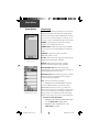
1
eTrex Vista
TM
personal navigator
®
owner’s
manual
and
reference
guide
VistaOMCover.indd 1
9/20/2002, 10:21:29 AM
© Copyright 2001-2002 GARMIN Ltd. or its subsidiaries
All Rights Reserved
GARMIN International, Inc.
1200 E 151st Street, Olathe, Kansas 66062 U.S.A.
Tel. 913/397.8200
Fax. 913/397.8282
GARMIN (Europe) Ltd.
Unit 5, The Quadrangle, Abbey Park Industrial Estate, Romsey, SO51 9AQ U.K.
Tel. 44/1794.519944
Fax.44/1794.519222
GARMIN Corporation
No. 68, Jangshu 2nd Road, Shijr, Taipei County, Taiwan
Tel. 886/2.2642.9199
Fax. 886/2.2642.9099
Except as expressly provided herein, no part of this manual may be reproduced,
copied, transmitted, disseminated, downloaded or stored in any storage medium, for
any purpose without the express prior written consent of GARMIN. GARMIN hereby
grants permission to download a single copy of this manual and of any revision to
this manual onto a hard drive or other electronic storage medium to be viewed and to
print one copy of this manual or of any revision hereto, provided that such electronic
or printed copy of this manual or revision must contain the complete text of this
copyright notice and provided further that any unauthorized commercial distribution
of this manual or any revision hereto is strictly prohibited.
Information in this document is subject to change without notice. GARMIN
reserves the right to change or improve its products and to make changes in the
content without obligation to notify any person or organization of such changes or
improvements.
GARMIN®, AutoLocate®, TracBack®, and Personal Navigator® are registered
trademarks, CLICK STICK™, eTrex Vista™, and MapSource™ are trademarks of
GARMIN Ltd. or its subsidiaries and may not be used without the express permission
of GARMIN.
September 2002
VistaOMCover.indd 2
Part Number 190-00219-00 Rev. C
Printed in Taiwan
9/20/2002, 10:21:57 AM
Introduction
Introduction
About This
Manual
Thank you for choosing the GARMIN eTrex Vista. To
get the most from your new eTrex Vista, take time to read
through this owner’s manual in order to understand all
of the operating features. This manual is organized into
three sections.
The Introduction section provides FCC, safety,
warranty, product registration information and the Table
of Contents.
The Main Pages section (listed in same order as
viewed on screen) provides details about using the features of the eTrex Vista according to topic. The explanations for each feature in this section are divided into:
(1) An overview that discusses the feature and how it
functions and (2) A detailed Step-by-Step instruction for
using the feature.
The Appendices include information on items such
as Specifications, Accessories, Data Field Definitions, MapSource information, a Troubleshooting
Guide and a Wiring Diagram followed by the Index.
i
190-00219-00_0C.indd i
9/20/2002, 9:53:30 AM
Introduction
FCC Compliance
Statement
The eTrex Vista complies with Part 15 of the FCC
interference limits for Class B digital devices FOR HOME
OR OFFICE USE. These limits are designed to provide
reasonable protection against harmful interference in
a residential installation, and are more stringent than
“outdoor” requirements.
Operation of this device is subject to the following
conditions: (1) This device may not cause harmful interference, and (2) this device must accept any interference
received, including interference that may cause undesired
operation.
This equipment generates, uses and can radiate
radio frequency energy and, if not installed and used in
accordance with the instructions, may cause harmful
interference to radio communications. However, there
is no guarantee that interference will not occur in a particular installation. If this equipment does cause harmful
interference to radio or television reception, which can be
determined by turning the equipment off and on, the user
is encouraged to try to correct the interference by one or
more of the following measures:
• Reorient or relocate the receiving antenna.
• Increase the separation between the equipment and
receiver.
• Connect the equipment into an outlet on a circuit
different from that to which the receiver is connected.
• Consult the dealer or an experienced radio/TV technician for help.
ii
190-00219-00_0C.indd ii
The eTrex Vista does not contain any user-serviceable parts. Repairs should only be made by an authorized GARMIN service center. Unauthorized repairs or
modifications could result in permanent damage to the
equipment, and void your warranty and your authority to
operate this device under Part 15 regulations.
9/20/2002, 9:54:07 AM
Introduction
WARNING: For use in vehicles, it is the sole responsibility of the owner/operator of the eTrex Vista to secure
the GPS unit so that it will not interfere with the vehicle’s
operating controls, obstruct the driver’s view of driving
conditions, or cause damage or personal injury in the
event of an accident. Do not mount the eTrex Vista over
air bag panels or in the field of air bag deployment. Air
bags expand with a rapid force that can propel objects in
their path toward the driver or passengers causing possible injury. Refer to air bag safety precautions contained
in the vehicle owner’s manual. Do not mount the eTrex
Vista in a place where the driver or passengers are likely
to impact it in an accident or collision. The mounting
hardware provided by GARMIN is not warranted against
collision damage or the consequences thereof.
Warnings
and
Precautions
Do Not Place Unsecured
on the Vehicle Dash
Do Not Mount Where
Driver’s Field of Vision
is Blocked
Do Not Mount
Over Air Bag Panels
WARNING: When used in vehicles, it is the sole
responsibility of the driver of the vehicle to operate the
vehicle in a safe manner, maintain full surveillance of all
driving conditions at all times, and not become distracted by the eTrex Vista to the exclusion of safe driving
practices. It is unsafe to operate the controls of the eTrex
Vista while you are driving. Failure by the driver of a
vehicle equipped with an eTrex Vista to pay full attention
to operation of the vehicle and road conditions while the
vehicle is in motion could result in an accident or collision with property damage and personal injury.
Do Not Mount in Front of
an Air Bag Field of
Deployment
CAUTION: IT IS THE USER’S RESPONSIBILITY TO
USE THIS PRODUCT PRUDENTLY. THIS PRODUCT IS
INTENDED TO BE USED ONLY AS A TRAVEL AID AND
MUST NOT BE USED FOR ANY PURPOSE REQUIRING
PRECISE MEASUREMENT OF DIRECTION, DISTANCE,
LOCATION, OR TOPOGRAPHY. THIS PRODUCT
SHOULD NOT BE USED AS AN AID TO DETERMINE
GROUND PROXIMITY FOR AIRCRAFT NAVIGATION.
190-00219-00_0C.indd iii
iii
9/20/2002, 9:54:07 AM
Introduction
Warnings
and
Precautions
CAUTION: The Global Positioning System (GPS) is
operated by the government of the United States, which is
solely responsible for its accuracy and maintenance. The
system is subject to changes which could affect the accuracy and performance of all GPS equipment. Although
the eTrex Vista is a precision electronic NAVigation AID
(NAVAID), any NAVAID can be misused or misinterpreted and, therefore, become unsafe.
MAP DATA INFORMATION: One of the goals of
GARMIN is to provide customers with the most complete
and accurate cartography that is available to us at a
reasonable cost. We use a combination of governmental
and private data sources, which we identify as required
in product literature and copyright messages displayed to
the consumer. Virtually all data sources contain inaccurate or incomplete data to some degree. This is particularly true outside the United States, where complete and
accurate digital data is either not available or prohibitively
expensive.
Software License
Agreement
BY USING THE ETREX VISTA, YOU AGREE TO BE
BOUND BY THE TERMS AND CONDITIONS OF THE
FOLLOWING SOFTWARE LICENSE AGREEMENT.
PLEASE READ THIS AGREEMENT CAREFULLY.
GARMIN grants you a limited license to use the software embedded in this device (the “Software”) in binary
executable form in the normal operation of the product.
Title, ownership rights and intellectual property rights in
and to the Software remain in GARMIN.
iv
190-00219-00_0C.indd iv
You acknowledge that the Software is the property
of GARMIN and is protected under the United States of
America copyright laws and international copyright treaties. You further acknowledge that the structure, organization and code of the Software are valuable trade
9/20/2002, 9:54:08 AM
Introduction
secrets of GARMIN and that the Software in source code
form remains a valuable trade secret of GARMIN. You
agree not to decompile, disassemble, modify, reverse
assemble, reverse engineer or reduce to human readable
form the Software or any part thereof or create any derivative works based on the Software. You agree not to export
or re-export the Software to any country in violation of
the export control laws of the United States of America.
Cleaning
Software License
Agreement
Maintenance
The eTrex Vista is constructed of high quality materials and does not require user maintenance other than
cleaning. Clean the unit using a cloth dampened with
a mild deteregent solution and then wipe dry. Avoid
chemical cleaners and solvents that may damage plastic
components.
Storage
Storing alkaline batteries in the unit is not recommended. To reduce the chance for battery leakage, remove
the batteries when storing the unit for more than six
months.
Do not store the eTrex Vista where prolonged exposure to temperature extremes may occur (such as in the
trunk of a car) as permanent damage may result. User
information, such as waypoints, routes, etc., is retained in
the unit’s memory without the need for external power. It
is always a good practice to back up important user data
by recording it manually.
Water Immersion
The eTrex Vista is waterproof to IEC Standard 529
IPX7. It can withstand immersion in 1 meter of water for
30 minutes. Prolonged submersion can cause damage to
the unit. After submersion, be certain to remove the batteries and dry the components before reuse.
190-00219-00_0C.indd v
v
9/20/2002, 9:54:08 AM
Introduction
GARMIN
Limited Warranty
This GARMIN product is warranted to be free from defects in materials or workmanship for one year from the date of purchase. Within this period, GARMIN will at
its sole option, repair or replace any components that fail in normal use. Such repairs
or replacement will be made at no charge to the customer for parts or labor, provided
that the customer shall be responsible for any transportation cost. This warranty does
not cover failures due to abuse, misuse, accident or unauthorized alteration or repairs.
THE WARRANTIES AND REMEDIES CONTAINED HEREIN ARE EXCLUSIVE
AND IN LIEU OF ALL OTHER WARRANTIES EXPRESS OR IMPLIED OR STATUTORY, INCLUDING ANY LIABILITY ARISING UNDER ANY WARRANTY OF
MERCHANTABILITY OR FITNESS FOR A PARTICULAR PURPOSE, STATUTORY OR
OTHERWISE. THIS WARRANTY GIVES YOU SPECIFIC LEGAL RIGHTS, WHICH
MAY VARY FROM STATE TO STATE.
IN NO EVENT SHALL GARMIN BE LIABLE FOR ANY INCIDENTAL, SPECIAL,
INDIRECT OR CONSEQUENTIAL DAMAGES, WHETHER RESULTING FROM THE
USE, MISUSE, OR INABILITY TO USE THIS PRODUCT OR FROM DEFECTS IN THE
PRODUCT. Some states do not allow the exclusion of incidental or consequential damages, so the above limitations may not apply to you.
GARMIN retains the exclusive right to repair or replace the unit or software or
offer a full refund of the purchase price at its sole discretion. SUCH REMEDY SHALL
BE YOUR SOLE AND EXCLUSIVE REMEDY FOR ANY BREACH OF WARRANTY.
To obtain warranty service, contact your local GARMIN authorized dealer. Or call
GARMIN Customer Service at one of the numbers shown below, for shipping instructions and an RMA tracking number. The unit should be securely packed with the
tracking number clearly written on the outside of the package. The unit should then be
sent, freight charges prepaid, to any GARMIN warranty service station. A copy of the
original sales receipt is required as the proof of purchase for warranty repairs.
vi
190-00219-00_0C.indd vi
9/20/2002, 9:54:08 AM
Introduction
GARMIN
Limited Warranty
Products sold through online auctions are not eligible for rebates or other special
offers from GARMIN. Online auction confirmations are not accepted for warranty
verification. To obtain warranty service, an original or copy of the sales receipt fromfrom
the original retailer is required. GARMIN will not replace missing components from any
package purchased through an online auction.
GARMIN International, Inc.
GARMIN (Europe) Ltd.
1200 East 151st Street
Unit 4, The Quadrangle, Abbey Park Industrial Estate
Olathe, Kansas 66062, U.S.A.
Romsey, SO51 9AQ, U.K.
Phone: 913/397.8200
Phone: 44/1794.519944
FAX: 913/397.0836
FAX: 44/1794.519222
Product Registration
Help us to better support you by completing our on-line registration today!
Have the serial number of your eTrex Vista handy and connect to our website
(www.garmin.com). Look for the Product Registration link on the Home Page.
Serial Number
Use this area to record the external serial number (8-digit number located inside
the battery compartment) in case it is lost, stolen, or needs service. Be sure to keep
your original sales receipt in a safe place or attach a photocopy to the inside of the
manual.
Serial Number:
*
*
NOTE: Do not confuse this external serial number with the unit i.d.
number that is displayed in the System Setup Page. The internal serial
number is relevant to the operating software and is required only when
transferring certain types of GARMIN MapSource Data to your unit.
vii
190-00219-00_0C.indd vii
9/20/2002, 9:54:09 AM
Table of Contents
Introduction
Options ......................................................27
About This Manual .......................................i
FCC Compliance Statement .........................ii
Warnings and Precautions .......................ii-iv
Software License Agreement ....................iv-v
Maintenance ................................................v
Warranty ................................................vi-vii
Product Registation ....................................vii
Table of Contents .......................................vii
Main Menu
Getting Started
Setup, and Features .....................................1
Features and Button Function ......................2
Battery Installation .......................................3
Backlighting and Contrast ...........................3
The Main Pages
Main Page Basics ..........................................4
Satellite
The Main Page .............................................5
Options ....................................................6-7
Navigating
Navigating with eTrex Vista .........................8
Map
The Main Page ........................................9-10
Options ................................................11-15
Using the Pan Map Option ...................12
Stop Navigation ....................................13
Hide/Show Navigation Status ................13
Hide/Show Data Fields .........................13
Setup ....................................................14-15
The Measure Distance option ................15
Navigation
The Main Page ...........................................16
Options ................................................17-20
Altimeter
The Main Page ......................................21-22
Plot Over Time/Distance .......................22
Options ................................................23-25
View Pressure Plots/Elevation................23
Zoom Ranges ........................................23
View Points ...........................................24
Reset .....................................................24
Calibrate Altimeter ................................24
Data Fields ............................................25
Trip Computer
The Main Page ...........................................26
The Main Page ...........................................28
Setting the Correct Time Zone ..............28
Using the Main Menu ...........................29
Mark Options .......................................30-32
Projecting a Waypoint ...........................32
Editing Waypoints ................................32
Find Options ........................................33-40
The Find Menu .....................................33
Finding a Waypoint ..............................34
Finding a Favorite ................................35
Finding a City .......................................35
Finding an Exit .....................................36
Finding a Point of Interest .....................37
Finding an Address or Intersection .......38
Using a Goto .........................................40
Routes Options .....................................41-46
Creating and Using A Route ..................41
Editing a Route ................................42-44
Add/Edit from the Route Map Page ..44-45
Navigating a Route ................................45
Data Fields for the Route Page ...............46
Tracks Options .....................................47-48
Setup Options ......................................49-53
Time Page .............................................49
Units Page .............................................50
Display Page .........................................51
Heading Page ........................................51
Interface Page ........................................52
System Page ..........................................53
Accessories ...........................................54-57
Sun and Moon ......................................54
Calendar Page .......................................55
Hunt and Fish Page ...............................56
Area Calculator Page .............................57
Calculator Page .....................................57
Appendices
Appendix A: Specifications .......................58
Appendix B: Accessories ...........................59
Appendix C: Data Field Definitions .....60-61
Appendix D: MapSource Setup .................62
Appendix E: Troubleshooting ...................63
Appendix F: Wiring Diagram ....................64
Index ...................................................65-71
viii
190-00219-00_0C.indd viii
9/20/2002, 9:54:09 AM
Getting Started
Before you begin to explore the eTrex Vista’s operating features, you should be familiar with the information
contained in the Quick Start which includes instructions
for installing batteries, how the buttons function, starting
the eTrex Vista, adjusting the screen contrast, and basic
navigation techniques to help you start enjoying your eTrex
Vista immediately.
Six Main Pages are your primary access to operating
the eTrex Vista. Each page provides either a basic navigation function or access to features which enhance navigation or customize the unit’s operation.
This manual is arranged on the Main Pages structure
with detailed instructions on using the eTrex Vista’s features
and their options.
Features include:
Storage for 500 Waypoints with name and graphic
symbol.
An automatic Track Log with storage capability for
3,000 points, or 10 saved Tracks with 250 points each.
Route building capability, with storage for 20 Routes
with 50 Waypoints each.
A Trip Computer for displaying a variety of navigation
data such as speed, ETA, ETE, heading, odometer, etc.
An Elevation Computer for displaying total ascent/
descent, average ascent/descent, maximum ascent/descent,
12 hour pressure trend, and maximum/minimum elevation.
A Find Feature for locating Waypoints, Cities,
Interstate Exits, Points of Interest, Street Addresses and
Intersections.*
24 MB of detailed map data storage, allowing transfer
from GARMIN MapSource CD-ROM’s.
Wide Area Augmentation System (WAAS) capability.**
Setup
and
Features
* Points of Interest, Address,
and Intersection data must be
transferred to the unit using a
GARMIN MapSource CD-ROM.
See page 62 for more information.
** About WAAS
Because the Wide Area
Augmentation System (WAAS)
is currently under development
and is not fully supported by
geo-stationary satellites, effective
use of the WAAS feature may be
limited by your geographic location in relation to those satellites
now in service.
There are two WAAS satellites
in service in geo-stationary orbit
above the Equator, one over the
Atlantic Ocean and one over the
Pacific Ocean.
Currently, WAAS satellite signal
reception requires an absolute
clear view of the sky and works
best when there are no nearby
obstructions such as buildings,
mountains, etc. In fact, you may
not be able to receive or easily
maintain a WAAS satellite signal
until full satellite support for this
program is complete.
Not enabling WAAS when you
cannot receive a signal speeds
unit map drawing and conserves
battery power.
See pages 5 and 53 for enabling
WAAS and satellite reception
techniques.
1
190-00219-00_0C.indd 1
9/20/2002, 9:54:10 AM
Getting Started
The CLICK STICKTM (Five Position Switch)
Features and
Button
Function
• Press to enter highlighted options and to
confirm messages
Internal Antenna
• Move Up/Down or Right/Left to move
through lists, highlight fields, on-screen
buttons, icons, enter data or move the map
panning arrow
• Press and hold for two seconds to mark
your current location as a waypoint
The PAGE button:
• Press to cycle through main pages.
• Press and hold to turn the electronic compass On/Off.
The POWER button:
• Press and hold to turn the unit On/Off.
• Press to toggle display backlighting On/Off.
Compass Sighting
Marks
LCD
Display
External Power and Data Connector
with Alignment Bar
Pressure
Power/Data
Sensor
Connector Cover
Vent
The ZOOM IN/OUT buttons:
•When on the Map Page, press to
Zoom in and out.
• When on the Satellite Page, press
to adjust the screen contrast
The FIND button:
• Press to access the Find Menu
Carry
Lanyard
Slot
Battery
Compartment
Cover
Installing the lanyard
NOTE: The eTrex Vista is designed to be held
and operated in the left hand, but it can be
held and operated using the right hand as
well to suit your preference.
2
190-00219-00_0C.indd 2
9/20/2002, 9:54:10 AM
Getting Started
Installing the Batteries
The eTrex Vista operates on two “AA” batteries (not
included), which are located in the back of the unit.
Rechargeable Alkaline, NiMH, NiCad or Lithium batteries
may also be used.
Stored data is not lost when
the batteries are removed.
To install batteries:
1. Remove the battery cover on
the back of the unit. Turn the
D-ring 1/4 turn counter-clockwise & pull away clockwise.
2. Insert batteries
observing the
polarity.
3. Reinstall the
battery cover
by turning the
D-ring 1/4
turn.
Battery
Installation and
Backlight/Contrast
Important Note:
When replacing batteries, use
only new or fully recharged
batteries and do not mix
Alkaline, NiMH, NiCad or
Lithium batteries.
Rechargeable batteries may
typically display less capacity
than Alkaline batteries.
Remove the batteries from the
unit if you don’t plan to use it
for several months.
Follow the battery manufacturer’s instructions for proper care
and disposal of used batteries.
Battery Compartment
D-ring
Battery Cover
When using ‘Battery Saver’ or
‘Use With GPS Off’ mode when
not navigating, Alkaline batteries can last up to 12 hours.
Display Backlighting and Contrast Set Up
If lighting conditions make it hard for you to see the
display screen, you can adjust the contrast or turn on the
backlight.
To turn on the backlighting:
1. Press the POWER button to turn on the backlight
from any page on the unit. The backlight remains
on until the set timeout period is completed or the
POWER button is pressed again.
Press & Release POWER
Button to turn Backlighting
On/Off
The unit is factory set to timeout 15 seconds after
the last button press. (To reset the backlight timeout, refer to page 51.)
To adjust the screen contrast:
1. When on the Satelllie Page, use the ZOOM IN or
OUT buttons to adjust the contrast.
190-00219-00_0C.indd 3
Use ZOOM IN & OUT
Buttons to Adjust Contrast
3
9/20/2002, 9:54:13 AM
Getting Started
Main Page Basics
Satellite Page
Map Page Navigation Page Altimeter Page Trip Computer
Main Menu
All of the information you need to operate the eTrex Vista can be found on six main
pages (or display screens). You can press and release the PAGE button to cycle through
the Satellite Page, Map Page, Navigation Page, Altimeter Page, Trip Computer, and Main
Menu Page.
While these six pages provide you with different types of navigation information,
they all share common features like Option Menus and a Main Page Menu, both of
which are accessed by on-screen buttons. To display these menus, highlight the onscreen button and press in on the CLICK STICK.
Option Menu Button
Option Menu
These menus provide additional features or customize
the unit to your preferences.
To exit these and other
pop-up type menus, move the
CLICK STICK to the left
or right.
Main Page Menu Button
Main Page Menu
Use to go directly to a Main
Page and as an alternate to
cycling through the Main
Pages.
Double click the on-screen
button to toggle between
two pages.
4
190-00219-00_0C.indd 4
9/20/2002, 9:54:16 AM
Satellite
The Main Page
On-Screen
Page and Option
Menu Buttons
Status Window
Outer Ring
(Satellites on the
horizon)
Inner Ring (Satellites within 45°
angle from vertical)
Center (Satellite
overhead)
Signal Strength bars
Satellite Page
with 9 Satellites Being
Tracked and WAAS Enabled.
WAAS Satellite is No. 35
and ‘D’ in Signal Bars for
GPS Satellites
Your location
coordinates
The Satellite Page provides a picture of satellite signal tracking, tells you when the
unit is ready for navigation, and shows your location coordinates.
The Skyview graphic represents a view looking up at the sky from your current
location showing satellites and their assigned numbers. The outer ring represents the
horizon around you, the inner ring represents a view above you at a 45° angle from vertical, and the center represents directly overhead. Signal Strength Bars for each satellite
are shown just below the Skyview. Satellites and their signals appear as hollow shapes
until a signal is received and then they appear darkened in. The stronger the signal, the
taller the signal bar.
The Wide Area Augmentation System (WAAS) capability produces a more accurate
position fix. When enabled (the GPS mode set to ‘Normal’ and the interface set to other
than RTCM mode), this feature searches for a WAAS satellite near your location and
then receives data for correcting differentials in the GPS satellite signals and the WAAS
satellite numbers (beginning at No. 33 or above) display on the Satellite Page. When
differential correction data has been received for GPS satellites (numbers 32 or below), a
‘D’ displays in the signal bar beneath the skyview. It is helpful to orient the unit antenna
toward the WAAS satellite shown in the skyview. To learn more about the WAAS
5
System, access the Federal Aviation Administration web site (http.//gps.faa.gov/).
190-00219-00_0C.indd 5
9/20/2002, 9:54:17 AM
Satellite
Options
There are four options for
the “Poor Satellite Reception”
message.
Because the eTrex Vista relies on satellite signals to
provide you with navigational guidance, the unit’s view
of the sky determines how fast you achieve navigational
status. GPS signals do not travel through rocks, buildings,
people, metal, or heavy tree cover so for best results, keep
the unit in clear view of the sky.
At least three satellite signals are needed to determine
your location, otherwise the unit displays a “Poor Satellite
Reception” message with four options and a brief explanation to guide your decision:
Use with GPS Off - Select this option if you want
GPS off (for faster map drawing).
New Location - Select this option if you have moved
hundreds of miles (from where you last used the
unit).
Restart Search - Select this option if today is not
(date provided).
Continue Acquiring - Select this option if no other
option applies. (The unit will attempt to gather GPS
signals.)
The Satellite Page options include:
Satellite Page Options Menu
Highlight the on-screen button
at the top of the page & press
in on the CLICK STICK.
Use With GPS Off - Use this option when you are
indoors, a clear view of the sky is obstructed, or you
want to save battery power. You can enter data, create
routes, etc., but cannot navigate in this mode.
Track Up/North Up - You can orient the satellite
skyview by selecting ‘Track Up’ (your direction of
travel) or ‘North Up’ (the satellite skyview oriented to
the north).
New Location - If you are more than 600 miles from
where you last used the unit, select the ‘New Location’ and then the ‘Use Map’ options to approximate
your location. This gives the unit reference information and speeds satellite acquisition.
6
190-00219-00_0C.indd 6
Show GPS Elevation - The elevation as determined
by the GPS information received.
9/20/2002, 9:54:18 AM
Satellite
To select the ‘Use With GPS Off’ option:
Options
1. Use the CLICK STICK to highlight the Option Menu
button at the top of the page and then press it in to
display the Options Menu.
2. Use the CLICK STICK to highlight the ‘Use With
GPS Off’ option and then press it in to activate.
The eTrex Vista stops tracking satellites and should
not be used for navigation. However, the next time
you turn the unit on, it returns to Normal GPS
operation.
The Satellite Page
Options Menu
To select ‘Track Up’ or ‘North Up’:
1. Use the CLICK STICK to highlight the Option Menu
button at the top of the page and then press it in to
display the Options Menu.
“GPS Off”
Message
2. Highlight either the ‘Track Up’ or ‘North Up’ option
(depending on which is currently in use), and press
in on the CLICK STICK to activate.
To enter a new location:
1. Use the CLICK STICK to highlight the Option Menu
button at the top of the page and then press it in to
display the Options Menu.
2. Highlight ‘New Location’ and press in on the
CLICK STICK to display choices of ‘Auto’ or ‘Use
Map’.
‘North Up’ Skyview Orientation
‘Use Map’ option helps to speed
acquisition.
If you choose ‘Auto’ the eTrex Vista determines your
new location automatically.
If you choose ‘Use Map’ a map page displays with
instructions stating, “Point to your approximate
location and press ENTER”. Use the CLICK STICK
to move the map pointer to your location on the
map and press it in.
To select ‘Show GPS Elevation’:
1. Use the CLICK STICK to highlight the Option Menu
button at the top of the page and then press it in to
display the Options Menu.
2. Use the CLICK STICK to highlight the ‘Show GPS
Elevation’ option, and press in to view the elevation
based on GPS information.
7
190-00219-00_0C.indd 7
9/20/2002, 9:54:18 AM
Navigating
Navigating with
eTrex Vista
Active Navigation is supported by three of the six
Main Pages: the Map Page, Navigation Page and Trip
Computer Page.
The Map Page graphically shows you map details,
your current location, marks your route to a destination
with a route line, and leaves a trail (track log) of where
you’ve been.
A Goto
The Navigation Page tells you what direction to go
and the direction you are traveling.
The Trip Computer Page records and displays travel
data, such as the distance you have traveled, your speed,
the time spent moving or stopped, and other options can
be chosen to display the elevation, the time of day or the
time remaining before reaching a destination.
A Track
There are four methods of navigating when using the
eTrex Vista and each is graphically displayed on the Map
Page.
Goto - A direct path to a selected destination
(waypoint, city, address, etc.).
A Route
Track - A previous path of travel that has been stored
(logged) in the eTrex Vista. A Track allows you to
repeat a path or to return to your starting point on
the same path using the GARMIN TracBack feature.
Route - A path to a destination consisting of intermediate stops along the way (waypoints, cities, highway
exits, points of interest, intersections, etc.).
Travel when not on a Goto,
Track, or Route as indicated
by the ‘Pointer Icon’ and a
dotted line indicating your
path of travel.
Travel when not on a Goto, Track or Route This is best described as travel without entering a
destination in the eTrex Vista. The Map Page displays
your real-time movement as you travel with the unit
turned on and receiving satellites.
8
190-00219-00_0C.indd 8
9/20/2002, 9:54:18 AM
Map
The Main Page
On-Screen
Page and Option
Menu Buttons
Status Window
Position Icon
Map Scale
Map Features
The Map Page displays your present position and direction of movement using a
triangular ‘Position Icon’ that is centered on the map. As you travel the map display
leaves a “trail” (track log) of your movements.
The map also displays geographic details such as rivers, lakes, highways, and towns.
The map shown above displays a higher level of detail than the basemap provided with
the unit (i.e. residential streets, parks, etc.), because GARMIN MapSource data has been
downloaded to the unit using a CD-ROM mapping program.
To allow you to view the map from different perspectives, the scale can be changed
from 120 feet to 500 miles. The ZOOM IN and OUT buttons on the side of the unit
allow you to zoom In or Out on the map. Pressing and holding these buttons causes the
scale to change rapidly instead of changing in increments. The IN button displays less
area but more map detail, while the OUT button shows you a larger area with less map
detail.
A Status Window at the top of the page provides you with current satellite tracking
and position accuracy information.
9
190-00219-00_0C.indd 9
9/20/2002, 9:54:19 AM
Map
The Main Page
The Map Page
The Map Page shows your present position and direction of movement as a triangular ‘Position Icon’, in the
center of the map. As you travel, the map display leaves a
“trail” (track log) of where you’ve been. The map display
also shows the map scale and geographic details such as
lakes, rivers, highways, and towns.
Zoom In
Zoom Out
Map Features
Map Scales
Use the ZOOM IN and OUT buttons to change
the map scale in order to show more map area with less
detail or less map area with more detail. Press and hold
to ZOOM the map scale rapidly. The map scale in the
lower left hand side of the display is shown in units of
measurement selected in the ‘Units’ field of the Unit Setup
Page (not to be confused with the Map Setup Page). If
you zoom in so far that the resolution of the map data
is exceeded and the appearance of the map is no longer
accurate, the word, “overzoom” displays just below the
map scale.
In many instances the map displays an ‘Accuracy
Circle’ surrounding the ‘Position Icon’. The eTrex Vista
uses both map resolution and GPS accuracy in defining
your location to a point within the circle. The smaller the
circle, the more accurate your location.
When using the ‘Pan Map’ feature, a small outline
arrow (Map Pointer) can be moved about the page to
highlight and identify map items or to scroll the map to
view areas not shown on the display screen.
A Status Field at the top of the page provides satellite
tracking and location accuracy information.
Accuracy Circle
Panning Arrow
(Map Pointer)
10
190-00219-00_0C.indd 10
Two optional Data fields at the bottom of the page
can be programmed to provide a variety of travel and
navigation information.
More detailed map features as well as information
about those features can be downloaded to the unit from
a GARMIN MapSource CD-ROM. When using MapSource
data, the word ‘mapsource’ displays below the map scale
whenever you zoom in to view map details.
9/20/2002, 9:54:19 AM
Map
Map Page options allow a variety of operating and
custom features for your eTrex Vista.
Not all of the Map Page options are available at the
same time. Many are replaced by an opposite option
when they are selected, such as Hide Data Fields/Show
Data Fields. The Map Page options are:
Options
On-screen Map Page
Options Menu button
Pan Map - Allows you to move the Panning Arrow
(Map Pointer) about on the map.
Stop Navigation - Stops navigating to a destination.
Hide Nav Status/Show Nav Status - Removes the
navigation status window to expand the map area or
inserts the navigation status window.
Hide Data Fields/Show Data Fields - Removes or
inserts two programmable data fields at the bottom of
the page and expands or reduces the map area.
Setup Map - Displays the Setup Map Pages, which
allows you to tailor the map to your requirements
such as changing text size, map orientation, and map
detail.
Measure Distance - Displays the distance from one
point on the map to another.
Restore Defaults - Returns the Map Page to the
original factory settings (defaults).
Map Page Options Menu with
‘Pan Map’ selected.
When no active navigation is
being used ‘Stop Navigation’
displays.
If ‘Show Data Fields’ is selected,
it is replaced by the ‘Hide Data
Fields’ option.
The ‘Setup Map’ option consists
of five sub-pages.
To select a map page option:
1. Highlight the Option Menu on-screen button at the
top of the display screen and then press in on the
CLICK STICK to open the menu.
2. Highlight the desired option on the menu and then
press in on the CLICK STICK to activate the option.
3. To close without making a selection, move the
CLICK STICK to the left or right.
11
190-00219-00_0C.indd 11
9/20/2002, 9:54:20 AM
Map
Options
Using the Pan Map option
The Map Page pan function allows you to display
an arrow used to point at and identify items on the map,
and to move the map in order to view areas beyond the
current viewing area on the display.
The map panning function is activated from the
Options Menu on the Map Page. The CLICK STICK
moves the panning arrow (also referred to as the map
pointer) in the desired direction on the map page. If the
arrow moves to the edge of the map display, the map also
moves to reveal more area but redraws the map slowly.
Map Page with
Panning Arrow
Whenever the panning arrow is placed on a map
item, the name of that item is highlighted. This features
applies to waypoints, roads, lakes, rivers...nearly everything that is displayed.
Pressing the CLICK STICK marks the arrow location
or displays the map item information page. An Options
Menu allows you to: add it to the Favorites list, add it to a
route, project a waypoint from it, save it as a waypoint, or
view the sun and moon phase from it. On-screen buttons
at the bottom of the page allow you to Goto the map
item, display it on the map or to select ‘OK’ and return to
the Map Page.
Highlighted Map Item
When using the panning arrow, pressing the FIND
button displays items with the panning arrow (map
pointer) location used as a reference point for nearest
items instead of your current location. Press the PAGE
button to return to the Main Map Page.
To find details about or Goto a map item:
1. Use the CLICK STICK to move the panning arrow
to the map item that you want to learn more about.
2. When the item’s name is highlighted, press in the
CLICK STICK to display the Information Page.
3. Use the CLICK STICK to highlight and press the
‘Goto’ button on the page to navigate to the item.
Map Item Information
12
190-00219-00_0C.indd 12
9/20/2002, 9:54:20 AM
Map
Stop Navigation
Options
The ‘Stop Navigation’ option allows you to quit navigating on a Goto, Route or Track in progress.
To stop navigation:
1. Select ‘Stop Navigation’ and then press in on the
CLICK STICK.
When there is no active navigation, the ‘Stop Navigation’ option is “grayed out” and is non-functional.
Hide/Show Navigation Status
The ‘Hide Nav Status/Show Nav Status’ option allows
you to view GPS navigation data in a window at the top
of the page that lists the status of satellite tracking and
accuracy of GPS positioning. When hidden, more map
area is displayed.
‘Stop Navigation’ Option
To hide or show Nav Status:
1. Select ‘Hide’ or ‘Show’ from the option list and then
press in on the CLICK STICK.
Hide Data Fields/Show Data Fields
The ‘Hide Data Fields/Show Data Fields’ option allows
you to view two programmable data fields. When hidden,
more map area is displayed.
To hide or show Data Fields:
1. Select ‘Hide’ or ‘Show’ from the option list and then
press in on the CLICK STICK.
Map Page with Nav Status and
Data Fields Hidden
To program a data field:
1. Use the CLICK STICK to highlight the data field and
then press it in to display the Options Menu.
2. Highlight the desired option and then press in on
the CLICK STICK to place it in the data field.
Map Data Fields
with Options Menu
13
190-00219-00_0C.indd 13
9/20/2002, 9:54:21 AM
Map
Setup Options
Page Setup
The ‘Setup Map’ option displays the five Map Setup
Pages, each accessed by an on-screen button. A list of
options displays for the features listed. Scale options
indicate the point at which Tracks, Tracks Logs, Map
Features, or Text Boxes display, allowing you to remove
map clutter and define map features.
Page - Orientation: ‘Track Up’ or ‘North Up’; fixes the
top of the map display to the current track heading
or to a north heading.
Auto Zoom: On or Off; automatically scales the map
to display both your current location and the next
point to which you are navigating.
Tracks Setup
Detail: Most, More, Normal, Less, or Least; controls
how much map detail you see. This setting only
applies to a map feature set to ‘Auto’. Those
features which have a specified scale or are turned
‘Off’ are unaffected by this setting.
Lock on Road: On or Off; available only if
MapSource Data is loaded; when ‘On’ the triangle
icon locks to the road that you are traveling.
Display Mode: Land or Water; choice displays in
light color while the other displays in a dark color.
Map Features Setup
Tracks - Saved Tracks and Track Log: Scale options;
‘Off’, ‘Auto’, or 20 ft.-500 miles, sets the maximum
scale at which the feature should appear on the
screen. Some types of data will display only to
certain zoom scales.
Goto Line: Bearing or Course; determines which
pointer displays.
Text Setup
Map Features - Points of Interest, Waypoints, Street
Label, and Land Cover, Scale options; ‘Off’, ‘Auto’,
or 20 ft.-500 miles, sets the maximum scale at
which the feature should appear on the screen.
Some types of data will display only to certain zoom
scales.
Text - Points of Interest, Waypoints, Street Label, and
Land Cover, Text sizes; ‘None’, ‘Small’, ‘Medium’, or
‘Large’control the screen size of the name.
Map Data
14
190-00219-00_0C.indd 14
MapSource Info - Show, Check box; check mark
determines if map data is used or not.
9/20/2002, 9:54:21 AM
Map
To use Setup Map options:
Setup Options
1. Select ‘Setup Map’ from the Options Menu and then
press in on the CLICK STICK to display the Map
Setup Page.
2. Highlight the desired sub-page button to display the
features list for that sub-page.
3. Highlight a feature on the list and press in on the
CLICK STICK to display the options list for that
feature.
4. Use the CLICK STICK to highlight the desired
option and then press it in to activate.
5. Press the PAGE button or the on-screen ‘X’ button
to return to the Map Page.
Map Page Setup
Feature Options
The Measure Distance option
To use the Measure Distance option:
1. Select ‘Measure Distance’ from the Options Menu
and then press in on the CLICK STICK to display
the Panning Arrow.
2. Use the CLICK STICK to move about on the Map
Page until you reach the point to which you want to
measure. A new ‘Map Pointer’ field displays showing the location of the pointer and the direction and
distance from where you began measuring.
15
190-00219-00_0C.indd 15
9/20/2002, 9:54:22 AM
Navigation
The Main Page
Destination (Waypoint) Name
Straight Line Distance
to the Destination
Time to Destination
Bearing Pointer
Selectable Data Fields
Compass Ring
The Navigation Page provides active guidance with a rotating compass ring that
shows your course over ground (track) while you’re moving and a bearing pointer to
indicate the current direction to your destination (bearing) relative to the course over
ground.
The Compass Ring works as an Electronic Compass (which can be turned On or
Off) functions as a magnetic compass when you are stationary. Or, when the Compass is
in the On mode and you are moving, the heading is controlled by the GPS receiver. The
Compass switches to the GPS receiver when your rate of travel reaches a pre-set speed,
and comes back on when you have stopped moving after a pre-set period of time. Use
the Heading Setup Page to change the pre-set time.
The Status Window at the top of the page shows you the name of your destination,
the distance, and the time to go. Two Data Fields are provided, and can be programmed
to display a variety of navigation data.
The Bent (Bearing) Pointer arrow alerts you to the upcoming turn while you are
navigating a route. When you get within 15 seconds ETA of the current point, the
pointer “bends” to indicate the direction of the turn to the next point while still showing
the direction to the current point.
When you are not on an active Goto, Track or Route (in other words: not traveling
to a recorded destination), the window at the top of the page displays the status of the
GPS Receiver and the approximate accuracy of your current position. The Compass Ring
displays your heading while you are moving, but the data fields at the bottom of the
page will not display any destination related data, such as Estimated Time of Arrival.
16
190-00219-00_0C.indd 16
9/20/2002, 9:54:22 AM
Navigation
Navigation Page
Options
The options include:
Sight ‘N Go - Use the Sight ‘N Go feature to locate a
landmark visually and then lock in a magnetic heading to it.
Stop Navigation - “Grayed out” unless you are
navigating on a Goto, Track, or Route.
Bearing Pointer/Course Pointer - Toggles between
Bearing (always directed at destination) and Course
(distinctive with dots across center of compass, shows
amount of correction needed to be back on course.)
Big Numbers/Big Compass - toggles to display data
fields in large text format while removing the Status
Window and reducing the size of the compass ring.
Calibrate Compass - The Electronic Compass must
be calibrated every time after adding batteries. (See
page 19.)
Navigation Page
Options Menu
Restore Defaults - Returns options and data field
choices to factory designations.
At the bottom of the page are two data fields that
are user programmable with a choice of different data
options:
The Bearing Pointer and Compass Ring work independently of the direction of your movement and the
direction to your destination. The Bearing Pointer always
points directly to the destination, no matter what your
current location might be.
For example: if the arrow is pointing straight up,
you are going directly to your destination. If it points
any direction other than up, turn toward the arrow until
it points up and then continue in that direction. If you
are using the ‘Course Pointer’ option instead and you
drift away from the line of travel to your destination,
the Course Deviation Indicator (CDI) provides graphic
indication of drift (right or left) and displays the distance
off course.
Navigation Page with
Course Pointer and
Course Deviation Indicator
(CDI) Scale active.
Use the ZOOM buttons to
adjust the CDI scale setting.
17
190-00219-00_0C.indd 17
9/20/2002, 9:54:23 AM
Navigation
Options
To Setup the Navigation Page:
1. With the Navigation Page displayed, use the
CLICK STICK to highlight the Options Menu button
at the top of the page. Then press it in to display the
menu.
2. Use the CLICK STICK to highlight your selection
and then press in to select it.
To use Sight ‘N Go to navigate:
1. Use the PAGE button to access the Navigation
Page and then use the CLICK STICK to access the
Options Menu.
2. Use the CLICK STICK to highlight the Sight ‘N Go
option and press it in to activate the Sight ‘N Go
feature. Note that the compass ring with pointer is
in-line with the two sighting marks on the case.
3. Hold the eTrex Vista at eye level and line up the two
sighting marks on the case with the distant object.
Press the CLICK STICK to ‘Lock Direction’.
4. Select ‘Set Course’ and press the CLICK STICK.
Electronic Compass with
Sight ‘N Go active
5. Begin traveling to your destination using the pointer
as a guide.
To stop navigation:
1. Highlight the on-screen Options Menu button at the
top of the Navigation or Map Page and press the
CLICK STICK.
2. Select ‘Stop Navigation’, then press the
CLICK STICK.
Turning the Electronic Compass On and Off:
1. Press and hold the PAGE button to turn the Electronic Compass On or Off.
A Compass Icon displays at the top of the Navigation and Map Pages when the Compass is On. Turn
the Electronic Compass off to conserve batteries.
Bent pointer shows current
direction, the approaching turn,
and points towards the next
waypoint.
2. Hold the eTrex Vista level to get an accurate Electronic Compass reading.
A ‘Hold level’ reminder displays if you are not holding the Compass correctly, or if it is not calibrated.
18
190-00219-00_0C.indd 18
9/20/2002, 9:54:23 AM
Navigation
When you manually turn the Compass Off, it stays
off until you manually turn it On again. Sometimes,
however, when you turn the Compass On, the eTrex
Vista overrides the Compass and uses the GPS receiver
to track your heading. The criteria for switching between
the Compass and the GPS is customized on the ‘Heading’
Setup Page. (See page 51.)
Options
To Calibrate the Electronic Compass:
1. Use the PAGE button to access the Navigation
Page.
2. Use the CLICK STICK to highlight the Options
Menu on-screen button and then press it in.
3. Highlight the ‘Calibrate Compass’ option and press
the CLICK STICK to display the Calibration Page.
4. Press the CLICK STICK to activate the ‘Start’
button and then follow on-screen directions for
holding and turning the unit.
The unit displays a “Just Right”, “Too Fast” or “Too
Slow” message for you to adjust your turning speed
as needed.
A Compass Icon is displayed
on this page and the Map Page
to indicate that the Compass
is On.
The “Calibration Successful” message displays when
finished. If a “Calibration Failed” message displays,
repeat the process.
The Electronic Compass must be calibrated outdoors
when you first use the eTrex Vista and after new batteries have been installed. The accuracy of the Electronic
Compass is adversely affected if the unit is not held level
or by nearby items that generate magnetic fields, such as
cars and buildings, etc.
Electronic Compass On/Off
Message.
Message turns off after 3
seconds.
19
190-00219-00_0C.indd 19
9/20/2002, 9:54:24 AM
Navigation
Options
To change data fields:
1. Use the CLICK STICK to highlight the desired data
field and then press it in to display the list of data
options.
2. Select the desired option from the list and press in
on the CLICK STICK.
Navigation Page Data Fields
Options Menu
(The slider at the side of the
menu indicates a multi-page list
of options.)
Bearing
Course
Current Destination
Current Distance
Current ETA
Current ETE
Elevation
Final Destination
Final Distance
Final ETA
Final ETE
Glide Ratio
Glide Ratio Dest
Heading
Maximum Speed
Moving Avg. Speed
Odometer
Off Course
Overall Avg. Speed
Pointer
Speed
Sunrise
Sunset
Time of Day
To Course
Trip Odometer
Trip Time - Moving
Trip Time - Stopped
Trip Time - Total
Turn
Velocity Made Good
Vertical Speed
Vertical Speed Dest
(For definitions, see Appendix C, pages 60-61.)
20
190-00219-00_0C.indd 20
9/20/2002, 9:54:25 AM
Altimeter
The Main Page
Elevation Status Window
Elevation Profile
Zoom Ranges allow
the user to select the
range of measurement over time
or distance.
Selectable Data Fields
The Altimeter Page provides the user with the current elevation, rate of ascent/
descent, a profile of elevation changes over distance or time, or a profile of pressure
changes over time. The Altimeter Page’s Options Menu allows you to select from a variety of display options such as plotting over time, plotting over distance, displaying the
zoom ranges of measurement, viewing elevation or pressure points, and resetting data
displays. Two user selectable data fields allow you to display a variety of current and
recorded pressure and elevation related data.
NOTE: The Altimeter should be calibrated for the greatest accuracy. Refer
to page 24 for information on calibrating the Altimeter.
21
190-00219-00_0C.indd 21
9/20/2002, 9:54:26 AM
Altimeter
The Main Page
The Altimeter Page provides you with a variety of
elevation information: A Status Window that displays current elevation and current rate of ascent/descent, a profile
of elevation changes over distance or time, a profile of
pressure changes over time, and two user selectable data
fields.
The Status Window is located at the top of the page
and displays the current elevation and your current rate
of ascent or descent when moving. It can also display the
ambient pressure.
The Profile Field is located in the center of the page
and can be configured to display either elevation or ambient pressure plots as selected from the Altimeter Page
Options Menu.
Altimeter Page
with Elevation Plot
Displayed
Data Fields at the bottom of the page are user selectable and display a variety of recorded or current data.
The Page Options Menu allows you to select the
type of information and how it is to be displayed. Page
Options include: ‘Plot Over Time’, ‘Plot Over Distance’,
‘View Elevation Plot’, ‘View Pressure Plot’, ‘Zoom Ranges’,
‘View Points’, ‘Reset’, ‘Calibrate Altimeter’, and ‘Restore
Defaults’.
You can customize the ‘View’ option displays using
the ‘Zoom Ranges’ option to determine time, distance,
pressure, and elevation parameters. If you know the
correct elevation for your location, you can increase the
accuracy of the altimeter using the ‘Calibrate Altimeter’
option. Use the ‘Reset’ option to clear recorded data from
the page and to begin recording new data.
Plot Over Time/Distance
Altimeter Page
Options Menu
These two measurement options (changes over a set
period of time or changes over a set distance) apply only
to the ‘View Elevation Plot’ option, while the ‘View Pressure Plot’ option is measured by time and pressure only.
When one option is active, the other is displayed on the
Page Options Menu.
22
190-00219-00_0C.indd 22
9/20/2002, 9:54:26 AM
Altimeter
View Pressure Plots/Elevation
Options
When selecting the ‘View Elevation Plot’ option you
can plot a profile of elevation changes that occur as you
navigate over a set distance or period of time. When
you select ‘View Pressure Plot’ you can view a record of
changes in barometric pressure for a set period of time.
When one option is active the other displays on the Page
Options Menu.
To view Elevation or Pressure plots:
1. Use the CLICK STICK to highlight the desired
option from the Options Menu and then press in to
display the plot.
Elevation Plot
2. Adjust time and distance measurement as desired
using the Elevation Plot Zoom Ranges feature
explained below.
3. To clear the plot and start a new one, you must
clear the ‘Track Log”.
Zoom Ranges
You can set the Zoom Ranges for elevation, distance,
or time when you display the ‘View Elevation Plot’.
Ranges for vertical distance are: 200, 400, 600, 800,
1,000, 2,500 and 5,000 feet. ranges for distance are: 0.2,
0.5, 1, 5, 10, 15, and 25 miles. Ranges for time are: 2, 5,
10, 20 and 30 minutes, 1 and 2 hours. Ranges for ‘View
Pressure Plot’ are fixed at 6.8 millibars and 12 hours.
Pressure Plot
To adjust zoom ranges:
1. Select the type of plot you want to display and use
the CLICK STICK to highlight ‘Zoom Ranges’ from
the Options Menu.
2. Press in on the CLICK STICK to display the Zoom
Ranges Page. Move the CLICK STICK Up or Down
to adjust the vertical distance and Left or Right to
adjust either the time or distance. Press in to return
to the Plot Page.
Altimeter Page
‘Zoom Ranges’
Option
23
190-00219-00_0C.indd 23
9/20/2002, 9:54:27 AM
Altimeter
Options
View Points
The ‘View Points’ option allows you to scroll through
the stored elevation profile and to view a single point
along the profile. When the pointer is stopped at a location along the profile, the display shows the elevation,
time of day and date the point was created.
To use the ‘View Points’ option:
1. Use the CLICK STICK to access the Options Menu.
2. Highlight the ‘View Points’ option and press in on
the CLICK STICK to display the View Points Page.
3. Move the CLICK STICK Right or Left to scroll the
profile past the pointer in the center of the page.
As the profile moves past the pointer, the status
window at the top of page changes to display the
date, time, and altitude for the point beneath the
pointer.
Altimeter Page
‘View Points’ Option
Reset
You can reset the elevation data and the maximum
elevation data by selecting the ‘Reset’ option from the
Altimeter Page Options Menu.
To reset the elevation data and max elevation
fields:
1. Use the CLICK STICK to highlight the ‘Reset’
option from the page Options Menu and press in on
the CLICK STICK to display the ‘Reset’ page.
Reset Options Menu
Useful for clearing old data.
IMPORTANT!
Use care when selecting
DELETE options as this
removes all saved Tracks,
Waypoints, and Routes from the
unit memory.
2. Use the CLICK STICK to highlight the reset options
on the page and then press in on the CLICK STICK
to place a check mark in the box next to a selected
item.
3. Move to the ‘Apply’ button and press in on the
CLICK STICK to reset the data fields.
Calibrate Altimeter
Because the eTrex Vista relies on the Barometric pressure to determine the elevation and the pressure at any
given elevation can fluctuate, you can calibrate the altimeter to increase its accuracy. You must know the elevation
24
190-00219-00_0C.indd 24
9/20/2002, 9:54:27 AM
Altimeter
at your current location, information you can obtain from
a map or other reliable source.
Options
To manually calibrate the altimeter:
1. Use the CLICK STICK to access the Options Menu.
2. Highlight the ‘Calibrate Altimeter’ option and press
the CLICK STICK to display the Calibration Page.
3. At the message stating “Do You Know The Correct
Elevation?” highlight the on-screen ‘Yes” button
and press in on the CLICK STICK.
4. On the number keyboard, use the CLICK STICK to
enter the new elevation, then highlight ‘OK’ and
press it in to return to the Altimeter Page.
Data Fields
The two user-selectable data fields support this page
and can be programmed to display the following data
options:
Ambient Pressure
Average Ascent
Average Descent
Barometer Pressure
Elevation
Glide Ratio
Glide Ratio Dest
Maximum Ascent
Maximum Descent
Maximum Elevation
Maximum Elevation
Total Ascent
Total Descent
Vertical Speed
Vertical Speed Dest
Calibration Page with ‘Number’
keyboard displayed.
Enter known altitude, highlight
‘OK’ and press in on the
CLICK STICK to calibrate the
altimeter.
(For definitions, see Appendix C, pages 61 and 62.)
To program a data field:
1. Use the CLICK STICK to highlight the desired data
field and then press it in to open the data field
Options Menu.
2. Use the CLICK STICK to move Up or Down the
menu to highlight a desired data option and then
press in to place it in the data field.
Navigation Page
Data Fields Options
25
190-00219-00_0C.indd 25
9/20/2002, 9:54:28 AM
Trip Computer
The Main Page
Selectable Data Fields
The Trip Computer Page displays up to eight different types of navigation data and
are user programmable. Each data field is selectable and can contain one of many data
information options. The default settings for these fields are shown in the illustration.
By selecting the information options that you prefer and arranging them in a desired
order on the page, you can customize the Trip Computer Page to meet your navigation
needs.
The Options Menu allows you to reset the Trip Computer data when you are ready
to start a new trip.
26
190-00219-00_0C.indd 26
9/20/2002, 9:54:29 AM
Trip Computer
Trip Computer Page
Options
The Trip Computer provides a variety of data fields
with read-outs of current information as you travel.
The list of data field options and definitions is in
Appendix C, pages 60-61. The Option Menu for this page
provides the following options: Reset, Big Numbers,
and Restore Defaults.
To program a data field:
1. Use the CLICK STICK to highlight the desired data
field and then press it in to open the data field
Options Menu.
2. Use the CLICK STICK to move Up or Down the
menu to highlight a desired data option.
3. Press in on the CLICK STICK to select the option
and place it in the data field.
Trip Computer Page
To access the page Options Menu:
1. Use the CLICK STICK to highlight the Options
Menu on-screen button and press it in to display the
Options Menu.
2. Highlight the desired option and then press in on
the CLICK STICK to activate.
Data Field Options Menu
3. To activate individual ‘Reset’ options, highlight
the item on the list and then press in on the
CLICK STICK to place or remove the check mark.
NOTE: Use care when choosing the ‘Delete’
options, as all stored Tracks, Waypoints, and
Routes can be permanently deleted when
resetting the Trip Computer.
Reset Options Menu
Useful when starting a new trip
to clear old data.
27
190-00219-00_0C.indd 27
9/20/2002, 9:54:29 AM
Main Menu
The Main Page
The Main Menu Page with
Feature Icons
&
Battery Capacity, Time/Date,
and Backlighting Status Bar.
To exit these pages, highlight the on-screen
‘X’ button and press in on the CLICK STICK.
The Main Menu provides you with a directory of the eTrex Vista’s advanced features.
From the Main Menu page you can mark and create new waypoints; find map items
such as cities, interstate exits, addresses, points of interest, etc.; create routes; save
tracks; setup system operating features; or access and use unit accessories.
Main Menu Pages
Setting the Correct Time Zone
If the time displayed in the field at the bottom of the Main Menu does not match
the time for your current location (time zone), use the Main Menu to access the Setup
Pages, select the Time Icon and then follow instructions for setting the time on page 49.
28
190-00219-00_0C.indd 28
9/20/2002, 9:54:30 AM
Main Menu
Using the Main Menu
The Main Page
The Main Menu provides access to additional eTrex
Vista feature pages. The pages listed below provide
enhancements to eTrex Vista operation. Press the PAGE
button repeatedly to cycle to the Main Menu or select it
from the page list at the top of each main page.
Mark Waypoint Page - Allows you to mark and
store a waypoint for your current location or a map
pointer location.
Find Menu - Allows you to locate, and Goto, or use
as part of a Route; Waypoints, Favorite Locations,
Cities, Interstate Exits, Points of Interest, Addresses,
and Intersections. (Some require MapSource data.)
Route Page - Allows you to create and store routes
for repeated use.
Tracks Page - Provides access to the track log and
saved tracks.
Main Menu with Feature Icons
and Power, Date/Time, and
Backlight Status Window
Setup Page - Allows tailoring of items such as
time format, units of measure, display backlighting
timeout and contrast adjustment, interface setups,
heading selection and system software information.
Accessories Page - Allows you to access Sun and
Moon data, a Calendar, Hunting and Fishing data, a
Calculator, and an Area Calculator.
Information about the status of backlighting, time
and date, and unit power are displayed in the window at
the bottom of the Main Menu Page.
The battery icon displays the approximate amount
of reserve power available. When the unit is powered
by a cigarette lighter adapter, a power plug icon replaces
the battery icon. The date and time are displayed in the
center of the window and when backlighting is active the
light bulb to the right appears illuminated.
Power, Date/Time, and
Backlight Status Window
29
190-00219-00_0C.indd 29
9/20/2002, 9:54:30 AM
Main Menu
Mark
The Mark Waypoint Page
The Mark Waypoint Page allows you to mark and
record your current location as a waypoint and appears
with a graphic name block (man with a flag) that displays
the assigned number for that waypoint and a waypoint
symbol.
To mark your current location as a waypoint:
1. Press in and hold the CLICK STICK until the
Mark Waypoint Page appears. You can also access
this page by highlighting the Mark Icon on the
Main Menu Page and then pressing in on the
CLICK STICK. It automatically is assigned a 3-digit
number.
2. To change the name of the waypoint, use the
CLICK STICK to highlight the waypoint name field.
Mark Waypoint Page
3. To assign an identifying symbol to a waypoint, use
the CLICK STICK to highlight the symbol block just
above the waypoint name.
4. To save the waypoint, highlight ‘OK’ and press in on
the CLICK STICK.
5. If you do not want to save it as a new waypoint,
press the PAGE button before pressing any other to
cancel.
Map Symbol List
To create a waypoint using the map panning
arrow:
1. With the Pan Map feature active, move the panning
arrow (map pointer) to the map item you want and
highlight it.
2. Press in and release the CLICK STICK to display
the item information page.
3. With the Information Page displayed, highlight the
Options Menu button at the top of the page and
then press the CLICK STICK to open the menu.
4. Highlight the ‘Save As Waypoint’ option and press
the CLICK STICK to save the map item as a
waypoint.
Marking a Waypoint with the
Panning Arrow
30
190-00219-00_0C.indd 30
9/20/2002, 9:54:31 AM
Main Menu
To create a waypoint using the panning arrow
when a map item is not highlighted:
Mark Options
1. With the Pan Map feature active, move the panning
arrow (map pointer) on the map to the location you
want to mark and then, press the CLICK STICK.
2. The Mark Waypoint Page displays, automatically
assigning a number to the waypoint.
Be certain to press and release the CLICK STICK
for this operation. Pressing in and holding the
CLICK STICK marks a waypoint for your current
location.
To create a waypoint by manually entering its
coordinates (lat/lon):
1. Press in and hold the CLICK STICK to access the
Mark Waypoint Page.
2. Highlight the Location Field on the Mark Waypoint
Page and enter the new coordinates using the
numerical keyboard. Highlight and press ‘OK’ when
finished.
Marking a Waypoint on the
map without
highlighting a map item.
3. You may also change the waypoint name and/or
symbol.
To move a waypoint:
1. Use the Find Menu to display the Waypoint Page for
the waypoint you want to move.
2. Highlight and press the ‘Map’ on-screen button to
display the map for the waypoint.
Creating a
Waypoint by
entering
coordinates.
3. With the waypoint highlighted by the panning
arrow, press in and release the CLICK STICK. The
word “Move” displays beneath the panning arrow.
4. Use the panning arrow to drag the waypoint to the
new location and then press in on the CLICK STICK
to place it.
5. Press the PAGE button before pressing the
CLICK STICK to cancel moving of the waypoint and
return to the Main Pages.
Moving a Waypoint
31
190-00219-00_0C.indd 31
9/20/2002, 9:54:31 AM
Main Menu
Mark Options
Projecting a Waypoint
Projecting a waypoint from any map item (another
waypoint, etc.) allows you to establish a new waypoint on
a bearing and distance projected from that map item.
To project a waypoint:
1. Select a map item from the Find Menu.
2. Highlight the Option Menu on-screen button at
the top of the Information Page and press the
CLICK STICK to display the Project Waypoint Page.
3. Press the CLICK STICK to display the numerical
keyboard for entering the distance. Move from
numeral to numeral pressing the CLICK STICK to
enter numbers.
Enter Distance and
Bearing to Project a Waypoint
4. Enter the distance and bearing to the projected
waypoint in the appropriate fields and then select
‘OK’ and press the CLICK STICK to complete.
Editing a Waypoint
A waypoint can be edited to change the map symbol,
name, coordinates, or elevation. It can also be deleted.
To edit a waypoint:
1. Use the Find Menu to display the waypoint.
2. Make changes to the waypoint map symbol, name,
location coordinates, and elevation fields. Highlight
the desired field and press the CLICK STICK to display the keyboard. Highlight the desired characters
on the keyboard to enter new data and then select
‘OK’ and press in to close the keyboard.
3. Highlight the ‘OK’ button the press the
CLICK STICK to save the changes.
Using the keyboard to edit
To delete a waypoint:
1. Use the Find feature to display the waypoint.
2. Highlight the ‘Delete’ button and then press the
CLICK STICK.
32
190-00219-00_0C.indd 32
9/20/2002, 9:54:32 AM
Main Menu
To save Map or Find Menu items as waypoints:
Find
1. Access the Information Page for the desired item
(highlighted from the map or selected from the Find
Menu).
2. Open the Options Menu at the top of the page, select
‘Save As Waypoint’ and press in on the CLICK STICK
to save the item to the Waypoints List.
3. Highlight the ‘Save As Waypoint’ option and press
Straight Down on the CLICK STICK.
Any Map or Find Menu item
can be saved as a Waypoint.
The Find Menu
The Find Menu allows you to find stored locations
(waypoints) and map items (cities, exits, etc.). They can be
found by name or by those nearest to your current location
(Position Icon). If you are using MapSource MetroGuide
data, the list of find locations is expanded to include
categories for Points of Interest, Street Addresses and
Intersections.
Press the FIND button to access the Find Menu.
For some categories, there are two methods of listing. The “By Name” list contains every item in the map
database for the selected category, while the “Nearest” list
contains only those items that are near to your Current
Location or the Map Pointer. Categories listed by either
method displays a choose prompt.
Find Page using your
current location as a point of
reference
‘Near Map Pointer’ or ‘By
Name’ Prompt displays when
using Map Pointer
These pages are structured with a set of sub-menus and
location information pages that guide you through the process of finding locations. Use them to construct a Route,
establish a direct line of travel (Goto), or when gathering
information.
Item Information Page
33
190-00219-00_0C.indd 33
9/20/2002, 9:54:32 AM
Main Menu
Find Options
Finding a Waypoint
Waypoints that you have created and stored in the
eTrex Vista can be found by selecting the “Waypoint’
option from the Find Menu. You can find a waypoint
from the list of waypoints using the ‘By Name’ or ‘Nearest’
options as explained on the previous page. When selected
from the list, the waypoint displays on the Waypoint
Information Page.
The Waypoint Information Page displays the
waypoint name or number, a map symbol, the location in
lat/lon, elevation, distance, bearing, and three on-screen
buttons for ‘Goto’, ‘Map’, and ‘OK’ functions.
To find a waypoint:
Waypoint Find List
1. Use the CLICK STICK to select the Waypoint option
from the Find List and then press it in to display a
prompt to select ‘By Name’ or ‘Nearest’. Select, then
press the CLICK STICK to display the Waypoints
List.
2. Use the CLICK STICK to select the desired
waypoint from the list and then press it in to display
the Information Page for that waypoint.
3. With the Information Page displayed, you can select
‘Goto’ to create a direct line of travel to the
waypoint. Select ‘Map’ to view the waypoint location on the map or select ‘OK’ to close the page.
Waypoint Information Page
4. Use the Options Menu to add the waypoints to the
‘Favorites’ list, add it to an existing route, project
a new waypoint from this location, view sun and
moon, and best fishing and hunting time information for this waypoint.
Favorites Category
34
190-00219-00_0C.indd 34
9/20/2002, 9:54:32 AM
Main Menu
Finding a Favorite
Find Options
Favorites are map items and waypoints designated as
those you would like to give a special status, as they are
frequently used or have other special significance. The
process for finding favorite waypoints from the ‘Favorites’
list is the same as finding a regular waypoint.
To find a ‘Favorite’:
1. Use the CLICK STICK to select the ‘Favorites’
option from the Find List and then press it in to
display the list. Use the list Options Menu to select
‘By Name’ or ‘Nearest’.
2. Use the CLICK STICK to select the desired Favorite
from the list and then press it in to display the
Information Page for that item.
Favorites List
3. With the Information Page displayed, you can select
‘Goto’ to create a direct line of travel to the item.
Select ‘Map’ to view the waypoint location or select
‘OK’.
4. Use the page Options Menu to add the item to an
existing route, project a new waypoint from this
location, or view sun and moon position data for
this time and date.
Finding a City
Cities can be found by selecting the ‘Cities’ option of
the Find Menu, selecting the city from the list of ‘Nearest’
or ‘By Name’, and then displaying the City Information
Page.
Find List for Nearest Cities
The City Information Page for the selected city displays the city name, the size by population, and distance
from your location. You can view it on the map or create
a Goto direct route to the city from your current location,
or from a location defined by the Panning Arrow (Map
Pointer). You can also save it as a waypoint, or add it to
an existing route.
City Information Page
190-00219-00_0C.indd 35
35
9/20/2002, 9:54:33 AM
Main Menu
Find Options
List of Exit
Types
To find a city:
1. Use the CLICK STICK to select the ‘Cities’ option,
then press it in to display the find ‘By Name’ or find
by ‘Nearest’ prompt. Selecting ‘By Name, displays
the keyboard to eliminate scrolling through the list
of cities.
2. If using find ‘By Name’, begin spelling the name
of the city by using the keyboard. When you have
entered enough characters to define the name, a
match list displays. If you are using find ‘By Nearest’
scroll through the list to find the city you want. Use
the CLICK STICK to select the desired city from the
list and then press it in to display the Information
Page for that city.
3. With the Information Page displayed, you can select
‘Goto’, ‘Map’, or ‘OK’ options.
Finding an Exit
Exits List
You can use the Find Exit option to locate a nearby
exit on an interstate highway. Exits are listed only by
‘Nearest’. Exit information pages provide a variety of
information about services near each exit, including rest
stops, lodging, restaurants, service stations, etc. Some
services (i.e. service stations) on this page can be selected
and a separate information page displays with specific
information concerning what types of fuel, mechanical
and food services are available.
To find an exit:
1. Press the FIND button to display the Find Menu.
Exit Information Page
2. Use the CLICK STICK to highlight ‘Exits’ and then
press it in to display the Exit List.
3. Highlight and select an exit type by pressing in on
the CLICK STICK.
4. A list of exits nearest to you displays. The title box
indicates the interstate highway which is served
by the exits. Two fields at the bottom of the page
indicate distance and bearing to the exit.
Services Information
36
190-00219-00_0C.indd 36
9/20/2002, 9:54:33 AM
Main Menu
5. Scroll through the list to highlight the desired exit.
Find Options
6. Press in on the CLICK STICK to display the Information Page for that exit. This page contains the
exit description with a list of available services near
that exit along with the distance and bearing fields.
7. Use the CLICK STICK to move to the list of services
and highlight a selection from the list.
8. Press in on the CLICK STICK to display the Information Page for the selected service.
The Exit Services Information Page displays the
name of the service, its direction from the exit, and
a list of the services available, each marked by a
check.
Points of Interest List
At the bottom of these Information Pages are onscreen buttons for ‘Goto’, ‘Map’, and ‘OK’.
9. Use the Options Menu at the top of the page to
save the exit as a waypoint, ‘Favorite’, project a
waypoint, or add to an existing route.
Finding a Point of Interest
You can use the Find Point of Interest option to
locate a nearby restaurant, lodging, landmark, public
building, park, etc. However, you must have transferred
a MapSource MetroGuide map to the unit map database
otherwise this option, plus Address and Intersection
options, displays grayed out and are not functional.
Food & Drink Categories
Here is a list of Point of Interest categories:
Food & Drink
Lodging
Attractions
Entertainment
Shopping
Services
Transportation
Emergency & Govt.
Manmade Places
In many instances, these categories are subdivided
into types, such as in the instance of Food & Drink.
When you select Food and Drink from the list of categories, you are then presented with a list of types which
includes ‘All Types’ and cuisine options such as American,
Asian, Barbecue, Chinese and many more.
Nearest Fast Food List
37
190-00219-00_0C.indd 37
9/20/2002, 9:54:34 AM
Main Menu
Find Options
Finding a Point of Interest - (Continued)
Once you have selected an item, you can display the
Information Page for that item. You can then use the onscreen buttons to ‘Goto’ or view the location on the ‘Map’;
or use the Options Menu for more choices.
To find a point of interest:
1. Press the FIND button to display the Find Menu.
2. Use the CLICK STICK to highlight ‘Points of Interest’ and then press it in to display the Points of
Interest Categories List.
3. Use the CLICK STICK to select the desired category
and then press it in to display the Types List.
Point of Interest Info Page
4. Use the CLICK STICK to select the desired type and
then press it in to display the list for that type.
5. Use the Options Menu at the top of page to select
from either ‘By Name’ or ‘Nearest’ options. Selecting
‘By Name’ displays a keyboard allowing you to
enter the characters of the name you want. A list
of matches displays when enough characters are
entered.
6. Use the CLICK STICK to highlight your selection
from the list and then press it in to display the
Information Page for that item.
7. Use the on-screen buttons to ‘Goto’ or view on the
‘Map’, or use the page Options Menu.
Finding an Address or Intersection
Find Address Page
You can enter a street number, choose a street name
from a list and find an address within the area of map
data coverage or enter two street names and locate the
intersection. To use these options, however, you must be
using a MapSource MetroGuide which provides this type
of map data.
To locate an address:
1. Press the FIND button to display the Find Menu.
Entering an Address
38
190-00219-00_0C.indd 38
9/20/2002, 9:54:34 AM
Main Menu
2. Use the CLICK STICK to highlight ‘Address’ and
press it in to display the ‘Find Address’ page.
Find Options
3. Highlight the’ Number’ field and use the keyboard
for entering numbers.
4. Move to the ‘Street’ field using the CLICK STICK.
5. Press in on the CLICK STICK to display the ‘Select
Street Name’ list. Find the street by using the
keyboard to enter characters until a list appears.
6. With the desired street highlighted, press in on
the CLICK STICK to place the street name on the
Find Address page. Repeat this process for city and
postal codes, if desired. A window at the bottom of
the page displays a list of matches and the quality
of each match.
7. Use the on-screen buttons at the bottom of the
page to ‘Goto’, view the item on the ‘Map’, ’OK’ to
close, or use the Options Menu for other choices.
Find Intersection Page
To locate an intersection:
1. Display the Find Menu and use the CLICK STICK to
highlight the ‘Intersection’ category and press it in
to display the ‘Find Intersection’ page.
2. Highlight the first ’Street’ field and then press in on
the CLICK STICK to display the ‘Street‘ list.
3. Enter the name of the street in the name field at
the top of the list using the keyboard data entry
method. Once you have spelled enough of the street
name, you a match displays, often with several
streets on the list. Press in on the CLICK STICK to
move the highlight to the street list and then scroll
up or down until you find the street name you want.
Press it in to place the name in the field.
Find Street Keyboard
4. Highlight the best match and then press in on the
CLICK STICK to display the Information Page for
the intersection. Use the on-screen buttons at the
bottom of the page to ‘Goto’, view the item on the
‘Map’, ‘OK’ to close, or use the Options Menu for
other choices.
Information Page Options
39
190-00219-00_0C.indd 39
9/20/2002, 9:54:35 AM
Main Menu
Find Options
Using a Goto to Navigate to a Destination
The Goto function allows you to create a direct route
to a destination, (waypoint, city, or point of interest).
Once you have accessed the Information Page for an item,
use the Goto button at the bottom of the page to initiate
travel to a map item using the Map and Navigation Pages
for guidance.
To activate a Goto:
1. Use the Find Menu to access the Information
Page for any desired destination and use the
CLICK STICK to highlight the Goto button.
2. Press in on the CLICK STICK to start navigation.
Information Page
3. Observe the Navigation Page, it displays the name
of your destination, the distance from your current
location, and a Bearing Pointer indicating the
direction you should travel. The time required to
reach your destination displays when you begin to
travel and establish a predicted rate of movement.
The Data Fields at the bottom of the page displays
information relative to your travel as appropriate for
the type of data selected to appear in those fields.
4. Use the PAGE button or Main Page Menu to access
the Map Page and observe your movements and a
dark line indicating the direct path from your current location to your destination.
Navigation Page
5. Use the Bearing Pointer on the Navigation Page to
maintain travel in the right direction and observe
distance and time information to monitor your
progress.
6. When you are close to your destination, an “Arriving
at Destination” message appears. If you move past
the destination the Bearing Pointer reverses and the
distance display increases.
To stop navigation:
1. Highlight the on-screen Options Menu button at the
top of the Navigation or Map Page and press in on
the CLICK STICK.
A Map Page Goto
40
190-00219-00_0C.indd 40
2. Select ‘Stop Navigation’, then press in on the
CLICK STICK.
9/20/2002, 9:54:35 AM
Main Menu
Creating and Using a Route
Routes
Route navigation allows you to create a sequence of
intermediate waypoints which lead you to your final destination. The eTrex Vista stores 20 routes, each with up to
50 waypoints. A route can be created and modified from
the Route Page, and waypoints can be added to a route
from the Find Menu. More complex routes can be created
using a PC and MapSource mapping programs and then
transferred to the unit memory.
To create a route:
1. Access the ‘Routes’ page from the Main Menu. The
page has a ‘New’ button, a list of routes, and the
number of unused routes.
2. Use the CLICK STICK to highlight the ‘New’ button
and press it in to display the route Setup Page.
3. With an empty row (dashed) in the route list highlighted, press in on the CLICK STICK to display the
Find Menu.
The Routes Page with a list
of Routes and the number of
Unused Routes.
4. Use the Find Menu to select a route waypoint from
one of the Find Menu categories and display the
Information Page for the selected waypoint, city,
exit, point of interest, etc. Highlight the on-screen
‘OK’ button and press in on the CLICK STICK to
place it on the Routes List.
5. To add more waypoints to the route, repeat the
process in Steps 3 and 4. The route is named for the
first and last waypoints on the route.
You can add waypoints to the end of an existing route
at any time by using the Find Menu.
To add a Find Menu item to a route:
A Route with list of waypoints.
1. Select an item from the Find Menu and display its
Information Page.
2. Display the page Options Menu and select the ‘Add
To Route’ option to display the Routes List.
3. Highlight and select the route desired and then
press in on the CLICK STICK. A “Waypoint Added
Successfully” message displays.
“Add To Route” option
from the Find Menu
Information Pages
41
190-00219-00_0C.indd 41
9/20/2002, 9:54:36 AM
Main Menu
Routes Options
Editing a Route
To remove all waypoints:
1. Select the on-screen page options button from the
Route Page and press the CLICK STICK in to access
the Options Menu.
A Route Options Menu
2. Highlight the ‘Remove All’ option and then press in
on the CLICK STICK to remove all waypoints from
the list. When you see the prompt “Do you really
want to remove all waypoints from the route?”,
select “Yes”.
To reverse the route:
1. Select the on-screen page options button from the
Route Page and press the CLICK STICK in to access
the Options Menu.
2. Highlight the ‘Reverse Route’ option and then press
in on the CLICK STICK to reverse the order of
waypoints in the list. To change the route back to
the original order, repeat this process.
To copy the route:
1. Select the on-screen page options button from the
Route Page and press the CLICK STICK in to access
the Options Menu.
Routes List With Two Copied
Routes
Copied Routes have a ‘1’ Suffix
2. Highlight the ‘Copy Route’ option and then press
in on the CLICK STICK to copy. The copied route
displays on the Routes Page and is named the same
but followed by a numeral 1. You may then rename
and/or modify the copied route.
To delete the route:
1. Select the on-screen page options button from the
Route Page and press the CLICK STICK in to access
the Options Menu.
2. Select ’Delete’ and then press in on the
CLICK STICK. When you see the prompt “Do you
really want to delete route?”, select “Yes”.
Delete Route Prompt
To restore default settings for the route:
1. Select the on-screen page options button from the
Route Page and press the CLICK STICK in to access
the Options Menu.
42
190-00219-00_0C.indd 42
9/20/2002, 9:54:36 AM
Main Menu
2. Select ’Restore Defaults’ and then press in on the
CLICK STICK to restore factory settings.
Routes Options
To review a waypoint:
1. Select the waypoint from the Route Waypoints
List and press the CLICK STICK in to access the
Options Menu for the waypoint.
2. Highlight ‘Review’ and then press in on the
CLICK STICK to display the Information Page.
3. Highlight the on-screen ‘OK’ button and then press
in on the CLICK STICK to return to the Route List.
To insert a new waypoint on the route list:
1. Select the row where you want the new waypoint
inserted before. Press the CLICK STICK in to access
the Options Menu.
2. Highlight ‘Insert’ and press in on the CLICK STICK
to display the Find Menu and select a new
waypoint, city, exit, point of interest, etc.
Route Page with
Waypoint List
3. With the new waypoint highlighted, press in on the
CLICK STICK to display the Information Page for
the new waypoint and then select the on-screen
‘OK’ button to add it the route.
To remove a waypoint from the route list:
1. Select the waypoint that you want to remove from
the Route Waypoints List and press in on the
CLICK STICK to display the Options Menu.
Route Waypoint
Options Menu
2. Highlight ‘Remove’ and press in on the
CLICK STICK to remove the waypoint from the list.
To change a route waypoint:
1. Select the waypoint that you want to change
from the Route Waypoints List and press in on the
CLICK STICK to display the Options Menu.
2. Highlight ‘Change’ and press in on the
CLICK STICK to display the Find Menu or create a
new waypoint and add it to the Waypoints list.
3. Select a new waypoint, access its Information Page
and press the on-screen ‘OK’ button to replace the
old route waypoint.
Using the Find Menu to change
a Route Waypoint
43
190-00219-00_0C.indd 43
9/20/2002, 9:54:37 AM
Main Menu
Routes Options
To move a route waypoint:
1. Select the waypoint from the Route Waypoints
List and press the CLICK STICK in to access the
Options Menu for the waypoint.
2. Highlight the ‘Move’ option and press in on the
CLICK STICK to select the waypoint.
3. Use the CLICK STICK to move the waypoint up or
down in the list. Press in on the CLICK STICK to
leave the waypoint in the new list order.
Adding or Editing from the Route Map Page
You can use the panning arrow with the Route Map
Page displayed to add or edit route waypoints.
To add a waypoint at either end of a route:
Moving a Route Waypoint by
clicking and dragging.
1. Select the Route from the Routes List and press the
CLICK STICK in to display the Route Page.
2. Highlight the on-screen ‘Map’ button at the bottom
of the page and press in on the CLICK STICK to
display the Route Map Page.
Map Page Route Options
3. Use the CLICK STICK to move the panning arrow
to either end of the displayed route until the end
waypoint is highlighted. Then press it in to display
the map Options Menu and select ‘Add Turns’. This
option appears only when highlighting the end
point of a route.
4. Move the panning arrow to a map item or location
where you would like to extend the route and press
in on the CLICK STICK to display the Information
Page for the new waypoint. Press the on-screen
‘OK’ button to return to the map page and then
press it again to place the new waypoint.
To add a route waypoint within a route:
1. Follow steps 1 and 2 in the previous instruction.
Adding a Route Waypoint to
an end point on the Route
Map Page
44
190-00219-00_0C.indd 44
2. Use the CLICK STICK to move the panning arrow
to a route line. When the arrow touches the line,
the line becomes thin. Press in on the CLICK STICK
to display the word ‘ADD’ next to the line.
3. Drag the line to a map item or other location where
you want to establish a new waypoint and then
9/20/2002, 9:54:37 AM
Main Menu
press in on the CLICK STICK to place the new
waypoint. A waypoint information page displays.
Press the on-screen ‘OK’ button to save the new
waypoint, then press it again after returning to the
Route Map.
Routes Options
To review or remove a route waypoint:
1. Select the Route from the Routes List and press the
CLICK STICK in to display the Route Page.
2. Use the CLICK STICK to highlight the desired route
and press in to display the Route Page for that
route.
Adding a new waypoint within
a Route
3. Use the CLICK STICK to move the map panning
arrow to the waypoint you want to review and press
in to pop-up the Options Menu. Select ‘Review’ or
‘Remove’ and press in again to either display the
Information Page or remove it from the route.
To view the next waypoint in the route:
1. Follow Steps 1 and 2 above.
2. Place the map panning arrow on the waypoint you
are currently viewing and press in to display the
Options Menu. Select ‘Next’ and press in again to
view the next waypoint.
Navigation Page with
Bearing Pointer
Navigating a Route
A Route can be navigated using the Map Page or the
Navigation Page. The Map Page displays your movement,
the route line, and waypoints on the route. The Navigation Page shows compass direction and a bearing pointer.
To navigate a route:
1. Select a route from the Routes List and then press in
on the CLICK STICK to display the Route Page.
2. Highlight the on-screen ‘Navigate’ button at the
190-00219-00_0C.indd 45
Navigating a Route on the
Map Page
45
9/20/2002, 9:54:38 AM
Main Menu
Routes Options
Navigating a Route (Continued)
bottom of the page and then press in on the
CLICK STICK to begin navigating the route.
The screen changes to the Navigation Page.
3. Move to the Map Page to view the route and the
position icon indicating your current location.
4. Begin moving, watching directional information on
the Navigation Page or progress on the Map Page.
To stop navigation:
1. Highlight the ‘Stop Navigation’ option on either the
Navigation or Map page or select the ‘Stop’ button
on the Route Page.
Data Fields for the Route Page
Data Field Options Menu
When navigating a Route, the data displayed in
the data fields on the Route Page may be customized to
provide useful navigation information that is specifically
related to route navigation.
Data options (for Route Page only) include:
Distance to Point vs Leg
Distance. To view Leg information, highlight the end waypoint
on a leg.
Distance to Point - The distance from your current location
to a route waypoint.
Leg Course - The line of travel between two route waypoints.
Leg Distance - The distance between two route waypoints.
Leg Time - The time required to travel from a route waypoint
to the next.
ETA To Point - Estimated Time of Arrival at a route waypoint
(in sequence).
ETE To Point - Estimated Time Enroute to a route waypoint.
Pointer - Direction pointer to a route waypoint.
Sunrise At Point - Time of sunrise at a route waypoint.
Sunset At Point - Time of sunset at a route waypoint.
To select data field options:
1. Use the CLICK STICK to highlight a data field on
the Route Page and then press in to display the
Data Field Options Menu.
2. Use the CLICK STICK to highlight the desired
option and then press in to enter the option in the
data field.
46
190-00219-00_0C.indd 46
9/20/2002, 9:54:38 AM
Main Menu
Using Track Logs
Tracks
The eTrex Vista draws an electronic bread crumb trail
on the Map Page as you travel along. This bread crumb
trail is the ‘Track Log’. The Track Log contains information about points along its path, including time, and
position. The eTrex Vista uses this information to allow
you to navigate using the saved track.
The ‘TracBack’ feature allows you to return along a
traveled path without marking any waypoints. When
you are ready to return to where you started, the eTrex
Vista takes you back by following the ‘Track Log’ that you
left behind. You can save a total of ten tracks in the unit
memory. The Track Log starts recording as soon as the
unit gets a satellite location fix and the Track Log feature
is turned on. When you no longer need a Track Log you
can press the on-screen ‘Clear’ button to remove it. This
also removes the Track Log Pressure or Elevation Plot.
Tracks Page
If you want to keep a record of a certain track log or
use the ‘TracBack’ feature, clear the Track Log before you
start traveling. The percentage of memory used by the
current track log displays at the top of the page. After the
Track Log is ‘Cleared’, it displays zero percent. When the
display reaches 100%, the most recent track points start
to overwrite the least recent if the default setting ‘Wrap
When Full’ remains selected on the track log setup. To
avoid losing track points, save the Track Log when it
approaches the 99% mark.
The Saved Track Page displays the track and it also
can be displayed on the Main Map Page as you navigate.
The ‘TracBack’ feature allows you to retrace your
track in both directions. Tracks are marked BEGIN and
END.
You can set the track recording interval to change
based on Distance (from 0 to 9.99 miles), Time (up to 99
hours, 59 minutes, and 59 seconds), or Automatic ( More
Often, Normal, Less Often, or Least Often).
Use the Options Menu to delete all saved tracks.
190-00219-00_0C.indd 47
Track on Main Map Page
For effective use of the
“TracBack” feature, clear the
Track Log before starting a
new trip or after saving the
Track Log.
Rename saved Track Logs to
help indentify them later.
47
9/20/2002, 9:54:39 AM
Main Menu
Tracks Options
To save and use a Track Log:
1. Access the ‘Tracks’ page from the Main Menu. The
page has On/Off buttons, a list of tracks, and the
number of unused tracks.
2. You can press in on the on-screen ‘Off’ button to
pause track logging. When track logging is active
the ‘On’ button appears to be recessed.
3. Highlight the ‘Save’ on-screen button and then
press the CLICK STICK to display the track log
‘Save Back Through’ list.
4. Use the CLICK STICK to select the time and date
that you would like to save the track through.
5. Press in on the CLICK STICK to save the track log
and display the Track Page.
Saved Track Page
Save Track Options
TracBack Options
The Track Page shows the track name, the total
distance of the track, the number of points along
the track, a ‘Show on Map’ option, and on-screen
buttons for ‘Map’, ‘OK’, and ‘Tracback’.
6. To enable the Tracback feature, highlight the
‘Tracback’ button and then press in on the
CLICK STICK. This displays the Tracback Menu
with two options. Highlight the desired option (‘To
Beginning’ or ‘To End’) and then press in on the
CLICK STICK to enable. Access the Map Page or
the Navigation Page to navigate the Track.
To use Track Log Setup options:
1. Highlight the Tracks Page Options Menu button
at the top of the page and press in on the
CLICK STICK to display the menu.
Track Log Setup Menu
Record
Method
Options
If you choose Auto-record, you
can set the recording interval
from More to Least Often. You
can set recording intervals for
Time or Distance
as desired.
48
190-00219-00_0C.indd 48
2. Highlight the ‘Tracks Log Setup’ option and then
press in on the CLICK STICK.
You can check the ‘Wrap When Full’ option
by highlighting it and then pressing in on the
CLICK STICK.
You can highlight the ‘Record Method’ and ‘Interval’
fields and press in on the CLICK STICK to display
their options. ‘Interval’ options change to accommodate the ‘Record Method’ choices.
9/20/2002, 9:54:39 AM
Main Menu
The Setup Menu
Setup
The Setup Pages allow you to customize your eTrex
Vista to your personal preferences. You can choose time
settings, units of measure, display backlighting and
contrast settings, heading measurement, interface options
and system operating mode.
By highlighting the icons on the Setup Menu and
then pressing in on the CLICK STICK, you can display
the Setup Page for each of the menu items.
Time Page
You can set the time to match your location or for a
projected location anywhere in the world.
Time Format - Allows you to choose from 12 or 24
hour time format so the clock displays like a standard
clock with 12-hour AM and PM cycles or display a 24hour cycle (Military Time).
Setup Menu
Time Zone - Can be set to one of the eight US Time
Zones, or 24 International Time Zones (nearest city or
geographical region). Select ‘Other’ so you can enter the
UTC Time Offset.
Daylight Savings Time - Can be turned On or Off
or set to Automatic.
To set the time:
1. Use the PAGE button to access the Main Menu.
2. Use the CLICK STICK to highlight the Setup Icon
and then press it in to display the Setup Menu.
3. Use the CLICK STICK to highlight the Time Icon
and then press it in to display the Time Page.
Time Setup Page
Time Format
Options
4. Use the CLICK STICK to highlight the ‘Time Zone’
field then press it in to display the time zone list.
5. Highlight a time zone from the list and then press in
on the CLICK STICK.
6. The correct time displays at the bottom of the page.
Daylight
Savings
Options
Time Zone Options
49
190-00219-00_0C.indd 49
9/20/2002, 9:54:40 AM
Main Menu
Setup Options
Units Page
The Units features are best used by individuals with
a working knowledge of map grids and datums. To learn
more about these subjects, visit the National Imagery and
Mapping Agency at http://www.nima.mil or inquire at
your library.
Position Format - Allows you to choose from
different grid formats. The default position format,
‘hddd°mm.mmm’ displays the latitude and longitude in
degrees and minutes and is most commonly used.
Units Page
Position Format
Options Menu
Map Datum - Offers a selection of nearly all map
datums in common use. Every map is based on a map
datum (a reference model of the earth’s shape) and is
usually listed in the title block of the map. If you are
comparing GPS coordinates to a paper map, chart, or
other reference, the map datum in this field must match
the horizontal map datum used to generate the map or
other reference. The default datum is WGS 84 (World
Geodetic Survey 1984) and should only be changed when
using maps or charts specifying a different datum. If a
map does specify a datum, use the options list to find
datums applicable to the region of the map, selecting the
one that provides the best positioning at a known point.
If necessary, you also may choose the ‘User’ datum for
custom designed grids.
Distance/Speed - You can choose from three units of
measure to display your rate of travel.
Map Datum Options
Menu
Distance/
Speed Options
Elevation/
Vertical
Speed
Options
Elevation/Vertical Speed - You can choose from
two units of measure to record your elevation and rate of
ascent.
To select Units Page options:
1. For all fields on this page, highlight the field and
then press the CLICK STICK to display the Options
Menu for the field.
2. Highlight the desired option on the menu and then
press the CLICK STICK to place it in the field.
50
190-00219-00_0C.indd 50
9/20/2002, 9:54:40 AM
Main Menu
Display Page
Setup Options
You can adjust the amount of time that the backlighting feature stays on and adjust the screen contrast.
Backlighting Timeout - Choose from Stays On, to
delays of 15 seconds, 30 seconds, one, or two minutes
before timing out.
Contrast Adjustment - Can be adjusted from light
to dark using the slider adjacent to the contrast bar.
To set the backlighting timeout:
1. Highlight the Backlight Timeout field and then press
in on the CLICK STICK to display options.
2. Highlight the desired option and then press in on
the CLICK STICK to activate it.
Display Page
To adjust the contrast:
Backlight
Timeout
Options
1. Highlight the contrast slider and then press in on
the CLICK STICK to activate.
2. Move the CLICK STICK up or down to move the
slider until the desired contrast has been set.
Heading Page
You can select the type of heading displays, the types
of North References, or enter the magnetic variation.
Display - Allows you to choose from Cardinal Letters, Degrees or Mils.
North Reference - You can choose from True,
Magnetic, Grid or User options. If ‘User’ is chosen, you
must correct for the Magnetic Variation. The Electronic or
GPS compass uses the North Reference setting to create a
bearing.
To select either option:
1. Highlight the field and then press in on the
CLICK STICK to display the options.
2. Highlight the option and press in on the
CLICK STICK to activate.
To set GPS and Electronic Compass Switch:
1. Highlight the field you want to set and use the
numerical keyboard to enter the desired value.
190-00219-00_0C.indd 51
Heading Page
Display
Options
North Reference
Options
51
9/20/2002, 9:54:41 AM
Main Menu
Setup Options
Interface Page
The Interface Settings Page allows you to choose from
different input/output serial data formats. This feature is
used when connecting to external NMEA devices, a DGPS
beacon receiver, a personal computer, etc. Effective use of
this feature requires a working knowledge of these formats:
GARMIN - The proprietary format used to exchange
waypoint, track, and map data with a PC.
GARMIN DGPS - Allows DGPS input using a GARMIN
beacon receiver and a standard RTCM SC-104 and DGPS
tuning.
NMEA Out - Supports the output of standard
NMEA 0183 version 3.0 data.
GARMIN Mode
with No Options
Text Out - Allows ASCII text output of location and velocity information without input capabilities.
RTCM In - Allows DGPS input using a standard
RTCM SC-104 format without output capabilities.
RTCM In/NMEA Out- Allows DGPS input using a
standard RTCM SC-104 format and supports the output of
standard NMEA 0183 version 3.0 data.
RTCM In/Text Out- Allows DGPS input using a standard
RTCM SC-104 format and simple ASCII text output of
location and velocity information.
None - Provides no interfacing capabilities.
GARMIN Differntial GPS Mode
with Data and Options Fields
If ‘GARMIN DGPS’ or ‘RTCM in/NMEA Out’ format
is selected, additional fields are provided to control a
GARMIN differential beacon receiver (e.g. GBR 21 &
GBR 23) directly from your unit. Tuning is automatic with
‘Scan’ or you can enter the beacon frequency and bit rate
when you select ‘User’ from the Beacon list to manually
tune the receiver. Refer to the beacon receiver instructions.
To select a serial data format:
1. Highlight the Serial Data Format field and then press
in on the CLICK STICK to display options.
52
190-00219-00_0C.indd 52
2. Highlight an option and then press in on the
CLICK STICK to activate it.
9/20/2002, 9:54:41 AM
Main Menu
System Page
Setup Options
The System Setup Page allows you to change:
GPS - Choose one of the four GPS options other than
‘Normal’ to significantly save battery power. The ‘Battery
Saver’ mode reduces the rate of satellite signal position
updating and the ‘Use With GPS Off’ option stops satellite
signal reception altogether. The ‘Demo Mode’ simulates
navigation.
WAAS - Switch between ‘Enabled’ and ‘Disabled’. See
page 5 for an explanation of WAAS capabilities.
Language - Change the display to any of 14 choices.
Compass - Turns the Electronic Compass on or off.
Altimeter - Turns the Automatic Calibration for the
Altimeter on or off. Selecting ‘Auto Calibration On’ for the
Altimeter allows the unit to provide a fairly accurate reading within minutes of obtaining a 3D fix without requiring you to remain stationary. The accuracy improves
over time as the barometric pressure is compared to GPS
information.
System Setup Page in Normal
Mode, WAAS Enabled,
Compass Off and Altimeter
Calibration on Automatic.
Also shown on this page is the Amount of Memory
Used, Power Status, Time, Date, and Backlighting Status.
The ‘Memory Used’ figure refers to the non-volatile
memory within your unit and cannot be adjusted directly.
Saving a number of track logs and waypoints may affect
the percentage but normally will not cause any problems.
System Page Options Menu
The ‘Power Status’ icon changes from a “battery” to
an “electric plug” when external power is connected. The
‘Backlight’ icon changes from a dark outline to a “bright”
outline when you press and release the POWER button.
The Option Menu allows you restore defaults or
display the current version of unit operating software and
the Unit I.D. Number.
To adjust System Page options:
1. Use the CLICK STICK to highlight the field and
then press in to display options. Then use the
CLICK STICK to select.
190-00219-00_0C.indd 53
53
9/20/2002, 9:54:42 AM
Main Menu
Accessories
Accessories Menu
The accessory pages (features which enhance the unit
operation, but are not essential) include: sun and moon
position relative to a location, a calendar, a hunting and
fishing best times record, an area calculator, and a basic
calculator. Highlight the appropriate icon and then press
in on the CLICK STICK to display the desired accessory.
Sun and Moon
Accessory Menu
This feature provides you with a graphic display of
both sun and moon positioning for a certain date, time
and location with times for sunrise, sunset, moonrise, and
moonset.
On-screen buttons at the bottom of this page allow
you to animate the movement of the sun and moon and
stop it at a given date. The first button on the left animates the overhead display of the sun and moon and you
can view positions for any given date by observing the
date field and stopping movement when the desired date
is displayed. You can also display the different phases of
the moon by pressing the center button and then the far
right ‘stop button’ when the desired date appears.
To set the date and time:
1. For the Date and Current Time, highlight each field,
then press in on the CLICK STICK to begin data
entry of individual characters.
Sun & Moon Page
2. To display the current date and time, highlight
the page Options Menu and press in on the
CLICK STICK to display the ‘Use Current Time’
option and then press in on the CLICK STICK to
activate.
To set the location:
Overhead Moon Phase Stop
Animation Buttons
Location Options List
54
190-00219-00_0C.indd 54
1. Highlight the Location field and then press the
CLICK STICK to display the ‘New Location’ options
list.
2. Highlight the option desired and then press in on
the CLICK STICK to activate. If you choose ‘Current
Location’ the field values displayed on the page
displays your location. If you choose ‘Use Map’, a
map page displays. Use the map pointer to identify
the desired location and then press in on the
CLICK STICK. If you choose ‘Use Find Menu’ follow
instructions for using the Find Menu on page 33.
9/20/2002, 9:54:42 AM
Main Menu
Calendar
Accessories
This feature provides you with a monthly calendar
with programmable reference notes dates. You can display
one monthly calendar of days at a time and mark days on
each with reference notes using the data entry keypad.
You can create reference notes for multiple months and
for months in years yet to come. You can record 100
notes with up to 18 characters each.
To set the month and year:
1. For the month, highlight the month field and then
press in on the CLICK STICK to begin to enter new
data using the data entry keyboard.
2. For the year, highlight the year and then press in on
the CLICK STICK to begin entering the year using
the data entry keyboard.
Calendar Page
Or...
Choose ‘Set To Current Date’ from the Options
Menu.
To create a reference note for a selected date:
Calendar Page Options
1. Use the CLICK STICK to highlight the day of the
month and then press in to display the Options
Menu for the date.
2. Highlight and select ‘New Note’ to begin entering
text from the keyboard.
Calendar Date Options
Observe the message as it is created in the message
block below the keyboard.
3. To edit or delete a note previously created, highlight
the date and press in on the CLICK STICK. Options
shown include ‘Edit Note’, ‘Delete Note’, ‘View Sun
and Moon’, or ‘View Hunt and Fish’.
Calendar Page Keyboard and
Message Block
55
190-00219-00_0C.indd 55
9/20/2002, 9:54:42 AM
Main Menu
Accessories
Hunt and Fish
This feature provides you with a listing of best
times for hunting and fishing for a chosen location
and date.
To set the date:
1. Highlight the date field and then press in on the
CLICK STICK to begin data entry of individual
characters. To display the current date, highlight
the page Options Menu and press in on the
CLICK STICK to display the ‘Use Current Date’
option and then press in on the CLICK STICK
to activate.
To set the location:
Hunt & Fish Page
‘New Location’ Options
1. Highlight the Location field and then press in on
the CLICK STICK to display the ‘New Location’
options list.
2. Highlight the option desired and then press in
on the CLICK STICK to activate. If you choose
‘Current Location’ the field values displayed on
the page reflects the times at your current location.
3. If you choose ‘Use Map’, a map page displays.
Use the map pointer to identify the desired location and then press in on the CLICK STICK.
If you choose ‘Use Find Menu’ follow instructions for using the Find Menu on page 33.
NOTE: The times displayed are the recognized best and good times for hunting
and fishing. But, be certain that they are
not in conflict with state and local game
laws which may vary from location to
location. It is your responsibility to know
and abide by these laws.
56
190-00219-00_0C.indd 56
9/20/2002, 9:54:43 AM
Main Menu
Area Calculator
Accessories
This feature provides you an area calculation as you
move about a location or view a saved track. The area
calculation displays in acres, hectares, and square feet,
square yards, square meters, square kilometers, and
square miles.
To calculate the area:
1. With the eTrex Vista “Ready to Navigate”, press
‘Start’ when you are ready to begin.
2. Begin walking or traveling the outskirts of the
area you want to measure. As soon as you change
direction, the eTrex Vista begins to display the area
traversed thus far.
3. Continue to the end point, then use the
CLICK STICK to stop the calculation.
Area Calculator Start Page
4. Use the CLICK STICK to store the area as a saved
track.
To review the area of a saved track:
1. On the Tracks page, highlight a Saved Track and
press in on the CLICK STICK to see a map with the
area shown in a data field at the bottom.
Area Calculator Option
Calculator
This feature provides you with all the basic functions
of both of standard or scientific calculator. You can perform most calculations identified by the function symbols
along the sides of the keypad and can save the results
temporarily in the memory. The memory is cleared either
manually or when you turn off the eTrex Vista.
To change calculator options:
1. Highlight the page Options Menu and press in on
the CLICK STICK to display the ‘Scientific/Standard’
and ‘Radian/Degrees’ options.
2. Highlight the option you want to change and then
press in on the CLICK STICK for the change to take
effect.
Standard calculator with
Scientific mode or Degrees
options to select
3. Use the CLICK STICK to move about the keypad,
enter numbers, and perform calculations.
57
190-00219-00_0C.indd 57
9/20/2002, 9:54:43 AM
Appendix A
Specifications
Physical
Case:
Fully-gasketed, high-impact plastic alloy, waterproof to IPX7 standards (waterproof to one meter for 30 minutes)
Size:
4.4”H x 2”W x 1.2”D
Weight:
Approx. 5.3 ounces (150 g) w/batteries
Temperature Range:
5° to 158°F (-15° to 70°C) (operating)
Performance
Receiver:
Differential-ready, 12 parallel channel
Acquisition time:
Approx. 15 seconds (warm start)
Approx. 45 seconds (EZinit/cold start)
Approx. 5 minutes (First Time/AutoLocate™)
Update Rate:
1/second, continuous
GPS Accuracy:
<15 meters (49 ft) RMS, 95% typical1
DGPS (USGC) Accuracy: 3-5 meters (10-16 ft), 95% typical with DGPS corrections2
DGPS (WAAS) Accuracy: <3 meters (10 ft), 95% typical with DGPS corrections2
Velocity Accuracy:
0.05 meter/sec steady state
Dynamics:
Performs to specifications to 6 g’s
Interfaces:
NMEA 0183, RTCM 104 (for DGPS corrections) and
RS-232 for PC interface
Antenna:
Built-In patch
Power
Input:
Two 1.5-volt AA batteries3
Power Consumption:
0.5 watts max.
Battery Life:
Up to 12 hours of typical use in ‘Battery Saver’ mode4
Specifications are subject to change without notice.
1
Subject to accuracy degradation to 100m 2DRMS under the U.S. DoD-imposed Selective Availability program.
2
With optional GARMIN Differential Beacon Receiver Input (such as GARMIN GBR 21 or 23).
3
The temperature rating for the eTrex Vista may exceed the usable range of some batteries. Alkaline batteries
can rupture at high temperatures. External power can only be applied using the GARMIN Auto Power
Adapter or PC Interface Cable with Auto Power Adapter. These cables contain a 12 Vdc to 3 Vdc voltage
regulator. Modifications or other applications voids the product warranty.
4
Alkaline batteries lose a significant amount of their capacity as temperature decreases. Use lithium batteries
when operating the eTrex Vista in below-freezing conditions. Extensive use of screen backlighting and the
electronic compass significantly reduces battery life. Different brands of batteries vary in performance.
58
190-00219-00_0C.indd 58
9/20/2002, 9:54:44 AM
Appendix B
To obtain accessories, see your local dealer or visit the
GARMIN web site at www.garmin.com and click on How
To Buy.
Vista Accessories
Automotive Mounting Bracket: Can be temporarily
or permanently mounted on the dash. (Shown at right)
Carry Lanyard: Provides convenient method for
carrying the eTrex Vista. Attaches to a slot on the bottom
of the unit. (Included)
Carrying Case: Protects the eTrex Vista and permits
use while in the case.
Carrying Holster: Allows easy access to the eTrex
Vista when clipped on a belt.
Automotive Mounting Bracket
Cigarette Lighter Adapter: Provides eTrex Vista
power from an automobile cigarette lighter.
Data Cable: Wiring harness. Bare wire connections
for data input/output.
Handlebar Mounting Bracket: Allows the eTrex
Vista to be mounted on bicycle handle bars. (Shown at
right)
MapSource™ dMap Data CD-ROMs: An excellent
tool for creating waypoints and routes on your PC using
a background map and downloading them to your eTrex
Vista. See your GARMIN dealer for MapSource details.
Owner’s Manual or Quick Start Guide (Included)
PC Interface Cable: Allows for transfer of data from
a PC (RS-232 serial port connector) to an eTrex Vista.
(Included)
PC Interface Cable and Cigarette Lighter Power
Adapter: Allows transfer of waypoints and routes from
a PC to the eTrex Vista and provides unit power from an
automobile cigarette lighter. (Shown at right)
Handlebar Mounting Bracket
Cigarette Lighter Power
Adapter-Converts 12 Vdc
output from the lighter to 3
Vdc input to the eTrex Vista.
Not interchangeable with
power adapters for GARMIN
VHF 720, 725, and 725e, or
GPS 170, 175, 190, and 195.
PC Interface with Cigarette
Lighter Power Adapter.
Also non-interchangeable with
the GARMIN power adapters
mentioned above.
Replacement Battery Cover: Replacement for lost
or damaged battery compartment cover.
59
190-00219-00_0C.indd 59
9/20/2002, 9:54:44 AM
Appendix C
Data Field
Definitions
The following data field options are available on the Map, Navigation, Altimeter,
and Trip Computer Main Pages. Options available only on the Altimeter Page are
listed on Page 61.
Bearing - The direction from your current location to a destination.
Course - The direction from your starting location to a destination.
Current Destination - The next waypoint on your route.
Current Distance - The remaining distance to your next waypoint.
Current ETA - The estimated time of day you will arrive at your next waypoint.
Current ETE - The estimated time needed to arrive at the next waypoint on your route.
Elevation - The altitude (height) above or below sea level.
Final Destination - The last waypoint on your route.
Final Distance - The remaining distance to your final destination.
Final ETA - The estimated time of day you will reach your final destination.
Final ETE - The estimated time needed to reach your final destination.
Glide Ratio -The ratio of horizontal distance travelled to vertical distance travelled.
For example, a 6:12 glide ratio indicates a 1000’ vertical descent for every 6000’
horizontal distance travelled.
Glide Ratio Destination - The glide ratio required to descend from current location
and altitude to the location and altitude of your destination.
Heading - Your moving direction.
Location (lat/lon) - Your current GPS position.
Location (selected) - The lat/lon of point defined on map.
Odometer - A running tally of distance travelled, based upon the distance between
second-by-second position readings.
Off Course - The distance left or right you are from the original course (path of travel).
Pointer - Indicates the direction to the next destination.
Speed - Your rate of travel can be displayed in miles per hour, kilometers per hour, or
nautical miles per hour.
Sunrise - The time at which the sun rises on this day.
Sunset - The time at which the sun sets on this day.
Time of Day - The time for the selected time zone.
60
190-00219-00_0C.indd 60
9/20/2002, 9:54:48 AM
Appendix C
Data Field
Definitions
To Course - The compass direction you must go in order to get back to the original
course.
Trip Odometer - A running tally of distance travelled since last reset.
Turn - The angle difference (in degrees) between the bearing to your destination and
your current line of travel. ‘L’ means turn Left. ‘R’ means turn Right.
Velocity Made Good - The speed at which you are closing on a destination along a
desired course.
Vertical Speed - Your rate of altitude gain/loss over time.
Vertical Speed Destination - The speed at which you are descending to your destination altitude.
Altimeter Page
These options are available only on the Altimeter Page. Other options available are
defined beginning on page 60.
Ambient Pressure - The uncalibrated current pressure.
Average Ascent - The avg. vertical distance of ascents.
Average Descent - The avg. vertical distance of descents.
Barometer Pressure - The calibrated current pressure.
Elevation - The altitude above sea level.
Maximum Ascent - The maximum ascent rate in feet per minute.
Maxium Descent - The maximum descent rate in feet per minute.
Maximum Elevation - The highest elevation reached.
Minimum Elevation - The lowest elevation reached.
Total Ascent - The total distance ascended.
Total Descent - The total distance descended.
61
190-00219-00_0C.indd 61
9/20/2002, 9:54:49 AM
Appendix D
MapSource
Setup
GARMIN MapSource
CD-ROM’s offer a variety of
detailed mapping data and
navigation information.
MapSource is also an exellent
medium for storage and safety
backup of Personal Waypoints,
Routes and Saved Tracks.
Transferring MapSource Map Data
If you have purchased a GARMIN MapSource™
CD-ROM mapping program you may want to transfer
detailed map data before beginning use, to provide
your unit with maximum Find features and mapping
capability. The eTrex Vista accepts up to 24 MB of map
data from MetroGuide, Points of Interest, Fishing Hot
Spots, Topographic maps, Roads and Recreation, and
WorldMap mapping guides.
Map data transfer requires the use of a PC, a
GARMIN MapSource CD-ROM, and the PC Interface
Cable with RS-232 serial port connector supplied with
this unit. Follow detailed instructions for data transfer
in the MapSource User’s Manual.
See your GARMIN Dealer or
visit the GARMIN website at:
www.garmin.com
for information.
Transferring Map Data:
You can transfer detailed map data to the eTrex Vista from a GARMIN MapSource®
CD-ROM. The eTrex Vista can accept up to 24 MB of data from any MapSource program
loaded on a PC and connected to the eTrex Vista Data Port. For this function you need
the eTrex PC Data Cable provided with your unit.
To transfer data:
1. Remove the Power/Data Port cover on the back of the unit by lifting up on the
protective cover on the back of the unit.
2. Connect the serial port connection on the cable to the PC serial port.
3. Connect the remaining cable connector to the back of the eTrex Vista by orienting
the slot on the connector with indexing bar on the back of the unit. Then, slide the
connector in place.
4. Turn on the eTrex Vista and follow instructions for map data transfer provided in the
MapSource User’s Manual.
62
190-00219-00_0C.indd 62
9/20/2002, 9:54:49 AM
Appendix E
To resolve problems that cannot be remedied using
this guide, contact GARMIN Customer Service at:
Troubleshooting
Guide
913-397-8200 or 800-800-1020
Symptom
Probable Cause
Remedy
Unit does not turn on.
Batteries are exhausted.
Replace batteries.
Unit does not turn ON,
even with new batteries.
Batteries may be installed backwards.
Reinstall batteries.
You are pressing and releasing the
POWER button.
You must press and hold the
POWER button for two seconds.
The unit turns On, then turns
Off.
Batteries may be nearly exhausted.
Replace batteries.
It takes more than ten minutes
to get a location fix.
The unit’s view of satellites is
obstructed.
Move to a location with a clear view
of the sky.
Cannot access a WAAS system Your view of the satellite is obstructed Move to a location with a clear view
satellite after 2 to 5 minutes. or you are located too far from satellites and point the unit antenna in the
direction of the satellite.
currently in service for the Americas.
System GPS operation is set to something other ‘Normal’ and/or interface
setting is for RTCM.
Cannot obtain a differential
position from WAAS.
Set system GPS to ‘Normal’ and
interface to other than RTCM.
You have not collected enough infor- Wait 10-20 minutes for the initial colmation from the WAAS satellite.
lection, then 1-2 minutes afterwards.
Cannot access Point of Interest, MetroGuide map data is not activated. Access the Map Setup ‘Map’ option
Street, or Intersection Find
and activate the check box.
Lists.
Cannot view a track being laid
down on the map page when
traveling.
The Track Log feature is turned Off.
Access the Tracks Page, highlight
the ‘ON’ button and press in on the
CLICK STICK.
Cannot see the panning arrow
on the Map Page easily.
There is too much map clutter or the
scale is such that map features are too
densely displayed.
Use the Map Page Setup Page to
reduce map clutter or change the
map scale.
Cannot exit a menu or page
by moving the CLICK STICK to
the left.
Some menus and pages have an ‘X’
(Exit) on-screen button in the upper
right corner.
Highlight the on-screen button and
then press in on the CLICK STICK.
The eTrex Vista is programmed to provide “pop-up” messages concerning operational characteristics and
conditions. Press in on the CLICK STICK to acknowledge a message and return to the current feature.
190-00219-00_0C.indd 63
9/20/2002, 9:54:50 AM
63
Appendix F
Wiring Diagram
Interface formats are selected from the Setup ‘Interface Page’ on page 52 of this
manual. The input/output lines on your eTrex Vista unit are RS-232 compatible, allowing easy interface to a wide range of external devices, including PC’s, differential beacon
receivers, marine autopilots and /or a second GPS receiver.
The NMEA 0183 version 3.0 interface format is supported by the eTrex Vista and
enables the unit to drive up to three NMEA devices.
NMEA 0183 Version 3.0 Approved Sentences:
GPGGA, GPGLL, GPGSA, GPGSV, GPRMB, GPRMC, GPRTE, GPVTG, GPWPL,
GPBOD
GARMIN Proprietary Sentences:
PGRME (estimated error), PGRMM (datum string), PGRMZ (altitude), PSLIB
(beacon receiver control)
DGPS (Differential GPS) corrections are accepted in RTCM SC-104 version 2.0
format through the ‘Data In’ line. The GARMIN GBR 21 and GBR 23 are the recommended beacon receivers for use with the eTrex Vista. Other beacon receivers with the
correct RTCM format may be used, but may not correctly display status or allow tuning
control from the GPS unit.
The eTrex Vista may be hard-wired to a serial connector using the Data Cable (see
Appendix B for more information). Refer to the wiring diagram and the eTrex Vista unit
data connection illustrated below.
Power (+)
Data In
Connector
Data Out
eTrex Vista
Ground (-)
Data In
Green
Data Out
White
Black
Ground (-)
The PC Interface Cable provided with this unit allows you to connect your eTrex
Vista to a PC-compatible computer’s serial port.
Data Cable
64
190-00219-00_0C.indd 64
9/20/2002, 9:54:50 AM
Index
A
Accessories ................................................ 59
Accessories Menu ...................................... 54
Accessories Page........................................ 29
Accuracy Circle ......................................... 10
Activate a route ......................................... 40
Alignment Bar ............................................. 2
Altimeter ................................... 4, 21–25, 53
Auto Calibration On 53
Calibrate 22
Main Page 21, 60
Altitude ............................................... 21–25
Altitude Entry............................................ 25
Ambient Pressure ................................ 25, 61
Amount of Memory Used .......................... 53
Antenna, Internal ........................................ 2
Area Calculator.......................................... 57
Arrow, Panning.................... 2, 10, 11, 12, 35
Ascent ....................................................... 25
Automotive Mounting Bracket................... 59
Auto Compass Switch Setup...................... 51
Auto Zoom................................................ 14
Average
Ascent 25, 61
Descent 25, 61
Speed 20
B
Backlight ................................................... 53
Status 29, 53
Timeout 51
Barometer Pressure.............................. 25, 61
Battery
Compartment 2, 3
Cover 3
Installation 3
Level Indicator 28, 53
Battery Type................................................. 3
Beacon Receiver Setup......................... 52, 64
Bearing.......................................... 14, 20, 60
Pointer 17
Bent Pointer .............................................. 18
Big Compass.............................................. 17
Big Numbers ....................................... 17, 27
190-00219-00_0C.indd 65
Buttons........................................................ 2
CDI Scale 17
Find 12, 33, 36, 38
Goto 12, 40
Main Page Menu 4
Map 44
On screen 27, 31, 32, 38
Page 4, 12, 15, 18, 19, 29, 30, 31, 40, 49
Power 3, 53
Zoom In/Out 3, 9, 10
Button Location
CLICK STICK 2
Find 2
Page 2
Power 2
Zoom In/Out 2
C
Calculator.................................................. 57
Calendar.................................................... 55
Calibrate
Altimeter 24
Electronic Compass 17, 19
Cancel Goto ........................................ 18, 40
Carrying Case............................................ 59
Carrying Holster 59
Carry Lanyard ........................................... 59
Slot 2
Cautions................................................ iii–iv
Cigarette Lighter Adapter .......................... 59
Cities, by name.......................................... 33
Cities, nearest............................................ 33
Cleaning...................................................... v
CLICK STICK.............................................. 2
Compass ................................................... 53
Calibration 19
On/Off 2, 19
Ring 16, 17
Sighting Marks 2
Continue Acquiring..................................... 6
Contrast
Adjustment 51
Set Up 3
65
9/20/2002, 9:54:51 AM
Index
Course........................................... 14, 20, 60
Course Deviation Indicator (CDI).............. 17
Course Pointer .......................................... 17
Creating a Route........................................ 41
Current Destination............................. 20, 60
Current Distance ................................. 20, 60
Current ETA........................................ 20, 60
Current ETE........................................ 20, 60
Current Location ....................................... 54
D
D-ring ......................................................... 3
Data Cable................................................. 59
Data entry ............................................. 2, 32
Data Fields ............................. 10, 11, 13, 16,
17, 20, 21, 22, 24, 25, 26, 27, 36, 40, 46, 52
Data Fields Definitions .............................. 60
Data options.............................................. 46
Date and Time
Setup 53
Status 53
Status Window 29
Daylight Savings Time ............................... 49
Delete
Note 55
Waypoint 32
Demo Mode .............................................. 53
Descent ..................................................... 25
Destination................................................ 20
Detail, Map................................................ 14
Differential GPS (DGPS) ............................ 64
Display...................................................... 51
Display Backlighting.................................... 3
Display Mode ............................................ 14
Display Page.............................................. 51
Distance .............................................. 20, 50
Distance/Speed.......................................... 50
Distance to Point ....................................... 46
E
Edit
From the Route Map Page
Note 55
66
190-00219-00_0C.indd 66
44
Route 42
Waypoint 32
Electronic Compass................................... 16
Elevation ........................... 20, 25, 50, 60, 61
Plot 47
Profile 21
Status Window 21
Vertical Speed 50
Enable
Tracback 48
WAAS 5, 53
ETA ........................................................... 20
ETA To Point ............................................. 46
ETE ........................................................... 20
ETE To Point ............................................. 46
Exits
Nearest 33, 36
Services 36
External Power and Data Connector............ 2
F
FCC Compliance Statement ........................ ii
Features................................................... 1, 2
Icons 29
Fields, Data ......................................... 10, 11,
13, 17, 20, 21, 22, 25, 27, 36, 37, 40, 46, 60
Final Destination ................................. 20, 60
Final Distance ..................................... 20, 60
Final ETA ............................................ 20, 60
Final ETE ............................................ 20, 60
Finding
Address 38
City 35
Exit 36
Favorite 35
Intersection 38
Point of Interest 37
Waypoint 34
FIND button ......................................... 2, 33
Find Menu .......................................... 29, 33
G
GARMIN ................................................... 52
DGPS 52
9/20/2002, 9:54:51 AM
Index
Limited Warranty vi, vii
Proprietary Sentences 64
Getting Started ............................................ 1
Glide Ratio .................................... 20, 25, 60
Destination (Dest) 20, 25, 60
Global Positioning System (GPS).....................
3, 5, 53, 58, 64, iii
Goto Functions ......................... 8, 12, 35, 40
Cancelling (Stop Navigation)
11, 13, 18,
40, 46
Goto Line .................................................. 14
H
Handlebar Mounting Bracket..................... 59
Heading .............................................. 20, 60
Page 51
Setup Page 16
Hide Data Fields.................................. 11, 13
Hide Navigation Status........................ 11, 13
How To
access the page Options Menu 27
activate a Goto 40
add a Find Menu item to a route 41
add a route waypoint within a route 44
add a waypoint at either end of a route 44
adjust System Page options 53
adjust the contrast 51
adjust zoom ranges 23
calculate the area 57
Calibrate the Electronic Compass 19
change a route waypoint 43
change calculator options 57
change data fields 20
copy the route 42
create a reference note for a selected date 55
create a route 41
create a waypoint by manually entering its
coordinates (lat/lon) 31
create a waypoint using the map panning
arrow 30
create a waypoint using the panning arrow
when a map item is not highlighted
31
delete a waypoint 32
delete the route 42
edit a waypoint 32
find an exit 36
find a city 36
find a Favorite 35
find a point of interest 38
find a waypoint 34
find details about a map item 12
find details about or Goto a map item 12
Goto a map item 12
hide Data Fields 13
hide Nav Status 13
hide or show Data Fields 13
insert a new waypoint on the route list 43
locate an address 38
locate an intersection 39
manually calibrate the altimeter 25
mark your current location as a waypoint 30
move a route waypoint 44
move a waypoint 31
navigate a route 45
program a data field 25, 27
project a waypoint 32
remove all waypoints 42
remove a waypoint from the route list 43
reset the elevation data 24
reset the max elevation fields 24
restore default settings for the route 42
reverse the route 42
review a waypoint 43
review or remove a route waypoint 45
review the area of a saved track 57
save a Track Log 48
save Find Menu item as waypoints 33
save Map Menu item as waypoints 33
select a map page option 11
select a serial data format 52
select data field options 46
select either option 51
select Units Page options 50
Setup the Navigation Page 18
set Electronic Compass Switch 51
set GPS and Electronic Compass Switch 51
67
190-00219-00_0C.indd 67
9/20/2002, 9:54:52 AM
Index
set GPS Switch 51
set the backlighting timeout 51
set the date 56
set the date and time 54
set the location 54, 56
set the month and year 55
set the time 49
show Data Fields 13
show Nav Status 13
stop navigating 13, 18, 40, 46
transfer data 62
use Setup Map options 15
use Sight N Go to navigate 18
use the Measure Distance option 15
use the View Points option 24
use Track Log Setup options 48
view Elevation or Pressure plots 23
view the next waypoint in the route 45
Hunt and Fish ........................................... 56
I
Installing
Batteries 3
Lanyard 2
Interface Page ............................................ 52
Internal Antenna ......................................... 2
L
Land Cover ............................................... 14
Land or Water ........................................... 14
Language................................................... 53
LCD Display................................................ 2
Leg Course ................................................ 46
Leg Distance.............................................. 46
Leg Time ................................................... 46
Location (lat/lon)....................................... 60
Location (marking).................................... 30
Location (selected) .................................... 60
Lock on Road ............................................ 14
M
Maintenance................................................ v
Main Menu Page.......................................... 4
Main Pages
68
190-00219-00_0C.indd 68
Altimeter 21
Main Menu 28
Map 9
Navigation 16
Satellite 5
Trip Computer 26
Main Page Basics ......................................... 4
Main Page Menu Button .............................. 4
Maps
Features 14
MapSource™ Map Data CD-ROMs 14, 59,
62
Map Datum ............................................... 50
Map Page....................................... 4, 8, 9, 10
Map Page, Main......................................... 60
Map Page options ................................ 11–15
Map Scale.............................................. 9, 10
Mark
Options 32
Marking
Location 12
Waypoint 29, 30
Maximum
Ascent 25, 61
Descent 25, 61
Elevation 25, 61
Speed 20
Measure Distance ................................ 11, 15
Memory Used............................................ 53
Minimum Elevation................................... 61
Modes
Demo 53
Normal 53
Moving Avg. Speed.................................... 20
Moving a Waypoint ............................. 31, 44
N
National Imagery and Mapping Agency..... 50
Navigation......................................... 4, 8, 17
Data Fields 20
Main Page 16, 60
Options 18
Route 8, 45
9/20/2002, 9:54:53 AM
Index
Nearest (Waypoints, Cities, Exits, etc.) 33–38
New Location .......................................... 6, 7
NMEA ........................................... 52, 58, 64
NMEA Out ................................................ 52
Normal Mode............................................ 53
North Reference ........................................ 51
North Up .......................................... 6, 7, 14
O
Odometer............................................ 20, 60
Off Course........................................... 20, 60
On-screen Button ....................... 2, 4, 5, 6, 9,
11, 12, 14, 15, 18, 19, 25, 27, 28, 31, 32, 34,
37, 38, 39, 41, 42, 43, 44, 45, 47, 48, 54, 63
Option Menus ....................................... 4, 21
Option Menu Button ................................... 4
Orientation................................................ 14
Overzoom ................................................. 10
P
PAGE button ............................................... 2
Page Setup................................................. 14
Pan Map........................................ 10, 11, 12
PC Interface Cable..................................... 59
PC Interface Cable and Cigarette Lighter Power
Adapter ..................................................... 59
Performance .............................................. 58
Physical..................................................... 58
Plot Over Distance..................................... 22
Plot Over Time.......................................... 22
Pointer .................................... 18, 20, 46, 60
Points of Interest ....................................... 14
Point of Interest categories......................... 37
Position Format......................................... 50
Position Icon ............................................. 10
Power........................................................ 58
Power/Data Connector Cover ...................... 2
POWER button ........................................... 2
Power Status.............................................. 53
Power Status Window ............................... 29
Precautions............................................ iii, iv
Pressure Plots, View .................................. 23
Pressure Sensor Vent ................................... 2
Product Registration .................................. vii
Profile Field............................................... 22
Projecting a Waypoint ............................... 32
R
Receiver Status .................................. 5–7, 53
Renaming a Waypoint ......................... 30–32
Replacement Battery Cover........................ 59
Reset ................................................... 24, 27
Restart Search.............................................. 6
Restore Defaults............................. 11, 17, 27
Route
Adding Find Menu item 41
Creating 41
Definition of 8
Editing 42
Options 42–46
Restore settings 42
Route Page 29
Using 41
RTCM In ................................................... 52
RTCM In/NMEA Out................................. 52
RTCM In/Text Out..................................... 52
S
Satellite Page ........................................... 4–7
Saved Tracks.............................................. 14
Saving the Track Log ........................... 47, 53
Selecting a Waypoint ................................. 34
Serial Number ........................................... vii
Setting the Correct Time Zone................... 28
Setup and Features...................................... 1
Setup Map........................................... 11, 14
Setup Map options .................................... 15
Setup Menu............................................... 49
Setup Page........................................... 28, 29
Setup the Navigation Page ......................... 18
Set course............................................ 16–20
Show
Data Fields 11, 13
GPS Elevation 6, 7
Navigation Status 13
Nav Status 11
69
190-00219-00_0C.indd 69
9/20/2002, 9:54:54 AM
Index
Sight ‘N’ Go............................................... 17
Software License Agreement ....................... iv
Software Version (operating) ............... 29, 53
Specifications ............................................ 58
Speed ...................................... 20, 25, 50, 60
Stop Navigation............................. 11, 13, 17
Storage ........................................................ v
Street Label ............................................... 14
Sunrise ................................................ 20, 60
Sunrise At Point ........................................ 46
Sunset ................................................. 20, 60
Sunset At Point.......................................... 46
Sun and Moon........................................... 54
Symbol (Map) List..................................... 30
System Page .............................................. 53
System Setup Page..................................... 53
T
Text ........................................................... 14
Text Out.................................................... 52
Time
Format 49
Icon 28
Of Day 20, 60
Page 49
Status 53
Time, Date, and Backlighting Status 53
Time/Date 53
Time Zone................................................. 49
Total Ascent......................................... 25, 61
Total Descent....................................... 25, 61
To Course............................................ 20, 61
TracBack.................................................... 47
Tracks
Definition of 8
Log 14
Options 14
Page 29
Track Up ........................................... 6, 7, 14
Transferring Map Data............................... 62
Travel when not on a Goto, Track or Route . 8
Trip Computer ............................ 4, 8, 26, 27
Main Page 60
Trip Odometer..................................... 20, 61
Trip Time
Moving 20
Stopped 20
Total 20
Troubleshooting ........................................ 63
Turn .................................................... 20, 61
Turning Electronic Compass On and Off ... 18
Turning GPS Receiver “off” .......................... 6
U
Units of Measure ..................... 10, 29, 49, 50
Units Page ................................................. 50
Unit I.D. Number...................................... 53
Use With GPS Off.................................... 6, 7
Using
Find Menu 54
Goto 40
Main Menu 29
Map 54
Route 41
Track Log 47, 48
V
Velocity Made Good ............................ 20, 61
Vertical Speed.......................... 20, 25, 50, 61
Dest (Destination) 20, 25, 61
View
Elevation 23
Hunt and Fish 55
Points 24
Pressure Plots 23
Sun and Moon 55
View Waypoints on Route ............. 41, 43, 45
W
WAAS
Wide Area Augmentation System 1, 53
Warnings............................................... iii, iv
Warranty ............................................... vi, vii
Water Immersion......................................... v
Waypoints ........................................... 30–33
Deleting 32
Editing 32
70
190-00219-00_0C.indd 70
9/20/2002, 9:54:55 AM
Index
Marking 30
Naming 30
Symbols 30
WGS 84 (World Geodetic Survey 1984)....
Wiring Diagram.........................................
www.GARMIN.com...................................
www.nima.mil...........................................
50
64
vii
50
Z
ZOOM IN ............................................. 9, 10
ZOOM IN button ........................................ 2
ZOOM OUT.......................................... 9, 10
ZOOM OUT button .................................... 2
Zoom Ranges....................................... 21, 23
71
190-00219-00_0C.indd 71
9/20/2002, 9:54:56 AM
Notes
72
190-00219-00_0C.indd 72
9/20/2002, 9:54:56 AM
VistaOMCover.indd 3
9/20/2002, 10:21:57 AM
For the latest free software updates throughout the life
of your GARMIN products, visit the GARMIN web site at
www.garmin.com.
© Copyright 2001-2002 GARMIN Ltd. or its subsidiaries
GARMIN International, Inc.
1200 E 151st Street, Olathe, KS 66062 U.S.A.
GARMIN (Europe) Ltd.
Unit 5, The Quadrangle, Abbey Park Industrial Estate, Romsey, SO51, 9AQ U.K.
GARMIN Corporation
No. 68, Jangshu 2nd Road, Shijr, Taipei County, Taiwan
www.garmin.com
Part Number: 190-00219-00 Rev. C
VistaOMCover.indd 4
9/20/2002, 10:21:57 AM