1
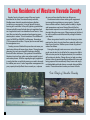
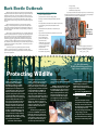
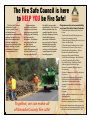
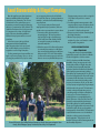
Prepare for
FIRE SEASON GUIDE
2015-2016
©
King Fire, September 17, 2014
Use Extreme Caution During These Activities!
includes
A public service in wildfire prevention brought to you by the U.S. Forest Service, your State Forester,
and supported by the Fire Safe Council of Nevada County, Nevada County Fire Chief’s and CAL FIRE.
Emergency Preparedness
and Evacuation Guide
To the Residents of Western Nevada County
Nevada County is home to some of the most scenic
forestland in the state. The natural beauty and mild,
Mediterranean climate have attracted many families
to settle in our community. Living in Nevada County is
learning to live with fire. In the past, lightning sparked fires
that periodically burned to help clear out vegetation fuels
on a regular basis and it was beneficial to our forests. Now,
most fires are started by people and are becoming more
catastrophic in nature. It is not a matter of IF a wildfire will
occur, but WHEN and WHERE it will happen. Remember,
YOU can prevent forest fires. Prepare your home and family
for emergencies now.
Creating an area of defensible space does not mean you
need a ring of bare dirt around your home. Through proper
planning, you can have a beautiful landscape, healthy
forest and a fire safe home. Flying embers from wildfires
threaten structures from miles away when carried by wind
and smoke plumes. With the ongoing drought, vegetation
is much drier than usual which means you need to be ready
for wildfire year-round. Lack of vegetation management on
your property directly affects those around you, so please
do your part to protect the forest we all treasure.
Use extreme caution when working with equipment
to manage the vegetation on your property. Conduct
these activities earlier in the day when humidity is higher
and temperatures are lower. Many of the calls the fire
department responds to are caused by people trying to do
the right thing the wrong way. When camping in the forest,
be sure to watch an active fire and fully extinguish before
you depart.
When using natural mulch in your landscaping to retain
moisture for plants, do not place these materials within ten
feet of your structure. Mulches pose a threat of ignition if
embers land there.
During the drought, water resources such as lakes and
ponds may be too low to utilize for fire suppression efforts.
Without snow pack in the higher elevations, this condition
will continue to decline. Please allow us to help you when
disaster strikes by providing effective defensible space and
being prepared to evacuate early. Many homes are simply
not defendable and hard choices are made during wildfire
events. Please take action to make your home fire safe.
Fire Chiefs of Nevada County
2
Creating and Maintaining A
Firewise Landscape
Vegetation Arrangement
The general concept is that native trees
should be kept furthest from your home, while
shrubs and hardwood ornamental trees may
be closer. Bedding plants and lawns may be
nearest to the structure. From a wildfire fuel
perspective, vegetation is often described in
terms of its vertical and horizontal arrangement.
The vertical fuel continuity is also referred to as
“ladder fuels.” Laddering arrangements of fuels
enables fire to climb neighboring vegetation
like a ladder. Reduce the chance of fire climbing
into trees by removing the lower tree limbs from
6-10 feet from the ground (or the lower third of
branches on smaller trees.)
Fire spreads on the ground from plant to
plant and then onto your home. To reduce the
chance of fire spreading horizontally, space
or group plants in clumps for visual screening
while providing enough space between plants
to reduce the fire spreading. Individual spacing
needs depends on the height and width of the
plant, but generally a three times height for
vertical separation is a good rule of thumb. Also
consider the overall fuel loading in terms of how
much vegetation there is within 100 feet of your
home. A more open, park like condition will
reduce the overall intensity of the fire.
Vegetation Zones
The home ignition zone is within 30 feet of
the house. The reduced fuel zone lies beyond
the home ignition zone and extends out to 100
feet from the house or to the property boundary.
Greater defense zone widths are necessary when
your home is sited on a steep slope. The most
intensive vegetation management lies within
the home ignition zone. Objectives for the
home ignition zone include:
• Remove any combustible materials
(such as needles, leaves, dead twigs,
firewood, dry grasses, recycling, and
building materials) from within 30 feet
of the home, garage, outbuildings, and
propane tanks.
• Reduce the ladder effect between plants.
• Replace any flammable plant species
(such as juniper, cypress, or broom
varieties) with Firewise plant selections.
• Maintain high moisture content in the
vegetation. Be cautious using mulch in
the home ignition zone (see graph.)
Mulching
With Governor Brown calling for 25% water
conservation, mulching plants is a good way to
retain soil moisture. Mulch conserves moisture,
but also burns. Carefully choose the location
of plants or garden beds that will need mulch.
Mulches greater than 2 inches deep tend to
smolder and are difficult to extinguish. Do not
use wood or bark mulches within 5 feet of the
house. Instead consider colored rock, pea gravel
or other less flammable materials. Having a
“hardscape” immediately adjacent to your home
will help protect the structure from flying ember
intrusion.
Where to Plant
Avoid putting plants immediately adjacent to
the siding, underneath vents or eaves and decks.
It is best to plant low-growing and low-volume
plants within 10 feet of the structure.
Maintenance
Maintenance is critical to fire safety.
Over time, plants grow both vertically and
horizontally, mulches dry out, leaves and needles
accumulate within and around landscape
vegetation. All of these fuels may help feed a
fire. Remember to conduct annual cleanups of
your established vegetation to ensure a fire safe
condition.
A fire safe landscape can increase your
property value, provide wildlife habitat and
conserve water while beautifying your home.
You may download a free Firewise plant guide for Western Nevada County online at:
http://www.areyoufiresafe.com/get-fire-smart/defensible-space-and-beyond/firewise-landscaping/
Graph courtesy of University of Nevada.
3
WILDFIRE IS COMING.
IS YOUR
HOME READY?
Harden your
home by using
fire resistant
building
materials
Remove dead
leaves and pine
needles from your
roof and gutters
Remove all dead or
dying plants from
around your home
Maintain
100 feet of
Defensible
Space
GET A SIMPLE 3-STEP PLAN TO PROTECT YOUR
HOME AND FAMILY FROM WILDFIRE AT…
ReadyForWildfire.org
4
Bark Beetle Outbreak
With the fourth consecutive year of below average rainfall, many
Registered Professional Foresters are watching for signs of bark beetle
infestations in their trees. Do you know what to look for? Have you
properly thinned your forest to protect them from moisture stress and
bark beetle attacks? You should keep a watchful eye and consider
thinning trees for improved vigor and protection against drought and
insects.
When bark beetle populations are not excessively large they
normally go unnoticed by humans. They become more important
during large population outbreaks. Trees killed by bark beetles, if not
removed, can become a fire hazard or danger of falling on structures,
vehicles or people.
When pines are stressed bark beetles can successfully attack trees
and build up their populations to very high levels, spreading from one
tree to another over successive generations. Adult bark beetles bore
through the bark of pines and into the cambium layer where they
mate and lay eggs. The eggs hatch into larvae which chew galleries,
or mines, through the cambium and inner bark. The larvae pupate in
the outer bark, become adult beetles, and chew their way out to fly off
to another tree and begin a new generation - in California, up to four
generations per year.
California is experiencing a bark beetle epidemic with the
southern Sierras showing 50-60% mortality in pine stands. Help
protect our forests by thinning suppressed trees and keep a watchful
eye for these symptoms:
boring activity
Signs and Symptoms of Bark Beetle Infestations
•
gradual or sudden tree death
•
yellow to brown or red brown foliage (fade)
•
bleeding on the trunk, frothy wet material. (oak bark
beetles)
•
white pitch tubes (initial attack of the Western pine beetle)
•
pitch streaming down trunk (initial attack of the fir
engraver)
•
small reddish brown pitch tubes on bark (most pine
engravers)
•
large pinkish to reddish brown pitch tubes near tree base
(red turpentine beetles)
•
white to pinkish pitch
granules near base (red
turpentine beetle)
•
sawdust-like and cinnamon
colored boring dust (frass)
collecting in bark crevices
and spider webs
•
tunnels under the bark
•
wood surface ‘engraved’ by
•
emergence holes in bark
•
bark flecked (woodpeckers)
If you suspect bark beetle activity in your pines, consider having a
Registered Professional Forester (RPF) make a visit to your property for
an assessment and site specific recommendations.
Actual Size
of Western
Pine Beetle
Pine Beetle Pitch Tubes
To find a Registered Professional
Forester, visit: http://www.bof.fire.ca.gov/
professional_foresters_registration/
locate_a_rpf_or_crm_/
Protecting Wildlife
As residents are preparing for
wildfire, many wildlife species are
still nesting their young. Wildlife
Rehabilitation and Release (WR&R)
offers the following suggestions to
minimize impact on nesting birds and
young wild animals. “Many of us forget
that as the weather warms up and we
begin our spring clean-up chores around
our property, wildlife critters may have
chosen our property to raise their young. One of the things that folks can do to
protect very young rabbits and hares is
to keep the weeds low all year round. When people let their weeds grow tall
and then cut them short in the spring,
it can hurt, kill or expose the babies to
predators,” stated Kelly Roberts, small
mammal rehabilitator with WR&R. She
also recommends carefully examining
any burn piles left over winter. Setting
the brush piles on fire without inspecting
them can kill or injure animals. Jan Crowell reminds folks that
it is illegal to trap and relocate wild
animals. “This time of year, especially,
it is best not to trap and relocate the
animals, as most are having babies. By
taking moms away they are leaving the
young ones to die,” stated Crowell, small
mammal rehabilitator for WR&R. She
recommends a variety of methods to
discourage critters. “Don’t leave cat or
dog food out as wild animals don’t know
it was not left out for them. Critter proof
your chicken house. Use chain link, not
chicken wire. Fruit trees can be more
difficult. Electronic eye sprinklers, noise
makers, dogs, whatever one can do to
make the orchard less attractive is a
good approach.” Janice Barberry, songbird rehab
team leader with WR&R, recommends
that before any trees are cut down in
the spring, to look for active nest sites
and to check for cavity nesters such as
woodpeckers before removing trees. “It is most important to take down
unwanted trees in the fall or winter after fire season, yet before wildlife baby
season.” WR&R recommends that since we all
live in wildlife habitat, please consider
the following tips to reduce impacts on
our fellow wildlife neighbors. “As you
plan your spring maintenance chores,
please keep in mind how you can be
sensitive to the wild critters living in
your neighborhood while also being
responsible for fire safe practices,”
For More Information: Wildlife Rehabilitation and Release
http://www.cawildlife911.org/ continued Crowell.
WR&R is the non-profit organization
staffed totally by volunteers to
rehabilitate and release injured or
orphaned native wild animals in Nevada
and surrounding counties. Tips for Protecting Wild Birds and
Animals in the Early Spring
• Keep grasses/weeds low all year
round
• Don’t burn brush piles in early
spring without inspecting them first
• Don’t trap and relocate animals in
the early spring as you will probably
leave the young ones to die
• Check for nesting birds including
cavity nesting species like
woodpeckers before removing trees
• Cut down unwanted trees and large
brush species in the fall if possible.
5
The Fire Safe Council is here
to HELP YOU be Fire Safe!
The Fire Safe Council
of Nevada County
is a non-profit, local
volunteer based
organization dedicated to
making Nevada County
safer from catastrophic
wildfire through fire
prevention education, fire
break clearing projects
and creating Firewise
Communities/USA®.
6
Fire prevention
education and direct
landowner assistance
programs are provided
through grant funding
and community
donations. Donations
are requested based
on the services
provided, however,
most all programs and
services are free of
charge regardless of
the ability to provide a
contribution. The Council
offers memberships for
specific benefits such as
priority chipping service,
scheduled chipping
service and discounts
on products and events.
Memberships provide
revenue to fund grant
writing and local match
requirements for grant
funded projects.
Together, we can make all
of Nevada County fire safe!
Programs and services provided by
your local Fire Safe Council include:
• Defensible Space Advisory Visits at Your
Home
• Year-Round, Drive-By Chipping Service
• Firewise Landscaping Guide
• Defensible Space Clearing for Low-Income
Seniors and Disabled
• Defensible Space Verification Service for
Homeowner’s Insurance (fee service)
• Educational Lending Library – Videos,
Books and Scientific Periodicals
• Emergency Evacuation Planning
• Scotch Broom Challenge – Weed Wrench
Loans & Community Project Sites
• Fire Safe Products – Reflective Road/
Address Signs & Fire Rated Tarps
• Firewise Community Wildfire Hazard
Assessments
• Firewise Communities/USA® Certification
Assistance
• Neighborhood Education Presentations
• Reduced Cost CAL STAR & REACH Air
Ambulance Service Memberships
• Strategic Community Fuel Reduction
Projects
• Children’s Fire Prevention Education
Program
• Memberships for Individuals, Associations
and Businesses
• Annual Awards Program for Volunteer,
Firewise Community & Partner of the Year
For complete information on all programs and
services, please visit www.areyoufiresafe.com or
call the Fire Safe Council at (530) 272-1122.
Land Stewardship & Illegal Camping
Over the past few years, there have been
numerous wildfire ignitions from illegal
camp fires in our community. The concern
of another 49’er Fire, sparked by a person
trespassing on vacant property and burning
debris, is a constant worry of fire officials. The
1988 49’er Fire burned over 33,000 acres and
312 structures in four days. It is still listed
as the 17th most devastating wildfire in
California history by structures lost even 27
years later.
It has been proven, that good forest
management and land stewardship
deters trespassers due to the open, parklike condition that does not provide any
vegetation cover for illegal camp sites.
Cooking, warming and ceremonial fires are
legal on your own property. If you so choose,
you may give permission for people to camp
on your property, but may also be left with
the cost of the clean-up – garbage, hazardous
materials – and other environmental damage
caused by them.
If you own property and have people
camping without your permission, there are
specific actions you may take to remove them.
1. You must post the property with “no
trespassing signs”. Be sure to put these
signs up high enough so that they may
not be easily torn down. Make an effort
to survey the property to identify any
potential camp sites.
2. Enlist the support of local law enforcement
in contacting any campers to notify them
they are trespassing and that you will have
them removed. File a “602” letter with the
local law enforcement agency to authorize
them to remove any identified trespassers.
Pictured left to right: Don Hoffler, Robinson Enterprises; Charlie Litton, representing the Litton
Family; and Jeff Wagner, Deputy Fire Marshal, Grass Valley Fire Department.
Private property owners need to re-sign the
“602” letter each year for it to remain
in effect.
3. Conduct vegetation management to thin
suppressed trees, remove understory brush
and ladder fuels, and limb up the trees to
be saved 6-10 feet from the ground.
4. Remove any trash or debris remaining from
the illegal camp sites.
5. Monitor the property (or work with a
neighbor if you live out of town) to control
the re-growth of vegetation.
SPECIAL RECOGNITION FOR
LAND STEWARDSHIP
During the Firewise Community Wildfire
Hazard Assessment for the Glenwood-MaiduCharlene Neighborhood in the summer
of 2013, a landscape wildfire hazard was
identified. A large, vacant property in the
vicinity had a number of illegal camp sites
in a heavily forested area with abundant
understory brush and ladder fuels. Members
of the hazard assessment team including
Grass Valley Fire Department, Cal Fire, Fire Safe
Council and a Registered Professional Forester
recommended the landowner be contacted
and asked to reduce the fuel loading on the
property. In the winter of 2014, an old cabin
on the property was ignited by illegal campers
and it burned to the ground. The landowner
recently conducted a mastication project,
contracting with local Robinson Enterprises
for the project. The transformation to a
healthy forest was so remarkable that the
Board of Directors of the Fire Safe Council of
Nevada County awarded the landowners a
Special Recognition for Land Stewardship.
The project is highly visible and serves to help
educate the public about good vegetation
management for forest health. The landowner
reported that there were over 20 individual
camp sites on this property obscured by
heavy vegetation. This project is also an
example of how good forest management can
attain multiple objectives.
7
General vicinity map for community defense
Fuel Reduction in Western Nevada County
Local, State, and Federal
agencies and organizations have
been working to reduce the fuels in
western Nevada County for many
years. In the area east and northeast
of Scotts Flat Lake and Cascade
Shores subdivision, several different
projects in different ownerships are
coalescing to provide better wildfire
defense in a strategic landscape
approach.
Tahoe National Forest:
Fuels reduction activities
continue on National Forest
System land with the goals of
improving evacuation routes and
reducing intensity of fire behavior.
These activities will also increase
the suppression capabilities of
firefighters and create safer areas to
fight fires.
This is the second year of the
Western Nevada County Community
Defense Project—Madrone Springs.
The Project will continue with hand
cutting and hand piling throughout
the summer in the Washington
Ridge Road and Cooper Road areas.
During the fall/winter season, when
ground and fuel conditions are
wet, pile burning will take place on
326 acres. Mastication (mechanical
thinning) of brush, small understory
trees and downed woody fuels will
also occur on 289 acres of National
Forest System lands.
In the first year of the Project, 466
acres were hand cut, pruned and
8
piled, and 11,000 piles on 222 acres
was completed.
Questions can be directed to
Eric Burke, Vegetation Management
Officer – 530-478-6222, or Mike
Cherry, Fire Management Officer
– 530-288-3231, on the Yuba River
Ranger District.
Bureau of Land Management:
The BLM Mother Lode Field
Office issues Hazardous Fuels
Variance Permits to landowners
who wish to reduce fuels on
adjacent BLM land. After receiving
a permit request, BLM will perform
the necessary environmental and
other reviews for the project before
issuing the permit. Throughout
the 2012-2015 fire seasons, BLM
has been providing fuel reduction
and strategic fire planning in the
South Yuba watershed, the Inimim
Forest and Round Mountain areas.
BLM will be conducting prescribed
fire within many areas of Nevada
County. BLM continues to support
the Fire Safe Council with personnel
and equipment. BLM encourages
landowners to
“Take Responsibility” and maintain
100’ defensible spaces around their
homes. For more information, visit
www.preventwildfireca.org
The Fire Safe Council of
Nevada County:
Work continues to implement
strategic fuel reduction projects on
the ground to reduce catastrophic
wildfire and protect homes.
During the 2014-15 fiscal year,
an expansion of the Deer Creek
Community Fuel Break below the
Morgan Ranch subdivision and
along Champion Mine Road in
Nevada City was implemented.
Ultimately, this fuel break will be
two miles long on either side of
Deer Creek to help protect ridgetop
home developments from ignition
sources in the environs. Ignitions
from illegal camping continue
to be a high concern among fire
agencies. Fuel reduction projects
deter illegal camping activity due
to the open nature of the forest
after treatment.The numerous
individual certified Firewise
Communities are also implementing
fuel reduction projects in their
neighborhoods to address identified
hazards through their action
plans. Firewise Communities
pulled cleared evacuation routes,
removed Scotch Broom, cleared
adjacent vacant parcels or assisted
low income seniors/disabled with
defensible space. These Firewise
Communities projects utilized the
assistance of AmeriCorps National
Civilian Community Corps crews
sponsored by the Fire Safe Council.
These fuel reduction projects
combined represent over 150
acres of community fuel reduction
treatments in the past year.
Madrone Springs Project
BEFORE
Madrone Springs Project
AFTER
9
2-1-1 Nevada County & Disaster Response
2-1-1 Nevada County is a resource and
information hub that connects people with
community, health and disaster services
through a free, 24/7 confidential phone service
and searchable online database. 2-1-1 locally
serves the entire population of Nevada County.
2-1-1 is a free confidential phone number that
offers assistance in multiple languages, and services
that are accessible to people with disabilities.
In the wake of a County emergency, 2-1-1 provides
citizens with critical non-emergency assistance such
as: Information on evacuation and return routes;
mass care shelter/housing options; food and water;
social services; family reunification status; animal and
pet evacuation information; traffic and road closures.
2-1-1 programs have been used to relieve pressure
on the 911 system and emergency response teams by
providing an easy number for citizens to remember and
call for non-emergency needs, freeing up emergency
responders to deal with true emergencies.
In addition, 2-1-1 provides a valuable referral
number for public safety and health personnel.
Police, Sheriff, CHP, and Fire personnel have an easyto-remember number to give to at-risk populations
as a resource to help with their needs in any type of
emergency or for ongoing assistance. For example,
police officers are able to give one phone number,
composed of three digits for marriage/family
counseling, substance abuse, job training, children/
senior services, health care services and other
assistance which may help the family avoid violence
and abuse. 2-1-1 helps law enforcement and the courts
connect people in need with resources to help.
Finally, 2-1-1’s trained information and referral
specialists give personalized attention to each caller by
utilizing a comprehensive computerized database of
more than 800 Agencies.
911 Wireless Services & Emergencies
The number of 911 calls placed
by people using wireless phones has
significantly increased in recent years. It
is estimated that about 70 percent of 911
calls are placed from wireless phones. For
many people, the ability to call 911 for
help in an emergency is one of the main
reasons they own a wireless phone.
While wireless phones can be an important
public safety tool, they also create unique
challenges for emergency response personnel and
wireless service providers. Since wireless phones
are mobile, they are not associated with one fixed
location or address. While the location of the cell
site closest to the 911 caller may provide a general
indication of the caller’s location, that information
is not always specific enough for rescue personnel
to deliver assistance to the caller quickly.
Consumers making a 911 call from a wireless
phone should remember the following:
Tell the emergency operator the location of the
emergency right away.
Provide the emergency operator with your
wireless phone number, so if the call gets
disconnected, the emergency operator can
10
call you back.
If your wireless phone is not “initialized”
(meaning you do not have a contract for service
with a wireless service provider), and your
emergency call gets disconnected, you must
call the emergency operator back because the
operator does not have your telephone number
and cannot contact you.
Refrain from programming your phone to
automatically dial 911 when one button, such
as the “9” key, is pressed. Unintentional wireless
911 calls, which often occur when auto-dial keys
are inadvertently pressed, cause problems for
emergency call centers.
If your wireless phone came pre-programmed
with the auto-dial 911 feature already turned on,
turn this feature off (consult your user manual for
instructions).
Lock your keypad when you’re not using your
wireless phone to help prevent accidental calls to
911.
Consider creating a contact in your wireless
phone’s memory with the name “ICE” (In Case of
Emergency), which lists the phone numbers of
people you want to have notified in an emergency.
EMERGENCY
NOTIFICATION
SYSTEM
The Nevada County Office of Emergency
Services (OES) has contracted with the
Emergency Communications Network
to utilize their CodeRED Emergency
Notification System. CodeRed is an
additional way for residents of Nevada
County to be notified of emergencies to
include evacuation orders if a wildfire
is threatening your neighborhood. If
you desire to be notified via your AT&T
residential or business phone only, no
action is required on your part since your
phone number is already accessible as part
of the public safety data base.
In order to be notified by the CodeRED
via your cable service phone line, cell
phone, cell phone text messaging, and
email, residents will need to manually add
their information. To assure your additional
contact information is included; go to the
Nevada County OES website at http://www.
mynevadacounty.com/nc/igs/oes/ and look
for the CodeRED link.
Though all Emergency Notification
systems are considered effective and
efficient, you should not wait for or rely
exclusively on a phone call for evacuation
direction. If you think you are in immediate
danger, do not hesitate to evacuate.
CodeRED will only be activated by
County public safety personnel. You must
be a resident of Nevada County to add your
information into CodeRED.
For assistance adding your information
into CodeRED, contact the
Nevada County Office of Emergency Services at:
530-265-1515 or [email protected]
AIR AMBULANCE
SERVICES
Are you covered for air ambulance
transport services? Living in a rural
area, you should be! Due to the lack of
a local medical trauma center, major
life threatening injuries require air
ambulance transport to save lives. These
air ambulance transports can be very
expensive. Some medical insurance
policies will cover the cost, while others
will not. Check with your medical
insurance carrier now to find out if
you’re covered. You don’t want to find
out after transport and be left with up
to a $35,000 bill to pay for this service
depending on where you were injured
and taken for treatment. The Fire Safe
Council of Nevada County’s mission
includes helping our residents prepare
for emergencies. To aid in meeting this
mission, they have negotiated group
discounts with both Cal Star and In
Reach Air Ambulance Service providers.
Simply state that you are in the “Fire
Safe Council of Nevada County group”
when signing up for service or renewing
your existing policy and save up to $15
a year. These policies cover everyone at
your residential address. Get peace of
mind by knowing that you are
prepared for being transported
by air ambulance during life
threatening emergencies.
Nevada County Firewise Communities/USA®!
By working together, residents can make their
own property – and their neighborhood – much safer
from wildfire. The Fire Safe Council of Nevada County has
been assisting individual neighborhoods in completing
the National Fire Protection Association’s Firewise
Communities/USA® certification process for over 7 years.
Nevada County currently has more certified Firewise
Communities/USA® than any other county in California.
It begins with a few concerned citizens who form a
committee. Next, a community wildfire hazard assessment
is conducted in collaboration with a Registered
Professional Forester, your local fire department and CAL
FIRE. From this assessment, recommendations are given in
how to best address the wildfire hazards. The community
committee develops an action plan to implement the
recommendations. Once the action plan is in place, an
educational event is held to let residents know their part
in implementing the action plan. The certification is
renewed annually to keep a focus on the ongoing need for
vegetation management to reduce the wildfire fuel on the
landscape.
The Fire Safe Council has aided the following
communities in attaining the Firewise Communities/USA®
certification:
• Lake Wildwood Association – 2007
• Lake of the Pines Association – 2009
• Mountain Lakes Estates – 2010
• Friends of Banner Mountain – 2010
• Tahoe-Donner Association – 2010
• Greater Cement Hill Neighborhood
Association – 2012
• Serene Lakes Property Owner’s Association – 2012
• Greater Alta Sierra Firewise Community – 2012
• Golden Oaks Homeowner’s Association – 2013
• Rattlesnake Ridge Estates – 2013
• Ridgeview Woodlands Homeowner’s
Association – 2014
• Cascade Shores Homeowner’s Association – 2014
• Glenwood-Maidu-Charlene Neighborhood – 2014
• Rattlesnake Neighborhood Association – 2014
Several local communities are currently undergoing
the certification process including: Toller Ridge Court
Homeowners; Greater Champion Neighborhood
Association; Brunswick East Condominiums; Stonebridge
Homeowner’s Association and The Gazebo’s. There is also
a waiting list of seven communities to become certified.
Aside from being safer from wildfire by working
together in your neighborhood to address the
wildfire hazard, you may be eligible for a discount on
your homeowner’s insurance if you live in a certified
Firewise Community/USA®. Last year, the United
Services Automobile Association (USAA) announced a
rate reduction program for California which provides
policyholders living in Firewise Communities/USA® a 5%
discount on their homeowner’s insurance policies. That’s
cash savings along with the peace of mind that you’ve
done all you can to protect your family and property from
the most significant natural disaster threat residents face
living in Nevada County.
To learn more, contact the Fire Safe Council
of Nevada County at (530) 272-1122 or
online at www.areyoufiresafe.com
11
Local Biomass Energy Facility Planning
The Nevada County Biomass Task Force is
continuing to work toward the goal of having a
biomass energy facility in Western Nevada County.
The task force began work almost 6 years ago with
an interest in helping reduce wildfire hazard both
around our communities and in the forested areas
that provide so many valued resources like water,
wildlife habitat and recreation. It was soon clear
that a biomass energy facility would be one way of
meeting that interest—by providing a market for
excess biomass in the form of small trees, limbs,
tops and defective logs that are produced from
forest management and hazard reduction projects
in our communities and surrounding forestlands.
A biomass energy facility will use the excess
biomass to product electrical energy that will be fed
into the existing electrical grid. The biomass will be
chipped at project sites and hauled by truck to the
facility. The facility will convert the chips to biogas
using well-established gasification technology.
The biogas will be used onsite to power an internal
combustion engine that will in turn run a generator.
Such technology is very clean—think natural gas
engine—and will use biomass that is for the most
part now being disposed of by open burning,
chipping or mastication onsite. All three of these
disposal methods result in emissions of carbon
dioxide, a greenhouse gas. Open burning, the
most common disposal method, also produces
other greenhouse gases and climate changeimpacting emissions.
The task force received grant funding in 2014
to complete a Biomass Feasibility Assessment that
showed there is adequate biomass available on a
long-term sustainable basis to support a biomass
energy facility. The assessment also identified
several feasible sites for a facility. The task force
recently received a grant to continue facility
planning work. The latest grant, for which the Fire
Safe Council of Nevada County is the fiscal manager,
will fund basic site planning and completion of
the Conditional Use Permit work necessary for
establishing the biomass facility. The task force will
be selecting a single site from the list of feasible
sites to be the focus of this planning and permitting
work. If all goes well, the work will be completed in
the next two years, after which efforts will include
working with potential energy facility developers to
pursue actual construction.
The Nevada County Biomass Task Force is a volunteer
organization that is open to anyone in the community
who has interest. For further information, you can
visit the Fire Safe Council of Nevada County website
at www.areyoufiresafe.com under the Resources Tab,
Biomass section.
Engineer’s rendering of a proposed biomass facility in Placer County.
Nevada County Hazardous Vegetation Abatement Ordinance
In June of 2014 the Nevada County Board of
Supervisors passed Ordinance Number 2380 adding
Article 7 to the Nevada County General Code
regarding Hazardous Vegetation Abatement.
In a nutshell, the ordinance gives the Federal,
State and Local Fire Agencies the ability to require
the property owner of an unimproved parcel to clear
a portion of their parcel that is next to an improved
parcel for the purposes of obtaining their Defensible
Space. In the past Fire Officials could not require
any clearing of vacant parcels. Nevada County
Consolidated Fire District had a program where by
local ordinance they would look at “Target Areas”
and send notices to the owners of vacant parcels
requiring them to clear their land of hazards. No work
could be done outside these Target Areas.
After numerous citizen complaints, the Board
of Supervisors put together a committee to work
on an ordinance to help the Fire Agencies by
establishing a hazardous vegetation abatement
ordinance that provides a process to identify and
12
abate hazardous vegetation on unimproved parcels
and protects the lives and property of the citizens of
Nevada County, while at the same time protecting
sensitive plant and animal species and protecting
against significant erosion and sedimentation.
The removal of hazardous vegetation in the areas
subject to this Article is recognized as an essential
action homeowners and property owners can take
to increase the chances that homes, structures
and other property will survive a wildfire, while
protecting the natural environment. Regular fuels
management and modifications on unimproved
parcels is necessary to ensure adequate defensible
space is achieved.
Fire Officials can now take action by first notifying
the property owner of the hazard and giving them
30 days to comply. If the hazard is not abated the fire
official has the choice of issuing an Administrative
Citation, a criminal citation, or go through the
process of abatement and recovering the costs
for that work. The property owner has the right to
appeal the decision if they feel no hazard exists.
Since this is something new to not only the
property owners but the Fire Agencies, we will all
need to continue to work together to make this
ordinance a success. If you have any questions
or concerns about the ordinance or a possible
hazardous parcel contact your local fire agency.
Assistance For
Forest Landowners
The U.S. Department of Agriculture’s Natural
Resources Conservation Service (NRCS) is a federal
agency that emphasizes voluntary, science-based
assistance to help private forest landowners.
The NRCS promotes and informs private forest
landowners about forestry practices that can improve
growth, reduce risk, and improve forest health. Many
of these practices can be cost-shared through Farm
Bill programs.
CONSERVATION PLANNING
The NRCS works with forest landowners to
develop a conservation plan customized to meet the
owner’s objectives for their land. The conservation
plan will address resource concerns and propose
improvements that can be voluntarily implemented
on the landscape. Conservation planning provides
direction to forest landowners to achieve goals and
improve natural resources.
HEALTHY FORESTS
Forest health is a very broad term. Many forests
are both healthy and productive. A number of
concerns have been identified as major forestry
problems. These include fire and fuels, invasion of
non-native and native pests, loss of biodiversity, air
pollution, water quality and quantity, and degraded
riparian forests. Many forest stands have too many
trees per acre or contain a disproportionate amount
of shrubs in the understory. This competition for
light, nutrients, and water leaves forests extremely
susceptible to disease and insect damage, increases
the risk of catastrophic fire, reduces productivity, and
provides poor quality wildlife habitat as well as limited
recreational opportunities.
FUEL HAZARD REDUCTION
Forests and woodlands make up about 42 percent
of California and half of that portion is in private
ownership. Many of these acres are overstocked and
at risk of wildfire damage. California and many of our
neighboring states have experienced abnormally
dry conditions. These adverse conditions have fueled
severe wildfires that are challenging our natural
resources.
FOREST LANDOWNER ASSISTANCE
NRCS conservationists can assist forest
landowners with management decisions as well
as providing technical and financial assistance to
improve forest health and reduce the impacts of
catastrophic wildfires. In more than 75 years of
assisting forest landowners, NRCS has assembled
a body of technical standards to help producers
address a large number of natural resource concerns.
ENVIRONMENTAL QUALITY INCENTIVES
PROGRAM (EQIP)
The Environmental Quality Incentives Program
(EQIP) is a voluntary conservation program that
promotes production and environmental stewardship
as compatible goals. EQIP shares conservation
costs with landowners to implement conservation
practices on the landscape. The Conservation
Stewardship Program (a separate program) can
help forest landowners obtain even higher levels of
environmental enhancements.
HOW TO APPLY
Contact the local NRCS District Conservationist
at (530) 272-3417 x 101. Eligible projects will be
evaluated, prioritized and selected for funding as
budget allocations permit.
TYPICAL NRCS FOREST
CONSERVATION
• Site Preparation
• Tree Planting
• Forest Stand Improvement
• Controlling Competing
Vegetation
• Fuel Break
• Sediment Reduction from
Roads and Trails
• Slash Disposal
• Wildlife Management
Activities
Without effective management, understory plants compete with trees for water, nutrients and sunlight.
13
DON’T BURN
DOWN OUR TOWN!
Hot sparks and campfires put everyone at risk
14
Local Firewise Communities & Fire Safe Council of Nevada County
530-272-1122 www.AreYouFireSafe.com
RESOURCE DIRECTORY
Agencies to assist with fuel reduction, conservation
planning, & emergency preparedness.
Fire Safe Council of Nevada County (530) 272-1122
Nevada County Office of Emergency Services (530) 265-1515
Nevada County Resource Conservation District (530) 272-3417
Cal Fire – Regional Office – Auburn (530) 889-0111
Cal Fire Recorded Fire Incident Information (530) 823-4083
Tahoe National Forest (530) 265-4531
Bureau of Land Management (916) 941-3101
Nevada County Public Health Department (530) 265-7174
American Red Cross Capital Region (916) 993-7070
American Red Cross Northeastern Chapter (530) 673-1460
15
Plant the “Right Tree in the Right Place”
Tree Planting Safety
The best way to protect yourself and your home is
by planting the “right tree in the right place.”
Though some large trees grow under power lines
naturally, many are planted without the
realization of how large they would eventually
become. So, select a tree with the proper height at
maturity for its location.
Your safety is PG&E's top priority. Planting trees
under power lines can pose electrical shock
hazards and fire safety risks. To stay safe, keep the
lights on and get the long-term benefit, beauty and
satisfaction from the trees you plant, refer to the
planting zone guidelines below.
Plant for personal and fire safety. Use the "Small,
Medium and Tall Zone" guidelines near distribution
lines and the "Wire Zone, Border Zone, Outer
Zone" guidelines near transmission lines. If you're
not sure whether a line is distribution or
transmission call us at 1-800-743-5000.
When landscaping be sure to consider overhead
power lines and underground utilities in addition to
fire hazard, sun exposure and soil conditions when
selecting shrubs and trees.
Tall
Zone
Trees taller
than 40 feet
at maturity
Medium
Zone
Trees no taller
than 40 feet at
maturity
Small
Zone
Trees no taller
than 25 feet at
maturity
Distribution
Line
Planting distances
from distribution lines:
50 ft.
15 ft.
0
Wire Zone
No trees
For more information about trees and power lines:
• Visit www.pge.com/trees
• Request a "Guide to Planting Small Trees Near
Distribution Lines" by calling 1-800-743-5000 or
email [email protected]. Specify:
Northern California, Central California or the Bay
Area/Inland area.
Border Zone
Only small trees
or shrubs.
Outer Zone
Trees no taller than
the distance to the
wire at maturity.
Transmission
Line
Only low growing shrubs.
Incompatible vegetation is subject to removal.
6/2009
BUREAU OF LAND MANAGEMENT
Take Responsibility...
Protect your home. Create 100 feet of defensible space!
MOTHER LODE FIELD OFFICE
takeresponsibility.cafirealliance.com