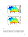
1
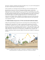
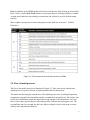
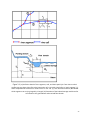
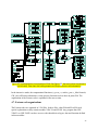
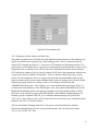
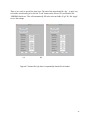
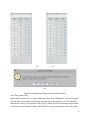
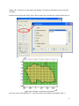
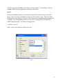
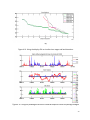
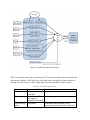
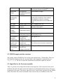
Watershed
Extent
River
Hydrography
Dataset
Soils Type
SSURGO soils
database
Weather
Station
Locations
Climatic Data
Groundwater
Hydraulic
Conductivity
Groundwater
Aquifer Layer
information
Initial
Groundwater
Head
Local agencies
delineated watershed
boundaries
NHD from USGS
transformation matrix; G for the group
information for each model RPT
ESRI shapefile: Polygon
ESRI shapefile: Polyline
Need to be processed. A river needs to
be coded for its river ID. Currently,
scattered observations of river width and
type
SSURGO mapunit map ASCII integer grid or Tiff
NRCS SSURGO
A .mat file containing processed
database
database information
NCDC and other
ESRI shapefile: Point
climatic data network
NCDC and other
climatic data network
Local agencies or
inferred from
geological information
Local agencies or
inferred from
geological information
Local agencies or
inferred from
geological information
NCDC downloaded format or MAWN
downloaded format
ASCII grid or Tiff
ASCII grid or Tiff
The thickness (or elevation) of each layer
ASCII grid or Tiff
5.2. PRISM output and data structure
The primary output of PRISM are the matName.mat and matName_CLM.mat files. These two
files should be transferred into the execution folder, either manually or automatically (see
dispatchJob.m). The driver control file should then be modified to update the mat file.
5.3. Input files for the Fortran executable
Table 5.3 provides a list of input files for the Fortran input files. Italic means the name can be
modified. Non-italic file names means the filenames are hardcoded and other names will not be
recognized by the model. The primary input file are the *.mat file that is produced by the PRISM
utility. Most other files can be customized easily or used as they are distributed. Some files
58