1
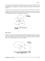
WPS
17. LEVEL_TEMPLATE : A character string giving the name of a field from which a list
of vertical levels should be obtained and used as a template. This keyword is used in
conjunction with a fill_lev specification that uses all in the DLEVEL part of its
specification. No default value.
18. MASKED : Either land or water, indicating whether the field is invalid over land or
water, respectively. When a field is masked, or invalid, the static LANDMASK field will
be used to determine which model grid points the field should be interpolated to; invalid
points will be assigned the value given by the FILL_MISSING keyword. Default value is
null (i.e., the field is valid for both land and water points).
19. MISSING_VALUE : A real number giving the value in the input field that is assumed
to represent missing data. No default value.
20. VERTICAL_INTERP_OPTION : A character string specifying the vertical
interpolation method that should be used when vertically interpolating to missing points.
Currently, this option is not implemented. No default value.
21. FLAG_IN_OUTPUT : A character string giving the name of a global attribute which
will be assigned a value of 1 and written to the metgrid output if the interpolated field is
to be output (output=yes). Default value is null (i.e., no flag will be written for the field).
Available Interpolation Options in Geogrid and Metgrid
Through the GEOGRID.TBL and METGRID.TBL files, the user can control the method
by which source data – either static fields in the case of geogrid or meteorological fields
in the case of metgrid – are interpolated. In fact, a list of interpolation methods may be
given, in which case, if it is not possible to employ the i-th method in the list, the (i+1)-st
method will be employed, until either some method can be used or there are no methods
left to try in the list. For example, to use a four-point bi-linear interpolation scheme for a
field, we could specify interp_option=four_pt. However, if the field had areas of
missing values, which could prevent the four_pt option from being used, we could
request that a simple four-point average be tried if the four_pt method couldn't be used
by specifying interp_option=four_pt+average_4pt instead. Below, each of the
available interpolation options in the WPS are described conceptually; for the details of
each method, the user is referred to the source code in the file
WPS/geogrid/src/interp_options.F.
WRF-ARW V3: User’s Guide
3-51


![[DRAFT] User Manual for the LMD Martian Mesoscale Model](http://vs1.manualzilla.com/store/data/005789657_1-11bdf725af45641ff39ff695d9ffff09-150x150.png)