1
Radial Mode and Waypoint Mode ........................................................................ 29
Measuring and Displaying Direction ..................................................................... 29
Placing an Anchor Point on Top of Other Custom Objects .......................................... 31
Building and Understanding Elevation Profiles ........................................................... 32
Building Elevation Profiles ................................................................................. 32
Understanding the Profile and Profile Statistics ....................................................... 32
Identifying Points Along the Elevation Profile on the Map ............................................ 33
Resizing the Profile Window ........................................................................... 34
Printing and Exporting Elevation Profiles ............................................................... 34
Printing and Exporting Maps ................................................................................. 35
Obtaining Maps by Mail .................................................................................... 35
Printing Basics .............................................................................................. 35
Using Page Setup Options: Printer Type, Paper Size, Orientation and Margins ................. 35
Exporting Maps ............................................................................................. 36
Suggestions for Maps Too Large to Print on a Page ............................................... 36
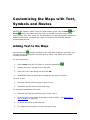
Customizing the Maps with Text, Symbols and Routes ................................................. 37
Adding Text to the Maps ................................................................................... 37
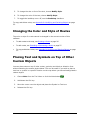
Changing the Color and Style of Routes ................................................................ 38
Placing Text and Symbols on Top of Other Custom Objects ........................................ 38
Customizing the Maps with Grids ........................................................................... 39
Determining Location and Reading Coordinates ...................................................... 39
Latitude / Longitude Coordinate System ............................................................. 39
UTM Coordinate System................................................................................ 40
Reading Coordinates in ADVENTURE Explorer .................................................... 40
Using the Coordinate Locator ............................................................................. 40
Using Grids .................................................................................................. 41
Using ADVENTURE Explorer with a GPS Receiver ..................................................... 42
A Quick-Start Guide to GPS .............................................................................. 42
Creating GPS Routes ...................................................................................... 43
Connecting to a GPS Receiver ........................................................................... 44
Setting up ADVENTURE Explorer and Your GPS Receiver for Connecting ...................... 45
Uploading to a GPS Receiver (Export Wizard) ........................................................ 46
Downloading from a GPS Receiver (Import Wizard) .................................................. 47
Tracking your Position in Real Time ..................................................................... 48
Saving GPS Data ........................................................................................... 49
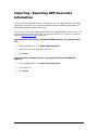
Importing / Exporting GPS Geocache Information .................................................... 50
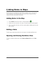
Linking Notes to Maps ........................................................................................ 51
Adding Notes to the Map .................................................................................. 51
Editing a Note ............................................................................................... 51
Opening and Closing the Notes View ................................................................... 51
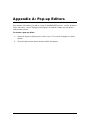
Appendix A: Pop-up Editors ................................................................................. 52
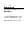
Appendix B: Modifying and Deleting Objects ............................................................. 53
Deleting Objects ............................................................................................ 53
Appendix C: Preference Settings ........................................................................... 54
Units .......................................................................................................... 54
Coordinates ............................................................................................... 55
Distance ................................................................................................... 55
Elevation................................................................................................... 55
ADVENTURE Explorer User Guide
©2009 National Geographic Maps
3