1
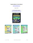
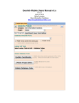
Tierra Mapper
Mobile Pocket PC GPS GIS Mapping
User’s Manual
Version 2.1
January 2007
Mike Schaefer
Geo-Information Solutions
5070 N. Stonehouse Place
Tucson Arizona, 85750
www.TierraMapper.com
[email protected]
Table of Contents
OVERVIEW ..........................................................................................................4
What Is Tierra Mapper?................................................................................................................. 4
Who Can Use Tierra Mapper? ...................................................................................................... 4
What Kind Of Data Can I Use With Tierra Mapper?.................................................................... 4
Spatial Image Data...................................................................................................................... 4
Spatial Vector Data ..................................................................................................................... 5
What Map Projections Does Tierra Mapper Support? ............................................................... 5
What GPS Units Does Tierra Mapper Support? ......................................................................... 5
What Pocket PC Devices Does Tierra Mapper Support? .......................................................... 5
What Benefits Does Tierra Mapper Have Over Other Products? ............................................. 6
INSTALLATION....................................................................................................7
Hardware and Software Requirements ....................................................................................... 8
Software ...................................................................................................................................... 8
Hardware..................................................................................................................................... 8
TIERRA CONVERTER .........................................................................................8
TIERRA CONVERTER .........................................................................................8
Image Conversion ......................................................................................................................... 8
Image Types................................................................................................................................ 8
Convert the Image....................................................................................................................... 9
TIERRA MAPPER ..............................................................................................10
Quick Start - Menu and Icon Summary ..................................................................................... 10
Tierra Mapper Icons .................................................................................................................. 10
Tierra Mapper Layer Control ..................................................................................................... 11
Tierra Mapper Map Menu.......................................................................................................... 12
Tierra Mapper Click and Hold Menu ......................................................................................... 14
Tierra Mapper Settings................................................................................................................ 14
GPS Settings and Track Tolerance........................................................................................... 15
Map Distance and Coordinate Display...................................................................................... 15
Map Rotation Mode ................................................................................................................... 15
Page
2
Projections................................................................................................................................. 16
Open a Map .................................................................................................................................. 16
Zoom and Pan .............................................................................................................................. 16
Layers ........................................................................................................................................... 17
Create Layer.............................................................................................................................. 18
Add Shapefile Layer .................................................................................................................. 19
Add Visual CE Layer ................................................................................................................. 19
Add Pocket Access Layer ......................................................................................................... 21
GPS Connection .......................................................................................................................... 21
GPSGate ................................................................................................................................... 23
Windows Mobile Virtual GPS Port............................................................................................. 24
GPS Information .......................................................................................................................... 24
GPS Navigation............................................................................................................................ 25
GPS Tracks................................................................................................................................... 26
Redlines........................................................................................................................................ 26
Creating and Editing Features ................................................................................................... 26
Measuring Distances................................................................................................................... 27
Map Sessions............................................................................................................................... 28
VISUAL CE INTEGRATION ...............................................................................28
Visual CE Field Wizard................................................................................................................ 28
Form Title ..................................................................................................................................... 30
Sort Field ...................................................................................................................................... 30
Key Field....................................................................................................................................... 30
Variable 90.................................................................................................................................... 31
BUILDING GIS MAPS FOR TIERRA MAPPER .................................................31
ArcGIS........................................................................................................................................... 31
MapInfo GIS.................................................................................................................................. 33
Page
3
Overview
What Is Tierra Mapper?
Tierra Mapper is a GPS enabled Pocket PC 2003 and Windows Mobile 5.0
mapping software that allows users to use a variety of georeferenced image and
vector GIS data on handheld Pocket PCs and Smart Phones. GIS data can be
created with GIS software or downloaded from the Web. Users can collect and
edit point and line mapping data in database and/or Shapefile formats. Tierra
Mapper interfaces with database form applications created with Visual CE.
Visual CE allows a user to create robust database forms applications for attribute
updating and editing.
Who Can Use Tierra Mapper?
Scientists, surveyors, utility workers, foresters, safety and law enforcement
officials, military personnel, hikers, hunters, and anglers, to name a few. Anyone
who has a need to view maps or images in the field can benefit from Tierra
Mapper. Anyone who has to maintain, capture or analyze spatial information in
the field (such as biologists, geologists, and hydrologists) will find Tierra Mapper
helpful for their fieldwork.
What Kind Of Data Can I Use With Tierra Mapper?
Tierra Mapper can import a variety of digital images that are widely available via
the Internet at sites such as www.mapmart.com, or maps can be created with
popular GIS software, like ArcGIS and MapInfo. Tierra Mapper also uses point
polyline and polygon data stored in Microsoft Pocket Access Databases,
Windows Pocket PC and Windows Mobile Object Store databases (Native), or
ESRI Shapefiles.
Spatial Image Data
TIF, GIF, JPEG, or BMP image files that have a World File definition (ArcGIS) file
or a MapInfo TAB file with georeferencing information.
Page
4
Spatial Vector Data
Tierra Mapper can display points plotted from Microsoft Access Databases or
Windows Pocket PC and Windows Mobile Object Store databases (Native) which
store spatial data as X and Y attributes in separate fields; Visual CE forms can
be used to create and attribute these databases from Tierra Mapper. ESRI
Shapefile format files are used or created by Tierra Mapper to store and edit
point and polyline data (Redlines and GPS Tracks).
What Map Projections Does Tierra Mapper Support?
Tierra Mapper supports data in 1843 different projections and 491 different
datums. Most all worldwide projections are supported.
Note: Albers projections are not supported
What GPS Units Does Tierra Mapper Support?
Tierra Mapper works with any serial GPS device that can output NMEA standard
$GPGGA and $GPRMC sentences (including RTK GPS). Tierra Mapper has
been tested on a variety of GPS units, including serial direct-connect GPS’s
(Garmin handhelds), compact-flash, secure digital (SD), Bluetooth GPS’s, and
integrated PPC – GPS devices.
What Pocket PC Devices Does Tierra Mapper Support?
Tierra Mapper has been tested on the following Pocket PC 2003 and Windows
Mobile devices, although it should work with most Pocket PC’s:
IPAQ 1950, 2210, 2215, 2400, 2490, 2790, 3850, 3970, 4150, 4155, 4350, 4355,
5450, 5915, 6200, 6500, 6800.
HTC XV6700, PC6700, 8125 PPC Phones.
Dell PPC’s
Note: an ETEN G500 PPC Phone has reported a flickering screen problem.
Page
5
What Benefits Does Tierra Mapper Have Over Other Products?
Tierra Mapper was designed to be an easy-to-use, cost effective mapping tool for
professionals and recreational users who need access to digital maps and
images in the field, as well as have the ability to collect and update spatial data in
the field. Tierra Mapper allows users to quickly map and edit data in the field
with a minimum of training, and update their centralized databases back at the
office.
•
•
•
•
•
•
•
•
GIS raster map support (ArcGIS and MapInfo)
Shapefile support for point and polyline creation and editing
Multilayer support; any mixture of database or Shapefile point and polyline
layers along with one raster map in any map session.
GPS enabled; location, tracks, navigation
North up and rotating map support
Visual CE Interface for forms database/attribute data collection
Microsoft Pocket Access and Object Store database support
Worldwide projection support
Page
6
Installation
**Important**: If installing a new version of Tierra Mapper over an older version,
uninstall the old version of Tierra Mapper from your PC and Pocket PC before
installing the new.
**Important**: You will need to ensure your PPC device is connected to your PC
with ActiveSync when installing Tierra Mapper.
**Important**: If installing to a PPC device with a memory card please select
install to device rather than memory card if prompted on your PPC device.
**Important**: If .NET Compact Framework 2.0 is NOT installed on your PPC
device, it will be installed during the installation. You will receive a prompt on
your Pocket PC to restart your device.* DISREGARD THE RESTART PROMPT!
(Select cancel) *Do NOT restart your device until Tierra Mapper has been
completely installed, as this will interrupt the installation process. After Tierra
Mapper is completely installed you should restart your device.
Double click on the TierraMapperVx.x.x.msi Microsoft Installer file. Tierra
Mapper is installed into the C:\Program Files\Geo-Information
Solutions\TierraMapper directory.
If your PC does not yet have .net 2.0 (installed by Windows Update) you will be
prompted to install it before the Tierra Mapper installer starts. This is a large
download from Microsoft.
Three applications are installed: Tierra Converter on your PC, Visual CE field
Wizard on your PC and Tierra Mapper on your Pocket PC. The PC programs
can be accessed from the Tierra Mapper program group in the Start menu of
your PC. This Tierra Mapper Users Manual is also installed on your PC and
accessible from the Tierra Mapper program group in the Start menu.
A free Visual CE database application, Observation Database, is available for
download at http://www.tierramapper.com/Products.htm. This application is
used to collect waypoint attribute information. Install and link this application to
Tierra Mapper.
Tip: If you want to use Pocket Access Databases (.cdb) then you will have to
install SQLCE runtimes. This can be downloaded at
http://www.tierramapper.com/Products.htm.
Page
7
Tip: If you have already installed Tierra Mapper on your PC and just want to
install Tierra Mapper on your Pocket PC, you can do this using ActiveSync. You
do not have to run the Tierra Mapper installer again.
Hardware and Software Requirements
Software
•
•
•
Pocket PC 2003, CE 2003, or Windows Mobile 5.0 (*Pocket PC 2002 not
supported)
Active Synch for PC
Windows 98, ME, 2000, or XP OS for PC
Hardware
•
•
•
•
•
Pocket PC running one of the operation systems above.
240 x 320 pixel QVGA screen for none scrolling map window, smaller
screens require scrolling. Note: VGA 640x480 screens are not
supported.
Memory card; SD or CF, to store maps.
GPS; Integrated Bluetooth, SD or CF.
PC running Windows.
Tierra Converter
Tierra Converter is a PC based application that converts GIS georeferenced
images to Tierra Mapper format. Tierra Converter is part of Tierra Mapper and is
installed along with it.
Image Conversion
Image Types
Tierra Converter is used to convert image files (such as jpg, tif, bmp or gif) to a
pyramided image format that performs well on Pocket PC’s. The input image
must have either an ESRI world header file (tfw, jgw, bpw, gfw) or MapInfo Tab
file with spatial georeferencing information.
Note: Images up to 100 megs have been tested and used effectively, your
hardware, PC and PPC, will determine the maximum image file size you can use.
Test your equipment to find optimum performance.
Page
8
Tip: When Exporting images out of GIS software, adjust line and point widths to
make them more visible in Tierra Mapper on a smaller Pocket PC screen.
Convert the Image
Select an input image, a projection and datum, and an output Tierra Mapper
image location and name, and then click Convert Image.
Tierra Converter creates two files that need to be copied to your Pocket PC; a
.tmm map file and a .tmw georeferencing header file. Both these files need to be
copied to the Secure Digital or Compact Flash memory card in your Pocket PC.
Tip: To create a single Tierra Mapper map out of several tiled PC image maps
(for example several adjoining collarless topography maps), select several maps
in the Input Image dialog by holding down the shift or control key at the same
time as selecting the images, and all the selected images will be merged into one
Tierra Mapper map.
Tip: Tierra Mapper uses a lot of the internal memory resources on your Pocket
PC and the Pocket PC will freeze if memory runs low. It is best to store all Tierra
Mapper maps on flash memory cards in your Pocket PC. This frees up all
available internal memory to run Tierra Mapper and other programs.
Page
9
Tierra Mapper
Tierra Mapper is a Mobile Pocket PC software to display maps, GPS locations,
and do basic GIS functions in field situations where laptop computers are
impractical.
Quick Start - Menu and Icon Summary
Tierra Mapper Icons
Zoom In – Zoom is by present intervals if the map is clicked or the user can draw a zoom
box on the screen. The tool is deactivated after it is used. Zoom In is also possible and
faster, using button 2, the Calendar button, on the Pocket PC.
Zoom Out - Zoom is by present intervals if the map is clicked or the user can draw a zoom
box on the screen. The tool is deactivated after it is used. Zoom In is also possible and
faster, using button 1, the Contacts button, on the Pocket PC.
RedLine Tool – Allows freehand drawing of lines and text on the map. The tool is active
when a polyline Shapefile layer has been loaded and made editable for Redlines in the
layer control dialog. Click on the icon to activate and then draw any number of objects.
When drawing is completed click the Redline icon again and the user will be prompted to
save or discard the current Redlines, if save is selected then the user is prompted to enter
a name for the Redlines. Each time the pen is lifted from the screen a new internal ID
number is generated for the object.
GPS Track – Allows collection of GPS Tracks. The tool is active when a polyline Shapefile
layer has been loaded and made editable for Tracks in the layer control dialog, and a valid
GPS is available. Click the icon to start collecting a GPS track. Clicking the icon a second
time stops the GPS track and prompts the user for a track name. GPS tolerance, settings
for how often track points are collected, is set in the Map Menu Settings screen.
Measure Tool – Select a start point on the screen and then a second point. Once a
second point is selected the distance and bearing to that point is displayed at the top of the
map. As more points are selected a cumulative distance is displayed.
Center on GPS – When Tierra Mapper is not set to connect to a GPS the icon will be grey.
When TM is set to connect to a GPS but a valid fix can not be established the icon will be
yellow. When a valid GPS fix is established the icon will be red and ready for use. When
selected the location icon will be centered on the screen at the current GPS location. In
north up mode (Settings dialog) the icon rotates to show the current direction of travel. In
map rotation mode the icon always points up and the map rotates to show the current
direction of travel. The display at the top of the map shows the current GPS location and
elevation.
Visual CE Database Form - Opens or toggles to a Visual CE database form to collect and
review point attributes. The tool is active when a Visual CE point layer has been loaded
and made editable for Points in the layer control dialog.
Layers – Opens the layer control dialog so the user can add and edit layer properties.
Page 10
Tierra Mapper Layer Control
Layer Control Icons
Create Shapefile
Add layer
Remove layer
Move layer up in layer list
Move layer down in layer list
Layer symbology properties, can also be edited by clicking on the symbol in the far right
column of the layer.
Make layer visible on map
Show label on map, for point layers
Current Redline edit layer
Current Track edit layer
Current Point edit layer
Layer symbology, click to edit symbology properties
Page 11
Tierra Mapper Map Menu
New Map – Opens a new raster map in the current session.
New Blank Map – Removes the current raster map from the session and leaves no map visible.
The zoom area is then sized to the extent of the points, redlines and tracks that are loaded in your
map session. This is useful for areas where you don’t have a base map at an appropriate scale
and you want to zoom to see your point, track and redline data.
Open Session – Opens a saved Tierra Mapper Session.
Save Session – Saves the current Tierra Mapper session including the map, the layer settings,
the map display properties, and the zoom.
Page 12
Settings – Sets up default settings for Tierra Mapper. These settings are not session dependent
but global for Tierra Mapper.
GPS Settings - sets the GPs communication settings. Open connects to the GPS. Scan finds the
Com port and Baud rate f it is unknown.
GPS Track Tolerance - sets the frequency of point collection when recording tracks.
Map Settings – Sets coordinate display and distance units.
Map Rotation - Map is by default in North Up mode. The center on GPS icon rotates to show the
current travel direction. Rotation mode sets the map to rotate in the current direction so up is
always the direct of travel. The Rotation tolerance is how often the map should rotate as long as a
specific speed is met. The user does not want the map to rotate if standing still. Since walking is
just over 1 m/sec, and the drift error of a typical GPS is < 1 m/sec, 1 m/sec is a good setting.
Projection and Datum – Shows current map projection and datum. This is controlled by the
current raster map.
GPS Information – GPS satellite, location, bearing and speed information screen.
Green satellite icons are locked and blue are visible but not locked. R icon rests max altitude and
speed.
Connect GPS – Disconnect GPS – Connects or disconnects the GPS.
Help – Access to this help file.
About – Tierra Mapper information
Page 13
Exit – Exits Tierra Mapper, OK button on window exits Tierra Mapper as well.
Tierra Mapper Click and Hold Menu
Start Navigation - Starts GPS navigation to the selected point. Only active when a valid GPS
reading is being received. The display at the top of the map shows the distance and bearing to
the target point. Selecting Stop Navigation, active when navigation is occurring, stops navigation
mode.
Update Points - Updates points on the map from a linked point database layer.
Edit Feature - Click and hold on a feature you want to edit, select Edit Feature, and this brings up
a simple attribute form or the Visual CE form at the selected feature.
Add Point - Click and hold on a point location you want to add; adds a point to the editable point
layer at the location selected on the screen and brings up the attributes or the Visual CE form for
editing.
Add GPS Point - Adds a point to the editable point layer at the current GPS location. This is only
available when a GPS is connected and a reading is valid.
Delete Feature - Deletes the selected feature from the editable layer.
Move Feature - Click and hold on a point you want to move, click Move Point, and then click on a
new location for the point on the map. Only available for points on the editable point layer.
Zoom Full Center - Zooms to the current raster map extents.
Zoom Previous - Zooms previous.
Tierra Mapper Settings
Tierra Mapper global settings are set in the Settings dialog which is activated
from the Map menu. GPS connection information, GPS track tolerance, map
Page 14
distance and coordinate units, map rotation mode and tolerance, and map
projection are controlled in the settings dialog.
GPS Settings and Track Tolerance
GPS track tolerance sets the frequency for collecting nodes along a track
polyline. The tolerance is set by the number of seconds traveled and meters
changed in position. Note that these two characteristics are related by AND so
both conditions have to be met for a new node to be collected. The goal of these
settings is to set the number of nodes collected in a track to a reasonable
number based on the speed and distance of travel. Lower tolerance settings
provide more track detail but also have the poorest performance. A setting of 1
meter and 1 second usually takes care of most GPS errors so the user is not
collecting points while standing still.
Map Distance and Coordinate Display
Distance settings can be metric or imperial. Coordinates can be displayed in
latitude/longitude, meters (UTM), feet (State Plane) or MRGS systems.
Map Rotation Mode
North up mode, the default map mode, always shows north up and the center on
GPS icon rotates the pointer to show the current direction of travel. Map rotation
mode rotates the map so that the current direction of travel is always up.
The rotation seconds tolerance allows a user to set how frequently a map will
rotate if the speed tolerance setting is met.
Page 15
The rotation tolerance speed (m/sec) allows users to set the travel speed
required before a map will rotate; the primary issue is not rotating the map while
standing still even though the GPS’s error shows a little travel. Generally 1
m/sec takes care of a map not rotating while standing still; GPS travel speed
errors are generally lower than 1 m/sec.
Tip: If many polyline and polygon layers are loaded in your mapping session you
might notice a performance drop as rotating shapes is processor intensive. It is
best to put as many features as possible in the raster image as these rotate very
quickly.
Projections
The projection settings are controlled by the projection selected in Tierra
Converter on your PC and are generally not editable by the PPC users. The
exception is when a raster image is not loaded (New Blank Map option in the
Map Menu); in this case the user can set the projection and datum.
Open a Map
From the Map menu, go to New Map. A map is a raster image that you have
created from your GIS software or downloaded from the web that you have
converted to Tierra Mapper format using Tierra Converter and copied to the SD
card on your Pocket PC (use the SD flash card memory because of PPC
memory limitations).
When you click on the map, the coordinates of the selected point will be
displayed above the map.
Zoom and Pan
To Pan, click and drag the map, or use the rocker pad hardware button on your
PPC.
To zoom, use the Zoom In Icon or Zoom Out Icon, or hardware buttons 1 and 2
on your PPC. Zoom In and Zoom Out is at preset levels when clicking on the
map or by a defined window when a box is drawn on the map. After a zoom is
completed the zoom tool is deactivated.
Zoom Full Center zooms to the complete map. This can be activated from
hardware button 3 or selecting Zoom Full Center from the Click and Hold
Menu.
Page 16
Zoom Previous is available on the Click and Hold Menu.
Tip: If you pan off, or lose your map in Tierra Mapper and can’t find it by Panning,
from the Click and Hold Menu select Zoom Full Center.
Tip: Zooming and panning are fast using the hardware buttons.
Layers
Vector point, polyline and polygon Shapefile format layers can be added to a
mapping session. Point layers can also be Visual CE forms (Object store, or
Pocket Access .cdb format databases) or Pocket Access databases (Pocket PC
2003 support only).
Layers are managed from the Layer Dialog, by clicking the Layer Icon . From
the layer dialog, layers can be added, removed, created or the properties of a
layer can be set.
Point and polyline Shapefile layers can be created with the Create Shapefile
Icon . Layers can be added and removed from a map session using the Add
Layer Icon
and Remove Layer Icon . Layers can be moved up and down
with the Layer Up Icon and Layer Down Icon . A layer’s properties; color,
or by clicking on
size, text, and label, can be edited with the Properties Icon
the layer’s symbology style on the far right of the layer under the layer symbology
Icon .
Page 17
A layer can be made visible by clicking the check box next to the layer under the
Visible Icon . A label field can be displayed by clicking the check box next to
the layer under the Label Icon .
One point layer can be set as editable by checking the check box next to the
layer under the Point Edit Icon . One polyline Shapefile layer can be set as
editable for Redlines and one for Tracks by checking the check box next to the
layer under the Redline Icon
and Track Icon
respectively.
Shapefiles have to be in the projection of the raster map that is loaded. Visual
CE form and Pocket Access database point layers can be in either Latitude
Longitude WGS84 projection or the projection of the current raster map. This
option is presented when a point layer is opened.
Tip. Usually Visual CE form layers are stored in Latitude Longitude WGS84
which matches the GPS capability of Visual CE.
Create Layer
From the Layers Dialog the Create Shapefile icon opens the Create Shapefile
dialog.
Select a Shapefile type, a file name and then click Create Layer. The shapefile
is created in the projection of the current loaded map.
Tip: Since the Shapefile projection depends on the raster map loaded in Tierra
Mapper, it might be a good idea to name Shapefiles with projection information if
you are going to use maps in different projections. It is possible to add data to
Page 18
Shapefiles in a different project, which will create location errors for some of the
features.
Add Shapefile Layer
From the Layers Dialog the Add Layer Icon opens the Select Data Source
dialog.
Select the browse button in the Shapefile section and locate a shape file to load.
The Symbols dialog opens where the user can set the symbol and text size and
color.
Shapefiles should only be loaded when the projection matches that of the raster
image. If they don’t match and features are added from two mapping sessions
with different projections, feature locations could be incorrect.
Add Visual CE Layer
Select the browse (…)button in the VCE section of the Select Data Source dialog
to browse for a Visual CE file to load. Many Visual CE applications have multiple
forms associated with them and in general the user should open/link to just the
main form of the application.
Page 19
Once a Visual CE file is selected (.vce) a Visual CE Form dialog opens. The
dialog varies depending on the type of database the Visual CE application is built
on (Native/Object Store or Pocket Access).
Tierra Mapper automatically populates the fields in the dialog by reading the
Visual CE file. The database, table and sort fields should be correctly populated
all the time. If the developer of the Visual CE application used the Visual CE
Field Wizard to define the X, Y, and Label fields or the user defined these
previously with Tierra Mapper these fields should not need editing. The key field
should be correct but might not be if an indexed numeric unique field does not
have ID in the name. The label field can be changed by the user and when
changed this change is written to the Visual CE file so that when it is opened
again the same label field is set.
The option exists to save coordinates in Lat/Long WGS84 or the current raster
maps projection.
Tip: If adding or editing a point and Tierra Mapper returns an error that the record
cannot be found, the Sort or Key fields are likely defined incorrectly.
Tip: For compatibility with Visual CE GPS functionality, using Lat/Long WGS84 is
suggested.
Tip: If you add a point from the Click and Hold Menu to a database being used
by Visual CE, only the ID, Latitude and Longitude fields are populated by Tierra
Mapper. Many Visual CE applications are set up to have several required fields
and auto numbering for IDs so you might get unexpected results when Visual CE
opens (automatically by Tierra Mapper after adding a point), depending on the
design of your Visual CE application. If you experience problems, add points to
Page 20
the database using Visual CE rather than Tierra Mapper. See the Visual CE
Integration section for building Tierra Mapper friendly applications.
Tip: If new points are added to the database as you are mapping with Tierra
Mapper (like when using Visual CE), you will have to update the points on the
map to see them. To update points go to the Click and Hold Menu and select
Update Points.
Add Pocket Access Layer
Adding a Pocket Access database is the same as that described above for a
Visual CE layer except the dialog does not have the Sort field column as that is
specific to Visual CE.
Adding a Pocket Access (.cdb) database is not supported with Windows Mobile 5
devices as Microsoft dropped support of Pocket Access databases (they are
supported if using a Visual CE application only).
A Pocket Access database can be created by copying an Access database from
your PC to your Pocket PC. ActiveSync will convert the Access database to
Pocket Access format.
GPS Connection
Page 21
From the Map menu select Settings. Select the GPS COM port and Baud Rate
settings to match your GPS. Most GPS’s will work at a baud rate of 4800, but
many will work at higher rates too.
The Track Tolerance settings are for the time and distance between collecting
points when you are recording a GPS track. The more points the better the track
resolution but that comes at the expense of performance and database size, so
pick appropriate settings for the GPS track tolerance (note that the tolerance is
time and distance, so both tolerances have to be met before for a new point is
collected).
The Output Coordinate Units setting sets the coordinates that are displayed at
the top of the map in Tierra Mapper, and the distances that are shown when
using the navigation and measuring tools. The projection and datum settings are
not editable, and are set from the map that was converted with Tierra Converter.
To connect Tierra Mapper to a GPS, you can click Connect from the Settings
dialog, or you can click Connect GPS from the Map Menu. If you use a
Bluetooth GPS you will be prompted with the Bluetooth browser screen to select
a Bluetooth GPS. When the GPS is connected the Connect GPS menu choice
will change to Disconnect GPS, the Settings Open button will say Disconnect,
and the Center on GPS Icon will be either yellow (trying to connect but no valid
fix) or red (connected with a valid fix).
To show your current GPS location on the map, click the Center on GPS Icon.
In Center On GPS mode the coordinates above the map will be GPS coordinates
and the map will always snap to the center of your current location.
Page 22
Tip: If you select a Bluetooth device from the Bluetooth browser screen, and the
Bluetooth radio on your PPC was not previously turned on, you will freeze your
PCC and you will have to do a soft reset.
GPSGate
GPSGate is a software tool that allows you to share one GPS between several
applications (for example, Tierra Mapper and a Visual CE application that reads
GPS coordinates); it creates a GPS virtual port. It also allows for automatic
connection to Bluetooth GPS's without the Bluetooth browser selection process
every time you use the GPS.
GPS Gate can be purchased at http://www.tierramapper.com/Products.htm.
GPSGate Installation Instructions:
1.
Install GPSGate software on your iPAQ from your PC with ActiveSync active.
2.
Create a shortcut to start GPSGate automatically every time you start the PPC
•
•
•
3.
Connect the PPC to your PC with active sync.
On your PC navigate to your PPC device, the \Program Files\GpsGate directory, and
right click on the GpsGateCE.EXE file and copy this file.
Navigate to the \Windows\StartUp directory and Paste a Shortcut. Rename the
shortcut to GpsGateCE.
GpsGate Setup
•
•
•
•
•
•
•
•
•
•
•
•
•
Turn the PPC Bluetooth radio on
Soft reset your PPC and after it reboots in the lower right corner of the today screen
right next to the Bluetooth Icon you will see the GPSGate Icon.
GPSGate automatically starts (if it doesn’t or you are resetting the GPS, click on the
GPSGate icon and select Settings).
Select Com Port as the Input then click Close
Select Com 8 as the Com Port and 4800 as the baud rate.
Below the Add Virtual Port button click the down arrow and select an available Com
Port for the virtual port, usually Com 6 or Com 7. This is the port that all your
programs will need to use to read the GPS when GPSGate is active.
Click Add Virtual Port. (check Com Port setting again, this changes sometimes to
Com 1)
For "Retry connection", select "On timeout"
Click "Open"
Select the GPS from the Bluetooth browser.
Close GPSGate by clicking anywhere on the screen (not an edit area) and then the
OK button in the upper right.
Exit GPS Gate - Click and hold the GPSGate Icon in lower right corner of the Today
screen and select Exit.
Soft reset iPAQ.
Page 23
4.
License GPSGate – Click on the GPSGate icon and select License.
GPSGate will automatically connect to the GPS when the PPC is started, the Bluetooth radio is
on, and the GPS is on.
GPSGate needs about 5-10 seconds to connect automatically and the status of the connection is
indicated by the icon color
•
•
•
Red – No GPS available.
Yellow – the GPS is available and connected but a valid GPS reading is not available.
Green – the GPS is connected and a valid reading is being received.
*Tip: If GPSGate does not connect automatically, do a soft reset of the PPC.
This happens sometimes when the GPS is turned off before the PPC and then
the PPC is turned off before GPSGate has time to disconnect from the GPS
(before the GPSGate icon turns red).
Windows Mobile Virtual GPS Port
The Windows Mobile 5 operating system has a built in GPS manager that
creates a virtual GPS port from a hardware GPS port so that multiple programs
can use the GPS simultaneously.
From the Start menu go to Settings, the System tab, then GPS. In the
Programs tab you select the port that programs will use to connect to the GPS.
This is the virtual port, not the real hardware port, and then in the Hardware tab
you select the actual hardware port that your GPS connects to (for Bluetooth
GPS’s this is usually Com 8). Select 4800 for the baud rate.
Tip: In the Programs tab where you select the virtual port that programs will use
to connect to the GPS, the list includes all Com ports on the Pocket PC, not just
the available ports (some ports are already being used). If you pick a port that is
already being used, the GPS will not be visible to programs on that port. Play
with ports until you find one that works. On an iPAQ 2490 Com 6 works.
GPS Information
GPS Information is viewed from the Map – GPS Information screen.
Information such as location, altitude, maximum altitude, speed, maximum
speed, bearing, GPS satellite visibility, number of satellites, satellite time, PDOP
(Position Dilution of Precision, location accuracy measurement 1-50, lower is
better), and HDOP (Horizontal Dilution of Precision, location accuracy
measurement 1-50, lower is better) are shown.
Green satellite icons are locked; blue are seen but not locked.
Page 24
GPS Navigation
To navigate to a point on the map, click and hold on the desired navigation
location on the map and when the Click and Hold Menu pops up select Start
Navigation. Distance and bearing to the point from your current GPS location
will be shown above the map and a line connecting your current location to the
navigation point will be drawn on the screen. To stop navigation click and hold
anywhere on the map and when the Click and Hold Menu pops up select Stop
Navigation.
Page 25
GPS Tracks
A GPS Track is started by clicking on the GPS Track Icon. This tool is available
when Tierra Mapper is connected to a GPS and a polyline Shapefile is made
editable for tracks in the Layers dialog. Clicking the icon starts the GPS track
mode and clicking it again stops the GPS Track mode. When you stop GPS
Track mode, you are prompted to save the track.
The GPS track is collected according to the tolerance settings in the Menu –
Settings screen. The Track Tolerance settings are for the time and distance
between collecting points when you are recording a GPS track. The more points
the better the track resolution but that comes at the expense of performance and
database size, so pick appropriate settings for the weeding tolerance (note that
the tolerance is time and distance, so both tolerances have to be met before for a
new point is collected).
Visibility of GPS Tracks can be tuned on and off in the Layers dialog.
Tip: Convert MapInfo GIS files to a Shapefile format using Universal Translator,
which can be found in the Tools menu of MapInfo.
Tip: MapInfo V7.0 and later reads Shapefiles directly without conversion.
Redlines
Redlines are free hand polyline drawings on the map, line features or text.
Redline drawing mode is started by clicking the Redline Icon. When you are
done drawing redlines on the screen, click the Redline Icon again and you will
be prompted to save the Redlines. Each time the pen is picked up and a new
line is started and a unique ID will be assigned.
Visibility of Redlines can be turned on and off in the Layers dialog.
Creating and Editing Features
From the Click and Hold Menu you have access to edit (attributes), delete and
move features (points and polylines). Points can be created from either a point
selected on the map (Add Point) or from the current GPS location (Add GPS
Point). The edit, create, delete and move tools are only available for features on
the point or polylines layers that are currently selected as editable in the Layers
dialog.
Page 26
•
•
Edit Feature – Select and hold a point or polyline feature on the map to
activate the Click and Hold Menu. When you select Edit Feature, you are
taken to that point in either a simple database form (if you are not linked to
Visual CE), or to the linked Visual CE form at the record you selected in
Tierra Mapper.
Add Point – A point is added to the linked database at the location where
the map was clicked to bring up the Click and Hold Menu. Coordinates
are automatically added to the Shapefile or database (with the projection
specified when the layer was added to your mapping session). If no
Visual CE application is linked to your current Tierra Mapper session, a
simple form is displayed that allows editing of database attributes for the
feature. To edit a database field, click on the field name and enter a
value. If you have linked your Tierra Mapper session to a Visual CE
application, then the linked Visual CE form is automatically opened for
attribute editing.
Tip: If you add a point from the Click and Hold Menu to a database
being used by Visual CE, only the ID, Latitude and Longitude fields are
populated by Tierra Mapper. Many Visual CE applications are set up to
have several required fields and auto numbering for IDs so you might get
unexpected results when Visual CE opens (automatically by Tierra
Mapper after adding a point), depending on the design of your Visual CE
application. If you experience problems, add points to the database using
Visual CE rather than Tierra Mapper or see the Visual CE Integration
section for building Tierra Mapper friendly applications.
•
•
•
Add GPS Point - This functions the same as Add Point discussed above,
but adds a point at the current GPS location, rather than the point on the
map where the Point and Click Menu was activated.
Delete Feature – Select a point or polyline feature on the map to activate
the Click and Hold Menu, and then select Delete Feature.
Move Feature - Select a point feature on the map to bring up the Click
and Hold Menu, and then select Move Feature. The selected point is
moved by clicking a new location on the map.
Measuring Distances
To measure a distance on the map, click the Measure Tool Icon, and then click
at least 2 points on the map. To stop measuring, click the Measure Tool Icon
again. Multi-point measuring is available by clicking as many points as you
would like, and distance is cumulative.
Tip: If you want to continue to measure an area outside your current map
window, use the hardware Zoom and Pan buttons to change your current map
window while retaining the measure tool active.
Page 27
Map Sessions
Saving a map session using the Map menu Save Session option allows you to
later open the map and layers quickly using the Open Session option. GPS
settings, coordinate and display settings are saved globally within Tierra Mapper,
but the map definition, zoom level, layers, custom point and track and redline
settings are saved in a session file.
Visual CE Integration
These tips and tools are provided for building integrated Visual CE applications
for Tierra Mapper. Consulting support is also provided at www.GeoInfoSol.com.
Visual CE Field Wizard
The Visual CE field Wizard is a tool to attribute Visual CE forms with the X, Y and
Label fields for use in Tierra Mapper. This tool is accessed on your PC from the
Geo-Information Solutions program group.
Page 28
Saving the X, Y and Label fields using the Visual CE Wizard is not required to
use Visual CE forms with Tierra Mapper, but it is a convenience for users who
might not know the Visual CE database structure. This wizard was designed for
developers who wish to ship integrated Visual CE and Tierra Mapper applications
to their users without the users having to define the X, Y, and Label fields that
Tierra Mapper uses to plot points on a map.
If the X, Y, and Label fields are not defined with this wizard before copying the
Visual CE file to your PPC, the user can still connect to the Visual CE form but
the user will have to define these fields the first time the form is used in Tierra
Mapper. After defining these fields the first time they are written to the Visual CE
form by Tierra Mapper, they are remembered for future use.
Tip: Every time a Visual CE file is saved in the Visual CE development software
the X, Y and Label field definitions are removed. Thus, the last step before
copying your Visual CE form to your Pocket PC or building an installer package
for your users, is to run the Visual CE Field Wizard to define the Tierra Mapper X,
Y, and Label fields.
Page 29
Form Title
When a user opens a Visual CE layer in Tierra Mapper and makes it the editable
point layer, the Visual CE icon links the user back to or opens the Visual CE form
(if it’s not already open on your Pocket PC). The form name that Tierra Mapper
looks for is the name of the .vce file (minus the .vce). For example: if the user
adds Observations.vce as a layer in Tierra Mapper, the title of the form that
Tierra Mapper looks to open, or make active, is Observations (the Visual CE
default title).
When building multi-form applications in Visual CE (using jump and run
commands to move between forms), title all the forms with the same name; the
name of the main form in the application. If the application has multiple forms
and all the titles are the same, when the user clicks the Visual CE icon in Tierra
Mapper the user will be linked back to the last form of the multi-form application
that was open before they opened or toggled to Tierra Mapper.
If all the forms in a multi-form application are not titled the same as the main form
then the Visual CE icon in Tierra Mapper will always open the main form rather
than take the user back to where they were previously in the multi-form
application. Setting the form titles all the same makes for seamless toggling
back and forth between Tierra Mapper and a multi-form Visual CE application.
As an example: the main form of an Observations application, Observations.vce
will be titled Observations by default in Visual CE. A second form that is called
from this Observations form, Observatons_Culture.vce, by default in Visual CE
will be titled Observatons_Culture. This default name should be changed to
Observations in the Form – Title Bar menu of Visual CE.
Sort Field
Tierra Mapper uses the sort field of a Visual CE application to open a Visual CE
form at a specific record when Edit, Add Point, Add GPS Point is activated (from
the Click and Hold menu). The sort field has to be defined in the Visual CE
application for these functions to work.
Key Field
Tierra Mapper requires an indexed numeric unique field in every database, called
the Key field. The Tierra Mapper load layer dialog searches for fields named ID
or having ID in the name for the key field, so it is best to use ID as the name.
Page 30
Variable 90
When a point is added to a Visual CE database from Tierra Mapper, either Add
Point or Add GPS Point, Tierra Mapper opens the linked Visual CE application
and sets the Visual CE @var(90) to “TM_ADD” or “TM_GPSADD” respectively.
This variable is set so the Visual CE developer can build a macro to run
whenever a point is created from Tierra Mapper and the Visual CE form is
opened. In the free available Observation database application, defaults are set
when a point is added and the Survey Type is assigned “GPS” if the point was
added with the Add GPS Point function and ”Map” if the point was added with the
Add Point function.
The idea behind using this variable is to build a form with a startup macro that
looks for or tests @var(90) = “TM_ADD” (or TM_GPSADD or TM_EDIT), runs a
macro designed specifically for Tierra Mapper added records if it’s true, then sets
@var(90) = “” so that the next time the form is open outside of Tierra Mapper the
macro won’t run.
If the Visual CE form is opened from TierraMapper using the Edit Point tool the
Visual CE @var(90) is set to “TM_EDIT”.
Building GIS Maps for Tierra Mapper
Tierra Mapper maps can be created using popular GIS and CAD programs, or
downloaded from various map sites on the internet
(http://www.tierramapper.com/forum/index.php?c=4&sid=1de4a8ff21fa4ac7c61ec
6b42c334ed0). Details are given below for creating maps using the two most
popular GIS programs: ArcGIS and MapInfo.
ArcGIS
The requirement for using ArcGIS maps in Tierra Mapper/Converter is an
exported raster image file, .jpg, .tif or .bmp, with a georeference world header file.
Build an ArcMap map with the information you want to take in the field with you in
Tierra Mapper. Size the map window similar to the screen dimensions of your
Pocket PC (not required but useful). Note that only the data in the displayed
window area will be exported as an image.
Page 31
To enhance the quality of the map display in Tierra Mapper, you may want to
change the style of any line or point layers to thick lines and big points. For
polygon layers you may want to use solid color fill, rather than just the outlines for
display.
From the File menu select Export Map… Select either jpg, tif or bmp file format
(with pre 9.0 versions of ArcMap, only the tif format supports exporting the World
Georeference File). Click on the Options button in the lower left corner of the
Export Map dialog box. Check the Write World File box to export the image with
georeference information, and select an appropriate dpi for resolution of the
image. The higher the dpi the larger the image and the more zoom capabilities
you will have in Tierra Mapper. Play with the dpi setting until you find what looks
good in Tierra Mapper. The exported georeference image is now ready to
convert to Tierra Mapper format using Tierra Converter.
Page 32
Tip: Play with the export dpi setting to find what works best; you might want to
make 2 maps for each map at different image scale factors, one for overview and
one for zoomed viewing.
MapInfo GIS
The requirement for using MapInfo maps in Tierra Mapper/Converter is a
MapInfo Image file, jpg, tif or bmp, with a Tab georeference file. MapInfo uses
the Tab file for storing georeference information for images and creates them
when you manually georeference images, but it does not provide an option for
saving map windows as images with the Tab georeference file (pre v8.5 does
not, but v8.5 now included this functionality). To export a georeferenced map
with pre MapInfo v8.5, a custom tool was developed for MapInfo, Tierra Exporter.
Tierra Exporter is an add-on to Tierra Mapper, and is sold packaged with Tierra
Mapper.
Page 33
To load Tierra Exporter in MapInfo, go to the Tools menu, select Tool Manager,
select Add Tool and browse to the TierraExporter.mbx file (sold as a separate
tool). Click Auto Load to have this tool load every time MapInfo is opened.
Build a MapInfo map with the information you want to take in the field with you in
Tierra Mapper. Size the MapInfo window similar to the screen dimensions of
your Pocket PC (not required but useful). Note that only the data in the displayed
window area will be exported as image.
To enhance the quality of the map display in Tierra Mapper, change the style of
any line or point layers to thick lines and big points. For polygon layers you may
want to use solid color fill rather than just the outlines for display. In the MapInfo
Layer Control, select the layer and click in the Display… button
Page 34
Activate the Style Override check box and press the sample button to change
the thickness of lines
Select the thickness in the Width group, Pixels and set if for 2 or 3, click OK.
Page 35
Note the new Style for the lines – Thickness. Click OK and OK again in the Layer
Control.
From the Tierra Exporter menu choose – Save Windows as Tab
The Enter Image / Table Details dialog is displayed. Select an image scale
factor, jpg as the file type to save on file size, and copy write text information you
might want to put on the lower left edge of the image (not required).
Page 36
•
•
•
•
Image Scale Factor (1-25): is the number of times (x) the actual screen
pixels you want to save the image as. 1 is the exact screen pixels of your
map and 10 is 10 times the screen pixels of your map. The higher the
scale factor, the larger the image, and the more zoom capabilities you will
have in Tierra Mapper. Lower scale factors work for larger regional views.
Three to five is good for general maps, and 8-10 is good for detailed
maps. Play with these settings until you find what you like.
Image Copyright Info: this is not required, but shows the entered text in
the lower left of the image.
Projection: Allows you to define a different projection for outputting the
image. This only works for vector data, if you have an image in the map
the projection has to be that of the image.
Select Image file type: .JPG is the best format for export, due the
compressed format.
Press Create Table button to Save the Image file with a MapInfo georeference
Tab file. Type the file name and press Save. The MapInfo image is now ready to
convert to Tierra Mapper format with Tierra Converter
Page 37
Page 38