1
calculate the Total incident, and uses these two values to calculate and display the Beam
Fraction.
Thus: if the background light changes strongly (e.g. sudden clouds in front of sun causing
different light) – measure beam fraction again. Sometimes you may encounter errors and you
will have to re-measure the beam fraction anyway. This may happen more often when you
think so don’t lose your spirit.
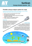
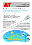
7) Go QUICKLY to S1 of plot (see plot setup above): at each sampling point take three Sunscan
readings from three different directions at about 80 to 100 cm above the ground. Make sure
your shadow does not appear on the 1 m probe. Hold the Probe levelled (no tilting or fancy
movements). All readings get appended one after the other. Go to S2 and take another three
readings from three different directions holding the Probe levelled, go to S3, etc.
-
Check in between: finishing at sample 6 you should have taken 18 readings and be ready
for reading LAI number 19.
-
If you went wrong: best start from beginning setting up new plot name. You will get very
confused otherwise, believe me.
-
At the end, in case you have 12 sampling points, you should have done 36 LAI readings.
If you are interested in getting the ground vegetation LAI you may want to run again through the
plot taking - at each Sample point – 3 readings from three different directions but holding the
probe levelled just at ground level into the vegetation. Compute difference between LAI 80cm per
plot and LAI ground level to get LAI of low vegetation.
5 References
Baret, Morissette, T. J., Fernandes, R. A., Champeaus, J. L., Myneni, R. B., Chen, J., Plummer, S., et al. (2006)
Evaluation of the representativeness of network of sites for the global validation and intercomparison of land
biophysical products: Proposition of the CEOS-BELMANIP. IEEE Transactions on Geoscience and Remote
Sensing, 44, 1794-1803.
Breda, N, J., J. (2003). Ground-based measurements of leaf area index: a review of methods, instruments and
current controversies. Journal of Experimental Botany, 54, 2403-2417.
Garrigues, S., Allard, D., Weiss, M., & Baret, F. (2002). Comparing VALERI sampling schemes to better
represent high spatial resolution satellite pixel from ground measurements: How to characterize an ESU.
Available for download at http://w3.avignon.inra.fr/valeri/methodology/ samplingschemes.pdf (accessed
17/08/2011).
11