Download BHC Navigation Co., Ltd.
Transcript
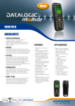
BHC Navigation Co., Ltd. Best Handheld Creator in Navigation BHC Navigation Co., Ltd. (BHCnav: Best Handheld Creator in Navigation) was legally registered in Beijing in 2004 and headquartered at Zhongguancun, which In June, 2009, BHCnav made the decision to develop its own brand and products. is considered as the Chinese Silicon Valley. With the purpose to promote the In October, 2010, BHCnav launched NAVA handheld GPS on the market development of China satellite positioning and navigation industry, BHCnav keeps The next year (in July, 2011) the second product, the GISA GIS data focusing on the field of GNSS development and modernization. controller was released to the market Between 2004 and 2009, the company inducted international GNSS brands and One year later, 2012, Land Measurement GPS was released In 2013, SPORCA bicycle GPS In 2013, BHCnav industrial tablet PC products into China and allocate products to sub-distributors, successfully built a big distributing network all over China. With 5 years of marketing, BHCnav has set As quick and success grew, BHCnav build up International Marketing up 14 representative offices all over China. As continues accumulation of Team in December, 2011, and starting distributing products to local marketing experience, BHCnav clearly realized what kind of product market really distributors in different countries. needs and what benefit will brought to sub-distributors and end-users if we sell exactly what the market needs. National Navigation Device Quality Test Center certificates Provide OEM/ODM solutions Contact BHCnav team to know more Today Our Mission The NAVA holds more than 40% share of the handheld GPS market in To become the Best Handheld Creator in Navigation, being a leading China. provider of GPS receivers/GIS handheld based solutions for business and So far, BHCnav is the only company that has succeeded on every test of personal use. the National Navigation Device Quality Test Center, and owns all the Our Spirit certificates. BHCnav remains at the cutting edge of innovation with outdoor Act in accordance with the laws and regulations in any circumstance. entertainment GPS and upcoming products, as Bicycle GPS and wrist GPS The staff observes the international, federal, state and local regulations Develop special products to meet different usage and requirement. The company’s products have sold to more than 55 countries all around and respects the rules and good practices relating to their activity. the world and BHCnav is expanding its market year after year. Establish a culture of integrity to avoid conflict between personal interests and company interests. BHCnav is proud of its strongly experienced R&D team in the field of We are deeply convinced that it’s a duty to respect certain moral values. GNSS, which allows us to offer reliable solutions to our customers. Thanks to its excellent service, high-quality products and win-win cooper ation business philosophy, BHCnav has become a leader in this field. Business Philosophy We feel that a strong cooperation will establish a faithful and mutually beneficial relationship. We apply this philosophy both external, with our suppliers and distributors, and internal, between our employees. Certificates. NAVA Land Measurement GPS NAVA Land Measurement is a new high-tech product independently researched Automatic farmland area & length measurement and developed by BHCnav, which is functioned with Area & Length & Able to set the unit-price, having unit-price memory facility Circumference & Price setting & Total Fare Calculation. It measures the length, Farmland area date showing in terms of square meter or acres width and area of the farm through satellites, and also has the function of unit Total working price displaying after area measurement price set and fare calculating. The product has been widely used in many (Total price = area× unit-price) agricultural activities for its creative handheld design and high performance and Current satellite signal intensity & measurement accuracy showing price ratio. NAVA Area Calculator is a very helpful tool for users’ outdoor land Current satellite signal positioning precision showing measurement. It enjoys high reputation from users especially from forestry and Current battery electric quantity showing, agriculture. Built-in Battery Electronic Quality Indicator Schematic Diagram showing Press to measure farmland of any shape NAVA Handheld GPS The NAVA handheld GPS offers functionalities for both professional and outdoor applications. • Micro SD expandable: Use a Micro SD card to enlarge the storage memory up to 4G. The card slot is located inside the waterproof battery compartment. • Lightweight and compact: NAVA is lightweight and compact • the perfect size for all your travels. • Waterproof: IPX7 • Readable under sunlight: 65k colors Transflective TFT LCD • Fast data transfer: USB 2.0 • Excellent GPS performance: With its high-sensitivity, SBAS-enabled GPS receiver, NAVA locates your position quickly and precisely and maintains its GPS location even in heavy cover and deep • Drop resistance: 1.5m drop from all 6 edges canyons. • User data compatibility: • Long battery life: Export and import user data from gpx, shp, kml, dxf, csv to NAVA proprietary Powered by two AA batteries, NAVA can work for up to 15 hours. Powered by format. special Li-ion battery, NAVA can work for up to 25 hours. • Worldwide Basemap, city detail map, topo map support: • Built-in Sensor: NAVA600 supports built-in worldwide basemap with countries boundaries and The built-in 3-axis E-compass provides you the bearing even when you stand still, and its barometer pinpoints air pressure. Also, you can use the thermometer to main city details. Other maps are optional and the complete list of available countries and related pricing is available upon request. know temperature conditions. • Shortcut key: • Multi-power source: Mark your current location as a waypoint directly by the MARK key. NAVA GPS can be powered by 2xAA, Li-ion, USB, vehicle power adapter, AC • User POI icons: adapter. You can design your own POI icons and load it to NAVA unit. GISA GIS Data Controller Excellent GPS Performance Hi-sensitivity antenna, SiRF IV solution. More (48) receive channels, integrated Real-Time SBAS. NMEA0183 and SiRF Binary Protocols. More Solutions to Adapt Different Task2 Windows mobile 6.1 is recommended/Windows CE 6.0 is available. Most GIS field software applications are available for both OS. Wider Range of Application Act as a GIS or GPS collector, working in a single unit. Ideal for use with most RTK solutions and GNSS sensor3. Flexible communication Mode. Integrate Bluetooth® technology for connectivity to supported devices. Industry-Standard Manufacture Mobile peripherals, including Bluetooth earphones, printer, laser Rugged shell cast with Industrial-grade GE fire-retardant Material rangefinder. Outdoor color display. Mainstream GPS receivers, as a controller to RTK or GPS system Anywhere and any environment Operating temperature –20 °C to +60 °C (–22 °F to +140 °F) Storage temperature –40 °C to +70 °C (–40 °F to +158 °F) High resistance: survives a 1.5 m (4.9 ft) drop onto plywood over concrete. Test passed on IP67 (Dust and sand, waterproof). Professional Configuration Features high-profiles hardware Max to 624Mhz Marvell PXA310 Processor, Large RAM, Memory expansion, HD camera with High-bright LED. solution. Integrates 802.11b/g wireless LAN for local network connectivity. GPRS/WCDMA connector module, alternative CDMA/EVDO More Optional Features and Interfaces can be configured. Selectable sensors listed below : Thermometer and Barometer \ E-compass \ Gyroscope RFID and RS232 VGA resolution display, Camera can be upgraded to 5 Megapixels A Secondary MicroSD card slot for additional and backup storage Micro SD card encoding SPORCA Bicycle GPS Computer Make different ride plans according to your personal status. You can also create a virtual training partner to set objectives. Support wireless transmission, can work together with step. Frequency and other devices using the same protocol. Use with SPORCA PC software, analyze and manage your physical status. You can upload and share your riding data on professional bicycle riding websites or on Google Earth. 2.2 inches colored screen, readable in strong sunlight. Sports flexible style, streamline design, low wind. Resistance, easy to mount, fits any bicycle design well. Waterproof IPx7 (30 minutes under water at 1.0 meter). High sensitive GPS antenna and Barometric Altimeter. Show calories, rides, track, speed, miles and slope. Information. GISA Tablet PC Safe Industry Tablet PC BHCnav Tablet PC contains software security to keep you data safe, as well as Fully-rugged Android tablet designed for professionals individual security features. It keeps secured information separate from the main processors for ultimate device protection. BHCnav tablet PC is engineered with enterprise-grade security, seamless connectivity and a long legacy of rugged, reliable computing to create the best Are compatible with devices controls for Mobile Device Management software, built tablets ever for mobile workers in any industry. which allows the tablets to be managed and highly secured by a network administrator. Fast Data Transmitting Tablet PC Availed 4G LTE broadband delivers faster, more reliable speeds for better information delivery. Android Full Functionning tablet PC Fully-rugged BHCnav Tablet PC resistant to dust, water and up to 5ft. drop. Mobile users can work without restrictions even in extreme temperature. It’s Not Just a tablet; it’s a fully functioning PC. The BHCnav Tablet PCruns the programs you need on an Android operating system. Featuring a docking keyboard, 7 inch touch screen; it provides you a perfect working environment anytime anywhere. Thanks you for reading! OEM & ODM service Feel free to contact us for more details and specifications Design the product that fits your activity! BHC Navigation Co., Ltd. With our experienced R&D team, we are able to offer customized solutions to 39°59'12.68" N satisfy our customer’s needs. GMT+08:00 External aspect 116°19'3 9.16" E Tel: +86-10-51266697 ext. 1020/1022/1026/1027/1029 (English language) Fax: +86-10-82600298 We can craft your device with your own design and colors. We can also add your own brand and product’s name on our device (instead of BHCnav). Address: 7 Floor, Tower C, Intelli-Center, No.18 Zhongguancun East Road, Haidian District, Beijing, 100083, China Hardware Want another sensor? Wants to get rid of all the parts you don’t need? You can choose to add or remove any sensor or peripheral from any of our devices… Or even ask for a fully new device! Software The software can be adapted* to your needs: Adding new language, new functionalities … www.BHCnav.com NAVA Land Measurement GPS Physical & Performance /Model NAVA 110 Dimensions 120x57x30 Display 2.2’’ mono color display Weight 105g (without battery) Battery 2xAA Work time 30 hours Standby time 12 days GPS receiver 48 Channel;Stand alone 2.5m, SBAS 1-3m Water Proof IPX-7 Drop Resistance 1.5m Operation Temperature -20℃--+60℃ Storage Temperature -40℃--+85℃ Specifications NAVA 110 Area Measurement Yes Line Length Measurement Yes Unit-price Setting Yes Record Yes Regular Field Measurement Yes Slop Area Measurement Yes Satellite display Yes Package Contents NAVA GPS User manual Reference guide Neck lanyard USB cable NAVA Handheld GPS Physical & Performance Unit Dimension, NAVA200 NAVA300 WxHxD NAVA400 NAVA600 56x119x32mm Display 2.2" QVGA, 240x320 pixels, Transflective TFT, 65536 colors Weight 108g (without battery) Battery (not included) Battery life 2xAA 2xAA or Special Li-ion Battery 15 hours 2xAA(15hours), Special Li-ion Battery(25hours) GPS Receiver 20 Channels,L1, CA code, High Sensitive GPS Module Acquisition Time Cold Start: < 35s, Hot Start: <1s GPS Accuracy 3-7m (GPS only), 1-3m (SBAS) SBAS WASS, EGNOS, MSAS Update Rate 1/second, continuous Interface USB 2.0 and NMEA 0183 compatible Waterproof IPX-7 Features NAVA200 NAVA300 NAVA400 NAVA600 Basemap No Yes Yes Yes Yes Yes Built-in memory Micro SD card slot 128M No No Waypoints 3000 Routes 60 Tracks 50 tracks, 5000 points Electronic Compass No No No Yes Barometric Altimeter No No No Yes Temperature No No No Yes Hunt/Fish Yes Sun/Moon Yes Calculator Yes Area Calculation Yes Coordinate System WGS84, UTM, User Grid··· Standard Packing List In the Box NAVA200 NAVA300 NAVA GPS Device Yes Owner's Manual Yes Quick Reference Guide Yes Neck Lanyard Yes USB Cable NAVA400 NAVA600 Yes Yes No Yes NAVA200 NAVA300 NAVA400 NAVA600 Dashboard Mount Yes Yes Yes Yes Bike Mount Yes Yes Yes Yes Carrying Case Yes Yes Yes Yes Vehicle Power Adapter Yes Yes Yes Yes USB Cable Yes Yes Yes Yes Lithium Battery No Yes Yes Yes AC Power Adapter No Yes Yes Yes Neck Lanyard Yes Yes Yes Yes Optional Accessories Accessories (Optional) GISA GIS Data Controller Physical & Performance /Model CPU M10 M20 M50 M60 PXA310(624MHz) PXA310(624MHz) PXA310(624MHz) PXA310(624MHz) Memory 256M DDR 256M DDR 256M DDR 256M DDR NandFlash 256M 256M 512M 512M Screen QVGA QVGA QVGA VGA Bluetooth √ √ √ √ Wi-Fi √ √ √ √ GPRS × √ × × 3G × × √ √ Camera 300 Mpixel 300 Mpixel 300 Mpixel 300 Mpixel Micro SD card √ √ √ √ USB HOST × √ √ √ RS232 × × √ √ Barometer altimeter × × √ √ E-compass × × √ √ External Antenna √ √ √ √ Speaker √ √ √ √ Microphone √ √ √ √ Earphone × √ √ √ Headphone √ √ √ √ Keyboard Keyboard noctilucent function Li battery √ √ √ √ × √ √ √ 3000mAh 3000mAh 3000mAh 3000mAh √ √ √ Flashlamp/Touchligh function √ GISA Tablet PC Specification of 7” Rugged Tablet Physical Dimensions 213*141*17.75mm Weight 2.1 Ibs Wireless Hardware Chipset RK3066 Quad Mali 400 GPU Processor ARM dual-core cortex-a9 Fréquency 1.6GHz RAM 1GB DDR3 SDRAM ROM 16GB Nand Flash Expansion Slot Additional with Micro SD card LCD Display 7" TFT IPS Resolution 1280×800 Backlight LED Multi-touch capacitive screen 5 points √ WCDMA/EVDO √ Audio call √ Data Transmission √ SMS&MMS √ 802.11 b/g/n √ Bluetooth Bluetooth 2.1+EDR √ Audio √ √ USB USB2.0 √ Front Camera OTG Résolution √ 2MP CMOS Resolution √ Rear Camera Sensor CMOS Auto Focus Flash E-compass √ √ √ √ Audio 3-Axis Gyroscope Microphone √ √ Charging indicator Speaker ( full waterproof) Headphone(full waterproof) 2 Double color led 2, 8Ω/0.5W √ Red=charging, green=full CPU Storage and Memory Display Capacitive Stylus 3G Module GPS 5MP Interface SIM Card √ Micro SD Card Micro USB 30pin USB Charging dock √ √ √ √ √ Dock Headphones/Speaker Charging dock key External charging dock DC IN Engine inducing key 4 pin Priorité batterie externe 1 power key, 1 reset key, 2 audio volume up/down key 4 function key Lithium, 5000mAh/3.7V, operation time≥5hrs Battery Accessories AC adapter USB cable Microphone Manual & Warranty card Operation system Media player Adobe Flash Menu Language Audio Vidéo UI Codec Format Codec Format Photograph E-book 4 pin Resolution Format Resolution Format 5V/2A √ √ √ Software Android 4.1 V11 Android OS supports Multi-language and local combinations TBD MPEG-1/2 Audio Layer 1/2/3 MP3, AAC, OGG, FLAC H.264/H.263, MPEG-4/2/1, VP8,DiVX4/5/6, XVID, MKV, MPG, MP4, AVI, RMVB, VOB, DAT Up to 1920×1080p JPEG, BMP, PNG, GIF 8000×8000 TXT


