1
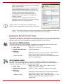
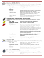
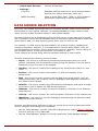
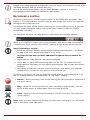
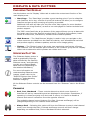
VESSEL DETAILS WIDGET The ‘Vessel Details’ widget is used to display the position, heading and velocity of the vessel, using data recorded from a connected GPS device (other devices such as Compasses or Velocimeters will only also display their results under the relevant heading). The format and units of measurement used for the readings can be adjusted using the controls under the “Setup” Ribbon Bar tab. ENVIRONMENT & DISPLAY OPTIONS Most environmental and display options can be quickly viewed and changed by selecting the “Setup” tab on the Ribbon Bar, or more comprehensive options are available by clicking ‘Setup : Options’. UNITS The ‘Units’ group on the “Setup” Ribbon Bar tab allows you to quickly select between metric or imperial measurement units and numerical formatting styles for data to be displayed in. The available categories of measurement units/format are… Depth & Range – These settings control how depth and sonar range data is displayed (select from metres, feet or yards). The measurement units used for Velocity-of-Sound reads are determined from this selection. Distance – These settings control how navigational distances are displayed (select from metres, kilometres, feet, yards or miles). Heading – These settings determine how heading bearings are displayed (select from decimal degrees only, degrees & minutes or degrees, minutes and seconds). Position – These settings determine how the sonar/vessel position is displayed. o Universal Transverse Mercator (UTM) – Position is given as a Northing & Easting in a grid zone, using the ‘Distance’ measurement units specified. o Latitude/Longitude – Shows positions as latitudes and longitudes based around the WGS-84 spheroid. Select from signed (±N and ±E) or unsigned (N, S, E & W) decimal degrees, degrees & minutes, or degrees, minutes and seconds. Signal Level – These settings determine if the sonar control values (for Gain and Contrast) should be sonar as a Percentage of the control limits, or in the absolute Decibel levels of the control. Temperature – These settings determine how values such as water temperatures are displayed (select from Celsius or Fahrenheit). Velocity – These settings determine how the speed of the vessel/sonar is displayed (select from metres-per-second, kilometres-per-hour, feet-per-second, miles-perhour or knots). NB: This does not affect the Velocity-of-Sound readings – see ‘Depth & Range’ above. 21