1
About This Manual
This manual may be used as a summary, a reference, and a
learning tool. Information is provided about all of the functions
available to the MX20. Your specific installation may not include
all of these functions.
Take a few moments to familiarize yourself with the various
sections in this manual. The Getting Started section gives an
introduction to the controls, basic operation, and organization of
the functions in your MX20. Be sure to read the Getting Started
section to learn the rules for using the MX20. The Detailed
Operation section is the reference for each of the functions in the
MX20. Refer to the Detailed Operation section when you want to
get into the details on every function and option along with
step-by-step instructions.
Not every function is available in all software versions or in every
installations.
Limitations
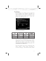
The Traffic function is not a collision avoidance system. It is an
aid to visual acquisition and does not relieve the flight crew of
their responsibility to “see and avoid.” There are no evasive
aircraft maneuvers authorized, recommended, or provided for as a
result of displayed traffic targets. Refer to the traffic sensor
documentation for additional information.
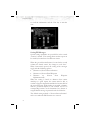
The Terrain function shows you the general terrain elevations
relative to your altitude and are advisory in nature. Individual
obstructions may be shown if available in the database. Terrain is
displayed from database information and may therefore contain
errors. The Terrain function does not relieve the flight crew of
their responsibility to “see and avoid.” Do not use this information
for navigation.
The moving map, weather information, and other displayed
information are intended only as aids to situational awareness.
The pilot should rely on the appropriate primary means of
navigation.
Refer to your airplane flight manual supplement for more
information.
iv