1
Chapter 16. Set-up your location
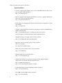
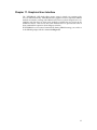
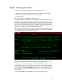
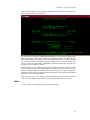
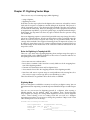
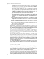
Next is the description of the boundary coordinates of the project area and the definition of the default raster resolution:
The default raster resolution (GRID RESOLUTION) has to be chosen according to the
needs. Generally, it is advisable to work in steps of 0.25 (0.25, 0.5, 1.75, 2.00, 12.25 etc.).
This resolution does not concern vector and site data since these are stored with their
exact coordinate values. Note that every raster map may have its own resolution. You
can leave this screen with “ESC”-“RETURN” and then accept the list of parameters
that appears, if everything is correct.
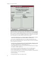
You will get back to the startup screen again to enter the mapset’s name (if not already entered). Another “ESC”-“RETURN” will finally let you leave this screen. This
mapset is created within the new location by answering “yes” to the next question.
The mapset will use the parameters of the location (such as the region and resolution
definitions) as its default parameters.
Now the project area, i.e. the location including a mapset has been created. You have
"arrived" in the GRASS system and can start working within this new location.
Notes
1. http://grass.itc.it/gdp/html_grass5/projections.html
41