1
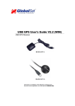
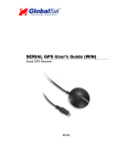
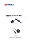
USB GPS User’s Guide (WIN)
USB GPS Receiver
BU-303 (SiRF II)
BU-353 (SiRF III)
(Information on installation of the USB driver contained in this
document is also applicable to our USB cable set #BR305-USB)
DOCUMENT REVISIONS
REV NO.
DATE
1.2
02-28-2003
2.0
06-08-2005
2.1
04-07-2006
2.2
01-07-2008
DESCRIPTION
Initial document
New document format
Revision of embedded web inks
Product discontinued- No warranty
APPROVED
BRF
NRG
AAK
JCB
© 2006 Globalsat Technology Corporation/USGlobalsat, Inc. All rights reserved. The Globalsat logo is a trademark
of Globalsat Corporation. Windows is a register trademark of Microsoft Corporation. Acrobat is a registered
trademark of Adobe Systems Incorporated. Mac is a registered trademark of the Apple Corporation. All other
trademarks or registered trademarks are acknowledged as the exclusive property of their respective owners.
All rights reserved. No part of this manual may be reproduced, transmitted, copied, or stored in any storage
medium, for any purpose, without prior written consent from Globalsat Technology Corporation or USGlobalsat, Inc.
Globalsat/USGlobalsat hereby grants the right to download one (1) copy of this manual onto a hard drive for
personal use. This manual is copyrighted and may contain proprietary information that is subject to change without
notice.
USB GPS (WIN)
Table of Contents
PACKAGE CONTENTS ....................................................................................................3
SYSTEM REQUIREMENTS .............................................................................................3
WELCOME.........................................................................................................................3
1. GETTING STARTED....................................................................................................4
2. INSTALLING THE USB DRIVER TO YOUR LAPTOP...............................................4
3. COM PORT VERIFICATION........................................................................................5
4. INITIALIZING YOUR GPS RECEIVER........................................................................6
5. USING / TESTING YOUR GPS RECEIVER...............................................................6
6. UN-INSTALL THE USB DRIVER.................................................................................8
7. FAQ’s.............................................................................................................................8
8. CONTACT INFORMATION..........................................................................................9
9. SAFETY AND LEGAL NOTICES.................................................................................9
10. LIMITED WARRANTY..............................................................................................11
11. BU-303 SPECIFICATIONS ......................................................................................12
12. BU-353 SPECIFICATIONS ......................................................................................13
PAGE 2 OF 13
USB_GPS_WIN_ v2.1
USB GPS (WIN)
PACKAGE CONTENTS
- USB GPS Receiver
- Driver CD-ROM with User’s Guide and test utility for WIN and Mac O/S*
•
WIN Users please refer to the root directory on the included CD-ROM for installation instructions
and drivers.
SYSTEM REQUIREMENTS
The Globalsat USB GPS receivers requires a Windows, or Macintosh laptop computer, with a CDROM*, USB port, and NMEA compatible navigation software. The 3rd party mapping/navigation
software may have its own system requirements, please check with software vendor for details.
*CD-ROM is required for USB driver installation and access to the User’s Guide. If no CD-ROM drive is available,
files can be downloaded from the Internet at : http://www.usglobalsat.com/
WELCOME
Thank you for purchasing a Globalsat USB GPS receiver! Globalsat USB GPS receivers allow for real-time street
navigation by using your laptop for graphical plotting and positioning of your route. Simply load the GPS driver, plug
the GPS receiver into your computer’s USB port and install your own personal mapping software to begin to view
your position in real-time in relation to the surrounding streets in your travel area.
You’ll find that almost any NMEA compliant mapping/charting software will be compatible with your USB GPS
receiver. Visit our web-site for recommended mapping programs that you can use.
PAGE 3 OF 13
USB_GPS_WIN_ v2.1
USB GPS (WIN)
1. GETTING STARTED
These are only a few simple steps that you need to follow before using your USB GPS receiver:
•
•
Install the USB driver and onto your laptop from the included CD-ROM or download the files from our web-site
www.usglobalsat.com
Plug-in the GPS receiver into your laptop.
NOTE: From within your mapping, or navigation software (including the supplied GPS Information utility), you will
need to manually configure the selection of the COM port to what was assigned to the GPS receiver so that proper
communication between the GPS receiver and mapping program can occur. Most all software requires that you
manually configure the COM port setting for any GPS device you use.
IMPORTANT:
1. You must change the default rate setting of your mapping software ‘s Baud Rate to 4800 if this is not currently
set as such otherwise GPS data cannot be received.
2. Set Baud Rate 4800, Data Bit: 8, Parity: None, Stop Bit: 1, Flow Control: None
2. INSTALLING THE USB DRIVER TO YOUR LAPTOP
1. Place the product CD-ROM into your CD-ROM drive.
2. Auto-run should detect the CD bring up the following screen below.
PAGE 4 OF 13
USB_GPS_WIN_ v2.1
USB GPS (WIN)
3. Click on the button titled “Install Driver” from the main screen as shown above.
4. Or should your “Auto-Run” be disabled on your PC, use Windows Explorer or File Manager to
locate the file titled ”PL-2303 Driver Installer.exe” in the root directory of the CD-ROM and click to
launch the install process.
3. COM PORT VERIFICATION
1. Once your USB Driver has been installed, you will need to confirm which COM Port your PC
has assigned to it in order to properly configure any software that will be utilizing the GPS data
being received.
2. Your USB GPS MUST be plugged into your USB port at this time.
3. Using Window’s Control Panel, select System > Hardware > Device Manager
4. Then look under the heading of: PORTS (Com & LPT)
5. There should be a listing for: Prolific Serial-to-USB Comm Port (COM x)
(“x” will actually be the number your PC has assigned the USB GPS receiver).
6. Once you have identified the COM port number, any software that you utilize must be
configured to read GPS data from this COM port.
We strongly suggest that you first test your USB GPS with the included GPS Info utility program to
confirm that the GPS receiver if functioning properly on your PC and that you have successfully
configured the right COM Port setting. Once this has been done, close the GPS Info program and
start your application for COM port configuration.
NOTE: By default, your PC will not allow you to run multiple applications from a single COM port. It
is important that you close any previously opened GPS application before switching to another
GPS application as the GPS receiver and data will not be found by the new program.
There are special utilities available to split data into multiple COM ports for use by more than one
application simultaneously. (see: http://franson.com/gpsgate/ )
PAGE 5 OF 13
USB_GPS_WIN_ v2.1
USB GPS (WIN)
4. INITIALIZING YOUR GPS RECEIVER
Before using your USB GPS receiver for navigation (especially for the first time), the receiver must
obtain a local GPS fix (coordinates) of the current position. To do this, take your laptop (with your USB
driver and the mapping software loaded and configured) to an open area that has a clear view to the
sky (such as a park or empty field). Start your software (or the included GPS Info utility program) and
wait for initialization of the GPS to complete. This may take a few minutes depending on various
factors such as the distance of the current coordinates from the last time the GPS receiver was
activated, GPS signal strength and surrounding terrain (tall trees and buildings can block the satellite
signals). Once the RAW GPS data is displayed onto the screen, if applicable for your software, a fix
has been initialized (red LED on the GPS will also start to flash). In some cases initialization can take
up to several minutes depending on the conditions mentioned above before complete GPS data will be
displayed on the screen.
Coordinates scrolling with zero’s means that the port connection is complete, but the satellite data is not
being received yet (possibly still initializing or in a bad area for satellite reception).
5. USING / TESTING YOUR GPS RECEIVER
Once the USB GPS receiver’s driver and your personal mapping software have been installed and
configured properly, you can begin to use your navigation system by plugging the USB GPS into your
laptop’s USB port and launching your mapping software. If you don’t have a mapping, or navigation
software, we’ve included a GPS test utility called “GPS Info” for the purpose of confirming your
installation and configuration. This utility can be installed by clicking the GPSInfo.exe file from the Win
directory on the CD-ROM or downloaded from our web-site www.usglobalsat.com.
LED Status indicator on the USB GPS”
LED OFF: GPS receiver is off (no power).
LED ON (solid): No fix, searching for GPS signals.
LED FLASHING: Position fix established and GPS signals are being received.
Always select an area in the vehicle where the GPS unit will be secure and not obstruct normal driving,
visibility and safety, but still maintaining a “view to the sky” in order to receive satellite data.
It is recommended that you first load and test your GPS receiver with the GPSinfo.exe. This process
will confirm you have found correct COM port number and have configured it properly.
1. Run GPSinfo.exe to load the utility.
2. Enter the proper COM port for your GPS device (see COM Port Verification above)
3. Set COM port to Baud rate: 4800
4. If no errors have been made in configuration, there should be GPS data being displayed in the
window, which is confirmation that the communication between the GPS device and the “GPSinfo”
software is working properly.
5. If there is no GPS data displayed (or data with multiple zeros in them), please exit the software and
unplug the GPS receiver from the USB port and reinsert it after 10 seconds to reset the device.
PAGE 6 OF 13
USB_GPS_WIN_ v2.1
USB GPS (WIN)
The above screen shows the available satellites (numbers) and their signal strength.
NOTE: Configuration (or selection) of an assigned COM port for the GPS device from within your
mapping or charting software must be completed whenever using a software for the first time.
PAGE 7 OF 13
USB_GPS_WIN_ v2.1
USB GPS (WIN)
6. UN-INSTALL THE USB DRIVER
Run the file the Remover98_2k.exe to uninstall the USB GPS driver.
7. FAQ’s
I an not getting GPS data into my application.
1. Check your DEVICE MANAGER to confirm the COM Port number assigned to the GPS
Receiver (it will be listed under the PORTS (COM & LPT) heading as Prolific Serial-to-USB
Comm. Then be sure this is the same COM port number configured in your application.
2. Be sure your Baud rate is configured correctly at:
Baud Rate: 4800
Data bit: 8
Parity: None
Stop Bit: 1
Flow Control: None
3. Re-boot your computer and then insert the USB GPS into a USB port.
4. Configure the GPS Info utility with the correct COM Port and test your GPS receiver first
before using it in your application.
Will the USB GPS work with other Street Mapping software?
Globalsat USB GPS receivers provides standard NMEA data for mapping software to use and convert
to coordinates and should work well with most any NMEA compliant software on the market today.
How accurate is the GPS?
The USB GPS is WAAS/EGNOS capable, and for units sold in North America through authorized
resellers, these units are WAAS/EGNOS enabled unless otherwise stated. Accuracy can be up to 5
meters 3D RMS with WAAS enabled and 10-15 meters 2D RMS WAAS disabled
What is ideal GPS environment?
The GPS requires an open, clear view of the sky. Buildings, covered parking areas, tunnels and dense
foliage can cause the GPS receiver to be unable to get a location fix.
If you are parked in a covered parking lot or near a tall building, it is recommended that you drive away
until you have a clear view of the sky before using the BU-303. You may need to give the GPS a few
minutes to find or get a fix its location.
How do I know if the GPS is ON?
Your USB GPS must be plugged into your laptop’s USB port to get power. If your PC is on and the
COM port was configured properly, the GPS receiver is on and receiving the streaming GPS data. This
can be verified by opening your mapping software program. In addition, the Globalsat USB GPS has a
built-in LED status indicator that shows the following:
LED OFF: GPS receiver is off (no power).
LED ON (solid): No fix, searching for GPS signals.
LED FLASHING: Position fix established and GPS signals are being received.
PAGE 8 OF 13
USB_GPS_WIN_ v2.1
USB GPS (WIN)
Why does the GPS not work near buildings and other tall objects?
The GPS uses satellites in the space to find out where it is. Therefore it needs a clear view of the sky.
Tall buildings and other objects that block the receiver’s view to the sky make it infeasible to determine
your location. Sometimes the satellites are not overhead but near the horizon. In these cases the GPS
must have a clear view of the horizon.
Other CommentsPlease allow an adequate amount of time for the GPS receiver’s boot-up (TTF) to complete before
contacting Technical Support.
Driver updates can be found at Prolific ’s web-site:
http://www.prolific.com.tw/eng/downloads.asp?ID=31 (www.prolific.com.tw)
8. CONTACT INFORMATION
Globalsat Technology Corporation (Taiwan)
www.globalsat.com.tw
[email protected] (pre-sales GPS product questions only)
USGlobalsat, Inc.
www.usglobalsat.com
[email protected] (pre-sales GPS product questions only)
Technical Support (North America)
See our DOWNLOADS and FAQ section on our web-site for GPS solutions, driver literature updates.
http://www.usglobalsat.com/custom.asp?recid=7
Pre-registration is required before receiving any type of technical support. Support issues submitted via
phone, fax or e-mail (any means outside of the recognized “Trouble Ticket” generated from your own
USGlobalsat registered account) WILL NOT be answered.
Create your account and register your products at: www.usglobalsat.com/support/custadminlogin.asp
9. SAFETY AND LEGAL NOTICES
Please read this section carefully before using the GPS receiver
Globalsat Technology Corporation / USGlobalsat, Inc. will not accept any responsibility
whatsoever for accidents resulting from failure to observe common sense precautions. Your
personal judgment, traffic regulations, and common sense must always take precedence over
any directions produced by GPS receiver or the mapping software
WARNING: Make sure that the GPS receiver is secure and does not interfere with driving
visibility and safety.
It is your responsibility as the vehicle operator to securely place the GPS unit and antenna so that they
will not interfere with driving and prevent operations of any safety device (such as the Airbag) in your
vehicle. Do not mount the devices in a place where the driver or passengers may receive injury during
vehicle operation or collision. For your safety, take care to route all cables away from shifters, pedals,
accessory controls and mechanisms.
PAGE 9 OF 13
USB_GPS_WIN_ v2.1
USB GPS (WIN)
WARNING: Drive safely and use common sense.
It is your responsibility as the vehicle operator to drive safely, observe all traffic rules and above all use
your own personal judgment while driving. If you feel that a route suggested by the navigation software
instructs you to perform an unsafe or illegal maneuver, places you in an unsafe situation, or routes you
into an area which you consider unsafe, do not follow the instructions.
WARNING: Keep your eyes on the road.
It is your responsibility as the vehicle operator to keep your eyes on the road and be an alert driver at all
times, especially when the vehicle is moving. The vehicle’s operator should not be distracted by the
navigation equipment or software. Should there be a distraction with the ability to drive responsibly,
please turn off the device. Should you want to look at the display for a prolonged time, park the car
safely, while following all traffic regulations before looking at the display.
WARNING: To reduce the risk of fire or shock hazard, do not expose this product to rain or
moisture. Do not remove covers or open housings, there are no user serviceable parts inside.
Refer servicing to qualified personnel only.
PAGE 10 OF 13
USB_GPS_WIN_ v2.1
USB GPS (WIN)
10. LIMITED WARRANTY
THIS PRODUCT HAS BEEN DISCONTINUED
AND CARRIES NO FACTORY WARRANTY
PAGE 11 OF 13
USB_GPS_WIN_ v2.1
USB GPS (WIN)
11. BU-303 SPECIFICATIONS
Electrical Characteristics (Receiver)
GPS Chipset
Frequency
C/A Code
Channels
Sensitivity
Accuracy
Position Horizontal
Velocity
Time
WAAS
Datum
Datum
Acquisition Rate
Hot start
Warm start
Cold start
Reacquisition
Protocol
GPS Protocol
GPS Output Data
GPS transfer rate
Dynamic Condition
Acceleration Limit
Altitude Limit
Velocity Limit
Jerk Limit
Temperature
Operating
Storage
Humidity
Power
Voltage
Current
Physical Characteristics
Dimension
USB Cable Length
Low Noise Amp
Amplifier Gain w/out cable
Filtering
Output VSWR
Voltage
Current
SiRF Star II e/LP
L1, 1575.42 MHZ
1.023 MHz chip rate
12 all-in-view tracking
-147 dBm
10m 2D RMS WAAS enabled
15m 2D RMS WAAS disabled
0.1m/sec 95% (SA off),
1 micro-second synchronized to GPS time
Enabled for North America product s (USGlobalSat, Inc)
WGS-84
8 sec., average (with ephemeris and almanac valid)
38 sec., average (with almanac but not ephemeris)
45 sec., average (neither almanac nor ephemeris)
0.1 sec. average (interruption recovery time)
Default: NMEA 0183 (Secondary: SiRF binary)
SiRF binary >> position, velocity, altitude, status and control
NMEA 0183 MEA0183 V2.2 protocol, and supports
command: GGA, GSA, GSV, RMC, VTG, GLL v2.2 (VTG
and GLL are optional)
Software command setting (Default : 4800,n,8,1 for NMEA )
Less than 4g
18,000 meters (60,000 feet) max.
515 meters/sec. (1,000 knots) max.
20 m/sec**3
-40°~ 176°F (-40°~ 80°C)
-40°~ 176°F (-40°~ 80°C)
Up to 95% non-condensing
5V ±5%
90mA typical
2.32" x 1.65" x 0.82" (59mm x 47mm x 21mm)
60" (152 cm)
27 dB Typical
-25dB (+100 MHz)
2.0 Max.
DC 3 ~ 5.0V
15mA max @ 5VDC
Due to continuous product improvements, all specifications are subject to change without notice.
FCC NOTICE
This device complies with part 15 of the FCC rules. Operation is subject to the following two conditions:
(1) This device may not cause harmful interference, and (2) This device must accept any interference received, including interference that may cause
undesired operation. FCC RF Exposure requirements: This device and its antenna(s) must not be co-located or operation in conjunction with any other
antenna or transmitter. NOTE: THE MANUFACTURER IS NOT RESPONSIBLE FOR ANY RADIO OR TV INTERFERENCE CAUSED BY
UNAUTHORIZED MODIFICATIONS TO THIS EQUIPMENT. SUCH MODIFICATIONS COULD VOID THE USER'S AUTHORITY TO OPERATE
THE EQUIPMENT.
PAGE 12 OF 13
USB_GPS_WIN_ v2.1
USB GPS (WIN)
12. BU-353 SPECIFICATIONS
Electrical Characteristics (Receiver)
GPS Chipset
Frequency
C/A Code
Channels
Sensitivity
Accuracy
Position Horizontal
Velocity
Time
WAAS/EGNOS
Datum
Datum
Acquisition Rate
Hot start
Warm start
Cold start
Reacquisition
Protocol
GPS Protocol
GPS Output Data
GPS transfer rate
Dynamic Condition
Acceleration Limit
Altitude Limit
Velocity Limit
Jerk Limit
Temperature
Operating
Storage
Humidity
Power
Voltage
Current
Physical Characteristics
Dimension
USB Cable Length
Low Noise Amp
Amplifier Gain w/out cable
Filtering
Output VSWR
Voltage
Current
SiRF Star III e/LP
L1, 1575.42 MHZ
1.023 MHz chip rate
20 all-in-view tracking
-159 dBm
5m 2D RMS WAAS enabled
10m 2D RMS WAAS disabled
0.1m/sec 95% (SA off),
1 micro-second synchronized to GPS time
Enabled for North America product s (USGlobalSat, Inc)
WGS-84
1 sec., average (with ephemeris and almanac valid)
38 sec., average (with almanac but not ephemeris)
42 sec., average (neither almanac nor ephemeris)
0.1 sec. average (interruption recovery time)
Default: NMEA 0183 (Secondary: SiRF binary)
SiRF binary >> position, velocity, altitude, status and control
NMEA 0183 MEA0183 V2.2 protocol, and supports
command: GGA, GSA, GSV, RMC, VTG, GLL v2.2 (VTG
and GLL are optional)
Software command setting (Default : 4800,n,8,1 for NMEA )
Less than 4g
18,000 meters (60,000 feet) max.
515 meters/sec. (1,000 knots) max.
20 m/sec**3
-40°~ 185°F (-40°~ 85°C)
-40°~ 185°F (-40°~ 85°C)
Up to 95% non-condensing
4.5 ~ 5.5V DC Input
80mA typical
2.08" diameter x 0.75" (53mm dia. x 19.2mm)
60" (152 cm)
27 dB Typical
-25dB (+100 MHz)
2.0 Max.
DC 3 ~ 5.0V
15mA max @ 5VDC
Due to continuous product improvements, all specifications are subject to change without notice.
FCC NOTICE
This device complies with part 15 of the FCC rules. Operation is subject to the following two conditions:
(1) This device may not cause harmful interference, and (2) This device must accept any interference received, including interference that may cause
undesired operation. FCC RF Exposure requirements: This device and its antenna(s) must not be co-located or operation in conjunction with any other
antenna or transmitter. NOTE: THE MANUFACTURER IS NOT RESPONSIBLE FOR ANY RADIO OR TV INTERFERENCE CAUSED BY
UNAUTHORIZED MODIFICATIONS TO THIS EQUIPMENT. SUCH MODIFICATIONS COULD VOID THE USER'S AUTHORITY TO OPERATE
THE EQUIPMENT.
PAGE 13 OF 13
USB_GPS_WIN_ v2.1