1
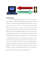
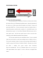
A Platform and Algorithm for High Speed Autonomous
Control of a 1/10th Scale Model Car
Mark Woodward, Stanford University
Abstract This paper describes an effort towards creating a software/hardware
platform for fairly testing driver algorithms designed to pilot 4-wheeled car like
vehicles. Various approaches to a positioning system and control system are
described in the paper, along with the optimal solutions to both: interfacing with a
standard model car radio transmitter for the control system and a rotating laserbased system for the positioning system. The software architecture is also
presented, including the key interfaces: Car and Driver. In addition, a simple
driver algorithm is presented, which is based on a waypoint algorithm used in
many racing video games.
1
ACE
Positioning System
Control System
INTRODUCTION:
Control of 4-wheeled non-holonomic vehicles is an area with a rich research
history; advances in electronics and artificial intelligence algorithms continue to push the
area forward. In this paper, I describe a flexible platform I have developed to serve as a
test-bed for future research in the area.
I also explain a simple driver algorithm
implemented to test the system. The scenario envisioned for the system is to test out
various driver algorithms for piloting a model car around a two-dimensional racetrack.
Before beginning, I made two simplifying assumptions: 1) The driver will have a priori
knowledge of obstacles defining the track, 2) The driver will be supplied with absolute
positioning information at regular intervals during the race. Some constraints apply to
the assumption of positioning data; an absolute position must be supplied: 1) at a rate no
slower than 10Hz, 2) to a precision no less accurate than 6 inches, 3) be able to represent
an area no less than 10,000ft2, and 4) be able to track an object moving within that space
at 20mph. The project work involved creating a software user interface, called ACE
(Autonomous Car Editor), for initiating and reviewing trial runs, creating a hardware
positioning system to provide the position information about the car, and creating a
hardware control system allowing the car to be controlled from software.
2
The paper describes in turn the various options, and final solutions, to 1) the ACE
architecture, 2) the positioning system, and 3) the control system. This is followed by a
description of the driver algorithm implemented to test out the system. Finally, some
related work is described.
ACE - Autonomous Car Editor
ACE
Positioning System
Control System
Overview of ACE:
ACE is a software application written in Java that provides an easy-to-use
environment for testing different driver algorithms. A driver algorithm is a software
component that will employ the ACE interfaces to pilot a car around a track. A user can
graphically design a track by placing and manipulating waypoints, wayregions, and
obstacles. Internally, obstacles are represented as undirected cycles (nodes, connected to
the next node and the previous node by an arc, forming a loop) plus a point not on the
cycle to designate the obstacle area. Points making up the obstacle can either be created
by selecting a menu item or captured from the current car’s position in the field. This
second option allows a user to define a track by physically walking the car around the
obstacles on that track.
In addition to defining a track, the interface allows a user to record and play back
instances of a driver piloting the car around a track. I call these recorded instances trials.
3
A trial is started by selecting a "Start Trial" menu item, resulting in an event being sent to
the driver, who then begins to execute the optimal path. The trial ends when the user
selects the "Stop Trial" menu item. Trials and tracks are stored as XML files on the local
filesystem, with, respectively, ".trl" and ".trk" extensions. A track can have many trials,
but a trial can be associated with only one track. Once a trial has been recorded, it can be
loaded and played, like a movie, at any time. Having the recorded trial data will be
useful for future performance analysis.
Track
Track
Track
Track
Track
ACE
Driver Interface
Trial
Car Interface
ACE Architecture:
Two important software interfaces in the ACE architecture are the Driver
Interface and the Car Interface. Through the Car interface, control signals, such as wheel
position and pedal position, are sent and car position events are thrown. Thus, as long as
a software component implements the car interface, ACE can use it. In the current
implementation, two objects implement the Car interface. The first is the obvious object
4
that interfaces with the hardware control and positioning systems. The second is a less
orthodox use of the interface. Instead of implementing a separate trial playback viewer, I
have an object that reads the trial file and through the Car interface generates wheel,
pedal, and position events at the appropriate times. By doing things this way, I was able
to use the same display code for displaying an actual trial as for displaying a playback.
Another useful implementation of the Car interface would be a software simulator. This
way a driver could be tested in simulation, before running on hardware.
Through the Driver interface, track changes and trial signals are sent.
The
implementing Car interface object is also sent through the Driver Interface. This gives
the driver a direct hook into the low-level control and signals of a Car. Higher-level
abstractions could also be built on top of the Car interface (for example, providing curve
specifications, instead of wheel positions) but these higher-level abstractions would be
selected on a driver-by-driver basis, and as such, should not be included in the base
interface.
The Future of ACE:
The choice of Java was made primarily for the language's ease of use. The time
allotted for the software code was only 1 week, which did not allow very much time for
tracking down “.dll” link errors and memory issues. That being said, I do feel that more
advanced driver implementations would benefit from the speed of C/C++. I am currently
debating re-implementing the architecture in C++.
details have been worked out, that task would be easier.
5
Now that the class/architectural
POSITIONING SYSTEM:
ACE
Positioning System
Control System
Overview of the Positioning System:
The positioning system is a combination of hardware and software that calculates
the location of the car in a 2-Dimensional coordinate system. Again, the requirements of
the system were as follows: greater than 10Hz update rate, less than 6” accuracy, and
greater than 10,000ft2 area. As for the environment, I assume line of sight at all times. I
explored four options to satisfy the above constraints: 1) a vision/fudicial system, 2) an
ultrasound beacon system, 3) a Carrier Phase Differential GPS-based system, and 4) a
rotary optical system.
Only the rotary optical system was able to meet the above
constraints, given the additional constraints of time and money.
The first system explored was the vision/fudicial system. It uses an overhead
camera and vision software to track known markings known as fudicials on the car.
Given my time constraints, I opted to leverage a software package called Mezzanine [1]
created by a group at the University of Southern California. Mezzanine runs on Linux
and
utilizes
a
standard
video
capture
interface
called
Video4Linux
(http://www.video4linux.net). The use of Video4linux allows one to use any type of
video capture hardware, from a simple T.V. card, to a Web-cam, to a high-end video
camera.
6
To use the Mezzanine software, one specifies a translation from camera
coordinates to real world coordinates and a description of the fudicials to be tracked.
Mezzanine then outputs real-world object coordinates to a memory-mapped file, from
which the user can read. I intended to use a Logitech Quickcam Pro 3000, which is
capable of providing the desired resolution and frame rate.
After a week of trying to get the software to work with my hardware, Linux
version, etc., I finally threw in the towel. I do think that the software has real potential
though, and I still intend to get it running once I have more time. The benefits of such a
system are many: 1) it allows one to track numerous objects, limited only by the
processing power of the computer and quality of the camera, and 2) it requires no
external hardware. I would like to thank Gabe Sibley and Andrew Howard, the creators
of Mezzanine from USC. They were extremely helpful with all questions I had; they
were even willing to dive into the Mezzanine code with me and try and work out the
problems. Envisioning weeks of code searching, I decided the safest bet was to explore
another option.
The second positioning system I explored was an ultrasound beacon system. In
this setup, the car is equipped with an RF transmitter and an ultrasound receiver. The
beacons are equipped with an RF receiver and an ultrasound transmitter. The car sends
out a message coded for a receiver, and waits for an ultrasound “blip” to come back. The
car starts a timer after the transmission of the RF signal and stops the timer when it hears
the ultrasound response. Based on the time recorded, the speed of sound, and the known
locations of the beacons, the position of the car can be triangulated.
7
Most ultrasound beacon systems use an ultrasound pulse to trigger the beacons
and not an RF signal. By using an RF trigger, I eliminated half of the propagation delay,
since the propagation time of radio signals is effectively instantaneous relative to the
speed of sound. More importantly, I eliminated error from ultra-sound echoes, a common
source of errors in such a system, since the first ultrasound signal you hear must be the
straight-line distance, assuming line of sight. Initial testing demonstrated update rates of
faster than 10Hz and precision to within a couple inches. But after bread-boarding the
circuits, I was disappointed to discover that I had a serious problem with range. I was
only able to get a distance of 20 feet. I realized that I would have to increase the quality
of my speakers to get better accuracy, but I lacked the funds for such an investment, so I
had to abandon this option.
One interesting thing about this system is that almost all of the error in position
information is introduced by the speed of the vehicle. Even though the RC car never
reaches speeds above 20mph, the speed of sound is slow enough to create problems.
That said, the maximum error introduced was still ~4 inches. I had planned to correct for
this error, obtaining even more precise positions, by using a dead reckoning-like
adjustment based on the believed speed of the car and the known location of the sensor.
But then again, this error occurs at a time when precision is least important. That is,
when the car is traveling at its top speed, which only happens on large long straightaways, where a conservative path would introduce minimal delays.
Another problem with ultrasound systems is the sensitivity to temperature; a 10degree shift can introduce a greater than 6inch error. Again, since the position of the
sensors is known, and since planar operation is assumed, this error could be removed in
8
software. In the future, I may still pursue this option, since it has the nice ability to locate
objects in 3-Dimensional space.
About the time I was discarding the Ultra-sound beacon option, I had a meeting
with Professor Steve Rock from the Stanford Aero-Astro Department. He suggested
looking further into Carrier Phase Differential GPS [2]. I had originally abandoned this
option on the assumption that the hardware was too expensive. It turns out that units
have come down to ~$200.00. The Global Positioning System, or GPS, is a constellation
of satellites with precisely synchronized atomic clocks that continually emit a signal. By
shifting the clock in a receiver unit, you can match the signal of satellite to an internal
signal, based on the amount of shift and the speed of light, you can calculate the distance
to the satellite. Given the distance to 3 or more satellites and the position of those three
satellites, you can triangulate back to your position. The problem with straight GPS is
that errors are introduced as the signal passes through the atmosphere, and it is difficult to
predict these errors. This limits straight GPS to ~20meter accuracy.
The next advancement is called Differential GPS, or DGPS. DGPS uses a second
receiver, called a base station, which is positioned at a known location. Since the base
station knows its actual position, it can calculate the error in the signals from each
satellite. The receiver can then transmit these errors to the mobile receiver, which can
use them to adjust their measurements. As long as the mobile receiver is within a few
hundred miles of the base station, the chances that it is under the same portion of the
atmosphere relative to a given satellite are high. This type of correction can produce
meter level accuracy, but is still too imprecise for my application.
9
Carrier Phase DGPS addresses the following source of error. While the carrier
signal for GPS has a frequency in the GHz range, the actual pseudorandom message used
to synchronize the receivers has a much lower frequency, producing a much higher
period of about 1 microsecond. Thus a receiver could sync itself with a satellite signal,
but still be off by a microsecond. This produces the meter error plaguing DGPS. Carrier
Phase DGPS takes advantage of the GHz carrier frequency. It first synchronizes up with
the pseudorandom signal and then tries to sync phase with the carrier signal, which is
running at a much higher frequency. Adding this adjustment to the aforementioned
DGPS produces cm level accuracy.1
While I am extremely excited about this technology for future projects, the
expense and time of integration were prohibitive. In addition, I would have had to devise
a system of transmitting the position information back to the laptop, once it had been
calculated, and this system would need to have a data rate high enough to encode
positions on a global scale.
The next and final design I tried uses a rotating laser in combination with three
static co-linear sensors to triangulate the position of the vehicle. The rotating laser is
mounted on the car and rotates at a known rate. From the distance between the light
sensors, the rotation rate of the laser, and the time the sensors are triggered, the position
of the car can be calculated. One advantage of this design is that the accuracy can be
increased, simply by slowing down the rotation of the laser. Of course, there is a trade
off: slowing down the laser can increase the stationary accuracy, but it also can increase
errors due to motion of the car between same cycle sensor readings.
A good summary of the various GPS technologies is located on the Trimble web site at
http://www.trimble.com/gps/how.html.
1
10
Y
a
alpha2
X
r
alpha1
a
beta
theta
(x1, y1)
phi
Figure 5: Components involved in the
calculation of the cars position
The rotating laser component is made up of a small 4mW laser, fitted with a
vertical line lens, and mounted on a modified hobby servo, equipped with a potentiometer
to control the rate of spin. The hobby servo is used to gear down the motor, which has a
minimum voltage higher than that which is necessary to directly produce the desired rate.
The three sensor components are made of a simple CDS cell, an op-amp, and a
potentiometer to adjust the trigger intensity. When the light falling on the CDS cell is
above the configured threshold, the op-amp sends a pulse to an RJ11 (phone jack)
connector. A standard phone cord carries the signal to a micro-controller that alerts the
computer of the event via a DB9 connector and RS232.
Positioning System Software:
The software for the rotating laser positioning system is broken up into two parts,
the PIC micro-controller code and the computer code. The micro-controller code just
runs a simple loop, constantly checking for a high voltage on one of the three input pins,
which will be triggered by one of the three sensors. When an event is detected, the chip
11
sends a 3-byte message to the computer’s serial port. The first byte is the ID of the
sensor that triggered the event. The next two bytes contain the 2-byte value of the microcontroller’s clock at the time of triggering.
The computer software receiving the
messages from the micro-controller was written using the Java Comm package, which
gives Java applications access to the serial port. When the software has received times
for all three sensors, it calculates the position of the car using the formula in figure 6 and
triggers a position-changed event to all car listeners.
• x = x1 + rcos(theta)
• y = y1 + rsin(theta)
• r = asin(alpha1 + beta)/sin(alpha1)
• beta = arctan[(2tan(alpha1)tan(alpha2)) /
(tan(alpha2)-tan(alpha1))] - 1
• theta = phi - beta.
Figure 6: formula for calculating the position of the car
The rotation rate of the laser could be statically specified by the user, but it might
change during the trial, so it is better to calculate the rate dynamically. This is done by
averaging the durations between the last 10 reception times of one of the sensors, and
then using this average as the rotation rate in the position calculation. In addition, signals
are discarded if an id has been skipped, signifying that a sensor has not fired. Signals are
also discarded if the time between messages from consecutive ID's is larger than that
which is possible given the current frequency, signifying that the sensor reading are not
from the same cycle.
Almost all of the positioning systems explored required some form of microcontroller programming. I would like to thank CCS for providing a PIC C2 compiler free
2
Information on CCS products can be found at http://www.ccsinfo.com
12
of charge. Being able to write the code in C, as opposed to assembly, saved me countless
hours of debugging.
Analysis of the Positioning System:
The next version of the positioning system will most likely be based on Carrier
Phase Differential GPS. The CP-DGPS components seem to be reasonably priced and
sufficiently accurate.
The only problem with that system will be that the position
information is initially determined on the mobile car and not at the computer, as it is with
the current system. This will require me to either move control onboard, losing some
ease of use, or message position data back to the computer, requiring substantial
bandwidth.
But the benefits of a CP-DGPS system definitely outweigh the
disadvantages. For one thing, I won’t be limited to certain weather conditions: the
current system is very sensitive to light; the best performance is achieved at night, which
is very limiting for demonstrations.
CONTROL SYSTEM:
ACE
Positioning System
Control System
13
Overview of the Control System:
The control system is made up of hardware and software components that allow
software drivers running on the computer to issue wheel and velocity commands and then
remotely control the R/C car based on these commands.
Control System Hardware:
Typical radio control cars have a radio transmitter, receiver, servo, electronic
speed controller, electric motor, and batteries. The receiver receives a signal on one of its
two channels, and then generates a Pulse Width Modulation (PWM) signal to either the
servo or the speed controller, depending on which channel the signal was received. The
servo adjusts its head position based on the PWM signal, which in turn controls the
position of the wheels. The speed controller takes its PWM signal and adjusts the voltage
across the motor leads accordingly.
One way to implement a control system, while still taking advantage of many of
the standard RC components, would be to replace the receiver with a micro-controller,
which could generate PWM pulses, but also execute code. This solution would work, but
since I wanted to control the car remotely from a laptop, I needed a wireless solution.
Another option would be to use the aforementioned micro-controller, but create a
wireless communication link between the computer and the micro-controller on the car.
14
This would require additional hardware and be fairly costly to provide any reasonable
range.
In their simplicity, the standard R/C car components offer the perfect combination
of wireless control with excellent range. All that is needed is a way for the computer to
interface with the radio transmitter. Training radios are available with plugs to connect to
another radio, but these radios start at around $500.00. Since I already had a standard 2channel radio, I decided to try and modify it. The style of the radio is called “pistol grip”,
which means that one holds it like a pistol. The trigger controls the speed and a wheel
exists to control the position of the wheels. Both the trigger and wheel are hooked up to
potentiometers. As the driver changes the trigger or wheel position, a different voltage is
applied across the respective potentiometer leads. By using a digital potentiometer and
hooking into the mechanical potentiometer leads, I can digitally duplicate the behavior of
the mechanical potentiometers.
I chose the DS1803 digital potentiometer chip.
It
contains two onboard pots and is controlled via a 3 wire I2C bus (Clock, Data, GND).
Using a voltage translator, I was able to directly bit bang the I2C protocol from the serial
port, using the RS232 DTR and RTS signals.
Control System Software:
The control system software consists of a portion of the car class layered on top of
a digital potentiometer abstraction class. The car class provides a wheel and pedal
abstraction to the driver class, and the digital potentiometer class abstracts away the
underlying bit-banging I2C details. The car class throws wheel and pedal changed
events, so that visualization and logging components can keep up to "speed".
15
Analysis of the Control System:
I created and debugged the Radio Transmitter interface on my 1.7Ghz desktop
computer. When running the program on my laptop, a 233Mhz machine, there appeared
a noticeable delay between the issuance of a command and the reception at the receiver.
I believe the delay occurs because the UART on the laptop is not designed for high speed
flipping of the DTR and RTS pins. In the next revision, I plan to use a micro-controller
between the digital potentiometer and the computer, which will allow me to command
using standard Asynchronous RS232. Moreover, I will use a potentiometer controlled via
stepper pulses; which will alleviate the overhead of I2C.
DRIVER:
Figure 8: On the left, the driver finds itself going to fast. If it continues, it will miss the waypoint. On the
right, the driver has slowed down, decreasing its minimum turn radius, and allowing it to hit the waypoint.
Overview of the Driver Algorithm:
The driver algorithm I implemented to test the system is a version of the standard
waypoint algorithm used for computer opponents in race simulation video games, with
the addition of accurate vehicle dynamics. It works as follows. A set of waypoints and
wayregions are defined. The driver begins with the first waypoint as its next objective.
16
When the driver enters the wayregion for the current waypoint, the next waypoint
becomes the objective.
The allowable turn radius is restricted by the current speed and the friction
coefficient of the tires. At any given point in the configuration space (velocity, position,
direction), the minimum turn angle projects two circles, both with the car on the circle,
and with the direction of the car tangent to the circles. One of the circles defines the
minimum angle for a left turn given that configuration and the other defines the minimum
angle for a right turn given that configuration. If the next waypoint is within either of
these circles, then the driver must slow down or it will miss the waypoint. If the
waypoint is outside both circles, then the driver can continue to accelerate, all the while
turning at the minimum allowable radius: turning to the right if the waypoint is to the
right of the line defined by the (position, direction) vector and to the left if the waypoint
is to the left. If the waypoint is on the line defined by the (position, direction) vector,
then the driver continues to accelerate and maintains the current heading. If the waypoint
is located on the circle, then the car continues to turn at the current angle and maintains
the current speed. This driver implementation is a temporary solution, developed to test
the system and to be used as a benchmark for more advanced drivers.
Future Drivers:
Immediate plans include incorporating maximum wheel change velocity into the
path planning and moving to more A.I.'ish framing of the problem, with configuration
spaces, etc. There exist limitless approaches to try out; for example, I could use some
17
form of machine learning to adjust the constraints of the car dynamically: tire friction
coefficients, max acceleration, max velocity, etc.
I would also like to incorporate some form of opponent avoidance. One option
would be to take the detected position of an opponent, assume a velocity, and then project
the opponent as an obstacle into time space, whose path is defined by the path the current
driver would take.
RELATED WORK:
While a deeper study of current research is warranted, there are a few related
projects I came across in designing this system. The first project I looked into when
exploring the positioning system was the Hummingbird project at Stanford [2]. This
project involved controlling a model helicopter using only data from Carrier Phase
Differential GPS and from no other telemetry data. The project was able to accurately
control the Helicopter to within inches of desired positions.
Since then, several
helicopter projects have sprung up at various universities. For example, both U.C.
Berkeley and C.M.U. have developed similar programs.
Also at Stanford, the Dynamic Design Laboratory3, led by Chris Gerdes, has
developed a 1/4 scale R/C car platform. They have used the platform to develop a GPSbased sideslip estimation system, a GPS-based tire slip estimation system, and many
other noteworthy endeavors.
The final Position System was based on work done by a group at a research
corporation called MTI. Their work is explained in a paper on sensing systems [3].
18
Their system has the ability to locate an object to within 2 centimeters, at 40Hz, and over
an 8 acre field.
SUMMARY:
The project as a whole has met the requirements set forth for it. In addition, the
remotely controlled, 1/10th scale hardware brings the cost of development and
experimentation from thousands of dollars down to just hundreds.
Because of the
componentized nature of the platform, incremental upgrades will be possible with
minimal to no re-engineering. Moreover, the system as a whole shows promise as more
than just a research tool. For example: the speed, size, and mobility of platform would be
ideal for use in urban warfare settings or for surveillance and reconnaissance. I look
forward to exploring future applications of the system and to using the system in my
search for an optimal driver algorithm.
3
Information on the Stanford Dynamic Design Laboratory can be found at http://www-
cdr.stanford.edu/dynamic
19
References:
1. Howard, Andrew. Mezzanine User Manual. http://playerstage.sourcefourge.net
2. Conway, Andrew (1995, March). Autonomous Control of an Unstable Model
Helicopter Using Carrier Phase GPS Only. Electrical Engineering Ph.D. Thesis,
Stanford University
3. Borenstein, Everett, and Feng (1962). Where am I? Systems and Methods for Mobile
Robot Positioning. A. K. Peters, Ltd., Wellesley, MA
20