1
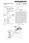
PC Maritime
http://www.pcmaritime.co.uk
Electronic Charting – A practical update for
superyachts
David Edmonds
1. Introduction
Electronic Chart Systems have been available for a decade and their main benefits are well
recognised. Until a few years ago the cartography came from private companies. Today there are
new choices with Hydrographic Offices providing official electronic chart services.
The UK HO’s world-wide catalogue of over 2800 ARCS raster charts has been a major factor in
building confidence in the market with 110,000 ARCS charts and 1200 systems sold in little more
than 12 months. The NOAA/BSB raster chart catalogue of 1016 official raster charts has been very
successful in the US with chart and PC-based systems sales of 750,000 and 10,000 respectively
(July 1997). These charts have gained the ascendancy in their respective markets because of their
quality, up-to-dateness and official government backing. Both “official” formats are supported by
chart update services. The BSB format also provides pilotage and photographic information addons. Similar developments are underway in Europe.
A lively raster v vector debate has arisen and in this paper I will attempt to explain the difference
between the chart types and their relative strengths and weaknesses. With the advent of official
raster charts a new Raster Chart Display System (RCDS) performance standard has been submitted
to IMO. I will put this into context against ECDIS and ECS. In the course of considering RCDS the
IMO have requested trials and user feedback and I outline some of the results of these.
I would like to draw your attention to the need for training and a good support relationship with
your supplier. To show how electronic chart regimes are forcing greater awareness of some long
standing technical issues, I explain why you need to attend to horizontal datum shifts between GPS
and charts.
Finally I provide a list of questions which I believe you should be asking of any system before
purchase and our website gives more detail at http://www.pcmaritime.co.uk
2. System Types
2.1 Electronic Chart Display and Information Systems (ECDIS)
Only one performance standard has been approved at IMO, and that was for ECDIS in
November 1995. This standard applies to vessels governed by the SOLAS convention who
would comply with the carriage requirement for charts with an ECDIS system using Electronic
Nautical Charts (ENCs).
The chart data used in an ECDIS must conform to the Electronic Nautical Chart (ENC) S-57
specification. There are few ENCs available today and without an ENC an ECDIS is not an
ECDIS. An ENC must be issued for use on the authority of government authorised hydrographic
offices.
Paper given at Project 97, METS, Amsterdam
Page 1 of 13
A Practical Update to Electronic Charting
PC Maritime
http://www.pcmaritime.co.uk
Some trial data is in use but widespread coverage will not be available for some time and some
regions of the world may never become available in ENC form. For example the UK HO, who
are leading the production of ENCs, have the following schedule:
•
Product Trials ................................................................................early 1998
•
Pilot service stage ...................................................................................1999
•
Commercial service with significant data .........................................2000 on
Coverage will be patchy with major ports such as Harwich, Thames and Southampton given
priority. Smaller ports and remote coastlines will be treated on their merits and may never be
converted to ENCs.
Although I have no figures it is certain that ENCs will be more expensive than Raster Nautical
Charts (RNCs) or privately produced vector data.
2.2 Raster Chart Display Systems (RCDS)
Recognising the delays in implementing ECDIS, various hydrographic offices identified a need
for alternative official chart data to connect the small pockets of ENCs expected over the next
few years.
This led to the development of the Admiralty ARCS raster chart and NOAA’s BSB raster chart.
Both formats come from the same production process used for paper charts and are in every
respect identical to the paper versions. Of course, the electronic version has many more
capabilities than paper, one of the most important being the ability to automatically merge chart
updates (notices to mariners).
A RCDS performance standard has been submitted to IMO. This performance standard is
modelled very closely on the ECDIS performance standard and incorporates important
requirements including:
•
Continuous chart plotting
•
Chart updating.
•
At least the same quality of display as the hydrographic office paper chart
•
Extensive checking, alarms and indicators concerning the integrity and status of the system.
•
Route planning and voyage monitoring.
For Mega yachts and other non-SOLAS vessels RCDS is a useful standard against which to
measure the systems on offer.
2.3 Dual Fuel Systems
A Dual Fuel System is one that is either an ECDIS or RCDS depending on the type of chart data
in use. ENCs are scarce so there are few opportunities to use ECDIS whereas RNCs are available
now in large numbers and can perform two important functions:
•
Provide official electronic chart coverage for areas not covered by ENCs
•
Provide link coverage between the ENCs that are available.
For the future, a system should provide a choice of cartography, whilst ensuring that navigation
calculations are consistent, regardless of the background chart. For example, in my company’s
system, Navmaster, world-wide variation is not derived from charts, and tidal stream is
calculated from validated tidal data models, rather than from chart-specific data. Thus when a
route is calculated, the result will be constant, whether the plan is drawn on a raster or a vector
chart.
Paper given at Project 97, METS, Amsterdam.
Page 2 of 13
A Practical Update to Electronic Charting
PC Maritime
http://www.pcmaritime.co.uk
2.4 Electronic Chart Systems (ECS)
An ECS is a system that does not conform to either the ECDIS or RCDS performance standards.
There are no official performance standards applicable to this type of system. The IMO are
working on an advisory document “Guidelines for the use of ECS”.
The rule of thumb to apply is that a system is an ECS if:
•
It is using chart data (of any type) which is not issued under the authority of a government authorised
hydrographic office.
•
Vector chart data is not in S-57 format.
•
The system does not meet the standards of either ECDIS or RCDS performance standards.
So the first question to ask of any system is
QUESTION 1
To what extent does the system conform to either the ECDIS (if vector) or RCDS (if raster)
performance standard?
And the second question is:
QUESTION 2
Does the system offer choice of cartography preferably with both vector and raster types?
3. Chart types
3.1 Privately produced vector
Privately produced vector charts are generally manufactured from scanned hydrographic office
paper charts. The scanned image is then digitised by tracing the lines and features on the chart.
This vectorisation process stores chart features in “layers” which can be redrawn automatically
at an appropriate size as you zoom into the chart. You can add or remove categories of data such
as spot depths, depth contours, navigation marks etc. In some systems you can query specific
chart items, eg to get more information on a navigation light.
The grouping of the data mirrors the paper chart regime. However the nature of the vector
display is such that the chart data is not displayed electronically as it was compiled (as a paper
document) and the original cartographic design of the paper chart is lost. Most systems
automatically decide on the information to be displayed, depending on the level of zoom, to
avoid the image becoming cluttered. Hence a new operational regime has to be developed to take
into account the implications of:
1. Adding or removing layers of data
2. Zooming and seeing more or less data appear according to the level of zoom
3. Displaying the chart at a larger scale than the source paper chart
3.2 Official Raster
There are two official raster chart formats
• ARCS (UK HO) and Seafarer (Australian HO) both produced in the UK HO’s proprietary
HCRF format. ARCS is updated weekly with the same information as the weekly Notice to
Mariners used to correct BA paper charts. Seafarer is updated monthly on a similar basis.
Paper given at Project 97, METS, Amsterdam.
Page 3 of 13
A Practical Update to Electronic Charting
PC Maritime
http://www.pcmaritime.co.uk
• BSB raster charts contain all the detail found in NOAA paper charts, with updates published
every 30 days. Weekly Notice to Mariner updates will be available in the second quarter of
1998. These will be distributed via the Internet and will be completely in-sync with the US
Coast Guard, NIMA and Canadian notices.
Raster charts are direct facsimiles of paper charts and directly mirror the paper chart regime. The
cartographic design (ie the chart data which should be displayed at a given scale) is maintained.
Raster charts are often referred to as being “simple images”. Far from being “simple”, official
raster charts incorporate considerable “meta data” which allows all chart information: notes,
source diagrams, tidal diamonds, horizontal and vertical datums etc, to be displayed clearly and
quickly. They are very accurate representations of the original paper chart with every pixel
referenced to a latitude and longitude. Horizontal datum shifts are included with each chart to
enable the chart and any information overlaid on it, to be referenced back to WGS-84. Chart file
sizes are larger than their vector counterparts but redraw times are not significantly slower than
commercial vector charts.
A common misconception is that all raster charts are produced by the same “simple” technology.
The following table, compiled from information supplied by BSB Electronic Charts and the UK
HO, indicates variations between raster chart types.
Feature
ARCS
BSB
Maptech
Government authorised
Yes
Yes
No
Entire catalogue always
up-to-date to latest notice
to mariner
Yes
Yes (from Qtr 2
1998)
No
Update service
Weekly
Weekly (from Qtr
2 1998)
not known
Original scan from:
stable colour
separates used for
printing paper
charts
stable mylar film
originals used for
printing paper
charts
paper copy
Scan resolution
1016 dpi
762 dpi
250 dpi
Chart resolution
127 dpi1
256 dpi
160 dpi
2
3
Anti-aliasing
Yes
No
No of points used to relate
the chart image to
Lat/Long co-ordinates.
Pixel to position
conversion is by
calculation and is
accurate to 1
pixel.
10-20, pixel to
location
conversions are
also provided,
accuracy depends
No
4
1
The UK HO point out that the decision to adopt 127 dpi resolution for ARCS was founded on screen technology.
When displaying all pixels on a typical screen there is a modest enlargement of the image compared to a paper chart.
Higher resolution either requires greater enlargement or the use of sub-sampling neither of which improves image
quality.
2
The automatic removal of the rough or jagged edges which can appear in images.
3
BSB Electronic charts comment that anti-aliasing is not needed on a 256 dpi chart.
Paper given at Project 97, METS, Amsterdam.
Page 4 of 13
A Practical Update to Electronic Charting
PC Maritime
http://www.pcmaritime.co.uk
Feature
ARCS
BSB
on the printed
chart
Maptech
Geodetic datum shifts
Yes
Yes
No
Integrity checks
32 bit CRC check
on original and
updated image
Byte checksums
are included in
chart file
Not known
Liability
UK government
accept liability on
Hydrographic
Office products
US Government
accepts liability
for errors on
NOAA charts
Not accepted
3.3 Electronic Nautical Chart (ENC)
One universal data format is defined for ENCs. The key factors which differentiate ENCs from
all other types of electronic chart are:
•
ENCs must be issued under the authority of a government authorised hydrographic office.
•
All chart data is referenced to a global geodetic datum - WGS84 (the datum used by GPS).
•
Every single item on the chart, whether a spot depth, a navigation mark, a point on a depth contour,
is attribute coded, and can be interrogated for information or used in calculations.
•
The data is delivered in cells to provide seamless data for the task in hand. In other words there is no
direct correlation to the paper regime. The cell structure ranges from harbour to ocean data sets.
Since the data is fully scaleable, the user only has to define a view area for an appropriate level
of data to be automatically presented to him. If he wishes to add or remove data, then the
structure of the data allows information to be grouped into layers and turned on or off as
required.
Individual contour lines can be defined as safety contours with anti-grounding warnings given
based on the ship’s nearness to them.
3.4 Vector overlays
With much talk about raster versus vector, you might draw the conclusion that the two types of
chart are like oil and water. This is not so; once you get to the operational level, the chart is
simply the background on which the work takes place.
The vector overlays used to display user data (such as waypoints and routes) and system data
(such as tidal vectors, radar overlays, etc) can be displayed on either type of chart.
3.5 Chart summary
Charts, whether produced officially or by commercial companies, should offer understandable
standards of accuracy and reliability and have a clearly defined chart update policy.
Personally, I do not see why we as customers (I include myself here as a customer of chart
providers), should accept anything less than up-to-date charts at the point of sale, ie charts which
have been corrected with all the official notice to mariner corrections that have been issued.
QUESTION 3
Are the charts supplied with the system up-to-date at the time of sale?
Paper given at Project 97, METS, Amsterdam.
Page 5 of 13
A Practical Update to Electronic Charting
PC Maritime
http://www.pcmaritime.co.uk
4. Feedback from RCDS Users
The majority of RCDS users in trials have identified considerable safety and efficiency benefits
over the use of paper charts. This followed from the integration of RCDS and GPS to provide
instant access to the latest positional information and the many extra functions provided by RCDS
compared to the paper chart including:
• Real-time position plotting
• Passage monitoring
• Passage planning
• Route and waypoint management
• The potential to reduce the navigator’s workload in carrying out chart corrections
More trials are underway to provide further evidence of the safety and effectiveness of RCDS. PC
Maritime’s Navmaster Professional is being used in 2 trials: one by Shell International’s Euplecta,
trading in the Caribbean, and one by a Shell UK vessel trading around the UK and European
coastlines.
5. Training
Most systems claim to be easy to use and indeed most probably are - if you have a reasonable
grounding in PC operating systems and how modern software applications are designed and work.
However the systems we are talking about here are not simple. They have to handle large numbers
of electronic charts; process data from EPFSs and other marine instruments; check the integrity of
data as it comes in; maintain databases of routes and waypoints; monitor progress against plan;
produce passage plan reports, etc. There is a lot to learn in order to work with the system
effectively.
Consider also the reliance you are placing on the system to assist you during your passage. I heard
recently of one of my company’s systems on a highly equipped new mega yacht. The Captain put
into a port where, fortunately, we had a dealer, complaining that the system did not work. The
Captain had not even realised that he could connect his GPS and plot positions on an electronic
chart. Our dealer was able to provide him with one day’s training, which introduced him to the full
capabilities of the system.
In my opinion the need for manufacturers training is under-estimated. To use a system effectively
the end user must have a full understanding of the system’s capabilities. I have recently run handson training courses on our product and the background technology to commercial users and have
been hard pressed to cover all the ground in two days.
Sometimes it is either impractical or too costly to provide face to face training and the fallback is
then the much derided User Manual (if all else fails read the manual). But a few hours spent
working through description of the system’s functions with examples can be a very productive way
to learn. I try to ensure that my Company’s user manuals allow any reasonably computerate person
to acquire a sound understanding of the system in a few hours.
However I must emphasise that it is not the manufacturers’ role to teach the foundations of
navigation; or how Windows or other operating systems work; and if there are any deficiencies in
these areas separate training should be provided.
Paper given at Project 97, METS, Amsterdam.
Page 6 of 13
A Practical Update to Electronic Charting
PC Maritime
http://www.pcmaritime.co.uk
QUESTION 4
Does the manufacturer provide training or have a network of dealers authorised to train on
their behalf?
QUESTION 5
Is the User Manual good enough for self training?
6. Geodetic Datums
Having just said that it is not the
manufacturer’s role to provide foundation
navigation training there are aspects of the
technology which should be drawn to your
attention.
A navigational chart is referenced to two
datums: one horizontal, for latitude and
longitude, and one vertical for depth and height.
Geodetic Datum
“A reference system for specifying positions on the
Earth’s surface. Each datum is associated with a
particular reference spheroid which can be different
in size, orientation and relative position from the
spheroids associated with other horizontal datums.
Positions referred to different datums can differ by
several hundred metres” 4.
Figure 1
The issue of geodetic datum shifts is not a concern for ECDIS since all ENCs should be referenced
to WGS84, but it does affect paper charts, RNCs and privately produced vector charts.
The issue arises because the earth is not a perfect sphere. Over the centuries mapmakers have
devised local models of the earth’s shape. Because the earth is not a regular shape the accuracy of
each datum will vary as you get further from the specific location for which it was defined.
Hundreds of different datums exist to define positions; examples are OSGB36, European 1950,
Indian, etc.
Satellite systems require a global datum and GPS positions are based on the World Geodetic
System 1984 (WGS-84) which is a model of the entire earth.
Problems arise when you are receiving positions based on one datum and plotting them on a chart
which is based on a different datum. Figure 1 illustrates the range of latitude and longitude
positions which could be derived for the same real location, depending on the datum used.
Further examples follow: in the English Channel all
Admiralty charts covering the English coastline are in
Figure 2
OSGB36. All Admiralty charts covering the French
coastline are in European 1950. Admiralty charts covering both sides of the channel tend to be in
OSGB36. Consequently if you plot a position on an OSGB36 chart and then move to an European
1950 chart without accounting for the shift you will have introduced an error. Figure 2 indicates the
magnitude of the error. In some parts of the world, the difference between WGS 84 and the local
datum can be quite significant as shown in Figure 3
As I have already mentioned this is not a new issue. It
has applied to the paper chart regime for as long as
Figure 3
satellite navigation has been in use. The solution is to
maintain positions in WGS-84 and apply the published shift every time you change chart. In
4
NAV 43/7/4 GEODETIC DATUMS Note by the International Electrotechnical Commission (IEC)
Paper given at Project 97, METS, Amsterdam.
Page 7 of 13
A Practical Update to Electronic Charting
PC Maritime
http://www.pcmaritime.co.uk
practice I suspect that few navigators do this on paper, probably because they feel that they are not
navigating to a precision at which these inaccuracies would be important.
However in the electronic regime there is a new phenomenon, which is the illusion of pinpoint
accuracy conveyed by GPS positions to two or more decimal places of a degree and by the
automatic and frequent position plotting.
6.1 GPS errors and datum considerations
GPS errors
So GPS positions already inaccurate to a
certain degree are made more inaccurate by
plotting on charts of different datum.
For civilian users GPS is artificially
degraded to give a probability of the
horizontal error being less than 100 metres
for 95% of the time and less than 300
metres for 99.99% of the time.
Most
GPS’s
have
built
in
datum
transformations so that you can set the machine
to output positions in a local datum. But there
are four problems with this:
Differential GPS (DGPS), which is
becoming more widely available is accurate
to +/- 5-10 metres (which may be more
precise than the accuracy of the chart).
1. There is no standard applied to
transformation formulae; two different
GPS’s may use different formulae and output different results. They provide a solution which
is averaged over a wide area. Any error in the transformation can range from say 25m to
much more at the fringes of the area covered by the datum. The resultant errors can be large
compared to the accuracy of DGPS.
2. It is hard to ensure that the GPS is switched to the correct datum each time a chart is changed.
3. GPS positions may be simultaneously fed to other instruments, eg ARPA, autopilot, expecting
to receive the data in WGS84 co-ordinates.
4. Some GPS manufacturers apply the datum transformation to all waypoint positions held in
memory when a datum other than WGS-84 is selected for the display of positions. The point
here is that you must be aware of the actions taken by your equipment.
6.2 Datum management
A better strategy is to maintain the output of GPS in WGS-84. In the case of Admiralty paper
charts, a shift from WGS-84 to the local datum is printed on the chart. If the Admiralty has
published a figure it means that they have reconciled the original survey to WGS84 and that the
published shifts can be used with confidence. There are a number of Admiralty charts where it
has not been possible to reconcile the original survey data against WGS-84. In this case no shift
values are published. Under these circumstances you are at least aware that plotted positions are
to be treated with caution.
Paper given at Project 97, METS, Amsterdam.
Page 8 of 13
A Practical Update to Electronic Charting
PC Maritime
http://www.pcmaritime.co.uk
One of the great benefits of software is that it
can automate the management of datum shifts.
A modern chart format such as ARCS has the
shift data built in and with this an RCDS can
keep track of the datums of positions of all
types, including vessel position and track,
waypoints and any other overlaid point on the
chart, and adjust them to the local geodetic
datum as required.
For this to work it is important that the GPS is
always set to output WGS-84 positions. Ideally
the GPS should identify the datum it is set to
within the NMEA sentence output to the chart
plotter. Unfortunately and surprisingly very
few GPS manufacturers output this vital
information although there are calls for the
mandatory inclusion of a geodetic datum code
with every position location message.
Equipment receiving such a message can then
automatically check that datums are correctly
matched.
Summary of situations where safe
navigation is affected by datum
mismatches. (equally applicable to paper
and electronic regimes)
1. Plotting of positions from GPS or other
EPFS on non-WGS84 charts
2. Moving overlaid information between
charts of different datum (eg waypoints
or routes).
3. Taking waypoint or other positions off
non-WGS84 charts and transmitting them
to GPS.
4. Calculation of waypoints from, for
example, great circle algorithms
Of course this emphasises the need to
exercise standard navigation practice and
not rely on positional information from just
one source. Every opportunity should be
taken to cross-check against all other
available sources, visual, radar, etc.
This is an area where you, as customers, can
reasonably ask that chart manufacturers provide datum shift parameters with all their charts; that
GPS manufacturers output datum information and that ECS and RCDS systems should manage
datums as outlined.
QUESTIONS
6 Does the chart format provide datum shift values?
7 Does your GPS output the datum with positional information?
8 Does the ECS / RCDS manage horizontal geodetic datums?
7. Technical Support
Some studies have shown that it takes, on average, 9 times longer for a user to solve a problem on
his own than if he called technical support. It surprises me that many users will struggle for hours,
or give up, when the solution is only a telephone call away.
Most manufacturers offer support contracts at around 15-20% of the purchase price of the system.
In PC Maritime’s case this allows access to our technical help desk by phone, fax or email. Because
the technology is still developing it is important to get regular updates. Our support contracts
include the automatic issue of new versions of the software and preferential rates for additional
modules as they become available.
Often support is required whilst at sea and I strongly recommend acquiring the ability to
communicate by email as being the most economical method of getting a quick answer.
Paper given at Project 97, METS, Amsterdam.
Page 9 of 13
A Practical Update to Electronic Charting
PC Maritime
http://www.pcmaritime.co.uk
8. Summary of Questions to Ask of an ECS \ RCDS system
1.
To what extent does the system conform to either the ECDIS (if vector) or RCDS (if
raster) performance standard?
2.
Does the system offer choice of cartography preferably with both vector and raster
types?
3.
Are the charts supplied with the system up-to-date at the time of sale?
4.
Does the manufacturer provide training or have a network of dealers authorised to
train on their behalf?
5.
Is the User Manual good enough for self training?
6.
Does the chart format provide datum shift values?
7.
Does your GPS output the datum with positional information?
8.
Does the ECS / RCDS manage horizontal geodetic datums?
Paper given at Project 97, METS, Amsterdam.
Page 10 of 13
A Practical Update to Electronic Charting
PC Maritime
http://www.pcmaritime.co.uk
Appendix 1 Summary of chart type differences
The following tables summarise the features, strengths and weaknesses of each chart type in
relation to one another.
Equivalence to the paper chart
Privately produced vector
Official Raster
ENCs
charts
(RNCs)
• Generally a copy of the
paper chart
• An exact replica of the
paper chart
• All data merged into cells
• a different image to the
original paper chart is
presented at all levels of
zoom and scale
• The same image as the
paper chart is always
presented. The chart is
more equivalent to the
paper chart than any
vector chart including
ENCs
• No resemblance to the
paper chart
• Symbols and colour vary
with manufacturer.
• The IHO publication S-52
• Symbols and colour are
defines new colours and
the same as the paper chart
symbols for ENCs.
equivalent.
• Accuracy, reliability and
completeness vary with
manufacturer.
• RNCs are as accurate,
reliable and complete as
the paper version.
• ENCs should be more
accurate and reliable than
the paper version.
• A new operational regime
is required
• The same operational
regime as paper charts is
followed.
• A new operational regime
is required
Chart Integrity
Official Raster
(RNCs)
Privately produced vector
charts
ENCs
• Produced by private
companies
• Produced by or under the
authority of government
authorised hydrographic
offices
• Produced by or under the
authority of government
authorised hydrographic
offices
• Unofficial
• Official
• Official
• Generally no
responsibility is accepted
• Responsibility is accepted
for chart data in terms of
its completeness and
accuracy in comparison
with the equivalent paper
chart.
• Responsibility is accepted
for chart data in terms of
its completeness and
accuracy.
• Is unlikely to become
legally equivalent to the
paper chart
• May become legally
equivalent to the paper
chart
• Is legally equivalent to the
paper chart
Paper given at Project 97, METS, Amsterdam.
Page 11 of 13
A Practical Update to Electronic Charting
PC Maritime
http://www.pcmaritime.co.uk
• It may be possible to
change original chart data
• The chart data is tamper
proof
• The chart data is tamper
proof
• Charts can be zoomed (ie
the display of a single
chart is magnified or
reduced) without
restriction. Chart detail
varies depending on the
level of zoom.
• Chart zoom should be
limited to a level that does
not break up the image
Information displayed on
the chart remains
unaltered.
• Charts can be zoomed in
or out without restriction.
Chart detail varies
depending on the level of
zoom.
• Quality Control varies
with manufacturer
• Quality Control is
government standard
• Quality Control is
government standard
Privately produced vector
charts
Chart corrections
Official Raster
(RNCs)
ENCs
• Up-to-dateness of charts
varies with manufacturer
• Charts are up-to-date at
the point of sale
• Charts will be up-to-date
at the point of sale
• It is difficult to determine
the updating policy of
private manufacturers
• Chart data is maintained
up-to-date to clearly stated
standards
• Chart data is maintained to
a clearly defined standard
• varies with manufacturer
• On demand updates for
leisure users
• not applicable
• varies with manufacturer
• Subscription updates for
commercial users
• Subscription updates
available
• varies with manufacturer
• Automatic integration of
chart updates
• Automatic integration of
chart updates
Safety
Official Raster
(RNCs)
Privately produced vector
charts
ENCs
• Geodetic datum shift to
WGS84 may not be
provided
• Chart data includes
geodetic datum shift to
WGS845.
• All data is referenced to
WGS84
• Chart data can be removed
from the display.
Significant navigation
information may be
inadvertently removed.
• Chart data cannot be
removed from the display.
The user cannot
inadvertently remove
significant navigation
information
• Chart data can be removed
from the display.
Significant navigation
information may be
inadvertently removed
5
For some charts it is not possible to reconcile the original survey data against WGS84 and no geodetic shift data is
available.
Paper given at Project 97, METS, Amsterdam.
Page 12 of 13
A Practical Update to Electronic Charting
PC Maritime
http://www.pcmaritime.co.uk
Appendix 2 Glossary of Terms related to Electronic Charting
ARCS
Admiralty Raster Chart Service - the UK HO proprietary RNC.
ECDIS
Electronic Chart Display and Information System
The performance standard for ECDIS approved by the IMO assembly in November 1995. The standards
are defined in documents of the IHO and IEC: IHO Special Publication S-52 Provisional Specifications for
Chart Content and Display of ECDIS; IHO Special Publication S-57 IHO Digital Data Transfer Standard
IEC 1174 ECDIS Performance Standards.
Note: The ECDIS standard is designed for use by vessels governed by SOLAS and requires data meeting
the above standards which, at the time of writing (October 1997), is not commercially available.
ECS
Electronic Chart System - a chart system which does not meet the requirements of SOLAS V/20 and is not
defined by official standards.
ENC
Electronic Nautical Chart
EPFS
Electronic Position Fixing System GPS, Loran, Decca etc
HCRF
Hydrographic Chart Raster Format. This is the format developed by UK HO and used (at September 1997)
by the UK HO for its Admiralty Raster Chart Service (ARCS) and the Australian HO for its Seafarer Chart
Service. Other HOs are also expected to adopt HCRF.
IEC
International Electrotechnical Commission
IHO
International Hydrographic Organisation
IMO
International Maritime Organisation
NMEA
National Marine Electronics Association
NMEA 0183 version 2.01 is the standard which is defined to permit the ready data communication
between electronic marine instruments, navigation equipment and communications equipment when
interconnected via an appropriate system.
RCDS
Raster Chart Display System (RCDS) means a navigation information system which can be accepted as
complying with the paper version of the up-to-date chart required by regulation V/20 of the SOLAS
Convention, by displaying RNC’s, with position information from navigation sensors to assist the mariner
in route planning and route monitoring, and if required display additional navigation-related information.
A draft performance standard for RCDS is being considered by IMO.
RNC
Raster Navigational Chart means a facsimile of a paper chart. Both the paper chart and the RNC are
originated by, or distributed on the authority of, a government authorised hydrographic office.
S-52
IHO standard which defines the presentation of chart data on an ECDIS display
S-57
IHO standard which defines the chart data format (DX90) and encoding for ECDIS
SOLAS
The International Convention for the Safety of Life at Sea. Chapter V Safety of Navigation, Regulation 20,
Nautical Publications requires that: “All ships shall carry adequate and up-to-date charts, sailing directions,
lists of lights, notices to mariners, tide tables and all other nautical publications necessary for the intended
voyage”
SOLAS does not apply to (Regulation 3 Exceptions):
I. Ships of war and troopships
II. Cargo ships of less than 500 tons gross tonnage
III. Ships not propelled by mechanical means
IV. Wooden ships of primitive build
V. Pleasure yachts not engaged in trade
VI. Fishing vessels
Paper given at Project 97, METS, Amsterdam.
Page 13 of 13