1
Abstract
The problem addressed in this project is the need for cost-effective tracking of sunken oil
following a spill, to target cleanup activities and to support cleanup termination decisions.
Sunken oil is difficult to locate because remote sensing techniques cannot as yet provide views
of sunken oil over large areas. Moreover, the oil may re-suspend and sink with changes in
salinity, sediment load, and temperature, making fate and transport models difficult to deploy
and calibrate when even the presence of sunken oil is difficult to assess. For these reasons,
together with the expense of field data collection, there is a need for a statistical data-limited
technique integrating field data collection with statistical fate and transport modeling.
Predictive Bayesian modeling techniques have been developed and demonstrated for exploiting
limited information for decision support in many other applications. These techniques
implemented in a Lagrangian modeling framework represent such an integrated approach to
modeling based on real-time field data. The objectives of this project were to (1) compile and
summarize data on the occurrence of sunken oil, directed by the project advisory team and
National Oceanographic and Atmospheric Administration (NOAA) Emergency Response
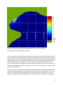
Division liaison; (2) develop a multi-modal predictive Bayesian Gaussian model to project in
time relative unconditional probabilities of finding sunken oil at locations across a relatively flat
bay bottom, based on limited available spatial field data on sunken oil concentrations; and (3)
verify the model versus sunken oil data, as possible, and simulated datasets. Methods included
(1) development of conceptual model and data base by literature review, including team kickoff
meeting to identify data sources and define model capability, (2) development of an open-source
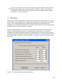
computer model with graphical user interface capable of accepting limited available field data on
oil concentrations in time and space, including development of combinatorial methods of oil
patch identification and superimposed image methods to account for curved shoreline
boundaries, and (3) model optimization and confirmation versus available real and/or simulated
field data, and dissemination by website, presentation, publication, and media release.
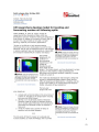
The model was developed and initially confirmed versus real and simulated data, presented at the
Clean Gulf 2009 conference, described in the media including USA Today online, and offered to
the State of Florida for use in the current Gulf of Mexico oil spill cleanup effort. The model
represents a new approach to pollutant tracking by inference from limited field data alone, and
the mapping of unconditional relative probabilities of finding pollutant mass in space and time
with rigorous accounting of uncertainty. The model was developed in the open-source Python
language, for potential interface with new response, cleanup, and damage assessment models
under development by NOAA as appropriate. Several extensions and refinements are
recommended, including the addition of capability for accepting available information on
bathymetry and bottom currents as Bayesian prior information, and extension to tracking of
suspended oil. It is expected that the model will be implemented by NOAA Emergency
Response Division for support of emergency response and recovery efforts, as an aid for rapid
and cost-effective location and tracking of sunken oil during response and recovery efforts and to
support cleanup termination decisions.
Keywords: sunken oil, Bayesian, Gaussian, model, emergency response, recovery